SERVIR: From Space to Village - NASA · SERVIR: From Space to Village ... future vegetation and...
27
SERVIR: From Space to Village Dan Irwin SERVIR Director NASA/Marshall Space Flight Center https://ntrs.nasa.gov/search.jsp?R=20120015005 2018-08-25T04:43:44+00:00Z
Transcript of SERVIR: From Space to Village - NASA · SERVIR: From Space to Village ... future vegetation and...

SERVIR: From Space to Village
Dan IrwinSERVIR Director
NASA/Marshall Space Flight Center
https://ntrs.nasa.gov/search.jsp?R=20120015005 2018-08-25T04:43:44+00:00Z

Agenda
• SERVIR Background– Vision/Mission– Program History– NASA Applied Sciences– USAID Results Framework
• SERVIR in Action– GEOSS Themes– Partnerships– Latest Developments
• Future Plans• Questions?

What is SERVIR?
South‐South Collaboration
A NASA‐USAID partnership to improve environmental management and resilience to climate change by strengthening the capacity of governments and other key stakeholders to integrate earth observation information and geospatial technologies into development decision‐making
Current SERVIR Network
SERVIR‐Himalaya SERVIR‐East Africa
NASA‐USAID MOU

NASA Applied Sciences
http://AppliedSciences.NASA.gov
Discovering and demonstrating innovative and practical
applications of Earth ScienceThe Applied Sciences Program funds projects that enable uses of Earth
observations and NASA Earth science in organizations’ policy, business, and
management decisions.
ApplicationsHands‐on projects and studies to
prove‐out and demonstrate applications ideas targeted at
integrating Earth observations in specific decision‐making activities
Capacity Building Projects and activities to build skills, users, and capabilities in the US and developing countries on how to access and apply environmental satellite data to benefit society

U.S. Agency for International Development
Science and Technology – renewed focus on integrating science, technology, and innovation in the practice of development to solve today’s most pressing development challenges around the globe.

SERVIR Results Framework
Roles and responsibilities:USAID: Cultivate use of better information in host nationsNASA: Supply access to high‐quality, user‐tailored tools and information servicesSERVIR: Expand hub network and get them functioning
SERVIR Background
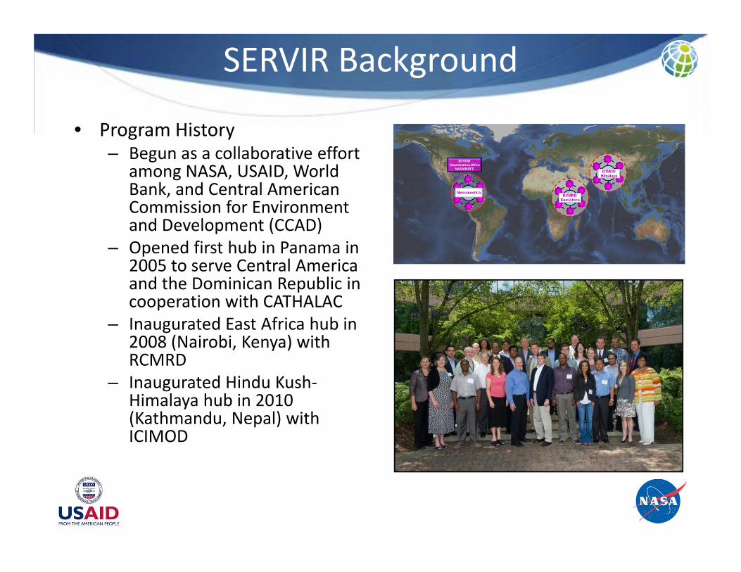
• Program History– Begun as a collaborative effort
among NASA, USAID, World Bank, and Central American Commission for Environment and Development (CCAD)
– Opened first hub in Panama in 2005 to serve Central America and the Dominican Republic in cooperation with CATHALAC
– Inaugurated East Africa hub in 2008 (Nairobi, Kenya) with RCMRD
– Inaugurated Hindu Kush‐Himalaya hub in 2010 (Kathmandu, Nepal) with ICIMOD

SERVIR‐Mesoamerica
Dedicated on February 3, 2005
Primary Issues•Agriculture• Biodiversity• Climate•Disasters• Ecosystems•Health• Infrastructure
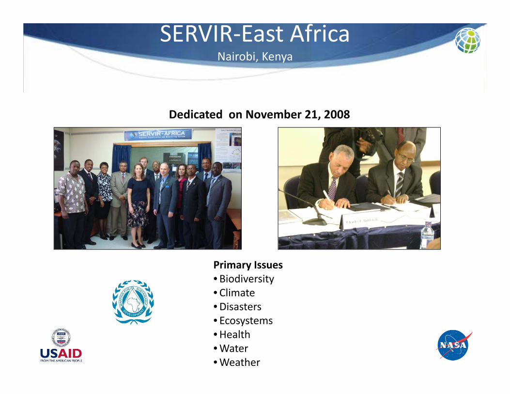
SERVIR‐East AfricaNairobi, Kenya
Dedicated on November 21, 2008
Primary Issues• Biodiversity• Climate•Disasters• Ecosystems•Health•Water•Weather

SERVIR‐HimalayaKathmandu, Nepal
Dedicated on October 5, 2010
Primary Issues• Cryosphere• Earthquakes and landslides• Pollution• Climate change
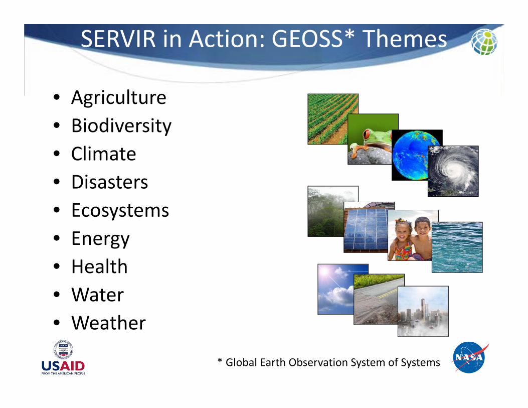
SERVIR in Action: GEOSS* Themes
• Agriculture• Biodiversity• Climate• Disasters• Ecosystems• Energy• Health• Water• Weather
* Global Earth Observation System of Systems

SERVIR in Action: Biodiversity
• USAID/SERVIR‐East Africa Biodiversity project depicts ranges of key flora and fauna
• Application will expand the knowledge of biodiversity vulnerability to climate change
• Project incorporates data from multiple NASA sources, including Tropical Rainforest Measurement Mission (TRMM) and Shuttle Radar Topography Mission (SRTM)
• Provide better understanding of how climate change will affect future vegetation and animal ranges
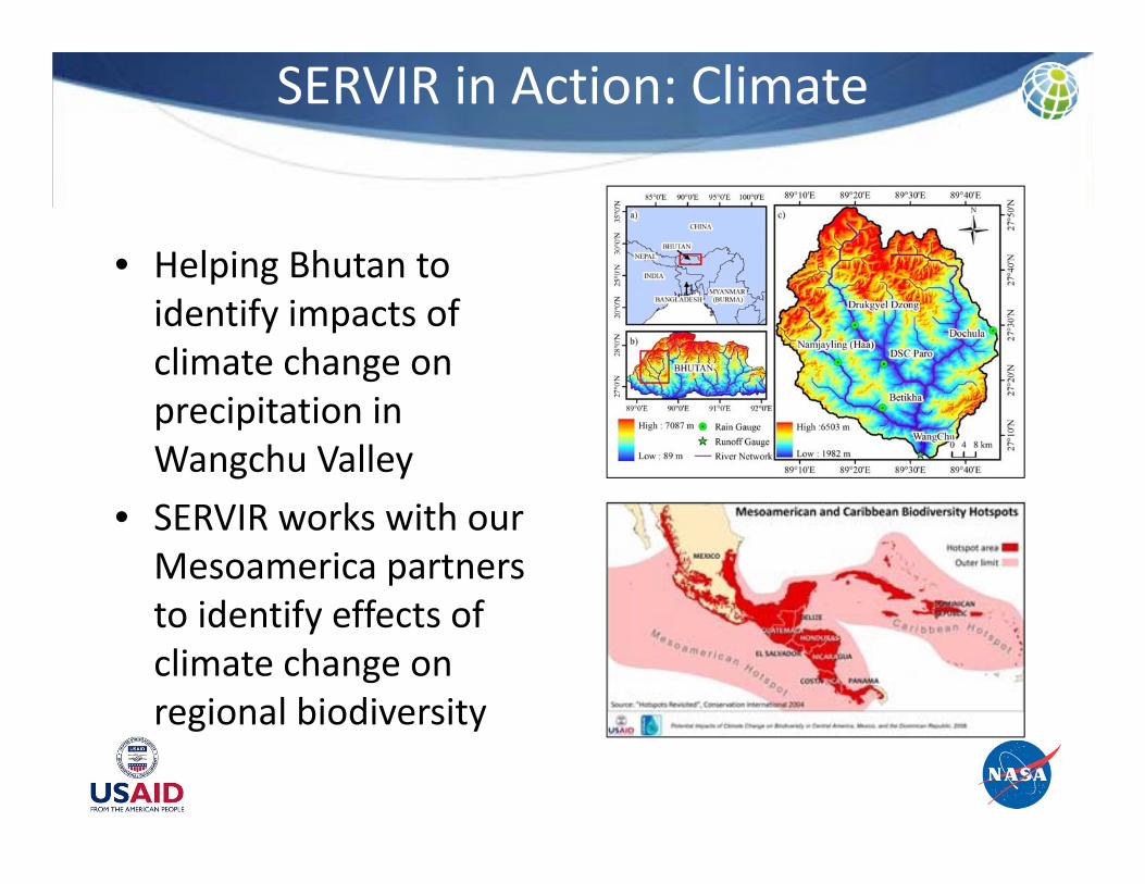
SERVIR in Action: Climate
• Helping Bhutan to identify impacts of climate change on precipitation in Wangchu Valley
• SERVIR works with our Mesoamerica partners to identify effects of climate change on regional biodiversity

SERVIR in Action: Disasters
LAKE LIAMBEZI AREA – NASA EO1 BAND 6 SCENES FOR 01, 09 and 14 APRIL 2009(false colours based on preliminary classification without ground verification)
Flood Monitoring

SERVIR in Action: Disasters
Fire Detection and Tracking

SERVIR in Action: Disasters
o Develop a Community of Interest
o Develop Disaster Services Framework
o Enhance Web Services for Current State
o Produce Catalog of SERVIR Disaster Services
o Produce shareable SOPs for use by and between hubs
o Develop standards for content and appearance of deliverables
o Develop SERVIR Resiliency Plan
o Conduct Outreach and Collaboration
o Establish Mechanisms for Continued Learning

SERVIR in Action: Ecosystems
• SERVIR‐East Africa hosted USGS workshops to develop ecosystem maps of entire continent
• SERVIR‐Mesoamerica performed a 30‐year study of deforestation in Belize– Now national data and used for ongoing studies
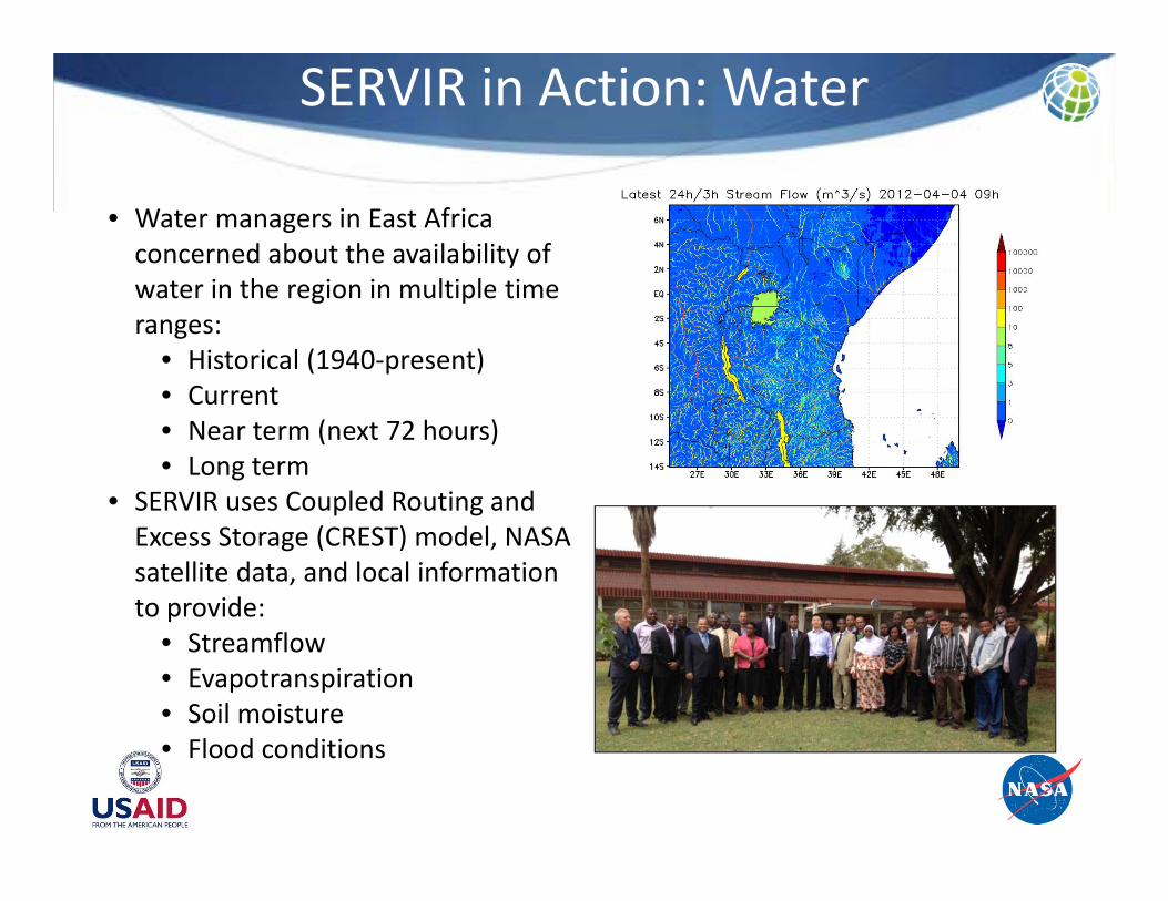
SERVIR in Action: Water
• Water managers in East Africa concerned about the availability of water in the region in multiple time ranges:
• Historical (1940‐present)• Current• Near term (next 72 hours)• Long term
• SERVIR uses Coupled Routing and Excess Storage (CREST) model, NASA satellite data, and local information to provide:
• Streamflow• Evapotranspiration• Soil moisture• Flood conditions
SERVIR in Action: Water
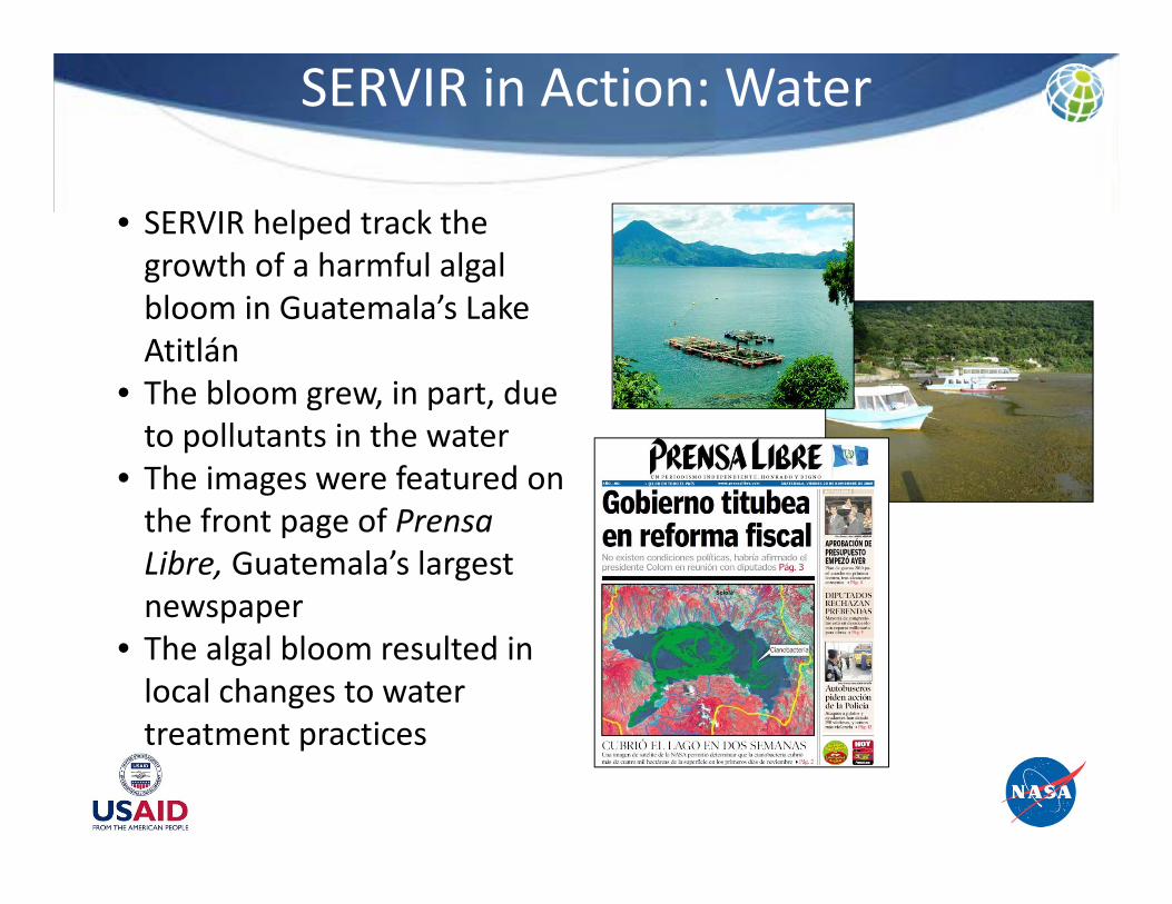
• SERVIR helped track the growth of a harmful algal bloom in Guatemala’s Lake Atitlán
• The bloom grew, in part, due to pollutants in the water
• The images were featured on the front page of PrensaLibre, Guatemala’s largest newspaper
• The algal bloom resulted in local changes to water treatment practices

SERVIR in Action: Weather
• SERVIR partners with NOAA and the U.S. National Weather Service to provide satellite data and computer‐based weather forecasting models for Central America– Precipitation– Severe weather– Air quality
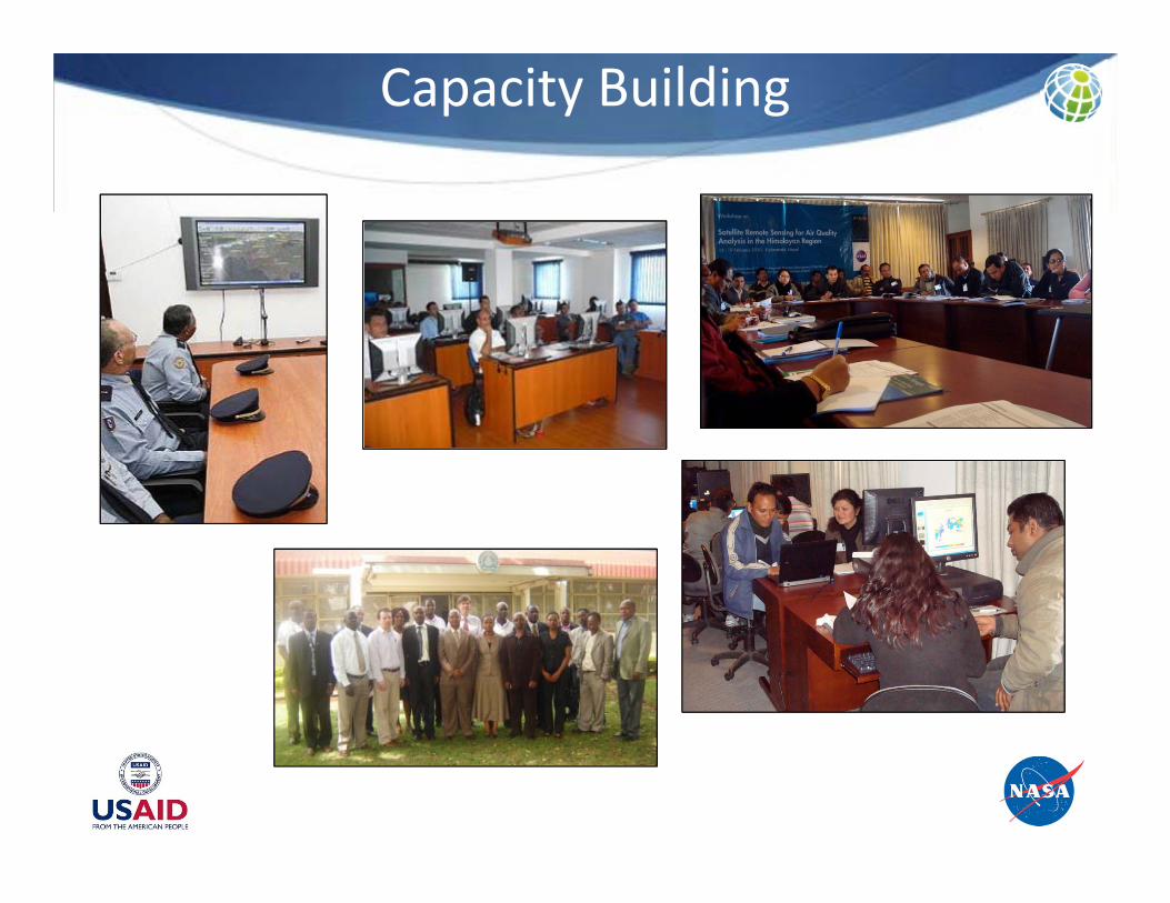
Capacity Building

My Country, Our Earth (MyCOE)
• Building capacity to protect biodiversity using GIS, RS, and geospatial analytical techniques
• Strengthening collaboration amongst universities, government environmental authorities, and NGOs
• Students and mentors competitively selected; both receive modest stipends to conduct six‐month‐long projects and travel support
• Soon to be expanded to other SERVIR regions

SERVIRGlobal.net

SERVIR Applied Science Team
This solicitation seeks proposals for individual members of a new Applied Sciences Team to support the SERVIR program in developing science applications for international development through the use of Earth observations.

Partnerships
• US Government Agencies– NASA– National Oceanographic
and Atmospheric Administration (NOAA)
• U.S. National Weather Service
– U.S. Agency for International Development
– U.S. Environmental Protection Agency
– U.S. Forestry Service– U.S. Geological Survey
• Other Partners– Group on Earth
Observations (GEO)– Kenya Meteorological
Department (KMD)– United Nations Platform
for Space‐Based Information for Disaster Management and Emergency Response (UN‐SPIDER)
– World Bank

ISERVISERV Pathfinder in WORFISERV Pathfinder in WORF
@ 350 km alt. Angular SpatialResolution 1.65 arc sec 2.8mFOV 2.38o x 1.59o 14.5km x 9.8kmSpectral 350nm to 800nm
ISERV Pathfinder is a COTS‐based, visible spectrum instrument designed to provide a low cost path to experience and expertise in data acquisition, and system design and implementation. Pathfinder is the first step in an envisioned suite of Earth observing instruments
aboard ISS, culminating in a broad spectrum, multipurpose, externally mounted sensor system.
Applications•Primary – Humanitarian Response/Disaster Analysis (assessment, ground operations support)•Secondary – Deforestation Survey, Space Archaeology, Agriculture Inventory
Applications•Primary – Humanitarian Response/Disaster Analysis (assessment, ground operations support)•Secondary – Deforestation Survey, Space Archaeology, Agriculture Inventory
Current Status•Fit check and HFIT verification – 11Jan2012•Payload delivery to CMC @ JSC – 12Jan2012•Shipment to JAXA – 23Jan2012•Launch aboard HTV‐3 – 26Jun2012•System operations initiation – 1Nov2012
Current Status•Fit check and HFIT verification – 11Jan2012•Payload delivery to CMC @ JSC – 12Jan2012•Shipment to JAXA – 23Jan2012•Launch aboard HTV‐3 – 26Jun2012•System operations initiation – 1Nov2012

Future Work
• SERVIR plans to increase its number of hubs• SERVIR issued a Research Opportunities in
Space and Earth Sciences (ROSES) call to encourage work on other GEOSS themes we currently do not address:
– Agriculture– Energy– Infrastructure
• Greenhouse Gas (GHG) inventory application in development
• ISERV


![[Day 2] Center Presentation: SERVIR](https://static.fdocuments.in/doc/165x107/5552d091b4c90581158b51fd/day-2-center-presentation-servir.jpg)


