Series Ground Penetrating Radars -...
24
VIY ® 3 Series Ground Penetrating Radars
Transcript of Series Ground Penetrating Radars -...
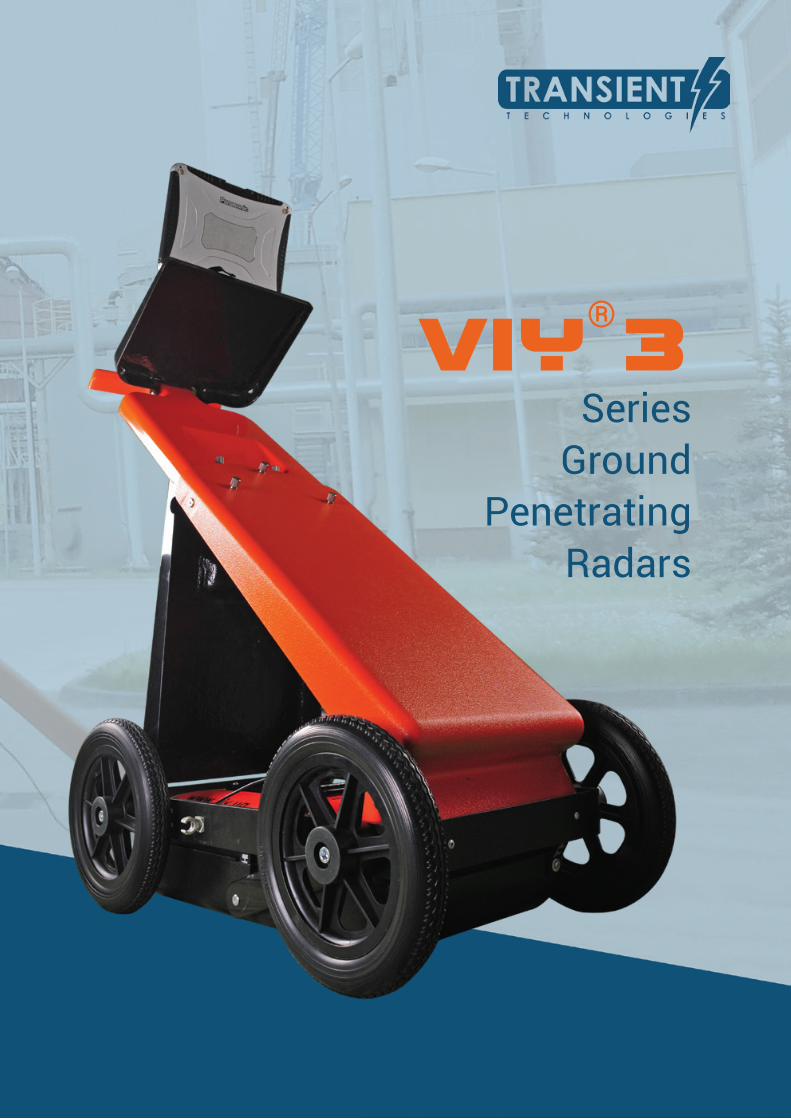
VIY®3
SeriesGround
PenetratingRadars

Transient Technologies LLC is a leading Ukrainian developer and manufacturer of Ground Penetrating Radar (GPR) equipment.
Company’s engineers have been leading the research and development in the field of ultra-wide band (UWB) technologies since 1998.
Transient Technologies’ progressive manufacturing and the vast technical experience of our staff both ensure the best solutions for searching for underground items and nondestructive subsurface inspection considering all the most exacting demands of our customers.
Our representatives from 16 countries provide distribution and ensure full technical support of GPR products of Transient Technologies LLC.
Innovative technologies being used in design of our GPR equipment and its reliability allowed our products to become the one of the most recognizable brands between worlds’ leading GPR manufacturers and to create as outstanding ground penetrating radars as VIY®3 series.
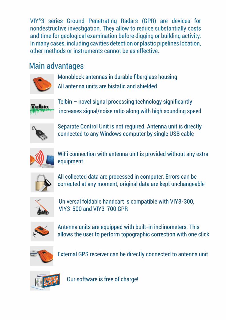
Main advantages
VIY®3 series Ground Penetrating Radars (GPR) are devices for nondestructive investigation. They allow to reduce substantially costs and time for geological examination before digging or building activity. In many cases, including cavities detection or plastic pipelines location, other methods or instruments cannot be as effective.
Monoblock antennas in durable fiberglass housingAll antenna units are bistatic and shielded
Telbin – novel signal processing technology significantly increases signal/noise ratio along with high sounding speed
Separate Control Unit is not required. Antenna unit is directly connected to any Windows computer by single USB cable
WiFi connection with antenna unit is provided without any extra equipment
All collected data are processed in computer. Errors can be corrected at any moment, original data are kept unchangeable
Universal foldable handcart is compatible with VIY3-300, VIY3-500 and VIY3-700 GPR
Antenna units are equipped with built-in inclinometers. This allows the user to perform topographic correction with one click
External GPS receiver can be directly connected to antenna unit
Our software is free of charge!

3
www.viy.ua
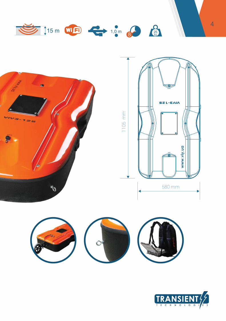
VIY3-125 GPR
SPECIFICATIONS
Antenna frequency, MHz 125Analogue-to-Digital Converter range, bits 18Dynamic range, no less than, dB 135Data aquisition rate, traces per second up to 55Survey window, nsec 120, 180, 240, 300Maximum number of samples per trace 1000Trace stacking number up to 300Depth of sounding, meters (determined by soil properties)
up to 15.0
Spatial resolution, better than, meters 1.0Trigger modes single, internal, externalMaximum size of profile, traces up to 1 000 000Interface USB2 or WiFiBuild-in inclinometer yesDimensions (L x W x H), mm 1105 х 580 х 232Weight, kg 25.0Operating temperature range, °С -20...+40Operating time, at least, hours 8
4
1105
mm
580 mm
15 m8 kg
251,0 m
5
www.viy.ua
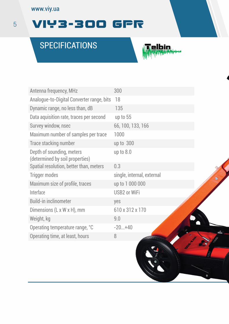
VIY3-300 GPR
SPECIFICATIONS
Antenna frequency, MHz 300Analogue-to-Digital Converter range, bits 18Dynamic range, no less than, dB 135Data aquisition rate, traces per second up to 55Survey window, nsec 66, 100, 133, 166Maximum number of samples per trace 1000Trace stacking number up to 300Depth of sounding, meters (determined by soil properties)
up to 8.0
Spatial resolution, better than, meters 0.3Trigger modes single, internal, externalMaximum size of profile, traces up to 1 000 000Interface USB2 or WiFiBuild-in inclinometer yesDimensions (L x W x H), mm 610 х 312 х 170Weight, kg 9.0Operating temperature range, °С -20...+40Operating time, at least, hours 8
6
610
mm
312 mm
8 m8 kg
90,3
7
www.viy.ua
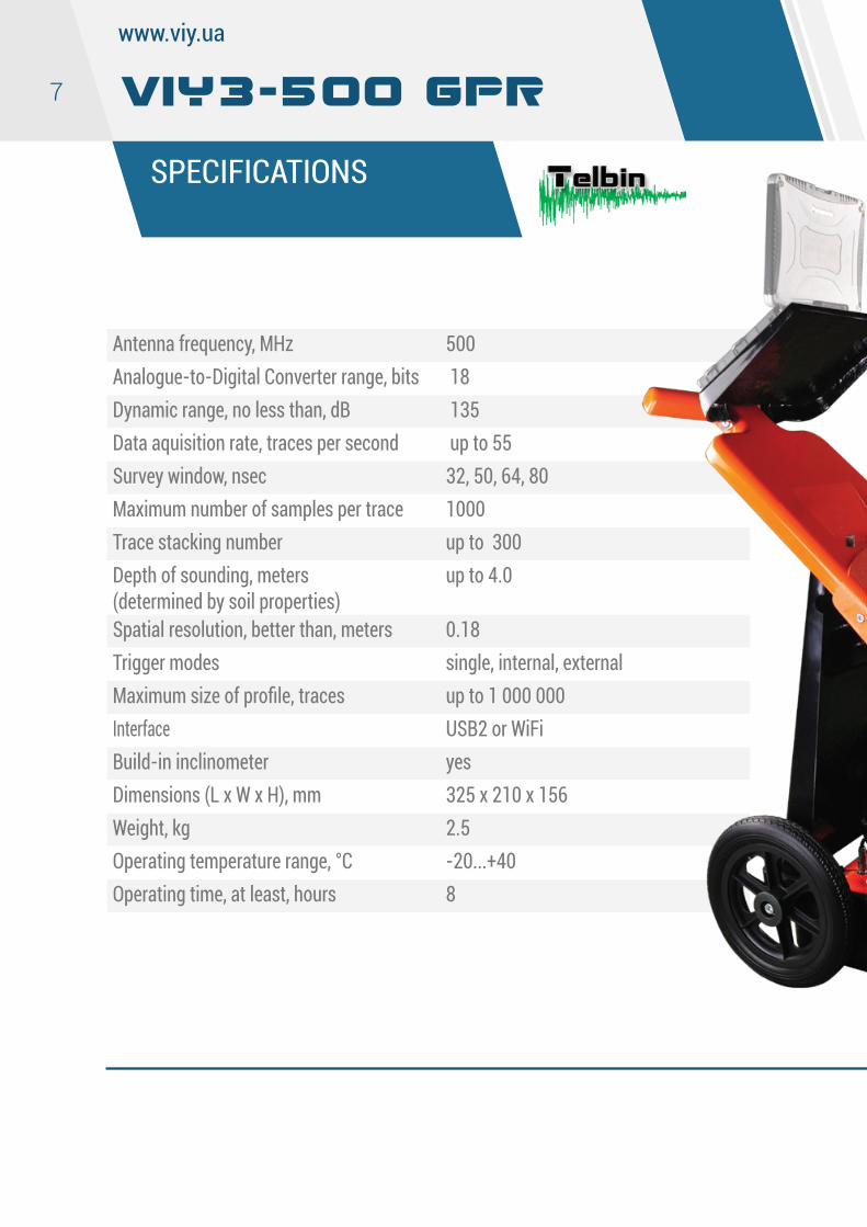
VIY3-500 GPR
SPECIFICATIONS
Antenna frequency, MHz 500Analogue-to-Digital Converter range, bits 18Dynamic range, no less than, dB 135Data aquisition rate, traces per second up to 55Survey window, nsec 32, 50, 64, 80Maximum number of samples per trace 1000Trace stacking number up to 300Depth of sounding, meters (determined by soil properties)
up to 4.0
Spatial resolution, better than, meters 0.18Trigger modes single, internal, externalMaximum size of profile, traces up to 1 000 000Interface USB2 or WiFiBuild-in inclinometer yesDimensions (L x W x H), mm 325 х 210 х 156Weight, kg 2.5Operating temperature range, °С -20...+40Operating time, at least, hours 8
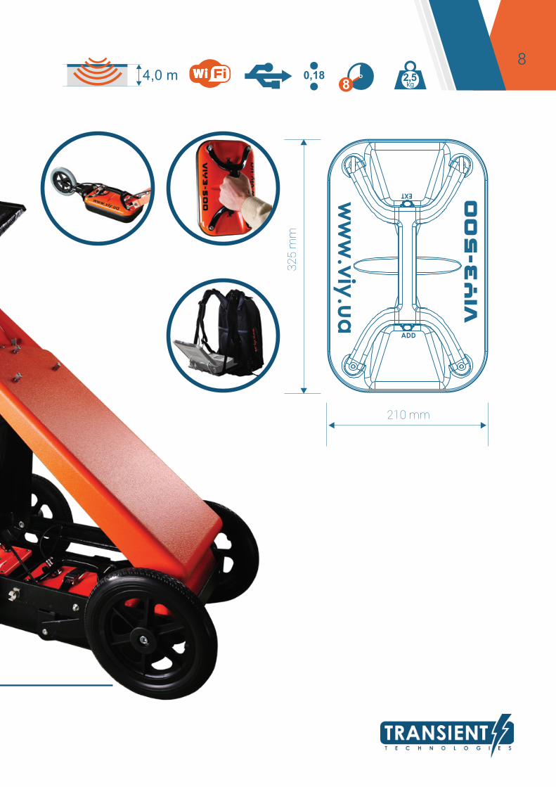
8 4,0 m 8 kg
2,50,18
325
mm
210 mm
9
www.viy.ua
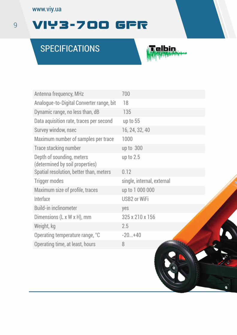
VIY3-700 GPR
SPECIFICATIONS
Antenna frequency, MHz 700Analogue-to-Digital Converter range, bit 18Dynamic range, no less than, dB 135Data aquisition rate, traces per second up to 55Survey window, nsec 16, 24, 32, 40Maximum number of samples per trace 1000Trace stacking number up to 300Depth of sounding, meters (determined by soil properties)
up to 2.5
Spatial resolution, better than, meters 0.12Trigger modes single, internal, externalMaximum size of profile, traces up to 1 000 000Interface USB2 or WiFiBuild-in inclinometer yesDimensions (L x W x H), mm 325 х 210 х 156Weight, kg 2.5Operating temperature range, °С -20...+40Operating time, at least, hours 8
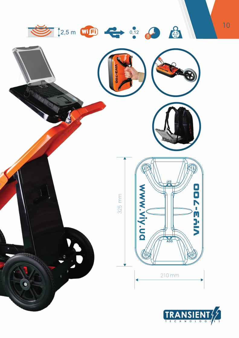
10 2,5 m
8 kg2,50,12
325
mm
210 mm
11
www.viy.ua
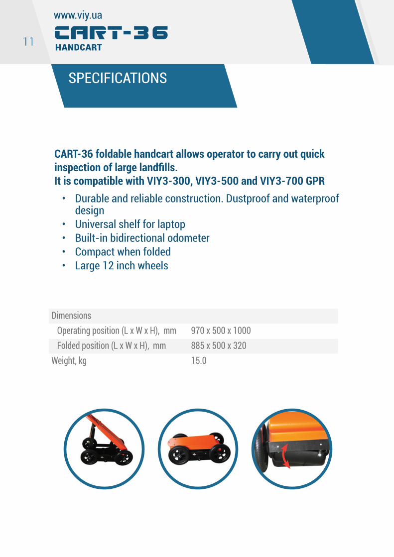
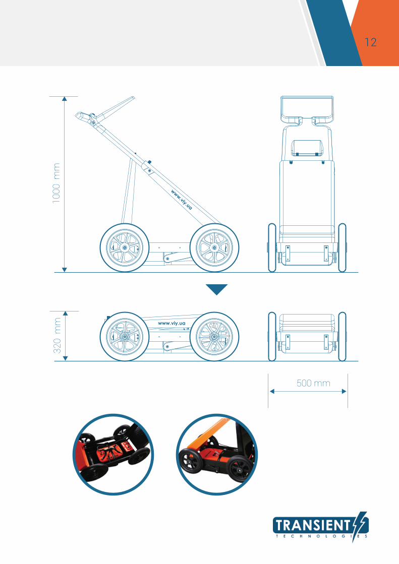
CART-36 foldable handcart allows operator to carry out quick inspection of large landfills. It is compatible with VIY3-300, VIY3-500 and VIY3-700 GPR
• Durable and reliable construction. Dustproof and waterproof design
• Universal shelf for laptop• Built-in bidirectional odometer• Compact when folded• Large 12 inch wheels
SPECIFICATIONS
CART-36 Handcart
Dimensions Operating position (L x W x H), mm 970 x 500 x 1000 Folded position (L x W x H), mm 885 x 500 x 320Weight, kg 15.0
12 10
00 m
m
500 mm
320
mm
13
www.viy.ua
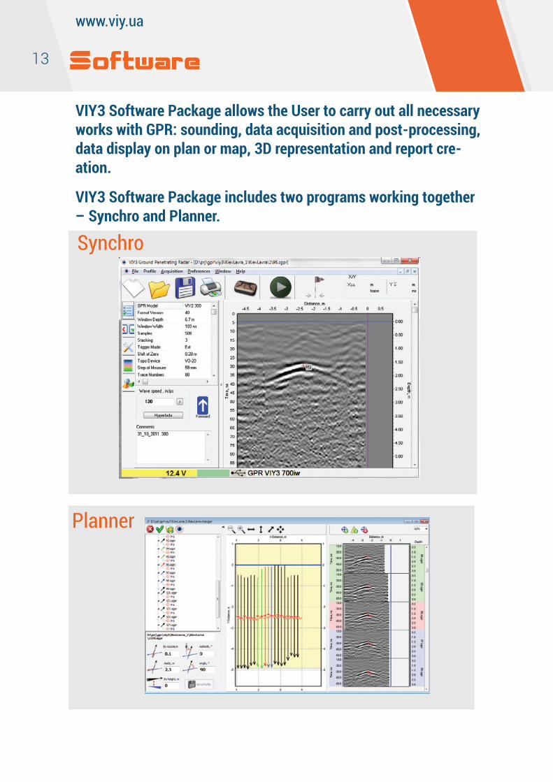
VIY3 Software Package allows the User to carry out all necessary works with GPR: sounding, data acquisition and post-processing, data display on plan or map, 3D representation and report cre-ation.
VIY3 Software Package includes two programs working together – Synchro and Planner.
Software
Synchro
Planner
14
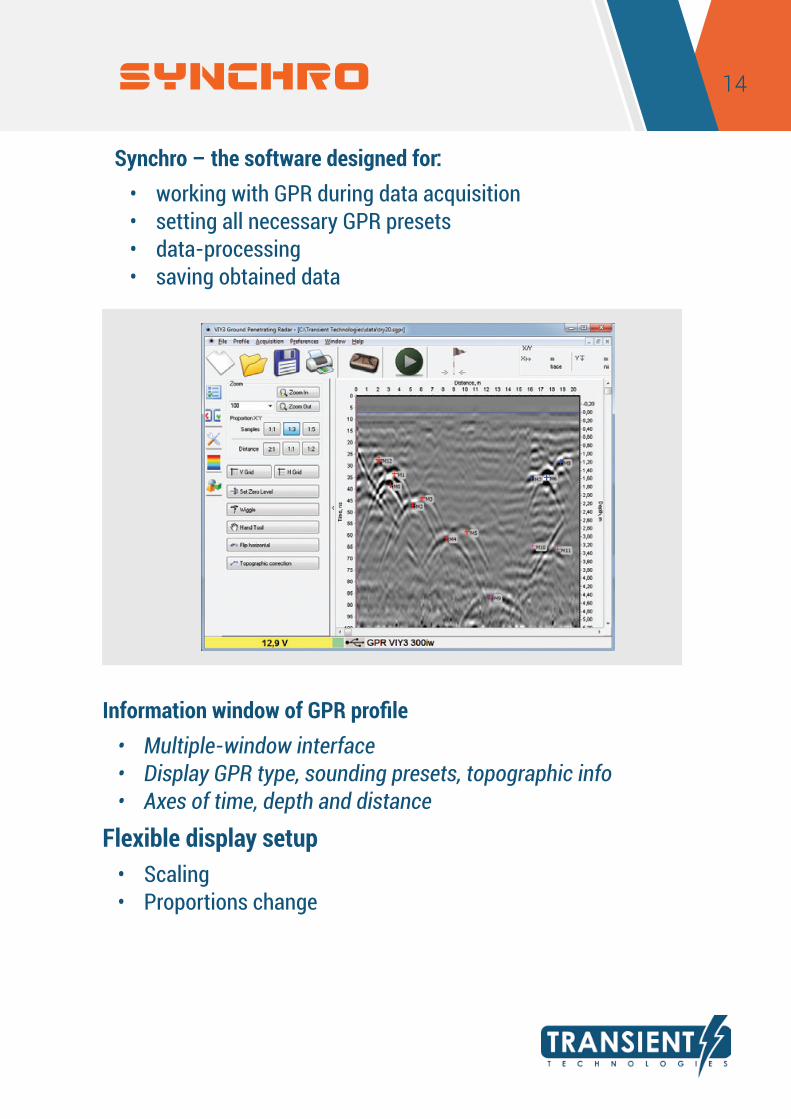
Synchro – the software designed for:• working with GPR during data acquisition• setting all necessary GPR presets• data-processing• saving obtained data
Information window of GPR profile• Multiple-window interface• Display GPR type, sounding presets, topographic info• Axes of time, depth and distance
Flexible display setup• Scaling• Proportions change
SYNCHRO

15
www.viy.ua
Control of GPR operation• Setting of GPR parameters• Start/stop of sounding process• Set-up of mutual profiles location• Maximum movement speed control
SYNCHRO
16
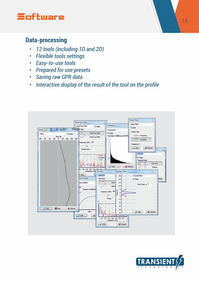
Data-processing• 12 tools (including 1D and 2D)• Flexible tools settings• Easy-to-use tools• Prepared for use presets• Saving raw GPR data• Interactive display of the result of the tool on the profile
Software
17
www.viy.ua
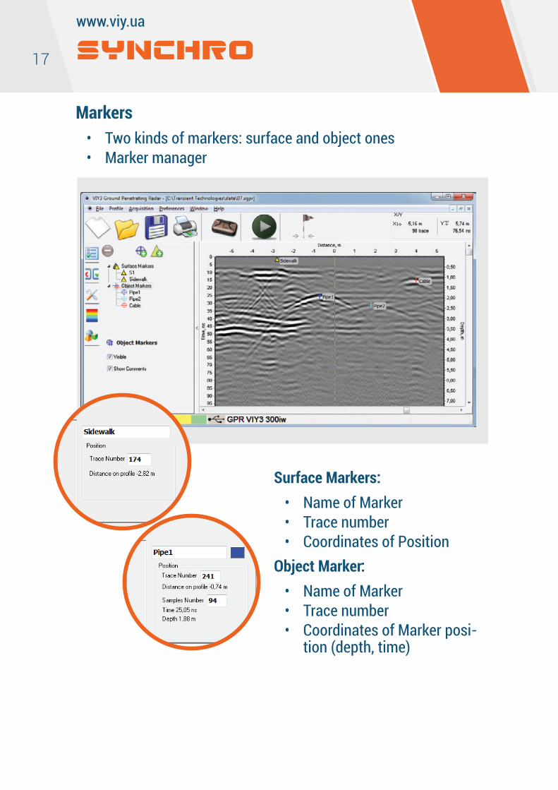
Markers• Two kinds of markers: surface and object ones• Marker manager
SYNCHRO
Surface Markers:• Name of Marker• Trace number• Coordinates of Position
Object Marker:• Name of Marker• Trace number• Coordinates of Marker posi-
tion (depth, time)
18
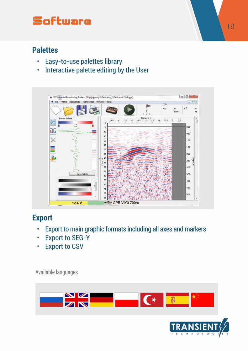
Palettes• Easy-to-use palettes library• Interactive palette editing by the User
Export• Export to main graphic formats including all axes and markers• Export to SEG-Y• Export to CSV
Available languages
Software
19
www.viy.ua
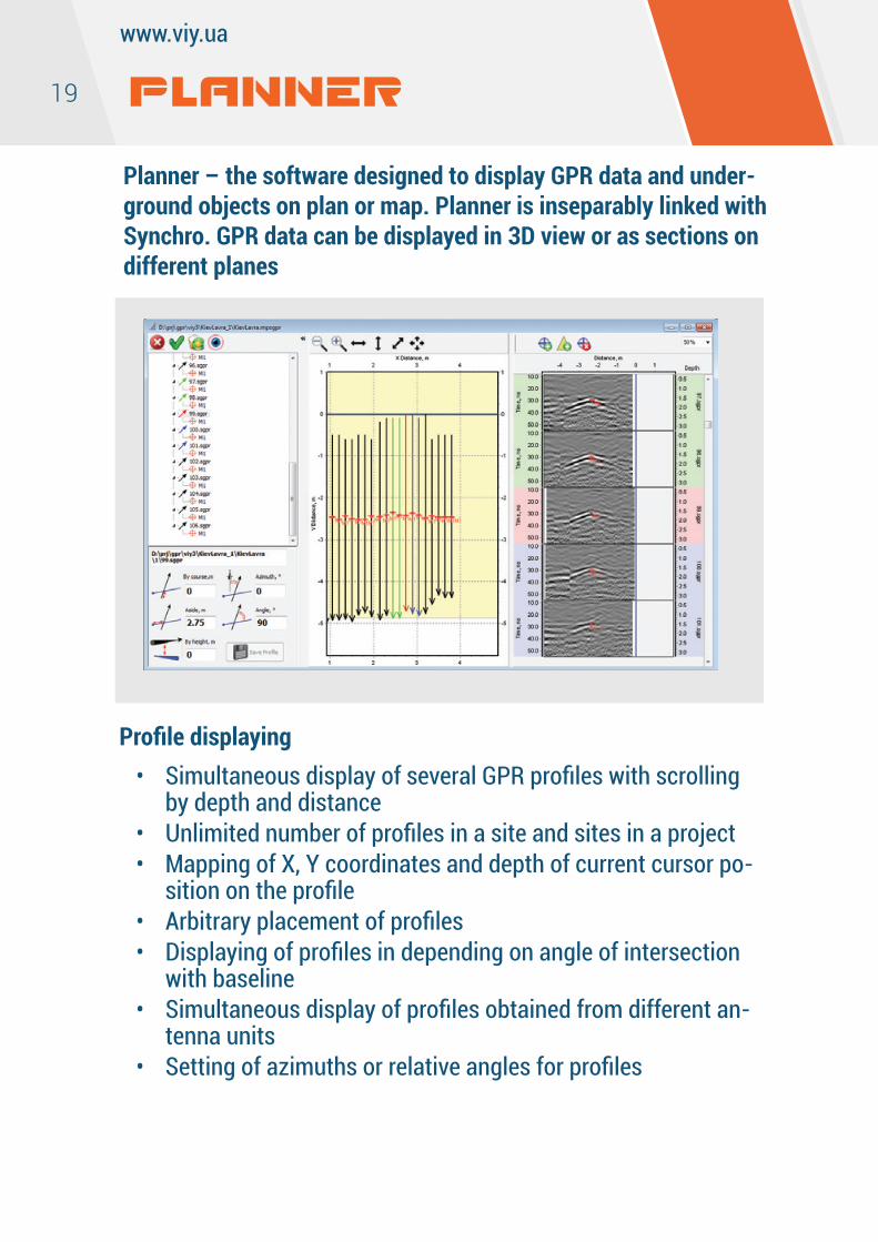
Planner – the software designed to display GPR data and under-ground objects on plan or map. Planner is inseparably linked with Synchro. GPR data can be displayed in 3D view or as sections on different planes
Profile displaying• Simultaneous display of several GPR profiles with scrolling
by depth and distance• Unlimited number of profiles in a site and sites in a project• Mapping of X, Y coordinates and depth of current cursor po-
sition on the profile• Arbitrary placement of profiles• Displaying of profiles in depending on angle of intersection
with baseline• Simultaneous display of profiles obtained from different an-
tenna units• Setting of azimuths or relative angles for profiles
PLANNER
20
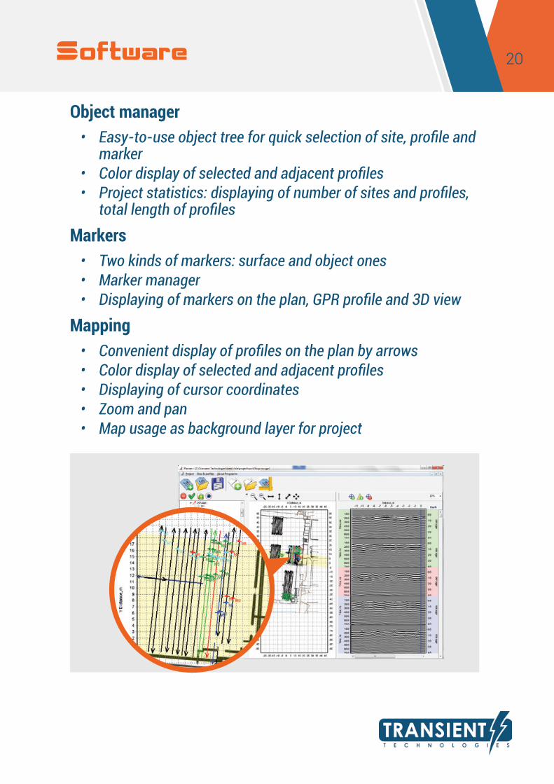
Object manager• Easy-to-use object tree for quick selection of site, profile and
marker• Color display of selected and adjacent profiles• Project statistics: displaying of number of sites and profiles,
total length of profiles
Markers• Two kinds of markers: surface and object ones• Marker manager• Displaying of markers on the plan, GPR profile and 3D view
Mapping• Convenient display of profiles on the plan by arrows• Color display of selected and adjacent profiles • Displaying of cursor coordinates• Zoom and pan• Map usage as background layer for project
Software
21
www.viy.ua
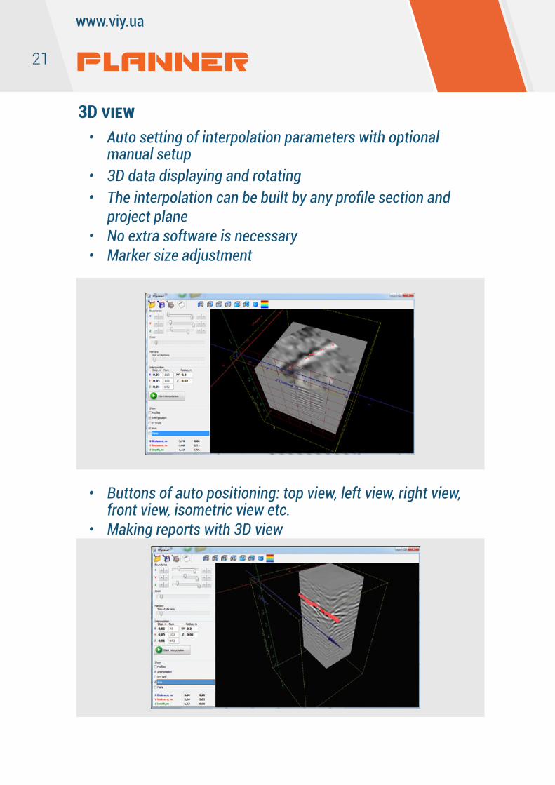
3D view• Auto setting of interpolation parameters with optional
manual setup• 3D data displaying and rotating• The interpolation can be built by any profile section and
project plane• No extra software is necessary• Marker size adjustment
• Buttons of auto positioning: top view, left view, right view, front view, isometric view etc.
• Making reports with 3D view
PLANNER
22
Reports• Creating of the report – image with all needed area of the
plan including added graphic elements – legend, figures and lines
• Making unlimited number of reports in the project• Wide opportunities of reports editing• Report export into graphic format for the further usage in
other documents• Export of the project’s data into DXF format• Export of the project’s data into AutoCad format in relative or
absolute coordinates• Export of markers into DXF format with saving of color, posi-
tion and depth setting
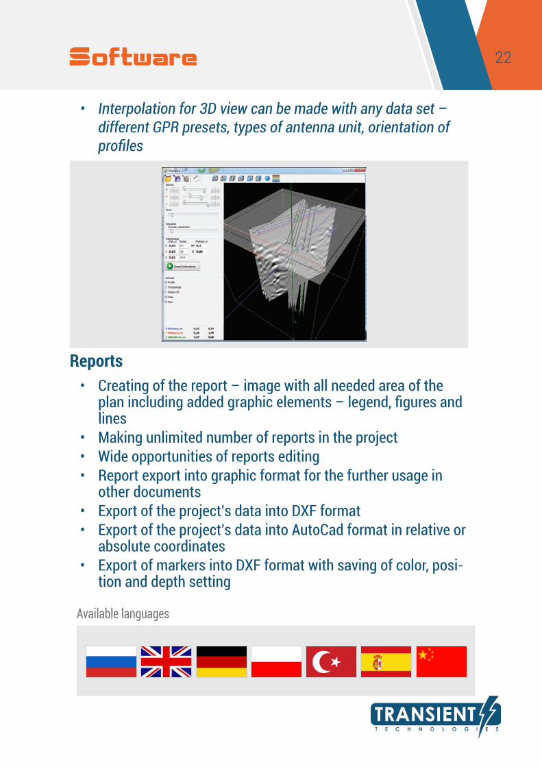
• Interpolation for 3D view can be made with any data set – different GPR presets, types of antenna unit, orientation of profiles
Available languages
Software

Transient Technologies LLCoffice 604, 13 Evgena Sverstuka str. Kyiv 02660, UkrainePhone: +380 (44) 240-85-94 e-mail: [email protected]