SENTINEL SITES: A NATIONAL NETWORK TO MONITOR SEA-LEVEL IMPACTS Coastal and Estuarine Research...
22
SENTINEL SITES: A NATIONAL NETWORK TO MONITOR SEA-LEVEL IMPACTS Coastal and Estuarine Research Federation Conference November 7th, 2013, San Diego, CA
-
Upload
amanda-daniels -
Category
Documents
-
view
216 -
download
0
Transcript of SENTINEL SITES: A NATIONAL NETWORK TO MONITOR SEA-LEVEL IMPACTS Coastal and Estuarine Research...
SENTINEL SITES: A NATIONAL NETWORK TO MONITOR SEA-LEVEL IMPACTS
Coastal and Estuarine Research Federation Conference
November 7th, 2013, San Diego, CA

Outline
The Sentinel Site framework Sentinel Site Cooperatives Development and Applications
of “Sentinel Sites” concept

Sentinel Site Framework Regional network of places
where we can ask and answer questions of local, regional, and national importance
Operational capacity for intensive study
Defined user communities Sustained observations Detect and understand changes
in the ecosystems they represent.
Informed, enabled stakeholder communities
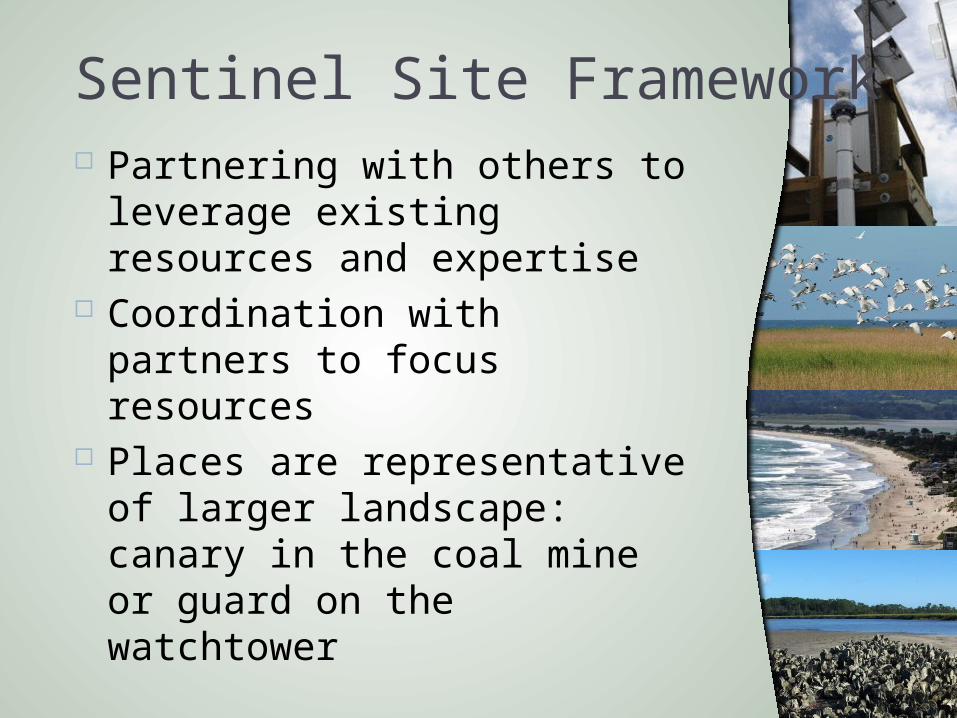
Sentinel Site Framework Partnering with others to
leverage existing resources and expertise
Coordination with partners to focus resources
Places are representative of larger landscape: canary in the coal mine or guard on the watchtower
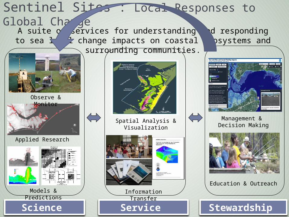
Sentinel Sites : Local Responses to Global Change
A suite of services for understanding and responding to sea level change impacts on coastal ecosystems and surrounding communities.
Science Service Stewardship
Observe & Monitor
Applied Research
Models & Predictions
Spatial Analysis & Visualization
Information Transfer
Education & Outreach
Management & Decision Making
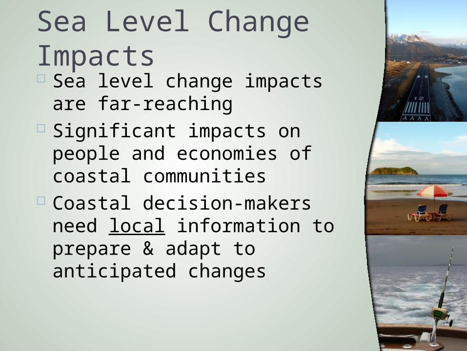
Sea Level Change Impacts Sea level change impacts are
far-reaching Significant impacts on people
and economies of coastal communities
Coastal decision-makers need local information to prepare & adapt to anticipated changes
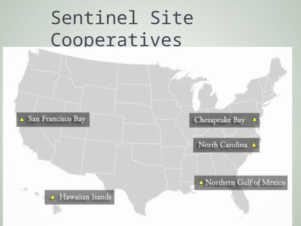
Sentinel Site Cooperatives
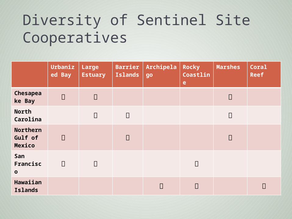
Diversity of Sentinel Site Cooperatives
Urbanized Bay
Large Estuary
Barrier Islands
Archipelago
Rocky Coastline
Marshes Coral Reef
Chesapeake Bay
North Carolina
Northern Gulf of Mexico
San Francisco
Hawaiian Islands

NOAA Sentinel Site Program Partners
San Francisco BayNorthern Gulf of Mexico
Hawaiian IslandsNorth CarolinaChesapeake Bay

Sentinel Site Cooperative Assets
Sentinel
Site 1
Sentinel Site
2
SentinelSite
3
Community 1
Community 2
Community 3

National Estuarine Research Reserve System

NERRS Sentinel Site Program Initial focus on sea level
change impacts to wetland vegetation
Local geodetic control networks
Coupled physical and biological monitoring

Sea Level
Upland
Initial Wetland Surface
Bench Mark with Geodetic Control (NAVD88, etc.)
Surface Elevation Table (SET)Tide Gauge
Depth of SET measurement integration
Deep Subsidence
Subsided Wetland SurfaceRise
Shallow Subsidence
Marker Horizon
Surface Accretion
Elevation Change
Sea level rise is expressed with respect to upland vertical control
monuments
(unstable, dynamic wetland surfaces follow a different vertical trajectory compared to uplands)
Making level connections between water levels, SETs and uplands allows you to measure the sea level rise that the wetlands are experiencing; connection to uplands checks for mark stability
Geodetic connection assures known gauge stability

NERRS Sentinel Site Program Initial focus on sea level
change impacts to wetland vegetation
Local geodetic control networks
Coupled physical and biological monitoring
Nation-wide adoption of similar protocols

Geospatial infrastructure guidelines2013
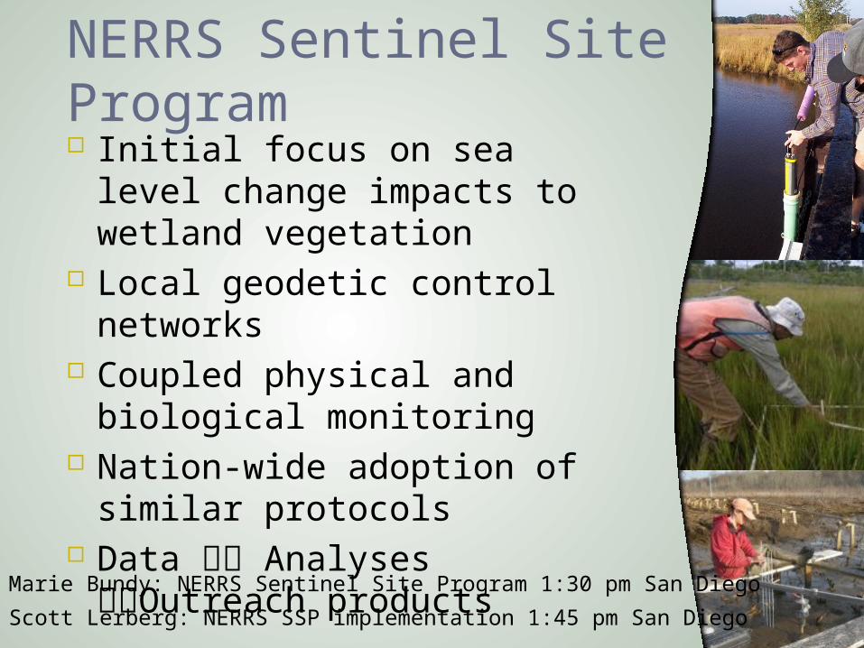
NERRS Sentinel Site Program Initial focus on sea level
change impacts to wetland vegetation
Local geodetic control networks
Coupled physical and biological monitoring
Nation-wide adoption of similar protocols
Data Analyses Outreach products
Marie Bundy: NERRS Sentinel Site Program 1:30 pm San Diego
Scott Lerberg: NERRS SSP implementation 1:45 pm San Diego

Interagency collaboration/leveraging
Nearshore bathymetry & coastal elevations
Refined local sea level trends in western AK
Improvements to tidal & geodetic datum conversion tools
Rapid assessments of storm impacts on Alaska’s coastline
Nicole Kinsman: RSLR/Inundation in AK, 2:00 pm San Diego

National Park Service
NPS Sentinel Sites Bench marks and accurate heights to
monitor vulnerability to sea level rise and coastal inundation
“Sentinel Sites:” locations where park managers determine there are critical infrastructure, habitats, cultural sites, and populations of species of concern
Neil Winn: Assateague Island National Seashore 2: 45 pm San Diego

The Smithsonian Institution Tennenbaum Marine
Observatories Network Worldwide network of coastal
ecological field sites Standardized measurements
of biological change Understanding how marine
biodiversity is affected by local human activities and global change
Ocean warming, acidification and rising sea levels
Session Presentation: Marguerite Toscano, 2:15 pm San Diego

Sentinel Site monitoring of climate change in an urban estuary
Focus on climate change impacts to LIS ecosystems
Establish sentinels for early detection
Develop management strategies for adaptation and resilience
LONG ISLAND SOUND STUDYA PARTNERSHIP TO RESPORE AND PROTECT THE SOUND
Jason Krumholz: Sentinel Monitoring in an Urban Estuary, 9:45 am

Poplar Island Restoration Project
Restoration in the face of sea level rise Full suite of physical & biological
monitoring Partnering with academic research to
understand processes of functional wetland restoration

SENTINEL SITES: A NATIONAL NETWORK TO MONITOR SEA-LEVEL IMPACTS