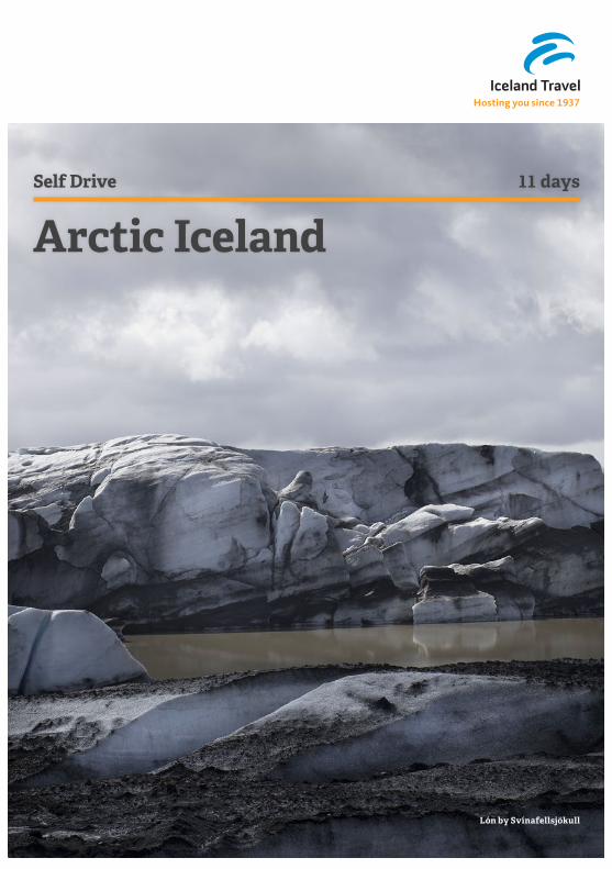
Self Drive 11 days Arctic Iceland
28
Hosting you since 1937 Arctic Iceland Lón by Svínafellsjökull Self Drive 11 days
Transcript of Self Drive 11 days Arctic Iceland
Hosting you since 1937
Arctic Iceland
Lón by Svínafellsjökull
Self Drive 11 days

Self Drive Arctic Iceland2
Welcome to Iceland!
To make your stay in Iceland more enjoyable, we would like to draw your attention to the following:
△ This booklet contains a standard itinerary. If you have added nights, please note that the itinerary has not been customized to show such amendments.
△ This itinerary is a guideline for your travel in Iceland. The route may vary according to your overnight stay and road conditions, especially during April/May and September/October.
△ Even with the long daylight, you will not be able to visit every nook and cranny nor enjoy all the fun things sug-gested. Please choose between the sites mentioned depending on your interest as time limits your possibilities.
△ The kilometer/mile distance per day is not precise. The distance may vary depending on the location of your accommodation and the detours you take each day.
△ On your accommodation itinerary you will find a detailed address list, describing how to reach your accommoda-tions. The accommodation itinerary also has a reference number, which is valid as your voucher. Official hotel check-in time is 14:00-18:00. If you arrive any later, it’s courteous to notify the hotel.
△ Breakfast is always included during your stay, but no other meals. Many of the rural hotels and guesthouses offer a nice dinner at a reasonable price.
Sat Nav
Speed Limit
Seat Belts
Road Map
Bin the Litter
One Lane Bridge
Watch out for Animals
Gravel Roads

3Arctic Iceland Self Drive
A few favourites from the trip
________________________________________________________________________________________________________________________________________________________________________
________________________________________________________________________________________________________________________________________________________________________
________________________________________________________________________________________________________________________________________________________________________
________________________________________________________________________________________________________________________________________________________________________
________________________________________________________________________________________________________________________________________________________________________
________________________________________________________________________________________________________________________________________________________________________
________________________________________________________________________________________________________________________________________________________________________
________________________________________________________________________________________________________________________________________________________________________
________________________________________________________________________________________________________________________________________________________________________
________________________________________________________________________________________________________________________________________________________________________
________________________________________________________________________________________________________________________________________________________________________
________________________________________________________________________________________________________________________________________________________________________
________________________________________________________________________________________________________________________________________________________________________
________________________________________________________________________________________________________________________________________________________________________
________________________________________________________________________________________________________________________________________________________________________
________________________________________________________________________________________________________________________________________________________________________
________________________________________________________________________________________________________________________________________________________________________
________________________________________________________________________________________________________________________________________________________________________
________________________________________________________________________________________________________________________________________________________________________
________________________________________________________________________________________________________________________________________________________________________
________________________________________________________________________________________________________________________________________________________________________
________________________________________________________________________________________________________________________________________________________________________

Self Drive Arctic Iceland4
Day 1:
Arrival
Pick-up your rental car and explore Reykjanes
Peninsula
➠➠Approximate driving distance:
104 km / 64 miles
Please see your Iceland Travel Itinerary for
details about your overnight stay
Upon your arrival in Iceland you’ll find your rental car help desk in the arrival hall at
Keflavik Airport. The desk is open every day from 5:00am – 5:00pm and again from 9:00pm-1:00am. The staff will advise you where to find your vehicle.
If you are arriving early enough in the day we recommend driving along the southern coast of the Reykjanes peninsula. Start your journey with a soak in the Blue Lagoon. Follow road no. 41 towards Reykjavik until you find road no. 43, leading south towards Grindavik. Before you reach Mt Þorbjorn you make a right turn to the Blue Lagoon area. To make it easier you can just follow the steam rising up through the air! At the Blue Lagoon you can wash of the jet lag and relax in the milky waters of the Lagoon and perhaps enjoy a glass of the famous Blue Lagoon cocktail while you let the algae mask bring out the skin’s inner glow!
Kindly note that the Blue lagoon is very popular year around and therefore you should book ahead.
If you are not relaxing in the lagoon at the beginning of your trip you continue on road no. 43 until you find your way to Grindavik. Take a left onto road no. 427 and explore the southern coastline on your way to Hveragerdi.
Follow this winding road along the shoreline, past stand-alone houses, lava rock formations, and endless sea views. Take a quick detour on road no. 42 to Krysuvik Geothermal Area and Kleifarvatn Lake, which are a part of the Reykjanes fissure zone.
Continue on your journey on road no. 427 until you reach road no. 38 which will take you to the charming village of Hveragerdi. The village is one of the few sites in the world located directly on top of a geothermal area and because of its many greenhouses heated by hot water from nearby springs it is often called the flower village.
Reykjavík
Stykkishólmur
9
Keflavík
Vík
Höfn
2 31
7
6
8
10
Hveragerði
Kirkjubæjarklaustur
EgilsstaðirMývatn
Akureyri
4-5
5Arctic Iceland Self Drive
Day 2:
Þingvellir, Gullfoss, Skálholt, Þjórsárdalur, Hella
National Park with Geological Wonders (UNESCO),
Exploding Geysers, Massive Waterfall. Hekla Volcano
➠➠Approximate driving distance:
300 km / 186 miles
Please see your Iceland Travel Itinerary for
details about your overnight stay
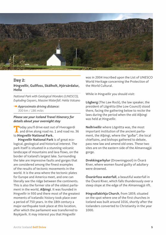
Today you’ll drive east out of Hveragerdi and drive along road no. 1 and road no. 36
to Þingvellir National Park.Þingvellir National Park is of great eco-
logical, geological and historical interest. The park itself is situated in a stunning volcanic landscape of mountains and lava flows, on the border of Iceland’s largest lake. Surrounding the lake are impressive faults and gorges that are considered among the finest examples of the results of tectonic movements in the world. It is the area where the tectonic plates for Europe and America meet, and one can literally see the ridge between the continents. This is also the former site of the oldest parlia-ment in the world, Alþingi. It was founded in Þingvellir in 930 and there most of the greatest moments of Icelandic history took place over a period of 750 years. In the 18th century a major earthquake took place at this location, after which the parliament was transferred to Reykjavík. It may interest you that Þingvellir
was in 2004 inscribed upon the List of UNESCO World Heritage concerning the Protection of the World Cultural.
While in Þingvellir you should visit:
Lögberg (The Law Rock), the law speaker, the president of Lögrétta (the Low Council) stood there, facing the gathering below to recite the laws during the period when the old Alþingi was held at Þingvellir.
Neðrivellir where Lögrétta was, the most important institution of the ancient parlia-ment, the Alþingi, where the “goðar”, the local chieftains, and bishops gathered to debate, pass new law and amend old ones. These two sites are on the eastern side of the Almannagjá gorge.
Drekkingarhylur (Drowningpool) in Öxará River, where women found guilty of adultery were drowned.
Öxarárfoss waterfall, a beautiful waterfall in the Öxará River, which falls thunderously over a steep slope at the edge of the Almannagjá rift.
Þingvallakirkja Church, from 1859, situated on the spot where one of the first churches in Iceland was built around 1016, shortly after the Icelanders converted to Christianity in the year 1000.

Self Drive Arctic Iceland6
From Þingvellir you will drive via Lyngdalsheiði on road no. 365 to the lake Laugarvatn area. Laugarvatn is a geothermal area, and it is said that when Christianity was legalized in the year 1000, the chieftains from the north who refused to be baptized in the cold water of Þingvellir, were brought to Laugarvatn to be baptized in the warm spring. Here at Fontana Spa you can enjoy the sauna, the steambath and a warm soak in the geothermal pools, tel. 486 1400.
You continue your tour to the beautiful Gull-foss and Geysir region. You drive to the Geysir area, which is by road no. 35. It is a colourful geothermal field in a 3 km2 (1.2 mi2) area where hot springs and geysers are abundant. Geysir spouting spring is the world’s largest geyser, whose name is the generic term for this strange phenomenon. Geysir, believed to have formed in the thirteenth century, has a bowl 18 m (59 ft) in diameter with a 20 m (66 ft) deep cham-ber below. Its eruptions are majestic and after the big earthquakes in 2000 it has erupted several times. A smaller, adjacent hot spout-ing spring, Strokkur, is a popular attraction,
erupting at 5–10 minute intervals. The whole area contains a variety of hot springs and bub-bling pools. Please be careful around the hot springs and around the waterfall and stick to the hiking-paths.
You continue your journey further north to Gullfoss waterfall, the “Golden Waterfall”. It is a beautiful double-folding fall that many believe to be the most scenic in Iceland. It thunders 32 m (105 ft) over a fault into a gorge, which measures 2.5 km (1.5 miles) in length and up to 70 m (230 ft) deep in places.
You head back on road no. 35 and then take a left on the no. 31. There you find the bishopric at Skálholt, which played a major role in Icelandic history from the year 1056 to 1796, when the bishopric moved to Reykjavík follow-ing a great series of earthquakes.
Turn into road no. 30 to the north and to road no. 32 to Þjórsárdalur valley, with its landscape of sharply contrasting birch woods, sandy lava fields, rivers and waterfalls. Follow the course of the mighty Þjórsá, Iceland’s longest river and the most important source of electric energy in the country. At the entrance

7Arctic Iceland Self Drive
to the Þjórsárdalur valley, you can stop for a short climb to the top of Gaukshöfði, a rocky crag with the mighty river at its foot and a splendid view of Hekla, Iceland’s most famous volcano. You will find the beautiful waterfall Hjálparfoss by the roadside, framed in twisted basalt columns before heading for Stöng, the excavated ruins of a Viking-age farmhouse in a fair state of preservation. Nearby is the ravine Gjáin, an outstanding beauty spot, with minia-ture landscape, brooks and waterfalls.
We recommend a visit to Þjóðveldisbærinn, an ancient Icelandic dwelling. The recon-structed medieval farmhouse in Þjórsárdalur valley is one of Iceland s hidden treasures. The farmhouse is an exact replica of an 11th cen-tury Icelandic manor, who offers the traveler a personal experience of the dwellings and daily life of medieval Icelanders. The recreated ruins are from a farm called Stöng which was destroyed by Mt. Hekla in 1104. The inhabit-ants of Stöng were chiefs in the district and the most famous of them is the Viking Gaukur Trandilsson. The reconstructed farmhouse is a living monument of the grandiose life

Self Drive Arctic Iceland8
of ancient Icelanders and a must-see for all travelers to Iceland. Open June to August 10:00–17:00.
Turn back to road no. 32 going north until you reach the junction of road no. 26 and no. 32. Take a right turn to road no. 26 and drive down that road to road no. 1. Continue your tour through the fertile farmlands of the south, towards the east through the small villages of Hella and Hvolsvöllur.
In this area you will have frequent view of mountains, including the majestic Mt. Hekla.
Mt. Hekla is without a doubt Iceland’s most famous volcano. It is still very active, erupting most recently in 1970, 1980, 1981 and in 1991. The last eruption started on 26th February in 2000 and lasted for 12 days; the lava from this eruption covers approximately 18 km2 (47 mi2). Instead of a classical volcano cone, Hekla is part of a rather squat series of ridges, although this is usually hidden behind a thick bank of clouds that earned Hekla its menacing name, which means the hooded one. Soon after the settle-ment period, in 1104, Hekla showed that it was a presence to be feared as it erupted with-out warning and devastated 20 farms in the Þjórsárdalur valley. Indeed the volcano’s fame grew so much that the Europeans in the middle Ages believed it was the gateway to hell. The volcanic eruptions from Hekla are spectacular as the mountain is 1,493 m (4897 ft) high and towers over the lowlands of the south.
This is the region where one of the best known Icelandic classical Sagas, the “Story of Brennu Njáll” is set. You have the opportunity to visit the Saga Centre in Hvolsvöllur where you can learn more about the sagas, tel. 487 8781.
Rising ahead of you now is the cone shaped Eyjafjallajökull glacier and volcano, 1666 m (5465 ft). On a clear day you can see the Westman Islands to your right.
There is a ferry to the Westman Islands, sailing from Landeyjarsandur. Therefore it is easy to take a detour to the Westman Islands, a small archipelago with around 15 small islands, the largest one Heimaey has a population of around 4.000 inhabitants.
Detour to the Westman Islands:
A few kilometres east of Hvolsvöllur, turn
right when you see the ferry sign and drive
towards the ocean. The ferry “Herjólfur” offers
several departures per day, please call 481 2800
for information about the schedule and prices.
You can either leave your car behind at the har-
bour or take it along on the ferry. The duration of
the trip is about 30 minutes in good weather.
Once in the Westman Islands, you should visit
Eldheimar – a volcano museum of remembrance, tel 488 2700. The exhibition focuses on
the 1973 volcanic eruption in Vestmannaeyjar,
without a doubt one of Iceland s biggest natural
disaster. The highlight of the exhibition is a house
that has been delicately excavated. Eldheimar
also houses the Surtsey exhibition with all avail-
able information about this unique island, which is
on the UNESCO World Heritage List.
A boat tour around the islands is a must for
all bird and nature lovers, please call Viking Tours
for further information, tel. 488 4884. They offer
various tours, such as the popular circle tour, whale
watching and deep sea fishing.
A visit to the Museum of Natural History is
recommended, that offers insight into the bird and
fish life, houses a rock and minerals collection and
an aquarium. From mid-May until mid-September
the museum is open daily from 10:00-17:00 but
less in other months, tel. 481 1997.
Beautiful walks in Vestmanneyjar includes a
walk to the southern tip of the island “Stórhöfði”
for puffin- and bird sightseeing and hike up to
Helgafell and/or Eldfell volcano.
Back on the ferry and you find yourself again
on the main-land.
Continue on road no. 1 and a stop at the spectacular waterfall Seljalandsfoss, 40 m (131 ft) high, is recommended. There you can actu-ally climb behind the waterfall, but be careful as it might be slippery.
Shortly after you pass Seljalandsfoss water-fall, you can pay a visit to the famous visitor centre at Þorvaldseyri farm, tel. 487 5757, which gained world-wide attention, during the volcanic eruption beneath Eyjafjallajökull Glacier. During the eruption, thick layers of ash

9Arctic Iceland Self Drive
fell to the ground and rivers flooded its banks, damaging the farmlands, hot water pipes and water barriers of the nearby farms. The farmer, Mr Olafur and his family, have extraordinary images on display, showing the farm and its sur-rounding before, during and after the eruption.
Drive onwards to Skógar, where you can visit the Folk museum and Skógafoss waterfall, 60 m (197 ft) high, one of the most impressive waterfalls in the country. The popular Folk museum is open daily from 09:00-18:00 during June-August but less in other months, tel. 487 8845.
Fun things to do
River Rafting on the river HvítáDuration: 3- 4 hours
Arctic Rafting, tel. 562 7000.Snowmobile tour on Langjokull GlacierDuration: 2,5-3 hrs
Mountaineers of Iceland, tel. 562 7000.
Day 3:
Hella, Vík, Kirkjubæjarklaustur
Thundering Waterfalls, Puffin Colony, Black Sand
Beaches, Lava Fields
➠➠Approximate driving distance:
160 km / 99 miles
Please see your Iceland Travel Itinerary for
details about your overnight stay
Mýrdalsjökull is Iceland’s fourth largest glacier. Glacier tongues creep down its
sides to the lowlands, the most prominent being Sólheimajökull. Under the south-eastern side of the glacier is Katla, a sub glacial central volcano, buried deep under 400 m (1312 ft) of ice. The caldera is 10 km (6.3 miles) in diameter. Since the settlement of Iceland, Katla has erupted 16–20 times at an average interval of 40–80 years, melting the glacial cap

Self Drive Arctic Iceland10
and causing catastrophic floods in the plains below. All of this has in the course of time created the vast Mýrdalssandur desert on the south-eastern side of the glacier. Katla last erupted in 1918.
Continue the journey and pass Dyrhólaey, a magnificent rocky headland with sheer cliffs. It is the southernmost point of Iceland and at the tip of it, is a huge wave cut gap which boats can sail through. The headland is known for its bird life and is certainly worth a visit. It is about 5 km (3 miles) from road no. 1 on road no. 218, about 8 km (5 miles) before you arrive to Vík village. Dyrhólaey is a bird sanctuary and traffic during breeding season from ca. 15th of May until 25th of June can be limited. Please note that the road to the top is not always recom-mendable as it is very steep. If it has been raining severely, the road turns muddy and is not recommended for smaller cars and inex-perienced drivers. One has to be very careful
walking on top of Dyrhólaey, as no fences protect you from falling, so do not walk close to the edge.
Before reaching Vík, there is another recom-mended detour to the so-called Reynishverfi by turning right on road no. 215. Reynishverfi offers a beautiful black beach and impres-sive basalt column. At one place you can even see and go into a cave called Hálsanefshellir formed by the sea through the thousands of years. Depending on the tides the cave may not always be accessible.
Please note:
As much as this stretch of black sand looks innocent, it’s open to the Atlantic Ocean and is known for extremely vicious waves and strong currents. You should therefore be extra careful, comply with warning signs at all times and keep away from the shore line.

11Arctic Iceland Self Drive
You will drive onwards to the quiet village of Vík, which is situated in the mild and fertile Mýrdalur valley which is the southernmost borough in Iceland. The western border is marked by the glacial river, Jökulsá, to the east by the river Blautakvísl, and to the south by black, volcanic beaches and the Atlantic Ocean. Mýrdalur is a farming area with about 600 inhabitants, 330 of them in the village of Vík. It is an area of great contrasts. Lush green pastures lie between vast black volcanic sands. Rugged mountains, scarred by deep gullies, rise from the sands and are topped by the Mýrdals-jökull glacier. The area has rich birdlife with the country’s largest nesting colony of arctic terns just east of the village. In the cliffs west of the village you will see countless puffins, kittiwakes and fulmars mainly during the months of May, June and July.
Please be careful when walking in the nest-ing area of the arctic terns as they are very
protective of their eggs and their young ones. Intruding those areas one can expect dive-bombing attacks, where they do not hesitate to pick with their pointed beak on one’s head. To avoid getting hurt, please put a stick, umbrella or something long above your head since they attack the highest point.
Reynisdrangar: These are high rocks or needles in the sea at the base of Reynisfjall Mountain, supposedly formed when two trolls were trying to drag a three-mastered ship to land. When daylight broke they turned into stone. The needles rise 66 m (216 ft) above sea level and can be seen from Vík.
Heiðarvatn: A lake that lies not far from Vík. It offers good trout fishing and is a nice area for walking. Please note that you will need a permit for fishing.
You continue your trip to Kirkjubæjarklaustur, an area of great beauty, a growing resort with a number of historical spots. You

Self Drive Arctic Iceland12
drive on road no. 1 across the south-eastern part of Iceland through the impressive Skaftáreldahraun lava field, which was created in the volcanic eruption at Laki Craters, supposedly the biggest lava field on earth coming from only one eruption, and which is now all covered with moss.
Fun things to do
Snowmobile Tour of Mýrdalsjökull glacierDuration: 1 hour
Arcanum, tel. 487 1500 / 893 3445.Glacial Walk on Crampons from Sólheima-jökull, with the possibility of some ice-climb-ing for those willing enough to tryDuration: 1.5 or 3.5 hours
Icelandic Mountain Guides, tel. 587 9999 or 899 9982.
Day 4:Skaftafell, Jökulsárlón, Höfn, Egilsstaðir
Europe’s Largest National Park and Glacier, Glacial
Lagoon with Icebergs
➠➠Approximate driving distance:
450 km / 280 miles
Please see your Iceland Travel Itinerary for
details about your overnight stay
Kirkjubæjarklaustur was the site of a convent in earlier times, a fact reflected
in place name like Systrastapi, Systrafoss and Systravatn, meaning Sister’s Rock, Sisters’ Fall and Sisters’ Lake, respectively. You can have a look at the famous Kirkjugólf or church floor, at the northern part of Kirkjubæjarklaustur, although it was never a floor in a church. It is the surface of huge basalt columns. It is worth a closer look. Near Kirkjubæjarklaustur you will see numerous hills, Landbrotshólar, but they make up the biggest area of pseudo craters in Iceland.
13Arctic Iceland Self Drive
The area has a lot to offer the visitor; Hiking, swimming in Kirkjubæjarklaustur and sight-seeing are some of the options. The Tourist Information Center in Kirkjubæjarklaustur, tel. 487-4620 can give further information on what to do in Kirkjubæjarklaustur.
On the way from Kirkjubæjarklaustur to Skaftafell National Park you will have a great opportunity to see an interesting basalt column formation at Dverghamrar, please look for a sign on the right hand side of the road. Then drive past Núpsstaður, an old farm surrounded by magnificent cliffs, where you will find one of the oldest churches in Iceland with a turf-cov-ered roof. You will also drive past Lómagnúpur; an impressive 688 m (2.257 ft) high precipice.
After passing Lómagnúpur, Skeiðarársandur sand plains will appear. Following a vol-canic eruption in Vatnajökull glacier in October 1996, millions of tons of water and ice flooded over Skeiðarársandur. The flood washed away large parts of the road and destroyed two bridges. Preliminary repairs were made and the road opened again in December, only
two months after the eruption. Some of the icebergs that the flood carried with it were as large as three story houses.
Skaftafell National Park is a masterpiece of seemingly impossible contrasts of nature. On the one hand you have the Skeiðarársandur plains, vast stretches of black sandy waste-land and volcanic debris borne from volcanic eruptions from underneath the icecap of Vatnajökull. On the other hand you have the enormous icecap of Vatnajökull with its valley glaciers descending like fingers in all direc-tions. In the middle lies Skaftafell plateau, like a verdant oasis, where you can see gorges with clear brooks and beautiful waterfalls, birch woods, a wealth of wild flowers and lush veg-etation. A walk on the marked paths along the gorges for a look at the waterfalls is a must for all visitors. The most majestic is Svartifoss, “Black Fall” plunging over a wall of symmetri-cal basalt columns that recall organ pipes. There is an alternative for those who have difficulty walking up to the Skaftafellsjökull glacier (wheelchair accessible). For further

Self Drive Arctic Iceland14
information please ask at the information centre in Skaftafell.
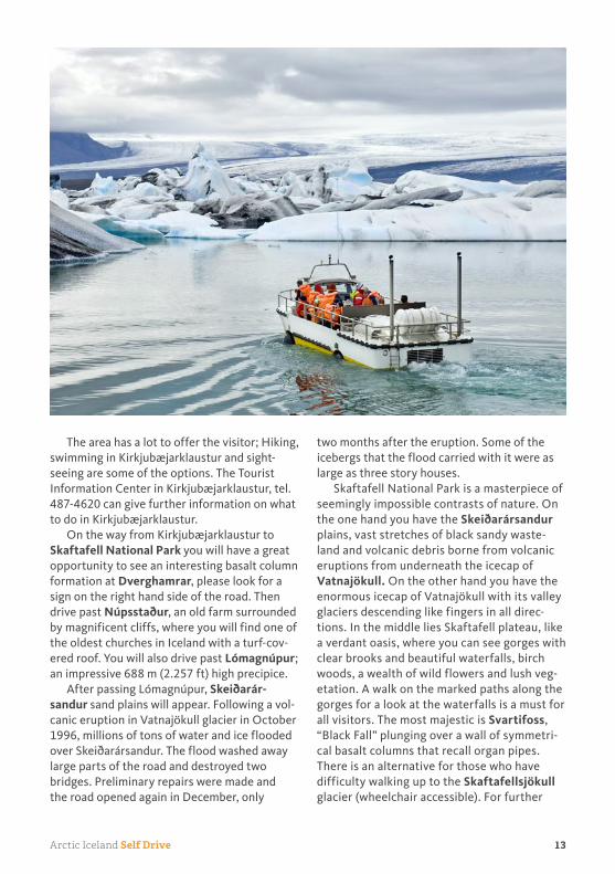
Continue your tour and drive from Skaftafell on to Jökulsárlón where it is possible to take a breathtaking cruise amongst floating icebergs on the fantastic 180 m (590 ft) deep glacial lagoon. The icebergs break off enormous ice lobes, advancing down deep valleys from the Vatnajökull icecap. The ice from the glacier is over 1000 years old, but the lagoon has largely been formed last century, as the glacier has retreated in the warmer climate. Sometimes you can see seals by the coastline of the lagoon.
At the travel service in Hólmur, before reaching Höfn, you can visit a café and MiniZoo with all the usual Icelandic farm animals, horses, sheep, dogs, cats and more. Open daily, 09:00-17:00, tel. 478 2063.
Brunnhóll farm and guesthouse makes a delicious stop on the way to Höfn, since the farm is known for its own production of home-made ice-cream.
Höfn is a bustling fishing and fish process-ing port, as well as a commercial centre, with considerable farming in the neighbouring area. In Höfn there is an interesting local exhibition worth seeing. The visitors have the opportunity to experience and learn about the area, the nature and the basic glaciology.
Eastern Iceland is a very mountainous region of deep fjords isolated from each other by sheer mountains. There is very little volcanic or geothermal activity there as the region is geologically the oldest part of Iceland. The region is heavily eroded and therefore there are many interesting minerals and semi-precious stones to be found there.
The Eastern Fjords are renowned for the history of brave French, Belgian and Spanish fishermen who fished cod in the seas off the coast of the eastern shores from the beginning of the 17th century. An Icelandic farmer com-piled the world’s first dictionary of the Basque language in the 17th century in order to be able to communicate with some of them.
Before you come to the Almannaskarð tun-nel you can take a little detour down the road to the right marked “Stokksnes”. At the end of that road, down at the shore, you will find
seabirds, arctic terns and possibly seals out on the cliffs.
You then drive east through the Almanna-skarð tunnel. If the weather is good an option is to drive to a view point on the east side of the tunnel. There you can enjoy the beautiful scen-ery towards the west. You will see the glacial tongues running down from the main icecap to the lowlands.
Continue through the Lón area, which many consider to be one of the most beautiful sites in Iceland. The road then leads north to Djúpi-vogur, at the southern opening of Berufjörður fjord, which is known for its zeolite-crystals.
Djúpivogur is a beautifully situated, pic-turesque fishing town. If you can, take a walk around this beautiful area, please ask for a hiking map of the area in the shops. Djúpivogur might be an interesting choice for birdwatchers because there you can experience unspoiled nature where you can see the bulk of Icelandic birds in their natural environment without dif-ficulties such as long walks or extra travelling. Mammals such as seals and reindeer can also be seen there frequently. In Djúpivogur are two birdwachting houses that every birdwatcher can use to take a closer look. You can get more information in their information centre in Langabúð.
Please note that you have 3 different routes to choose from depending on the time you have. First option is to drive via the rugged fjords of the East Coast, on road no. 96, after passing Breiðdalsvík village. The second option is to travel the short mountain road Öxi no. 939 from Djúpivogur village (depends on road conditions, please inquire locally) or thirdly to continue on road no. 1, crossing Breiðdalsheiði heath.
Detour via the rugged Fjords of the East coast:
Continue the journey through Breiðdalsvík and on to Stöðvarfjörður, where you
can visit the famous Rock Collection of Petra
Sveinsdóttir, tel. 475 8834. Over 90% of the stones
in her collection were found in Stöðvarfjörður and
the surroundings.
15Arctic Iceland Self Drive
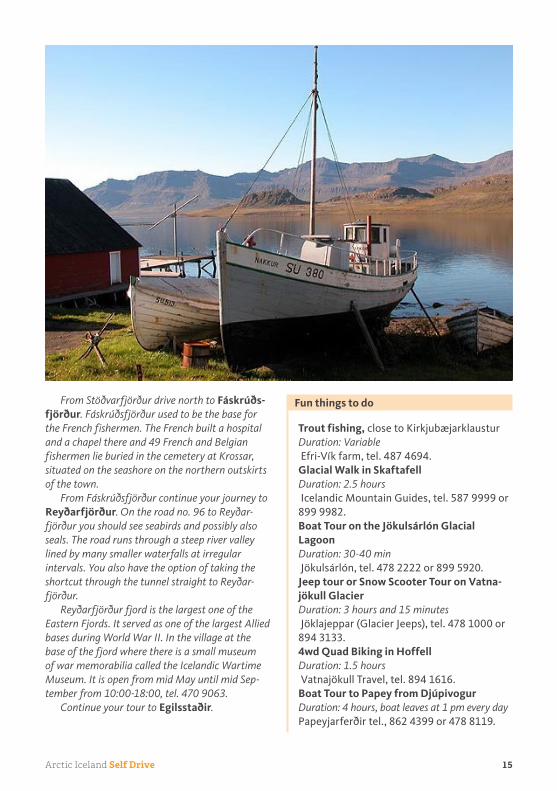
From Stöðvarfjörður drive north to Fáskrúðsfjörður. Fáskrúðsfjörður used to be the base for
the French fishermen. The French built a hospital
and a chapel there and 49 French and Belgian
fishermen lie buried in the cemetery at Krossar,
situated on the seashore on the northern outskirts
of the town.
From Fáskrúðsfjörður continue your journey to
Reyðarfjörður. On the road no. 96 to Reyðar-
fjörður you should see seabirds and possibly also
seals. The road runs through a steep river valley
lined by many smaller waterfalls at irregular
intervals. You also have the option of taking the
shortcut through the tunnel straight to Reyðar-
fjörður.
Reyðarfjörður fjord is the largest one of the
Eastern Fjords. It served as one of the largest Allied
bases during World War II. In the village at the
base of the fjord where there is a small museum
of war memorabilia called the Icelandic Wartime
Museum. It is open from mid May until mid Sep-
tember from 10:00-18:00, tel. 470 9063.
Continue your tour to Egilsstaðir.
Fun things to do
Trout fishing, close to KirkjubæjarklausturDuration: Variable
Efri-Vík farm, tel. 487 4694.Glacial Walk in SkaftafellDuration: 2.5 hours
Icelandic Mountain Guides, tel. 587 9999 or 899 9982.Boat Tour on the Jökulsárlón Glacial LagoonDuration: 30-40 min
Jökulsárlón, tel. 478 2222 or 899 5920. Jeep tour or Snow Scooter Tour on Vatnajökull GlacierDuration: 3 hours and 15 minutes
Jöklajeppar (Glacier Jeeps), tel. 478 1000 or 894 3133.4wd Quad Biking in HoffellDuration: 1.5 hours
Vatnajökull Travel, tel. 894 1616.Boat Tour to Papey from DjúpivogurDuration: 4 hours, boat leaves at 1 pm every day
Papeyjarferðir tel., 862 4399 or 478 8119.

Self Drive Arctic Iceland16
Day 5:
Egilsstaðir and Surroundings
East Fjords, Legendary Lake Monster, Largest
Forest in Iceland
➠➠Approximate driving distance:
Variable
Please see your Iceland Travel Itinerary for
details about your overnight stay
Egilsstaðir is situated some distance inland, on a fertile plain on the border of Lake
Lagarfljót, which is a huge glacial river. Accord-ing to local legends, similar to those about Loch Ness in Scotland, you might expect to see a sea serpent called Lagarfljótsormurinn reputedly living in the lake. Egilsstaðir is a natural centre for regional social services and transportation to many of the towns and villages in the eastern part of Iceland. Taking advantage of the gener-ally fine weather in this part of the country, summer attractions include an outdoor market and evening programs of theatre and music.
You can make an interesting visit to Hallormsstaður driving road no.1 south from Egilsstaðir and then road no. 931. It is a government forestry station in the beautiful Hallormsstaðaskógur, where 80 species of trees from various parts of the world are growing. Hallormsstaðaskógur is the largest forest plantation in Iceland. From Egilsstaðir to Hall-ormsstaður the distance is 26 km (16 miles), but if you have the time to drive around the lake, which is altogether 84 km (52 miles), we recommend a stop on the other side of the lake, 20 km (12,5 miles) from Hallormsstaður, called Skriðuklaustur. The building was designed by the German architect Fritz Höger and built in 1939 for the writer Gunnar Gunnarsson. Today it is an institute which enables artists, writers and scholars to stay temporarily to work, but a part of it is open for the public. If you are here in the afternoon, you will have the opportu-nity to enjoy one of the finest refreshments in Iceland. Everything is home-made and served by the local women.
Seyðisfjörður is only 27 km (17 miles) away from Egilsstaðir on the road no. 93. It is a beau-
tiful town worth visiting, situated in a deep, 18 km (11 miles) long fjord of the same name. Trading started in Seyðisfjörður in 1834 and in the latter part of the 19th century it became, for a while, one of the largest towns in Iceland. Many beautiful Norwegian-style houses date from that time.
Another option today is to drive to Bakkagerði or Borgarfjörður Eystri, a rather isolated village, driving through steep slopes. First drive road no. 94 north of Egilsstaðir, passing Eiðar and Lake Eiðavatn, where it is possible to fish trout. Drive through the mountain pass Vatnsskarð and continue to Borgarfjörður fjord, passing the steep scree slope, Njarðvíkurskriður.
Njarðvíkurskriður were formerly a very dan-gerous route, where the many accidents that occurred were at one time attributed to an evil spirit named Naddi. He is said to have dwelt in Naddagil (Naddi’s canyon), at the northern end of the scree, where there is a cave in the cliffs at sea level. When they finally exorcised him in 1306, a cross was erected, with an inscription directing travelers to pray at the cross before continuing across the scree. The cross has been regularly renewed ever since. It is worthwhile to stop and enjoy the beautiful scenery.
Borgarfjörður is a short wide fjord and in the Borgarfjörður valley you will see colorful mountains, and many rare and beautiful stones are also found there. The village Bakkagerði, also called Borgarfjörður Eystri, is a small fishing village in the fjord. In the middle of the town there is a small, beautiful church. At the altar of the church is a painting by the most loved son of the area, Jóhannes Kjarval. If you drive through the village, over to the new har-bor, you can leave your car for a while, and walk to the cape where you can see the Icelandic puffins flying around. The outermost farm on the east side of Borgarfjörður is Höfn (3 km / 2 miles) from Bakkagerði, where there is a harbor and a small island with a puffin colony. You can drive through the town to the farm Hvannstóð by road F946, where the mountain scene is extraordinary.
Continue your journey and drive the same road you came, but make a right hand turn onto
17Arctic Iceland Self Drive
road no. 944 and take road no. 926 to Húsey, which is near the confluence of the rivers Jökulsá and Lagarfljót. It once had the greatest amount of seal hunting in the district, and you can see seals rest on the sand banks, accompa-nied by various species of birds on the plain.
Day 6:
Vopnafjörður, Langanes
Glacial Rivers, Small Fishing Villages,
Northernmost Point in Iceland
➠➠Approximate driving distance:
140 km / 87 miles
Please see your Iceland Travel Itinerary for
details about your overnight stay
Today you will continue the journey to explore some of the least populated and
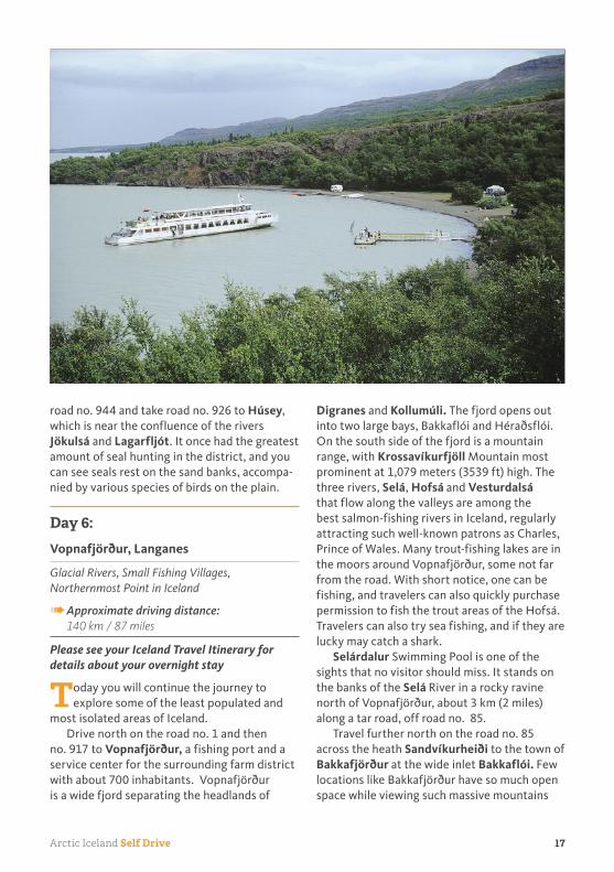
most isolated areas of Iceland. Drive north on the road no. 1 and then
no. 917 to Vopnafjörður, a fishing port and a service center for the surrounding farm district with about 700 inhabitants. Vopnafjörður is a wide fjord separating the headlands of
Digranes and Kollumúli. The fjord opens out into two large bays, Bakkaflói and Héraðsflói. On the south side of the fjord is a mountain range, with Krossavíkurfjöll Mountain most prominent at 1,079 meters (3539 ft) high. The three rivers, Selá, Hofsá and Vesturdalsá that flow along the valleys are among the best salmon-fishing rivers in Iceland, regularly attracting such well-known patrons as Charles, Prince of Wales. Many trout-fishing lakes are in the moors around Vopnafjörður, some not far from the road. With short notice, one can be fishing, and travelers can also quickly purchase permission to fish the trout areas of the Hofsá. Travelers can also try sea fishing, and if they are lucky may catch a shark.
Selárdalur Swimming Pool is one of the sights that no visitor should miss. It stands on the banks of the Selá River in a rocky ravine north of Vopnafjörður, about 3 km (2 miles) along a tar road, off road no. 85.
Travel further north on the road no. 85 across the heath Sandvíkurheiði to the town of Bakkafjörður at the wide inlet Bakkaflói. Few locations like Bakkafjörður have so much open space while viewing such massive mountains

Self Drive Arctic Iceland18
nearby at Langanes-peninsula to the west. The fjord is wide and the heaths of Bakkafjörður to the south are fairly low, so that they do not shade off the sun as in so many other fjords around the turn of the year. The main industries in this area are seasonal inshore fisheries and farming. An excellent overview of the region can be enjoyed at Sandvíkurheiði, at a height of 275 meters (902 ft).
Now you continue north on no. 85 along Langanesströnd coastline on your way to the Langanes peninsula. For the more active travelers there is a chance of a mountain climb up Gunnólfsvíkurfjall, located at Langanesströnd, south of the old farm Gunnólfsvík which is now deserted. It rises up to 719 meters (2358 ft) above sea level with spectacu-lar view. The road up the mountain to the radar station is closed to public traffic.
You can finish the day with a detour out to the Langanes peninsula, where you can hope-fully find a spot to enjoy a moment of solitude and silence, except maybe for the whistling of the wind.
Day 7:
Ásbyrgi, Húsavík, Lake Mývatn, Akureyri
Glacier Carved Gorge, Whale Watching, Waterfall
of the “Gods”, Iceland’s Second Largest City
➠➠Approximate driving distance:
240 km / 149 miles
Please see your Iceland Travel Itinerary for
details about your overnight stay
Today you travel to the Jökulsárgljúfur Canyons National Park. You can either
travel the new road no.85, Hófaskarðleið, across Melrakkaslétta peninsula or continue to the tip of Melrakkaslétta peninsula on road no. 870, via Raufarhöfn and Kópasker villages.
If you are not travelling between mid June and mid September, please note that the roads to Jökulsárgljúfur and Dettifoss waterfall are closed. Please ask locally for information on road conditions before leaving Egilsstaðir.
If the roads to Dettifoss are closed, you must continue to Húsavík by road no. 85.

19Arctic Iceland Self Drive
If the roads are open, continue your journey by taking road no. 862 (4x4), until you reach Jökulsárgljúfur Canyons National Park, the largest and most rugged gorge in Iceland, through which flows Jökulsá, one of the country’s mighty glacial rivers. Once there, you should visit:
Ásbyrgi, at road no. 861, a natural horse-shoe-shaped rock enclosure, whose impressive walls reach a height of 90 m (295 ft), sheltering fertile and lush vegetation.
The Nature Reserve of Hljóðaklettar (The Echo Cliffs) on road F862 from Ásbyrgi, a great labyrinth of crags and rock formations which, like other strange rock formations and canyons in the National Park, is the result of cata-strophic floods and water erosion
Hólmatungur Nature Reserve, also at road F862 with beautiful, colourful rock formations and rich flora.
Dettifoss, Europe’s most powerful water-fall, contrasting strikingly with the smaller waterfalls of Hafragilsfoss and Selfoss.
You drive road no. 85 round the Tjörnes peninsula, famous for its fossiliferous layers and bird life, to Húsavík.
Húsavík is situated in a picturesque fjord surrounded by majestic mountains white with snow, even in summertime, and is a commercial centre for the agricultural area, as well as a busy fishing port. The Húsavík Whale Museum which is a museum on cetaceans in Iceland provides information on whale species, their evolution and biology, whale stranding and the history of whaling. Open June, July, August: 08:30 – 18:30 daily. May and September: 9:00 – 18:00 daily. Shorter opening hours in the autumn and winter months., tel. 414 2800.
Recommended cafés and restaurants in Húsavík are Gamli Baukur located right at the pier in a charming house made mainly of drift wood and Salka restaurant.
Continue on road no. 85 in the Lake Myvatn direction, for overnight stay.
Fun things to do
Whale Watching from HúsavíkDuration: 3 hours
Please call Norðursigling at 464 7272.
Day 8:
Akureyri and Surroundings
Botanical Gardens, Volcanic Area, Lava Form-
ations
➠➠Approximate driving distance:
Variable
Please see your Iceland Travel Itinerary for
details about your overnight stay
Today’s high-light is Lake Mývatn, one of the country’s most fascinating places. The
unique ecology of the lake and its unusual envi-ronment has made it one of northern Iceland’s greatest attractions. Lake Mývatn is famous for many things, such as rich bird life, beautiful landscape influenced by volcanic activity and boiling sulfates. In and near the lake, all the Icelandic duck species, apart from the eider, breed annually, all together 15. During the summer the lake is covered with birds, which utilize the rich fauna and flora in the lake. The area is protected by international law as a very important breeding place for different birds. Birds to look out for, apart from the ducks, are great northern divers, red-necked phalaropes, Slovenian grebes, red-throated divers, merlins and gyrfalcons. Bring bug repellant / nets.
There are several remarkable natural phenom-ena in the district worth visiting, such as:
Skútustaðargígar pseudo craters: A cluster of colourful and beautifully formed pseudo craters situated close to Skútustaðir and easily accessible from there by foot.
Höfði, Nature Park: With rich flora, fauna and a beautiful view of the lake.
Dimmuborgir: Translated as “Black Castles”, a landscape of rugged crags and strange lava formations. There are 3 different routes marked for walking. Please stay on the paths, as this area is like a labyrinth.
Hverfjall: A huge explosive tuff crater. It looks like a giant circular stadium with a crater bowl

Self Drive Arctic Iceland20
of 1,040 – 1,200 m (3.411-3.936 ft) in diameter and 140 m (459 ft) in depth. It stands only 150 m (492 ft) above its surroundings so it is not difficult to hike to the top. Well worth visiting and exploring by foot.
Vogafjóscafé: A small café located inside a cowshed where you can see the milking of the cows. It is possible to taste the fresh milk and even try to do some milking. The cows are milked twice per day. The emphasis is on home-made local food such as smoked trout, Moz-zarella cheese from their own milk and geyser bread baked in geothermal heat in the earth. You will find Vogafjós by road no. 1 where it surrounds Lake Mývatn, 10 minutes drive from the village of Reykjahlíð.
Gamli Bær is a small café with a nice atmos-phere close to Hotel Reynihlíð, where you can sit outside on a good day during summer.
Námafjall: A mountain ridge singed and boiled by sulphurous vapours. The area is famous for the colourful solfataras and bubbling pools of
hot viscous mud of amazing patterns and col-ours. Please be very careful here and do not get too close to the bubbling pools as they might splash hot mud.
Grjótagjá: One of Iceland’s most well known chasms, half full of hot water, which made it a popular bathing spot for a long time, but has reached too high temperature today for that purpose. Please watch your step if you walk down to the water.
Krafla: A high temperature field with active volcanic craters, where a steam-powered elec-tricity generating station has been built.
The NatureBaths: The geothermal spa called, Mývatn Nature Baths is the latest addition to the region’s many visitor attractions and are well worth visiting. It contains a unique blend of minerals, silicates and geothermal micro-organisms. It’s open all year around: 1 June - 31 August from 09:00 to 24:00 and from 12:00 to 22:00 in the wintertime. For directions you can call the baths directly tel. 464 4411, or ask local

21Arctic Iceland Self Drive
hotels and service-centres in the Mývatn area.
Bird Museum (Fuglasafn Sigurgeirs): An impressive private collection of birds, now open to the public. For directions you can call the museum directly, 464 4477.
Leirhnjúkur: Part of the Krafla fissure com-plex. It is one of the most interesting sights in the Mývatn area. A highly active volcano and a small but very colourful high-temperature geothermal field situated west of Krafla, which last erupted in a series of nine eruptions from 1975–1984.
West of it are a series of craters and volcanic fissures of the same name. In this area you can also see the lava fields from 1984, which are still hot. A vast magma chamber lies under the region, in some parts as close to the surface as 3 km (1.9 mile). From the car park, a circular footpath leads you around the volcano and up to its summit from where there is a beautiful view over the impressive volcanic landscapes surrounding it. This is a very interesting walk but one has to be very careful when crossing the high-temperature area. It is important to wear good walking boots. On rainy days there is considerable mud in the geothermal area and it can become very slippery there, so one has to take extra care when crossing it.
After exploring the Myvatn area, head for Akureyri, via road no 1. On the way to Akureyri, the “capital” of northern Iceland, you will pass Goðafoss waterfall, one of Iceland’s most beau-tiful and renowned waterfalls.
Driving 18 km (11 miles) from Goðafoss towards Akureyri you could make a detour by taking road no. 835 to visit the Laufás Museum. Here you can see one of the country’s best preserved turf/sod farmhouses. The museum is open from mid May to mid September from 09:00 – 18:00. From Laufás you would continue on road no. 83 to drive to Akureyri.
Akureyri boasts some of the finest timber buildings in the country, beautifully restored. Because of its excellent natural harbour and good communications, Akureyri has become the northern centre of education, culture, trade
and industry. Akureyri has a whole street in its centre, Listagil (Art Gorge), devoted to arts, crafts and design, where it is ideal to visit the Akureyri Art Museum. This charming town is located inland at the base of Eyjafjörður Fjord, the longest fjord in Iceland, which means that Akureyri, together with Egilsstaðir, is one of the two towns in Iceland closest to the centre of the country. This provides Akureyri with a cli-mate, which is more continental than oceanic, with colder winters and warmer summers than in most other towns in Iceland. Therefore, in spite of its location, about 70 km (44 miles) south of the Arctic Circle, the town is verdant with a public park and botanical garden, Lystigarðurinn, which was opened in 1912. It was originally only planted with various kinds of trees, but it now also includes over 400 to 450 Icelandic vascular plants.
There are many other interesting places and museums in Akureyri. One is Nonnahús, a museum and former home of children’s writer and Jesuit priest Jón Sveinsson, “Nonni”. (It is located at Aðalstræti 54b). Next-door, and equally interesting, is the Akureyri Museum. Akureyri also has a new swimming pool with indoor, outdoor and children’s pools, jacuzzis and slides.
At the Tourist Information Center at the cul-turhouse Hof, right in the center, you are able to get yourself a map of Akureyri and find other interesting information about Akureyri.
If you drive road no. 821 and pass the airport you will soon reach the so called Santa House (Jólahúsið), a Christmas store which operates all year round. This is a nice way to learn about the Christmas celebration in Ice-land, get the Icelandic Christmas smell, songs and feel the spirit. They offer a wide selection of souvenir; both hand-made from Iceland as well as imported. This is especially worth visit-ing for huge Christmas fans and children.
Fun things to do
Ferry to the Island of HríseyDuration: 15 min. in the ferry to the island
The ferry line, Hríseyjarferjan Sævar, tel. 695 5544.

Self Drive Arctic Iceland22
Day 9:
Akureyri, Stykkishólmur
Fertile Farmland, Viking Horses, Quaint Fishing
Villages
➠➠Approximate driving distance:
350 km / 217 miles
Please see your Iceland Travel Itinerary for
details about your overnight stay
When you leave Akureyri, you can either drive directly to Varmahlíð village via
Öxnadalsheiði heath on road no. 1, or take a detour through the small fishing villages of Dalvík, Ólafsfjörður, Siglufjörður and Sauðárkrókur on the Tröllaskagi Peninsula.
Detour to Tröllaskagi peninsula:
If you decide to take the detour, drive on road
no. 1 and then turn into road no. 82, heading
north. Just before reaching Dalvík village, you
will pass a bird-sanctuary by the river. The main
industries in Dalvík are fishing, fish processing
and trading. In Dalvik, recreations such as whale
watching and horse rental are available and there
is always the option of visiting the museums in
town or try the local swimming pool. The museum
is a traditional folk museum with an unusual twist,
representing Jóhann Svarfdælingur, known as
“the Giant”, once being the tallest man in the
world. You can try on his huge shoes and view his
especially made bicycle and chair, amongst other
things.
Continue driving the coastline, through
the tunnel, to the famous herring town of
Siglufjörður. Siglufjörður was an important her-
ring centre from 1904 to recent times, when the
herring disappeared. A very interesting museum,
offering a glimpse into the glory days is the “Her-
ring Museum”, recreating the town’s bustling
harbour of the 1950s. You might be lucky enough
to witness a show of salting herring into barrels,
singing and dancing to accordion music on the
museum dock. The museum is open June-August
from 10:00-18:00 but less in other months.
From Siglufjörður you will drive on road no.

23Arctic Iceland Self Drive
76 and then on road no. 75 to Sauðárkrókur. On
the way you will pass Hofsós village, where you
will find beautiful columnar basalt by the coast
and also the Emigration Museum. If you still
have time, a visit to the old bishopric in the north,
Hólar, is recommended, on road no. 767. The
Hólar Cathedral is beautiful, with many objects
dating all the way back to Catholic times (before
1600 A.D.)
From Sauðárkrókur drive towards Skaga-
fjörður fjord and the small village of Varmahlíð
on road no. 75 and you can pick up the itinerary
from below.
If you are not taking the detour, drive on road no. 1 via Öxnadalsheiði heath, towards Skagafjörður fjord and valley where the small village Varmahlíð is situated. Skagafjörður stretches from the Arctic Ocean to the high-lands and is one of the “cradles of Icelandic his-tory” playing a leading role in the events on the 13th century civil war and in cultural develop-ments for centuries afterwards. Skagafjörður is one of the most important areas for river rafting in the country, as there are several large glacial rivers originating from the highland interior, ideal for that purpose.
Varmahlíð is a small village situated at the junction of road no. 1 and road no. 75.
We suggest you visit Glaumbær Museum, located on road no. 75 only about 14 km (9 miles) from Varmahlíð - watch out for a sign-post. This is an old farm with turf buildings in traditional style, some parts of which date back to the 18th century. Guðríður Þorbjarnardóttir, the first woman to go to America and who gave birth to the first American of European decent, lived at Glaumbær in the 11th century. A part of the museum is a charming café called Áskaffi serving traditional pastries in grandmother’s style of a living room.
Heading towards Blönduós and Hvammstangi on road no. 1, you will pass some of the finest salmon rivers in Iceland. You will drive past the small town of Blönduós situ-ated on both sides of the glacial river Blanda.
Þingeyrar Church (road no. 721) is worth a visit. At the junction of road no. 721 and road no. 1, you will see numerous small hills, which
are the result of a landslide, the uncountable Vatnsdalshólar hills. Approximately, 16 km (10 miles) further west we suggest that you drive along road no. 718 and go to the spectacular Kolugil canyon. You can take road no. 715 on the way back to road no. 1.
Detour to Vatnsnes peninsula:
Take road no. 711 to Vatnsnes peninsula.
The distance from road no. 1 and back to
road no. 1 again is approximately 82 km (51 mile)
more or less on a gravel road. The main attraction
here is the Hvítserkur (White Cowl) cliff standing
right at the shore. It resembles a fantasy animal
that is having a drink and reaches a height of 15
meters (50 ft). The name is probably derived from
the white colour of the bird droppings that cover
Hvítserkur. This area is very peaceful and seals can
often be spotted here on the peninsula.
In Hvammstangi (on road no. 72) you can pay a visit to the Icelandic Seal Centre, open daily from 09:00 to 19:00, June-August, please call tel. 451 2345.
You will continue driving on road no. 1 to Staðarskáli, a popular rest-stop, where you can stop for light refreshments and use the washrooms, before continuing your tour to Snæfellsnes peninsula. Take road no. 68 north to the junction of road no. 59. Drive road no. 59 until you come to road no. 60. Then take a turn in direction west to road no. 54 which will take you onto Snæfellsnes, Iceland’s longest peninsula, jutting 100 km (62,5 miles) into the North Atlantic.
Before you go to Snæfellsnes you can take a detour on the road no. 586 along the lake Haukadalsvatn to the Eiríksstaðir Museum, where you will find an exact replica of a Viking farm. This is the birthplace of Leifur Eiríksson, the discoverer of America according to Icelandic sources. The museum is open every day from 9:00-18:00 from June 1 - August 31, but call ahead to verify, 434 1118.
Snæfellsnes is bounded on the north by Breiðafjörður, Iceland’s largest and widest bay and to the south by Faxaflói Bay. The peninsula is renowned for its unspoiled nature,

Self Drive Arctic Iceland24
interesting geological features, the magical Snæfellsjökull glacier, its bird colonies and magnificent golden sandy beaches which con-trast dramatically with bizarre, black, basaltic lava rock formations.
Drive on to Stykkishólmur.
Fun things to do
Horse Show in SkagafjörðurDuration: 1 hour
Varmilækur Farm, tel. 898 7756 or 453 8021.Horseback Riding in SkagafjörðurDuration: 1.5 -2 hours
Hestasport Tours, tel. 453 8383 or 453 8211.Seal Watching and Sea Angling from HvammstangiDuration: 1 hours and 45 min for Seal Watch-
ing, 3 hours for Sea Angling
Selasigling, Tel. 897 9900.
Day 10:
Stykkishólmur, Arnarstapi, Borgarfjörður, Reykjavik
Coastal Villages, Sea Cliffs with Birdlife, Volcanic
Crater, Picturesque Fjord
➠➠Approximate driving distance:
200 km / 130 miles
Please see your Iceland Travel Itinerary for
details about your overnight stay
Stykkishólmur is the largest town of the Snæfellsnes peninsula. It has a fine natural
harbor sheltered amongst beautiful rock formations. Fishing is the main occupation with emphasis on shellfish. Trade began in Stykk-ishólmur in the late 16th century. Iceland’s first meteorological measurements were made here in 1845 by Árni Thorlacius, who in 1832 built the Norwegian house, a fine timber building that has been beautifully renovated and houses the local folk museum.
The Café Narfeyrarstofa is located in the centre of the village in one of those older houses.
While in Stykkishólmur, we recommend the museum Vatnasafn or “Library of Water”, tel. 433 8154, in the former library building,
overlooking the ocean on one side and the harbour and town on the other. Ice from 24 glaciers around Iceland was extracted and the results are stored in liquid form inside glass columns scattered through the building. This is a work created by American artist Roni Horn in collaboration with Art Angel as a multi–faceted long-term installation and community centre in the town of Stykkishólmur.
Continuing from Stykkishólmur, you take road no. 58 and road no. 54 along the northern coast of the Snæfellsnes peninsula. It is a good idea to take the short detour on road no. 577 to the farm and museum of Bjarnarhöfn, where you may learn how to take care of shark once pulled out of the water, tel. 438 1581.
Continue your journey through the small fishing villages on the northern shores of the peninsula, Grundarfjörður and Ólafsvík. Hellissandur, a busy fishing village stands on the edge of the sea on an elevated coastal plateau near the outermost tip of the peninsula adjacent to another seaside fishing village Rif that faces the open sea. In medieval times, Rif was an important trading port.
The Snæfellsnes peninsula is volcanic in many places, with older rock types in between. At the western end you will find the strato volcano Snæfellsjökull. Snæfellsjökull is considered to be one of the most beautiful glaciers in Iceland, and believed by many to have supernatural powers. Snæfellsfjökull first became famous after the publication in 1864 of Jules Verne’s Journey to the Centre of the Earth. The glacier itself and its surroundings were established as a National Park in the year of 2001.
Take road no. 574 going west. At the tip of the peninsula, near Dritvík, look for a sign saying “Djúpalónssandur”, a small inlet used as a landing for small fishing boats in earlier centuries. The fishermen got wages according to their strength; measured on weight-stones, still to be seen down by the landing. Here the roar of the ocean cannot cover the sound of the seagulls constantly on the move.
You drive by the romantic little fishing villages of Hellnar and Arnarstapi, both known for their rock formations in the shapes

25Arctic Iceland Self Drive
of arches, caves, stacks, as well as cliffs alive with huge colonies of birds. At Hellnar there is a small café by the seashore, worth visiting. Here in Hellnar you can visit the Snæfellsjökull National Park’s Visitor Centre, which displays a part of the country’s trade history and the geology, geography and animal life of the park. It also serves as an information centre and is open daily from mid May to mid September 10:00- 18:00.
In Arnarstapi local fishermen can be seen fishing and landing the catch of the day. A suggested walk is from one of the islands most picturesque harbours along the basalt cliffs, ravines and grottoes, which surround Arnarstapi pier, towards the man-made stone troll Bárður Snæfellsás. There are myriads of birds in the ravines, especially kittiwakes. Be careful of two things; walk only on the path to avoid falling into the ravines and be aware of the arctic terns nesting close to Bárður Snæfellsás. Another recommended walk, especially for bird watchers is from Arnarstapi to Hellnar. Approx. 45 min. walk.
Drive further along road no. 574 and road no. 54 to Búðir, which is picturesquely situated by the shore, surrounded by Búðahraun lava. This is a unique place to walk in the sandy lava fields, see the charming black church and stroll on one of the few yellow beaches of Iceland. Here you get endless possibilities for photographing. You continue on road no. 54 eastwards. At the junction of roads no. 54 and 56, you will find a small shop and a cafeteria. It might be a good place for a break. If you haven’t seen basalt column so far you should stop at Gerðuberg, which is an interesting rock face with high uniform basalt columns. It is one of the longest rock faces in the country. Look for a sign with Ytri-Rauðamelur on the left hand side. An interesting site on the right hand side is Eldborg, a perfectly-shaped crater; there is a marked hiking path all the way to the top of the crater from the farm Snorrastaðir. The walk is relatively comfortable and takes about 1 hour. Keep on going in direction to Borgarnes .
Borgarnes is the largest coastal community in Iceland that is not dependent on fishing. The

Self Drive Arctic Iceland26
town is built on a scenic headland jutting into the picturesque fjord Borgarfjörður, close to the spot, Borg, where the Viking poet and war-rior, Egill Skallagrímsson, the main character of one of Iceland’s most famous Sagas, Egil’s Saga, lived in the 10th century.
It’s a good idea to visit the Icelandic Settlement Centre in Borgarnes, tel. 437 1600, which opened in 2006. The museum is operated in three buildings. The main floor of the centre houses an exhibition entitled “The Settlement of Iceland”.
You have the choice between either tak-ing the tunnel (ISK 1000 per car), or con-tinuing south along the beautiful coastline of Hvalfjörður, one of Iceland’s longest fjords (30 km / 19 miles), on road no. 47. During World War II, Hvalfjörður became one of the most important Allied naval bases in the North Atlantic as a refuelling station for the Allied fleet. The many large oil tanks around the village of Miðsandur, often the cause of much tourist curiosity, are indeed remnants of this refuelling station. Here you also find Iceland’s only whaling station, which operated until 1986. Leaving Hvalfjörður you will drive along the base of the beautiful Mt. Esja (918 m or 3.011 ft) into the city of Reykavík.
For those that have some time to spare in Reykjavik we suggest that you visit Laugardalslaug swimming pool or one of the many swim-ming pools in Reykjavík. There is also a botani-cal garden and family park in the Laugardalur area you might enjoy visiting. You can also browse around the old city center of Reykjavík, with its many shops, galleries, museums, cafés and restaurants. Recommended sites to visit if walking are: Hallgrímskirkja Church, the City Hall, Tjörnin Lake, the harbour area, Harpa conference and music hall, and the sculpture Sun Voyager. A little bit outside of the center you can visit Perlan and the Höfði House.
Fun things to do
Snow Scooter tour to Snæfellsjökull Glacier from ArnarstapiDuration: 1.5 hours
Snjófell, tel. 435 6783.
If you have not planned any extra activities in Reykjavik and would like to add an experi-ence to your stay there, be sure to take a look at our day tours selection on our web www.icelandtravel.is.

27Arctic Iceland Self Drive
Day 11:
Departure
Departure from your accommodation is recommended 3 hours before the
departure of your flight, as it takes approx. 1 hour to drive to the airport and check in will start 2 hours before your departure.
If you did not visit the Blue Lagoon on your
way to the city on day one, but have time to spare today you might want to use the oppor-tunity en route to the airport. For this detour, please be sure to allow for at least 2-2.5 hours extra to make sure you’ll have ample time at the lagoon.
The rental car should be returned to the airport service area which is located only 2 minutes from the airport building. A shuttle will then transport you to the departures hall.
We at Iceland Travel hope you have enjoyed your stay in Iceland and
wish you a safe journey back home.
It would be great to hear how your holiday went when you get back home! You can either log onto our website’s comment section at www.icelandtravel.is/comment/ or visit our TripAdvisor profile.

Skógarhlíð 12
IS-105 Reykjavík
Iceland
Tel +354 585 4300
Fax +354 585 4390
Iceland Travelicelandtravel.is