seIsmIc measurements In unstable sea clIFF areas · 2017-03-15 · (Upper Globigerina Limestone,...
8
SEISMIC MEASUREMENTS IN UNSTABLE SEA CLIFF AREAS R. Iannucci 1 , S. D’Amico 2 , D. Farrugia 2 , P. Galea 2 , S. Martino 1 , A. Paciello 3 1 Department of Earth Sciences and Research Center for the Geological Risks (CERI), Sapienza University, Rome, Italy 2 Department of Geosciences, University of Malta, Msida, Malta 3 ENEA, National Agency for New Technologies, Energy and Sustainable Economic Development, Rome, Italy Introduction. Sea cliffs are high-risk elements in the Mediterranean area due to the diffused landslide processes that affect sites of touristic relevance as well as buildings which are part of the cultural heritage. The Favignana Island (Sicily, Italy) represents a significant case study as several sea cliffs located in its eastern part are involved in landslide processes where porous carbonate grainstones overlying plastic clay deposits widely outcrop (Falconi et al., 2015). More in particular, the western sector of Cala Rossa Bay was selected as a test site as its geological setting predisposes a large lateral spreading responsible for instabilities of the sea cliff, associated to falls and topples of different-size rock blocks. 5 GNGTS 2015 SESSIONE 3.2
Transcript of seIsmIc measurements In unstable sea clIFF areas · 2017-03-15 · (Upper Globigerina Limestone,...

seIsmIc measurements In unstable sea clIFF areas R. Iannucci1, S. D’Amico2, D. Farrugia2, P. Galea2, S. Martino1, A. Paciello3
1 Department of Earth Sciences and Research Center for the Geological Risks (CERI), Sapienza University, Rome, Italy2 Department of Geosciences, University of Malta, Msida, Malta3 ENEA, National Agency for New Technologies, Energy and Sustainable Economic Development, Rome, Italy
Introduction. Sea cliffs are high-risk elements in the Mediterranean area due to the diffused landslide processes that affect sites of touristic relevance as well as buildings which are part of the cultural heritage. The Favignana Island (Sicily, Italy) represents a significant case study as several sea cliffs located in its eastern part are involved in landslide processes where porous carbonate grainstones overlying plastic clay deposits widely outcrop (Falconi et al., 2015). More in particular, the western sector of Cala Rossa Bay was selected as a test site as its geological setting predisposes a large lateral spreading responsible for instabilities of the sea cliff, associated to falls and topples of different-size rock blocks.
5�
GNGTS 2015 sessione 3.2

This paper reports the preliminary results of a geophysical campaign of seismic noise measurements carried out in May 2015 at Cala Rossa Bay. In recent years, several studies applied ambient noise techniques to investigate landslide-involved slopes (Del Gaudio et al., 2008; Burjánek et al., 2010, 2012) or to characterize blocks of unstable cliffs (Got et al., 2010; Panzera et al., 2012; Galea et al., 2014), through different approaches among which H/V spectral ratios, f-k analysis, site to reference spectral ratios, polarization analysis, base noise level variations.
The noise measurement stations were distributed in correspondence of the unstable sea cliff as well as on the stable plateau area (i.e. located about 100 m far from the cliff). The seismic noise was recorded for 1 hour and was analyzed by computing the Fast Fourier Transform (FFT) of the three ground-motion components as well as the HVSR. Because of the similar geological and geomorphological setting, the results obtained for the Cala Rossa Bay test site were compared to the ones obtained for Anchor Bay (Malta), reported in Galea et al. (2014) and partially reprocessed for the here discussed comparison.
The goal of this research is to provide new evidences about local seismic response in unstable sea cliffs through the analysis of single-station noise records. The relevance of such a geophysical application consists on the possibility to manage the hazard related to sea-cliff landslides in order to mitigate the associated coastal risk.
Geological and geomorphological setting. The Favignana Island belongs to the Egadi Archipelago and is part of the NW sector of Sicily (Italy), which represents the emerged western edge of the Sicilian-Maghrebian Chain, originated from the deformation of the Meso-Cenozoic Northern African continental margin (Scandone et al., 1974; Antonioli et al., 2006). Tectonic units, overthrusted in the Middle Miocene and Lower Pliocene, compose the Egadi Islands as well as the whole Trapani area (Nigro et al., 2000). The Favignana Island is mainly built-up of Mesozoic-Lower Tertiary carbonate deposits, covered by transgressive Plio-Pleistocene shallow-water marine deposits (Abate et al., 1995, 1997; Catalano et al., 1996). The Lower Pleistocene deposits widespread outcrop along the eastern slope of the emerged paleo-Favignana Island in a pull-apart basin, probably generated by transtensional faults activity (Slaczka et al., 2011).
In Cala Rossa Bay, located in the eastern portion of the Favignana Island, porous carbonate grainstones of the Lower Pleistocene widely outcrop, about 20 m thick and with almost-horizontal strata; these carbonate rocks overlie high-plasticity clays of Pliocene age with a thickness varying from 5 up to 10 m (Fig. 1a). The clays overlie massive carbonate grainstones of the Lower-Middle Miocene, with a thickness varies between 10 and 30 m (Abate et al., 1995, 1997; Tondi et al., 2012), which does not outcrop at Cala Rossa Bay.
This geological setting characterized by the over-position of stiff rocks on a more plastic substratum (Goudie, 2004) leads to a lateral spreading phenomenon which widely involve the sea cliff. More in particular, the horizontal deformations affecting the clayey materials, with a visco-plastic behavior, induce cracks and failures in the overlying stiff rock causing the detachment of single rock blocks and the generation of falls and topples. Lateral spreading processes act selectively, shaping plateau of stiff rocks bordered by unstable cliffs. Lateral spreading phenomena represent a gravity-induced instability highly dangerous respect to the coastal cultural heritages and cause several touristic places in the Mediterranean area (Canuti et al., 1990; Gigli et al., 2012; Falconi et al., 2015) to be inaccessible or avoided for tourists.
The study area. In the western sector of Cala Rossa Bay in Favignana Island the ongoing lateral spreading produced a complex ground crack pattern which favors gravitational instabilities also influenced by the presence of an extensive network of underground tunnels related to historical quarry activities in the porous carbonate grainstones and terminated in the latter half of the last century (Falconi et al., 2015).
Based on field surveys, a main gravitational joint system was devised, consisting of three open fractures whose direction is nearly parallel to the coastline (Fig. 1b). Three different unstable zones, separated by the three opened ground cracks, and a fourth stable zone, consisting in the
GNGTS 2015 sessione 3.2
57

plateau area, were distinguished. The first zone includes the portion of the slope between the edge of the cliff and the first main fracture (f1) where the rock mass is intensely joined by some additional open cracks related to the stress release. This joint system produces several unstable meter-scale rock blocks. The three deep cracks isolate two large blocks, which correspond to the second and third unstable zone. Where visible, the main cracks have an aperture about 35 cm and a vertical displacement up to 60 cm. A stable plateau area is encountered moving upslope from the third fracture f3.
Fig. 1 – Geological and geomorphological setting of Cala Rossa Bay. a) Excerpt of Favignana geological map in the Cala Rossa area (from Abate et al., 1997) and picture of cliff in the Cala Rossa western part that shows the overlapping of the Lower Pleistocene carbonate grainstones on the Pliocene clay deposits. b) Orthophoto of the Cala Rossa western part in which shows: the open fractures with related code, the estimated fractures, the three unstable zones, the stable plateau area, the 25 noise measurement stations.
58
GNGTS 2015 sessione 3.2
According to Varnes (1978) and Hutchinson (1988), the resulting landslide process should be defined as a complex-type one since the failure mechanism is a combination of lateral spreading, rock fall and rock topples. Moreover, the two main isolated blocks show a counter-slope top, indicating that a roto-translational component is also present in the spreading process.
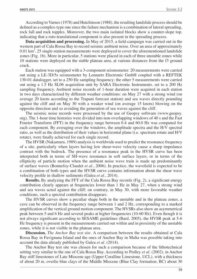
Data acquisition and processing. In May of 2015, a field-campaign was carried out in the western part of Cala Rossa Bay to record seismic ambient noise. Over an area of approximately 0.01 km2, 25 single-station measurements were deployed to cover the aforementioned landslide zones (Fig. 1b). More in particular, 5 stations were placed in each of three unstable zones while 10 stations were deployed on the stable plateau area, at various distances from the f3 ground crack.
Each station was equipped with a 3-component seismometer: 20 measurements were carried out using a LE-3D/5s seismometer by Lennartz Electronic GmbH coupled with a REFTEK 130-01 datalogger, set to a 250 Hz sampling frequency; the other 5 measurements were carried out using a 1.5 Hz SL06 acquisition unit by SARA Electronic Instruments, set to a 200 Hz sampling frequency. Ambient noise records of 1-hour duration were acquired in each station in two days characterized by different weather conditions: on May 27 with a strong wind (on average 20 knots according to the Trapani forecast station) and sea waves directly pounding against the cliff and on May 30 with a weaker wind (on average 15 knots) blowing on the opposite direction and so avoiding the generation of sea waves against the cliff.
The seismic noise records were processed by the use of Geopsy software (www.geopsy.org). The 1-hour time histories were divided into non-overlapping windows of 40 s and the Fast Fourier Transform (FFT) in the frequency range between 0.4 and 60.0 Hz was computed for each component. By averaging over the windows, the amplitude spectra and the H/V spectral ratio, as well as the distribution of their values in horizontal plane (i.e. spectrum rotate and H/V rotate), were finally achieved for each single record.
The HVSR (Nakamura, 1989) analysis is worldwide used to predict the resonance frequency of a site, particularly when layers having low shear-wave velocity cause a sharp impedance contrast with the bedrock. The presence of a resonance peak in the HVSR curve has been interpreted both in terms of SH-wave resonance in soft surface layers, or in terms of the ellipticity of particle motion when the ambient noise wave train is made up predominantly of surface waves (Bonnefoy-Claudet et al., 2006). In practice, the wavefield is expected to be a combination of both types and the HVSR curve contains information about the shear wave velocity profile in shallow sediments (Galea et al., 2014).
Results. By analyzing the FFT of the Cala Rossa Bay records (Fig. 2), a significant energy contribution clearly appears at frequencies lower than 1 Hz in May 27, when a strong wind and sea waves acted against the cliff; on contrary, in May 30, with more favorable weather conditions, such a spectral contribution disappears.
The HVSR curves show a peculiar shape both in the unstable and in the plateau zones, a cave can be observed in the frequency range between 1 and 2 Hz, corresponding to a marked amplification of the vertical ground motion component. The HVSRs also show an asymmetrical peak between 5 and 6 Hz and several peaks at higher frequencies (10-60 Hz). Even though it is not always significant according to SESAME guidelines (Bard, 2005), the HVSR peak at 5-6 Hz frequency is present in the measurements carried out within and in proximity of the unstable zones, while it is not visible in the plateau area.
Discussion. The Anchor Bay test site. A comparison between the results obtained at Cala Rossa Bay in Favignana Island and the ones of Anchor Bay in Malta was possible taking into account the data already published by Galea et al. (2014).
The Anchor Bay test site was chosen for such a comparison because of the lithotechnical setting very similar to the one of Cala Rossa Bay. According to Pedley et al. (2002), in Anchor Bay stiff limestones of Late Miocene age (Upper Coralline Limestone, UCL), with a thickness of about 20 m, overlie blue clays of the Middle Miocene (Blue Clay formation, BC) about 30
GNGTS 2015 sessione 3.2
59

m thick. The blue clays lie on top of a not-outcropping stiff limestone of the Lower Miocene (Upper Globigerina Limestone, UGL).
Also in this case, a lateral spreading is generated by the juxtaposition of the stiff limestones over the plastic blue clays. The phenomenon is responsible for the generation of four unstable rock blocks, behind which there is a stable plateau area. Seismic noise measurements were carried out on both the unstable blocks and the plateau area. Time-series of 20 minutes recorded using a three-component seismometer Tromino at a sampling frequency of 128 Hz were reprocessed for this study.
In Anchor Bay, the HVSRs show a ubiquitous resonance peak in a narrow frequency range between 1 and 2 Hz and a following sharp dip of the spectral ratio. As this HVSR feature is widespread present in the Maltese archipelago, the dip of the HVSR curve has been interpreted in terms of a shallow shear-wave velocity inversion, which corresponds to the interface between the competent UCL and the plastic BC (Galea et al., 2014).
HVSR analysis comparison and interpretation. Given the similar outcropping lithologies, a similar response in the HVSR results of Cala Rossa Bay and Anchor Bay would be expected (Fig. 3). The HVSR peak at 5-6 Hz observed in Favignana and the peak at 1-2 Hz observed in Malta, as well as the following dips, could be related to a stratigraphic response. According to Galea et al. (2014), the HVSR peak can be interpreted in terms of Rayleigh-wave ellipticity and/
Fig. 2 – Amplitude spectrum and HVSR analysis results at A3 station. Left: results referred to the measurement on May 27 with stronger wind (on average 20 knots) and sea waves pounding directly on the cliff. Right: results referred to the measurement on May 30 with weak wind (on average 15 knots) and low sea waves on the cliff.
�0
GNGTS 2015 sessione 3.2

or trapping of SH-waves, while the dip in terms of a shallow shear-wave velocity inversion, i.e. the same that in Favignana due to the interface between the stiff grainstones and the plastic clays. The shift of the stratigraphic response to higher frequencies at Cala Rossa Bay when compared to Anchor Bay could be related to the different thickness or depth of the clayey deposits. Based on estimated shear-wave velocities and thicknesses, the peak observed in the HVSR curves is compatible with the stratigraphy of Cala Rossa Bay. However, further in-site characterization will be surveyed for future analyses. The HVSR peak generally is visible on the unstable blocks and this could be related to the weakening of the clays in the landslide zone that is responsible for an increasing of the local impedance contrast with the underlying bedrock.
Fig. 3 – Comparison between amplitude spectrum and HVSR results for the A3 station in Cala Rossa Bay (on left) and the station 11 in Anchor Bay (on right).
GNGTS 2015 sessione 3.2
�1

On the other side, the HVSRs at Cala Rossa Bay generally become lower than 1 in the frequency range between 1 and 2 Hz. Such an anomaly respect to the Anchor Bay site could be related to the complex network of man-made tunnels and caves within the Lower Pleistocene carbonate grainstones, which could have a disturbing role in seismic wave propagation, leading to an amplification of the ground motion vertical component.
Finally, the complex behavior of the HVSRs in the higher frequency range (10-60 Hz) can be related to the vibrational behavior of the dislodged rock blocks. The seismic response observed in frequency from 10 to 60 Hz is in agreement with the results published by Got et al. (2010) showing that the highest seismic energy was concentrated in specific frequency bands depending on geometrical and mechanical properties of the rock blocks. Polarization analyses (Burjánek et al., 2010, 2012; Galea et al., 2014) will be carried out in order to derive the main modes of vibration for a better comprehension of the seismic response of the cliff slope as well as of its stability in case of earthquake shaking.
Conclusions. Preliminary results of seismic noise measurements carried out in the western part of Cala Rossa Bay (Favignana, Italy) show that a site stratigraphic response exists and is characterized by a HVSR peak between 5 and 6 Hz followed by a dip of the HVSR curve. It was also observed a HVSR dip below level 1 in a narrow frequency range, between 1 and 2 Hz, that could be related to the dense network of man-made tunnels and caves within the Lower Pleistocene carbonate grainstones of the Island.
A complex local seismic response was also observed at higher frequencies (10-60 Hz) that can be related to the seismic response of the dislodged rock blocks. The results obtained at Cala Rossa Bay were compared to the ones obtained at Anchor Bay in Malta due to the high similarity of the local geological and lithotechnical setting responsible for ongoing lateral spreading landslide processes.
More-detailed studies will be carry out by experiencing analytical approaches devoted to characterize the vibrational modes of the surveyed rock blocks, in order to evaluate the sea cliff stability conditions during earthquake shaking.Acknowledgements. This study is part of a PhD research (Roberto Iannucci) at the Department of Earth Sciences of Sapienza University of Rome. The Authors wish to thank Luca Falconi, Vladimiro Verrubbi and Augusto Screpanti for data and information provided about the Cala Rossa Bay area and Fabio Martorelli for his useful support in the field geological survey.
ReferencesAbate B., Ferruzza G., Incandela A. and Renda P.; 1995: Tettonica trascorrente nelle Isole Egadi (Sicilia occidentale).
Studi Geologici Camerti, vol. spec. 1995/2, pp. 9-14.Abate B., Incandela A. and Renda P.; 1997: Carta geologica delle isole di Favignana e Levanzo (Arcipelago delle
Egadi), Scala 1:12.500. Dip. di Geologia e Geodesia, Università di Palermo.Antonioli F., Kershaw S., Renda P., Rust D., Belluomini G., Cerasoli M., Radtke U. and Silenzi S.; 2006: Elevation
of the last interglacial highstand in Sicily (Italy): A benchmark of coastal tectonics. Quaternary International, 145-146, pp. 3-18.
Bard P.Y.; 2005: Guidelines for the implementation of the H/V spectral ratio technique on ambient vibrations: measurements, processing, and interpretations. SESAME European Research Project. WP12, deliverable D23.12, 2004, Available at: http://sesame-fp5.obs.ujf-grenoble.fr/Deliverables2004.
Bonnefoy-Claudet S., Cotton F. and Bard P.Y.; 2006: The nature of noise wavefield and its applications for site effects studies: a literature review. Earth-Sci. Rev., 79 (3), pp. 205-227.
Burjánek �., Gassner-Stamm G., Poggi V., Moore �.R. and Fäh D.; 2010: Ambient vibration analysis of an unstable mountain slope. Geophys. �. Int., 180 (2), pp. 820-828.
Burjánek �., Moore �.R., Yugsi Molina F.X. and Fäh D.; 2012: Instrumental evidence of normal mode rock slope vibration. Geophys. �. Int., 188 (2), pp. 559-569.
Canuti, P., Casagli, N., Garzonio, C. A. and Vannocci, P.; 1990: Lateral spreads and landslide hazards in the Northern Apennine: the example of M. Fumaiolo (Emilia Romagna) and Chiusi della Verna (Tuscany). Proc. 6th International Congress of the International Association of Engeneering Geology, Amsterdam (Netherlands), August 1990, 3, pp. 1525-1533.
Catalano R., Di Stefano P., Sulli A. and Vitale F.P.; 1996: Paleogeography and structure of the central Mediterranean: Sicily and its offshore area. Tectonophysics, 260, pp. 291-323.
�2
GNGTS 2015 sessione 3.2

Del Gaudio V., Coccia S., Wasowski �., Gallipoli M.R. and Mucciarelli M.; 2008: Detection of directivity in seismic site response from microtremor spectral analysis. Nat. Hazards Earth Syst. Sci., 8, pp. 751-762.
Falconi L., Peloso A., Puglisi C., Screpanti A., Tati A. and Verrubbi V.; 2015: Rockfalls monitoring along eastern coastal cliffs of the Favignana island (Egadi, Sicily): preliminary remarks. In Lollino G., Giordan D., Marunteanu C., Christaras B., Yoshinori I. and Margottini C., eds: Engineering Geology for Society and Territory, 8, pp. 287-291. DOI: 10.1007/978-3-319-09408-3_50
Galea P., D’Amico S. and Farrugia D.; 2014: Dynamic characteristics of an active coastal spreading area using ambient noise measurements-Anchor Bay, Malta. Geophys. �. Int., 199, pp. 1166-1175.
Gigli G., Frodella W., Mugnai F., Tapete D., Cigna F., Fanti R., Intrieri E. and Lombardi L.; 2012: Instability mechanisms affecting cultural heritage sites in the Maltese Archipelago. Nat. Hazards Earth Syst. Sci., 12, pp. 1883-1903.
Got J.-L., Mourot P. and Grangeon J.; 2010: Pre-failure behaviour of an unstable limestone cliff from displacement and seismic data. Nat. Hazards Earth Syst. Sci., 10, pp. 819-829.
Goudie A.; 2004: Encyclopedia of Geomorphology. Routledge, London (United Kingdom), 1156 pp.Hutchinson �.N.; 1988: General Report: Morphological and geotechnical parameters of landslides in relation to
geology and hydrogeology. In Bonnard C., ed: Proceedings, Fifth International Symposium on Landslides, 1, Balkema, Rotterdam (Netherlands), pp. 3-35.
Nakamura Y.; 1989: A method for dynamic characteristics estimation of subsurface using microtremor on the ground surface. Quarterly Report of Railway Technical Research Institute (RTRI), 30 (1), pp. 25-33.
Nigro F., Renda P. and Arisco G.; 2000: Tettonica recente nella Sicilia nord-occidentale e nelle Isole Egadi. Soc. Geol. It., 119, pp. 307-319.
Panzera F., D’Amico S., Lotteri A., Galea P. & Lombardo G.; 2012: Seismic site response of unstable steep slope using noise measurements: the case study of Xemxija Bay area, Malta. Nat. Hazards Earth Syst. Sci., 12 (11), pp. 3421-3431.
Pedley M., Hughes-Clarke M. & Galea P.; 2002: Limestone Isles in a Crystal Sea: The Geology of the Maltese Islands. Publishers Enterprises Group Ltd, San Gwann (Malta), 109 pp.
Scandone P., Giunta G. and Liguori V.; 1974: The connection between Apulia and Sahara continental margins in the Southern Apennines and in Sicily. Mem. Soc. Geol. It., 13, pp. 317-323.
Slaczka A., Nigro F., Renda P. and Favara R.; 2011: Lower Pleistocene deposits in East part of the Favignana Island, Sicily, Italy. Il Quaternario Italian �ournal of Quaternary Sciences, 24 (2), pp. 153-159.
Tondi E., Cilona A., Agosta F., Aydin A., Rustichelli A., Renda P. and Giunta G.; 2012: Growth processes, dimensional parameters and scaling relationships of two conjugate sets of compactive shear bands in porous carbonate grainstones, Favignana Island, Italy. �ournal of Structural Geology, 37, pp. 53-64.
Varnes D.J.; 1978: Slope movement types and processes. In Schuster R.L. and Krizek R.�., eds: Landslides Analysis and Control, Special Report 176, National Academy of Science, Washington D.C. (USA), pp. 11-33.
GNGTS 2015 sessione 3.2
�3