SEISMIC DAMAGEABILITY ASSESSMENT PROBABLE MAXIMUM LOSS … · SEISMIC DAMAGEABILITY ASSESSMENT...
29
SEISMIC DAMAGEABILITY ASSESSMENT PROBABLE MAXIMUM LOSS REPORT 730 MARINERS ISLAND/735 FATHOM DRIVE San Mateo, California 94404 August 1, 2012 Partner Project No. 12-92178.1 Prepared for ALAIN PINEL REALTORS 520 South El Camino Real, Suite 100 San Mateo, California 94402
Transcript of SEISMIC DAMAGEABILITY ASSESSMENT PROBABLE MAXIMUM LOSS … · SEISMIC DAMAGEABILITY ASSESSMENT...

SEISMIC DAMAGEABILITY ASSESSMENT PROBABLE MAXIMUM LOSS REPORT
730 MARINERS ISLAND/735 FATHOM DRIVE San Mateo, California 94404 August 1, 2012 Partner Project No. 12-92178.1 Prepared for ALAIN PINEL REALTORS 520 South El Camino Real, Suite 100 San Mateo, California 94402

2154 Torrance Blvd, Suite 200, Torrance, CA 90501 ◊ Phone 800-419-4923 ◊ Fax 866-928-7418
August 1, 2012 Mr. Greg Terry Alain Pinel Realtors 520 South El Camino Real, Suite 100 San Mateo, California 94402 Subject: Probable Maximum Loss Assessment 730 Mariners Island/735 Fathom Drive San Mateo, California 94404 Partner Project No. 12-92178.1 Dear Mr. Terry: Partner Engineering and Science, Inc. (Partner) is pleased to provide the results of the Probable Maximum Loss (PML) report for the abovementioned address (the “subject property”). This assessment was performed in general conformance with the scope and limitations of ASTM Guide E 2026-07: Standard Guide for the Seismic Risk Assessment of Buildings.
This assessment was performed utilizing methods and procedures consistent with good commercial or customary practices designed to conform to acceptable industry standards. The independent conclusions represent Partner’s best professional judgment based upon existing conditions and the information and data available to us during the course of this assignment.
We appreciate the opportunity to provide an engineering service. If you have any questions concerning this report, or if we can assist you in any other matter, please contact me at (415) 992-3755.
Sincerely,
Jay Grenfell Relationship Manager
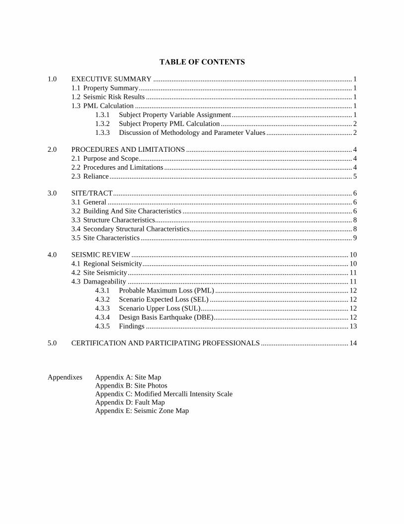
TABLE OF CONTENTS
1.0 EXECUTIVE SUMMARY ............................................................................................................. 1 1.1 Property Summary ..................................................................................................................... 1 1.2 Seismic Risk Results ................................................................................................................. 1 1.3 PML Calculation ....................................................................................................................... 1
1.3.1 Subject Property Variable Assignment .................................................................. 1 1.3.2 Subject Property PML Calculation ........................................................................ 2 1.3.3 Discussion of Methodology and Parameter Values ............................................... 2
2.0 PROCEDURES AND LIMITATIONS ........................................................................................... 4 2.1 Purpose and Scope ..................................................................................................................... 4 2.2 Procedures and Limitations ....................................................................................................... 4 2.3 Reliance ..................................................................................................................................... 5
3.0 SITE/TRACT ................................................................................................................................... 6 3.1 General ...................................................................................................................................... 6 3.2 Building And Site Characteristics ............................................................................................. 6 3.3 Structure Characteristics ............................................................................................................ 8 3.4 Secondary Structural Characteristics ......................................................................................... 8 3.5 Site Characteristics .................................................................................................................... 9
4.0 SEISMIC REVIEW ....................................................................................................................... 10 4.1 Regional Seismicity ................................................................................................................. 10 4.2 Site Seismicity ......................................................................................................................... 11 4.3 Damageability ......................................................................................................................... 11
4.3.1 Probable Maximum Loss (PML) ......................................................................... 12 4.3.2 Scenario Expected Loss (SEL) ............................................................................ 12 4.3.3 Scenario Upper Loss (SUL) ................................................................................. 12 4.3.4 Design Basis Earthquake (DBE) .......................................................................... 12 4.3.5 Findings ............................................................................................................... 13
5.0 CERTIFICATION AND PARTICIPATING PROFESSIONALS ................................................ 14
Appendixes Appendix A: Site Map Appendix B: Site Photos
Appendix C: Modified Mercalli Intensity Scale Appendix D: Fault Map Appendix E: Seismic Zone Map

Seismic Damageability Assessment Project No. 12-92178.1 August 1, 2012 Page 1
1.0 EXECUTIVE SUMMARY
1.1 PROPERTY SUMMARY Site Name 730 Mariners Island/735 Fathom Drive Address 730 Mariners Island/735 Fathom Drive, San Mateo, California 94404 Property Type Multifamily residential No. of Buildings Two Building Area (SF) 730 Building: 23,560 SF
735 Building: 23,370 SF No. of Stories Four (three levels of
residential apartments over ground floor tuck-under parking)
Year Built 1976 and 1979 Lot Size (Acres) 730 Building: 0.66-acre 735 Building: 0.53-acre
Assessment Date July 25, 2012 Construction Type Wood frame with some structural steel elements at the garage level
Surveyed By Joshua M. Marrow, P.E. Assessment Time: 1:30 PM
1.2 SEISMIC RISK RESULTS We have performed a probable maximum loss (PML) evaluation for earthquake due diligence assessment in conformance with the scope and limitation of Guide E 2026 for a Level I assessment of 730 Mariners Island/735 Fathom Drive, San Mateo, California 94404 (subject property). Any exceptions to or deletion from, this practice are described in Section 2.1 of this report. The findings in this report are based on our field observations on July 25, 2012, a review of any available construction documents, the damage prediction method developed by Thiel and Zsutty, and earthquake ground acceleration data obtained from the California Geological Survey and/or United States Geological Survey.
1.3 PML CALCULATION
1.3.1 SUBJECT PROPERTY VARIABLE ASSIGNMENT
Thiel Zsutty Formula: PML = d =0.554 (b m s)a0.630
Building Vulnerability Parameter – b
0.30 (Moderate due to ground floor parking area)
Spectral Modification parameter – m
1.0 (Standard)
Site (soil) Coefficient – s 1.75 (High – Very High liquefaction susceptibility)
Acceleration Parameter - a 0.45 g (Slightly above average for seismic zone 4 but typical for this region of the San Francisco Bay Area)

Seismic Damageability Assessment Project No. 12-92178.1 August 1, 2012 Page 2
1.3.2 SUBJECT PROPERTY PML CALCULATION
PML (SEL)
PML = d =0.554 (0.30 x 1.75) x 0.450.630 18 %
The Scenario Upper Limit (SULDBE) is provided in Section 4.3.5 of this report.
1.3.3 DISCUSSION OF METHODOLOGY AND PARAMETER VALUES
Building Vulnerability Parameter: (b) - is a vulnerability parameter representing the potential for damage of buildings with various structural systems. Buildings with more resistive systems have values less than 1.00, such that the best system can be as low as b=0.1, and the poorest can be equal to 1.25.
The lateral load resisting system consists of flexible, horizontal roof and upper floor diaphragms (spaced sawn lumber structural members sheathed with plywood) spanning to interior and exterior shear walls. The exterior walls are all sheathed with T1-11 exterior grade plywood with sufficient edge nailing to justify it as a structural shear wall. The entire exterior is sheathed with this plywood. The upper floor shear walls are discontinuous at the ground floor level around the interior elevations above the parking space entrances. The upper walls cantilever about 6 feet beyond the ground floor structural steel beams. This discontinuity is referred to as a soft-story condition due to the lack of shear walls on the ground floor. Shear walls do exist on the ground floor around the exterior, perimeter walls, and at distributed transverse shear wall locations parallel to the parking spaces. It appears that the plywood sheathing was added over the existing gypsum drywall on the transverse walls, possibly as a seismic strengthening measure. The edge nailing is consistent with structural shear wall nailing (6-inches on center or less).
The openings of the ground level parking spaces are framed with structural steel columns and a continuous steel beam along the second floor level. It is uncertain whether this framing was specifically detailing for seismic loading or if it is merely for gravity loads. Regardless of the as-built detailing, the structural steel elements will provide some lateral load resistance along the interior elevations. Thus the condition is not entirely considered a soft story. Further investigation is warranted to potentially validate the as-built detailing and potentially reduce the reported seismic losses in this report.
Overall the building is expected to have good seismic performance, primarily due to the plywood sheathing on the entire exterior of the building. The overall reported SEL and SUL for the subject property is mainly due to the soft soil conditions and the high levels of expected ground shaking at the site, not because the buildings are particularly vulnerable.
Based on these factors, the buildings are assigned a low-to-moderate vulnerability value: b = 0.30.

Seismic Damageability Assessment Project No. 12-92178.1 August 1, 2012 Page 3
Spectral modification parameter: (m) - is a spectral modification parameter representing the similarity of the building and site periods. Level 1, 2, and 3 PMLs generally do not have enough soils data and building data to evaluate this parameter. The range of values for “m” on a site where failure is not likely is from 0.5 to 2.0, where m=0.5 when the building and site have different structural periods and m=2.0 when they have equivalent structural periods and is considered a conjectural value. The industry standard assumption is that m = 1.0.
Site (soil) Coefficient: (s) - is a site parameter representing the relative response of the site reference to a standard site condition. According to the Association of Bay Area Governments (ABAG) seismic hazards website the subject property is located in a region with Very High liquefaction susceptibility. The area beneath and surrounding the property is reclaimed land that was once part of the San Francisco Bay. The soils placed at the site consist of engineered fill layers with high ground water. A site specific geotechnical study may provide more accurate assessment of the liquefaction potential beyond the regional data.
Partner considers the two structures to have moderate liquefaction resilience (resistance to immediate and sudden loss of soil bearing and site settlement) primarily due to the symmetrical, regular building configuration. Soil pressures beneath the property are assumed to be fairly uniform. Differential settlement is a lesser concern with even soil bearing. Partner has assigned a standard increase to the site coefficient to account for soft soil ground motion amplification, which will increase the expected levels of damage over a similar building founded on a firm or rock site. s =1.75.
Acceleration Parameter: (a) – represents the amount of lateral acceleration that the building will experience during the 475-year seismic event. The specified peak ground acceleration is based on the probabilistic seismic hazard analyses program from California Geological Survey and/or United States Geological Survey website(s).
The subject property is 4.5 miles from the San Andreas Fault. The subject property was assigned a value: a = 0.45. This value is slightly above average for Uniform Building Code (UBC) 1997 Table 16.1 Seismic Zone 4.
It was determined that the subject property is not located within an Earthquake Fault Zone as defined in the California Geological Survey Alquist-Priolo Earthquake Zone Act
It appears that for this seismic area, the basic elements of a lateral force-resisting system have been provided in accordance with the building codes established at the time of construction.

Seismic Damageability Assessment Project No. 12-92178.1 August 1, 2012 Page 4
2.0 PROCEDURES AND LIMITATIONS
2.1 PURPOSE AND SCOPE
The purpose of this assessment is to develop an estimate of mean costs to repair damage at the subject property caused by ground shaking having a probability of exceedance of not more than 10% in 50 years (a return period of not more than 475 years) for consideration in underwriting a lending transaction.
Partner Engineering & Science, Inc. (herein identified as Partner) conducted a Scenario Expected Loss (SEL) and Scenario Upper Loss (SUL) assessment (previously referred to as Probable Maximum Loss – PML50 and PML90) on the subject project according to ASTM E2026-07 (ASTM E2026-07, Standard Guide For Seismic Risk Assessment Of Buildings, Approved May 1, 2007).
Earthquakes are randomly distributed in time and are usually defined on a probabilistic basis. ASTM E2026-07 defines the Design Basis Earthquake as the site ground motion with a 10% probability of exceedance in 50 years, equivalent to a 475-year return period. This earthquake has an equal chance of occurrence in any year, and the probability of occurrence in any given year is 1/475 or approximately 0.2%. This is a standardized hazard level, often used by property owners in gauging the severity of earthquake ground motions at appropriately conservative damage risk levels. (Other stakeholders in an investment, for instance a mortgage lender or insurer, may require different levels of conservatism in their decision making process.) The 475-year return period ground motion is basis for the damage estimates for the subject property.
2.2 PROCEDURES AND LIMITATIONS
Our Report is based upon our limited site observation and a review of available documents. The conclusions of this assessment are strictly limited by site observations, review of available documents and current geological data. Damageability has been estimated utilizing the damage prediction method developed by Messrs. Charles C. Thiel, Jr. and Theodore C. Zsutty, (see “Earthquake Spectra” Vol. 3, No. 4: Nov. 1987 titled Earthquake Characteristics and Damage Statistics) USGS, CGS and other sources as determined appropriate by the engineer. Except as identified below, this assessment does not include review of plans, structural calculations, review of geotechnical investigations, or collection or analysis of soil samples. As a result, conclusions of this assessment are subject to a high degree of uncertainty.
This assessment does not take into consideration the value of equipment, inventory or monetary loss from business interruption. Partner represents that the estimate of seismic performance for this building complex is based on a limited review of the property condition, and on a large measure of engineering judgment that is incorporated into the damage prediction estimation.
Engineering judgment is a necessary component of this review since analytical methods do not exist that will encompass all parameters necessary to determine a precise estimate of the cost of any damage caused by the maximum possible earthquake.
Our Report represents our professional experience and judgment, and a good faith effort to obtain all available information. Documents and data provided by Alain Pinel Realtors, designated representatives of the Client, or other interested parties, and consulted in the preparation of this Report, have been reviewed and may be referenced herein with the understanding that Partner assumes no responsibility or liability for their accuracy or for the

Seismic Damageability Assessment Project No. 12-92178.1 August 1, 2012 Page 5
withholding by any of the involved parties of any reports or other information that could affect the transactions.
2.3 RELIANCE
Alain Pinel Realtors engaged Partner to perform this assessment in accordance with an agreement governing the nature, scope and purpose of the work as well as other matters critical to the engagement. All reports, both verbal and written, are for the sole use and benefit of Alain Pinel Realtors. Either verbally or in writing, third parties may come into possession of this report or all or part of the information generated as a result of this work. In the absence of a written agreement with Partner granting such rights, no third parties shall have rights of recourse or recovery whatsoever under any course of action against Partner, its officers, employees, vendors, successors or assigns. Any such unauthorized user shall be responsible to protect, indemnify and hold Partner, Client and their respective officers, employees, vendors, successors and assigns harmless from any and all claims, damages, losses, liabilities, expenses (including reasonable attorneys’ fees) and costs attributable to such Use. Unauthorized use of this report shall constitute acceptance of and commitment to these responsibilities, which shall be irrevocable and shall apply regardless of the cause of action or legal theory pled or asserted. Additional legal penalties may apply.

Seismic Damageability Assessment Project No. 12-92178.1 August 1, 2012 Page 6
3.0 SITE/TRACT
3.1 GENERAL
The subject property consists of an irregular-shaped, 1.19-acre parcel developed with two, four-story wood and steel framed multifamily apartment buildings. The buildings were reportedly constructed circa 1976 and 1979. The buildings have a total square footage of 46,930 square feet. The site is flat and located directly adjacent to a waterway. Both buildings have identical configuration, generally rectangular, with three-stories of wood-framed apartments over ground floor tuck-under parking with a central drive access.
According to the 1997 Uniform Building Code, the subject property is located in a Seismic Zone 4, defined as an area with a high probability of damaging ground motion.
3.2 BUILDING AND SITE CHARACTERISTICS
Structures can be grouped into various building classes. Different buildings within the same class can be expected to perform similarly during earthquake shaking. To account for the differences between buildings with the same class, additional information is utilized. For example, the year built provides an insight into the level of design code used. Generally speaking, the more information is available about a particular building, the more reliably potential damage can be estimated. It appears that, for this seismic area, the basic elements of a lateral-force resisting system have been provided in accordance with building codes established at the time of construction.
Structural drawings were not provided for our review. Therefore, based on our limited site assessment, the structural components of the buildings appear to be as follows:
Foundation
Based on our visual observations of the foundation system it appears to consist of conventionally reinforced concrete spread footings. The footings are assumed to be continuous beneath load-bearing walls and isolated spread footings are founded beneath areas of load concentration (beneath columns and posts). The garage floor is finished with a continuous reinforced concrete slab-on-grade. Based on the regional site soil conditions the foundations may also consist of reinforced concrete grade beams supported by drilled or driven piers. Partner could not validate this without further geotechnical investigation of drawing review.
Superstructure
The buildings have the same characteristic superstructure configuration. The roof and upper floors are constructed with spaced sawn lumber structural members sheathed with plywood. The roof and floors are supported by interior and exterior stud-frame load-bearing walls. The upper three floors appear to be supported by a wood and structural steel frame system at the second floor level, over the ground floor parking. There is visual evidence that the beams and columns that frame the interior courtyard elevations at the parking entrances are constructed of structural steel. It is uncertain whether the connections were detailed to resist moment (from laterally induced seismic forces) and shear forces from gravity loads. The building exterior is finished entirely with T1-11 exterior grade plywood panels. The interiors are finished with gypsum drywall.

Seismic Damageability Assessment Project No. 12-92178.1 August 1, 2012 Page 7
Lateral Load Resisting System
The lateral load resisting system consists of flexible, horizontal roof and upper floor diaphragms (spaced sawn lumber structural members sheathed with plywood) spanning to interior and exterior shear walls. The exterior walls are all sheathed with T1-11 exterior grade plywood with sufficient edge nailing to justify it as a structural shear wall. The entire exterior is sheathed with this plywood. The upper floor shear walls are discontinuous at the ground floor level around the interior elevations above the parking space entrances. The upper walls cantilever about 6 feet beyond the ground floor structural steel beams. This discontinuity is referred to as a soft-story condition due to the lack of shear walls on the ground floor. Shear walls do exist on the ground floor around the exterior, perimeter walls, and at distributed transverse shear wall locations parallel to the parking spaces. It appears that the plywood sheathing was added over the existing gypsum drywall on the transverse walls, possibly as a seismic strengthening measure. The edge nailing is consistent with structural shear wall nailing (6-inches on center or less).
The openings of the ground level parking spaces are framed with structural steel columns and a continuous steel beam along the second floor level. It is uncertain whether this framing was specifically detailing for seismic loading or if it is merely for gravity loads. Regardless of the as-built detailing, the structural steel elements will provide some lateral load resistance along the interior elevations. Thus the condition is not entirely considered a soft story. Further investigation is warranted to potentially validate the as-built detailing and potentially reduce the reported seismic losses in this report.
Overall the building is expected to have good seismic performance, primarily due to the plywood sheathing on the entire exterior of the building. The overall reported SEL and SUL for the subject property is mainly due to the soft soil conditions and the high levels of expected ground shaking at the site, not because the buildings are particularly vulnerable.

Seismic Damageability Assessment Project No. 12-92178.1 August 1, 2012 Page 8
3.3 STRUCTURE CHARACTERISTICS
Structural System: Wood-frame with some structural steel elements at the second floor level over the parking spaces
Number of Stories: Four stories
Year Constructed: 730 Building: 1979
735 Building: 1976
Occupancy Type: Multi-family Residential
3.4 SECONDARY STRUCTURAL CHARACTERISTICS
Shape Configuration: Generally rectangular with a central opening to the parking area
Setbacks/Overhangs: Moderate balcony overhangs on the east and west elevations; minor upper floor overhang at ground floor parking spaces
Redundancy: Good with nearly the entire exterior of the building sheathed in T-11 exterior grade plywood with three to six-inch on center edge nailing
Torsion: Assumed low given symmetrical plan
Building Exterior: Painted, T-11 exterior grade plywood and wood trim elements
Seismic Detailing: Interior detailing not visible at the time of the site visit. Exterior plywood is adequately nailed to the wood structure below enough to justify the plywood as a shear wall element (not typical of all exterior grade plywood attachment)
Structural Upgrade: None reported
Engineered Foundation: Reinforced concrete shallow spread footings. Based on the site soils conditions the building may have a reinforced concrete grade beam foundation supported by drilled or driven concrete piers.
Construction Quality: Good – well maintained with no visible signs of deterioration or structural damage
Hazardous Exposure: None reported

Seismic Damageability Assessment Project No. 12-92178.1 August 1, 2012 Page 9
3.5 SITE CHARACTERISTICS
The soil conditions at a site can influence the damageability of a structure in two general ways:
1) Soft soils tend to amplify ground motion.
2) Collateral hazards such as soil liquefaction, sliding or rupturing can potentially result in considerable damage to a structure.
Detailed soil and liquefaction information was not provided for this subject property. However, soil data was obtained from the Geologic Map of the State of California. Regional liquefaction hazard data was obtained from the Association of Bay Area Governments seismic hazards website. The findings are summarized in the table below:
SOIL DATA
Site Soil Type: Quaternary alluvial deposits and engineered fill materials
Liquefaction Potential: Very High
Landslide Potential: None – flat site
Fault Rupture Potential: Low (San Andreas fault is 4.7 miles to the west of the property)

Seismic Damageability Assessment Project No. 12-92178.1 August 1, 2012 Page 10
4.0 SEISMIC REVIEW
4.1 REGIONAL SEISMICITY
Based on various geological and seismological characteristics, researchers have developed estimates of the theoretical maximum moment magnitude (Mw) earthquake a fault can generate.
The following table lists the faults with the most potentially damaging earthquakes for the subject property (within a 50-mile radius) using EQFault by Thomas Blake. The table shows the potential peak horizontal ground acceleration (in terms of gravity) at the subject property for an estimated earthquake of the cited moment magnitude by the fault listed in the first column:
Local Faults
Fault or Source Name Approx. Distance
in miles (km)
Maximum Earthquake Magnitude
(Mw)
Site Peak Horizontal
Ground Acceleration
(g)
Estimated Site
MMI
SAN ANDREAS (Peninsula) 4.7( 7.6) 7.1 0.329 IX SAN ANDREAS (1906) 4.7( 7.6) 7.9 0.501 X MONTE VISTA - SHANNON 8.9( 14.3) 6.8 0.234 IX SAN GREGORIO 12.0( 19.3) 7.3 0.203 VIII HAYWARD (Total Length) 13.7( 22.0) 7.1 0.166 VIII HAYWARD (South) 13.7( 22.0) 6.9 0.149 VIII HAYWARD (North) 14.5( 23.4) 6.9 0.143 VIII CALAVERAS (No.of Calaveras Res) 21.4( 34.5) 6.8 0.101 VII HAYWARD (SE Extension) 22.4( 36.1) 6.4 0.079 VII SAN ANDREAS (North Coast) 24.2( 39.0) 7.6 0.141 VIII CONCORD - GREEN VALLEY 28.2( 45.4) 6.9 0.087 VII CALAVERAS (So.of Calaveras Res) 28.5( 45.9) 6.2 0.059 VI SAN ANDREAS (Santa Cruz Mtn.) 30.9( 49.7) 7 0.085 VII GREENVILLE 32.4( 52.2) 6.9 0.078 VII SARGENT 34.9( 56.1) 6.8 0.07 VI GREAT VALLEY 6 35.1( 56.5) 6.7 0.08 VII RODGERS CREEK 36.4( 58.6) 7 0.075 VII ZAYANTE-VERGELES 37.0( 59.5) 6.8 0.067 VI GREAT VALLEY 7 38.3( 61.7) 6.7 0.075 VII POINT REYES 39.8( 64.1) 6.8 0.077 VII GREAT VALLEY 5 40.9( 65.8) 6.5 0.064 VI WEST NAPA 41.6( 67.0) 6.5 0.052 VI MONTEREY BAY - TULARCITOS 45.2( 72.8) 7.1 0.081 VII
Notes: 1. Data source: EQFault software by Thomas Blake. 2. km = kilometers. 3. Mw = moment magnitude. 4. g = gravity (the peak horizontal ground motion is expressed as a percentage of gravity). 5. MMI = Modified Mercalli Intensity Scale. Definitions are provided in Appendix A.

Seismic Damageability Assessment Project No. 12-92178.1 August 1, 2012 Page 11
4.2 SITE SEISMICITY
The Richter Magnitude Scale gives an implication of the absolute energy released in an earthquake. However, generally speaking, the farther a building is from the epicenter, the less shaking it will experience. As such, just considering the magnitude of an earthquake does not give an adequate picture of the building’s risk, since the distances from potential earthquake sources to the subject property must also be considered.
The Modified Mercalli Intensity Scale considers the reduction, or attenuation, or ground motion as the distance between source and site increases; the scale is calibrated I to XII. For example, in a large earthquake, a site next to the fault may experience intensity IX shaking, while a site many miles away may experience only intensity VI shaking.
Several earthquakes of moderate-to-large magnitude have occurred in northern California in recent history. The following table lists historical earthquakes with magnitude greater than 5.3 (Richter) and their corresponding effect (MMI) at the subject property; these earthquakes are within a 100 kilometer radius of the subject property as recorded since 1973:
Historic Earthquakes North Latitude West Longitude Date (Year) Moment Magnitude
37.10 -121.50 1979 5.7 37.85 -121.82 1980 5.8 37.74 -121.74 1980 5.8 37.32 -121.70 1984 6.2 37.48 -121.69 1986 5.7 37.39 -121.77 1988 5.4 37.13 -121.88 1988 5.7 37.13 -121.95 1989 5.4 37.04 -121.88 1989 6.9 36.92 -121.68 1990 5.4 37.03 -121.46 1993 5.3 37.43 -121.77 2007 5.6
Data source: United States Geological Survey (USGS), National Earthquake Information Center (NEIC)
4.3 DAMAGEABILITY
Since understanding of earthquakes and the response of structures is not sufficient to make exact statements on damageability, the loss estimation process reflects uncertainty in both the seismic environment and the performance. As a result, loss estimates are developed using probabilistic methodologies which consider the likelihood of ground shaking and building damage based on statistical models.
The seismic loss assessment values are defined by the ASTM E 2026-07 term, Scenario Expected Loss (SEL) and Scenario Upper Loss (SUL). The Scenario Expected Loss (SEL) is the monetary loss of a structure as a result of vibratory motion. The specified peak ground acceleration is based on the probabilistic seismic hazard analyses by California Geological Survey (CGS) and United States Geological Survey (USGS, 2003) national seismic hazard maps, and is produced by a seismic event that has a 10-percent chance of exceedance in a 50-year exposure period, or a 475-year return period.

Seismic Damageability Assessment Project No. 12-92178.1 August 1, 2012 Page 12
4.3.1 PROBABLE MAXIMUM LOSS (PML)
ASTM E2026 defines Probable Maximum Loss as a general non-specific term, which has been historically used to characterize building damageability. PMLs can be modeled many different ways within the ASTM E2026 standard.
PML Variable: Partner Lender PML:
Seismic Event or Return Period: This report models the 475-year event, which has a 10% chance of coming to pass in 50 years.
Method of Defining Seismic Event: Design Basis Earthquake (DBE).
Loss Scenario: Partner will report both the Scenario Expected Limit (SEL) and the Scenario Upper Limit (SUL)
4.3.2 SCENARIO EXPECTED LOSS (SEL)
Scenario Expected Los (SEL) utilizes selective adjacent faults to the site, which introduce average site ground acceleration with the return period. Scenario Expected Loss (SEL) is defined as the average (mean) value of damage for the similar construction category of buildings due to the average site ground acceleration.
4.3.3 SCENARIO UPPER LOSS (SUL)
Scenario Upper Loss (SUL) utilizes selective adjacent faults to the site, which introduce upper level site ground acceleration with a 10% probability of being exceeded during the return period. In other words if there were 10 identical buildings 9 would suffer an amount of damage less than the SUL and one would suffer an amount of damage greater that the SUL (within the similar construction category).
4.3.4 DESIGN BASIS EARTHQUAKE (DBE)
The design basis earthquake ground motions are associated with any earthquake that has the specified site ground motion value; often there are several earthquakes with different magnitudes and causative faults that yield equivalent site peak ground motions.

Seismic Damageability Assessment Project No. 12-92178.1 August 1, 2012 Page 13
4.3.5 FINDINGS
SCENARIO LOSS (SL) / PROBABLE MAXIMUM LOSS (PML)
Fault: San Andreas Fault
Return Period: 475 years
Magnitude (Richter): IX
Distance to Site: 4.7 miles
Local Intensity (MMI): X
PROBABLE MAXIMUM LOSS (PML) = d = 0.554 (b m s)a0.630
Expected Loss (SEL) Upper-bound Loss (SUL)
Building(s) “a” Value(1)
“m” x “s”
Value(2)
“b” Value(3)
SEL(5) “b” Value(4)
SUL(6)
730 Mariners Island and 735 Fathom Drive
0.45 g 1.75 0.30 18% 0.42 25%
(1) Peak Ground Acceleration (pga) (2) Spectral modification multiplied by the Site (soil) Coefficient (3) The “b” value is a building parameter representing the mean damage potential of the building
referenced to a standard comparative structure. For example: "b" for a low rise building with unreinforced masonry bearing walls equals 1.00; a building with more resistive systems has a value of b less than 1.00 with the very best system having a value of b as low as 0.11.
(4) The “b” value is a building parameter representing the upper 10% against damage potential of the building referenced to a standard comparative structure. The maximum monetary loss that will not be exceeded for 9 out of 10 structures of that class. It is meant to represent the maxi-mum monetary loss that will not be exceeded for 9 out of 10 structures of that class.
(5) PML (SEL): [0.554 x (0.30 x 1.75) x 0.450.630] = 18% (6) SUL: [0.554 x (0.42 x 1.75) x 0.450.630] = 25%

Seismic Damageability Assessment Project No. 12-92178.1 August 1, 2012 Page 14
5.0 CERTIFICATION AND PARTICIPATING PROFESSIONALS
Partner’s work was undertaken in a professional manner with the best interests of our client in mind. Our objective was to perform our work with care, exercising the customary skill and competence of consulting professionals in the relevant disciplines. The conclusions presented in this report are professional opinions based solely upon visual observations of the site and vicinity and our interpretation of the provided information and documents reviewed. The opinions and recommendations presented herein apply to existing and reasonably foreseeable site conditions. We cannot act as insurers, and no expressed or implied representation or warrant is included or intended in our report, except that our work was performed, within the limits prescribed by our clients, with the customary thoroughness and competence of our profession at the time and place the services were rendered.
1. The report was prepared in a manner consistent with generally accepted industry practices and standards.
2. All information is true and correct, to the best of the undersigned’s knowledge, and reflects the consultant’s best professional opinion and judgment.
Prepared By:
Joshua M. Marrow, P.E. Senior Project Manager Reviewed By:
Hector I. Talavera Senior Author – Building Science Division

APPENDIX A: SITE PLAN

APPENDIX A: SITE PLAN Project No. 12-92178.1
KEY:
Subject Site
730 Mariners Island Building
735 Fathom Drive Building

APPENDIX B: SITE PHOTOGRAPHS

APPENDIX B: SITE PHOTOGRAPHS Project No. 12-92178.1
1. View of the east elevation of the subject property.
2. View of the south elevation of the 735 Fathom building.
3. View of the south-east corner of the 735 Fathom building
4. Close view of the upper floor exterior balconies, typical of the east elevations of both buildings.
5. View of the north elevation of the 730 Mariners Island building.
6. View of the gate leading to the ground level interior parking area (typical of both buildings)

APPENDIX B: SITE PHOTOGRAPHS Project No. 12-92178.1
7. View of the interior parking area typical of both buildings.
8. View of the other side of the same parking area shown in Photo 7.
9. View of the upper floors above the interior parking area. The walls are primarily exterior grade plywood with few windows.
10. View of the interior corner and the upper floor windows.
11. View of the ground floor tuck-under parking area.
12. Close view of a typical transverse shear wall with raised foundation wall at the tuck-under parking region.

APPENDIX B: SITE PHOTOGRAPHS Project No. 12-92178.1
13. View of another shear wall similar to Photo 12.
14. Close view of the foundation wall running along the east side of the property.
15. View of another shear wall with exterior grade plywood overlain on top of the existing drywall finish.
16. View of a typical second floor beam to column connection at the garage spaces.
17. Close view of the connection in Photo 16. The steel gusset plates indicate the beam and column are structural steel beneath the wood trim.
18. View of a typical parking bay with steel columns on both sides, and the continuous steel beam above.

APPENDIX C: MODIFIED MERCALLI INTENSITY SCALE

MODIFIED MERCALLI INTENSITY SCALE (1931 ABRIDGED) I. Not felt except by a very few under especially favorable circumstances
II. Felt only by a few persons at rest, especially on upper floors of buildings. Delicately suspended objects may swing
III. Felt noticeably indoors, especially on upper floors of buildings, but many people do not recognize it as an earthquake. Standing motor cars may rock slightly. Vibration likes passing of truck. Duration estimated
IV. During the day felt by many, felt outdoors by few. At night some awakened. Dishes, windows, doors disturbed; walls make creaking sound. Sensation like heavy truck striking building. Standing motor cars rocked noticeably
V. Felt by nearly everyone; many awakened. Some dishes, windows, etc. broken; a few instances of cracked plaster; unstable objects overturned. Disturbances of trees, poles, and other tall objects sometimes noticed. Pendulum clocks may stop
VI. Felt by all; many frightened and run outdoors. Some heavy furniture moved; a few instances of fallen plaster or damaged chimneys. Damage slight
VII. Everybody runs outdoors. Damage negligible in buildings of ordinary structures; considerable in poorly built or badly designed structures; some chimneys broken. Noticed by persons driving motor cars
VIII. Damage slight in specially designed structures; considerable in ordinary substantial buildings with partial collapse; great in poorly built structures. Panel walls thrown out of frame structures. Fall of chimney, factory stacks, columns, monuments, and walls. Heavy furniture overturned. Sand and mud ejected in small amounts. Changes in well water. Disturbs persons driving motor cars
IX. Damage considerable in specially designed structures; well-designed frame structures thrown out of plumb; damage great in substantial buildings, with partial collapse. Buildings shifted off foundations. Ground cracked conspicuously. Underground pipes broken
X. Some well-built wooden structures destroyed; most masonry and frame structures destroyed with foundations; ground badly cracked. Rails bent. Landslides considerable from riverbanks and steep slopes. Shifted sand and mud. Water splashed (slopped) over banks
XI. Few, if any, (masonry) structures remain standing. Bridges destroyed. Broad fissures in ground. Underground pipe lines completely out of service. Earth slumps and land slips in soft ground. Rails bent greatly
XII. Damage total. Waves seen on ground surfaces. Lines of sight and level distorted. Objects thrown upward into the air

APPENDIX D: FAULT MAP


APPENDIX E: SEISMIC ZONE MAP

SEISMIC ZONE MAP OF THE UNITED STATES UNIFORM BUILDING CODE 1997 VOLUME 2 TABLE 16.2