Sediment Transport and Sediment Management … Transport and Sediment Management in the Elbe Estuary...
18
Sediment Transport and Sediment Management in the Elbe Estuary Holger Weilbeer Summary In this article the tidal Elbe serves as an example to show which kind of data, modelling and analysis tools are required for a qualitative and quantitative description of sediment transport in an estuary. These methods can be used to investigate sediment management options. Keywords Elbe, estuary, numerical model, suspended sediment measurements, dredging, sediment transport, sediment management Zusammenfassung Am Beispiel der Tideelbe wird gezeigt, welche Art von Daten, Modellierungs- und Analysewerkzeugen benötigt werden, um den Sedimenttransport in einem Ästuar qualitativ und auch quantitativ beschreiben zu können. Mit Hilfe dieser Methoden können Optionen für das Sedimentmanagement untersucht werden. Schlagwörter Elbe, Ästuar, numerisches Modell, Schwebstoffmessungen, Baggern, Sedimenttransport, Sediment- management Contents 1 Introduction ...................................................................................................................... 410 2 The Elbe estuary – a brief overview.............................................................................. 411 3 Modelling system .............................................................................................................. 414 4 Sediment transport in the Elbe estuary......................................................................... 415 4.1 Measurements ................................................................................................................... 415 4.2 Model results ..................................................................................................................... 418 4.3 Monitoring of dredging activities................................................................................... 420 5 Application to sediment management tasks ................................................................ 421 5.1 Sediment management concept ..................................................................................... 421 5.2 Investigation of disposal sites ......................................................................................... 423 5.3 Modelling dredging activities .......................................................................................... 424 409 Die Küste, 81 (2014), 409-426
Transcript of Sediment Transport and Sediment Management … Transport and Sediment Management in the Elbe Estuary...

Sediment Transport and Sediment Management in the Elbe Estuary
Holger Weilbeer
Summary
In this article the tidal Elbe serves as an example to show which kind of data, modelling and analysis tools are required for a qualitative and quantitative description of sediment transport in an estuary. These methods can be used to investigate sediment management options.
Keywords
Elbe, estuary, numerical model, suspended sediment measurements, dredging, sediment transport, sediment management
Zusammenfassung
Am Beispiel der Tideelbe wird gezeigt, welche Art von Daten, Modellierungs- und Analysewerkzeugen benötigt werden, um den Sedimenttransport in einem Ästuar qualitativ und auch quantitativ beschreiben zu können. Mit Hilfe dieser Methoden können Optionen für das Sedimentmanagement untersucht werden.
Schlagwörter
Elbe, Ästuar, numerisches Modell, Schwebstoffmessungen, Baggern, Sedimenttransport, Sediment-management
Contents
1 Introduction ...................................................................................................................... 410
2 The Elbe estuary – a brief overview .............................................................................. 411
3 Modelling system .............................................................................................................. 414
4 Sediment transport in the Elbe estuary ......................................................................... 415
4.1 Measurements ................................................................................................................... 415
4.2 Model results ..................................................................................................................... 418
4.3 Monitoring of dredging activities ................................................................................... 420
5 Application to sediment management tasks ................................................................ 421
5.1 Sediment management concept ..................................................................................... 421
5.2 Investigation of disposal sites ......................................................................................... 423
5.3 Modelling dredging activities .......................................................................................... 424
409
Die Küste, 81 (2014), 409-426
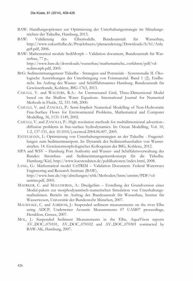
6 Outlook .............................................................................................................................. 425
7 References ......................................................................................................................... 425
1 Introduction
Estuaries are strongly influenced by tidal waves on the one hand and salt water, mixed water and freshwater zones on the other, and they transport large volumes of sediment along with their alternating currents. The deeper the water in fairways, the higher the tidal exchange volume and the higher the amounts of sediment that can be transported with the flowing water mass. As a result, dredging operations become more intensive. In Germany, for example, more than 45 million m³ of sediment material are dredged every year to maintain the required fairway depths. With over 40 million m³, the material dredged in sea waterways and seaports accounts for the major share of dredging operations. Considering these volumes it is clear that sediment transport processes in estuaries are of eminent importance. One of the main objectives is to stop the continuing increase in the amount of dredging material and rising dredging costs - even if the trend towards greater ship sizes continues unbroken.
Most of the dredged material is transported to temporary disposal sites in the estuary, meaning that the material remains in the system, thus influencing sediment transport rates and consequently also the estuary’s morphological development. When choosing a disposal site, hydromorphological criteria as well as nature conservation aspects have to be considered. As a rule, the spreading of the relocated dredged material is considered as a desired effect, for instance, while resedimentation in dredged areas should be avoided since this would encourage repeated sediment and dredging cycles. By choosing suitable disposal sites and times, it might also be possible to promote beneficial morphological developments. The evolution of the Wadden Sea, for example, is extremely important as it compensates for the impact of the sea level rise.
An understanding of the hydrodynamic and morphodynamic influences in an estuary and knowledge about the relationships with water quality parameters are therefore an essential scientific prerequisite for the optimum management of sediment. An example is the upstream transport of sediments due to tidal pumping and the influence of baroclinic processes on the water flow and sediment transport in the estuary’s gradient zone. Both are crucial factors in sediment transport and are the main cause of potential sediment cycles. Consequently, they need to be taken adequately into account when designing and implementing a sediment management strategy.
In this article the tidal Elbe serves as an example to show which kind of data, modelling and analysis tools are required for a qualitative and quantitative description of sediment transport processes in an estuary. These methods can be used to investigate sediment management options.
Section 2 provides a brief overview of the historic development of the Elbe estuary and section 3 describes the modelling system used in this study. Section 4 presents measurements and model results for sediment transport in the Elbe estuary. Section 5 then looks at specific model applications for sediment management tasks.
410
Die Küste, 81 (2014), 409-426

2 The Elbe estuary – a brief overview
The Elbe estuary is a very important German waterway. Its mouth is situated in the south-east of the German Bight, with the weir in Geesthacht defining the tidal limit. The entire length from the weir to the mouth, which has a width of approximately 15 km, is more than 160 km (Fig. 1).
Over the centuries, the Elbe estuary has been modified several times to meet the changing requirements of maritime traffic. Between 1860 and 1999 the fairway was deepened up to 10 m. Furthermore, a range of measures, such as the construction of the weir in Geesthacht, the cut-off of tributaries, the backfill of harbour basins, as well as diking and poldering, have been carried out in the last 50 years. Today the morphology of the Elbe estuary is characterised by a deep fairway leading to the Port of Hamburg and a complex system of islands, tributaries and branches in the landward section of the estuary as well as extensive tidal flats and tidal creeks in the seaward section.
Figure 1: Geographic positions and denotations of the Elbe estuary.
Anthropogenic measures have given rise to changes in tidal characteristics and sediment transport processes. Fig. 2 shows the mean high water and the mean low water at a tidal gauge in St. Pauli, Hamburg, from 1900 to 2010. The tidal range has increased considerably (1 m in the last 35 years) due to a fall in the low water level and a rise in the high water level. The asymmetry of the tidal curve is enhanced, i.e. the flood current has become shorter but now reaches higher velocities, the slack tide between flood current and ebb current has become longer, and the ebb current has also become longer with smaller current velocities. This hydrodynamic behaviour is probably the main reason for the enhanced tidal pumping of sediment upstream. Sediment is transported upstream with the strong flood current, settles during the slack tide with less sediment mass being transported downstream with the weaker ebb current. The net transport of sediments depends on strength of the head water discharge (section 4.2).
Ongoing maintenance dredging of the channel has been necessary in order to guaran-tee the safety of shipping traffic. The amount of maintenance dredging has increased significantly since the last deepening in 1999, especially in the upper region of the estuary near Hamburg (Fig. 3). This graphic also shows a change in the management strategy for
411
Die Küste, 81 (2014), 409-426

fine sediments. Since 2008, all fine sediments dredged downstream of Hamburg have been disposed on sites located in the turbidity zone (Fig. 1) in order to enlarge sediment cycles. As a consequence the amount of dredging near Osteriff has increased.
Figure 2: Mean high water and mean low water from 1900 to 2010 at tidal gauge in St. Pauli, Hamburg. Major anthropogenic measures are marked. Graphic from http://www.portal-tideelbe.de/Projekte/FRA1999/index.html, modified.
Another noticeable peak can be seen in a section in the outer estuary called “östliche Mit-telrinne”. The amount of dredged sediments was doubled in 2008, and more sediment also needs to be dredged in the neighbouring sections. The reason for this strong increase can be found in the large-scale morphodynamics of the Outer Elbe caused by a chain of pronounced hydrological and meteorological events. In the winter season 2007/2008 the number of tidal high water events (Thw > 2.40 m NHN) was significantly larger than usual (BAW 2013). Thus the hydrodynamic load on the shallow areas in the Wadden Sea due to wave and current actions was higher and more sediment was moved.
Morphological development in the Outer Elbe is a very important issue, not only with respect to dredging amounts, but also for the evolution of the Wadden Sea as an important habitat and its meaning for coastal protection, and of course for the hydro-dynamics of the whole tidal Elbe because of the dissipation of tidal energy in the outer area. The morphological development of the last 40 years is shown in Fig. 4. It is strongly influenced by the longitudinal dike “Kugelbake“ north of Cuxhaven. On the one hand, millions of cubic meters of sediment are lost in some areas and, on the other, millions of cubic meters of sediment must be dredged every year to maintain the fairway.
412
Die Küste, 81 (2014), 409-426

Figure 3: Amount of maintenance dredging in the Elbe estuary from 2000 to 2012. (Data from Baggerbüro Küste, GDWS-Nord).
All of these issues require monitoring, scientific investigation and system analysis of sed-iment transport processes using modern numerical methods. A better understanding of the cause-and-effect chain which has brought about these apparently anthropogenic driv-en changes to the estuary is required.
Figure 4: Morphological development in the Outer Elbe from 1970 to 2009.
413
Die Küste, 81 (2014), 409-426

3 Modelling system
The model runs described in this article are performed with the UnTRIM hydrodynamic and suspended transport model in combination with the SediMorph morphological mo-del and – for some applications – in combination with the dredging module DredgeSim.
UnTRIM is a computational model for solving a variety of two- and three-dimensional differential equations relating to hydrostatic and non-hydrostatic free-surface flow and transport in water bodies (CASULLI and WALTERS (2000), CASULLI and ZANOLLI (2002, 2005), LANG 2005).
SediMorph is a software package for the two- or three-dimensional simulation of fractioned sediment transport processes within the bottom and at the bottom surface bodies (BAW 2005).
DredgeSim can be used to take account of dredging and disposal actions in free surface flows. This allows the anthropogenic influence on sediment transport and morphology to be considered and maintenance strategies to be developed and evaluated focusing on different optimisation criteria (e.g. minimising dredging costs). DredgeSim can be used in two different modes. In each case the user has to define dredging and disposal areas. The date, time and amount of dredged material and its deposition is prescribed by the user in the time controlled maintenance mode. In this criterion controlled maintenance mode dredging is initiated according to prescribed dredge criteria, for instance if a deposition area in the shipping channel affects navigability. This simulation module was developed in cooperation with BAW and the University of the Armed Forces, Munich (MAERKER and MALCHEREK 2007).
Figure 5: Simulation modules of the BAW modelling system. The most important modules used for this study are shown in red.
The interaction of the simulation modules used in the applications is shown schematically in Fig. 5. The modelling system contains all the necessary simulation modules which will enable it to be used as a tool for predicting estuary responses to proposed management options. Results presented in this article are produced with validated models from the Elbe estuary (BAW 2006, 2012).
414
Die Küste, 81 (2014), 409-426

4 Sediment transport in the Elbe estuary
4.1 Measurements
Field data of sediment concentrations and transport rates, which can be used for cali-bration and validation purposes, must be collected in special measurement campaigns. A medium-term field program was initiated in 2006 (and repeated in 2010 and 2011) with the aim of improving our understanding of the suspended sediment regime and of building up a database for validation of the numerical model.
The field data collection program covers the entire Elbe estuary and provides data on suspended solid concentrations and transport rates. Acoustic Doppler Current Profilers (ADCPs) are used for the measurements as these can provide data over (nearly) the whole depth range in a temporal and spatial resolution which is very suitable for numerical models. Some results of measurements along cross-sections are presented in this section. Further results and more detailed technical information can be found in MAUSHAKE and AARDOM (2007) and MOL (2007).
The measurements were carried out in autumn 2006. The head water discharge in this period was below 400 m³/s. A total of three cross-section measurements have been performed, each representing a characteristic hydrographic regime (Cuxhaven: marine zone; Rhinplatte: turbidity zone; Hamburg: fluvial zone). In total, the cross-section mea-surements consist of more than 200 ship-mounted crossings on three transects, each one covering the period of one tide with around 160 calibration sites and more than 300 water samples.
Some measured distributions of suspended sediment concentrations for three cross-sections are shown in Fig. 6. In each case, the maximum concentration during ebb and flood currents has been selected for each profile. Transport rates and transport fluxes can be computed directly from the collected datasets as ADCPs combine a current sensor and a SSC sensor in a single device which provides velocity and suspended sediment concentration profiles in the same area. Measured sediment concentrations, transport rates and velocities are shown as cross-section integrated values in Fig. 7. Cross-section at Hamburg:
The maximum flood concentrations at the entrance to the Port of Hamburg (Hamburg profile) are much higher than the maximum ebb concentrations. Peak values of mean measured concentrations of more than 0.4 g/l are reached during flood, followed by a decrease to 0.05 g/l during slack water at high tide (Fig. 7). The ebb current is slower than the flood current owing to the significant tidal asymmetry in this part of the estuary. Thus the sediment concentrations during ebb are lower than those during flood and reach maximum values of 0.2 g/l. The concentrations again decrease to 0.05 g/l during slack water at low tide. The calculated sediment flux is a distinct indicator of the flood-dominated transport regime in this area: During flood current the transport of 27000 t suspended sediment was measured, during ebb current only 13000 t. Cross-section at Rhinplatte:
In the turbidity zone of the Elbe estuary (Rhinplatte profile) the concentration in some areas sometimes increases to over 2 g/l, for example at the sides of the navigation channel (Fig. 6). Higher values probably occur near the bottom, but the measurement method is not valid for this reach. Thus the real sediment fluxes must be higher than
415
Die Küste, 81 (2014), 409-426

calculated fluxes based on measurements. Values of mean (cross-section integrated) measured concentrations of more than 0.6 g/l are reached during flood peak, followed by a decrease to 0.10 g/l during slack water at high tide (Fig. 7). The sediment concentra-tions during ebb are higher than during flood and reach maximum values of 0.7 g/l. This peak concentration at the end of the ebb current is probably caused by a muddy area located a few kilometres upstream of this cross-section. This does not necessarily indicate an ebb-dominated transport regime because the length of the cross-section navigable with the vessel was shorter during the ebb and thus lateral areas with lower sediment concentrations are not taken into account. During both flood and ebb current the transport of 130000 t suspended sediment was measured.
Figure 6: Maximum measured sediment concentrations at the cross-sections Hamburg/Blankenese, Glückstadt/Rhinplatte and Cuxhaven during flood and ebb current. The scale at the profile Glückstadt/Rhinplatte was adapted to the higher sediment concentrations in this area.
Cross-section at Cuxhaven: The lowest concentrations were measured in the marine transect near Cuxhaven. The
maximum of the ebb current is located in the western area of the profile and during flood the maximum current velocities occur at the eastern area of the profile. Thus the pattern
416
Die Küste, 81 (2014), 409-426

of suspended sediment concentration looks different (Fig. 6). Due to the high current velocities in this area the morphology is mainly affected by sand transport. The averaged measured sediment concentrations are small and vary between 0.02 g/l and 0.11 g/l with a tidal-averaged value of 0.07 g/l (Fig. 7). During flood current as well as ebb current the transport of 30000 t suspended sediment was measured.
Figure 7: Measured current velocities, sediment concentrations and sediment fluxes at the cross-sections Hamburg/Blankenese (upper graph), Glückstadt/Rhinplatte (middle graph) and Cuxhaven (lower graph). The values are averaged over the cross-section area.
417
Die Küste, 81 (2014), 409-426

4.2 Model results
These data were used in a calibration process. The site-specific model was first calibrated using bathymetric and hydrologic conditions from 2006. During the calibration process the influence of settling velocity formulations was also investigated. This process cannot be described here in detail. One of the main findings was that none of the tested settling velocity formulations works well for the whole estuary. The model setup using two suspended sediment fractions each with constant settling velocities delivered the best results. However, flocculation processes, which are probably responsible for the strong decrease in sediment concentrations during slack tides, have not yet been considered satisfactorily in the model. Despite this weakness, mean sediment concentrations and transport rates calculated from the model are qualitatively and quantitatively in an acceptable range for the entire Elbe estuary, i.e. the model reproduces, in a broad sense, the general nature of sediment dynamics in the estuarine system.
Fig. 8 shows a comparison of measured and modelled current velocities and sediment concentrations at the cross-section Glückstadt/Rhinplatte. In general, measured values are more scattered and modelled values are smoother. The vertical distribution of sediment concentrations is more pronounced in the measurements. High concentrations near the bottom seem to be underestimated by the model, but on the other hand measured data are often not valid in this region.
Figure 8: Elbe model 2006: Measured and modelled current velocities (left graph) and respective sediment concentrations (right graph) at the cross-section Glückstadt/Rhinplatte.
Results of measurements and model results for a similar setup of the Elbe model 2010 are shown in Fig. 9. Measured and modelled current velocities, sediment concentrations, discharges and sediment fluxes at the cross-sections at Elbe-Km 689 are averaged over the cross-section area. Note that with this calibration procedure the model ran already nearly 6 months until it was compared with measured data, i.e. the hydrologic history is inherent in the model results. Overall the model fits the measured data well. This model is used for the morphodynamic application described in section 5.3.
418
Die Küste, 81 (2014), 409-426

Figure 9: Elbe model 2010: Measured and modelled current velocities, sediment concentrations (left graph) and respective discharges, sediment fluxes (right graph) at the cross-sections at Elbe-Km 689. The values are averaged over the cross-section area.
In further specific model applications only the head water discharge is varied (Q = 180, 720 and 1260 m³/s) in order to investigate the influence of head water discharge on hydrodynamic and sediment transport processes. All other model steering parameters, including initial conditions such as sediment and salinity distribution and other boundary conditions and values, were uniform for all model runs.
The model runs cover a four week simulation period (June 2nd to June 30th 2006). The analysis of the model results starts after nine days of simulation (June 11th 2006 to June 25th 2006). During this period (one spring-neap-cycle) all model results are stored every ten minutes. In several post-processing steps these data are analysed to calculate the minimum, mean and maximum values of water level, current velocities, salinities and sediment concentrations for each element. In addition, the sediment transport across defined cross-sections and along defined long-sections is calculated for each model run. This analysis provides a set of metrics which are useful to describe the system behaviour and provides a basis for comparison between model runs.
Fig. 10 shows on the right side suspended sediment concentrations along the fairway. These are time-averaged values of three-dimensional model results for one spring-neap-cycle. A turbidity maximum exists in all model runs. A higher fresh water discharge flushes the suspended sediments to the sea. Higher sediment concentrations occur in these runs. On the left side the ratio between the suspended sediment transport rates during flood current and during ebb current is shown. This value does not provide any information about quantities, but instead characterises the transport regime of suspended sediments. Together with the knowledge about absolute transport rates, this ratio constitutes an important criterion, for example for the assessment of dumping sites. The highest values of this ratio occur near the Port of Hamburg at low discharges.
There are two hydrodynamic reasons for this transport behaviour - baroclinic effects due to density gradients and tidal pumping, both indicated in Fig. 10. The influence of baroclinic processes on the sediment transport is high. The strong dominance of the near bed transport in flood direction between Cuxhaven and Brunsbüttel, which is also visible at higher head water discharges, may indicate further sediment cycles in the Elbe estuary. Furthermore the model runs for low or mean head water discharge predict distinct sedi-ment transport in flood direction, at least upstream of Brunsbüttel. This transport charac-teristic is caused by tidal asymmetry, already described in section 2. Owing to these
419
Die Küste, 81 (2014), 409-426

transport characteristics fine sediments accumulate over the long term in this part of the Elbe and lead to an increase in the amount of maintenance dredging.
Figure 10: Flood/ebb (F:E) ratio of suspended load transport (left graph) and mean suspended load (right graph) for discharge Q = 180 / 720 / 1260 m³/s. 3D data, averaged over one spring-neap cycle. Specific features are marked by red circles.
4.3 Monitoring of dredging activities
Dredging and disposal actions lead to changes of morphology, of sediment concentra-tions and thus to changes in the net transport of sediments. The spreading of sediments and changes in sediment concentrations may offer economic and ecologic criteria for comparing and evaluating realistic dredging and disposal scenarios (location, tidal phase, sediment properties etc.). Detailed data of real dredging and disposal actions, or at least information about the applied sediment management strategy, are also needed for mid-term or long-term morphodynamic simulations.
Usually only information about the yearly amount of dredging volume for certain sections of the waterway are available (Fig. 3). A detailed spatial and temporal analysis of these data is not possible and this kind of data is therefore not appropriate for use in a numerical simulation.
420
Die Küste, 81 (2014), 409-426

Dredging data which can be used for a model run must describe the dredging and disposal action in great detail:
A polygon to describe the dredging area Date and time of dredging Volume and density of dredged sediments A polygon to describe the disposal area Date and time of disposal Several identification numbers for a distinct description of the dredging cycle
If these data are available, dredging and disposal actions can be considered in detail during a numerical simulation. Since 2009, most of the dredging vessels working in the Elbe estuary have been equipped with the sensors needed for operational monitoring purposes and the data is now available for further investigations. If the morphodynamic model is only driven by dredging data, only that part of the bottom evolution becomes visible which is influenced by dredging operations. Fig. 11 shows dredge polygons near Osteriff and the resulting bed evolution based on monitoring data from the year 2010.
Figure 11: Dredge polygons near Osteriff and resulting bed evolution based on monitoring data from the year 2010.
5 Application to sediment management tasks
5.1 Sediment management concept
Currently, the maintenance concept for the Elbe estuary is a sediment management system combining different hydraulic engineering activities. It includes construction measures and optimised dredging actions and was developed in cooperation with all the associated authorities (HPA and WSV 2008). This concept is in a continuous process of ongoing developed and completion (ENTELMANN 2012, BAW 2013, BfG 2013).
421
Die Küste, 81 (2014), 409-426

Construction measures are mainly investigated to overcome the negative effects arising from flood dominated tidal characteristics and associated sediment transport. This can be achieved by creating a bigger tidal volume upstream and by increasing the dissipation of the incoming tidal energy. Possible measures include construction of hydraulic structures, the enlargement of shallow water areas in the Outer Elbe and the construction of additional tidally influenced areas in the upper part.
Further, optimised dredging and disposal strategies are aspired to reduce volumes of dredged material. This includes identifying and enlarging or destroying dredging cycles, where dredged material which is disposed in the estuary is transported back to dredging sites. This can be achieved by disposing of fine sediments in a more ebb-dominated transport regime. Coarse particles, in contrast, can be used in construction measures. Further, the influence of the head water discharge as well as the time-dependent change of the flow regime can be used to optimise dredging and even more disposal activities.
By constructing several sediment traps, the sediments are further forced to settle at certain stages to keep them out of critical areas. This enables the sedimentation processes to be steered in the estuary and the entry of fresh sediments in polluted harbour basins avoided.
Currently, most dredged material is disposed of within the estuary (Fig. 12). Further-more, the Hamburg Port Authority has had temporary permission to dispose of a certain amount of fine sediments in the North Sea. As a result, around 1 million m³ of fine sedi-ment was removed from the estuary every year between 2005 and 2011. A smaller amount, polluted by different contaminants which are transported and accumulating in the harbour from sources upstream, has to be treated and deposited landside. This man-agement concept still requires the treatment and deposition of polluted sediments. The improvement of the water quality of the river Elbe and its sediments is still an important goal, and one which can only be fully achieved by stopping the emission of contamina-tions along the upstream tributaries. This is supported within the estuary by removing polluted sediments in the harbour.
Figure 12: Schematic view of the management concept for fine sediments, applied 2005-2011. Red arrow indicate storage on land.
422
Die Küste, 81 (2014), 409-426

5.2 Investigation of disposal sites
The modelling system was applied to investigate the function of the disposal sites used in the Elbe estuary. The set-up of the model for this application is nearly identical to the studies described in section 4.2, but in addition to the initial sediment inventory three more sediment fractions are taken into account. These sediment fractions (fine, mean and coarse silt) have physical properties which are identical with the background inventory. These sediments are located at disposal sites and can be eroded and transported by the tidal current.
This kind of model application allows for detailed analysis of the transport behaviour of different types of sediments from different locations in the estuary. The spreading of the marked sediments shows the extent of influence of the investigated disposal site. This information, together with knowledge of dredging and disposal strategies, can be used to recognise sediment cycles.
This method was applied not only to all recent disposal sites in the Elbe estuary, but also to potential new sites, which may be more convenient (BAW 2012, 2013). An exam-ple from this investigation is the spreading of coarse silt from the disposal site at Elbe km 738 as shown in Fig. 13. The preferred transport direction is indicated by maximum sediment concentrations of coarse silt eroded from the disposal site. This is a proper site from a hydraulic engineering point of view because most of the sediments are transported in a south-east direction towards shallow areas, but not in the fairway, indicated by the black line. Thereby the formation of the Wadden Sea is supported, or at least the erosion of sediments from this region is compensated.
Figure 13: Spreading of fine sediments from the disposal site at Elbe km 738, indicated by maximum sediment concentrations of coarse silt eroded from the disposal site.
423
Die Küste, 81 (2014), 409-426

5.3 Modelling dredging activities
Finally the modelling system (section 3) was applied to simulate hydro- and morpho-dynamics for the year 2010, whereby all known dredging and dumping operations were included. Fig. 14 shows the modelled bottom evolution in the mouth of the Elbe estuary. Dredging sites as well as disposal sites are recognisable. Some larger scale morphological trends correspond well with observed changes (Fig. 15), but overall the model setup used for this run appears to overestimate erosion in some areas. Nevertheless the model is an indispensable tool for evaluating different sediment management strategies. It can be used to test management options, and the difference between two model runs shows the impact of the variation.
Figure 14: Modelled bottom evolution in the mouth of the Elbe estuary for the year 2010. Result of a three-dimensional model run. All known dredging and dumping operations are included. Dredging sites as well as disposal sites are recognizable. Black lines indicate the borders between dredging sections according to Fig. 3. Numbers denote stream kilometers.
Finally, Fig. 15 shows the difference in topography from the year 2011-2010. Dredging sites known from monitoring data are indicated as green polygons. The bottom evolution in the vicinity of the disposal sites is obviously influenced by disposal opera-tions, as we have already seen in Fig. 14. However, some larger morphological trends also appear to be influenced by the disposal sites, e.g. the depositions are south-east of the disposal site at Elbe km 738 (Fig. 13).
We observe large morphological changes in the mouth of the Elbe estuary. The reasons for these changes need to be better understood given that the morphological state of the Outer Elbe has a strong impact on the tidal dynamics of the whole estuary. If possible proper morphological developments should be supported by a flexible and adaptive sediment management strategy.
424
Die Küste, 81 (2014), 409-426

Figure 15: Difference topography for the year 2011-2010. Dredging sites are indicated as green polygons. The bottom evolution in the vicinity of the disposal sites is obviously influenced by disposal operations.
6 Outlook
Especially in the region of the North Sea estuaries, a profound understanding of sediment processes and expert sediment management are indispensable. It follows from the relationships discussed above that it is advisable to pursue an optimisation strategy for handling the dredged material which fulfils several purposes: minimising costs and dredging volumes, but also meeting other objectives. Optimised sediment management takes account of all the processes referred to above. At present, little is known about the long-term effects of the repeated removal of sediments. More scientific and practical basic knowledge is needed. Such knowledge would be of direct benefit for sediment man-agement and would contribute to understanding the system. Hence, there is a need for further development of existing approaches. Given the permanent hydromorphological changes in estuarine systems due to both anthropogenic and natural influences, adapting and optimising sediment management strategies is a never-ending task.
7 References
BAW: Model validation and system studies for hydrodynamics, salt and sediment transport in the Elbe Estuary - Basic information for the River engineering and sediment management concept, Version 1.0, Hamburg, 2012.
425
Die Küste, 81 (2014), 409-426
BAW: Handlungsoptionen zur Optimierung der Unterhaltungsstrategie im Mündungs-trichter der Tideelbe, Hamburg, 2013.
BAW: Validierung des Elbemodells. Bundesanstalt für Wasserbau, http://www.zukunftelbe.de/Projektbuero/planaenderung/Downloads/h/h1/Anlage8.pdf, 2006.
BAW: Mathematical module SediMorph – Validation document, Bundesanstalt für Was-serbau, 77 p., http://www.baw.de/downloads/wasserbau/mathematische_verfahren/pdf/vd-sedimorph.pdf, 2005.
BFG: Sedimentmanagement Tideelbe - Strategien und Potenziale - Systemstudie II. Öko-logische Auswirkungen der Unterbringung von Feinmaterial. Band 1 (2), Endbe-richt. Im Auftrag des Wasser- und Schifffahrtsamtes Hamburg. Bundesanstalt für Gewässerkunde, Koblenz, BfG-1763, 2013.
CASULLI, V. and WALTERS, R.A.: An Unstructured Grid, Three-Dimensional Model based on the Shallow Water Equations. International Journal for Numerical Methods in Fluids, 32, 331-348, 2000.
CASULLI, V. and ZANOLLI, P.: Semi-Implicit Numerical Modelling of Non-Hydrostatic Free-Surface Flows for Environmental Problems, Mathematical and Computer Modelling, 36, 1131-1149, 2002.
CASULLI, V. and ZANOLLI, P.: High resolution methods for multidimensional advection–diffusion problems in free-surface hydrodynamics. In: Ocean Modelling, Vol. 10, 1-2, 137-151, doi: 10.1016/j.ocemod.2004.06.007, 2005.
ENTELMANN, I.: Optimierung von Unterhaltungsstrategien an der Tideelbe - Fragestel-lungen zum Sedimenttransport. In: Dynamik des Sedimenthaushaltes von Wasser-straßen. 14. Gewässermorphologisches Kolloquium der BfG, Koblenz, 2012.
HPA and WSV – Hamburg Port Authority and Wasser- und Schiffahrtsverwaltung des Bundes: Strombau- und Sedimentmanagementkonzept für die Tideelbe. Hamburg/Kiel, http://www.kuestendaten.de/publikationen/index.html, 2008.
LANG, G.: Mathematical model UnTRIM – Validation Document. Federal Waterways Engineering and Research Institute (BAW), http://www.baw.de/vip/abteilungen/wbk/Methoden/hnm/untrim/PDF/vd-untrim.pdf, 2005.
MAERKER, C. and MALCHEREK, A.: DredgeSim – Erstellung der Grundversion eines Modul-pakets zur morphodynamisch-numerischen Simulation von Unterhaltungs-maßnahmen. Bericht im Auftrag der Bundesanstalt für Wasserbau, Institut für Wasserwesen, Universität der Bundeswehr München, 2007.
MAUSHAKE, C. and AARDOM, J.: Suspended sediment measurements on the river Elbe using ADCP, Underwater Acoustic Measurements 07 UAM07 proceedings, Heraklion, Greece, 2007.
MOL, J.: Suspended Sediment Measurements in the Elbe, AquaVison reports AV_DOC_070101, AV_DOC_070102 and AV_DOC_070301 contracted by BAW-AK, Hamburg, 2007.
426
Die Küste, 81 (2014), 409-426