Scoping Report - Sazi Environmental Consulting · Web viewSCOPING REPORT FOR LISTED ACTIVITIES...
54
SCOPING REPORT FOR LISTED ACTIVITIES ASSOCIATED WITH MINING RIGHT AND/OR BULK SAMPLING ACTIVITIES INCLUDING TRENCHING IN CASES OF ALLUVIAL DIAMOND PROSPECTING. SUBMITTED FOR ENVIRONMENTAL AUTHORIZATIONS IN TERMS OF THE NATIONAL ENVIRONMENTAL MANAGEMENT ACT, 1998 AND THE NATIONAL ENVIRONMENTAL MANAGEMENT WASTE ACT, 2008 IN RESPECT OF LISTED ACTIVITIES THAT HAVE BEEN TRIGGERED BY APPLICATIONS IN TERMS OF THE MINERAL AND PETROLEUM RESOURCES DEVELOPMENT ACT, 2002 (MPRDA) (AS AMENDED).
-
Upload
nguyenhanh -
Category
Documents
-
view
214 -
download
1
Transcript of Scoping Report - Sazi Environmental Consulting · Web viewSCOPING REPORT FOR LISTED ACTIVITIES...

SCOPING REPORT
FOR LISTED ACTIVITIES ASSOCIATED WITH MINING RIGHT AND/OR BULK SAMPLING ACTIVITIES INCLUDING TRENCHING
IN CASES OF ALLUVIAL DIAMOND PROSPECTING.
SUBMITTED FOR ENVIRONMENTAL AUTHORIZATIONS IN TERMS OF THE NATIONAL
ENVIRONMENTAL MANAGEMENT ACT, 1998 AND THE NATIONAL ENVIRONMENTAL
MANAGEMENT WASTE ACT, 2008 IN RESPECT OF LISTED ACTIVITIES THAT HAVE
BEEN TRIGGERED BY APPLICATIONS IN TERMS OF THE MINERAL AND PETROLEUM
RESOURCES DEVELOPMENT ACT, 2002 (MPRDA) (AS AMENDED).
NAME OF APPLICANT: Cronimet Chrome Mining SA (Pty) Ltd
TEL NO: 011 958 0544
FAX NO: 011 958 0467
POSTAL ADDRESS: P. O. Box 3319, Witkoppen
PHYSICAL ADDRESS: 220 Corner 3rd Street and Cedar Road, Building C, Willowwood Office Park,
Broadacres
FILE REFERENCE NUMBER SAMRAD:
IMPORTANT NOTICE
In terms of the Mineral and Petroleum Resources Development Act (Act 28 of 2002 as
amended), the Minister must grant a prospecting or mining right if among others the mining
“will not result in unacceptable pollution, ecological degradation or damage to the
environment”.
Unless an Environmental Authorisation can be granted following the evaluation of an
Environmental Impact Assessment and an Environmental Management Programme report
in terms of the National Environmental Management Act (Act 107 of 1998) (NEMA), it
cannot be concluded that the said activities will not result in unacceptable pollution,
ecological degradation or damage to the environment.
In terms of section 16(3)(b) of the EIA Regulations, 2014, any report submitted as part of an
application must be prepared in a format that may be determined by the Competent
Authority and in terms of section 17 (1) (c) the competent Authority must check whether the
application has taken into account any minimum requirements applicable or instructions or
guidance provided by the competent authority to the submission of applications.
It is therefore an instruction that the prescribed reports required in respect of applications
for an environmental authorisation for listed activities triggered by an application for a right
or permit are submitted in the exact format of, and provide all the information required in
terms of, this template. Furthermore please be advised that failure to submit the information
required in the format provided in this template will be regarded as a failure to meet the
requirements of the Regulation and will lead to the Environmental Authorisation being
refused.
It is furthermore an instruction that the Environmental Assessment Practitioner must
process and interpret his/her research and analysis and use the findings thereof to compile
the information required herein. (Unprocessed supporting information may be attached as
appendices). The EAP must ensure that the information required is placed correctly in the
relevant sections of the Report, in the order, and under the provided headings as set out
below, and ensure that the report is not cluttered with un-interpreted information and that it
unambiguously represents the interpretation of the applicant.

OBJECTIVE OF THE SCOPING PROCESS
1) The objective of the scoping process is to, through a consultative process—
(a) identify the relevant policies and legislation relevant to the activity;
(b) motivate the need and desirability of the proposed activity, including the need and
desirability of the activity in the context of the preferred location;
(c) identify and confirm the preferred activity and technology alternative through an impact
and risk assessment and ranking process;
(d) identify and confirm the preferred site, through a detailed site selection process, which
includes an impact and risk assessment process inclusive of cumulative impacts and a
ranking process of all the identified alternatives focusing on the geographical, physical,
biological, social, economic, and cultural aspects of the environment;
(e) identify the key issues to be addressed in the assessment phase;
(f) agree on the level of assessment to be undertaken, including the methodology to be
applied, the expertise required as well as the extent of further consultation to be
undertaken to determine the impacts and risks the activity will impose on the preferred
site through the life of the activity, including the nature, significance, consequence,
extent, duration and probability of the impacts to inform the location of the
development footprint within the preferred site; and
(g) identify suitable measures to avoid, manage, or mitigate identified impacts and to
determine the extent of the residual risks that need to be managed and monitored.
_________

SCOPING REPORT
2) Contact Person and correspondence address
a) Details of:
i) The EAP who prepared the report
Name of The Practitioner: Mrs. Nonkanyiso Zungu
Tel No.: +27 (0)11 312 7208
Fax No. : +27 (0)11 312 7208
e-mail address: [email protected] /or
ii) Expertise of the EAP.(1) The qualifications of the EAP
(With evidence attached as Appendix 1).
University of Pretoria 2011 MSc. Environmental ManagementUniversity of KwaZulu-Natal 2005 BSc. Honours, Biological Science University of KwaZulu-Natal 2003 BSc. Biological Sciences
(2) Summary of the EAP’s past experience. (Attach the EAP’s curriculum vitae as Appendix 2)Nonkanyiso Zungu is a Professional Natural Scientist (Pr.Sci.Nat) with 10 years’ experience in the environmental field. She has a Masters Degree in Environmental Management, and specializes on Water Resource Management. Nonkanyiso has extensive experience in water resource management, waste management, and obtaining environmental authorisations (air, water, waste) across sectors that include: power generation, infrastructure (Construction), transportation (rail), waste disposal, water purification & sewage works. The projects she has undertaken include: Environmental Impact Assessments, Basic Assessments, Environmental Feasibility Studies, Environmental scoping studies, Environmental legal compliance audits, Waste management licences, Water use licences, and Baseline risk assessments.
b) Description of the property. Farm Name: Portion 1 of the farm Elandskuil 378 KQ
Portion 1 of the farm Middellaagte 382 KQ

Remaining extent of the farm Moddergat 389 KQPortion 8 of the farm Roodedam 368 KQRemaining extent and portion 1 of the Schildpadness 385 KQPortion 17, 18, 21, 26, and 28 of the farm Zwartkop 369 KQ
Application area (Ha) 101.8 ha
Magisterial district: Waterberg
Distance and direction from nearest town
30 km North East of Thabazimbi
21 digit Surveyor General Code for each farm portion
T0KQ00000000038200001 (Middelaagte Portion 1)T0KQ00000000038900000 (Moddergat Remaining extent)T0KQ00000000036900018 (Zwartkop Portion 18)T0KQ00000000037800001 (Elandskuil Portion 1)T0KQ00000000036800008 (Roodedam Portion 8)T0KQ00000000038500001 (Schildpadnest Portion 1)T0KQ00000000038500000 (Schildpasnest Remaining extent)T0KQ00000000036900017 (Zwartkop Portion 17)T0KQ00000000036900021 (Zwartkop Portion 21)T0KQ00000000036900026 (Zwartkop Portion 26)T0KQ00000000036900028 (Zwartkop Portion 8)
c) Locality map (show nearest town, scale not smaller than 1:250000 attached as Appendix 3).
ATTACHED AS APPENDIX 3

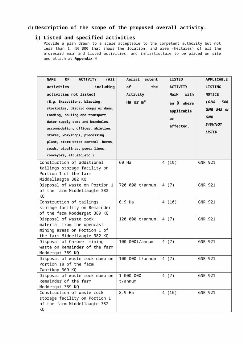
d) Description of the scope of the proposed overall activity. i) Listed and specified activities
Provide a plan drawn to a scale acceptable to the competent authority but not less than 1: 10 000 that shows the location, and area (hectares) of all the aforesaid main and listed activities, and infrastructure to be placed on site and attach as Appendix 4
NAME OF ACTIVITY (All activities including activities not listed)(E.g. Excavations, blasting, stockpiles, discard dumps or dams, Loading, hauling and transport, Water supply dams and boreholes, accommodation, offices, ablution, stores, workshops, processing plant, storm water control, berms, roads, pipelines, power lines, conveyors, etc…etc…etc.)
Aerial extent of the Activity
Ha or m²
LISTEDACTIVITYMark with an
X where
applicable or affected.
APPLICABLE LISTING NOTICE (GNR 544, GNR 545 or GNR 546)/NOT LISTED
Construction of additional tailings storage facility on Portion 1 of the farm Middellaagte 382 KQ
60 Ha 4 (10) GNR 921
Disposal of waste on Portion 1 of the farm Middellaagte 382 KQ
720 000 t/annum 4 (7) GNR 921
Construction of tailings storage facility on Remainder of the farm Moddergat 389 KQ
6.9 Ha 4 (10) GNR 921
Disposal of waste rock material from the opencast mining areas on Portion 1 of the farm Middellaagte 382 KQ
120 000 t/annum 4 (7) GNR 921
Disposal of Chrome mining waste on Remainder of the farm Moddergat 389 KQ
100 000t/annum 4 (7) GNR 921
Disposal of waste rock dump on Portion 18 of the farm Zwartkop 369 KQ
100 000 t/annum 4 (7) GNR 921
Disposal of waste rock dump on Remainder of the farm Moddergat 389 KQ
1 000 000 t/annum 4 (7) GNR 921
Construction of waste rock storage facility on Portion 1 of the farm Middellaagte 382 KQ
8.9 Ha 4 (10) GNR 921
Construction of waste rock storage facility on Portion 18 of the farm Zwartkop 369 KQ
10.6 Ha 4 (10) GNR 921
Construction of waste rock storage facility on Remainder of the farm Moddergat 389 KQ
7.4 Ha 4 (10) GNR 921
Construction of waste rock storage facility on Portion 18 of the farm Zwartkop 369 KQ
8.0 Ha 4 (10) GNR 921
ii) De scription of the activities to be undertaken(Describe Methodology or technology to be employed, and for a linear activity, a description of the route of the activity

Cronimet Chrome Mining SA (Pty) Ltd is a holder of a mining right (LP 30/5/1/3/2/1 (115) EM) for its existing Cronimet Thaba Chrome Mine granted in terms of section 23 of the Mineral and Petroleum Resources Development Act, 2002 (Act No. 28 of 2002) (MPRDA). The right involves exploitation of Cr and PGMs contained in the LG6 (including LG6A), LG4-high Cr to Fe ratio) (Lower Groups), MG2 and MG3 (Middle Groups) of the Critical Zone in the Western Bushveld Igneous Complex using both opencast (ML1, ML2, and ZK1D pits) and conventional underground mining method (ZK2A, ZK2B, ZK2C, RD1 pits) on portions of the farms Elandskuil 378 KQ, Middellaagte 382 KQ, Moddergat 389 KQ, Roodedam 368 KQ, Schildpadness 385 KQ, and Zwartkop 369 KQ, located within the Magisterial District of Thabazimbi, Limpopo Province.
The mine plans to increase production through the expansion of the opencast mining operations to include the following pits: ZK4, ZK3, ZK2, ZK1.1, ZK1, ZK4A, ZK3A, ZK1A, ZK4B, ZK3B, ZK1B, ZK1C, ZK4C, ZK5B, EK2, ML3, ML4, ZK5A, and EK1. Expansion will cover an area of approximately 2129 hectares in extent and will include development of chrome processing plant on the remaining extent of the farm Moddergat 389 KQ and PGMs and chrome processing plant on portion 1 of the farm Middellaagte 382 KQ. Thus, an amendment to the 2009 Environmental Impact Assessment Report (EIR) (see reference below) has been submitted to both Limpopo Department of Economic Development and Tourism (LEDET) and DMR Limpopo Region to meet the requirements of the National Environmental Management Act, 1998 (Act No. 107 of 1998) (and Environmental Impact Assessment Regulations, 2010) and Section 102 of the MPRDA.a. Record of Decision (Ref. No. 12/1/9-7/2-W109)b. Project Amendment Ref. No. 12/1/9/2-W64c. NEAS Ref. No.LIM/EIA/0001010/2014
Mining will involve pre-stripping of vegetation to clear the pit area, followed by the removal of topsoil and waste rock material to expose the ore. Production for both the opencast and underground mining operations is planned at 1 320 000 t/annum and 900 000 t/annum over a 27 years LoM. The underground mining areas have an estimated combined chromitite ore mineable reserves of approximately 25 509 132 tons, with an estimated saleable product at 19 131 849 tons. The RoM will be processed to produce metallurgical concentrate, chemical concentrate, and foundary sand. Final tailings from the processing will be pumped to a tailings thickener. The overflow from the thickener will gravitate to a process tank whilst underflow will be pumped to a tailings storage facility (TSF) with a maximum height of 40 meter (m).
The supporting infrastructure for opencast mining operation includes construction of a 60haTailings Storage Facility (TSF) for the disposal of 720 000 t/annum of tailings and waste rock material which is comprised of 25 opencast workings on 8.9ha of land, which will be disposed of into Waste Rock Dumps (WRD) with a capacity of 100 000t/annum. Both the TSF and waste rock from opencast mining will be undertaken on Portion 1 of the farm Middellaagte 382 KQ. Another WRD is proposed on Portion 18 of the farm Zwartkop 369 KQ, which will cover 10.6ha of land for the 100 000t/annum disposal of waste rock.
Underground mining infrastructure also includes the TSF and WRD areas on the Remainder of the farm Moddergat 389KG, where 6.9ha of land will be cleared for the disposal of 120 000t/annum tailings. All tailings from the Cr and PGMs processing will be pumped into this TSF through a pipe and discharged through spigot outlets. The WRD will clear 7.4ha of land for the disposal of 1 000 000t/annum of waste rock. Another WRD is proposed on Portion 18 of the farm Zwartkop 369 KQ, which will cover 8ha for the disposal of 1 000 000t/annum of waste rock.
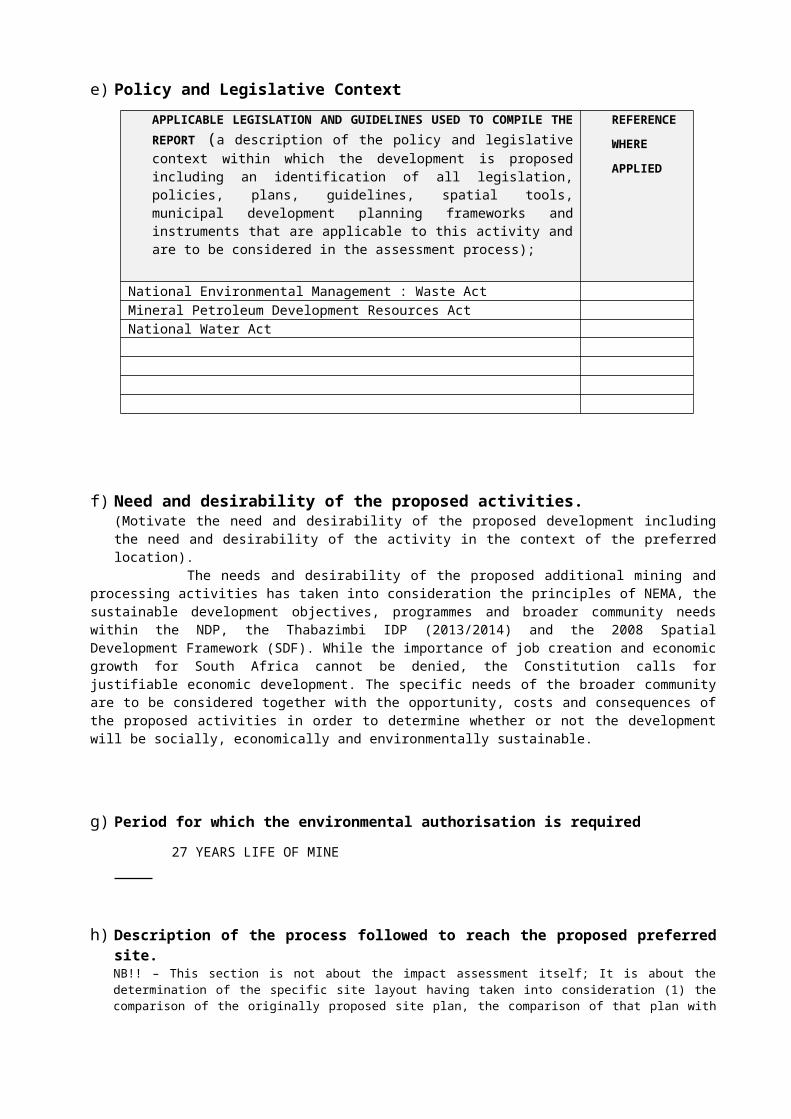
e) Policy and Legislative Context APPLICABLE LEGISLATION AND GUIDELINES USED TO COMPILE THE REPORT (a description of the policy and legislative context within which the development is proposed including an identification of all legislation, policies, plans, guidelines, spatial tools, municipal development planning frameworks and instruments that are applicable to this activity and are to be considered in the assessment process);
REFERENCE WHERE APPLIED
National Environmental Management : Waste Act Mineral Petroleum Development Resources Act National Water Act
f) Need and desirability of the proposed activities. (Motivate the need and desirability of the proposed development including the need and desirability of the activity in the context of the preferred location).
The needs and desirability of the proposed additional mining and processing activities has taken into consideration the principles of NEMA, the sustainable development objectives, programmes and broader community needs within the NDP, the Thabazimbi IDP (2013/2014) and the 2008 Spatial Development Framework (SDF). While the importance of job creation and economic growth for South Africa cannot be denied, the Constitution calls for justifiable economic development. The specific needs of the broader community are to be considered together with the opportunity, costs and consequences of the proposed activities in order to determine whether or not the development will be socially, economically and environmentally sustainable.
g) Period for which the environmental authorisation is required 27 YEARS LIFE OF MINE
h) Description of the process followed to reach the proposed preferred site. NB!! – This section is not about the impact assessment itself; It is about the determination of the specific site layout having taken into consideration (1) the comparison of the originally proposed site plan, the comparison of that plan with the plan of environmental features and current land uses, the issues raised by interested and affected parties, and the consideration of alternatives to the initially proposed site layout as a result.
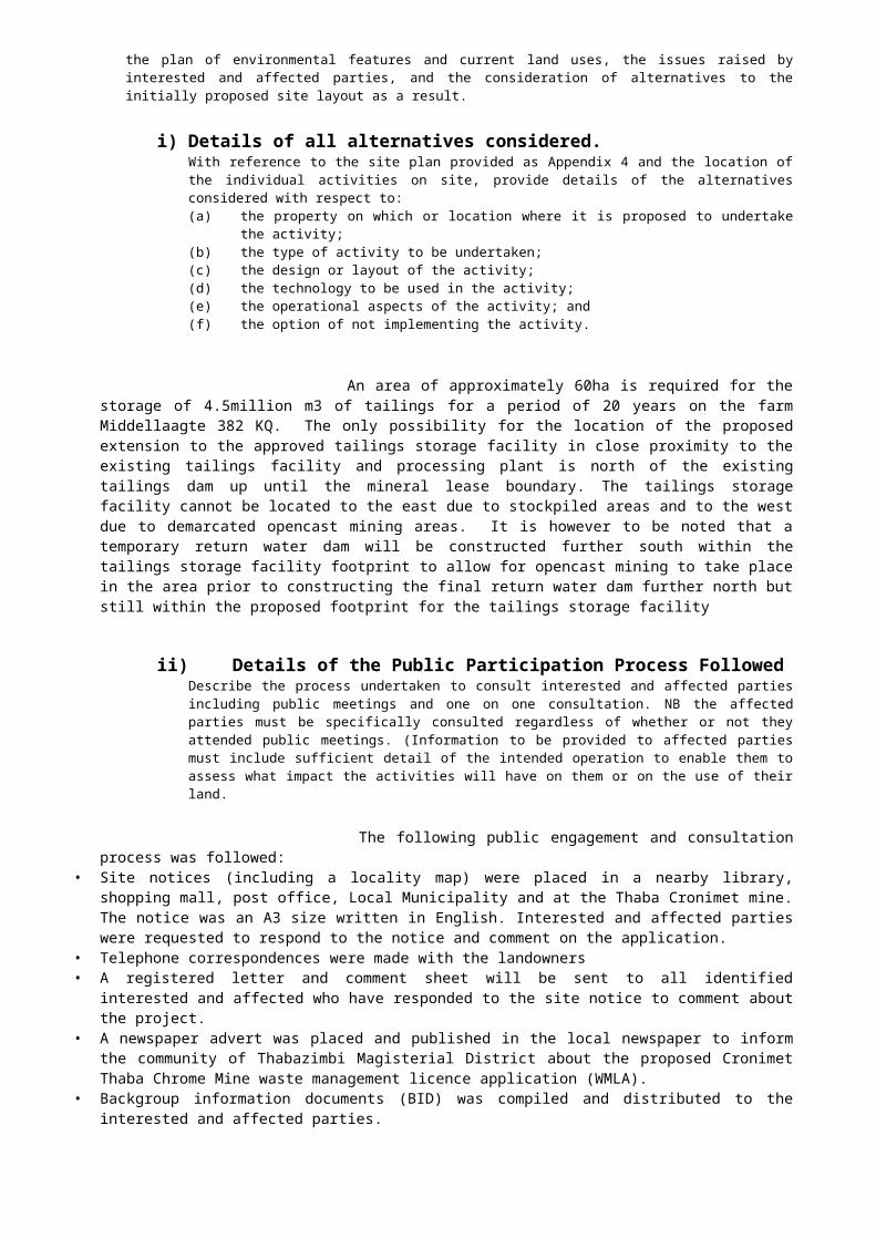
i) Details of all alternatives considered.With reference to the site plan provided as Appendix 4 and the location of the individual activities on site, provide details of the alternatives considered with respect to:(a) the property on which or location where it is proposed to undertake the activity;(b) the type of activity to be undertaken;(c) the design or layout of the activity;(d) the technology to be used in the activity;(e) the operational aspects of the activity; and(f) the option of not implementing the activity.
An area of approximately 60ha is required for the storage of 4.5million m3 of tailings for a period of 20 years on the farm Middellaagte 382 KQ. The only possibility for the location of the proposed extension to the approved tailings storage facility in close proximity to the existing tailings facility and processing plant is north of the existing tailings dam up until the mineral lease boundary. The tailings storage facility cannot be located to the east due to stockpiled areas and to the west due to demarcated

opencast mining areas. It is however to be noted that a temporary return water dam will be constructed further south within the tailings storage facility footprint to allow for opencast mining to take place in the area prior to constructing the final return water dam further north but still within the proposed footprint for the tailings storage facility
ii) Details of the Public Participation Process FollowedDescribe the process undertaken to consult interested and affected parties including public meetings and one on one consultation. NB the affected parties must be specifically consulted regardless of whether or not they attended public meetings. (Information to be provided to affected parties must include sufficient detail of the intended operation to enable them to assess what impact the activities will have on them or on the use of their land.
The following public engagement and consultation process was followed:• Site notices (including a locality map) were placed in a nearby library, shopping mall, post office, Local
Municipality and at the Thaba Cronimet mine. The notice was an A3 size written in English. Interested and affected parties were requested to respond to the notice and comment on the application.
• Telephone correspondences were made with the landowners• A registered letter and comment sheet will be sent to all identified interested and affected who have
responded to the site notice to comment about the project.• A newspaper advert was placed and published in the local newspaper to inform the community of
Thabazimbi Magisterial District about the proposed Cronimet Thaba Chrome Mine waste management licence application (WMLA).
• Backgroup information documents (BID) was compiled and distributed to the interested and affected parties.
• A public meeting with all interested and affectedf parties will be scheduled and held at the nearby community hall or private hall.
• All issues and comments raised by interested and affected parties will be considered and included in the compilation of the final scoping report.
Scoping Report
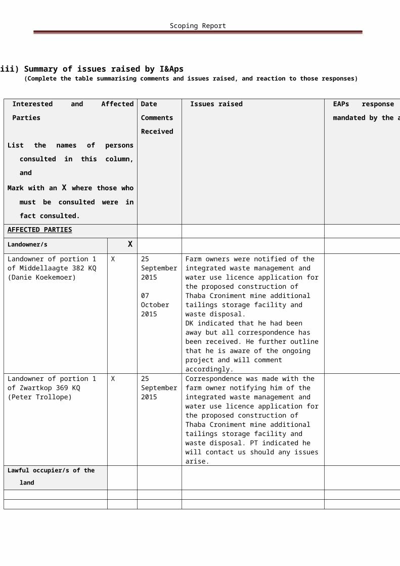
iii) Summary of issues raised by I&Aps(Complete the table summarising comments and issues raised, and reaction to those responses)
Interested and Affected Parties
List the names of persons consulted in this column, and
Mark with an X where those who must
be consulted were in fact consulted.
DateCommentsReceived
Issues raised EAPs response to issues as mandated by the applicant
AFFECTED PARTIES
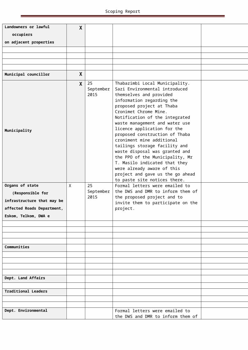
Landowner/s X
Landowner of portion 1 of Middellaagte 382 KQ (Danie Koekemoer)
X 25 September 2015
07 October 2015
Farm owners were notified of the integrated waste management and water use licence application for the proposed construction of Thaba Croniment mine additional tailings storage facility and waste disposal.DK indicated that he had been away but all correspondence has been received. He further outline that he is aware of the ongoing project and will comment accordingly.
Landowner of portion 1 of Zwartkop 369 KQ (Peter Trollope)
X 25 September 2015
Correspondence was made with the farm owner notifying him of the integrated waste management and water use licence application for the proposed construction of Thaba Croniment mine additional tailings storage facility and waste disposal. PT indicated he will contact us should any issues arise.
Lawful occupier/s of the land
Landowners or lawful occupierson adjacent properties
X
Municipal councillor X
Municipality X 25 September 2015
Thabazimbi Local Municipality. Sazi Environmental introduced themselves and provided information regarding the proposed project at Thaba Cronimet Chrome Mine. Notification of the integrated waste management and water use licence application for the proposed construction of Thaba croniment mine additional tailings storage facility and waste disposal was granted and the PPO of the Municipality, Mr T. Masilo indicated that they were already
Scoping Report
aware of this project and gave us the go ahead to paste site notices there.
Organs of state (Responsible forinfrastructure that may beaffected Roads Department,Eskom, Telkom, DWA e
X 25 September 2015
Formal letters were emailed to the DWS and DMR to inform them of the proposed project and to invite them to participate on the project.
Communities
Dept. Land Affairs
Traditional Leaders
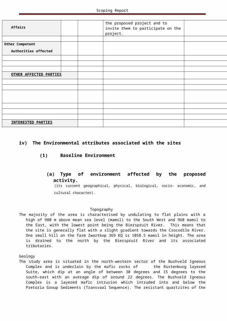
Dept. Environmental Affairs Formal letters were emailed to the DWS and
DMR to inform them of the proposed project and to invite them to participate on the project.
Other Competent Authorities
affected
OTHER AFFECTED PARTIES
INTERESTED PARTIES
iv) The Environmental attributes associated with the sites
(1) Baseline Environment
(a) Type of environment affected by the proposed activity.(its current geographical, physical, biological, socio- economic, and cultural character).
TopographyThe majority of the area is characterised by undulating to flat plains with a high of 980 m above mean sea level
(mamsl) to the South West and 960 mamsl to the East, with the lowest point being the Bierspruit River.
Scoping Report
This means that the site is generally flat with a slight gradient towards the Crocodile River. One small hill on the farm Zwartkop 369 KQ is 1058.5 mamsl in height. The area is drained to the north by the Bierspruit River and its associated tributaries.
GeologyThe study area is situated in the north-western sector of the Bushveld Igneous Complex and is underlain by
the mafic rocks of the Rustenburg layered Suite, which dip at an angle of between 30 degrees and 15 degrees to the south-east with an average dip of around 22 degrees. The Bushveld Igneous Complex is a layered mafic intrusion which intruded into and below the Pretoria Group Sediments (Transvaal Sequence). The resistant quartzites of the Transvaal Sequence lie to the west and north of the study area, forming the Witfonteinrand Mountains.The study area is generally flat and featureless with the underlying geology being covered by a thin layer of “black turf” soils. The underlying geology at the mine is predominantly confined to the main and critical zone stratigraphy of the Bushveld Igneous Complex and ranges from Gabbro’s through to norites, anorthosites and pyroxenites.
FloraThe Thaba Cronimet Chrome Mine lies within the Savanna biome which is the largest biome in Southern
Africa. It is characterised by a grassy ground layer and a distinct upper layer of woody plants (trees and shrubs). The environmental factors delimiting the biome are complex and include altitude, rainfall, geology and soil types, with rainfall being the major delimiting factor. Fire and grazing also keep the grassy layer dominant. The classification of the area was the microphyllous woodland which is part of the Dwaalboom Thornveld vegetation type. The Dwaalboom Thornveld vegetation type had threatened conservation status, with 14 percent transformed and six percent statutorily conserved. Vegetation units were identified according to plant species composition, previous land-use, soil types and topography. The state of the vegetation of the proposed mining site varied from being natural to completely degraded.
Socio-Economic CharacterThe main economic activities within the region included agriculture, small scale farming, commercial farming
and mining. These activities were widely scattered throughout the region. Cattle farms (primarily when operated on large scale) are significant sources of fugitive dust especially when feedlots are used and the cattle trample in confined areas. The calf-cow sector of the beef industry was found to be the large stemitter of methane emissions. Where animals are confined densely, the main pollutants of concern include dust from the animal movements, their feed and their manure, ammonia from the animal urine and manure, and hydrogen sulphide from manure pits. This was not a likely problem in this region with farms only located far away and covering large areas
DemographicsThe population of Limpopo Province in 2001 was approximately five million people. The Waterberg District
Municipality is located in the western part of the Limpopo province and has Botswana as its international neighbour. The District Municipality accounts for approximately twelve percent of the population of the province, and is comprised of six local municipalities; Belabela, Lephalale, Modimolle, Mogalakwena, Naboomspruit and Thabazimbi. Thabazimbi is situated in the south-western part of the District Municipality and accounts for about ten percent of its population. The local municipality includes the towns of Rooiberg, Northam, Leeupoort, Thabazimbi and Dwaalboom.
The Limpopo Province and Waterberg District Municipality as a whole have age distributions that are typical of populations with a high growth rate, in that the largest proportions of the population are found in the youngest age brackets. Thabazimbi Municipality and the wards in the study area differ from this profile, however, in that the largest proportion of their populations was concentrated in the 20-29 year age bracket. The economy of the northern region of Limpopo Province was and still is based on trading, game farming, cattle farming, while mining still is the major economic activity in the south-western region, which includes the Thabazimbi Local Municipality. The local municipal area is rich in mineral wealth, with iron, platinum and nickel among the key products. The importance of its mining sector was reflected in the fact that Thabazimbi Local Municipality alone accounts for about six percent of the national employment figures in mining. There are a number of platinum-producing mines in the vicinity of the proposed project, including Northam Platinum Mine, and the Anglo Platinum operations of Amandelbult and Union Mines. Other minerals produced in the area include:
• Andalusite, which was mined at the Rhino Andalusite Mine of Trollope Mining Services; and • Limestone for the production of cement, which was mined by Pretoria Portland Cement at Dwaalboom
Palygorskite.Apart from mining, agriculture constituted an important part of community life and economic activities in the
local municipality. Farming activities in the area included crops, livestock and game farming (hunting and

Scoping Report
game ranches); these made a substantial contribution to the local municipality’s gross geographic product, and were becoming increasingly popular.
(b) Description of the current land uses.
For most of the mineral lease area, the soils were suited to extensive grazing as they were not radically disturbed. The areas that have been disturbed by historic mining activities were not suited to grazing or agriculture as these soils have been degraded significantly due to disturbance. The land use was changing from grazing to rural dwellings in a large area of the site and with this change the soil’s quality was also degrading. Low intensity agricultural activities can be considered for the remaining open areas but the risk of crop failures will be high if rainfall is erratic and if management is not optimal The land-use on the different farms in 2009/2010 was as follows:• Farms Zwartkop 369 KQ and Schilpadnest 385 KQ was old mining activities and tribal land• Middellaagte 382 KQ, Roodedam 368 KQ and Elandskuil 378 KQ was utilised for livestock farming• Moddergat 389 KQ was managed as two separate game farms
(c) Description of specific environmental features and infrastructure on the site.
Fauna
BirdsA survey was conducted on the study site during October 2009 to identify specific bird habitats, and to
compare these habitats with habitat preferences of birds occurring in the quarter degree grid according to Harrison et al. (1997). The list of red data species potentially occurring in the area includes: White Pelican, Pinkbacked Pelican, Whitebacked Night Heron, Black Stork, Marabou Stork, Yellowbilled Stork, Greater Flamingo, Lesser Flamingo, Secretarybird, Cape Vulture, Whitebacked Vulture, Lappetfaced Vulture, Tawny Eagle, Ayres' Eagle, Martial Eagle, African Marsh Harrier, Peregrine Falcon, Pallid Harrier, Lanner Falcon, Lesser Kestrel
MammalsRed data mammal species that could occur according to Friedman and Daly (2004), in the study area in
2009/2010 include: Acinonyx jubatus, Atelerix frontalis, Hyaena brunnea, Laecon pictus, Manis temminckii Mellivora capensis, Miniopterus schreibersii
HerpetofaunaThe Southern African Python (phython natalensis), an International Union for Conservation of Nature (IUCN)
red data species had a moderate to high probability of occurring in the mineral lease area.
Wetland Delineation and ClassificationThe study area is drained by the Bierspruit and its associated tributaries. Three different wetland types were
identified within the study area, namely:• Channelled valley bottom wetlands;• Unchannelled valley bottom wetlands; and• Seepage wetlands.
In addition, several riparian zones occurred within the study area, while numerous small dams also occurred within the riparian zones and valley bottom wetlands. Small drainage lines that displayed no clear wetland or riparian zone characteristics but that are classified as a watercourse also occurred on site
(d) Environmental and current land use map.(Show all environmental, and current land use features)
Scoping Report
ATTACHED AS APPENDIX 5
v) Impacts identified(Provide a list of the potential impacts identified of the activities described in the initial site layout that will be undertaken, as informed by both the typical known impacts of such activities, and as informed by the consultations with affected parties together with the significance, probability and duration of the impacts
Construction Phase: GeologyAccess to the underground chrome and PGM reserves will be via three declines at various locations consisting
of a downcast conveyor belt, a downcast chairlift and material decline. The excavation and construction of the portals and associated declines will affect the geological strata. Soil and overburden from these excavations will be stockpiled adjacent to the shaft for rehabilitation at closure.
TopographyChanges to the topography of the areas where surface infrastructure is situated will include the excavation of
the shaft/portal areas, foundations, the the clean and dirty dams, canals, berms, processing plants, stockpiling of overburden and soil and the tailings storage facilities.
Waste Management and Hazardous SubstancesThe impacts associated with waste management and hazardous substances handling include legal non-
compliance, potential soil and water contamination and lost opportunities for waste recycling. Without mitigation, the negative impacts, of high probability certainty, are expected to take place on a frequent basis and the duration of impacts are expected to be short term in nature. T
Soil, Land Use and Land CapabilityThe main impacts associated with the construction phase are soil compaction and topsoil loss leading to
reduced fertility, soil loss as a result of wind and water erosion and sediment release to land and water (by removing vegetation); alteration of natural drainage lines; and the change of land use from natural vegetation and agriculture (livestock grazing) to industrial within the planned development areas of the proposed project.
Flora and FaunaFloraVegetation clearing associated with opencast mining and the construction of the surface infrastructure for the
mine will cause a disturbance and destruction to the flora ecosystem. The expected impacts are fragmentation of the habitat, reduction in the extent of a habitat, destruction of rare, endangered, endemic and protected species, the establishment and spread of declared weeds and alien invasives and an increased risk of veld fires causing loss and damage to the natural vegetation.
FaunaVegetation clearing, habitat fragmentation and loss and increased human activity associated with opencast
mining and the construction of the surface infrastructure for the mine will cause a disturbance and destruction to the fauna ecosystem.
NoiseThe environment is characterised by the presence of numerous mining operations. Therefore, the current and
proposed operations will not present a new type of source to it. Noise is in its very nature a negative impact. Due to the above considerations and the fact that the noise impacts will be much reduced during night-time the significance of the noise impact is rated as low.
Air QualityDuring construction the main dust generating sources will be vehicle activity on unpaved roads and vegetation
clearing and soil stripping for placement of the surface infrastructure.
Scoping Report
Surface WaterThere are many surface water impacts that can be expected from the current and proposed TSF and WRD.
During the construction phase the impacts associated with the decrease in water quality will be of a short term nature as construction activities will be less than ten years in duration. The impact on surface water qualities will be contained within the mineral lease area.
WetlandsImpacts associated with wetlands during the construction phase may include direct loss and disturbance of
wetland habitat; increased sedimentation within the wetlands due to sediment rich runoff from the construction site, also leading to increased turbidity; obstruction of flows, increased risk of erosion and water quality deterioration
All approved and proposed surface infrastructure associated with the underground mining, i.e. the underground portals (shafts), the decline box cut and the central surface area (including explosives magazine) will be located outside delineated wetland habitat and in fact more than 500m from any delineated wetland habitat. Given the flat nature of the terrain, it is our opinion that the construction of the surface infrastructures will not result in any significant impact to the wetlands. Without this mitigation, the impact of surface infrastructure on wetlands would highly probably to definitely result in a MODERATELY INTENSE frequent impact on a short terms basis. Thus the impact without mitigation would range between low to medium significance.
The proposed underground mining will extend under the upper reach of the Trollope wetland system, which is considered an artificial wetland. It is understood that underground mining will be undertaken at depth, and that no surface subsidence is expected – the proposed opencast mining and stockpiles located over the underground mining area attest to this. As a result, the underground mining is not expected to have any impact on surface flows or on the shallow, unconfined aquifer. As such, it is improbable that a low negative impact on an occasional basis (local extent) to the wetlands is expected due to the proposed underground mining.
The proposed opencast mining activities will extend into the delineated wetland habitat on site. Three opencast pits will extend across the Trollope wetland system – two within the upper artificial seepage wetland reach and one across the riparian habitat west of the tar road. One of the proposed topsoil stockpiles also extends across the riparian habitat, while a further overburden stockpile marginally infringes on the riparian habitat. Given the nature of the Trollope wetland, which is considered to be artificial in nature and to have formed in response to increased wetness due to seepage and leakage out of mine dams, as well as the disturbed nature of the wetland with numerous excavations across the wetland area, it is not considered necessary to adjust the proposed opencast pits located within the Trollope wetland to remain outside of the wetland. Thus for impacts on wetland systems as a result of opencast mining, prior to mitigation, the definite to highly probable impacts are rated ranging from a low to a medium significance, with a MODERATELY INTENSE severity, on a frequent or continuous basis and in the short to long term.
Both the proposed chrome plant and the PGM plant are located within an existing disturbed footprint within an existing dirty water area of the mine. Both plants will also be located more than 500m from the Anglo wetland area. These activities are therefore expected to have NO impact on the wetlands on site. The proposed tailings storage facility extension is also located well away from the Anglo wetland system, with approximately 300m separating the proposed footprint from the delineated wetland boundary at its nearest point. The return water dam will also be approximately 400m from the delineated wetland edge. There is thus a low probability of negative impacts to the wetlands on an occasional and short term basis, which may have an impact locally. The impacts, without mitigation are expected to have a MODERATELY INTENSE significance. The anticipated impacts, without mitigation are expected to have low significant ratings, with the most significant being the seepage of water out of the tailings storage facility and return water dam leading to increased flows in the adjacent wetland area and possibly the formation of a new artificial seepage wetland area.
With regards to cumulative impacts during the construction phase to general degradation of wetland habitat, the anticipated impact pre-mitigation is expected to be definite and occurring on a continuous basis, with impacts potentially extending beyond the mineral lease area (local). The impact is expected to be of INTENSE severity as significant degradation to wetland habitat will take place resulting to habitat loss in some places. The impacts will remain long term. The resultant cumulative impact will thus be high negative.
Scoping Report
Residual ImpactOn a cumulative basis, with proposed mitigation measures in place, it can be expected that the rating of the
impacts will decrease to a medium significance due to the decrease in frequency, intensity and extent of the impact.
ArchaeologyImpact AssessmentThe potential impact associated with pre-construction and construction activities for the proposed additional
mining and processing activities and associated infrastructure is that Iron Age and Stone Age sites will be destroyed. Without mitigation, the anticipated negative impact will be probable and permanent as damage to heritage sites is irreversible. The significance of the impact is expected to be VERY INTENSE as it is of a permanent nature. The destruction of the sites will impact on the archaeological record of the area (thus local extent). Thus the expected impact without mitigation will be high negative
Residual ImpactThe residual impact will probably be of a low significant nature on a regional basis, SLIGHT in intensity and in
the short term as construction will not be longer than ten years in duration.
TrafficThe proposed access roads to Thaba Cronimet Chrome Mine are located approximately 17 km, from Northam
and 30 km from Thabazimbi respectively. Although the anticipated additional vehicles on the road as a result of the operations will probably be low, the traffic to and from Northam will be affected as well as that to and from Thabazimbi on a frequent daily basis. The impact will be of a SLIGHT intensity and will be on a regional basis. The intersections operate as t-junctions and disruption to peak hour (morning and afternoon) vehicle traffic flow will occur. It is therefore preferable to restrict mine construction traffic to the off-peak hours, to minimise the impact on the traffic flows on the public roads in the vicinity of the mine. Additional impacts associated with traffic expected during the construction phase will be dust generation and noise generation.
VisualIt is highly probable that there would be impacts an aesthetic quality and sense of place during the
construction phase. The frequency of occurrence of these impacts would range between on a continuous and on a daily basis. The spatial extent of the impacts would all be regional, within 50 km from the mineral lease area as in some instances these could be seen from such a distance.
Socio-EconomicImpacts during the construction phase on socio-economic conditions include the effects of the project on the
local economy (including job creation, multiplier effects on the local economy, etc.); impacts related to the effects of the project on the physical environment (such as safety impacts arising from increased traffic, visual, acoustic and air quality impacts, etc.); and impacts related to an influx of workers and job-seekers (such as an increase in social pathologies, etc.)
Job CreationJob creation will be a highly probable low positive impact that will extend to the short term as construction
period is approximately five years in length. The majority of the construction workers will be contract positions, thus the impact will be of a SLIGHT intensity and the extent of the impact will be site specific as most of the positions will be filled by people living in the local municipal area
Multiplier effects on local economyMultiplier effects on the local economy will be a low probability low significant positive impact that will depend
on the proportion of local spending by employees and availability local enterprises to supply required goods/services. The impact which is expected to be of a MODERATELY INTENSE severity will take place on an occasional basis and will continue through the construction phase (short term) and will extend locally as the impact will include micro and macroeconomic elements.
Continued Corporate Investment In Host Communities
Scoping Report
Continued corporate investment in host communities will be a low probability low significant positive impact that without appropriate mitigation, forecasts of local infrastructure development might not be achieved. The impact which is expected to be of a MODERATELY INTENSE severity as it may result in much required access to services will take place on an occasional basis and will continue through the construction period (short term) and will extend locally as the impact will affect surrounding communities.
Physical IntrusionIt is expected that physical intrusion, a negative impact, will be highly probable and on a continuous basis if
mitigation measures are not implemented. The impact will be on a regional and short term scale as the impact will continue throughout the construction phase. The severity is expected to be INTENSE as this impact could negatively impact on quality of life. The impact is thus rated as high negative significance.
Increased Social PathologiesIt is expected that increased pathologies, a negative impact, will be a low probability and on a frequent basis if
mitigation measures are not implemented. The impact will be on a local scale and the effects will extend beyond the operational phase of the mine and may be permanent. The severity is expected to be INTENSE as this impact could severely affect well-being of communities, especially as cumulative impact combining with existing effects of other mining operations in the area The impact is thus rated as medium negative significance.
Increased Pressure On Resources And ServicesIt is expected that increased pressure on resources and services in the local area will probably be a
MODERATLEY INTENSE severity as backlogs already occur in the municipal area. It is expected that without mitigation, the impact would take place on a frequent basis and may be of a medium term duration as impacts will probably persist post construction. The impact is thus rated as medium negative significance
Operational Phase
Soil, Land Use and Land CapabilityThe main impacts associated with the operational phase are soil compaction and topsoil loss leading to
reduced fertility, soil loss as a result of wind and water erosion and sediment release to land and water (by removing vegetation); alteration of natural drainage lines; and the change of land use from natural vegetation and agriculture (livestock grazing) to industrial within the planned development areas of the proposed project.
Flora and FaunaFloraThe footprints of the tailings storage facility and waste rock dumps for the mine will cause a disturbance and
destruction to the flora ecosystem. The expected impacts are fragmentation of the habitat, reduction in the extent of a habitat, destruction of rare, endangered, endemic and protected species, the establishment and spread of declared weeds and alien invasives and an increased risk of veld fires causing loss and damage to the natural vegetation.
FaunaVegetation clearing, habitat fragmentation and loss and increased human activity associated with opencast
mining will cause a disturbance and destruction to the fauna ecosystem. The certainty of the impact is definite as natural fauna will not stay in the area.
NoiseNoise is in its very nature a negative impact. The extent of the noise impacts during the operational phase will
remain local and very much centred around the activities (site specific).
Effects On Water QualityThe impact on the water quality for the surface infrastructure, mining operations and processing plants, post
mitigation will decrease to a medium significance.

Scoping Report
vi) Methodology used in determining the significance of environmental impacts(Describe how the significance, probability, and duration of the aforesaid identified impacts that were identified through the consultation process was determined in order to decide the extent to which the initial site layout needs revision).
Qualitative Impact Assessment MethodologyEach impact identified with regards to the proposed additional mining and processing activities and associated
infrastructure has been qualitatively assessed with and without mitigation providing context and reasons for the description that has been chosen. In order to make the EIR easier to read, the following notation format has been used to highlight the various components of the assessment. Quantitative Impact Assessment Methodology
Status Of The ImpactThe nature of the impact can be described as negative or positive and can be derived from the significance
rating of the impacts.
Status Of The Impact And RatingsRating Description Quantitative ratingPositive A benefit to the holistic environment -1Negative A detriment to the holistic environment 1
Certainty Of ImpactThe certainty or probability of the impact describes the likelihood of the impact actually occurring.Certainty of Impact and RatingsRating Description Quantitative ratingImprobable In all likelihood the impact will not occur. Less than 20 percent probability of a particular
fact 1 Low probability Possibility of the impact to materialise is low. Between 20 and 50 percent probability of a
particular fact or of the likelihood of an impact occurring.2 Probable A distinct possibility that the impact will occur. Between 50 and 80 percent probability of a
particular fact or of the likelihood of an impact occurring.3 Highly probable Most likely that the impact will occur. More than 80 percent probability of a particular fact or
of the likelihood of an impact occurring.4 Definite The impact will occur regardless of any prevention measures. 100 percent probability of a
particular fact or of the likelihood of an impact occurring.5
Frequency Of ImpactThe frequency of the impact refers to the temporal scale of the impact or benefit, in terms of the period of time
that the surrounding environment will be affected or altered by the proposed project. This is determined by the following scale:
Frequency Of Impact And RatingsRating Description Quantitative ratingContinuous Occurs on a daily basis 4Frequent Occurs on a weekly basis 3Infrequent Occurs on a monthly basis 2Occasional Occurs less than on a monthly basis 1
Spatial Extent Of ImpactThe extent of the impact refers to the spatial scale of the impact or benefit of the proposed project and the
area over which it extends. A description is provided of whether effects are limited in extent or affects a wide area or group of people.
Spatial Extent Of ImpactRating Description Quantitative ratingSite specific Effects occur within the mining right boundary1 Local Effects extend beyond the mining right boundary, up to five kilometres from the mining right boundary2 Regional Widespread effect with impacts extending far beyond the mining right boundary, but within a
50 kilometre radius of the boundary

Scoping Report
3 National Within the boundaries of South Africa but further than the Limpopo Province4 International Beyond the boundaries of South Africa5
Intensity Of ImpactThe severity or intensity of an impact is an attempt to quantify the magnitude of the impacts and benefits
associated with the proposed activities.
Intensity Of Impact And RatingsRating Description Quantitative RatingVery intense Substantial deterioration/substantial improvement or benefit Irreversible or permanent change/permanent improvement Negative impacts cannot be mitigated 4Intense Marked deterioration/improvement Long term duration Mitigation for negative impacts is very expensive, difficult or time consuming 3Moderately intense Moderate deterioration/improvement Medium term to long term duration Negative impacts are fairly easily mitigated 2Slight Minor deterioration/improvement Short to medium term duration Mitigation for negative impacts is easy, cheap or quick 1
Duration Of ImpactThe duration of the impact refers to the temporal scale of the impact or benefit, in terms of the period of time
that the surrounding environment will be affected or altered by the proposed project.
Duration Of Impact and RatingsRating Description Quantitative ratingShort term The environmental impact identified will be present for less than 10 years 1Medium term The environmental impact identified will be present for life of mine 2Long term The environmental impact identified will be present beyond the life of mine 3Permanent The environmental impact identified will be irreversible and will remain post closure 4
Assessing SignificanceAfter assessment of an impact in accordance to the preceding six criteria, the significance of an impact can be
determined through a synthesis of the aspects produced in terms of their status, probability, duration, extent and severity. The significance of an impact is an expression of the cost or value of an impact to society. The focus must be a judgement as to whether or not impacts are significant, based upon the value system of society, or groups of people (Thompson, 1988, 1990). The evaluation of significance is subject to, contingent with values, and dependent upon the environmental and community context (Sadler, 1996). This subsection presents the criteria used to define significant effects on the environment. The rankings of each of the different impacts relates to the maximum and minimum totals that can be achieved for each possible impact. The total of the criteria’s multiplied by the value of either negative or positive impact value is used to calculate the threshold “classes” to determine the significance of the impact.
Assessing Significance (Negative Impacts)Rating Description Threshold of significanceHigh Long term or permanent change to the natural and social environment. Of the highest order possible
within the bounds of impacts which could occur. In the case of adverse impacts, there is no possible mitigation and/or remedial activity which could offset the impact. In the case of beneficial impacts, there is no real alternative to achieving this benefit. 17-22
MediumImpact is real but not substantial in relation to other impacts which might take effect within the bounds of those which could occur. In the case of adverse impacts, mitigation and/or remedial activity are both feasible and possible. In the case of beneficial impacts, other means of achieving this benefit are feasible but they are more difficult, expensive, time-consuming or some combination of these. 11-16
Low Impact is of a low order and therefore likely to have little real effect. In the case of adverse impacts, mitigation and/or remedial activity are not required, easily achieved, inexpensive or a combination of these. In the case of beneficial impacts, alternative means for achieving this benefit are likely to be easier, cheaper, more effective, less time consuming, or a combination of these. 5-10

Scoping Report
Some impacts have been assessed and proved to be positive and a benefit to the social and or natural environment. Although these impacts have been rated in accordance with the methodology provided above, high significance values were obtained. The nature or status of the impact proved to be the key indicator. Should the nature of the activity, as assessed, be positive the significance threshold is reversed.
Assessing Significance (Positive Impacts)Rating Description Threshold of significanceHigh A large benefit to the holistic environment 17-22MediumA benefit to the holistic environment 11-16Low No real benefit to the holistic environment 5-10
vii) The positive and negative impacts that the proposed activity (in terms of the initial site layout) and alternatives will have on the environment and the community that may be affected.(Provide a discussion in terms of advantages and disadvantages of the initial site layout compared to alternative layout options to accommodate concerns raised by affected parties)
GeologyRemoval of Ore bodies and overburden
TopographyDisturbances or changes to the topography area
Waste and hazardous substancesPotential soil and water contamination, legal non-compliance and lost opportunities for waste recycling
Soil and Land capabilitySoil compaction, soil loss due to wind and water erosion;Change of land-use from natural to industrialSoil pollution due to hydrocarbon and cement spillagessterilisation of the soil resource
Flora and FaunaHabitat loss and harm to flora and faunaFragmentation of the habitat resulting in harm to flora and fauna;Fauna mortalities and Habitat degradation
Noise/ VibrationsHuman discomfort and structural damage; New total resulting ambient noise levels elevated above pre-development levels and the actual increase in
ambient noise levels
Air QualityCumulative particulate and NO2 emissions
Surface WaterSheet erosion and dust generation Potential pollution by hazardous substancesPoor sanitation and poor storm water management Deterioration in water Quality and decrease in catchment Yield;
Ground WaterGroundwater Availability and groundwater quality
Wetland

Scoping Report
Increased sedimentation within the wetlands Increased turbidity and obstruction of flows,Increased risk of erosion and water quality deterioration
AquaticDestruction / disturbance of the Bierpruit and other rivers in the area
Archaeology and HeritageDestruction of archaeological and heritage sites
TrafficIncreased traffic flowDust generation and noise generation.VisualAesthetic value and sense of place
Socio-economicJob creation during construction;Multiplier effect on local economy;Continued corporate investment in host communities;Physical intrusionIncreased social pathologies;Increased pressure on services and resources.
viii) The possible mitigation measures that could be applied and the level of risk.(With regard to the issues and concerns raised by affected parties provide a list of the issues raised and an assessment/ discussion of the mitigations or site layout alternatives available to accommodate or address their concerns, together with an assessment of the impacts or risks associated with the mitigation or alternatives considered).
NOT APPLICABLE. CURRENTLY, NO ISSUES HAVE BEEN RAISED BY INTERESTED AND AFFECTED PARTIES
ix) The outcome of the site selection Matrix. Final Site Layout Plan(Provide a final site layout plan as informed by the process of consultation with interested and affected parties)
NOT APPLICABLE AS SCOPING PUBLIC PARTICIPATION HAS NOT BEEN UNDERTAKEN
x) Motivation where no alternative sites were considered.
NOT APPLICABLE
xi) Statement motivating the preferred site.(Provide a statement motivation the final site layout that is proposed)
The only proposed project alternatives is with regard to the tailings storage facility (TSF) located on the portion 1 of the farm Middellagte 382 KQ. An area of approximately 60ha is required for the storage of 4.5million m3 of tailings for a period of 20 years. The only possibility for the location of the proposed extension to the approved tailings storage facility in close proximity to the existing tailings facility and processing plant is north of the existing tailings dam up until the mineral lease boundary. The tailings storage facility cannot be located to the east due to stockpiled areas and to the west due to demarcated opencast mining areas.

Scoping Report
From a mining and environmental perspective, all residual deposits (tailings and waste rock material) must disposed of on the land surface in order to sterilize the chrome and platinum group metals minerals within upper and lower critical zones of the Bushveld Igneous Complex (BIC)
(i) Plan of study for the Environmental Impact Assessment process
i. Description of alternatives to be considered including the option of not going ahead with the activity.
ii. Description of the aspects to be assessed as part of the environmental impact assessment process
(The EAP must undertake to assess the aspects affected by each individual mining activity whether listed or not, including activities such as blasting, Loading, hauling and transport, and mining activities such as Excavations, stockpiles, discard dumps or dams, water supply dams and boreholes, accommodation, offices, ablution, stores, workshops, processing plant, storm water control, berms, roads, pipelines, power lines, conveyors, etc…etc…etc.).
Increased vehicle movementFootprint of the TSF and WRD sitesClearing of land Processing processessChange in socio-econimics of the community due to construction of new infrastructure
iii. Description of aspects to be assessed by specialists
• The key issues identified during the Scoping process, and to be assessed in detail during the EIA phase are as follows:
• impact on the Social;• impacts on flora;• Impacts on fauna; • impact on Avifauna;• Impact on water resources; and• impacts on heritage and archaeology.
iv. Proposed method of assessing the environmental aspects including the proposed method of assessing alternatives
Qualitative Impact Assessment MethodologyEach impact identified with regards to the proposed additional mining and processing activities and associated
infrastructure has been qualitatively assessed with and without mitigation providing context and reasons for the description that has been chosen. In order to make the EIR easier to read, the following notation format has been used to highlight the various components of the assessment. Quantitative Impact Assessment Methodology

Scoping Report
Status Of The ImpactThe nature of the impact can be described as negative or positive and can be derived from the significance
rating of the impacts.
Status Of The Impact And RatingsRating Description Quantitative ratingPositive A benefit to the holistic environment -1Negative A detriment to the holistic environment 1
Certainty Of ImpactThe certainty or probability of the impact describes the likelihood of the impact actually occurring.Certainty of Impact and RatingsRating Description Quantitative ratingImprobable In all likelihood the impact will not occur. Less than 20 percent probability of a particular
fact 1 Low probability Possibility of the impact to materialise is low. Between 20 and 50 percent probability of a
particular fact or of the likelihood of an impact occurring.2 Probable A distinct possibility that the impact will occur. Between 50 and 80 percent probability of a
particular fact or of the likelihood of an impact occurring.3 Highly probable Most likely that the impact will occur. More than 80 percent probability of a particular fact or
of the likelihood of an impact occurring.4 Definite The impact will occur regardless of any prevention measures. 100 percent probability of a
particular fact or of the likelihood of an impact occurring.5
Frequency Of ImpactThe frequency of the impact refers to the temporal scale of the impact or benefit, in terms of the period of time
that the surrounding environment will be affected or altered by the proposed project. This is determined by the following scale:
Frequency Of Impact And RatingsRating Description Quantitative ratingContinuous Occurs on a daily basis 4Frequent Occurs on a weekly basis 3Infrequent Occurs on a monthly basis 2Occasional Occurs less than on a monthly basis 1
Spatial Extent Of ImpactThe extent of the impact refers to the spatial scale of the impact or benefit of the proposed project and the
area over which it extends. A description is provided of whether effects are limited in extent or affects a wide area or group of people.
Spatial Extent Of ImpactRating Description Quantitative ratingSite specific Effects occur within the mining right boundary1 Local Effects extend beyond the mining right boundary, up to five kilometres from the mining right boundary2 Regional Widespread effect with impacts extending far beyond the mining right boundary, but within a
50 kilometre radius of the boundary3 National Within the boundaries of South Africa but further than the Limpopo Province4 International Beyond the boundaries of South Africa5
Intensity Of ImpactThe severity or intensity of an impact is an attempt to quantify the magnitude of the impacts and benefits
associated with the proposed activities.
Intensity Of Impact And RatingsRating Description Quantitative RatingVery intense Substantial deterioration/substantial improvement or benefit Irreversible or permanent change/permanent improvement Negative impacts cannot be mitigated 4Intense Marked deterioration/improvement Long term duration
Scoping Report
Mitigation for negative impacts is very expensive, difficult or time consuming 3Moderately intense Moderate deterioration/improvement Medium term to long term duration Negative impacts are fairly easily mitigated 2Slight Minor deterioration/improvement Short to medium term duration Mitigation for negative impacts is easy, cheap or quick 1
Duration Of ImpactThe duration of the impact refers to the temporal scale of the impact or benefit, in terms of the period of time
that the surrounding environment will be affected or altered by the proposed project.
Duration Of Impact and RatingsRating Description Quantitative ratingShort term The environmental impact identified will be present for less than 10 years 1Medium term The environmental impact identified will be present for life of mine 2Long term The environmental impact identified will be present beyond the life of mine 3Permanent The environmental impact identified will be irreversible and will remain post closure 4
v. The proposed method of assessing duration significance
Assessing SignificanceAfter assessment of an impact in accordance to the preceding six criteria, the significance of an impact can be
determined through a synthesis of the aspects produced in terms of their status, probability, duration, extent and severity. The significance of an impact is an expression of the cost or value of an impact to society. The focus must be a judgement as to whether or not impacts are significant, based upon the value system of society, or groups of people (Thompson, 1988, 1990). The evaluation of significance is subject to, contingent with values, and dependent upon the environmental and community context (Sadler, 1996). This subsection presents the criteria used to define significant effects on the environment. The rankings of each of the different impacts relates to the maximum and minimum totals that can be achieved for each possible impact. The total of the criteria’s multiplied by the value of either negative or positive impact value is used to calculate the threshold “classes” to determine the significance of the impact.
Assessing Significance (Negative Impacts)Rating Description Threshold of significanceHigh Long term or permanent change to the natural and social environment. Of the highest order possible
within the bounds of impacts which could occur. In the case of adverse impacts, there is no possible mitigation and/or remedial activity which could offset the impact. In the case of beneficial impacts, there is no real alternative to achieving this benefit. 17-22
MediumImpact is real but not substantial in relation to other impacts which might take effect within the bounds of those which could occur. In the case of adverse impacts, mitigation and/or remedial activity are both feasible and possible. In the case of beneficial impacts, other means of achieving this benefit are feasible but they are more difficult, expensive, time-consuming or some combination of these. 11-16
Low Impact is of a low order and therefore likely to have little real effect. In the case of adverse impacts, mitigation and/or remedial activity are not required, easily achieved, inexpensive or a combination of these. In the case of beneficial impacts, alternative means for achieving this benefit are likely to be easier, cheaper, more effective, less time consuming, or a combination of these. 5-10
Some impacts have been assessed and proved to be positive and a benefit to the social and or natural environment. Although these impacts have been rated in accordance with the methodology provided above, high significance values were obtained. The nature or status of the impact proved to be the key indicator. Should the nature of the activity, as assessed, be positive the significance threshold is reversed.
Assessing Significance (Positive Impacts)Rating Description Threshold of significanceHigh A large benefit to the holistic environment 17-22

Scoping Report
MediumA benefit to the holistic environment 11-16Low No real benefit to the holistic environment 5-10
vi. The stages at which the competent authority will be consulted
A pre-consultation meeting was undertaken before an initail application was compiledA draft scoping report will be submitted to the DMR and I&APs including organs of state for comment before
the final scoping report is compiled. A final scoping report will be submitted to DMR for approvalDraft EIR and EMP will be sumitted to DMR, I&APs and organs of state for comments
The Draft EIAR will be made available to the competent and commenting authorities during the PPP. The following authorities will be consulted and informed of the availability of the Draft EIAR and of the Final
EIAR: • NWREAD;• Department of Agriculture, Forestry & Fisheries• DMR;• DWS;• DPWR;• Bojanala District Municipality;• RLM; • National and/or Provincial Heritage Resources Agency – electronic submission
vii. Particulars of the public participation processwith regard to the Impact Assessment process that will be conducted1. Steps to be taken to notify interested and affected parties.
(These steps must include the steps that will be taken to ensure consultation with the affected parties identified in (h) (ii) herein).
I&APs that are registered on the project database were consulted during the Scoping
Phase and sent notification and background information.
The Stakeholder Engagement Process undertaken during the project announcement phase was incorporated into the DSR and was undertaken in terms of the EIA Regulations, GN R982 of 2014.
The I&APs Register was compiled making use of existing the Stakeholder Database from the mine for this area. The I&APs Register will be updated as necessary (i.e. with new contact details, new I&APs etc).
An advert was placed on a local newspaper to inform the land owners and all I&APs of the proposed TSF and MRDs.
Notices were placed at various places around the mine and public areas
Adjacent landowners were handed the BID and notice.
All comments received from the I&APs during the project announcement phase were incorporated into the DSR

Scoping Report
The I&APs will be informed of the availability of reports for comment, where/how these reports can be accessed and the commenting timeframes and the manner in which comment can be submitted to Headwaters. Proof of the PPP undertaken
during the Impact Assessment Phase will be appended to all reports produced.
Tasks to be performed to inform the registered I&APs of the availability of the documents for comment:
•All registered and I&APs will be informed of the availability of the reports for comment by means of notices sent via an advertisement, posted letters, e-mails and Short Message
Services (SMS);• The Draft Reports will be made available to the public for a 40-day commenting period;• The Final Reports will be made available to the public for a 21-day commenting period;• These reports will be made available for comment be means of: - Placement on the Headwaters website;- Placement at the public places
2. Details of the engagement process to be followed.(Describe the process to be undertaken to consult interested and affected parties including public meetings and one on one consultation. NB the affected parties must be specifically consulted regardless of whether or not they attended public meetings and records of such consultation will be required in the EIA at a later stage).
A list of identified communities, landowners, lawful occupiers, and other interested and
affected parties was compiled and were consulted.
A BID was forwarded to the community, landowners, and interested and affected parties to inform them in sufficient detail of what the TSF and MRD construction and operation will ental on the land, in order for them to assess what impact the prospecting will have on them or on the use of their land. A follow up draft Scoping Report will be forwarded for comments.
The community, landowners, and I&APs views in regard to the existing cultural, socioeconomic, or biophysical environment, as the case may be, will be recorded and included in the Issues and Response Report.
All comments received from the I&APs during the Impact Assessment Phase will be incorporated into the Draft EIAR and Final EIAR
The I&APs Register will be updated as necessary (i.e. with new contact details, new I&APs etc). The I&APs will be informed of the availability of reports for comment, where/how these reports can be accessed and the commenting timeframes and the manner in which comment can be submitted to SRK. Proof of the PPP undertaken during the
Impact Assessment Phase will be appended to the Draft EIAR and Final EIAR
Focus group meetings will be scheduled where minutes and records of the consultations will be compiled.
Information with regard to any objections received will be noted and included in the EIR and possibly EMP.

Scoping Report
3. Description of the information to be provided to Interested and Affected Parties.(Information to be provided must include the initial site plan and sufficient detail of the intended operation and the typical impacts of each activity, to enable them to assess what impact the activities will have on them or on the use of their land).
Details about location of the proposed activities, brief project description, as well as expectations for the I&APs during the S&EIA process were outlined.
A draft scoping report will be forwarded to the I&APs for their comments. The information contained in the draft Scoping Report will include: the baseline natural environmental condition of the locatity of the TSFs and MRDs, the plan of study for the EIA, which outlines the specialist studies to be undertaken as well as the terms of reference for specialist studies. The landowners, I&APs, and organs of state will get an opportunity to comment and provide input during this scoping phase.
A draft EIR and EMP will be forwarded to the I&APs and they will be given 30days to comment on the proposed project.
The EIR and EMP will include specialist studies that were undertaken
An Impact Assessment Report will be compiled and forwarded as part of the EIR, where I&APs together with landowners will be informed of the likely impacts of the proposed development.
viii. Description of the tasks that will be undertaken during the environmental impact assessment process
The objectives of the Impact Assessment Phase will be to: • Identify and assess the environmental (biophysical and social) impacts of the construction, operation, decommissioning and post closure impacts of the proposed project. The cumulative impacts of the
proposed development will also be identified and evaluated; • Alternative activities and locations will be determined and assessed in parallel with the proposed activity; • Identify and evaluate potential management and mitigation measures that will reduce the negative impacts of
the proposed development and enhance the positive impacts; • Compile monitoring, management, mitigation and training needs in the EMPr; • Provide the I&APs with sufficient and accurate information in order to provide informed comment on the
proposed development;• Provide the decision - making authorities with sufficient and accurate information in order to make an
informed decision on the proposed development.
SPECIALIST STUDIES TO BE CONDUCTED DURING THE EIA PHASE:Detailed specialist studies have been performed for the majority of the areas impacted on by the TSF and MRD. Existing specialist studies will be used to inform the current study as they were undertaken in
early 2015 and are still relevant. Due to the potential impacts that may arise as result of the proposed development and due to the issued raised during the PPP inputs towards the following specialist studies
will be undertaken during the Impact Assessment Phase:

Scoping Report
• Air quality assessment;• Biodiversity assessment: Aquatic; Faunal; Floral; Wetlands• Heritage, Archaeological and Paleontological assessment;• Noise impact assessment;• Visual Impact assessment;. Soils; Land use and land capability;• Vibration impact statement; • Hydrology (surface water and groundwater);• Closure/rehabilitation plan.
TERMS OF REFERENCE FOR SPECIALIST STUDIES
Air Quality assessmentThe Air Quality Impact Assessment TOR must include the following:The literature review with respect to air quality and climate for the study area must be done in a radius of 5 km
from the project area;Undertaking of a site inspection to characterise the receiving environment, including the sensitivity, proximity
and direction, and review the suitability of the existing dust monitoring network with respect to the proposed TSFs and MRDs location;
Assess existing monitoring systems, if availableDevelop an emissions inventory; excluding Greenhouse Gasses and carbon foot print studies;Set up and run an air dispersion model for dust and gas that integrates the information obtained for 3
scenarios with respect to the concentrator plant location and 3 scenarios with respect to the proposed TSF location and operation;
Identification of all sources of atmospheric emissions that are associated with the proposed new infrastructure; Simulations of the ground level PM 2.5, PM 10 concentrations and dust fallout for highest daily and annual PM10 concentrations and total daily dust deposition due to routine and upset emissions from the proposed new
infrastructure.
AQUATIC ASSESSMENTThe aquatic assessment must make allowance for the assessment of two representative aquatic ecological
assessment points to characterise a and to define the Present Ecological State (PES) of aquatic resources at strategic points within on the system. Allowance has been made for one round of assessment.
The aquatic ecological assessment must focus on, amongst other: On site biota specific water quality testing (including pH, conductivity, dissolved oxygen and temperature); Instream habitat integrity and conditions for aquatic macro-invertebrates (IHAS, HCR and IHIA); Assessment of the aquatic macro-invertebrate community based on the SASS5 index. Making use of the MIRIA Ecostatus tool to characterise and define the PES and potential risks to the aquatic macro-invertebrate community; Assessment of the fish community based on the FRAI11 Ecostatus tool to characterise and define the PES and potential risks to the aquatic macro-invertebrate community;
Assessment of the riparian vegetation community integrity;Findings must be compiled into a report which will highlight the PES, Ecostatus and Ecological Importance and Sensitivity (EIS) of the system
FAUNAL ASSESSMENTThe faunal assessment will be conducted using the following methods:Extensive consideration will be given to determining the ecological importance and sensitivity (EISC) of
the subject property according to relevant databases. The relevant North West Province databases for the QDS will also be consulted and will serve as the reference data to which field surveys will be compared to;
• Visual observations of actually occurring species;• Identification of evidence of occurrence, e.g. call spoor, droppings, etc.;• Capture of fauna by various methods including netting, trapping and dragging. In this regard
special mention is made of the use of pitfall traps and sweep netting for invertebrates as well as the use of Sherman traps to determine the composition of the small mammal community on the site. Rope dragging methods will also be used to flush birds from areas where RDL avifaunal species are deemed likely to occur;
• Nocturnal studies to identify nocturnal animals in the area may take place if it is deemed necessary;
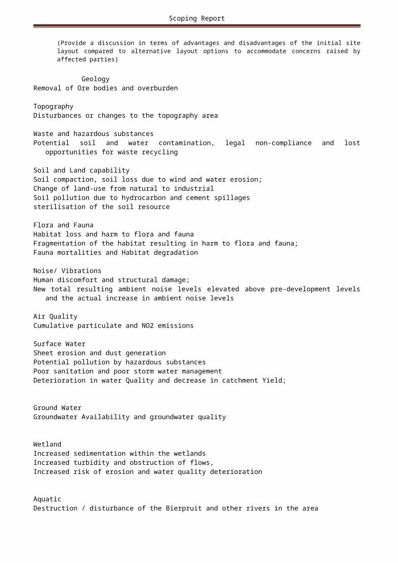
Scoping Report
The reports produced will include sensitive habitat types and impacts from habitat disturbance, faunal assemblages at risk and an assessment of impacts on migratory routes;
• The RDSIS index will also be considered in order to quantify the importance of the subject property in terms of RDL faunal conservation;
• Based on the findings a detailed impact assessment on all identified significant risks will take place; and• Recommendations on management and mitigation measures (including opportunities and constraints) with
regards to the construction and operation of the proposed development in order to manage and mitigate impacts on the faunal assemblage of the area will be provided.
FLORA ASSESSMENTThe proposed methodology includes both a desktop review and a field work component. A desktop review of distribution lists (including Red Data Listed (RDL) species) and available literature will be
conducted to guide the field work component. The vegetation type of the area will be defined according to sources such as Mucina & Rutherford (2006).
Extensive consideration will also be given to determining the ecological importance and sensitivity (EISC) of the subject property according to relevant provincial and national conservation databases. The SANBI and PRECIS databases for the Quarted Degree Square (QDS) will also be consulted and will serve as the reference data to which field surveys will be compared to.
The assessment will include a detailed assessment for the entire area to be affected by mining activities as well as the surrounding zone of influence. The field assessment will identify:
Various habitat types;• A description of each habitat type based on conservation importance and present ecological state;• Floral species associated with each habitat component:Focus on sensitive habitat types and impacts associated to them in order to fulfil the requirements of the study. Such sensitive areas will be mapped where detail will be given of the ecological aspect of concern in each
sensitivity zone;Focus on establishing the presence of RDL species and other sensitive species identified as well as suitable habitats for any of these species;Specific focus will also be given to identifying areas of severe weed and alien vegetation encroachment, which will be mapped;Medicinal plant species will also be identified and the location of special medicinal species will be presented
on maps;Veld condition will be quantitatively assessed according to a pre-defined veld condition index and will also be quantitatively compared to the typical vegetation for the vegetation type of the area a ccording to Mucina & Rutherford (2006);Species lists for each habitat unit will be developed;Based on the findings a detailed impact assessment on all identified significant risks will take place;Recommendations on management and mitigation measures with regards to the construction and operation of the proposed development in order to manage and mitigate impacts on the ecology of the area; andRehabilitation and closure requirements will be considered.
WETLAND ASSESSMENTThe wetland assessment will comprise of detailed desktop assessments of the National Freshwater
Ecosystem Priority Areas (FEPA) database as well as available regional wetland layers in order to define the wetland features based on existing desktop data. The wetlands will then be delineated in the field according to the
Department of Water Affairs (DWA) (2005) guideline methodology. Once the wetland boundary has been defined
it will be mapped and the relevant buffers applied.• Delineation of the wetland resources will take place according to the DWAF (2005) guidelines and an
assessment of the wetland Present Ecological State (PES), Index of Habitat Integrity (IHI), WET-Health, and wetland function and ecoservices will take place according to DWA approved protocols.
Recommendations for mitigating impacts on the aquatic environment will also be provided.Results will be compiled into a report which will include a discussion on the findings. Specific attention will be
given to the impacts associated with the proposed development with impacts being assessed according to a pre-defined impact assessment methodology.
• Extensive attention will be given to the development of recommendations for mitigating impacts on the receiving
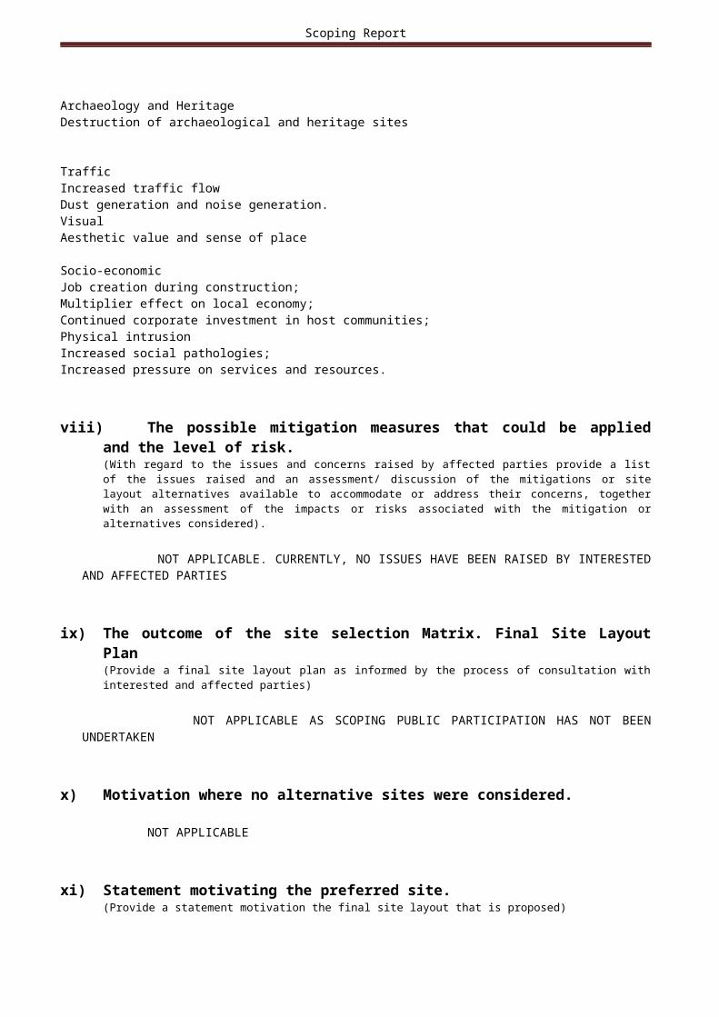
Scoping Report
environment. These mitigation measures can then be incorporated into the EMP for the development to ensure that the wetland ecology of the area is adequately protected
HERITAGE ASSESSMENTThe HIA and desktop Palaeontology Assessment must be conducted. The purpose of the heritage survey is to
ascertain if any archaeological or historical remains occur in the survey area and if they are of aesthetic, architectural, historical, scientific, social, spiritual, linguistic or technological value. Attention must be given to both tangible and intangible heritage remains. The Heritage and desktop Palaeontology Assessment TOR is not limited to, but must include the following:
• Liaison with SAHRA and search SAHR Information Systems for existing reports and information of the survey area;
• Compile detailed maps of the survey area indicating all cultural heritage resources (Stone Age, Iron Age and Historical Period);• Utilise Geographic Information System (GIS) systems and Google Earth (also topographic maps and aerial photographs);• Survey of the survey area; reconnoitre larger area with vehicle and foot survey of sensitive spots and areas;• Random consultation with local people to ascertain aspects of intangible heritage;• Recording and documenting of all sites using standard archaeological field work techniques;• Recording of site s with a Geographic Positioning System (GPS) and compiling maps;• Detailed description of all archaeological and historical artefacts, structures (including graves) and
settlements documented in the area (including photographs) will be included in the phase 1 heritage report;• Establish the level of sensitivity/importance of the archaeological and historical (both tangible and intangible) remains in the area;• Cultural traditions related by the local communities will be a high priority when establishing the significance of archaeological and historical remains as well as graves in formal cemeteries and informal burials;• Provide the relevant authorities with appropriate documents for their review and decision-making. In
particular, copies of the Heritage Report must be sent to SAHRA and the relevant Provincial Heritage Resource Agency;
• The desktop Palaeontology Assessment must include:A description of significant fossil occurrences;Recommendation on whether a phase 1 Paleontological Impact Assessment will be required.
NOISE ASSESSMENTThe Noise Assessment TOR is not limited to, but must include the following:• Determine the prevailing noise levels in and around the proposed TSF and MRD;• This noise survey from an environmental noise point of view must be done during the daytime period and the night-time period in order to evaluate the recommended
residual noise levels laid down by SANS 10103:2008 and to get a representative residual noise level for the areas where the proposed activities will or takes place;
• The proposed noise survey will consist out of the following:Preliminary survey and identification of measuring points;All measurements will be done on the boundary of the property;Sound pressure readings will also be done at the closest residential area – if applicable;Noise survey at the identified measuring sites – Ambient noise measurements;Calculation of noise propagation;Analysing of results;Results of the survey, report and recommendations and mapping of noise contours for the sites.
SOIL AND LAND CAPABILITY ASSESSMENTThe Soil, Land Use and Land Capability Assessment TOR are not limited to, but must include the following:• A detailed soil survey must be conducted at the proposed area where the proposed development project will
be. The maps generated during the desktop study phase must be used to determine a grid and these areas will be traversed on the pre-determined transects and auger samples will be studied. In areas of great soil form variety, more samples points must be evaluated as well as to establish soil form boundaries;
• Observations must be made regarding soil texture, depth of soil, soil structure, organic matter content and slope of the area. The soil characteristics of each sample point must be noted and logged with a GPS. The location of these auger points must be indicated in a Survey Points Map to be included in the final

Scoping Report
specialist report. Soil samples for chemical analysis must be taken at 25 sampling points and at each point both topsoil (0-300mm) and subsoil (300-600mm) will be sampled;
• The soils will be described using the S.A. Soil Classification Taxonomic System (Soil Classification Working Group, 1991) published as memoirs on the Agricultural Natural Resources of South Africa No.15. Soils will be grouped into classes with relatively similar soil properties and pedogenesis. A cold 10% hydrochloric acid solution will be used on site to test for the presence of carbonates in the soil;
• The 24 representative soil samples must be stored in perforated soil sampling plastic bags on site and sent by
courier to SGS Soil Laboratory in Somerset West for chemical soil analysis;• Samples must be analysed for pH, phosphorus content, cations (calcium, magnesium, potassium and
sodium), electrical conductivity, organic carbon content and relative fractions of sand, silt and clay;• The results of the soil survey must be mapped and zones of similar soil forms indicated. Once soil form
groups have been outlined, soil potential and land capability must be determined using the guidelines developed by the Agricultural Research Council unless otherwise specified by the client;
• The possible impacts of the proposed project on soil, agricultural potential and land capability must be evaluated.
VISUAL ASSESSMENTThe Visual Impact Assessment (VIA) TOR is not limited to, but must include the following:• The assessment must establish a view catchment area, view corridors, viewpoints and receptors;• The assessment must indicate the potential visual impacts using established criteria;• The assessment must include amongst other potential lighting impacts at night;• The report must be based upon the WC Guidelines the proposed activities would require a Level 3
assessment; and must include amongst other:Identification of issues raised during the EIA process;Undertake a desktop VIA analysis;Conduct a site visit to verify the scope of the VIA as well as gain an understanding of the receiving
environment;Describe the receiving environment with regards to the various elements of the project;Conduct a viewshed analysis of the proposed expansions, identifying potential sensitive receptors;Identify any potential mitigation measures (including lighting impacts – should they be raised and potential impacts on tourism in the area); andIdentify potential alternatives, mitigation measures and monitoring programmesThe data required for the project includes, but is not limited to, structural heights, alignments and footprint
areas for the proposed expansions. Once these data are made available the following must be undertaken:Review of the information based on information supplied;Perform a desktop analysis to outline the baseline visual aspects of the site and to identify preliminary
sensitive visual receptors – the classification of the landscape’s visual character and possible receptors to the proposed project;Consult with the EAP to discuss the project and attend to any questions that may have arisen from the EIA
process;Liaise with the EAP to obtain any I&APs concerns noted by the EAP regarding the potential visual impacts the proposed expansions may have; and · The data required for the project includes, but is not limited to: structural heights and footprint areas for the proposed TSFs and MRDs• The viewshed analysis must include the compilation of a preliminary spatial model (based on the proposed expansions). Tasks will include:Compile a preliminary spatial model (based on the plans and contour information) for the proposed
expansions using a GIS three dimensional software modelling package;Compile a set of viewpoints from areas that are deemed to be potentially visually influenced by the proposed expansions;Using these viewpoints in conjunction with a site visit assess the visual impacts of the proposed expansions;Provide descriptions of the possible visual impacts that the proposed expansions may have on the surrounding landscape using viewshed analysis, including the identification of potential sensitive viewers / receptors informed by the EIA process, as well from the viewshed.
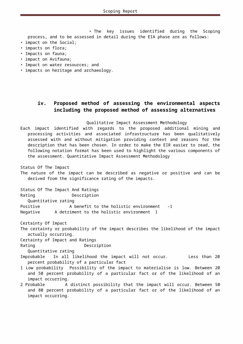
Scoping Report
SURFACE WATER ASSESSMENTThe Surface Water Assessment TOR is not limited to, but must include the following:• Water related considerations must be guided by the NWA Regulation 704 and the DWS Best Practice
Guidelines;• The surface water study must consider the following items:Assess crossings and diversions against details and visuals where the pipeline crosses the rivers and identify if there are going to be additional impacts with the construction of a new pipe crossing;Identify areas where ponding / restriction of flow is occurring due to structural restrictions or operational activities;Assess stability of river banks at crossings and diversions. Relate findings to actual suspended solids/turbidity
data in BRPM's water quality database;Assess crossings and diversions for potential to be impacted by spills and ability to handle such spills, with specific reference to tailings and wastewater pipeline crossings;Review floodlines and revise as appropriate;Identify any unauthorised activities within the floodline or 100m of the watercourse including infrastructure, operations, storage of materials, dumping etc;Document all erosion controls, energy dissipaters where stormwater releases occur to the natural environment Assess watercourses at crossings and diversions for erosion, signs of current/previous flooding. Review
inspection records, if any. Identify areas where maintenance or rehabilitation have been implemented or are required e.g. energy dissipation, erosion repairs/controls, removal of accumulated debris to maintain
capacity etc.• Stormwater Management Plan must include the followingA site audit to understand the existing stormwater layout and the future stormwater controls;Hydrology of the site to indicate the storm volumes emenating from the various sub catchments within the site (Calculation of the stormwater runoff based on impervious surface of the site);Describe the hydrology in relation to the position of the major pans in the area;Provide layout drawings (3 drawings) of the following elements:Indicate the site in relation to watercourses in the area; Indicate the existing layout of where the stormwater flows are; Detailed property designed layout and demarcation clean and dirty water areas as well as proposed
stormwater controls and monitoring points;Describe what stormwater controls are required to ensure that the site will be environmentally compliant from a
stormwater point of view

Scoping Report
(ix) Measures to avoid, reverse, mitigate, or manage identified impacts and to determine the extent of the residual risks that need to be managed and monitored.
ACTIVITYwhether listed or not listed.
(E.g. Excavations, blasting, stockpiles, discard dumps or dams, Loading, hauling and transport, Water supply dams and boreholes, accommodation, offices, ablution, stores, workshops, processing plant, storm water control, berms, roads, pipelines, power lines, conveyors, etc…etc…etc.).
POTENTIAL IMPACT
(e.g. dust, noise, drainage surface disturbance, fly rock, surface water contamination, groundwater contamination, air pollution etc….etc…)
MITIGATION TYPE
(modify, remedy, control, or stop)
through(e.g. noise control measures, storm-water control, dust control, rehabilitation, design measures, blasting controls, avoidance, relocation, alternative activity etc. etc)
E.g.Modify through alternative
method.Control through noise controlControl through management and monitoring through rehabilitation..
POTENTIAL FOR RESIDUAL RISK
Excavation Disturbances/changes to the topography of the area
•Impact will be slightly mitigated through mitigation measures for flora and fauna and soil management.
Inadequate storage of harzadous material
potential soil and water contamination
•Store all hydrocarbon sources inside bunded areas with impermeable floors. •Filter all surface water from these bunded areas through hydrocarbon management facilities.•Store all hazardous substances (oils, diesel, chemicals) in containers of sufficient strength and structural integrity to ensure that it is unlikely to burst or leak during ordinary use.•Handle, manage and store all chemicals according to their material safety data sheets which are to be located at all points of storage and where the chemical is used.
vehicle movement and the construction of facilities.
vegetation is cleared
Soil compaction
Soil loss
hydrocarbon and cement
•Use existing roads and minimise new roads. The width of service roads must be minimised as much as possible.•Maintain grass cover for as long as possible•Erosion control measures must be constructed•Stripped soils should be stockpiled as a berm

Scoping Report
Construction activities spillages upslope (majority) and surrounding the disturbed area.•Stripping machinery should be used when soil moisture content is below approximately 8% to limit soil compaction.•Stripping of topsoil should not be done earlier than required.•An intercept drain should be constructed upslope of construction and operational areas, in order to re-direct clean water away.•An intercept drain should possibly be constructed downslope of polluted areas, in order to drain potentially polluted water into a pollution control dam.•Conduct proper chemical waste management to avoid spillage of chemicals•Use tracked vehicles rather than wheeled vehicles due to their lower point loading and slip, thereby minimise compaction;•Soil stockpiles must be sampled, ameliorated (fertilized) and re-vegetated as soon possible after construction
Land clearing Cumulative impacts on flora and fauna including:Habitat loss and harm to flora and faunaFragmentation of the habitat resulting in harm to flora and faunaFauna mortalitiesPresence of alien and invasive species resulting in habitat degradation
•Clearly demarcate the development footprint prior to initial site clearance and prevent construction personnel from leaving the demarcated area;•Retain where possible, vegetation between infrastructural elements associated with the project;•Conduct flora species search and rescue efforts before ground clearing begins;•Remove and relocate any plants of botanical or ecological significance (protected species);•Provide upfront and regular environmental training to construction workers to ensure the protection of the habitat,

Scoping Report
fauna and flora and their sensitivity to conservation;•Where trenches pose a risk to animal safety, ensure that the trench is secured to prevent animals falling in and getting trapped and/or injured;•Avoid the use of poisons for the control of problem animals and where it is necessary obtain approval from the Environmental Officer on type of poison to be used.•Use existing facilities (e.g., access roads, parking lots, graded areas) to the extent possible to minimize the amount of new disturbance;•Establish protective buffers in areas where there is sensitive habitat such as ravines.•Avoid all sensitive habitats by construction vehicles and equipment, wherever possible, in order to reduce potential impacts•Do not undertake any activities outside of the defined construction areas and the road servitudes.•In areas where the speed limit tends to be disobeyed, consider installing speed bumps. •Limit or avoid travelling at night as much as possible. •Where possible, position lighting five meters from the roads or paved areas.•Destroy alien invasive plants present, and the seedlings which emerge•Establish and manage an alternative plant cover to limit re-growth and re-invasion. •Institute strict control over materials brought onto site, which should be inspected for seeds of noxious plants and steps taken to eradicate these before transport to the site. Routinely fumigate or spray all materials with

Scoping Report
appropriate low-residual herbicides prior to transport to site or in a quarantine area on site.•Develop a detailed plan for the control of invader fauna species, noxious weeds and invasive plants that could colonize the area as a result of new surface disturbance activities at the site. The plan should address monitoring, weed identification, the manner in which weeds spread, and methods for treating infestations.
l) Other Information required by the competent Authority
i) Compliance with the provisions of sections 24(4)(a) and (b) read with section 24 (3) (a) and (7) of the National Environmental Management Act (Act 107 of 1998). the EIA report must include the:-
(1) Impact on the socio-economic conditions of any directly affected person. (Provide the results of Investigation, assessment, and evaluation of the impact of the mining, bulk sampling or alluvial diamond prospecting on any directly affected person including the landowner, lawful occupier, or, where applicable, potential beneficiaries of any land restitution claim, attach the investigation report as Appendix 2.19.1 and confirm that the applicable mitigation is reflected in 2.5.3; 2.11.6.and 2.12.herein).
ATTACHED AS APPENDIX 7
2) Impact on any national estate referred to in section 3(2) of the National Heritage Resources Act. (Provide the results of Investigation, assessment, and evaluation of the impact of the mining, bulk sampling or alluvial diamond prospecting on any national estate referred to in section 3(2) of the National Heritage Resources Act, 1999 (Act No. 25 of 1999) with the exception of the national estate contemplated in section 3(2)(i)(vi) and (vii) of that Act, attach the investigation report as Appendix 2.19.2 and confirm that the applicable mitigation is reflected in 2.5.3; 2.11.6.and 2.12.herein). ATTACHED AS APPENDIX 8

Scoping Report
m) Other matters required in terms of sections 24(4)(a) and (b) of the Act.(the EAP managing the application must provide the competent authority with detailed, written proof of an investigation as required by section 24(4)(b)(i) of the Act and motivation if no reasonable or feasible alternatives, as contemplated in sub-regulation 22(2)(h), exist. The EAP must attach such motivation as Appendix 4).
ATTACHED AS APPENDIX 9
j) UNDERTAKING REGARDING CORRECTNESS OF INFORMATION
I Nonkanyiso Zungu______________________herewith undertake that the information provided in the foregoing report is correct, and that the comments and inputs from stakeholders and Interested and Affected parties has been correctly recorded in the report.
_ _________________Signature of the EAP DATE:
k) UNDERTAKING REGARDING LEVEL OF AGREEMENT
I Nonkanyiso Zungu______herewith undertake that the information provided in the foregoing report is correct, and that the level of agreement with interested and Affected Parties and stakeholders has been correctly recorded and reported herein.
_ ___________Signature of the EAP DATE:
-END-