Scenic Drive Pilot Project - Sonoran Permaculture · Scenic Drive Pilot Project: Report and...
21
Scenic Drive Pilot Project: A Model for Water Harvesting, Watershed Restoration and Education Report And Recommendations Prepared for Town Of Marana, Pima County, Arizona
Transcript of Scenic Drive Pilot Project - Sonoran Permaculture · Scenic Drive Pilot Project: Report and...

Scenic Drive Pilot Project: A Model for Water Harvesting, Watershed Restoration and Education
Report And Recommendations
Prepared for Town Of Marana, Pima County, Arizona

Scenic Drive Pilot Project: Report and Recommendations
December 2006
Written and Illustrated by Barbara Rose
Prepared for The Town of Marana
With many thanks and appreciation for the Town’s support for Sustainable Development
Acknowledgments:
Town of Marana
Ann Audrey Phillips, City of Tucson
Safford Peak Watershed Education Team (SaPWET)
Sonoran Permaculture Guild
Pilot Project Participants, July 2005:
Dan Dorsey, Sonoran Permaculture Guild (instructor)Brad Lancaster-SPG (instructor)
John Litzel- Li’l John’s Excavating (instructor)Lisa Duncan-Town of MaranaTerry Hansen-Town of Marana
Thomas R. Peercy-Town of MaranaThomas Thivener-Town of MaranaMike Washburn-Town of Marana
Evan Canfield-Pima CountyIrene Ogata-City of Tucson
Joan Pettit-Scenic DriveEmmet Rose-Scenic Drive
Barbara Rose-Scenic Drive, SPG (organizer)Zachary E. Smith- Scenic Drive
Asa Toburen-Scenic DriveRyan Koch- intern, Prescott College
Cover page photograph: Workshop participants use a simple and inexpensive “Bunyip”, or water level, to determine contour for placement of gabion for erosion control
2
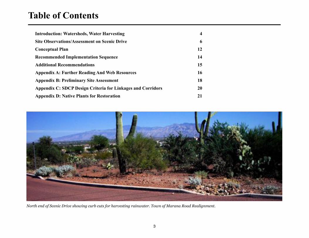
Table of Contents
Introduction: Watersheds, Water Harvesting 4
Site Observations/Assessment on Scenic Drive 6
Conceptual Plan 12
Recommended Implementation Sequence 14
Additional Recommendations 15
Appendix A: Further Reading And Web Resources 16
Appendix B: Preliminary Site Assessment 18
Appendix C: SDCP Design Criteria for Linkages and Corridors 20
Appendix D: Native Plants for Restoration 21
3
North end of Scenic Drive showing curb cuts for harvesting rainwater. Town of Marana Road Realignment.
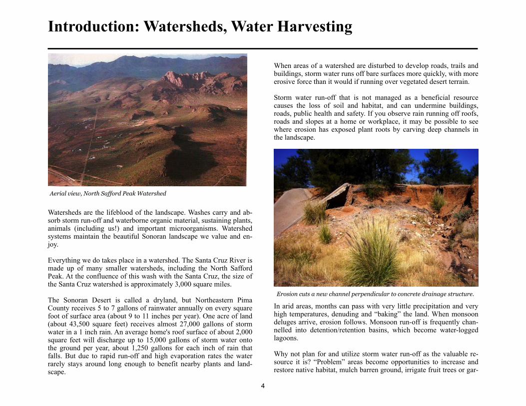
Introduction: Watersheds, Water Harvesting
Aerial view, North Safford Peak Watershed
Watersheds are the lifeblood of the landscape. Washes carry and ab-sorb storm run-off and waterborne organic material, sustaining plants, animals (including us!) and important microorganisms. Watershed systems maintain the beautiful Sonoran landscape we value and en-joy.
Everything we do takes place in a watershed. The Santa Cruz River is made up of many smaller watersheds, including the North Safford Peak. At the confluence of this wash with the Santa Cruz, the size of the Santa Cruz watershed is approximately 3,000 square miles.
The Sonoran Desert is called a dryland, but Northeastern Pima County receives 5 to 7 gallons of rainwater annually on every square foot of surface area (about 9 to 11 inches per year). One acre of land (about 43,500 square feet) receives almost 27,000 gallons of storm water in a 1 inch rain. An average home's roof surface of about 2,000 square feet will discharge up to 15,000 gallons of storm water onto the ground per year, about 1,250 gallons for each inch of rain that falls. But due to rapid run-off and high evaporation rates the water rarely stays around long enough to benefit nearby plants and land-scape.
When areas of a watershed are disturbed to develop roads, trails and buildings, storm water runs off bare surfaces more quickly, with more erosive force than it would if running over vegetated desert terrain.
Storm water run-off that is not managed as a beneficial resource causes the loss of soil and habitat, and can undermine buildings, roads, public health and safety. If you observe rain running off roofs, roads and slopes at a home or workplace, it may be possible to see where erosion has exposed plant roots by carving deep channels in the landscape.
Erosion cuts a new channel perpendicular to concrete drainage structure.
In arid areas, months can pass with very little precipitation and very high temperatures, denuding and “baking” the land. When monsoon deluges arrive, erosion follows. Monsoon run-off is frequently chan-nelled into detention/retention basins, which become water-logged lagoons.
Why not plan for and utilize storm water run-off as the valuable re-source it is? “Problem” areas become opportunities to increase and restore native habitat, mulch barren ground, irrigate fruit trees or gar-
4

dens for local food security, and even provide emergency water sup-plies (if collected in cisterns).
By following the landscape’s natural contours and vegetation, and incorporating thoughtful design and development, the land can infil-trate rain that falls directly on it and additional run-off that passes over it. Thus the need for irrigation, flood control structures and costly maintenance are reduced, while the beauty and health of the community is increased. Sonoran native landscapes, whether urban or rural, make invaluable contributions to our quality of life. They im-prove air quality, control dust, and moderate climate. They also at-tract tourists, residents, and businesses who understands the connec-tions between healthy economy and healthy ecology.
The Town of Marana recently updated its General Plan and described its intent to lead the region in Green Building and Sustainable Devel-opment, utilizing water harvesting and integrated design systems, like permaculture, to create more sustainable communities. As a fast growing sunbelt area, how we guide current and future development will be celebrated or regretted by those who come after us. We live in a time of increasing concerns about water quality and availability. In arid regions like ours, prudent planners, developers, and residents can all benefit from integrated water harvesting design that reduces the need to pump groundwater to support landscapes.
This report describes water harvesting and restoration activities un-dertaken at the Scenic Drive Pilot Project in the North Safford Peak Watershed, and provides recommendations to conduct remaining right-of-way improvements committed by the Town Planning De-partment in 2004.
In 1998, neighborhood residents formed a watershed conservation team, now known as Safford Peak Watershed Education Team (SaP-WET). SaPWET received a Pro-Neighborhoods grant to begin water-shed stewardship activities on private land. They have continued to
share educational opportunities with residents and the larger commu-nity since SaPWET was formed.
We hope that ongoing projects like this one will serve as a model for future “green” roadway projects, and as a template for jurisdictions partnering with citizens to create better neighborhoods through wa-tershed stewardship.
Gravel road designed to harvest water for landscape.
5
Waterborne soils from upstream erosion are deposited on Scenic Drive
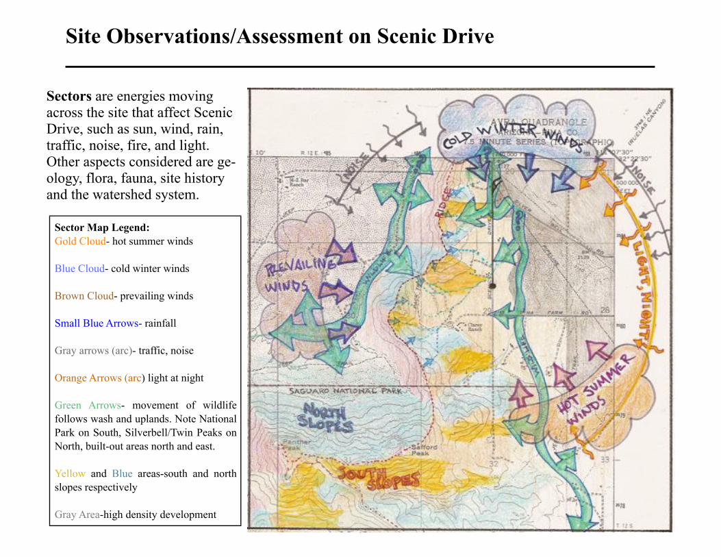
Site Observations/Assessment on Scenic Drive
6
Sector Map Legend:
Gold Cloud- hot summer winds
Blue Cloud- cold winter winds
Brown Cloud- prevailing winds
Small Blue Arrows- rainfall
Gray arrows (arc)- traffic, noise
Orange Arrows (arc) light at night
Green Arrows- movement of wildlife
follows wash and uplands. Note National
Park on South, Silverbell/Twin Peaks on
North, built-out areas north and east.
Yellow and Blue areas-south and north
slopes respectively
Gray Area-high density development
Sectors are energies moving across the site that affect Scenic Drive, such as sun, wind, rain, traffic, noise, fire, and light. Other aspects considered are ge-ology, flora, fauna, site history and the watershed system.
SunThe Scenic Drive area benefits from its east-facing orientation. As the sun moves west each afternoon, shadows from the Western ridges shade and cool the land and buildings. Rugged canyons create shady northern and sunny southern micro-climates. These cooler or warmer niches greatly increase habitat and species diversity.
WindPrevailing seasonal south and west winds can become extremely turbulent as they move over and across the rough terrain of canyons and ridges of the Tucson Mountains. Winter storms arrive mostly from the north. Summer “monsoons” arrive mostly from the south and east.
RainRainfall for this area can exceed Tucson’s annual average of about 12 per year, although the east slope of the Tucson Mountains are in a rain shadow, so rainfall here is unpredictable. Safford Peak, at over 3,500 feet, affects cloud formation and weather patterns. Localized summer storm cells can deposit inches of rain in minutes in one small area while sun shines nearby. Winter rains tend to be more gentle, allowing for more infiltration and less run-off. Scenic Drive residents have been recording rainfall for many years.
Traffic, NoiseSilverbell Road traffic is close to the north end of Scenic Drive. Northeast-facing canyons act as amphitheaters, amplifying Silverbell traffic as well as noise from Interstate 10 and the railroad. Marana Regional Airport traffic increases noise levels as it expands. Military air traffic to and from Evergreen Airpark on the Pinal County line impacts quality of life.
LightMore residences, businesses and roads continue to increase light pollution, washing out the night sky.
FireFire generally follows prevailing winds, travels upslope, and is most intense on saddles and ridges. Scars from the Buffelgrass fire on the north slope above Lazy K Bar are still visible after many years. Na-tive cacti, shrubs, and trees are not able to recover after fires of this kind. Exotic plants such as Eucalyptus, Italian Cypress, Pines and Cedars can carry accidental backyard fires that begin as barbeques,
campfires and fireworks. The probability of human-caused fire in-creases with population.
Geology, SoilsThe rocky uplands above Scenic Drive are mainly composed of reddish-brown, volcanic Andesite, formed from cooling lava flows. Lenses of chalky calcium carbonate (caliche) have been mined since prehistoric times to make plasters for adobe walls. Today caliche is an important ingredient in Portland Cement. Andesite cracks, folds, and weathers into red clay soils, forming the alluvial fans crossed by Scenic Drive. Local green builders utilize these soils as a ready sup-ply of high mass building material for adobe, cob (a clay/straw mix), rammed earth, and traditional plasters. Seams of agate, chalcedony and quartz provided quarry sites for Hohokam toolmakers and today attract modern rockhounds.
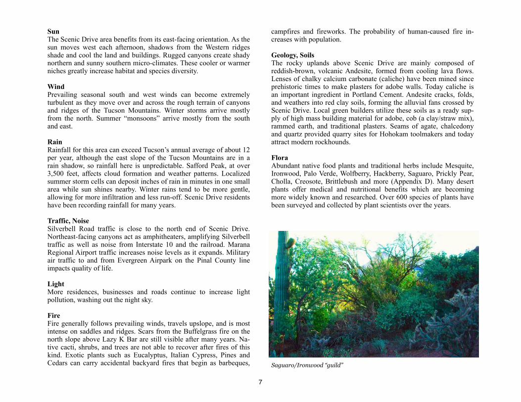
FloraAbundant native food plants and traditional herbs include Mesquite, Ironwood, Palo Verde, Wolfberry, Hackberry, Saguaro, Prickly Pear, Cholla, Creosote, Brittlebush and more (Appendix D). Many desert plants offer medical and nutritional benefits which are becoming more widely known and researched. Over 600 species of plants have been surveyed and collected by plant scientists over the years.
7
Saguaro/Ironwood “guild”
FaunaAnimal life is abundant, though diminishing due to urbanization and road kill. Cactus Ferruginous Pygmy Owls, sighted in the mid ‘90’s, have not been recorded here in recent years, but migratory birds, birds of prey, deer, bobcats, mountain lions, coyotes, rodents, desert tortoises, toads, important pollinators (bees, butterflies, moths), in-sects and reptiles are regular residents moving across their ranges.
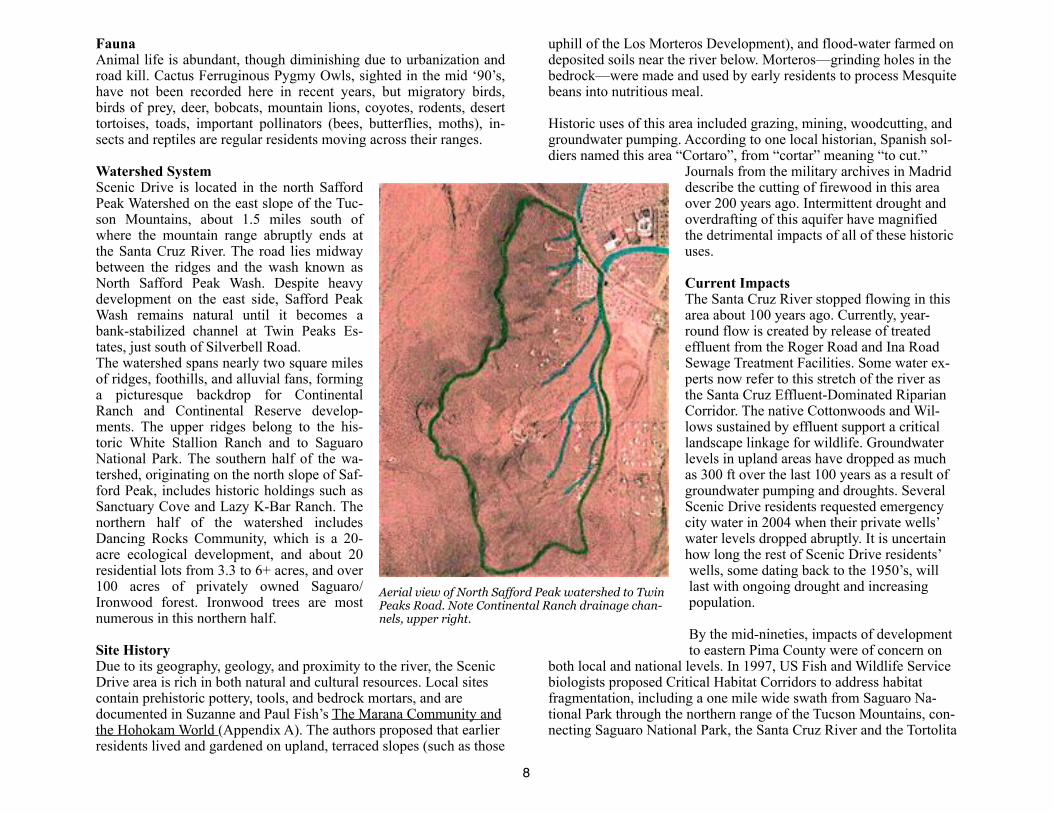
Watershed SystemScenic Drive is located in the north Safford Peak Watershed on the east slope of the Tuc-son Mountains, about 1.5 miles south of where the mountain range abruptly ends at the Santa Cruz River. The road lies midway between the ridges and the wash known as North Safford Peak Wash. Despite heavy development on the east side, Safford Peak Wash remains natural until it becomes a bank-stabilized channel at Twin Peaks Es-tates, just south of Silverbell Road.The watershed spans nearly two square miles of ridges, foothills, and alluvial fans, forming a picturesque backdrop for Continental Ranch and Continental Reserve develop-ments. The upper ridges belong to the his-toric White Stallion Ranch and to Saguaro National Park. The southern half of the wa-tershed, originating on the north slope of Saf-ford Peak, includes historic holdings such as Sanctuary Cove and Lazy K-Bar Ranch. The northern half of the watershed includes Dancing Rocks Community, which is a 20-acre ecological development, and about 20 residential lots from 3.3 to 6+ acres, and over 100 acres of privately owned Saguaro/Ironwood forest. Ironwood trees are most numerous in this northern half.
Site HistoryDue to its geography, geology, and proximity to the river, the Scenic Drive area is rich in both natural and cultural resources. Local sites contain prehistoric pottery, tools, and bedrock mortars, and are documented in Suzanne and Paul Fish’s The Marana Community and the Hohokam World (Appendix A). The authors proposed that earlier residents lived and gardened on upland, terraced slopes (such as those
uphill of the Los Morteros Development), and flood-water farmed on deposited soils near the river below. Morteros—grinding holes in the bedrock—were made and used by early residents to process Mesquite beans into nutritious meal.
Historic uses of this area included grazing, mining, woodcutting, and groundwater pumping. According to one local historian, Spanish sol-diers named this area “Cortaro”, from “cortar” meaning “to cut.”
Journals from the military archives in Madrid describe the cutting of firewood in this area over 200 years ago. Intermittent drought and overdrafting of this aquifer have magnified the detrimental impacts of all of these historic uses.
Current ImpactsThe Santa Cruz River stopped flowing in this area about 100 years ago. Currently, year-round flow is created by release of treated effluent from the Roger Road and Ina Road Sewage Treatment Facilities. Some water ex-perts now refer to this stretch of the river as the Santa Cruz Effluent-Dominated Riparian Corridor. The native Cottonwoods and Wil-lows sustained by effluent support a critical landscape linkage for wildlife. Groundwater levels in upland areas have dropped as much as 300 ft over the last 100 years as a result of groundwater pumping and droughts. Several Scenic Drive residents requested emergency city water in 2004 when their private wells’ water levels dropped abruptly. It is uncertain how long the rest of Scenic Drive residents’ wells, some dating back to the 1950’s, will last with ongoing drought and increasing population.
By the mid-nineties, impacts of development to eastern Pima County were of concern on
both local and national levels. In 1997, US Fish and Wildlife Service biologists proposed Critical Habitat Corridors to address habitat fragmentation, including a one mile wide swath from Saguaro Na-tional Park through the northern range of the Tucson Mountains, con-necting Saguaro National Park, the Santa Cruz River and the Tortolita
8
Aerial view of North Safford Peak watershed to Twin Peaks Road. Note Continental Ranch drainage chan-nels, upper right.

Fan. Scenic Drive marked the centerline of this corridor, which in-cludes the ridges, uplands, and washes of this watershed.
In 1998, Pima County began preparing the Sonoran Desert Conserva-tion Plan (SDCP), a science-based approach to creating a federally approved Multi-Species Habitat Conservation Plan (MSHCP) and an integrated planning process for guiding the actions of future devel-opment that provides for interconnected bioregional conservation corridors. The Science Technical Advisory Team (STAT) of the SDCP designated this area as Priority Habitat, to be managed as part of the Conservation Lands System (Appendix C).
Now in its final planning stage, the SDCP has received national rec-ognition and strong local support, as well as voter-approved bond funding for acquisition of conservation lands. Scenic Drive residents have actively supported the SDCP by serving on SDCP’s Steering Committee and supporting the Coalition for Sonoran Desert Protec-tion.
Other ObservationsAs Marana has grown, the urban/suburban “edge,” sprawling into this formerly rural area, has greatly increased economic and cultural di-versity. Residents include young families who are first time home-owners (Twin Peaks Estates), 30+ year residents on older home-steads, newer foothills residents building and remodeling large, estate homes, and the guests and staff at Lazy K/Stardance Event Center and Sanctuary Cove.
Several years ago, the Town of Marana and Lazy K-Bar proposed closing a portion of Scenic Drive adjacent to the ranch to enable the resort’s guests to ride horses across the road unrestricted by traffic. Historic use of Scenic Drive by residents and Continental Ranch hik-ers was redirected to a perimeter trail adjacent to Safford Peak Wash, a long and remote route, especially for the elderly and neighborhood children. Daily opportunities for informal visiting, which maintained neighborhood cohesiveness, were reduced. To counteract this foot-path access down Scenic Drive is still desired. Residents appreciate the Town for providing traffic reduction, roadside native habitat res-toration, erosion mitigation, and neighborhood involvement.
Funding was allocated for Scenic Drive Restoration in 20041, and. twenty percent of that has funded the Pilot Project. The remainder could rehabilitate the rest of the sites identified and undertake inte-grated design for roadway improvements. With the Town’s support, the tradition of environmental education and sustainable development for residents and stakeholders in the northern Tucson Mountains will continue.
The Scenic Drive neighborhood has welcomed growing population by inviting community participation in many watershed education activities over the years, including:
• 1994-ongoing: Many water harvesting basins, berms, and gabions have been built at Dancing Rocks Community workshops.
• 1994-ongoing: Scenic Drive residents have conducted classes and workshops in water harvesting, integrated design, and permaculture
9
1 2004-2005, per Jim Mazzocco, Lisa Duncan, and Jim DeGroode; Town of Marana designates $50,000 for restoration activities on Scenic Drive.
Pink arrow points to Scenic Drive within the Conservation Land System. (Pima County map)
for Coyote Trail Elementary, Pima College, local high schools, Prescott College and others.
• 1999-2000: Tthe Northern Tucson Mountains Resource Conservation/Education Project (funded by Pro-Neighborhoods, Town of Marana, and Pima County) conducted workshops for resi-dents, planners, developers and students, and produced a video about the project (DVD is available from SapWET).
• 2000: ADOT proposal for Scenic Drive.
• 2005: Marana Community Social and Information Session, Mason Audubon Center. Native foods and conservation overview provided by a SaPWET member from Scenic Drive.
• 2006: Pima County Green Building Incentive Program, SapWet participant on committee
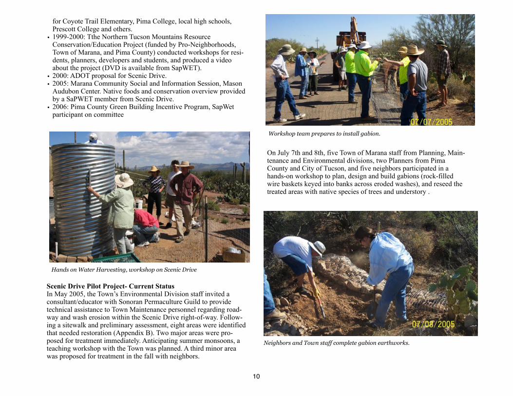
Scenic Drive Pilot Project- Current StatusIn May 2005, the Town’s Environmental Division staff invited a consultant/educator with Sonoran Permaculture Guild to provide technical assistance to Town Maintenance personnel regarding road-way and wash erosion within the Scenic Drive right-of-way. Follow-ing a sitewalk and preliminary assessment, eight areas were identified that needed restoration (Appendix B). Two major areas were pro-posed for treatment immediately. Anticipating summer monsoons, a teaching workshop with the Town was planned. A third minor area was proposed for treatment in the fall with neighbors.
On July 7th and 8th, five Town of Marana staff from Planning, Main-tenance and Environmental divisions, two Planners from Pima County and City of Tucson, and five neighbors participated in a hands-on workshop to plan, design and build gabions (rock-filled wire baskets keyed into banks across eroded washes), and reseed the treated areas with native species of trees and understory .
10
Hands on Water Harvesting, workshop on Scenic Drive
Workshop team prepares to install gabion.
Neighbors and Town staff complete gabion earthworks.

Pilot Project Goals A primary goal of this project was to assist the Town in implementing innovative methods for repairing common erosion problems such as those on Scenic Drive. In addition, the project was intended to pro-mote design skills that would assist the Town for both new construc-tion and improvement projects, reduce the Town’s maintenance costs, and enhance conservation of roadside native vegetation. This project also provided guidance to neighbors who wish to implement water-shed restoration and improve quality-of life on Scenic Drive.
A year after implementation, most erosion at the treated sites has ceased and native plants are thriving, following an unusual summer monsoon dropping over ten inches of rain between July and Septem-ber, 2006.
However, in some areas (see page 12, activity site number three), soils washing down from above Scenic Drive continue to cause ero-sion and deposition. Rather than viewing deposition as a “problem” solely for roadway maintenance, it is recommended that the neigh-borhood work together to practice upstream watershed conservation methods to hold soils and plants in place.
ConclusionsScenic Drive provides access across diverse and highly sensitive ar-eas. North Safford Peak Wash and the uplands and ridges act as criti-cal landscape linkages. Scenic Drive is also an important buffer be-tween urban expansion and zoned rural, ranch, and wild landscapes.
Concerns about water resources and growth limits are increasing on a local and regional scale. Because of SapWET and past Scenic Drive educational projects, the watershed has begun to model ways to turn erosion problems into water harvesting opportunities. It is this model,
adapting and improving over time, that we hope to continue to ex-plore. With the Town’s ongoing interest and support, as well as that of others interested in sustainable planning and conservation of val-ued natural resources in Pima County, The Safford Peak Watershed Team and it’s neighbors can work together on the next steps of this community “watershed event”.
The Conceptual Plan (page 12),Planning Concepts (page 13) and Recommended Implementation Sequence (page 14) are proposed to guide the next steps.
11
Gabion after summer 2006 rains.
Workshop participants complete gabion on Scenic Drive
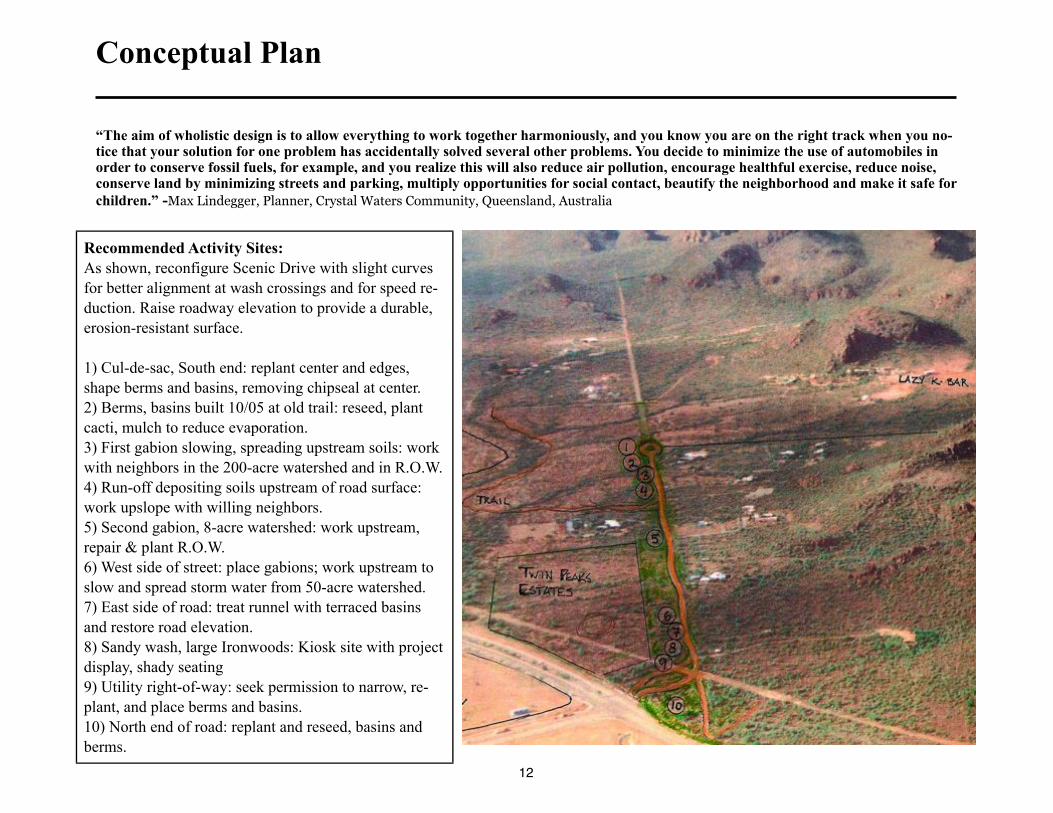
Conceptual Plan
“The aim of wholistic design is to allow everything to work together harmoniously, and you know you are on the right track when you no-tice that your solution for one problem has accidentally solved several other problems. You decide to minimize the use of automobiles in order to conserve fossil fuels, for example, and you realize this will also reduce air pollution, encourage healthful exercise, reduce noise, conserve land by minimizing streets and parking, multiply opportunities for social contact, beautify the neighborhood and make it safe for
children.” -Max Lindegger, Planner, Crystal Waters Community, Queensland, Australia
12
Recommended Activity Sites:
As shown, reconfigure Scenic Drive with slight curves
for better alignment at wash crossings and for speed re-
duction. Raise roadway elevation to provide a durable,
erosion-resistant surface.
1) Cul-de-sac, South end: replant center and edges,
shape berms and basins, removing chipseal at center.
2) Berms, basins built 10/05 at old trail: reseed, plant
cacti, mulch to reduce evaporation.
3) First gabion slowing, spreading upstream soils: work
with neighbors in the 200-acre watershed and in R.O.W.
4) Run-off depositing soils upstream of road surface:
work upslope with willing neighbors.
5) Second gabion, 8-acre watershed: work upstream,
repair & plant R.O.W.
6) West side of street: place gabions; work upstream to
slow and spread storm water from 50-acre watershed.
7) East side of road: treat runnel with terraced basins
and restore road elevation.
8) Sandy wash, large Ironwoods: Kiosk site with project
display, shady seating
9) Utility right-of-way: seek permission to narrow, re-
plant, and place berms and basins.
10) North end of road: replant and reseed, basins and
berms.
Planning Concepts:
• Scenic drive right-of-way problems (stormwater run-off, channel down-cutting, diminishing native vegetation, non point-source pol-lution, community access) are considered opportunities to improve habitat conservation and neighborhood involvement, utilizing local resources and experience in all aspects of planning and design.
• The Town provides leadership in Water Conservation and Sustain-able Development, fulfilling a vision of its General Plan. Scenic Drive serves as one of its teaching models for rehabilitating a local streetscape for storm water management, traffic calming, environ-mental education and more livable neighborhoods.
• The Town models methods that can be used by private landowners and developers, reducing future maintenance costs and leading to neighborhood-scale conservation actions that benefit the larger community.
• Initial time and funds invested for training, planning, design and installation are more than offset by reduction of future maintenance costs and accidents, increased knowledge base, and increased health and scenic beauty of the Town. This will also create new job opportunities.
• Proven, successful water harvesting principles are used at every step of planning, design and implementation:
1. Begin with long and thoughtful observation2. Start at the top-or highpoint-of your watershed and work your way down3. Start small and simple4. Spread and infiltrate the flow of water5. Always plan for an overflow route, and manage that overflow water as a resource6. Maximize living and organic groundcover7. Maximize beneficial relationships and efficiency by “stack-ing functions”8. Continually reassess your system: The “Feedback Loop”
Excerpted with permission, "Rainwater Harvesting for Drylands, Volume 1: Guiding Principles to Welcome Rain Into Your Life and Landscape,by Brad Lancaster, Rainsource Press (Appendix “A”)
13
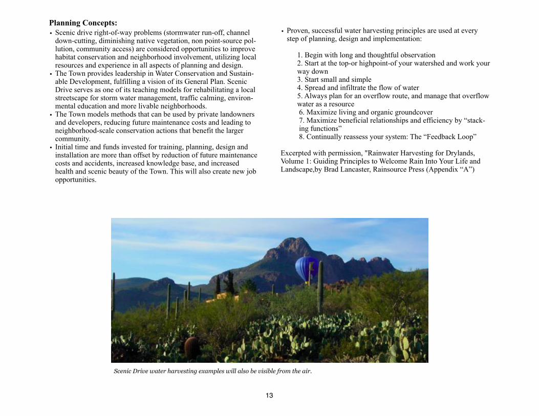
Scenic Drive water harvesting examples will also be visible from the air.
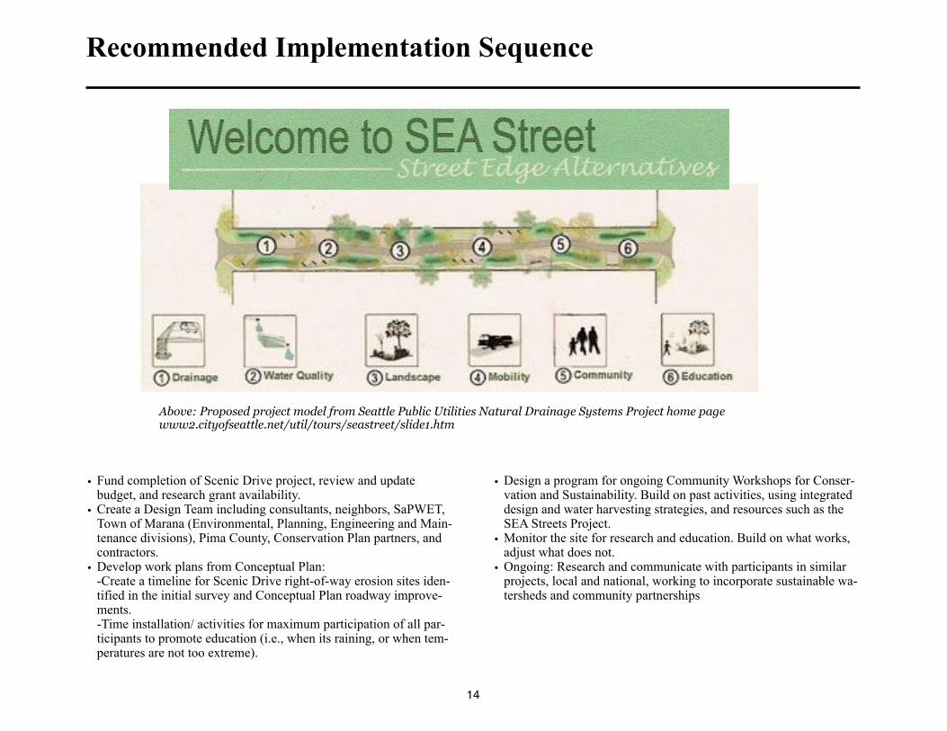
Recommended Implementation Sequence
• Fund completion of Scenic Drive project, review and update budget, and research grant availability.
• Create a Design Team including consultants, neighbors, SaPWET, Town of Marana (Environmental, Planning, Engineering and Main-tenance divisions), Pima County, Conservation Plan partners, and contractors.
• Develop work plans from Conceptual Plan:-Create a timeline for Scenic Drive right-of-way erosion sites iden-tified in the initial survey and Conceptual Plan roadway improve-ments.-Time installation/ activities for maximum participation of all par-ticipants to promote education (i.e., when its raining, or when tem-peratures are not too extreme).
• Design a program for ongoing Community Workshops for Conser-vation and Sustainability. Build on past activities, using integrated design and water harvesting strategies, and resources such as the SEA Streets Project.
• Monitor the site for research and education. Build on what works, adjust what does not.
• Ongoing: Research and communicate with participants in similar projects, local and national, working to incorporate sustainable wa-tersheds and community partnerships
14
Above: Proposed project model from Seattle Public Utilities Natural Drainage Systems Project home page www2.cityofseattle.net/util/tours/seastreet/slide1.htm
Additional Recommendations
• Monitoring can help measure the project’s success over time. Pos-sible partners include the Town, Pima County, neighbors, Audubon, Game and Fish,USDS, AZDEQ and others. Water levels in wells adjacent to water harvesting structures could also be monitored.
• Invite participation to grow watershed stewardship efforts includ-ing: presentations to the Town, and interested residents and busi-nesses, seasonal neighborhood plantings, plant and watershed walks, and backyard water harvesting activities.
• Review and update existing “green” codes, ordinances and guide-lines of the Town. Incentivise water harvesting and neighborhood watershed planning. Review City of Tucson’s “Office of Conserva-tion and Sustainable Development”activities, Pima County’s Green Building Incentive program (based on NAHB Green Building Guidelines, adapted for drylands), for adoption by the Town.
• Use seeding techniques like pelletizing seed, plan for a community native plant nursery and composting and mulch facility.
• Work with MUSD to create hands-on learning experiences for all ages.
• Design a program for Community Workshops for Conservation and Sustainability. Build on successful activities.
• Study examples of existing water harvesting sites.Local Examples (for planning field trips for the Design Team):~Stone Curves Neighborhood. Stone Avenue and Limberlost. New Co-housing infill project, sold out quickly.~Sonora Cohousing. Roger Road between Stone and First Avenue. First Co-housing project in Tucson mature landscape.~Milagro Cohousing, Goret Road West of Silverbell. Second Co-housing project, more rural, Tucson Mountains.~Civano. Houghton Road just South of Irvington. Mature Vegeta-tion, 50% reduction in energy and water use.~Dancing Rocks Community, Scenic Drive. Solar green homes with 75%+ reduction in energy and water use~Lancaster site, Dunbar Spring neighborhood. Historic adobe, so-lar, gardens, urban Permaculture hub.~Nature Conservancy (water harvesting parking lot). 1510 E. Ft Lowell Road.~Dunbar Spring Organic Community Garden.
Out of Town Examples: (also see links to websites):~Davis, California, Village Homes (Web and Book)~Los Angeles, California, Tree People Projects (website)~Portland, Oregon, Self-guided tours, Sustainable Drainage (web-site)~Seattle, Washington, Street Edge Alternatives (website)~Seattle, Growing Vine Street Project, Broadview Green Grid Natural Drainage Project (websites)
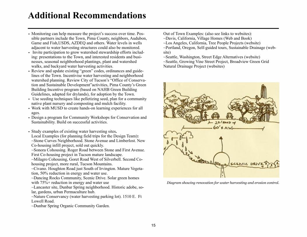
Diagram showing renovation for water harvesting and erosion control.
15
Appendix A: Further Reading And Web Resources
Books and Publications:
Rainwater Harvesting for Drylands, Vol. 1: GuidingPrinciples To Welcome Rain Into Your Life and Landscape, by Brad Lancaster,
Rainsource Press, 2006. Volumes 2 and 3 are expected in 2007.
City of Tucson Water Harvesting Guidance Manual, edited by Ann Audrey Phillips. Available from City of Tucson, Department of
Transportation, Stormwater Section, PO Box27210, Tucson, Arizona, 85726. Online: www.ci.tucson.az.us/water/harvesting.htm. Writ-
ten especially for developers, engineers, designers, and contractors of commercial sites, public buildings, subdivisions, and public
rights-of-way.
Superbia!, Dan Chiras and Dave Wann, New Society, 2003
Street Reclaiming, David Engwicht, New Society, 1999
Designing Sustainable Communities, Judy and Michael Corbett, Island Press, 2000
Road Kill Study, Natasha Kline, Saguaro National Park, 1997
The Marana Community and the Hohokam World, Suzanne Fish, Paul Fish, John Madsen, Anthropological Papers of the University of
Arizona, Number 56, 1992, University of Arizona Press
Introduction to Permaculture, Mollison and Slay, Tagari Press, 1994
Stormwater as a Resource: How to Harvest and Protect a Dryland Treasure, by David Morgan and Sandy Trevathan. A collaboration
between City of Santa Fe and the College of Santa Fe, 2002. Online: www.nmenv.state.nm.us/swqb/Storm_Water_as_a_Resource.pdf
The Lessening Stream: An Environmental History of the Santa Cruz River, by Michael F. Logan, University of Arizona Press, 2002
Green Streets- Innovative Solutions for Stormwater and Stream Crossings, by Metro, 2002
Skinny Streets and Green Neighborhoods: Design for Environment and Community, by Cynthia Girling and Ronald Kellett, Island
Press, 2005. Eighteen case studies.
Second Nature: Adapting LA’s Landscape for Sustainable Living, by TreePeople, 1999. www.TreePeople.org
Porous Pavements, by Bruce K. Ferguson, CRC Press, 2005
Daylighting: New Life for Buried Streams, by Richard Pinkham, Rocky Mountain Institute, September 2000.
http://www.rmi.org/images/other/Water/WOO-32_Daylighting.pdf
Restoring Streams in Cities: A Guide for Planners, Policymakers, and Citizens, by Ann L. Riley, Island Press, 1998
The Simple Act of Planting a Tree- Healing Your Neighborhood, Your City, and Your World, by TreePeople with Andy and Katie Lip-
kis, Jeremy P. Tarcher, Inc, 1990
Memorandum from USFWS, 6/23/05 To: Science Technical Advisory Team. Pima County Sonoran Desert Conservation Plan. Scott
Richardson, U.S. Fish and Wildlife Service. Subject: Cactus Ferruginous Pygmy-Owl Conservation in Northwest Tucson.
www.sonorandesert.org.
DVDs:
Restoring Los Angeles: Healing the Nature of Our Cities, (DVD)Andy Lipkus, 2005, from Bioneers Conference, www.bioneers.org
16
Websites:
www.harvestingrainwater.com. Rainwater harvesting resources, great website with many links to water harvesting and sustainable practices locally and worldwide. Created by Brad Lancaster. You will find most of the following websites here.www.sonorandesert.org. Coalition for Sonoran Desert Protection website. Information, maps, plans and educational resources. CSDP stives to educate and build support for Pima County’s groundbreaking Sonoran Desert Conservation Plan.www.drachmaninstitute.org. Waterharvesting and green community design. See Keeling Neighborhood Greenway, Ironwood Elementary School (Marana).www.desertharvesters.org. Innovative and informative local website for information about using and harvesting native foods, community food security and building sustainable communities.www.pima.gov/sdcp. Website for Pima County’s Sonoran Desert Conservation Planwww.sonoranpermaculture.org. Website for the Sonoran Permaculture Guild www.pimaxpress.com. Website for Pima County’s Greenbuilding Incentive Program, a work in progress modeled on the National Association of Home Builders Green Building Manual.www.TreePeople.org/trees/. Features water harvesting demonstration sites in Los Angeles, California and the effort to manage the city as a forested watershed. If they can do it there, certainly we can do it here! Also promotes awareness of the jobs that can be created and the long term economic benefits to this work for the entire community.www.cityrepair.org. Portland, Oregon. Community led rehabilitation and restoration of urban areas website.www.portlandonline.com/bes/index/cfm?c=34598. City of Portland, Sustainable Stormwater Program featuring Natural Drainage Systems and more. Progressive multi-use water harvesting/beautification/flood control strategies in the public rights-of-way and beyond. Includes permeable paving, water-harvesting curb cuts, bioremediation of toxins, urban forestry, and more.www.portlandonline.com/bes/index.cfm?c=degae. City of Portland, Self-guided tours of Natural Drainage Systems, Water Harvesting, Eco-roofs, and more. If in Portland, download the maps for these walking, bicycling, and driving self-guided tours. Look to these downloadable self-guided tours as models that can be replicated in our community.www.portlandonline.com/bes/index.cfm?c=31870. City of Portland, Integrated Stormwater/Water Harvesting Publications developed by the City of Portland.www.portlandonline.com/bes/index.cfm?c=31094. City of Portland, Sustainable Stormwater Management Demonstration Projects/Publicationswww.portlandonline.com/bes/index.cfm?c=43077. City of Portland, excellent example of a Community Watershed Stewardship Program, includes water harvesting swales, restoration projects, urban forestry and more.www.ci.seattle.wa.us/util/About_SPU/Drainage_&_Sewer_System/Natural_Drainage_Systems/index.asp. City of Seattle, Public Utilities SEA Streets Project. Progressive multi-use water harvesting/beautification/flood control strategies in the public rights-of-way.www.thehighpoint.com, and www.www.seattle.gov/util/About_SPU_Drainage_&Sewer_System/Natural_Drainage_Systems/High_Point_Project/index.asp. High Point Project. Large scale, multi-income housing/community redevelopment project, in West Seattle, features the largest scale natural drainage strategy in a high density urban setting.www.growingvinestreet.org. This project is a laboratory for green solutions within an urban design context. Integrated desin, hydrologic cycle awareness, public art, community gardens, urban tree planting and more.www.metrocouncil.org/environment/Watershed/bmp/manual.htm. Metropolitan Council’s Environmental Services’s Urban Small Sites Best Man-agement Practice Manual. Includes information on pavement reduction, stormwater management, and more.www.citizen.org/cmep/water. The Water for All Campaign.www.lgc.org. Local Government Commission website. Awhanee Principles for sustainable communitieswww.trafficcalming.org. Great examples of traffic calming strategies and info on their effectiveness. Needs integration with water harvesting and hardscape reduction strategies.www.walkinginfo.org. Pedestrian and Bicycle Information Center. Good image library of traffic calming strategies.
17
Appendix B: Preliminary Site Assessment
Sites Identified for watershed restoration by Marana Environmental Division, Lisa Duncan
June 7, 2005
Notes:
-All sites in Proposed Critical Habitat per USFWS at time of survey
-Consultants to review recommendations with Town staff and engineers
-All sites bluestaked for utilities prior to planning earthworks
1) South end of Scenic Drive, old horse trail eroding and downcutting on east side of Scenic. Trail downstream is fenced off, no longer
in use. Check with Lazy K-Bar, Fish and Wildlife (Scott Richardson) and implement erosion mitigation and native plant restoration
(pelletized seed) if permitted. Planning to integrate future resurfacing of Scenic Drive to enhance mitigation, rather than create further
erosion. Use workshop experience to promote participants' understanding of the benefits of working upstream, where water flows are
more manageable.
2) Northern wash from Lazy K-Bar, south slope of Moonrise Ranch. Upstream worse from drought, downstream extensive downcut-
ting (2'-3') and erosion off east edge of Scenic. Recommend erosion mitigation earthworks and planning to integrate future resurfacing
of Scenic Drive to enhance mitigation, rather than create further erosion. Use workshop experience to promote participants' under-
standing of the benefits of working upstream, where water flows are more manageable.
3) Large pile of decomposed granite washed down from steep drive to the East, native plant disturbance area. Recommend removal/
redistribution of pile to assist with erosion control, basin and swale earthworks, native plant restoration (pelletized seed) and planning
to integrate future resurfacing of Scenic Drive to enhance mitigation, rather than create further erosion. Use workshop experience to
promote participants' understanding of the benefits of working upstream, where water flows are more manageable.
4) Wash near 8825 Scenic Drive, same treatment as site #2.
5) Wash originating south and west of Dancing Rocks Community and southern end of Mitchell Property. Recommend gabion/
earthworks on west side of Scenic and planning to integrate future resurfacing of Scenic Drive to enhance mitigation, rather than cre-
ate further erosion. Use workshop experience to promote participants' understanding of the benefits of working upstream, where water
flows are more manageable.
6) Runnel on east side of Scenic, undercutting chip-seal due to slope and hard edge of road surface. Recommend rock-paved earth-
works (basins and berms) to stabilize and planning to integrate future resurfacing of Scenic Drive to enhance mitigation, rather than
create further erosion. Use workshop experience to promote participants' understanding of the benefits of working upstream, where
water flows are more manageable.
7) Wash with large Ironwoods and deposition of silt/sand/vegetation, less slope, native plant disturbance. Good shade under Ironwood
tree. Recommend this site be location of an educational kiosk explaining the watershed, past and current projects,and community re-
sources that enabled them, and plan to integrate future resurfacing of Scenic Drive to enhance mitigation, rather than create further
18

erosion. Use workshop experience to promote participants' understanding of the benefits of working upstream, where water flows are
more manageable.
8) El Paso Gas ROW, a large expanse of denuded land on either side of right-of-way. Recommend water harvesting earthworks (basins
and berms) and reseeding with native plants as permitted by El Paso and planning to integrate future resurfacing of Scenic Drive to
enhance mitigation, rather than create further erosion. Use workshop experience to promote participants' understanding of the benefits
of working upstream, where water flows are more manageable.
Gabion in upper Safford Peak watershed, 1.7-inch rainfall, July, 2006. Note color of surrounding vegetation, even after a period of eight months of drought.
19
Appendix C: SDCP Design Criteria for Linkages and Corridors
Section 3.2.3.2: Sonoran Desert Conservation Plan Design Criteria for Linkages and Corridors
The following criteria will be employed in the process of designing and evaluating linkages and corridors within the CLS.
• Habitat linkages will be maintained.
• Existing movement corridors within linkages will be identified and maintained.
• Corridors with good vegetative and/or topographic cover will be protected.
• Regional linkages that accommodate travel for a wide range of wildlife species, especially those linkages that support resident populations of
wildlife, will be protected.
• The width of a linkage will be based on the biological information for the target species, the quality of the habitat within and adjacent to the cor-
ridor, topography, and adjacent land uses. Where there is limited topographic relief, the corridor must be well vegetated and adequately buffered
from adjacent development.
• If a corridor is relatively long, it must be wide enough for animals to hide in during the day. Generally, wide linkages are better than narrow
ones. If narrow corridors are unavoidable, they should be relatively short. Pima County Department of Transportation (PCDOT) will continue to
work collaboratively with AGFD, USFWS, NPS, and others to determine appropriate crossing widths and other attributes.
• Visual continuity (i.e. long lines-of-sight) will be provided within movement corridors. This makes it more likely that the animals will keep
moving through the corridor. Developments along the rim of a canyon used as a corridor should be set back from the canyon rim and screened to
minimize their visual impact.
• Corridors with low levels of human disturbance, especially at night, will be selected. This includes maintaining low noise levels and limited arti-
ficial lighting.
• Barriers, such as roads, will be minimized. Appropriate wildlife fencing should be utilized to channel wildlife to designated crossing locations or
structures. PCDOT will work with AGFD, USFWS, NPS, and others to determine the appropriate level of mitigation in these locations.
• Regulations banning off-road vehicle use will be enforced and maintained.
20
Appendix D: Native Plants for Restoration
Native trees:Desert Ironwood (Olneya tesota), Velvet Mesquite (Prosopis ve-lutina), Screwbean Mesquite (Prosopis pubensis), Cat claw Acacia (Acacia greggii), Desert Willow (Chilopsis linearis), Canyon Hack-berry (Celtis reticulada), Foothills Palo Verde (Cercidium microphyl-lum), Blue Palo Verde (Cercidium floridum)
Native shrubs, vines and understory:Oreganillo (Aloysia Wrightii), Quail-brush (Atriplex lentiformis), Chiltepine (Capsicum annum), Desert Hackberry (Celtis pallida), Brittlebush (Encelia farinosa), Mormon Tea (Ephedra trifurca), Oco-tillo (Fouqueira splendens), Chuparosa (Justicia californica), Creo-sote (Larrea tridentata), Wolfberry (Lycium fremontii), Penstemon (P. parryi), Desert Lavender (Hyptis emoryi), Jojoba (Simmondsia chinensis), Bursage (Ambrosia deltoidea), Bricklebush (Brickellia coulteri), Ratany (Krameria grayii), Milkweed (Matelea producta, Sarcostemma cynanchoides), Herb of the Deer (Porophyllum gracile), Wild Carrot (Daucus pusillus), Amsinckia (Amsinckia in-termedia, A. tesselata), Trixis (Trixis californica), Streptanthus (Streptanthus carinatus), Wild Geranium (Erodium texanum), Phace-lia (Phacelia coerulia, P. distans), Slender Janusia (Janusia gracilis), Mallow/Hibiscus (Abutilon incanum, Hibiscus coulteri, Sphaeralcea ambigua), Desert Tobacco (Nicotiana trigonophylla), Datura (Datura discolor), Penstemon (Penstemon parryi), Anemone (Anemone tube-rosa), Delphinium (Delphinium scaposum), Graythorn (Ziziphus ob-tusifolia), Wild Buckwheat (Eriogonum wrightii)
Native cacti:Saguaro (Carnegia gigantica), Barrel Cactus (Ferocactus wislizenii), Cholla and Prickly Pear (Opuntia sp), Pincushion (mammillaria sp).
Excerpted from: Listing of 125 native species found on April 15, 1998. Arizona-Sonora Desert Museum native plant survey, Dancing Rocks site.
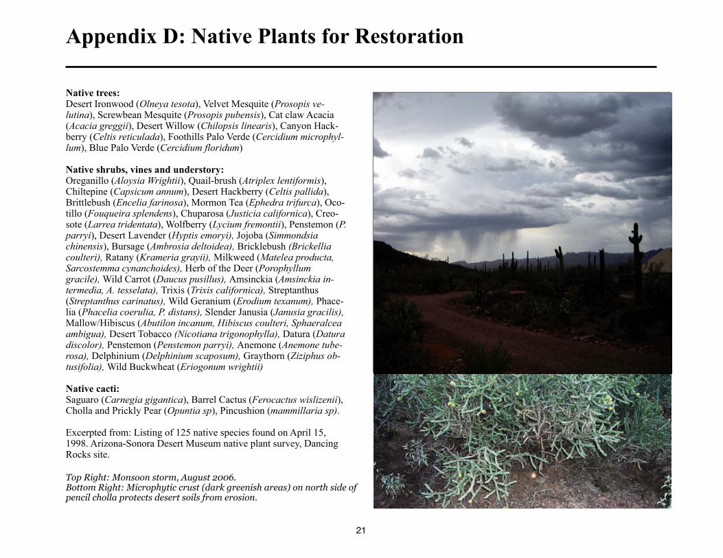
Top Right: Monsoon storm, August 2006.Bottom Right: Microphytic crust (dark greenish areas) on north side of pencil cholla protects desert soils from erosion.
21