
SCAG Region: Compass Blueprint Case Study … · SCAG Region: Compass Blueprint Case Study Downtown...
16
SCAG Region: Compass Blueprint Case Study Downtown Glendale March 2008 A Project of Center for Transit-Oriented Development
Transcript of SCAG Region: Compass Blueprint Case Study … · SCAG Region: Compass Blueprint Case Study Downtown...
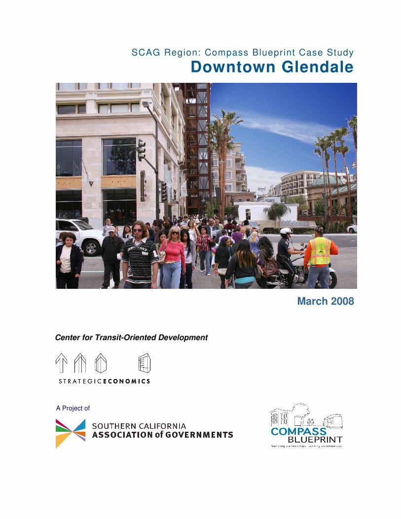
SCAG Region: Compass Blueprint Case Study
Downtown Glendale
March 2008
A Project of
Center for Transit-Oriented Development

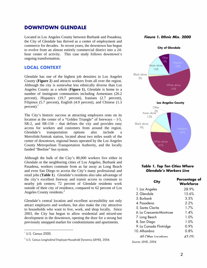
DOWNTOWN GLENDALE Located in Los Angeles County between Burbank and Pasadena, the City of Glendale has thrived as a center of employment and commerce for decades. In recent years, the downtown has begun to evolve from an almost entirely commercial district into a 24-hour center of activity. This case study follows downtown’s ongoing transformation. LOCAL CONTEXT Glendale has one of the highest job densities in Los Angeles County (Figure 2) and attracts workers from all over the region. Although the city is somewhat less ethnically diverse than Los Angeles County as a whole (Figure 1), Glendale is home to a number of immigrant communities including Armenians (26.2 percent), Hispanics (19.7 percent), Iranians (2.7 percent), Filipinos (5.7 percent), English (4.9 percent), and Chinese (1.3 percent).1 The City’s historic success at attracting employers rests on its location at the center of a “Golden Triangle” of freeways – I-5, SR-2, and SR-134 – that defines the city and provides easy access for workers and customers from around the region. Glendale’s transportation options also include a Metrolink/Amtrak station, located about two miles south of the center of downtown, regional buses operated by the Los Angeles County Metropolitan Transportation Authority, and the locally funded “Beeline” bus system. Although the bulk of the City’s 80,000 workers live either in Glendale or the neighboring cities of Los Angeles, Burbank and Pasadena, workers commute from as far away as Long Beach and even San Diego to access the City’s many professional and retail jobs (Table 1). Glendale’s residents also take advantage of the city’s excellent freeway and transit access to commute to nearby job centers; 72 percent of Glendale residents work outside of their city of residence, compared to 62 percent of Los Angeles County residents.2 Glendale’s central location and excellent accessibility not only attract employers and workers, but also make the city attractive to households who want to live, work, and shop locally. Since 2003, the City has begun to allow residential and mixed-use development in the downtown, opening the door for a strong but previously untapped market for condominiums and apartments.
1 U.S. Census 2000. 2 U.S. Census Longitudinal Employer-Household Dynamics (LEHD), 2004.
Los Angeles County
Other 3%
Black alone9%
Asian alone12%
Hispanic45%
White alone31%
City of Glendale
Other9%
Black alone2%
Asian alone16%
Hispanic20%
White alone54%
Figure 1. Ethnic Mix, 2000
Table 1. Top Ten Cities Where Glendale’s Workers Live
City
Percentage ofWorkforce
1. Los Angeles 28.9% 2.Glendale 15.6% 3.Burbank 3.5% 4. Pasadena 2.2% 5.Santa Clarita 1.7% 6. La Crescenta-Montrose 1.4% 7. Long Beach 1.0% 8.San Diego 1.0% 9. La Canada Flintridge 0.9%
10.Alhambra 0.8%
All Other Locations 43.0%Source: LEHD, 2004.
2
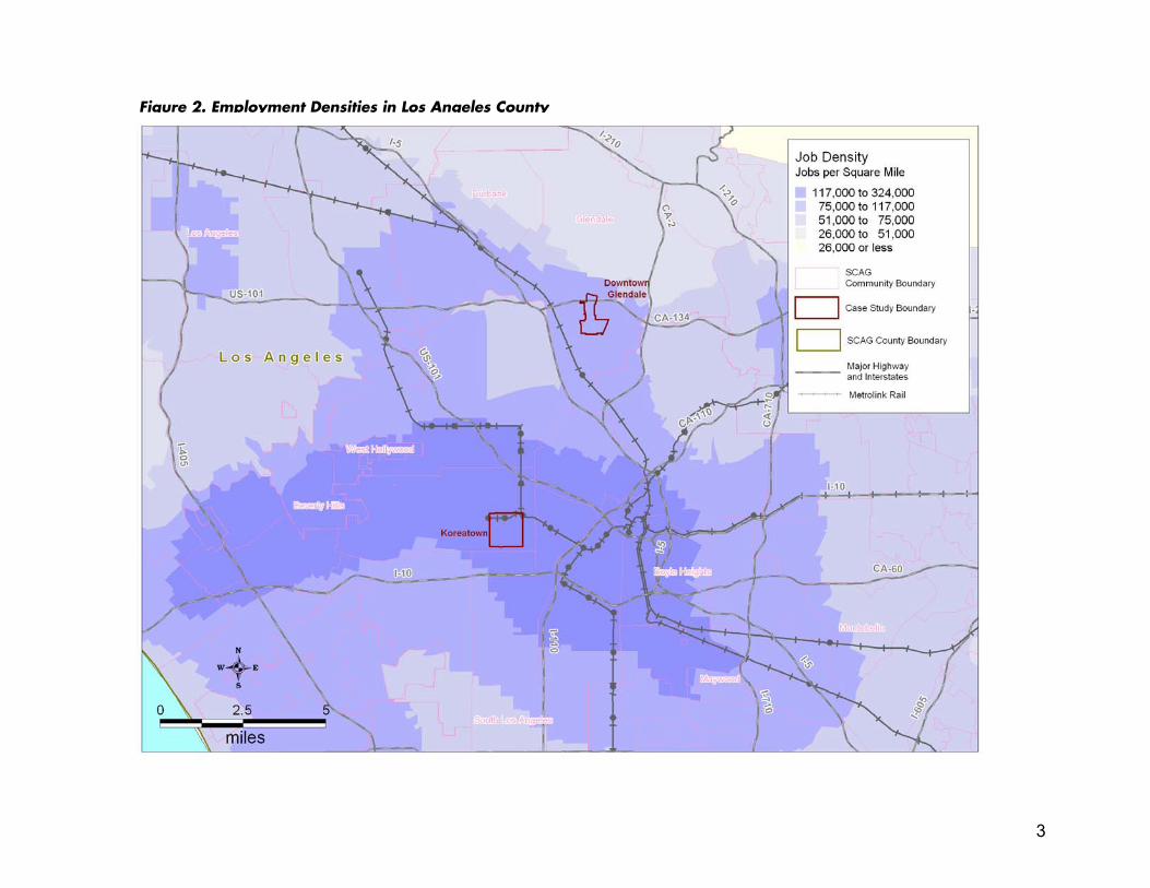
Figure 2. Employment Densities in Los Angeles County
3
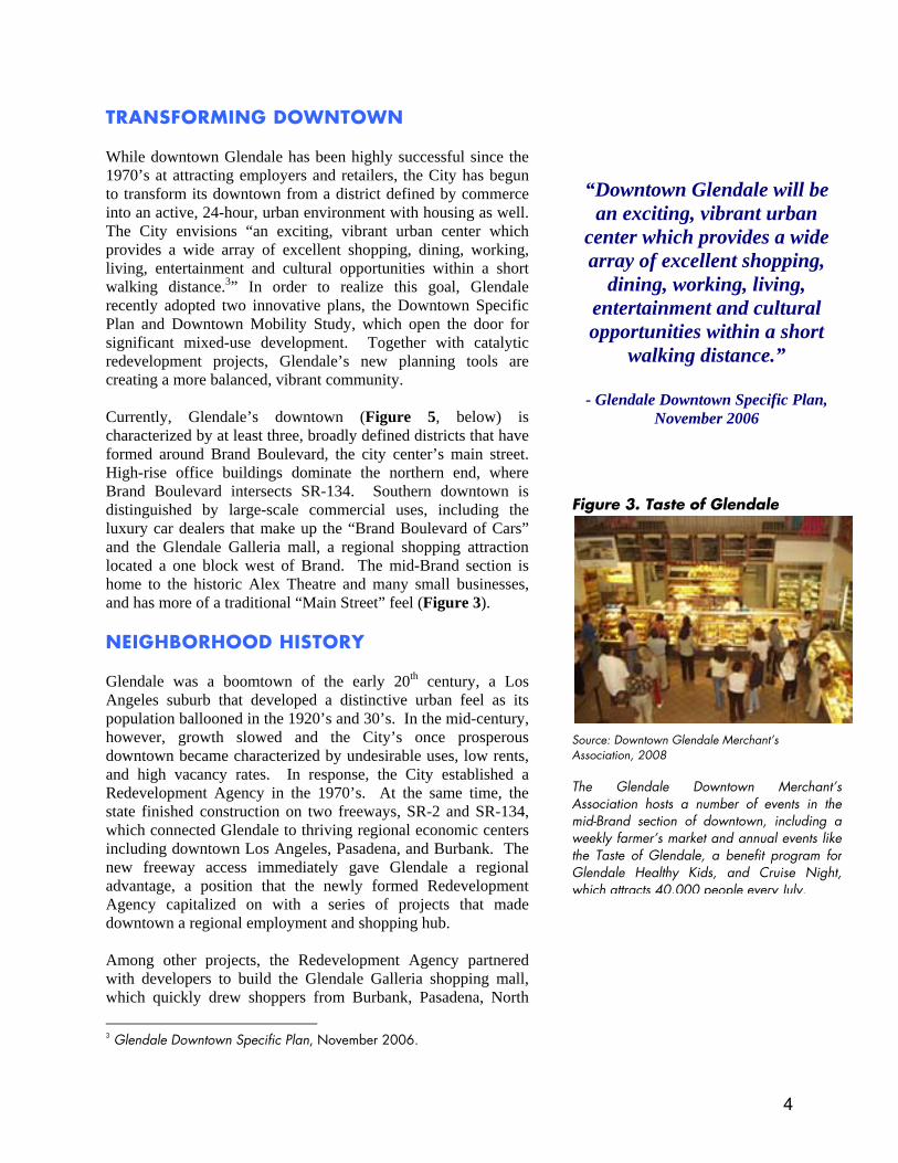
TRANSFORMING DOWNTOWN While downtown Glendale has been highly successful since the 1970’s at attracting employers and retailers, the City has begun to transform its downtown from a district defined by commerce into an active, 24-hour, urban environment with housing as well. The City envisions “an exciting, vibrant urban center which provides a wide array of excellent shopping, dining, working, living, entertainment and cultural opportunities within a short walking distance.3” In order to realize this goal, Glendale recently adopted two innovative plans, the Downtown Specific Plan and Downtown Mobility Study, which open the door for significant mixed-use development. Together with catalytic redevelopment projects, Glendale’s new planning tools are creating a more balanced, vibrant community. Currently, Glendale’s downtown (Figure 5, below) is characterized by at least three, broadly defined districts that have formed around Brand Boulevard, the city center’s main street. High-rise office buildings dominate the northern end, where Brand Boulevard intersects SR-134. Southern downtown is distinguished by large-scale commercial uses, including the luxury car dealers that make up the “Brand Boulevard of Cars” and the Glendale Galleria mall, a regional shopping attraction located a one block west of Brand. The mid-Brand section is home to the historic Alex Theatre and many small businesses, and has more of a traditional “Main Street” feel (Figure 3). NEIGHBORHOOD HISTORY Glendale was a boomtown of the early 20th century, a Los Angeles suburb that developed a distinctive urban feel as its population ballooned in the 1920’s and 30’s. In the mid-century, however, growth slowed and the City’s once prosperous downtown became characterized by undesirable uses, low rents, and high vacancy rates. In response, the City established a Redevelopment Agency in the 1970’s. At the same time, the state finished construction on two freeways, SR-2 and SR-134, which connected Glendale to thriving regional economic centers including downtown Los Angeles, Pasadena, and Burbank. The new freeway access immediately gave Glendale a regional advantage, a position that the newly formed Redevelopment Agency capitalized on with a series of projects that made downtown a regional employment and shopping hub. Among other projects, the Redevelopment Agency partnered with developers to build the Glendale Galleria shopping mall, which quickly drew shoppers from Burbank, Pasadena, North 3 Glendale Downtown Specific Plan, November 2006.
“Downtown Glendale will be an exciting, vibrant urban
center which provides a wide array of excellent shopping,
dining, working, living, entertainment and cultural opportunities within a short
walking distance.”
- Glendale Downtown Specific Plan, November 2006
Figure 3. Taste of Glendale
Source: Downtown Glendale Merchant’s Association, 2008 The Glendale Downtown Merchant’sAssociation hosts a number of events in themid-Brand section of downtown, including aweekly farmer’s market and annual events likethe Taste of Glendale, a benefit program forGlendale Healthy Kids, and Cruise Night,which attracts 40,000 people every July.
4
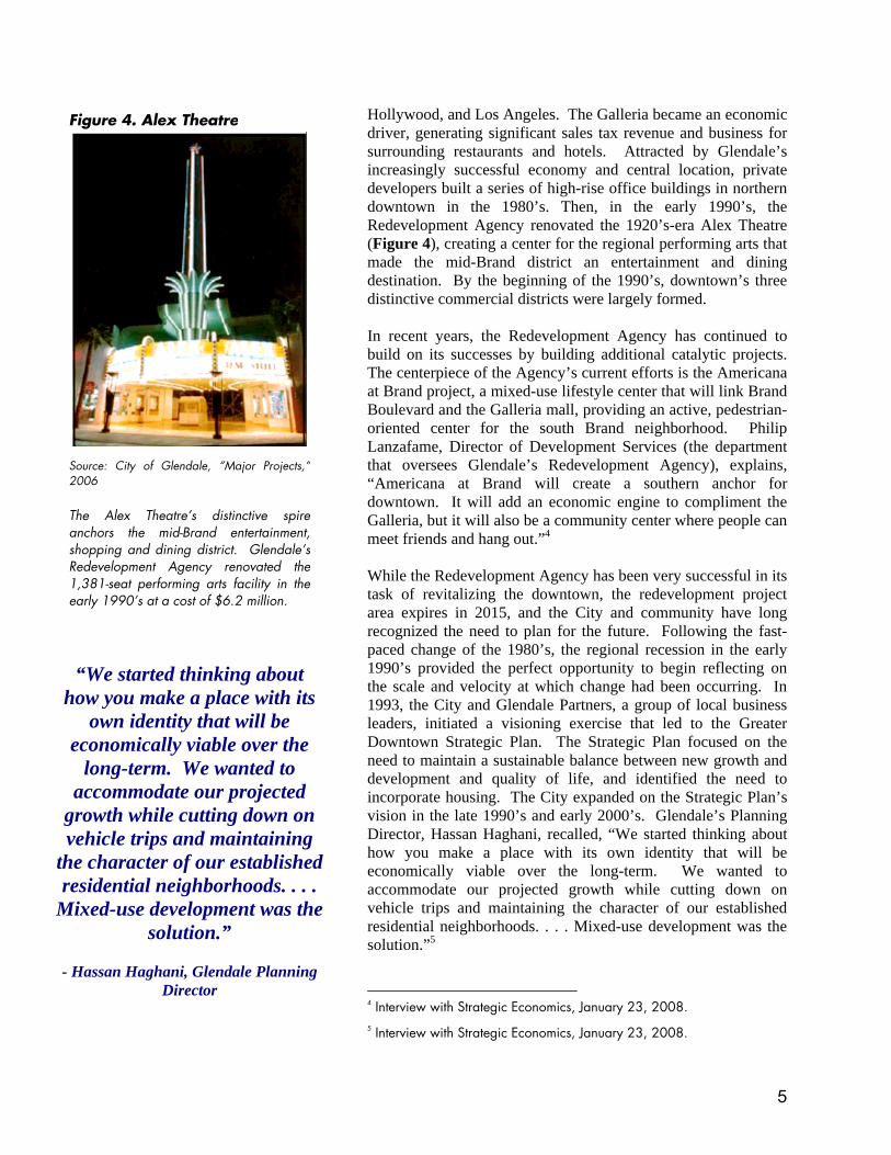
Hollywood, and Los Angeles. The Galleria became an economic driver, generating significant sales tax revenue and business for surrounding restaurants and hotels. Attracted by Glendale’s increasingly successful economy and central location, private developers built a series of high-rise office buildings in northern downtown in the 1980’s. Then, in the early 1990’s, the Redevelopment Agency renovated the 1920’s-era Alex Theatre (Figure 4), creating a center for the regional performing arts that made the mid-Brand district an entertainment and dining destination. By the beginning of the 1990’s, downtown’s three distinctive commercial districts were largely formed. In recent years, the Redevelopment Agency has continued to build on its successes by building additional catalytic projects. The centerpiece of the Agency’s current efforts is the Americana at Brand project, a mixed-use lifestyle center that will link Brand Boulevard and the Galleria mall, providing an active, pedestrian-oriented center for the south Brand neighborhood. Philip Lanzafame, Director of Development Services (the department that oversees Glendale’s Redevelopment Agency), explains, “Americana at Brand will create a southern anchor for downtown. It will add an economic engine to compliment the Galleria, but it will also be a community center where people can meet friends and hang out.”4 While the Redevelopment Agency has been very successful in its task of revitalizing the downtown, the redevelopment project area expires in 2015, and the City and community have long recognized the need to plan for the future. Following the fast-paced change of the 1980’s, the regional recession in the early 1990’s provided the perfect opportunity to begin reflecting on the scale and velocity at which change had been occurring. In 1993, the City and Glendale Partners, a group of local business leaders, initiated a visioning exercise that led to the Greater Downtown Strategic Plan. The Strategic Plan focused on the need to maintain a sustainable balance between new growth and development and quality of life, and identified the need to incorporate housing. The City expanded on the Strategic Plan’s vision in the late 1990’s and early 2000’s. Glendale’s Planning Director, Hassan Haghani, recalled, “We started thinking about how you make a place with its own identity that will be economically viable over the long-term. We wanted to accommodate our projected growth while cutting down on vehicle trips and maintaining the character of our established residential neighborhoods. . . . Mixed-use development was the solution.”5
4 Interview with Strategic Economics, January 23, 2008. 5 Interview with Strategic Economics, January 23, 2008.
Figure 4. Alex Theatre Source: City of Glendale, “Major Projects,”2006 The Alex Theatre’s distinctive spireanchors the mid-Brand entertainment,shopping and dining district. Glendale’sRedevelopment Agency renovated the1,381-seat performing arts facility in theearly 1990’s at a cost of $6.2 million.
“We started thinking about how you make a place with its
own identity that will be economically viable over the
long-term. We wanted to accommodate our projected
growth while cutting down on vehicle trips and maintaining
the character of our established residential neighborhoods. . . .
Mixed-use development was the solution.”
- Hassan Haghani, Glendale Planning
Director
5
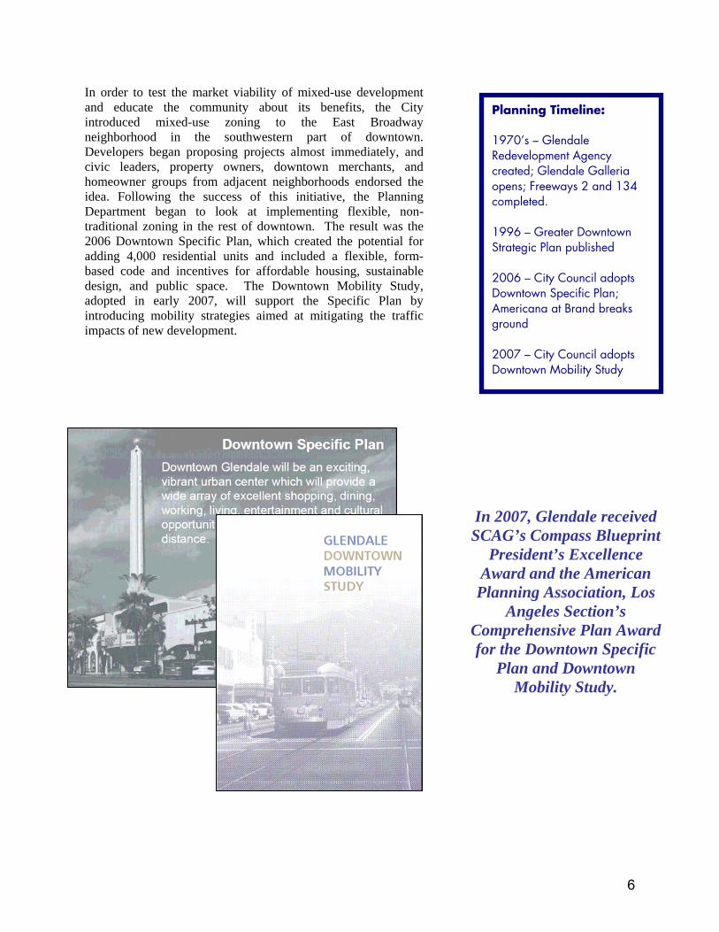
In order to test the market viability of mixed-use development and educate the community about its benefits, the City introduced mixed-use zoning to the East Broadway neighborhood in the southwestern part of downtown. Developers began proposing projects almost immediately, and civic leaders, property owners, downtown merchants, and homeowner groups from adjacent neighborhoods endorsed the idea. Following the success of this initiative, the Planning Department began to look at implementing flexible, non-traditional zoning in the rest of downtown. The result was the 2006 Downtown Specific Plan, which created the potential for adding 4,000 residential units and included a flexible, form-based code and incentives for affordable housing, sustainable design, and public space. The Downtown Mobility Study, adopted in early 2007, will support the Specific Plan by introducing mobility strategies aimed at mitigating the traffic impacts of new development.
In 2007, Glendale received SCAG’s Compass Blueprint
President’s Excellence Award and the American Planning Association, Los
Angeles Section’s Comprehensive Plan Award for the Downtown Specific
Plan and Downtown Mobility Study.
Planning Timeline: 1970’s – Glendale Redevelopment Agency created; Glendale Galleria opens; Freeways 2 and 134 completed. 1996 – Greater Downtown Strategic Plan published 2006 – City Council adopts Downtown Specific Plan; Americana at Brand breaks ground 2007 – City Council adopts Downtown Mobility Study
6
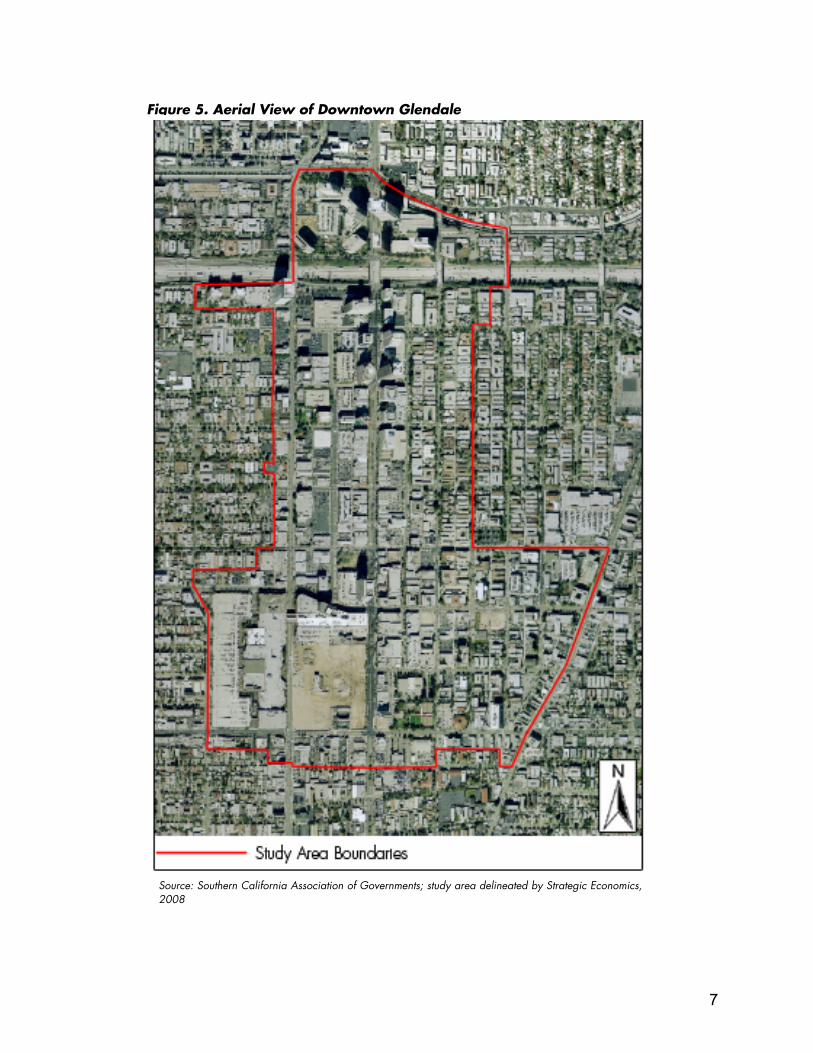
Figure 5. Aerial View of Downtown Glendale
Source: Southern California Association of Governments; study area delineated by Strategic Economics,2008
7
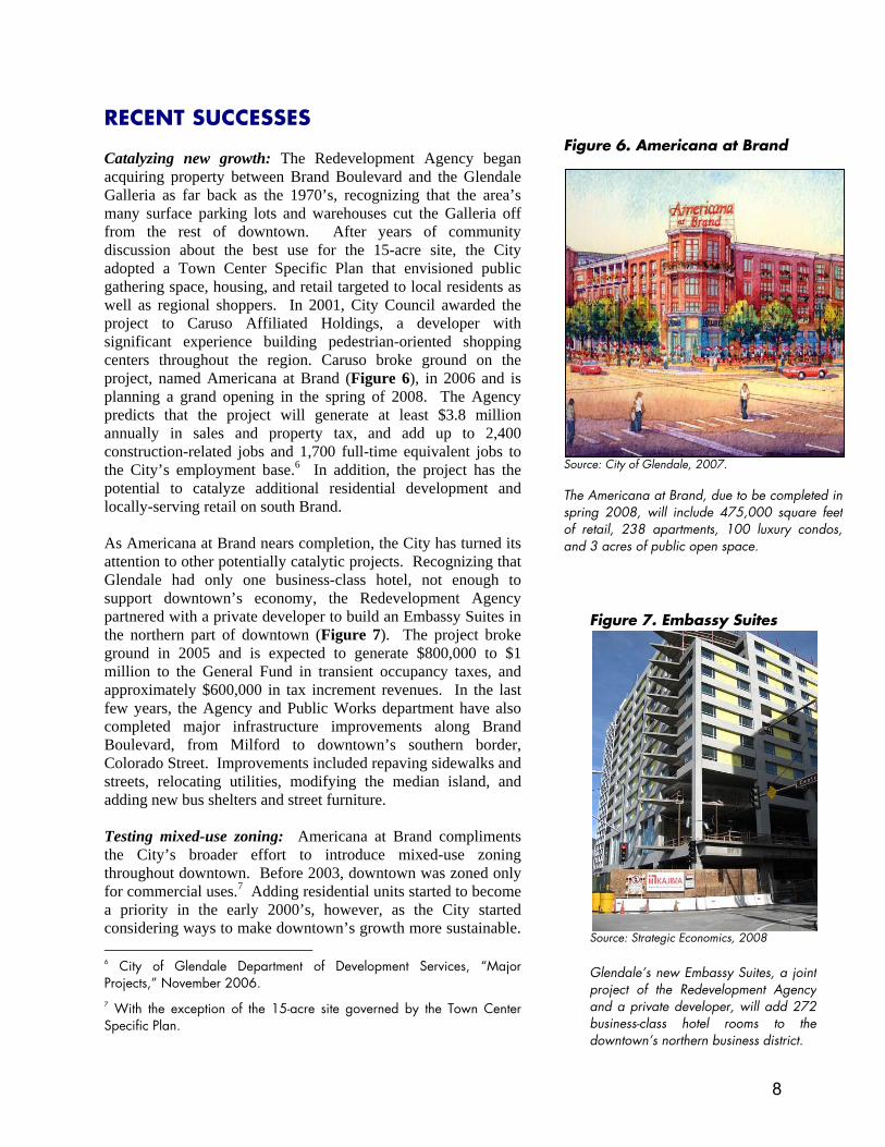
RECENT SUCCESSES Catalyzing new growth: The Redevelopment Agency began acquiring property between Brand Boulevard and the Glendale Galleria as far back as the 1970’s, recognizing that the area’s many surface parking lots and warehouses cut the Galleria off from the rest of downtown. After years of community discussion about the best use for the 15-acre site, the City adopted a Town Center Specific Plan that envisioned public gathering space, housing, and retail targeted to local residents as well as regional shoppers. In 2001, City Council awarded the project to Caruso Affiliated Holdings, a developer with significant experience building pedestrian-oriented shopping centers throughout the region. Caruso broke ground on the project, named Americana at Brand (Figure 6), in 2006 and is planning a grand opening in the spring of 2008. The Agency predicts that the project will generate at least $3.8 million annually in sales and property tax, and add up to 2,400 construction-related jobs and 1,700 full-time equivalent jobs to the City’s employment base.6 In addition, the project has the potential to catalyze additional residential development and locally-serving retail on south Brand. As Americana at Brand nears completion, the City has turned its attention to other potentially catalytic projects. Recognizing that Glendale had only one business-class hotel, not enough to support downtown’s economy, the Redevelopment Agency partnered with a private developer to build an Embassy Suites in the northern part of downtown (Figure 7). The project broke ground in 2005 and is expected to generate $800,000 to $1 million to the General Fund in transient occupancy taxes, and approximately $600,000 in tax increment revenues. In the last few years, the Agency and Public Works department have also completed major infrastructure improvements along Brand Boulevard, from Milford to downtown’s southern border, Colorado Street. Improvements included repaving sidewalks and streets, relocating utilities, modifying the median island, and adding new bus shelters and street furniture. Testing mixed-use zoning: Americana at Brand compliments the City’s broader effort to introduce mixed-use zoning throughout downtown. Before 2003, downtown was zoned only for commercial uses.7 Adding residential units started to become a priority in the early 2000’s, however, as the City started considering ways to make downtown’s growth more sustainable. 6 City of Glendale Department of Development Services, “Major Projects,” November 2006. 7 With the exception of the 15-acre site governed by the Town Center Specific Plan.
Figure 6. Americana at Brand Source: City of Glendale, 2007. The Americana at Brand, due to be completed inspring 2008, will include 475,000 square feetof retail, 238 apartments, 100 luxury condos,and 3 acres of public open space.
Figure 7. Embassy Suites Source: Strategic Economics, 2008 Glendale’s new Embassy Suites, a jointproject of the Redevelopment Agencyand a private developer, will add 272business-class hotel rooms to thedowntown’s northern business district.
8
In response to community concerns that increased residential density might increase congestion and strain city services, the City decided to start slowly. In 2003, City Council adopted mixed-use residential zoning for the East Broadway neighborhood, bounded roughly by Wilson and Colorado to the north and south and Glendale Avenue and Louise to the east and west. Several developers immediately proposed condominium projects with ground floor commercial space, demonstrating the existence of a viable market. As these projects began construction, the City used them as examples to help civic leaders, downtown merchants, and property owners envision the benefits of downtown housing. Business owners began to buy into the idea of creating a local customer base. Several community groups from surrounding neighborhoods also endorsed the East Broadway zoning change, encouraged by the idea that adding downtown housing would allow Glendale to accommodate future population growth without significantly expanding city infrastructure or compromising the character of established residential neighborhoods. Downtown Specific Plan: As consensus gathered around mixed-use zoning in the East Broadway neighborhood, the City found support to extend the use of untraditional zoning throughout downtown and using other planning tools to help accommodate as much of the City’s future growth as possible in the downtown area. Intensifying downtown will both mitigate the impact on Glendale’s existing residential neighborhoods and reduce the need for building additional infrastructure. As the City considered how much residential density would be needed to concentrate population growth downtown, staff relied heavily on SCAG’s population growth forecasts. The SCAG 2004 Regional Growth Forecast predicted that Glendale will add approximately 5,000 households by 2020; the Specific Plan creates the capacity for adding nearly 4,000 housing units downtown, nearly 80 percent of the anticipated growth.8 Form-Based Code: A form-based code dictates land use regulations in the Downtown Specific Plan (see sidebar). The Plan divides downtown Glendale into 11 distinct districts9 with
8 City of Glendale Planning Department, Final Program Environmental Impact Report for the Glendale Downtown Specific Plan, October 2006. 9 The 11 districts formally identified in the Downtown Specific Plan (DSP) are smaller and more narrowly defined than the three, more informal districts that this case study uses to describe downtown. However, the 11 DSP districts fit generally within the broader characterization of north, south, and mid-Brand. For example, the Specific Plan’s “Gateway District” falls within the northern end of downtown and is characterized by high-rise office buildings, while the “Alex Theatre District” falls within
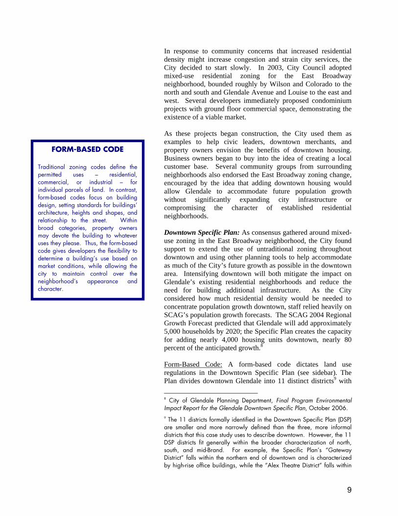
FORM-BASED CODE Traditional zoning codes define thepermitted uses – residential,commercial, or industrial – forindividual parcels of land. In contrast,form-based codes focus on buildingdesign, setting standards for buildings’architecture, heights and shapes, andrelationship to the street. Withinbroad categories, property ownersmay devote the building to whateveruses they please. Thus, the form-basedcode gives developers the flexibility todetermine a building’s use based onmarket conditions, while allowing thecity to maintain control over theneighborhood’s appearance andcharacter.
9
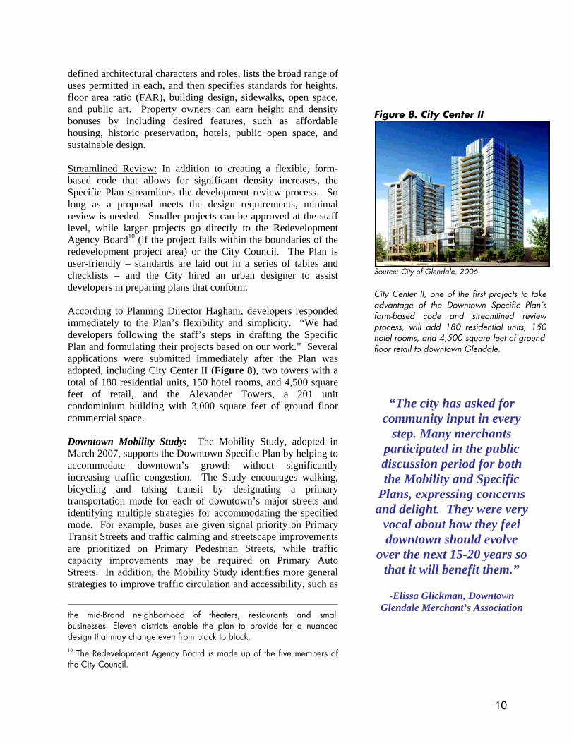
defined architectural characters and roles, lists the broad range of uses permitted in each, and then specifies standards for heights, floor area ratio (FAR), building design, sidewalks, open space, and public art. Property owners can earn height and density bonuses by including desired features, such as affordable housing, historic preservation, hotels, public open space, and sustainable design. Streamlined Review: In addition to creating a flexible, form- based code that allows for significant density increases, the Specific Plan streamlines the development review process. So long as a proposal meets the design requirements, minimal review is needed. Smaller projects can be approved at the staff level, while larger projects go directly to the Redevelopment Agency Board10 (if the project falls within the boundaries of the redevelopment project area) or the City Council. The Plan is user-friendly – standards are laid out in a series of tables and checklists – and the City hired an urban designer to assist developers in preparing plans that conform. According to Planning Director Haghani, developers responded immediately to the Plan’s flexibility and simplicity. “We had developers following the staff’s steps in drafting the Specific Plan and formulating their projects based on our work.” Several applications were submitted immediately after the Plan was adopted, including City Center II (Figure 8), two towers with a total of 180 residential units, 150 hotel rooms, and 4,500 square feet of retail, and the Alexander Towers, a 201 unit condominium building with 3,000 square feet of ground floor commercial space. Downtown Mobility Study: The Mobility Study, adopted in March 2007, supports the Downtown Specific Plan by helping to accommodate downtown’s growth without significantly increasing traffic congestion. The Study encourages walking, bicycling and taking transit by designating a primary transportation mode for each of downtown’s major streets and identifying multiple strategies for accommodating the specified mode. For example, buses are given signal priority on Primary Transit Streets and traffic calming and streetscape improvements are prioritized on Primary Pedestrian Streets, while traffic capacity improvements may be required on Primary Auto Streets. In addition, the Mobility Study identifies more general strategies to improve traffic circulation and accessibility, such as
the mid-Brand neighborhood of theaters, restaurants and small businesses. Eleven districts enable the plan to provide for a nuanced design that may change even from block to block. 10 The Redevelopment Agency Board is made up of the five members of the City Council.
“The city has asked for community input in every
step. Many merchants participated in the public discussion period for both the Mobility and Specific
Plans, expressing concerns and delight. They were very
vocal about how they feel downtown should evolve
over the next 15-20 years so that it will benefit them.”
-Elissa Glickman, Downtown
Glendale Merchant’s Association
Figure 8. City Center II Source: City of Glendale, 2006 City Center II, one of the first projects to takeadvantage of the Downtown Specific Plan’sform-based code and streamlined reviewprocess, will add 180 residential units, 150hotel rooms, and 4,500 square feet of ground-floor retail to downtown Glendale.
10
creating a “Park Once” district, improving transit and adopting other transportation demand management policies. “Park Once:” A “Park Once” strategy aims to “[transform] motorists into pedestrians” by encouraging visitors, residents and commuters to park once and walk or take transit to their various destinations. In order to help drivers find a convenient parking space without searching extensively, the Mobility Study plans to maximize the efficiency of existing parking facilities. Currently, Glendale is perceived to have a parking shortage, but only 53 percent of the downtown’s parking spaces are occupied at peak hours. In order to achieve a goal of 85 percent occupancy of all parking facilities at peak hours, the Mobility Study proposes:
• Installing a wayfinding system to efficiently direct drivers to available spaces
• Encouraging private parking facilities that serve workers during the business day to open to residents and visitors in the evening and on weekends.
• Implementing demand-responsive parking prices, making parking most expensive at peak hours and managing the difference in price between on-street, metered parking and parking garages and lots.
Transit Improvements: Good transit options not only support a “Park Once” strategy by providing an alternative means of travelling around downtown, but also reduce the need to drive to downtown in the first place. The Mobility Plan proposes making several improvements to downtown’s transit accessibility, including:
• Creating a east-west bus route to connect downtown Glendale with the Gold Line in Pasadena and the Red Line in North Hollywood. The proposed bus route would operate on HOV lanes on Highway 134.
• Providing a downtown shuttle (“The Glendale Buzz Shuttle”) to connect the Glendale Metrolink/Amtrak station with downtown’s major destinations and the east-west bus route.
Transportation Demand Management: In addition to improving transit options, the Mobility Study recommends that the City Council strengthen its existing Transportation Demand Management (TDM) Ordinance, which was originally approved in 1993. The new ordinance would require all employers to join a Transportation Management Association and pay membership dues based on the number of employees and/or number of auto trips taken by employees. The Ordinance would also require that employers and developers provide all downtown workers and residents with discounted transit passes, enable employees who
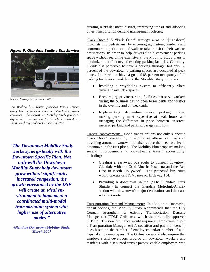
Figure 9. Glendale Beeline Bus Service Source: Strategic Economics, 2008 The Beeline bus system provides transit serviceevery ten minutes on some of Glendale’s busiestcorridors. The Downtown Mobility Study proposesexpanding bus service to include a downtownshuttle and regional east-west connector.
“The Downtown Mobility Study works synergistically with the Downtown Specific Plan. Not
only will the Downtown Mobility Study help downtown
grow without significantly increased congestion, the
growth envisioned by the DSP will create an ideal en-
vironment to implement a coordinated multi-modal
transportation system with higher use of alternative
modes.”
-Glendale Downtown Mobility Study, March 2007
11
commute on foot, bicycle or transit to “cash-out” their reserved parking space, and make bicycle facilities mandatory in new developments. Financing Improvements: The Mobility Study identified a menu of options to finance improvements to parking, bicycle, and pedestrian infrastructure, as well as ongoing transportation programs. Sources identified in the plan for infrastructure improvements include development impact fees, a community facilities district, Federal earmarks, and Proposition 1b (which provides local allocations of State funds for infrastructure improvements that promote infill development). Other possible financing options for ongoing programs included parking taxes, in-lieu fees, and Transportation Demand Management dues.
12
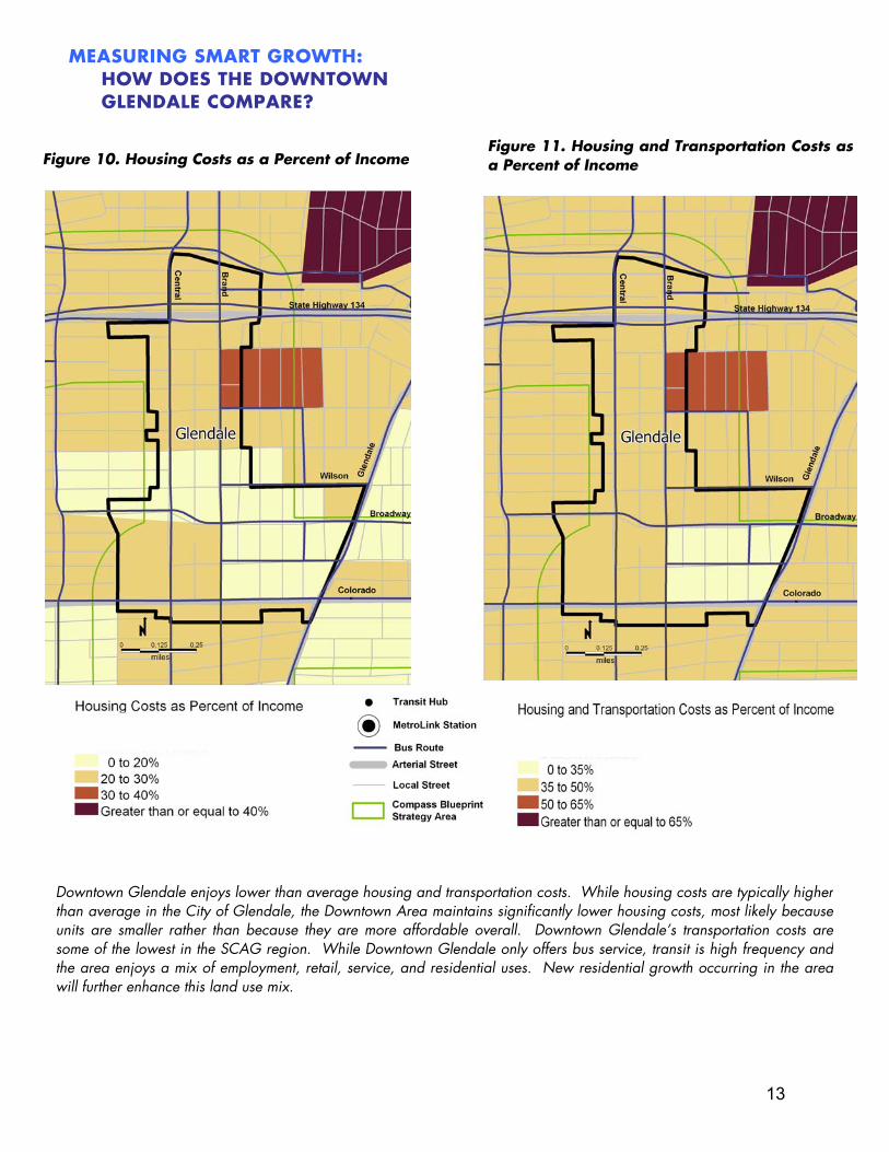
Downtown Glendale enjoys lower than average housing and transportation costs. While housing costs are typically higherthan average in the City of Glendale, the Downtown Area maintains significantly lower housing costs, most likely becauseunits are smaller rather than because they are more affordable overall. Downtown Glendale’s transportation costs aresome of the lowest in the SCAG region. While Downtown Glendale only offers bus service, transit is high frequency andthe area enjoys a mix of employment, retail, service, and residential uses. New residential growth occurring in the areawill further enhance this land use mix.
Figure 11. Housing and Transportation Costs asa Percent of Income Figure 10. Housing Costs as a Percent of Income
MEASURING SMART GROWTH:HOW DOES THE DOWNTOWN GLENDALE COMPARE?
13
Smart Growth Factors Affecting Transportation Affordability
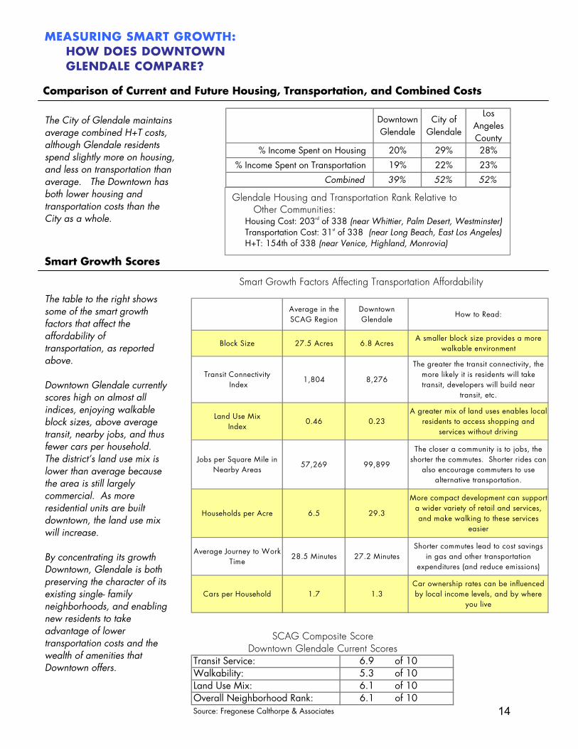
The City of Glendale maintains average combined H+T costs, although Glendale residents spend slightly more on housing, and less on transportation than average. The Downtown has both lower housing and transportation costs than the City as a whole.
Glendale Housing and Transportation Rank Relative to Other Communities:
Housing Cost: 203rd of 338 (near Whittier, Palm Desert, Westminster)Transportation Cost: 31st of 338 (near Long Beach, East Los Angeles)H+T: 154th of 338 (near Venice, Highland, Monrovia)
Comparison of Current and Future Housing, Transportation, and Combined Costs
MEASURING SMART GROWTH:HOW DOES DOWNTOWN GLENDALE COMPARE?
Smart Growth Scores
The table to the right shows some of the smart growth factors that affect the affordability of transportation, as reported above. Downtown Glendale currently scores high on almost all indices, enjoying walkable block sizes, above average transit, nearby jobs, and thus fewer cars per household. The district’s land use mix is lower than average because the area is still largely commercial. As more residential units are built downtown, the land use mix will increase. By concentrating its growth Downtown, Glendale is both preserving the character of its existing single- family neighborhoods, and enabling new residents to take advantage of lower transportation costs and the wealth of amenities that Downtown offers.
Downtown Glendale
City of Glendale
Los Angeles County
% Income Spent on Housing 20% 29% 28%
% Income Spent on Transportation 19% 22% 23%
Combined 39% 52% 52%
SCAG Composite ScoreDowntown Glendale Current Scores
Transit Service: 6.9 of 10Walkability: 5.3 of 10Land Use Mix: 6.1 of 10Overall Neighborhood Rank: 6.1 of 10Source: Fregonese Calthorpe & Associates
Average in the SCAG Region
Downtown Glendale
How to Read:
Block Size 27.5 Acres 6.8 AcresA smaller block size provides a more
walkable environment
Transit Connectivity Index
1,804 8,276
The greater the transit connectivity, the more likely it is residents will take transit, developers will build near
transit, etc.
Land Use Mix Index
0.46 0.23A greater mix of land uses enables local
residents to access shopping and services without driving
Jobs per Square Mile in Nearby Areas
57,269 99,899
The closer a community is to jobs, the shorter the commutes. Shorter rides can
also encourage commuters to use alternative transportation.
Households per Acre 6.5 29.3
More compact development can support a wider variety of retail and services, and make walking to these services
easier
Average Journey to Work Time
28.5 Minutes 27.2 MinutesShorter commutes lead to cost savings
in gas and other transportation expenditures (and reduce emissions)
Cars per Household 1.7 1.3Car ownership rates can be influenced by local income levels, and by where
you live
14
LESSONS LEARNED
Introducing mixed-use zoning one step at a time can help build community support. Community members initially feared that allowinghousing in Glendale’s downtown would worsentraffic congestion and tax city services. Byintroducing mixed-use zoning slowly, beginning inthe East Broadway neighborhood, the City was ableto demonstrate the benefits of including housing inthe downtown, eventually convincing neighboringhomeowners that building housing downtownwould allow Glendale to accommodate futuregrowth without impinging on existingneighborhoods. This early educational process wasa crucial part of winning community support for theDowntown Specific Plan later on.
Plan ahead for major changes to yourimplementation plan. Glendale’s Redevelopment Agency has had ahugely beneficial impact on downtown, butCalifornia state law mandates that the projectarea end in 2015. The Downtown Specific Planand Mobility Study set a vision for the future,and will help smooth downtown’s transition fromthe jurisdiction of the Redevelopment Agency tothat of the Planning Department. AsRedevelopment Agency Director PhilipLanzafame explains, the Downtown SpecificPlan “will take the place [of the RedevelopmentAgency], ensuring that development is ongoingand that downtown is constantly being upgradedand remains vibrant.”
Parking management tools can facilitate infill development. In many urban environments, parking requirementsdetermine the density and design of a project.Developers may need to build fewer units in orderto fit the required amount of parking, or evenabandon a project all together if fitting the numberof required parking spaces is impossible. Parkingis also a crucial consideration for retailers whoneed their customers to be able to find convenientparking near their stores. Glendale’s reducedparking minimums and “Park Once” policy helpsreduce these pressures by managing all sharedpublic parking, allowing developers to buildprojects most appropriate to the site and assuringbusiness owners that employees and customers willbe able to find parking.
Balance planning to consider all transportation modes, including walking, bicycling, driving, and transit. The needs of buses, pedestrians, bicycles andcars can sometimes conflict, particularly in busyareas like downtown Glendale. The DowntownMobility Plan addresses this problem bydesignating a primary transportation mode foreach street and identifying strategies to maximizeefficiency for the designated mode. The “ParkOnce” District will encourage drivers to parkquickly and then leave their cars and walk or taketransit, while transit improvements and othertransportation demand management strategieswill help encourage people to use alternativemodes to get to downtown in the first place.Together, these strategies will create safer, moreactive streets and reduce the congestion impactsof new development.
ACKNOWLEDGEMENTS The following individuals provided information for this case study: John Takhtalian, Assistant to the City Manager Philip Lanzafame, Director of Development Services Hassan Haghani, Planning Director Elissa Glickman, Director of Marketing and Resource Development, Alex Theatre Lead Authors: Abby Thorne-Lyman, Strategic Economics Alison Nemirow, Strategic Economics
For more information, contact: Joseph Carreras Program Manager, Housing and Community Planning Southern California Association of Governments 213-236-1856
15
anemirow
Rectangle
anemirow
Rectangle
anemirow
Text Box
15


