Satellite data products to support climate modelling –Land Cover Finnish Environment Institute...
17
Satellite data products to support climate modelling – Land Cover Finnish Environment Institute Pekka Härmä Markus Törmä Suvi Hatunen
-
Upload
earl-welch -
Category
Documents
-
view
216 -
download
0
Transcript of Satellite data products to support climate modelling –Land Cover Finnish Environment Institute...
Satellite data products to support climate modelling –Land Cover
Finnish Environment Institute
Pekka Härmä
Markus Törmä
Suvi Hatunen
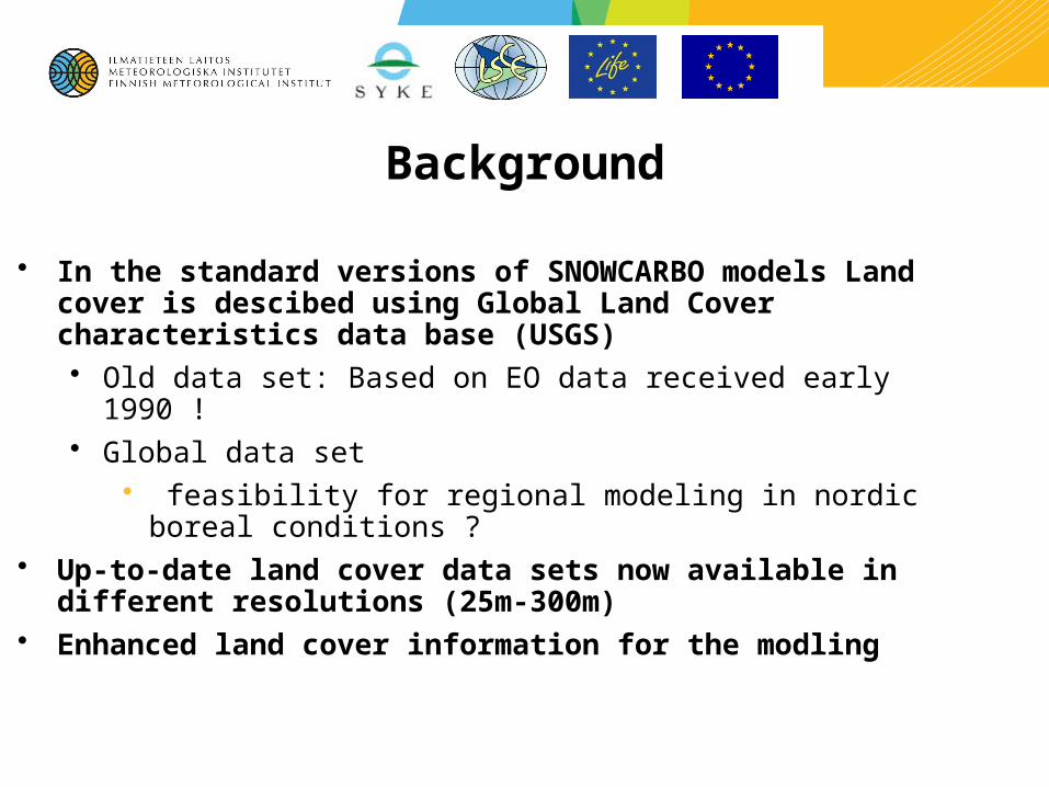
Background
• In the standard versions of SNOWCARBO models Land cover is descibed using Global Land Cover characteristics data base (USGS)• Old data set: Based on EO data received early 1990 !• Global data set
• feasibility for regional modeling in nordic boreal conditions ? • Up-to-date land cover data sets now available in different
resolutions (25m-300m)• Enhanced land cover information for the modling
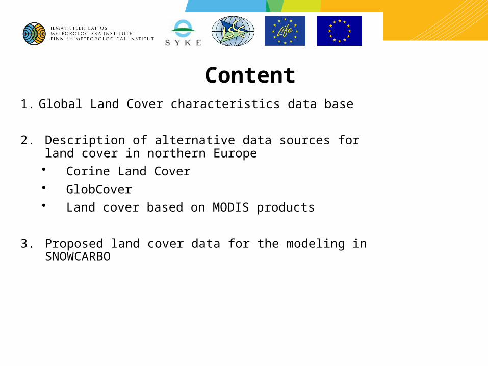
Content1. Global Land Cover characteristics data base
2. Description of alternative data sources for land cover in northern Europe• Corine Land Cover• GlobCover• Land cover based on MODIS products
3. Proposed land cover data for the modeling in SNOWCARBO
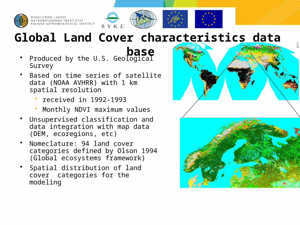
Global Land Cover characteristics data base
• Produced by the U.S. Geological Survey • Based on time series of satellite data (NOAA
AVHRR) with 1 km spatial resolution• received in 1992-1993• Monthly NDVI maximum values
• Unsupervised classification and data integration with map data (DEM, ecoregions, etc)
• Nomeclature: 94 land cover categories defined by Olson 1994 (Global ecosystems framework)
• Spatial distribution of land cover categories for the modeling

Global Land Cover characteristics data base Modified by Max Plank Institute
• Allocation of land surface parameters for each Olsson ecosystem type • Background surface albedo αs,
• Surface roughness length due to vegetation z0,veg,
• Fractional vegetation cover cv, L
• Leaf area index LAI for the growing and dormancy season,
• Forest ratio or fraction cf,
• Plant-available soil water holding capacity Wava,
• Volumetric wilting point fpwp
• Gives the characteristics of vegetation and soils for the models
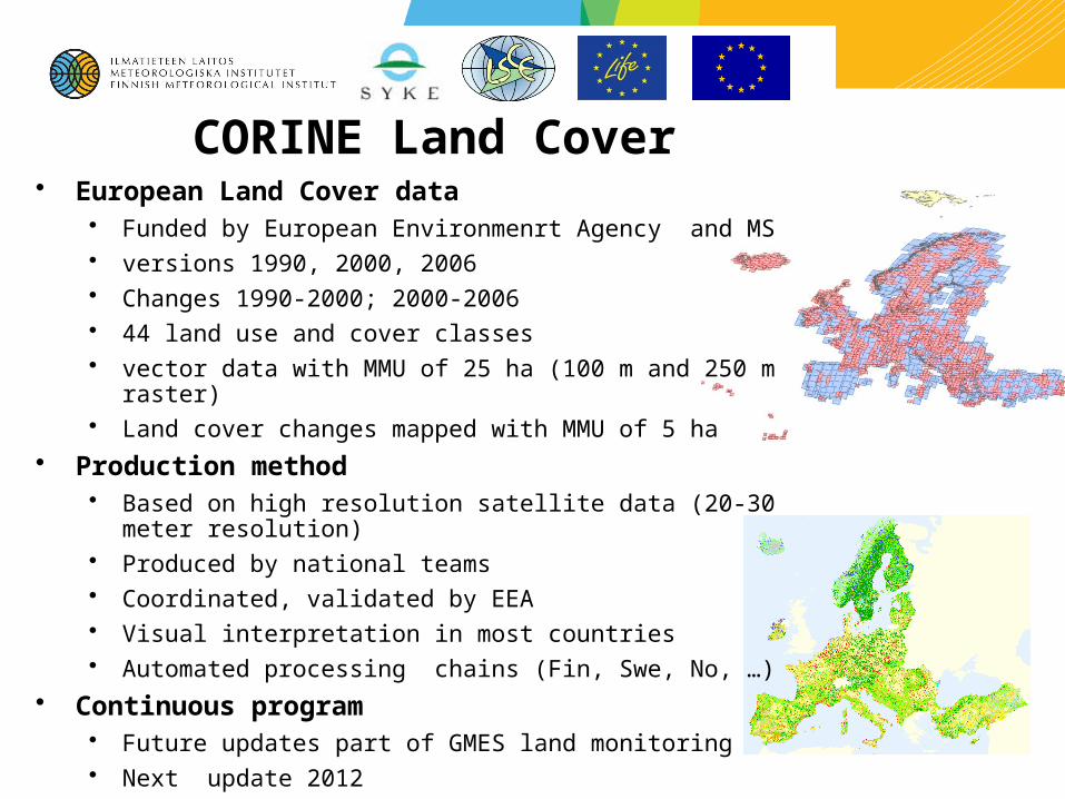
CORINE Land Cover • European Land Cover data
• Funded by European Environmenrt Agency and MS • versions 1990, 2000, 2006• Changes 1990-2000; 2000-2006• 44 land use and cover classes • vector data with MMU of 25 ha (100 m and 250 m raster)• Land cover changes mapped with MMU of 5 ha
• Production method• Based on high resolution satellite data (20-30 meter resolution) • Produced by national teams• Coordinated, validated by EEA • Visual interpretation in most countries• Automated processing chains (Fin, Swe, No, …)
• Continuous program • Future updates part of GMES land monitoring • Next update 2012
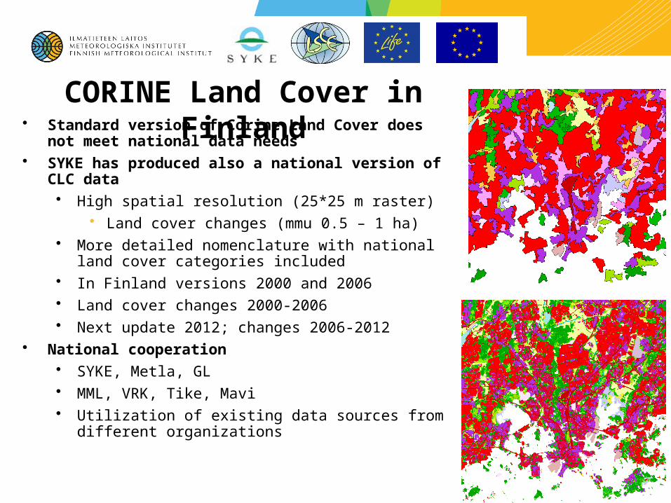
CORINE Land Cover in Finland• Standard version of Corine Land Cover does not meet
national data needs • SYKE has produced also a national version of CLC data
• High spatial resolution (25*25 m raster) • Land cover changes (mmu 0.5 – 1 ha)
• More detailed nomenclature with national land cover categories included
• In Finland versions 2000 and 2006• Land cover changes 2000-2006• Next update 2012; changes 2006-2012
• National cooperation • SYKE, Metla, GL• MML, VRK, Tike, Mavi • Utilization of existing data sources from different
organizations
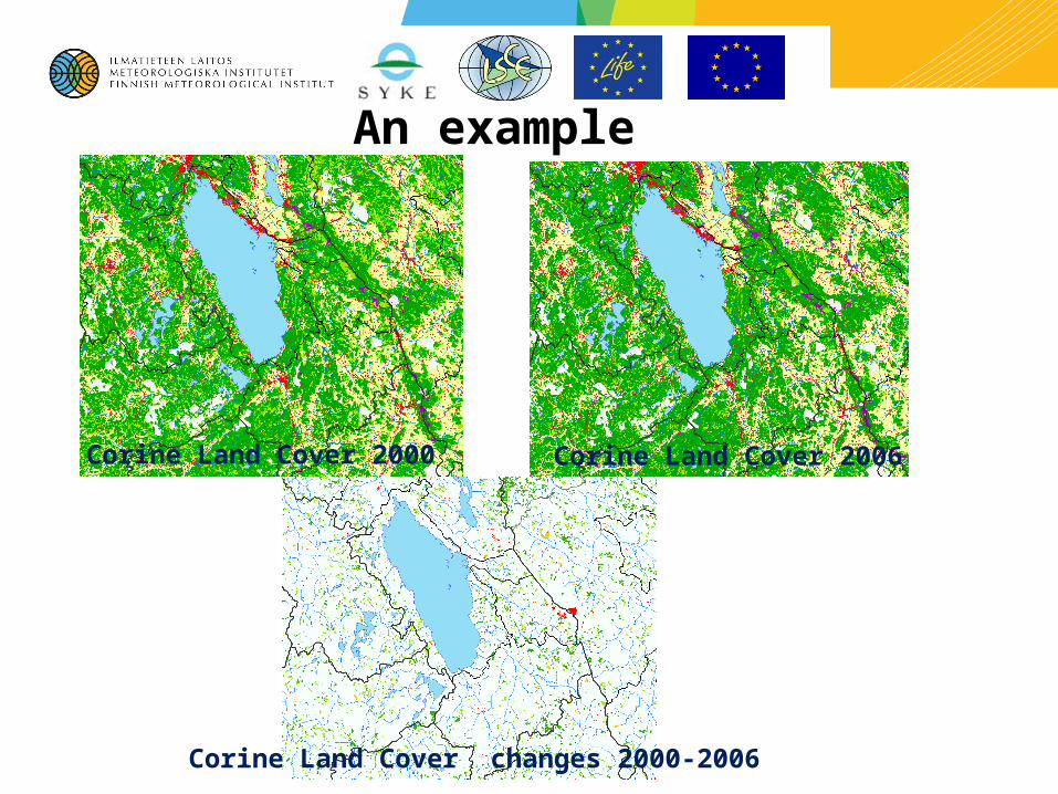
Corine Land Cover 2000
Corine Land Cover changes 2000-2006
Corine Land Cover 2006
An example
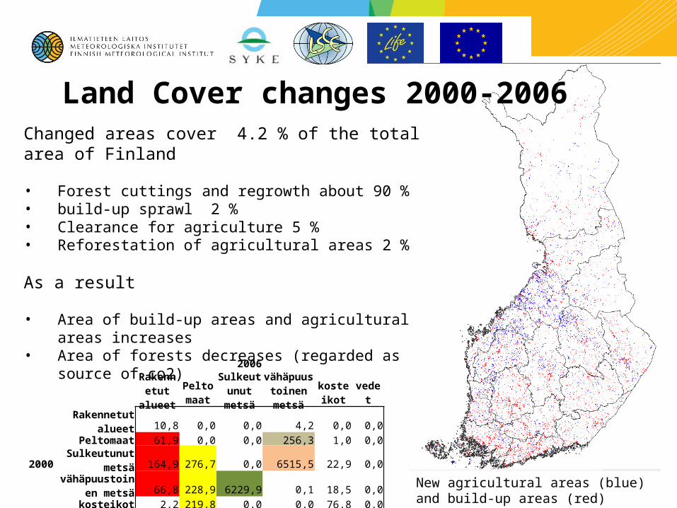
Land Cover changes 2000-2006Changed areas cover 4.2 % of the total area of Finland
• Forest cuttings and regrowth about 90 % • build-up sprawl 2 %• Clearance for agriculture 5 %• Reforestation of agricultural areas 2 %
As a result
• Area of build-up areas and agricultural areas increases • Area of forests decreases (regarded as source of co2)
New agricultural areas (blue) and build-up areas (red)
2006Rakennetut alueet
Peltomaat
Sulkeutunut metsä
vähäpuustoinen metsä
kosteikot vedet
Rakennetut alueet 10,8 0,0 0,0 4,2 0,0 0,0Peltomaat 61,9 0,0 0,0 256,3 1,0 0,0
2000Sulkeutunut
metsä 164,9 276,7 0,0 6515,5 22,9 0,0vähäpuustoinen
metsä 66,8 228,9 6229,9 0,1 18,5 0,0kosteikot 2,2 219,8 0,0 0,0 76,8 0,0
vedet 1,5 0,0 0,0 0,0 0,0 0,0
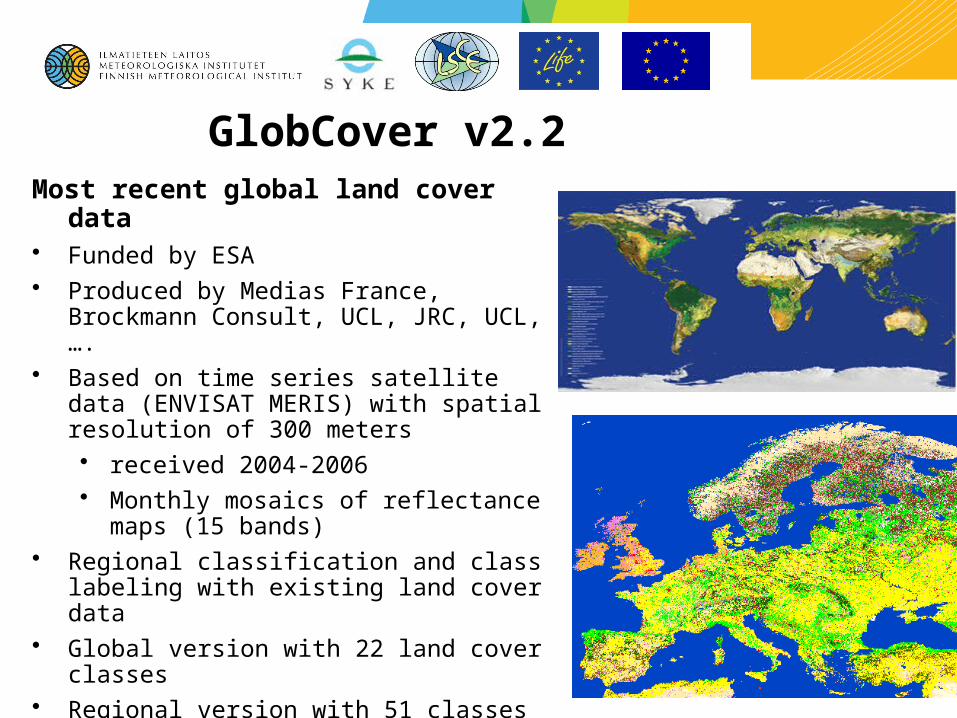
GlobCover v2.2Most recent global land cover data • Funded by ESA • Produced by Medias France, Brockmann
Consult, UCL, JRC, UCL, ….• Based on time series satellite data (ENVISAT
MERIS) with spatial resolution of 300 meters• received 2004-2006• Monthly mosaics of reflectance maps (15
bands) • Regional classification and class labeling with
existing land cover data • Global version with 22 land cover classes• Regional version with 51 classes• Nomenclature defined using UN land cover
classification system (LCCS)
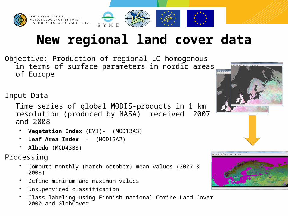
New regional land cover dataObjective: Production of regional LC homogenous in terms of
surface parameters in nordic areas of Europe
Input Data
Time series of global MODIS-products in 1 km resolution (produced by NASA) received 2007 and 2008• Vegetation Index (EVI)- (MOD13A3)• Leaf Area Index - (MOD15A2)• Albedo (MCD43B3)
Processing• Compute monthly (march-october) mean values (2007 & 2008)• Define minimum and maximum values • Unsuperviced classification • Class labeling using Finnish national Corine Land Cover 2000 and
GlobCover
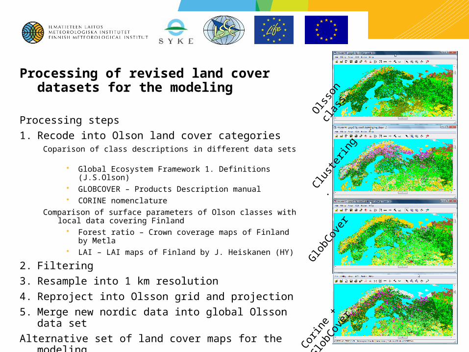
Processing of revised land cover datasets for the modeling
Processing steps
1. Recode into Olson land cover categoriesCoparison of class descriptions in different data sets
• Global Ecosystem Framework 1. Definitions (J.S.Olson) • GLOBCOVER – Products Description manual• CORINE nomenclature
Comparison of surface parameters of Olson classes with local data covering Finland
• Forest ratio – Crown coverage maps of Finland by Metla• LAI – LAI maps of Finland by J. Heiskanen (HY)
2. Filtering
3. Resample into 1 km resolution
4. Reproject into Olsson grid and projection
5. Merge new nordic data into global Olsson data set
Alternative set of land cover maps for the modeling O
lsso
n cl
ass.
Corin
e +
Glo
bCov
er
Glo
bCov
er
Clust
erin
g.
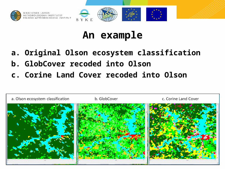
An example
a. Original Olson ecosystem classification
b. GlobCover recoded into Olson
c. Corine Land Cover recoded into Olson
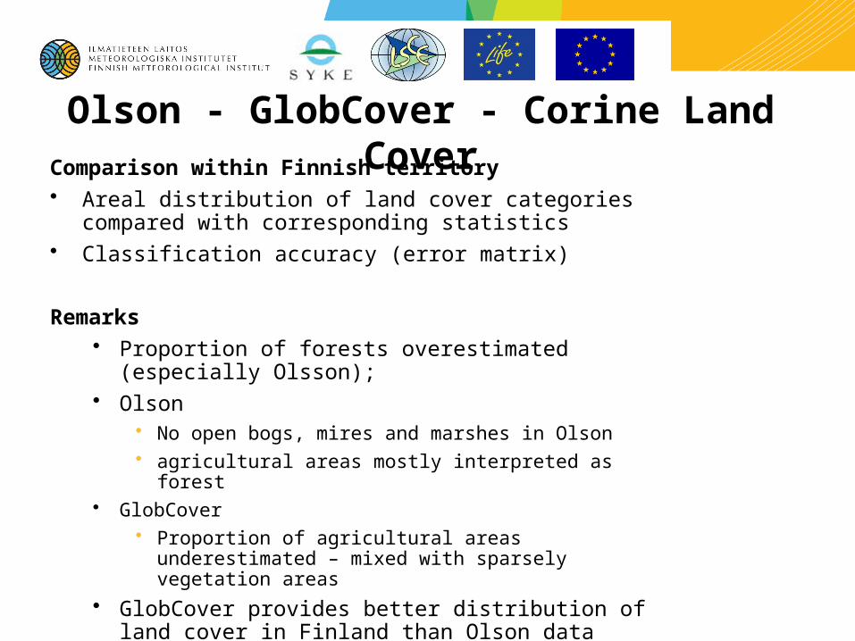
Olson - GlobCover - Corine Land CoverComparison within Finnish territory• Areal distribution of land cover categories compared with
corresponding statistics • Classification accuracy (error matrix)
Remarks• Proportion of forests overestimated (especially Olsson); • Olson
• No open bogs, mires and marshes in Olson • agricultural areas mostly interpreted as forest
• GlobCover• Proportion of agricultural areas underestimated – mixed
with sparsely vegetation areas
• GlobCover provides better distribution of land cover in Finland than Olson data
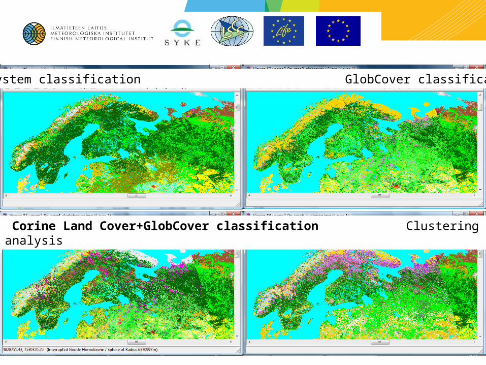
Olson ecosystem classification GlobCover classification
Corine Land Cover+GlobCover classification Clustering analysis
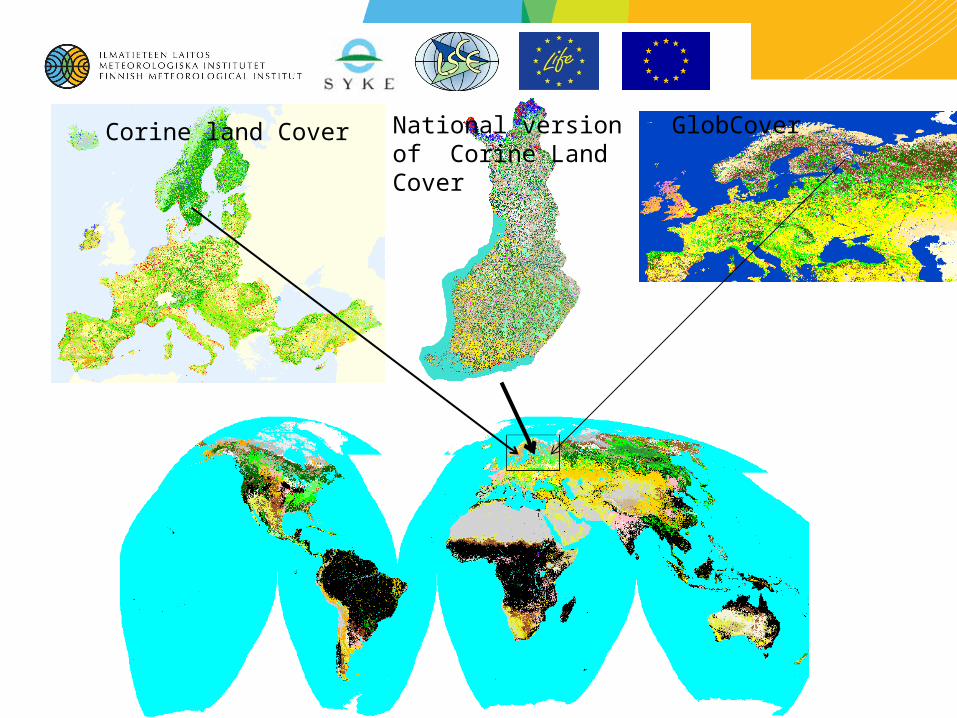
Corine land Cover National version of Corine Land Cover
GlobCover
Thank you