San Andreas Fault A drive along the fault.. Background Information The San Andreas is a Slip...
46
San Andreas Fault A drive along the fault.
-
Upload
melvin-ramsey -
Category
Documents
-
view
228 -
download
0
Transcript of San Andreas Fault A drive along the fault.. Background Information The San Andreas is a Slip...

San Andreas Fault
A drive along the fault.

Background Information
The San Andreas is a Slip Fault…
What does that mean?
It is two pieces of earth slipping past each other.
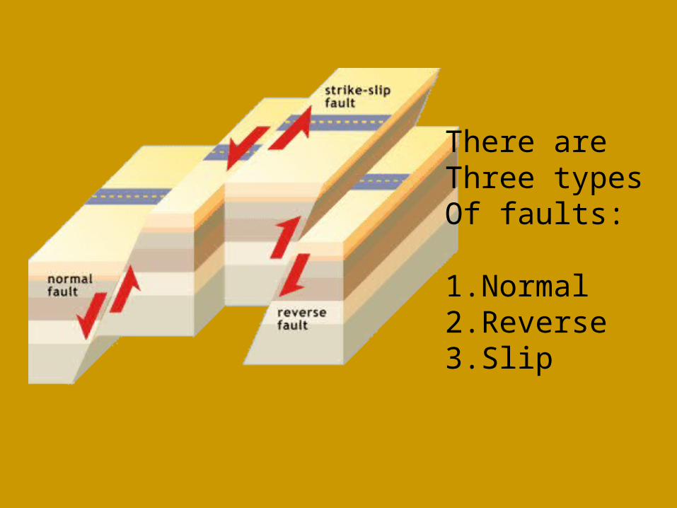
There areThree types Of faults:
1.Normal2.Reverse3.Slip


Why does the earth move?
The earth is dynamic!
That means it is in motion!
The earth is in layers…
The crust, the layer we live on floats on the thick mantle, which is fluid.


The Earth’s Crust
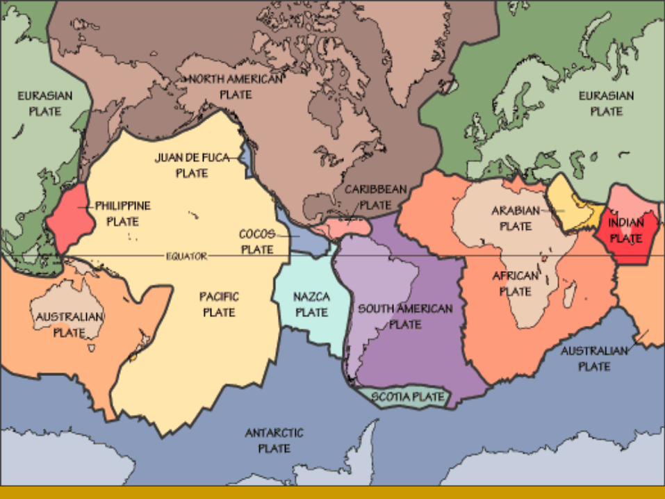
The earth’s crust is not one whole piece…it is in pieces that move around…
Scientists call these pieces “plates” and the study of the movement of these plates is called Plate Tectonics.


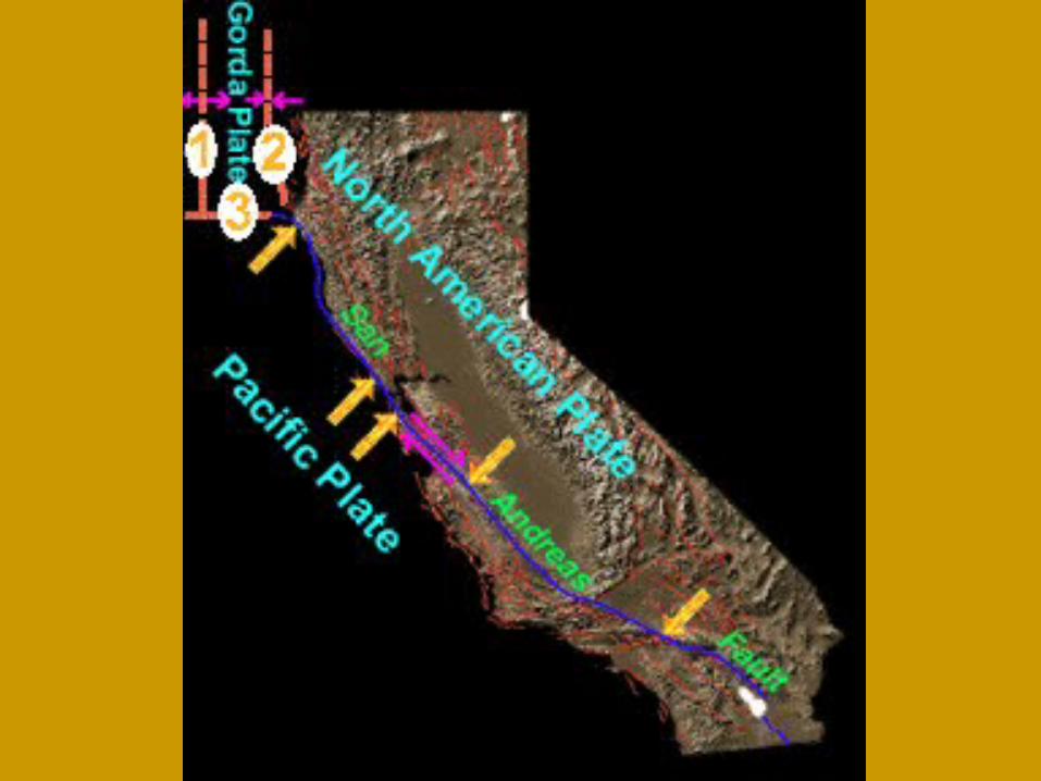
The San Andreas Fault
The San Andreas Fault is a boundary between the North America Plate and the Pacific Plate.
These two plates are both sliding past each other and in some places the Pacific Plate is sinking beneath the other.

How do earthquakes happen on the fault?
As the plates move past each other, the rocks get stuck and build up energy.
Eventually, the rocks can no longer withstand the build up and they break!!
Result:
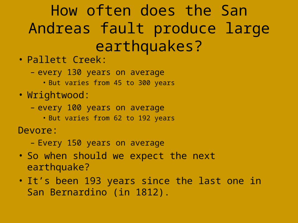
How often does the San Andreas fault produce large earthquakes?
• Pallett Creek: – every 130 years on average
• But varies from 45 to 300 years
• Wrightwood: – every 100 years on average
• But varies from 62 to 192 years
Devore: – Every 150 years on average
• So when should we expect the next earthquake?• It’s been 193 years since the last one in San
Bernardino (in 1812).


How strong would the shaking be?
Factors that affect how strong the shaking in an earthquake will be
1) Earthquake magnitude
2) How far away the earthquake is
3) Soil conditions


Earthquake Waves
Earthquakes create several different types of waves.
p waves are compression waves
(like sound).
s waves are transverse waves that move side to side or up and down.


The Beginning
At the start of the trip we must all first pick up a forest pass from the Chevron station at the bottom of the pass.
We will meet up at the McDonald’s adjacent to the Chevron station.
You must pick up your $5 pass first!

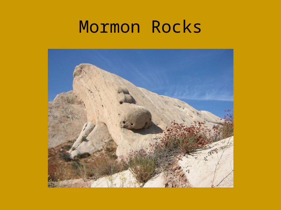
Mormon Rocks
Our first stop is the Mormon Rocks.
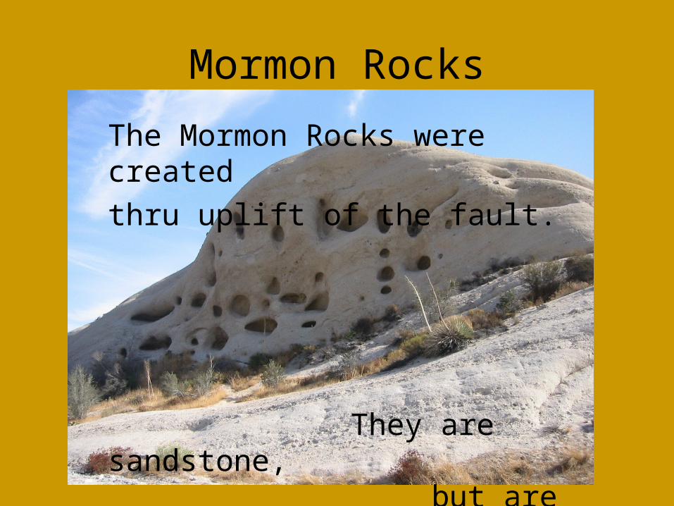
Mormon Rocks
The Mormon Rocks were created
thru uplift of the fault.
They are sandstone,
but are fairly resistant
to weathering.
Mormon Rocks

Mormon Rocks

Lone Pine Canyon
The next part of the trip is along Lone Pine Canyon Road. This road and canyon directly follow the fault…In fact, this canyon is a direct result of the fault.

Marble Quarry
Traveling up Lone Pine Canyon Road towards Wrightwood, we stop at an old Marble quarry.
We stop here to collect marble samples before moving into Wrightwood.
Look for other rocks like actinalyte as well!

Marble Quarry

Marble Quarry

Plants at the Marble Quarry
At the quarry you will see various plant life representative of the lower valley.
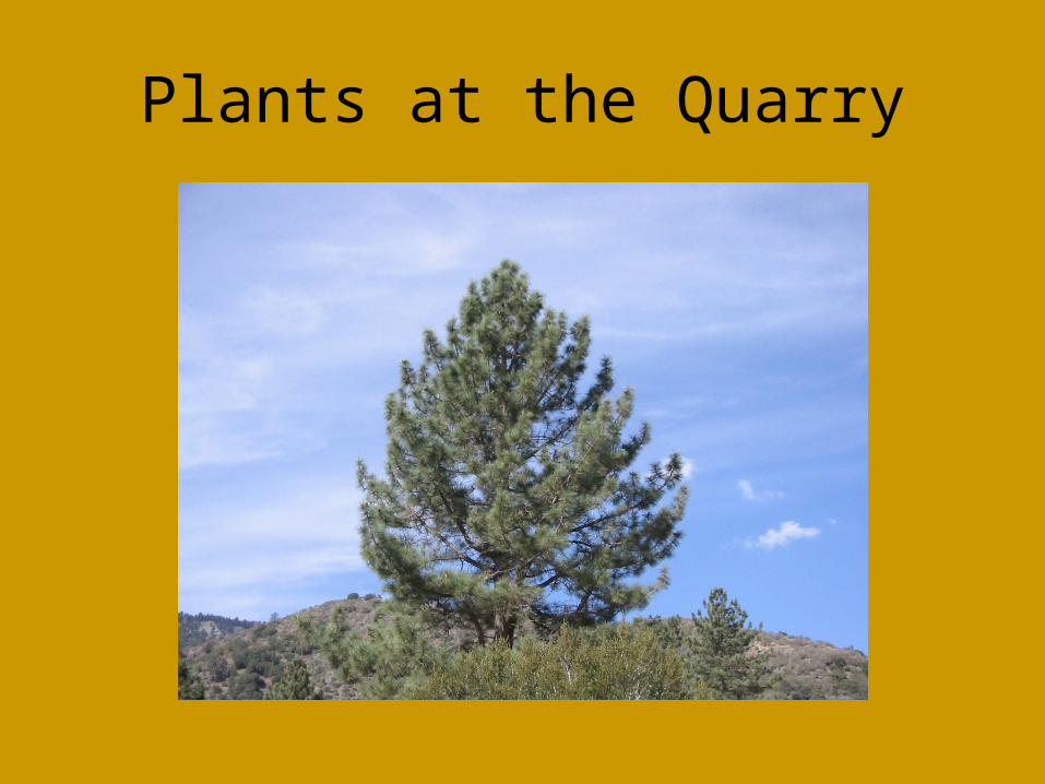
Plants at the Quarry

Plants at the Quarry

Plants at the Quarry

Lone Pine Canyon Road through Wrightwood
We follow Lone Pine Canyon Road to Highway 2 and head west on Hwy. 2.
The fault runs through Wrightwood and here in Wrightwood is the sight of one of the largest earthquakes in the history of the fault, the 1857 quake.
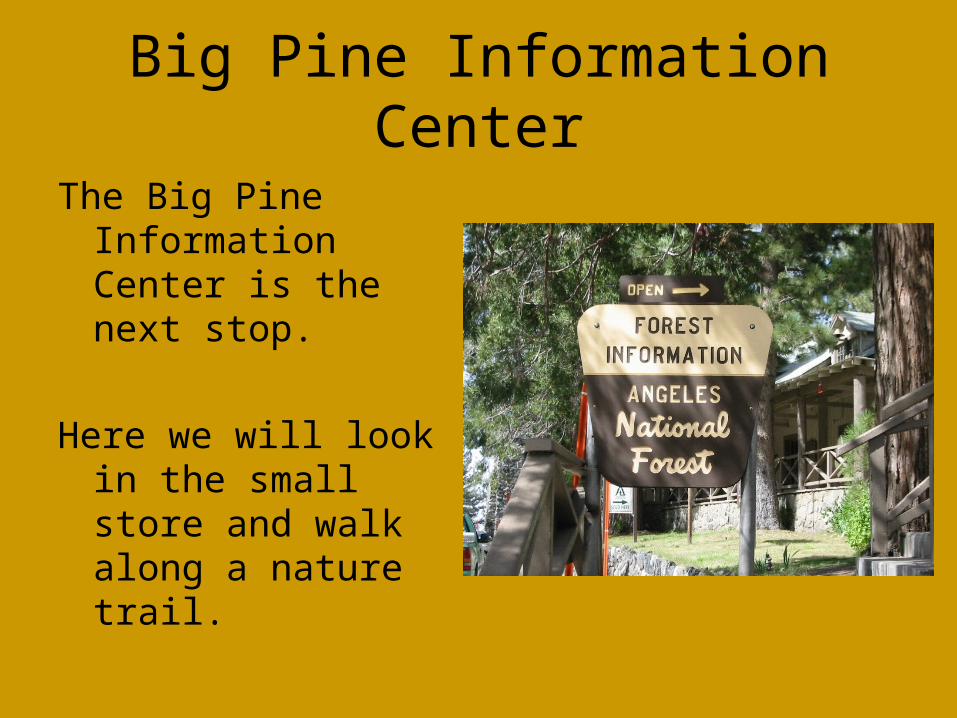
Big Pine Information Center
The Big Pine Information Center is the next stop.
Here we will look in the small store and walk along a nature trail.

Big Pine Information Center
This tower sits on the fault. It is the highest point on the San Andreas Fault.

Big Pines Highway
We travel along Big Pines Highway now on the edge of the fault!

Appletree Campground
We will stop on the side of the road (Completely off the road!) and walk across the road to the Appletree Campground where we will then walk up a short forestry road to look down at the fault and collect some “fault flower”.

Lunch!!!
Lunch will be taken at a little off the road picnic area called Mescal Picnic Area.

Yummm…

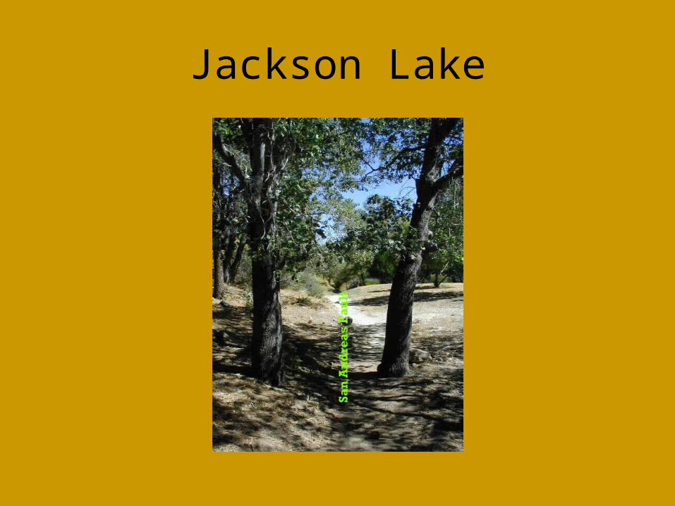
Jackson Lake
Last stop…

Jackson Lake
Jackson Lake is a creation of the fault.
It is a sag pond…an
area which sank
as a result
of the fault.
Jackson Lake

Go Home!!!
Head back through Wrightwood on
Highway 2 and to
Highway 138…
Have a Safe Trip!
God Bless!