Salmon Research, Monitoring, and Evaluation Project Objective · 2012-10-31 · Salmon Research,...
50
Pacific Coastal Salmon Recovery Fund Salmon Research, Monitoring, and Evaluation Project Objective Project Progress Report format for the period of May 2007 – November 2007 Project Title: PCSRF Evaluation Tools for Habitat Recovery Projects Project Number: 2006-5-02 Fiscal Year: 2006 Project Type: Salmon Research, Monitoring, and Evaluation Project status Completed Proposed End Date 12/31/2007 HUC #: Huc1 = 17 Geographic Area Name/Watershed: Entire Columbia Basin Geospatial reference/Location/GPS Point: N 45° 31.75’ W 122° 39.50’, Datum Nad27 (Columbia River InterTribal Fish Commission Office) Project Manager Name: Phil Roger Phone: (503) 238-0667 Email: [email protected] PCSRF Funding Amount: $33,688 Have there been any budget modifications from original project budget No Partners and Cost Share National Oceanic and Atmospheric Administration Fisheries Pacific Coast Salmon Recovery Fund program, member tribes of the Columbia River InterTribal Fish Commission (Nez Perce, Umatilla, Warm Springs, Yakama), and Columbia Basin Fish and Wildlife Authority – Status of the Resource projects. Cost share was not provided by the partners. Project Products
Transcript of Salmon Research, Monitoring, and Evaluation Project Objective · 2012-10-31 · Salmon Research,...

Pacific Coastal Salmon Recovery Fund
Salmon Research, Monitoring, and Evaluation Project Objective
Project Progress Report format for the period of
May 2007 – November 2007
Project Title: PCSRF Evaluation Tools for Habitat Recovery Projects Project Number: 2006-5-02 Fiscal Year: 2006 Project Type: Salmon Research, Monitoring, and Evaluation Project status Completed Proposed End Date 12/31/2007 HUC #: Huc1 = 17
Geographic Area Name/Watershed: Entire Columbia Basin
Geospatial reference/Location/GPS Point: N 45° 31.75’ W 122° 39.50’, Datum Nad27
(Columbia River InterTribal Fish Commission Office)
Project Manager Name: Phil Roger Phone: (503) 238-0667 Email: [email protected] PCSRF Funding Amount: $33,688 Have there been any budget modifications from original project budget No Partners and Cost Share National Oceanic and Atmospheric Administration Fisheries Pacific Coast Salmon Recovery Fund program, member tribes of the Columbia River InterTribal Fish Commission (Nez Perce, Umatilla, Warm Springs, Yakama), and Columbia Basin Fish and Wildlife Authority – Status of the Resource projects. Cost share was not provided by the partners. Project Products

During Fiscal Year 2006/2007, we proposed to create a set of tools to aid our Tribal and CRITFC members with the selection, documentation, and evaluation of PCSRF-funded projects for Salmon habitat recovery. We are pleased to have completed this work and anticipate expanding these products during FY 2007/2008 in a continuing project.
We have assembled a comprehensive set of information used in subbasin planning and Ecosystem Diagnosis and Treatment (EDT), including metrics on habitat quality at the reach level and fish population productivity and timing, as well as databases of PCSRF and BPA funded tribal projects. We have converted this information into a standardized and spatially referenced (GIS) format. By incorporating information including habitat quality, limiting factors, population status, and management goals and constraints, we are providing researchers, planners, and managers with tools that meet the following key functions: 1. Incorporate many different data sets pertaining to salmon and steelhead recovery
including both scientific and management information. 2. Create forms to enter habitat proposal information to match the NOAA PCSRF
reporting format. 3. Include built queries and ad-hoc capabilities to evaluate the project information. 4. Include reporting functions (graphs, charts, maps, etc.) with an emphasis on an
evaluation of the relevancy of proposed projects to scientific information and management goals.
During FY 2006/07, we completed tools and a form to help meet these goals.
We prepared the infrastructure that supports this project including the finalization of a database containing reach level habitat and limiting factor information collected from the subbasin planning process. We developed a streamlined data entry form for Tribal PCSRF solicitors to document their projects in accordance with the requirements of the NOAA reporting database (attachment 1) , and an internal process at CRITFC to track and display these projects in database and GIS formats (see figure 1 for example map). We also have been cooperating with CBFWA and NOAA personnel to standardize our fish populations database which is helpful for assessing populations and management areas that PCSRF projects relate to.
We assembled a known list of limiting factors by watershed and created a web-enabled tool for solicitors to examine these limiting factors along with additional watershed-scale information during the project proposal phase. This tool is available for use to anyone at http://www.critfc.org/maps/). When using the tool, one selects a basin (Huc3) and then a sub-basin (Huc4) of interest. Five sets of information are accessible via the web report for the selected watershed:
(a) A map of the watersheds (Huc5) that are within this sub-basin. This allows a project manager to quickly document their affected watershed(s) for the PCSRF data entry requirements.
(b) A list of completed and ongoing Tribal PCSRF projects that have occurred within this sub-basin.

(c) A list of limiting factors of habitat in this sub-basin by watershed. We included limiting factors cited in subbasin planning and those described by tribal biologists as part of the Federal Biological Opinion Remand negotiation.
(d) A link to the CBFWA Status of the Resource page for this sub-basin. This site provides a wealth of additional information at the sub-basin scale, including BPA-funded projects, limiting factors, and species information.
(e) A link to StreamNet and EPA information for this sub-basin. This includes data on species distribution, abundance, and trends, facilities information, and water quality.
This tool has been demonstrated to the members of the Columbia River InterTribal Fish Commission, and provided to project managers at the four member Tribes. By using this web-enabled tool, a project manager can evaluate the status of areas for habitat recovery, and better document a project during the proposal and reporting stages. Indicate any significant changes/obstacles to this project workplan: None Project Progress Summary:
(reporting period: May 2007 – November 2007)
During May to November of 2007 we completed the bulk of the work that is described under the project products section, including the PCSRF proposal form and the web-enabled tool for the evaluation and documentation of PCSRF projects. The data compilation work including the assembly of limiting factors was completed in the previous period (November 2006 – May 2007).
Cooperating Organizations: National Oceanic and Atmospheric Administration Fisheries Pacific Coast Salmon Recovery Fund program, member tribes of the Columbia River InterTribal Fish Commission (Nez Perce, Umatilla, Warm Springs, Yakama), and Columbia Basin Fish and Wildlife Authority – Status of the Resource projects. Number of organizations cooperating on the project:
Proposed: 6 Actual to date: 6
Report the number of research findings related to Pacific Salmon Treaty incorporated into abundance-based management regimes:
Proposed: 0 Actual to date: 0

Report the stream length assessed/monitored for habitat condition, water quality, salmonid abundance and productivity in accordance with Research, Monitoring, and Evaluation or watershed monitoring strategy (in miles to 0.01 miles):
Proposed: 0 Actual to date: 0 Cite the reports prepared by the project on key management or restoration data, information, and needs. These reports could be progress reports, monitoring reports, or final reports associated with research (Attach a copy of any completed reports including bibliographic information):
Number Proposed: 0 Actual to date: 0
Figure 1: Example Map of Tribal PCSRF projects tracked at CRITFC
Attachment 1: Data Entry Form created for Tribal PCSRF projects
Pacific Coastal Salmon Recovery Fund
General Instructions for Submittal of Project Proposals for

PCSRF FY 2007 Funding
The Columbia River Inter-Tribal Fish Commission (CRITFC), on behalf of and at the direction
of its member Tribes, and the National Marine Fisheries Service (NMFS), signed a
Memorandum of Understanding (MOU) in 2000 to provide the basis for the orderly and effective
allocation of funding from the Pacific Coastal Salmon Recovery Fund (PCSRF). The MOU
specifically addresses how federal funds provided to CRITFC through the PCSRF will be
distributed to the four member Tribes for eligible salmon recovery activities and projects in the
Columbia River Basin. Attached is the amended MOU for 2005 that addresses recent issues
raised by the Inspector General during the PCSRF audits and to improve reporting and grant
funding accountability.
The CRITFC PSCRF allocation for FY 2007 is $1,095,600. At the Commission meeting on June
29, 2007, the Commissioners approved the following distribution level for PCSRF projects:
$232,815 for each tribe and $164,340 for CRITFC. These funds will be available through
December 31, 2009.
CRITFC will provide the funds to the member Tribes through the MOU with NOAA Fisheries.
The attached MOU reflects current authorizations mutually agreed by NOAA Fisheries and the
CRITFC. The CRITFC will submit the required financial assistance grant application to NOAA
Fisheries for FY 2006 PCSRF funding (similar to the last five years). Subcontracts between the
CRITFC and each Tribe will be implemented once; 1) the CRITFC receives the financial
assistance award letter, and 2) the Commission officially approves each Tribe’s project
proposals.
Based upon the revised MOU, a CRITFC/Tribal technical team will evaluate project proposals
from each of the four Tribes or the CRITFC itself. The MOU was developed to be consistent
with the salmon restoration strategies described in the Tribes’ salmon restoration plan Wy-Kan-
Ush-Mi Wa-Kish-Wit, and Congressional authorization and guidance. Each project proposal
needs to explicitly identify one or more of the following project categories that are consistent
with the PCSRF goals and objectives:
A. Watershed And Sub-Basin Planning And Assessment Projects;
B. Habitat Protection and Restoration Projects;
C. Salmon Enhancement Projects;
D. Salmon Research, Monitoring, and Evaluation Projects;
E. Outreach and Education Projects;
F. Other programmatic activities geared to the restoration of
salmon, consistent with the overall goal of the PCSRF.
The use of the PCSRF is predicated on implementation of Wy-Kan-Ush-Mi Wa-Kish
Wit. The critical technical recommendations of Wy-Kan-Ush-Mi Wa-Kish-Wit are as
follows:

• Begin improving in-channel stream conditions for anadromous fish by
improving or eliminating land-use practices that degrade water quality.
• Protect and increase instream flows by limiting additional consumptive
water withdrawals, using the most efficient irrigation methods, preventing
soil compaction and riparian vegetation removal and wetland destruction;
where necessary, restore soil, restore riparian vegetation and recreate
wetlands.
• Actively restore watersheds where salmon are in imminent danger of
extirpation.
• Use supplementation to help rebuild salmon populations at high
demographic risk of extirpation.
• Use supplementation to reintroduce salmon to watersheds from which they
have been extirpated.
• Closely monitor tributary production and escapement to improve
management.
Project selection and evaluation: To meet the MOU objectives, CRITFC utilizes an internal
technical team of CRITFC/Tribal staff (includes Fish Science Department), to assure that
projects are consistent with the MOU. Tribal staffs are directed to take the final project proposals before their respective Fish and Wildlife Committee or Natural Resources Committee for review and approval before presenting the proposals to the Commission. This ensures that a tribal public process for project selection is always present.
Once the Commission approves projects, the CRITFC enters into sub-recipient agreements with
each Tribe that establishes funding criteria consistent with the goals and objectives of the
PCSRF. Tribal sub-recipient agreements provide project proposal, reporting, and monitoring and
evaluation criteria to ensure that tribal activities and projects funded through the MOU are
consistent with Congressional intent to advance salmon recovery efforts. Please be aware that in
the contracting process, your proposals will be reformatted into a contract document or modified
to be consistent with the MOU as necessary.
ESA Compliance: All projects that affect ESA listed species must have ESA coverage prior to
modification of critical habitat or other “take” of ESA-listed species. For salmon stock
enhancement and supplementation programs that utilize artificial propagation, those projects that
are consistent with current NMFS hatchery biological opinions from ESA consultations on
production or supplementation in the Columbia River Basin may be funded without further
consultation under the ESA. For salmon stock enhancement projects that are not consistent with
current biological opinions, NMFS, at the request of the sponsoring Tribe, will expedite ESA
consultation, dependent on available resources, to address the project.
NEPA Compliance: Project proponents are required to seek and acquire NEPA coverage prior
to on-the-ground implementation.
Federal Cost Principles Compliance: Project proponents must ensure that its administration of
the subgrant adheres to applicable federal cost principles and uniform administrative

requirements such as the OMB Circular A-87. The OMB provisions regarding allocation of
personnel costs, based on a labor distribution system that captures actual time spent on different
projects and funding sources must be implemented. The Inspector General will be continuing
the PCSRF audits and the CRITFC and its member tribes are sure to be audited at some point.
Supplanting other Projects: PCSRF funds cannot be used to supplant existing projects or
programs that had a previously allocated funding source. Only projects that enhance/supplement
ongoing projects or new projects altogether can be funded. Land Acquisition: The generally accepted principle is that land acquisition costs should not
exceed 10% or the appraised value. Federal approval may be required in acquisition transactions
in excess of 10% of the appraised value. All land acquisitions must have a direct connection to
salmon habitat protection and/or restoration.
Cost-Share Encouragement: The CRITFC Tribes are not required to include cost-share
components for each project. However, it is strongly encouraged that project sponsors
collaborate with cost-share partners.
Budget Modification Guidelines: No-cost budget modifications require written documentation
signed by the authorized project manager. Once the request is received and approved by the
CRITFC, a letter of confirmation will be signed by the CRITFC Executive Director and sent to
the project manager. (An example of a no-cost modification includes moving funds from the
“equipment” line item for a project to the “salary” line item within the same project or between
projects).
New Project Guidelines: If the project objective changes a new project proposal must be
submitted and, the corresponding Tribes’ tribal council approval is needed along with a
corresponding official action by the CRITFC Commission. The same procedure for the original
project selection and evaluation process is followed. (An example of a project objective
modification includes changing a restoration project into a supplementation project).
Progress Report Requirements: Staff at each Tribe is required to prepare bi-annual progress
reports addressing all of the performance metrics related to each project implemented under the
PCSRF, and identifying progress towards the project objectives. Progress reports are due to CRITFC November 30, 2007 (Semi-Annual Report), and April 30, 2008 (Annual Report), with a repeating cycle until projects are completed. A detailed expenditure update by project
is required with the progress reports. Projects are subject to an annual evaluation by tribal and
Commission staff.
Project Spending Plan: Over the next year, the CRITFC staff will meet with all tribal project
managers to assist in developing a spending plan/strategies for the PCSRF projects that will
continue to incorporate the Tribes’ restoration plan, “Wy-Kan-Ush-Mi Wa-Kish-Wit”. The
spending plan will clarify how the PCSRF funds will be used in a timely and efficient manner.
Each spending plan will identify ways to leverage more cost-share opportunities and ensure that
adequate monitoring and evaluation is incorporated in each project to demonstrate salmon
restoration benefits.

The CRITFC member Tribes would like to see the PCSRF continue, with increased funding
levels through 2009. This will allow salmon managers to capture two more life cycles of coho
salmon, as well as two full cycles of Chinook salmon, under the PSCRF program. To measure
the success of PCSRF project implementation requires improved long-term evaluation.
The goal is to have all tribal projects approved and sub-contracts
signed by the end of 2007!
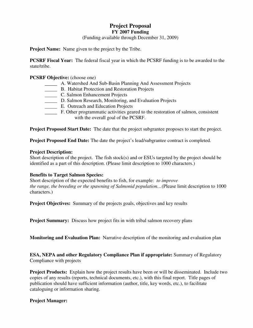
Project Proposal FY 2007 Funding
(Funding available through December 31, 2009)
Project Name: Name given to the project by the Tribe. PCSRF Fiscal Year: The federal fiscal year in which the PCSRF funding is to be awarded to the
state/tribe. PCSRF Objective: (choose one)
A. Watershed And Sub-Basin Planning And Assessment Projects
B. Habitat Protection and Restoration Projects
C. Salmon Enhancement Projects
D. Salmon Research, Monitoring, and Evaluation Projects
E. Outreach and Education Projects
F. Other programmatic activities geared to the restoration of salmon, consistent
with the overall goal of the PCSRF.
Project Proposed Start Date: The date that the project subgrantee proposes to start the project.
Project Proposed End Date: The date the project’s lead/subgrantee contract is completed.
Project Description: Short description of the project. The fish stock(s) and or ESUs targeted by the project should be
identified as a part of this description. (Please limit description to 1000 characters.)
Benefits to Target Salmon Species: Short description of the expected benefits to fish, for example: to improve
the range, the breeding or the spawning of Salmonid population…(Please limit description to 1000
characters.)
Project Objectives: Summary of the projects goals, objectives and key results
Project Summary: Discuss how project fits in with tribal salmon recovery plans
Monitoring and Evaluation Plan: Narrative description of the monitoring and evaluation plan
ESA, NEPA and other Regulatory Compliance Plan if appropriate: Summary of Regulatory
Compliance with projects
Project Products: Explain how the project results have been or will be disseminated. Include two
copies of any results (reports, technical documents, etc.), with this final report. Title pages of
publication should have sufficient information (author, title, key words, etc.), to facilitate
cataloguing or information sharing.
Project Manager:

Name
Address
Phone
Cell phone
Key Project Staff: Name
Address
Phone,
Cell phone
PCSRF Funding Amount and Budget Details: The amount of PCSRF Federal funds requested to
be expended on this project. List the dollar amounts requested for each category and the total in the
following table.
Category PCSRF Amount Salary Fringe Travel Supplies Communications/Utilities Training Lease/Rental Equipment Operation & Maintenance Subcontracts Capitalized Equipment Professional Services Other Indirect costs Total Budget Amount Partners and Cost Share: List project partners and cost share totals.
Geographic Area Name/Watershed: This is the name of the watershed or general geographic area
(choose one).
Clearwater
Deschutes
John Day
Lower Columbia
Lower Snake
Middle Columbia
Middle Snake-Boise
Middle Snake-Powder
Oregon Closed Basins
Salmon
Upper Columbia

Yakima
Idaho
Oregon
Oregon and Washington
Washington
Other (give details)
Project Worksite Locations (For EACH worksite location provide the following geospatial and
targeted ESU information. Copy this section for each worksite in this project.)
Worksite Name #1:
Geospatial Reference/Location/GPS Point: (Choose one method)
1. For a point location
Latitude (in decimal degrees, 4 decimal place minimum):
Longitude (in decimal degrees, 4 decimal place minimum):
Datum (horizontal reference model):
Site Location Collection Method (GPS, DEM, map derived, etc.):
2. For a stream segment location
Streamname:
Beginning latitude (in decimal degrees, 4 decimal place minimum):
Beginning longitude (in decimal degrees, 4 decimal place minimum):
Ending latitude (in decimal degrees, 4 decimal place minimum):
Ending longitude (in decimal degrees, 4 decimal place minimum):
Datum (horizontal reference model):
Site Location Collection Method (GPS, DEM, map derived, etc.):
3. For an area location
5th
field HUC (select from Appendix A (pgs. 23-44) at the end of this document):
Latitude to represent the area (in decimal degrees):
Longitude to represent the area (in decimal degrees):
Datum (horizontal reference model):
Site Location Collection Method (GPS, DEM, map derived, etc.):
4. Other – give description
Targeted ESUs: (check all that apply to this worksite)
Deschutes River summer/fall-run ESU (Chinook Salmon)
Lower Columbia River ESU (Chinook Salmon)
Middle Columbia River spring-run ESU (Chinook Salmon)
Snake River Fall-run ESU (Chinook Salmon)
Snake River Spring/Summer-run ESU (Chinook Salmon)
Upper Columbia River Spring-run ESU (Chinook Salmon)
Upper Columbia River summer/fall-run ESU (Chinook Salmon)

Lower Columbia River ESU (Steelhead)
Middle Columbia River ESU (Steelhead)
Snake River Basin ESU (Steelhead)
Upper Columbia River ESU (Steelhead)
Columbia River ESU (Chum Salmon)
Lower Columbia River ESU (Coho Salmon)
Okanogan River ESU (Sockeye Salmon)
Snake River ESU (Sockeye Salmon)
Other (give name and species)
Worksite Name #2(Fill out only if applicable) (copy the above geospatial and ESU sections for this and each additional worksite)
NOTE: There are 5 sections below – one for each PCSRF Objective/Project type. Complete only the section for the objective/project type you chose above.
A. Watershed And Sub-Basin Planning And Assessment Projects (complete page 6)
B. Habitat Protection and Restoration Projects (complete pages 7-15)
C. Salmon Enhancement Projects (complete pages 16-17)
D. Salmon Research, Monitoring, and Evaluation Projects (complete page 18)
E. Outreach and Education Projects (complete page 19)
F. Other programmatic activities geared to the restoration of salmon, consistent with the overall
goal of the PCSRF (no extra section needed)
A. WATERSHED AND SUB-BASIN PLANNING AND ASSESSMENT PROJECTS Projects that assess current or baseline habitat condition/s and or prioritize factors limiting native
salmonid production such as amount of freshwater flow and address measures needed to eliminate
limiting factors. Types of reports include recovery plans, water shed plans, subbasin plans and
habitat inventory reports, and Tribal Resource Management Plans. Projects can include recovery
planning and participation in NMFS Technical Recovery Teams, watershed assessments, including
mapping/inventory for plans, subbasin planning, development of habitat inventory reports, support

for watershed councils and organizational infrastructure and staffing for local conservation groups
and tribal entities.
Does the project fund operations of watershed councils, or provide technical assistance to
watershed councils? Yes/No
Does the project provide staff support and/or infrastructure costs directly related to
assessments or recovery planning? Yes/No
Does this project support development of a plan or assessment? If so, record the name of the
plan/assessment: Yes/No and name of plan/assessment
Has the plan or assessment funded with PCSRF been completed? This will show how many plans were completed each year. Yes/No and Citation: Author, date, name, source, source address. Endnote citation format. Does the plan/assessment identify/prioritize specific factors limiting the production of populations and ESUs or conservation opportunities at the
watershed scale?
Yes/No comments
Does the plan/assessment incorporate biological goals consistent with State or Tribal conservation
plans or Technical Recovery Team recommendations? Yes/No comments
Does the plan/assessment identify actions needed to meet goals? Yes/No comments
Has the plan/assessment been used by a local watershed group to guide restoration actions? The purpose of watershed plans or assessment is to guide decision making and implementation. Yes/No
The number of stream miles surveyed for this plan/assessment that contain anadromous Pacific
Salmon.
Number of miles surveyed or assessed
The number of stream miles surveyed for this plan/assessment that have riparian disturbance; for example landslide, road, parking lot, vegetation clearing.

Number of disturbed stream miles surveyed

B. HABITAT PROTECTION AND RESTORATION PROJECTS Projects that restore ecosystem characteristics and processes and address priority factors that are limiting salmonid production. There are 10 different types of habitat projects: Fish Screening, Fish Passage, Instream Flow, Instream Habitat, Riparian Habitat, Upland Habitat, Water quality, Wetland, Estuarine, and Land Acquisition/Easements/Leases.
The watershed/sub-basin plan or assessment in which the project is identified as a priority All
projects should be a result of assessing the watershed for limiting factors.
The written document/s used as a reference for justifying the work should be cited. Author, date, title, source, source address and/or URL. (Endnote citation format - not applicable text field for comments)
NOTE: for EACH worksite listed above, complete the following sections.
Worksite #1: Type of Monitoring: A narrative that identifies the type of monitoring included in the project. This refers to what is being
monitored at the project site. Some projects may be monitored and others not. Some projects may be
monitored for engineering design specifications, habitat changes, and fish. Others may only measure
one or two of the parameters.
Stream section to be treated (Report the length of stream section to be treated by the project in
miles to 0.01 miles. Meander measurement of portion of stream proposed for treatment, counting
one side of stream only.):
Limiting factors for this worksite: (Name the priority habitat limiting factors that are addressed by
the project. Check all that apply from this list.) biological processes
channel conditions
estuarine and near-shore habitat
exotic species
fire regime
floodplain conditions
irrigation diversions – screens
lake habitat
loss of access to spawning and rearing habitat
predator/competitor interactions
riparian condition
streambed sediment conditions
temperature
trophic interactions (e.g. nutrient cycling)
water quality (toxics)
water quality
water quantity

Complete proposed metrics for each type of treatment at this worksite.
Fish Screening Treatments (Projects that result in the installation or improvement of screening systems that prevent Salmonids from passing into areas that do not support salmonid survival, for example into irrigation diversion channels.)
Number of screen(s) installed: A total count of screens proposed for installation and actually installed, recognizing that a
project may install more than one screen.
The flow rate of water diverted: The flow rate at the screened diversion(s) from the water right in cfs.
Quantity of water protected by screens (duty): The amount of water proposed for protection and actually protected, as stated in the water
right in terms of acre-feet per year in (acre-feet)/year.
Instream Habitat
Instream Habitat Treatments (Projects that increase or improve the physical conditions within the stream environment (below the ordinary high water mark of the stream) to support an increased salmonid population.)
Streambank stabilization projects: The number of miles of streambank stabilization treatment. Add length treated on both sides
when both sides are stabilized. Add one side when one side is treated. The measurement
should be in miles to .01 miles.
Length of instream habitat treated, except for bank stabilization: This refers to meander miles of instream habitat treatments, except for bank stabilization
treatments. Count actual stream length treated in miles to .01 miles.
Check all instream habitat treatment types that apply at this worksite: anchored habitat structures
bank stabilization
boulders
boulders placed in stream
brush bundles
carcass placement
channel connectivity
channel reconfiguration
concrete weir construction
dam repair
deflectors/barbs

engineered structures
fish barrier removal
fish ladder improvement
fish screens
floodplain connectivity
install sediment-trap dam
log control (weir)
maintenance of previously installed structures
off-channel habitat
off-channel habitat wetland
off-channel ponds
other
other instream treatment
other stabilization treatment
permanent removal of pushup dam
plant removal/control
pools created using scour structure
pools created
reslope streambank
rock control (weir)
rock gabions
roughened channel
sediment removal
signage
site maintenance
spawning gravel placement
stream channels
weir installed 9unknown type, not below culvert)
weirs/grade control
woody debris placement.
Instream Flow Treatments (Projects that maintain and/or increase the flow of water to provide needed habitat conditions. These can include releases of water from dams or impoundments or water conservation projects to reduce stream diversions or extractions.)
Amount of water returned to the stream:
The flow of water returned to the stream (not including water that is maintained in the
stream) in cubic feet per second.
The start and end date of the return flow: Start and end dates of the return flow to the stream in days.
Number of flow gauges installed:
The number of gauges proposed and installed as a part of the project. Water withdrawal
projects require a gauge to measure water use.

Volume of water leased or purchased: Water volume proposed for lease or purchase and actually leased or purchased should be
reported in acre-feet.
Check all instream flow treatment types that apply at this worksite: instream flow treatments
instream water right transfers/leases
other
water right purchase
water right purchased or leased
Fish Passsage Improvement Treatments (Projects that affect or provide fish migration up and down stream including road crossings
(bridges or culverts), barriers (dams or log jams), fishways (ladders, chutes or pools), and
weirs (log or rock)).
Number of fish passage blockages removed or improved: There may be more than one blockage per project. Report a count of all blockages that are
proposed for removal or improvement and those that are actually removed or improved as
part of this project.
Length of stream made accessible by the removal of barriers other than culverts:
The miles of stream proposed and actually opened to improved salmon production upstream
of the barrier(s) other than culverts in miles to .01 miles.
Length of stream made accessible for passage of salmon species by the improvement or removal of culverts: The miles of stream proposed for and actually made accessible for passage of salmon species
by upgrading or removing culverts in miles to .01 miles.
Check all fish passage improvement treatment types that apply at this worksite: culvert/bridge/corrugated pipe removal
culverts/structures removed and not replaced
culvers/structures replaced with bridge
culverts/structures replaced with culverts placed embedded or flat
culverts/structures replaced with open bottom arch culverts
culverts/structures replaced with weir/baffle culverts
culverts/structures retrofitted with baffles or weirs
fish barrier removal
install fish passage structure
other
permanent removal of pushup dam
reduce access to side channels
remove/replace culvert
small dam removal

upgrade culverts/bridges
Riparian Habitat Treatments
(Projects that change areas (above the ordinary high water mark of the stream and within the flood plain of streams) in order to improve the environmental conditions necessary to sustain Salmonids throughout their life cycle.)
Length of riparian stream bank treated:
This refers to meander miles of stream bank proposed for treatment and treated. Report the
actual length of proposed treatment, adding lengths of treatment on both sides if treatment
was on both sides in miles to .01 miles.
Amount of riparian area treated except for invasive species treatment:
This refers to the total riparian acres proposed and actually treated. Examples of treatment
include riparian plantings, or protection of riparian zone with a fence.
Amount of riparian area treated for invasive plant species: This refers to the acres of invasive plant species proposed and actually treated. An invasive
species is a plant species that is recognized by the State or Tribe as an invasive species in
acres.
Check all riparian habitat treatment types that apply at this worksite: bank stabilization
conservation grazing management
fencing
hardwood planting
irrigated new plantings
irrigation practice improvement
livestock exclusion
livestock water development
nutrient management
other
other riparian treatment
planting
riparian tree planting
riparian vegetation management
shrub or herbaceous planting
water gap development
weed control
willow planting
Upland Habitat Treatments

(Landscape level projects implemented above the elevation of the riparian zone (above the floodplain) that indirectly affect salmonid habitat, for example by affecting the water quality and quantity.)
Amount of upland habitat area treated: Total acres proposed for each treatment above. Report proposed and completed road projects
in “Length of road treated”.
Length of road treated: Proposed and actual treatments include road(s) decommissioned (closed, obliterated),
upgraded, or restored in miles to .01 miles.
Check all upland habitat treatment types that apply at this worksite: conservation butters
conservation grazing management
ditches/drainage/culvert maintenance
irrigation systems for improved water conservation
irrigation systems for improved water quality
irrigation system improvement
livestock stream access/crossing created or improved
no till agriculture
non-native/noxious plant control
nutrient management
other
other upland treatment
restore historic habitats
road drainage system improvements
road grass seeding
road obliterated, decommissioned, or vacated
road obliteration
road reconstruction
road stabilization
road stream crossing improvements
road survey
road upgrade maintenance
road peak flow passage improvement
roadside planting
terracing
upland livestock water development
upland erosion control
upland erosion control - conservation land management
upland erosion control – planting
upland erosion control - sediment control basins
upland erosion control – windbreaks
upland fencing
upland tree planting
upland vegetation planting
vegetation management

Water Quality Treatments (Projects that result in an improvement of water quality conditions for example through improved water treatment, the installation of sediment traps to capture highway runoff, or the reduction in the use of herbicides, pesticides and fertilizers.)
Check all water quality limitations that apply at this worksite: bacteria
dissolved oxygen
heavy metals
nutrients
other
pesticides
pH
phosphorus
temperature
turbidity
Wetland Treatments (Projects designed to protect, create or improve connected wetland areas (that meet the
standard for federal delineation) that are known to support salmonid production. For
example salmonid populations, especially juveniles, can benefit from access to connected
wetland areas where conditions provide food supply, protection from high flows and
protection from predators.)
Amount of wetland area treated: Acres of wetland proposed for treatment and actually treated. Include acres of invasive
species proposed for treatment below in “Amount of wetland area of invasive species
proposed for treatment and actually treated”.
Amount of artificial wetland area created: Acres of artificial wetland proposed to be created and actually created from an area not
formerly a wetland.
Amount of wetland area of invasive species proposed for treatment and actually treated: The acreage of invasive species proposed for treatment and actually treated in the wetland
project. The proposed project area may only be a portion of an existing wetland such as
removing an area of purple loosestrife.
Check all wetland treatment types that apply at this worksite: other
wetland creation
wetland improvement/enhancement

wetland invasive species removal
wetland restoration
wetland vegetation planting
Estuarine Treatments
Acres of estuary proposed for treatment. Include creation of estuarine wetlands (acres):
Acres of artificial estuary proposed for creation from an area not formerly saline (acres):
This refers to meander miles of stream bank proposed for protection by acquisition, easement or lease. Count miles on both sides of stream if both sices are acquired. Count on one side if only one side is acquired (acres):
Check all estuarine treatment types that apply at this worksite: channel modification/creation
increased freshwater flow
other
removal of existing fill material
tide gate modification
tide gate removal
tide gate alteration/removal
Land Acquisition, Easement, and Lease Treatments (Projects that involve the acquisition or lease of land or riparian areas. )
Amount of land, wetland or estuarine area protected with acquisition/easement/lease: The acreage reported should be the total acreage proposed for protection and actually
protected regardless of whether all of the habitat is applicable to the desired goals for
acquisition.
Length of stream bank protected through land acquisition/easement/lease: This refers to meander miles of stream bank proposed for protection and actually protected
by acquisition, easement or lease. Count miles on both sides of stream if both sides are
acquired. Count on one side if only one side is acquired.
Check all treatment types that apply at this worksite: site purchase
other (briefly describe)

Worksite #2: (If this habitat project has more than one worksite, copy the entire section from above and paste it in here for the second worksite. Repeat for each worksite.)
C. SALMON ENHANCEMENT PROJECTS Projects that will enhance depressed stocks of naturally spawning anadromous salmonids through
salmonid supplementation, reduction in fishing effort on depressed wild stocks; or enhancement of
Pacific salmon fisheries on healthy stocks.
For EACH worksite listed above, complete the applicable portions of the following metrics section: (copy this entire section for each worksite)
Worksite #1:
Check all the types of enhancement that apply:
Supplementation (no metrics to fill out)
Production Technology (no metrics to fill out)
Fisheries Management (no metrics to fill out)
Fish Marking Technology (Enhancement projects that invest in fish marking, hatchery
modifications, or production improvements. Fill in the metrics below only if you are using fish marking technology:
Does the project evaluate potential sites or strategies for Pacific salmon enhancement to
promote fisheries that do not impact depressed stocks? Yes or No
Enhancement projects that reduce effort on depressed stocks. Report whether or not the project implements management measures designed to reduce fishing effort on depressed stocks.
Yes or No
Enter the number of each of the following enhancement types which applies:
Acquisition of supplementation sites
Facility modification
Fish marking equipment (including trailers)
Fish transport
Increase in fish marking capacity
Production technology improvements
Rearing/acclimation ponds

Traps/weirs
Fish Marking Details
(Enter species and proposed count for each - copy species/count lines as needed)
Frys/smolts produced through production technology improvements
species__________________ proposed count___________
species__________________ proposed count___________
Number of fish marked
species__________________ proposed count___________
species__________________ proposed count___________
Production technology improvements
species__________________ proposed count___________
species__________________ proposed count___________
Rebuilding Weak Stocks (Enhancement projects that rebuild weak stocks or
sustain/enhance naturally spawning salmon populations. Fill in the metrics below only if you are rebuilding weak stocks. Enter counts, copy species/count lines as needed.
Compensate for reductions in harvest levels set to meet Pacific Salmon Treaty obligations
species__________________ proposed count___________
species__________________ proposed count___________
Compensate for weak or depressed stocks
species__________________ proposed count___________
Marked as a result of marking enhancement
species__________________ proposed count___________
Natural spawning
species__________________ proposed count___________
Redirecting fishing effort
species__________________ proposed count___________
Releases compensate harvest reductions
species__________________ proposed count___________
Supplementating weak/depressed stocks
species__________________ proposed count___________
D. SALMON RESEARCH, MONITORING, AND EVALUATION PROJECTS Projects for conducting salmon research and monitoring to: 1) assess watershed health and salmon
status; 2) monitor and evaluate PCSRF projects; 3) validate the effectiveness of protection and

restoration projects; and 4) implement data requirements of the 1999 Pacific Salmon Treaty
agreement.
State whether or not the project is directly related to key salmon management questions regarding salmon recovery and/or sustainability of healthy salmon stocks? Yes or No
List names of the organizations cooperating on the Research, Monitoring and Evaluation Project: Names of organizations
Number of organizations cooperating on the Research, Monitoring and Evaluation Project:
Number of proposed organizations
Report the number of research findings related to Pacific Salmon Treaty incorporated into abundance-based management regimes: Number of findings
Describe the Research Monitoring and Evaluation findings utilized in adaptive changes to salmon and watershed programs and policies: Narrative limited to 4000 characters (answer on
final report only)
Report the stream length assessed/monitored for habitat condition, water quality, salmonid abundance and productivity in accordance with Research Monitoring and Evaluation or watershed monitoring strategy in miles: Miles assessed/monitored
Cite the reports prepared by the project on key management or restoration data, information and needs. These reports include PCSRF and other progress reports, or final reports associated with research: Author, date, name, source, source address
E. OUTREACH AND EDUCATION PROJECTS Projects that educate constituencies on the value of and actions taken for conservation, restoration, and sustainability of healthy Pacific salmonid populations and their habitat - including workshops, forums, preparation of educational materials, training and citizen participation. Report whether or not the project focuses on sustainability, restoration (where needed), and the
maintenance of watershed and salmon population health: Yes or No
Report the number of completed workshops/training events within the project: Number of events
Report the number of participants in completed workshops/training events within the project: Number of participants at event
Report the Number of schools and other institutions reached within the project: Number of schools/institutions

Report the number or documents proposed or the citations of documents produced within the project. Number of reports and Author, date, title, source, source address and/or url. (Endnote citation
format)

MEMORANDUM OF UNDERSTANDING
As amended
Between
COLUMBIA RIVER INTER-TRIBAL FISH COMMISSION
And
NATIONAL MARINE FISHERIES SERVICE
On the
PACIFIC COASTAL SALMON RECOVERY FUND FOR COLUMBIA RIVER TRIBES
INTRODUCTION
This Memorandum of Understanding (MOU) is entered into by the National Marine Fisheries
Service (NMFS), a federal agency within the U.S. Department of Commerce, National Oceanic and
Atmospheric Administration (NOAA) and the Columbia River Inter-Tribal Fish Commission
(CRITFC) on behalf of and at the direction of its member tribes. NMFS and CRITFC enter this
MOU pursuant to authorities under the Endangered Species Act (16 U.S.C. 1531 et seq.) and
pursuant to authorities and in furtherance of the programmatic goals and objectives of the Pacific
Coastal Salmon Recovery Fund as authorized under 16 U.S.C. 3645 (d)(2), and consistent with
Congressional intent, the federal-tribal trust relationship, and other relevant federal authority.
This MOU provides the basis for the Commission to approve projects, and disburse PCSRF funds to
tribal organizations, as authorized by Congress for the Columbia River Tribes in 16 U.S.C. 3645 (d)
(2). The federal funds provided to CRITFC through the PCSRF will be distributed to eligible tribal
salmon recovery activities and projects in the Columbia River basin.
PARTIES
The Columbia River tribes enter into this MOU through the Columbia River Inter-Tribal Fish
Commission (CRITFC). The CRITFC was formed in 1977 by resolution of the Nez Perce Tribe, the
Confederated Tribes of the Umatilla Indian Reservation, the Confederated Tribes of the Warm
Springs Reservation of Oregon and the Confederated Tribes and Bands of the Yakama Nation.
CRITFC provides coordination and technical assistance to ensure that the resolution of outstanding
treaty fishing rights issues guarantees the continuation and restoration of tribal fisheries into
perpetuity. Since 1979, CRITFC has contracted with the Bureau of Indian Affairs under the Indian
Self-Determination Act (Public Law 93-638) to provide this technical support. Each of the four

tribes of the CRITFC has, under treaties with the United States of America1, reserved sovereign
rights and authorities to themselves, including the use of, and management authority and
responsibilities for, the fisheries resources originating in or passing through their original lands and
territories and traditional use areas.
NMFS enters into this MOU through its Northwest Regional Office, which has primary day-to-day
responsibility for federal activities related to the protection and recovery of salmon populations in
the Pacific Northwest.
PURPOSE, GOALS AND OBJECTIVES
The purpose of this MOU is to generally describe the strategies to be used by the CRITFC to allocate
the Pacific Coastal Salmon Recovery Fund monies that will be issued to CRITFC under a NOAA
grant for projects related to salmon habitat restoration, salmon stock enhancement, salmon research,
supplementation activities and other programmatic activities geared to the restoration of salmon,
consistent with the overall performance goals of the PCSRF. CRITFC will allocate funding only to
projects and activities that seek to protect and restore salmonid species in the Columbia River basin.
The goal of the tribes, individually and acting through CRITFC, is to restore healthy, sustainable
salmon populations and other fishes throughout the Columbia River basin so that they may
meaningfully exercise treaty rights they have reserved to themselves under treaties with the U.S.
Tribal and CRITFC staff have developed a watershed-based framework designed to restore fisheries
in the Columbia River Basin, Wy-Kan-Ush-Mi Wa-Kish-Wit (Spirit of the Salmon). The tribes'
restoration plan identifies threats to salmon, proposes hypotheses based upon adaptive management
principles to address those threats, and provides specific recommendations and practices that must be
adopted by all natural resource managers to restore healthy fish populations and meet treaty
obligations. Wy-Kan-Ush-Mi Wa-Kish-Wit can be viewed at www.critfc.org.
Project Selection Process
To meet these MOU objectives, CRITFC will utilize an internal project review process to assure that
projects will be consistent with Congressional guidance regarding the Pacific Coastal Salmon
Recovery Fund; and 2) the tribes’ goals and objectives.
CRITFC will coordinate salmon recovery efforts and facilitate the efficient and productive use of
Pacific Coastal Salmon Recovery Fund monies. CRITFC will enter into sub-recipient agreements
with each tribe that establish funding criteria consistent with this MOU and intertribal agreements
concerning distribution of these funds. Tribal sub-recipient agreements will specify project
proposal, reporting, and monitoring criteria to ensure tribal activities funded through this MOU are
consistent with Congressional intent and PCSRF performance measures (adopted jointly by the
States and tribes and continually evolving) to advance Pacific coastal salmon recovery efforts.
1 Treaty with the Yakama Tribe, June 9, 1855, 12 Stat. 951; Treaty with the
Tribes of Middle Oregon, June 25, 1855, 12 Stat. 963; Treaty with the Umatilla Tribe,
June 9, 1855, 12 Stat. 945; Treaty with the Nez Perce Tribe, June 11, 1855, 12 Stat.
957.

CRITFC’s role is to coordinate the tribes’ overall strategy to enhance their salmon restoration efforts
by ensuring projects are consistent with the PCSRF authorizations and performance goals and that
tribal projects result in measurable benefits for salmon and steelhead and their habitats. CRITFC will
evaluate and approve project proposals from each of the four tribes or the CRITFC based upon the
salmon restoration strategies described in the tribes’ salmon restoration plan and Congressional
authorization and guidance.
Pursuant to 16 U.S.C. 3645 (d) (2), this MOU defines salmon recovery strategies to allocate funds to
the Tribes for projects consistent with the following PCSRF goals and objectives:
Salmon-related habitat restoration and conservation projects;
Salmon watershed restoration and coordination projects;
Salmon stock enhancement and supplementation projects;
Salmon-related research, data collection and for the maintenance and monitoring of projects
completed with assistance from this Fund; and,
Other programmatic activities geared to the restoration of salmon, consistent with the overall
goal of the PCSRF.
For salmon stock enhancement and supplementation programs that utilize artificial propagation,
those projects that are consistent with current NMFS hatchery biological opinions from ESA
consultations on production or supplementation in the Columbia River Basin may be funded without
further consultation under the ESA. For salmon stock enhancement projects that are not consistent
with current biological opinions, NMFS, at the request of the sponsoring tribe, will expedite ESA
consultation, dependent on available resources, to address the project.
CRITFC will consult with NMFS on project proposals that include activities previously supported
by other funding, and document the decision to continue or augment these activities under PCSRF
funding.
Project Proposals. Project proposals will be submitted for review and approval by the CRITFC at
one of its regularly scheduled or special Commission meetings as timely and appropriate, consistent
with the above guidelines and will include at a minimum:
1). A project title, project manager and key staff, project description, project category, a
clear statement of objectives, and an explanation on how the project promotes restoration and
conservation of salmon populations. If there are ESA-listed populations that may be affected
by the project, then information for NMFS to complete a consultation under the ESA as
provided for under this MOU is required. Also required is the geographic area to be covered,
timeframe, and other information as required under the Request for Proposals outline;
2) Detailed budget;
3) Performance measures – how to assess achievements
4) Estimated time to complete or implement the project; and,
5) A monitoring and/or evaluation protocol for measuring and reporting project benefits.
MONITORING, EVALUATION AND REPORTING
Each tribe will monitor projects for which it is receiving funding pursuant to this MOU for
consistency with the project proposal submitted and will, in conjunction with the CRITFC, evaluate

the immediate or anticipated measurable benefits of the project, particularly for its value in
addressing factors limiting production or productivity of salmon stocks. Each tribe will submit a
report to the CRITFC as provided for in the approved project proposals that describes the
measurable benefits of the project, especially the manner in which the project has, or will increase
the production and/or productivity of salmon stocks. CRITFC will compile these reports, along with
reports on its own salmon recovery activities on behalf of the four tribes pursuant to this MOU for
annual submission to NMFS, other tribal, federal or state agencies as appropriate, and for public
distribution, for so long as funding is provided to the Columbia River tribes to carry out such
activities and purposes under the Pacific Coastal Salmon Recovery Fund.
CRITFC will update the NMFS database as new or modified project information becomes available,
or at least quarterly, so that the PCSRF database contains accurate descriptions and performance
metrics for all completed, ongoing, and proposed projects. On a quarterly basis, the CRITFC will
download and complete the PCSRF fiscal verification report and submit it to NMFS.
FUND DISTRIBUTION
CRITFC shall distribute the funds to each one of the four tribes and to CRITFC for projects
consistent with this MOU and applicable agreements. CRITFC will ensure the maintenance of up-
to-date data in the PCSRF database. No other individual, organization, or entity is entitled to
funding under this MOU.
This MOU does not constitute a financial commitment on the part of any party. Financial support
shall be subject to the budgetary and administrative procedures of NOAA and the CRITFC.
OTHER PROVISIONS
Nothing herein is intended to conflict with current Department of Commerce or CRITFC directives.
If the terms of this MOU are inconsistent with existing directives of either of the agencies entering
into this MOU, then those portions of this MOU which are determined to be inconsistent shall be
invalid; but the remaining terms and conditions not affected by the inconsistency shall remain in full
force and effect. Any changes to this MOU will be accomplished by either a written amendment or
by entering into a new MOU; whichever is deemed expedient to the interest of both parties. Any
disputes regarding this MOU or its implementation, which cannot be resolved at the operating level,
shall be resolved by the NMFS Northwest Regional Administrator and the Chairman or Executive
Director of CRITFC.
NMFS has already completed a consultation on the issuance of this MOU in accordance with
Section 7 of the ESA. Execution of this MOU does not imply any authorization of incidental "take"
of listed species under the ESA. CRITFC will require all sub-agreements include the stipulation that
project actions that may affect ESA-listed populations cannot commence until an ESA consultation
has been completed and that they comply with applicable local, state and federal permitting
requirements.
IMPLEMENTATION
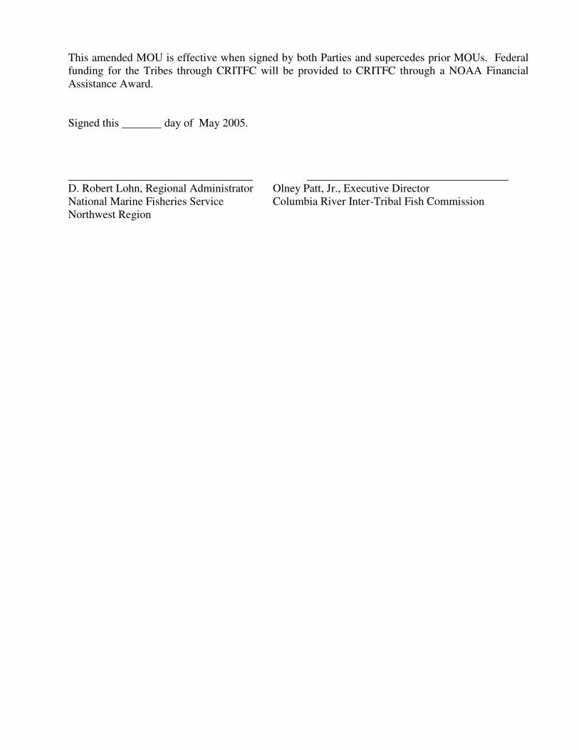
This amended MOU is effective when signed by both Parties and supercedes prior MOUs. Federal
funding for the Tribes through CRITFC will be provided to CRITFC through a NOAA Financial
Assistance Award.
Signed this day of May 2005.
D. Robert Lohn, Regional Administrator Olney Patt, Jr., Executive Director
National Marine Fisheries Service Columbia River Inter-Tribal Fish Commission
Northwest Region

Appendix A – 5th Field HUC (Hydrologic Unit Code) Listing HUC4 HUC4 Name HUC5 HUC5 NAME
Coeur D'Alene / Spokane 17010301 Upper Coeur D'Alene 1701030101 NF Coeur d'Alene River abv Tepee Cr
1701030102 Tepee Cr
1701030103 Middle NF Coeur d'Alene River abv Prichard
1701030104 Shoshone Cr
1701030105 Prichard Cr
1701030106 Lower NF Coeur d'Alene River blw Prichard
1701030107 Little NF Coeur d'Alene River
17010302
South Fork Coeur
D'Alene 1701030201 SF Coeur d'Alene River abv Placer Cr
1701030202 SF Coeur d'Alene River blw Placer Cr
1701030204 Pine Cr
17010303 Coeur D'Alene Lake 1701030301 Coeur d'Alene River abv Rose Cr
1701030302 Lower Coeur d'Alene River
1701030303 Wolf Lodge Arm
1701030304 Coeur d'Alene Lake basin
17010304 St. Joe 1701030401 St Joe River abv Simmons Cr
1701030402 St Joe River abv Fishhook Cr
1701030403 NF St Joe River
1701030404 St Joe River abv St Maries River
1701030405 Slate Cr
1701030406 Marble Cr
1701030407 Upper St Maries River
1701030408 Middle St Maries River
1701030409 Lower St Maries River
1701030410 Santa Cr
1701030411 St Joe River blw St Maries River
17010305 Upper Spokane 1701030501 Rathdrum Prairie blw Hayden Lake
1701030502 Hayden Lake
1701030503 Rathdrum Prairie
1701030504 Spokane River
17010306 Hangman 1701030601 Upper Hangman Creek
1701030602 Hangman Creek-Rock Creek
1701030603 Lower Hangman Creek
17010307 Lower Spokane 1701030701 Spokane River-Deep Creek
1701030702 Chamokane Creek
1701030703 Middle Lower Spokane River
1701030704 Spokane River-Orzada Creek
17010308 Little Spokane 1701030801 Upper Little Spokane River
1701030802 Dragoon Creek
1701030803 Lower Little Spokane River

Upper Columbia 17020001 Lake Roosevelt 1702000101 Deep Creek-Franklin D Roosevelt Lake
1702000102 North Lake Roosevelt
1702000103 Sherman Creek
1702000104 Franklin D Roosevelt Lake-Hall Creek
1702000105 Wilmont Creek-Ninemile Creek
1702000106 Franklin D Roosevelt Lake-Hawk Creek
17020002 Kettle River 1702000201 Myers Creek
1702000202 Toroda Creek
1702000203 Curlew Creek
1702000204 Kettle River-Vulcan Mountain
1702000205 Kettle River-Boulder Creek
17020003 Colville 1702000301 Colville River-Chewelah River
1702000302 Little Pend Oreille River
1702000303 Mill Creek-Colville River
1702000304 Colville River-Franklin D Roosevelt Lake
17020004 Sanpoil 1702000401 Upper Sanpoil River
1702000402 West Fork Sanpoil River
1702000403 Middle Sanpoil River
1702000404 Lower Sanpoil River
17020005 Chief Joseph 1702000501 Nespelem River
1702000502 Columbia River-Coyote Creek
1702000503 Foster Creek
1702000504 Columbia River-Jordan Creek
1702000505 Upper Columbia-Swamp Creek
17020006 Okanogan 1702000601 Upper Okanogan River
1702000602 Okanogan River-Bonaparte Creek
1702000603 Salmon Creek
1702000604 Okanogan River-Omak Creek
1702000605 Lower Okanogan River
17020007 Similkameen 1702000701 Pasayten River
1702000702 Ashnola River
1702000703 Sinlahekin Creek
1702000704 Lower Silkameen River
17020008 Methow 1702000801 Lost River
1702000802 Upper Methow River
1702000803 Upper Chewuch River
1702000804 Lower Chewuch River
1702000805 Twisp River
1702000806 Middle Methow River
1702000807 Lower Methow River
17020009 Lake Chelan 1702000901 Stehekin River
1702000902 Upper Lake Chelan
1702000903 Lower Lake Chelan

17020010 Upper Columbia- Entiat 1702001001 Entiat River
1702001002 Lake Entiat
1702001003 Columbia River-Lynch Coulee
1702001004 Columbia River-Sand Hollow
17020011 Wenatchee 1702001101 White River-Little Wenatchee River
1702001102 Chiawa River
1702001103 Wenatchee River-Nason Creek
1702001104 Wenatchee River-Icicle Creek
1702001105 Lower Wenatchee River
17020012 Moses Coulee 1702001201 Upper Mc Carteney Creek
1702001202 Lower Mc Carteney Creek
1702001203 Douglas Creek
1702001204 Rattlesnake Creek
17020013 Upper Crab 1702001301 Upper Crab Creek
1702001302 Crab Creek-Rock Creek
1702001303 Crab Creek-South Fork
1702001304 Crab Creek-Duck Creek
1702001305 Crab Creek-Lake Creek
1702001306 Upper Wilson Creek
1702001307 Lower Wilson Creek
17020014 Banks Lake 1702001401 Upper Grand Coulee
1702001402 Lower Grand Coulee
1702001403 Arbuckle Draw
17020015 Lower Crab 1702001501 Sand Coulee
1702001502 Rocky Coulee
1702001504 Weber Coulee
1702001505 Lind Coulee
1702001506 Town of Winchester
1702001507 Frenchman Hills Wasteway
1702001508 Rocky Ford Creek
1702001509 Lower Crab Creek
17020016
Upper Columbia-Priest
Rapids 1702001601 Old Maid Coulee
1702001602 Esquatzel Coulee
1702001603 Eagle Lakes
1702001604 Yakima River-Hanson Creek
1702001605 Middle Columbia River-Priest Rapids
1702001606 Columbia River-Zintel Canyon
Yakima 17030001 Upper Yakima 1703000101 Upper Yakima River
1703000102 Tenaway River
1703000103 Middle Yakima River
1703000104 Yakima River-Umatanum Creek
17030002 Naches 1703000201 Little Naches River
1703000202 Naches River-Rattlesnake Creek
1703000203 Naches River-Tieton River

17030003 Lower Yakima 1703000301 Ahtanum Creek
1703000302 Upper Lower Yakima River
1703000303 Upper Toppenish Creek
1703000304 Lower Toppenish Creek
1703000305 Satus Creek
1703000306 Yakima River-Spring Creek
1703000307 Yakima River-Cold Creek
Middle Snake 17050101 C. J. Strike Reservoir 1705010101 No Name Assigned
1705010102 No Name Assigned
1705010103 No Name Assigned
1705010104 No Name Assigned
1705010105 No Name Assigned
1705010106 No Name Assigned
1705010107 No Name Assigned
1705010108 No Name Assigned
1705010109 No Name Assigned
1705010110 No Name Assigned
1705010111 No Name Assigned
17050102 Bruneau 1705010201 Headwaters Bruneau River
1705010202 Bruneau River-Meadow Creek
1705010203 Bruneau River-McDonald Creek
1705010204 Upper Jarbidge River
1705010205 Lower Jarbidge River
1705010206 Bruneau River-Sheephead Draw
1705010207 Upper Sheep Creek
1705010208 Marys Creek
1705010209 Lower Sheep Creek
1705010210 Three Creek
1705010211 Clover Creek
1705010212 Bruneau River-Miller Water
1705010213 Bruneau River Valley
1705010214 Big Jacks Creek
1705010215 Little Jacks Creek
1705010216 Jacks Creek
17050103 Middle Snake-Succor 1705010301 Middle Snake River-Birch Creek
1705010302 Shoofly Creek
1705010303 Middle Snake River-Swan Falls
1705010304 Castle Creek
1705010305 Middle Snake River-Rabbit Creek
1705010306 Reynolds Creek
1705010307 Middle Snake River-Hardtrigger Creek
1705010308 Middle Snake River-Jump Creek
1705010309 Upper Succor Creek
1705010310 Lower Succor Creek
1705010311 Middle Snake River-North Alkali Creek
17050104 Upper Owyhee 1705010401 Owyhee River Headwaters
1705010402 Owyhee River/Badger Creek
1705010403 Owyhee River/Skull Creek

1705010404 Owyhee River/Blue Creek
1705010405 Upper Blue Creek
1705010406 Middle Blue Creek
1705010407 Lower Blue Creek
1705010408 Owyhee River/Juniper Creek
1705010409 Juniper Creek
1705010410 Battle Creek Headwaters
1705010411 Battle Creek
1705010412 Owyhee River/Deep Creek
1705010413 Deep Creek Headwaters
1705010414 Pole Creek
1705010415 Deep Creek
1705010416 Dickshooter Creek
1705010417 Piute Creek
17050105 South Fork Owyhee 1705010501 Indian Creek
1705010502 South Fork Owyhee River
1705010503 South Fork Owyhee River-Red Cow Creek
1705010504 South Fork Owyhee River
1705010505 South Fork Owyhee River-Bull Run Creek
1705010506 Bull Run Creek
1705010507 Sheep Creek
1705010508 Fourmile Creek
1705010509 South Fork Owyhee River-Coyote Hole
17050106 East Little Owyhee 1705010601 Silver Lake
1705010602 Lake Creek
1705010603 Upper Little Owyhee River
1705010604 Raven Creek
1705010605 Willow Creek
1705010606 Tent Creek
17050107 Middle Owyhee 1705010701 West Little Owyhee River
1705010702 Antelope Creek
1705010703 Middle Fork Owyhee River
1705010704 North Fork Owyhee River
1705010705 Owyhee River-Oregon Lake
1705010706 Soldier Creek
1705010707 Owyhee River-Skull Creek
17050108 Jordan 1705010801 Rock Creek
1705010802 Big Boulder Creek
1705010803 Jordan Creek Headwaters
1705010804 Jordan Creek-Lone Tree Creek
1705010805 Jordan Creek-Sheep Spring Creek
1705010806 Upper Cow Creek
1705010807 Lower Cow Creek
1705010808 Jordan Creek-Dry Creek
17050109 Crooked-Rattlesnake 1705010901 Upper Crooked Creek
1705010902 Rattlesnake Creek
1705010903 Wildcat Creek
1705010904 Dry Creek

1705010905 Lower Crooked Creek
17050110 Lower Owyhee 1705011001 Owyhee River-Ryegrass Creek
1705011002 Owyhee River-Jackson Creek
1705011003 Crowley Creek
1705011004 Upper Dry Creek
1705011005 Lower Dry Creek
1705011006 Owyhee River-Three Fingers Gulch
1705011007 Owyhee River-Sand Hollow Creek
17050111
North and Middle Fork
Boise 1705011101 Upper North Fork Boise River
1705011102 Middle North Fork Boise River
1705011103 Crooked River
1705011104 Lower North Fork Boise River
1705011105 Upper Middle Fork Boise River
1705011106 Middle Fork Boise River - Queens River
1705011107 Lower Middle Fork Boise River
17050112 Boise-Mores 1705011201 Upper Grimes Creek
1705011202 Lower Grimes Creek
1705011203 Upper Mores Creek
1705011204 Lower Mores Creek
1705011205 Middle Fork Boise River - Sheep Creek
1705011206 Boise River - Lucky Peak Reservoir
17050113 South Fork Boise 1705011301 Big Smoky Creek
1705011302 Little Smoky Creek
1705011303 South Fork Boise River - Skeleton Creek
1705011304 Upper South Fork Boise River
1705011305 South Fork Boise River - Feather River
1705011306 Anderson Ranch Reservoir
1705011307 Lime Creek
1705011308 Fall Creek
1705011309 Rock Creek - Cayuse Creek
1705011310 Lower South Fork Boise River
1705011311 Willow Creek
17050114 Lower Boise 1705011401 Lower Boise River
1705011402 No Name Assigned
1705011403 Tenmile Creek
1705011404 Willow Creek
1705011405 Indian Creek
1705011406 Lake Lowell
1705011407 Snake River-Lower Boise River
1705011408 Sand Hollow Creek
17050115 Middle Snake-Payette 1705011501 Snake River-Locket Gulch
1705011502 Snake River-Jacobsen Gulch
17050116 Upper Malheur 1705011601 Upper Malheur River
1705011602 Wolf Creek
1705011603 Pine Creek
1705011604 Stinkingwater Creek

1705011605 Upper Malheur River-Griffin Creek
1705011606 Otis Creek
1705011607 Upper Malheur River-Warm Springs Reservoir
1705011608 Upper South Fork Malheur River
1705011609 Crane Creek
1705011610 Lower South Fork Malheur River
1705011611 Upper North Fork Malheur River
1705011612 Little Malheur River
1705011613 Lower North Fork Malheur River
1705011614 Upper Malheur River-Juniper Basin Creek
17050117 Lower Malheur 1705011701 Lower Malheur River-Hunter Creek
1705011702 Lower Malheur River-Hog Creek
1705011703 Cottonwood Creek
1705011704 Lower Malheur River-Little Sandy Reservoir
1705011705 Sand Hollow Creek
1705011706 Lower Malheur River-Johnston Gulch Reservoir
17050118 Bully 1705011801 Upper Bully Creek
1705011802 Clover Creek
1705011803 Lower Bully Creek
17050119 Willow 1705011901 South Willow Creek
1705011902 Upper Willow Creek
1705011903 Cow Creek
1705011904 Middle Willow Creek
1705011905 West Tub Mountain Reservoir
1705011906 Lower Willow Creek
17050120 South Fork Payette 1705012001 Upper South Fork Payette River
1705012002 South Fork Payette River - Canyon Creek
1705012003 South Fork Payette River - Clear Creek
1705012004 Upper Deadwood River
1705012005 Lower Deadwood River
1705012006 South Fork Payette River - Alder Creek
17050121 North Fork Payette 1705012101 Middle Fork Payette River - Bull Creek
1705012102 Middle Fork Payette River - Silver Creek
1705012103 Middle Fork Payette River - Lightning Creek
1705012104 Middle Fork Payette River - Anderson Creek
17050122 Payette 1705012201 Payette River - Hill Creek
1705012202 Shafer Creek
1705012203 Payette River-Black Canyon Reservoir
1705012204 Upper Squaw Creek
1705012205 Lower Squaw Creek
1705012206 Little Squaw Creek
1705012207 Little Willow Creek
1705012208 Big Willow Creek
1705012209 Payette River-Snake River
17050123 North Fork Payette 1705012301 Upper North Fork Payette River
1705012302 North Fork Payette River-Lake Fork Creek

1705012303 Gold Fork River
1705012304 Cascade Reservoir
1705012305 North Fork Payette River-Big Creek
1705012306 Lower North Fork Payette River
17050124 Weiser 1705012401 Upper Weiser River
1705012402 West Fork Weiser River
1705012403 Hornet Creek
1705012404 Weiser River-Rush Creek
1705012405 Middle Fork Weiser River
1705012406 Pine Creek
1705012407 Little Weiser River
1705012408 Weiser River-Keithly Creek
1705012409 Crane Creek
1705012410 Weiser River-Monroe Creek
1705012411 Mann Creek
Burnt / Powder 17050201 Brownlee Reservoir 1705020101 Snake River-Hog Creek
1705020102 Snake River-Birch Creek
1705020103 Snake River-Rock Creek
1705020104 Snake River-Brownlee Creek
1705020105 Wildhorse River
1705020106 Pine Creek
1705020107 Snake River-Indian Creek
17050202 Burnt River 1705020201 North Fork Burnt River
1705020202 South Fork Burnt River
1705020203 Camp Creek
1705020204 Burnt River-Big Creek
1705020205 Burnt River-Auburn Creek
1705020206 Burnt River-Burnt River Canyon
1705020207 Pritchard Creek
1705020208 Lower Burnt River
17050203 Powder River 1705020301 Upper Powder River
1705020302 Powder River-Sutton Creek
1705020303 Powder River-Baldock Slough
1705020304 Powder River-Rock Creek
1705020305 North Powder River
1705020306 Powder River-Wolf Creek
1705020307 Big Creek
1705020308 Powder River-Ruckles Creek
1705020309 Powder River-Love Creek
1705020310 Eagle Creek
1705020311 Lower Powder River
Lower Snake 17060101 Hells Canyon 1706010101 Snake River-Granite Creek
1706010102 Snake River-Temperance Creek
1706010103 Snake River-Wolf Creek
17060102 Imnaha River 1706010201 Upper Imnaha River
1706010202 Middle Imnaha River
1706010203 Upper Big Sheep Creek

1706010204 Lower Big Sheep Creek
1706010205 Lower Imnaha River
17060103 Lower Snake-Asotin 1706010301 Snake River-Cherry Creek
1706010302 Asotin Creek
1706010303 Snake River-Captain John Creek
17060104
Upper Grande Ronde
River 1706010401 Upper Grande Ronde River
1706010402 Meadow Creek
1706010403 Grande Ronde River-Beaver Creek
1706010404 Grande Ronde River-Five Points Creek
1706010405 Upper Catherine Creek
1706010406 Ladd Creek
1706010407 Lower Catherine Creek
1706010408 Willow Creek
1706010409 Grande Ronde River-Indian Creek
1706010410 Lookingglass Creek
1706010411 Grande Ronde River-Cabin Creek
17060105 Wallowa River 1706010501 Upper Wallowa River
1706010502 Lostine River
1706010503 Middle Wallowa River
1706010504 Bear Creek
1706010505 Minam River
1706010506 Lower Wallowa River
17060106 Lower Grande Ronde 1706010601 Grande Ronde River-Grossman Creek
1706010602 Grande Ronde River-Mud Creek
1706010603 Wenaha River
1706010604 Chesnimnus Creek
1706010605 Upper Joseph Creek
1706010606 Lower Joseph Creek
1706010607 Lower Grande Ronde River
17060107 Lower Snake-Tucannon 1706010701 Alpowa Creek
1706010702 Snake River-Steptoe Canyon
1706010703 Deadman Creek
1706010704 Flat Creek
1706010705 Pataha Creek
1706010706 Upper Tucannon River
1706010707 Lower Tucannon River
1706010708 Snake River-Penawawa Creek
17060108 Palouse River 1706010801 Upper South Cow Creek
1706010802 Lower South Cow Creek
1706010803 Upper Palouse River
1706010804 South Fork Palouse River
1706010805 Palouse River-Silver Creek
1706010806 Union Flat Creek
1706010807 Palouse River-Rebel Flat Creek
1706010808 Lower Palouse River
17060109 Rock Creek 1706010901 Pine Creek

1706010902 Upper Rock Creek
1706010903 Cottonwood Creek
1706010904 Lower Rock Creek
17060110 Lower Snake River 1706011001 Snake River-Walker Creek
1706011002 Rye Grass Coulee
1706011003 Snake River-Mc Coy Creek
1706011004 Mouth of Snake River
Salmon 17060201 Upper Salmon 1706020101 Salmon River-Pole Creek
1706020102 Alturas Lake Creek
1706020103 Salmon River-Redfish Lake Creek
1706020104 Valley Creek
1706020105 Salmon River-Basin Creek
1706020106 Yankee Fork
1706020107 Warm Springs Creek
1706020108 Salmon River-Slate Creek
1706020109 Squaw Creek
1706020110 Upper East Fork Salmon River
1706020111 Middle East Fork Salmon River
1706020112 Herd Creek
1706020113 Lower East Fork Salmon River
1706020114 Salmon River-Bayhorse Creek
1706020115 Warm Spring Creek
1706020116 Salmon River-Garden Creek
1706020117 Challis Creek
1706020118 Morgan Creek
17060202 Pahsimeroi 1706020201 Upper Pahsimeroi River
1706020202 Middle Pahsimeroi River
1706020203 Lower Pahsimeroi River
17060203 Middle Salmon-Panther 1706020301 Middle Salmon River-Hat Creek
1706020302 Middle Salmon River-Iron Creek
1706020303 Middle Salmon River-Twelvemile Creek
1706020304 Middle Salmon River-Williams Creek
1706020305 Middle Salmon River-Carmen Creek
1706020306 North Fork Salmon River
1706020307 Middle Salmon River-Indian Creek
1706020308 Middle Salmon River-Pine Creek
1706020309 Upper Panther Creek
1706020310 Middle Panther Creek
1706020311 Napias Creek
1706020312 Lower Panther Creek
1706020313 Middle Salmon River-Owl Creek
17060204 Lemhi 1706020401 Texas Creek
1706020402 Eighteenmile Creek
1706020403 Hawley Creek
1706020404 Upper Lemhi River
1706020405 Timber Creek
1706020406 Middle Lemhi River
1706020407 Hayden Creek
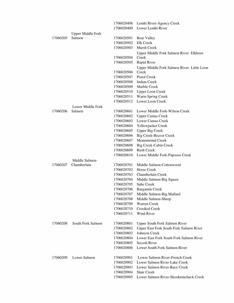
1706020408 Lemhi River-Agency Creek
1706020409 Lower Lemhi River
17060205
Upper Middle Fork
Salmon 1706020501 Bear Valley
1706020502 Elk Creek
1706020503 Marsh Creek
1706020504
Upper Middle Fork Salmon River- Elkhorn
Creek
1706020505 Rapid River
1706020506
Upper Middle Fork Salmon River- Little Loon
Creek
1706020507 Pistol Creek
1706020508 Indian Creek
1706020509 Marble Creek
1706020510 Upper Loon Creek
1706020511 Warm Spring Creek
1706020512 Lower Loon Creek
17060206
Lower Middle Fork
Salmon 1706020601 Lower Middle Fork-Wilson Creek
1706020602 Upper Camas Creek
1706020603 Lower Camas Creek
1706020604 Yellowjacket Creek
1706020605 Upper Big Creek
1706020606 Big Creek-Beaver Creek
1706020607 Monumental Creek
1706020608 Big Creek-Cabin Creek
1706020609 Rush Creek
1706020610 Lower Middle Fork-Papoose Creek
17060207
Middle Salmon-
Chamberlain 1706020701 Middle Salmon-Cottonwood
1706020702 Horse Creek
1706020703 Chamberlain Creek
1706020704 Middle Salmon-Big Squaw
1706020705 Sabe Creek
1706020706 Bargamin Creek
1706020707 Middle Salmon-Big Mallard
1706020708 Middle Salmon-Sheep
1706020709 Warren Creek
1706020710 Crooked Creek
1706020711 Wind River
17060208 South Fork Salmon 1706020801 Upper South Fork Salmon River
1706020802 Upper East Fork South Fork Salmon River
1706020803 Johnson Creek
1706020804 Lower East Fork South Fork Salmon River
1706020805 Secesh River
1706020806 Lower South Fork Salmon River
17060209 Lower Salmon 1706020901 Lower Salmon River-French Creek
1706020902 Lower Salmon River-Lake Creek
1706020903 Lower Salmon River-Race Creek
1706020904 Slate Creek
1706020905 Lower Salmon River-Skookumchuck Creek

1706020906 White Bird Creek
1706020907 Lower Salmon River-Rice Creek
1706020908 Rock Creek
1706020909 Lower Salmon River-Deep Creek
1706020910 Lower Salmon River-Deer Creek
17060210 Little Salmon 1706021001 Upper Little Salmon River
1706021002 Middle Little Salmon River
1706021003 Hazard Creek
1706021004 Rapid River
1706021005 Lower Little Salmon River
Clearwater 17060301 Upper Selway 1706030101 Selway River Headwaters
1706030102 Upper Selway River-Bad Luck Creek
1706030103 Little Clearwater River
1706030104 White Cap Creek
1706030105 Upper Selway River-Pettibone Creek
1706030106 Running Creek
1706030107 Bear Creek
17060302 Lower Selway 1706030201 Moose Creek
1706030202 Lower Selway River-Three Links Creek
1706030203 Meadow Creek
1706030204 Lower Selway River-Gedney Creek
17060303 Lochsa 1706030301 Crooked Fork Creek
1706030302 Colt Killed Creek
1706030303 Upper Lochsa River
1706030304 Warm Springs Creek
1706030305 Middle Lochsa River
1706030306 Fish Creek
1706030307 Lower Lochsa River
17060304 Middle Fork Clearwater 1706030401 Middle Fork Clearwater River
1706030402 Clear Creek
17060305 South Fork Clearwater 1706030501 Red River
1706030502 American River
1706030503 Upper South Fork Clearwater River
1706030504 Crooked River
1706030505 Newsome Creek
1706030506 Johns Creek
1706030507 Middle South Fork Clearwater River
1706030508 Lower South Fork Clearwater River
1706030509 Cottonwood Creek
17060306 Clearwater 1706030601 Upper Clearwater River
1706030602 Lawyer Creek
1706030603 Lolo Creek
1706030604 Jim Ford Creek
1706030605 Orofino Creek
1706030606 Lower Clearwater River
1706030607 Big Canyon Creek

1706030608 Cottonwood Creek
1706030609 Upper Potlatch River
1706030610 Middle Potlatch River
1706030611 Big Bear Creek
1706030612 Lower Potlatch River
1706030613 Lapwai Creek
17060307
Upper North Fork
Clearwater 1706030701
Upper North Fork of the Clearwater River - Lake
Creek
1706030702 Kelly Creek
1706030703 Cayuse Creek
1706030704 Moose Creek
1706030705
Upper North Fork of the Clearwater River -
Weitas Creek
1706030706 Weitas Creek
1706030707 Orogrande Creek
1706030708
Upper North Fork of the Clearwater River -
Washington Creek
1706030709
Upper North Fork of the Clearwater River -
Quartz Creek
1706030710 Skull Creek
17060308
Lower North Fork
Clearwater 1706030801
Lower North Fork of the Clearwater River -
Beaver Creek
1706030802 Upper Little North Fork of the Clearwater River
1706030803 Lower Little North Fork of the Clearwater River
1706030804 Breakfast Creek
1706030805 Lower North Fork of the Clearwater River
1706030806 Reeds Creek
1706030807
Lower North Fork of the Clearwater River -
Dicks Creek
1706030808 Elk Creek
Middle Columbia 17070101
Middle Columbia-Lake
Wallula 1707010101 Upper Lake Wallula
1707010102 Lower Lake Wallula
1707010103 Four Mile Canyon
1707010104 Bing Canyon
1707010105 Glade Creek
1707010106 Upper Lake Umatilla
1707010107 Juniper Canyon
1707010108 Sixmile Canyon
1707010109 Middle Lake Umatilla
1707010110 Alder Creek
1707010111 Pine Creek
1707010112 Wood Gulch
1707010113 Rock Creek
1707010114 Lower Lake Umatilla
17070102 Walla Walla 1707010201 Upper Walla Walla River
1707010202 Mill Creek-Walla Walla River
1707010203 Upper Touchet River
1707010204 Middle Touchet River
1707010205 Whetstone Hollow
1707010206 Winnett Canyon
1707010207 Lower Touchet River

1707010208 Cottonwood Creek
1707010209 Pine Creek
1707010210 Dry Creek
1707010211 Lower Walla Walla River
17070103 Umatilla 1707010301 Upper Umatilla River
1707010302 Meacham Creek
1707010303 Umatilla River-Mission Creek
1707010304 Wildhorse Creek
1707010305 McKay Creek
1707010306 Birch Creek
1707010307 Umatilla River-Alkali Canyon
1707010308 Stage Gulch
1707010309 Upper Butter Creek
1707010310 Lower Butter Creek
1707010311 Sand Hollow
1707010312 Cold Springs Canyon
1707010313 Lower Umatilla River
17070104 Willow 1707010401 Upper Willow Creek
1707010402 Middle Willow Creek
1707010403 Rhea Creek
1707010404 Eightmile Canyon
1707010405 Lower Willow Creek
17070105 Middle Columbia-Hood 1707010501 Middle Columbia River-Hood River
1707010502 Fifteenmile Creek
1707010503 Fivemile Creek
1707010504 Middle Columbia River-Mill Creek
1707010505 Mosier Creek
1707010506 East Fork Hood River
1707010507 West Fork Hood River
1707010508 Hood River
1707010509 Middle Columbia River-Grays Creek
1707010510 White Salmon River
1707010511 Little White Salmon River
1707010512 Wind River
1707010513 Middle Columbia River-Eagle Creek
17070106 Klickitat 1707010601 Upper Klickitat River
1707010602 Middle Klickitat River
1707010603 Little Klickitat River
1707010604 Lower Klickitat River
John Day 17070201 Upper John Day 1707020101 Upper South Fork John Day River
1707020103 Middle South Fork John Day River
1707020104 Murderers Creek
1707020105 Lower South Fork John Day River
1707020106 Upper John Day River
1707020107 Canyon Creek
1707020108 Strawberry Creek
1707020109 Beech Creek
1707020110 Laycock Creek

1707020111 Fields Creek
1707020112 Upper Middle John Day
1707020113 Mountain Creek
1707020114 Rock Creek
1707020115 John Day River-Johnson Creek
17070202 North Fork John Day 1707020201 Upper North Fork John Day River
1707020202 Granite Creek
1707020203 North Fork John Day River-Big Creek
1707020204 Desolation Creek
1707020205 Upper Camas Creek
1707020206 Lower Camas Creek
1707020207 North Fork John Day River-Potamus Creek
1707020208 Wall Creek
1707020209 Cottonwood Creek
1707020210 Lower North Fork John Day River
17070203 Middle Fork John Day 1707020301 Upper Middle Fork John Day River
1707020302 Camp Creek
1707020303 Big Creek
1707020304 Long Creek
1707020305 Lower Middle Fork John Day River
17070204 Lower John Day 1707020401 Lower John Day River-Kahler Creek
1707020402 Lower John Day River-Service Creek
1707020403 Bridge Creek
1707020404 Lower John Day River-Muddy Creek
1707020405 Lower John Day River-Clarno Rapids
1707020406 Butte Creek
1707020407 Pine Hollow
1707020408 Thirtymile Creek
1707020409 Lower John Day River-Ferry Canyon
1707020410 Lower John Day River-Scott Canyon
1707020411 Upper Rock Creek
1707020412 Lower Rock Creek
1707020413 Grass Valley Canyon
1707020414 Lower John Day River-McDonald Ferry
Deschutes 17070301 Upper Deschutes 1707030101 Deschutes River-Charleton Creek
1707030102 Deschutes River-Browns Creek
1707030103 Deschutes River-Fall River
1707030104 Deschutes River-Pilot Butte
1707030105 Tumalo Creek
1707030106 Deep Canyon
1707030107 Deschutes River-McKenzie Canyon
1707030108 Squaw Creek
1707030109 Upper Metolius River
1707030110 Lower Metolius River
1707030111 Deschutes River-Haystack
1707030201 Upper Little Deschutes River
1707030202 Crescent Creek
1707030203 Middle Little Deschutes River
1707030204 Sellers Creek

1707030205 Little Walker Mountain
1707030206 Long Prairie
1707030207 Lower Little Deschutes River
17070303 South Fork Crooked 1707030301 Soldier Cap
1707030302 Upper South Fork Crooked River
1707030303 Buck Creek
1707030304 Lower South Fork Crooked River
1707030305 Twelvemile Creek
1707030306 Grindstone Creek
1707030307 South Fork Beaver Creek
1707030308 Upper Beaver Creek
1707030309 Paulina Creek
1707030310 Lower Beaver Creek
17070304 Upper Crooked 1707030401 Crooked River-Watson Creek
1707030402 Camp Creek
1707030403 Upper North Fork Crooked River
1707030404 Deep Creek
1707030405 Lower North Fork Crooked River
1707030406 Upper Crooked River
1707030407 Bear Creek
1707030408 Prineville Reservoir
17070305 Lower Crooked 1707030501 Chimney Rock
1707030502 Upper Ochoco Creek
1707030503 Mill Creek-Ochoco Reservoir
1707030504 Lower Ochoco Creek
1707030505 McKay Creek
1707030506 Kotzman Basin
1707030507 Upper Dry River
1707030508 Lower Dry River
1707030509 Crooked River Irrigation Canals
1707030510 Lower Crooked Valley
1707030511 Crooked River-Crooked River Grassland
17070306 Lower Deschutes 1707030601 Headwaters Deschutes River
1707030602 Willow Creek
1707030603 Upper Deschutes River
1707030604 Mill Creek-Warm Springs River
1707030605 Beaver Creek
1707030606 Warm Springs River
1707030607 Middle Deschutes River
1707030608 Bakeoven Creek
1707030609 Tygh Creek
1707030610 White River
1707030611 Buck Hollow Creek
1707030612 Lower Deschutes River
17070307 Trout 1707030701 Upper Trout Creek
1707030702 Antelope Creek
1707030703 Hay Creek
1707030704 Mud Springs Creek

1707030705 Lower Trout Creek
Lower Columbia 17080001 Lower Columbia-Sandy 1708000101 Salmon River
1708000102 Zigzag River
1708000103 Upper Sandy River
1708000104 Middle Sandy River
1708000105 Bull Run River
1708000106 Washougal River
1708000107 Columbia Gorge Tributary
1708000108 Lower Sandy River
17080002 Lewis 1708000201 Upper Lewis River
1708000202 Muddy River
1708000203 Swift Reservoir
1708000204 Yale Reservoir
1708000205 East Fork Lewis River
1708000206 Lower Lewis River
17080003
Lower Columbia-
Clatskanie 1708000301 Kalama River
1708000302 Beaver Creek-Columbia River
1708000303 Clatskanie River
1708000304 Germany Creek
1708000305 Skamokawa Creek-Elochoman River
1708000306 Plympton Creek
1708000307 Columbia River-Cathlamet Channel
17080004 Upper Cowlitz 1708000401 Headwaters Cowlitz River
1708000402 Upper Cowlitz River
1708000403 Cowlitz River-Oliver Creek
1708000404 Upper Cispus River
1708000405 Lower Cispus River
17080005 Cowlitz 1708000501 Tilton River
1708000502 Riffe Reservoir
1708000503 Jackson Prairie
1708000504 North Fork Toutle River
1708000505 Green River
1708000506 South Fork Toutle River
1708000507 Toutle River-Cowlitz River
1708000508 Cowlitz River-Coweeman River
17080006 Lower Columbia 1708000601 Youngs River
1708000602 Big Creek
1708000603 Grays Bay
1708000604 Crooked Creek-Chinook River Frontal
1708000605 Columbia River-Baker Bay
Willamette 17090001 Middle Fork Willamette 1709000101 Upper Middle Fork Willamette River
1709000102 Hills Creek
1709000103 Salt Creek-Willamette River
1709000104 Salmon Creek
1709000105 Hills Creek Reservoir
1709000106 North Fork of Middle Fork Willamette River

1709000107
Middle Fork Willamette River-Lookout Point
Reservoir
1709000108 Little Fall Creek
1709000109 Fall Creek
1709000110 Lower Middle Fork of Willamette River
17090002 Coast Fork Willamette 1709000201 Row River
1709000202 Mosby Creek
1709000203 Upper Coast Fork Willamette River
1709000204 Lower Coast Fork Willamette River
17090003 Upper Willamette 1709000301 Long Tom River
1709000302 Muddy Creek
1709000303 Calapooia River
1709000304 Oak Creek
1709000305 Marys River
1709000306 Luckiamute River
17090004 Mckenzie 1709000401 Upper McKenzie River
1709000402 Horse Creek
1709000403 South Fork McKenzie River
1709000404 Blue River
1709000405 McKenzie River-Quartz Creek
1709000406 Mohawk River
1709000407 Lower McKenzie River
17090005 North Santiam 1709000501 Upper North Santiam River
1709000502 North Fork Breitenbush River
1709000503 Detroit Reservoir-Blow Out Divide Creek
1709000504 Middle North Santiam River
1709000505 Little North Santiam River
1709000506 Lower North Santiam River
17090006 South Santiam 1709000601 Middle Santiam River
1709000602 Quartzville Creek
1709000603 South Santiam River
1709000604 South Santiam River-Foster Reservoir
1709000605 Wiley Creek
1709000606 Crabtree Creek
1709000607 Thomas Creek
1709000608 South Santiam River-Hamilton Creek
17090007 Middle Willamette 1709000701 Mill Creek-Willamette River
1709000702 Rickreall Creek
1709000703 Willamette River-Chehalem Creek
1709000704 Abernethy Creek
17090008 Yamhill 1709000801 Upper South Yamhill River
1709000802 Willamina Creek
1709000803 Mill Creek-South Yamhill River
1709000804 Lower South Yamhill River
1709000805 Salt Creek-South Yamhill River
1709000806 North Yamhill River

1709000807 Yamhill River
17090009 Molalla-Pudding 1709000901 Abiqua Creek-Pudding River
1709000902 Butte Creek-Pudding River
1709000903 Rock Creek-Pudding River
1709000904 Senecal Creek-Mill Creek
1709000905 Upper Molalla River
1709000906 Lower Molalla River
17090010 Tualatin 1709001001 Dairy Creek
1709001002 Gales Creek
1709001003 Scoggins Creek
1709001004 Rock Creek-Tualatin River
1709001005 Lower Tualatin River
17090011 Clackamas 1709001101 Collawash River
1709001102 Upper Clackamas River
1709001103 Oak Grove Fork Clackamas River
1709001104 Middle Clackamas River
1709001105 Eagle Creek
1709001106 Lower Clackamas River
17090012 Lower Willamette 1709001201 Johnson Creek
1709001202 Scappoose Creek
1709001203 Columbia Slough-Willamette River
1709001204 Salmon Creek
1709001205 Columbia River-Hayden Island