SABLE-3 Southern Alberta Balloon Launch Experiment #3 On August 11/2007 a group of amateur radio...
39
SABLE-3 Southern Alberta Balloon Launch Experiment #3 On August 11/2007 a group of amateur radio buffs in the Edmonton ,Alberta area sent a camera into space using a weather balloon. Taking pictures all the way up and down they reached the incredible height of 117,597 feet … that’s 22 miles or 35 km ! Camera In Space ! Awesome !
-
Upload
luke-barks -
Category
Documents
-
view
214 -
download
0
Transcript of SABLE-3 Southern Alberta Balloon Launch Experiment #3 On August 11/2007 a group of amateur radio...
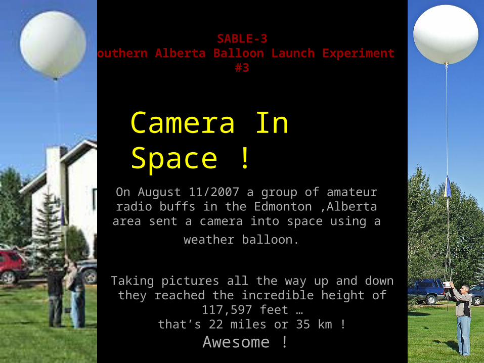
SABLE-3Southern Alberta Balloon Launch Experiment #3
On August 11/2007 a group of amateur radio buffs in the Edmonton ,Alberta area sent a camera into
space using a weather balloon.
Taking pictures all the way up and down they reached the incredible height of 117,597 feet …
that’s 22 miles or 35 km !
Camera In Space !
Awesome !
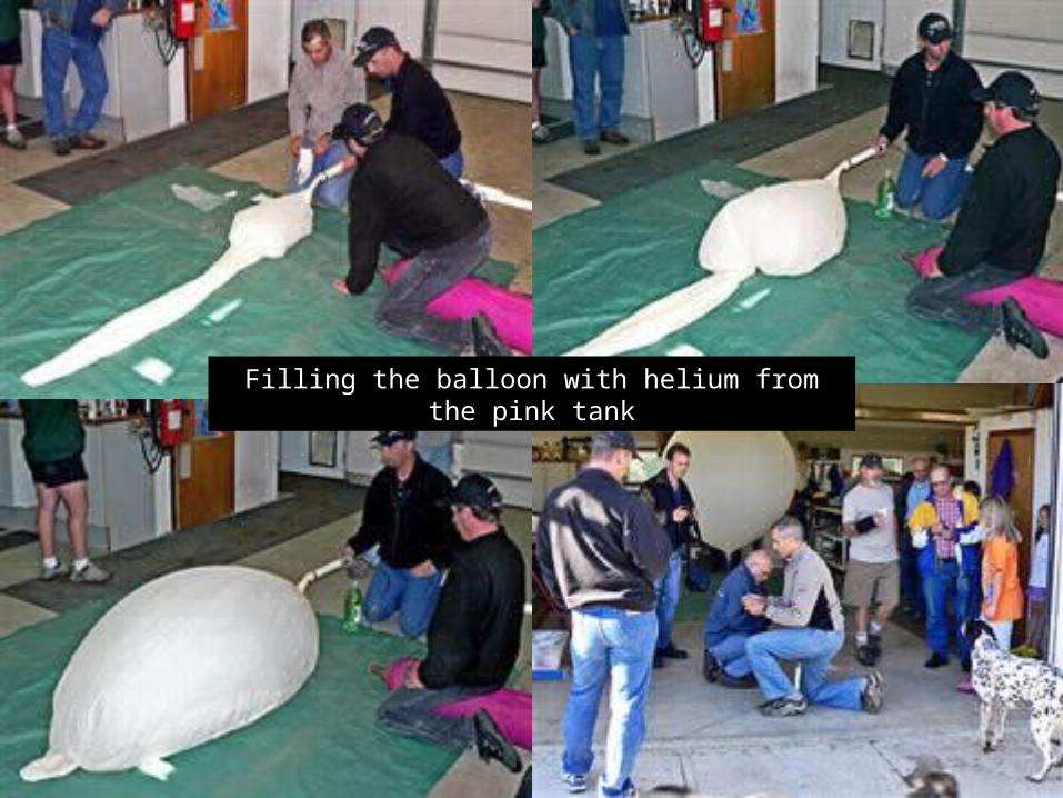
Filling the balloon with helium from the pink tank
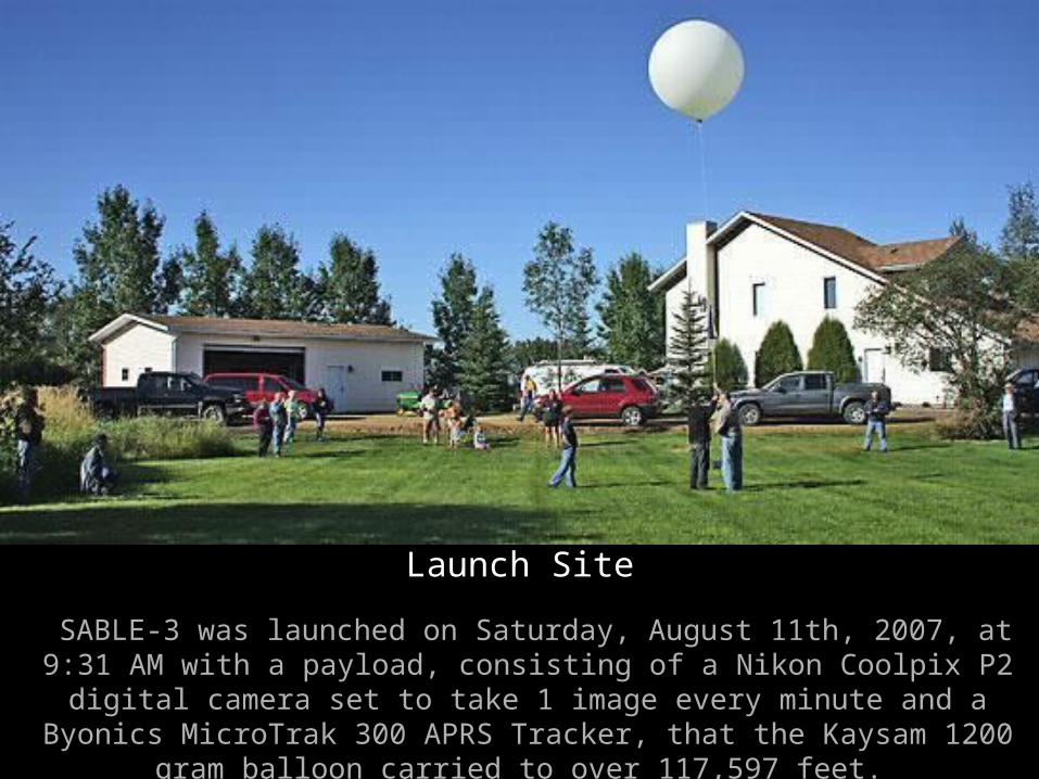
Launch Site
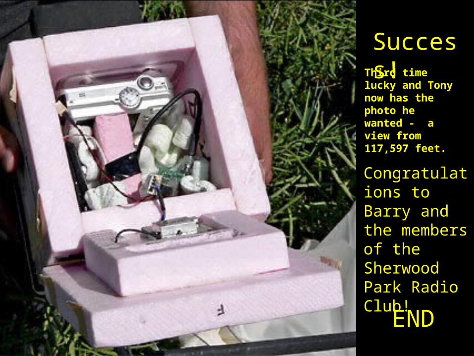
SABLE-3 was launched on Saturday, August 11th, 2007, at 9:31 AM with a payload, consisting of a Nikon Coolpix P2 digital camera set to take 1 image every minute and a Byonics MicroTrak 300 APRS Tracker, that the Kaysam
1200 gram balloon carried to over 117,597 feet.
Launch Site
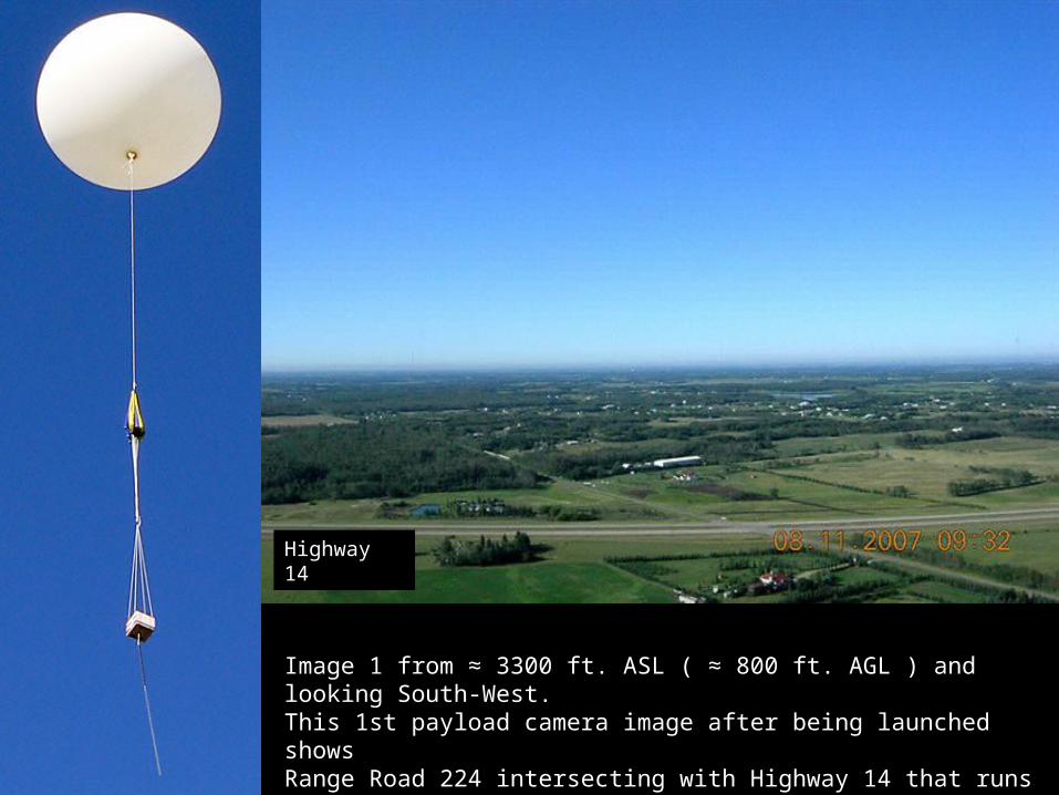
Image 1 from ≈ 3300 ft. ASL ( ≈ 800 ft. AGL ) and looking South-West.This 1st payload camera image after being launched shows Range Road 224 intersecting with Highway 14 that runs across the image.
Highway 14
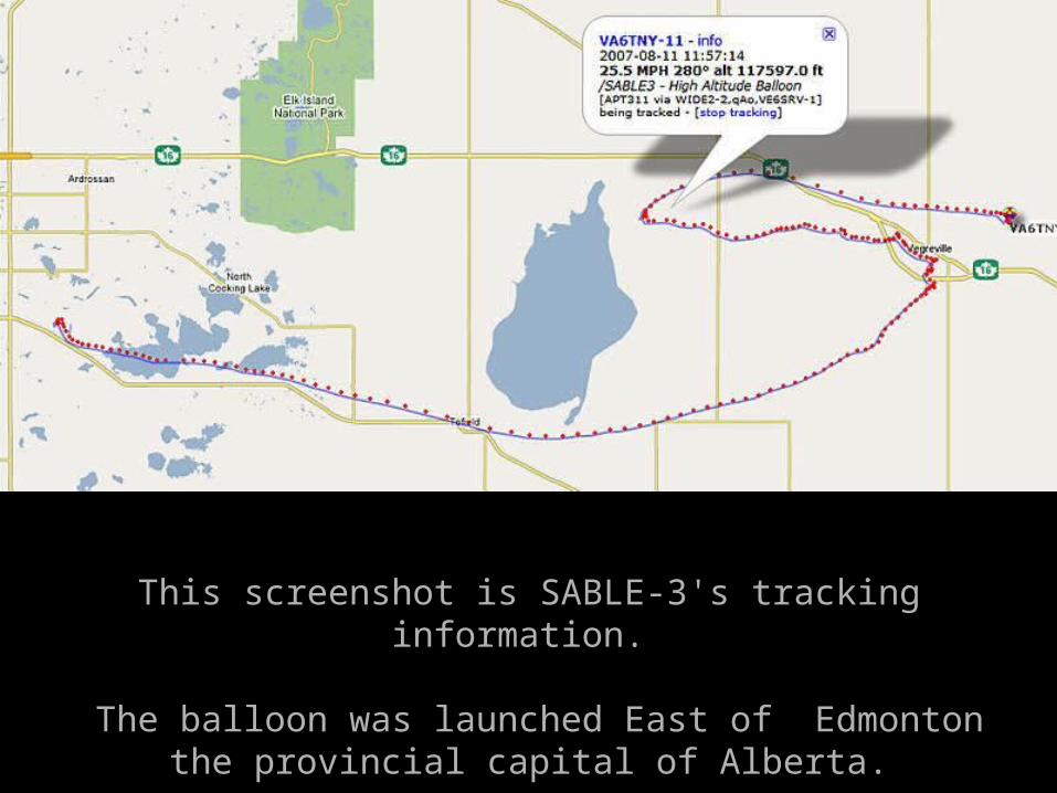
This screenshot is SABLE-3's tracking information.
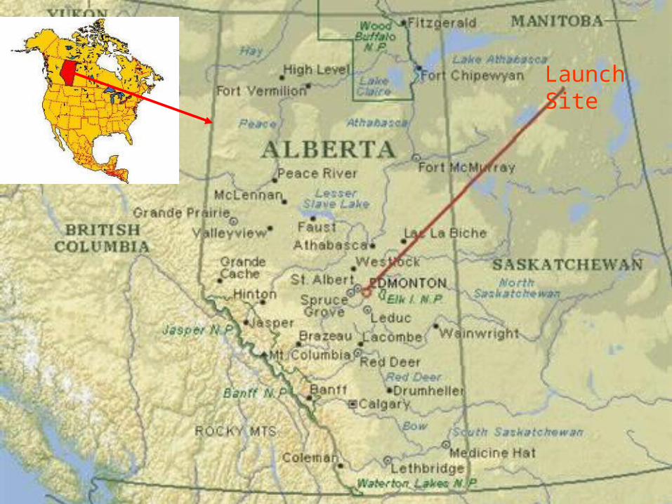
The balloon was launched East of Edmonton the provincial capital of Alberta.
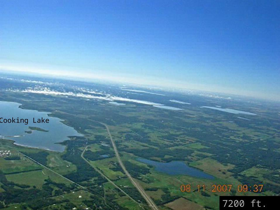
7200 ft. ASL
Cooking Lake
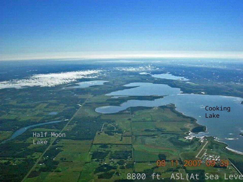
8800 ft. ASL(At Sea Level)
Half Moon Lake
Cooking Lake
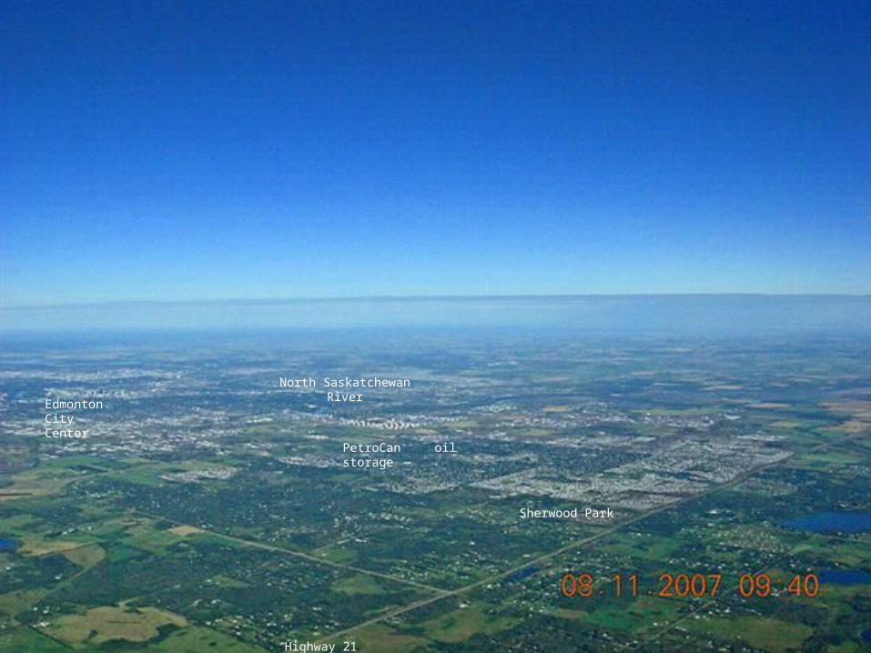
Highway 21
Sherwood Park
PetroCan oil storage
Edmonton City Center
North Saskatchewan River
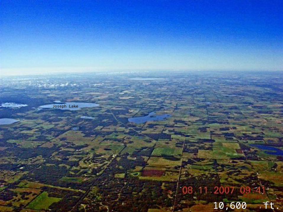
10,600 ft. ASL
Joseph Lake
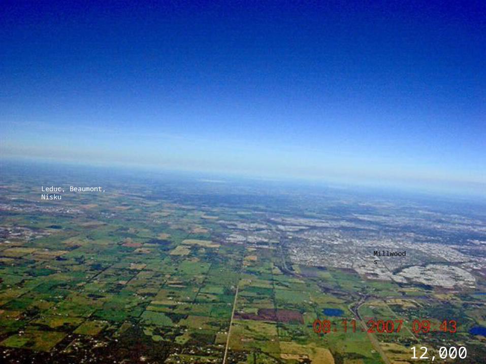
Millwoods
Leduc, Beaumont, Nisku
12,000 ft
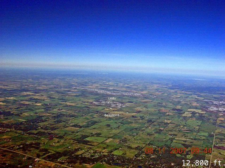
Beaumont
Leduc
12,800 ft.
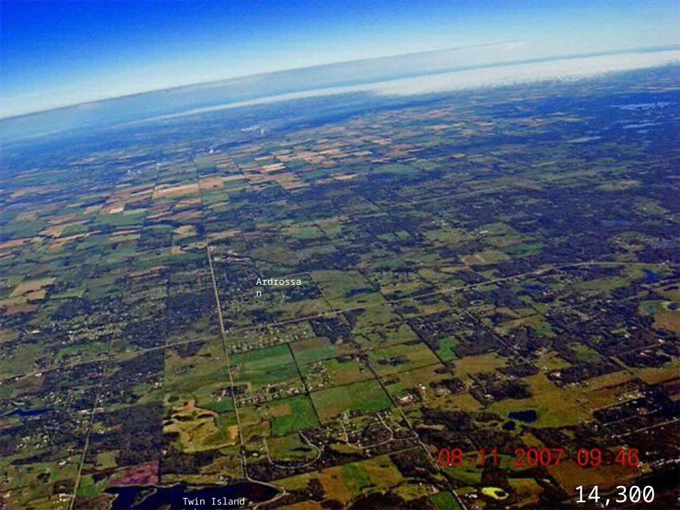
Twin Island Lake 14,300 ft
Ardrossan
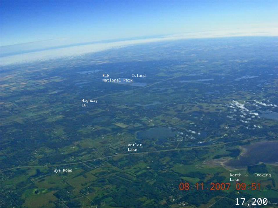
North Cooking Lake
Antler Lake
Elk Island National Park
Wye Road
Highway 16
17,200 ft.
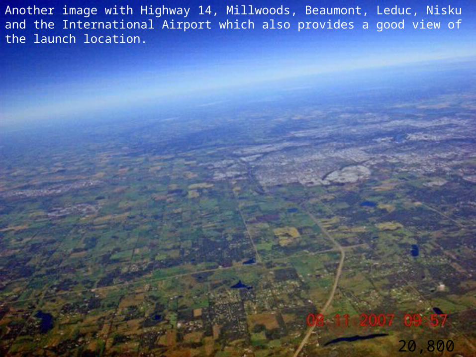
20,800 ft.
Another image with Highway 14, Millwoods, Beaumont, Leduc, Nisku and the International Airport which also provides a good view of the launch location.
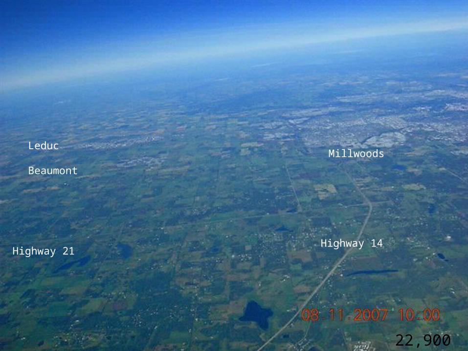
22,900 ft
Highway 21
Millwoods
Highway 14
Leduc
Beaumont
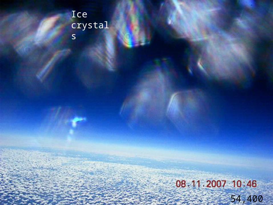
54,400 ft
Ice crystals
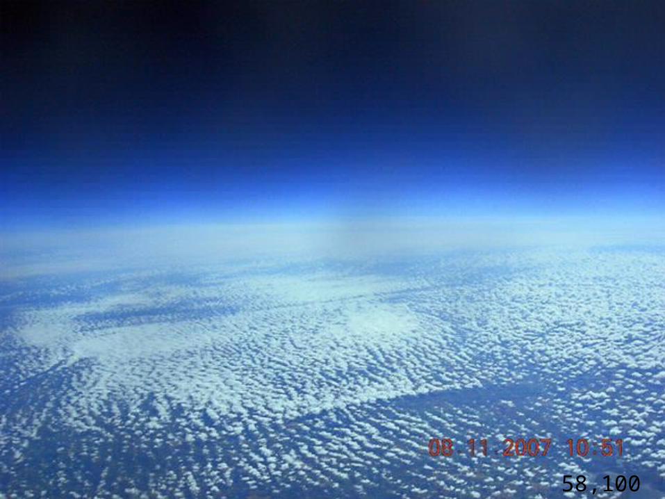
58,100 ft
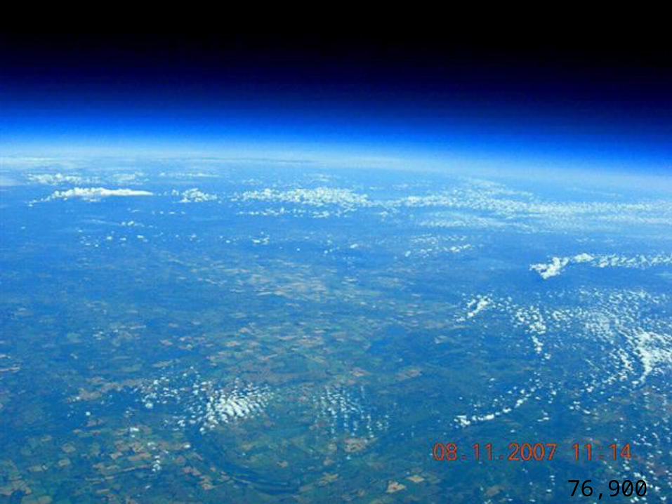
76,900 ft
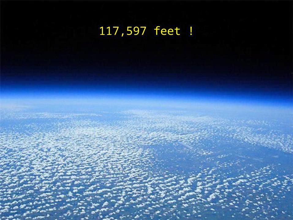
117,597 feet !
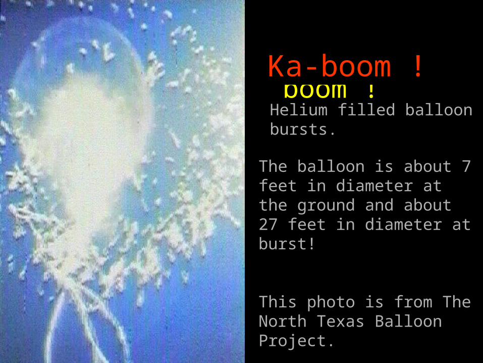
Ka-boom !
The balloon is about 7 feet in diameter at the ground and about 27 feet in diameter at burst!
This photo is from The North Texas Balloon Project.
Helium filled balloon bursts.
Ka-boom !
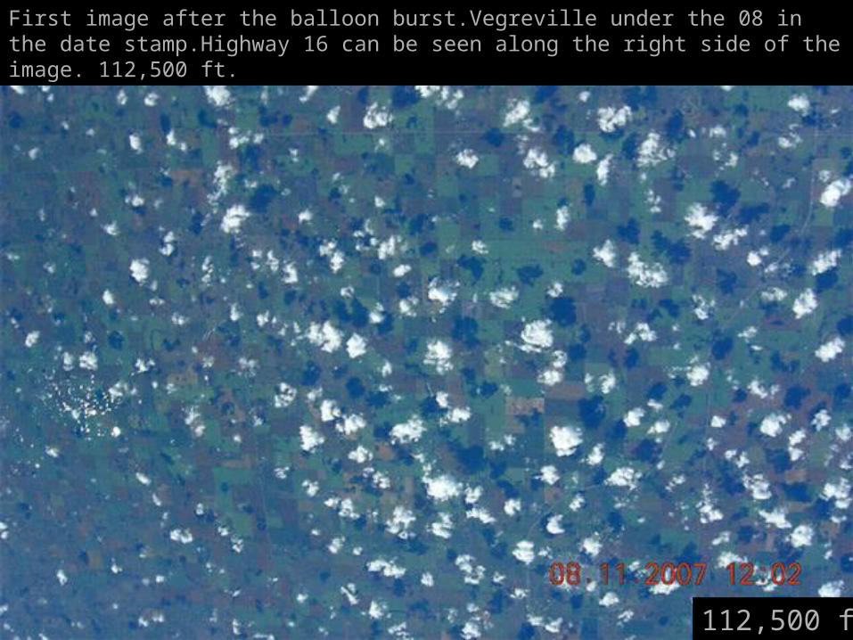
First image after the balloon burst.Vegreville under the 08 in the date stamp.Highway 16 can be seen along the right side of the image. 112,500 ft.
112,500 ft
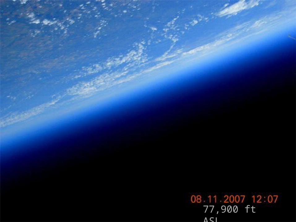
77,900 ft ASL
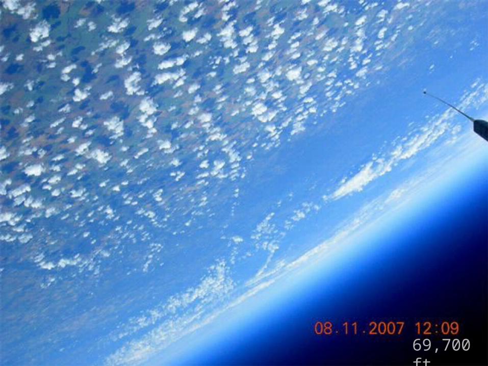
69,700 ft.
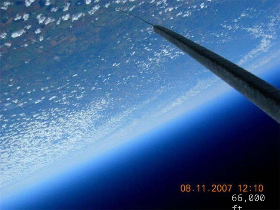
66,000 ft.
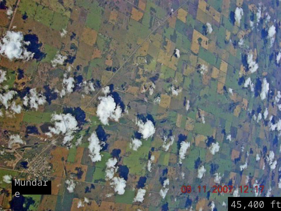
Mundare
45,400 ft.
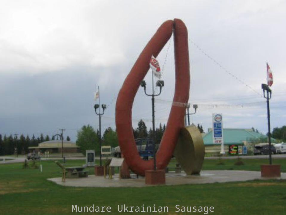
Mundare Ukrainian Sausage Display
39,000 ft.
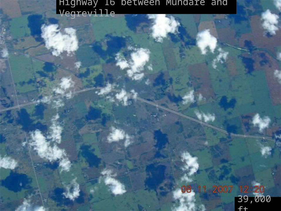
Highway 16 between Mundare and Vegreville
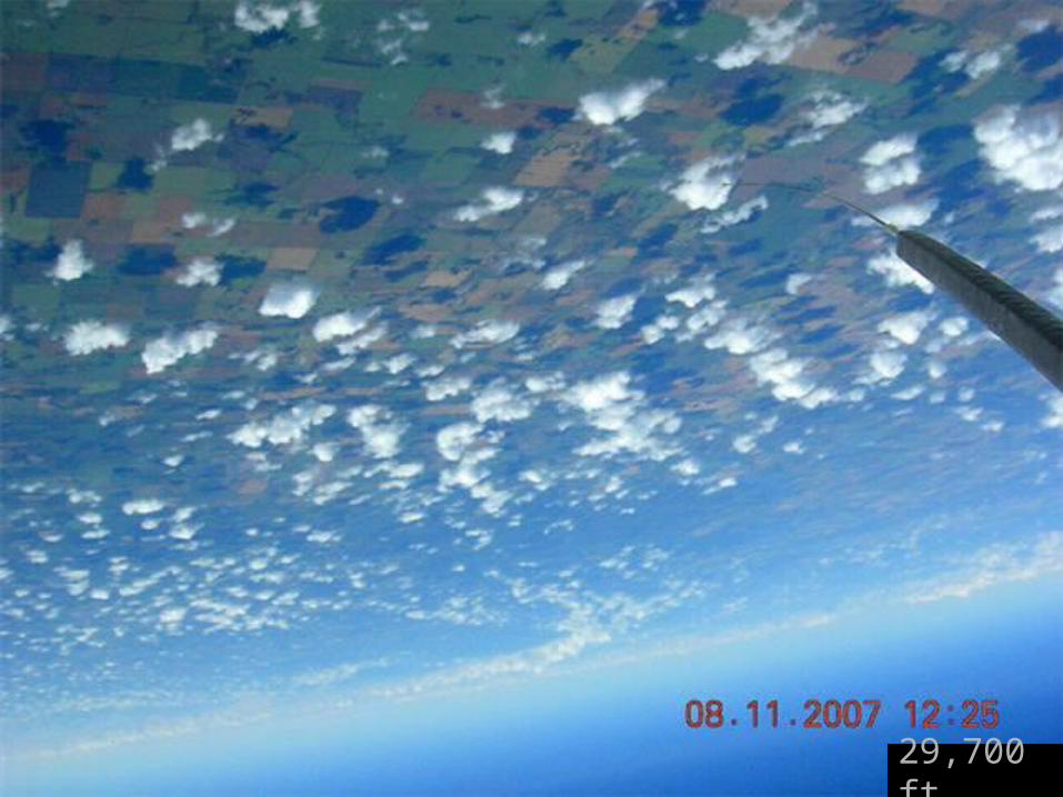
29,700 ft.
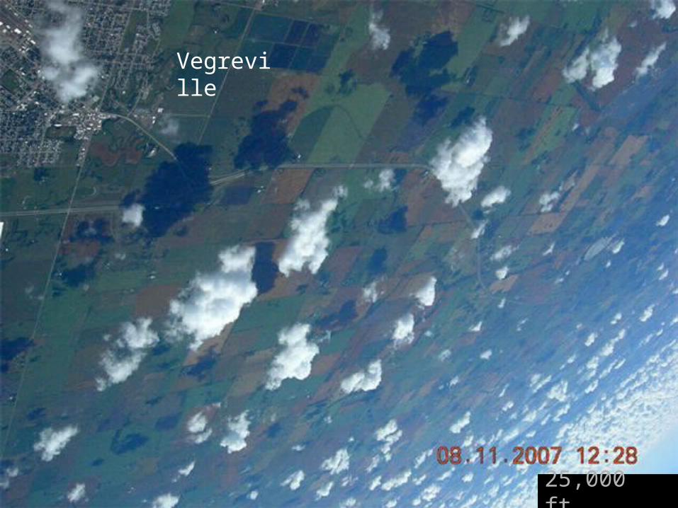
Vegreville
25,000 ft.
Vegreville
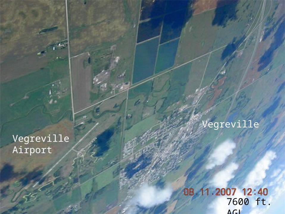
7600 ft. AGL
Vegreville Airport
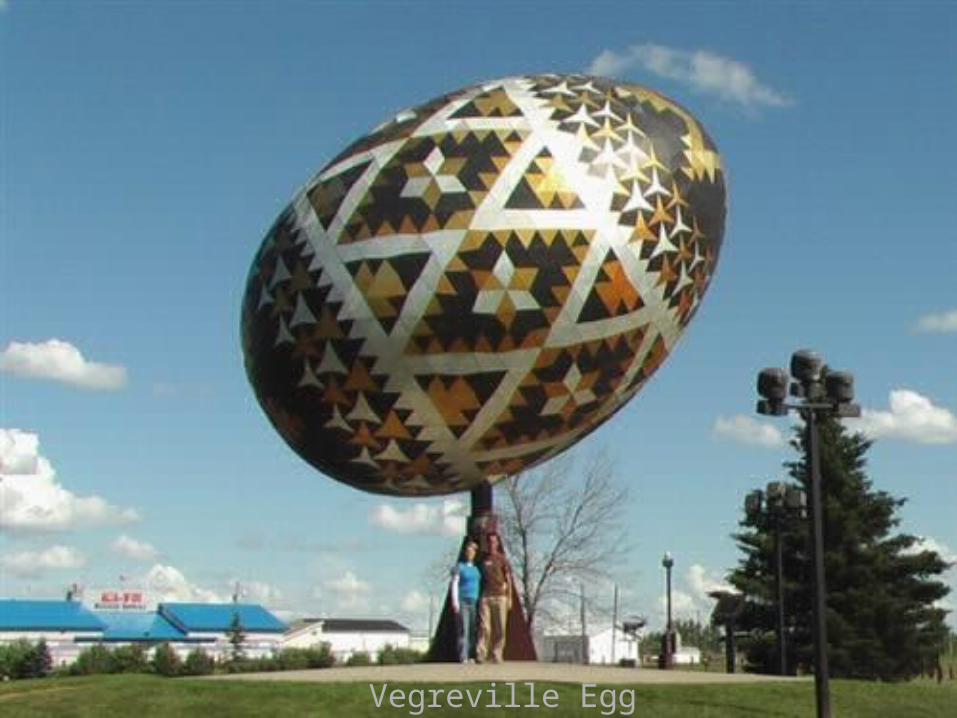
Vegreville Egg
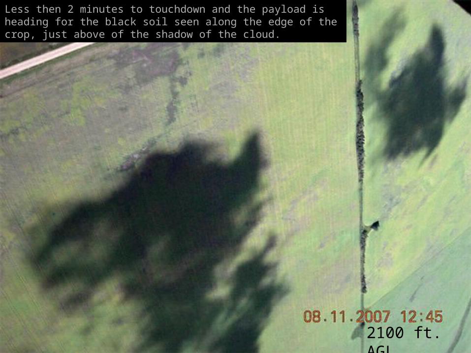
2100 ft. AGL
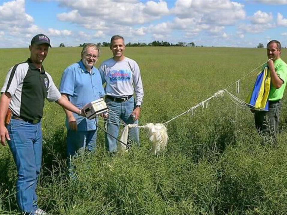
Less then 2 minutes to touchdown and the payload is heading for the black soil seen along the edge of the crop, just above of the shadow of the cloud.
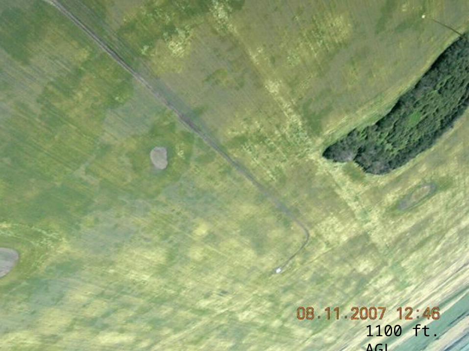
1100 ft. AGL
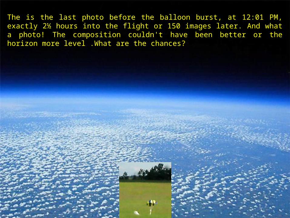
The is the last photo before the balloon burst, at 12:01 PM, exactly 2½ hours into the flight or 150 images later. And what a photo! The composition couldn't have been better or the horizon more level .What are the chances?
END
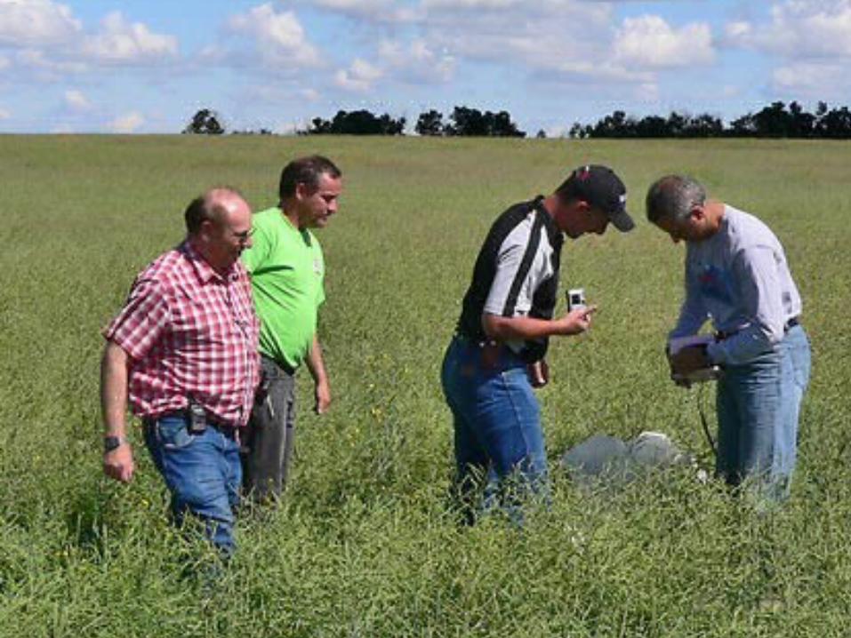
Third time lucky and Tony now has the photo he wanted - a view from 117,597 feet.
Success!
Congratulations to Barry and the members of the Sherwood Park Radio Club!