![rotorheadsrus.usrotorheadsrus.us/documents/Flying Mag. July 1988 Article 129th ARRS...homing in on the ELT's signal. "The SARSAT [Search and Rescue Satellite-Aided Tracking] satellite](https://static.fdocuments.in/doc/165x107/5b05ec407f8b9ac33f8c151a/mag-july-1988-article-129th-arrshoming-in-on-the-elts-signal-the-sarsat-search.jpg)
S A R S A T Search & Rescue Satellite-Aided Tracking.
41
S A R S A T SARSAT Search & Rescue Search & Rescue Satellite-Aided Tracking Satellite-Aided Tracking
-
Upload
cecil-brown -
Category
Documents
-
view
242 -
download
0
Transcript of S A R S A T Search & Rescue Satellite-Aided Tracking.
S A R S A T
SARSAT
Search & RescueSearch & Rescue
Satellite-Aided TrackingSatellite-Aided Tracking

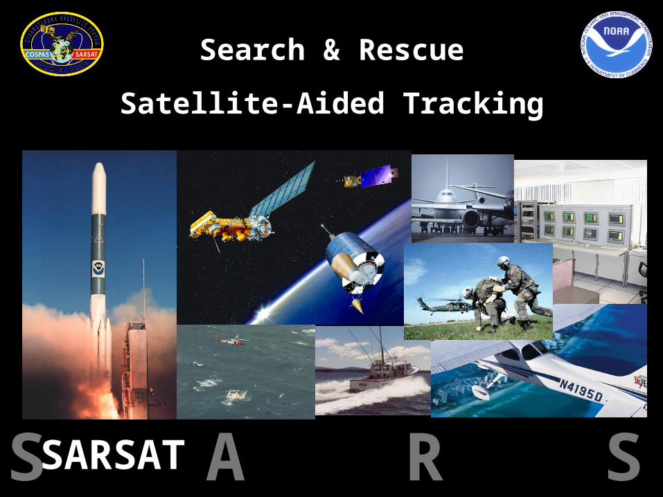
COSPAS = Cosmicheskaya Systyema Poiska Aariynyich Sudov
Which loosely translates into: “The Space System for the Search of Vessels in Distress”
SARSAT = Search And Rescue Satellite Aided Tracking
What is Cospas-Sarsat???What is Cospas-Sarsat???
In short, Cospas-Sarsat takes the “search” out In short, Cospas-Sarsat takes the “search” out of Search & Rescueof Search & Rescue
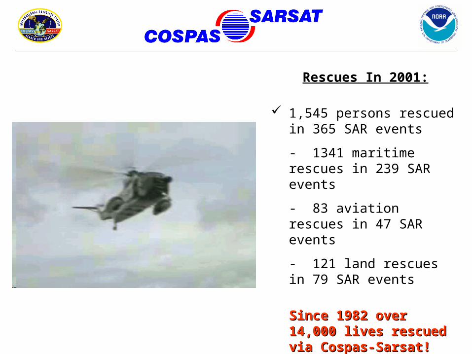
Rescues In 2001:
1,545 persons rescued in 365 SAR events
- 1341 maritime rescues in 239 SAR events
- 83 aviation rescues in 47 SAR events
- 121 land rescues in 79 SAR events
Since 1982 over 14,000 Since 1982 over 14,000 lives rescued via Cospas-lives rescued via Cospas-Sarsat! Nearly 5,000 in Sarsat! Nearly 5,000 in U.S. AOR’s alone!U.S. AOR’s alone!
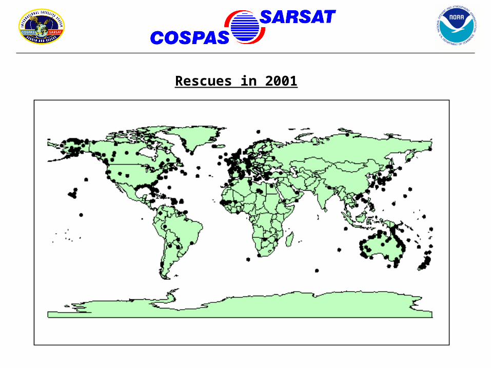
Rescues in 2001
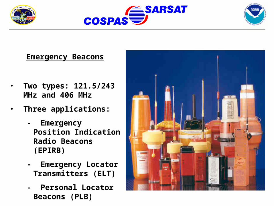
Emergency Beacons
• Two types: 121.5/243 MHz and 406 MHz
• Three applications:
- Emergency Position Indication Radio Beacons (EPIRB)
- Emergency Locator Transmitters (ELT)
- Personal Locator Beacons (PLB)
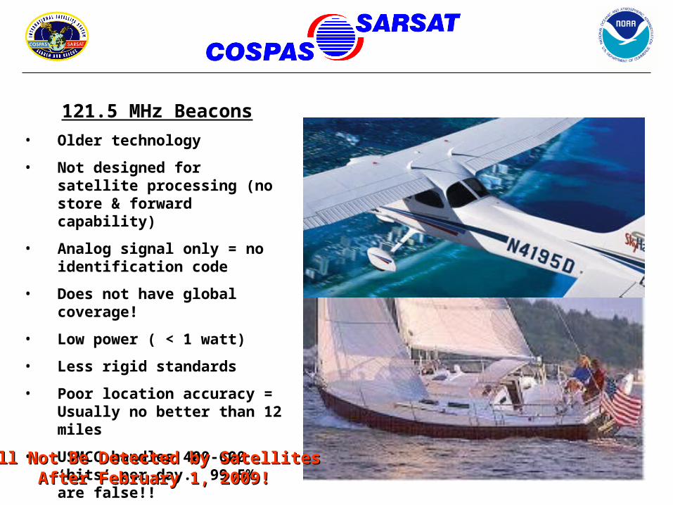
121.5 MHz Beacons
• Older technology
• Not designed for satellite processing (no store & forward capability)
• Analog signal only = no identification code
• Does not have global coverage!
• Low power ( < 1 watt)
• Less rigid standards
• Poor location accuracy = Usually no better than 12 miles
• USMCC handles 400-600 ‘hits’ per day. 99.5% are false!!
Will Not Be Detected by Satellites Will Not Be Detected by Satellites After February 1, 2009!After February 1, 2009!
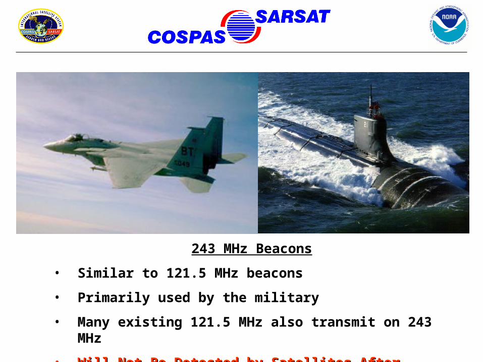
243 MHz Beacons
• Similar to 121.5 MHz beacons
• Primarily used by the military
• Many existing 121.5 MHz also transmit on 243 MHz
• Will Not Be Detected by Satellites After February 1, 2009!Will Not Be Detected by Satellites After February 1, 2009!
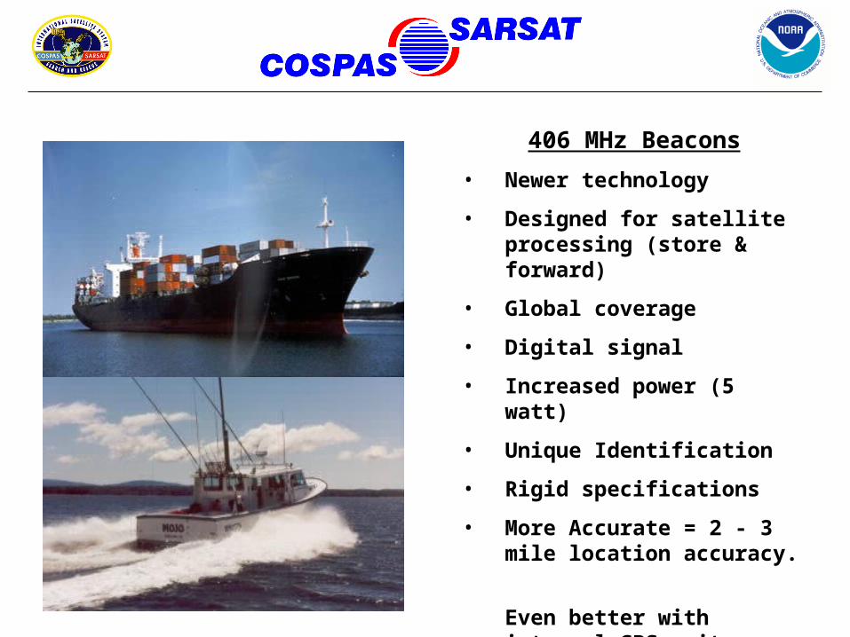
406 MHz Beacons
• Newer technology
• Designed for satellite processing (store & forward)
• Global coverage
• Digital signal
• Increased power (5 watt)
• Unique Identification
• Rigid specifications
• More Accurate = 2 - 3 mile location accuracy.
Even better with integral GPS units = 100 meter accuracy!
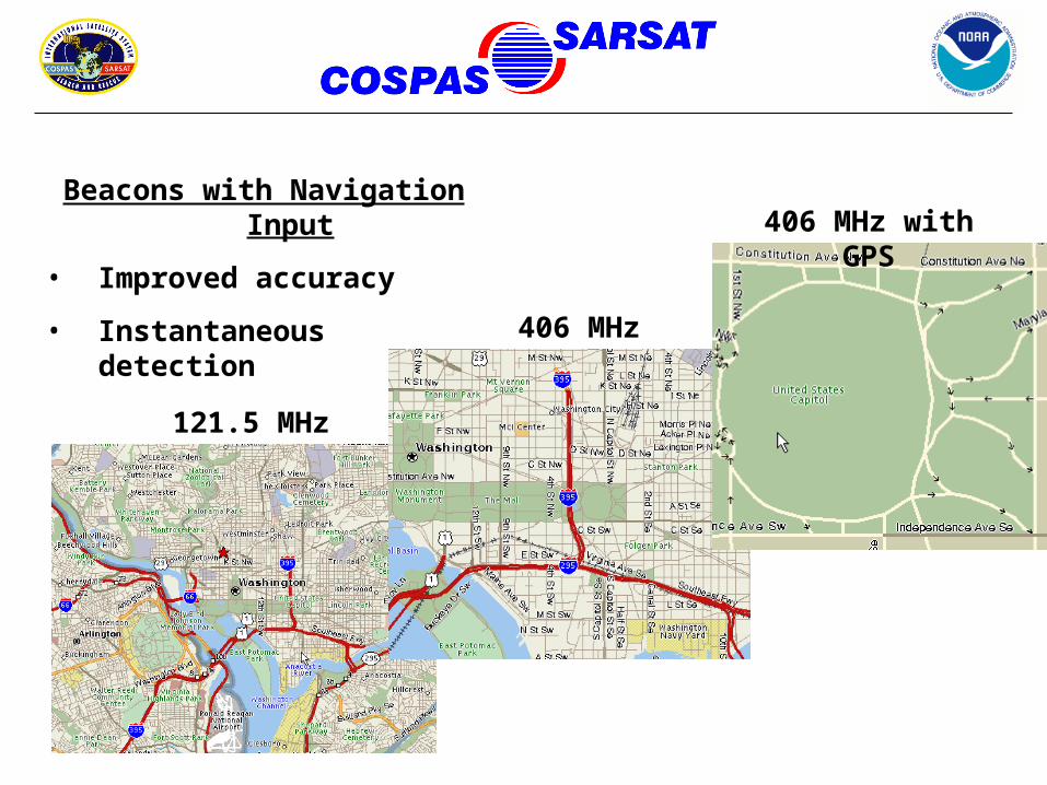
Beacons with Navigation Input
• Improved accuracy
• Instantaneous detection
121.5 MHz
406 MHz
406 MHz with GPS
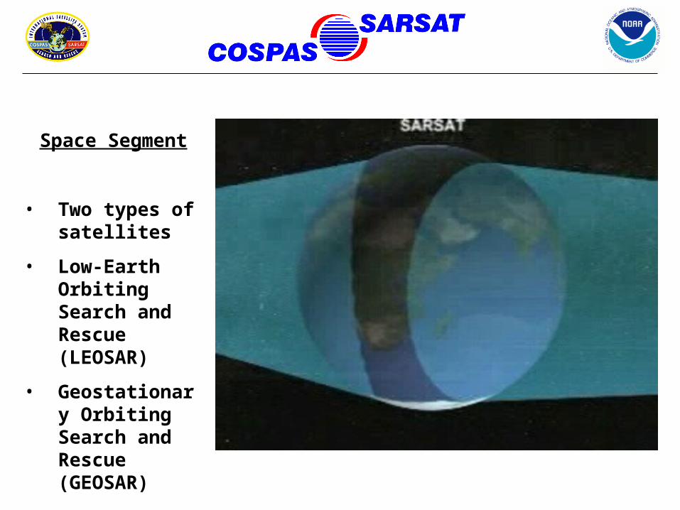
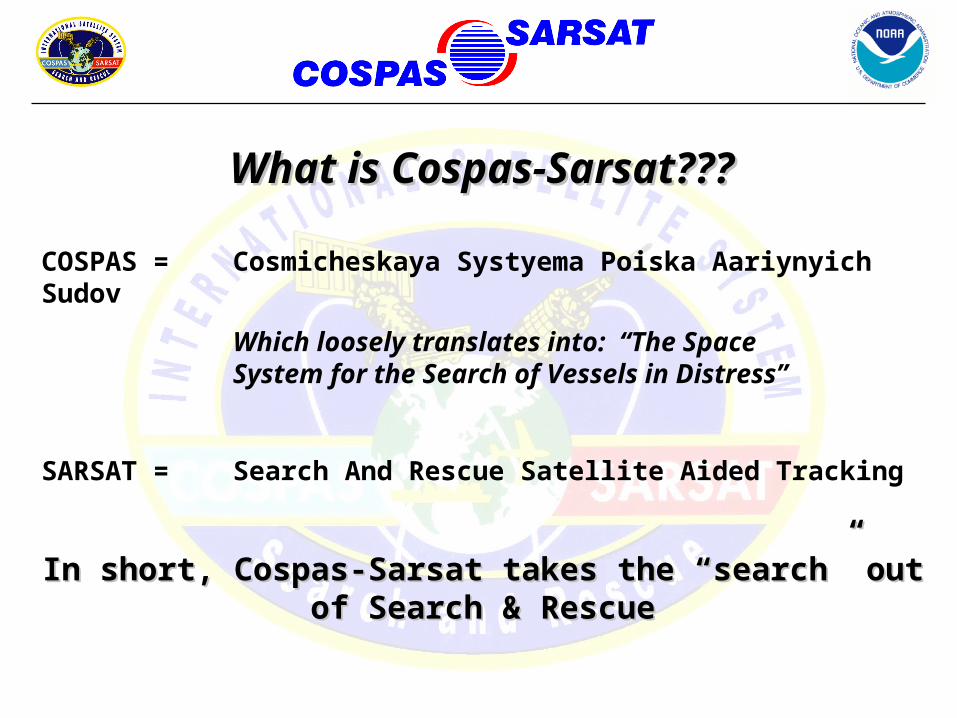
Space Segment
• Two types of satellites
• Low-Earth Orbiting Search and Rescue (LEOSAR)
• Geostationary Orbiting Search and Rescue (GEOSAR)
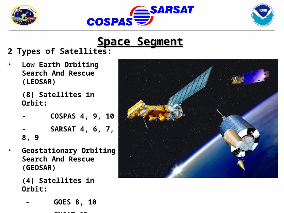
2 Types of Satellites:
• Low Earth Orbiting Search And Rescue (LEOSAR)
(8) Satellites in Orbit:
- COSPAS 4, 9, 10
- SARSAT 4, 6, 7, 8, 9
• Geostationary Orbiting Search And Rescue (GEOSAR)
(4) Satellites in Orbit:
- GOES 8, 10
- INSAT 2B
- MSG (recently launched & undergoing testing)
Space SegmentSpace Segment
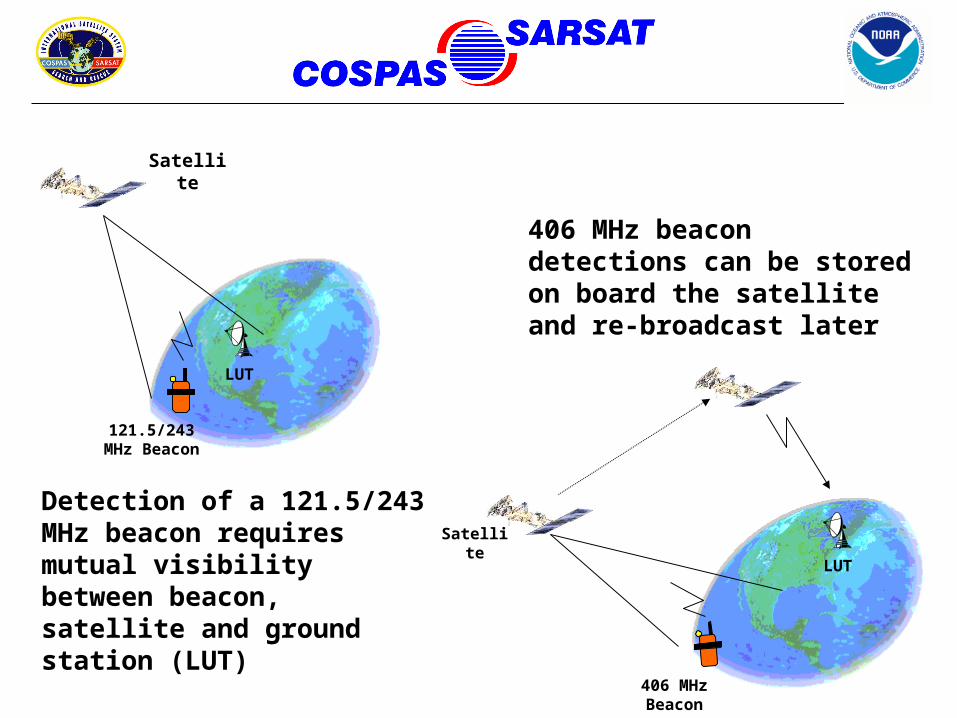
121.5/243 MHz Beacon
Satellite
LUT
Detection of a 121.5/243 MHz beacon requires mutual visibility between beacon, satellite and ground station (LUT)
406 MHz Beacon
Satellite
LUT
406 MHz beacon detections can be stored on board the satellite and re-broadcast later
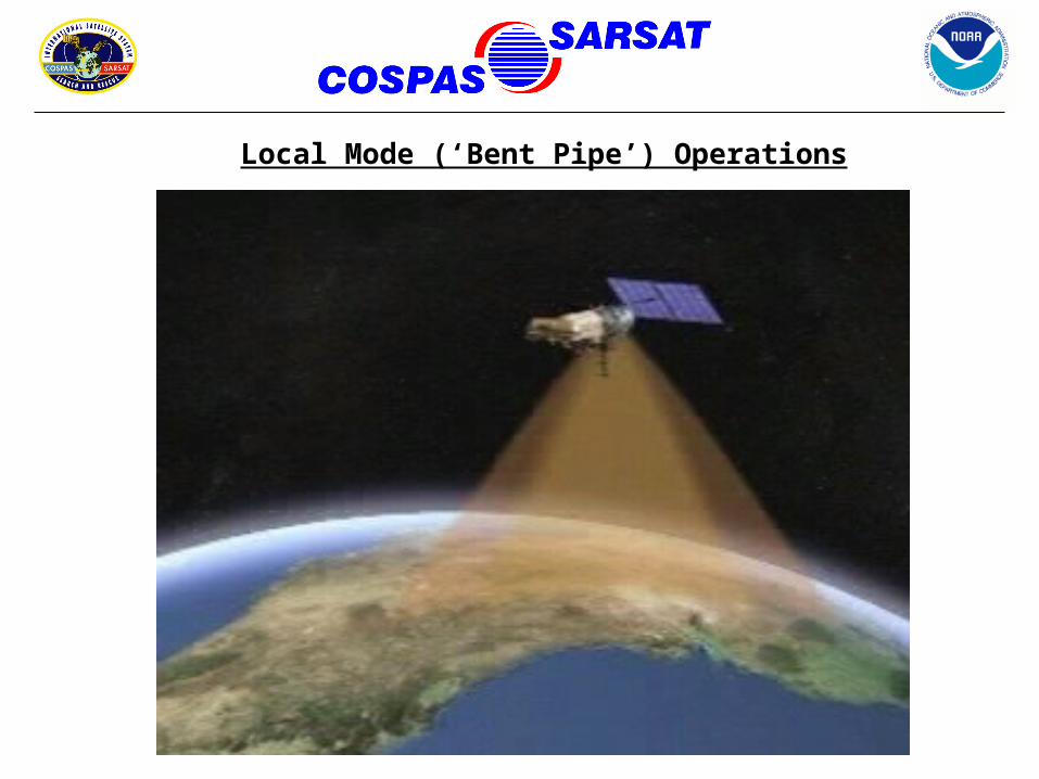
Local Mode (‘Bent Pipe’) Operations
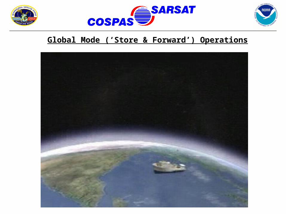
Global Mode (‘Store & Forward’) Operations
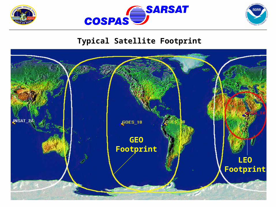
Typical Satellite Footprint
GEO Footprint
LEO Footprint
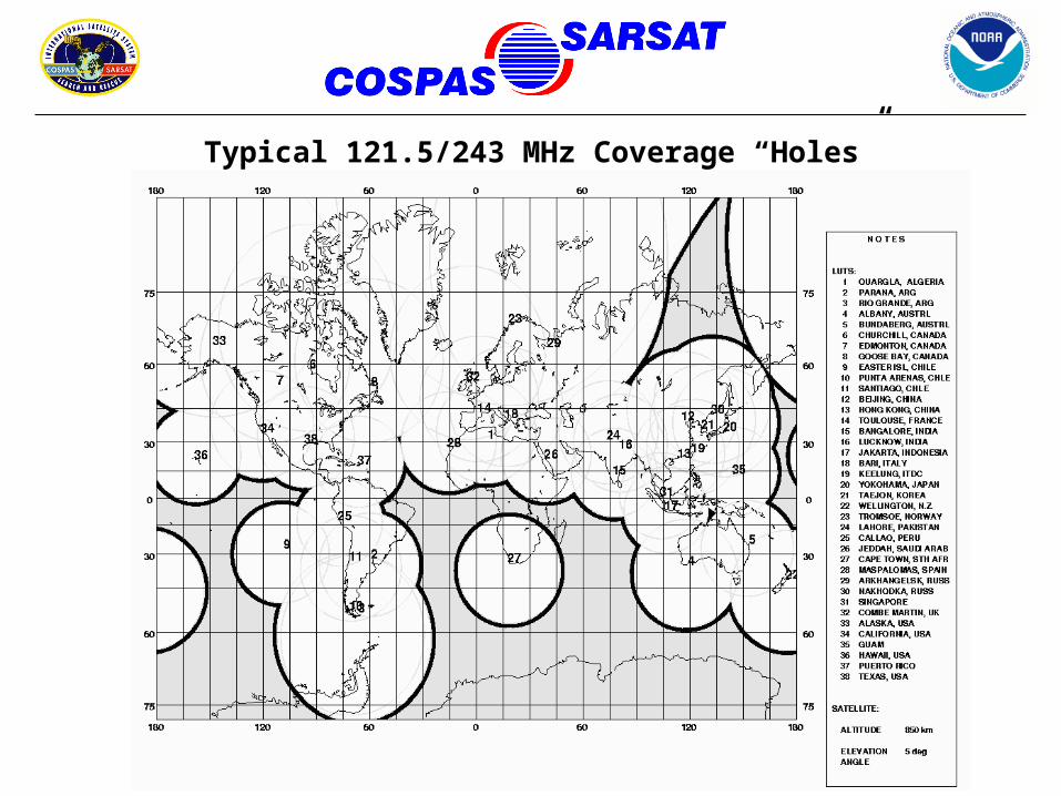
Typical 121.5/243 MHz Coverage “Holes”
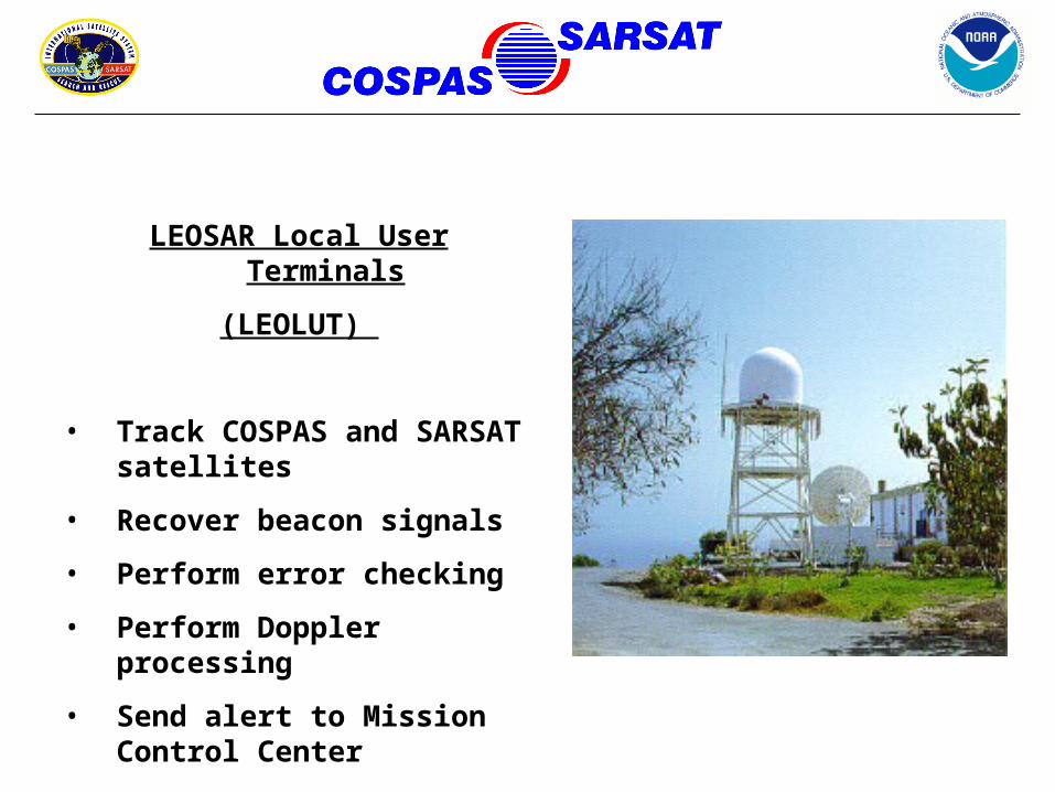
LEOSAR Local User Terminals
(LEOLUT)
• Track COSPAS and SARSAT satellites
• Recover beacon signals
• Perform error checking
• Perform Doppler processing
• Send alert to Mission Control Center

Maryland
Puerto RicoTexas
AlaskaHawaii
United States LEOLUTs
Guam
California
(Deployable LUT)
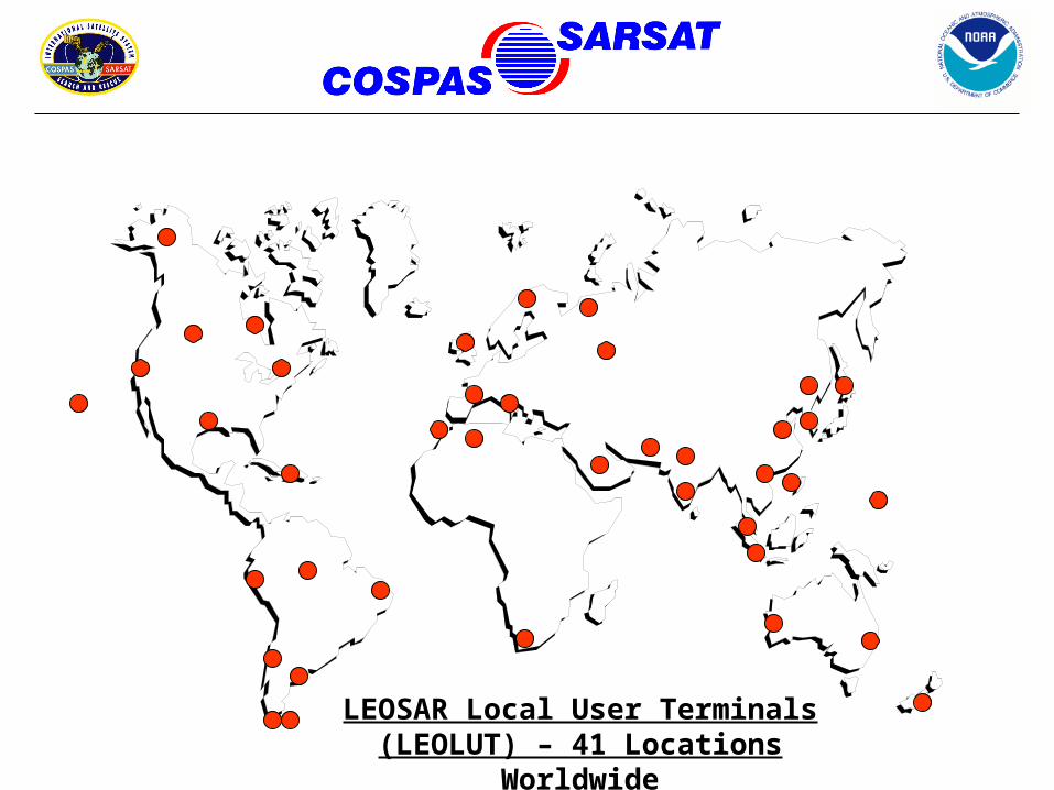
LEOSAR Local User Terminals
(LEOLUT) – 41 Locations Worldwide
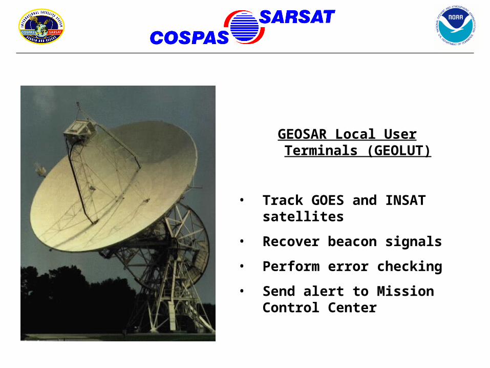
GEOSAR Local User Terminals (GEOLUT)
• Track GOES and INSAT satellites
• Recover beacon signals
• Perform error checking
• Send alert to Mission Control Center
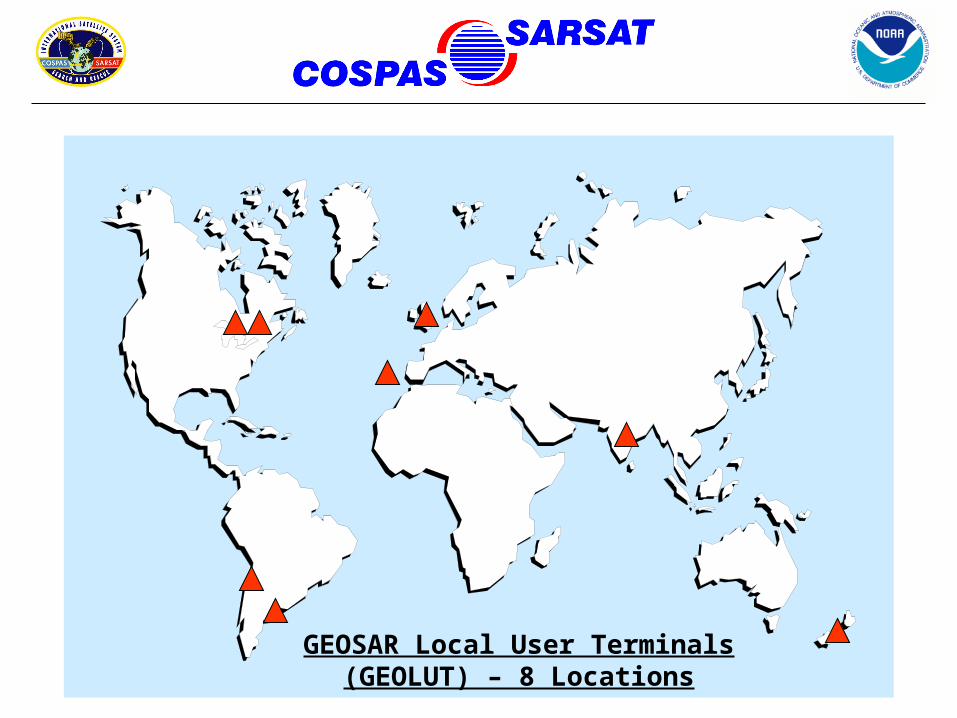
GEOSAR Local User Terminals
(GEOLUT) – 8 Locations
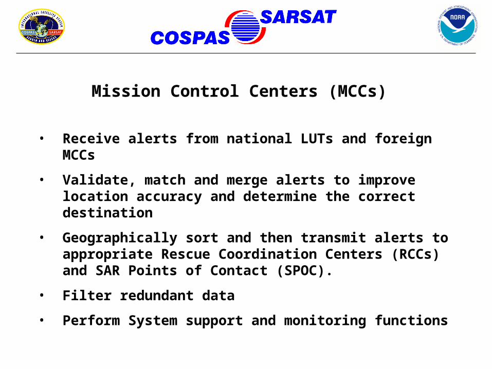
• Receive alerts from national LUTs and foreign MCCs
• Validate, match and merge alerts to improve location accuracy and determine the correct destination
• Geographically sort and then transmit alerts to appropriate Rescue Coordination Centers (RCCs) and SAR Points of Contact (SPOC).
• Filter redundant data
• Perform System support and monitoring functions
Mission Control Centers (MCCs)
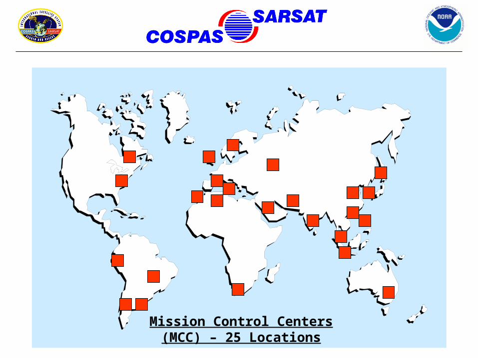
Mission Control Centers
(MCC) – 25 Locations
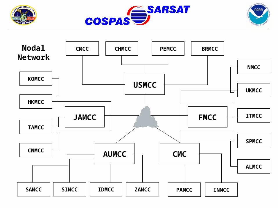
JAMCC
USMCC
AUMCC CMC
FMCC
CMCC CHMCC PEMCC BRMCC
KOMCC
HKMCC
NMCC
UKMCC
ITMCC
SPMCC
PAMCC INMCC
ALMCC
TAMCC
CNMCC
SIMCC IDMCC
Nodal Network
SAMCC ZAMCC
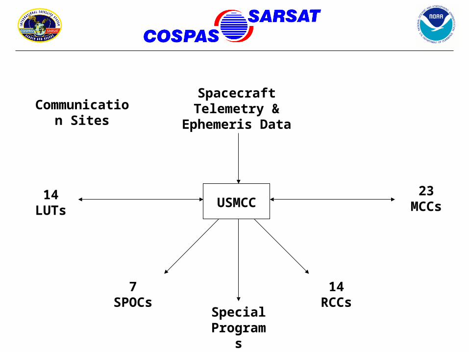
USMCC23
MCCs14
LUTs
14 RCCs
7 SPOCs
Special Programs
Spacecraft Telemetry &
Ephemeris Data
Communication Sites
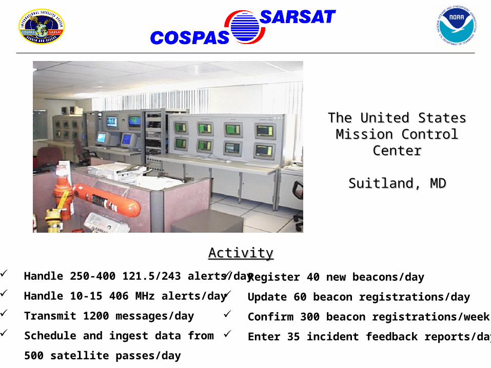
Handle 250-400 121.5/243 alerts/day
Handle 10-15 406 MHz alerts/day
Transmit 1200 messages/day
Schedule and ingest data from
500 satellite passes/day
Register 40 new beacons/day
Update 60 beacon registrations/day
Confirm 300 beacon registrations/week
Enter 35 incident feedback reports/day
ActivityActivity
The United StatesThe United StatesMission Control Mission Control
CenterCenter
Suitland, MDSuitland, MD

CGD14
CGD17
AKRCC
AFRCC
PACAREA
LANTAREA
CGD8
CGD7
CGD1CGD13
GANTSEC
CGD9
United States Rescue Coordination Centers & their Areas of Responsibility (AOR’s)
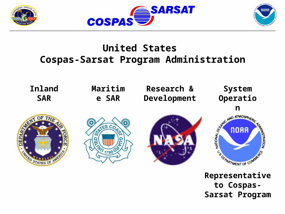
United States Cospas-Sarsat Program Administration
Inland SAR
Maritime SAR
Research & Development
System Operation
Representative to Cospas-Sarsat
Program
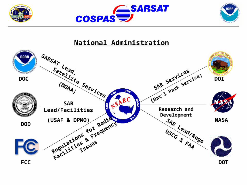
National Administration
DOC
DOD
FCC
DOI
NASA
DOT
SARSAT Lead,
Satellite Services(NOAA)
SAR Lead/Facilities
(USAF & DPMO)
Regulations fo
r Radio
Facilities & Frequency
Issues
SAR Services
(Nat’l Park Service)
Research and Development
SAR Lead/Regs
USCG & FAA
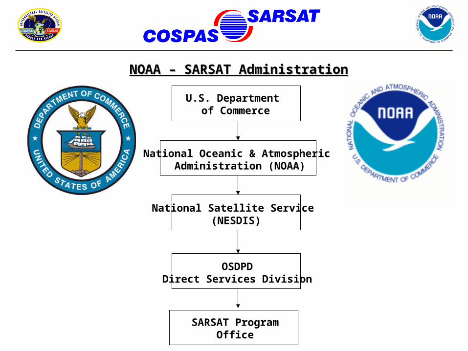
NOAA – SARSAT AdministrationNOAA – SARSAT Administration
U.S. Department of Commerce
National Oceanic & Atmospheric Administration (NOAA)
National Satellite Service (NESDIS)
SARSAT ProgramOffice
OSDPDDirect Services Division
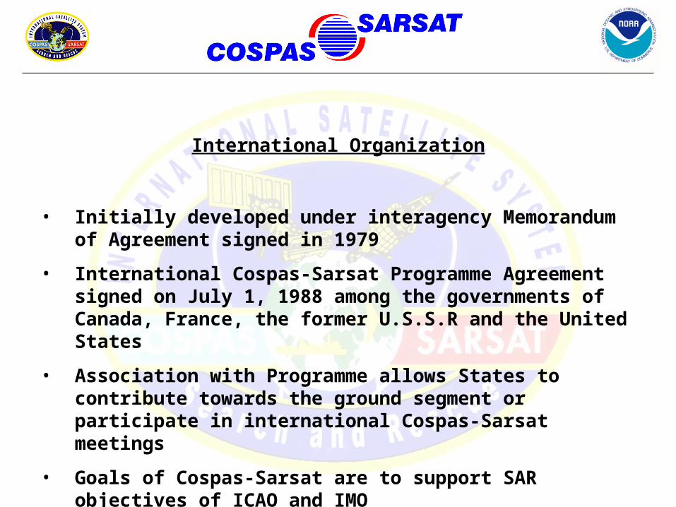
International Organization
• Initially developed under interagency Memorandum of Agreement signed in 1979
• International Cospas-Sarsat Programme Agreement signed on July 1, 1988 among the governments of Canada, France, the former U.S.S.R and the United States
• Association with Programme allows States to contribute towards the ground segment or participate in international Cospas-Sarsat meetings
• Goals of Cospas-Sarsat are to support SAR objectives of ICAO and IMO
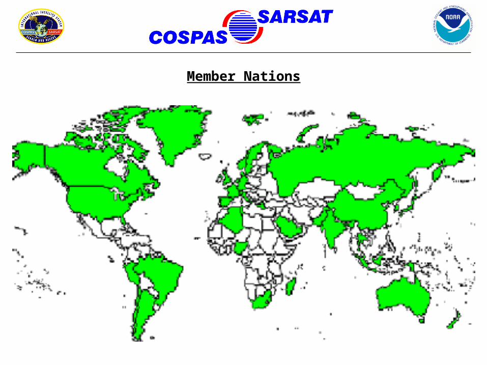
Member Nations
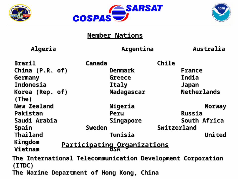
AlgeriaAlgeria ArgentinaArgentina AustraliaAustraliaBrazilBrazil CanadaCanada ChileChile China China (P.R. of) (P.R. of) Denmark Denmark FranceFranceGermanyGermany GreeceGreece IndiaIndiaIndonesiaIndonesia ItalyItaly JapanJapanKorea (Rep. of)Korea (Rep. of) MadagascarMadagascar Netherlands (The)Netherlands (The)New ZealandNew Zealand NigeriaNigeria NorwayNorwayPakistanPakistan PeruPeru RussiaRussiaSaudi ArabiaSaudi Arabia SingaporeSingapore South AfricaSouth AfricaSpainSpain SwedenSweden SwitzerlandSwitzerlandThailandThailand TunisiaTunisia United KingdomUnited KingdomVietnamVietnam USAUSA
The International Telecommunication Development Corporation (ITDC) The International Telecommunication Development Corporation (ITDC) The Marine Department of Hong Kong, China The Marine Department of Hong Kong, China
Member Nations
Participating Organizations
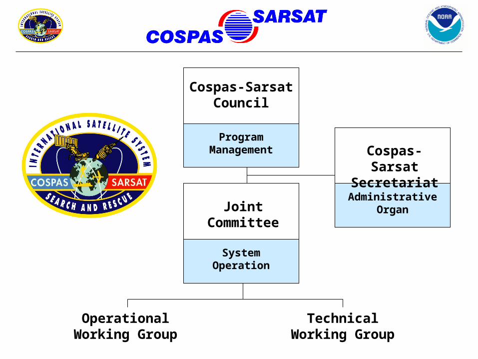
Program Management
Cospas-Sarsat Council
System Operation
Joint Committee
Administrative Organ
Cospas-Sarsat Secretariat
Operational Working Group
Technical Working Group
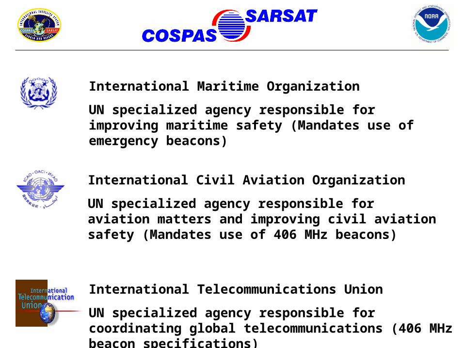
International Maritime Organization
UN specialized agency responsible for improving maritime safety (Mandates use of emergency beacons)
International Civil Aviation Organization
UN specialized agency responsible for aviation matters and improving civil aviation safety (Mandates use of 406 MHz beacons)
International Telecommunications Union
UN specialized agency responsible for coordinating global telecommunications (406 MHz beacon specifications)
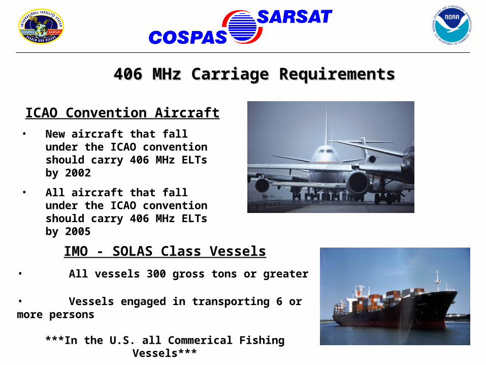
ICAO Convention Aircraft
• New aircraft that fall under the ICAO convention should carry 406 MHz ELTs by 2002
• All aircraft that fall under the ICAO convention should carry 406 MHz ELTs by 2005
406 MHz Carriage Requirements406 MHz Carriage Requirements
IMO - SOLAS Class Vessels
• All vessels 300 gross tons or greater
• Vessels engaged in transporting 6 or more persons
***In the U.S. all Commerical Fishing Vessels***
Phase-Out of 121.5/243 MHz Satellite AlertingPhase-Out of 121.5/243 MHz Satellite Alerting
121.5 MHz BEACON USAGE– International Termination of 121.5 MHz Satellite Alerting on
01 February 2009!
– U.S. Termination of 121.5 MHz EPIRBs = 3 Phases• Certification of new 121.5 EPIRBs cease immediately • Sales and manufacture of 121.5 MHz EPIRBs cease on 01 February, 2003• Operation/Use of 121.5 MHz EPIRBs becomes illegal on 31 December, 2006
– 121.5 MHz ELTs will still be in use and required on general aviation aircraft…
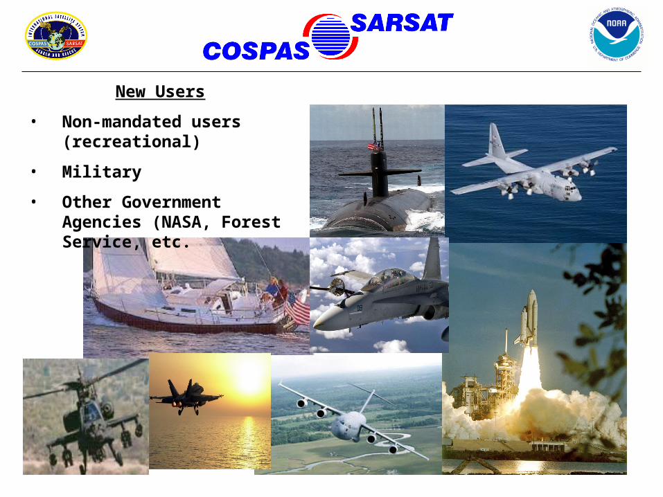
New Users
• Non-mandated users (recreational)
• Military
• Other Government Agencies (NASA, Forest Service, etc.
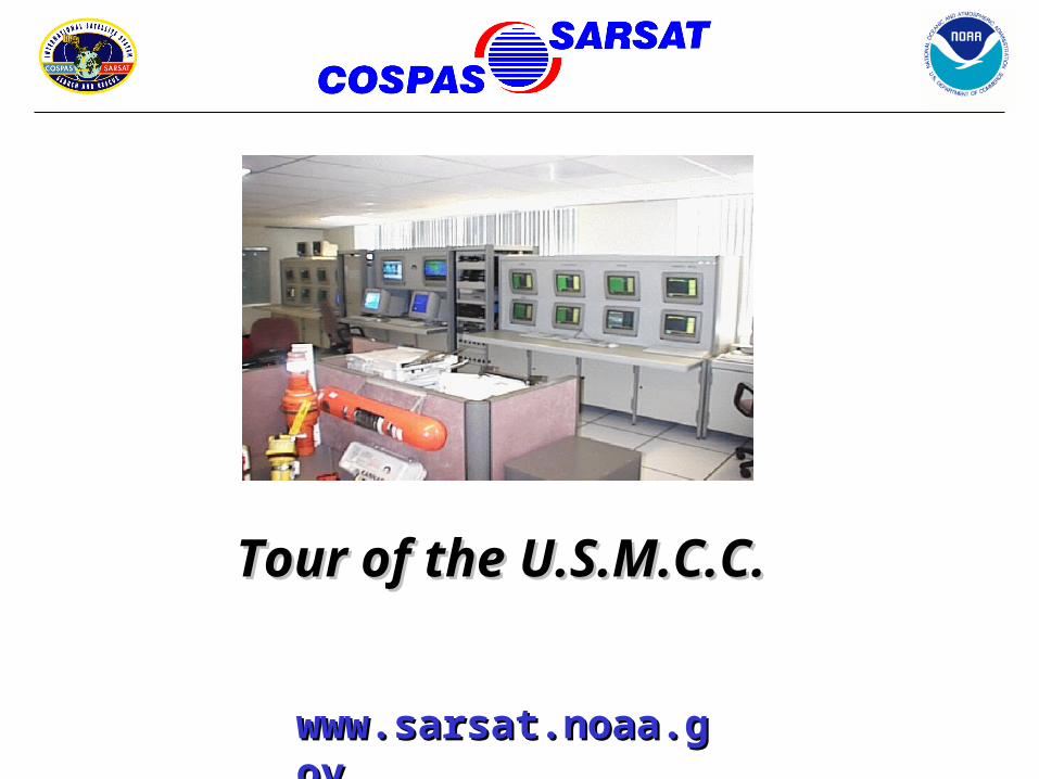
Tour of the U.S.M.C.C.Tour of the U.S.M.C.C.
www.sarsat.noaa.www.sarsat.noaa.govgov