Rui Fernandes - TeroMovigoteromovigo.ubi.pt/wp-content/uploads/2017/11/Teromovigo_Example... ·...
16
Optimizing GNSS CORS networks at remote locations Rui Fernandes João Apolinário Hugo Valentim Pedro Venâncio Nuno Gonçalves DI-UBI, Univ. Beira Interior, Covilh ã, Portugal. Instituto Geofísico D. Luis, Lisboa , Portugal. 1
Transcript of Rui Fernandes - TeroMovigoteromovigo.ubi.pt/wp-content/uploads/2017/11/Teromovigo_Example... ·...
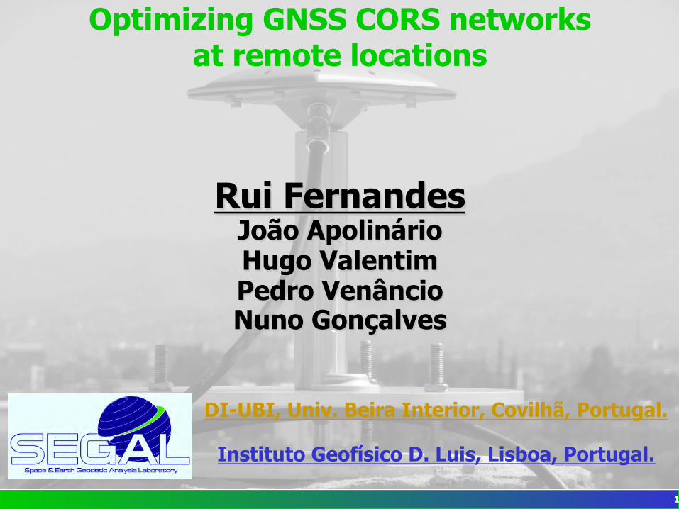
Optimizing GNSS CORS networks at remote locations
Rui Fernandes João Apolinário Hugo Valentim Pedro Venâncio Nuno Gonçalves
DI-UBI, Univ. Beira Interior, Covilhã, Portugal.
Instituto Geofísico D. Luis, Lisboa, Portugal.
1
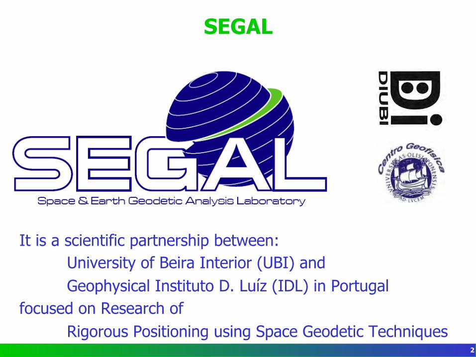
SEGAL
It is a scientific partnership between: University of Beira Interior (UBI) and Geophysical Instituto D. Luíz (IDL) in Portugal
focused on Research of Rigorous Positioning using Space Geodetic Techniques
2
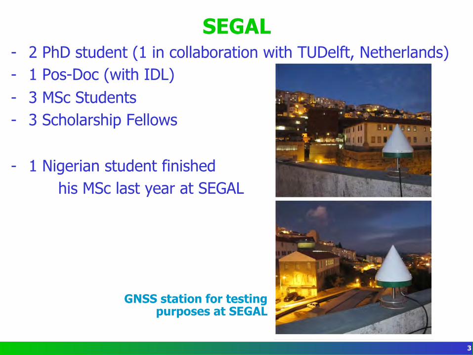
SEGAL - 2 PhD student (1 in collaboration with TUDelft, Netherlands) - 1 Pos-Doc (with IDL) - 3 MSc Students - 3 Scholarship Fellows
- 1 Nigerian student finished his MSc last year at SEGAL
GNSS station for testing purposes at SEGAL
3
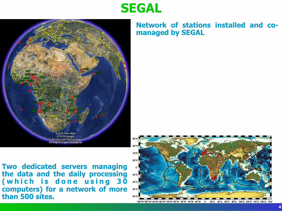
SEGAL Network of stations installed and co-managed by SEGAL
Two dedicated servers managing the data and the daily processing ( w h i c h i s d o n e u s i n g 3 0 computers) for a network of more than 500 sites.
4
SEGAL some current projects
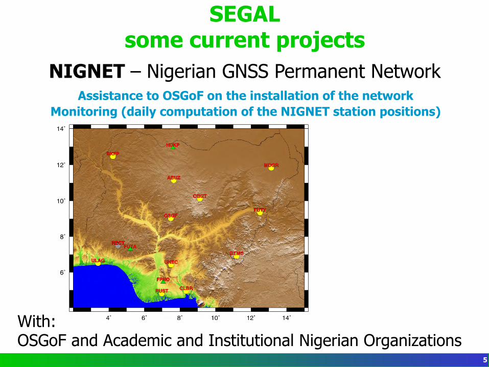
NIGNET – Nigerian GNSS Permanent Network Assistance to OSGoF on the installation of the network
Monitoring (daily computation of the NIGNET station positions)
With: OSGoF and Academic and Institutional Nigerian Organizations
5
SEGAL some current projects
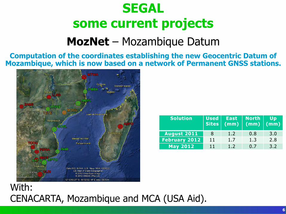
MozNet – Mozambique Datum Computation of the coordinates establishing the new Geocentric Datum of
Mozambique, which is now based on a network of Permanent GNSS stations.
With: CENACARTA, Mozambique and MCA (USA Aid).
Solution Used Sites
East (mm)
North (mm)
Up (mm)
August 2011 8 1.2 0.8 3.0 February 2012 11 1.7 1.3 2.8
May 2012 11 1.2 0.7 3.2
6
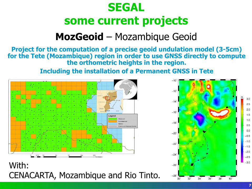
SEGAL some current projects
MozGeoid – Mozambique Geoid Project for the computation of a precise geoid undulation model (3-5cm)
for the Tete (Mozambique) region in order to use GNSS directly to compute the orthometric heights in the region.
Including the installation of a Permanent GNSS in Tete
With: CENACARTA, Mozambique and Rio Tinto.
7
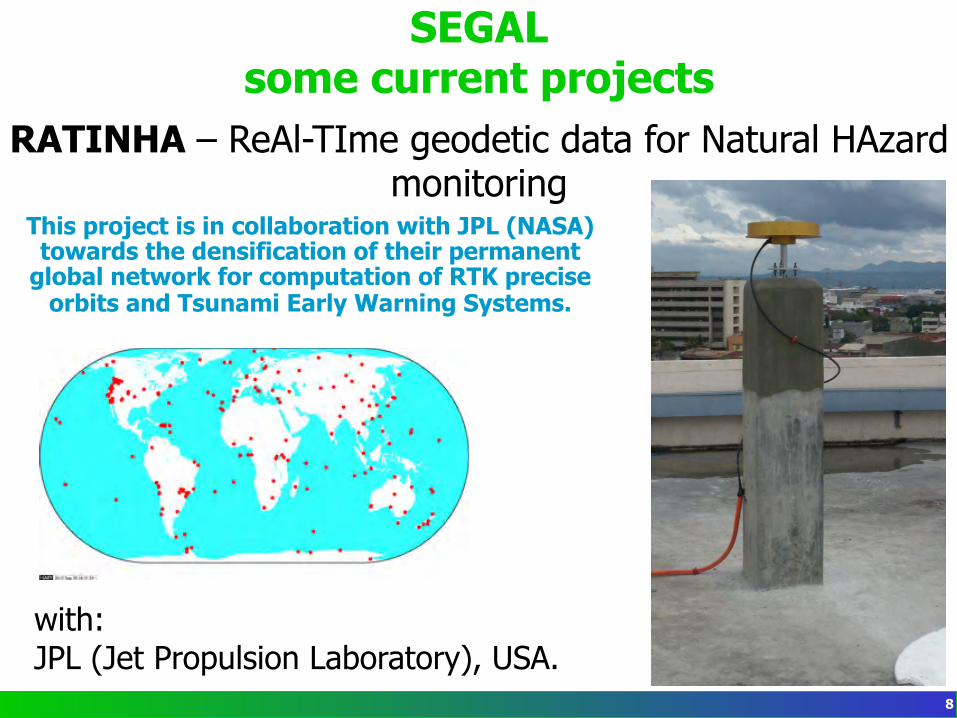
SEGAL some current projects
RATINHA – ReAl-TIme geodetic data for Natural HAzard monitoring
This project is in collaboration with JPL (NASA) towards the densification of their permanent
global network for computation of RTK precise orbits and Tsunami Early Warning Systems.
with: JPL (Jet Propulsion Laboratory), USA.
8
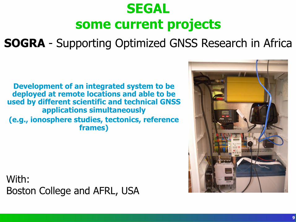
SEGAL some current projects
SOGRA - Supporting Optimized GNSS Research in Africa
Development of an integrated system to be deployed at remote locations and able to be
used by different scientific and technical GNSS applications simultaneously
(e.g., ionosphere studies, tectonics, reference frames)
With: Boston College and AFRL, USA
9
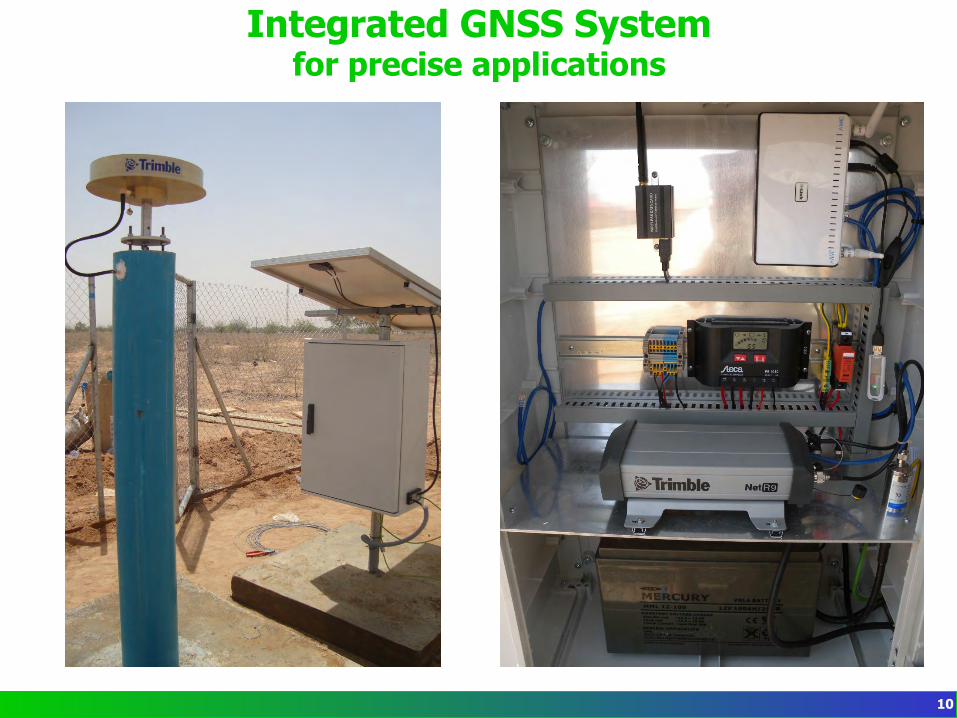
Integrated GNSS System for precise applications
10
Integrated GNSS System for precise applications
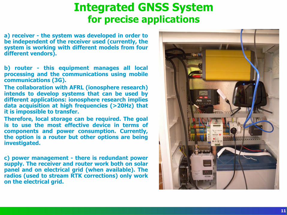
a) receiver - the system was developed in order to be independent of the receiver used (currently, the system is working with different models from four different vendors). b) router - this equipment manages all local processing and the communications using mobile communications (3G). The collaboration with AFRL (ionosphere research) intends to develop systems that can be used by different applications: ionosphere research implies data acquisition at high frequencies (>20Hz) that it is impossible to transfer. Therefore, local storage can be required. The goal is to use the most effective device in terms of components and power consumption. Currently, the option is a router but other options are being investigated. c) power management - there is redundant power supply. The receiver and router work both on solar panel and on electrical grid (when available). The radios (used to stream RTK corrections) only work on the electrical grid.
11
Integrated GNSS System for precise applications
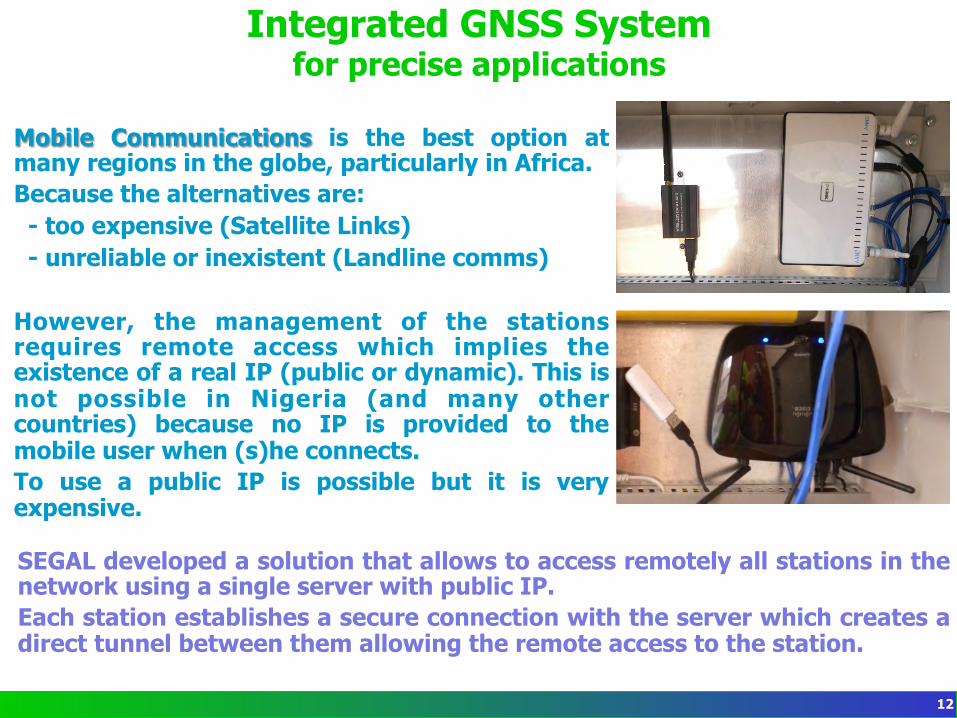
Mobile Communications is the best option at many regions in the globe, particularly in Africa. Because the alternatives are: - too expensive (Satellite Links) - unreliable or inexistent (Landline comms)
However, the management of the stations requires remote access which implies the existence of a real IP (public or dynamic). This is not possible in Nigeria (and many other countries) because no IP is provided to the mobile user when (s)he connects. To use a public IP is possible but it is very expensive. SEGAL developed a solution that allows to access remotely all stations in the network using a single server with public IP. Each station establishes a secure connection with the server which creates a direct tunnel between them allowing the remote access to the station.
12
Integrated GNSS System for precise applications
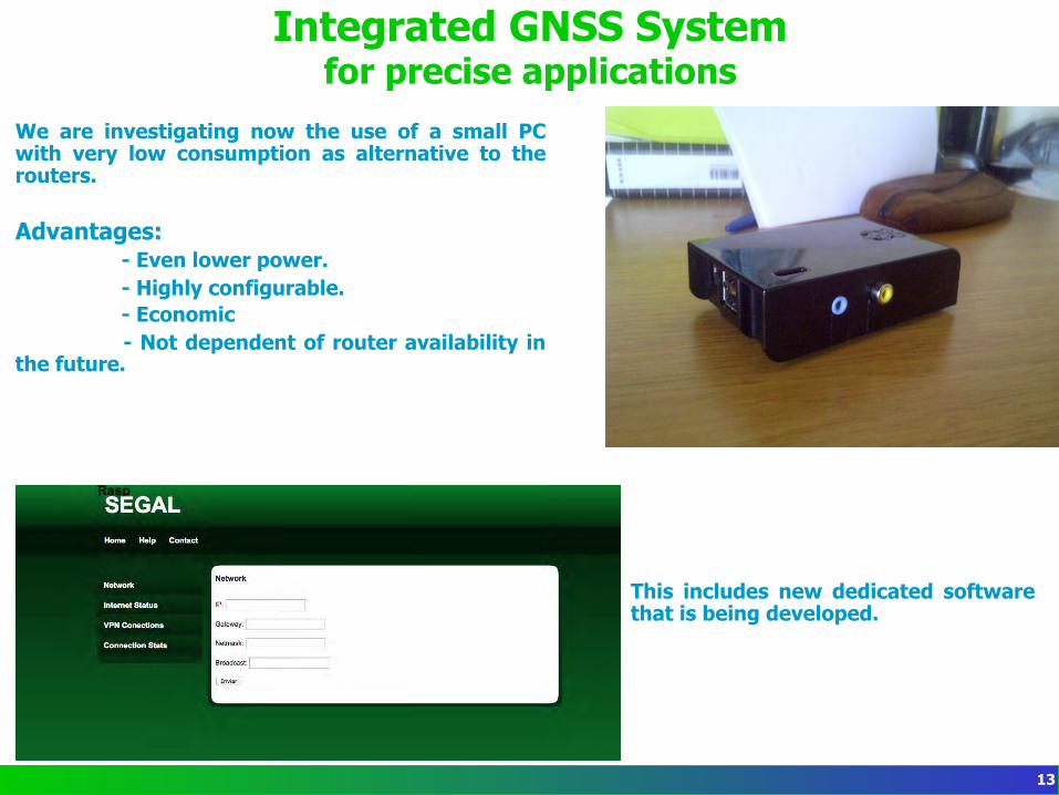
We are investigating now the use of a small PC with very low consumption as alternative to the routers. Advantages:
- Even lower power. - Highly configurable. - Economic - Not dependent of router availability in
the future.
This includes new dedicated software that is being developed.
13
Web-services for Network Management
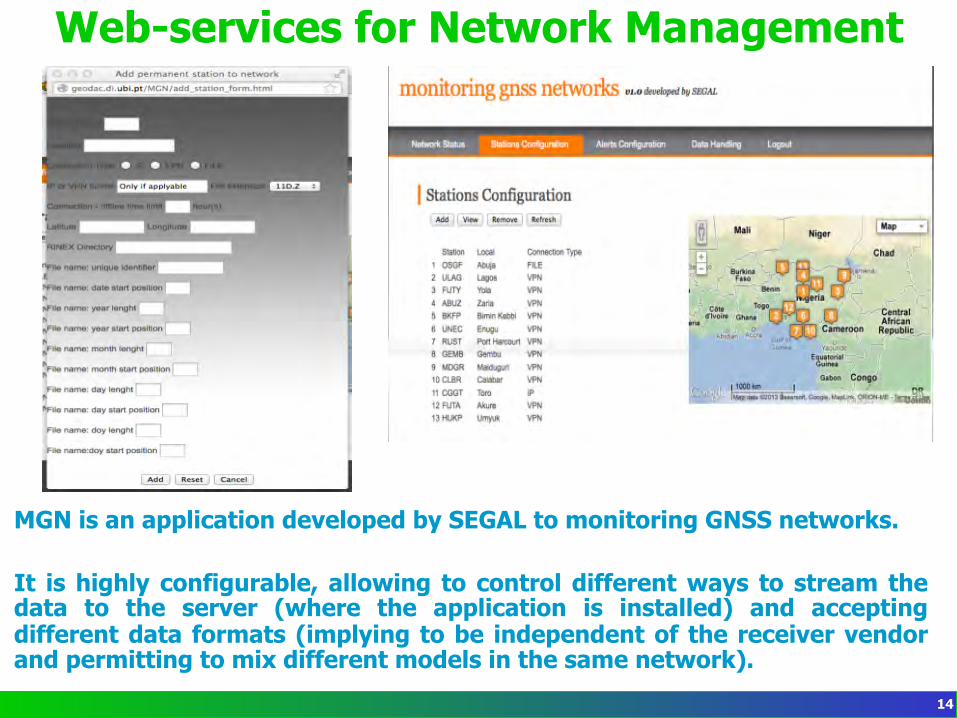
MGN is an application developed by SEGAL to monitoring GNSS networks. It is highly configurable, allowing to control different ways to stream the data to the server (where the application is installed) and accepting different data formats (implying to be independent of the receiver vendor and permitting to mix different models in the same network).
14
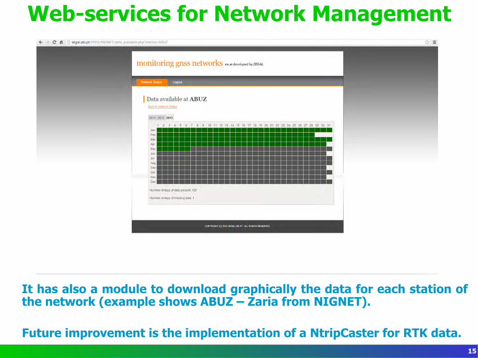
Web-services for Network Management
It has also a module to download graphically the data for each station of the network (example shows ABUZ – Zaria from NIGNET). Future improvement is the implementation of a NtripCaster for RTK data.
15
Thank you / Obrigado 16
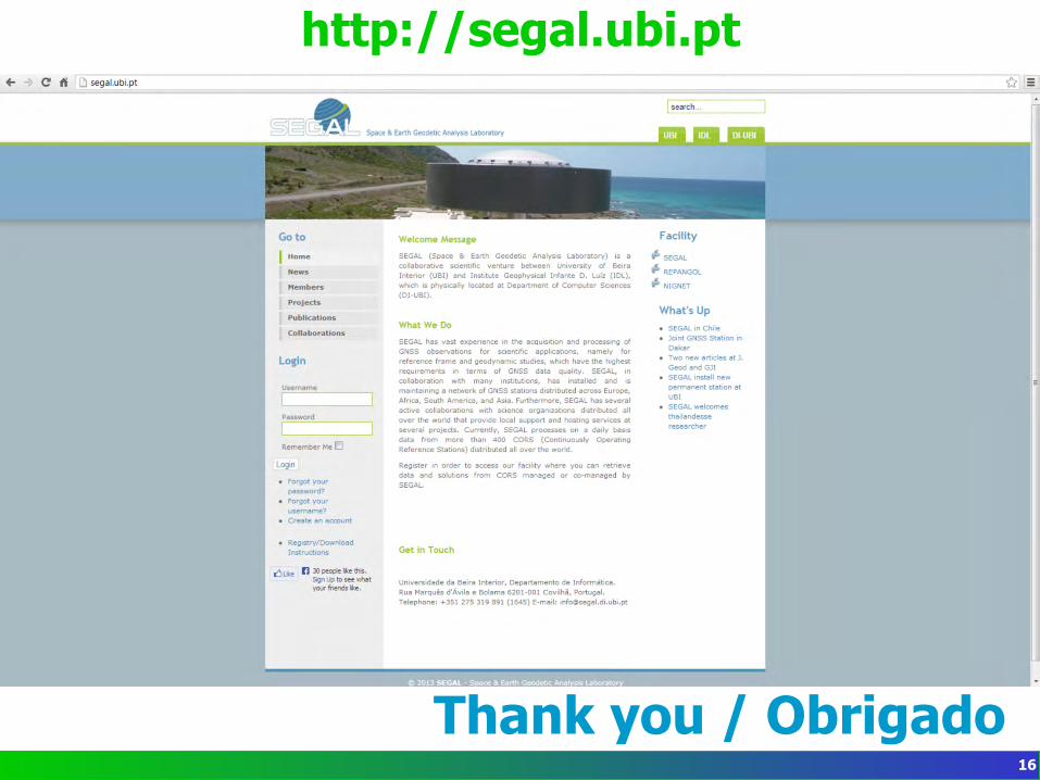
http://segal.ubi.pt