Rockyfor3D - Rockfall simulation program
23
ROCKFALL SIMULATION ANALYSIS WITH ROCKYFOR 3D
-
Upload
thomas-frenez -
Category
Engineering
-
view
736 -
download
31
Transcript of Rockyfor3D - Rockfall simulation program

ROCKFALL SIMULATION ANALYSIS
WITH ROCKYFOR 3D
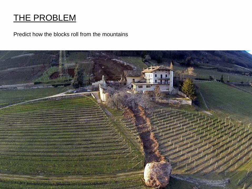
THE PROBLEM
Predict how the blocks roll from the mountains

21-07-2014 Presentazione progetto
THE SOLUTIONS
RockyFor3D (www.ecorisq.org)
Software that simulates the rolling blocks on the slope
21-07-2014 Presentazione progetto
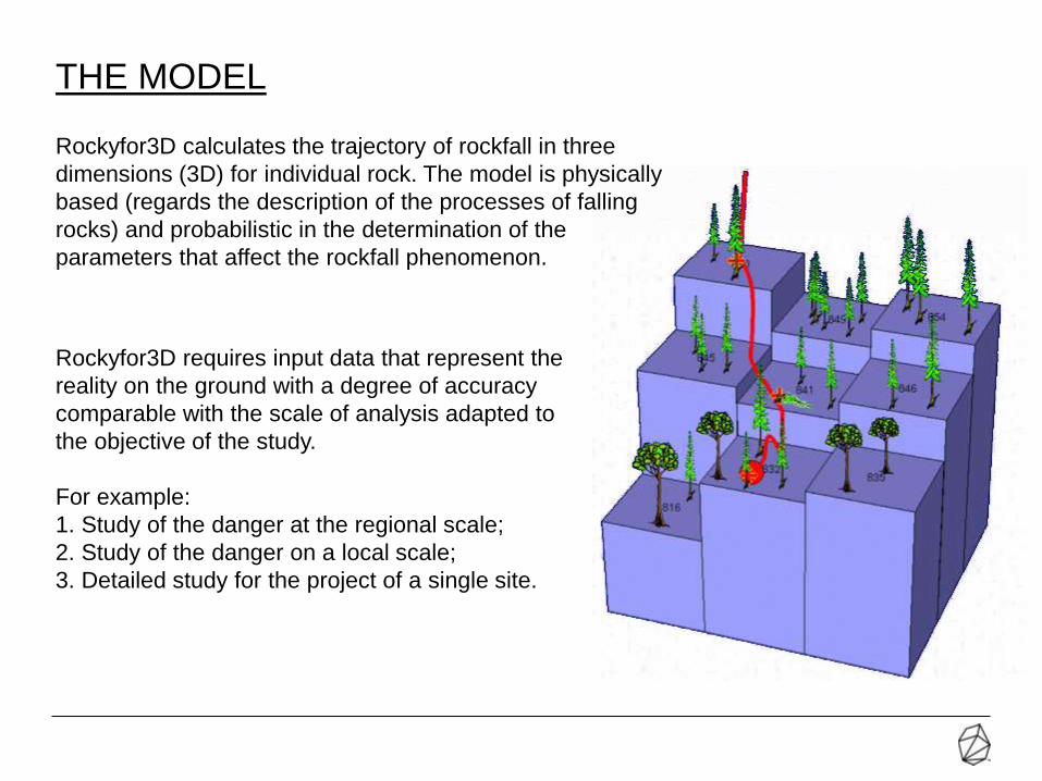
THE MODEL
Rockyfor3D requires input data that represent the
reality on the ground with a degree of accuracy
comparable with the scale of analysis adapted to
the objective of the study.
For example:
1. Study of the danger at the regional scale;
2. Study of the danger on a local scale;
3. Detailed study for the project of a single site.
Rockyfor3D calculates the trajectory of rockfall in three
dimensions (3D) for individual rock. The model is physically
based (regards the description of the processes of falling
rocks) and probabilistic in the determination of the
parameters that affect the rockfall phenomenon.

21-07-2014 Presentazione progetto
INPUT DATA – MORPHOLOGY OF SLOPE
DEM: Digital Elevation Model of terrain. The morphology of the terrain with its
irregularities determines the characteristics of the rock fall and impacts occurred.
Recommended resolution between 2x2m e 10x10m
21-07-2014 Presentazione progetto
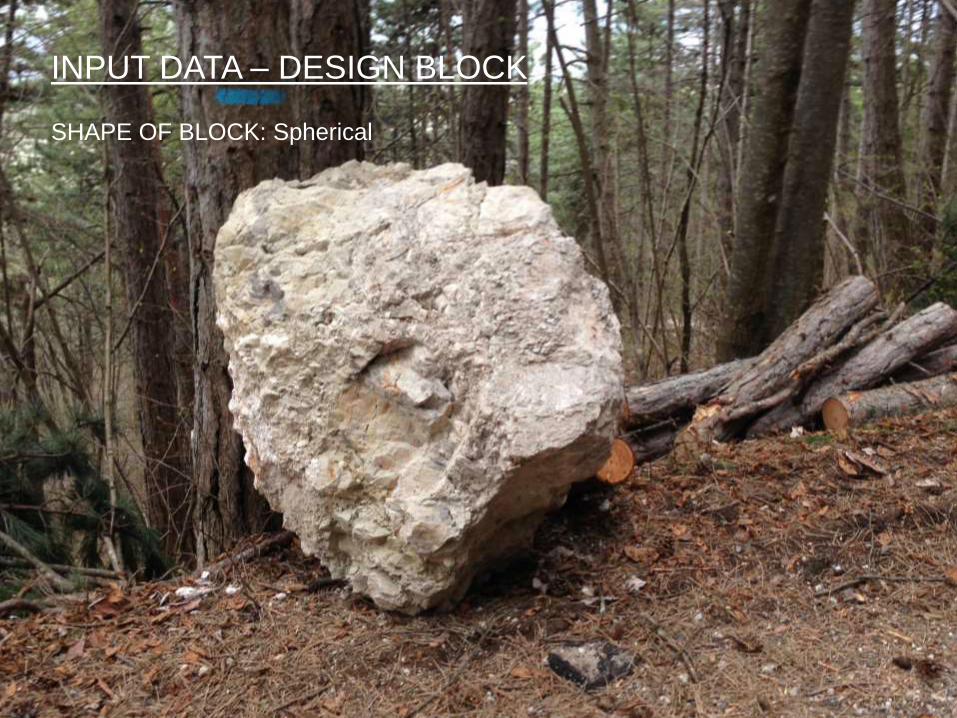
INPUT DATA – DESIGN BLOCK
SHAPE OF BLOCK: Spherical
21-07-2014 Presentazione progetto
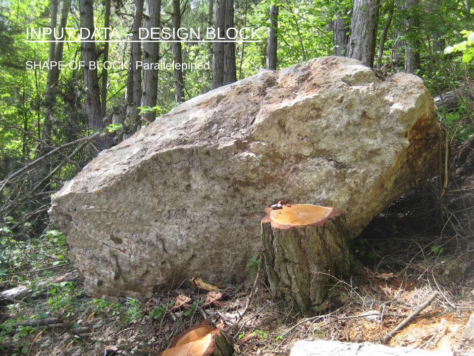
SHAPE OF BLOCK: Parallelepiped
INPUT DATA – DESIGN BLOCK
21-07-2014 Presentazione progetto
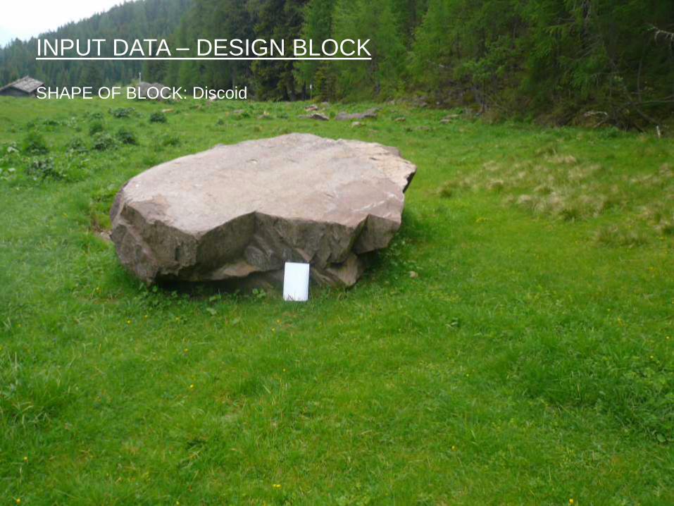
INPUT DATA – DESIGN BLOCK
SHAPE OF BLOCK: Discoid

21-07-2014 Presentazione progetto
INPUT DATA – DESIGN BLOCK
SHAPE OF BLOCK: Ellipsoial
21-07-2014 Presentazione progetto
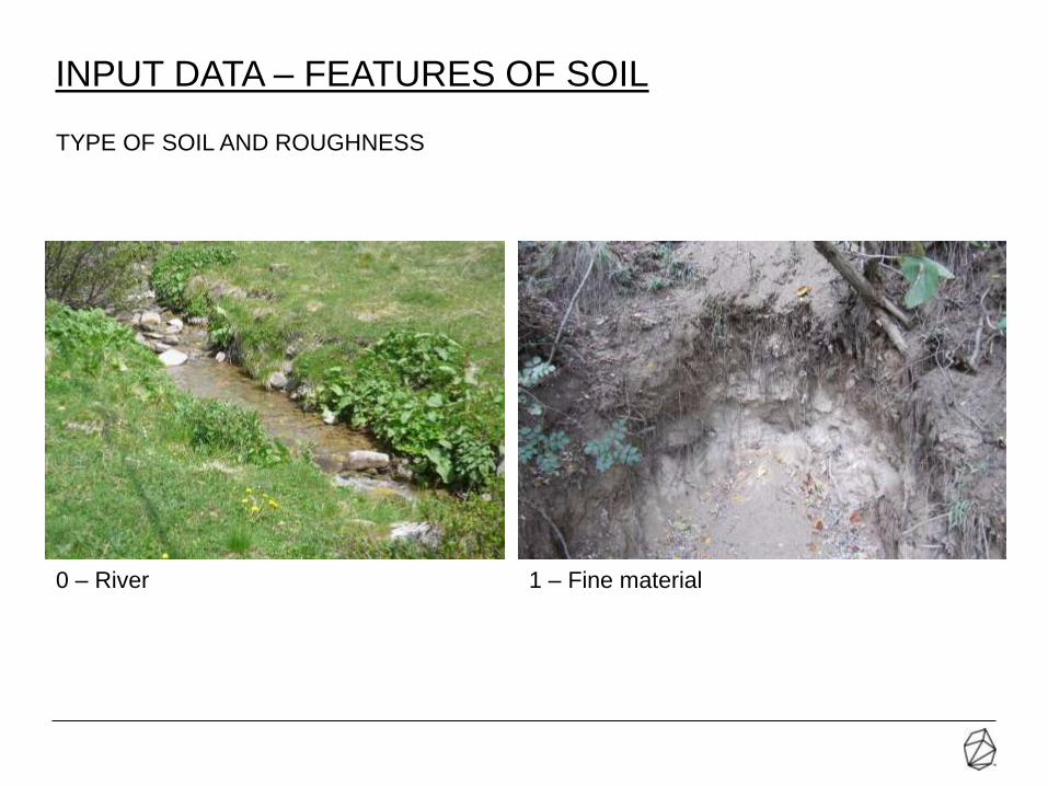
INPUT DATA – FEATURES OF SOIL
0 – River 1 – Fine material
TYPE OF SOIL AND ROUGHNESS
21-07-2014 Presentazione progetto
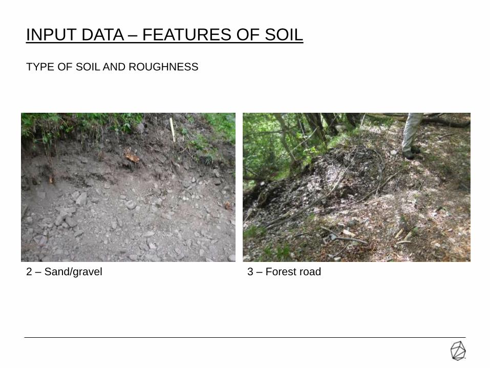
2 – Sand/gravel 3 – Forest road
INPUT DATA – FEATURES OF SOIL
TYPE OF SOIL AND ROUGHNESS
21-07-2014 Presentazione progetto
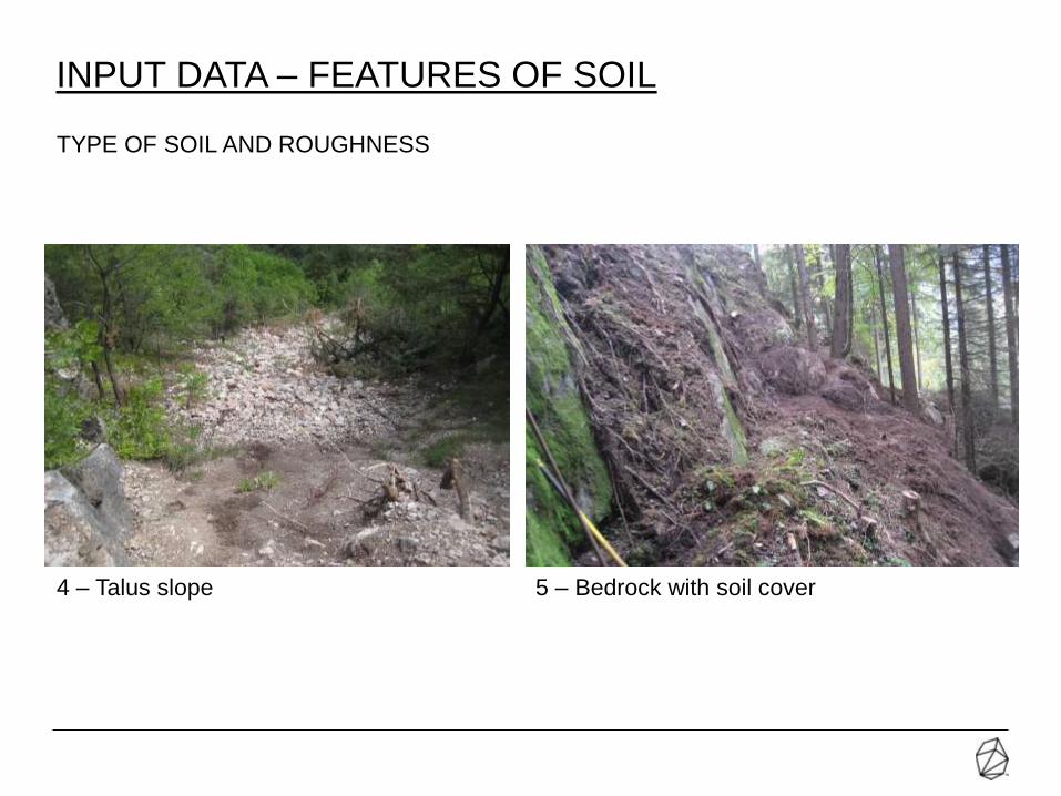
4 – Talus slope 5 – Bedrock with soil cover
INPUT DATA – FEATURES OF SOIL
TYPE OF SOIL AND ROUGHNESS

21-07-2014 Presentazione progetto
6 – Rock 7 – Asphalt
INPUT DATA – FEATURES OF SOIL
TYPE OF SOIL AND ROUGHNESS

21-07-2014 Presentazione progetto
INPUT DATA – FOREST/TREE
Depending on the diameter of the tree and the type of tree (coniferous or deciduous), the
model calculates the position of the impact on the trees (front / smear);
this influence on the energy dissipation.

21-07-2014 Presentazione progetto
INPUT DATA: ROCKFALL BARRIER / EMBANKMENT
Is possible simulate rockfall barriers or geogrid embankments; the input data is: position,
length, height and Maximum Energy Level (MEL).

21-07-2014 Presentazione progetto
OUTPUT DATA – TRANSIT ENERGY OF BLOCKS

21-07-2014 Presentazione progetto
OUTPUT DATA– NUMBER OF PASSAGES OF BLOCKS
21-07-2014 Presentazione progetto
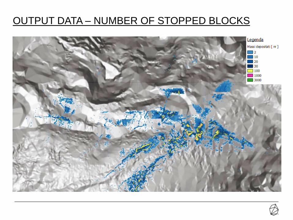
OUTPUT DATA – NUMBER OF STOPPED BLOCKS
21-07-2014 Presentazione progetto
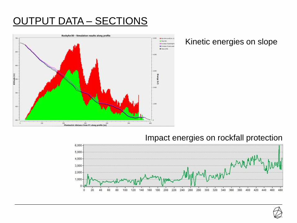
Kinetic energies on slope
Impact energies on rockfall protection
OUTPUT DATA – SECTIONS

21-07-2014 Presentazione progetto
OUTPUT DATA –3D VIEW

21-07-2014 Presentazione progetto
• Easy and quick assessment of the rockfall hazard and its parameters over large areas
(reconaissance) for subsequent more detailed analyses (both 3D or 2D).
• More reliable and realistic than 2D simulations in case of complex morphology and then
trajectories not parallel to each other along the slope.
• Unexpected bounces due to local obstacles, and not intersected by 2D sections, can be
seen only with 3D simulations.
• Assessment of protection structures position in the design phase: 2D simulation are
good to assess energy absorbtion and height, but don't provide any information that
allow the designer to move/extend the protection structures all along the slope
according to the trajectories.
Note: For design of protection works is good practice use the 2D software for detail design
of the heights and the energy class of protection structures; the definition of the position of
the protection structures (plan and section) is better 3D software
PROS –3D SIMULATIONS VS. 2D SIMULATIONS
21-07-2014 Presentazione progetto
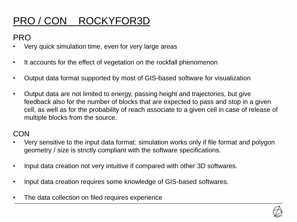
PRO• Very quick simulation time, even for very large areas
• It accounts for the effect of vegetation on the rockfall phenomenon
• Output data format supported by most of GIS-based software for visualization
• Output data are not limited to energy, passing height and trajectories, but give
feedback also for the number of blocks that are expected to pass and stop in a given
cell, as well as for the probability of reach associate to a given cell in case of release of
multiple blocks from the source.
CON• Very sensitive to the input data format: simulation works only if file format and polygon
geometry / size is strictly compliant with the software specifications.
• Input data creation not very intuitive if compared with other 3D softwares.
• Input data creation requires some knowledge of GIS-based softwares.
• The data collection on filed requires experience
PRO / CON ROCKYFOR3D

Piazza San Giovanni, 2
38017 Mezzolombardo (TN)
t. +39 0461 60 01 31
f. +39 0461 60 05 73
ING. THOMAS FRENEZ theincline.it