River Corridor Aspect of Floodplain Protection Efforts.
7
River Corridor Aspect of Floodplain Protection Efforts
-
Upload
charleen-pierce -
Category
Documents
-
view
218 -
download
0
Transcript of River Corridor Aspect of Floodplain Protection Efforts.
River Corridor Aspect of Floodplain Protection Efforts


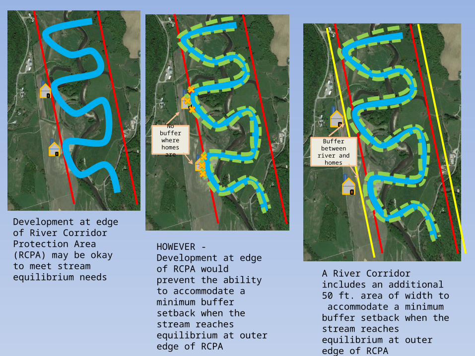
Development at edge of River Corridor Protection Area (RCPA) may be okay to meet stream equilibrium needs
HOWEVER - Development at edge of RCPA would prevent the ability to accommodate a minimum buffer setback when the stream reaches equilibrium at outer edge of RCPA
A River Corridor includes an additional 50 ft. area of width to accommodate a minimum buffer setback when the stream reaches equilibrium at outer edge of RCPA
No buffer where
homes are Buffer between river
and homes

Streams > 2 sq. mile watershed that would be included in River Corridors:• Moose River
• Small un-named tributary• Kirby Brook
• Halls Brook• Mink Brook• Roaring Brook• Miles Stream
• Carr Brook• Scales Brook
CT River - During the initial development of the River Corridor Base Map, the DEC recognized the Connecticut River flows in a unique geologic and geographic setting and is influenced by numerous impoundments. In order to create an appropriate River Corridor for the Vermont side of the Connecticut, the Rivers Program will conduct a separate analysis in 2015 to review the influence of features such as escarpments and impoundments that affect fluvial processes, valley bottom lands, floodplains, river planform, and corridor widths. For projects being reviewed while this River Corridor is being developed, the FEMA NFIP maps and site visits will be used to make a floodway determination and recommendations. When the Connecticut River Corridor is developed it will be available for a public review and comment similar to the release of the Statewide River Corridor Base Map.