Us_lshc_The Right Spice - Good Paper on Market Entry to India
Parcel No.1 FBCED# R33l40 Road: James Lane From: F.M. 1093
To: End of James Lane
RIGHT OF ENTRY AND NON-WAIVER AGREEMENT
THE STATE OF TEXAS §
COUNTY OF FORT BEND §
WHEREAS the County of Fort Bend, a political subdivision of the State of Texas, desires to acquire from Kenneth G. McCann, Gerald W. McCann and John D. McCann (hereinafter referred to as Grantor's) a right of ently for construction purposes, over, upon and across property lying and being situated in the County of Fort Bend, State of Texas, as more particularly described in Exhibit "A", attached hereto and made a part hereof.
WHEREAS Fort Bend County, andlor its designated agents, ifany, desires to enter upon said premises within the immediate future, prior to the date said property is acquired, hy conveyance for the purpose of the construction of a bridge and associated drainage on the proposed James Lane at Ressies Creek.
WHER FAS i1 is millllRlly figre(:ahle \0 tht Grantor', ane! Fort Rene! County rhi'lt the County and/or its designated agents, if any, shall have the right ro enter upon the aforesaid laTld for the ahove-stHted purpose or purposes.
NOW, THEREFORE, the Grantor's does hereby grant pennission to Fort Bend County and/or any of its designated agents, to enter upon and perform any and all acts necessary to construct the bridge and associated drainage on James Lane at Bessies Creek.
This agreement is made prior to the execution of formal legal documents in order to avoid delay in the commencement of work on the subject roadway, and in no way shall jeopardize Grantor's right to receive just compensation for any interest in land and/or improvements; and Grantor does not waive any right they may have under the laws of the State of Texas.
It is further agreed and understood that the County shall proceed with acquisition of said property with speed and due diligence.
It is further agreed and understood that this Agreement shall in no way jeopardize Fort Bend County's legal rights nor waive any right it may have under the laws of the State of Texas.
IN WITNESS WHEREOF, this instrument is EXECUTED on this the day of ______ ,20
I '.wPDArA\LE1TEHS\E~GIilRIL>GE)AMESL'" K~'I P.IGm OF ENTRY AGREE\<IENT_1111 OOC
---
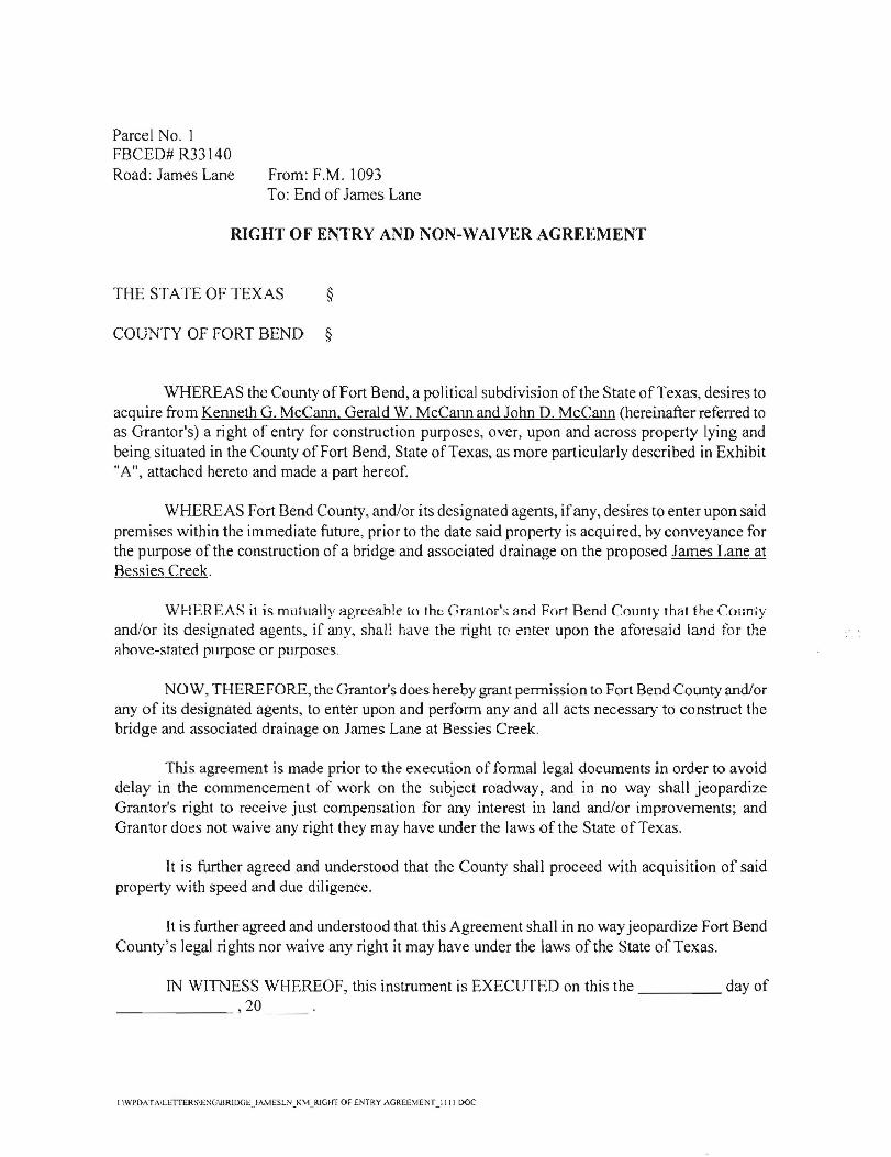
Right of Entry and Non- Waiver Agreement Page 2
FORT BEND COUNTY, TEXAS APPROVED: AiTI::S1:
Robert E. Hebert, County Judge Dianne Wilson, County Clerk
Date: _
/I. =3t> ./ J Date
---'-.L-_2f!}~~L __. Date
IJ. - 9-1/ Date
This Agreement is subject to approval by Commissioners Court of Fort Bend County.
I IWI'D,\ TA'J.ETTERS'lc~G'BRlDGEJ,\MESL1'i)(\1_RIGHT OF ENTRY AGREEMENT IIII DOC
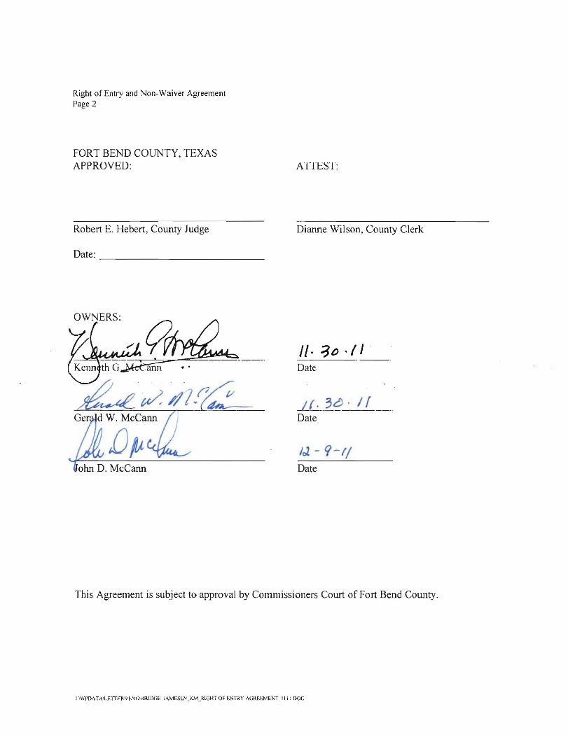
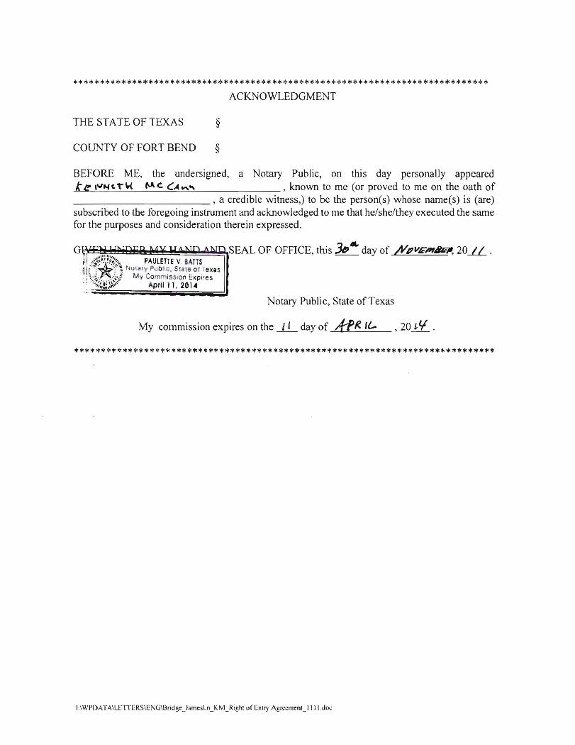
***************************************************************************** ACKNOWLEDGMENT
THE STATE OF TEXAS §
COUNTY OF FORT BEND §
BEFORE ME, the undersigned, a Notary Public, on this day personally appeared ~0 k \'\ 1). Jolt a ~klJ tJ , known to me (or proved to me on the oath of
___________ , a credible witness,) to be the person(s) whose name(s) is (are) suhscrihed to the foregoi ng instrument and acknowledged to me that he/shelthey executed the same for the purposes and consideration therein expressed.
GIVEN UNDER MY HAND AND SEAL OF OFFICE, this ~ay of ~<c_b,.. ,2011.
Notary Public, State of Texas
My commission expires on the _L_'_ day of frrR lL ,20 l \ .
******************************************************************~***********
IIWPDATA\LETTERSIENGIBridgc_JamesLn_KM_RighI of EnlT)' AgrccmenU Ill.doc
***************************~*************************************************
ACKNOWLEDGMENT
THE STATE OF TEXAS §
COUNTY OF FORT BEND §
BEFORE ME, the undersigned, a Notary Public, on this day personally appeared ......t'-'e"'-""--:""'---c,'---T'_W__""'_C._C.=:....:A....:..""-=-'-'-- , known to me (or proved to me on the oath of ___________ , a credible witness,) to be the person(s) whose name(s) is (are) subscribed to the foregoing instrument and acknowledged to me that he/she/they executed the same for the purposes and consideration therein expressed.
G~ ,....""" . SEAL OF OFFICE, this Je,1IA. day of /YpV/i'"Pl8E!I, 20.11- . ; ,,-;,~~~.'~~,:,,_ PAULETTE v. BATTS4i£'>,Xt\ NUllifY PUbliC, Sate ot TeXiS .: :''';.~.·;'f My CommiSSion Expires ., ~::,;;~.~~;"" April II, 2014
Notary Public, State of Texas
My commission expires on the _1_'_ day of A-f~ I{,.. ,201,tf .
******************************************************************************
1:\WPDAfA\LETTERSIENGIBridge_JamesLn_KM_Righr of Enl!)' Agrccmenl_llll.doc
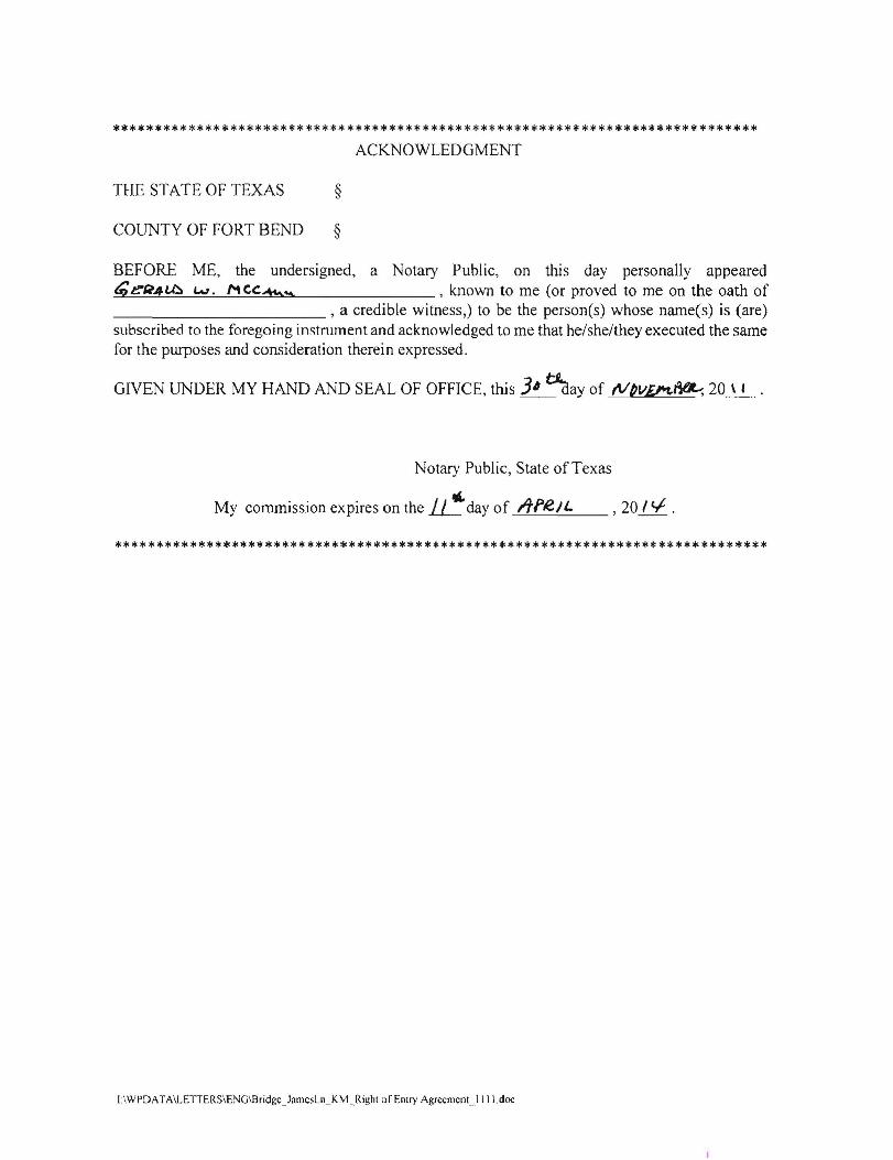
***************************************************************************** ACKNOWLEDGMENT
THE STATE OF TEXAS §
COUNTY OF FORT BEND §
BEFORE ME, the undersigned, a Notary Public, on this day personally appeared t;e-fi4l.)::) w. MCC:~~ , known to me (or proved to me on the oath of ___________ , a credible witness,) to be the person(s) whose name(s) is (are) subscribed to the foregoing instrument and acknowledged to me that he/she/they executed the same for the purposes and consideration therein expressed.
GIVEN UNDER MY HAND AND SEAL OF OFFICE, this 3' tRaay of Nbv£!'1.~20_\_I •
Notary Public, State of Texas
My commission expires on the.LJ!:.day of Itfl!.lL , 20 I t..f .
******************************************************************************
I:\WPDATA\LETTERS\ENG\Bridgc_JamcsLn_KM_Righl ofEmry AgrcemcnU IIl.doc
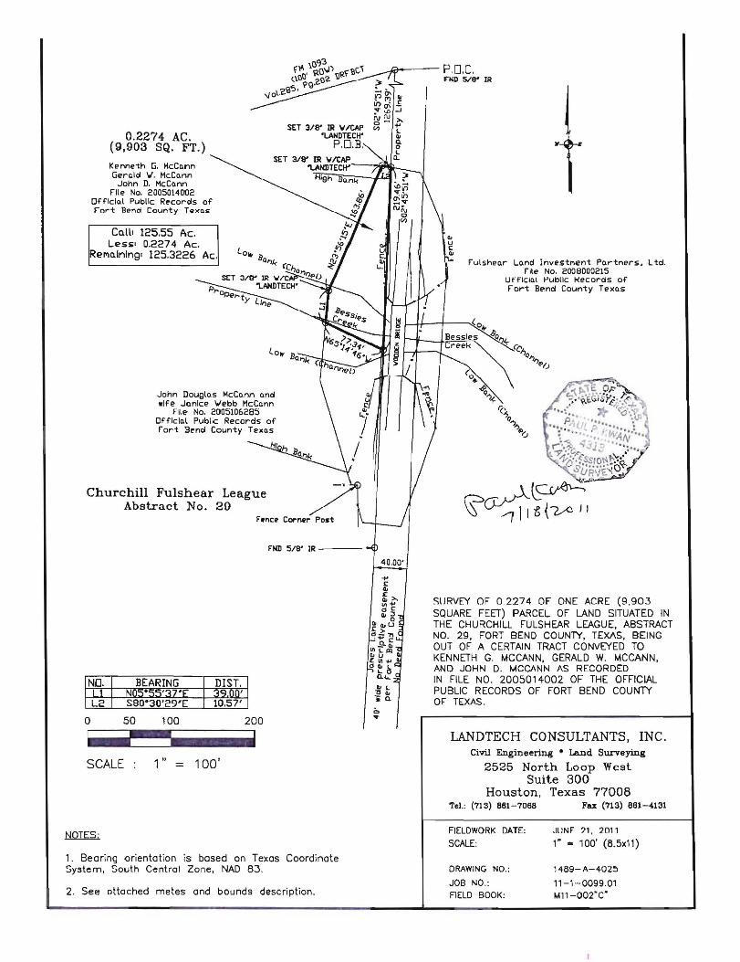
~~---- P.D.C. fllD 5/8" IR
SET 3/a' IR \IlCAP 0.2274 AC. 'LANDTECW
(9,903 SQ. FT.) P.D.B.
Kenneth G. McCann Gerald Y. McCann
John D. McCann File No. 2005014002
Official Public Records of Fort Bend County TexQ~
COoIlI 125.55 Ac. Less. 0.2274 Ac.
ReMo.lnlng' 125.3226 Ac. Fulshear Lo..nd InvestMent Partners. Ltd.
File No. 2006000215 Ufflclal Public t<ecords of tort Bend County Texas
John Douglas McCann and wife JQnlce ....ebb McCann
File No. 2005105285 Official Public Records of Fort Bend County Texas
Churchill Fulshear League Abstract No. 29
F'ND 5/8' IR ----IV
SURVEY OF 0.2274 OF ONE ACRE (9.903
BEARING
seO·30'29'E
o 50 lOa
SQUARE FEET) PARCEL OF LAND SITUATED IN THE CHURCHILL FULSHEAR LEAGUE, ABSTRACT NO. 29, FORT BEND COUNlY, TEXAS, BEING OUT OF A CERTAIN TRACT CONVEYED TO KENNETH G. MCCANN, GERALD W. MCCANN, AND JOHN D. MCCANN AS RECORDED IN FILE NO. 2005014002 OF THE OFFICIAL PUBLIC RECORDS OF FORT BEND COUNTY OF TEXAS.
-!~_liiiiiiiiiiIiiiiiii
SCALE: 1" = 100'
1. Bearing orientation is based on Texas Coordinate System, South Central Zone, NAD 83.
2. See attached metes and bounds description.
LANDTECH CONSULTANTS, INC. Civil EngineeI'i.n8 • Land Surveying
2525 North Loop West Suite 300
Tel.:
Houston, (713) 861-7068
Texas 77008 Fax (713) 861-4131
FIELDWORK
SCALE: DATE: .HINt
1" = ?1. 2011
100' (8.5xll)
DRAWING NO.: 1489-A-4025
JOB NO.: 11-1-0099.01 FIELD BOOK: ~11-002·C"
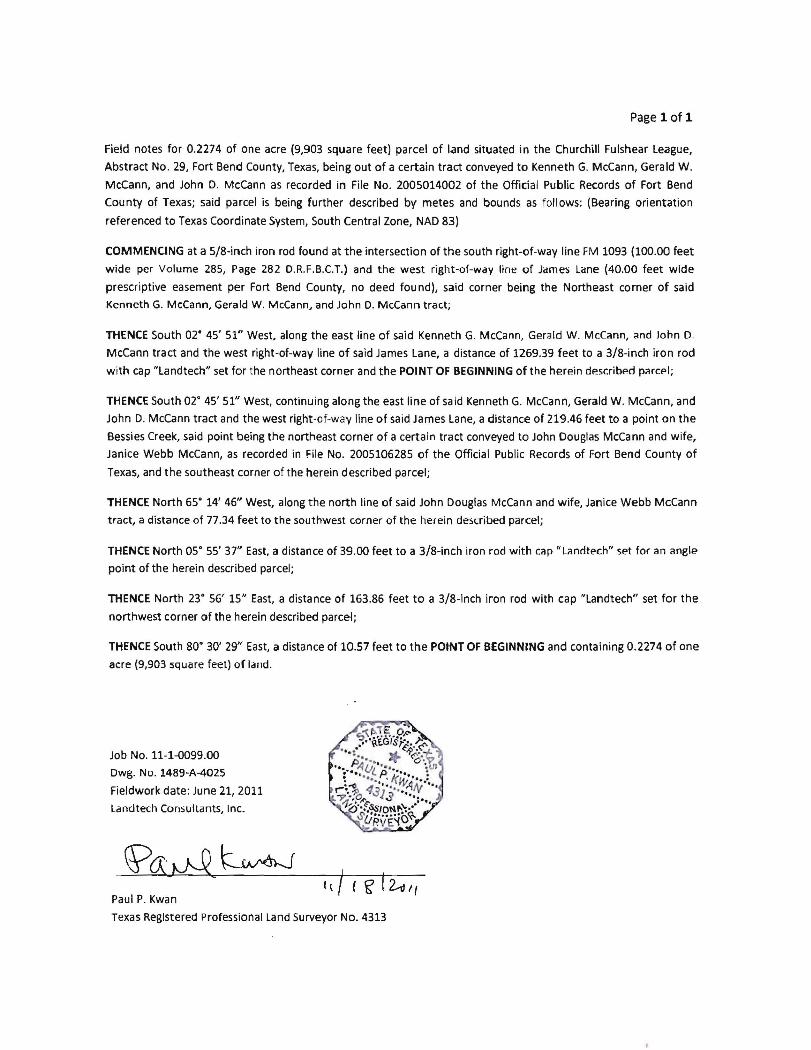
Page 1 of 1
Field notes for 0.2274 of one acre (9,903 square feet) parcel of land situated in the Churchill Fulshear League,
Abstract No. 29, Fort Bend County, Texas, being out of a certain tract conveyed to Kenneth G. McCann, Gerald W.
Mccann, and John D. McCann as recorded in File No. 2005014002 of the Official Public Records of Fort Bend
County of Texas; said parcel is being further described by metes and bounds as follows: (Bearing orientation
referenced to Texas Coordinate System, South Central Zone, NAD 83)
COMMENCING at a 5/8-inch iron rod found at the intersection of the south right-of-way line FM 1093 (l00.CO feet
wide per Volume 285, Page 282 D.R.F.B.C.T.) and the west right-or-way line of James Lane (40.00 feet wide
prescriptive easement per Fort Bend County, no deed found), said corner being the Northeast corner of said
Kenneth G. McCann, Gerald W. McCann, and John D. McCann tract;
THENCE South 02· 45' 51" West, along the east line of said Kenneth G. McCann, Gerald W. McCann, and John 0
McCann tract and the west right-of-way line of said James Lane, a distance of 1269.39 feet to a 3/8-inch iron rod
with cap "Landtech" set for the northeast corner and the POINT OF BEGINNING of the herein describp.d parcpl;
THENCE South 02° 45' 51" West, continuing along the east line of said Kenneth G. McCann, Gerald W. McCann, and
John D. McCann tract and the west right-of-way line of said James Lane, a distance of 219.46 feet to a point on the
Bessies Creek, said point being the northeast corner of a certain tract conveyed to John Douglas McCann and wife,
Janice Webb McCann, as recorded in File No. 2005106285 of the Official Public Records of Fort Bend County of
Texas, and the southeast corner of the herein described parcel;
THENCE North 65° 14' 46" West, along the north line of said John Douglas McCann and wife, Janice Webb McCann
tract, a distance of 77.34 feet to the southwest corner of the herein desaibed parcel;
THENCE North 05° 55' 37" East, a distance of 39.00 feet to a 3/8-inch iron rod with cap "Lanrltech" set for an angle
point of the herein described parcel;
THENCE North 23° 56' 15" East, a distance of 163.86 feet to a 3/8-inch iron rod with cap "Landtech" set for the
northwest corner of the herein described parcel;
THENCE South 80° 30' 29" East, a distance of 10.57 feet to the POINT OF BEGINNING and containing 0.2274 of one
acre (9,903 square feet) of land.
Job No. 11-HlO99.00
Dwg. No. 1489-A-4025
Fieldwork date: June 21, 2011
Landtech Consultants, Inc.
Paul P. Kwan
Texas Registered professional Land Surveyor No. 4313