LINE REFLECTIONS Review Mrs. Erickson The Coordinate Axes x-axis y-axis Origin: (0,0) (x,y)
Upload
hoangthuanCategory
view
217download
1
PEACE RIVER DEVELOPMENT SITE C PROJECT
REVIEW OF UPSTREAM AXES
Prepared by
Klohn Crippen Berger Ltd. and SNC-Lavalin Inc.
For
B.C. Hydro
Report No. 5032A01 02 May 2006
Not to be reproduced without the permission of BC Hydro

Peace River Development – Site C Project Review of Upstream Axes
Report No. 5032A01 02 May 2006
Not to be reproduced without the permission of BC Hydro
APPENDIX A
PHOTOGRAPHS AND NOTES
FROM THE
NOVEMBER 2005 SITE RECONNAISSANCE

Site C Trip• Day 1 (Nov. 06, 2005) we flew early in the morning to Ft.
St. John from Vancouver.• John Nunn (Klohn Crippen), Alfred Hanna (SNC
Lavalin), Tim Little (BCH) and John Boots (BCH) went to look at three potential sites.
• Rented a helicopter and flew up the Peace River. Flew over the three proposed sites.
• We then flew further upstream to the Halfway River and looked at landslides that occurred. We observed several landmarks along the way and are identified in the following photographs.
• On the way back we landed at Site C1 and C3. At Site C3 we observed that the instrumentation on the Island was mostly destroyed.

Site C Trip• Day 2 (Nov. 07, 2005) we drove to Site C3 Left Bank and walked
down to the river.• We observed some washouts and much movement of the Left Bank
slopes. Instrumentation had moved extensively and would likely not be of any value. See Photos.
• Walked to the bottom and observed the shale faces of the left bank. The shale faces are well defined at Site C3.
• We walked back to SUV, had lunch in town and drove out to Cache slide and Halfway River. We observed the slide activity in theseareas and noted the highway improvements that have been made because of the slope movements.
• Drove to airport and flew back to Vancouver arriving just before6:00pm.

Day 1 – November 06,2005Site C3 – On axis of dam looking from right to left bank.

Site C3 – Over right bank structures area looking to the left bank. Island in the middle where proposed test fill is to be placed.

Site C3 – Over right bank structures area looking to the left bank. Shaleoutcropping on left bank very visible.

Site C3 – Upper portions of the left bank showing access road and sloughing that has occurred.
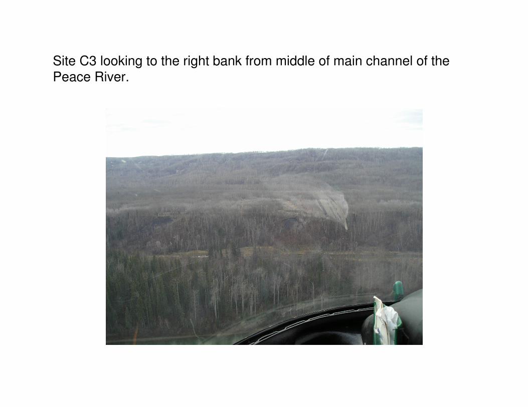
Site C3 looking to the right bank from middle of main channel of the Peace River.

Site C3 – Looking from the Right bank towards the left.

Site C3- Looking at the left bank where the exploration tunnel adit and chamber were constructed into the exposed shale.

Site C3 – Looking upstream towards Garbage Creek from axis of proposed dam.

Site C3 – Looking downstream at left bank where spoil area L6 is located.

Site C3 – Looking upstream over river island where preload was to be placed for determination of design parameters.

Moberly River – Shot of the mouth of the Moberly River immediately upstream of Site C3.

Garbage Creek – Just upstream of Site C3 on the left bank. Site C3 Left Bank excavation daylights into Garbage Creek. Has potential for a spoil area.

Site C2 – Hovering over the right bank looking across on the dam axis. Note the slides over the left abutment.

Site C2 – Left abutment where some shale is exposed.

Site C2 – Close-up of the Left abutment where slides have occurred.

Site C2 – Looking upstream on the Left bank.

Near Site C2 – A ravine on the Left bank upstream (?) of site.

Approaching Site C1 in the distance (traveling in the upstream direction). Tea Creek is just to the right of the treed island.

Site C2 looking towards Site C3. Moberly River is on the right side in the distance.

Site C2 – Looking across to the Left Abutment.

Site C2 – Looking at Left abutment on dam axis.
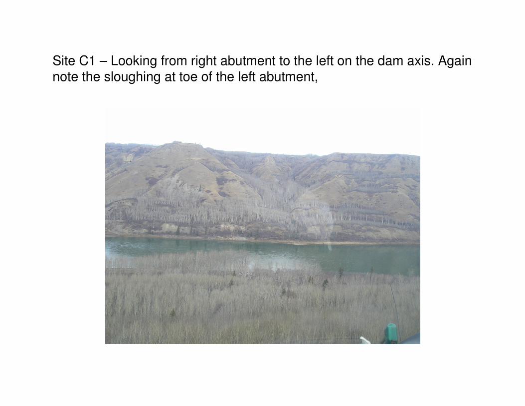
Site C1 – Looking from right abutment to the left on the dam axis. Again note the sloughing at toe of the left abutment,