Review of Existing Documents - Caltrans · The 2015-2020 SMP identified targets for doubling...
81
Review of Existing Documents California Department of Transportation March 2016
Transcript of Review of Existing Documents - Caltrans · The 2015-2020 SMP identified targets for doubling...
Review of Existing Documents
California Department of Transportation
March 2016


i | Alta Planning + Design
Document Information
Alta Planning + Design
100 Webster Street, Ste 300
Oakland, CA 94607
Ph. (510) 540-5008
Fax. (510) 540-5039
www.altaplanning.com
Prepared by Hugh Louch, Connery Cepeda, Lola Torney, Emily Tracy, Kyle James
Project Manager Brett Hondorp
Project Title California State Bicycle and Pedestrian Plan
Client Scott Forsythe
Document Revision Schedule
Review of Existing Documents
Rev. Description Date Reviewed by
v1 Draft report 1/19/2016 Brett Hondorp
v2 Draft report 2/10/2016 Brett Hondorp
v3 Draft report 3/17/2016 Hugh Louch

Review of Existing Documents California State Bicycle and Pedestrian Plan
ii | Alta Planning + Design
Table of Contents
1. Introduction ......................................................................................................................................... 1
2. Existing Caltrans Policy Framework ............................................................................................ 2
Existing Goals .............................................................................................................................................................. 2
Review of Existing Plans .........................................................................................................................................4
California Codes and Laws .................................................................................................................................. 13
Other Caltrans Policy Directives ....................................................................................................................... 14
USDOT Policy Guidance ....................................................................................................................................... 15
3. Existing Design Standards and Guidance ................................................................................ 16
California Design Standards ................................................................................................................................ 17
National Design Standards and Guides .......................................................................................................... 19
4. Guidebooks and Research ........................................................................................................... 26
Caltrans Guidebooks ............................................................................................................................................. 26
Federal and National Guidebooks ................................................................................................................... 29
Reports and Research ........................................................................................................................................... 32
5. Review of Regional Plans ............................................................................................................. 37
Goals, Objectives & Strategies .......................................................................................................................... 37
Challenges & Trends .............................................................................................................................................. 38
Needs from Caltrans .............................................................................................................................................. 39
Detailed Plan Review ............................................................................................................................................. 39
District Bicycle Maps and Guides ..................................................................................................................... 58
6. Review of Other State Plans ........................................................................................................ 61
Detailed Review of Plans ..................................................................................................................................... 62
Appendix A California Vehicle Code and Streets and Highways Code ............................... 73
California Vehicle Code ........................................................................................................................................ 73
California Streets and Highways Code .......................................................................................................... 76
1 | Alta Planning + Design
1. Introduction
bicycle and pedestrian plan. The plan is developing goals, objectives, and strategies that
Caltrans can support to implement the stated goal to triple bicycling and double walking in the
state by 2020.
This review provides background information to support development of a statewide policy
plan for active transportation. Caltrans and other agencies have developed a number of
previous plans and guidance documents that provide a foundation for bicycle and pedestrian
planning in the state. The intent of this planning process is to build on these existing efforts.
This review is not intended to provide a comprehensive critique of all available information, but
instead to highlight key elements and issues. This information is provided to the Technical
Advisory Committee to help formulate potential goals, objectives, and policies.
This document is organized as follows:
Section 2 reviews the existing Caltrans policy framework, including the plans, laws,
and other documents that shape how Caltrans approaches bicycle and pedestrian travel
in the state
Section 3 reviews existing design guidance relevant to California from both state and
national sources
Section 4 reviews a selection of regional bicycle and pedestrian plans from across
California to identify relevant goals and objectives to consider in the statewide plan
Section 5 reviews a selection of bicycle and pedestrian plans from other states

2 | Alta Planning + Design
2. Existing Caltrans Policy Framework
This section describes the existing policy framework that the California State Bicycle and
Pedestrian Plan (CSBPP) must fit within. As a policy plan, the CSBPP will develop a set of goals
and objectives for active transportation in California. It will also identify and develop strategies,
actions,
goals and objectives.
This section includes a review of many of the codes and laws, plans, and policies relevant to
the California State Bicycle and Pedestrian Plan. This section identifies:
Existing long range goals developed for the state
Codes and laws that govern bicycle and pedestrian travel in California
Other relevant state and Federal policies that help shape the policy framework
Existing Goals Caltrans has published several reports and plans that provide policy language and showcase
the direction Caltrans is heading in terms of a multimodal transportation system. The relevant
Plans reviewed were
The California Transportation Plan (CTP) 2040 - statewide, long-range transportation
plan to meet future mobility needs and reduce greenhouse gas (GHG) emissions
Caltrans Strategic Management Plan provides the strategic direction for Caltrans as
an organization. The 2015-2020 SMP identified targets for doubling walking and tripling
bicycling in California by 2020.
California Complete Streets Implementation Action Plan 2.0 - describes Caltrans
complete streets policy framework and overviews
efforts
Smart Mobility 2010: A Call to Action for the New Decade (Smart Mobility
Framework) planning guide that provides tools and techniques that improve
transportation by using six smart mobility principles to achieve sustainable outcomes
The CTP 2040 provides the overarching policy framework for all transportation in California.
Table 1 compares the themes of the goals found in the CTP to the other plans reviewed.
Table 1. Goal Themes from Existing Caltrans Plans
Goal Area CTP 2040 Caltrans SMP Complete
Streets Plan
Smart Mobility 2010
Safety
Multimodal Mobility
System Preservation
Economy
Livability
Health

Review of Existing Documents California State Bicycle and Pedestrian Plan
Alta Planning + Design | 3
Goal Area CTP 2040 Caltrans SMP Complete
Streets Plan
Smart Mobility 2010
Social Equity
Environment
System Efficiency
Departmental Excellence
Figure 1 presents the goals and policies from the draft CTP.
Figure 1. CTP 2040 Goals and Policies

Review of Existing Documents California State Bicycle and Pedestrian Plan
4 | Alta Planning + Design
Review of Existing Plans This section provides a detailed review of existing plans.
California Transportation Plan 2040 http://www.dot.ca.gov/hq/tpp/californiatransportationplan2040/
The California Transportation Plan (CTP) 2040 identifies
goals, strategies, and a long-range, performance-based
policies to guide multimodal transportation investments and
decisions by all levels of government, the private sector, and
stakeholders. Input was gathered from 27 partner agencies
and advocacy groups, as well as through seven public
workshops. The CTP 2040 focused on meeting new trends
and challenges, such as economic and job growth, climate
change, freight movement, and public health. In addition,
performance measures and targets were developed to
assess performance of the transportation system and its
ability to meet requirements of federal transportation
funding legislation.
While the CTP 2040 is not finalized, there are several
recurring themes raised through public workshops,
including:
Support for the reduction of greenhouse gases
Support for the improvement of multimodal mobility and accessibility for all people
Support for viable and equitable multimodal choices; including active transportation
Support for livable, healthy communities and the promotion of social equity
Support for the integration of land use development with multimodal transportation
Support for the reduction of collisions resulting in serious injuries and fatalities
Table 2 summarizes relevant comments to the California State Bicycle and Pedestrian Plan by
location.
Table 2. Summary of Public Bike/Ped Comments from CTP Public Meetings
Location Key Comments
Sacramento Incorporate bicycle facilities in all Caltrans projects
Use Complete Intersections guidebook
Improved sidewalk connectivity and ADA compliance
Equitable active transportation options for low income groups
Redding More concentration on complete streets at local level
Funding for active transportation and flexible use of funds
Separate off-street facilities for bicycling

Review of Existing Documents California State Bicycle and Pedestrian Plan
Alta Planning + Design | 5
Location Key Comments
San Diego Improved sidewalks
Support active transportation choices
Equity
Focus investments on reducing impacts of climate change
Riverside Improve ADA at intersections for visually impaired
Distribute funding according to desired mode share
Better accommodation for bikes and pedestrians
Destinations in close proximity to enable walking and biking as viable
options
Los Angeles Expand regional Class I, II and IV facilities convert flood control
channels into multi-purpose greenways
Increase funding and planning for active transportation
Improve opportunities to walk and bike
Traffic calming on neighborhood streets
Aesthetic improvements for sidewalks
Safe routes to schools
Fresno Incorporate pedestrian and bicycle accommodations from the
beginning of any project
For freeways where bicycles are prohibited, identify alternate routes
Bicycle safety
Gaps in bicycle and pedestrian networks
Oakland Separation of walking paths and sidewalks from traffic
Active transportation options that support long distance trips
Bicycle and pedestrian connections to transit
Reduce burden for local jurisdictions that want to implement
progressive bike/pedestrian projects on Caltrans right of way that are
also city streets
Tie funding to mode shift goal

Review of Existing Documents California State Bicycle and Pedestrian Plan
6 | Alta Planning + Design
Caltrans Strategic Management Plan [March 2015] http://www.dot.ca.gov/perf/library/pdf/Caltrans_Strategic_Mgmt_Plan_033015.pdf
The Caltrans 2015-2020 Strategic Management Plan (SMP)
operations in meeting the challenges of modernizing
Caltrans into a world-class Department of Transportation.
The plan serves a number of functions: provides a clear
direction for meeting statewide objectives; creates and
deepens strategic partnerships; and provides performance
measures that monitor success. The plan lists the following
five goals and provides strategic objectives, performance
measures, and targets for each of those goals:
Safety and Health: Provide a safe transportation
system for workers and users and promote health
through active transportation and reduced pollution
in communities.
Stewardship and Efficiency: Responsibly manage
-related assets.
Sustainability, Livability, and Economy: Make long-lasting, smart mobility decisions that
improve the environment, support a vibrant economy, and build communities, not
sprawl.
System Performance: Utilize leadership, collaboration, and strategic partnerships to
develop an integrated transportation system that provides reliable and accessible
mobility for travelers.
Organizational Excellence: Be a national leader in delivering quality service through
excellent employee performance, public communication, and accountability.
Table 3 identifies the strategic objectives, performance measures, and targets that are most
relevant to the California State Bicycle and Pedestrian Plan project

Review of Existing Documents California State Bicycle and Pedestrian Plan
Alta Planning + Design | 7
Table 3. Relevant Caltrans Strategic Objectives for the CSBPP
Strategic Objective Measure Target
Reduce user fatalities and
injuries by adopting a
practice
Number of fatalities for bicycle, pedestrian,
and transit modes of travel
10 percent reduction in number of fatalities in a
calendar year in each of the following mode types:
car, transit, pedestrian, and bicyclist
Promote community
health through active
transportation and
reduced pollution in
communities
Increase and improvement in opportunities
for safe and accessible active
transportation
100 percent of funds of allocated v. programmed
100 percent of projects being allocated for
construction awarded within six months
Percent reduction of transportation
system-related air pollution for criteria
pollutant emissions
85 percent reduction (from 2000 levels) in diesel
particulate matter emissions statewide by 2020
80 percent reduction from (from 2010 levels) in
NOx emissions in South Coast Air Basin by 2023
Improve the quality of life
for all Californians by
providing mobility choice,
increasing accessibility to
all modes of
transportation, and
creating transportation
corridors not only for
conveyance of people,
goods, and services, but
also as livable public
spaces
Percent increase of non-auto modes for
bicycle, pedestrian, and transit
By 2020, increase non-auto modes by tripling
bicycling, doubling walking, and doubling transit
mode splits over 2010-12 California Household
Travel Survey baseline
Accessibility Score (to be determined
considering e.g., multimodal transportation
proximity to jobs, disadvantaged
communities, housing services, transit-
oriented communities, etc.)
By December 2016, develop and adopt Caltrans
Accessibility Score
Livability Score (To be determined
considering, e.g., quality of life, noise,
safety, localized emissions, environmental
justice concerns, etc.)
By December 2016, develop and adopt Caltrans
Livability Score

Review of Existing Documents California State Bicycle and Pedestrian Plan
8 | Alta Planning + Design
Strategic Objective Measure Target
Reduce environmental
impacts from the
transportation system with
emphasis on supporting a
statewide reduction
greenhouse gas emissions
to achieve 80 percent
below 1990 levels by 2050
Per capita vehicle miles traveled By 2020, achieve 15 percent reduction (3 percent
per year) of statewide per capita VMT relative to
2010 levels reported by District
Percent reduction of transportation
system-related air pollution for greenhouse
gas emissions and criteria air pollutant
emissions
15 percent reduction (from 2010 levels) of
greenhouse gases to achieve 1990 levels by 2020
Percent increase in transportation projects
that include green infrastructure.
Weighting mechanism to be determined
By 2020, increase by 20 percent (5 percent per
year) incorporating green infrastructure into
transportation projects relative to 2010 levels
Increase the number of
Complete Streets features
on State highways that are
also local streets in urban,
suburban, and small town
settings
Percentage of projects that include
Complete Street features
By 2016, establish baseline and by 2020, increase
annual number of Complete Streets projects by 20
percent
Number of Complete Streets features on
State highway system
By 2016, establish baseline and by 2020, increase
annual number of Complete Streets features by 5
percent
Percentage of high-focus actions fully
implemented from the Complete Streets
Implementation Action Plan 2.0
By 2016, implement 80 percent of the 14 high-focus
actions
By 2018, implement 100 percent of the 14 high focus
actions

Review of Existing Documents California State Bicycle and Pedestrian Plan
Alta Planning + Design | 9
California Strategic Highway Safety Plan Update [2015] http://www.dot.ca.gov/hq/traffops/shsp/update.html
The California Strategic Highway Safety Plan (SHSP)
Update is a statewide, data-driven, traffic safety plan that
coordinates the efforts of a wide range of organizations to
reduce traffic fatalities and serious injuries on all public
roads. In coordination with federal, state, local, and private
sector safety stakeholders, the SHSP establishes goals,
objectives, and emphasis (or challenge) areas.
Federal regulations require that the California SHSP include
the following:
Consultation with a variety of stakeholders: At
present, there are over 400 identified stakeholders
assisting with the SHSP Update process.
Analysis and effective use of crash data: California
has or uses multiple crash data systems including
Statewide Integrated Traffic Records System
(SWITRS), the National Fatality Reporting System (FARS), the National Emergency
Medical Services Information System (NEMSIS), and the Crash Medical Outcomes Data
Outcome Data Evaluation System (CODES).
Plans to address the 4Es of traffic safety: Engineering, Enforcement, Education, and
Emergency Services. Some safety issues like vehicles running off the roadway involve
engineering challenges. Treating collision injuries involves emergency service issues like
improving training for first responders, and ensuring that responders have the right
equipment. Some safety issues, like texting while driving, involve multiple areas of
education, reminding drivers that texting is not worth it, and enforcement, citing drivers
for texting while driving.
Consideration for the safety of all public roads, and all users, including pedestrians and
bicyclists.
A program of projects or strategies to reduce or eliminate safety hazards: The SHSP
represents a continual process with focused teams studying safety problems, searching
for answers, and developing programs to improve traffic safety.
Implementation and evaluation: The SHSP Update will include review of the last SHSP
and the emphasis or challenge areas developed by that SHSP.
The California SHSP includes a large number of emphasis areas, including separate areas
focused on bicycle and pedestrian fatalities and serious injuries. The SHSP identifies five
strategies for each emphasis area. For the pedestrian emphasis area, the SHSP includes the
following strategies:
Improve the safety of pedestrian crossings by using proven effective countermeasures
Expand effective enforcement and education of all roadway users to improve
pedestrian safety based on known risk factors and data trends.
Increase funding for pedestrian safety infrastructure and non-infrastructure projects

Review of Existing Documents California State Bicycle and Pedestrian Plan
10 | Alta Planning + Design
Improve collection, use, and analysis of data needed for pedestrian safety planning and
programming
Increase pedestrian safety-focused coordination among state, regional, and local
agencies including on transportation planning and land use efforts
The bicycle emphasis area includes the following strategies:
Improve roadway and bikeway planning, design, operations, and connectivity to
enhance bicycling safety and mobility to all destinations.
Improve data collection regarding bicyclist trips, injuries, and fatalities on California
roadways and bicycle paths
Improve education and enforcement to promote safe multimodal travel
Encourage more bicycle travel by improving public attitudes about bicycling as a safe
mode of transportation
Develop safe, direct, and connected routes for bicycling.
California Complete Streets Implementation Action Plan 2.0 [2014] http://www.dot.ca.gov/hq/tpp/offices/ocp/docs/CSIAP2_rpt.pdf
The intent of the Complete Streets Implementation Action
Plan (CSIAP) 2.0 is to describe the current Caltrans
complete streets policy framework and to provide an
plete streets efforts.
This update lays out the structure for monitoring, reporting,
and overcoming barriers to further integrate complete
streets into all Caltrans functions and processes. Included in
the plan are the following items:
ision, and goals (goals are
consistent with the Caltrans Strategic Management
Plan)
Complete Streets definition
High-level benefits of Complete Streets
List of the most successful action items from the
2010 CSIAP
Summary of bicycle-friendly state survey
Su Urban Street Design Guide and Urban
Bikeway Design Guide
Summary of Complete Streets training for Caltrans employees
Summary of the Active Transportation Program
An updated list of action items
The action items most relevant to the California State Bicycle and Pedestrian Plan project are
listed below:
Guidance, Manuals, and Handbooks
o Finalize an update to the Highway Design Manual guidance related to design
speed, place type terminology, lane/shoulder widths, and curb extensions (bulb-
outs).

Review of Existing Documents California State Bicycle and Pedestrian Plan
Alta Planning + Design | 11
o Assist the AASHTO Standing Committee on Design ad-hoc group comparing the
NACTO Urban Street Design Guide with the AASHTO A Policy on Geometric
Design of Highways and Streets.
o
action item and many proposed new action items. The current active action item
on, the
CA 13 group provides suggested updated language to the Driver Training
Handbook used by the DMV.
o District 5 guidance on handling bicycle traffic in work zone areas and informing
the public.
Policy and Plans
o Develop a comprehensive, data-driven SHSP Update that defines state safety
goals and describes a program of strategies to improve safety on all public
roads. All modes of transportation, including pedestrian and bicycle, are to be
considered in the development of this plan update.
o Develop a Statewide Bicycle and Pedestrian Plan that is inspirational, visionary,
goal and performance driven, realistic, and constitutes a strategic policy
framework for bicycle and pedestrian transportation in California.
o Receive and process ADA grievances on Caltrans infrastructure. Transition the
handling of the web-based ADA request/grievance process from consultant to
Caltrans staff.
District Plans
o Develop improvement priorities for the Pacific Coast Bike Route for state
highways in District 1.
o Update District 2 bicycle guide with new and modified laws, regulations, and
bicycling information.
o
the National Designated Bike Trail for interregional and intraregional connection
along local and state routes (District 3).
o Produce maps of District 4 bicycling opportunities, which will show freeway
segments open to bicyclists, alternate routes for freeway segments not open to
bicyclists, and the bikeway status of conventional routes (Class II, III, or simply
open to bicyclists if not a Bike Route).
o Evaluation of conditions and identification of needs for bicycling in District 5.
o Publish an updated version of the District 5 bicycle map.
o Existing Bicycle Guides in Caltrans provide mostly bicycle information but do
not contain Complete Streets Elements or other multimodal alternative
information. Incorporate this information into the Draft Bicycle Guide for District
6, including pedestrian, transit, rail, and potentially airport information.
o Currently District 6 does not have a Bicycle Guide. A Bicycle Guide is needed to
keep pace with requests for bicycle-related data. The Bicycle Guide will include
elevation charts, detailed shoulder information, bikes allowed/prohibited, a map,
street/post-mile data, number of lanes, terrain, and alternative route data. A
bicycle inventory has been completed but never signed off by the District 6
Planning Deputy.

Review of Existing Documents California State Bicycle and Pedestrian Plan
12 | Alta Planning + Design
o Provide an updated guide for bicyclists showing where they are allowed to and
prohibited from riding bicycles on the state highways within District 8.
o Using a GIS-driven, web-based platform, District 11 will produce a bicycle map.
o The District 12 Bicycle Plan will identify existing and proposed bikeways in
Orange County and will provide resources for the development of future
bikeways.
Funding and Project Selection
o Conduct a review of Caltrans Park and Ride lots, safety roadside rest areas,
pedestrian over/under crossings, and on/off ramps. Develop a plan to address
the needed ADA improvements.
o Identify two District 11 interchanges one in project development and one that
is not currently a project to improve bicycle and pedestrian mobility at both
locations.
o Identify freeway interchanges in the San Diego region that are candidates for
bicycling and pedestrian improvements at locations that are not included in the
Regional Transportation Plan.
Awareness and Outreach
o Prepare and implement rollout of outreach training for the ATP guidelines.
o Travel behavior data profiles that can include data from current bike riders and
walkers regarding the lack of complete streets features in their communities.
o As part of the State Bicycle Plan and Bicycle Map, CT Earth GIS layers will be
developed that include available information on state route types, areas closed
to bicycles, alternative routes, and Class II or III bicycle facilities.
Data and Performance Measures
o Report the complete streets data collected from the Project Delivery Assets
(PDA) Web Tool in the Caltrans Executive Fact Book.
o Add additional complete streets questions in the 2015 National Household Travel
Survey regarding the lack of sidewalks, bicycle lanes, ramps, street markings,
and other features that affect mode choice. Focus on rural communities and lack
of sidewalks, lighting, and other complete streets features.
o Recognizing there are numerous efforts and activities underway on the subject
of Complete Streets, the Transportation Planning Bicycle Task Force will spur
more discussion among leaders in HQ and the Districts. The Task Force is a forum
to allow a focus discussion with the intent of identifying actions that can foster
cultural shift within Caltrans to support bicycling. The purpose of the Task Force
state highway system, identify actions to enhance bicycling and permeate
o A report will be generated showing the effectiveness of bike box installed on
State Route 227 as a possible design treatment to be used as a tool of expanding
complete streets.
Training
o Develop the curriculum and provide ADA-related training to Caltrans
construction, maintenance, and encroachment permit staff.

Review of Existing Documents California State Bicycle and Pedestrian Plan
Alta Planning + Design | 13
o Develop an in-house training course on geometric design and operational
treatments for pedestrians and bicyclists.
Research
o Research methodologies, and if applicable, develop a methodology to measure
the economic impacts of improvements made on main streets.
o Evaluate the use of MMLOS from the Highway Design Manual to determine its
effectiveness in assessing impacts and related mitigation in Intergovernmental
Review projects.
o Caltrans has been using chip seal as a pavement preservation strategy since the
1970s. Chip seal is most commonly used on highways, including shoulders to
extend the service life of the pavement. Depending on the materials used for
chip seal, the surface of shoulder where bicyclists ride could be rough. This effort
investigates potential ways to minimize roughness for bicyclists when chip seal
is used as a pavement preservation treatment.
o Improve and increase reporting on bicycle and pedestrian data through an
expanded National Household Travel Survey. Interpret and make
recommendations on how the data can best be utilized. Ongoing communication
and interaction with Transportation Planning and System Information staff to
advance expansion of bike/pedestrian data.
California Codes and Laws
California Vehicle Code
While Caltrans has established policies for the planning, design, and construction of bicycle and
pedestrian facilities, such policies must adhere to the California Vehicle Code (CVC), enforced
by the California Highway Patrol (CHP) and local law enforcement.
Relevant CVC sections (§) for bicycle travel, include:
CVC § 21200 states that the rules of the road, set out in Division 11 of the CVC, that do
not specifically apply only to motor vehicles are applicable to bicyclists.
CVC § 21202 requires bicyclists to ride, "as close as practicable to the right-hand curb
or edge of the roadway" except in certain circumstances.
CVC § 21650.1 clarifies that cyclists, unlike drivers of vehicles, are not prohibited from
riding on the shoulder of the road.
Where bike lanes exist on roadways, CVC § 21208 requires cyclists to use them, except
under certain conditions.
The Three Feet for Safety Act (CVC § 21760), which became operative on September
16, 2014, requires motor vehicles to leave a 3-foot margin while passing a cyclist if
possible.
CVC § 21100 sets out that, "Local authorities may adopt rules and regulations... regarding
the ... Operation of bicycles, and, as specified in Section 21114.5, electric carts by
physically disabled persons, or persons 50 years of age or older, on the public
sidewalks." This allows local jurisdictions to ban sidewalk cycling in business districts,
for example.
Review of Existing Documents California State Bicycle and Pedestrian Plan
14 | Alta Planning + Design
CVC § 39002 allows local jurisdictions to implement mandatory licensing for bicycles
and prohibit unlicensed riding.
Though pedestrians are, by definition, not operating a vehicle, CVC sections that reference
pedestrians include:
CVC §
in the CVC) as crossing a roadway between 2 adjacent intersections controlled by traffic
signals without using a crosswalk.
CVC § 21966 states that pedestrians shall not use a bicycle lane or path where an
adjacent adequate pedestrian facility (e.g., sidewalk) exists.
CVC § 21950(a) states that a driver (including bicyclists) shall yield to a pedestrian
within any marked or unmarked crosswalk at an intersection.
California Streets and Highways Code
The California Streets and Highways Code is one of 29 legal codes enacted by the California
State Legislature, which together form the general statutory law of California. The codes form
an important part of California law; however, they must be read in combination with the federal
and state constitutions, federal and state case law, and the California Code of Regulations in
order to understand how they are actually interpreted and enforced in court.
The most relevant sections of the California Streets and Highways Code for reference in the
CSBPP are listed below in order of appearance:
Tourist-Oriented Directional Signs (Div. 1, Ch. 1.5)
Non-Motorized Transportation (Div. 1, Ch. 8); including requirement to develop a
statewide bicycle map (Section 887.2)
Active Transportation Program (Div. 3, Ch. 8)
Pedestrian Malls (Div. 13)
Street Lighting (Div. 14)
Tree Planting, Landscaping, and Lighting (Div. 15)
Particular Highway Crossings (Div. 17, Ch. 2)
Relevant excerpts of California Codes and Laws are provided in Appendix A.
Other Caltrans Policy Directives
Deputy Directive 64 Revision 2: Complete
Streets Integrating the Transportation System
[2014]
Arguably the first significant Caltrans policy on the
pedestrian and bicycling modes was Deputy Directive 64
(DD-
to accommodate non-motorized travelers as an important
consideration in improving the transportatio
revision to Deputy Directive 64 (DD-64-R1) to make it more consistent with Assembly Bill (AB)
of transportation modes. The directive was revised again in October 2014 (DD-64-R2),

Review of Existing Documents California State Bicycle and Pedestrian Plan
Alta Planning + Design | 15
travelers of all ages and abilities in all planning, programming, design, construction, operations,
maintenance activities, and products on the State Highway System. The policy document
defines the term Complete Streets and identifies responsibilities among Caltrans employees for
creating Complete Streets.
DD-64-R2 establishes a policy within the California Department of Transportation (Caltrans)
that the State highway system provide for the needs of travelers of all ages and abilities in all
planning, programming, design, construction, operations, and maintenance activities and
products. This Complete Street policy views all transportation improvements as opportunities
to improve the safety, access, and mobility for all travelers in California and recognizes bicycle,
pedestrian, and transit modes as integral elements of the transportation system.
USDOT Policy Guidance
has published a policy statement on bicycle and pedestrian accommodation regulations and
recommendations, given below.
safe and convenient walking and bicycling facilities into
transportation projects. Every transportation agency, including DOT, has the responsibility to
improve conditions and opportunities for walking and bicycling and to integrate walking
and bicycling into their transportation systems. Because of the numerous individual and
community benefits that walking and bicycling provide including health, safety,
environmental, transportation, and quality of life transportation agencies are encouraged to
go beyond minimum standards
FHWA, March 2010 (emphasis added)
16 | Alta Planning + Design
3. Existing Design Standards and Guidance
One of the most important roles for Caltrans is in establishing engineering standards for the
development of transportation facilities. This section describes available design standards in
California and nationally. For the purposes of this report, standards are part of a code, rule or
regulation by a regulatory government agency and impose a legal obligation on specified
parties to conform to it. Standards are typically the minimum or lowest acceptable limit in
design, yet exceptions may be approved by providing documentation and following an
established procedure. Meanwhile, guidance and guides provide best practices and examples
of how to use good engineering judgement in certain contexts, but are generally not part of a
code, rule or regulation. The following section describes available guidance and relevant
national research in more detail.
In California, there are two key design manuals that guide the development of transportation
facilities:
The California Highway Design Manual (HDM) establishes uniform policies and
procedures to carry out the State highway design functions of the Department. It is
neither intended as, nor does it establish, a legal standard for these functions. The
Bicycle
rnia Vehicle
of types of bicycle infrastructure on roadways and declares the minimum widths
allowed.
o Chapter 1000 of the HDM also contains descriptions of the various bicycle facility
types, but guidance for facilities contained within the roadbed are found in the
parts of the manual related to roadbed design. The complete streets version
released in 2012 was intended, in part, to make designers aware of bicycle
treatments as they were investigating needs for motorized users. Most important
are the features, dimensions, and standards for the most common situation
where there is no designated bicycle facility. Bicycle users are supposed to be
considered in the design of all highway types that are open to bicycle use.
The California Manual on Uniform Traffic Control Devices (MUTCD) provides uniform
standards and specifications for all official traffic control devices in California, including
the types of signs allowed. Another pertinent guide includes Assembly Bill (AB) 819
(Bikeway Research, Experimentation, Testing, Evaluation, or Verification Related to
Design Criteria), which outlines the procedures for when a bicycle project is planned on
a State highway system or used federal funding.
In addition, there are several national design standards and guidelines that were reviewed as
part of this project, including:
Americans with Disabilities Act Standards
American Association of State Highway and Transportation Officials (AASHTO) Guide
for the Development of Bicycle Facilities

Review of Existing Documents California State Bicycle and Pedestrian Plan
Alta Planning + Design | 17
AASHTO Guide for the Planning, Design, and Operation of Pedestrian Facilities
NACTO Urban Street Design Guide
NACTO Urban Bikeway Design Guide
Caltrans has reaffirmed and promoted flexibility in design on roadways. As part of the Design
Flexibility memo, Caltrans endorsed National Association of City Transportation Officials
(NACTO) guides for use, including the Urban Bikeway Design Guide. These guidelines offer
designs not found in the HDM, but have been implemented elsewhere and are considered safer
alternatives than some of the designs and treatments found in the HDM. In December 2015,
Caltrans released Design Information Bulletin 89, which provides guidance on the design of
Class IV or separated bikeways.
Like Caltrans, USDOT has also endorsed the use of alternate design guidelines, as shown in the
quote below.
the States may consider guides from the American Association of State Highway and
Transportation Officials (AASHTO) and other publications for design standards. Under
23 U.S.C. 109(o), States establish their own design standards for projects not on the
NHS. FHWA supports a holistic approach to planning and design that will routinely
incorporate bicycling and walking. FHWA also supports taking a flexible approach to
bicycle and pedestrian facility design as described in the memo on Bicycle and 1
Recent federal legislative and policy changes also provide additional guidance. Specifically,
The FAST Act transportation funding bill specifically allows for use of non-AASHTO
design.
USDOT is also in the middle of revising the controlling criteria for design of various types
of facilities.
California Design Standards
California Highway Design Manual [2015] http://www.dot.ca.gov/hq/oppd/hdm/hdmtoc.htm
This manual establishes uniform policies and procedures to carry out the State highway design
functions of the Department. It is neither intended as, nor does it establish, a legal standard for
these functions.
A scan of the 6th Edition of the California Highway Design Manual (HDM) shows the following
sections may be most relevant to the California State Bicycle and Pedestrian Plan:
102.2 - Design Capacity and Quality of Service (Pedestrians and Bicycles)
105 Pedestrian Facilities
115 - Designing for Bicycle Traffic
116 Bicyclists and Pedestrians on Freeways
208.4 Bridge Sidewalks
1 http://www.fhwa.dot.gov/environment/bicycle_pedestrian/guidance/guidance_2015.cfm
Review of Existing Documents California State Bicycle and Pedestrian Plan
18 | Alta Planning + Design
208.6 Bicycle and Pedestrian Overcrossings and Undercrossings
301 Traveled Way Standards
303.4A Typical Bulbout with Class II Bikeway (Bike Lane)
303.4B - Typical Bulbout without Class II Bikeway (Bike Lane)
403.3B - Class II Bikeway Crossing Railroad
403.6A Typical Bicycle and Motor Vehicle Movements at Intersections of Multilane
Streets without Right-Turn-Only Lanes
403.6B Bicycle Left-Turn-Only Lane
405.5 - Pedestrian Refuge Island
903.8 Security and Pedestrian Amenities
Chapter 1000 Bicycle Transportation Design
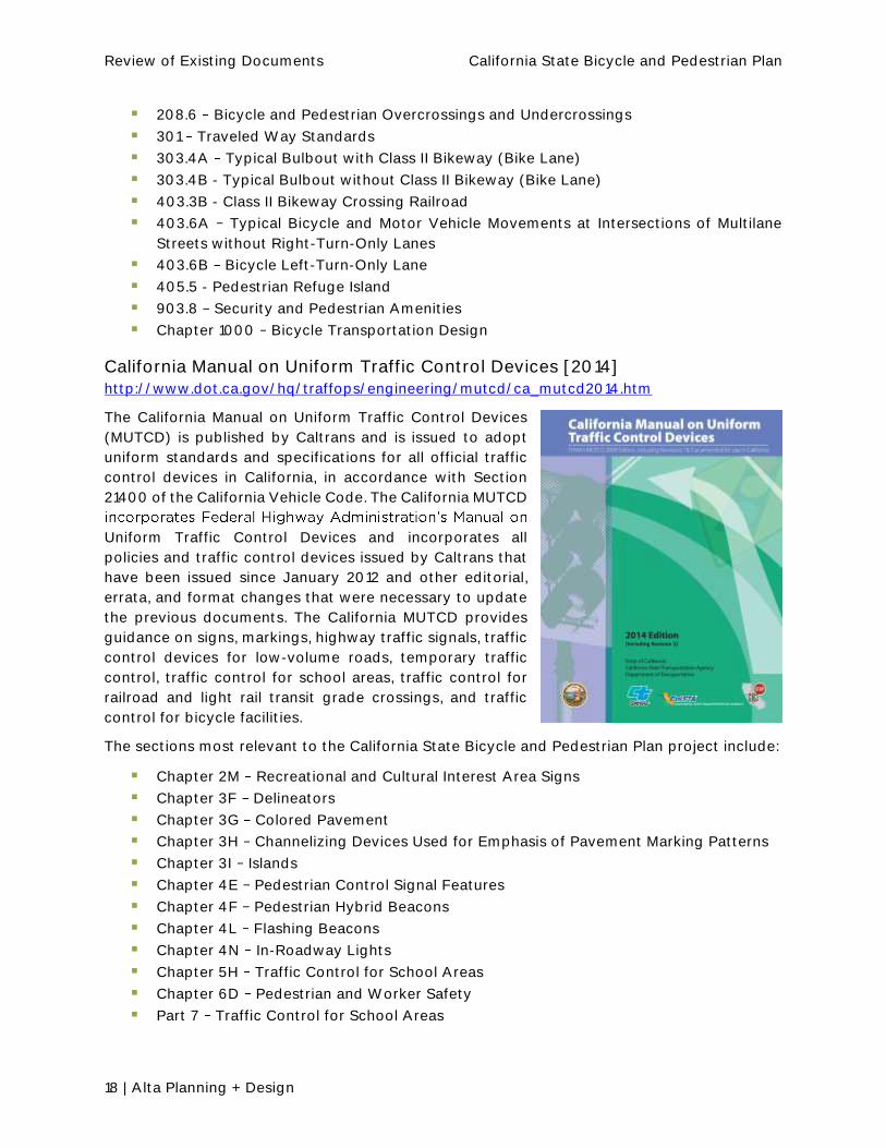
California Manual on Uniform Traffic Control Devices [2014] http://www.dot.ca.gov/hq/traffops/engineering/mutcd/ca_mutcd2014.htm
The California Manual on Uniform Traffic Control Devices
(MUTCD) is published by Caltrans and is issued to adopt
uniform standards and specifications for all official traffic
control devices in California, in accordance with Section
21400 of the California Vehicle Code. The California MUTCD
Uniform Traffic Control Devices and incorporates all
policies and traffic control devices issued by Caltrans that
have been issued since January 2012 and other editorial,
errata, and format changes that were necessary to update
the previous documents. The California MUTCD provides
guidance on signs, markings, highway traffic signals, traffic
control devices for low-volume roads, temporary traffic
control, traffic control for school areas, traffic control for
railroad and light rail transit grade crossings, and traffic
control for bicycle facilities.
The sections most relevant to the California State Bicycle and Pedestrian Plan project include:
Chapter 2M Recreational and Cultural Interest Area Signs
Chapter 3F Delineators
Chapter 3G Colored Pavement
Chapter 3H Channelizing Devices Used for Emphasis of Pavement Marking Patterns
Chapter 3I Islands
Chapter 4E Pedestrian Control Signal Features
Chapter 4F Pedestrian Hybrid Beacons
Chapter 4L Flashing Beacons
Chapter 4N In-Roadway Lights
Chapter 5H Traffic Control for School Areas
Chapter 6D Pedestrian and Worker Safety
Part 7 Traffic Control for School Areas

Review of Existing Documents California State Bicycle and Pedestrian Plan
Alta Planning + Design | 19
Part 9 Traffic Control for Bicycle Facilities
Caltrans Class IV Separated Bikeway Design Information Bulletin (DIB 89)
[2015] http://www.dot.ca.gov/hq/oppd/dib/dib89.pdf
The Protected Bikeways Act of 2014 (Assembly Bill 1193) established Class IV Bikeways, also
referred to as separated bikeways or cycle tracks, for California and required Caltrans, in
cooperation with local agencies and in consultation with the existing Caltrans advisory
committee dedicated to improve access for persons with disabilities, to establish design criteria
for separated bikeways. Approved on December 30, 2015, Design Information Bulletin (DIB)
Number 89 was prepared to provide that design criteria and other general guidance on best
practices related to separated bikeways to establish uniform guidance for the use of owners of
these facilities.
The design criteria and guidance in this DIB has been written to allow designers to exercise
sound judgment when applying it, consistent with the Project Development philosophy (see
Caltrans Highway Design Manual Index 81.1) when designing projects and has been written to
allow for flexibility in applying the design criteria, taking into consideration the context of the
project location; which enables the designer to tailor the design, as appropriate, for the specific
circumstances while maintaining safety.
This DIB provides additional design criteria and traffic operations guidance (signing and
markings) in accordance with existing California codes and the California MUTCD. In addition,
this DIB is also referenced in the Caltrans HDM. In particular, bikeway design guidance for Class
I Bikeways (bike paths) in HDM Chapters 200 and 1000 for vertical clearance, design speed,
stopping sight distance, drainage, landscaping, etc., may be used as appropriate for the Class
IV Bikeway design.
National Design Standards and Guides
Americans with Disabilities Act Standards
The Americans with Disabilities Act (ADA) of 1990 prescribes that facilities, including for
transportation, shall be made accessible to persons with disabilities. To comply with the ADA,
the 2010 Americans with Disabilities Act Standards, as adopted by the U.S. Department of
Justice (DOJ), serve as the primary basis of accessibility standards for public rights-of-way.
For transportation facilities on the California State Highway System, Caltrans (in addition to the
California Department of General Services Division of the State Architect that oversees
California Building Code compliance) is authorized to certify, on a project-by-project basis, that
a project complies with State pedestrian accessibility design standards.
Proposed Guidelines for Pedestrian Facilities in the Public Right-of-Way
http://www.fhwa.dot.gov/environment/bicycle_pedestrian/resources/prwaa.cfm
The Draft Proposed Guidelines for Pedestrian Facilities in the Public Right-of-Way (PROWAG)
ensure that sidewalks, pedestrian street crossings, pedestrian signals, and other facilities for
pedestrian circulation and use constructed or altered in the public right-of-way by state and
local governments are readily accessible to and usable by pedestrians with disabilities. The

Review of Existing Documents California State Bicycle and Pedestrian Plan
20 | Alta Planning + Design
Draft Guidelines are not standards until adopted by the U.S. DOJ and the U.S. DOT; the present
standards to be followed are the aforementioned ADA Accessibility Guidelines (ADAAG)
standards. However, the Draft Guidelines are the currently recommended best practices, and
can be considered the state of the practice that could be followed for areas not fully addressed
by the present ADAAG standards.
Proposed Federal Revisions to Design Controlling Criteria
This is part of a current rulemaking, so these have not been completed, but the revisions include
reducing and clarifying the criteria that control design on the National Highway System (NHS),
specifically:
Eliminating three criteria related to Bridge Width, Vertical Alignment, and Lateral Offset
to Obstruction
Renaming several criteria for clarity
Requiring the full set of remaining criteria only for high speed facilities (design speed of
at least 50 mph). On low-speed NHS roadways (design speed < 50 mph), design
exceptions would only be required by FHWA for deviations from the design speed or
design loading structural capacity criteria.
The resulting controlling criteria for design for high speed facilities would be as follows:
Design Speed.
Lane Width.
Shoulder Width.
Horizontal Curve Radius.
Superelevation.
Stopping Sight Distance.
Maximum Grade.
Cross Slope.
Vertical Clearance.
Design Loading Structural Capacity.
FHWA Case Studies in Delivering Safe, Comfortable and Connected Pedestrian
and Bicycle Networks
https://www.fhwa.dot.gov/environment/bicycle_pedestrian/publications/network_report/
Published in December 2015, this report provides an overview of pedestrian and bicycle
network principles, and highlights examples from communities across the country, building off
of the 2010 U.S. DOT Policy Statement on Bicycle and Pedestrian Accommodation Regulations
commitment to and inve
identified, evaluated, and categorized into several key project types, including:
Planning and Prioritization
Shared Use Paths
Corridor Improvements
Bridges

Review of Existing Documents California State Bicycle and Pedestrian Plan
Alta Planning + Design | 21
On-Road Facilities
Intersections and Crossing Improvements
AASHTO Guide for the Development of Bicycle Facilities [2012] https://bookstore.transportation.org/item_details.aspx?ID=1943
The AASHTO Guide for the Development of Bicycle Facilities
provides information on the physical infrastructure needed to
support bicycling. AASHTO envisions that the guide will be
used as a state level design handbook or the basis for a state
to develop their own handbook. The most recent edition of the
guide provides guidance on how to choose between the
bikeway typologies, affirms lane diets and road diets, and
includes expanded bike lane, signal and shared-use path
Urban Bikeway Design Guide provides
much of the same information as the AASHTO Bike Guide but
contains more experimental solutions that are currently being
tested and does not cover paths.
The AASHTO Bike Guide can serve as a basis for a California-
specific design handbook. It contains chapters on:
Bicycle Planning overview of basic concepts in bicycle planning such as different levels
of planning studies, quality of service, demand analysis, cost-benefit analysis, and the
role of public input in the planning process.
Bicycle Operation and Safety covers design vehicle and an analysis of bicyclist
collision factors.
Design of On-Road Facilities provides comprehensive design guidance for on-street
facilities such as paved shoulders, alleviating conflicts between bicycle lanes and on-
street parking, right and left turn considerations, and bicycle boulevards.
Design of Shared-Use Paths provides comprehensive design guidance for shared-use
paths including design speed, horizontal alignment, cross slope, grade, and stopping
sight distance information.
Bicycle Parking Facilities overview of short- and long-term bicycle parking site and
facility design.
Maintenance and Operations covers street sweeping, vegetation, sign and marking
maintenance, chip sealing, snow clearance, operating bikeways in work zones, and other
related topics.
Review of Existing Documents California State Bicycle and Pedestrian Plan
22 | Alta Planning + Design
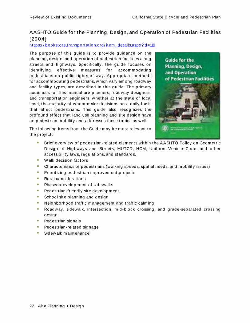
AASHTO Guide for the Planning, Design, and Operation of Pedestrian Facilities
[2004] https://bookstore.transportation.org/item_details.aspx?id=119
The purpose of this guide is to provide guidance on the
planning, design, and operation of pedestrian facilities along
streets and highways. Specifically, the guide focuses on
identifying effective measures for accommodating
pedestrians on public rights-of-way. Appropriate methods
for accommodating pedestrians, which vary among roadway
and facility types, are described in this guide. The primary
audiences for this manual are planners, roadway designers,
and transportation engineers, whether at the state or local
level, the majority of whom make decisions on a daily basis
that affect pedestrians. This guide also recognizes the
profound effect that land use planning and site design have
on pedestrian mobility and addresses these topics as well.
The following items from the Guide may be most relevant to
the project:
Brief overview of pedestrian-related elements within the AASHTO Policy on Geometric
Design of Highways and Streets, MUTCD, HCM, Uniform Vehicle Code, and other
accessibility laws, regulations, and standards.
Walk decision factors
Characteristics of pedestrians (walking speeds, spatial needs, and mobility issues)
Prioritizing pedestrian improvement projects
Rural considerations
Phased development of sidewalks
Pedestrian-friendly site development
School site planning and design
Neighborhood traffic management and traffic calming
Roadway, sidewalk, intersection, mid-block crossing, and grade-separated crossing
design
Pedestrian signals
Pedestrian-related signage
Sidewalk maintenance

Review of Existing Documents California State Bicycle and Pedestrian Plan
Alta Planning + Design | 23
NACTO Urban Bikeway Design Guide [2013] http://nacto.org/publication/urban-bikeway-design-guide/
The purpose of the NACTO Urban Bikeway Design Guide is
to provide cities with state-of-the-practice solutions that
can help create complete streets that are safe and
enjoyable for bicyclists. Most of these treatments are not
directly referenced in the current version of the AASHTO
Guide to Bikeway Facilities, although they are virtually all
(with two exceptions) permitted under the Manual on
Uniform Traffic Control Devices (MUTCD). The Federal
Highway Administration has posted information regarding
MUTCD approval status of all of the bicycle related
treatments in this guide and in August 2013 issued a
memorandum officially supporting use of the document. All
of the NACTO Urban Bikeway Design Guide treatments are
in use internationally and in many cities around the US.
Below is the basic organization of the NACTO Urban
Bikeway Design Guide:
Bike Lanes
o Conventional Bike Lanes
o Buffered Bike Lanes
o Contra-Flow Bike Lanes
o Left Side Bike Lanes
Cycle Tracks
o One-way Protected Cycle Tracks
o Raised Cycle Tracks
o Two-way Cycle Tracks
Intersection Treatments
o Bike Boxes
o Intersection Crossing Markings
o Two-stage Turn Queue Boxes
o Median Refuge Island
o Through Bike Lanes
o Combined Bike Lane/Turn Lane
o Cycle Track Intersection Approach
Bicycle Signals
o Active Warning Beacon for Bike Route at Unsignalized Intersection
o Bicycle Signal Heads
o Hybrid Beacon for Bike Route Crossing of Major Street
o Signal Detection and Actuation
Bikeway Signing and Marking

Review of Existing Documents California State Bicycle and Pedestrian Plan
24 | Alta Planning + Design
o Colored Bike Facilities
o Colored Pavement Material Guidance
o Shared Lane Markings
o Bike Route Wayfinding Signage and Markings System
Bicycle Boulevards
o Route Planning
o Bicycle Boulevard Signs and Pavement Markings
o Speed Management
o Volume Management
o Minor Street Crossings
o Major Street Crossings
o Offset Intersections
o Green Infrastructure
NACTO Urban Street Design Guide [2013] http://nacto.org/publication/urban-street-design-guide/
The Urban Street Design Guide focuses on the design of
city streets and public spaces. While other national
A Policy on Geometric Design
of Highways and Streets, provide a general discussion of
street design in an urban context, the Urban Street Design
Guide emphasizes city street design as a unique practice
with its own set of design goals, parameters, and tools.
Many cities have already gone through the process of
developing a local street design manual in the interest of
creating internal design consensus between different local
agencies. NACTO references materials from a selection of
these guides and urges municipalities to use the Urban
Street Design Guide as a basis for the creation of local
standards. For most topics and treatments in this guide,
the reader will find three levels of guidance:
Critical Features are elements for which there is a strong consensus of absolute
necessity.
Recommended Features are elements for which there is a strong consensus of added
value.
Optional Features are elements that may vary across cities and may add value,
depending on the situation.
The sections from the NACTO Urban Street Design Guide that may be most relevant to the
California State Bicycle and Pedestrian Plan project include:
Phases of Transformation
Downtown Thoroughfare
Lane Width
Major Intersections

Review of Existing Documents California State Bicycle and Pedestrian Plan
Alta Planning + Design | 25
Intersections of Major and Minor Streets
Complex Intersections
Complex Intersection Analysis
Coordinated Signal Timing
Design Speed
Speed Reduction Mechanisms
Design Vehicle
Design Hour
Performance Measures
Functional Classification

26 | Alta Planning + Design
4. Guidebooks and Research
In addition to the design standards reviewed in Section 3, other guidebooks and research
efforts were reviewed. These guides provide information on designing bicycle and pedestrian
facilities. In some cases, the guides may pull information from other design guidelines to
highlight how bicyclists and pedestrians are accommodate.
Caltrans Guidebooks
Complete Intersections: A Guide to Reconstructing Intersections and
Interchanges for Bicyclists and Pedestrians
The Complete Intersections Guide provides direction on implementing an important aspect of
Caltrans' Complete actions that will improve safety and mobility
for bicyclists and pedestrians at intersections and interchanges." The Guide is intended
primarily for Caltrans planners, engineers, and other highway designers working as generalists
or specialists in advising, engineering or designing for safe travel for all highway users at
intersections and interchanges. Th
constitute a standard, specification, or regulation. It is not intended to replace the existing
[Caltrans] mandatory or advisory standards, nor the exercise of engineering judgment by
licensed prof
Main Street, California: A Guide for Improving Community and Transportation
Vitality http://www.dot.ca.gov/hq/LandArch/16_livability/main_street/index.htm
This document is focused on the design of California State
community. The guide does not develop new guidance,
but provides information from existing Caltrans manuals
and policies, as well as national resources, to help
communities improve multimodal access, livability and
sustainability, while meeting appropriate engineering
standards. The guide helps readers find information about
standards and procedures described in the Caltrans
Highway Design Manual (HDM), the California Manual on
Uniform Traffic Control Devices (California MUTCD), and
the Project Development Procedures Manual (PDPM). The
guide is organized around five principles appropriate to
main streets (and other State Highways):
Flexibility in Design recognizes that state
highways that are main streets must accommodate
both through movement and local circulation

Review of Existing Documents California State Bicycle and Pedestrian Plan
Alta Planning + Design | 27
Partnerships: Caltrans, Communities and Stakeholders recognizes that Caltrans, the
local community, and its residents and businesses must participate in the design of
transportation facilities
Main Streets for All recognizes that all users and modes must be evaluated in
transportation investments in main streets
Livable Main Streets recognizes that streets are places people live, work, shop and
play, not just transportation routes
Sustainable Main Streets identifies opportunities for main streets to make use of green
infrastructure and related techniques
The guide provides examples of the implementation of these principles across California and
provides links to resources to help plan, design, and implement State Highway main streets
that follow these principles.
Pedestrian and Bicycle Facilities in California A Technical Reference and
Technology Transfer Synthesis for Caltrans Planners and Engineers [2005] http://atfiles.org/files/pdf/Pedestrian-Bicycle-Facilities-Caltrans.pdf
This technical reference document provides Caltrans
staff with a synthesis of information on non-motorized
transportation and serves as a resource on policies, laws,
programs, the Caltrans planning and design process,
guidelines, and best practices. Although primarily
intended for Caltrans planners and engineers, local
agency staff and the general public may also find it
useful. This document provides a bicycle and pedestrian-
focused literature review on the following topics:
Statutes and Policies
Planning
Funding Sources
Standard and Innovative Practices for Pedestrian
Facilities and Traffic Calming
Standard and Innovative Practices for Bicycle
Facilities
Benefits of Walking and Bicycling
Pedestrian and Bicycle Mobility and Safety Data
Pedestrian Characteristics in California Survey
Safe Access to Transit
Estimating Auto Trip Reduction by Non-Motorized Facilities
Assessing State DOT Performance
Bibliography
o General Information and Design Resources
o Bicycle and Pedestrian Facility Resources
o Trail Resources
o ADA-related Resources

Review of Existing Documents California State Bicycle and Pedestrian Plan
28 | Alta Planning + Design
o Traffic Calming Resources
o Safety Resources
While much of the information in the statues and policies, planning, and funding sources is
dated and the sections on innovative pedestrian and facilities have been superseded by various
NACTO guides, the appendices provide a framework for comparison of recent data to historic
data and the bibliography provides a quick review of active transportation-related documents
that pre-date 2005.

Review of Existing Documents California State Bicycle and Pedestrian Plan
Alta Planning + Design | 29
School Area Pedestrian Safety Manual [2006] http://www.dot.ca.gov/hq/traffops/engineering/control-devices/pdf/TMChapter10.pdf
Chapter 10 of the Caltrans Traffic Manual is dedicated to pedestrian safety traffic control
guidelines around K-12 schools. It provides guidance for signs, markings, and supervision at
established school crossings, grade-separated crossings, and pedestrian walkways including
flashing yellow beacons, school crossing traffic signals, heights for signs, and the schools and
travel to schools.
This document presents a valuable starting point for understanding the state of rules and
regulations in place for walking school routes in California and provides a primer to the
California Safe Routes to Schools Program.
Federal and National Guidebooks
FHWA Statewide Pedestrian and Bicycle Planning Handbook [2014] http://www.fhwa.dot.gov/planning/processes/pedestrian_bicycle/pedestrian_bicycle_handb
ook/fhwahep14051.pdf
This handbook is designed to help State departments of
transportation (DOTs) develop or update state pedestrian
and bicycle plans. Based on research including interviews
with nine state DOTs and critical evaluations of documents
from 15 states, this handbook covers statewide planning
from plan inception and scoping to engaging stakeholders
and the general public; developing goals, objectives and
strategies; collecting and analyzing data; linking to the
larger statewide transportation planning process; and
implementation. For each stage of the planning process,
this handbook uses recent experiences and noteworthy
practices from DOTs around the country, helping inform a
new generation of statewide non-motorized planning and
implementation.
As part of this handbook, the following themes emerged
from discussions with statewide pedestrian and bicycle coordinators in early 2014. Discussions
with DOTs in Colorado, Hawaii, Iowa, Louisiana, Maryland, Minnesota, North Carolina, Vermont,
and Washington yielded the following key themes.
Plan Focus
Most statewide plans are policy plans. Many states want plans that focus more on
guidance and direction than lists of projects. Still, some plans identify specific corridors
for statewide bicycling routes and include project scoping checklists and project
prioritizing criteria.
The plan needs a clear purpose. Many states felt it was important to think about how
the results of the plan are used, beginning with the end in mind and working backwards.
Planners should consider who will use it and what it will be used for; this helps to define
the expectations of the process.

Review of Existing Documents California State Bicycle and Pedestrian Plan
30 | Alta Planning + Design
Planning Process
The plan is a point in time. The plan may be prompted by legislative requirements, DOT
priorities, and/or internal champions. Other plans and initiatives will follow it.
Engagement, buy-in, and ownership are critical to making it a living document that
influences departmental direction.
Public involvement is time intensive, but essential to a quality outcome. Good public
involvement requires significant energy and resources. If the budget does not allow
many in-person meetings, webinars and interactive web tools can be effective.
Plan development can span a wide range of costs and effort. Statewide pedestrian and
bicycle planning efforts can vary widely in terms of cost and effort, from less than
$100,000 to upwards of $800,000. The range depends on the level of detail, data
collection, the balance between focusing on specific projects and corridors versus
policy, and the degree to which the plan is developed in-house or uses outside
consultants. Some states break up the planning process into multiple, discrete phases
in order to help with funding.
Institutional Analysis
Internal coordination is important, especially with district engineers and people tasked
with collecting data. The state DOT staff are the people that ultimately implement the
plan. Coordination is key for information exchange, education, and buy-in.
Many plans place great emphas
development process. It is critical to link planning to project development, in order to
ensure that the plan concepts are followed through into practice. This type of effort
changing internal procedures, or providing professional training internally and
externally.
Performance Management
Long-term data collection for performance management should be carefully
considered. In order to successfully track plan and program performance over time,
agencies must identify the right mix of accountability, ownership, and resources for
long-term data collection.
The connection between performance measures and project selection criteria needs to
be strengthened. This is an emerging area in planning that some States are making
progress on, but there is still much to learn about the most effective pedestrian and
bicycle performance measures and how to best apply them at the statewide level.
When selecting performance measures and indicators, planners should be careful to
focus on what the state DOT can control. Performance monitoring is important for
tracking progress of planning efforts and continuing to make the case for increased
investments. However, planners should consider carefully the measures and indicators
that they will be able to influence and track through the planning process. For instance,
does the plan address bicycle facility development across the state or only on state
routes? DOT plans should not rely too heavily on decisions or data collection by other

Review of Existing Documents California State Bicycle and Pedestrian Plan
Alta Planning + Design | 31
Designing Walkable Urban Thoroughfares: A Context-Sensitive Approach
[2010] http://www.ite.org/css/online/
This report was developed in response to widespread
interest for improving both mobility choices and
community character through a commitment to
creating and enhancing walkable communities. While
the concepts and principles of context sensitive
solutions (CSS) are applicable to all types of
transportation facilities, this report focuses on applying
the concepts and principles in the planning and design
of urban thoroughfares facilities commonly
designated by the conventional functional
classifications of arterials and collectors. Freeways,
expressways and local streets are not covered in this
report. The following chapters emphasize
thoroughfares in "walkable communities" compact,
pedestrian-scaled villages, neighborhoods, town
centers, urban centers, urban cores and other areas where walking, bicycling and transit are
encouraged. The objectives of this report are to:
Identify how CSS principles can be applied in the processes (for example, network,
corridor, project development) involved with planning and developing roadway
improvement projects on urban thoroughfares for walkable communities
Describe the relationship, compatibility, and trade-offs that may be appropriate when
balancing the needs of all users, adjoining land uses, environment and community
interests when making decisions in the project development process
Describe the principles of CSS and the benefits and importance of these principles in
transportation projects
Present guidance on how to identify and select appropriate thoroughfare types and
corresponding design parameters to best meet the walkability needs in a particular
context
Provide criteria for specific thoroughfare elements, along with guidance on balancing
stakeholder, community and environmental needs and constraints in planning and
designing walk-able urban thoroughfare projects
The sections from the report that may be most relevant to the California State Bicycle and
Pedestrian Plan project include:
CSS in the Transportation Planning Process
CSS in the Project Development Process
CSS in Network Planning
Network Design Guidelines
CSS Example in Corridor Planning Developing Evaluation Criteria
Thoroughfare Types

Review of Existing Documents California State Bicycle and Pedestrian Plan
32 | Alta Planning + Design
Separated Bike Lane Planning and Design Guide [2015] https://www.fhwa.dot.gov/environment/bicycle_pedestrian/publications/separated_bikelane
_pdg/
Separated Bike Lane Planning and Design Guide
outlines planning considerations for separated bike lanes and
provides a menu of design options covering typical one and
two-way scenarios. It highlights different options for providing
separation, while also documenting midblock design
considerations for driveways, transit stops, accessible parking,
and loading zones. It provides detailed intersection design
information covering topics such as turning movement
operations, signalization, signage, and on-road markings. Case
studies highlight best practices and lessons learned throughout
the document.
The guide consolidates lessons learned from practitioners
designing and implementing separated bike lanes throughout
the U.S. It attempts to capture the current state of practice,
while still recognizing that our understanding of this facility type is still evolving and that there
is a need for design flexibility. To encourage continued development and refinement of
techniques, the guide identifies specific data elements to collect before and after
implementation to enable future analysis across facilities in different communities. It identifies
potential future research, highlights the importance of ongoing peer exchange and capacity
building, and emphasizes the need to create holistic ways to evaluate the performance of a
separated bike lane.
Topics of relevance for the California State Bicycle and Pedestrian Plan include:
Factors that should be considered when planning separated bike lanes
Federal funding sources that can be used to implement separated bike lanes
Maintenance challenges and solutions related to separated bike lanes
Outreach needed for separated bike lanes
Various options to provide separation
Reports and Research
California Blueprint for Bicycling and Walking [2002]
The California Blueprint for Bicycling and Walking was prepared by Caltrans for the 2002
California State Legislature. The blueprint laid out ambitious goals for improving bicycling and
walking, including a 50 percent increase in bicycling and walking trips by 2010; a 50 percent
decrease in pedestrian and bicycle fatality rates by 2010; and increased funding for pedestrian
and bicycle programs.

Review of Existing Documents California State Bicycle and Pedestrian Plan
Alta Planning + Design | 33
Seamless Travel: Measuring Bicycle and Pedestrian Activity in San Diego
County and its Relationship to Land Use, Transportation, Safety, and Facility
Type [2010] http://www.path.berkeley.edu/sites/default/files/publications/PRR-2010-12.pdf
This research paper provides the data collection and research results for the Seamless Travel
project, a research project funded by Caltrans. This research is designed to (a) evaluate existing
bicycle and pedestrian data sources and collection methods, (b) conduct comprehensive
counts and surveys of bicyclists and pedestrians in a consistent manner using the National
Bicycle & Pedestrian Documentation Project (NBPD) as a template 9, (c) conduct counts and
surveys using San Diego County (with extensive historical count information) as a model
community, (d) analyze how bicycle and pedestrian activity levels relate to facility quality and
factors such as land use and demographics, (e) identify factors that are highly correlated with
increased bicycling and walking, (e) provide methods for quantifying usage and demand that
will enhance research on benefits and exposure, and (f) evaluate how the transit-linkage
(bicycle and pedestrian connections to transit) can be improved. This report presents materials
developed including a literature review, advisory committee meeting input, project objectives,
data collection methodology, results from the data collection effort, analysis of correlations,
trends, and patterns, conclusions on the accuracy and applicability of the data, and
recommendations on increasing walking and bicycling in California.
The study provides a starting point for the development of a more refined bicycle and
pedestrian regression model for estimating potential demand for bicycle and pedestrian
facilities.
The Non-Motorized Transportation Facilities Report to the California State
Legislature, Fiscal Year: FY 2013-14 [2014] http://www.dot.ca.gov/docs/Non-Motorized_Transportation_Facilities_Report_FY_2013-
14.pdf
Caltrans is required under Section 887.4 of the Streets and Highways Code to submit an annual
non-motorized transportation facility report to the California Legislature. The report is divided
into six chapters and five appendices:
Completed Projects: Profiles in Community Success
Bicycle and Pedestrian Program Highlights
Caltrans Non-motorized Program Activities
The Active Transportation Program
Other State and Federal Funding for Bicycle and Pedestrian Facilities
Committees and Advisory Groups
State Statues on Bicycling and Walking
Key Legislation Affecting Transportation Planning
Non-motorized Information Websites
Non-Motorized Report Acronyms
Deputy Directive 64-R2

Review of Existing Documents California State Bicycle and Pedestrian Plan
34 | Alta Planning + Design
This document presents a valuable starting point for understanding the state of bicycling and
walking in California and provides a primer to the California Complete Streets Implementation
Action Plan 2.0.
2010-2012 California Household Travel Survey Final Report [2013] http://www.dot.ca.gov/hq/tpp/offices/omsp/statewide_travel_analysis/files/CHTS_Final_Re
port_June_2013.pdf
The 2010 - 2012 California Household Travel Survey (CHTS) was a multi-modal study of the
demographic and travel behavior characteristics of residents across the entire State of
California, and the largest single regional household travel survey ever conducted in the United
States. Detailed travel behavior information was obtained from over 42,500 households, using
multiple data collection methods, including Computer Assisted Telephone Interviewing (CATI),
Online, Mail surveys, wearable and in-vehicle GPS as well as using On-Board Diagnostic (OBD)
sensors that gathered data directly from a vehicle's engine, which was a new and innovative
approach. Details of personal travel behavior within region of residence, and inter-regionally
within the state, as well as adjoining states and Mexico, were gathered. The survey sampling
plan was designed to ensure an accurate representation of the entire population of the state.
Under the leadership of the California Department of Transportation (Caltrans), the study was
jointly sponsored and funded by Caltrans, the California Strategic Growth Council, the California
Energy Commission, and the following local transportation planning agencies:
Association of Monterey Bay Area Governments (AMBAG)
Metropolitan Transportation Commission (MTC)
San Joaquin Air Pollution Control District
Santa Barbara County Association of Governments
Southern California Association of Governments (SCAG)
Tulare County Association of Governments.
Other state agencies, including the California Air Resources Board, California Department of
Public Health, and California Department of Housing and Community Development as well as
Planning Agencies (RTPAs) were survey stakeholders. The Federal Highway Administration
(FHWA) had active involvement with the survey and assisted Caltrans with funding for a public
outreach program.
The main objective of the survey was to be able to apply the data to develop and update
transportation models in order to meet statutory requirements of both federal (air quality
analysis) and state (AB 32, SB 375 and SB 391). Other main objectives included gathering data
from a considerably larger sample than in the past, a robust collection of all travel modes and
use of tolled facilities data, proper targeting of long distance travel, and an accurate
representation of weekday and weekend travel. The 2010 - 2012 CHTS included additional
features to support advanced model development, which included more detailed data on
vehicle acquisition decisions, parking choices, work schedules and flexibility, use of toll
lanes/priced facilities, and walk and bicycle trips.

Review of Existing Documents California State Bicycle and Pedestrian Plan
Alta Planning + Design | 35
Walking and Biking in California: Analysis of the CA-NHTS [2012] http://its.ucdavis.edu/research/publications/publication-detail/?pub_id=1661.
To estimate the safety risk for pedestrians and bicyclists requires reliable counts of the number
of pedestrian and bicycle crashes and collisions and the amount of walking and biking. To
create estimates of the amount of walking and biking in the state that can be used to estimate
the exposure of bicycles and pedestrians to crashes, the State of California purchased an add-
on to the 2009 National Household Travel Survey (called the CA-NHTS in this report). The CA-
NHTS provides a significant opportunity for California decision-makers to better understand
walking and biking, filling an important gap in the existing knowledge base. This report
calculates exposure rates for pedestrians and bicyclists in the State, each Caltrans District, and
for each of the Metropolitan Planning Organizations (MPO).
NCHRP Report 717: Guidebook on Pedestrian and Bicycle Volume Data
Collection [2014] http://onlinepubs.trb.org/onlinepubs/nchrp/nchrp_rpt_797.pdf
The Guidebook on Pedestrian and Bicycle Volume Data Collection is a resource for those who
are, or would like to be, involved in collecting non-motorized count data. The guidebook
includes:
Descriptions of methods and technologies for counting pedestrians and bicyclists
Guidance on developing a non-motorized count program
Gives suggestions on selecting appropriate counting methods and technologies, and
Examples of how organizations have used non-motorized count data to better fulfill
their missions
This guidebook also describes correction factors to improve the accuracy of counts produced
by automated counters, factors for expanding short-term counts to longer-term volume
estimates, and factors for adjusting counts to reflect environmental conditions at the time of
the count, such as rain. Related topics, such as trip sampling techniques (e.g., surveys, wireless
device detection, and global positioning system [GPS] data), pedestrian and bicycle presence
detection, and pedestrian and bicycle trip generation estim
scope.
National Bicycle and Pedestrian Documentation Project [2009] http://bikepeddocumentation.org/downloads/
The National Documentation Project (NDP) is an annual bicycle and pedestrian count and
survey effort that is sponsored by the Institute of Transportation Engineers Pedestrian and
Bicycle Council. This report provides guidance to local agencies and organizations conducting
bicycle and pedestrian counts and surveys as part of the National Bicycle & Pedestrian
Documentation Program being sponsored by the Institute of Transportation Engineers (ITE)
Pedestrian and Bicycle Council.
The report provides an overview of the National Documentation program, goals and objectives
of the program, and instructions on how to become involved. The report also suggests specific
research topics that could be initiated through this data collection effort.

Review of Existing Documents California State Bicycle and Pedestrian Plan
36 | Alta Planning + Design
Working with universities, organizations and agencies around the country, the National
Documentation Project proposes the following objectives:
Establish a consistent national bicycle and pedestrian count and survey methodology,
of this free material for use by agencies and organizations on-line.
Establish a national database of bicycle and pedestrian count information generated by
these consistent methods and practices.
Use the count and survey information to begin analysis on the correlations between
land use, demographic, type of facility, and other factors and bicycle and pedestrian
activity.

37 | Alta Planning + Design
5. Review of Regional Plans in California
Alta reviewed 13 regional plans developed by Metropolitan Planning Organizations (MPOs),
Councils of Governments (COGs), and counties across California in order to ascertain the issues
and concerns currently expressed by each. This review was not comprehensive, but instead
reflected a review of readily available plans available on public websites for MPOs and COGs
across the state. While some county plans are included, these were limited to plans that have
a multi-jurisdictional approach. It is important to note that most of the regional plans have a
bicycle planning focus, and that pedestrian planning is predominantly done at the local (sub-
regional) jurisdiction level; additional information and analysis of local pedestrian and bicycle
master plans in the state is necessary for a more comprehensive assessment.
The plans reviewed included:
Kern County Bicycle Master Plan and Complete Streets Recommendations (2012)
Kings County Regional Bicycle Plan (2011)
Lake Tahoe Region Bicycle and Pedestrian Plan (2010)
Metropolitan Transportation Commission Regional Bicycle Plan for the San Francisco
Bay Area (2009 update)
Monterey Bay Area Mobility 2035 (2010)
Sacramento Area Council of Governments Regional Bicycle, Pedestrian, and Trails
Master Plan (2015)
San Diego Association of Governments Regional Bicycle Plan (2010)
San Luis Obispo County Bikeways Plan (2010)
Santa Barbara County Association of Governments Regional Active Transportation Plan
(2015)
Shasta County Regional Transportation Plan (2010)
Southern California Association of Governments (SCAG) Active Transportation Work
Plan
Stanislaus Council of Governments Non-Motorized Transportation Master Plan (2013)
Tulare County Regional Bicycle Transportation Plan (2010)
The review focused on four questions:
1. What are the goals or objectives of the plan?
2. What challenges and trends related to walking and bicycling were identified in the plan?
3. What are the most important strategies recommended for implementation?
4. What does the region need from Caltrans to implement their plan?
Goals, Objectives & Strategies
The themes covered most frequently in the reviewed plans are listed below in descending
order.
Provide a connected network with access to local and regional destinations, and route
choices for bicyclists and pedestrians (12 plans)

Review of Existing Documents California State Bicycle and Pedestrian Plan
38 | Alta Planning + Design
Integrate walking and bicycling with transit (12 plans)
Increase safety or reduce collisions for bicyclists and pedestrians (11 plans)
Improve air quality, reduce emissions, or improve public health and physical activity
levels (11 plans)
Coordinate planning across jurisdictions and agency levels, including coordinating with
developers, nonprofits, and other non-government organizations (11 plans)
Provide support facilities and wayfinding (11 plans)
Improve the funding for and quality of maintenance and operations on bicycle and
pedestrian facilities (10 plans)
Reduce congestion or vehicle miles traveled by promoting walking and bicycling (9
plans)
Support or implement education and encouragement programs (8 plans)
Figure 2. Priority Goals from Regional Plans
Challenges & Trends
The plans that included an assessment of current or future walking and bicycling trips were
unanimous in projecting significant growth in walking and bicycling within the next 15-35 years.
Additional notable trends and challenges include:
Long-distance interregional commuting is growing, as people seek less expensive
housing options
New infrastructure tools are becoming more widely used: bike boxes, bike boulevards,
mini traffic circles, long-term bike parking, lead pedestrian intervals, and pedestrian
scramble phases
Freeways, waterways, and railroads often create barriers to walking and bicycling
become less confident or capable drivers
On a regional scale, infrastructure investments may be less impactful than land use
strategies, pricing systems, or technology solutions to discourage driving
13
13
12
12
11
10
10
10
9
Connected Network
Transit integration
Safety
Air quality & health
Support facilities
Coordination
Maintenance & operations
Reduce congestion/VMT
Education & Encouragement

Review of Existing Documents California State Bicycle and Pedestrian Plan
Alta Planning + Design | 39
Needs from Caltrans
The most commonly cited need from Caltrans was increased coordination with local
jurisdictions to provide bikeways on state routes, especially where state routes serve as the
Other needs include managing on-street bicycle facilities on state routes, expanding the scope
and depth of data collection efforts like the National Personal Transportation Survey, and
supporting the expansion of transit services like high speed rail.
Detailed Plan Review A summary of the plan review is included below. Plan contents have been paraphrased or
condensed to identify similar policy language. Goals, objectives, and strategies are summarized
in one combined section, because there was significant overlap between these two questions
in the reviewed plans.
Kern County Bicycle Master Plan and Complete Streets Recommendations
[2012]
Goals and Objectives
treet should be the
mobility and safety of all roadway users
Provide a balanced and efficient transportation
system that maximizes the reduction of air pollution
Provide safe, accessible and convenient bicycling
facilities
Support and encourage increased levels of
bicycling and walking
Promote the use of bicycles as an integral
component of the regional multi-modal
transportation network
Challenges and Trends
This plan estimated potential future walking and bicycling
trips and the associated benefits by using the future
population predictions from the 2011 Regional Transportation Plan. It is noted that additional
population modeling and model calibration is recommended to better reflect potential future
conditions. The analysis projects that the number of annual walking and bicycling trips in 2030
will be 44.4 million, which will reduce 31 million annual vehicle trips. Additionally, the annual
number of miles bicycled and walked is forecast to be 28.6 million in 2030. This helps lead to a
potential future reduction of over 17.5 million pounds of carbon dioxide from annual bicycle
trips and over 5.5 million from annual walking trips.
Strategies
Update/remove current LOS policy
Adopt an LOS policy for pedestrian, bicycle, or transit users
Adopt policies for proper planning and development of pedestrian facilities

Review of Existing Documents California State Bicycle and Pedestrian Plan
40 | Alta Planning + Design
Update Kern County Design Standards for bicycle and pedestrian facilities including
ways and off-street trails
and paths
Caltrans Needs
County should coordinate with Caltrans to develop bikeways on state routes.
Kings County Regional Bicycle Plan [2011]
Goals and Objectives
Provide a well-developed, safe and convenient,
inter-regionally connected system of bikeways
complete with support facilities
Future public and private development should
support and facilitate the expansion, improvement,
connectivity, and maintenance of the bikeway
system
Encourage on-going bicycle safety education and
information programs
Bikeways should connect educational facilities,
major employers, residential neighborhoods, and
recreational areas
Encourage partnerships between private, non-
profit, governmental, and citizen's groups
Encourage the use of bicycles to enhance air quality
and improve the health of the rider
Challenges and Trends
None specifically identified.
Strategies
None specifically identified.
Caltrans Needs
Work with Caltrans in an effort to further study the concept of utilizing any relinquished ROW
for potential non-motorized transportation facilities.

Review of Existing Documents California State Bicycle and Pedestrian Plan
Alta Planning + Design | 41
Lake Tahoe Region Bicycle and Pedestrian Plan [2010]
Goals and Objectives
Goal 1: Complete a bicycle and pedestrian network that
provides convenient access to Basin destinations and
destinations outside the Basin
Focused Goal: A complete bicycle and pedestrian
network - Construct, upgrade, and maintain a
complete regional network of bicycle and
pedestrian facilities that connects communities and
destinations. (M2030)
o Policies:
1.1 To the extent possible,
accommodate all users,
encompassing a wide range of
abilities and travel objectives, by the
bicycle and pedestrian network
1.2 Encourage the adoption of the Lake Tahoe Bicycle and Pedestrian
Plan by local agencies and work collaboratively to achieve
implementation (M2030)
1.3 All hard-surface bicycle and pedestrian facilities should conform to
the most recent design standards adopted by Caltrans and the Nevada
Department of Transportation (NDOT), except where unique standards
have been established by TRPA in consideration of environmental
conditions and regional consistency
1.4 Prioritize constructing pedestrian and bicycle facilities in urbanized
areas of the Region, facilities that increase connectivity of the bicycle
network, and facilities that can be constructed concurrently with other
projects (M2030)
1.6 The bicycle and pedestrian network shall conform to the requirements
of the Americans with Disabilities Act (ADA)
1.7 Design shared-use paths to support emergency vehicle access where
possible
1.8 Actively pursue funding for priority projects and programs
1.9 To facilitate cost savings, coordinate project construction with the
needs of utility providers, particularly water suppliers and
communications providers
Highway Administration where adherence to published standards is not
feasible, or where different standards would provide safety, economic,
environmental, or social benefits
Focused goal: Bicyclist and Pedestrian Accommodation - Create and maintain bikeable,
walkable communities through existing and new development (M2030)

Review of Existing Documents California State Bicycle and Pedestrian Plan
42 | Alta Planning + Design
o Policies:
1.11 Include pedestrian and bicycle access equal to or greater than private
vehicle access as a feature of new development and redevelopment
projects proposed in proximity to major bicycle and pedestrian routes
(M2030)
1.12 Incorporate segments of the bicycle and pedestrian network into new
and redeveloped commercial, tourist, multi-family, public service and
recreation projects consistent with the Lake Tahoe Region Bicycle and
Pedestrian Plan. Implementation of the facilities will be through
construction, easements, or in-lieu fees as appropriate to the scale of
development (M2030)
1.13 Increase bicycle and pedestrian support facilities, such as sidewalks,
bicycle racks, bicycle lockers, and bike-share programs at commercial
and tourist centers, recreational areas, transit centers, lodging properties,
and government buildings (M2030)
1.14 In addition to those bicycle and pedestrian facilities shown in the BPP,
consider shared-use paths and sidewalks where a connection to the
existing network is needed to provide improved safety or convenience
1.15 Accommodate bicyclists and pedestrians as described in the Lake
Tahoe Bicycle and Pedestrian Plan in all roadway improvement projects.
Include specialized pedestrian crossing treatments, traffic calming, and
bicycle-activated signals as appropriate to the scale of the project
(M2030)
1.16 Construct, upgrade, and maintain pedestrian and Class II bicycle
facilities (bike lanes) meeting AASHTO standards where feasible along
major travel routes when the edge of roadway is altered or improved.
Where bicycle lanes are not feasible due to environmental or land
ownership constraints, provide as much shoulder area as possible for safe
bicycle passage
Focused goal: Transit Integration - Integrate the transit, bicycle and pedestrian
networks to provide seamless transitions and stimulate both increased transit ridership
and increased use of the bicycle and pedestrian network (M2030)
o Policies:
1.20 Provide secure bicycle storage on all transit vehicles and at all major
transit stops and stations
1.21 Maximize bicycle carrying capacity on new transit vehicles using best
available technology (M2030)
1.22 Prioritize sidewalk improvements that provide pedestrian access to
transit stops
Focused goal: Maintenance - Maintain the bicycle and pedestrian network to a high
standard that encourages ridership and improves the safety of all users (M2030)
o Policies:
1.23 Where feasible, maintain the year-round use and condition of
identified sidewalks and bike facilities (M2030)
Review of Existing Documents California State Bicycle and Pedestrian Plan
Alta Planning + Design | 43
1.24 Pursue innovative funding that covers the costs of on-going and
long-term maintenance and that increases as the mileage of facilities to
be maintained increases
1.25 Require a maintenance plan before issuing a permit or funding for
any bicycle and pedestrian facilities
The maintenance plan shall specify a strategy for long and short-term
funding for the life of the project
1.26 Up to 25 percent of Air Quality Mitigation Funds may be set aside for
operations and maintenance of completed or future EIP projects,
including EIP bicycle path projects
1.27 Consider creative funding mechanisms for bicycle path and sidewalk
maintenance
Examples include, but are not limited to: non-profit maintenance
partnerships, bicycle registration programs, renting conduit under
shared-use paths to utility companies, or forming business
improvement districts
1.28 Encourage jurisdictions and private property owners to minimize
maintenance costs by consolidating maintenance responsibilities
1.29 Design and construct all portions of the bicycle and pedestrian
network to reduce long-term maintenance costs and encourage efficient
operation
1.30 Maintain and upgrade infiltration devices along paths as appropriate
over time
1.31 Encourage jurisdictions and roadway agencies to snow-clear, sweep,
and stripe bicycle routes where needed before major cycling events
Goal 2: Raise awareness of the bicycle and pedestrian network and encourage safe and
increased bicycling and walking.
Focused Goal: Education and Outreach - Cultivate enthusiasm for bicycling and walking
at Lake Tahoe and awareness of the bicycle and pedestrian network through education,
outreach, and signage (M2030)
o Policies:
2.1 Encourage and support all Basin communities to seek recognition as
2.2 Provide clear and consistent signage to help bicyclists identify the
best routes to reach their destination safely, quickly, and easily
2.3 Use signage and traffic control devices consistent with the Manual on
Uniform Traffic Control Devices (MUTCD) and those established by
federal, state, and local standards to ensure a high level of safety for
bicyclists, pedestrians, and motorists
days and other events to encourage biking and walking (TRPA, local
jurisdictions, local advocacy groups)
Focused Goal: Enforcement - Encourage safe bicycling and walking through
enforcement of traffic and parking violations

Review of Existing Documents California State Bicycle and Pedestrian Plan
44 | Alta Planning + Design
o Policies:
2.5 Encourage all state and local law enforcement agencies to cite
drivers, cyclists, and pedestrians who create unsafe and unlawful cycling
and walking conditions
2.6 Encourage all state and local law enforcement agencies to enforce
parking restrictions at recreation destinations, especially where nearby
bicycle or pedestrian facilities provide a convenient alternative to driving
Goal 3: Provide environmental, economic, and social benefits to the Region through increased
bicycling and walking.
Focused Goal: Reduced Environmental Impacts - Reduce vehicle miles traveled (VMT),
emissions, erosion, runoff, and other environmental impacts through careful
implementation of the bicycle and pedestrian network
o Policies:
3.1 Minimize roadway capacity or parking facilities where they can be
effectively replaced by transit bicycling and/or walking facilities
3.2 Seek partnerships and opportunities for environmental restoration in
conjunction with BPP facility implementation
3.3 Include design features, landscaping, signage, or barriers on shared-
use paths through sensitive environmental areas to discourage pets and
humans from leaving the path
3.4 Incorporate Best Management Practices (BMPs) into bicycle and
pedestrian facility design to filter all sheet flow associated with project
improvements
Focused goal: Evaluation - Attain bicycle and pedestrian goals and environmental
thresholds through performance measures consistent with the Regional Transportation
Plan and the Regional Plan for the Lake Tahoe Basin
o Policies:
3.5 Conduct biannual monitoring of the bicycle and pedestrian network
to track use levels over time. This data will be provided to local
operational authorities to aid in prioritizing construction, maintenance
and enforcement
3.6 Develop measures for tracking bicycling and walking impacts on local
economies (M2030)
3.7 Track bicycle and pedestrian accident rates and identify high-priority
locations for safety improvements with each update of the BPP
Challenges and Trends
Model, TRPA/TMPO estimated future daily and annual use for a complete regional network,
assuming high quality, well-maintained Class I/Shared-Use Paths on all major corridors in the
Tahoe Region. This yielded approximately 40,000 trips on the entire network on a peak
summer day (2.5 percent of all trips), and almost 6 million annual trips assuming no winter path
maintenance. The estimated 40,000 daily trips represent a four-fold increase over current
bicycling and walking rates on Class I/Shared-Use Paths.2 Assuming the same rates of

Review of Existing Documents California State Bicycle and Pedestrian Plan
Alta Planning + Design | 45
commuting that were reported in the 2007 TRPA/TCORP surveys, approximately 40 percent
(16,000) of these daily trips would be for commute
Strategies
with project developers to accommodate bicyclists and pedestrians. Other policies direct the
TRPA to collaborate with local jurisdictions and agencies, for instance in identifying and
obtaining funding for projects. Finally, there are many instances where the TRPA will have an
advisory role, by encouraging local agencies to increase walkability and bikeability through
Caltrans Needs
TRPA staff has held multiple meetings with Caltrans and NDOT planners, designers, and
engineers to discuss the need for bicycle and pedestrian accommodation. Building on this, the
2010 BPP includes policy language on accommodation of bicyclists and pedestrians
Ordinances with the Regional Plan update. On-going meetings with Caltrans and NDOT are also
called for as part of this BPP.
Metropolitan Transportation Commission Regional Bicycle Plan for the San
Francisco Bay Area [2009]
Goals and Objectives
prosperous Economy, quality Environment, and
social Equity. More explicitly, the principal goal of
this plan is,
convenient, and practical means of
transportation and healthy recreation throughout
the Bay Area, including in Priority Development
Areas; to reduce traffic congestion and risk of
climate change; and to increase opportunities for
Specific goals and policies include:
1. Routine accommodation Policies require all transportation projects funded by MTC to
consider enhancing bicycle transportation, and encourage bike-friendly design of all
roadways, transit systems, and transportation facilities
2. Regional bicycle network
3. Bicycle safety Policies include encouraging and supporting local agencies to invest in
infrastructure that help reduce bicyclist fatalities, and to enforce the vehicle code for
both bicyclists and motorists with an emphasis on diversion classes and education
rather than punitive measures
4. Expand bicycle education and promotion, including expanding driver education,
diversion programs, and outreach efforts building on Bike to Work Day successes
5. Multimodal integration Encourage seamless transfers between bicycling and public
transportation through better bicycle parking (including short and long term parking,
bike repair stations, or bike garages), accommodating bicycles on transit vehicles,

Review of Existing Documents California State Bicycle and Pedestrian Plan
46 | Alta Planning + Design
providing opportunities for bike share or bike rentals at transit locations, and closing
6. Funding Consider benefits of bicycle projects in the allocation of all transportation
funding and in developing performance measures, including VMT and greenhouse gas
reductions, public health goals, and community livability initiatives. Create or identify
new funding sources to support operations and maintenance of bicycle and pedestrian
facilities, and support additional Safe Routes to School funding
7. Planning Support planning efforts at all levels, encouraging them to incorporate
guidance from higher level plans and coordinating closely with Bicycle Advisory
Committees across jurisdictions
8. Data collection Routinely collect data to monitor bicycle and pedestrian trip-making,
collisions, and public transit use
Challenges and Trends
More than 300,000 bicycle trips are made every weekday by Bay Area residents. Additional
tables of current ridership are provided.
Strategies
Routine accommodation
Complete the regional bikeway network, update network map in between plan updates
Help local/lower jurisdictions improve bike safety
Fund ongoing maintenance and operations costs
Promote education and encouragement
Better integrate biking and transit
Uniform support facilities including wayfinding, lockers, and signage
Caltrans Needs
Coordinate with Caltrans to complete the Bay Trail and other intercounty systems (among
other agencies), encourage Caltrans to purchase additional Bay Area households for the
National Personal Transportation Survey.

Review of Existing Documents California State Bicycle and Pedestrian Plan
Alta Planning + Design | 47
Monterey Bay Area Mobility 2035 [2010]
Goals and Objectives
The Monterey Bay Area Mobility Plan has several relevant
goals. The tables below provide details for those goals.
Recognizing the interdependence of transportation
and land use, promote consistency between such
transportation projects and adopted local, regional,
and state land use plans, programs and projects.
Plan and promote safe, healthy, efficient,
coordinated, convenient, energy-conserving
transportation to meet existing and reasonably
foreseeable travel demand in the region, via
efficient transportation modes.
Promote transit, vanpooling, ridesharing, bicycling,
pedestrian, and other alternative transportation
modes to reduce single-occupant vehicle travel
Seek consistency between planned growth in population and jobs and the planned
capacity growth of the regional and interregional transportation system.
Seek consistency between planned growth in population and jobs and the planned
capacity growth of the regional and interregional transportation system.

Review of Existing Documents California State Bicycle and Pedestrian Plan
48 | Alta Planning + Design
Review of Existing Documents California State Bicycle and Pedestrian Plan
Alta Planning + Design | 49
Challenges and Trends
The Plan does not provide projected bicycle and walking trip numbers. However, it does give
areas of opportunity for improvement such as multi-purpose trails, programmatic efforts, and
funding opportunities which could provide better incentive to community members to walk or
bicycle on a regular basis.
Strategies
The Plan lists several short- and long-range strategies to facilitate the development of an
integrated multimodal transportation system that each regional transportation planning
agency is charged with implementing. Strategies include to increase the number of bicycle
facility miles in Monterey County by 10% from 246 miles to 271 miles by the year 2015 (Monterey
County) and to develop a shared-use trail along the San Benito River (San Benito County).
Caltrans Needs
A memorandum of understanding exists between Caltrans and the region wherein the cities
and counties implement bike and pedestrian facilities on their roadways, and Caltrans may
transfer streets over to cities where pedestrian and bike amenities are to be added.
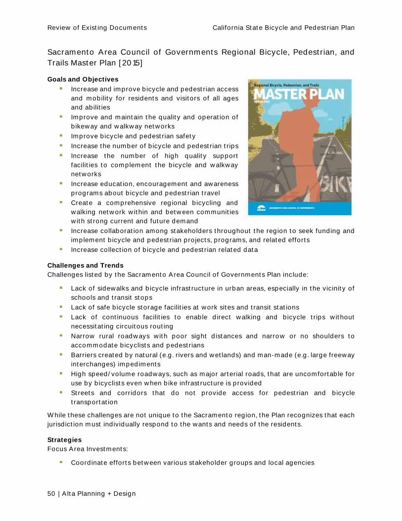
Review of Existing Documents California State Bicycle and Pedestrian Plan
50 | Alta Planning + Design
Sacramento Area Council of Governments Regional Bicycle, Pedestrian, and
Trails Master Plan [2015]
Goals and Objectives
Increase and improve bicycle and pedestrian access
and mobility for residents and visitors of all ages
and abilities
Improve and maintain the quality and operation of
bikeway and walkway networks
Improve bicycle and pedestrian safety
Increase the number of bicycle and pedestrian trips
Increase the number of high quality support
facilities to complement the bicycle and walkway
networks
Increase education, encouragement and awareness
programs about bicycle and pedestrian travel
Create a comprehensive regional bicycling and
walking network within and between communities
with strong current and future demand
Increase collaboration among stakeholders throughout the region to seek funding and
implement bicycle and pedestrian projects, programs, and related efforts
Increase collection of bicycle and pedestrian related data
Challenges and Trends
Challenges listed by the Sacramento Area Council of Governments Plan include:
Lack of sidewalks and bicycle infrastructure in urban areas, especially in the vicinity of
schools and transit stops
Lack of safe bicycle storage facilities at work sites and transit stations
Lack of continuous facilities to enable direct walking and bicycle trips without
necessitating circuitous routing
Narrow rural roadways with poor sight distances and narrow or no shoulders to
accommodate bicyclists and pedestrians
Barriers created by natural (e.g. rivers and wetlands) and man-made (e.g. large freeway
interchanges) impediments
High speed/volume roadways, such as major arterial roads, that are uncomfortable for
use by bicyclists even when bike infrastructure is provided
Streets and corridors that do not provide access for pedestrian and bicycle
transportation
While these challenges are not unique to the Sacramento region, the Plan recognizes that each
jurisdiction must individually respond to the wants and needs of the residents.
Strategies
Focus Area Investments:
Coordinate efforts between various stakeholder groups and local agencies

Review of Existing Documents California State Bicycle and Pedestrian Plan
Alta Planning + Design | 51
Measure the performance of bicycle and pedestrian systems
Assist with complete streets planning
Understand the impacts to safety, public health, and the economy
Promote traveler safety through education
Promote multi-modal trips through transit connections
Support infrastructure and programs
Caltrans Needs
Coordination required when Main Streets of towns are state highways.
San Diego Association of Governments Regional Bicycle Plan [2010]
Goals and Objectives
Increase the number of people who bike
Increase the frequency of bicycle trips for all
purposes
Encourage the development of Complete Streets
Improve safety for bicyclists
Support reductions in greenhouse gas emissions
Increase public awareness and support for bicycling
in the San Diego region
Challenges and Trends
Recent local and regional bicycling questionnaires have
found that residents are willing to bicycle more frequently
when better bicycle facilities, support facilities, and
bicycle-related programs are provided. Numbers of people
bicycling:
0.6% commute to work by bike
Extrapolation estimates 76,000 bicyclists make 152,000 trips by bicycle daily
Projections estimate 280,000 bicyclists and 560,000 daily bicycle trips by 2030
Strategies
Improve connectivity and quality of the regional bicycle network: support
improvements that close gaps, encourage local projects that connect to regional
corridors, and promote consistent wayfinding and signage
Provide policy direction and funding guidance to assist local jurisdictions with bicycle
planning and implementation
Support bicycle-transit integration to improve access to major employment and other
activity centers, and to encourage multimodal travel for longer trip distances: support
development of bicycle facilities that provide access to transit, coordinate with transit
providers to ensure bicycles can be accommodated on all forms of transit vehicles,
coordinate with transit agencies to provide short and long term bicycle parking facilities,
provide current and relevant information to bicyclists on bicycle parking opportunities
at transit locations
Provide convenient and secure bicycle parking and support facilities region-wide

Review of Existing Documents California State Bicycle and Pedestrian Plan
52 | Alta Planning + Design
Institutionalize Complete Streets principles in roadway planning, design, and
maintenance policies: provide training to transportation-related professionals, consider
development of a region-wide Complete Streets policy manual, encourage local
jurisdictions to adopt a Complete Streets policy into their general plans
Increase education, encouragement, enforcement, and performance monitoring and
evaluation programs: support programs that educate the bicycling and general public
about bicycle operation, rights and responsibilities, and lawful interactions between
motorists and cyclists
Caltrans Needs
No significant mention beyond Caltrans bikeway guidelines, Caltrans-administered funding
sources.
San Luis Obispo County Bikeways Plan [2010]
Goals and Objectives
Increase use of the bicycle as a mode of transportation.
Challenges and Trends
The 2000 Census found that 1.3% of the San Luis
Obispo County commuter population commutes by
bicycle
A 2001 City of San Luis Obispo Transportation
Survey found over 90% of non-bicyclists would
respond positively to improvements included in the
bike plan
Strategies
Prioritize links between City and County bikeways,
especially those that provide access to regional
destinations
o Key element in encouraging bicycling transportation is the provision of a safe
and efficient network of bikeways
Key actions in addition to providing adequate bikeways:
o Provide auxiliary facilities such as bicycle parking and storage
o Make efficient connections with other modes, including public transportation
o Integrate bicycle transportation into the relationship between land use planning
and circulation
Caltrans Needs

Review of Existing Documents California State Bicycle and Pedestrian Plan
Alta Planning + Design | 53
Santa Barbara County Association of Governments Regional Active
Transportation Plan [2015]
Goals and Objectives
Enhance Mobility
Increase Connectivity
Promote Equity for all Users in all
Communities
Improve Safety and Public Health
Challenges and Trends
Innovative infrastructure treatments
mentioned in the plan include bicycle
boxes, bicycle boulevards, mini-circles,
long-term bicycle parking solutions, lead
pedestrian intervals, and pedestrian scramble phases
Current trip estimates: 37,200 bicycle trips and 37,000 walking trips daily in the region
o Future estimates for 2040 are expressed as ranges: bicycling 46,300 to
48,900, walking 46,000 to 47,300 daily trips
Strategies
Encourage the design and building of complete streets that balance the needs of all
users
Consider bicycle and pedestrian infrastructure improvements as a mitigation strategy
for the traffic impacts of new land developments
Ensure bicycle and pedestrian amenities are properly maintained to enable their
continued safe use
Stay current with evolving trends in bicycle and pedestrian infrastructure, and make
recommendations to local planning staffs when new advances may be appropriate at
the local level
Promote consistent signage that directs bicyclists to destinations and increases the
visibility of the regional bicycle network
Work with local jurisdictions to improve interconnectivity between bicycle, pedestrian,
and transit networks
Coordinate planning activities, when appropriate, with neighboring jurisdictions and
other related agencies, such as Caltrans to ensure connectivity across regional
boundaries
Pedestrian access should be considered in the design of transportation facilities,
especially if these facilities act as a barrier to pedestrian movement
Support education and training programs for bicyclists, pedestrians, and motorists that
explain the rights and responsibilities of each mode, as well as the relevant laws and
codes
Monitor collision patterns to recognize locations needing safety improvements with the
aim of an aggressive long-term downward trend in the number and severity of bicycle
and pedestrian collisions

Review of Existing Documents California State Bicycle and Pedestrian Plan
54 | Alta Planning + Design
Accommodating bicyclists and pedestrians through construction areas; including,
Respond to pedestrian actions well-worn paths alongside roads, or pedestrians
walking on the roadway, are indications that there is unmet pedestrian access demand.
Maintain existing infrastructure, particularly for bicycles
Encourage the next generation of bicyclists provide family-friendly bicycle facilities
Caltrans Needs
explore options for local bike facilities within Caltrans right-of-way on a case-by-case basis.
Regarding bike lanes, Caltrans generally favors standard width shoulders (usually 8 feet) for
bicycle use in rural areas. In urban areas, where there is more competition for space, Caltrans
is generally supportive of bike lanes. However, for bike lanes to be added to a state highway in
an urban setting, several criteria must be met:
The project must be supported by the host jurisdiction
The host jurisdiction must be willing to repurpose space for the bike lanes, which may
include the loss of parking, narrowing travel lanes, or another means
Not cause adverse traffic or safety conditions
Caltrans also strives to work cooperatively with jurisdictions for Class III bikeways within its
right-of-way. For these, Caltrans may authorize encroachment permits for the host jurisdictions
Shasta County Regional Transportation Plan [2010]
Goals and Objectives
non-motorized alternatives. Actions and policies listed
below promote bicycling and walking as a means to
decrease automobile-dependency; reduce traffic
congestion, air pollution, and noise pollution; and support
Challenges and Trends
Current demand:
o Bicycling and walking together are 3% of
commute trips
Challenges:
o Barriers to walking/biking include Interstate
5, the Union Pacific Railroad, and the
Sacramento River
o Many existing or potential on-street bicycle or pedestrian routes are not used
due to a lack of shoulders, or other barriers

Review of Existing Documents California State Bicycle and Pedestrian Plan
Alta Planning + Design | 55
o Class I bikeways are costly, difficult to maintain, and used less by bicycle
commuters
Strategies
Encourage each city and the county to maintain an updated bikeway plan
Encourage sweeping of shoulders on all feeder and arterial routes on a frequent
schedule to improve conditions for bicyclists
Encourage pedestrian and bicycle transportation as mitigation for regional
transportation impacts
Caltrans Needs
None.
Southern California Association of Governments (SCAG) Active Transportation
Work Plan [2012]
Goals and Objectives
Vision: Develop the Active Transportation Program at SCAG as a best practice model that can
be used by other agencies in the nation.
Reduce the number of bicycle and pedestrian fatalities to less than 50% of current levels
by 2035
Increase the number of projects/funding in the FTIP that include bicycle and/or
pedestrian components
Increase in mode share for bicycling and walking by at least 33% above the current
estimate of 24% of all trips in the region
Encourage the League of American Bicyclists to create a Bicycle Friendly Region
Challenges and Trends
None mentioned.
Strategies
Because this is a Work Plan, strategies and action items feature prominently. The Work Program
Areas and key strategies are listed below:
Infrastructure Development
Develop Complete Streets Policies and Guidelines
Develop regional first mile/last mile strategies
Develop regional bikeways network
Health and Safety
Develop a regional SRTS strategy
Develop a regional implementation strategy for the California SHSP
Document how the SHSP implementation strategy will reduce bicycling and pedestrian
fatalities in absolute numbers
Develop Active Transportation performance criteria for public health

Review of Existing Documents California State Bicycle and Pedestrian Plan
56 | Alta Planning + Design
Transportation Modeling
Develop and expand performance measures for active transportation
Leverage existing data to extrapolate information regarding active transportation
Work with Caltrans to collect and expand the inventory of available data
Outreach
Develop regional Active Transportation Advisory Committee
Develop internal peer review committee
Work with stakeholders/local governments to extend CycLAvia to multiple cities in the
region
Work with stakeholders and local governments to regularly update and publish
interregional bikeway maps and guides
Participate in promotional events designed to encourage bicycling and walking
Funding
Develop Active Transportation Incentive Grant Outline
Work with Caltrans and stakeholders to implement MAP-21 and maximize funding for
regional active transportation
Develop methods to leverage different sources of federal/state/local dollars to fund
active transportation
Legislative Strategy
Develop legislative strategy to assist in meeting active transportation goals and
objectives in the 2012 RTP/SCS
Develop program to assist active transportation fundraising in future transportation
authorizations
Caltrans Needs
Work with Caltrans to collect and expand the inventory of available data
Work with Caltrans and stakeholders to implement MAP-21 and maximize funding for
regional active transportation
Work with Caltrans and other stakeholders to regularly update and publish interregional
bikeway maps and guides

Review of Existing Documents California State Bicycle and Pedestrian Plan
Alta Planning + Design | 57
Stanislaus Council of Governments Non-Motorized Transportation Master Plan
[2013]
Goals and Objectives
Increase bicycle and pedestrian access and safety. Expand
bicycle and pedestrian facilities and access in and between
local destinations such as neighborhoods, employment
centers, shopping areas, schools, and recreational sites as
well as throughout the region to increase the number of
bicycling trips to five percent of all trips by 2030.
Increase bicycle and pedestrian trips. Make bicycling and
walking a viable option for shopping, school, and work trips
in Stanislaus County and other trips of fewer than five miles
by implementing and maintaining a bikeway network,
providing end-of-trip facilities for bicyclists, improving
access and integration with transit, and making walking
and bicycling convenient and safer.
Challenges and Trends
Currently 0.5% bicycle to work In Stanislaus County
Assume 7,066 work trips are made by bicycle each day
Future bicycle trips are expected to depend on a variety of factors such as the availability of
well-connected facilities and the location, density, and type of future land development. With
appropriate bicycle facilities in place and implementation of bicycle support facilities such as
bike parking, mode share could increase countywide.
Strategies
Maximize coordination between all municipalities, schools, and community
organizations to review and comment on bicycle and pedestrian issues of mutual
concern
Implement the recommendations to regularly monitor bicycle- and pedestrian-related
collision levels, and seek a reduction in these collision levels on a per capita basis over
the next twenty years
Complete existing gaps in the pedestrian network, especially in the vicinity of land use
attractors such as schools, parks, and neighborhood commercial areas as well as over
major barriers such as railroad tracks, highways, and water bodies
Conduct bicycle and pedestrian counts at regular intervals and include bicycle and
pedestrian counts as part of vehicle traffic counts to evaluate usage and demand, and
assist in the prioritization of project funding
Develop a bicycle parking policy to encourage or require the inclusion of bicycle parking
in new development projects
Encourage future commercial development to provide bicycle and pedestrian access to
and from their businesses and surrounding developments
Caltrans Needs
Coordination with Caltrans required on some bikeway projects on state facilities.

Review of Existing Documents California State Bicycle and Pedestrian Plan
58 | Alta Planning + Design
Tulare County Regional Bicycle Transportation Plan [2010]
Goals and Objectives
Objective A - Implement the Bicycle Transportation
Plan, which identifies existing and future needs, and
provides specific recommendations for facilities
and programs over the next four (4) years and
beyond
o Assign a coordinator who is familiar with the
plan act as a liaison to the public, and pursue
funding
o Establish and maintain uniform standards so
major developments are required to make
bicycle improvements as development
happens
o Update the Tulare County Regional Bicycle
Plan every four years (as required by
Caltrans) to reflect new policies and
requirements for non-motorized transportation funding
o Coordinate between all municipalities, schools, and community organizations to
review and comment on bicycle and non-motorized issues of mutual concern
o Regularly monitor bicycle-related accident levels and seek a significant
reduction on a per capita basis over the next twenty years
o Encourage Plan adoption by all local jurisdictions within Tulare County
Objective B - Complete a network of bikeways that is feasible, fundable over the life of
schools, commercial districts, transit terminals and recreational destinations
o Encourage jurisdictions to develop a bicycle network that connects
neighborhoods, cities and communities
o Seek funding for bikeway projects through regional, state, and federal funding
programs and encourage multi-jurisdictional funding bicycle improvements
o Develop and implement destination-based signage for the bikeway network
o Coordinate with local jurisdictions and developers in Tulare County to ensure
appropriate opportunities for bicycle connections are planned, constructed, and
maintained
Objective C - Maintain and improve the quality, operation, and integrity of the bikeway
network and facilities
o Encourage member agencies to undertake required maintenance of the bikeway
network and facilities, such as sweeping bicycle lanes and routine surface repair,
as funding and priorities allow
o Encourage member agencies regarding repair and construction of
transportation facilities to minimize disruption to the cycling environment to the
extent practical

Review of Existing Documents California State Bicycle and Pedestrian Plan
Alta Planning + Design | 59
o Encourage member agencies to undertake bicycle improvements that do not
negatively impact the environment
o Encourage member agencies to prioritize bicycle improvements based upon the
o Encourage member agencies to work with Caltrans to widen shoulders on the
State Highway System throughout the County to improve intercity cycling
conditions
Objective D - Provide short- and long-term bicycle parking and amenities in
employment and commercial areas, in multifamily housing, at schools, and at recreation
and transit facilities
o Consider modifying zoning code ordinances requirements for bicycle parking so
developments and new residential development are less dependent on
automobile parking provisions
o Encourage the installation of short and long term bicycle parking in the public
right-of-way
o Encourage local agencies to work with area elementary, middle, and high
schools to promote bicycle commuting and to assist in purchasing and planning
long- and short-term bicycle parking
o Provide current and relevant information to bicyclists regarding bicycle parking
opportunities through a variety of formats
o Encourage local agencies to require bicycle parking at major events to help ease
traffic and parking
Objective E - Increase bicycle ridership in Tulare County
o Increase the number of bicycle commuters by at least 70% in the next four (4)
years
o Include bicycle facilities as an integral part of future developments across Tulare
County, and connect to other existing and proposed bicycle facilities
o Provide bicycle access to transit vehicles whenever feasible on all municipal and
regional transit buses within Tulare County
o Provide convenient bicycle access and bicycle parking at schools, parks,
neighborhoods, shopping centers, government buildings, and local businesses
o Encourage transit providers in providing and promoting secure bicycle racks and
lockers in the transit system to encourage bicycle use
o Request that any future transit service in Tulare County provide adequate
bicycle and pedestrian access and bicycle parking
Objective F - Develop and implement education and encourage plans aimed at youth,
adult cyclists, pedestrians, and motorists. Increase public awareness of the benefits of
bicycling and of available resources and facilities
o Develop adult and youth bicycle, pedestrian education and encourage safety
programs at schools and community events
o Market the health benefits of bicycling
o Market the existing opportunities for bicycling in Tulare County

Review of Existing Documents California State Bicycle and Pedestrian Plan
60 | Alta Planning + Design
Challenges and Trends
The Scope and Organization section mentions that the plan would address these, but not
specifically identified in the plan document
Strategies
None.
Caltrans Needs
Coordination and funding (through grants).
District Bicycle Maps and Guides Most of the Caltrans Districts have created bike maps and guides. Many of the guides include
policies, bicycling laws, hand signals, mile marker information, campground and rest stop
locations, and helmet information.
These guides provide an overview of existing bicycle infrastructure, transit service, pedestrian
access, and park and ride lots. In addition, the guide provides bicycling-related contacts and
an overview of relevant legislation. The sections from the guide that may be most relevant to
the California State Bicycle and Pedestrian Plan project include:
State Laws
Allowed/Prohibited Bicycle Map
Bicycle Maps of State Routes
Items that may be relevant to the CSBPP include:
Bike maps, including interactive bike maps for District 11
Bike laws
Park and Ride locations
Rest stop and vista locations
Caltrans bike routes
The list of district level resources includes:
http://www.dot.ca.gov/dist1/planning/regional-system/bikeped/bikeguide/full.pdf
http://www.dot.ca.gov/dist2/pdf/bikeguide.pdf
http://www.dot.ca.gov/dist3/departments/planning/Systemplanning/BicycleGuide3-
8-12.pdf
http://www.dot.ca.gov/dist05/bike_ped/bikeguide/bikeguide.pdf
http://www.tularecog.org/wp-content/uploads/2015/07/DOT-CalTrans-District-6-
Complete-Streets-BicycleGuide.pdf
http://www.dot.ca.gov/dist9/bicycle/d9_bike_brochure.pdf
http://www.dot.ca.gov/dist10/docs/BIKEGUIDE0809.pdf
http://www.icommutesd.com/bike/documents/SanDiegoBikeMap2015_North.pdf
http://www.icommutesd.com/bike/documents/SanDiegoBikeMap2015_South.pdf
http://dot.ca.gov/dist11/departments/planning/planningpages/bicyclepages.htm

61 | Alta Planning + Design
6. Review of Other State Plans
As part of this review, bicycle and pedestrian plans from eight other states were examined,
including:
North Carolina WalkBikeNC, 2014
Connecticut - CT Statewide Bicycle & Pedestrian Plan Update, 2009
Arizona ADOT Statewide Bicycle and Pedestrian Plan Update, 2013
Massachusetts Massachusetts Bicycle Transportation Plan, 2008
Ohio Access Ohio 2040 multimodal transportation plan, not just bicycle and
pedestrian, 2014
New York Transportation Choices for the 21st Century: The New York State Bicycle and
Pedestrian Plan, 1997
New Hampshire, NH Statewide Bicycle and Pedestrian Plan, 2000
Georgia, GA Bicycle and Pedestrian Safety Action Plan, 2007
These plans were reviewed for the contents and outline of the plan, goals and objectives, and
major strategies. Common organizational elements from other state plans include:
History/Context
Definition of Terms
Principles, Goals, and Objectives
Safety/Crash Analysis
Previous State/Regional Planning Efforts
Existing State Policies and Laws
Benchmark/Performance Standards
Public Involvement Process
Design Guidelines
Roles and Responsibilities
Operation and Maintenance
Potential Funding Sources
Education and Training
Enforcement
Recommended Policies and Procedures
Common goals from other state plans included:
Safety
Encourage connections
Education
Funding
Integration with other modes
Increase bike/ped trips
Improve infrastructure

Review of Existing Documents California State Bicycle and Pedestrian Plan
62 | Alta Planning + Design
Improve data collection
Detailed Review of Plans
New York [1997] In the mid-1990s, NYSDOT initiated the development of a
1,000 mile on-road bike route system. New York was
among the first states in the country to do this. The
planning effort involved all of the MPOs and NYSDOT
regions, as well as agencies from the adjacent states of NJ,
CT, MA, VT and Quebec.
Structure of the Plan
1. Introduction (Mission and Goals)
2. Action Plan for Infrastructure
3. Action Plan for Programs
4. Implementation, Integration, and Evaluation
Identified Goals:
1. Increase mobility: New York State will meet or
exceed the State's share of the USDOT National
Bicycling and Walking Study goal of doubling the amount of bicycling and walking
in the U.S. by increasing New York State bike/ped commuter trips by 15% (from 7.2%
to 8.5% of all work trips) by the year 2015, and by meeting or exceeding the national
goal of 16% of all trips, including trips to school, shpping, and other travel
destinations.
2. Improve safety: New York will work to improve the safety of bicyclists and
pedestrians of all ages and abilities, and meet or exceed the USDOT National
Bicycling and Walking Study goal of a 10% reduction in the rate of
bicyclist/pedestrian injuries and fatalities.
3. Provide accessibility: New York State will work to ensure accessibility of bicycle and
pedestrian transportation to all destinations, including work sites, schools, shopping
areas, parks, parks and public transportation, by integrating bicycling and walking
into the local, regional, and statewide transportation infrastructure.
Priority Actions:
1. Share the Road Campaign
2. Walk and Bike to Work Promotion
3.
4. Urban Bicycle and Pedestrian Plans
5. High Visibility Crosswalks
6. Suburban Sidewalks
7. Bicycle and Pedestrian Design Guidelines
8. Intermodal Connections
9. Greenway and Rail Trail Development
10. State Bicycle and Pedestrian Advisory Council
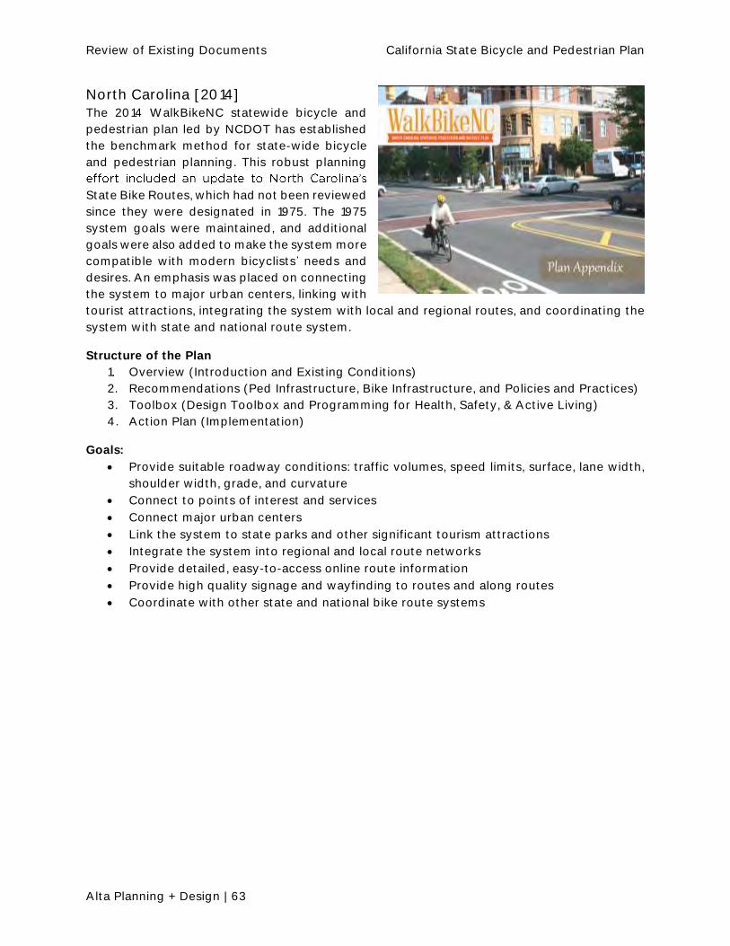
Review of Existing Documents California State Bicycle and Pedestrian Plan
Alta Planning + Design | 63
North Carolina [2014] The 2014 WalkBikeNC statewide bicycle and
pedestrian plan led by NCDOT has established
the benchmark method for state-wide bicycle
and pedestrian planning. This robust planning
State Bike Routes, which had not been reviewed
since they were designated in 1975. The 1975
system goals were maintained, and additional
goals were also added to make the system more
compatible with modern bicyclists needs and
desires. An emphasis was placed on connecting
the system to major urban centers, linking with
tourist attractions, integrating the system with local and regional routes, and coordinating the
system with state and national route system.
Structure of the Plan
1. Overview (Introduction and Existing Conditions)
2. Recommendations (Ped Infrastructure, Bike Infrastructure, and Policies and Practices)
3. Toolbox (Design Toolbox and Programming for Health, Safety, & Active Living)
4. Action Plan (Implementation)
Goals:
Provide suitable roadway conditions: traffic volumes, speed limits, surface, lane width,
shoulder width, grade, and curvature
Connect to points of interest and services
Connect major urban centers
Link the system to state parks and other significant tourism attractions
Integrate the system into regional and local route networks
Provide detailed, easy-to-access online route information
Provide high quality signage and wayfinding to routes and along routes
Coordinate with other state and national bike route systems

Review of Existing Documents California State Bicycle and Pedestrian Plan
64 | Alta Planning + Design
New Hampshire [2000]
Goal and Objectives:
Goal: The NHDOT recognizes, supports and encourages
bicycling and walking as alternatives to motorized forms of
transportation and as an element of the state's intermodal
transportation system.
OBJECTIVES:
1. The NHDOT will promote bicycling and walking as
viable modes of transportation.
2. The NHDOT will cooperate with other state
agencies in initiating, developing and implementing
programs that encourage bicycling and walking and
that enhance bicyclist and pedestrian safety.
3. The NHDOT adopts the enclosed interconnected
network of existing roads and bicycle facilities as its primary network of routes for inter-
regional bicycle travel. The NHDOT will produce and maintain the map and will develop
standards through a pilot project for appropriate signage of the network.
4. The NHDOT will provide a safe and efficient means of bicycle travel throughout the
State. The NHDOT will identify deficiencies and initiate appropriate corrections within
financial constraints for routes on the network in its overall transportation planning
effort. The NHDOT will work with the towns and cities, through the regional planning
commissions, to identify, fund, design, construct, and maintain appropriate bicycle and
pedestrian facilities where feasible.
5. The NHDOT adopts and will use bicycle facility design guidelines as issued by the
American Association of State Highway and Transportation Officials (AASHTO). The
NHDOT also adopts the Manual on Uniform Traffic Control Devices (MUTCD) for
guidance on traffic operations. The NHDOT will actively provide for the needs of
bicyclists and pedestrians in all highway projects where possible.
6. The NHDOT in cooperation with Department of Resources and Economic Development
(DRED) will propose a statewide plan for the integration of recreational trails with other
bicycle/pedestrian facilities; set standards for their development; encourage and
support their improvement to all season condition.
7. The NHDOT will, as part of its normal road striping operations on resurfaced roads,
restripe roads to allow for paved shoulders where none exist now, as long as travel lanes
meet width requirements.
8. The NHDOT will consider bicycle/pedestrian concerns in all projects.
Structure of the Plan
1. Executive Summary
2. Introduction and Purpose
3. Goal and Objectives
4. Background
5. Planning and Design Considerations
6. Development Process
7. Funding Categories, Levels, and Availability
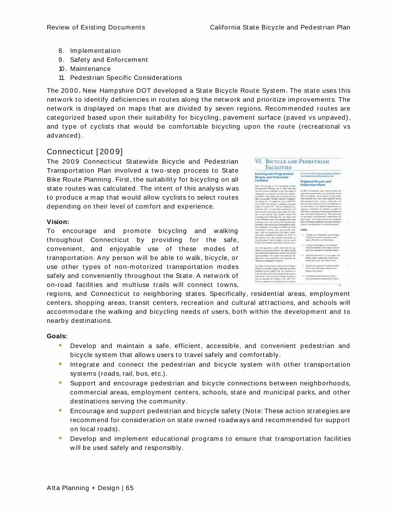
Review of Existing Documents California State Bicycle and Pedestrian Plan
Alta Planning + Design | 65
8. Implementation
9. Safety and Enforcement
10. Maintenance
11. Pedestrian Specific Considerations
The 2000, New Hampshire DOT developed a State Bicycle Route System. The state uses this
network to identify deficiencies in routes along the network and prioritize improvements. The
network is displayed on maps that are divided by seven regions. Recommended routes are
categorized based upon their suitability for bicycling, pavement surface (paved vs unpaved),
and type of cyclists that would be comfortable bicycling upon the route (recreational vs
advanced).
Connecticut [2009] The 2009 Connecticut Statewide Bicycle and Pedestrian
Transportation Plan involved a two-step process to State
Bike Route Planning. First, the suitability for bicycling on all
state routes was calculated. The intent of this analysis was
to produce a map that would allow cyclists to select routes
depending on their level of comfort and experience.
Vision:
To encourage and promote bicycling and walking
throughout Connecticut by providing for the safe,
convenient, and enjoyable use of these modes of
transportation. Any person will be able to walk, bicycle, or
use other types of non-motorized transportation modes
safely and conveniently throughout the State. A network of
on-road facilities and multiuse trails will connect towns,
regions, and Connecticut to neighboring states. Specifically, residential areas, employment
centers, shopping areas, transit centers, recreation and cultural attractions, and schools will
accommodate the walking and bicycling needs of users, both within the development and to
nearby destinations.
Goals:
Develop and maintain a safe, efficient, accessible, and convenient pedestrian and
bicycle system that allows users to travel safely and comfortably.
Integrate and connect the pedestrian and bicycle system with other transportation
systems (roads, rail, bus, etc.).
Support and encourage pedestrian and bicycle connections between neighborhoods,
commercial areas, employment centers, schools, state and municipal parks, and other
destinations serving the community.
Encourage and support pedestrian and bicycle safety (Note: These action strategies are
recommend for consideration on state owned roadways and recommended for support
on local roads).
Develop and implement educational programs to ensure that transportation facilities
will be used safely and responsibly.

Review of Existing Documents California State Bicycle and Pedestrian Plan
66 | Alta Planning + Design
Provide financial and technical support and seek to utilize all available funding for the
development and construction of bicycle and pedestrian facilities throughout
and consistent with federal program
initiatives.
Contribute to public health by providing safe and attractive opportunities for walking
and bicycling.
Structure of the Plan
1. Executive Summary
2. Introduction (Plan Purpose, Development, Existing Conditions, Other State Plans)
3. Vision, Goals, & Action Strategies
4. Demand for and Benefits of Walking and Bicycling in Connecticut (Value and Demand
Analysis)
5. Policies and Practices (Design Standards, Internal and External Coordination, and
Recommendations)
6. Bicycle and Pedestrian Safety (Bicycling and Walking Safely in Connecticut, Crash Data,
and Recommendations)
7. Bicycle and Pedestrian Facilities (Existing and Programmed Bicycle and Pedestrian
Facilities, Regional Bicycle and Pedestrian Plans, Statewide Bicycle Network, and
Recommendations)
8. Bicycle and Pedestrian Funding (Review of Current Funding Program, Innovative
Funding Sources, and Recommendations)
Connecticut Review of Other State Plans
The Connecticut Plan also included a comprehensive review of other state bicycle and
pedestrian plans at the time it was written. The exhibits that describe these plans are provided
below.

67 | Alta Planning + Design
Items Included in Prior State Plans From Connecticut Bicycle and Pedestrian Plan

Review of Existing Documents California State Bicycle and Pedestrian Plan
68 | Alta Planning + Design
Items Included in Prior State Maps From Connecticut Bicycle and Pedestrian Plan

69 | Alta Planning + Design
Massachusetts [2008 and 2015] The 2008 Massachusetts Bicycle Transportation Plan
emphasized that Massachusetts was a bicycle friendly state,
and that the state had many resources produced
commercially that supported and promoted bicycling, such
as local and regional bicycle maps. The report noted that
none of these resources were compiled into a central
repository for bicycle information though. Modeled after
the Route Verte system in Quebec, the plan sought to
establish a statewide bicycle network that incorporated
both on and off-road route alignments, called the called the
Bay State Greenway (BSG).
Structure of the Plan
1. Executive Summary
2.
Investing in Bicycle Transportation, Plan Organization)
3. Plan Context (Relevant Plans and Public Outreach)
4. Bicycle Resources and Opportunities (Facility types, resources, funded projects, and
Congressionally funded projects)
5. Proposed Bay State Greenway (Why?, Determining Primary Corridors, Routing Criteria,
Seven Alignments, and Summary)
6. Implementation and Funding (Interim Strategy, Branding, EOT Duties, Funding
Strategies, Facility Resource Allocation Strategy, and Additional Funding Strategies)
7. Other Recommendations and Action Items (Roles of Government, Outstanding Action
Items from 1998 Plan, and Other Programs)
In 2015, Massachusetts released a Separated Bike Lane
Planning and Design Guide (SBLPDG) that provides a
comprehensive review for planning, designing, and operating
bicycle facilities in the state. The guide defines separated bike
lanes and identifies relevant bike lane types to implement on
different types of facilities. The guide provides visual design
guidance for these types of facilities in several locations,
including:
General guidance
Intersections
Areas of significant curbside activity (parking, bus stops, etc.)
Signals
The guide also provides recommendations for ongoing maintenance of facilities, including
winter and seasonal maintenance, sweeping and debris removal, trash collection, and
construction zones.

Review of Existing Documents California State Bicycle and Pedestrian Plan
70 | Alta Planning + Design
Arizona [2013]
Structure of the Plan
1. Introduction
2. Plan Goals and Objectives
3. Existing Conditions
4. Plan Recommendations
5. Implementation Summary
Goals
Increase Bicycle and Pedestrian Trips
Improve Bicyclist and Pedestrian Safety
Improve Pedestrian and Bicycle Infrastructure
Each goal has a supporting objective, performance
indicator, baseline, and target.
Other:
Includes proposed DOT policy language
Includes proposed safety campaign materials and strategy
Georgia [2007]
Structure of the Plan
1. Introduction and Planning Process
2. Goals and Objectives
3. Existing Conditions Report
4. Policy & Non-Engineering Recommendations
5. Systemwide Engineering Recommendations
6. Site-Specific Recommendations for High Crash
Areas
Goals and Objectives:
The following goals and objectives were identified as part
of the planning process:
Goal 1: Improve Bicycle and Pedestrian Safety
Reduce pedestrian fatalities by 33% by 2013.
Statewide, the average number of annual pedestrian fatalities is 164 (2004 2006); a
33% reduction would result in about 110 fatalities per year by 2012
Reduce all pedestrian crashes and injuries by 20% by end of calendar year 2013.
Statewide, the average number of annual pedestrian crashes (2004-2006) was 2,582; a
20% reduction would result in 2,066 pedestrian crashes per year by 2012

Review of Existing Documents California State Bicycle and Pedestrian Plan
Alta Planning + Design | 71
Overall 20% reduction in bicycle crashes and injuries by the end of calendar year 2013.
Statewide, the average number of annual bicycle crashes (2004-2006) was 939; a 20%
reduction would result in approximately 750 annual crashes
Goal 2: Increase Trips Made by Bicycle and On Foot (including those using wheelchairs
or other mobility assistance device)
Increase bicycle and walking trips to school statewide by 20% by 2013. (Measured
Develop educational and promotional programs to encourage biking and walking.
Goal 3: Increase Funding for Bicycle and Pedestrian Programs and Infrastructure
Improvements
Base the percentage of total safety funds spent on bicycle/pedestrian safety projects
on the percentage of bicycle/pedestrian fatalities statewide
Include bicycle and pedestrian facilities in all GDOT projects and all road projects with
federal participation
Goal 4: Improve Bicycle and Pedestrian Related Data Collection
Conduct inventory of sidewalk, bike lane, trail and shoulder mileage
Develop a data collection method for bicycle and pedestrian traffic counts, so that
biking/walking rates can be measured
Ohio [2014] Ohio has not created a separate bicycle or pedestrian Plan, but instead included a bicycle
network chapter in their long-range transportation Plan.
Structure
Introducing Access Ohio 2040
How AO40 was Developed
Public Outreach and Stakeholder Participation
AO40 Vision
Trends Analysis
Other Concurrent Studies
Existing Assets
Safety Analysis
State of the System Report
Financial Analysis
Environmental Overview
Corridor Analysis
Recommendations
o Performance Management
o Leveraging Resources
o Future Funding
o Asset Management
o Freight Network
o Transit Needs
o Climate Variability
o Bicycle Network

Review of Existing Documents California State Bicycle and Pedestrian Plan
72 | Alta Planning + Design
o Planning Partnerships
o Strategic Transportation System
o Regional Transportation Needs

73 | Alta Planning + Design
Appendix A California Vehicle Code and
Streets and Highways Code
California Vehicle Code http://www.leginfo.ca.gov/.html/veh_table_of_contents.html
The California Vehicle Code contains almost all statutes relating to the operation, ownership
and registration of vehicles (including bicycles) in the state of California. It also contains
statutes concerning the California Department of Motor Vehicles and the California Highway
Patrol. The Vehicle Code is one of 29 codes containing general statutes adopted by the
California legislature.
Relevant CVC sections (§) for bicycle travel include:
power through a belt, chain, or gears, and having one or mor
§ 231).
CVC § 21200 states that the rules of the road, set out in Division 11 of the CVC, that do
not specifically apply only to motor vehicles are applicable to bicyclists:
(a) Every person riding a bicycle upon a highway has all the rights and is subject
to all the provisions applicable to the driver of a vehicle by this division... except
those provisions which by their very nature can have no application.
CVC § 530 defines the roadway as "that portion of a highway improved, designed, or
ordinarily used for vehicular travel"; CVC § 21650 sets the on-road position for all
bicyclists to ride "as close as practicable to the right-hand curb or edge of the roadway"
except in certain circumstances.
CVC § 21650.1 clarifies that cyclists, unlike drivers of vehicles, are not prohibited from
riding on the shoulder of the road:
A bicycle operated on a roadway, or the shoulder of a highway, shall be operated
in the same direction as vehicles are required to be driven upon the roadway.
Where bike lanes exist on roadways, CVC § 21208 requires cyclists to use them, except
under certain conditions:
(a) Whenever a bicycle lane has been established on a roadway pursuant to
Section 21207, any person operating a bicycle upon the roadway at a speed less
than the normal speed of traffic moving in the same direction at that time shall
ride within the bicycle lane, except that the person may move out of the lane
under any of the following situations:
1. When overtaking and passing another bicycle, vehicle, or pedestrian
within the lane or about to enter the lane if the overtaking and passing
cannot be done safely within the lane.
2. When preparing for a left turn at an intersection or into a private road or
driveway.

Review of Existing Documents California State Bicycle and Pedestrian Plan
74 | Alta Planning + Design
3. When reasonably necessary to leave the bicycle lane to avoid debris or
other hazardous conditions.
4. When approaching a place where a right turn is authorized.
(b) No person operating a bicycle shall leave a bicycle lane until the movement
can be made with reasonable safety and then only after giving an appropriate
signal in the manner provided in Chapter 6 (commencing with Section 22100) in
the event that any vehicle may be affected by the movement.
The Three Feet for Safety Act (CVC § 21760), which became operative on September
16, 2014, requires motor vehicles to leave a 3-foot margin while passing a cyclist if
possible:
(a) This section shall be known and may be cited as the Three Feet for Safety
Act. (b) The driver of a motor vehicle overtaking and passing a bicycle that is
proceeding in the same direction on a highway shall pass in compliance with the
requirements of this article applicable to overtaking and passing a vehicle, and
shall do so at a safe distance that does not interfere with the safe operation of
the overtaken bicycle, having due regard for the size and speed of the motor
vehicle and the bicycle, traffic conditions, weather, visibility, and the surface and
width of the highway. (c) A driver of a motor vehicle shall not overtake or pass a
bicycle proceeding in the same direction on a highway at a distance of less than
three feet between any part of the motor vehicle and any part of the bicycle or
its operator. (d) If the driver of a motor vehicle is unable to comply with
subdivision (c), due to traffic or roadway conditions, the driver shall slow to a
speed that is reasonable and prudent, and may pass only when doing so would
not endanger the safety of the operator of the bicycle, taking into account the
size and speed of the motor vehicle and bicycle, traffic conditions, weather,
visibility, and surface and width of the highway. (e) (1) A violation of subdivision
(b), (c), or (d) is an infraction punishable by a fine of thirty-five dollars ($35). (2)
If a collision occurs between a motor vehicle and a bicycle causing bodily injury
to the operator of the bicycle, and the driver of the motor vehicle is found to be
in violation of subdivision (b), (c), or (d), a two-hundred-twenty-dollar ($220)
fine shall be imposed on that driver. (f) This section shall become operative on
September 16, 2014.
CVC § 21100 sets out that "Local authorities may adopt rules and regulations... regarding
the ... Operation of bicycles, and, as specified in Section 21114.5, electric carts by
physically disabled persons, or persons 50 years of age or older, on the public
sidewalks." This allows local jurisdictions to ban sidewalk cycling in business districts,
for example.
CVC § 39002 allows local jurisdictions to implement mandatory licensing for bicycles
and prohibit unlicensed riding.
Though pedestrians are by definition not operating a vehicle, CVC sections that reference
pedestrians include:
means
of conveyance propelled by human power other than a bicycle; (2) An electric personal

Review of Existing Documents California State Bicycle and Pedestrian Plan
Alta Planning + Design | 75
in the CVC) as crossing a roadway between 2 adjacent intersections controlled by traffic
signals without using a crosswalk.
CVC § 21966 states that pedestrians shall not use a bicycle lane or path where an
adjacent adequate pedestrian facility (e.g., sidewalk) exists.
CVC § 21950(a) states that a driver (including bicyclists) shall yield to a pedestrian
within any marked crosswalk or unmarked crosswalk at an intersection.

Review of Existing Documents California State Bicycle and Pedestrian Plan
76 | Alta Planning + Design
California Streets and Highways Code http://www.leginfo.ca.gov/.html/shc_table_of_contents.html
The California Streets and Highways Code is one of 29 legal codes enacted by the California
State Legislature, which together form the general statutory law of California. The codes form
an important part of California law; however, they must be read in combination with the federal
and state constitutions, federal and state case law, and the California Code of Regulations in
order to understand how they are actually interpreted and enforced in court. The California
Streets and Highways Code is separated into 20 divisions, listed below:
Division 1 - State Highways
Division 2 County Highways
Division 2.5 City Streets
Division 2.7 Courtesy Signs
Division 3 Appointment and Expenditure of Highway Funds
Division 4 The Special Assessment Investigation, Limitation and Majority Protest Act
of 1931
Division 4.5 Notice of Special Assessment, Special Tax, and Foreclosure Proceedings
Division 6 Street Opening
Division 7 The Improvement Act of 1911
Division 9 Change of Grade and Vacation
Division 10 The Improvement Bond Act of 1915
Division 11
Division 11.5 Refunding Act of 1984 for 1915 Improvement Act Bonds
Division 12 The Municipal Improvement Act of 1913
Division 13 Pedestrian Malls
Division 14 Street Lighting
Division 15 Tree Planting, Landscaping, and Lighting
Division 16 Highway Districts
Division 17 Toll Facilities and Related Matters
Division 18 - Parking
The most relevant sections of the California Streets and Highways Code for reference in the
California State Bicycle and Pedestrian Plan project are detailed below in order of appearance:
Tourist-Oriented Directional Signs (Div. 1, Ch. 1.5) This chapter governs the
administration, standards, eligibility, and fees concerning the tourist-oriented
directional sign program.
Non-Motorized Transportation (Div. 1, Ch. 8) This chapter, which may be cited as the
Protected Bikeways Act of 2014, lists the reason why the State of California needs a
-motorized
non-motorized transportation facilities; declares the need to establish a process for
identifying and promoting (including promotion through signage) bicycle routes of
national, state, and regional significance; defines four classifications of bikeways;
identifies the need for uniform specifications and symbols for signs, markers, and traffic

Review of Existing Documents California State Bicycle and Pedestrian Plan
Alta Planning + Design | 77
control devices for bikeways; establishes required elements in a city or county bicycle
transportation plan; and establishes the Pedestrian Safety Account. Section 887.2
tewide map illustrating state highway routes available
for the use of bicyclists and, where bicyclists are prohibited from using a state highway,
illustrating, in such a case, safe, alternate rou
Active Transportation Program (Div. 3, Ch. 8) This chapter establishes the Active
goals of the program, designates the funding mechanism for the plan and the division
of funding, and establishes an Active Transportation Program Workgroup which
develops guidelines and project selection criteria for the program.
Pedestrian Malls (Div. 13)
legislative body of a city to establish a pedestrian mall and prohibit, in whole or in part,
vehicular traffic on a pedestrian mall; and establishes provisions for the acquisition and
funding of pedestrian malls.
Street Lighting (Div. 14) This division details the Street Lighting Act of 1919, the Street
Lighting Act of 1931, the Municipal Lighting Maintenance District Act of 1927, the
Highway Lighting District Act, and provisions for street lighting financial assistance
Tree Planting, Landscaping, and Lighting (Div. 15) This division includes the Tree
Planting Act of 1931 and the Landscaping and Lighting Act of 1972, which provide
provisions for the removal of trees and the installation of new trees, landscaping, and
lighting.
Particular Highway Crossings (Div. 17, Ch. 2) This chapter details the responsibility for
operating and maintaining different elements of the San Francisco-Oakland Bay Bridge,
the San Pedro-Terminal Island Bridge, bridge access across the Carquinez Straits, the
Antioch Bridge, the San Francisco-Oakland Rapid Transit Tube, the San Mateo-Hayward
and Dumbarton Bridges, and the San Diego-Coronado Bridge.