
Revealing the Past
28
www.archaeolandscapes.eu ArchaeoLandscapes Europe Revealing the Past: The Use of Modern Remote Sensing Techniques in Archaeology
-
Upload
archaeolandscapes-europe -
Category
Education
-
view
89 -
download
0
Transcript of Revealing the Past
www.archaeolandscapes.eu
ArchaeoLandscapes Europe
Revealing the Past:
The Use of Modern Remote Sensing
Techniques in Archaeology
www.archaeolandscapes.eu
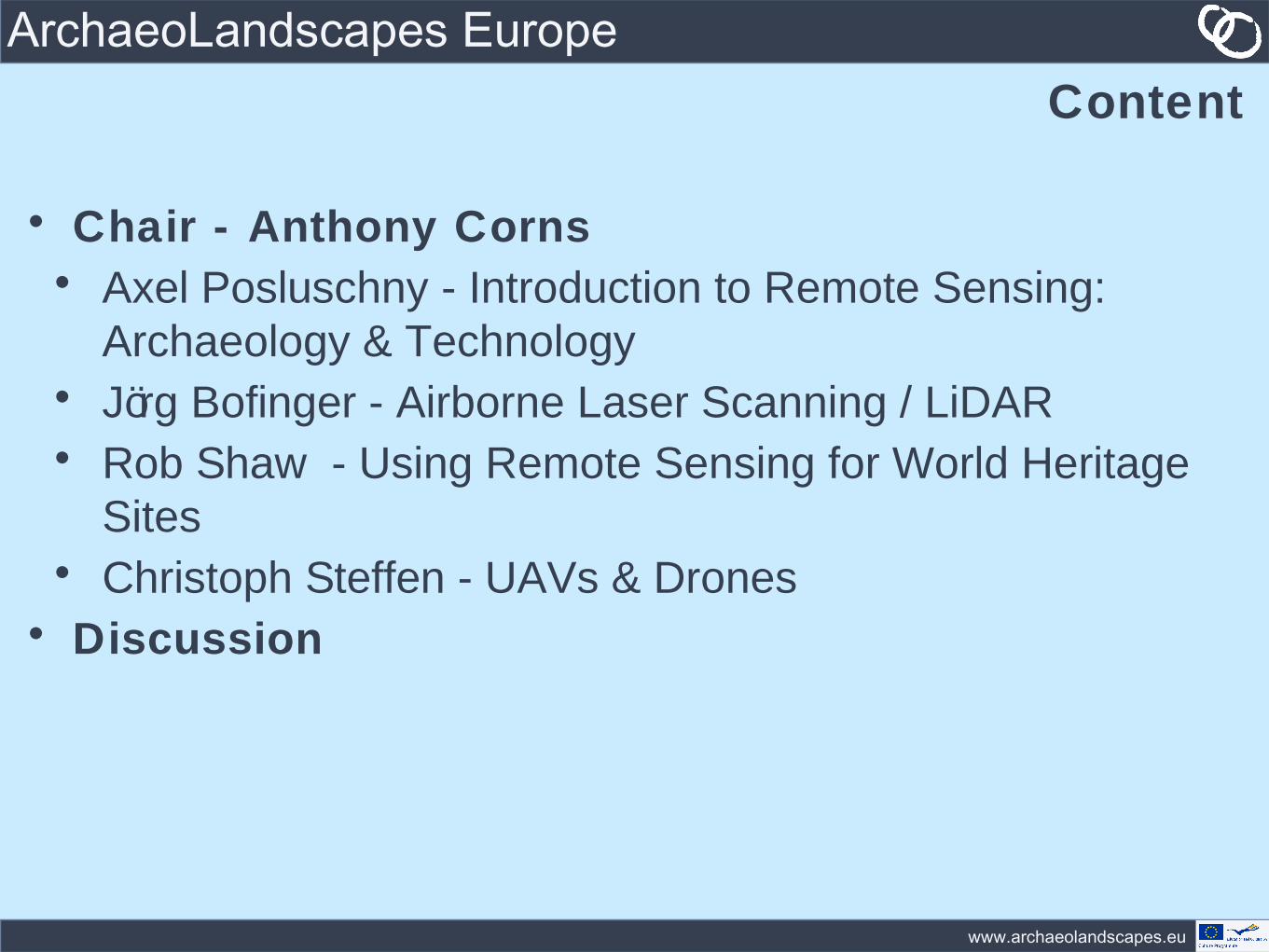
ArchaeoLandscapes EuropeContent
• Chair - Anthony Corns• Axel Posluschny - Introduction to Remote Sensing:
Archaeology & Technology• Jörg Bofinger - Airborne Laser Scanning / LiDAR• Rob Shaw - Using Remote Sensing for World Heritage
Sites• Christoph Steffen - UAVs & Drones
• Discussion
www.archaeolandscapes.eu
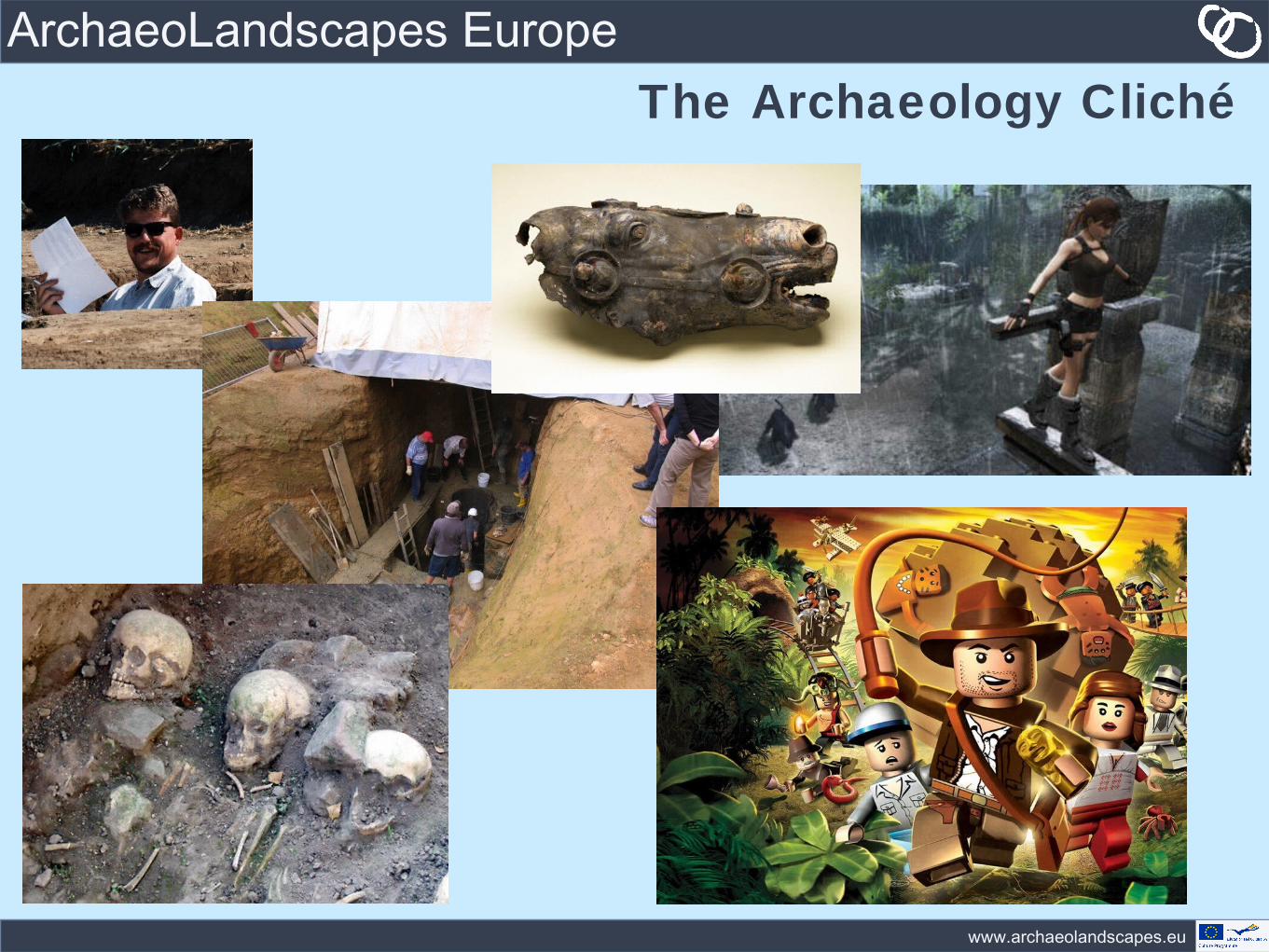
ArchaeoLandscapes EuropeThe Archaeology Cliché
www.archaeolandscapes.eu
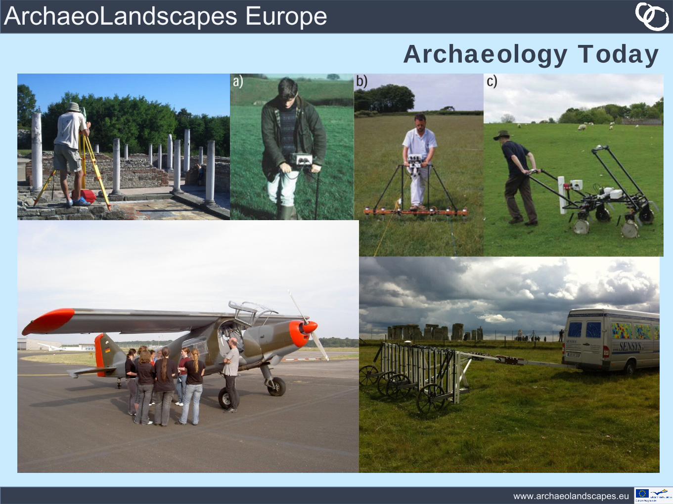
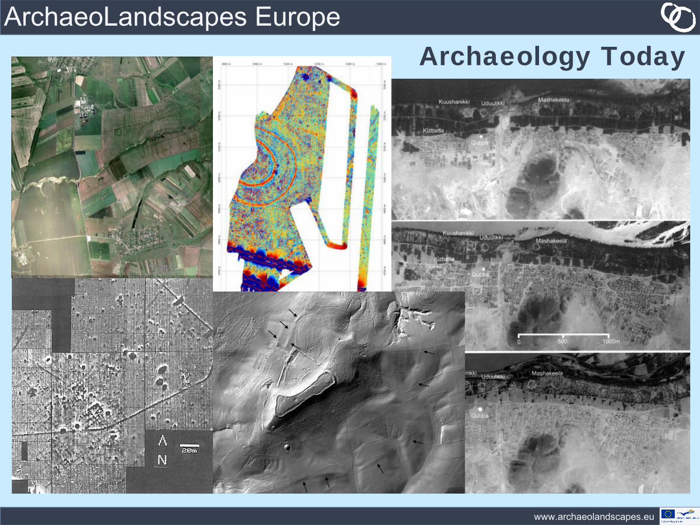
ArchaeoLandscapes EuropeArchaeology Today
www.archaeolandscapes.eu
ArchaeoLandscapes EuropeArchaeology Today
www.archaeolandscapes.eu
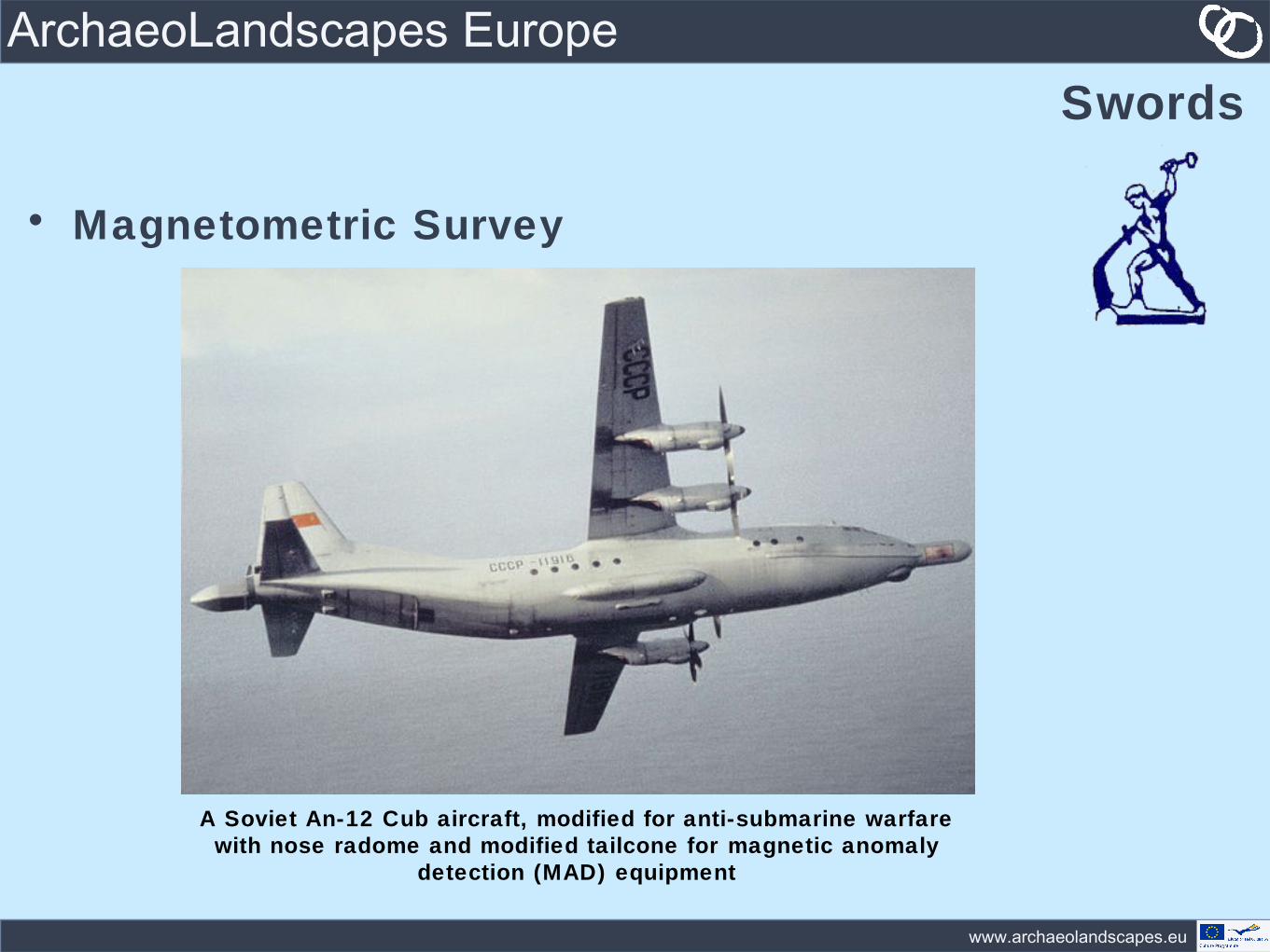
ArchaeoLandscapes EuropeSwords
• Magnetometric Survey
A Soviet An-12 Cub aircraft, modified for anti-submarine warfare with nose radome and modified tailcone for magnetic anomaly
detection (MAD) equipment
www.archaeolandscapes.eu
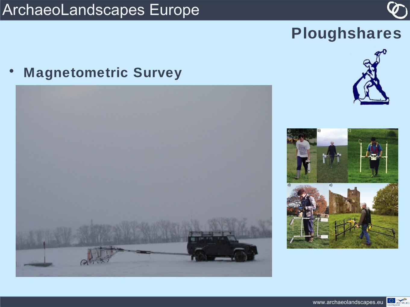
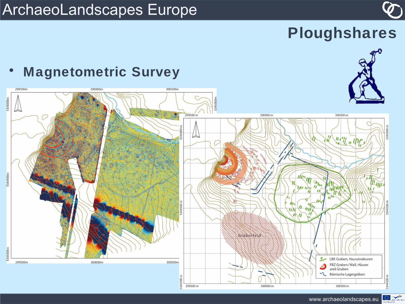
ArchaeoLandscapes EuropePloughshares
• Magnetometric Survey
www.archaeolandscapes.eu
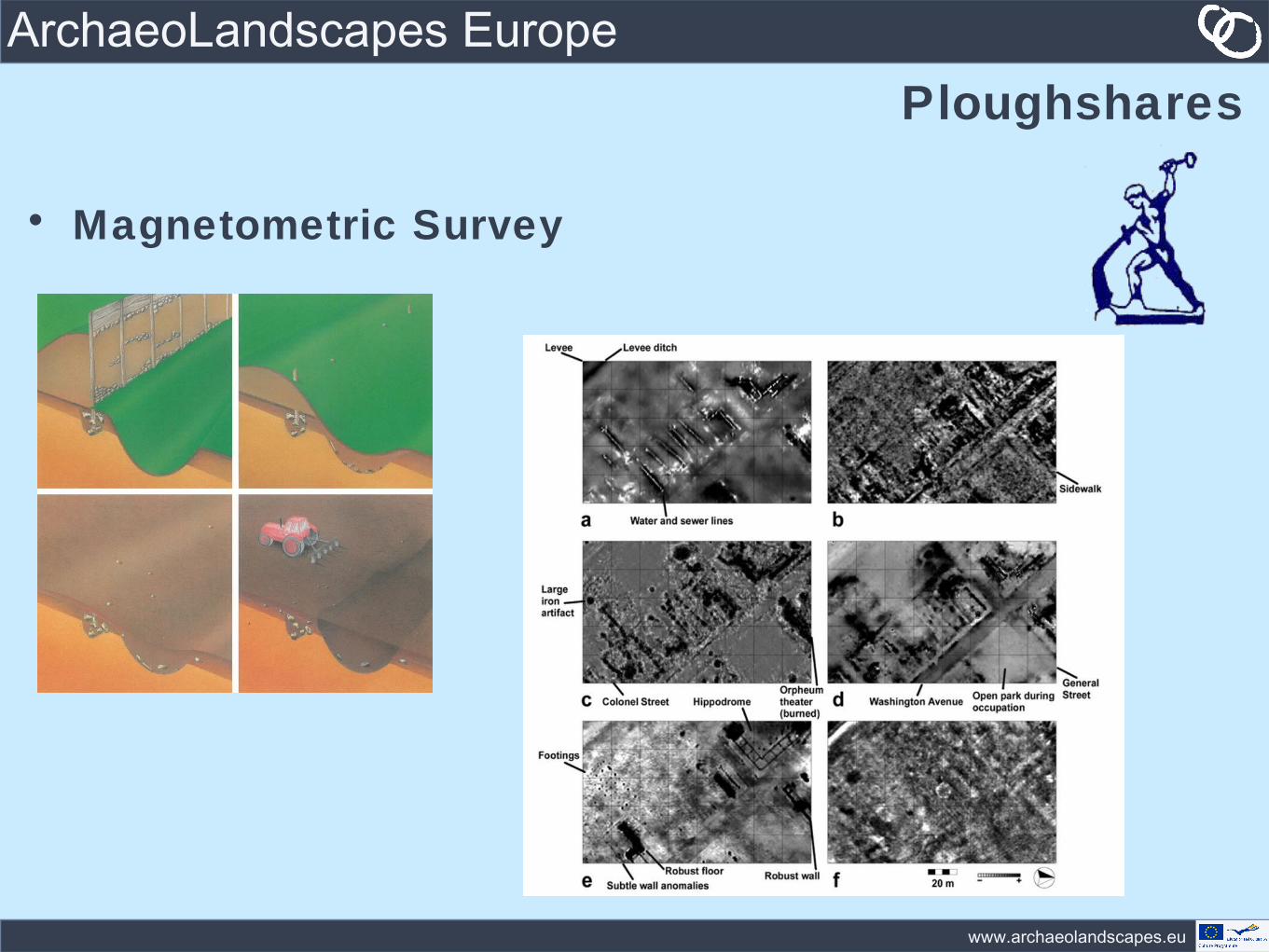
ArchaeoLandscapes EuropePloughshares
• Magnetometric Survey
www.archaeolandscapes.eu
ArchaeoLandscapes EuropePloughshares
• Magnetometric Survey
www.archaeolandscapes.eu
ArchaeoLandscapes EuropeSwords
• Aerial Archaeology
www.archaeolandscapes.eu
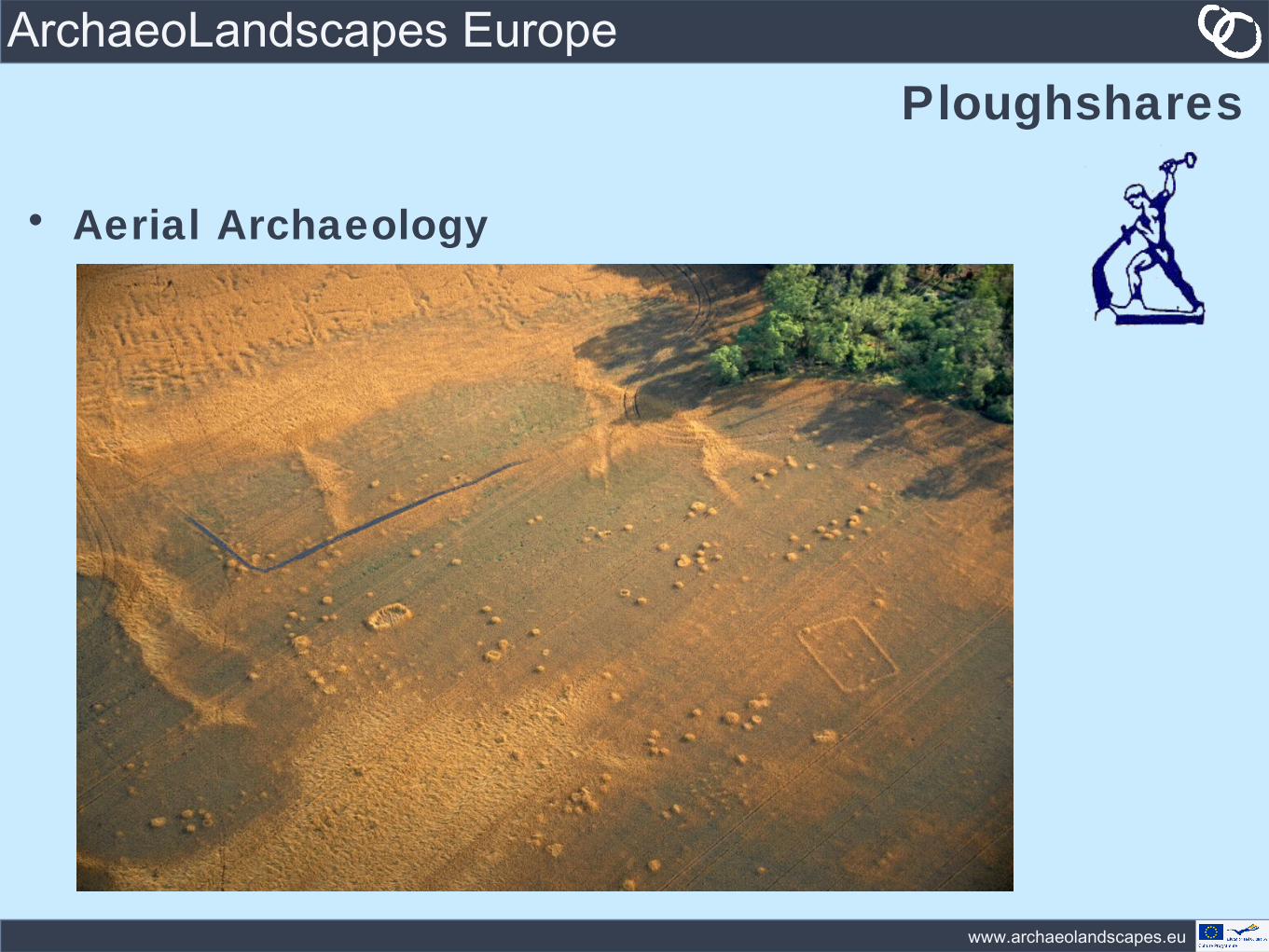
ArchaeoLandscapes EuropePloughshares
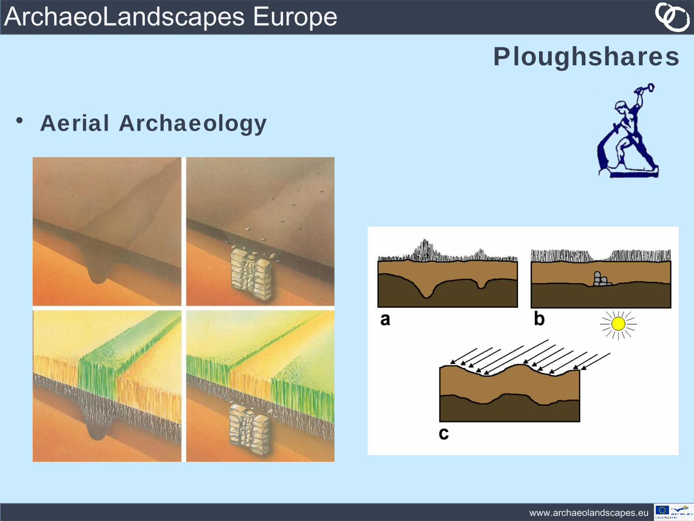
• Aerial Archaeology

www.archaeolandscapes.eu
ArchaeoLandscapes EuropePloughshares
• Aerial Archaeology
www.archaeolandscapes.eu
ArchaeoLandscapes EuropePloughshares
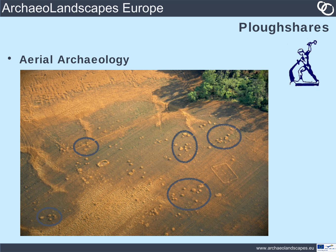
• Aerial Archaeology

www.archaeolandscapes.eu
ArchaeoLandscapes EuropePloughshares
• Aerial Archaeology

www.archaeolandscapes.eu
ArchaeoLandscapes EuropePloughshares
• Aerial Archaeology
www.archaeolandscapes.eu
ArchaeoLandscapes EuropePloughshares
• Aerial Archaeology
www.archaeolandscapes.eu
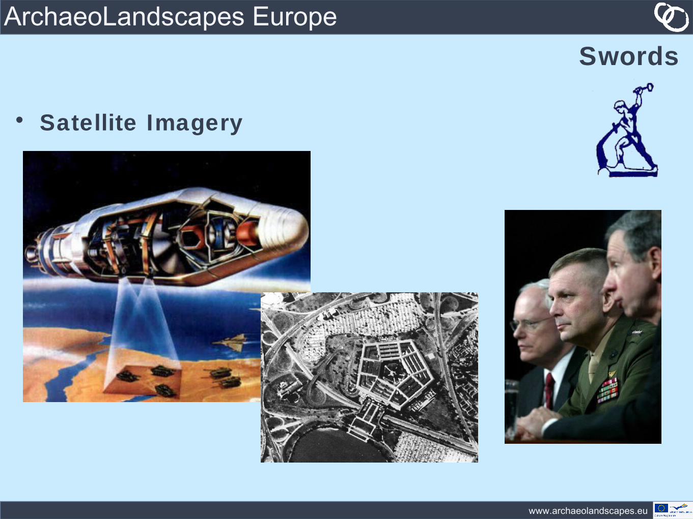
ArchaeoLandscapes EuropeSwords
• Satellite Imagery
www.archaeolandscapes.eu
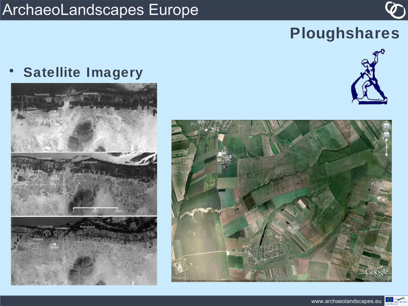
ArchaeoLandscapes EuropePloughshares
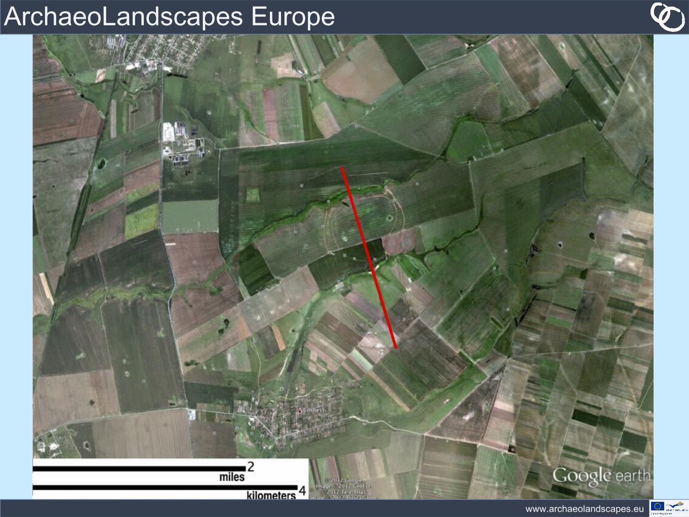
• Satellite Imagery
www.archaeolandscapes.eu
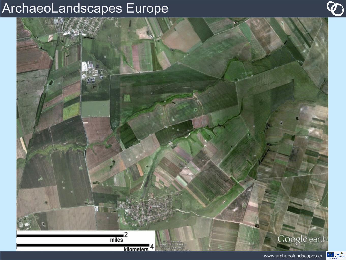
ArchaeoLandscapes Europe

www.archaeolandscapes.eu
ArchaeoLandscapes Europe
www.archaeolandscapes.eu
ArchaeoLandscapes Europe
www.archaeolandscapes.eu
ArchaeoLandscapes EuropeSwords
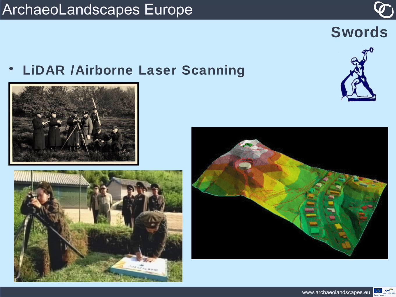
• LiDAR /Airborne Laser Scanning
www.archaeolandscapes.eu
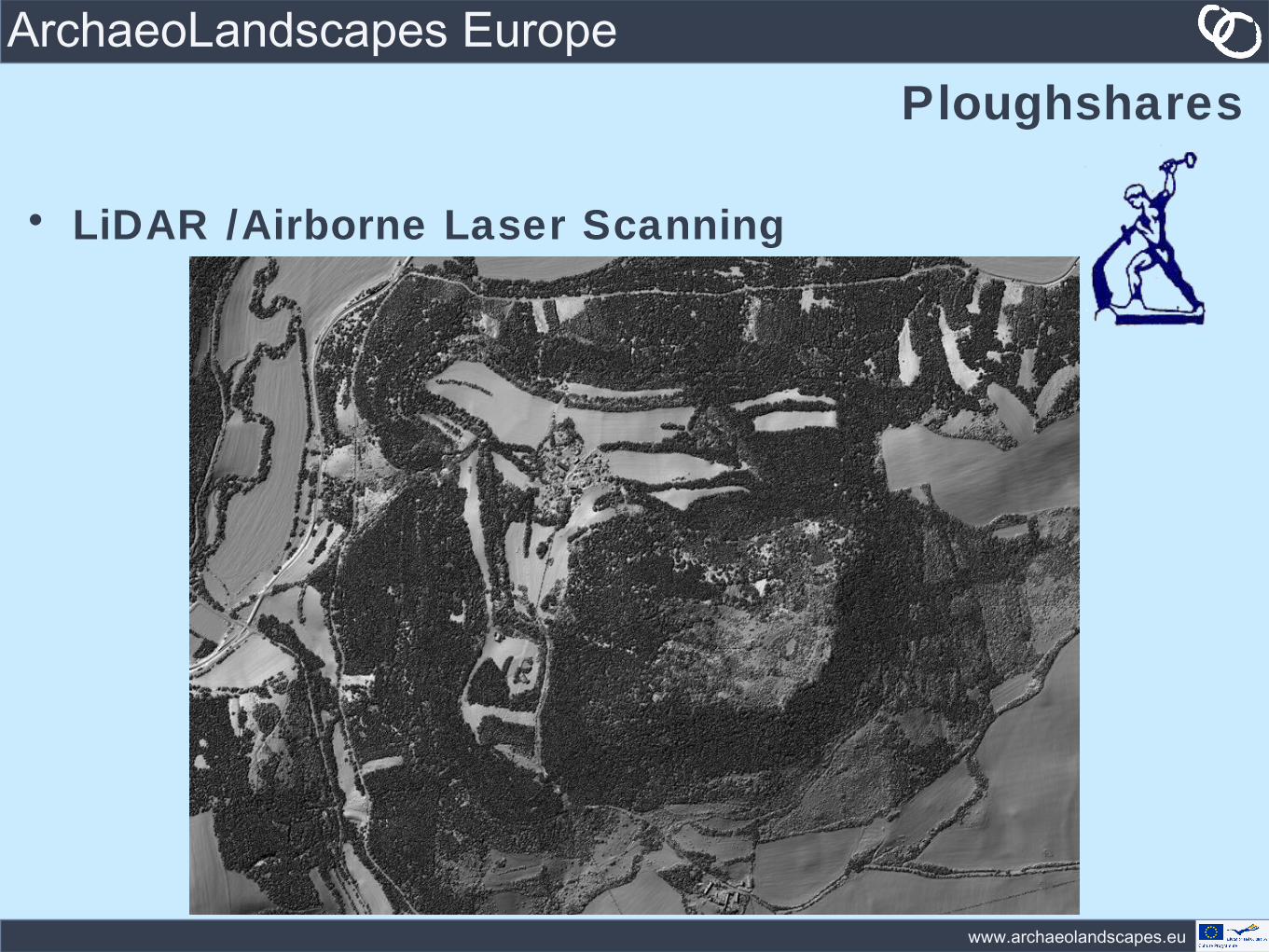
ArchaeoLandscapes EuropePloughshares
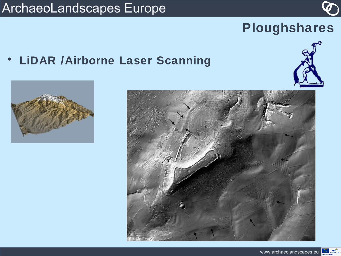
• LiDAR /Airborne Laser Scanning
www.archaeolandscapes.eu
ArchaeoLandscapes EuropePloughshares
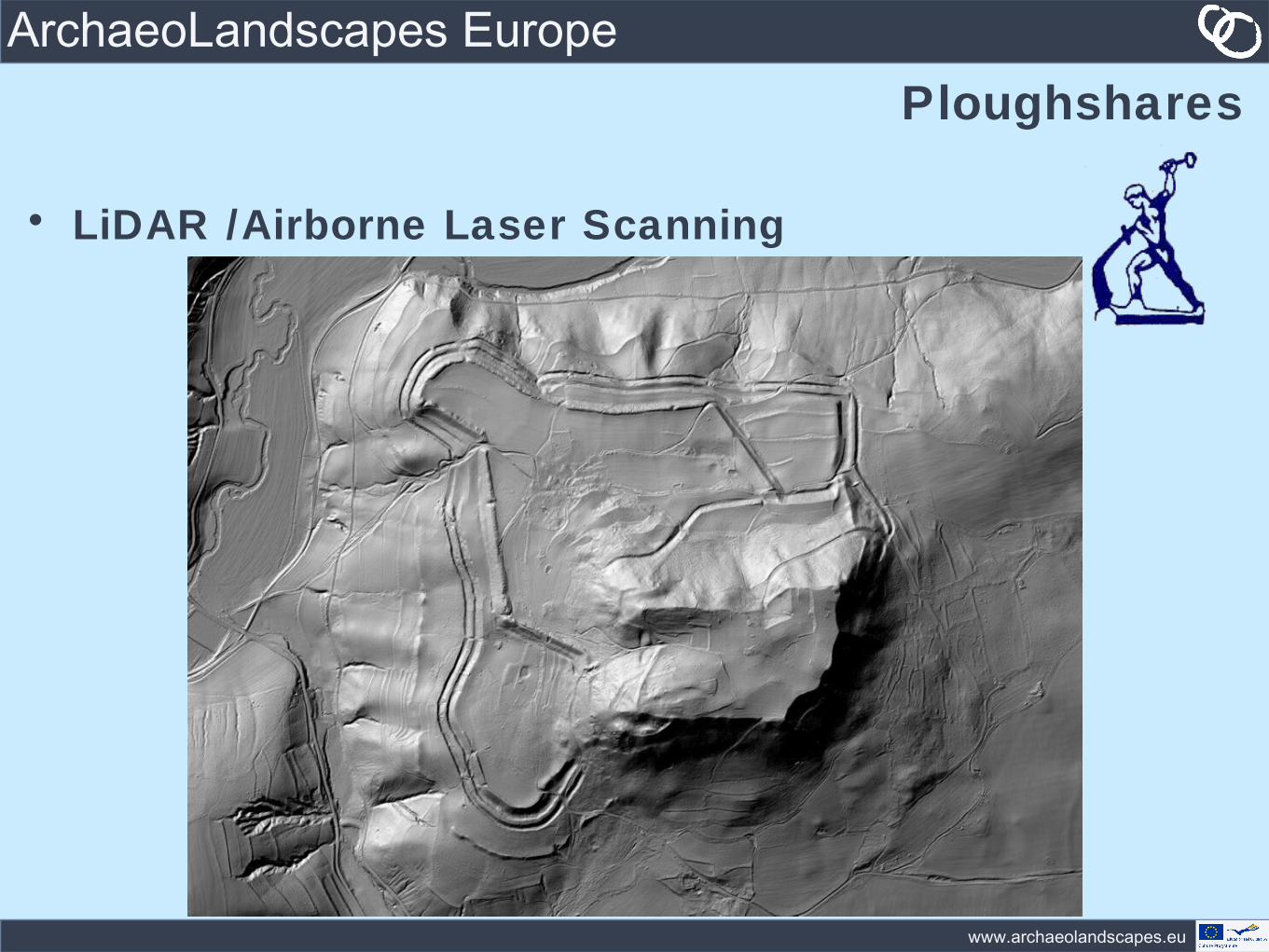
• LiDAR /Airborne Laser Scanning
www.archaeolandscapes.eu
ArchaeoLandscapes EuropePloughshares
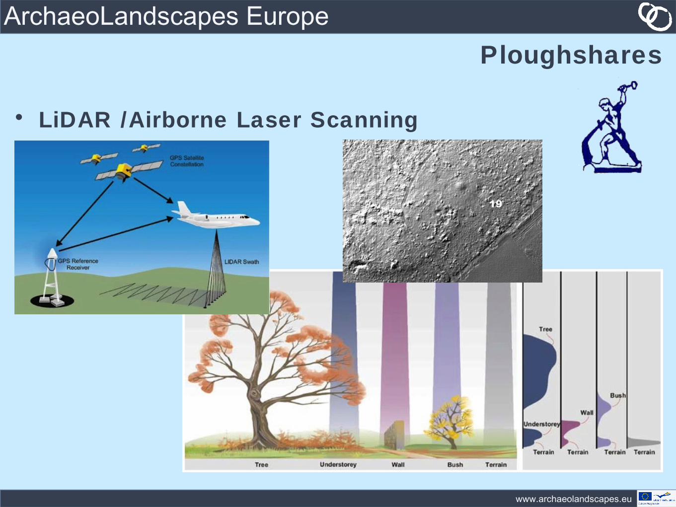
• LiDAR /Airborne Laser Scanning
www.archaeolandscapes.eu
ArchaeoLandscapes EuropePloughshares
• LiDAR /Airborne Laser Scanning
www.archaeolandscapes.eu
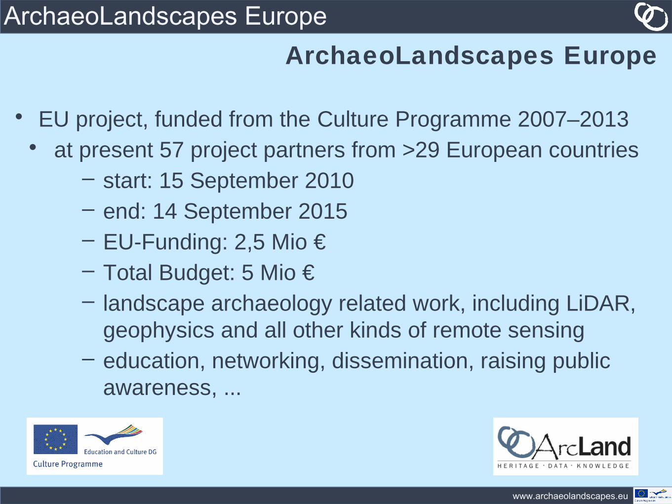
ArchaeoLandscapes EuropeArchaeoLandscapes Europe
• EU project, funded from the Culture Programme 2007–2013• at present 57 project partners from >29 European countries
– start: 15 September 2010– end: 14 September 2015– EU-Funding: 2,5 Mio €– Total Budget: 5 Mio €– landscape archaeology related work, including LiDAR,
geophysics and all other kinds of remote sensing– education, networking, dissemination, raising public
awareness, ...
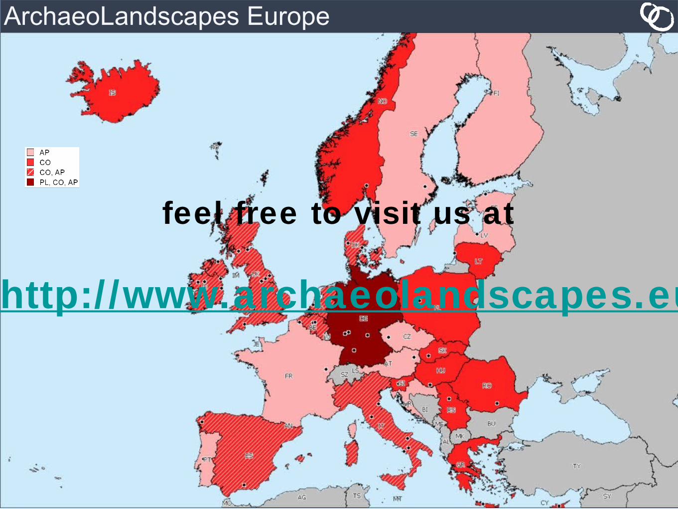
ArchaeoLandscapes Europe
feel free to visit us at
http://www.archaeolandscapes.eu