Research and Systematic Observations
33
8 Research and Systematic Observations OVERVIEW T he United States is committed to understanding the issues driving global change and to conducting the energy research that will lead to global emission reductions over the long run. The United States is providing global leadership in developing the fundamen- tal scientific and technological foundation for understanding the causes and consequences of climate and global change, reducing scientific uncertainties, and supporting adaptation and mitigation actions to manage risks and produce benefits at local, regional, and global scales. The United States places a high priority on research and development (R&D) needed to un- derstand, observe, and respond to global change. Major U.S. investment in climate and related global change science over the past few decades has greatly increased understanding of glob- al climate change, including its attribution to human influences. Now, as the effects on peo- ple’s well-being are already being felt in the form of more heat waves, alterations in rainfall patterns on which agriculture depends, and coastal communities increasingly at risk from ris- ing seas, scientific knowledge of the integrated Earth system is even more critical as the foun- dation for responding effectively. During the last few years, U.S. government agencies have put forward a coordinated set of investments in global change science to gain new theoretical knowledge of Earth system pro- cesses; to maintain and enhance a mix of atmospheric, oceanic, land, and space-based ob- serving systems; to advance predictive capabilities through the next generation of numerical models; to promote advances in computational capabilities, data management, and informa- tion sharing; and to further develop an expert scientific workforce in the United States and worldwide. For the period 2009–2013, the United States has invested roughly $12.5 billion in global change science (USGCRP 2011, 2012b, 2013). Additional investments under the American Recovery and Reinvestment Act (ARRA) have contributed to enhancing research infrastruc- ture, building next-generation cyberinfrastructure assets, and awarding many new research grants and graduate fellowships. The U.S. government is also making major investments in R&D to support clean energy and climate change mitigation technologies. The United States has committed to accelerating the development and deployment of technologies to reduce greenhouse gas (GHG) emissions, while increasing energy end-use efficiency. These steps would enable the nation to greatly reduce GHG emissions and stabilize GHG atmospheric concentrations at a level that avoids dangerous human interference with the climate system. To address these challenges, the Obama administration and Congress have continued to build on these efforts, such as with the creation of the Advanced Research Projects Agency– Energy (ARPA-E), to spur a revolution in clean energy technologies. Overall, ARRA has pro- vided more than $25 billion in additional funding for R&D activities across a broad portfolio of GHG mitigation options, including high-performance buildings; efficient manufacturing; ad- vanced vehicles; clean biofuels; wind, solar, geothermal, hydropower, and nuclear fusion; 1 See http://www.globalchange.gov/ about/global-change-research-act. 2 Additionally, the Defense Meteoro- logical Satellites Program (DMSP) supplies some data sets that are useful for climate science.
Transcript of Research and Systematic Observations

8Research and Systematic Observations
OVERVIEW
The United States is committed to understanding the issues driving global change and to conducting the energy research that will lead to global emission reductions over the long run. The United States is providing global leadership in developing the fundamen-
tal scientific and technological foundation for understanding the causes and consequences of climate and global change, reducing scientific uncertainties, and supporting adaptation and mitigation actions to manage risks and produce benefits at local, regional, and global scales.
The United States places a high priority on research and development (R&D) needed to un-derstand, observe, and respond to global change. Major U.S. investment in climate and related global change science over the past few decades has greatly increased understanding of glob-al climate change, including its attribution to human influences. Now, as the effects on peo-ple’s well-being are already being felt in the form of more heat waves, alterations in rainfall patterns on which agriculture depends, and coastal communities increasingly at risk from ris-ing seas, scientific knowledge of the integrated Earth system is even more critical as the foun-dation for responding effectively.
During the last few years, U.S. government agencies have put forward a coordinated set of investments in global change science to gain new theoretical knowledge of Earth system pro-cesses; to maintain and enhance a mix of atmospheric, oceanic, land, and space-based ob-serving systems; to advance predictive capabilities through the next generation of numerical models; to promote advances in computational capabilities, data management, and informa-tion sharing; and to further develop an expert scientific workforce in the United States and worldwide.
For the period 2009–2013, the United States has invested roughly $12.5 billion in global change science (USGCRP 2011, 2012b, 2013). Additional investments under the American Recovery and Reinvestment Act (ARRA) have contributed to enhancing research infrastruc-ture, building next-generation cyberinfrastructure assets, and awarding many new research grants and graduate fellowships.
The U.S. government is also making major investments in R&D to support clean energy and climate change mitigation technologies. The United States has committed to accelerating the development and deployment of technologies to reduce greenhouse gas (GHG) emissions, while increasing energy end-use efficiency. These steps would enable the nation to greatly reduce GHG emissions and stabilize GHG atmospheric concentrations at a level that avoids dangerous human interference with the climate system.
To address these challenges, the Obama administration and Congress have continued to build on these efforts, such as with the creation of the Advanced Research Projects Agency–Energy (ARPA-E), to spur a revolution in clean energy technologies. Overall, ARRA has pro-vided more than $25 billion in additional funding for R&D activities across a broad portfolio of GHG mitigation options, including high-performance buildings; efficient manufacturing; ad-vanced vehicles; clean biofuels; wind, solar, geothermal, hydropower, and nuclear fusion;
1 See http://www.globalchange.gov/about/global-change-research-act. 2 Additionally, the Defense Meteoro-logical Satellites Program (DMSP) supplies some data sets that are useful for climate science.
196 U.S. Climate Action Report 2014
carbon capture and sequestration; advanced energy storage; a more intelligent electric grid; and techniques for reducing emissions and/or increasing uptake of carbon dioxide (CO2) in agriculture and forestry.
This chapter is divided in three major parts. The first two sections discuss how the United States pursues research and observations of global change, while the third section focuses on U.S. energy research and technology. Collectively, these commitments to research, observa-tions, and technology demonstrate continuing U.S. leadership in understanding and respond-ing to climate and global change.
Research on Global ChangeAs the essential capacities for research and observations are widely distributed across U.S. government agencies, they are brought together into a single interagency program. Created by the Global Change Research Act (GCRA) of 1990,1 the U.S. Global Change Research Program (USGCRP) advances the legislative mandate to deepen basic scientific understand-ing while providing information and tools to support the nation’s and the world’s preparation for, and response to, global change. The United States is fostering greater coordination across its agencies and the international scientific community than ever before, in areas that include Earth observations, model development and use, assessments of climate change and impacts in the United States and worldwide, and data and information sharing.
At its core, global change is an issue that requires a coordinated, international response. Over the past three years, the United States has enhanced coordination with other nations and in-ternational organizations on global change research activities, promoted increased interna-tional access to scientific data and information, and fostered increased participation in international global change research by developing nations. In partnership with the International Council for Science (ICSU), the International Social Science Council (ISSC), and the Belmont Forum, the United States, is helping to shape the future of international global change research coordination.
In addition, during the last three years, the United States and international scientific commu-nities have embarked upon, and are on the verge of completing, the Fifth Assessment of the Intergovernmental Panel on Climate Change (AR5) (IPCC 2013; the Working Group I report has now been released, with the remaining reports to follow soon). U.S. researchers are play-ing critical and wide-ranging roles in the assessment, serving as working group co-chairs, co-ordinating lead authors, lead authors, contributing authors, review editors, and reviewers. The U.S. government also directly supports the IPCC Task Force on National Greenhouse Gas Inventories, as well as the IPCC Working Group II Technical Support Unit (which also sup-ports U.S. authors and contributors to all IPCC Working Groups).
Observing SystemsAll of these research and assessment activities depend on the existence of a comprehensive, continuous, integrated, and sustained set of physical, chemical, biological, and societal obser-vations of global change and its impacts. The current portfolio upon which the U.S. and inter-national research enterprise relies includes satellite, airborne, ground-based, and ocean-based missions, platforms, and networks that provide measurements of the Earth sys-tem variables important for understanding global change.
The United States supports a large number of civilian remote-sensing satellites that supply climate-related information. These satellites are operated by the National Aeronautics and Space Administration (NASA), the National Oceanic and Atmospheric Administration (NOAA), and the U.S. Geological Survey (USGS) Earth-observing satellites.2 The United States also supports extensive nonsatellite observational capabilities across multiple federal agencies, providing the backbone for many global observing networks. For example, the United States sponsors half of the platforms deployed in the global ocean (3,860 of 7,723), with 72 other countries providing the remainder.
The United States achieved new milestones with the launch of critical new satellite observing systems, including the Suomi National Polar-orbiting Partnership (NPP), Landsat-8, and Aquarius (in partnership with the Space Agency of Argentina). New surface-based networks,

Chapter 8 Research and Systematic Observations 197
such as the National Ecological Observatory Network (NEON) and Ocean Observatories Initiative (OOI) are well on their way to operation, creating a next generation of in situ observ-ing capabilities. And the U.S. Department of Energy (DOE) Atmospheric Radiation Measurement (ARM) Climate Research Facility received $60 million in ARRA funding to build its next-generation facility for climate research, deploying an expansive array of new instru-ments, as well as the cyberinfrastructure needed to support the increased data volume and distribution requirements.
Energy Research and TechnologyTo address the challenge of transitioning the U.S. energy portfolio in the face of climate change, the Obama administration and Congress are working to spur a revolution in clean energy technologies. The research and innovation activities in this arena, which span multiple federal agencies, are organized around such goals as reducing emissions from energy supply, end use, and infrastructure; capturing and sequestering CO2 and reducing emissions of other GHGs; measuring and monitoring emissions; and bolstering the contributions of basic science to innovation.
This section describes how these technology research and innovation activities are organized around these goals and are achieved through such mechanisms as the new Bioenergy Research Centers (BRCs), Energy Frontier Research Centers (EFRCs), and the multidisci-plinary DOE Energy Innovation Hubs. These investments build on the $400 million in ARRA funds for establishing ARPA-E within DOE to help overcome the long-term and high-risk tech-nological barriers to the development of clean energy options.
Furthermore, the United States believes that well-designed multilateral collaborations fo-cused on achieving practical results can accelerate development and commercialization of new technologies. Thus, the United States has initiated or joined a number of technology col-laborations in hydrogen, carbon sequestration, nuclear energy, and fusion that address many energy-related concerns, including climate change. These include the Carbon Sequestration Leadership Forum (CSLF), the Generation IV International Forum (GIF), and the ITER interna-tional fusion experiment.
RESEARCH ON GLOBAL CHANGEGlobal change is happening now. Increases in population, industrialization, and human activi-ties have altered the world’s climate, oceans, land, ice cover, and ecosystems. Decision mak-ers at every level of government, across every geographic region, and in every economic sector are demanding clear information about global change in order to plan, prepare, adapt, and respond. Responding effectively depends on a sound understanding of the changes un-derway, the threats and opportunities they present, and how they will evolve over time.
The U.S. Congress recognized this urgent need in 1990 by mandating USGCRP to “assist the Nation and the world to understand, assess, predict, and respond to human-induced and nat-ural processes of global change.”3 USGCRP is designed to fulfill that mandate by coordinating the federal government’s $2.7 billion annual investment in global change research—the larg-est such investment in the world. The science portfolio managed by the USGCRP federal agencies spans scales from atoms, to ecosystems, to the entire planet, and includes changes being wrought by human behaviors as well as by natural forces. It encompasses laboratory experiments, field research, computer modeling, scientific assessment, and observations of Earth from land, air, sea, and space.
This vast body of work is carried out by 13 federal agencies, each with its own mission and areas of expertise. Since USGCRP’s founding in 1990, these federal agencies have coordinated their investments and activities in global change science to create and maintain a mix of at-mospheric, oceanic, land-, and space-based observing systems; gain new theoretical knowl-edge of Earth system processes and the causes and consequences of global change; advance Earth system understanding and predictive capabilities through numerical modeling; promote advances in computational capabilities, data management, and information sharing; and de-velop an expert scientific workforce. These activities have proven critical to improving scien-tific understanding of the rich interconnections and feedbacks within the Earth system; the 3 See http://www.globalchange.gov/
about/global-change-research-act.
198 U.S. Climate Action Report 2014
significant role of human activities in climate and related global change; and the current and potential future rates, magnitudes, and impacts of this change.
These investments stand today as the foundation of current understanding, in the United States and worldwide. Today, USGCRP continues to advance fundamental scientific under-standing of global change. However, recognizing that global change and its consequences are happening already, USGCRP is also focusing on a new priority: ensuring that its science is as immediately decision-relevant as possible.
A New 10-Year Strategic Plan for USGCRPAs mandated by the GCRA, USGCRP is required to develop a National Global Change Research Plan every 10 years. In April 2012, USGCRP released a new research plan that de-scribes in detail how it will fulfill this role and its congressional mandate over the next decade. Entitled The National Global Change Research Plan 2012–2021 (USGCRP 2012b), the plan lays out specific goals and objectives to generate fundamental new scientific knowledge and to disseminate this knowledge in readily available and directly useful ways to decision makers and citizens.
This 10-year strategic plan—which reflects recommendations from multiple reports of the U.S. National Academies, dozens of listening sessions with stakeholders around the country, public comments on a draft plan, and collaborative planning among the USGCRP agencies—charts a course that will advance USGCRP’s legislative mandate to deepen basic scientific understanding, while providing information and tools to support the nation’s and the world’s preparation for, and response to, global change. This includes strengthening and expanding fundamental understanding of climate change and its interactions with other critical drivers of global change, more effective collaboration among researchers in the natural and social sci-ences, increased interagency cooperation to sustain ongoing assessments of global change impacts, and robust dialogues with diverse audiences to enhance communication of scientific knowledge.
Under the new strategic plan, USGCRP will coordinate federal research efforts through the following four strategic goals:
• Goal 1: Advance Science—Advance scientific knowledge of the integrated natural and hu-man components of the Earth system.
• Goal 2: Inform Decisions—Provide the scientific basis to inform and enable timely decisions on adaptation and mitigation.
• Goal 3: Conduct Sustained Assessments—Build sustained assessment capacity that improves the nation’s ability to understand, anticipate, and respond to global change impacts and vulnerabilities.
• Goal 4: Communicate and Educate—Advance communications and education to broaden public understanding of global change and develop the scientific workforce of the future.
In particular, the plan calls for greater coordination than ever before across U.S. agencies and the international scientific community in a number of critical areas, including (1) observations of Earth, including both satellite and in situ observations for monitoring global change and un-derstanding its key processes; (2) development, testing, and application of sophisticated models, the principal tools used to anticipate future changes and understand the possibility of tipping points in the Earth system; (3) assessments of climate change and impacts in the United States, synthesizing across peer-reviewed scientific literature and other credible sources; (4) sharing of information to support adaptation and mitigation response needs; and (5) communication of scientific findings to diverse audiences, including the public, Congress, and the global scientific community.
A substantial amount of work is underway to achieve this vision, building from the foundation in fundamental global change research and research infrastructure over the last two-plus de-cades. Achieving these goals will continue to depend on integrating observations of all es-sential Earth system components and processes, which is essential for developing theories and explanations of the causes and consequences of global change. These theoretical
Chapter 8 Research and Systematic Observations 199
advances must in turn be captured and tested in integrated modeling systems for further ad-vancing fundamental scientific understanding and informing decision making about respond-ing to global change. Finally, success in all of these areas will need to build on continuing advances in information management and data sharing to aid scientific progress and to com-municate with and inform society.
The following section discusses in more detail the principles for advancing global change sci-ence embodied in the 2012–2021 USGCRP strategic plan (as per Goal 1 above), as well as ex-amples of major research accomplishments in the last three years. Chapter 6 of this report provides a detailed description of actions by U.S. government agencies to deliver credible, timely, and relevant information grounded in the best available science, as well as to advance an inclusive, broad-based, and sustained process for assessing and communicating scientific knowledge of the impacts, risks, and vulnerabilities associated with climate change, in support of decision making across the United States (as per Goals 2 and 3 above). Chapter 9 provides a detailed description of actions by U.S. federal agencies to support national global change-related communication and education efforts (as per Goal 4 above), including gaining greater understanding of the public’s science and information needs through engagement and dialogue.
Advancing Global Change ScienceScientific knowledge of the integrated Earth system is the foundation for responding effec-tively to global change. The USGCRP agencies define a research program that acknowledges the complexity of global change as both a scientific and a societal challenge. To meet this challenge, USGCRP embraces multiple forms of integration: across the components of the Earth system (including humans), across observations and modeling, across space and time, across scientific disciplines, across domestic and international partnerships, and across the capabilities of science and the needs of decision makers.
As articulated in the new USGCRP strategic plan, these aims are being accomplished through the pursuit of five objectives:
• Earth System Understanding—Advance fundamental understanding of the physical, chemi-cal, biological, and human components of the Earth system, and the interactions among them, to improve knowledge of the causes and consequences of global change.
• Science for Adaptation and Mitigation—Advance understanding of the vulnerability and resil-ience of integrated human–natural systems, and enhance the usability of scientific knowl-edge in supporting responses to global change.
• Integrated Observations—Advance capabilities to observe the physical, chemical, biological, and human components of the Earth system over multiple space and time scales, to gain fundamental scientific understanding and monitor important variations and trends.
• Integrated Modeling—Improve and develop advanced models that integrate across the physical, chemical, biological, and human components of the Earth system, including the feedbacks among them, to represent more comprehensively and predict more realistically global change processes.
• Information Management and Sharing—Advance the capability to collect, store, access, visu-alize, and share data and information about the integrated Earth system, the vulnerabilities of integrated human–natural systems to global change, and the responses to these vulnerabilities.
Although these five objectives are defined distinctly and discussed separately, they describe one integrated body of knowledge and practice: seeking answers to fundamental scientific questions about the integrated Earth system, and harnessing that improved scientific under-standing to support the development of actions in response to global change. Areas of in-creased emphasis in USGCRP under its new strategic plan include:
• Fostering new research at the interface between the study of the physical climate system and the biological sciences.
200 U.S. Climate Action Report 2014
• Improving integration of the social, behavioral, and economic sciences within the larger global change research enterprise.
• Recognizing the interplay between climate change and other dimensions of global change, such as land-use change, alteration of biogeochemical cycles, pollution, and biodiversity loss.
• Improving understanding of climate system extremes, thresholds, and tipping points.
• Assessing the vulnerability of sectors, regions, and populations, and supporting iterative risk management of these vulnerabilities through adaptation and mitigation responses.
These efforts are complemented by the ongoing efforts of the U.S. Carbon Cycle Science Program, which finished its planning for carbon cycle research in the upcoming decade with its 2011 release of its U.S. Carbon Cycle Science Plan (Michalak et al. 2011). This plan outlines a strategy for refocusing U.S. carbon cycle research based on the current state of the science, and provides funding agencies with community-recommended research priorities over the next decade. Global in scale and recognizing a strong need for international cooperation and collaboration, the plan is organized around how natural processes and human actions affect the carbon cycle on land, in the atmosphere, and in the oceans; how policy and management decisions affect the levels of the primary carbon-containing gases in the atmosphere; and how ecosystems, species, and natural resources are affected by increasing GHG concentra-tions, the associated changes in climate, and carbon management decisions. In addition to reaffirming the need for basic research and for continuing the current areas of research in car-bon cycle science and successful efforts, such as the North American Carbon Program (NACP), the 2011 plan outlines specific recommendations for new priorities, such as the con-sequences of carbon management activities, the direct impacts of CO2 on ecosystems, and the need to coordinate researchers from the natural and social sciences to address societal concerns.
Observing SystemsAll of this research depends on the existence of a comprehensive, continuous, integrated, and sustained set of physical, chemical, biological, and societal observations of global change and its impacts. These are essential for improving the understanding of the components and pro-cesses of the Earth system and the causes and consequences of global change. As will be dis-cussed in more detail in the Systematic Observations section of this chapter, the current observational portfolio upon which the U.S. and international global change research enter-prise relies includes satellite, airborne, ground-based, and ocean-based missions, platforms, and networks that provide measurements of the Earth system variables important for under-standing global change.
Understanding the complexity of the global, integrated Earth system requires simultaneous recording of diverse observations, maintained over long time periods. Effective Earth system observation requires both remotely sensed and in situ observations from all domains—atmo-sphere, ocean, land, and ice—that are then transformed into products, information, and knowledge through analysis and integration in both time and space. For most measurements, no single approach can provide all the needed observations of sufficient quantity and quality, requiring coordination across platforms and instruments. In addition, such observations should be sustained in a well-calibrated state for decades (over multiple generations of ob-serving systems) to separate long-term trends from short-term variability, and should have global coverage at sufficient spatial resolution to account for variability across a wide range of scales.
For example, two new NASA efforts—the Aquarius satellite mission and the Salinity Processes in the Upper Ocean Regional Study (SPURS) field campaign—will complement the information about sea surface salinity that, for more than a century, has been collected only from ships, surface buoys, and profiling floats. These unprecedented new ocean observations will enhance this sometimes-sparse data record of complex interactions between evapora-tion, precipitation, and ocean circulation worldwide. These observations are important be-cause regional variations in ocean salinity can influence the ocean’s ability to absorb,
Chapter 8 Research and Systematic Observations 201
transport, and store heat, freshwater, and CO2, and, therefore, drive further changes in atmo-spheric circulation and the hydrologic cycle.
Other efforts to integrate observations to improve fundamental understanding of Earth sys-tem processes include recent USGS work to assess the amount of carbon stored on and with-in the U.S. land surface, and future plans, under NEON, to combine site-based data with remotely sensed data to document and understand changes in the nation’s ecosystems. This sustained, long-term measurement of the climate system is complemented by process-based research to document the Earth system’s response to global change over broad space and time scales.
Modeling CapabilitiesIntegration across Major Classes of Models—In addition, this research depends on the devel-opment, use, and, increasingly, integration of three classes of models to improve understand-ing of the causes and consequences of global change: Earth system models (ESMs); integrated assessment models (IAMs); and impact, adaptation, and vulnerability (IAV) mod-els. Of these, ESMs have the most comprehensive representations of physical and biological systems and their interactions; thus, they are essential tools for exploring Earth system com-plexities predicting the behavior of the climate system, and interpreting observed changes in climate and weather.
New and enhanced models are expected to make important contributions toward advancing fundamental understanding of climate change, as well as informing future policymaking, plan-ning, and decision support for sectors, such as energy, natural resources, food, and water, and national security. Used in conjunction with climate and ESMs, so-called IAV models are de-signed for assessments of potential climate change impacts, critical vulnerabilities, and effec-tive adaptation strategies in such sectors as agriculture, coastal systems, energy, transportation, health, forestry, fisheries, and ecosystem services. These IAV models also as-sist in the development of more informative and comprehensive scenarios of drivers of future climate forcing, socioeconomic vulnerability, and adaptive capacity.
Also, IAMs combine the drivers and consequences of climate change within a consistent modeling framework. At the center of IAMs are representations of present and possible fu-ture human activities (e.g., changes in emissions, land, or water uses) and their potential in-fluence on the Earth system.
Enhanced Modeling Capabilities—The major U.S. modeling centers—NOAA Geophysical Fluid Dynamics Laboratory and National Centers for Environmental Prediction, NASA Goddard Institute for Space Studies and Global Modeling and Assimilation Office, and National Science Foundation (NSF)/U.S. Department of Energy (DOE) National Center for Atmospheric Research—continue to lead in developing, evaluating, and applying ESMs and other modeling systems, as well increasing the accessibility of model output to user communities.
Under the auspices of USGCRP, the climate and global change modeling community has tak-en advantage of rapidly advancing computing resources to work toward a number of goals. To provide regional-scale information for planning purposes, the resolution at which models are being run has continued to increase as ESMs aim to provide information at scales that are relevant to decision makers. New numerical methods, grids, and parameterizations have been introduced to meet the challenges of running these models at unprecedentedly fine resolutions.
Coupled Model Intercomparison Project—These modeling centers, along with other USGCRP agencies, such as USGS, are playing a critical role in Phase 5 of the Coupled Model Intercomparison Project (CMIP5)—a major international effort under the auspices of the World Climate Research Programme (WCRP) to evaluate and improve climate models and provide critical input to national and international scientific assessments.4 Extensive analysis of these simulations by members of the international climate community has provided an im-portant scientific basis for the IPCC’s AR5 (IPCC 2013).
The Project for Climate Model Diagnosis and Intercomparison (PCMDI) at the Lawrence Livermore National Laboratory is playing a leadership role worldwide in managing CMIP5 4 See http://cmip-pcmdi.llnl.gov/cmip5/.
202 U.S. Climate Action Report 2014
data archival and access, including responsibility for leading the Earth System Grid Federation, which stores and distributes terascale data sets from multiple coupled ocean-atmosphere global climate model simulations and allows users to download model output from multiple locations without needing to know where the data sets physically reside—giv-ing them faster, easier access to climate data.
Recently, NASA’s Jet Propulsion Laboratory and PCMDI have worked jointly on “Obs4MIPS,” an effort to identify and provide a number of appropriate satellite data sets in a format specifi-cally tailored to facilitate model evaluation, with the initial target being CMIP5. In addition, the scenarios and emission profiles used to drive the CMIP5 models were developed as a re-sult of international and interagency cooperation. DOE and the U.S. Environmental Protection Agency (EPA) supported the U.S. contribution to this effort, which projected socioeconomic trends, energy pathways, land use, and biogeochemical emissions and their implications for GHG concentrations at appropriate spatial scales.
Increased Representation of Processes—The scope of processes represented in such models, particularly in the area of biogeochemistry, has increased as a direct result of U.S. and inter-national investments in basic research. A first generation of ESMs now captures representa-tions of carbon and nitrogen cycles and dynamic vegetation, thereby allowing for feedbacks involving these processes. In addition, the simulation of cloud and aerosol processes has be-come more sophisticated, enabling improved modeling of aerosol effects on clouds and cli-mate, as well as associated feedbacks. Also, until recently, ESMs have not included dynamic models for the large Greenland and Antarctic ice sheets, and have thus been unable to pro-vide projections of future sea level rise. However, ice sheet model components have recently been added to some ESMs to provide a fully interactive and dynamic model of ice sheet melt-ing and its contribution to sea level rise.
Decadal and Regional Climate Prediction—To advance these and related areas, NSF, DOE, and the U.S. Department of Agriculture (USDA) have developed a joint funding competition, Decadal and Regional Climate Prediction using Earth System Models (known as the EaSM program). The EaSM projects address challenges associated with the development of next-generation ESMs that include coupled and interactive representations of ecosystems, agricul-tural lands and forests, urban environments, Earth’s biogeochemistry, atmospheric chemistry, ocean and atmospheric currents, the water cycle, land and sea ice, and human activities. These projects are expected to generate results that will lead to improved understanding of impacts at regional levels, as well as facilitate development of effective adaptation strategies on decadal time scales. Both the regional spatial scale and the earlier time frame are direct responses to the needs of decision makers, who have repeatedly requested information at the scale at which management decisions are made. Through two rounds, these three agencies have jointly supported 61 projects for a total investment of more than $90 million.
Seasonal Climate Prediction In addition, NOAA, in partnership with NASA, DOE, NSF, and other research institutions, has initiated a research effort to improve seasonal climate prediction skill based on multiple U.S. climate models. Such a research effort follows the U.S. National Academy of Sciences’ 2010 recommendation for experimentation with multi-model ensembles as a way to improve upon current predictive capabilities. The current initiative, named the National Multi-Model Ensemble (NMME), in its initial phase, is producing real-time multi-model seasonal climate predictions based on readily available models and a basic experimental design. Future NMME plans, spearheaded by NOAA, include a more comprehensive research investigation regard-ing the optimal design and added value of this multi-model predictive system.
High-Performance Computing Capabilities Finally, the U.S. government has made major new investments in high-performance capabili-ties to support the global change modeling enterprise. For example, ARRA support for the Evergreen project and the Pacific Northwest National Laboratory Joint Global Change Research Institute enabled the creation of an advanced computing infrastructure, installed at

Chapter 8 Research and Systematic Observations 203
the Research Data Center at the University of Maryland, to execute millions of simulations, conduct post-processing calculations, store input and output data, and visualize results.
USGCRP International Research Programs and PartnershipsAt its core, global change is an issue that requires an international, coordinated response. Effectively advancing the understanding of global change, establishing and sustaining obser-vations, and preparing for global environmental change require concerted international coop-eration. Since its mandate includes both basic research coordination and supporting decision making about responding to global change, USGCRP finds it necessary and desirable to en-gage other nations and international organizations.
Congress recognized the importance of international cooperation and collaboration and codi-fied it in the GCRA of 1990, where USGCRP is mandated to (1) coordinate U.S. activities with other nations and international organizations on global change research projects and activi-ties, (2) promote international cooperation and access to scientific data and information, and (3) participate in international global change research by developing nations. Through this engagement, USGCRP and its member agencies leverage existing and future scientific capa-bilities and more effectively use resources to accomplish strategic priorities.
USGCRP engages with, and provides significant financial support for, a variety of international programs, such as the WCRP, the International Geosphere-Biosphere Program, the International Human Dimensions Program, the Earth Systems Science Partnership, DIVERSITAS, the SysTem for Analysis, Research and Training, and the Global Research Alliance on Agricultural Greenhouse Gases. U.S. agencies were among the largest sponsors of WCRP’s 2011 Open Science Conference, with more than 1,900 participants from around the world. In addition, the USDA Foreign Agricultural Service sponsors the Global Research Alliance Fellowships, which to date have provided funding for 17 scientists from developing countries to come to the United States and work directly with U.S. researchers on research priorities and goals of the Alliance.
In addition, USGCRP-supported researchers continue to play critical and wide-ranging roles in the development of several major international assessments, including the IPCC AR5 (IPCC 2013). They serve as working group co-chairs, coordinating lead authors, lead authors, contributing authors, review editors, and reviewers, and they provide technical support and scientific expertise as reviewers to IPCC assessments and other international efforts. USGCRP coordinates author nominations, as well as government and expert reviews for AR5. It also provides direct financial support for the operations of the IPCC Working Group II Technical Support Unit, which is responsible for coordinating the production of the Working Group II volume, U.S. participation in the production of the Working Group I and III reports, and U.S. participation in the ongoing Scientific Assessment of Ozone Depletion,5 the Special Report on Renewable Energy Sources and Climate Change Mitigation (IPCC 2011), and the Special Report on Managing the Risks of Extreme Events and Disasters to Advance Climate Change Adaptation (IPCC 2012).
USGCRP also supports regional activities through the Inter-American Institute for Global Change Research and the Asia-Pacific Network for Global Change Research, and is working with international partners to foster global change research cooperation in Africa. Individual USGCRP agencies provide additional support to other programs and projects that advance collaborative multidisciplinary research relevant to global environmental change and its im-pacts on society. These types of global partnerships maximize international scientific ex-change and best practices, support complementary research efforts, and allow decision makers to make more informed science-based decisions domestically and globally. Support of these programs provides opportunities for U.S. investigators to work with their counterparts from other countries in a coordinated fashion. These activities enrich national activities on the same subjects, build capacity to conduct research and make observations of environmental change in less-developed countries, and foster advances in understanding of global environ-mental change in ways the investments of any single nation could not accomplish.
5 See http://www.esrl.noaa.gov/csd/assessments/ozone/.
204 U.S. Climate Action Report 2014
The mission of the USGCRP under its new decadal strategic plan aligns with efforts being un-dertaken recently by the international community, in which the traditional physical and bio-logical research focus on global change is being restructured to respond to the growing demand for information and products by both the public and the private sectors. The ICSU, with the ISSC and other partners, including the International Group of Funding Agencies for Global Change Research (IGFA) and its Council of Principals, the Belmont Forum, is shaping the future of international global change research coordination.
One such initiative is Future Earth, which follows on years of planning that began with the re-view of a suite of ICSU-sponsored global change research programs, in particular the Earth System Science Partnership. Future Earth will merge the International Geosphere-Biosphere Program, the International Human Dimensions Program, and the DIVERSITAS program. USGCRP played a role in the Alliance Transition Team, which led an 18-month process to de-sign a 10-year Future Earth Initiative that is the result of the visioning process led by ICSU and ISSC. USGCRP also contributes to a variety of other activities of the Belmont Forum and IGFA, including redesigning and hosting the group’s Web sites and hosting the U.S. portion of the secretariat.
Another example of efforts to advance cooperation among international global environmental change communities can be found in the outcomes of the World Climate Conference-3, with a decision to establish a Global Framework for Climate Services (GFCS) to strengthen the application of science-based climate prediction and services around the world. Such a frame-work has the potential to offer significant economic, public health and safety, and security benefits for participating countries, and the physical, biological, and social science research and infrastructure funded by USGCRP agencies are highly relevant to the GFCS. USGCRP is already working with WCRP to develop the modeling and understanding components of the GFCS that will emphasize linkages to adaptation and observations. USGCRP can further con-tribute to, and benefit from, this emerging framework through increased coordination with the international community to provide global change information.
SYSTEMATIC OBSERVATIONSContinuous, high-quality, scientific observations of the global environment are critical for de-fining the current state of Earth’s integrated environmental system—in particular, the con-stantly changing conditions of the atmosphere, hydrosphere, and biosphere. A historical continuum of high-confidence data is essential to initialize forecast models, reconstruct his-torical variances and interrelationships, and document changes in Earth’s systems. Building this knowledge base requires systematizing historical data and paleoclimatic reconstructions to modern scientific standards, as well as quantifying the ever-shifting present. The fidelity of predictions of the future is directly related to such a knowledge base being in place, accurate, and sustained over a long time period.
The term “climate observations” encompasses a broad range of environmental observations, including (1) routine weather observations, which are collected consistently over a long pe-riod; (2) observations collected as part of research investigations to elucidate processes that contribute to maintaining climate patterns or their variability; (3) highly precise, continuous observations of climate system variables collected for the express purpose of documenting long-term (decadal to centennial) changes; (4) observations to document the changing state of the oceans and atmosphere; and (5) observations of climate proxies, collected to extend the instrumental climate record to remote regions and back in time.
A critical challenge is to maintain measurements provided by current observing capabilities. To detect climate change, understand and attribute change to specific climate processes, and anticipate climate impacts on the Earth system requires a long-term (many decades), consis-tent, comprehensive observing system with multiple complementary components. Many cli-mate trends are small and can only be distinguished from short-term variability through careful analysis of long time series of sufficient length, consistency, continuity, and accuracy to deter-mine climate variability and change (e.g., climate data records). Short data records or long gaps in the records can make such detection and analysis much more uncertain and costly. To confi-dently detect small climate shifts requires instrument stability better than generally required for other uses.
Chapter 8 Research and Systematic Observations 205
In addition, the sustained global observing systems that are essential to global change re-search require international partnerships. In situ and satellite-based observations of the envi-ronment are of fundamental importance to understanding the Earth system. Because these observations are of great value globally, require significant investments of resources, and need to be collected outside of the United States, international partnerships are crucial to le-verage investments, expand system coverage, and increase usable science. The global scien-tific community has recognized the value of intelligently connected and consistent observing systems that incorporate both longer-term (sustained) and shorter-term (intensive) observa-tions. As discussed in detail in the following section, the United States plays a leadership role in a number of international observing systems.
Documentation of U.S. Climate ObservationsU.S. government investments in climate observing systems provide the backbone of much of the international climate data information infrastructure. Since the U.S. Climate Action Report 2010 (2010 CAR) (U.S. DOS 2010), the United States has maintained and improved its do-mestic and international investments in both satellite and nonsatellite observing systems.
The United States supports a large number of remote-sensing satellite platforms, as well as a broad network of Earth-based global atmospheric, oceanic, and terrestrial observation sys-tems that are essential to climate monitoring. These systems are a baseline Earth-observing system and include NASA, NOAA, USGS, and DMSP Earth-observing satellites and extensive nonsatellite observational capabilities across multiple federal agencies that participate in USGCRP.
Working through the U.S. Group on Earth Observations (USGEO), the United States is a founding member of and vital contributor to the intergovernmental Group on Earth Observations (GEO). As such, it contributes to the development and operation of a number of global observing systems, both research and operational, that collectively provide a compre-hensive measure of climate system variability and climate change processes. In particular, through USGEO, and through the international Committee on Earth Observation Satellites (CEOS), of which NASA, NOAA, and USGS are active members, the United States further supports cooperative, international efforts to build the Global Earth Observation System of Systems (GEOSS). GEOSS is being developed through the GEO, a partnership of 80 countries, the European Commission, and nearly 60 international organizations.
Global Climate Observing SystemUSGCRP also supports surface-based measurement activities that provide the data used in studies of the various climate processes necessary for better understanding of climate change. U.S. observational and monitoring activities contribute significantly to several inter-national observing systems, including the Global Climate Observing System (GCOS), princi-pally sponsored by the World Meteorological Organization (WMO); the Global Ocean Observing System (GOOS), sponsored by the United Nations Educational, Scientific and Cultural Organization’s Intergovernmental Oceanographic Commission (IOC); and the Global Terrestrial Observing System (GTOS), sponsored by the Food and Agriculture Organization of the United Nations (FAO). The latter two have climate-related elements being developed jointly with GCOS.
Based at NOAA’s National Climatic Data Center, the U.S. GCOS Program6 has two primary areas of focus: the development and sustenance of reference-level climate observing efforts, and the contribution to a sustained climate science, observing, and associated data manage-ment program in the Pacific Islands region. U.S. support for a strong GCOS regional program in the Pacific is of critical importance for climate observation, given that the Pacific is the source of such phenomena as El Niño, coupled with the general sparseness of data from this critical climate region. The U.S. GCOS Program, via NOAA’s Pacific Climate Information System (PaCIS), has partnered with the New Zealand MetService and National Institutes of Water and Atmosphere, as well as the Australian Bureau of Meteorology, in a series of bilat-eral efforts to help carry out a number of activities toward strengthening climate science, ob-servation, and related data management efforts across the region.
6 See http://gosic.org/gcos/USGCOS.html.
206 U.S. Climate Action Report 2014
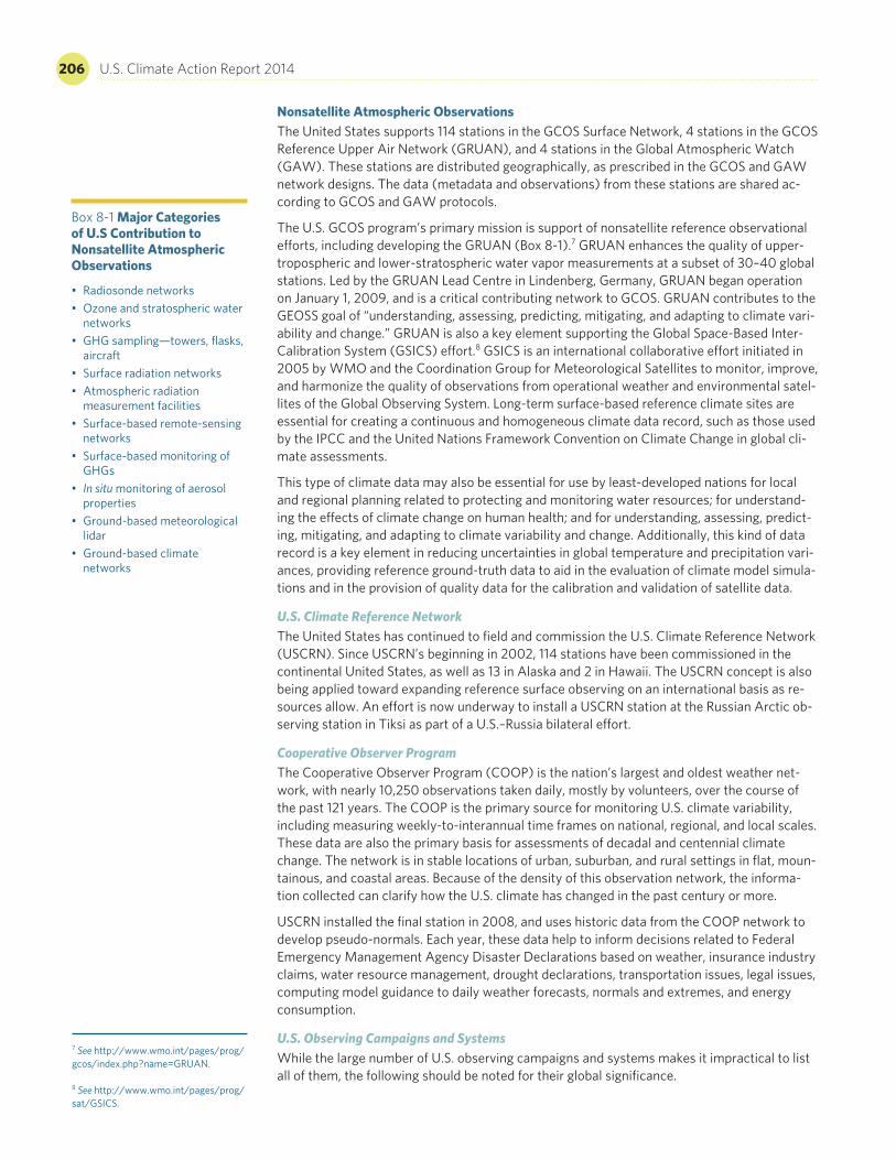
Nonsatellite Atmospheric ObservationsThe United States supports 114 stations in the GCOS Surface Network, 4 stations in the GCOS Reference Upper Air Network (GRUAN), and 4 stations in the Global Atmospheric Watch (GAW). These stations are distributed geographically, as prescribed in the GCOS and GAW network designs. The data (metadata and observations) from these stations are shared ac-cording to GCOS and GAW protocols.
The U.S. GCOS program’s primary mission is support of nonsatellite reference observational efforts, including developing the GRUAN (Box 8-1).7 GRUAN enhances the quality of upper-tropospheric and lower-stratospheric water vapor measurements at a subset of 30–40 global stations. Led by the GRUAN Lead Centre in Lindenberg, Germany, GRUAN began operation on January 1, 2009, and is a critical contributing network to GCOS. GRUAN contributes to the GEOSS goal of “understanding, assessing, predicting, mitigating, and adapting to climate vari-ability and change.” GRUAN is also a key element supporting the Global Space-Based Inter-Calibration System (GSICS) effort.8 GSICS is an international collaborative effort initiated in 2005 by WMO and the Coordination Group for Meteorological Satellites to monitor, improve, and harmonize the quality of observations from operational weather and environmental satel-lites of the Global Observing System. Long-term surface-based reference climate sites are essential for creating a continuous and homogeneous climate data record, such as those used by the IPCC and the United Nations Framework Convention on Climate Change in global cli-mate assessments.
This type of climate data may also be essential for use by least-developed nations for local and regional planning related to protecting and monitoring water resources; for understand-ing the effects of climate change on human health; and for understanding, assessing, predict-ing, mitigating, and adapting to climate variability and change. Additionally, this kind of data record is a key element in reducing uncertainties in global temperature and precipitation vari-ances, providing reference ground-truth data to aid in the evaluation of climate model simula-tions and in the provision of quality data for the calibration and validation of satellite data.
U.S. Climate Reference Network The United States has continued to field and commission the U.S. Climate Reference Network (USCRN). Since USCRN’s beginning in 2002, 114 stations have been commissioned in the continental United States, as well as 13 in Alaska and 2 in Hawaii. The USCRN concept is also being applied toward expanding reference surface observing on an international basis as re-sources allow. An effort is now underway to install a USCRN station at the Russian Arctic ob-serving station in Tiksi as part of a U.S.–Russia bilateral effort.
Cooperative Observer Program The Cooperative Observer Program (COOP) is the nation’s largest and oldest weather net-work, with nearly 10,250 observations taken daily, mostly by volunteers, over the course of the past 121 years. The COOP is the primary source for monitoring U.S. climate variability, including measuring weekly-to-interannual time frames on national, regional, and local scales. These data are also the primary basis for assessments of decadal and centennial climate change. The network is in stable locations of urban, suburban, and rural settings in flat, moun-tainous, and coastal areas. Because of the density of this observation network, the informa-tion collected can clarify how the U.S. climate has changed in the past century or more.
USCRN installed the final station in 2008, and uses historic data from the COOP network to develop pseudo-normals. Each year, these data help to inform decisions related to Federal Emergency Management Agency Disaster Declarations based on weather, insurance industry claims, water resource management, drought declarations, transportation issues, legal issues, computing model guidance to daily weather forecasts, normals and extremes, and energy consumption.
U.S. Observing Campaigns and Systems While the large number of U.S. observing campaigns and systems makes it impractical to list all of them, the following should be noted for their global significance.
Box 8-1 Major Categories of U.S Contribution to Nonsatellite Atmospheric Observations
• Radiosonde networks• Ozone and stratospheric water
networks• GHG sampling—towers, flasks,
aircraft• Surface radiation networks• Atmospheric radiation
measurement facilities• Surface-based remote-sensing
networks• Surface-based monitoring of
GHGs• In situ monitoring of aerosol
properties• Ground-based meteorological
lidar• Ground-based climate
networks
7 See http://www.wmo.int/pages/prog/gcos/index.php?name=GRUAN. 8 See http://www.wmo.int/pages/prog/sat/GSICS.
Chapter 8 Research and Systematic Observations 207
The Atmospheric Radiation Measurement (ARM) Climate Research Facility (ACRF) and Mobile Facilities (AMFs)9—The ACRF and AMFs are scientific user capabilities for obtaining continu-ous, long-term measurements of radiative fluxes, cloud and aerosol properties, and related atmospheric characteristics in focused clusters of instruments in diverse climate regimes for critical process-oriented studies. Operating for more than 20 years, the ARM program para-digm of long-term, continuous measurements is essential to the evaluation and enhancement of climate models that must simulate the evolution of atmospheric properties for long con-tinuous periods, from decades to centuries. The two AMFs, which include aerial measure-ments that complement the ground-based measurements, expand the geographic coverage of the ACRF through deployments in major field campaigns, such as the Ganges Valley Aerosol Experiment, the ARM Madden-Julian Oscillation Experiment, the Arctic Observing eXperiment, and GOAMAZON 2014.
The AErosol RObotic NETwork10—AERONET is a federation of ground-based remote-sensing aerosol networks established in part by NASA and France’s Centre National de la Recherche Scientifique. AERONET provides a long-term, continuous, and readily accessible public do-main database of aerosol optical properties for research and characterization of aerosols; vali-dates satellite retrievals; and provides synergy with other databases.
Advanced Global Atmospheric Gases Experiment (AGAGE)11 and NOAA’s Carbon Cycle Greenhouse Gases Group Cooperative Global Air Sampling Network12—The collaborative effort between NASA’s AGAGE program and NOAA’s flask monitoring network has been instru-mental in measuring the composition of the global atmosphere continuously since 1978. AGAGE is distinguished by its capability to measure globally and at high frequency most of the important gases in the Montreal Protocol and almost all of the significant non-CO2 gases in the Kyoto Protocol.
Micro-Pulse Lidar Network13—The NASA MPLNET is a federated network of micro-pulse light-detection and ranging (MPL lidar) systems designed to measure aerosol and cloud vertical struc-ture continuously, day and night, over the long time periods required to contribute to climate change studies and provide ground validation for models and satellite sensors in the NASA Earth Observing System. At present, there are 18 active sites worldwide. Numerous temporary sites have also been deployed in support of field campaigns. Most MPLNET sites are co-located with AERONET sites to provide both column and vertically resolved aerosol and cloud data.
Surface Radiation Budget Network14—SURFRAD was established in 1993 through NOAA to support climate research with accurate, continuous, long-term measurements of the surface radiation budget. Currently, seven SURFRAD stations are operating in climatologically diverse regions across the United States. These sites provide primary measurements of upwelling and downwelling solar and infrared, along with ancillary observations of direct and diffuse solar, photosynthetically active radiation, ultraviolet B radiation, spectral solar, and meteorological parameters. SURFRAD is an important contribution to the worldwide GCOS Baseline Surface Radiation Network.
Interagency Coordinating Committee for Airborne Geosciences Research and Applications15—ICCAGRA is a collaboration of U.S. government agencies (NASA, NOAA, NSF, DOE, the U.S. Department of Defense [DoD], and USGS). Its primary purpose is to increase the effective utilization of the federal airborne fleet in support of airborne geoscience research and applica-tions programs conducted by the individual agencies. ICCAGRA improves cooperation, fos-ters awareness, and facilitates communication among U.S. government agencies having or using aircraft and instruments for airborne research and applications, and serves as a re-source to senior-level managers on airborne geoscience issues. ICCAGRA members operate and manage more than 25 aircraft across the country, including unmanned aircraft systems.
Nonsatellite Ocean ObservationGlobal Ocean Observing System The United States currently provides satellite, buoy, glider, and ship coverage of the global oceans for sea-surface temperatures, surface elevation, ocean-surface vector winds, sea ice,
9 See http://www.arm.gov/. 10 See http://gcmd.nasa.gov/records/GCMD_AERONET_NASA.html. 11 See http://agage.eas.gatech.edu/. 12 See http://www.esrl.noaa.gov/gmd/ccgg/flask.html. 13 See http://www.ndsc.ncep.noaa.gov/coop/mplnet/. 14 See http://www.esrl.noaa.gov/gmd/grad/surfrad/. 15 See http://www.nsf.gov/geo/ags/ulafos/laof/iccagra.jsp.

208 U.S. Climate Action Report 2014
ocean color, and other climate variables (Box 8-2). These observations provide foundational support for the Global Ocean Observing System (GOOS) and other international efforts. The climate requirements of GOOS are the same as those for GCOS; like GCOS, GOOS is based on a number of nonsatellite and space-based observing components.
Completed in September 2005, the first element of the climate portion of GOOS is the global drifting buoy array, which is a network of 1,250 drifting buoys measuring sea-surface tem-perature and other variables as they flow in the ocean currents. At present, the United States is the world leader in implementing the nonsatellite elements of GOOS for climate, and spon-sors the majority of the U.S. Integrated Ocean Observing System (IOOS) global component, which is the U.S. contribution to the international GOOS program and the GEOSS ocean base-line. Specifically, the United States sponsors nearly half of the platforms currently deployed in the global ocean (3,860 of 7,723), with 72 other countries providing the remainder.
Integrated Ocean Observing System IOOS16 is the U.S. coastal observing component of GOOS, envisioned as a coordinated na-tional and international network of observations, data management, and analyses that sys-tematically acquires and disseminates data and information on past, present, and future states of the oceans. A coordinated IOOS effort is being established by NOAA via a national IOOS Program Office. The IOOS observing subsystem employs both remote and nonsatellite sensing, including satellite-, aircraft- and land-based sensors; ships; buoys; and gliders. The United States supports IOOS’s surface and marine observations through a variety of compo-nents, including fixed and surface-drifting buoys, subsurface floats, and volunteer observing ships. Expanding in coverage, currently 60 percent of the initial GOOS design is complete.
U.S.-Funded Ocean Observing Systems While the large number of U.S.-funded ocean observing systems makes it impractical to list all of them, the following systems have global significance.
Argo17—In 1998, an international consortium presented plans for Argo, a global array of 3,000 autonomous instruments that would revolutionize the collection of critical, climate-relevant information from the upper 2 kilometers (1.2 miles) of the world’s oceans. These instruments drift at depth, periodically rising to the sea surface, collecting data along the way, and report their observations in real time via satellite communications.
The initial deployment objective of 3,000 instruments distributed homogeneously throughout the world’s oceans has been attained, and Argo now provides more than 100,000 high-quality temperature and salinity profiles annually, along with global-scale velocity data, all without a seasonal bias. The Argo array has been deployed through the collaboration of more than 40 countries plus the European Union. Argo data are openly and immediately available to anyone wishing to use them.
Argo data, coupled with global-scale satellite measurements from radar altimeters, have made possible significant advances in the representation of the oceans in coupled ocean-atmosphere models for climate forecasts and the routine analysis and forecasting of the state of the subsur-face ocean. Going forward, the United States has committed to maintaining half of the array, and other contributing nations are striving to continue the array’s strong international nature.
Ocean Observatories Initiative18—Construction is now underway on the OOI, a significant new effort funded by NSF. The OOI is planned as a networked infrastructure of sensor systems to measure the physical, chemical, geological, and biological variables in the ocean and seafloor, with the goal of improving detection and forecasting of environmental change and its effects on biodiversity, coastal ecosystems, and climate. Ultimately, the OOI will be one fully inte-grated system, collecting data on coastal, regional, and global scales employing advanced ocean research and sensor tools, including buoys and remotely operated and autonomous vehicles—all linked via telecommunications cables and satellites directly to laboratories. With these advances, the OOI will improve the rate and scale of ocean data collection, and its net-worked observatories will focus on global, regional, and coastal science questions, and pro-vide platforms to support new types of instruments and autonomous vehicles.
16 See http://www.ioos.noaa.gov/. 17 See http://www.argo.net/. 18 See http://www.oceanobservatories.org/.
Box 8-2 Major Categories of U.S. Contribution to Nonsatellite Ocean Observations
• Moored and floating buoy networks
• Argo floats and gliders • Research and volunteer ships • Tide gauge networks
Chapter 8 Research and Systematic Observations 209
Global Sea Level Observing System19—Continued upgrading of the GLOSS tidal gauge network from 43 to 170 stations is planned for the period 2006–2010. Ocean carbon inventory surveys in 10-year repeat survey cycles help determine the anthropogenic intake of carbon into the oceans.
Tropical–Atmosphere–Ocean Network20—The TAO network of ocean buoys includes an ex-pansion of the network into the Indian Ocean. (The Pacific Ocean has a current array of 70 TAO buoys.) From 2005 to 2007, 8 new TAO buoys were installed in the Indian Ocean in collaboration with partners from India, Indonesia, and France. Plans call for a total of 38 TAO buoys in the Indian Ocean by 2013.
Research Moored Array for African-Asian-Australian Monsoon Analysis and Prediction21—The RAMA network is a multinationally supported element of the Indian Ocean Observing System, a combination of complementary satellite and nonsatellite measurement platforms for climate research and forecasting purposes. NASA is currently investing in the development of new prototype geodetic instruments for deployment later this decade to support the creation of a next-generation geodetic network for the improvement of the terrestrial reference frame.
Voluntary Observing Ship Climate Program22—Voluntary ship observations have been the backbone of the ocean observing system for centuries. Volunteer crew members around the world observe the weather at their location, encode each observation in a standard format, and transmit the data to national meteorological services that have responsibility for marine weather forecasts. In addition, these data are archived for future use by climatologists and other scientists. The U.S. VOS Program within the overall WMO VOS framework services about one-quarter of the world’s VOS fleet, providing ships’ crews with weather observer training, handbooks and forms, observation encoding software, barometer calibration, the Mariners Weather Log, and weather-observing tools. A subprogram within VOS is VOSClim, an ongoing, NOAA-supported program within the WMO Joint Technical Commission for Oceanography and Marine Meteorology’s Voluntary Observing Ships’ Scheme. It aims to pro-vide a high-quality subset of marine meteorological data, with extensive associated metadata, to be available in both real-time and delayed modes to support global climate studies.
University-National Oceanographic Laboratory System23—UNOLS is an organization of 62 aca-demic institutions and national laboratories involved in oceanographic research and joined for the purpose of coordinating oceanographic ships’ schedules and research facilities. A major aim of UNOLS is to ensure the efficient scheduling of scientific cruises aboard the 21 research vessels located at 16 U.S. operating institutions (and numerous partner institutions) in the UNOLS organization.
Nonsatellite Terrestrial and Cryospheric Observations
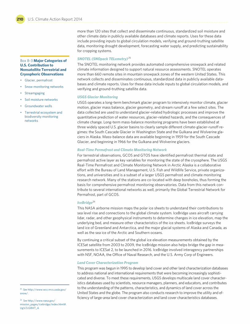
Many of the most critical variables for long-term monitoring and process-level understanding of the rate and magnitude of climate change and its impacts involve in situ observations of terrestrial and cryospheric variables, such as soil moisture, streamflow, permafrost, glaciers, and terrestrial ecosystems (Box 8-3). Following are some major U.S. terrestrial observation programs.
National Streamgage and Groundwater NetworksStreamflow is one of the most important variables for both long-term monitoring of the im-pacts of climate change and real-time decision making about water availability and quality. USGS has been measuring flow in U.S. rivers and streams since 1889. In partnership with more than 850 other federal, state, and local agencies, USGS maintains a comprehensive U.S. streamgage network of consistent measurements, obtained using standard techniques and technology subject to the same quality assurance and quality control. In addition, USGS annu-ally monitors groundwater levels in thousands of U.S. wells, and collects and stores the data either as discrete field-water-level measurements or as continuous time-series data from au-tomated recorders. The overall USGS groundwater database consists of more than 850,000 records of wells, springs, test holes, tunnels, drains, and excavations in the United States.
SCAN (Soil Climate Analysis Network) 24 The SCAN monitoring network provides automated comprehensive soil moisture and related climate information designed to support natural resource assessments. SCAN consists of
19 See http://www.gloss-sealevel.org/. 20 See http://www.pmel.noaa.gov/tao/. 21 See http://www.pmel.noaa.gov/tao/rama/. 22 See http://www.vos.noaa.gov/. 23 See http://www.unols.org/. 24 See http://www.wcc.nrcs.usda.gov/scan/.
210 U.S. Climate Action Report 2014
more than 120 sites that collect and disseminate continuous, standardized soil moisture and other climate data in publicly available databases and climate reports. Uses for these data include providing inputs to global circulation models, verifying and ground-truthing satellite data, monitoring drought development, forecasting water supply, and predicting sustainability for cropping systems.
SNOTEL (SNOpack TELemetry) 25 The SNOTEL monitoring network provides automated comprehensive snowpack and related climate information designed to support natural resource assessments. SNOTEL operates more than 660 remote sites in mountain snowpack zones of the western United States. This network collects and disseminates continuous, standardized data in publicly available data-bases and climate reports. Uses for these data include inputs to global circulation models, and verifying and ground-truthing satellite data.
USGS Glacier MonitoringUSGS operates a long-term benchmark glacier program to intensively monitor climate, glacier motion, glacier mass balance, glacier geometry, and stream runoff at a few select sites. The data collected are used to understand glacier-related hydrologic processes and improve the quantitative prediction of water resources, glacier-related hazards, and the consequences of climate change. Long-term mass-balance monitoring programs have been established at three widely spaced U.S. glacier basins to clearly sample different climate-glacier-runoff re-gimes: the South Cascade Glacier in Washington State and the Gulkana and Wolverine gla-ciers in Alaska. Mass-balance data are available beginning in 1959 for the South Cascade Glacier, and beginning in 1966 for the Gulkana and Wolverine glaciers.
Real-Time Permafrost and Climate Monitoring NetworkFor terrestrial observations, GCOS and GTOS have identified permafrost thermal state and permafrost active layer as key variables for monitoring the state of the cryosphere. The USGS Real-Time Permafrost and Climate Monitoring Network in Arctic Alaska is a collaborative effort with the Bureau of Land Management, U.S. Fish and Wildlife Service, private organiza-tions, and universities and is a subset of a larger USGS permafrost and climate monitoring research network. Many of the stations are co-located with deep boreholes, thus forming the basis for comprehensive permafrost monitoring observatories. Data from this network con-tribute to several international networks as well, primarily the Global Terrestrial Network for Permafrost, part of GCOS.
IceBridge26
This NASA airborne mission maps the polar ice sheets to understand their contributions to sea level rise and connections to the global climate system. IceBridge uses aircraft carrying lidar, radar, and other geophysical instruments to determine changes in ice elevation, map the underlying bed, and measure other characteristics of the ice sheets. IceBridge surveys the land ice of Greenland and Antarctica, and the major glacial systems of Alaska and Canada, as well as the sea ice of the Arctic and Southern oceans.
By continuing a critical subset of the global ice elevation measurements obtained by the ICESat satellite from 2003 to 2009, the IceBridge mission also helps bridge the gap in mea-surements to ICESat 2, to be launched in 2016. IceBridge involved interagency partnerships with NSF, NOAA, the Office of Naval Research, and the U.S. Army Corp of Engineers.
Land Cover Characterization Program This program was begun in 1995 to develop land cover and other land characterization databases to address national and international requirements that were becoming increasingly sophisti-cated and diverse. To meet these requirements, USGS develops multiscale land cover character-istics databases used by scientists, resource managers, planners, and educators, and contributes to the understanding of the patterns, characteristics, and dynamics of land cover across the United States and the globe. The program also conducts research to improve the utility and ef-ficiency of large-area land cover characterization and land cover characteristics databases.
25 See http://www.wcc.nrcs.usda.gov/snow/. 26 See http://www.nasa.gov/mission_pages/icebridge/index.html#.UgVZcGRAT_4.
Box 8-3 Major Categories of U.S. Contribution to Nonsatellite Terrestrial and Cryospheric Observations • Glacier, permafrost
• Snow monitoring networks
• Streamgaging
• Soil moisture networks
• Groundwater wells
• Terrestrial ecosystem and biodiversity monitoring networks
Chapter 8 Research and Systematic Observations 211
AmeriFLUX Network27 This network endeavors to establish an infrastructure for guiding, collecting, synthesizing, and disseminating long-term measurements of CO2, water, and energy exchange from a variety of ecosystems. Its objectives are to collect critical new information to help define the current global CO2 budget, to enable improved projections of future concentrations of atmospheric CO2, and to enhance the understanding of carbon fluxes, net ecosystem production, and car-bon sequestration in the terrestrial biosphere.
North American Carbon Program28 A major focus of USGCRP and the U.S. Carbon Cycle Science Program, NACP is a multidisci-plinary research program established to obtain scientific understanding of North America’s carbon sources and sinks, and changes in carbon stocks. NACP is supported by a number of federal agencies through a variety of intramural and extramural funding mechanisms and award instruments.
NACP relies upon a rich and diverse array of existing observational networks, monitoring sites, and experimental field studies in North America and its adjacent oceans to determine the emissions and uptake of CO2, methane (CH4), and carbon monoxide (CO); the changes in carbon stocks; and the factors regulating these processes for North America and adjacent ocean basins. NACP also aims to develop the scientific basis to implement full carbon ac-counting on regional and continental scales. This is the knowledge base needed to design monitoring programs for natural and managed CO2 sinks and emissions of CH4; to support long-term quantitative measurements of fluxes, sources, and sinks of atmospheric CO2 and CH4; and to develop forecasts for future trends.
USGS LandCarbon Project29
USGS has initiated the LandCarbon project, a national assessment of ecosystem carbon se-questration and GHG fluxes. This assessment focuses on carbon stored in the U.S. land sur-face, by region, with model-based projections of future carbon storage in the U.S. land surface by region and by land cover type. Assessments for the western and central United States have been published, the eastern U.S. assessment will be published in late 2013, and assessments for Alaska and Hawaii are under development.
National Ecological Observatory Network30 NEON is a planned continental-scale research platform for discovering and understanding the impacts of climate change, land-use change, and invasive species on ecology, natural resourc-es, and biodiversity. NEON is expected to serve as a U.S. terrestrial contribution to GEOSS. Data are planned to be collected from 106 sites (60 terrestrial, 36 aquatic, and 10 aquatic experimental) across the United States (including Alaska, Hawaii, and Puerto Rico), using instrument measurements and field sampling. The sites have been strategically selected to represent different regions of vegetation, landforms, climate, and ecosystem performance. NEON will combine site-based data with remotely sensed data and other large-scale data sets to provide a range of data products that can be used to describe changes in the nation’s ecosystems through space and time, linked by advanced cyber infrastructure to record and archive ecological data for at least 30 years.
NEON has successfully completed the planning and design phases, and has entered the con-struction and deployment phase. Constructing the entire network will take approximately five years, so NEON expects to be in full operation by approximately 2017.
Long-Term Ecological Research Program31 NSF has supported the LTER program for three decades, with 26 projects currently existing, including two urban sites in Phoenix, Arizona, and Baltimore, Maryland. Over this time, the U.S. Forest Service (USFS) has collaborated in supporting seven of the LTER sites, including the Baltimore Ecosystem Study site.
Recent strategic planning by the LTER community has highlighted the need for greater inte-gration of the social and ecological sciences across the LTER network, as evidenced in its decadal plan and the strategic research initiative titled Integrative Science for Society and the
27 See http://ameriflux.lbl.gov/SitePages/Home.aspx. 28 See http://www.nacarbon.org/. 29 See http://www.usgs.gov/climate_landuse/land_carbon/. 30 See http://www.neoninc.org/. 31 See http://www.lternet.edu/.
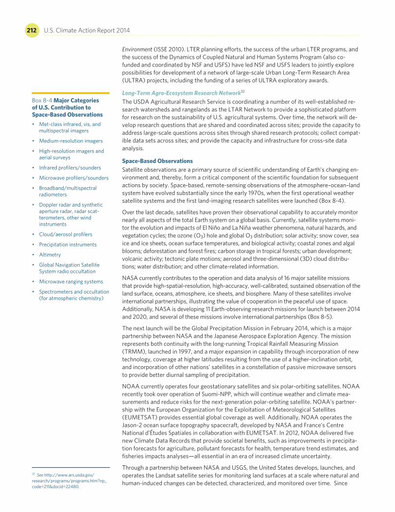
212 U.S. Climate Action Report 2014
Environment (ISSE 2010). LTER planning efforts, the success of the urban LTER programs, and the success of the Dynamics of Coupled Natural and Human Systems Program (also co- funded and coordinated by NSF and USFS) have led NSF and USFS leaders to jointly explore possibilities for development of a network of large-scale Urban Long-Term Research Area (ULTRA) projects, including the funding of a series of ULTRA exploratory awards.
Long-Term Agro-Ecosystem Research Network32 The USDA Agricultural Research Service is coordinating a number of its well-established re-search watersheds and rangelands as the LTAR Network to provide a sophisticated platform for research on the sustainability of U.S. agricultural systems. Over time, the network will de-velop research questions that are shared and coordinated across sites; provide the capacity to address large-scale questions across sites through shared research protocols; collect compat-ible data sets across sites; and provide the capacity and infrastructure for cross-site data analysis.
Space-Based ObservationsSatellite observations are a primary source of scientific understanding of Earth’s changing en-vironment and, thereby, form a critical component of the scientific foundation for subsequent actions by society. Space-based, remote-sensing observations of the atmosphere–ocean–land system have evolved substantially since the early 1970s, when the first operational weather satellite systems and the first land-imaging research satellites were launched (Box 8-4).
Over the last decade, satellites have proven their observational capability to accurately monitor nearly all aspects of the total Earth system on a global basis. Currently, satellite systems moni-tor the evolution and impacts of El Niño and La Niña weather phenomena, natural hazards, and vegetation cycles; the ozone (O3) hole and global O3 distribution; solar activity; snow cover, sea ice and ice sheets, ocean surface temperatures, and biological activity; coastal zones and algal blooms; deforestation and forest fires; carbon storage in tropical forests; urban development; volcanic activity; tectonic plate motions; aerosol and three-dimensional (3D) cloud distribu-tions; water distribution; and other climate-related information.
NASA currently contributes to the operation and data analysis of 16 major satellite missions that provide high-spatial-resolution, high-accuracy, well-calibrated, sustained observation of the land surface, oceans, atmosphere, ice sheets, and biosphere. Many of these satellites involve international partnerships, illustrating the value of cooperation in the peaceful use of space. Additionally, NASA is developing 11 Earth-observing research missions for launch between 2014 and 2020, and several of these missions involve international partnerships (Box 8-5).
The next launch will be the Global Precipitation Mission in February 2014, which is a major partnership between NASA and the Japanese Aerospace Exploration Agency. The mission represents both continuity with the long-running Tropical Rainfall Measuring Mission (TRMM), launched in 1997, and a major expansion in capability through incorporation of new technology, coverage at higher latitudes resulting from the use of a higher-inclination orbit, and incorporation of other nations’ satellites in a constellation of passive microwave sensors to provide better diurnal sampling of precipitation.
NOAA currently operates four geostationary satellites and six polar-orbiting satellites. NOAA recently took over operation of Suomi-NPP, which will continue weather and climate mea-surements and reduce risks for the next-generation polar-orbiting satellite. NOAA’s partner-ship with the European Organization for the Exploitation of Meteorological Satellites (EUMETSAT) provides essential global coverage as well. Additionally, NOAA operates the Jason-2 ocean surface topography spacecraft, developed by NASA and France’s Centre National d’Études Spatiales in collaboration with EUMETSAT. In 2012, NOAA delivered five new Climate Data Records that provide societal benefits, such as improvements in precipita-tion forecasts for agriculture, pollutant forecasts for health, temperature trend estimates, and fisheries impacts analyses—all essential in an era of increased climate uncertainty.
Through a partnership between NASA and USGS, the United States develops, launches, and operates the Landsat satellite series for monitoring land surfaces at a scale where natural and human-induced changes can be detected, characterized, and monitored over time. Since
Box 8-4 Major Categories of U.S. Contribution to Space-Based Observations • Met-class infrared, vis, and
multispectral imagers
• Medium-resolution imagers
• High-resolution imagers and aerial surveys
• Infrared profilers/sounders
• Microwave profilers/sounders
• Broadband/multispectral radiometers
• Doppler radar and synthetic aperture radar, radar scat-terometers, other wind instruments
• Cloud/aerosol profilers
• Precipitation instruments
• Altimetry
• Global Navigation Satellite System radio occultation
• Microwave ranging systems
• Spectrometers and occultation (for atmospheric chemistry)
32 See http://www.ars.usda.gov/research/programs/programs.htm?np_code=211&docid=22480.
Chapter 8 Research and Systematic Observations 213
1972, Landsat satellites have consistently captured moderate-resolution (e.g., 30-meter [98-foot]) data of the Earth. This archive of data has become vital for agriculture and water man-agement, disaster response, forest carbon monitoring, and monitoring incremental effects of climate change. A cost-free and open-data policy, combined with consolidation of the Landsat Global Archive, provides current, repeatable, and historical access to more than 40 years of terrestrial land cover change.
With the successful launch of the Landsat Data Continuity Mission, which was renamed Landsat 8 once it became operational at the end of May 2013, scientists throughout the world can now make direct comparisons with the past, while taking advantage of significant ad-vancements incorporated in the mission, including additional bands to improve atmospheric corrections to the data and higher quantization of the entire data stream to enable detection of more subtle changes.
U.S. satellite observing activities contribute significantly to several international observing systems, principally sponsored by elements of the United Nations, such as WMO, IOC, and FAO. In particular, the United States continues to work with GCOS, whose goal is to provide a comprehensive view of the total climate system. GCOS partners include NOAA and NASA, as well as three international groups strongly supported and led by the United States: GEO, CEOS, and the Coordination Group for Meteorological Satellites. GCOS constitutes the climate-observing component of GEOSS. A number of U.S. satellite operational and research missions form the basis of a robust national remote-sensing program that seeks to fully sup-port the requirements of GCOS.
The United States continues to demonstrate the immense value of satellites for observing the changing global climate and for developing new fundamental knowledge of the global inte-grated Earth system. Satellite observations and the increased scientific understanding they enable can improve international security, enhance economic prosperity, mitigate impacts of short-term and climate-related hazards, and strengthen global stewardship of the environ-ment. The U.S. policy is to maximize timely, full, and open access to data from its civil satel-lites and to disseminate tools and knowledge to use this information.
Suomi National Polar-orbiting Partnership33
In October 2011, NASA and NOAA launched the Suomi NPP satellite, with a mission to ac-quire a wide range of land, ocean, and atmospheric measurements. The 2,100-kilogram (4,600-pound) spacecraft carries five key instruments: the Advanced Technology Microwave Sounder, the Cross-track Infrared Sounder (CrIS), the Ozone Mapping and Profiler Suite, the Visible Infrared Imaging Radiometer Suite, and Clouds and the Earth’s Radiant Energy System. The NPP mission is a bridge between NASA’s Earth Observing System (EOS) satellites and the forthcoming series of Joint Polar Satellite System satellites, and will provide a wide range of data, including atmospheric and sea surface temperatures, land and ocean biological pro-ductivity measurements, cloud and aerosol property information, ozone measurements, and information about fluxes in Earth’s radiation budget.
Landsat Data Continuity Mission/Landsat-834 NASA launched its LDCM successfully on February 11, 2013. Following on-orbit testing, NASA turned its satellite operations over to USGS on May 30, 2013, when the mission officially became Landsat 8. Landsat data offer the longest continuous record of satellite observations of Earth’s land surface at scales for detecting, characterizing, and monitoring natural and human-induced changes on the landscape. The Landsat satellite series has provided imagery of Earth’s surface for more than 40 years, providing the most consistent, reliable documenta-tion of global land surface change ever assembled.
Thousands of Landsat images are downloaded every day from the USGS archive. Government, commercial, industrial, civilian, military, and educational communities throughout the United States and worldwide rely on Landsat for a wide range of applications in such areas as global change research, agriculture, forestry, geology, resource management, geography, mapping, water quality, and oceanography. The full USGS archive holds more than four million Landsat scenes obtained continuously from July 1972 to the present day. Since December 2008, when
33 See http://npp.gsfc.nasa.gov/. 34 See http://landsat.usgs.gov/.

214 U.S. Climate Action Report 2014
the images became available free of charge over the Internet, more than 12 million scenes have been downloaded by users in 186 countries and territories.
Jason Altimeter SeriesObservation of global sea level rise through satellite altimetry, in particular the systematic collection of sea level observations gathered first by TOPEX/Poseidon and now by the ongo-ing Jason series of satellite missions, is a critical data stream for understanding global change. These observations suggest that sea level rise is accelerating. In particular, the value of ap-proximately 3.1 millimeters (mm) (0.12 inches [in]) per year from altimeters over the past 15 years is almost twice the estimate of approximately 1.7 mm (0.07 in) per year from tide gaug-es over the past century.
The Jason series is being transitioned as a research endeavor from NASA and the Centre National d’Études Spatiales to NOAA and EUMETSAT, for joint implementation as a sus-tained operational capability. NOAA and EUMETSAT have already assumed responsibility for the ground system and operation of the Jason-2 satellite launched in June 2008. Jason-3, scheduled to launch in 2015, will extend this critical time series of ocean surface topography measurements.
Aquarius35 NASA’s Aquarius mission was launched in 2011 in partnership with the Space Agency of Argentina (Comision Nacional de Actividades Espaciales). Aquarius is the first satellite mis-sion specifically focused on producing global observations of sea surface salinity. It delivers monthly salinity maps with an estimated accuracy of 0.2 practical salinity units, equivalent to detecting a single “pinch” of salt (about half a milliliter, or 1/8th of a teaspoon) in nearly 4 liters (1 gallon) of water.
In the fall of 2012, Aquarius measurements were complemented by the SPURS field campaign to closely monitor the saltiest region of Earth’s oceans—the subtropical North Atlantic gyre—to provide a 3D view of processes that drive changes in salinity distribution. NASA, NSF, NOAA, and European partner agencies have been deploying instruments on floats, ships, moored buoys, underwater gliders, and an autonomous underwater vehicle to capture this detailed view of ocean processes.
The Gravity Recovery and Climate Experiment36 The twin GRACE satellites celebrated their eleventh anniversary in orbit in March 2013. This milestone exceeded by six years a successful primary mission that demonstrated a new para-digm—the spaceborne measurement of high-resolution gravity fields with sufficient accuracy to resolve the transport of mass within the Earth system.
In conjunction with other data and models, the GRACE mission provides the first global and re-gional measurements of monthly to interannual changes in terrestrial water storage, polar ice cap and glacial ice masses, earthquake-induced crustal deformation, and variations in ocean mass and circulation. The GRACE mission also carries a NASA global positioning system (GPS) occultation receiver to measure atmospheric and ionospheric dynamics for weather and climate studies. The mission is a collaboration with the German space agency DLR (Deutsches Zentrum für Luft- und Raumfahrt) and numerous partnering international scientific institutions.
Constellation Observing System for Meteorology, Ionosphere, and Climate37
COSMIC, a system of six microsatellites launched jointly by the United States and Taiwan in 2006, uses GPS radio receivers to measure the bending of GPS signals (GPS occultation) by Earth’s atmosphere. The atmospheric refractivity measurements are used to estimate atmo-spheric temperature and humidity with unprecedented accuracy for both weather forecasting and climate studies.
GPS occultation data have improved the accuracy of long-range weather forecasts, and have become an important data source for the operational weather services. The GPS data and a sounder instrument are also used to measure ionospheric structure for communications and space weather studies.
35 See http://www.nasa.gov/mission_pages/aquarius/main/index.html#.UgVarGRAT_4. 36 See http://www.nasa.gov/mission_pages/Grace/index.html#.UgVa1WRAT_4. 37 See http://www.cosmic.ucar.edu/.
Chapter 8 Research and Systematic Observations 215
The COSMIC GPS occultation receivers were designed by NASA, and the ionospheric sounder was designed by the U.S. Naval Research Laboratory. Operations and analysis of the COSMIC data are a partnership between the Taiwanese Space Agency and the University Corporation for Atmospheric Research. Domestic funding for COSMIC is coordinated by NSF, and the pro-gram also receives co-funding from NOAA, NASA, the U.S. Air Force, and the U.S. Navy.
Polar Operational Environmental Satellite System38
Since 1979, the NOAA POES system has provided the nation with the longest time series of essential climate variables (ECVs), including atmospheric temperature, water vapor, clouds, ozone, vegetation, and sea and land surface temperature.
Geostationary Operational Environmental Satellite System39
Since the 1980s, GOES has provided essential information on the diurnal cycle of clouds, and has been used as a key data set for the International Satellite Cloud Climatology Project. GOES has also been used to study the diurnal cycle of sea surface temperature.
Aqua40 Aqua is part of the “Afternoon Train” (A-Train) constellation, a key Sun-synchronous satellite formation that studies the atmosphere and consists of five satellites flying in close proximity to each other—Aqua, Aura, CALIPSO,41 CloudSat, and now the Japanese GCOM-W1. The French mission PARASOL42 exited the A-Train after five years of concurrent operations in the constellation.
Aqua is designed to acquire precise measurements that provide a greater understanding of the Earth’s atmosphere and oceans. Operational agencies around the world are also using Aqua data to improve weather prediction. The six Aqua instruments were carefully selected to make measurements for the improved characterization and understanding of atmospheric temperature and humidity profiles, clouds, global precipitation, and Earth’s thermal radiation balance; terrestrial snow and sea ice; sea surface temperature and ocean productivity; and soil moisture.
Global thermal sounder retrievals from the Atmospheric InfraRed Sounder (AIRS) instrument on Aqua help to increase understanding of the distribution and transport mechanisms of CO, CH4, and CO2 in the middle troposphere. NOAA has incorporated the lessons learned from AIRS into operational carbon products from the EUMETSAT Infrared Atmospheric Sounding Interferometer (IASI), which launched aboard the MetOp-A satellite in 2006.
NOAA is planning to continue these products with CrIS aboard Suomi-NPP. The IASI and CrIS missions will allow the creation of a 20-year record of satellite thermal sounder-derived car-bon trace gases, along with self-consistent ozone, temperature, moisture, and cloud informa-tion. The Moderate Resolution Imaging Spectroradiometer (MODIS) instrument provides regional-to-global land cover, sea surface temperature, ocean color, clouds, and aerosols. Data from the A-Train instruments help answer important questions related to aerosols, clouds, and atmospheric processes.
Aura43 The NASA Aura satellite, also part of the A-Train, was launched with four instruments to ex-tensively monitor the composition of the atmosphere. The Microwave Limb Sounder obtains highly resolved altitude profiles of the stratosphere and upper troposphere for understanding photochemical and dynamical processes in these altitude ranges. The Tropospheric Emission Spectrometer obtains column and partial altitude profiles for ozone and tropospheric trace gases, while the Ozone Monitoring Instrument obtains nearly daily global ozone column maps, as well as columns for other important air quality parameters.
CALIPSO44 and CloudSat45 NASA’s highly complementary CALIPSO and CloudSat satellites provide unprecedented infor-mation on the vertical profile of clouds, cloud liquid water, and aerosol particles over the globe, leading to improved 3D perspectives of how clouds and aerosols form, evolve, and affect weather and climate. Both satellites have been flying in formation as part of the NASA A-Train
38 See http://poes.gsfc.nasa.gov/. 39 See http://www.goes.noaa.gov/. 40 See http://aqua.nasa.gov/. 41 Cloud-Aerosol Lidar and Infrared Pathfinder Satellite Observation. 42 Polarization and Anisotropy of Reflectances for Atmospheric Science coupled with Observations from a Lidar. 43 See http://aura.gsfc.nasa.gov/. 44 See http://www-calipso.larc.nasa.gov/. 45 See http://www.nasa.gov/mission_pages/cloudsat/main/index.html.
216 U.S. Climate Action Report 2014
constellation since their launch in 2006, providing the benefits of near simultaneity, and thus the opportunity for synergistic measurements made with complementary techniques.
Solar Radiation and Climate Experiment46 Launched in 2003, SORCE is equipped with four instruments that measure variations in solar radiation much more accurately than previous measurements and observe some of the spec-tral properties of solar radiation for the first time. These measurements have been a critical part of the long-term record of total solar irradiance observations, which also include those from, for example, the ACRIMSat mission, launched in 1999.
Terra47 Launched in 1999, Terra flies in the morning constellation with the Landsat missions, to com-plement the A-Train constellation. Like Aqua, Terra carries the multidisciplinary MODIS sen-sor. Terra emphasizes observations of terrestrial surface features and carries four additional sensors, all of which continue to operate successfully to provide decade-plus data sets of ter-restrial and oceanic properties, clouds, water vapor, aerosols, and the radiation budget.
Tropical Rainfall Measuring Mission48
Launched in 1997, TRMM carries the innovative Precipitation Radar, contributed by Japan and designed to provide 3D maps of storm structure. The ongoing 15-year data set provides infor-mation on the intensity and distribution of rain.
Quick Scatterometer49 Launched in June 1999, QuikSCAT, remained fully operational until November 2009, when the primary instrument (SeaWinds) antenna stopped rotating due to a mechanical failure of the antenna spin mechanism. During its nominal mission, QuikSCAT was a primary data source for science applications and studies involving climate models; interactions between the atmosphere and ocean; and weather/climate phenomena, such as hurricanes and El Niño.
Although SeaWinds’ radar performance was not affected by the spin mechanism failure, QuikSCAT now tracks an operational data path swath significantly reduced from its original capability. Nevertheless, these data are continuing to provide an accurate and reliable transfer standard for cross-calibration of other ocean vector wind sensors, and for establishing the measurement stability needed for continuity with future scatterometer missions.
Earth Observing-1 50
Launched in 1999, EO-1 validated technologies contributing to future land-imaging missions. The hyperspectral instrument Hyperion is the first of its kind to provide images of land sur-face in more than 220 spectral colors. In the future, an operational version of the Hyperion will allow complex land ecosystems to be imaged and accurately classified.
Data Management and Information SystemsData management is an important aspect of any systematic observing effort. While U.S. agencies have unique mandates for climate-focused and -related systematic observations, and for the attendant data processing, archiving, and use of the important information from these observing systems, it is clear that the climate observations portfolio must be handled in an integrated way. A robust strategy for management of the climate observations portfolio must capture the critical interaction between climate system components, as well as sustain this observations strategy over time.
On May 9, 2013, President Obama signed the Executive Order (E.O.) “Making Open and Machine Readable the New Default for Government Information.”51 The E.O. directed federal agencies to make government-held data more accessible to the public and to entrepreneurs and others, as fuel for innovation and economic growth. Under the terms of the E.O. and a new Open Data Policy released by the White House Office of Management and Budget and Office of Science and Technology Policy,52 the new default for newly generated U.S. govern-ment data is that data will be open and machine readable to enhance accessibility and useful-ness where possible and will be consistent with the law, while continuing to ensure privacy, confidentiality, and national security. As part of this initiative, USGEO is leading an effort to transform federal holdings of environmental observation data to machine-readable formats.
46 See http://lasp.colorado.edu/home/sorce/. 47 See http://www.nasa.gov/mission_pages/terra/index.html#.UgVb_GRAT_4. 48 See http://trmm.gsfc.nasa.gov/. 49 See http://science1.nasa.gov/missions/quikscat/. 50 See http://eo1.gsfc.nasa.gov/. 51 See http://www.whitehouse.gov/the-press-office/2013/05/09/executive-order-making-open-and-machine-readable-new-default-government-. 52 See http://www.whitehouse.gov/open.

Chapter 8 Research and Systematic Observations 217
These efforts complement, and interact with, the Earth systems data aspects of the adminis-tration’s “Big Data” initiative, launched in 2012.53
In addition, U.S. government agencies partner with nongovernmental organizations and the private sector on issues related to information management and systems through the Federation of Earth Science Information Partners (ESIP). Over the past 14 years, this open-networked community has brought together science, Earth system data, and information technology practitioners into an intellectual commons.
ESIP is a broad-based consortium of Earth scientists, representing the entire research spec-trum from data collection, to research, to applications development. ESIP includes distributors of satellite- and ground-based data sets; providers of data and information products, technol-ogy, or services aimed primarily at the Earth science and research communities; commercial and noncommercial organizations engaged in developing tools for Earth science; and strategic funding partners.
Earth Observing System Data and Information System54 NASA’s EOSDIS provides convenient mechanisms for discovering and accessing Earth sci-ence data products, almost all of which are available online at no cost to the user. EOSDIS has an operational search-and-order client, called Reverb, which provides access to all data hold-ings at all the Distributed Active Archive Centers (DAACs). A middleware layer called the EOS ClearingHOuse (ECHO) provides interfaces that allow other user communities to build their own search-and order-clients for EOSDIS data tailored to their needs.
EOSDIS data abide by a NASA Earth Science Data Policy55 that promotes the full and open sharing of all data with the research and applications communities, private industry, aca-demia, and the general public. Ten geographically distributed NASA DAACs, representing a wide range of Earth science disciplines, have the responsibility for archiving and distributing data products. The Science Investigator-led Processing Systems are responsible for process-ing certain standard science data products from instrument data, and the DAACs are respon-sible for their archiving and distribution. The DAACs also provide a full range of user support tailored for the discipline-oriented user communities they serve.
Almost 7,000 distinct data products are archived at and distributed from the DAACs, an ar-chive volume of 7.4 petabytes in aggregate. These institutions are stewards of Earth science mission data until the data are moved to long-term archives. They ensure that data will be easily accessible to users.
Socioeconomic Data and Applications Center56 The recent priority given by USGCRP under its new strategic plan to integration of knowledge and models about both the natural and the human components of the Earth system under-scores the need for access to and integration of relevant natural and social science data. Key in this effort is SEDAC, established more than a decade ago as part of EOSDIS.
SEDAC provides interdisciplinary data resources about human systems and their interactions with the environment, including data on population, urbanization, agriculture, natural hazards, public health, income distribution, infrastructure, climate change effects, natural resource management, and environmental governance. Data products and services are designed to complement remote-sensing data (e.g., by identifying population distribution relative to mea-sures of land cover, air quality, or ice extent). SEDAC also provides spatial data sets, maps, and online mapping tools to promote data access, visualization, and analysis, as well as policy-relevant indicator data sets, including the Natural Resource Management Index, one of the indicators used by the Millennium Challenge Corporation in determining aid allocations. SEDAC is promoting interoperable access to its data products and services through GEOSS.
National Integrated Drought Information System57 With the likelihood of drier, warmer seasons and the possibility of increased frequency, dura-tion, and intensity of droughts in some parts of the country in the future as a result of climate change, society is faced with the challenge of continuing to supply adequate amounts of fresh,
53 See http://www.whitehouse.gov/sites/default/files/microsites/ostp/big_data_press_release_final_2.pdf. 54 See https://earthdata.nasa.gov/. 55 See http://science1.nasa.gov/earth-science/earth-science-data/data-information-policy/. 56 See http://sedac.ciesin.columbia.edu/. 57 See http://www.drought.gov/drought/.
218 U.S. Climate Action Report 2014
clean water to growing populations. This is a particular concern in the arid U.S. Southwest, where the population has nearly doubled over the past 30 years.
Eight USGCRP member agencies are part of a federal consortium that supports NIDIS by pro-viding scientific underpinnings, including new observing and modeling capabilities and prod-ucts. NIDIS provides the best available information to enable users to determine risks associated with drought and provides supporting data and tools to inform drought mitigation. Programs such as NIDIS are crucial input to decision makers who manage scarce natural re-sources, particularly in the face of the large uncertainties about the pace and magnitude of future climate change. NIDIS continues to be a major contributor to GEOSS.
Global Change Information SystemUSGCRP is developing a new, systematic approach to global change information provision. This new approach is in response to the challenge that there is no single point of access for authoritative information on interrelated, multidisciplinary global change issues, such as the coastal impacts of sea level rise, the health costs associated with temperature extremes, and other topics with large user communities. GCIS uses linked data approaches to facilitate the needed aggregation and synthesis. As a first step, GCIS will provide data related to the forth-coming National Climate Assessment, which is scheduled for release in 2014.
Metadata Access Tool for Climate and Health58 Addressing the effects of climate change on human health is especially challenging, because both the surrounding environment and the decisions that people make influence health. In 2012, USGCRP began development of MATCH, an interactive clearinghouse of data sets and tools related to the human health impacts of global climate change. The MATCH project is a pilot data-integration effort that will inform development of the broader GCIS described above. It presents a publicly accessible user search interface for federal data sets, and allows for automated deposition of metadata into Data.gov and other existing federal portals.
Integrated Data and Environmental Applications Center59 NOAA’s IDEA Center helps meet critical regional needs for ocean, climate, and ecosystem information to protect lives and property, support economic development, and enhance the resilience of Pacific Island communities in the face of changing environmental conditions. This activity integrates regional observations, research, assessment, and services, and provides a prototype for a next-generation NOAA data center, as well as strengthens the delivery of ocean, climate, and ecosystem data products and information services to the diverse Pacific Island user community. The IDEA Center supports the emergence of regional ocean- and climate-observing systems and information services that are responsive to the needs of com-munities, governments, and businesses via the evolving PaCIS program, and continues U.S. leadership in the emergence of a thematic and multi-purpose observing system (e.g., GCOS, GOOS, IOOS, and GEOSS).
State of the Climate Report60 Produced in partnership with WMO and numerous national and international partners, the annual “State of the Climate Report–Using Earth Observations to Monitor the Global Climate” combines historical data with current observations to place today’s climate in historical con-text and provide perspectives on the extent to which the climate continues to vary and change.61 More than 150 scientists from over 30 countries are now part of an annual process of turning raw observations collected from the global array of observing systems into infor-mation that enhances the ability of decision makers to understand the state of Earth’s climate and its variation and change during the past year.
The report is published in the Bulletin of the American Meteorological Society each year and is translated into other languages and distributed to all 187 WMO member nations. The report provides details on as many of the ECVs as possible, as identified in the GCOS Second Adequacy Report (WMO 2003). Since this report began monitoring ECVs in 2001, and in line with the recently published 2008 edition, the number of reported ECVs has more than dou-bled to nearly 25.
58 See http://match.globalchange.gov/geoportal/catalog/main/home.page. 59 See http://www.ideademo.org/. 60 See http://www.ncdc.noaa.gov/bams-state-of-the-climate/2012.php. 61 See www.ncdc.noaa.gov/bams-state-of-the-climate/2011.php.
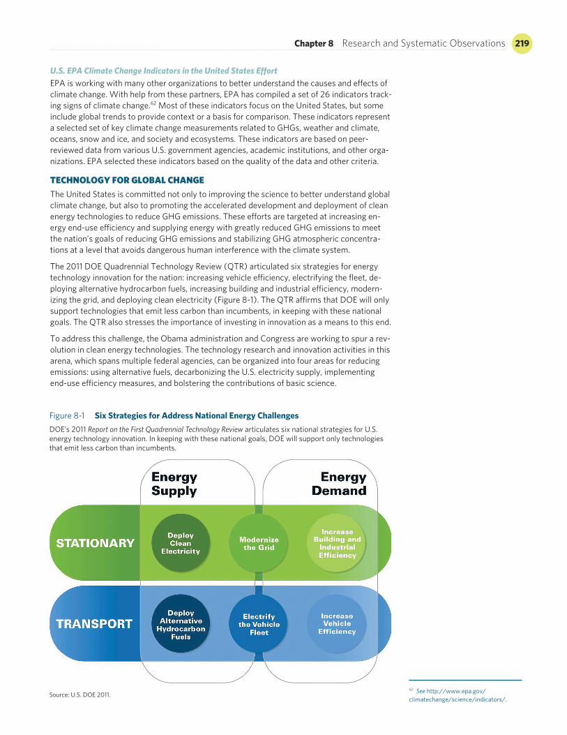
Chapter 8 Research and Systematic Observations 219
U.S. EPA Climate Change Indicators in the United States EffortEPA is working with many other organizations to better understand the causes and effects of climate change. With help from these partners, EPA has compiled a set of 26 indicators track-ing signs of climate change.62 Most of these indicators focus on the United States, but some include global trends to provide context or a basis for comparison. These indicators represent a selected set of key climate change measurements related to GHGs, weather and climate, oceans, snow and ice, and society and ecosystems. These indicators are based on peer- reviewed data from various U.S. government agencies, academic institutions, and other orga-nizations. EPA selected these indicators based on the quality of the data and other criteria.
TECHNOLOGY FOR GLOBAL CHANGEThe United States is committed not only to improving the science to better understand global climate change, but also to promoting the accelerated development and deployment of clean energy technologies to reduce GHG emissions. These efforts are targeted at increasing en-ergy end-use efficiency and supplying energy with greatly reduced GHG emissions to meet the nation’s goals of reducing GHG emissions and stabilizing GHG atmospheric concentra-tions at a level that avoids dangerous human interference with the climate system.
The 2011 DOE Quadrennial Technology Review (QTR) articulated six strategies for energy technology innovation for the nation: increasing vehicle efficiency, electrifying the fleet, de-ploying alternative hydrocarbon fuels, increasing building and industrial efficiency, modern-izing the grid, and deploying clean electricity (Figure 8-1). The QTR affirms that DOE will only support technologies that emit less carbon than incumbents, in keeping with these national goals. The QTR also stresses the importance of investing in innovation as a means to this end.
To address this challenge, the Obama administration and Congress are working to spur a rev-olution in clean energy technologies. The technology research and innovation activities in this arena, which spans multiple federal agencies, can be organized into four areas for reducing emissions: using alternative fuels, decarbonizing the U.S. electricity supply, implementing end-use efficiency measures, and bolstering the contributions of basic science.
Figure 8-1 Six Strategies for Address National Energy ChallengesDOE’s 2011 Report on the First Quadrennial Technology Review articulates six national strategies for U.S. energy technology innovation. In keeping with these national goals, DOE will support only technologies that emit less carbon than incumbents.
Source: U.S. DOE 2011.62 See http://www.epa.gov/climatechange/science/indicators/.
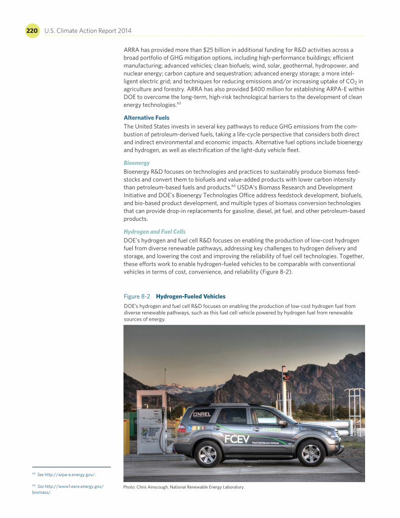
220 U.S. Climate Action Report 2014
ARRA has provided more than $25 billion in additional funding for R&D activities across a broad portfolio of GHG mitigation options, including high-performance buildings; efficient manufacturing; advanced vehicles; clean biofuels; wind, solar, geothermal, hydropower, and nuclear energy; carbon capture and sequestration; advanced energy storage; a more intel-ligent electric grid; and techniques for reducing emissions and/or increasing uptake of CO2 in agriculture and forestry. ARRA has also provided $400 million for establishing ARPA-E within DOE to overcome the long-term, high-risk technological barriers to the development of clean energy technologies.63
Alternative FuelsThe United States invests in several key pathways to reduce GHG emissions from the com-bustion of petroleum-derived fuels, taking a life-cycle perspective that considers both direct and indirect environmental and economic impacts. Alternative fuel options include bioenergy and hydrogen, as well as electrification of the light-duty vehicle fleet.
Bioenergy Bioenergy R&D focuses on technologies and practices to sustainably produce biomass feed-stocks and convert them to biofuels and value-added products with lower carbon intensity than petroleum-based fuels and products.64 USDA’s Biomass Research and Development Initiative and DOE’s Bioenergy Technologies Office address feedstock development, biofuels, and bio-based product development, and multiple types of biomass conversion technologies that can provide drop-in replacements for gasoline, diesel, jet fuel, and other petroleum-based products.
Hydrogen and Fuel Cells DOE’s hydrogen and fuel cell R&D focuses on enabling the production of low-cost hydrogen fuel from diverse renewable pathways, addressing key challenges to hydrogen delivery and storage, and lowering the cost and improving the reliability of fuel cell technologies. Together, these efforts work to enable hydrogen-fueled vehicles to be comparable with conventional vehicles in terms of cost, convenience, and reliability (Figure 8-2).
Figure 8-2 Hydrogen-Fueled VehiclesDOE’s hydrogen and fuel cell R&D focuses on enabling the production of low-cost hydrogen fuel from diverse renewable pathways, such as this fuel cell vehicle powered by hydrogen fuel from renewable sources of energy.
Photo: Chris Ainscough, National Renewable Energy Laboratory.
63 See http://arpa-e.energy.gov/. 64 See http://www1.eere.energy.gov/biomass/.
Chapter 8 Research and Systematic Observations 221
In addition, the U.S. Department of Transportation’s (DOT’s) Federal Transit Administration supports research activities to improve the performance of public transportation through de-velopment, testing, and deployment of innovative technologies, such as low-emission and no-emission vehicles.65 DOE’s Vehicle Technologies Program also supports R&D to make ve-hicles more efficient and capable of operating on nonpetroleum fuels.66 Other DOT programs include efforts to improve travel activity, reduce vehicle miles traveled, and enhance vehicle and system operations.
Vehicle Electrification Vehicle electrification offers near-term efficiency gains through hybrid systems and long-term benefits as a low-emission petroleum alternative when deployed in conjunction with clean electricity generation. R&D of electric vehicles seeks to make them as affordable and conve-nient as today’s gasoline-powered vehicles.
U.S. Electricity SupplyGlobal and domestic electricity generation sources are dominated by fossil fuels that emit CO2 when burned. The transition to a low-carbon energy future will require cost-competitive, low- or zero-carbon electricity supply technologies. DOE supports R&D across a wide range of innovative low-carbon technologies in advanced fossil fuel and renewable energy, and modernization of the electric grid.
Advanced Fossil Energy, Including Carbon Capture and Storage DOE is focused on lowering the impact of traditional fossil fuel energy production and use. The United States is actively funding applied R&D on advanced coal utilization technologies that improve efficiency and capture and store CO2 emissions. These activities are conducted through a combination of research and demonstration programs that are primarily cost-shared partnerships between the federal government and the private sector.67
Carbon capture and storage (CCS) captures CO2 emissions from stationary sources, such as power plants and factories, and permanently stores the CO2 in the soil’s subsurface. DOE classifies CCS technology as either first or second generation, or transformational. First-generation technologies are being pursued in the United States and elsewhere to demonstrate that CCS can be integrated at commercial scale while maintaining reliable, predictable, and safe plant operations. DOE currently has 16 large-scale demonstrations in this category fea-turing both fully integrated CCS projects and stand-alone CO2 injections. Seven of these proj-ects are either under construction or operating.
To reduce the cost of CCS, DOE’s carbon capture research is also pursuing a new generation of solvents, solid sorbents, and membranes to greatly reduce the energy needed to separate CO2, both for post-combustion CO2 capture as well as for pre-combustion capture associated with coal gasification technology. In addition, enhanced oil recovery (EOR), or the process of pumping CO2 into the ground to drive out petroleum, is being used to help enhance the eco-nomics of CCS and accelerate development of a CCS industry once a significant market in-centive materializes for reducing CO2 emissions. For DOE’s first-generation demonstration projects, 12 of the 16 projects involve EOR.
Carbon storage research seeks to improve the predictability of CO2 storage (e.g., migration and trapping of CO2) and reduce the risk of unanticipated events (e.g., inadequate storage capacity, CO2 leakage, induced seismicity) that could be expensive to remediate. DOE’s pro-gram includes a core R&D component, as well as the Regional Carbon Sequestration Partnerships Initiative, which involves 7 partnerships, 43 states, 4 Canadian provinces, and more than 400 independent organizations. The program is entering its final, demonstration-oriented phase.
In the longer term, CCS is expected to rely on vast domestic saline and other geologic forma-tions for CO2 storage. When transformational CCS technologies emerge, a relatively modest “price” for CO2 is expected to be adequate for CCS to be cost-effective without CO2 utiliza-tion. While DOE’s CO2 capture research, development, and demonstration (RD&D)
65 See http://www.nrel.gov/hydrogen/proj_fc_bus_eval.html. 66 See http://www1.eere.energy.gov/vehiclesandfuels/. 67 See http://www.netl.doe.gov.
222 U.S. Climate Action Report 2014
historically has focused primarily on coal power plants, most of the innovations under investi-gation (and everything related to CO2 storage) are equally applicable to large stationary fa-cilities that use natural gas. Advanced concepts under study may be particularly effective for natural gas.
USGS has been playing a major role in the national assessment of geologic CO2 storage re-sources. Several USGS assessment products have been completed since 2009, including an assessment methodology for hydrocarbon recovery potential using CO2 and associated car-bon sequestration, CO2 fluid-flow modeling and injectivity calculations, and implementation of the methodology for the entire United States.
The Carbon Sequestration Leadership Forum (CSLF) is a multilateral U.S. initiative that pro-vides a framework for international collaboration on sequestration technologies. The CSLF’s main focus is promoting the development of improved cost-effective technologies for the separation and capture of CO2 for its transport, utilization, and long-term safe storage. The CSLF seeks to make these technologies available internationally, and identify and address broader issues relating to carbon capture, utilization, and storage.
Nuclear EnergyA key mission of DOE’s nuclear energy R&D program is to plan and conduct applied research in advanced reactor and fuel and waste management technologies. The aim of these efforts is to enable nuclear energy to be used as a safe, advanced, cost-effective source of reliable en-ergy that will help address climate change by reducing GHG emissions. Small modular reactor designs offer attractive safety, manufacturing, and operational innovations that can be avail-able in the next decade. DOE is investigating the next-generation reactor and fuel-cycle sys-tems, which could represent a significant leap in economic performance, safety, and proliferation resistance.
Renewable EnergyThe United States has abundant renewable energy resources. In recent years, enabling poli-cies at the state and federal levels have driven rapid deployment of renewable electricity gen-eration capacity. The combined impacts of private-sector investments and publicly funded R&D are continuing to push down the cost of renewable electricity technologies and improve their performance.
The federal government invests in a broad portfolio of renewable electricity technologies, in-cluding solar, wind, geothermal, and water power, with the goal of making cost-competitive renewable electricity options available in every region of the country (Figure 8-3). Some ex-amples of these activities follow.
Solar—The DOE SunShot Initiative68 is a national collaborative to make solar energy cost-competitive with other forms of electricity by 2020, reducing solar energy systems by 50–75 percent from 2010 baseline costs. With rapid photovoltaic module cost declines experienced in recent years, a key challenge is reducing nonhardware costs, such as permitting and instal-lation, which can now account for more than 50 percent of a system. For concentrating solar power, R&D targets advanced thermal storage technologies to enable solar energy to provide electricity that can be dispatched when needed.
Wind—Wind power R&D by DOE’s Wind Technologies Office works on advances in new wind energy system designs and technologies to increase energy capture, reliability, and sur-vivability for reduced life-cycle costs for land-based and offshore wind turbines. Next-generation advanced rotors can enable higher wind turbine blade tip speeds with lower acoustic emissions. System-level research can lead to substantial efficiency gains, for in-stance, by understanding complex wind plant aerodynamics to improve overall wind plant capacity factors. DOE’s Wind and Water Power Technologies Office and the U.S. Department of the Interior’s Bureau of Ocean Energy Management are working to advance a coordinated strategy for offshore wind research and development.69
68 See http://www1.eere.energy.gov/solar/sunshot/. 69 See eere.energy.gov/analysis/pdfs/winds_energy_r_and_d_linkages.pdf; wind.energy.gov/; and http://www1.eere.energy.gov/windandhydro/.

Chapter 8 Research and Systematic Observations 223
Geothermal—DOE develops innovative technologies to locate, access, and develop the nation’s substantial geothermal resources by advancing (1) hydrothermal power production, where fluid flow and hot rock occur naturally, and (2) enhanced geothermal systems technologies, where fluid is injected into deep, hot rock formations to create a geothermal reservoir. Development risks and costs are key barriers, and DOE’s Geothermal Technologies Office supports innovative technologies for resource development and demonstrations that enable field testing and valida-tion, committed to demonstrating ways to achieve sustained, enhanced geothermal reservoirs.
Water—Water power investments by DOE’s Wind and Water Power Technologies Office enable the development of innovative technologies and improve the reliability and technology readiness of marine and hydrokinetic systems using ocean wave, current, and tidal resources. Collaborations with industry and federal agencies are working to accelerate the development and deployment of sustainable hydropower technologies utilizing domestic river, stream, and water conveyance system resources for clean generation.
Grid Modernization Grid modernization is a key component in the transition to a cleaner supply of electricity. Improving the infrastructure of the electricity transmission and distribution grid can reduce GHG emissions by making power delivery more efficient and by enabling higher penetrations of low-emission electricity from renewable energy. Key research activities include DOE’s na-tionwide plan to modernize the electric grid, enhance the security of the U.S. energy infra-structure, and ensure reliable electricity delivery to meet growing demand. The emphasis is on developing advanced transmission technologies, including advanced sensors and moni-tors, thereby strengthening the reliability of the electric grid by enabling wide-area situational awareness through real-time measurement of the system, advancing real-time visualization and operational support tools, and developing a “smart grid” system with enhanced intelli-gence and connectivity. In addition, DOE is investing in advanced technology research, includ-ing smart grid devices and infrastructure and more efficient grid storage and microgrids to improve resiliency. These improvements will reduce GHG emissions and increase U.S. energy independence and economic growth.
U.S. Energy End UseMajor U.S. sources of GHGs are closely tied to the use of energy in transportation, residential and commercial buildings, and industrial processes. Improving energy efficiency and reducing the intensity of GHG emissions in these sectors can significantly reduce overall GHG emis-sions. DOE invests in R&D for technologies that enable high-performance buildings, advance clean and efficient industrial technologies and processes, and create more efficient transpor-tation options. These investments will significantly reduce both U.S. energy consumption and domestic and global GHG emissions.
Residential and Commercial Buildings The Emerging Technologies Program within DOE’s Building Technologies Office partners with national laboratories, industry, and universities to advance research, development, and com-mercialization of energy-efficient, cost-effective building technologies that could be
Figure 8-3 U.S. Renewable Energy The United States is capitalizing on its abundant renewable energy resources, including this photovoltaic array and wind turbines at the National Wind Technology Center near Boulder, Colorado.
Photo: Dennis Schroeder, National Renewable Energy Laboratory.
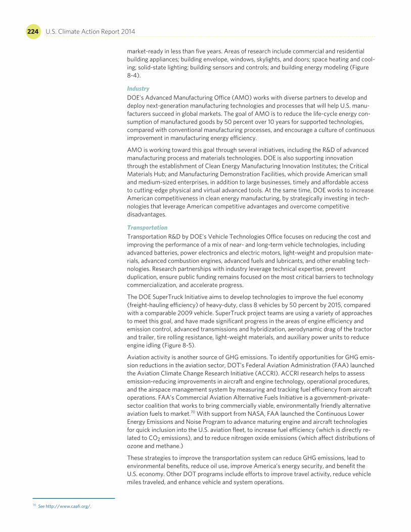
224 U.S. Climate Action Report 2014
market-ready in less than five years. Areas of research include commercial and residential building appliances; building envelope, windows, skylights, and doors; space heating and cool-ing; solid-state lighting; building sensors and controls; and building energy modeling (Figure 8-4).
Industry DOE’s Advanced Manufacturing Office (AMO) works with diverse partners to develop and deploy next-generation manufacturing technologies and processes that will help U.S. manu-facturers succeed in global markets. The goal of AMO is to reduce the life-cycle energy con-sumption of manufactured goods by 50 percent over 10 years for supported technologies, compared with conventional manufacturing processes, and encourage a culture of continuous improvement in manufacturing energy efficiency.
AMO is working toward this goal through several initiatives, including the R&D of advanced manufacturing process and materials technologies. DOE is also supporting innovation through the establishment of Clean Energy Manufacturing Innovation Institutes; the Critical Materials Hub; and Manufacturing Demonstration Facilities, which provide American small and medium-sized enterprises, in addition to large businesses, timely and affordable access to cutting-edge physical and virtual advanced tools. At the same time, DOE works to increase American competitiveness in clean energy manufacturing, by strategically investing in tech-nologies that leverage American competitive advantages and overcome competitive disadvantages.
Transportation Transportation R&D by DOE’s Vehicle Technologies Office focuses on reducing the cost and improving the performance of a mix of near- and long-term vehicle technologies, including advanced batteries, power electronics and electric motors, light-weight and propulsion mate-rials, advanced combustion engines, advanced fuels and lubricants, and other enabling tech-nologies. Research partnerships with industry leverage technical expertise, prevent duplication, ensure public funding remains focused on the most critical barriers to technology commercialization, and accelerate progress.
The DOE SuperTruck Initiative aims to develop technologies to improve the fuel economy (freight-hauling efficiency) of heavy-duty, class 8 vehicles by 50 percent by 2015, compared with a comparable 2009 vehicle. SuperTruck project teams are using a variety of approaches to meet this goal, and have made significant progress in the areas of engine efficiency and emission control, advanced transmissions and hybridization, aerodynamic drag of the tractor and trailer, tire rolling resistance, light-weight materials, and auxiliary power units to reduce engine idling (Figure 8-5).
Aviation activity is another source of GHG emissions. To identify opportunities for GHG emis-sion reductions in the aviation sector, DOT’s Federal Aviation Administration (FAA) launched the Aviation Climate Change Research Initiative (ACCRI). ACCRI research helps to assess emission-reducing improvements in aircraft and engine technology, operational procedures, and the airspace management system by measuring and tracking fuel efficiency from aircraft operations. FAA’s Commercial Aviation Alternative Fuels Initiative is a government–private-sector coalition that works to bring commercially viable, environmentally friendly alternative aviation fuels to market.70 With support from NASA, FAA launched the Continuous Lower Energy Emissions and Noise Program to advance maturing engine and aircraft technologies for quick inclusion into the U.S. aviation fleet, to increase fuel efficiency (which is directly re-lated to CO2 emissions), and to reduce nitrogen oxide emissions (which affect distributions of ozone and methane.)
These strategies to improve the transportation system can reduce GHG emissions, lead to environmental benefits, reduce oil use, improve America’s energy security, and benefit the U.S. economy. Other DOT programs include efforts to improve travel activity, reduce vehicle miles traveled, and enhance vehicle and system operations.
70 See http://www.caafi.org/.
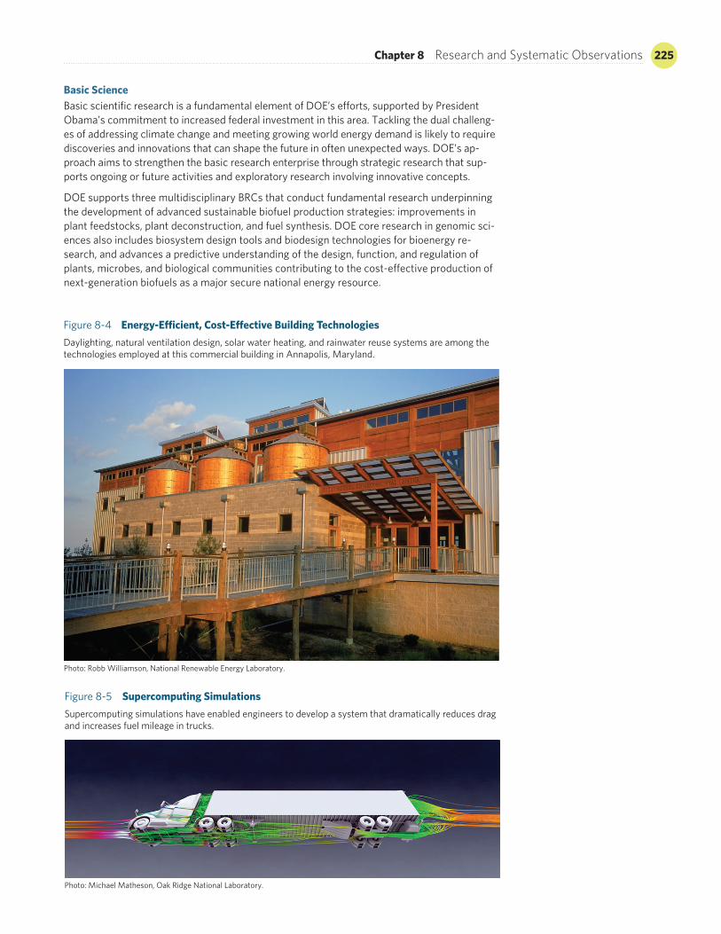
Chapter 8 Research and Systematic Observations 225
Basic ScienceBasic scientific research is a fundamental element of DOE’s efforts, supported by President Obama’s commitment to increased federal investment in this area. Tackling the dual challeng-es of addressing climate change and meeting growing world energy demand is likely to require discoveries and innovations that can shape the future in often unexpected ways. DOE’s ap-proach aims to strengthen the basic research enterprise through strategic research that sup-ports ongoing or future activities and exploratory research involving innovative concepts.
DOE supports three multidisciplinary BRCs that conduct fundamental research underpinning the development of advanced sustainable biofuel production strategies: improvements in plant feedstocks, plant deconstruction, and fuel synthesis. DOE core research in genomic sci-ences also includes biosystem design tools and biodesign technologies for bioenergy re-search, and advances a predictive understanding of the design, function, and regulation of plants, microbes, and biological communities contributing to the cost-effective production of next-generation biofuels as a major secure national energy resource.
Figure 8-4 Energy-Efficient, Cost-Effective Building TechnologiesDaylighting, natural ventilation design, solar water heating, and rainwater reuse systems are among the technologies employed at this commercial building in Annapolis, Maryland.
Photo: Robb Williamson, National Renewable Energy Laboratory.
Figure 8-5 Supercomputing Simulations Supercomputing simulations have enabled engineers to develop a system that dramatically reduces drag and increases fuel mileage in trucks.
Photo: Michael Matheson, Oak Ridge National Laboratory.
226 U.S. Climate Action Report 2014
In addition, DOE will continue to support a number of EFRCs that are addressing current fun-damental scientific roadblocks to clean energy and energy security.71 These centers address a range of energy research challenges in renewable and low-carbon energy, energy efficiency, energy storage, and cross-cutting science. The EFRCs are taking advantage of new capabili-ties in nanotechnology, light sources and neutron scattering sources, supercomputers, and other advanced instrumentation.
DOE’s multidisciplinary Energy Innovation Hubs are also addressing basic science, technol-ogy, and economic and policy issues. The hubs support cross-disciplinary R&D focused on the barriers to transforming energy technologies into commercially deployable materials, devices, and systems. Current hubs focus on fuels from sunlight, energy-efficient buildings, modeling for nuclear reactors, critical materials, and batteries and electrical energy storage. These hubs are advancing promising areas of energy science and technology from their early stages of research to the point where the risk of investing in them will be low enough for industry to deploy them into the marketplace.
Established by DOE in 2009, ARPA-E is modeled after the Defense Advanced Research Projects Agency, created during the Eisenhower administration in response to the Russian Sputnik program, which launched the world’s first artificial satellite. The purpose of ARPA-E is to advance high-risk energy research projects that can yield revolutionary changes in how energy is produced, distributed, and used.72 ARRA has provided $400 million for ARPA-E, and the program received funding for 2010–2013 that greatly expanded the number of projects it supports.
Multilateral Research and CollaborationThe United States believes that well-designed multilateral collaborations focused on achiev-ing practical results can accelerate development and commercialization of new technologies. Thus, the United States has initiated or joined a number of multilateral technology collabora-tions in hydrogen energy, carbon sequestration, nuclear energy, and fusion that address many energy-related concerns (e.g., energy security, climate change, and environmental protec-tion). The following initiatives are examples of U.S. multinational collaboration.
Carbon Sequestration Leadership ForumThe CSLF is a multilateral U.S. initiative that provides a framework for international collaboration on sequestration technologies.73 Established at a June 2003 ministerial meeting held in Washington, D.C., the CSLF consists of 23 members, including 22 national governments repre-senting both developed and developing countries, as well as the European Commission. The CSLF’s main focus is assisting the development of technologies to separate, capture, transport, and store CO2 safely over the long term; making carbon sequestration technologies broadly avail-able internationally; and addressing broader issues, such as regulation and policy. To date, the CSLF has endorsed 20 international research projects, five of which involve the United States.
ITER In 2003, the United States joined the negotiations for agreeing on the construction and opera-tion of ITER, an international experiment to design and build a fusion reactor.74 The goal of this collaborative project is to demonstrate the scientific and technological feasibility of fusion as an energy source. If successful, ITER will advance progress toward producing clean, abun-dant, commercially available fusion energy by the end of the 21st century.
Toward this goal, the seven ITER partners signed an agreement in November 2006 to build the project; site preparation began in Saint-Paul-lez-Durance, France, in January 2007; and civil construction began in 2009 and continues today. The ITER Agreement established the ITER Organization, a public international organization managed by a Director General, as the ITER design authority and operator on behalf of the seven partner members. ITER has approx-imately 500 full-time staff.
The ITER Organization has secured nuclear regulatory approval for full facility construction. Fabrication of in-kind components by ITER members is accelerating. U.S. long-lead, early- delivery items are currently being fabricated, and. some U.S. in-kind components have been delivered.
71 See http://.science.energydoe.gov/bes/efrc/. 72 See http://arpa-e.energy.gov/. 73 See http://www.cslforum.org/. 74 See http://www.iter.org/.

Chapter 8 Research and Systematic Observations 227
Major Economies Forum Global Partnership At the 2009 Group of Eight (G8) meeting in L’Aquila, Italy, the Major Economies Forum countries (G8 plus China, India, South Africa, Brazil, Mexico, and Indonesia) announced a global partnership for transformational low-carbon, climate-friendly technologies. The part-ners committed to significantly increase and coordinate public-sector investments in RD&D of these technologies. The partnership’s ultimate goal is to double these investments by 2015, while recognizing the importance of private investment, public–private partnerships, and in-ternational cooperation, including regional innovation centers.
The United States will lead on “efficiency,” which includes commercial and residential build-ings and the industrial sector. Technology action plans and roadmaps will be developed, along with recommendations for further progress. Drawing on global best practice policies, the Global Partnership will strive to remove barriers to, establish incentives for, and enhance ca-pacity building of U.S. climate-friendly technologies, and implement appropriate measures to aggressively accelerate deployment and transfer of key existing and new low-carbon tech-nologies, in accordance with national circumstances.