COF - ctc · Title: COF - ctc Author: Admin Created Date: 1/12/2010 9:57:44 AM

REPORT >
Documentary Study and Archaeological Monitoring of the Cromley Row Project Area
DATE > DECEMBER, 2013
LOCATION > City of Alexandria, Virginia
PREPARED FOR >William Cromley 426 N. Columbus St. Alexandria, Virginia 22314
PREPARED BY >Dutton + Associates, LLC
Sanborn Map of the project area, 1921. Source: Library of Virginia.
Dutton + Associates CULTURAL RESOURCE SURVEY, PLANNING, AND MANAGEMENT
DOCUMENTARY STUDY AND ARCHAEOLOGICAL MONITORING OF THE CROMLEY ROW PROJECT AREA
CITY OF ALEXANDRIA, VIRGINIA
PREPARED FOR: WILLIAM CROMLEY 426 N. COLUMBUS STREET ALEXANDRIA, VIRGINIA 22314 PREPARED BY: DUTTON + ASSOCIATES, LLC 812 MOOREFIELD PARK DRIVE, SUITE 126 RICHMOND, VIRGINIA 23236 PRINCIPAL INVESTIGATOR: DAVID H. DUTTON, M.A. DECEMBER 2013

THIS PAGE INTENTIONALLY LEFT BLANK

ABSTRACT
i
ABSTRACT In October 2013, Dutton + Associates, LLC (D+A) conducted a documentary study of the Cromley Row project area in the City of Alexandria, Virginia. The study was conducted at the request of the City of Alexandria Archaeology Department for planning purposes in order to aid in the understanding of the potential for the project area to contain eighteenth or nineteenth-century burials associated with a documented Quaker Burying Ground located to the south. The project area is located on the City of Alexandria’s real estate map No. 064.04 on block No. 02, and includes lots No. 01 through 07. Research revealed that the Quaker Burying Ground was established at its current location in 1784, following sale of the property to the Religious Society of Friends by Thomas West. Meeting minutes of the Friends indicate that the Burying Ground was fenced as early as 1794 suggesting that the boundaries of the Burying Ground were well established and visually marked early in the developmental history of the block. Actual development of the project area does not occur in earnest until the mid-nineteenth century and continues with various episodes of building and demolition into the early-twentieth century. During this period brick and frame townhomes, as well as detached single dwellings were constructed with the most recent being constructed at 313 N. Columbus Street immediately adjacent to the northern brick wall bounding the Quaker Burying Ground. Throughout much of their history, these properties were rental units with tenants and little is known of the occupants and their use of the properties until the turn of the twentieth century. Construction for the Cromley Row homes will begin approximately 56-feet feet north of the brick wall enclosing the former Quaker Burying Ground, presently land of the Kate Waller Barrett Branch Library. Historically, this would have included the northern end of 317 N. Columbus Street up to and including land of 331 North Columbus. Between the first new home (labeled #606 on Cromley Row’s Subdivision Plat) and the brick wall there will be parking spaces and the existing entry into the parking lot. Based upon the results of documentary study the project area is expected to contain archaeological deposits associated with the nineteenth century townhouses located at 317 and 319 N. Columbus Street. Given that proposed ground disturbance associated with the Cromley Row development will not begin until approximately 56-feet north of the boundary wall of the Burying Ground, the likelihood that human burials are present within the project is considered low. Following review of the documentary research, archaeological monitoring of an area approximately 6-meters (20-feet) north-south by 18.2-meters (60-feet) east-west was undertaken and conformed the absence of human burial or grave related features in the project area.

ABSTRACT
ii
THIS PAGE LEFT INTENTIONALLY BLANK

TABLE OF CONTENTS
iii
TABLE OF CONTENTS 1. INTRODUCTION ................................................................................................................... 1
Project Area Physical Description and Location ........................................................................ 2
2. METHODOLOGY .................................................................................................................. 5
Documentary Research ............................................................................................................... 5
Archaeological Monitoring ......................................................................................................... 6
3. Historical Overview ................................................................................................................. 7
Settlement to Society (1607 – 1750) ........................................................................................... 7
Colony to Nation (1750 – 1789) ............................................................................................... 10
Early National Period (1789 – 1830) ........................................................................................ 11
Antebellum Period (1830 – 1860)............................................................................................. 13
Civil War (1861 – 1865) ........................................................................................................... 14
Reconstruction and Growth (1865–1917) ................................................................................. 16
World War I to World War II (1917 – 1945)............................................................................ 18
New Dominion (1945 – Present) .............................................................................................. 20
4. PROJECT AREA DEVELOPMENT .................................................................................... 21
Quaker Burying Ground ........................................................................................................... 21
Quaker Burial Practices ............................................................................................................ 23
Cromley Row Project Area ....................................................................................................... 23
5. ARCHAEOLOGICAL MONITORING ................................................................................ 31
Expected Results ....................................................................................................................... 31
Results of Monitoring ............................................................................................................... 31
6. RESULTS AND CONCLUSIONS ....................................................................................... 41
Documentary Research ............................................................................................................. 41
Archaeological Monitoring ....................................................................................................... 42
7. REFERENCES ...................................................................................................................... 43
APPENDIX A. .............................................................................................................................. 47

TABLE OF CONTENTS
iv
LIST OF FIGURES Figure 1: Detail of the Alexandria, VA USGS Quadrangle depicting the location of the Cromley Row project area (green) ................................................................................................................. 1 Figure 2: Aerial map depicting the Cromley Row documentary study area and archaeological monitoring area. Source: Google 2013. ......................................................................................... 2 Figure 3: Aerial View of the Cromley Row project area and documentary study (red). Source: Google Earth 2013 .......................................................................................................................... 3 Figure 4: Detail of 1610 Virginia, Discovered and Described [sic], Depicting the General Vicinity of the Project Area. Source: Library of Congress. ........................................................... 8 Figure 5: Detail of Virginia and Maryland, 1673. Source: Library of Congress. ......................... 9 Figure 6: Detail of A plan of Alexandria, now Belhaven, 1749. Source: Library of Congress ... 10 Figure 7: Detail of Alexandria, 1763, with location of project area. Source: Library of Congress....................................................................................................................................................... 11 Figure 8: Detail of Plan of the Town of Alexandria in the District of Columbia 1798, with location of project area. Source: Library of Congress. ................................................................. 13 Figure 9: Detail of Plan of the town of Alexandria, D.C. with the environs: exhibiting the outlet of the Alexandria Canal, the shipping channel, wharves, Hunting Cr., 1845. Source: Library of Congress. ....................................................................................................................................... 14 Figure 10: Detail of Map of Alexandria and Fairfax Counties, 1864. Source: Library of Congress....................................................................................................................................................... 15 Figure 11: Birds’ Eye View of Alexandria, 1863. Source: Library of Virginia ........................... 16 Figure 12: Washington USGS Topographical Map, 1900. Source: USGS .................................. 17 Figure 13: Washington USGS Topographical Map, 1900. Source: USGS .................................. 18 Figure 14: Alexandria USGS Topographical Map, 1945. Source: USGS .................................... 19 Figure 15: Detail of Hopkins map, 1877, with location of project area. ....................................... 25 Figure 16: Detail of Sanborn map, 1921, with location of project area. ...................................... 27 Figure 17: Detail of Sanborn map, 1941 updated in 1959, with location of project area............. 28 Figure 18: Aerial view of area of asphalt removal and monitoring. ............................................ 31 Figure 19: View of destruction layer in the western portion of the project area immediately underlying gravel fill beneath the current asphalt parking lot. ..................................................... 32 Figure 20: View of northern foundation wall and interior buttresses, looking north. ................. 33 Figure 21: Plan and profile drawings of northwestern corner of basement. ................................. 34 Figure 22: View of northern foundation wall, interior buttresses, and potential coal chute, looking east. .................................................................................................................................. 35 Figure 23: View of destruction layer in the eastern portion of the project area immediately underlying gravel fill beneath the current asphalt parking lot. ..................................................... 36 Figure 24: View of subsoil underlying the destruction layer in the eastern portion of the project area, looking southeast. ................................................................................................................. 37 Figure 25:Detail of Sanborn map, 1941 updated in1959, with area of monitoring outlined in red........................................................................................................................................................ 38 Figure 26: Plan view of townhouse foundation identified within the project area. ..................... 39

TABLE OF CONTENTS
v
LIST OF TABLES Table 1: Owners and Occupants of 317 N. Columbus Street ....................................................... 47 Table 2: Owners and Occupants of 319 N. Columbus Street ....................................................... 47 Table 3: Owners and Occupants of 321 N. Columbus Street ....................................................... 48 Table 4: Owners and Occupants of 323 N. Columbus Street ....................................................... 48 Table 5: Owners and Occupants of 325 N. Columbus Street ....................................................... 49 Table 6: Owners and Occupants of 327 N. Columbus Street ....................................................... 49 Table 7: Owners and Occupants of 329 N. Columbus Street ....................................................... 50 Table 8: Owners and Occupants of 331 N. Columbus Street ....................................................... 51

TABLE OF CONTENTS
vi
THIS PAGE INTENTIONALLY LEFT BLANK

INTRODUCTION
1
1. INTRODUCTION In October 2013, Dutton + Associates, LLC (D+A) conducted a documentary study of the Cromley Row project area in the City of Alexandria, Virginia. The study was conducted at the request of the City of Alexandria Archaeology Department for planning purposes in order to aid in the understanding of the potential for the project area to contain eighteenth or nineteenth century burials associated with a documented Quaker Burying Ground located to the south. The project area is located on the City of Alexandria’s real estate map No. 064.04 on block No. 02, and includes lots No. 01 through 07 (Figure 1). Following the documentary study, archaeological investigation of an area approximately 6-meters (20-feet) north-south by 18.2-meters (60-feet) east-west will be undertaken and will focus on identifying the presence or absence of human burials (Figure 2). All work was completed in accordance with the guidance specified in the Secretary of the Interior’s Standards and Guidelines for Archeology and Historic Preservation (Federal Register 48:44716-44742, September 29, 1983), the Guidelines for Conducting Historic Resources Survey in Virginia (October 2011) promulgated by the Virginia Department of Historic Resources (VDHR), and the City of Alexandria Archaeological Standards. David H. Dutton, M.A. served as the Principal Investigator, prepared the research design, and co-authored the technical report. Dara A. Friedberg, M.S. and Robert J. Taylor, M.A. assisted with the research and report production. Copies of all notes, maps, correspondence, and research materials are on file at D+A’s main office in Richmond, Virginia.
Figure 1: Detail of the Alexandria, VA USGS Quadrangle depicting the location of the Cromley Row project area (green)
Project Area

INTRODUCTION
2
Figure 2: Aerial map depicting the Cromley Row documentary study area and archaeological monitoring area. Source: Google 2013. PROJECT AREA PHYSICAL DESCRIPTION AND LOCATION The Cromley Row project area is located in the 300 Block of North Columbus Street in the City of Alexandria, Virginia and consists of ±0.17 acres of the northwest corner of the block bounded by Columbus Street, Princess Street, Queen Street, and Washington Street (Figure 3). The project area presently consists of a parking lot surrounded by a low brick wall with trees planted throughout. On the southwestern quarter of the block sits the former Quaker Burying Ground, currently the site of the Kate Waller Barrett Branch Library of Alexandria. The remainder of the block consists of new construction in the form of office buildings, which are along the eastern half of the block.
Documentary Study Area
Archaeological Monitoring Area

INTRODUCTION
3
Figure 3: Aerial View of the Cromley Row project area and documentary study (red). Source: Google Earth 2013
Documentary Study Area
Kate Waller Library

INTRODUCTION
4
THIS PAGE LEFT INTENTIONALLY BLANK

METHODOLOGY
5
2. METHODOLOGY DOCUMENTARY RESEARCH The documentary study of the Cromley Row project area was undertaken in order to confirm the potential for eighteenth and nineteenth century burials to be present in the project area. The background research methodology is summarized below. D+A conducted pertinent background research with the following goals: Establishing an appropriate historic context for the project area, as defined by the
Secretary of the Interior’s Standards and Guidelines for Archaeology and Historic Preservation (USDI 1983) and the Virginia Department of Historic Resources’ (VDHR) How to Use Historic Context in Virginia: A Guide for Survey, Registration, Protection, and Treatment Projects (VDHR 1992);
Identifying land ownership and property use through time; Identifying the project area’s potential to contain eighteenth and nineteenth century
burials based upon past land use and development of the project area and the nearby Quaker Burying Ground.
Background research took place in local archival facilities, as well as the traditional state archival repositories. Research was undertaken at the Library of Virginia, the Virginia Historical Society, the Library of Congress, the City of Alexandria, Alexandria Library's Special Collections and Local History Division, and other repositories of archival materials deemed appropriate. Materials examined included deed records, land tax records, newspaper articles, census data, city directories, historic maps, and personal letters. Documentary and cartographic data that summarized development patterns, property ownership, building construction and use, as well as previous archaeological investigations and related historical research were reviewed and synthesized in an effort to develop an overall understanding of the project area’s history. Historic maps and map overlays were used to illustrate Quaker Burying Ground and previous building locations through time, particularly as they relate to the project area. While comprehensive in its treatment of the study area, this work is not intended to be an exhaustive treatment of the social history of the block, its occupants, or the Burying Ground itself. Rather, the primary purpose of the study is to provide reliable and concise data regarding the potential for eighteenth and nineteenth century human burials, associated with the Quaker Burying Ground, to be present within the project area.

METHODOLOGY
6
ARCHAEOLOGICAL MONITORING Archaeological monitoring entailed visual inspection of exposed soil surfaces following initial mechanical clearing of the asphalt parking lot. The entire exposed project area was visually inspected for surface evidence of cultural material and intact subsurface archaeological deposits. For any archaeological resources identified during monitoring, photographs will be taken of the general vicinity and of any visible features. Sampling of features and/or artifact deposits was not undertaken as part of this monitoring effort. Notes were taken on surface conditions, soil characteristics, dimensions and construction of features evident, and the amount and distribution of cultural materials present.

HISTORICAL OVERVIEW
7
3. HISTORICAL OVERVIEW The following section provides a brief summary of the general overarching regional historic themes relevant to the development of the City of Alexandria. The primary emphasis of this context focuses on development of the city from the seventeenth century to the present day with emphasis on the vicinity of the project area. The use of historic maps, published and unpublished manuscripts, and assorted historic narratives aided in establishing the appropriate cultural context for the project area as defined by the Secretary of the Interior’s Standards and Guidelines for Archaeology and Historic Preservation and the Virginia Department of Historic Resources’ How to use Historic Contexts in Virginia: A Guide for Survey, Registration, Protection, and Treatment Projects (VDHR 1997). SETTLEMENT TO SOCIETY (1607 – 1750) At the time of European contact, the area encompassing the northern portion of Virginia was occupied by Algonquian-speaking tribes in the Tidewater and Siouan-speaking tribes west of the Fall Line (Walker 1981; Bushnell 1935, 1937). Groups living on the southern and western sides of the Potomac River included the Moyumpse, or Doegs/Dogues as they became known to the colonists (Moore 1993). When John Smith sailed up the Potomac in 1608, he noted that their main village, Tauxenent, was located in the vicinity of Mason Neck, and comprised of longhouses, arbor-likes structures of bent poles covered with bark or reed mats. He also encountered two smaller villages in the vicinity; Namassingakent, situated near present-day Mount Vernon, and Assaomeck, on the south side of Hunting Creek (Smith 1610) (Figure 4).

HISTORICAL OVERVIEW
8
Figure 4: Detail of 1610 Virginia, Discovered and Described [sic], Depicting the General Vicinity of the Project Area. Source: Library of Congress.
As European settlers moved up the Potomac River throughout the early seventeenth century, most of the settlement occurred along the east side of the River in Maryland as the Virginia side was still considered too dangerous due to conflict with the native inhabitants. By the mid-1600s though, settlers began to move into the region of Virginia where Alexandria is now located and in 1648, a treaty with the local tribes opened up the Northern Neck region to European expansion, and colonization began swiftly (Figure 5). In 1649, the area was part of a tremendous land grant issues by King Charles II to a group of wealthy English investors. This grant, consisting of all land between the Potomac and Rappahannock rivers was known as the Northern Neck Proprietary and managed by the proprietors who leased out large tracts of their respective lands to smaller land investors who in-turn sold or leased the land to those who actually settled the area.
Project Area Vicinity

HISTORICAL OVERVIEW
9
Figure 5: Detail of Virginia and Maryland, 1673. Source: Library of Congress.
During this period, the cultivation of tobacco was the primary economy and cultural influence in the region and thus large tracts of land were at a premium. In many cases, land was leased or outright purchased from the Northern Neck Propietary and its agents, and in other cases, grants were given as payment in the headright system where the provision of safe travel to new settlers was awarded to the responsible sponsor. Throughout the late-seventeenth and early-eighteenth centuries, tobacco plantations were established on both sides of the Potomac River. In 1669, 6,000 acres of land in the vicinity of present-day Alexandria was given to an English ship captain Robert Howson by Sir William Berkeley, Governor of Virginia, as payment for the transportation of 120 people to Virginia (50 acres a person under the headright system). Just a month later, Howson sold the land to John Alexander, a wealthy planter (City of Alexandria n.d.). The economy of Prince William County and the northern Virginia region as a whole was centered primarily on the cultivation of tobacco during this period. The Tobacco Inspection law, passed in Virginia in 1730, required all exported tobacco shipments to be inspected and bear an official certificate (Prince William County Historical Commission 2012). A reliable road network was not yet in place, so tobacco inspection stations and warehouses were constructed along waterways which served as the primary transportation and shipping routes. One such tobacco warehouse was established in the vicinity of present-day Alexandria on what is now the end of Oronoco Street in 1732 by Hugh West. Meanwhile, much of the surrounding area was farmed by John and Philip Alexandria. By the mid-eighteenth century, the population in the area warranted political division and the Virginia Assembly established Fairfax County from the northern portion of Prince William
Project Area Vicinity

HISTORICAL OVERVIEW
10
County in 1741. The Fairfax County Courthouse was built in 1742, on land near present day Tysons Corner. Meanwhile, only a few settlements and isolated farms dotted the area. To promote further growth, towns and villages were authorized in the county, particularly around tobacco inspection stations that already functioned as make-shift communities and centers of commerce. In 1748, the Virginia’s House of Burgesses authorized the formation of a town around Hugh West’s warehouse consisting of 66 half-acre lots, nine streets, and two public landings to serve as a port (Brockett and Rock 1883: 7). This new town was named Alexandria to honor the early owner of much of the land. John West, Fairfax County surveyor, and George Washington laid out 60-acres and lots were auctioned off in July 1749 (Figure 6) (City of Alexandria n.d.). This original town encompassed what is now Lee Street to the east, Royal Street to the west, Oronoco Street to the north and Duke Street to the south. Building in the town began in its northeast section as first-class structures built of brick (Brockett and Rock 1883: 8). During this period, the Cromley Row project area was outside of the original town limits on land that was likely used for agriculture purposes.
Figure 6: Detail of A plan of Alexandria, now Belhaven, 1749. Source: Library of Congress
COLONY TO NATION (1750 – 1789) The flourishing tobacco trade brought about a boom period in Alexandria in the mid- to late-eighteenth century and the city became the county seat of Fairfax County in 1752 (Netherton and Netherton 1992). In 1763, an expansion of the town’s limits increased the size of the community by adding Wolfe and Wiles Streets to the south and Pitt and St. Asaph Streets to the west (City of Alexandria 1907) (Figure 7). The town expanded again in 1780s by filling in part of the Potomac shoreline to allow merchants to build wharves to serve ocean-going vessels (City of Alexandria n.d.). By this time, Alexandria had evolved into a substantial community and lots all over town
HISTORICAL OVERVIEW
11
were subdivided repeatedly by their owners who rented space to dozens of different types of skilled artisans, grocers and small merchants, tavern keepers and other tradesmen. The population also included many slaves as well as free blacks who lived primarily in neighborhoods called "the Bottoms" and "Hayti." (City of Alexandria n.d.)
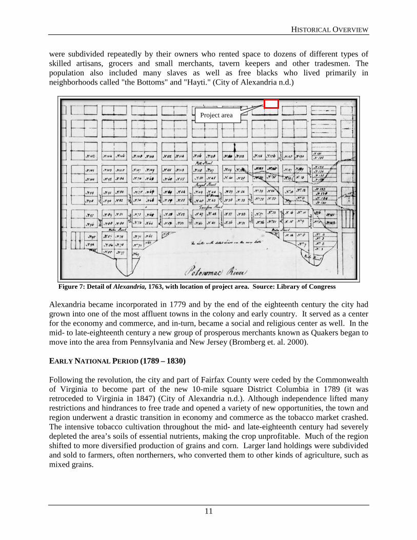
Figure 7: Detail of Alexandria, 1763, with location of project area. Source: Library of Congress
Alexandria became incorporated in 1779 and by the end of the eighteenth century the city had grown into one of the most affluent towns in the colony and early country. It served as a center for the economy and commerce, and in-turn, became a social and religious center as well. In the mid- to late-eighteenth century a new group of prosperous merchants known as Quakers began to move into the area from Pennsylvania and New Jersey (Bromberg et. al. 2000). EARLY NATIONAL PERIOD (1789 – 1830) Following the revolution, the city and part of Fairfax County were ceded by the Commonwealth of Virginia to become part of the new 10-mile square District Columbia in 1789 (it was retroceded to Virginia in 1847) (City of Alexandria n.d.). Although independence lifted many restrictions and hindrances to free trade and opened a variety of new opportunities, the town and region underwent a drastic transition in economy and commerce as the tobacco market crashed. The intensive tobacco cultivation throughout the mid- and late-eighteenth century had severely depleted the area’s soils of essential nutrients, making the crop unprofitable. Much of the region shifted to more diversified production of grains and corn. Larger land holdings were subdivided and sold to farmers, often northerners, who converted them to other kinds of agriculture, such as mixed grains.
Project area

HISTORICAL OVERVIEW
12
The new trends in agriculture led to changes in the labor system as farm owners and their families could generally tend to their own fields. Acre for acre, the newer crops did not require as much manual labor as the expansive tobacco plantations had required. The result of these changes for the African American community was that large numbers of enslaved individuals were no longer needed in local agriculture. Rather than freeing them, many local plantation owners began either selling them to slave traders who sold them to other individuals in the deep South, where cotton farming was on the rise, or hiring them out to in-town employers. As such, Alexandria grew into one of the largest slave trade markets in the nation during this period, in addition to developing a large population of urban slaves and free blacks. Because the city was part of both Virginia and Washington D.C. during this period, there was a split in regards to the public opinion of slavery, abolition, racial equality, and related issues, often opposing the rest of the commonwealth. The city had a number of white citizens, including an active Quaker congregation, who assisted the African American community and therefore the city became a haven to many African Americans who migrated to Alexandria to escape laws that made it difficult for them to remain in the commonwealth (Necciai and Drummond 2007). Changes in the agricultural system to smaller farms and grains also necessitated the construction of additional road and turnpikes to Alexandria resulting in a flourishing city with additional new warehouses, mills, and merchants. Wealthy merchants and sea captains built gracious houses, schools, a library and churches. The city expanded its grid in 1796, particularly to the north and west as the Potomac River and Hunting Creek limited further growth to the east and south (Figure 8). Despite the expansion however, development within the city remained clustered relatively close to the waterfront, and the inland portions, particularly in the northwest quadrant, remained relatively undeveloped through the early nineteenth century.

HISTORICAL OVERVIEW
13
Figure 8: Detail of Plan of the Town of Alexandria in the District of Columbia 1798, with location of project area. Source: Library of Congress.
The far western fringe of the city along Hooff’s Creek became the site of several cemeteries during this time that would serve as the edge of development well into the nineteenth century. Until that time, religious organizations such as churches and meeting houses typically incorporated burial grounds on the grounds of the gathering place; however beginning in 1804, the organizations were forced to look beyond the Alexandria boundaries for new cemetery locations, when the Alexandria Common Council decreed in that year that no new cemeteries were to be opened or burial lots to be sold within Alexandria (City of Alexandria n.d.). Local churches and, later, burial associations, settled on the area then known as Spring Garden Farm, bounded by Duke Street, South Henry Street, Hunting Creek, and Hooff’s Creek. Since then, the number of cemeteries in this small area has grown to thirteen. Meanwhile, established cemeteries and burial grounds were allowed to continue to be used. ANTEBELLUM PERIOD (1830 – 1860) During the Antebellum Period, the population and economy of the region began to rise again as it became home to new settlers from northern states and improved farming methods. Crop rotation and other techniques revitalized the agricultural system and the region began to prosper again. In addition to new roads, the railroad began to influence development and the economy in the region. This network of lines greatly improved commerce in Virginia. Farmers could ship their products, produce and goods much more cheaply than before and could go any direction via the connecting railroad. As a railroad and seaport town, Alexandria continued to thrive and grow. In 1847, Virginia retroceded its claim to Alexandria and the northern portion of Fairfax
Project area

HISTORICAL OVERVIEW
14
County from the federal government. The population of the town almost doubled in the decade before 1860. Between 1851 and 1854, Alexandria experienced a building boom with the construction of more than 700 houses. Infrastructure improvements in the 1850s led to underground gas and water lines to serve the city’s growing population (City of Alexandria n.d.). Much of the new construction consisted of row-housing and multi-family development around the fringes of the town on remaining vacant blocks and property. The presence of the courthouse along Columbus Street between Queen and Princess Streets may have encouraged some growth in the northwestern quadrant of the city (Figure 9).
Figure 9: Detail of Plan of the town of Alexandria, D.C. with the environs: exhibiting the outlet of the Alexandria Canal, the shipping channel, wharves, Hunting Cr., 1845. Source: Library of Congress.
CIVIL WAR (1861 – 1865) With the eruption of the Civil War, Alexandria’s proximity to the federal government in Washington, D.C. meant that it would play a strategic role in the War. Within days of Virginia’s secession in 1861, Federal troops arrived and took possession of the city. The vast transportation system that the city had created served in supplying the Union with troops and supplies, as well as bringing their wounded back to hospitals and temporary medical facilities. Troops and supplies were transported to Alexandria by both the shipping port and the railroad, and then dispersed where needed at the front. Wounded soldiers, brought back on the trains, were treated
Project area

HISTORICAL OVERVIEW
15
within buildings converted to makeshift hospitals throughout the town. A ring of forts and earthworks were constructed around the city to defend it as well as to serve as part of the greater defenses of Washington (Figure 10).
Figure 10: Detail of Map of Alexandria and Fairfax Counties, 1864. Source: Library of Congress
From 1863 to 1865, the City was the capital of the Restored Government of Virginia, which represented the seven Virginia counties remaining under federal control during the War. By the War’s end the City’s economy was in shambles, however its early possession by the Union probably prevented the destruction of much of its physical fabric (City of Alexandria n.d.) (Figure 11). The demographics of the city also changed substantially during this period when African American refugees flooded into Union-controlled areas, including Alexandria and Washington. Although Alexandria was a major slave-trading center prior to the Civil War, and had a number of free blacks, the influx of numerous additional former slaves led to the establishment of several free black communities and in-turn, churches, social and fraternal organizations, and businesses (City of Alexandria n.d.). Many of these African American residents moved to the northwestern quadrant of the area where established development was more sparse and thus property was more readily available (Necciai and Drummond 2007).
Project area

HISTORICAL OVERVIEW
16
Figure 11: Birds’ Eye View of Alexandria, 1863. Source: Library of Virginia
RECONSTRUCTION AND GROWTH (1865–1917) Four years of military occupation and the lasting effects of the Civil War impacted Alexandria severely. The economy was devastated, residents had been displaced, and many people returned to find their homes and businesses damaged or destroyed. As with much of Virginia, economic realities following the end of the Civil War resulted in slow redevelopment of the city’s commercial and industrial capabilities. For cities like Alexandria, not only did direct effects to the city’s infrastructure make recovery difficult, but much of its economy and success were built around the agriculture and economy of the surrounding region that was also severely disrupted. Road and railway infrastructure were among the first resources rebuilt which aided in the salvation of industry and commerce. An influx of northerners to the region who brought with them improved methods for farming came to the region and helped rebuild the agricultural system. Some of the growth in population during this period also resulted from the proximity of the area to the nation’s capital (Fairfax County History Commission). In 1870, Virginia was readmitted to the Union, by which time the economy of Alexandria and surrounding Fairfax County had substantially recovered from the war. Throughout the 1870s, the region continued to grow as schools and churches began functioning again, telegraph lines were repaired, and new canals and railroads constructed (Fairfax County n.d.). Electricity and telephone service arrived in the city in the 1880s and new neighborhoods sprang up around the outskirts of town by the turn of the century as the city began to outgrow its original grid configuration (Figure 12).
Project area

HISTORICAL OVERVIEW
17
Figure 12: Washington USGS Topographical Map, 1900. Source: USGS
The first two decades of the twentieth century saw Alexandria and Fairfax County’s economy continue to grow. The emergence of the county as a leading dairy producer spurred the construction of better roads and rail service, and enhanced the commercial connection to markets in Alexandria and Washington, D.C. In part due to its excellent rail connections to both north and south, Alexandria became an important industrial and commercial center in Northern Virginia (Figure 13). As a result of this transportation system, Alexandria developed a large industrial center along its waterfront adjacent to the railway. Throughout the early twentieth century, industrial growth in Alexandria included large lumber yards, leather and shoe factories, coal wharves, ice factories, a brewery, glass works, a tile manufactory, and a gas works. As the industrial area developed, so too did the commercial base rise to support the needs of the residents who were drawn to Alexandria by the availability of jobs and adequate housing. During the first two decades of this century, a central business district developed along King and Washington Streets (Sheely 1966). The waves of residential growth that coincided with the industrial and residential developments of the latter decades of the nineteenth century produced the distinctive high-density row-house and multi-family construction that characterizes much of the development during this period (Necciai and Drummond 2007).
Project Area

HISTORICAL OVERVIEW
18
Figure 13: Washington USGS Topographical Map, 1900. Source: USGS
WORLD WAR I TO WORLD WAR II (1917 – 1945) The decades between World War I and World War II marked a shift from the agricultural economy of the region to that of a growing urban center. Throughout the 1910s and 1920s, the industrial and commercial economy of Alexandria continued to grow due to the presence of the railroads and stockyards. The downtown commercial district expanded alongside an ever-growing industrial center along the wharfs. The increase in commerce and jobs prompted an influx of residents to the area. The combination of industrial development along with Alexandria's proximity to Washington D. C. caused an explosion of residential development in the first third of the twentieth century. With its reasonable rents, relatively pure drinking water, fine educational system, and availability of loans through various cash-rich building associations, small scale residential developments, particularly row-housing, sprang up throughout the city (Sheely 1966). Much of the population growth was in the African American neighborhoods who supplied the labor to much of the city’s industrial base. As such, Alexandria became the focal point of several regionally and nationally important chapters in African American history. Jim Crow laws and “separate but equal” became contested issues in the city and cultural attitudes toward race and official policies about segregation sharpened during this period drawing more rigid lines separating Alexandria’s white and black neighborhoods. Segregated schools, libraries, and other institutions were opened in the city and were the site of several high-profile protests and resistance movements. In 1937, the city’s first free public library was constructed at the corner of Queen Street and Columbus Street on the border of the by-now recognized African American Parker-Gray neighborhood (present-day Kate Waller Barrett Branch Library) (Figure 14). The
Project Area

HISTORICAL OVERVIEW
19
library forbade black residents from obtaining library cards, and thus became an issue of contention. In 1937, it was the site of an early “sit-in” protest when dozens of African American teenagers attempted to obtain library cards and then proceeded to sit down in the lobby one after another after being rejected. Ironically, the library had been built on the site of a Quaker Burying Ground, established by the same Quaker congregation that had encouraged African American families to settle in the neighborhood in the nineteenth century. The result of the protest was not that the library became unsegregated, but rather a segregated black-only library was built further into the neighborhood, and further delineating black and white Alexandria (Necciai and Drummond 2007).
Figure 14: Alexandria USGS Topographical Map, 1945. Source: USGS
Meanwhile, the white population of Alexandria was continuing to grow as well due to the government buildup in the years leading up to World War II. The Depression that struck the nation in the 1930s, had fortunately not impacted the region as heavily as others due not only to the favorable business policies in Virginia, but also due to its proximity and connection to the Federal Government in Washington, D.C.. The Second World War brought tremendous growth and change to the Washington area and to northern Virginia. National Airport was constructed at the beginning of the war on Alexandria's northern edge. The population of the region exploded as the government expanded and Alexandria became one of many "bedroom communities" serving the capital city (City of Alexandria n.d.).
Project Area

HISTORICAL OVERVIEW
20
NEW DOMINION (1945 – PRESENT) Following World War II, the population of Alexandria and Northern Virginia in general continued to rise at unprecedented speeds. In the immediate years after the war, the population of Fairfax County alone doubled from roughly 40,000 to over 98,000 (Fairfax County n.d.). Throughout the 1950s and 1960s expansion increased at a more rapid rate than ever. To accommodate the growth, I-95 was commissioned in 1956 and complete in 1964. The corridor was selected as the boundary between the City of Alexandria and Fairfax County. In 1964, the I-495 Beltway around Washington D.C. was completed with the southern extent of it grazing the southern edge of Alexandria. The construction of the beltway resulted in significant grading activities that filled and leveled much of Hunting Creek, but also promoted additional growth in the town. Similar to cities throughout the country, the City of Alexandria also saw an insurgence of urban renewal projects beginning in the 1960s. While its existing historic fabric spurred the use of historic preservation, many residential “slums,” particularly those in predominantly African American neighborhoods were eliminated and replaced with housing projects (McCloskey 1999). A neighborhood analysis of the City was conducted in 1966 and Planning District 1, which consisted of the northwest quadrant of the city, had 78% of the City’s deteriorated and dilapidated housing (Urban Renewal Office 1966). Many homes and buildings were torn down for parking lots, housing projects, or assorted other developments in the name of progress. In the last few decades, the population of Alexandria has continued to grow at exponential rates. Fueled by the federal government and related corporations, Alexandria has become a desirable suburb of Washington D.C. for people wishing to escape the density and bustle of the city. Development, particularly within the Old Town portion of the city has blossomed and property is at a premium.
PROJECT AREA DEVELOPMENT
21
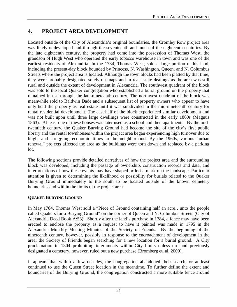
4. PROJECT AREA DEVELOPMENT Located outside of the City of Alexandria’s original boundaries, the Cromley Row project area was likely undeveloped and through the seventeenth and much of the eighteenth centuries. By the late eighteenth century, the property had come into the possession of Thomas West, the grandson of Hugh West who operated the early tobacco warehouse in town and was one of the earliest residents of Alexandria. In the 1784, Thomas West, sold a large portion of his land, including the present-day block bounded by Princess, N. Washington, Queen, and N. Columbus Streets where the project area is located. Although the town blocks had been platted by that time, they were probably designated solely on maps and in real estate dealings as the area was still rural and outside the extent of development in Alexandria. The southwest quadrant of the block was sold to the local Quaker congregation who established a burial ground on the property that remained in use through the late-nineteenth century. The northwest quadrant of the block was meanwhile sold to Baldwin Dade and a subsequent list of property owners who appear to have only held the property as real estate until it was subdivided in the mid-nineteenth century for rental residential development. The east half of the block experienced similar development and was not built upon until three large dwellings were constructed in the early 1860s (Magnus 1863). At least one of these houses was later used as a school and then apartments. By the mid-twentieth century, the Quaker Burying Ground had become the site of the city’s first public library and the rental townhouses within the project area began experiencing high turnover due to blight and struggling economic times in the neighborhood. By the 1960s, various “urban renewal” projects affected the area as the buildings were torn down and replaced by a parking lot. The following sections provide detailed narratives of how the project area and the surrounding block was developed, including the passage of ownership, construction records and data, and interpretations of how these events may have shaped or left a mark on the landscape. Particular attention is given to determining the likelihood or possibility for burials related to the Quaker Burying Ground immediately to the south to be located outside of the known cemetery boundaries and within the limits of the project area. QUAKER BURYING GROUND In May 1784, Thomas West sold a “Piece of Ground containing half an acre…unto the people called Quakers for a Burying Ground” on the corner of Queen and N. Columbus Streets (City of Alexandria Deed Book A:53). Shortly after the land’s purchase in 1784, a fence may have been erected to enclose the property as a request to have it painted was made in 1795 in the Alexandria Monthly Meeting Minutes of the Society of Friends. By the beginning of the nineteenth century, however, possibly in response to the encroachment of development in the area, the Society of Friends began searching for a new location for a burial ground. A City proclamation in 1804 prohibiting internments within City limits unless on land previously designated a cemetery, however, ruled out a new purchase (Bromberg et. al. 2000). It appears that within a few decades, the congregation abandoned their search, or at least continued to use the Queen Street location in the meantime. To further define the extent and boundaries of the Burying Ground, the congregation constructed a more suitable fence around

PROJECT AREA DEVELOPMENT
22
the lot in 1815-1816; which was subsequently replaced by a brick wall in 1860. Also at this time, three brick houses were constructed along N. Columbus Street, on a lot of land measuring 18-feet, 5-inches wide which was purchased from William Irwin, a Quaker (Bromberg et. al. 2000). These houses are visible in an 1863 Birds Eye View of Alexandria by Charles Magnus. The Burying Ground first appears on a map in 1877, identified as “Friends Burying Ground.” While the Burying Ground had been enclosed for much of its history, an enclosure does not appear on a map until a 1902 when it is identified as being 4-feet high on the north side and 6-feet high on the south side. Throughout second half of the eighteenth century, the number of Quakers living in Alexandria slowly diminished and their meetings alternated between Woodlawn, Alexandria, and Washington. By May 1884, it was reported that the Alexandria Meeting House was being used only four times a year and that it should be sold (Bromberg et. al. 2000). With this closure, use of the Queen Street Quaker Burying Ground ended. The Society of Friends loaned the land to the City for use as a playground in 1921. There is documentation of a few burial relocations from this cemetery to others near Alexandria. According to a newspaper article at the time, there were few burials in place.
Many years ago the city ordered all those who had relative buried there to move the bodies elsewhere as there would be no more burials permitted. So one by one the old head-stones in the little Quaker lot were taken away and there remained but a few tottering stones up against the high brick walls—reminders that the plans of man sometimes go awry. (Washington Post, July 29, 1923, quoted in Bromberg, et. al. 2000).
The Burying Ground continued to be used as a playground until c.1932 when entries in the Alexandria Monthly Meeting minutes indicate it was no longer being used as such. In 1937, a ninety-nine year lease agreement was made between the Society of Friends and the City of Alexandria for the purpose of constructing a library (the same segregated library where the infamous sit-in took place in 1939). Construction began with the understanding that the burials would not be disturbed and the foundation to the building would only be 30-inches deep. High use of the library necessitated an addition by 1954. This consisted of a large concrete slab on grade addition on the north elevation. By 1964 additional space was needed and two wings, one on the east and one on the west of the original 1937 building, were added (Bromberg, et. al., 2000). In 1992, the City began planning the demolition and reconstruction of the north wing. While, steps were taken to minimize disturbances to the ground, the depth of the new basement pilings necessitated the removal of graves from these areas. During construction, 156 burial features were identified, 58 percent of which could be preserved in place. Those that had to be removed were re-buried on-site (Shephard 1995). Alexandria’s Board of Architectural Review staff examined the boundary wall in 1993 and found that the north wall dated to the mid-twentieth century with extensive repairs made in 1990 (Bromberg, et. al. 2000).

PROJECT AREA DEVELOPMENT
23
QUAKER BURIAL PRACTICES Burial practices within the Religious Society of Friends appear to vary by Meeting House. Meetings that maintain their own burial grounds were to “establish rules and regulations governing internments, the marking of graves, and the keeping of records.” (Faith and Practice 2001). According to Thomas Clarkson, author of A Portraiture of Quakerism, Quakers had the tradition of having burying grounds that were not on church grounds, or in their case, not contiguous with their Meeting Houses. This was exemplified in Alexandria where the Meeting House was located in the city at St. Asaph and Wolfe Street, while the Burying Ground was outside the extent of the city (when established) at the corner of Queen and Columbus Streets. In their cemeteries, the deceased were buried in order of death, not necessarily beside a relation. “When the first grave in a row is opened and filled, the person who dies next, is put into that which is next to it” and so forth (Clarkson 1806). By these means, no room is lost. In Alexandria, however, there were six deeds for the lots in this cemetery, dated 1784. This may indicate that individual lots were sold in this cemetery and relatives could have adjoining plots (Bromberg et. al. 2000). Additionally, those permitted burial in the cemeteries varied. Some Meeting Houses authorized the burial of non-Quakers in their cemeteries, while others were stricter (Moger 1985). Rejection of a deceased individual may occur due to actions or beliefs of the individual in life. This is illustrated by a case in Pennsylvania in which members of a Quaker family were buried outside of the Quaker cemetery because of their militant actions during life (Mulcahy n.d.). It is unclear however whether such a practice was performed in Alexandria and whether burials were conducted outside of the cemetery walls. CROMLEY ROW PROJECT AREA The Cromley Row project area lies north of the Quaker Burying Ground; the cemetery being the impetus for this study. Both the Burying Ground and the project area were originally owned by the West family. With Thomas West’s transfer of land in 1784, more than 26-acres were sold to Baldwin Dade, a prominent citizen of the City. Both West and Dade conveyed a small number of half-acre lots of this land to various individuals, including that used as a Quaker Burying Ground. Rev. Dr. David Griffith purchased the bulk of the property, adjoining the City of Alexandria and adjacent to the Quaker Burying Ground (City of Alexandria Deed Book A:53). At the time of this land transaction, Baldwin Dade petitioned to have a street laid through the lot. Today this is known as Washington Street (Journal 1828). Rev. Dr. David Griffith studied medicine in England and practiced in the colonies. He went on to become a man of the cloth and during the American Revolution he served both as a surgeon and chaplain. He was also a friend to many leaders of the time including George Washington and the Marquis de Lafayette. After the War, Griffith became the third rector of Christ Church at Cameron and N. Columbus Streets in Alexandria. During his time in Alexandria, he lived at 711 Princess Street, the Christ Church rectory, which faces the project area (McLoone 2013). Griffith was selected as Virginia’s first bishop elect; however funds could not be raised to send him to England to be consecrated (“Christ Church, Lucketts”). Rev. Dr. Griffith served as rector from 1779 until his death in 1789 (Christ Church n.d.).

PROJECT AREA DEVELOPMENT
24
The considerable amount of land that the Griffith family owned in Alexandria, including the project area, was passed down through the generations. According to letters among family members, descendents were selling various lots as early as the 1800s (Randolph Family Papers). Although the project area was eventually divided into three lots, it remained unimproved and in the Griffith family until the mid-nineteenth century. Dr. William Wilmer Hoxton, M.D., husband of Rev. Dr. David Griffith’s grand-daughter, purchased the land in the project area from the remaining family and trustees and sold it to Henry Daingerfield and Martha Fitzpatrick (City of Alexandria Deed Books I, No. 3: 145 and M, No. 3: 602). In July 1847, Henry Daingerfield purchased the southern half of the Griffith property for $450.00. This land would become known as 313, 315, 317 and 319 N. Columbus Street and is adjacent to the Quaker Burying Ground to the south. Daingerfield was one of the most prominent businessmen in northern Virginia in the early- to mid-nineteenth century. In addition to traditional trading activities, Daingerfield was a founder of the Mount Vernon Cotton Manufacturing Company and a promoter of other industries and railroads which were largely responsible for the economic boom enjoyed in the City (Hurst 1991: 18). He has been described as follows:
The city tax list for 1855 discloses that Henry Daingerfield was the highest assessed property holder in the community [Alexandria] and the owner of stores, warehouses, wharves, a large private residence, a flourishing farm, and personal property whose total value exceeded $130,000.00 (Hurst 1991: 18).
According to the Alexandria City Directory, Daingerfield’s residence in Alexandria was at Prince and Columbus Streets (Directory of Alexandria 1834). He developed the properties at 317 and 319 N. Columbus Street as rental units. While they first appear on a map in 1877 (Figure 15), they may have been constructed by 1852, when the value of improvements to Daingerfield’s land on Columbus Street was listed for the first time at $600.00 (Alexandria Land Tax Records 1852). These structures were paired, 2-story, brick houses each with a long 2-story brick rear ell and all with a slate or tin roof. John A. Roach, a trustee, purchased the northern half of the Griffith property, what would become known as 321, 323, 325, 327, 329, and 331 N. Columbus Street, in November 1851 for a price of $755.00. This purchase was made on behalf of Martha Fitzpatrick, wife of James Fitzpatrick. According to the 1850 Census, James Fitzpatrick was born in Ireland and worked as a cotton spinner and later as a mattress maker (Alexandria Virginia City and County Census, 1850, 1860). There is no mention of Martha. The buildings at 321, 323, 325, and 327 N. Columbus Street first appear on a map in 1877. However, James Fitzpatrick was taxed for their improved land at this location in 1852, with improvements valued at $800.00 (Alexandria Land Tax Records 1853). These were paired, 2-story, frame dwellings with 1-story rear ells all covered by a shingle roof. Alterations to the rear ells of all four houses were made over time and a shed was constructed at the back of the properties of 321 and 323 N. Columbus Street by 1902.

PROJECT AREA DEVELOPMENT
25
The properties within the Cromley Row project area were developed as rentals. According to City Directories, the early owners of the properties did not reside in them (refer to Appendix I for a breakdown of owners and occupants for each 317 through 331 N. Columbus Street). Henry Daingerfield and John A. Roach, on behalf of Fitzpatrick, began selling their lots in the project area in the late-1850s and 1860s. From this point forward, with a few exceptions, owners had possession of single lots as opposed to multiple addresses.
Figure 15: Detail of Hopkins map, 1877, with location of project area.
Project Area

PROJECT AREA DEVELOPMENT
26
While there had previously been a structure at the corner of Princess and N. Columbus Street, it was demolished and the houses of 329 and 331 N. Columbus Street were constructed by the late 1880s as they do not appear on a map until 1891. These properties were paired, 2-story, frame structures with a slate or tin roof and a 2-story rear ell. By 1902, a 1-story frame shed was at the back of each property. In the late-nineteenth century, the properties were owned by two individuals noted for building houses in the city. Between 1883 and 1887 Dr. Edward S. Fawcett had ownership. He was a dentist known for building a number of houses; however these were largely in the southwestern section of the City (Alexandria Gazette 21 March 1901). The owner of the land between 1887 and 1897 was James R. Caton, a local attorney. Caton developed a partnership with Michael B. Harlow, city treasurer, and Park Agnew; they developed and sold many houses in the late 1800s including dwellings in the African American neighborhood the “Hump” (Sipe 2010). The free-standing frame dwelling at 315 N. Columbus Street, just south of the project area, was constructed by 1896, at which point it appears on the Sanborn map. This house was demolished by 1941. The dwelling at 313 N. Columbus Street, south of the project area and immediately north of the Quaker Burying Ground, was not constructed until 1921-22 (Figure 16). A building permit applied for in October 1921 by the owner Carey Crump detailed a 2-story, brick dwelling with a concrete foundation and a cellar (“Application for Permit to Build”).

PROJECT AREA DEVELOPMENT
27
Figure 16: Detail of Sanborn map, 1921, with location of project area.
After their construction, the properties were all used as residences with the exception of 323 N. Columbus Street and later 331 N. Columbus. Charles Ward, owner of 321, 323, 325, 329, and 331 N. Columbus Street for much of the late-nineteenth and early- to mid-twentieth centuries, was identified as a grocer in the Alexandria City Directories. According to Sanborn maps, he had a grocery store in 323 N. Columbus Street in the 1890s; it was relocated to 331 N. Columbus
Project Area

PROJECT AREA DEVELOPMENT
28
by 1902. Use of the building as a store appears to have ended by 1921 although the Ward family continued to have ownership.
Figure 17: Detail of Sanborn map, 1941 updated in 1959, with location of project area.
Project Area
PROJECT AREA DEVELOPMENT
29
The houses in the project area were continually rented out through the first half of the twentieth century. Even as the City of Alexandria expanded through the 1950s and 1960s, it saw an insurgence of urban renewal projects similar to cities throughout the country. While its existing historic fabric spurred the use of historic preservation, many residential “slums” were eliminated (McCloskey 1999). A neighborhood analysis of the City was conducted in 1966; the Cromley Row project area lied in Planning District 1. In 1960, District 1 had 78% of the City’s deteriorated and dilapidated housing (Urban Renewal Office 1966). Dwellings in the project area were witnessing a higher turnover in occupants; by 1964 the houses were vacant. They were later demolished and the land turned into a parking lot.

PROJECT AREA DEVELOPMENT
30
THIS PAGE LEFT INTENTIONALLY BLANK

ARCHAEOLOGICAL MONITORING
31
5. ARCHAEOLOGICAL MONITORING In November 2013, archaeologist with D+A monitored the mechanical removal of soil from an area approximately 6.0-meters (20-feet) by 18.2-meters (60-feet) located within a parking lot at the intersection of Columbus and Princess Streets in Alexandria, Virginia (Figure 18). The work was completed in accordance with requirements established by Alexandria Archaeology and was sufficient to conclusively determine the presence or absence of human burial features associated with the nearby Quaker Burying Ground site.
Figure 18: Aerial view of area of asphalt removal and monitoring. EXPECTED RESULTS Based upon background and property title research, anticipated resources included domestic structural resources and demolition debris from the second half of the nineteenth and first half of the twentieth century associated with occupation and use of the project area. Anticipated archaeological features included foundation remnants, a partial basement, and associated architectural debris. Given the distance between the excavation area and the nearby Quaker burying ground boundary the presence of graves or grave related features is unlikely; however, excavation will include soil removal to sterile subsoil using an abundance of caution. RESULTS OF MONITORING Initial excavation included the demolition and removal of the overlying asphalt parking lot using a saw and excavator. This was followed by removal of a gravel base layer measuring approximately 20-cm (8-inches) thick (Figure 19). Once this gravel layer was removed, the

ARCHAEOLOGICAL MONITORING
32
remnants of a brick foundation were immediately encountered along the northwestern edge of the area of excavation.
Figure 19: View of destruction layer in the western portion of the project area immediately underlying gravel fill beneath the current asphalt parking lot.
The exposed brick was excavated around, revealing the presence of brick buttresses along the interior and further exposing the brick foundation wall to the east (Figures 20 and 21). Soils on the interior of this excavated area consisted of a destruction layer of brick and mortar debris mixed with sand and clay. Cultural material within this area consisted of some twentieth century metal pipe and conduit.

ARCHAEOLOGICAL MONITORING
33
Figure 20: View of northern foundation wall and interior buttresses, looking north.

ARCHAEOLOGICAL MONITORING
34
Figure 21: Plan and profile drawings of northwestern corner of basement. Additional excavation around the perimeter of the western end of the project area resulted in the identification of a continuous brick foundation, exposing a 6-meter (20-foot) by 6-meter (20-foot) partial basement, which would have been located under the front portion of the town house fronting Columbus Street. Excavation into the interior of the foundation revealed a distinct destruction layer, which filled the partial basement and extended approximately 1.5-meters (5-feet) below ground surface. Located within the debris was a large iron boiler and associated piping. A coal chute was also identified in the northeast portion of this area (Figure 22). Artifacts located within the destruction debris in and around the coal chute included architectural materials such as brick fragments, wood, nails, and plaster fragments, as well as a few domestic artifacts including a modern pillow and early to mid-twentieth century whiteware ceramic sherds. Soils identified within the 6-meter (20-foot) by 6-meter (20-foot) basement area consisted of a brick and mortar destruction layer mixed with sand and clay. Below this was a brownish yellow hard clay consistent with subsoils identified in the Quaker Burying Ground report (City of Alexandria, 2000). Interspersed with the subsoil were areas of brick pavers, which formed the basement floor.

ARCHAEOLOGICAL MONITORING
35
Figure 22: View of northern foundation wall, interior buttresses, and potential coal chute, looking east.
Excavation in the eastern portion of the project area also revealed the presence of a gravel and demolition debris layer underlying the asphalt parking lot. Following removal of this layer the presence of a brick foundation corresponding closely with the perimeter of the overall excavation area was revealed. This foundation was significantly less substantial than that of the front portion, being only two courses thick and extending only approximately eight inches below the ground surface (Figure 23). Excavation within the interior of this portion resulted in the discovery of more destruction debris just east of the partial basement, as well as a shallow pit located towards the eastern edge of the interior (Figure 24). This pit had been infilled with significant amounts of destruction debris, including several large timbers, bricks, and some architectural features such as a portion of a newel post.

ARCHAEOLOGICAL MONITORING
36
Figure 23: View of destruction layer in the eastern portion of the project area immediately underlying gravel fill beneath the current asphalt parking lot.

ARCHAEOLOGICAL MONITORING
37
Figure 24: View of subsoil underlying the destruction layer in the eastern portion of the project area, looking southeast. Soils in the eastern portion of the project area (under the ell of the townhouse) consisted of a destruction layer of inconsistent thickness and composition, which was underlain by the same brownish yellow hard clay subsoil identified in the western portion of the project area. No evidence of grave features was identified in any part of the project area.
The excavated foundation closely aligned with the building outline shown at 319 North Columbus Street on period Sanborn Fire Insurance maps (Figure 25). The brick two-story structure was part of a duplex constructed possibly as early as 1852. The structures were paired, 2-story, brick houses each with a long 2-story brick rear ell and all with a slate or tin roof. The description of these buildings is consistent with the findings during archaeological monitoring of the project area. The front portion of the building had a basement, which was confirmed through excavation and the real ell was set at grade (Figure 26). Because the primary goal of the archaeological monitoring was to confirm the presence or absence of human burials associated with the nearby Quaker burial ground, once it was confirmed that a basement was present in the front section of the structure, no additional excavation or monitoring of this area was undertaken. Archaeologists with Alexandria Archaeology, however, did continue with removal of demolition debris and fill within the remainder of the basement and documentation of that effort is available from the City. All demolition debris and fills in the area of the rear ell were removed to expose

ARCHAEOLOGICAL MONITORING
38
subsoil, which were then inspected for evidence of human burials. Aside from the one shallow pit feature filled with timber and other architectural debris, no other evidence of archaeological features, other than the foundation walls, were observed in the area of the rear ell. Given the confirmed absence of human burial features it is D+A’s opinion that burials associated with the nearby Quaker Burying Ground did not extend northward in to the project area.
Figure 25:Detail of Sanborn map, 1941 updated in1959, with area of monitoring outlined in red.
Area of archaeological monitoring

ARCHAEOLOGICAL MONITORING
39
Figure 26: Plan view of townhouse foundation identified within the project area.

ARCHAEOLOGICAL MONITORING
40
THIS PAGE INTENTIONALLY LEFT BLANK

RESULTS AND CONCLUSIONS
41
6. RESULTS AND CONCLUSIONS DOCUMENTARY RESEARCH The documentary study of the Cromley Row project area on Princess and N. Columbus Streets consisted of archival research in an effort to understand the potential for the project area to contain eighteenth and nineteenth century burials associated with the nearby Quaker Burying Ground. Research revealed that the Quaker Burying Ground was established at its current location in 1784, following sale of the property to the Religious Society of Friends by Thomas West. Meeting minutes of the Friends indicate that the Burying Ground was fenced as early as 1794 suggesting that the boundaries of the Burying Ground were well established and visually marked early in the developmental history of the block. Shortly thereafter in 1804, the City of Alexandria prohibited the creation or expansion of cemeteries within the city limits, which would have likely constrained the Quaker’s expansion of the Burying Ground beyond its original boundaries. Throughout the late eighteenth and early-nineteenth century little documented activity appears to have occurred in the project area with the exception of the Quaker Burying Ground in the southwest corner of the block. It is therefore likely that burials during this period were located within the fenced area of the Burying Ground especially since the City had banned new cemeteries. While records document rebuilding of the Burying Ground fence in the mid-nineteenth century and later in the early-twentieth century, there is the possibility that the fence location was moved through time. If such movement did occur, it would have likely only been a matter of a few feet, rather than several feet, especially since development had begun in earnest on the adjacent lots by the mid-nineteenth century. There is documentation, however, of Quakers burying “outside” the fence, a practice used when members strayed from or fell out of favor with the faith (i.e. military service, or violent crimes). Given the location of the Burying Ground within the block and constraints to the south and west, any burials “outside” the wall would most likely have been to the north or east if they occurred at all. Actual development of the project area does not occur until the mid-nineteenth century and continues with various episodes of building and demolition into the early-twentieth century. During this period brick and frame townhomes, as well as detached single dwellings were constructed with the most recent being constructed at 313 N. Columbus Street immediately adjacent to the northern brick wall bounding the Quaker Burying Ground. Throughout much of their history, these properties were rental units with tenants and little is known of the occupants and their use of the properties until the turn of the twentieth century. Similarly, without specific documentation, the amount of ground disturbance attributed to construction and occupation of the buildings in the project area can only be speculated. It is likely that the buildings in the project area possess characteristics similar to other nearby dwellings constructed in the mid-nineteenth century. For example, the adjacent Uptown/Parker-Gray Historic District defined extant dwellings built c.1850 as being both frame and brick of the Greek Revival or Italianate architectural styles (Necciai 2007) similar to those that were located

RESULTS AND CONCLUSIONS
42
in the project area. Of those houses, 44% have basements and 56% do not. Of these 32% of the houses were identified as frame construction and 68% of brick. No houses with frame construction had a basement and 65% of houses made of brick had a basement. In simply looking at this data, it may be reasoned that the frame houses in the project area at 321 through 331 N. Columbus Street may not have had basements, and that the brick dwellings at 317 and 319 N. Columbus Street likely did have basements. As noted above, the house at 313 N. Columbus Street, immediately adjacent to the north wall of the former Burying Ground, was constructed in 1921-22 and was a 2-story, brick house with a documented cellar. Construction of the cellar at 313 N. Columbus Street would have resulted significant land disturbance sufficient to reveal the presence of human burials should they have been present; however, there is no recorded evidence of burial discoveries during the construction of 313 N. Columbus or other dwellings north of the Burying Ground. Construction for the Cromley Row homes will begin approximately 56-feet feet north of the brick wall enclosing the former Quaker Burying Ground, presently land of the Kate Waller Barrett Branch Library. Historically, this would have included the northern end of 317 N. Columbus Street up to and including land of 331 N. Columbus. Between the first new home (labeled #606 on Cromley Row’s Subdivision Plat) and the brick wall there will be parking spaces and the existing entry into the parking lot. Based upon the results of documentary study the project area is expected to contain archaeological deposits associated with the nineteenth-century townhouses located at 317 and 319 N. Columbus Street. Given that proposed ground disturbance associated with the Cromley Row development will not begin until approximately 56-feet north of the boundary wall of the burying ground, the likelihood that human burials are present within the project is considered low. ARCHAEOLOGICAL MONITORING D+A monitored the mechanical removal of soil from an area approximately 6.0-meters (20-feet) by 18.2-meters (60-feet) located within a parking lot at the intersection of Columbus and Princess Streets in Alexandria, Virginia. Monitoring revealed the presence of a brick foundation closely aligned with the building outline shown at 319 North Columbus Street on period Sanborn Fire Insurance maps. The front portion of the building had a basement, which was confirmed through excavation and the real ell was set at grade. Following confirmation that a basement was present in the front section of the structure, no additional excavation or monitoring of this area was undertaken by D+A. All demolition debris and fills in the area of the rear ell were removed to expose subsoil, which were then inspected for evidence of human burials. Aside from the one shallow pit feature filled with timber and other architectural debris, no other evidence of archaeological features, other than the foundation walls, were observed in the area of the rear ell. Given the confirmed absence of human burial features it is D+A’s opinion that burials associated with the nearby Quaker Burying Ground did not extend northward in to the project area.

REFERENCES
43
7. REFERENCES ----- 1921 “Application for Permit to Build,” City of Alexandria, VA, October 3, 1921. n.d. “Christ Church, Lucketts,” Available online at:
http://christchurchlucketts.cfsites.org/custom.php?pageid=38248. 1834 For 1834. Full directory, for Washington City, Georgetown, and Alexandria… E.A.
Cohen & Co., Washington, D.C. n.d. “Griffith Archives,” Rootsweb. Available online at:
http://archiver.rootsweb.ancestry.com/th/read/GRIFFITH/2004-10/1098684533 n.d. “ History 1749 – 1800,” Christ Church. Available online at:
http://www.historicchristchurch.org/about-us/history/1749-1800/ 1828 Journal of the House of Delegates of the Commonwealth of Virginia. Thomas W. White,
Richmond, VA. Alexandria City Directories
1895, 1897, 1900, 1903, 1907, 1915, 1917, 1924, 1934, 1936, 1938, 1940, 1942, 1945, 1947, 1950, 1952, 1953, 1955, 1956, 1960, 1961, 1962, 1963, 1964
“Alexandria Land Tax Records,” Library of Virginia. 1847; 1848; 1849; 1850; 1851; 1852; 1853 Brokett, Franklin Longdon and George W. Rock 1883 A Concise History of the City of Alexandria, VA: from 1669 to 1883, with a Directory of
Reliable Business Houses in the City. Alexandria, VA. Available online at: http://books.google.com
Bromberg, Francine W., Steven J. Shephard, Barbara H. Magid, Pamela J. Cressey, Timothy Dennée, Bernard K. Means 2000 “To Find Rest From All Trouble” The Archaeology of the Quaker Burying Ground
Alexandria, Virginia. Alexandria Archaeology, City of Alexandria, VA. Shephard, Stephen J. and Francine W. Bromberg.
1995 The Quaker Burying Ground in Alexandria: Archaeology Evidence of 18th and 19th Burial Practices. Alexandria Archaeology Publication 7, Alexandria, VA.
Chataigne, J.H. 1876 Chataigne’s Alexandria City Directory. Office of the Librarian of Congress,
Washington, D.C. 1881 Chataigne’s Alexandria City Directory. Office of the Librarian of Congress,
Washington, D.C.

REFERENCES
44
1889 Chataigne’s Alexandria City Directory. Office of the Librarian of Congress, Washington, D.C.
City of Alexandria n.d. A Brief History of Alexandria. Available online at:
http://alexandriava.gov/historic/info/default.aspx?id=29540 n.d. “Discovering the Decades: 1850s.” Available online at:
http://www.alexandriava.gov/historic/info/default.aspx?id=28408 1907 Souvenir Virginia Tercentennial Historic Alexandria, VA. Available online at:
http://www.alexandriava.gov/uploadedFiles/oha/info/OHAHistory1907TercentennialSouvenir.pdf
City of Alexandria Deed Books 1963 Deed Book 579:12 1961 Deed Book 536:183 1960 Deed Book 507:164 1950 Deed Book 295:586 1940 Deed Book 164:594 1930 Deed Book 102:190 1929 Deed Book 97:329 1926 Deed Book 85:495 1922 Deed Book 73:299 1919 Deed Book 68:514 1913 Deed Book 63:165 1911 Deed Book 61:398 1911 Deed Book 60:435 1899 Deed Book 44:101 1895 Deed Book 35:183 1893 Deed Book 29:482 1893 Deed Book 29:483 1891 Deed Book 25:354 1891 Deed Book 25:351 1891 Deed Book 25:86 1886 Deed Book 16:581 1884 Deed Book 13:573 1882 Deed Book 11:485 1871 Deed Book 1:282 1865 Liber W, No. 3:328 1865 Liber W, No. 3:156 1859 Liber U, No.3:29 1855 Liber W, No. 3:147 1855 Liber Q, No. 3:493 1851 Liber M, No. 3:602 1847 Liber I, No. 3:145

REFERENCES
45
1847 Liber I, No. 3:116 1847 Liber I, No. 3:115 1847 Liber I, No. 3:114 1786 Liber C: 22 1784 Liber A:53 City of Alexandria Will Books 1921 Will Book C, No.2:119 1906 Will Book 3:115 Clarkson, Thomas, M.A. 1806 A Portraiture of Quakerism. Taken from a View of the Education and Discipline, Social
Manners, Political and Civil Economy, Religious Principles and Character of the Society of Friends, Vol II. Samuel Stransbury, New York. Available online at: http://www.gutenberg.org/cache/epub/15261/pg15261.html.
Fairfax County n.d. “An Interactive Tour of Historic Fairfax County,” Available online at
http://www.fairfaxcounty.gov/parks/histmap/histour.htm. Hurst, Harold W. 1991 Alexandria on the Potomac: The Portrait of an Antebellum Community. University
Press of America, Lanham, MD. McCloskey, Patricia Ellen. 1999 Urban Renewal: Historic Preservation A Case Study of Alexandria, Virginia, 1945-
1980. James Madison University, Thesis. McLoone, Sharon 2013 “Original Christ Church Rectory for Sale,” Old Town Alexandria Patch, May 7, 2013.
Available online at: http://oldtownalexandria.patch.com/groups/house-and-home/p/original-christ-church-rectory-for-sale
Miller, T. Michael (transcription) 1986 Alexandria Virginia City and County Census 1860. Heritage Books, Inc., Bowie, MD. Mulcahy, Peter n.d. The Doan Outlaw of Bucks County: The Life and Times of the Plumstead Cowboys.
Available online at http://www.haygenealogy.com/hay/sources/gibson/doans.html. Necciai, Terry and Arianna Drumond. 2007 “Uptown/Parker-Gray Historic District,” National Register of Historic Places
Registration Form. Netherton, Ross and Nan 1992 Fairfax County: A Contemporary Portrait. Walsworth Pub. Co.

REFERENCES
46
1992 Fairfax County Virginia: A History. Fairfax County Board of Supervisors. Randolph Family Papers, Virginia Historical Society. Letter from Llewellyn Griffith to Camillus Griffith, April 12, 1815 Letter from Elizabeth (Griffith) Thompson, February 19, 1809 Letter from Dr. William W. Hoxton to Doctor, July 3, 1841 Sheely, Horace 1966 “Alexandria Historic District” National Historic Landmarks Registration Form. Tallichet, Marjorie D. (transcription) 1986 Alexandria Virginia City and County 1850 Census. Heritage Books, Inc., Bowie, MD. Thomas, Alan 2013 “Burials on the Richter tract?” MainLine Media News. Available online at:
http://www.mainlinemedianews.com/articles/2013/02/05/main_line_suburban_life/news/doc51116aa8e908f815958622.txt.
Urban Renewal Office 1966 Neighborhood Analysis of Alexandria, VA. Alexandria, VA.

APPENDIX A
47
APPENDIX A. The properties within the Cromley Row project area were developed as rentals. According to City Directories, the early owners of the properties did not reside in them. The known occupations of those that rented the properties, beginning in the late-nineteenth century, indicate that the project area was part of a working class neighborhood. The following indicates each property’s owner and the property’s known occupant and occupation.
Table 1: Owners and Occupants of 317 N. Columbus Street 317 N. Columbus Street
Date Range Owner Known Occupant(s) / Occupation -1784 Thomas West
1784 - 1786 Baldwin Dade 1786 - 1847 Family of Rev. Dr. David Griffith
1847 - 1865 Henry Daingerfield 1865 - 1891 William L. Padgett
1891 - 1919 Mary Jane Schofield and family 1903: Daniel W. Schofield (clerk) and Mary J. Schofield
1907: Daniel W. Schofield (clerk), Mary J. Schofield, Mary M. Schofield (student)
1919 - 1930 The American Agricultural Chemical Company of Connecticut
1930 - 1961 George Arthur Harrison 1936-1961: George A. Harrison 1961 - 1963 Ira R. Devonald, trustee 1962-1963: Thomas A. Gilliam
1963 - 2004 Alexandria National Bank
2004 - 2012 First States Investors 2012 - Mrs. Real Estate Investment
Properties, LLC
Table 2: Owners and Occupants of 319 N. Columbus Street
319 N. Columbus Street
Date Range Owner Known Occupant(s) / Occupation -1784 Thomas West
1784 - 1786 Baldwin Dade 1786 - 1847 Family of Rev. Dr. David Griffith
1847 - 1865 Henry Daingerfield
1865 - 1891 William L. Padgett 1891 - 1940 John Henry Schofield and family 1903: John T. Harrison (foreman)
1907-1934: Arthur G. Harrison (clerk)
1940 - 1961 Arthur Harrison (aka George Arthur Harrison)
1945-1956: Henry W. Moriarty (cabinet maker), Arthur J. Moriarty, Henry T. Moriarty, Henry W. Moriarty (mill foreman)
1960: Ervin M. Hasty
1961 - 1963 Ira R. Devonald, trustee 1961-1962: Ervin M. Hasty

APPENDIX A
48
1963 - 2004 Alexandria National Bank
2004 - 2012 First States Investors 2012 - Mrs. Real Estate Investment
Properties, LLC
Table 3: Owners and Occupants of 321 N. Columbus Street
321 N. Columbus Street
Date Range Owner Known Occupant(s) / Occupation -1784 Thomas West
1784 - 1786 Baldwin Dade
1786 - 1847 Family of Rev. Dr. David Griffith 1847 - 1851 William W. Hoxton (trustee for
Griffith)
1851 - 1855 John A. Roach for Martha Fitzpatrick
1855 - 1865 Elizabeth E. Vane 1865 - 1871 William L. Padgett
1871 - 1893 Mary D. Diez
1893 - 1922 Charles W. Ward and family 1922 - 1929 John O'Neil and family
1929 - 1960 Robert W. Clarke 1945-1954: Mary L. Polkinhorn (grocery clerk), Robert Polkinhorn (grocery clerk)
1955-1956: Cary Hansbrough 1960 - 1963 Ira R. Devonald, trustee 1961-1963: Willie C. Logan
1963 - 2004 Alexandria National Bank
2004 - 2012 First States Investors 2012 - Mrs. Real Estate Investment
Properties, LLC
Table 4: Owners and Occupants of 323 N. Columbus Street
323 N. Columbus Street
Date Range Owner Known Occupant(s) / Occupation -1784 Thomas West
1784 - 1786 Baldwin Dade
1786 - 1847 Family of Rev. Dr. David Griffith 1847 - 1851 William W. Hoxton (trustee for
Griffith)
1851 - 1859 John A. Roach for Martha Fitzpatrick
1859 - 1882 William L. Padgett 1882 - 1884 Robert G. Kinnier
1884 - 1960 Charles E. Ward and family 1888-1900: Charles E. Ward (grocer)
1945-1956: John T. Lee (bus operator)
1960 - 1963 Ira R. Devonald 1960: Robert W. Bailey

APPENDIX A
49
1961-1962: John F. Johnson
1963 - 2004 Alexandria National Bank 2004 - 2012 First States Investors
2012 - Mrs. Real Estate Investment Properties, LLC
Table 5: Owners and Occupants of 325 N. Columbus Street
325 N. Columbus Street Date Range Owner Known Occupant(s) / Occupation
-1784 Thomas West
1784 - 1786 Baldwin Dade 1786 - 1847 Family of Rev. Dr. David Griffith
1847 - 1851 William W. Hoxton (trustee for Griffith)
1851 - 1860 John A. Roach for Martha Fitzpatrick
1860 - 1870 Henson Wilburn
1870 - 1882 George A. Bossart
1882 - 1893 Eliza Ann Deavers and Orlando 1893 - 1960 Charles E. Ward and family 1952-1956: Elmer R. Kopp, Nellie Z.
Kopp
1960; Fred Smith
1961-1962: Arthur Johnson 1960 - 1963 Ira R. Devonald
1963 - 2004 Alexandria National Bank 2004 - 2012 First States Investors
2012 - Mrs. Real Estate Investment Properties, LLC
Table 6: Owners and Occupants of 327 N. Columbus Street
327 N. Columbus Street
Date Range Owner Known Occupant(s) / Occupation -1784 Thomas West
1784 - 1786 Baldwin Dade 1786 - 1847 Family of Rev. Dr. David Griffith
1847 - 1851 William W. Hoxton (trustee for Griffith)
1851 - 1860 John A. Roach for Martha Fitzpatrick
1860 - 1877 Charles R. Joyce 1877 - 1879 John A. Marchant
1879 - 1882 Benjamin F. Peake 1882 - 1901 George W. Harrison 1888-1900: George W. Harrison
(carpenter, patternmaker)
1901 - 1901 Eliza A. Deavers and Orlando
1901 - 1919 Ellen S. Darley

APPENDIX A
50
1919 - 1926 Charles F. Downey 1924: Charles F. Downey (car repair)
1926 - 1933 Richard Daingerfield Hooe 1932-1950: Richard D. Hooe (carpenter, machinist for Fruit Growers Exp. Co.) 1933 - 1952 Barton A. Lawson
1952 - 1953 Sophie Catlett 1952: Ralph Jackson
1953 - 1960 Alice A. Lawson 1953: Sophie Catlett
1955-1956: James H. Woolfrey 1960 - 1963 Ira R. Devonald, trustee 1960-1962: Marie Moses
1963: Moses Greenfair 1963 - 2004 Alexandria National Bank
2004 - 2012 First States Investors 2012 - Mrs. Real Estate Investment
Properties, LLC
Table 7: Owners and Occupants of 329 N. Columbus Street
329 N. Columbus Street
Date Range Owner Known Occupant(s) / Occupation
-1784 Thomas West 1784 - 1786 Baldwin Dade
1786 - 1847 Family of Rev. Dr. David Griffith 1847 - 1851 William W. Hoxton (trustee for
Griffith)
1851 - 1855 John A. Roach for Martha Fitzpatrick
1855 - 1864 J. Louis Kinzer (trustee possibly for Fitzpatrick)
1864 - 1883 Charles Joyce 1883 - 1887 Edward S. Fawcett
1887 - 1897 James R. Caton
1897 - Back to Edward S. Fawcett to secure payment, he failed to paid so property was conveyed to Muir to sell
1897 - 1901 John A. Muir 1901 - 1901 William K. Harlow
1901 - 1902 William Desmond 1902 - 1960 Charles E. Ward and family 1903: Charles E. Ward (grocer)
1945-1954: Malcolm A. Toombs (mechanic), Doris V. Toombs
1955-1956: Wesley F. Garris 1960 - 1963 Ira R. Devonald, trustee 1960: Annie F. Bostic
1963 - 2004 Alexandria National Bank
2004 - 2012 First States Investors 2012 - Mrs. Real Estate Investment
Properties, LLC

APPENDIX A
51
Table 8: Owners and Occupants of 331 N. Columbus Street 331 N. Columbus Street
Date Range Owner Known Occupant(s) / Occupation -1784 Thomas West
1784 - 1786 Baldwin Dade 1786 - 1847 Family of Rev. Dr. David Griffith
1847 - 1851 William W. Hoxton (trustee for Griffith)
1851 - 1855 John A. Roach for Martha Fitzpatrick
1855 - 1864 J. Louis Kinzer (trustee possibly for Fitzpatrick)
1864 - 1883 Charles Joyce
1883 - 1887 Edward S. Fawcett
1887 - 1897 James R. Caton 1897 - Back to Edward S. Fawcett to secure payment, he failed to paid so property was conveyed to Muir to sell
1897 - 1901 John A. Muir
1901 - 1901 William K. Harlow 1901 - 1902 William Desmond
1902 - 1960 Charles E. Ward and family 1947: Robert W. Clarke (engineer), Elizabeth Clarke (descendent of Ward)
1952-1960: Elizabeth Clarke
1960 - 1963 Ira R. Devonald, trustee 1961-1962: John K. Sherman 1963 - 2004 Alexandria National Bank
2004 - 2012 First States Investors 2012 - Mrs. Real Estate Investment
Properties, LLC