Remote Sensing and Sensor Networks
22
Slide 1 Remote Sensing and Sensor Networks: Providing meteorological intelligence to support system operations SDG&E Meteorology Mike Espinoza – Project Manager Steven Vanderburg – Senior Meteorologist Brian D’Agostino – Senior Meteorologist
Transcript of Remote Sensing and Sensor Networks

Slide 1
Remote Sensing and Sensor Networks:
Providing meteorological intelligence to
support system operations
SDG&E Meteorology
Mike Espinoza – Project Manager
Steven Vanderburg – Senior Meteorologist
Brian D’Agostino – Senior Meteorologist
Slide 2
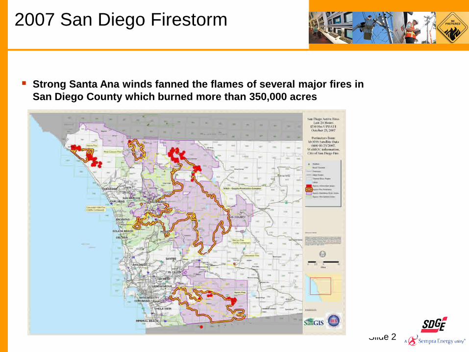
2007 San Diego Firestorm
Strong Santa Ana winds fanned the flames of several major fires in
San Diego County which burned more than 350,000 acres

Santa Ana
Forecasting
3

mph
65 km x 3.4 km
Witch Ramona
4
Fire Preparation and Safety Understanding Santa Ana’s
West Santa Ysabel
Julian

Slide 5
SDG&E MesoNet / Weather Network
We own and operate the nations 3rd largest ,and densest weather
network
Currently 138 weather station MesoNet
Supports operational decisions
8 Portable Weather Stations
Reports every 10 minutes
Redundant communications
All data is made public
6 Back-Country Weather Cameras
We collect 130,000 data points daily
Supports real-time operations
Supports forecasting capability
Supports research
Anemometer
measures
wind speed/gust
Temperature,
Relative Humidity
Sensor
Dead-
Fuel
Moisture
Sensor
Datalogger,
Communications

Weather station installation near Los Coches Substation, Lakeside
All stations
are on
SCADA
SDG&E MesoNet/Weather Network

Slide 7
SDG&E Weather
Stations and
Instruments
Anemometer
(wind speed
& gusts)
SDG&E MesoNet/Weather Network

SDG&E MesoNet / Weather Network

Slide 9
SDG&E Weather Network

Slide 10
SDG&E MesoNet / Weather Network

SDG&E VISA & KPI

Slide 12
Weather Cameras
6 Cameras Borrego Springs, Creelman, Loveland, Rincon,
Rough-Acres, Warner Springs
Monitor the weather Impacts (vegetation, structures)
Flying Debris
Creelman

Slide 13
● This system will improve our forecasting capabilities Greater lead time, increased resolution, better accuracy
Direct access to NWS data, forecasts, and warnings
NOAA Port & MetWise Enterprise

Slide 14
Using Satellites to Determine Surface
Greenness

Slide 15
0
10
20
30
40
50
60
70
80
90
100
110
120
00
/01
/06
00
/05
/11
00
/09
/07
00
/12
/28
01
/05
/24
01
/09
/06
01
/12
/20
02
/04
/18
02
/08
/01
02
/11
/14
03
/03
/11
03
/06
/24
03
/10
/07
04
/02
/10
04
/06
/08
04
/09
/21
05
/01
/18
05
/05
/10
05
/08
/30
05
/12
/13
06
/04
/25
06
/08
/08
06
/11
/21
07
/03
/19
07
/07
/09
07
/10
/22
08
/02
/25
08
/06
/09
08
/09
/22
09
/01
/05
09
/05
/04
09
/09
/07
09
/12
/21
10
/04
/12
10
/07
/26
10
/11
/15
11
/03
/14
11
/07
/04
11
/10
/24
12
/03
/05
Using Satellites to Determine Surface
Greenness
•Satellite data can help us
determine the current state
of the fuels across our service area
•The information is updated daily

Slide 16
We are using this technology to increase
our knowledge base about the weather and
how it impacts the electric system. We
provide the system operators with the
information intelligence to make better and
more informed operational decisions.
Using Weather Technology

SDG&E MesoNet Currently Operates 43 Pyranometers
Approximately 25 additional Locations through Sustainable Communities
Renewable Energy/Solar Forecasting

Solar Forecasting / Marine Layer Research
Power Generation Forecasting
Coastal Marine Layer Forecasting/Modeling
• Statistical Approach / Research
• Numerical Weather Prediction
Modeling past 50 years for wind, solar radiation, temperature in
conjunction with MeteoGroup
• Design of System
• Hardening Projects
• Support better understanding of Santa Ana Winds and Fire Potential
Acquiring Atmospheric Profilers • Improve monitoring and
short-term forecasting of the
marine layer
1. .

Solar Photovoltaic Power Generation Forecasting
Project Objectives:
Advance SDG&E’s understanding of long-term
benefits, determine solar forecasting
Integration requirements
Green Power Labs Project Deliverables:
Provide SDG&E with Day Ahead (DA) and
Hour Ahead (HA) Solar Power Forecasting
of 12 PV facilities
Our Current Operational Solar PV 1: ~120MW
Our Current Approved and Pending Solar 2: 1GW+
1. Current operational solar capacity provided by SDG&E operations.
2. Approved and Pending CPUC Interconnection Requests, solar PV and solar thermal. October 2011.

Slide 20
Coastal Marine Layer (CML)
Forecasting
Binary Logistic Regression Model
Binary Classification — Cloudy or Clear
Compartmentalize San Diego County into 1km grid, ~32,000 grid cells in region
Before the CML spatial and inland extent can be studied, each grid cell must be
quantitatively identified as cloudy or clear for each time step
Slide 21
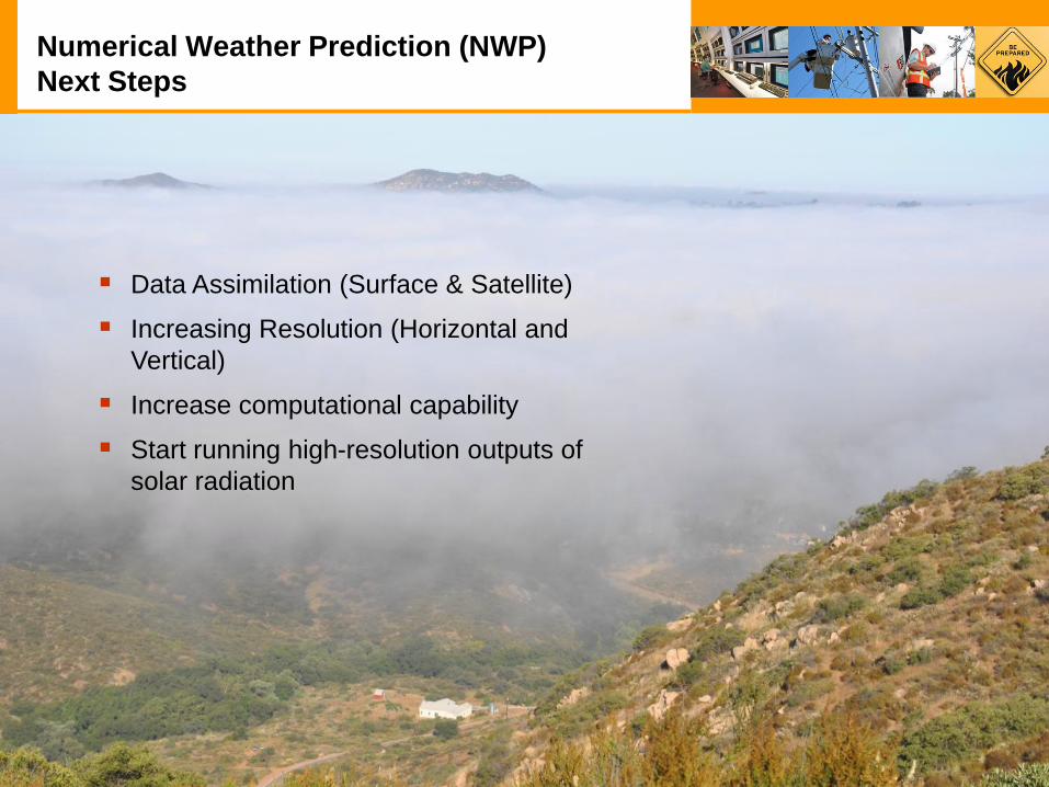
Numerical Weather Prediction (NWP)
Next Steps
Data Assimilation (Surface & Satellite)
Increasing Resolution (Horizontal and
Vertical)
Increase computational capability
Start running high-resolution outputs of
solar radiation

Slide 22
Thank You!
Questions?