Reliance Jio Infocomm Limited 4G OFC Network · 2016-09-08 · Reliance Jio Infocomm Limited 4G OFC...
31
Geotrax 2016 Page 1 of 31 Reliance Jio Infocomm Limited 4G OFC Network DGPS Survey report for Forest Diversion of proposed OFC Cable Route from Palli to Katghora with Route Length 29.44 Km in District Korba APPLICATION SUBMITTED BY: RELIANCE JIO INFOCOMM LIMITED DGPS SURVEY AND GIS MAPPING DONE BY: Geotrax International Services Raipur, Chhattisgarh.
Transcript of Reliance Jio Infocomm Limited 4G OFC Network · 2016-09-08 · Reliance Jio Infocomm Limited 4G OFC...

Geotrax 2016 Page 1 of 31
Reliance Jio Infocomm Limited 4G OFC Network
DGPS Survey report for Forest Diversion of
proposed OFC Cable Route from Palli to
Katghora with Route Length 29.44 Km in
District Korba
APPLICATION SUBMITTED BY:
RELIANCE JIO INFOCOMM LIMITED
DGPS SURVEY AND GIS MAPPING DONE BY:
Geotrax International Services
Raipur, Chhattisgarh.

Geotrax 2016 Page 2 of 31
Table of Contents
1. Introduction and Background ....................................................................... 3 1.1 Background.......................................................................................... 3 1.2 Location and Communication .................................................................. 3 1.3 Objective ............................................................................................. 4 1.4 Geotrax Empanelment Certificate in Chhattisgarh ...................................... 5 2. Scope of Work ........................................................................................... 8 3. Deliverables .............................................................................................. 9 4. Brief description of the Technical approach .................................................... 9 4.1 Input Data ........................................................................................... 9 4.2 GIS Data Preparation ............................................................................ 9 4.3 Establishment of Primary Control Point (PCP) .......................................... 10 4.4 Establishment of Secondary Control Point (SCP) ...................................... 11 4.5 DGPS Survey Procedure ....................................................................... 12 4.6 Creation of Vector Layers ..................................................................... 12 4.7 Specification of DGPS Equipment .......................................................... 12 5. Results .................................................................................................... 15 6. Background of Organization ........................................................................ 17 6.1 Company Profile: Geotrax .................................................................... 17 7. Annexure ................................................................................................. 19 7.1 Annexure – 1: PCP Observation Processing Report ................................... 19 7.2 Annexure – 2: DGPS Surveyed coordinates of Forest Patches .................... 26 7.3 Annexure – 3: Geo-Referenced Maps of the Proposed Route ..................... 31
7.3.1 Geo-referenced Forest Map showing Proposed 4G OFC Route ................. 31 7.3.2 Geo-referenced SOI Map (1:50000) showing Proposed 4G OFC Route ...... 31
Geotrax 2016 Page 3 of 31
1. Introduction and Background
PROJECT 4G OPTICAL FIBER CABLE
1.1 Background
Reliance Jio Infocomm Limited is setting up 4G Optical Fiber Cable network
across the country. In the state of Chhattisgarh, the company plans to set
up the telecom network (including laying of OFC cable) along the NHAI/PWD
Road corridor. Reliance Jio Infocomm is granted license by Ministry of
Communications & IT, Dept. of Telecommunications, and Govt. Of India, to
establish Optical Fiber Cable network under the license number 370/2011
dated. 23.06.2011 issued to M/S Infotel Broadband Services Limited
(company name changed to Reliance Jio Infocomm Limited on 22.01.2013).
The OFC Cable is laid under the ground at approx. depth of 1.65m and the
trench width is 0.5m. In most of the places the cable trench line on National
Highways is approx. at a distance of 14.5m from the road centerline and
for State/District highways it is approx. 7m from the road centerline.
1.2 Location and Communication
The proposed OFC Cable route from Katghora to Palli (Tehsil: Palli, District:
Korba) is on the National Highway corridor NH-111. The route length is
approx. 29.44 km. The National Highway 111 links the town Bilaspur to
Ambikapur via Katghora. OFC cable route falls in two tehsils: Palli and Pondi
Uproda of the Korba district. The survey site passes through two forest
ranges – Palli and Katghora of Katghora forest division. The cable route’s
proposed starting point is Palli Village Latitude 22°22'35.3551"N and
Longitude 82°19'39.7134"E and the end location is Katghora at Latitude
22°33'16.76" N and Longitude 82°32'49.29" E. The OFC Cable route is
covered under Survey of India Toposheet 64 J/07, 64 J/11 and 64 J/10 on
RF 1:50000.
Geotrax 2016 Page 4 of 31
1.3 Objective
As per directives of Ministry of Environment & Forests (MoEF) dated 8th July
2011; all applications for Forest Diversion, under Forest Conservation Act,
1980 must be accompanied with Geo‐referenced shape file, showing the
boundary of the proposed area (both soft copy and hard copy maps),
prepared using Differential GPS (DGPS) and the same should be uploaded
to MoEF website along with the online application.
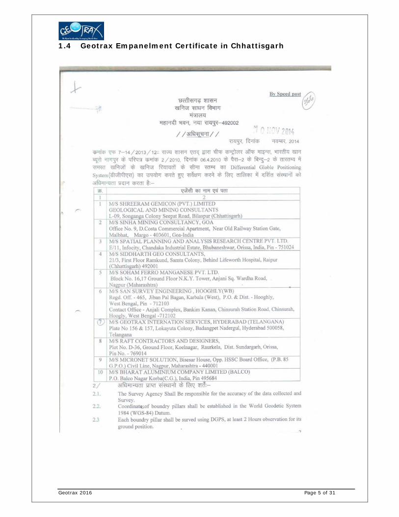
To meet this requirement of MoEF, Reliance Jio Infocomm Limited,
entrusted the DGPS survey work to M/s Geotrax International Services,
Raipur, which is an empanelled agency of Directorate of Geology and Mines,
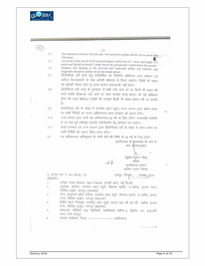
Chhattisgarh (Ref. Circular No. F-7-14/2013/12, dated. 10.11.2014).
Geotrax 2016 Page 5 of 31
1.4 Geotrax Empanelment Certificate in Chhattisgarh
Geotrax 2016 Page 6 of 31

Geotrax 2016 Page 7 of 31

Geotrax 2016 Page 8 of 31
Not to Scale
Fig-1: Katghora to Palli 4G OFC Cable Proposed Route on Satellite Imagery
2. Scope of Work
1. Establishment of one base station with 72 Hours observationand secondary control points at every 10km along the proposed route.
2. DGPS Survey for collection of ground coordinates along the OFCCable trench at every 50m interval and/or at every turn/bend along the porposed trench. The DGPS data is collected at forest patches only.
3. Data processing and Interpretation
a. Geo-referencing of SOI Toposheet (1:50000), Forest Stock map (1:15000, if available) and satellite imagery
b. Creation of OFC Cable trench boundary vector map using the DGPS Surveyed data
c. Superimposition of cable route layer on Georeferencedforest maps, SOI Toposheet and Satellite imagery.
d. Computation of Forest area proposed for diversion. It includes Reserved/Protected Forest & Revenue Forest.
e. Preparation of Geo-referenced forest map at 1:15000 scale, and SOI Toposheet at 1:50000 scale.

Geotrax 2016 Page 9 of 31
f. Preparation of DGPS survey report along with soft copy of – maps in shapefile format and kml file
4. Printing of report and Geo-referenced maps and Technical compliance.
3. Deliverables
The deliverables envisaged for the assignment are described below
1. Post processed DGPS observations data as well as raw data in RINEX format.
2. DGPS Reports - Base line & network adjustment report for the primary and Secondary Control Points.
3. Geo-referenced SOI maps & forest block mapsbased on DGPS observations – Hard and Soft Copy (SHP and KML formats).
4. Proposed Forest Diversion area statement as per DGPS Survey
5. DGPS Survey and mapping report
4. Brief description of the Technical approach
4.1 Input Data
The proposed 4G Cable Route plan is shown on the ground by the engineer/
Vendor of Reliance Jio Infocomm Ltd (RJIL). The Forest & SOI maps required
for geo-referencing were provided byReliance Jio Infocomm Limited.It is
proposed that the cable is laid within the ROW of the NHAI/PWD road corridor
(where possible). The cable trench is laid at a depth of 1.65m below ground
and the trench width is 0.5m. The revenue village maps were collected from
NIC online website (http://cg.nic.in/bhunaksha/). The revenue forest
information& details are collected from the District Revenue department and
were provided by RJIL.
4.2 GIS Data Preparation
Based on the input data (maps, boundary coordinates from CMPDI) and information provided by
Revenue Department of Surguja and Surajpur districts, the DGPS base station - Primary and
Temporary Benchmarks Control Points (PCP and TBM) in the project area are planned. One PCP
with 72 hours observation was planned and established on the roof top of the Forest Department
Guest House (Shiv Park), Surajpur. Secondary control points are planned for DGPS Static

Geotrax 2016 Page 10 of 31
Observation for at least 12 hours duration at Tara Forest Guest House, Surajpur which is
approximately 45 Km (aerial distance) from Surajpur Primary Control Point. The Temporary Bench
Mark are established along the National Highway route from Tara to Katghora and further upto
Palli using the Tara Secondary control point as the reference point.
Not to Scale Fig-2: Satellite Image showing the location of the Surajpur Primary Control Point
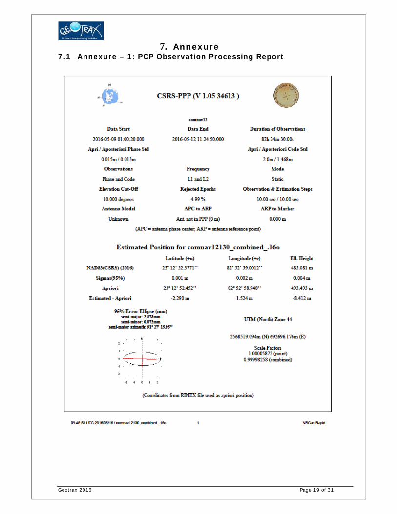
4.3 Establishment of Primary Control Point (PCP) The Primary Control Point (PCP) with 72 hours of DGPS Observation was established as the DGPS
base station. The PCP was established in the roof top of the Forest Department Guest House (Shiv
Park) in Surajpur. As per Survey of India (SOI) Guideline, the PCP is to be fixed through
continuous observation for 72 hours duration. The observed data was processed with reference to
the data of International GNSS Service (IGS) stations as per SOI guideline (IGS processed report is
enclosed as Annexure-1).
The coordinate of the PCP is given below:
Point ID Latitude (d:m:s) Longitude (d:m:s) Ellipsoidal Height(m)
SurajpurBase 23°12'52.39820"N 082°52'59.05530"E 486.559000
Geotrax 2016 Page 11 of 31
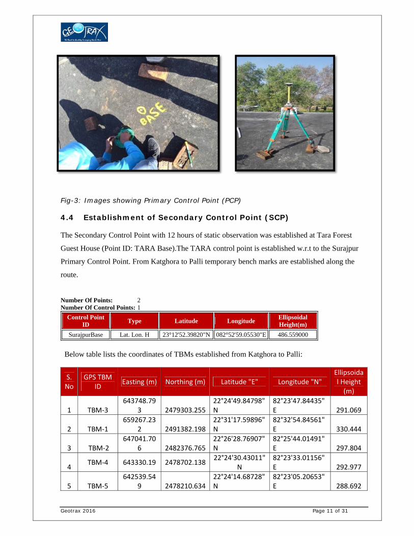
Fig-3: Images showing Primary Control Point (PCP)
4.4 Establishment of Secondary Control Point (SCP) The Secondary Control Point with 12 hours of static observation was established at Tara Forest
Guest House (Point ID: TARA Base).The TARA control point is established w.r.t to the Surajpur
Primary Control Point. From Katghora to Palli temporary bench marks are established along the
route.
Number Of Points: 2 Number Of Control Points: 1
Control Point ID
Type Latitude Longitude Ellipsoidal Height(m)
SurajpurBase Lat. Lon. H 23°12'52.39820"N 082°52'59.05530"E 486.559000
Below table lists the coordinates of TBMs established from Katghora to Palli:
S.No
GPS TBM ID
Easting (m) Northing (m) Latitude "E" Longitude "N" Ellipsoidal Height (m)
1 TBM‐3 643748.79
3 2479303.255 22°24'49.84798"N
82°23'47.84435"E 291.069
2 TBM‐1 659267.23
2 2491382.19822°31'17.59896"N
82°32'54.84561"E 330.444
3 TBM‐2 647041.70
6 2482376.765 22°26'28.76907"N
82°25'44.01491"E 297.804
4 TBM‐4 643330.19 2478702.138
22°24'30.43011"N
82°23'33.01156"E 292.977
5 TBM‐5 642539.54
9 2478210.634 22°24'14.68728"N
82°23'05.20653"E 288.692

Geotrax 2016 Page 12 of 31
6 TBM‐7 637819.16
1 2475442.769 22°22'46.08366"N
82°20'19.28831"E 265.227
7 TARA_Bas
e 678405.90
8 2526163.501
22°50'01.39550"N
82°44'18.77644"E
509.562
4.5 DGPS Survey Procedure DGPS survey was carried out using a pair of DGPS instrument. One DGPS
Instrument was used as Base Station. The first base station for the survey was
established at the Temporary Bench Mark -1 Point near Katghora. The base is
shifted using the Real Time Kinematic Survey method. The distance between
the Base Station and rover was always less than 5km.
The other DGPS instrument was working as Rover. The survey was conducted
in Real Time Kinematic (RTK) mode. The Survey team carried out DGPS Survey
of boundary points by walking along the proposed cable trench boundary. DGPS
readings were collected at every 50m distance along trench and at every turn
or bend. For Geo-referencing village maps around 5 GCPs were collected for the
each village having Govt. Forest Land.
During the survey the start and end of forest patch was identified in the field
with the help of staff from the forest department. The forest department staff
also provided information regarding the forest range, compartment number etc.
The static data is Post Processed using Trimble Business Centre software.
4.6 Creation of Vector Layers The surveyed points captured through DGPS were plotted in the GIS Software and the Polygon and
Polyline layers are created using the DGPS Surveyed points. Different layers such as the Forest
Patch polygon, Forest Trench centerline, Non-Forest Trench line, polygon showing Revenue forest
patches (Chote Jad ka Jungle + Bade Jad Ka Jungle) etc., are prepared. The vector layers prepared
are then super-imposed on the Geo-referenced Forest map and Cadastral maps.
4.7 Specification of DGPS Equipment

Geotrax 2016 Page 13 of 31
Geotrax deployed the most advance and hi-precision devices to carry out the
DGPS survey. The DGPS performance specifications are given below. The
corresponding fact sheets are placed below for ready reference.

Geotrax 2016 Page 14 of 31

Geotrax 2016 Page 15 of 31
5. Results The total route length from Katghora to Hadmor is approx. 29.44 km and the proposed forest area
for diversion is 0.548 Ha. DGPS Survey processing report and co-ordinates of the PCP are in
Annexure-1, and DGPS coordinates of TBM and forest patch boundary coordinates is in Annexure-
2. The geo-referenced maps are in Annexure -3.
AREA STATEMENT
Palli to Katghora: Proposed Forest Diversion Area Statement
Total Route Length (in KM)
Total Forest Patch Length
(in KM)
OFC Cable Trench Width (in KM)
Total Forest Diversion Area (in
HA)
29.44 10.95 0.0005 0.548
TABLE - A
SCHEDULE OF FOREST LAND - PROTECTED FOREST & ORANGE FOREST AREA
SL. NO.
PATCH NUMBER
DIVISION RANGE COMPARTME
NT TYPE
COMPARTMEN
T NUMBE
R
DIVERSION AREA
(in HA)
1 PATCH NO 9
KATGHORA
KATGHORA,JATA
GA
PROTECTED FOREST
P 308 0.032
2 PATCH NO 9 PROTECTED
FOREST P 308 0.036
3 PATCH NO 2
PALI,CHAITAMA
PROTECTED FOREST
P 148 0.054
4 PATCH NO 3 PROTECTED
FOREST P 143 0.087
5 PATCH NO 3 PROTECTED
FOREST P 143 0.016
6 PATCH NO 1 ORANGE AREA OA 592 0.067
TOTAL FOREST AREA 0.292

Geotrax 2016 Page 16 of 31
TABLE - B
SCHEDULE OF FOREST LAND - REVENUE FOREST (CJJ + BJJ)
SL. NO.
PATCH NUMBER
DISTRICT
TALUK VILLAGE NAME
KHASRA
NUMBER
DIVERSION AREA (in HA)
1 PATCH NO 2
KORBA
PALI
MAKHANPUR 367/1 0.046
2 PATCH NO 1 MADAN 589/1 0.018
3 PATCH NO 5 KUTELAMUDA
701 0.002
4 PATCH NO 6 726/1ka 0.006
5 PATCH NO 1 PALI 367/1 0.032
6 PATCH NO 7 MADANPUR
631/1 0.004
7 PATCH NO 8 631/1 0.021
8 PATCH NO 4 CHAITMA
72/1 0.020
9 PATCH NO 4 72/3 0.005
10 PATCH NO 4 72/2 0.002
11 PATCH NO 3 BANBANDHA
128/1 0.022
12 PATCH NO 3 101 0.004
13 PATCH NO 9 PONDI UPRODA
SUTARRA (MASATI VILLAGE)
211/1ka 0.059
14 PATCH NO 9 211/1ka 0.015
TOTAL FOREST AREA 0.256
TOTAL FOREST LAND (TABLE A+TABLE B) 0.548

Geotrax 2016 Page 17 of 31
6. Background of Organization
6.1 Company Profile: Geotrax Geotrax International Services (www.geotrax.in) is a Professional Land Mapping and Services
provider across India established in the year 1999. During the last 14+ years, we had an opportunity
to execute a variety of surveying jobs all over India and in the Middle East to various customer
specifications for RIS, LIS, and Municipal GIS oriented jobs. Cadastral Surveys using ETS/DGPS
and Provision of Ground control conforming to stringent accuracy standards using high end
instruments as RTK/GPRS DGPS is our specialty. We also have a UAV (Drone) and Ground
Penetrating Radar (on Roaster).
Geotrax is headed by Mr. V.V.S Bandhakavi (Ex-Survey of India employee) who has more than
40+ years’ experience in the field of surveying in India and abroad.
Some of our major clients include: Odisha Space Application Centre (ORSAC) Steel Authority of India (SAIL) National Thermal Power Corporation (NTPC) Survey Settlement and Land Records Department (Govt. Of Gujarat) Survey Settlement and Land Records Department (Govt. Of Madhya Pradesh) Irrigation Dept. (Govt. of Jammu and Kashmir) National Remote Sensing Agency (Hyderabad) Meinhardt India Private Limited (Delhi), Nagarjuna Construction Company (NCC, Hyderabad) Consulting Engineering Services (CES, New Delhi) Lee Associates of South Asia (LASA, Delhi) Power development Corporation (Govt. of Jammu and Kashmir)
Geotrax expertise covers: DGPS Surveys for Mining lease boundary, and Forest Diversion Consultancy services for Mining Plan & EIA Boundary and cadastral surveys using DGPS and Total station; Topographic surveys. Ground control surveys for photogrammetric projects, including Airborne GPS. Only one of the two companies in India who are empanelled by NRSA for DGPS survey
for ground control point collection Route and alignment surveys combining conventional and photogrammetric methods. Construction and cross-section surveys (from road design to precision layout and quality
control).
Geotrax 2016 Page 18 of 31
Being a client focused organization, GeoTrax’s combination of survey equipment, personnel, and
computer resources allow for the tailoring of the project approach to match the orders of accuracy
and precision requirements for each project. GeoTrax’s equipment resources include 250 DGPS, 33
hand-held GPS units, theodolites, electronic digital and automatic levels, 19 Electronic Total
Stations, and data collectors.
On the mapping side, our CAD and GIS professionals assist the survey projects by creating accurate
maps. We have dedicated CAD experts who have extensive experience with different CAD
software.
Geotrax 2016 Page 19 of 31
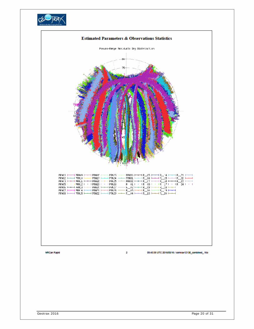
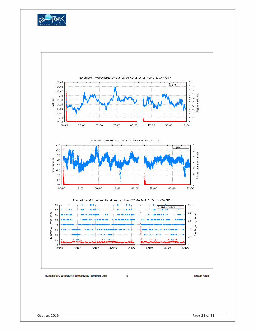
7. Annexure 7.1 Annexure – 1: PCP Observation Processing Report
Geotrax 2016 Page 20 of 31

Geotrax 2016 Page 21 of 31

Geotrax 2016 Page 22 of 31
Geotrax 2016 Page 23 of 31

Geotrax 2016 Page 24 of 31

Geotrax 2016 Page 25 of 31

Geotrax 2016 Page 26 of 31
7.2 Annexure – 2: DGPS Surveyed coordinates of Forest Patches
Sl. No.
Pillar ID
Patch No Easting (m) Northing
(m) Latitude "N" Longitude "E"
1 P1
PATCH NO 1
636789.3636 2475152.243 22°22'36.93360" 82°19'43.19760"2 P2 636846.5243 2475180.741 22°22'37.84440" 82°19'45.20280"3 P3 636851.674 2475182.775 22°22'37.90920" 82°19'45.38280"4 P4 636855.841 2475186.495 22°22'38.02800" 82°19'45.53040"5 P5 636926.012 2475224.22 22°22'39.23400" 82°19'47.99640"6 P6 637086.9984 2475304.176 22°22'41.79000" 82°19'53.64840"7 P7 637214.112 2475358.827 22°22'43.52880" 82°19'58.10880"8 P8 637327.596 2475397.722 22°22'44.76000" 82°20'02.09040"9 P9 637367.3051 2475401.702 22°22'44.87880" 82°20'03.48000"10 P10 637392.9795 2475404.276 22°22'44.95440" 82°20'04.37640"11 P11 637432.5352 2475408.241 22°22'45.07320" 82°20'05.76240"12 P12 637496.6337 2475414.614 22°22'45.26040" 82°20'08.00520"13 P13 637526.759 2475417.446 22°22'45.34320" 82°20'09.05640"14 P14 637553.4624 2475418.377 22°22'45.36840" 82°20'09.99240"15 P15 637602.4706 2475420.085 22°22'45.40800" 82°20'11.70600"16 P16 637667.9617 2475422.368 22°22'45.46560" 82°20'13.99560"17 P17 637726.359 2475424.403 22°22'45.51240" 82°20'16.03680"18 P18 637785.2255 2475433.775 22°22'45.80040" 82°20'18.09960"19 P19 637825.621 2475440.207 22°22'45.99840" 82°20'19.51440"20 P20 637980.1002 2475439.761 22°22'45.94080" 82°20'24.91440"21 P21 638101.755 2475438.352 22°22'45.85800" 82°20'29.16600"22 P22 638385.627 2475413.303 22°22'44.96160" 82°20'39.08400"23 P23 638505.86 2475376.346 22°22'43.72320" 82°20'43.27440"24 P24 638666.494 2475356.693 22°22'43.03920" 82°20'48.88320"25 P25 638751.025 2475353.247 22°22'42.90240" 82°20'51.83880"26 P26 638835.289 2475368.858 22°22'43.38480" 82°20'54.79080"27 P27 638879.129 2475382.324 22°22'43.80960" 82°20'56.32800"28 P28 638979.373 2475385.019 22°22'43.86720" 82°20'59.83080"29 P29 639055.4056 2475399.739 22°22'44.32440" 82°21'02.49480"30 P30
PATCH NO 2
639763.5473 2475627.586 22°22'51.52800" 82°21'27.32400"31 P31 639819.8838 2475672.887 22°22'52.98240" 82°21'29.30760"32 P32 639866.3041 2475710.215 22°22'54.18120" 82°21'30.94200"33 P33 639899.9408 2475735.921 22°22'55.00920" 82°21'32.12640"34 P34 639939.175 2475765.853 22°22'55.97040" 82°21'33.50880"35 P35 640032.548 2475837.089 22°22'58.26000" 82°21'36.79560"36 P36 640201.0496 2475985.912 22°23'03.04800" 82°21'42.73200"37 P37 640391.833 2476164.887 22°23'08.81160" 82°21'49.46040"38 P38 640412.502 2476169.275 22°23'08.94840" 82°21'50.18400"39 P39 640423.914 2476191.357 22°23'09.66120" 82°21'50.59080"40 P40 640437.712 2476218.056 22°23'10.52520" 82°21'51.08040"

Geotrax 2016 Page 27 of 31
Sl. No.
Pillar ID
Patch No Easting (m) Northing
(m) Latitude "N" Longitude "E"
41 P41 640443.25 2476226.206 22°23'10.78800" 82°21'51.27840"42 P42 640503.4723 2476314.837 22°23'13.65360" 82°21'53.40960"43 P43 640636.355 2476514.529 22°23'20.10840" 82°21'58.11840"44 P44 640761.657 2476603.467 22°23'22.96320" 82°22'02.52840"45 P45 640869.867 2476666.075 22°23'24.96480" 82°22'06.33360"46 P46 640884.7796 2476681.056 22°23'25.44720" 82°22'06.85920"47 P47 641056.2081 2476768.053 22°23'28.22640" 82°22'12.87840"48 P48 641151.9936 2476817.788 22°23'29.81400" 82°22'16.24440"49 P49 641186.2847 2476850.016 22°23'30.85080" 82°22'17.45400"50 P50 641228.2682 2476917.902 22°23'33.04680" 82°22'18.94440"51 P51
PATCH NO 3
641829.5411 2477619.485 22°23'55.68000" 82°22'40.19160"52 P52 641843.1122 2477630.918 22°23'56.04720" 82°22'40.67040"53 P53 641858.427 2477643.821 22°23'56.46120" 82°22'41.20680"54 P54 641884.3452 2477665.656 22°23'57.16320" 82°22'42.12120"55 P55 641890.1508 2477670.547 22°23'57.32160" 82°22'42.32640"56 P56 641893.0167 2477672.82 22°23'57.39360" 82°22'42.42720"57 P57 641900.9729 2477679.132 22°23'57.59880" 82°22'42.70800"58 P58 641909.9656 2477686.266 22°23'57.82560" 82°22'43.02480"59 P59 641927.958 2477700.54 22°23'58.28640" 82°22'43.65840"60 P60 641954.5169 2477719.383 22°23'58.89120" 82°22'44.59080"61 P61 642022.0108 2477762.275 22°24'00.26280" 82°22'46.96680"62 P62 642061.0394 2477790.782 22°24'01.18080" 82°22'48.33840"63 P63 642061.9273 2477792.928 22°24'01.24920" 82°22'48.37080"64 P64 642068.2131 2477800.296 22°24'01.48680" 82°22'48.59400"65 P65 642070.7799 2477801.16 22°24'01.51560" 82°22'48.68400"66 P66 642078.5696 2477814.928 22°24'01.95840" 82°22'48.96120"67 P67 642107.0908 2477858.714 22°24'03.37320" 82°22'49.97280"68 P68 642116.2748 2477876.638 22°24'03.95280" 82°22'50.30040"69 P69 642130.6338 2477901.496 22°24'04.75920" 82°22'50.80800"70 P70 642141.384 2477918.095 22°24'05.29560" 82°22'51.18960"71 P71 642150.7378 2477931.058 22°24'05.71320" 82°22'51.52080"72 P72 642151.251 2477931.23 22°24'05.72040" 82°22'51.53880"73 P73 642169.8557 2477952.665 22°24'06.41160" 82°22'52.19760"74 P74 642190.1223 2477974.909 22°24'07.12800" 82°22'52.91400"75 P75 642205.6562 2477992.016 22°24'07.67880" 82°22'53.46120"76 P76 642231.6657 2478018.283 22°24'08.52480" 82°22'54.37920"77 P77 642250.8369 2478036.73 22°24'09.11880" 82°22'55.05600"78 P78 642268.5173 2478054.634 22°24'09.69480" 82°22'55.67880"79 P79 642283.5196 2478068.549 22°24'10.14480" 82°22'56.20800"80 P80 642299.5933 2478084.56 22°24'10.65960" 82°22'56.77680"81 P81 642333.0211 2478114.985 22°24'11.63880" 82°22'57.95400"82 P82 642370.4281 2478148.627 22°24'12.72240" 82°22'59.27160"83 P83 642426.3591 2478197.504 22°24'14.29560" 82°23'01.24440"84 P84 642458.446 2478224.632 22°24'15.16680" 82°23'02.37480"

Geotrax 2016 Page 28 of 31
Sl. No.
Pillar ID
Patch No Easting (m) Northing
(m) Latitude "N" Longitude "E"
85 P85 642475.8448 2478235.737 22°24'15.52320" 82°23'02.98680"86 P86 642494.8081 2478243.253 22°24'15.76080" 82°23'03.65280"87 P87 642527.6699 2478253.511 22°24'16.08480" 82°23'04.80480"88 P88 642636.2586 2478299.86 22°24'17.56080" 82°23'08.61720"89 P89 642755.739 2478361.445 22°24'19.52640" 82°23'12.81480"90 P90 642790.0793 2478384.968 22°24'20.27880" 82°23'14.02440"91 P91 642851.049 2478444.006 22°24'22.18320" 82°23'16.17360"92 P92 642942.92 2478498.097 22°24'23.91120" 82°23'19.40280"93 P93 643106.282 2478550.772 22°24'25.57440" 82°23'25.13400"94 P94 643204.333 2478611.741 22°24'27.52920" 82°23'28.58280"95 P95 643335.393 2478708.058 22°24'30.62160" 82°23'33.19440"96 P96 643375.739 2478755.598 22°24'32.15520" 82°23'34.62000"97 P97 643463.669 2478931.504 22°24'37.84680" 82°23'37.75200"
Sl. No.
Pillar ID
Patch No Easting (m) Northing
(m) Latitude "N" Longitude "E"
98 P98 PATCH NO 3
643587.935 2479054.001 22°24'41.79240" 82°23'42.13680"99 P99 643676.368 2479106.217 22°24'43.46280" 82°23'45.24720"
100 P100 643734.4632 2479243.683 22°24'47.91600" 82°23'47.32440"101 P101
PATCH NO 4
646001.6845 2481497.754 22°26'00.51000" 82°25'07.34880"102 P102 646024.5127 2481506.033 22°26'00.77280" 82°25'08.15160"103 P103 646039.259 2481511.391 22°26'00.94200" 82°25'08.66640"104 P104 646051.0984 2481515.732 22°26'01.07880" 82°25'09.08400"105 P105 646136.0578 2481547.388 22°26'02.08320" 82°25'12.06480"106 P106 646220.7468 2481579.594 22°26'03.10560" 82°25'15.03840"107 P107 646256.8564 2481593.808 22°26'03.55560" 82°25'16.30560"108 P108 646378.6097 2481634.946 22°26'04.85520" 82°25'20.57880"109 P109 646387.9865 2481638.115 22°26'04.95600" 82°25'20.90640"110 P110 646405.6138 2481644.61 22°26'05.16120" 82°25'21.52560"111 P111 646425.7686 2481652.036 22°26'05.39520" 82°25'22.23120"112 P112 646455.382 2481665.485 22°26'05.82360" 82°25'23.27160"113 P113 646467.1103 2481671.214 22°26'06.00720" 82°25'23.68560"114 P114 646479.6034 2481677.403 22°26'06.20520" 82°25'24.12480"115 P115 646485.7949 2481680.471 22°26'06.30240" 82°25'24.34080"116 P116 646498.823 2481689.215 22°26'06.58320" 82°25'24.79800"117 P117 646505.6833 2481693.819 22°26'06.73080" 82°25'25.03920"118 P118 646515.2391 2481703.592 22°26'07.04400" 82°25'25.37760"119 P119
PATCH NO 5
650236.898 2483330.048 22°26'58.76160" 82°27'36.09000"120 P120 650251.7947 2483330.377 22°26'58.76880" 82°27'36.61200"121 P121 650264.3405 2483330.655 22°26'58.77240" 82°27'37.05120"122 P122 650275.8164 2483330.908 22°26'58.77960" 82°27'37.45080"123 P123
PATCH NO 6 650379.2821 2483345.494 22°26'59.21880" 82°27'41.07600"
124 P124 650383.143 2483347.634 22°26'59.28720" 82°27'41.21280"125 P125 650421.8263 2483349.13 22°26'59.32320" 82°27'42.56640"

Geotrax 2016 Page 29 of 31
Sl. No.
Pillar ID
Patch No Easting (m) Northing
(m) Latitude "N" Longitude "E"
126 P126 650460.5095 2483350.627 22°26'59.35920" 82°27'43.92000"127 P127 650489.7452 2483358.674 22°26'59.61120" 82°27'44.94240"128 P128 650506.536 2483363.245 22°26'59.75520" 82°27'45.53280"129 P129
PATCH NO 7
650621.435 2483404.785 22°27'01.06920" 82°27'49.56480"130 P130 650643.1614 2483416.168 22°27'01.43280" 82°27'50.32800"131 P131 650664.7065 2483427.456 22°27'01.79280" 82°27'51.08760"132 P132 650687.6125 2483439.457 22°27'02.17800" 82°27'51.89400"133 P133
PATCH NO 8
650738.0126 2483468.406 22°27'03.10320" 82°27'53.66520"134 P134 650749.3726 2483475.253 22°27'03.31920" 82°27'54.06480"135 P135 650773.8989 2483485.671 22°27'03.65040" 82°27'54.92520"136 P136 650796.0257 2483495.069 22°27'03.94920" 82°27'55.70280"137 P137 650820.5594 2483505.489 22°27'04.28040" 82°27'56.56320"138 P138 650821.8484 2483505.42 22°27'04.27680" 82°27'56.61000"139 P139 650850.7045 2483518.554 22°27'04.69800" 82°27'57.62520"140 P140 650884.0451 2483529.417 22°27'05.04000" 82°27'58.79520"141 P141 650939.9607 2483547.13 22°27'05.59800" 82°28'00.75360"142 P142 650995.8446 2483563.645 22°27'06.11640" 82°28'02.71560"143 P143 651037.167 2483574.213 22°27'06.44760" 82°28'04.16640"144 P144 651082.1667 2483584.683 22°27'06.77160" 82°28'05.74320"145 P145 651108.6102 2483590.836 22°27'06.96600" 82°28'06.66840"146 P146 651127.1665 2483595.154 22°27'07.09920" 82°28'07.32000"147 P147
PATCH NO 9
654618.7288 2484784.458 22°27'44.64000" 82°30'09.86040"148 P148 654634.11 2484793.917 22°27'44.94240" 82°30'10.40040"149 P149 654647.9523 2484802.43 22°27'45.21600" 82°30'10.89000"150 P150 654659.22 2484809.359 22°27'45.43560" 82°30'11.28600"151 P151 654679.331 2484813.698 22°27'45.57240" 82°30'11.99160"152 P152 654720.155 2484836.727 22°27'46.30680" 82°30'13.42800"153 P153 654745.176 2484847.919 22°27'46.66320" 82°30'14.30640"154 P154 654755.893 2484859.764 22°27'47.04480" 82°30'14.68440"155 P155 654765.687 2484888.138 22°27'47.96280" 82°30'15.03720"156 P156 654801.332 2484917.283 22°27'48.89880" 82°30'16.29360"157 P157 654826.868 2484932.517 22°27'49.38480" 82°30'17.19360"158 P158 654855.4111 2484943.23 22°27'49.72680" 82°30'18.19440"159 P159 654867.255 2484947.675 22°27'49.86720" 82°30'18.61200"160 P160 654883.2764 2484953.688 22°27'50.05440" 82°30'19.17360"161 P161 654895.536 2484958.289 22°27'50.20200" 82°30'19.60200"162 P162 654909.2765 2484968.88 22°27'50.54040" 82°30'20.08800"163 P163 654923.017 2484979.47 22°27'50.88240" 82°30'20.57400"164 P164 654934.112 2484997.159 22°27'51.45120" 82°30'20.96640"165 P165 654950.801 2485031.282 22°27'52.55640" 82°30'21.56400"166 P166 654967.49 2485065.404 22°27'53.66160" 82°30'22.15800"167 P167 655010.549 2485141.298 22°27'56.11320" 82°30'23.69160"168 P168 655101.926 2485252.142 22°27'59.68800" 82°30'26.92800"169 P169 655190.745 2485306.47 22°28'01.42320" 82°30'30.05280"

Geotrax 2016 Page 30 of 31
Sl. No.
Pillar ID
Patch No Easting (m) Northing
(m) Latitude "N" Longitude "E"
170 P170 655300.958 2485360.492 22°28'03.14400" 82°30'33.92640"171 P171 655385.6958 2485420.913 22°28'05.08080" 82°30'36.91080"172 P172 655461.7667 2485444.674 22°28'05.82960" 82°30'39.58200"173 P173 655515.8502 2485474.194 22°28'06.77280" 82°30'41.48280"174 P174 655591.1861 2485519.416 22°28'08.21640" 82°30'44.13600"175 P175 655629.9349 2485553.178 22°28'09.30360" 82°30'45.50400"176 P176 655678.9107 2485591.21 22°28'10.52400" 82°30'47.22840"177 P177 655713.9606 2485640.616 22°28'12.11520" 82°30'48.47400"178 P178 655774.0015 2485782.369 22°28'16.70520" 82°30'50.62320"179 P179 655793.3723 2485821.957 22°28'17.98680" 82°30'51.31440"180 P180 655961.7849 2486028.139 22°28'24.63600" 82°30'57.27960"181 P181 656087.752 2486171.097 22°28'29.24040" 82°31'01.73640"182 P182 656120.8026 2486184.333 22°28'29.66160" 82°31'02.89560"183 P183 656160.9568 2486200.413 22°28'30.16920" 82°31'04.30680"184 P184 656194.0105 2486213.933 22°28'30.59760" 82°31'05.46960"185 P185 656221.7672 2486225.419 22°28'30.96120" 82°31'06.44520"186 P186 656249.524 2486236.905 22°28'31.32840" 82°31'07.41720"187 P187 656301.3445 2486269.534 22°28'32.36880" 82°31'09.24240"188 P188 656371.9984 2486314.565 22°28'33.81240" 82°31'11.73000"189 P189 656435.047 2486356.084 22°28'35.14080" 82°31'13.95120"190 P190 656521.166 2486422.166 22°28'37.26120" 82°31'16.98600"191 P191 656563.713 2486461.489 22°28'38.52480" 82°31'18.49080"192 P192 656657.252 2486521.555 22°28'40.44720" 82°31'21.78120"193 P193 656695.8187 2486542.299 22°28'41.10960" 82°31'23.13840"194 P194 656730.9359 2486561.187 22°28'41.71080" 82°31'24.37320"
Geotrax 2016 Page 31 of 31
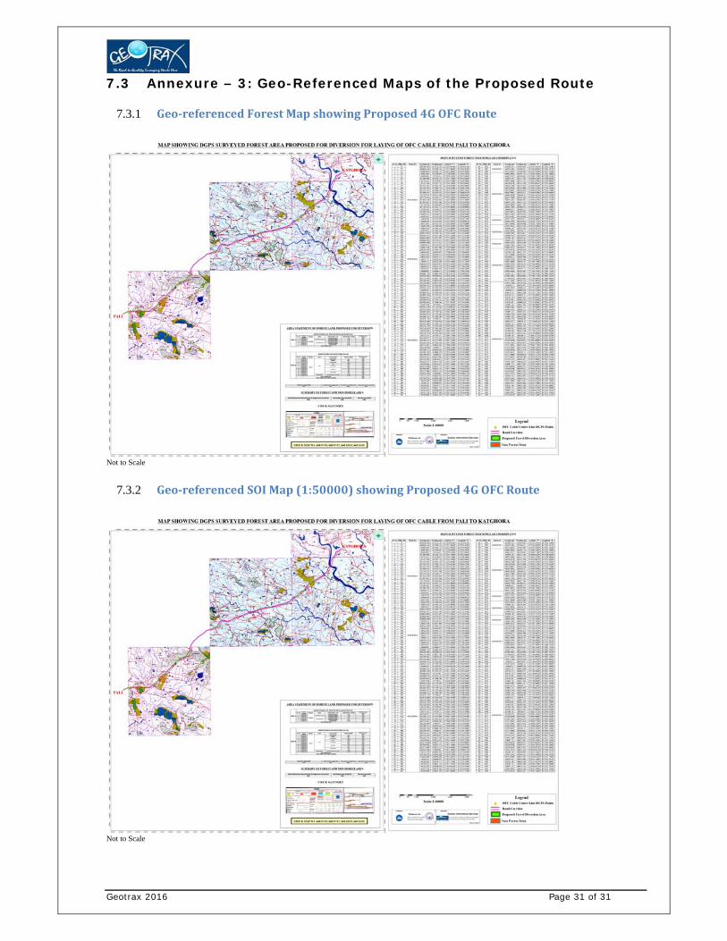
7.3 Annexure – 3: Geo-Referenced Maps of the Proposed Route
7.3.1 Geo‐referencedForestMapshowingProposed4GOFCRoute
Not to Scale
7.3.2 Geo‐referencedSOIMap(1:50000)showingProposed4GOFCRoute
Not to Scale