Regional GNS workshop - Inland Navigation Europe · Regional GNS workshop ... EFIP Executive...
76
Good Navigation Status Regional GNS workshop Klaipeda, 7 th of September
Transcript of Regional GNS workshop - Inland Navigation Europe · Regional GNS workshop ... EFIP Executive...

Good Navigation Status
Regional GNS workshop
Klaipeda, 7th of September

2
Good Navigation Status – regional workshop
Agenda
TIME TOPIC SPEAKER
09:00 Welcome and introduction EMMA project / GNS consortium
09:10 Presentation of Good Navigation Status study GNS consortium
09:25 Q&A all
09:30 Navigation Standards in the Nordic countries and view on GNS concept
Regional waterway managers / authorities
10:00 Q&A all
10:10 Coffee break

3
Good Navigation Status – regional workshop
TIME TOPIC SPEAKER
10:25 Presentation of current study results and approach towards GNS
GNS consortium
10:40 Q&A, discussion on approach and indicators
Discussion on selected GNS aspects and indicators for Nordic countries
GNS consortium all
11:10 Contributions and discussion on Good Practice Guidelines for developing GNS
GNS consortium all
11:25 Discussion on possible exemption criteria for non-compliance with Art. 15 § 3.(a) of the TEN-T guidelines
GNS consortium all
11:40 Discussion on implications of GNS assessment:Bottlenecks / Projects
GNS consortium all
11:50 Conclusions and actions, further cooperation GNS consortium
12:00 Closing GNS consortium

General introduction on GNS and the study
• Background and purpose of study• Possible outcome• Timeline and current status• Ways to get involved• Overview of today`s session• Outline of GNS concept
4
Presentation of GNS study

To substantiate Article 15 §3.(b) of TEN‐T Guidelines (Reg.1315/2013) as regards Good Navigation Status:
Member States shall ensure that on the Comprehensive Network“Rivers, canals and lakes are maintained so as to preserve Good Navigation Status while respecting the applicable environmental law”
Article 38: “For inland navigation infrastructure within the TEN‐T core network, Good Navigation Status has to be achieved (and thereafter preserved) by 31 December 2030.”
5
Background and purpose of GNS study

Entire TEN‐T inland waterway network– Not only core network
corridors– All CEMT ≥IV waterways– Including (isolated) inland
waterways in Sweden, Finland, Lithuania, Italy, Portugal and Spain
– Good Practice also of interest for CEMT <IV waterways and non‐EU countries
6
Background and purpose of GNS study

Main challenge of the study: to develop a broadly accepted GNS concept and common methodology allowing for sufficient differentiation to regional requirements and user needs
Study focuses on technical content andmethodology, supervised by the European Commission
Use of result is “open”:Technical background for the legal interpretation of Article 15 §3.(b): e.g. Input for a Staff Working Document by DG MOVE Basis for project selection criteria by INEA (CEF funding..)
7
Implications and possible outcome

Study 1/2016 – 10/2017:
Agreed GNS components and recommended parameters/ requirements (quantitative/qualitative)
Monitoring and reporting options and requirements
Input to TENtec Database IWW Glossary
Specification of exemption criteria to Art. 15 § 3.(a)
GNS network assessment ‐ additional GNS parameters and KPIs
Roadmaps for critical GNS sections
Good Practice Guidelines for implementation of GNS
8
Planned Deliverables

Ongoing bilateral expert contacts and discussions
Survey on GNS elements among European Working Group
Input to updated draft TENtec glossary
Draft discussion papers on GNS concept
Presentation, discussion of concept:
EFIP Executive Committee on 7 – 8 April 2016, Vukovar
CCNR Roundtable on 2 March 2016, Strasbourg
EMMA kick‐off meeting, Hamburg, 25 February 2016
Pan‐European meeting on 20 June 2016, Rotterdam
Regional workshops Klaipeda, Budapest, Strasbourg, Berlin
Dedicated workshop with experts representing users (13 Oct.)
Discussion of links to AGN with UN‐ECE on 2 November 20169
Status and planned meetings
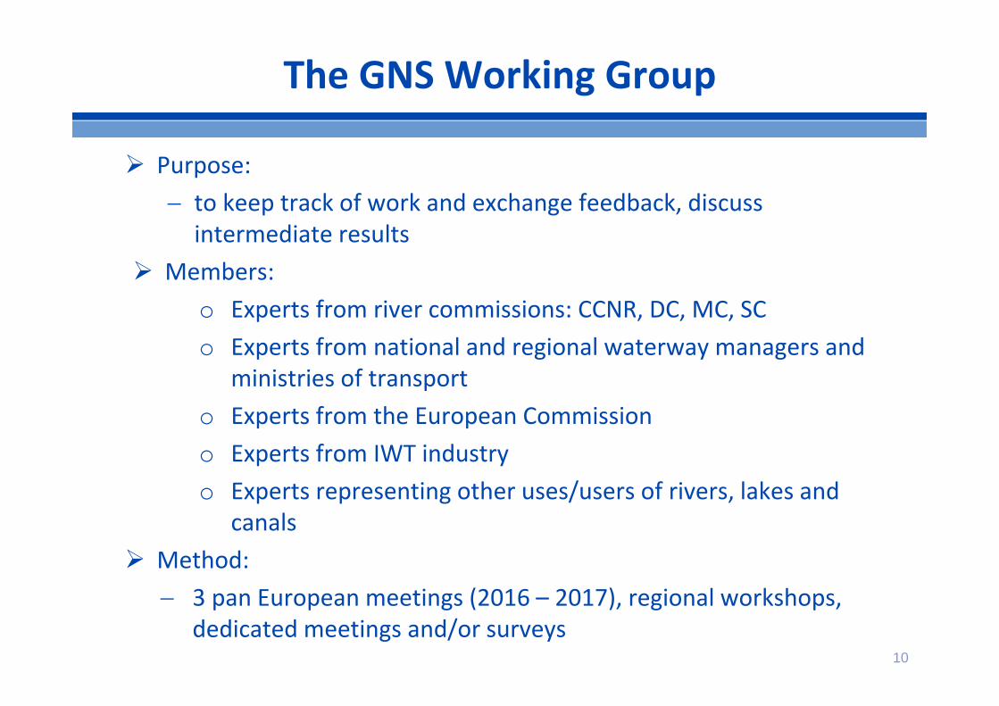
Purpose: to keep track of work and exchange feedback, discuss
intermediate results Members:
o Experts from river commissions: CCNR, DC, MC, SCo Experts from national and regional waterway managers and
ministries of transport o Experts from the European Commission o Experts from IWT industryo Experts representing other uses/users of rivers, lakes and
canals Method:
3 pan European meetings (2016 – 2017), regional workshops, dedicated meetings and/or surveys
10
The GNS Working Group

11
• 1st Pan‐European Working Group meeting: 20 June 2016 Broader audience, on invitation: validation of first views on GNS in different corridors
• Regional workshops 09‐10/2016: Klaipeda, Budapest, Strasbourg, BerlinExpert group meetings with regional focus; discussion of technical content
• 2nd GNS pan‐European Working Group meeting: mid 2017Broader audience on European scale: communicate and validate the study results
Status of meetings

12
Today’s session
Specific focus of discussion with you:
• Validation of the overall GNS concept and approach
• Discussion of GNS components and parameters for this corridor/region
• Focus topics and possible contributions as regards good practices and needed guidelines for achieving GNS
• First discussion on exemption criteria, stocktaking on possible criteria
• Discussion on implications of GNS assessment

13
Basic outline of GNS concept

14
What is important for Good Navigation Status?– Maximising payload on board, economies of scale– Minimising waiting times– Reliability and predictability of transport– Safety– Sustainability (o.a. fuel consumption, working with nature)
Article 15 b: “Rivers, canals and lakes are maintained so as to preserve good navigation status” key focus physical infrastructure
Outline of GNS concept
15
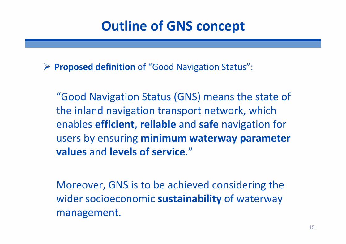
Proposed definition of “Good Navigation Status”:
“Good Navigation Status (GNS) means the state of the inland navigation transport network, which enables efficient, reliable and safe navigation for users by ensuring minimum waterway parameter values and levels of service.”
Moreover, GNS is to be achieved considering the wider socioeconomic sustainability of waterway management.
Outline of GNS concept

16
1. Quantitative measureable “hard” components related to the output of waterway management addressing the navigability standards Dimensions of fairways, locks and bridges and their
availability over time
2. More indirect and/or qualitative “soft” components Waterway infrastructure management process (e.g.
maintenance), traffic management process (e.g. information to users) and wider scope (e.g. facilities along waterways)
3. Minimum standards for a process to reach GNS, monitoring and enforcement of objectives, application of exemptionsand revision of concept
Outline of GNS concept

Outline of GNS concept

Contributions by regional waterway managers
• Navigation Standards in Nordic countries• View on GNS concept
18

Current study results and approach towards GNS
• GNS concept• GNS elements• Parameters and KPI• Proposed procedures for developing GNS
19

20
Implementation of related TEN‐T provisions:
1. Article 15.3 a) CEMT IV minimum requirements or an exemption in a duly justified case (2.5m draught; 5,25m bridge clearance; 365 days per year)
2. Article 16.b)Higher standards than class IV where appropriate (e.g. Class V, VI, AGN)
3. Articles 15.3 c) and article 39.2 b) RIS implementation and availability of clean fuels
GNS concept

21
4. Article 15.3 b)“Rivers, canals and lakes shall be maintained so as to preserve good navigation status”
1. Implementation of related TEN‐T provisions2. GNS “hard” components and parameters3. GNS “soft” components and requirements4. Minimum standards of a process for the development, implementation, monitoring of “Good Navigation Status”5. Application of exemption criteria as referred to in article 15.3a)
GNS concept

GNS concept

23
• Focus physical waterway infrastructure: navigability standards for users (fairway, locks, bridges)
• Homogeneous parameters applicable to the entire TEN‐T waterway network
• Directly targeted by TEN‐T and/or AGN• Quantitative parameter: Good Navigation Status measurable
on EU level and meaningful information for using Key Performance Indicators
• Experts in the GNS working group confirm high priority
GNS “hard” components

24
Proposed core KPI on Navigation Reliability andWaiting times
• Core KPI on Navigation Reliability• Link to articles 15.3 (a) and 16.(b) (class IV or higher)• Daily availability of draught, height, width and length per year
• TEN – T objective: 365 d/year • Core KPI on Waiting times
• Waiting time at locks
Exemption criteria may apply as regards TEN‐T minimum requirements regarding 2.5 metre draught and 5.25 metre height under bridges separate discussion
GNS “hard” components

25
• Process‐related components which contribute to score of “hard” components– infrastructure management (e.g. maintenance, marking)– traffic management (e.g. information to users)
• Wider scope of inland navigation infrastructure (e.g. facilities along waterways)
• Specific EU regulations already apply (e.g. RIS, clean fuels)• Relevance may be limited to specific regions • No need for quantitative measurable parameters across Europe
on section level• Experts in the GNS working group confirm their relevance
GNS “soft” components

26
• Focus of requirements on process“How to reach GNS”?• Targets / Objectives of “soft” components:
Benchmarks and guidelines described in GNS Good Practice Guidelines
Monitoring and reporting based on minimum requirements by means of checklists
GNS “soft” components

27
Minimum standards:• Identification of waterway sections for which GNS will be defined• Objectives/measures are developed in a coordinated way between
waterway managers (if applicable – (trans‐)nationally/regionally coordinated)
• Systematic consideration of: Minimum TEN‐T requirements Transport potential demand and user requirements of a waterway
section (domestic and foreign) Local conditions as regards waterway sections Further uses of a river, lake or canal (cross‐sectoral) The applicable environmental law. Where possible, synergies are
created (“working with nature”) Cost and benefits of measures from a socio‐economic perspective Possibilities of innovation and technological development (ship design,
maintenance technologies..)
Minimum standards for process and methodology
28
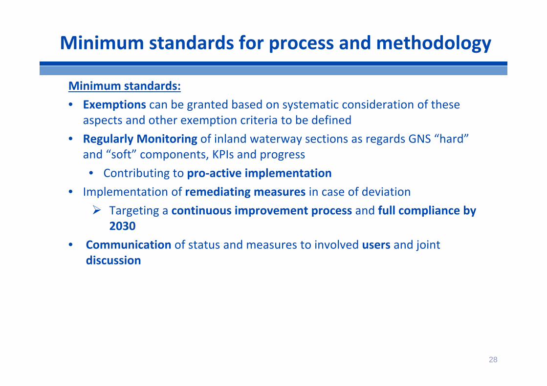
Minimum standards:• Exemptions can be granted based on systematic consideration of these
aspects and other exemption criteria to be defined • Regularly Monitoring of inland waterway sections as regards GNS “hard”
and “soft” components, KPIs and progress• Contributing to pro‐active implementation
• Implementation of remediating measures in case of deviation Targeting a continuous improvement process and full compliance by
2030• Communication of status and measures to involved users and joint
discussion
Minimum standards for process and methodology

Key Performance Indicatorson Good Navigation Status
29

30
Waterway parameters• Draught of vessel, the minimum depth• Beam of vessel, width of waterway and curve radius• Height of vessel, air clearance under bridges and other infrastructure• Length of vessel, curve radius of waterway and size of locks
Core KPI: Navigation Reliability of a specific (TENtec) section• Availability of the physical waterway infrastructure:
yearly score on the targeted infrastructure dimensionsCore KPI: Waiting times• Waiting time (capacity/use) at locks, ship lifts, moveable bridge
GNS “hard” components and proposed KPIs
• Monitoring of parameters and KPIs on GNS using TENtec (first data collection is running, additional will follow)
• Contribution to TENtec glossary by GNS study
• Meaningful GNS data set for 2016 and the next years to come

Core KPI Navigation Reliability
Navigation reliability of a specific section:
-> Targeted dimensions met in
days/year
Targeted physical dimensions for vessel/convoy at waterwaysection:- Draught/navigation channel depth - Height under bridges- Beam- Length
Availability of physical dimensions:- Available fairway depth/width- Available height under bridges
Closures of waterways- Man-made and/or natural causes - For waterway links and objects (locks, bridges)
Navigation dimensions of a specific section:
->Targeted Classification
CEM
T cl
ass
IV ta
rget
sLo
cal
targ
ets
31

• Targeted dimension CEMT class IV: 2.5m draught and 5.25 m height under bridges at 365d/year
• Local targeted dimension (if higher than CEMT class IV or exemption): x m draught/fairway channel depth at x days/year
• Framework of draught/depth target with varying water levels– applicable reference water level– N° of days with water level above reference water level– N° of days without ice
Example Navigation Reliability: Availability of fairway channel dimensions
32What framework apply in the Nordic countries?

• Waterway closures Proposed approach: Event >24 hrs duration Man‐made
• Planned (announcement >12 weeks in advance)• Not planned
– Natural events• Ice• High water
33
Example Navigation Reliability: Waterway closures

34
• GNS “hard” components focus on the physical waterway infrastructure
• Quantitative parameters and KPI for “hard” components• Core KPIs Navigation Reliability and Waiting times• GNS “soft” components related to infrastructure and traffic
management processes and to a wider scope• More qualitative/indirect nature of “soft” components• TEN‐T minimum requirements and local targets/objectives• Minimum standards for process to reach GNS, define
exemptions, enforcement of objectives, monitoring and revision
• Benchmarks and Good Practice Guidelines• Exemptions based on specific criteria and process
Summary

35
Discussion
• Your view on the GNS concept and approach?• Do you agree with the scope of GNS? Does it correspond with
the needs in your region? • Your view on GNS “hard” components and parameters?• Main topics which need to be addressed in guideline document
on developing GNS?• Your view on process to develop/monitor GNS?
• Into what extent is it already `common practice’?• Is it applicable in practice ?• Are there elements missing/redundant?

36
Discussion
• Your comments on the Core KPIs?• What is your view on feasibility/data availability?• “Local targets” – your view on measuring fairway channel depth
instead of draught?• Reference values for factor draught/depth?• Framework for draught/fairway channel depth objectives in
Nordic countries?• Measurement and reporting of waiting times: Suggestions for
common standard?• Waterway closures: broken down to what extent on section
level? What standard period should apply?• Properly announcement of man‐made closures: what is a
sufficient time limit in advance?• What significant developments are expected towards the year
2030 as regards data availability (e.g. technological innovation)?

Regional Specifics
37

• Mixed traffic: Inland and maritime navigation along inland waterways• Focus of GNS on inland navigation• Definition for coverage of maritime navigation and maritime inland
waterways by GNS• Interdependence with sea‐river transport and maritime transport
• Physical dimensions for inland navigation usually less relevant at maritime waterways
• Other requirements may be of similar relevance: e.g. lock waiting times
• Interdependence with zoning according to Directive 2006/87/EC• Ship requirements related to wave class may only allow
coasters/maritime vessels• TENtec parameter on zoning
Mixed traffic
38
How should waterways with mixed traffic be addressed by GNS?

• Closures are addressed by KPI Navigation reliability• Separate TENtec parameter on waterway closures (>24 hours) due to ice• Closures due to ice may qualify as exemption depending on climate and local
conditions• Feasibility of ice breaking• Timing of ice breaking
• Questions for discussion• How do you determine the navigation period? • When are closures due to ice necessary?• What are the limits of ice breaking? Feasibility?• When to do ice breaking? Adverse impact of quick reaction?• How to operationalise exemption criteria regarding ice?
Closures due to ice
39
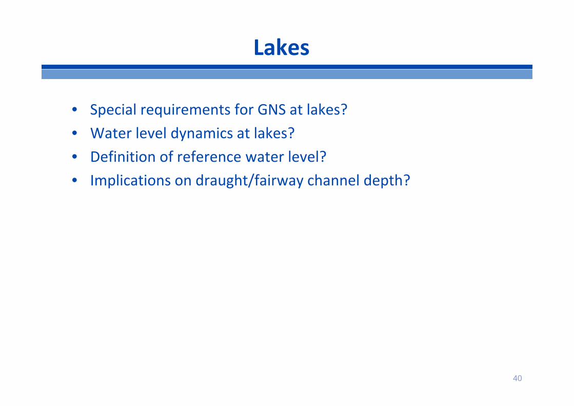
• Special requirements for GNS at lakes?• Water level dynamics at lakes?• Definition of reference water level?• Implications on draught/fairway channel depth?
Lakes
40

• Possible relevance for GNS• Other inland navigation interests and requirements• Barrier for upgrade of waterway• Requirement for exemption criteria
• Potential for connection of TEN‐T network with thirdcountries
• Questions for discussion• Relevance for GNS?• Need / Opportunities for exemption criteria?
Waterways running through third territory
41

Good Practice Guidelines
• Background and purpose• Overview and suggested content
42

43
Guidelines: Background and Purpose
• Need for guidelines and good practice examples on how to develop GNS confirmed by expert group
• Need for common understanding of key principles (vocabulary, fairway channel depth vs. water levels, requirements of different regulations etc.)
• Exchange on European level has proven fruitful in past activities, additional to PLATINA I and II Good Practice Manuals as well as further key documents
• Especially for GNS “soft” components, benchmarks need to be identified vs. need to focus

44
GNS Good Practice Manual ‐ Content
I. Introduction and reference to further manualsII. Basic information on fairway parameters and navigability
(“hard” components)III. Definition of GNS and implicationsIV. Minimum standards of a process on GNS developmentV. Good Practices for maintenance and rehabilitation
(fairway, locks, bridges )VI. Further topics in need of discussion (information to users,
technological development, emergency response …)

45
Discussion
Do you agree with the selection of topics? On which topics is guidance most needed? Good practice examples from your background/expertise? Are there specific requests towards the form/methodology
of the guidelines?

Exemption criteria
Proposed topics and discussion
46

47
Article 15.3a:In duly justified cases, exemptions shall be granted to Member States by the Commission from the minimum requirements on draught (less than 2,50 m) and on minimum height under bridges (less than 5,25 m).
Exemption criteria

48
Proposed topics for exemption criteria:– local conditions (hydrology, hydromorphology, other use) – extreme weather events– environmental requirements– Socioeconomic cost‐benefit‐aspects of measures
Coordination with the European Commission after following a process covering the minimum standards for development of GNS
Exemption criteria
Catalogue of exemption criteria and procedures forapplication

49
Do you have examples for application of exemption criteria ? • Local conditions• Extreme weather events• Environmental requirements• Economic feasibility• Other?
• What criteria (should) apply? • Link to environmental law as referred to in article 15.3 (b)?• Example exemptions regarding draught: Relevance of reference water
level?• Trade‐off with the economic relevance for inland navigation?• Procedure for application?
Discussion

50
GNS assessment
• Identification of Bottlenecks• Projects / Roadmap

51
• Application of GNS concept to assess network• Identification of bottlenecks• Evaluation of deficits
• Projection of network assessment for 2030• Development of network conditions and navigation status• Stocktaking of upgrading projects planned to be completed by 2030
• Roadmap to achieve GNS• Collection of measures to address bottlenecks• Project outline including cost estimation• Feasibility• Timeline
Questions / Input from EMMA activities:• Bottlenecks in Nordic countries?• Projects are under implementation? Scheduled until 2030? Planned?• Additional measures needed to address bottlenecks?
GNS assessment

Thank you for your contributions.

53
GNS Input to TENtec Glossary
• TENtec: Multimodal European database for TEN‐T Network development
• IWW part: parameters on characteristics and performance of waterway links, locks and bridges
• GNS study provided first input for revised glossary: improved parameters and definitions
• TENtec is tool to monitor parameters and KPIs on GNS (first data collection is running, additional will follow)
• Meaningful data set for 2016 and the next years to come
• Initial data collection will be base for network assessment
• Focus on GNS core elements
• Total 58 parameters, of which 22 danymic
• Further data collection planned for 2017

Core KPIs ‐ locks
Navigation reliability of a specific lock/ section: -> Targeted dimensions met
in days/year
Targeted physical dimensionsfor vessel/convoy at lock:- Draught- Height- Beam- Length
Closures of locks- Man-made and/or natural causes - For waterway links and objects (locks, bridges)
Navigation dimensions of a specific lock/section:
->Targeted Classification
Availability of locks- capacity and use
Waiting timeat a specific lock/ section
during peak times
CEM
T cl
ass
IV ta
rget
sLo
cal
targ
ets
54

• KPI is strongly demanded by Industry• Definition is varying• Data is not available all across Europe
• Accept fuzziness?• Elaborate “waiting times” indicator until 2030?• Find alternative indicators?
• Average chamber utilisation, average operation time, number of vessels waiting, ..
• Apply a model based approach?• Collection of lock and traffic characteristics and simulation with
standardised model? high efforts
Waiting time at locks
55

56
Back‐UpRegional Specifics

• Questions for discussion• Requirements for river‐sea/coastal/maritime traffic?• How to address GNS for mixed traffic / maritime navigation?• Feasibility of targets for physical dimensions?• Opportunities to adapt zone classification?• Criteria for classification of waterway?
• Traffic shares• Zone (Directive 2006/87/EC)• AGN: reference to coastal routes• UNECE Blue Book: classification as sea vessels route
Mixed traffic
57

• Focus of GNS on physical waterway infrastructure• Core elements
• Physical dimensions• Reliability of physical dimensions
• Additional elements• Information• Incident management• Equipment• Facilities• Etc.
Regional specifics: Scope of GNS
58

• Deficits regarding additional elements or even beyond may be barrier for inland navigation• regulation / initiative• Implementation• monitoring
• Questions for dicussion• Scope of GNS?• What additional elements have priority?• How should they be addressed? Indicators? Guidelines?
Scope of GNS
59

• Maintenance management required to achieve GNS• Maintenance plan• Timely execution of planned maintenance work
• Maintenance management will be addressed by guidelines• Planning• Working procedures etc.
Questions:• Relevance for GNS?• Consideration in guidelines adequate?• Focus of maintenance: Fairway/navigation channel? Constructions
(locks, bridges)? Other?• Challenges? How to address these challenges?• Feasibility of proper maintenance?
Maintenance management
60

61
Back‐UpDefinitions

Source: Prsic, Carevic, Brcic : Promet – Traffic&Transportation, Vol. 23, 2011, No. 2, 147-154
Source:viadonau

63
Back‐UpExemption criteria

64
Examples for possible application of exemption criteria
• Environmental requirements?• Fairway dredging limited due to water framework directive
• Economic feasibility?• Transport volume and social economic benefit insufficient to compensate (high)
cost of fairway dredging / lock upgrade / bridge renewal• Limited maintenance due to low traffic
• Extreme weather events?• Severe flood in the past has led to extensive damage / flood risk• Waterway upgrade would increase flood risk beyond acceptable level• Extraordinary drought leads to low water level• Ice
• Local conditions?• Hydrology/hydromorphology• Water management• Recreational use / housing
Exemption criteria

65
Possible determinants for exemption
• Environmental impact• Impact on eco‐system• Link with Requirements of water framework directive Art. 4 (7)
• Ecological status dependent on local conditions, waterway type etc.• Relation to GNS through environmental law in Art. 15 3 (b) of TEN‐T regulation
• Danger of floods (reference to EC directive on flood danger and risk)• Economic feasibility
• Traffic characteristics / economic benefit• Volume (forecast/potential)• Modal shift benefits• Economic impact
• Cost of measures• Upgrade investment• Maintenance• Reactive measures: ice breaking
Exemption criteria

66
• Extreme weather events• Link to flood danger and risk assessment directiveEx‐ante:• Coverage by environmental law, e.g. water framework directive?• Events in the past and related impact (flood / ice)• Likelihood of flood and related danger• Feasibility and reliability of preparatory measures Ex‐post:• Feasibility of ice‐breaking• Consideration of flood/drought issues by change in water discharge/ temperature
Exemption criteria

67
• Local conditions:• Hydrology/hydromorphology
• Discharge• Morphological potential
• Water management • Adverse impact on other uses (e.g. recreational use of waterway / housing)
• Impact of measure (related to environmental impact?)• Social Relevance of uses
Exemption criteria

68
Back‐UpGuidelines

69
II. Fairway parameters and navigability
Key vocabulary and definitionsReference water levelsWater levels and fairway depth Fairway depth and draught…
Sou
rce:
Xav
ax

70
Purpose:
• To reach agreements on exemptions on core GNS elements• To reach agreement on additional GNS objectives/benchmarks,
if applicable• To foster implementation and maintenance of GNS• To monitor GNS process• Study defines minimum standards of the process in order to
keep it flexible and applicable to existing, well‐functioningmechanisms
III. Process to develop GNS

71
Minimum standards:• Identification of waterway sections for which GNS will be defined• Objectives/measures are developed in a coordinated way between
waterway managers (if applicable – (trans‐)nationally/regionally coordinated)
• Systematic consideration of: Minimum TEN‐T requirements Transport potential demand and user requirements of a waterway
section (domestic and foreign) Local conditions as regards waterway sections Further uses of a river, lake or canal (cross‐sectoral) The applicable environmental law. Where possible, synergies are
created (“working with nature”) Cost and benefits of measures from a socio‐economic perspective Possibilities of innovation and technological development (ship design,
maintenance technologies..)
III. Process to develop GNS

72
Minimum standards:• Exemptions can be granted based on systematic consideration of these
aspects and other exemption criteria to be defined • Regularly Monitoring of inland waterway sections as regards GNS “hard”
and “soft” components, KPIs and progress• Contributing to pro‐active implementation
• Implementation of remediating measures in case of deviation Targeting a continuous improvement process and full compliance
by 2030• Communication of status and measures to involved users and joint
discussion
III. Process to develop GNS

73
IV. Maintenance and rehabilitation
Locks, ship lifts and weir maintenance ?
Bridge maintenance ?
Fairway maintenance Fairway Masterplan for the Danube and NEWADA duo Performance Indicators, Recommendations of the Danube Commission
PLATINA I and II Good Practice Manuals IT supported Waterway Management System …

74
Topics of relevance
Key vocabulary and definitions Reference water levels Water levels, fairway channel depth and draught Process to develop GNS Fairway maintenance Locks, ship lifts, weir and bridge maintenance Information to users Technological development Emergency response …

75
Further topics of relevance
Water level measurements and forecast, Information to users: shallow section information in ECDIS, RIS
supported lock planning, Up‐to‐the‐minute bridge clearance information, Mooring places availability, Traffic planning
Emergency response Administrative barriers for users, port procedures Mixed traffic Practical implications of the Water Framework Directive Port entrance areas (surveying and dredging) Waterway‐related facilities Interplay between structural (engineering) measures and regular
maintenance activities Financing models for maintenance …

76
Summary
Need for guidelines confirmed by Expert Group
Focus topics: Basic information on navigability issues, vocabulary etc. Good practices for planning and implementation of maintenance
(fairway, locks, bridges) Suggested process to define exemptions, develop objectives,
support and monitor implementation of GNS Reference to further topics in need of discussion
Your input is welcome