Regional Framework for Highway Jurisdictional Transfer Study
48
i Regional Framework for Highway Jurisdictional Transfer Study November 2020 Final Regional Framework for Highway Jurisdictional Transfer Study
Transcript of Regional Framework for Highway Jurisdictional Transfer Study
iRegional Framework for Highway Jurisdictional Transfer Study
November 2020Final
Regional Framework for Highway Jurisdictional
Transfer Study

ii Regional Framework for Highway Jurisdictional Transfer Study
Metro respects civil rights Metro fully complies with Title VI of the Civil Rights Act of 1964 and related statutes that ban discrimination. If any person believes they have been discriminated against regarding the receipt of benefits or services because of race, color, national origin, sex, age, or disability, they have the right to file a complaint with Metro. For information on Metro’s civil rights program, or to obtain a discrimination complaint form, visit www.oregonmetro.gov/civilrights or call 503-797-1536.
Metro provides services or accommodations upon request to persons with disabilities and people who need an interpreter at public meetings. If you need a sign language interpreter, communication aid, or language assistance, call 503-797-1700 or TDD/TTY 503-797-1804 (8 a.m. to 5 p.m. weekdays) five business days before the meeting. All Metro meetings are wheelchair accessible. For up-to-date public transportation information, visit TriMet’s website at www.trimet.org.
Metro is the federally mandated metropolitan planning organization designated by the governor to develop an overall transportation plan and to allocate federal funds for the region.
The Joint Policy Advisory Committee on Transportation (JPACT) is a 17-member committee that provides a forum for elected officials and representatives of agencies involved in transportation to evaluate transportation needs in the region and to make recommendations to the Metro Council. The established decision-making process assures a well-balanced regional transportation system and involves local elected officials directly in decisions that help the Metro Council develop regional transportation policies, including allocating transportation funds.
Project web site: https://www.oregonmetro.gov/tools-partners/guides-and-tools/jurisdictional-transfer-assessment

iiiRegional Framework for Highway Jurisdictional Transfer Study
AcknowledgmentsMetroMargi BradwayTom KlosterJohn Mermin
Oregon Department of TransportationMandy PutneyGlen Bolen
Project Steering CommitteeMargi Bradway, MetroTom Kloster, MetroMandy Putney, ODOTArt Pearce, Portland Bureau of Transportation Kristin Hull, Portland Bureau of TransportationJessica Berry, Multnomah CountyChris Fick, Multnomah CountyChris Deffebach, Washington CountyStephen Roberts, Washington CountyMike Bezner, Clackamas CountyBernie Bottomly, TriMet
Metro Council, JPACT, TPAC
ConsultantsWSPKirsten PenningtonLiz AntinGeoff Gibson Mike Mason John MaloneyZoie WesenbergEmily Wolff
JLABrandy SteffenJaye Cromwell

iv Regional Framework for Highway Jurisdictional Transfer Study
Table of contentsList of Abbreviations and Acronyms .........................................viExecutive Summary ....................................................................vii1. Introduction .............................................................................12. Policy framework ....................................................................3
2.1 Roadway classifications ...........................................................................................................32.2 Legal considerations and legal process for transfer in Oregon ..............................62.3 Jurisdictional transfer process and considerations ......................................................8
3. Methodologies ........................................................................133.1 Round 1: Preliminary screening ...........................................................................................143.2 Round 2a: technical evaluation ............................................................................................153.3 Round 2b: readiness evaluation ..........................................................................................153.4 Equity considerations ..............................................................................................................16
4. Findings ....................................................................................194.1 Most promising candidates for jurisdictional transfer ................................................194.2 Round 1: preliminary screening results ............................................................................224.3 Round 2a: technical evaluation results .............................................................................244.4 Round 2b: Readiness Evaluation Results ..........................................................................27
5. Needs and deficiencies ...........................................................316. Cost estimating methodology ...............................................33
6.1 State of good repair .................................................................................................................346.2 Capital needs ..............................................................................................................................346.3 Maintenance and operation costs ......................................................................................356.4 Ownership costs ........................................................................................................................35
7. Conclusion ...............................................................................37

vRegional Framework for Highway Jurisdictional Transfer Study
Figure ES-1: Corridors identified as promising candidates for jurisdictional transfer ............................................xFigure ES-2: Screening, technical evaluation and readiness evaluation process ......................................................ixFigure 2-1. Jurisdictional transfer process ................................................................................................................................9Figure 2-2. Best practices for communication during a jurisdictional transfer process .........................................11Figure 3-1. Metro RTP’s four pillars ............................................................................................................................................14Figure 3-2: Metro’s Equity Focus Areas with the 17 arterial highway segments ......................................................18Figure 4-1: Corridors identified as promising candidates for jurisdictional transfer ...............................................20Figure 4-2. Round 1: preliminary screening results ..............................................................................................................23Figure 4-3. Round 2a: technical evaluation results ...............................................................................................................26Figure 4-4. Round 2b: readiness evaluation results ..............................................................................................................28Figure 6-1. Seven steps to bring a corridor segment to a SOGR ....................................................................................34
Table of contentsList of figures
List of tables
Attachments
Table 3-1. Metro’s regional averages for demographic data ............................................................................................17Table 4-1. Round 1: Segments designated as OHP Expressway or RTP Throughway .............................................22-24Table 4-2. Round 2a: Segments that scored high in the technical assessment .........................................................24-25Table 4-3. Round 2b: Segments that scored high in the readiness assessment........................................................27
A. Inventory of Non-Interstate Highways .....................................................................................................................39B. Policy Framework ..............................................................................................................................................................83C. Corridor Segment Selection Methodology and Evaluation Results ..............................................................105D. Equity Considerations .....................................................................................................................................................139E. Needs and Deficiencies Assessment .........................................................................................................................165F. Cost Estimating Methodology .....................................................................................................................................215G. Roadway Classification Change Recommendations ............................................................................................229

vi Regional Framework for Highway Jurisdictional Transfer Study
List of Abbreviations and AcronymsADA American with Disabilities Act
FHWA Federal Highway Administration
FTA Federal Transit Administration
HB House Bill
HDM Highway Design Manual
HWY Highway
I- Interstate
IGA Intergovernmental agreement
JPACT Joint Policy Advisory Committee on Transportation
MPAs Metropolitan Planning Areas
NHS National Highway System
OAR Oregon Administrative Rule
ODOT Oregon Department of Transportation
OHP Oregon Highway Plan
ROW Right of way
RTP Regional Transportation Plan
Study Regional Framework for Highway Jurisdictional Transfer Study
TSP Transportation System Plan
TV Tualatin Valley

viiRegional Framework for Highway Jurisdictional Transfer Study
The Regional Framework for Highway Jurisdictional Transfer Study identifies which state-owned routes in greater Portland could be evaluated and considered for a jurisdictional transfer based on regional priorities, and summarizes key opportunities and barriers to transfer the routes. For the purposes of this study, jurisdictional transfer (also referred to as interjurisdictional transfer) is the process of changing ownership of a highway right-of-way from the State to a local jurisdiction – a city or county.¹ The decision framework serves as a tool for the state, regional and local jurisdiction leaders to identify promising candidate roadways for transfer and facilitate successful transfer of roadway ownership. The study was convened by Metro in collaboration with the Oregon Department of Transportation (ODOT).
Metro’s 2018 Regional Transportation Plan (RTP) identified a jurisdictional transfer assessment as a necessary step to help the region meet its equity, safety and multimodal goals. In greater Portland, ownership patterns of streets, roads, and highways reflect historical patterns; these patterns do not necessarily reflect current transportation, land use, and development needs.
Several arterials in greater Portland were originally constructed to provide connections from farmland to the cities (referred to as “farm-to-market” roads). Over time, they grew to become highways. In 1956, the federal government began building the Interstate Highway System (known as the Dwight D. Eisenhower National System of Interstate and Defense Highways) and between 1960 and 1980, the highway system in the Portland area was built. It included limited access facilities such as Interstate 5 (I-5), I-205, and Highway 26, which provided more efficient long-distance travel options and replaced the function of the existing state system.
Since then, much of the land surrounding these highways has evolved to accommodate population growth, new development, and diversified land uses. As a result, many of the original roads now serve multiple travel needs, providing space for people walking and biking, taking transit, and making short- and medium-distance trips by motor vehicle. Roadway designs that catered to convenient auto access and were useful last century do not always work for our communities today. Managing these roads – ones that used to function as highways – to meet the needs of our communities, especially people of color, people with low-incomes, or limited-English speakers, has become increasingly complex due to historic lack of public and private investment in areas serving disadvantaged communities of color or communities with lower incomes.
While roadway functions have changed, for many, their roadway classification and physical design have not. Roadways that remain state highways retain the same classification identified in the 1999 Oregon Highway Plan (OHP), as amended. Transferring non-limited access state highways that function as urban arterials to local jurisdictions could provide the opportunity for them to be re-constructed and operated consistent with local design standards that may respond better to modern transportation uses and mobility options, desired land use and development patterns, and community needs.
The study provides a toolkit for state, regional, and local jurisdiction leaders to identify promising candidate roadways for transfer and to facilitate successful transfer of roadway ownership. It identified 11 state-owned highway segments in greater Portland that could be considered for a jurisdictional transfer and addressed some of the opportunities and barriers to transferring the routes. These 11 highway segments have significant needs and deficiencies, such as pedestrian and bicycle facility gaps, poor pavement conditions, or inadequate safety infrastructure. Many of these segments travel adjacent to areas with high concentrations of people of color, people with low incomes, or people who speak English as a second language. In general, these characteristics make them more promising candidates for jurisdictional transfer to local jurisdictions. In some cases, there is current interest from the local jurisdictions to pursue transfer in attempts to align existing and future land uses with community interest. As such, an investment in a jurisdictional transfer is not just a transportation investment, but also a community investment.
Regional Framework for Highway Jurisdictional Transfer Study Executive Summary November 2020
1. A jurisdictional transfer can also be the transfer of ownership from a local jurisdiction to ODOT.

viii Regional Framework for Highway Jurisdictional Transfer Study
In addition to briefings and workshops with members of Metro’s Transportation Policy Alternatives Committee (TPAC) and Metro Council, project-focused committees were established to inform the study.
The Project Executive Team included representatives from Metro and ODOT and the Project Steering Committee included representatives from Metro, ODOT, TriMet, Washington County, Clackamas County, Multnomah County and the City of Portland.
Inventory of non-interstate highways
The study team prepared an atlas including all state-owned highways within the Portland metropolitan area that are not freeways. The atlas identifies jurisdictional boundaries, national, state, regional and local roadway classifications or designations and other roadway characteristics or elements such as surrounding land use, average annual daily traffic volume, presence of sidewalks, bike lanes, and bridges, and environmental factors. The atlas provided an inventory to help identify which roadways were studied further to develop findings regarding the most promising candidates for jurisdictional transfer. The atlas is included as Attachment A.
Policy framework
The study team summarized the legal, regulatory, and policy framework for highway jurisdictional transfers in Oregon. The team also identified major constraints to the transfer process and provided best practices based on examples of completed roadway transfers in Oregon. The summary gives decision-makers the overarching policy framework, relevant case studies and best practices needed to identify, analyze and implement jurisdictional transfers in the region. (see Section 2 and Attachment B)
Corridor evaluations and findings
The study team evaluated 78 corridor segments within the Portland metropolitan area to determine the most promising corridor segments for transfer. For the purposes of this evaluation, a corridor segment is defined as a portion of an arterial highway within a single jurisdiction in the Portland Metropolitan Planning Area (MPA).2,3 The evaluation methodology consists of two parallel processes, each consisting of one screening round and one evaluation round.
▪ Round 1: Preliminary screening of all ODOT-owned arterial highway corridor segments in the Portland MPA to screen out segments that are not viable candidates for jurisdictional transfer because of their intended vehicle and freight throughput function
▪ Round 2a: Technical evaluation of the remaining segments from Round 1 to select promising segments for potential transfer
▪ Round 2b: Readiness evaluation of the remaining segments from Round 1 to select promising segments for potential transfer
The results from Round 1, preliminary screening, equally informed subsequent evaluation rounds. After Round 1, the study team evaluated the remaining corridor segments to identify the most promising segments as candidates for jurisdictional transfer from two perspectives: technical (Round 2a) and readiness of the local jurisdictional to accept and manage an arterial (Round 2b). The technical evaluation examined segments using technical considerations related to the existing and future function of the roadway. Starting with a technical perspective allows considerations about the function of a roadway to inform conversations about jurisdictional transfer. The readiness evaluation examines the same universe of segments using readiness considerations related to local support and interest, including characteristics such as jurisdictional capacity, leadership interest, or experience with jurisdictional transfers.
Historically, identifying a single, comprehensive funding source for jurisdictional transfers in the region has been a challenge. Jurisdictions are typically only interested in transfers when accompanied by funding to improve the roadway, and it is difficult to provide a meaningful funding amount by piecing different funding
2. The MPA is a federally-mandated boundary designated by Metro and encompasses all cities in the metropolitan area.3. Corridor segment definitions are for this evaluation only. Highway transfer recommendations may combine or split corridor segments based on what makes sense at the time of a transfer.

ixRegional Framework for Highway Jurisdictional Transfer Study
buckets together. The study team recognizes the need for a wholistic and comprehensive funding strategy to fully accomplish jurisdictional transfers. Refer to the Consultant Recommendation memorandum (November 2020) for a list of funding sources and a broader funding discussion.
The study team also conducted an equity consideration evaluation to identify highway corridors with higher-than-average levels of people of color, low-income households, people who are unemployed and people with limited English proficiency and/or disabilities. Those corridors with higher than regional averages of equity-focused populations were given additional consideration as most promising for jurisdictional transfer.
The team evaluated and compared results from Round 2a and Round 2b, informed by the equity considerations evaluation, to identify segments that appeared most promising for jurisdictional transfer discussion (see Sections 3 and 4 and Attachment C for evaluation criteria and scoring and Attachment D for the Equity Considerations).
While all of the corridors in this report are of importance, the team identified the 11 corridors with mile points (MP) listed below (as shown in Figure ES-1) for consideration for further jurisdictional transfer discussions. These corridors showed the strongest characteristics for potential jurisdictional transfer based on an assessment of technical, readiness and equity considerations. Many of these highway corridors are within areas that have higher than average concentrations of people of color and people who are low-income. In addition, many of these highway corridors demonstrated traffic safety needs. Of the factors used in the analysis, these factors were identified of critical concern in the 2018 RTP. Figure ES-2 illustrates the evaluation process.
1. Powell Boulevard (U.S. 26): MP 0.2 - 10.02. Barbur Boulevard (OR 99W): MP 1.2 - 7.63. SE/NE 82nd Avenue (OR 213): MP -0.1 - 7.24. Tualatin Valley Highway (OR 8): MP 2.9 - 5.95. Pacific Highway W (OR 99W): MP 7.6 -11.56. Tualatin Valley Highway (OR 8): MP 5.9 - 17.97. Pacific Highway W (OR 99W): MP 11.5 - 14.58. Farmington Road (OR 10): MP 5.9 - 7.39. SW Hall Boulevard (OR 141: MP 2.6 - 7.1 and
MP 7.7 - 8.910. SE McLoughlin Boulevard (OR 99E): MP 5.7 - 6.711. Willamette Drive (OR 43): MP 8.0 - 11.5
Needs and deficiencies
The study team prepared a high-level assessment of the needs and deficiencies based on today’s conditions and sentiments of the 11 potential jurisdictional transfer candidates identified above to help inform future conversations about investment and/or jurisdictional transfer. The needs and deficiencies assessment is designed and organized primarily as a tool for cities and counties most likely to receive these facilities and secondarily for regional and state agencies. See Section 5 and Attachment E.
Cost estimating methodology
The study team developed a cost estimating methodology to provide partners with a consistent process for use in developing and understanding the costs associated with a highway jurisdictional transfer in greater Portland. The methodology is based on industry practices, asset management strategies, past jurisdictional transfers, and technical expertise in consultation with ODOT staff and technical experts. Roadways require maintenance, improvements, and oversight over the course of ownership. The methodology ensures partners have consistent, necessary tools to consider these variables as local jurisdictions, Metro and ODOT engage in conversations regarding highway jurisdictional transfer. See Section 6 and Attachment F.
Figure ES-2: Screening, technical evaluation and readiness evaluation process
ODOT Arterial Highways
Preliminary ScreeningTechnical
EvaluationReadinessEvaluation
Findings
Equity

x Regional Framework for Highway Jurisdictional Transfer Study
WASHINGTON COUNTY
CLARKCOUNTY
MULTNOMAHCOUNTY
CLACKAMAS COUNTYOregon
City
WestLinn
Gladstone
HappyValley
Gresham
TroutdalePortland
Beaverton
Tigard
Tualatin
Wilsonville
HillsboroForestGrove
Willamette River
Columbia River
SE Powell Blvd
SE 8
2nd
Ave
SE McLoughlin Blvd
SW Tualatin Valley Hwy
N Lombard St
Willam
ette Dr
SW Hall Bl vd
205
84
5
405
213south
99east
224
213north
30B30
west
30east
99west
26
26
212
224
43
8
10
10
8
47
5
205
26
217
219
141SW Farmington
Rd
LEGEND
County boundariesMetropolitan Planning AreaOther highways and Interstates
Most Promising Transfer Candidates
0 2 4
Miles
Figure ES-1: Corridors identified as promising candidates for jurisdictional transferAs of 2020. Conditions may change over time

1Regional Framework for Highway Jurisdictional Transfer Study
1. Introduction
The Regional Framework for Highway Jurisdictional Transfer Study (study) identifies which state-owned routes in greater Portland could be evaluated and considered for a jurisdictional transfer based on regional priorities, and summarizes key opportunities and barriers to transfer the routes.
For the purposes of this study, jurisdictional transfer (also referred to as interjurisdictional transfer) is the process of changing ownership of a highway right of way from the State to a local jurisdiction – a city or county.⁴ The decision framework will serve as a tool for state, regional and local jurisdiction leaders to identify promising candidate roadways for transfer and facilitate successful transfer of roadway ownership. The study is convened by Metro in collaboration with the Oregon Department of Transportation (ODOT).
Metro’s 2018 Regional Transportation Plan (RTP) identified a jurisdictional transfer assessment as a necessary step to help the region meet its equity, safety and multimodal goals. In greater Portland, ownership patterns of streets, roads and highways reflect historical patterns, but do not necessarily reflect current transportation, land use and development needs.
Several arterials in greater Portland were originally constructed to provide connections from farmland to the cities (referred to as “farm-to-market” roads). Over time, they grew to become highways. In 1956, the federal government began building the Interstate Highway System (known as the Dwight D. Eisenhower National System of Interstate and Defense Highways) and between 1960 and 1980 the highway system in the Portland area was built. It included limited access facilities such as Interstate (I-)5, I-205 and Highway 26, which provided more efficient long-distance travel options and replaced the function of the existing state system. Since then, much of the land surrounding these highways has evolved to accommodate population growth, new development, and diversified land uses. As a result, many of the original roads now serve multiple travel needs, providing space for people walking and biking, transit, and short- and medium-distance travel for vehicles. Roadway designs that catered to convenient auto access and were useful last century do not always work for our communities today. Managing these roads that used to function
4. A jurisdictional transfer can also be the transfer of ownership from a local jurisdiction to ODOT.

2 Regional Framework for Highway Jurisdictional Transfer Study
Introductionas highways to meet the needs of our communities, especially people of color, people with low-incomes, or limited-English speakers has become increasingly complex due to historic lack of public and private investment in areas serving communities of color or communities with lower incomes.
While roadway functions have changed, for many, their roadway classification and physical design have not. Roadways that remain state highways retain the same classification identified in the 1999 Oregon Highway Plan (OHP), as amended. Transferring non-limited access state highways that function as urban arterials to local jurisdictions could provide the opportunity for them to be re-constructed and operated consistent with local design standards that may respond better to modern transportation uses and mobility options, desired land use and development patterns, and community needs. As such, an investment in a jurisdictional transfer is not just a transportation investment, but also a community investment.
In addition to briefings and workshops with members of Metro’s Transportation Policy Alternatives Committee (TPAC) and Metro Council, project-focused committees were established to inform the study.
The Project Executive Team included representatives from Metro and ODOT and the Project Steering Committee included representatives from Metro, ODOT, TriMet, Washington County, Clackamas County, Multnomah County and the City of Portland.
This report includes the following sections and attachments:1. Introduction2. Policy framework – an overview of the legal, regulatory and policy framework for highway
jurisdictional transfers in Oregon3. Methodologies – summarizes the methodology used for three rounds of evaluation –
Preliminary Screening (Round 1), Round 2a Technical, and Round 2b Readiness – and the equity considerations analysis
4. Findings – summarizes the findings from the 3 rounds of evaluation and equity considerations and provides a description of the potential jurisdictional transfer candidates
5. Needs and deficiencies – summarizes a high-level snapshot assessment of the needs and deficiencies of potential jurisdictional transfer candidates in the Greater Portland Area to help inform future conversations about investment and/or jurisdictional transfer
6. Cost estimating methodology – summarizes the considerations needed to develop costs to support a highway jurisdictional transfer. The baseline approach developed for this project provides information such as costs and necessary supporting information for decision-makers to engage in jurisdictional transfer negotiations
7. Conclusion – describes next steps in general and considerations at a state, regional, local level
A. Inventory of non-interstate highwaysB. Policy frameworkC. Methodologies and evaluation (round 1,
2a, 2b)
D. Equity considerations memorandumE. Needs & deficiencies assessmentF. Cost estimating methodologyG. Reclassification memo
Attachments

3Regional Framework for Highway Jurisdictional Transfer Study
2. Policy framework
Understanding Oregon’s legal, regulatory, and policy framework for highway jurisdictional transfers is critical to navigating a transfer process. The study identifies major constraints to the transfer process and provides best practices based on examples of completed roadway transfers in Oregon (see Attachment B: Policy framework).
To give decision-makers the tools they need to identify, analyze, and implement jurisdictional transfers in the region, the study focuses on providing policy framework background, relevant case studies, and best practices.
The study’s policy framework describes the federal, state, regional, and local government policies and plans that affect roadway classifications. It also defines key legal considerations for a jurisdictional transfer and describes the legal process for a transfer.
2.1 Roadway classificationsRoadway classifications are categorizations given to roadways by the federal, state, regional, or local governments to help delineate differences in roadway purpose and design.⁵ A single roadway may have multiple classifications
(e.g., federal, state, regional, and local) and multiple policy overlays (e.g., expressways, land use, statewide freight routes, scenic byways, lifeline routes, etc.).
These classifications are intended to define the purpose of a road and its function within the larger transportation network. Classifications are based on how many people use a road, how often they use it, why they use it, and their experience while using it. A roadway’s design standards, planning, engineering, maintenance, and operations can all be influenced by its classification. In general, the classification designated by the owner of the roadway most significantly impacts roadway design. Roadway classifications are delineated in plans and policies. In some cases, classifications are based on a roadway’s past
5. Policy Brief: Route Designations and Classifications. Oregon Department of Transportation. n.d.

4 Regional Framework for Highway Jurisdictional Transfer Study
Policy frameworkuse and the roadway no longer functions consistent with its classification given current needs of local jurisdictions or changes in land use. In these cases, a roadway classifications may need to be updated to better align its function and classification.
Federal: The Federal Highway Administration (FHWA) oversees the National Highway System designations and has established the following functional classifications for roadways:
Principal Arterial (all sub-categories are recognized in both urban and rural forms) ▪ Interstate ▪ Other Freeways & Expressways ▪ Other ▪ Minor Arterial ▪ Collector (all sub-categories are recognized in both urban and rural forms) ▪ Major ▪ Minor ▪ Local
The federal classification hierarchy identifies how roadways meet intended travel objectives. These objectives range from serving long-distance passenger and freight needs to neighborhood travel. The coordinated and systemic maintenance of an effective roadway functional classification system supports the strategic allocation of Federal Aid funds to the roadways with the greatest need and enables people and goods to move fluidly through the transportation system.
State: The 1999 OHP has three main elements: Vision, Policy, and System. The Policy Element contains goals, policies, and actions.
Goal 1 of the OHP is System Definition. This goal is “to maintain and improve the safe and efficient movement of people and goods and contribute to the health of Oregon’s local, regional and statewide economies and livability of its communities.” The System Definition policies define a
Tualatin Valley Hwy (OR 8)

5Regional Framework for Highway Jurisdictional Transfer Study
roadway classification system for state highways to guide decisions. Policy 1A divides state highways into five roadway classification categories based on function:
▪ Interstate Highways provide connections to major cities, regions of the state, and other states. In urban areas, they provide connections for intraregional trips as a secondary function.
▪ Statewide Highways provide interurban and interregional mobility and provide connections to larger urban areas, ports, and major recreation areas. They also provide connections for intra- urban and intraregional trips.
▪ Regional Highways provide connections to regional centers, statewide or interstate highways, or economic and activity centers of regional significance.
▪ District Highways provide connections between small urbanized area, rural centers, and urban hubs. They serve local access and traffic.
▪ Local Interest Roads function as local streets or arterials and serve little or no purpose for through traffic mobility.⁶
Additionally, OHP Policy 2C (Interjurisdictional Transfers) requires the State of Oregon to consider, in cooperation with local jurisdictions, interjurisdictional transfers that:
▪ rationalize and simplify the management responsibilities along a roadway segment or corridor; ▪ reflect the appropriate functional classification of a roadway segment or corridor; and/or ▪ lead to increased efficiencies in the operation and maintenance of a roadway segment or
corridor.⁷
Regional: Oregon Metro’s 2018 Regional Transportation Plan (RTP) is the blueprint to guide investments for all forms of travel in the Metro area. The RTP prioritizes policies, planning, and projects identified and adopted by the Joint Policy Advisory Committee on Transportation (JPACT) and approved by FHWA and Federal Transit Administration (FTA) as the region-wide transportation plan. It identifies the region’s most urgent transportation needs and priorities for investments over the next 25 years.
Chapter 3 of the 2018 RTP establishes regional classifications for roadways within the Portland metropolitan area. These classifications categorize roads for each identified regional modal network (pedestrian, bicycle, transit, freight, and motor vehicles). Like federal and state classification systems, the RTP’s classifications are hierarchical and provide a vision for the modal networks. Each classification describes the volume and type of trips most suited for the group of roadways. The RTP classifications, by modal network, include:
SE 82nd Ave (OR 213)
Policy framework
6. Oregon Highway Plan. Oregon Department of Transportation. 1999. 7. Ibid.

6 Regional Framework for Highway Jurisdictional Transfer Study
▪ Pedestrian: pedestrian parkway, regional pedestrian corridor, local pedestrian connectors ▪ Bicycle: bicycle parkway, regional bikeway, local bikeways ▪ Transit: existing light rail, commuter rail, enhanced transit corridor, street car, High Capacity
Transit (HCT) in progress, future HCT, intercity high-speed rail, frequent bus, regional and local bus
▪ Freight: main roadway routes, regional intermodal connections, roadway connections ▪ Motor Vehicle: throughways, major arterial, minor arterial
Chapter 8 of the RTP establishes the Jurisdictional Transfer Assessment Program as part of the ongoing and future efforts to implement the RTP. Metro created this program as part of near-term planning efforts to apply the plan at the regional scale (section 8.2.3.4 of the RTP).
Local: At the local level, cities and counties use Transportation System Plans (TSPs) and local code to designate roadway classifications and their design standards. Pursuant to Oregon Administrative Rule (OAR) 660-012-0015, all TSPs require a road plan for a system of arterials and collectors and standards for the layout of local streets and other important non-collector street connections.
Roadway classifications in city and county TSPs are also required to be consistent with regional and state classifications.⁸ Local classifications often use different systems and/or terminology but are fundamentally consistent in policy.
2.2 Legal considerations and legal process for transfer in OregonThe jurisdictional transfer process includes completing and approving two documents that can address specific legal issues if they arise: the Jurisdictional Transfer Agreement and the intergovernmental agreement (IGA).
The jurisdictional transfer agreement should clearly spell out maintenance responsibilities to prevent confusion about which agency performs maintenance and to what standard. In particular, highways that have been constructed or improved using federal funds may still have federal requirements dictating maintenance levels for long periods of time, usually the useful life of the facility.
An IGA should clearly state the process and timing for transfer and identify the responsibilities of the
State and local jurisdiction to address three common legal issues: ▪ Tort liability ▪ Americans with Disabilities Act (ADA) claims ▪ Right-of-way designations
The IGA addresses tort claims by identifying who assumes liability (i.e., liability for a wrongful act, not including breach of contract or trust, that results in injury to another person’s property or the like and for which the injured party is entitled to compensation). Because agencies have six months to respond to tort claims, the involved agencies would likely know of any outstanding claims related to the segment for jurisdictional transfer. The IGA should lay out a clear timeframe for transfer and identify agency roles to prevent liability issues.
Policy framework
8. OAR 660-012-0020.
7Regional Framework for Highway Jurisdictional Transfer Study
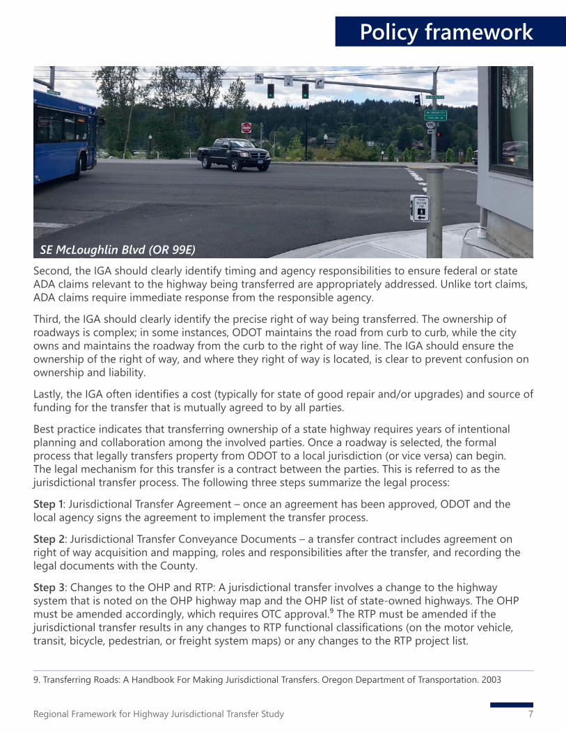
Second, the IGA should clearly identify timing and agency responsibilities to ensure federal or state ADA claims relevant to the highway being transferred are appropriately addressed. Unlike tort claims, ADA claims require immediate response from the responsible agency.
Third, the IGA should clearly identify the precise right of way being transferred. The ownership of roadways is complex; in some instances, ODOT maintains the road from curb to curb, while the city owns and maintains the roadway from the curb to the right of way line. The IGA should ensure the ownership of the right of way, and where they right of way is located, is clear to prevent confusion on ownership and liability.
Lastly, the IGA often identifies a cost (typically for state of good repair and/or upgrades) and source of funding for the transfer that is mutually agreed to by all parties.
Best practice indicates that transferring ownership of a state highway requires years of intentional planning and collaboration among the involved parties. Once a roadway is selected, the formal process that legally transfers property from ODOT to a local jurisdiction (or vice versa) can begin. The legal mechanism for this transfer is a contract between the parties. This is referred to as the jurisdictional transfer process. The following three steps summarize the legal process:
Step 1: Jurisdictional Transfer Agreement – once an agreement has been approved, ODOT and the local agency signs the agreement to implement the transfer process.
Step 2: Jurisdictional Transfer Conveyance Documents – a transfer contract includes agreement on right of way acquisition and mapping, roles and responsibilities after the transfer, and recording the legal documents with the County.
Step 3: Changes to the OHP and RTP: A jurisdictional transfer involves a change to the highway system that is noted on the OHP highway map and the OHP list of state-owned highways. The OHP must be amended accordingly, which requires OTC approval.⁹ The RTP must be amended if the jurisdictional transfer results in any changes to RTP functional classifications (on the motor vehicle, transit, bicycle, pedestrian, or freight system maps) or any changes to the RTP project list.
Policy framework
SE McLoughlin Blvd (OR 99E)
9. Transferring Roads: A Handbook For Making Jurisdictional Transfers. Oregon Department of Transportation. 2003

8 Regional Framework for Highway Jurisdictional Transfer Study
2.3 Jurisdictional transfer process and considerationsThe study’s examination of case studies of completed highway jurisdictional transfers yielded three primary themes:
1. Incentive and mutual benefits: Jurisdictional transfer is initiated when the state and local jurisdiction have incentive to execute the transfer. Case studies indicate that local jurisdictions are motivated by the community’s desire for an improved roadway and when a change in roadway function will prioritize non-automobile travel modes, to improve traffic safety or support desired land use outcomes. Transfer is easiest when funding is available (for example, through the State Legislature) to upgrade the road prior to transfer. Frequently, a transfer reduces maintenance costs and liability for the State, providing long-term financial incentive for the State to complete a transfer. Once incentives are established, the state and local jurisdiction are motivated to complete a transfer by the prospect of mutual benefits. Because the jurisdictional transfer process is grounded in negotiations, transparent and frequent communication ensures that both parties will receive some type of benefit – a financial benefit or outcome that supports the agency’s mission.
2. Roadway maintenance and design standards: Jurisdictional transfers frequently occur to improve a roadway’s maintenance or change its design standards. ODOT design standards are consistent with the Highway Design Manual, and many local jurisdictions use design standards with more flexibility for urban design. Design standards are influenced by a road’s classification and may not be consistent with current or future uses of the roadway.
3. Consistency with current land use: While jurisdictional transfers often occur to update physical conditions of a roadway, they also occur when a roadway’s function is not consistent with current and future land use. Transferring road ownership to a local jurisdiction can help support development or redevelopment by aligning transportation and adjacent land use. The transfer process itself can facilitate development when the negotiation process results in a design that supports adjacent land uses. Sandy Boulevard between Grand Avenue and 99th Avenue was transferred from ODOT to the City of Portland in 2003. Prior to the transfer, two segments of Sandy Boulevard operated differently from the remainder of the road, with greater mixing of modes as the roadway moved east. The transfer was intended to support redevelopment and growth within the Hollywood Town Center and Main Street improvements. Under City ownership, the Sandy Boulevard Resurfacing and Streetscape Project made multimodal improvements and changed the streetscape. In 2008, the City prepared a report that found the project to be widely successful. The transfer reduced ODOT’s maintenance costs and regional through traffic is still served by I-84.
Best practices
Best practices for highway jurisdictional transfer should be followed throughout the entire transfer process – from selection to implementation.
Follow a process: The jurisdictional transfer process typically begins years prior to the formal legal process, starting with regional and statewide planning, and continuing through highway selection to implementation of the Transfer Agreement. From initiation to completion, jurisdictional transfers should follow a clear process to enable the State and local jurisdiction(s) to effectively address issues before they become sticking points that prevent or delay the transfer.
Policy framework

9Regional Framework for Highway Jurisdictional Transfer Study
Importantly, a fair, equitable process helps jurisdictional transfers meet community goals. Throughout the process, the involved agencies should prioritize community needs and values. In the Portland region, 56% of state-owned arterial highways are located in Historically Marginalized Communities (areas with higher than average number of people of color, English language learners, and/or lower-income people). It is imperative for the involved agencies to develop a process and identify equitable outcomes to ensure the results of jurisdictional transfer reduce barriers for people of color and marginalized communities and is consistent with Metro Council’s Regional Equity Strategy, which is being carried out across Metro’s planning department. Figure 2-1 provides an overview of the comprehensive jurisdictional transfer process.
Phase 1: The first phase is focused on preparing for the transfer. During this phase, the involved agencies should:
▪ Identify a regulatory and policy framework to allow the involved agency staff and stakeholders to understand the basis for jurisdictional transfer. The jurisdictional transfer process is rooted in state statute, but it includes intricacies at the federal, regional and local levels. A regulatory and policy framework helps navigate these complexities, such as, roadway ownership, classifications, relevant policies and legal requirements. It also helps involved staff and stakeholders to become familiar with relevant terminology and concepts. This step provides the same information to the involved agencies, ensuring they enter the transfer process with a shared understanding of the applicable regulations and policies.
▪ Understand the political context in the region and within and among the State and local jurisdiction(s) to help identify funding opportunities, develop a process for transfer and set expectations for the transfer process. Developing a knowledge of the political context, including agency and community priorities, helps determine if highway jurisdictional transfer is the right tool to accomplish the desired outcomes. Jurisdictional transfer can help achieve community goals and result in mutual benefits – but it is not always the most effective route to achieving desired outcomes for the roadway under consideration. Once a roadway is selected, taking inventory of each agency’s priorities, elected officials’ interests, and community goals will support a more successful process. Agency priorities will vary and are often influenced by elected officials. Understanding the overall political context will help set expectations for the formal transfer process, ensuring the process and desired outcomes are achievable. Agency priorities
Figure 2-1. Jurisdictional transfer process
Policy framework

10 Regional Framework for Highway Jurisdictional Transfer Study
will impact candidate roadways for transfer, available funding sources and levels, and the interests each agency brings to the negotiating table. All these elements should be documented and understood before entering Phase 2 and 3.
▪ Identify decision makers early for jurisdictional transfer to set expectations, help identify realistic outcomes and help navigate the process to achieve desired outcomes. The decision-makers include those who will agree to enter into negotiations, and those who will sign the transfer documents to formalize the transfer. Identifying the approvers early will ensure the process is on track to complete the jurisdictional transfer and avoid backpedaling down the road. It will also set outcomes that are expected to be approved.
Phase 2: Once the foundation for transfer has been established, the agencies are set to select a roadway and identify the constraints to transferring it from one agency to another. Identifying a roadway may hinge on available funding, but best practice indicates that roadways should be selected based on community needs and values. The 2018 RTP recommends the following steps to select roadways for transfer:
▪ identify state owned routes that the community and stakeholders would like to evaluate and consider for jurisdictional transfer;
▪ identify gaps and deficiencies on these roadways; ▪ prioritize the roadways; and ▪ address some of the barriers and opportunities to transfer the prioritized routes from state
ownership to local ownership.
After the roadway has been selected, constraints should be identified. Major constraints, as illustrated in the case studies, can delay or limit the ability to achieve the preferred outcome, even if both parties agree a transfer is the best option. However, identifying and addressing constraints early and effectively helps shape expectations for the involved parties. It encourages compromise and creativity to develop a mutually beneficial agreement. Constraints differ on a case-by-case basis, but can generally be categorized into two categories: fiscal constraints and physical constraints. Refer to Attachment B: Policy Framework for additional information.
Policy framework
SW Barbur Blvd (OR 99W)

11Regional Framework for Highway Jurisdictional Transfer Study
Figure 2-2. Best practices for communication during a jurisdictional transfer process
Policy frameworkPhase 3: After the roadway is selected, the agencies can enter into the formal transfer process that implements an intergovernmental agreement. This phase is described above in the Legal Considerations and Legal Process for Transfer in Oregon section.
Communicate: Best practices for jurisdictional transfer include communications that result in shared desired outcomes. Best practices (shown in figure 2-2) include:
▪ Identify clear roles within ODOT and within the involved local jurisdiction(s), such as a jurisdictional transfer specialist, asset manager, agreements specialist, traffic engineer and financial and support services staff. This will allow staff to develop expertise in the process and foster relationships among the involved staff.
▪ Set expectations for clear, open, and frequent communication among each agency’s departments and between agencies.
▪ Encourage compromise and creativity between the state and local agencies to lead to a fair and acceptable agreement. Communication is particularly critical during negotiation.
▪ Conduct early outreach with the affected communities. ▪ Commit the partnering agencies to do their due diligence to understand the community’s needs.
Early engagement will lead to a smoother process by preventing tension and backpedaling during negotiation and agreement.

This page intentionally left blank.
12 Regional Framework for Highway Jurisdictional Transfer Study

13Regional Framework for Highway Jurisdictional Transfer Study
3. Methodologies
This section describes the methodology to evaluate and select the most promising arterial highways in greater Portland as potential candidates for highway jurisdictional transfer. This overall methodology describes the methods for three different evaluations: the technical evaluation, the readiness evaluation, and equity considerations. The technical evaluation examines segments using technical considerations related to the existing and future function of the roadway. Starting with a technical perspective allows considerations about the function of a roadway to inform conversations about jurisdictional transfer. The readiness evaluation examines the same universe of segments using readiness considerations related to current (2020) local support and interest, including characteristics such as jurisdictional capacity, leadership interest, or experience with jurisdictional transfers. The results of the technical evaluation are more static, and the results of the readiness evaluation are more fluid; the readiness evaluation may change over time as local support and political interest change.
The methodology consists of two parallel processes, each consisting of one screening round and one evaluation round, to determine the most promising corridor segments for transfer from ODOT to a local jurisdiction. For the purposes of this evaluation, a corridor segment is defined as a portion of an arterial highway within a single jurisdiction in the Portland Metropolitan Planning Area (MPA).10,11
Round 1: Preliminary screening of all ODOT-owned arterial highway corridor segments in the Portland MPA to screen out segments that are not viable candidates for jurisdictional transfer because of their intended vehicle and freight throughput function.
Round 2a: Technical evaluation of the remaining segments from Round 1 to select promising segments for potential transfer.
Round 2b: Readiness evaluation of the remaining segments from Round 1 to select promising segments for potential transfer.
10. The MPA is a federally-mandated boundary designated by Metro and encompasses all cities in the metropolitan area.11. Corridor segment definitions are for this evaluation only. Highway transfer recommendations may combine or split corridor segments based on what makes sense at the time of a transfer.

14 Regional Framework for Highway Jurisdictional Transfer Study
The results from Round 1, preliminary screening, equally informed subsequent evaluation rounds. After Round 1, the study team evaluated the remaining corridor segments to identify the most promising segments as candidates for jurisdictional transfer from two perspectives: technical (Round 2a) and readiness of the local jurisdictional to accept and manage an arterial (Round 2b). The readiness evaluation lagged the technical evaluation to allow roadway function to inform transfer discussions. The team completed Round 1 and Round 2a in fall 2019, and completed Round 2b in spring 2020. The team then evaluated and compared results from Round 2a and Round 2b to develop findings for consideration. These findings were informed by the project team’s Equity Considerations analysis, which evaluated highway corridors for numbers of people of color, low-income households, people who are unemployed and people with limited English proficiency and/or disabilities.
The project team selected segments with the highest scores from each of the evaluations as recommendations for the most promising candidates for jurisdictional transfer (see Section 4 Findings). Refer to Attachment C for more detailed technical and readiness evaluation methodologies and Attachment D for a more detailed equity considerations analysis methodology. Figure 3-1 illustrates this process.
3.1 Round 1: preliminary screeningRound 1 had one yes/no question that identified significant barriers to jurisdictional transfer. The study team applied the question to each corridor segment. Corridor segments that did not “pass” Round 1 did not move to Round 2a or 2b. Corridor segments with a “no” answer to the screening question moved on the technical and readiness evaluation rounds. The Round 1 preliminary screening question, including rationale, is listed below.
Question: Does the segment have an Expressway (OHP) and/or Throughway (RTP) designation?
If the answer to this question was “no,” the segment moved to Round 2 of the evaluation and selection process. Expressway and Throughway designations indicate that a roadway or corridor segment has statewide or regional significance and describes the function of the roadway. The results from this preliminary screening round equally informed subsequent evaluation rounds.
Figure 3-1. Metro RTP four pillars
Methodologies

15Regional Framework for Highway Jurisdictional Transfer Study
Methodologies
3.2 Round 2a: technical evaluationRound 2a’s purpose was to evaluate the remaining corridor segments with a consistent set of technical criteria that reflect regional values (i.e., consistent with the RTP and its four pillars). Using professional expertise, the team intentionally developed measures and corresponding questions to avoid complicated technical analysis, allowing any jurisdiction to evaluate its own roadways.
The following criteria were used for the technical evaluation: ▪ Local plans ▪ Access to business and housing ▪ Historically marginalized communities ▪ Crash frequency ▪ Density of conflict points ▪ Freight connection ▪ Pedestrian and bicycle system priority ▪ Transit priority ▪ Redundant route
After the study team evaluated the corridor segments, they used the results to select segments that appeared most promising for jurisdictional transfer from a technical perspective. The evaluation was based on the overall results, so that the segments receiving more “high” and “medium” ratings were selected.
3.3 Round 2b: readiness evaluationRound 2b’s purpose was to evaluate the remaining segments (after Round 1) with a consistent set of readiness criteria. This was the same group of segments evaluated in Round 2a. The project team evaluated the corridor segments for readiness using a mix of available data and interviews with a staff representative from the local jurisdiction where the highway segment is physically located.
Professional judgment was used in cases where an interview response was not available. The study’s interview guide is found in Appendix B of Attachment C.
The readiness analysis represents a snapshot-in-time evaluation of each corridor segment. Changes in political leadership or investments in paving, safety enhancements, or other improvements will change the overall readiness score for a corridor. The following criteria were used for the readiness evaluation:
▪ Jurisdiction interest ▪ Segmentation ▪ Funding capacity ▪ Maintenance capacity
▪ Existing conditions and state of maintenance ▪ Bridges/structures ▪ Environmental ▪ Land use

16 Regional Framework for Highway Jurisdictional Transfer Study
The results of the evaluation were used to identify segments that appeared most promising for jurisdictional transfer from a readiness perspective. The evaluation was based on overall results, so that the segments receiving more “high” and “medium” ratings were selected as most promising.
3.4 Equity considerationsState highway designs of the past, coupled with limited design options available as these facilities grew from market road to highway, means that roadways do not always work for the multimodal needs of communities along the corridors. This is particularly the case for people of color, people with low incomes, or limited-English speakers due to the prevalence of these communities living near these corridors and typically being more transit-dependent.
Highway management is increasingly complex because of the competition for limited funds, resulting in less investment in these areas than would be expected for similar roadways owned by local jurisdictions. Understanding the demographics of these corridors is critical to ensure highway transfer decisions address the needs of people of color, people with low-incomes, or limited-English speaking communities. Current and historic decision-making has resulted in communities along these corridors experiencing disparate impacts relating to safety, access to transit and sidewalks, and noise.
The equity considerations analysis supplements and informs the corridor segment selection’s technical and readiness evaluations for jurisdictional transfer (see Attachment D: Equity Considerations for Highway Jurisdictional Transfer). Understanding where equity-focused communities exist informs the identification of placemaking opportunities to help address the results of the
Methodologies
SW Hall Blvd (OR 141)

17Regional Framework for Highway Jurisdictional Transfer Study
Demographic Category % DensityPeople of color (residents) 28.6 1.11 People of color (unemployed) 4.6 0.03Hispanic & Latino (unemployed) 4.9 0.02Low-income (residents) 28.5 1.09Low-income (unemployment) 13.0 0.04Limited English proficiency 7.9 0.29Notes:Percentage is the number of people that fit the category per the total census tract population. Density is defined as the number of people per acre.
Table 3-1. Metro’s regional averages for demographic data
12. “Historical Context of Racist Planning: A History of How Planning Segregated Portland” (2019) https://beta.portland.gov/sites/default/files/2019-12/portlandracistplanninghistoryreport.pdf13. The region is defined as the Portland MPA.
region’s racist history of zoning.¹² Equity considerations also can help identify corridors that would benefit from funding to make them better for people walking, needing better access to transit, and biking.
The study team identified the census tracts adjacent to each of the State-owned nonarterial highways in the study to collect existing demographic data. For each census tract, the study team used the U.S. Census Bureau American Community Survey (ACS) FactFinder to collect the following 2017 demographic data (density and percent):
▪ people of color (residents) ▪ people of color (unemployment) ▪ low-income residents ▪ low-income unemployment ▪ limited English proficiency
The data for each highway corridor was compared to the regional¹³ density average determined by Metro, defined as twice the average density for the given population, and to the regional percentage average (see Table 3-1). Figure 3-2 shows the MPA, Metro’s equity focus areas, and the 17 highway segments.
Highways – or segments of highways – identified in the equity considerations analysis as having high ratios of people of color, low income, and unemployment compared to the Metro regional average added support to segments scoring high on technical and readiness evaluations for promising jurisdictional transfer corridors.
Methodologies

18 Regional Framework for Highway Jurisdictional Transfer Study
Figure 3-2: Metro’s Equity Focus Areas with the 17 arterial highway segments
Methodologies

19Regional Framework for Highway Jurisdictional Transfer Study
4. Findings
4.1 Most promising candidates for jurisdictional transferConsidered together, the preliminary screening, technical and readiness evaluations, and the equity considerations analysis produced 11 state highway corridor segments that show the most promising characteristics for potential jurisdictional transfer. These segments are identified to help inform future conversations about investment and/or jurisdictional transfer. While all of the corridors in this report are of importance, the team identified these 11 corridors for consideration for further jurisdictional transfer discussions. These corridors showed the strongest characteristics for potential jurisdictional transfer based on an assessment of technical, readiness, and equity considerations.
Many of these highway corridors are in areas with high concentrations of people of color and people with low income compared to regional averages, and many of them have serious safety needs (refer to Section 5). In some cases, the local jurisdiction’s interest in a transfer is low. However, considering the technical, readiness and equity evaluations, the findings suggest that despite a jurisdiction’s low interest, those corridors may be the most promising for transfer when looking at transfers from a regional perspective. These corridors function more similar to a local roadway than a state highway. A transfer would give local jurisdictions more autonomy to make improvements. The corridors are listed below and shown in Figure 4-1.
1. Powell Boulevard (U.S. 26) (MP 0.2 – 10.0) – Powell Boulevard in the City of Portland scored high in the technical evaluation and the readiness evaluation. The portion of the corridor from I-205 to the Gresham city line has high ratio of people of color, with low incomes and unemployment compared to the regional average. The City of Portland’s interest in jurisdictional transfer is medium.
2. Barbur Boulevard (OR 99W) (MP 1.2 – 7.6) – Barbur Boulevard in the City of Portland scored high in the technical evaluation and the readiness evaluation. The corridor scored low in the equity considerations evaluation. The City of Portland’s interest in jurisdictional transfer is high.

20 Regional Framework for Highway Jurisdictional Transfer Study
WASHINGTON COUNTY
CLARKCOUNTY
MULTNOMAHCOUNTY
CLACKAMAS COUNTYOregon
City
WestLinn
Gladstone
HappyValley
Gresham
TroutdalePortland
Beaverton
Tigard
Tualatin
Wilsonville
HillsboroForestGrove
Willamette River
Columbia River
SE Powell Blvd
SE 8
2nd
Ave
SE McLoughlin Blvd
SW Tualatin Valley Hwy
N Lombard St
Willam
ette Dr
SW Hall Bl vd
205
84
5
405
213south
99east
224
213north
30B30
west
30east
99west
26
26
212
224
43
8
10
10
8
47
5
205
26
217
219
141SW Farmington
Rd
LEGEND
County boundariesMetropolitan Planning AreaOther highways and Interstates
Most Promising Transfer Candidates
0 2 4
Miles
Figure 4-1: Corridors identified as promising candidates for jurisdictional transfer
Findings
As of 2020. Conditions may change over time
21Regional Framework for Highway Jurisdictional Transfer Study
3. SE/NE 82nd Avenue (OR 213) (MP -0.1-7.2) – 82nd Avenue in the City of Portland scored high in the technical evaluation and the readiness evaluation. The corridor has high ratio of people of color, with low incomes and unemployment compared to the regional average. The City of Portland’s interest in jurisdictional transfer is high.
4. Tualatin Valley Highway (OR 8) (MP 2.9-5.9) – Tualatin Valley Highway, west of OR 217 in the City of Beaverton, scored high in the technical evaluation and the readiness evaluation. The corridor scored medium in the equity considerations evaluation. The City of Beaverton’s interest in jurisdictional transfer is high.
5. Pacific Highway West (OR 99W) (MP 7.6-11.5) – Pacific Highway West in the City of Tigard scored high in the technical evaluation and the readiness evaluation. The corridor has high ratio of people of color, with low incomes and unemployment compared to the regional average. The City of Tigard’s interest in jurisdictional transfer is low.
6. Tualatin Valley Highway (OR 8) (MP 5.9-17.9) – The majority of Tualatin Valley Highway in Washington County scored high in the technical evaluation (MP 14.3 – 14.9 scored medium) and all of highway corridor scored medium in the readiness evaluation. The corridor has high ratios of people of color, with low incomes and unemployment compared to the regional average. Washington County’s interest in jurisdictional transfer for the whole corridor is high.
7. Pacific Highway W (OR 99W) (MP 11.5-14.5) – Pacific Highway West from MP 11.5 to 12.2 in Washington County scored high in the technical evaluation and MP 12.2 to 14.5 scored medium in the technical evaluation. MP 11.5-13.3 scored medium in the readiness evaluation and MP 13.3-14.5 scored high in the readiness evaluation. The corridor scored low in the equity considerations evaluation. Washington County’s interest in jurisdictional transfer is low.
8. Farmington Road (OR 10) (MP 5.9-7.3) – Farmington Road in Washington County scored medium in the technical evaluation and high in the readiness evaluation. The corridor has high ratios of people of color, with low incomes and unemployment compared to the regional average. Washington County’s interest in jurisdictional transfer is high.
9. SW Hall Boulevard (OR 141) (MP 2.6-7.1 and 7.7-8.9) – SW Hall Boulevard from MP 2.6 to 7.1 in Washington County scored high in the technical evaluation and MP 7.7 to 8.9 scored medium in the technical evaluation. MP 3.3-7.1 and 7.7-8.9 scored high in the readiness evaluation and MP 2.6-3.3 and 8.9 scored medium in the readiness evaluation. The segments of the corridor in Beaverton (MP 2.6-3.3) and Tigard (MP 4.1-7.1 and 7.7-7.8) have high ratios of people of color, with low incomes and limited English proficiency compared to the regional average. Washington County’s interest in jurisdictional transfer is high.
10. SE McLoughlin Boulevard (OR 99E) (MP 5.7-6.7) – SE McLoughlin Boulevard in the City of Milwaukie scored high in the technical evaluation and the readiness evaluation. The corridor has high ratios of people with low incomes and unemployment compared to the regional average. The City of Milwaukie’s interest in jurisdictional transfer is low.
11. Willamette Drive (OR 43) (MP 8.0-11.5) – Willamette Drive in the City of West Linn scored high in the technical evaluation and the readiness evaluation. The corridor scored low in the equity considerations evaluation. The City of West Linn’s interest in jurisdictional transfer is high.
Findings

22 Regional Framework for Highway Jurisdictional Transfer Study
Findings
Segment ID Mile Point begin Mile Point end Jurisdiction Throughways ExpresswaysOR 47 - TV HighwayA7 17.9 19.4 Forest Grove Yes NoA8 19.4 23.2 Washington Yes NoU.S. 26 - Mount Hood HighwayC2 14.2 15.6 Gresham Yes YesC3 15.6 16.8 Multnomah Yes YesC4 16.8 19.6 Clackamas Yes YesOR 30W - Lower Columbia River HighwayF1 2.8 9.7 Portland Yes NoF2 9.7 13.3 Multnomah Yes NoOR 47 - Nehalem HighwayH1 88.5 90.2 Washington Yes NoH2 90.2 90.6 Forest Grove Yes NoOR 99E - Pacific Highway EastI1 -5.7 -5.9 Portland Yes NoI3 1.5 4.6 Portland Yes NoI4 4.6 5.7 Milwaukie Yes NoI9 12.4 14.2 Oregon City Yes NoI10 14.2 16.4 Clackamas Yes NoOR 99W - Pacific Highway WestJ7 14.5 16.7 Sherwood Yes NoJ8 16.7 17.9 Washington Yes NoOR 212 - Clackamas-Boring HighwayM1 1.9 8.6 Clackamas Yes NoM2 1.8 1.9 Happy Valley Yes NoM3 1.0 1.8 Clackamas Yes No
Table 4-1. Round 1: Segments designated as OHP Expressway or RTP Throughway
The sections below describe the results from each of the individual evaluations described in Section 3.
4.2 Round 1: preliminary screening resultsRound 1’s purpose was to perform a preliminary screening of all ODOT-owned arterial highway corridor segments in the Portland metro region to screen out those not viable for jurisdictional transfer because of their intended vehicle throughput function. A total of 78 highway segments in the region were considered during the preliminary screening round (see Section 3 for more on the methodologies for each round of evaluation). Of these highway segments, 48 were classified as either an OHP Expressway or as an RTP Throughway.
These 48 segments did not move on to the technical and readiness evaluations, are shown in Figure 4-2, and are listed in Table 4-1.

23Regional Framework for Highway Jurisdictional Transfer Study
Figure 4-2. Round 1: preliminary screening results
Findings

24 Regional Framework for Highway Jurisdictional Transfer Study
4.3 Round 2a: technical evaluation resultsRound 2a’s purpose was to evaluate the 48 corridor segments that emerged from Round 1 with a consistent set of technical criteria that reflect regional values (i.e., consistent with the RTP pillars). The study team evaluated each of the 48 non-throughway and non-expressway corridor segments with the technical criteria, measures, and ratings/definitions described in Section 3.
The top-scoring segments are the most promising candidates for jurisdictional transfer from a technical perspective in that they function more like a local roadway than a state roadway. There were 25 segments that scored highest. These are shown in Figure 4-3 and listed in Table 4-2.
Findings
Segment ID Mile Point begin Mile Point end Jurisdiction Technically Promising for Transfer?OR 8 - TV HighwayA1 0.1 5.9 Beaverton Yes - HighA2 5.9 7.8 Washington Yes - HighA3 7.8 14.3 Hillsboro Yes - HighA5 14.9 17.2 Cornelius Yes - HighA6 17.2 17.9 Forest Grove Yes - HighOR 10 - Beaverton-Hillsdale/Farmington HighwayB1 2.6 3.4 Washington Yes - HighU.S. 26 - Mount Hood HighwayC1 0.2 10.0 Portland Yes - HighOR 30B - Northeast Portland HighwayD1 0 14.7 Portland Yes - High
Segment ID Mile Point begin Mile Point end Jurisdiction Throughways ExpresswaysOR 213S - Cascade Highway SouthO1 0.0 0.6 Oregon City Yes YesO2 0.6 1.1 Clackamas Yes YesO3 1.1 1.3 Oregon City Yes YesO4 1.3 2.6 Clackamas Yes YesO5 2.6 4.2 Oregon City Yes YesO6 4.2 6.5 Clackamas Yes NoOR 224 - Clackamas Highway/Sunrise ExpresswayQ1 9.4 10.5 Clackamas Yes NoQ2 8.2 9.5 Happy Valley Yes NoQ3 4.6 6.3 Clackamas Yes NoQ4 2.7 3.8 Clackamas Yes YesQ5 0.0 2.7 Milwaukie Yes YesNotes:ODOT convention allows some Mile Points to be negative numbers.
Table 4-1. Round 1: Segments designated as OHP Expressway or RTP Throughway (cont.)
Table 4-2. Round 2a: Segments that scored high in the technical assessment

25Regional Framework for Highway Jurisdictional Transfer Study
Findings
Table 4-2. Round 2a: Segments that scored high in the technical assessment (cont.)Segment ID Mile Point begin Mile Point end Jurisdiction Technically Promising for Transfer?OR 43 - Oswego HighwayG1 0 3.6 Portland Yes - HighG4 5.8 8.0 Lake Oswego Yes - HighG5 8.0 11.5 West Linn Yes - HighOR 99E - Pacific Highway EastI5 5.7 6.7 Milwaukie Yes - HighI6 6.7 10.4 Clackamas Yes - HighI7 10.4 11.2 Gladstone Yes - HighI8 11.2 12.4 Oregon City Yes - HighOR 99W - Pacific Highway WestJ1 -6.0 -4.8 Portland Yes - HighJ2 1.2 7.6 Portland Yes - HighJ3 7.6 11.5 Tigard Yes - HighJ4 11.5 12.2 Washington Yes - HighOR 141 - Beaverton-Tualatin Highway/SW Hall BlvdK1 2.6 3.3 Beaverton Yes - HighK2 3.3 4.1 Washington Yes - HighK3 4.1 7.1 Tigard Yes - HighOR 210 - Scholls Highway/SW Scholls Ferry RdL1 9.6 9.1 Beaverton Yes - HighOR 213N - Cascade Highway NorthN1 -0.1 7.2 Portland Yes - HighN2 7.2 10.4 Clackamas Yes - HighNotes:ODOT convention allows some Mile Points to be negative numbers. All segments with a “Yes - High” are arterial highway segments that scored 17-26 points in the Round 2a technical evaluations. These segments are identified as the most promising candidates for jurisdictional transfer from a technical perspective. Segments that have a Medium scored 8-16 points and segments that have a Low scored 0-7 in the Round 2a technical evaluations.

26 Regional Framework for Highway Jurisdictional Transfer Study
Figure 4-3. Round 2a: technical evaluation results
FindingsTransfer discussion are underway for the following segments:
Outer Powell (U.S. 26 from I-205 to SE 174th Ave ). Safety improvement project is underway and will be completed in 2022. Once completed, ownership and operation will transfer to City of Portland per House Bill 2017.
82nd Avenue (213 N from NE Columbia Blvd to SE Clatsop St). Corridor planning completed in May 2019. Negotiations regarding transfer have been initiated.
SW Barbur Boulevard (99W from I-405 to SW 64th Ave). As part of the SW Corridor transit project, an intergovernmental agreement was signed that would facilitate the transfer of SW Barbur/OR 99W to the City of Portland.

27Regional Framework for Highway Jurisdictional Transfer Study
Findings
Segment ID Mile Point begin Mile Point end Jurisdiction High rank for transfer readiness?OR 8 - TV HighwayA1 0.1 5.9 Beaverton Yes - HighOR 10 - Beaverton-Hillsdale/Farmington HighwayB3 5.9 7.4 Washington Yes - HighU.S. 26 - Mount Hood HighwayC1 0.2 10.0 Portland Yes - HighOR 43 - Oswego HighwayG5 8.0 11.5 West Linn Yes - HighOR 99E - Pacific Highway EastI5 5.7 6.7 Milwaukie Yes - HighOR 99W - Pacific Highway WestJ2 1.2 7.6 Portland Yes - HighJ3 7.6 11.5 Tigard Yes - HighJ6 13.3 14.5 Washington Yes - HighOR 141 - Beaverton-Tualatin Highway/SW Hall BlvdK2 3.3 4.1 Washington Yes - HighK3 4.1 7.1 Tigard Yes - HighK4 7.7 7.8 Tigard Yes - HighK5 7.8 8.9 Durham Yes - HighK7 12.5 13.1 Wilsonville Yes - HighOR 213N - Cascade Highway NorthN1 -0.1 7.2 Portland Yes - HighNotes:ODOT convention allows some Mile Points to be negative numbers. All segments with a “Yes - High” are arterial highway segments that scored 14-22 points in the Round 2a readiness evaluations. These segments are identified as the most promising candidates for jurisdictional transfer from a technical perspective. Segments that have a Medium scored 8-13 points and segments that have a Low scored 0-7 in the Round 2a technical evaluations.
Table 4-3. Round 2b: Segments that scored high in the readiness assessment
4.4 Round 2b: Readiness Evaluation ResultsRound 2b’s purpose was to evaluate the remaining corridor segments (those remaining after Round 2a with a consistent set of readiness criteria. This was the same group of segments evaluated in the Round 2a Technical Evaluation. The study team evaluated each of the 48 non-throughway and non- expressway corridor segments with the readiness criteria, measures, and ratings/definitions described in Section 3.
Readiness scores reflect a snapshot-in-time evaluation of each corridor. Changes in political leadership, new investments in corridor improvements, or other fungible factors will change a corridor segment’s readiness score.
A total of 14 segments scored in the readiness evaluation’s top third of points meaning that for these segments, local jurisdictions are more capable and willing to assume the responsibilities of the roadway, and the roadway itself is in adequate condition with minimal barriers to ownership from the perspective of the local jurisdiction. These 14 segments are shown in Figure 4-4 and listed in Table 4-3.

28 Regional Framework for Highway Jurisdictional Transfer Study
Figure 4-4. Round 2b: readiness evaluation results
Findings
Transfer discussion are underway for the following segments:
Outer Powell (U.S. 26 from I-205 to SE 174th Ave ). Safety improvement project is underway and will be completed in 2022. Once completed, ownership and operation will transfer to City of Portland per House Bill 2017.
82nd Avenue (213 N from NE Columbia Blvd to SE Clatsop St). Corridor planning completed in May 2019. Negotiations regarding transfer have been initiated.
SW Barbur Boulevard (99W from I-405 to SW 64th Ave). As part of the SW Corridor transit project, an intergovernmental agreement was signed that would facilitate the transfer of SW Barbur/OR 99W to the City of Portland.

29Regional Framework for Highway Jurisdictional Transfer Study
Findings4.5 Equity considerations analysisThe purpose of the equity considerations analysis was to supplement and inform the segment selection technical and readiness evaluations for jurisdictional transfer. The goal is to reduce disparities and barriers faced by communities of color and other historically marginalized communities. Equity considerations can help identify corridors that would benefit from funding to make them better for walking, access to transit, and biking. In some cases, a jurisdictional transfer and/or a change in roadway design would benefit the communities identified in this equity considerations analysis that live along these corridors.
Highways – or segments of highways – and their locations identified in the equity analysis as having high ratios of people of color, low income, and unemployment compared to the Metro regional average are described below.
TV Highway (OR 8): TV Highway segments in Washington County, Hillsboro and Cornelius have high ratios of people of color, low income, and unemployment compared to the Metro regional average.
Beaverton-Hillsdale/Farmington Highway (OR 10): Beaverton-Hillsdale/Farmington Highway segments in Beaverton and west Washington County have high ratios of people of color, low income, and unemployment compared to the regional average.
Mount Hood Highway (U.S. 26): The Mount Hood Highway segment in Portland from I-205 to the Gresham city line has high ratios of people of color, low income, and unemployment compared to the regional average.
Northeast Portland Highway (U.S. 30B): The NE Portland Highway corridor has high ratios of people of color, low income, and unemployment compared to the regional average.
Nehalem Highway (OR 47): The Nehalem Highway segment that divides Forest Grove and Washington County has high ratios of people of color, low income, and unemployment compared to the regional average.
Pacific Highway East (OR 99E): Pacific Highway East’s most northern segment in Portland has high ratios of people of color, low-income, and limited English proficiency compared to the regional average. OR 99E segments farther to the south in Milwaukie have high ratios of low income and unemployment. This southern area does not have a high percentage of people of color.
Pacific Highway West (OR 99W): The Pacific Highway West segment in Tigard has high ratios of people of color, low income, and unemployment compared to the regional average.
Beaverton-Tualatin Highway (OR 141): The Beaverton-Tualatin Highway segments in Beaverton and Tigard have high ratios of people of color, low income, and limited English proficiency compared to the regional average.
Scholls Highway (OR 210): Scholls Highway has high ratios of people of color, low income, and unemployment compared to the regional average.
Cascade Highway North (OR 213N): The Cascade Highway North segment from North Portland to Clackamas County has high ratios of people of color, low income, and unemployment compared to the regional average.
Hillsboro-Silverton Highway (OR 219): Hillsboro-Silverton Highway has high ratios of people of color, low income, and unemployment compared to the regional average.

This page intentionally left blank.
30 Regional Framework for Highway Jurisdictional Transfer Study

31Regional Framework for Highway Jurisdictional Transfer Study
5. Needs and deficiencies
This section provides a high-level assessment of the needs and deficiencies of the most promising jurisdictional transfer candidates (identified in Section 4) in the Metro area to help inform future conversations about investment and/or jurisdictional transfer.
The assessment is designed and organized primarily as a tool for local jurisdictions and secondarily for regional and state agencies. The corridors featured in the assessment show the strongest characteristics for potential jurisdictional transfer based on an assessment of technical, readiness, and equity considerations (see Attachment E: Needs and Deficiencies Assessment). The assessment presents a corridor’s characteristics as a snapshot in time.
For example, future investments in paving, safety enhancements or other improvements will change a corridor’s needs and deficiencies assessment.
Many of these highway corridors travel through areas with high concentrations of people of color and people who are low-income compared to regional averages. In addition, many of these highway corridors demonstrate safety needs. Key characteristics of each promising segment are assembled in the assessment, including information on:
▪ Pedestrian network ▪ Bicycle network ▪ Transit routes ▪ Safety data ▪ Corridor data (pavement condition, freight route designation, bridge
ratings, speed limit, lane number, and length) ▪ Roadway classification ▪ Demographics
In addition, the mapping provided in the assessment shows environmentally sensitive areas, Metro equity focus areas, regional land use, and the location for each corridor. A list of projects funded in an adopted capital improvement program and typical photos from the corridor round out the information in the assessment.

This page intentionally left blank.
32 Regional Framework for Highway Jurisdictional Transfer Study

33Regional Framework for Highway Jurisdictional Transfer Study
6. Cost estimating methodology
The study team developed a cost estimating methodology to identify high- level planning costs associated with transferring ownership of a highway from one jurisdiction to another, typically ODOT to a city or county (see Attachment F: Cost Estimating Methodology).
The study team developed this cost estimating methodology to provide partners with a consistent process for use in developing and understanding the costs associated with a highway jurisdictional transfer in the Portland Metro area. The methodology is based on industry practices, asset management strategies, past jurisdictional transfers, and technical expertise in consultation with ODOT staff and technical experts. Roadways require maintenance, improvements, and oversight over the course of ownership. This methodology ensures partners have consistent, necessary tools to consider these variables as local jurisdictions, Metro, and ODOT engage in conversations regarding highway jurisdictional transfer.
This methodology is a toolkit for assessing deficiency on a roadway, assuming the roadways are improved to meeting existing traffic safety needs. The methodology includes approaches to estimating direct costs (e.g., upgrading roadway elements to address crashes) and indirect costs (e.g., ongoing maintenance of roadway elements).
The overall cost estimating methodology includes physical and programmatic cost considerations. Physical costs are immediate state of good repair upgrades, identified capital needs, or future maintenance projects that require construction work. Programmatic cost considerations are costs incurred as part of the ownership (i.e., soft costs) and management of a corridor over time. The following four categories address both physical costs and programmatic cost considerations to provide a full understanding of financial implications of jurisdictional transfer:
▪ State of good repair ▪ Regionally or locally identified capital needs ▪ Maintenance and operations ▪ Soft ownership costs
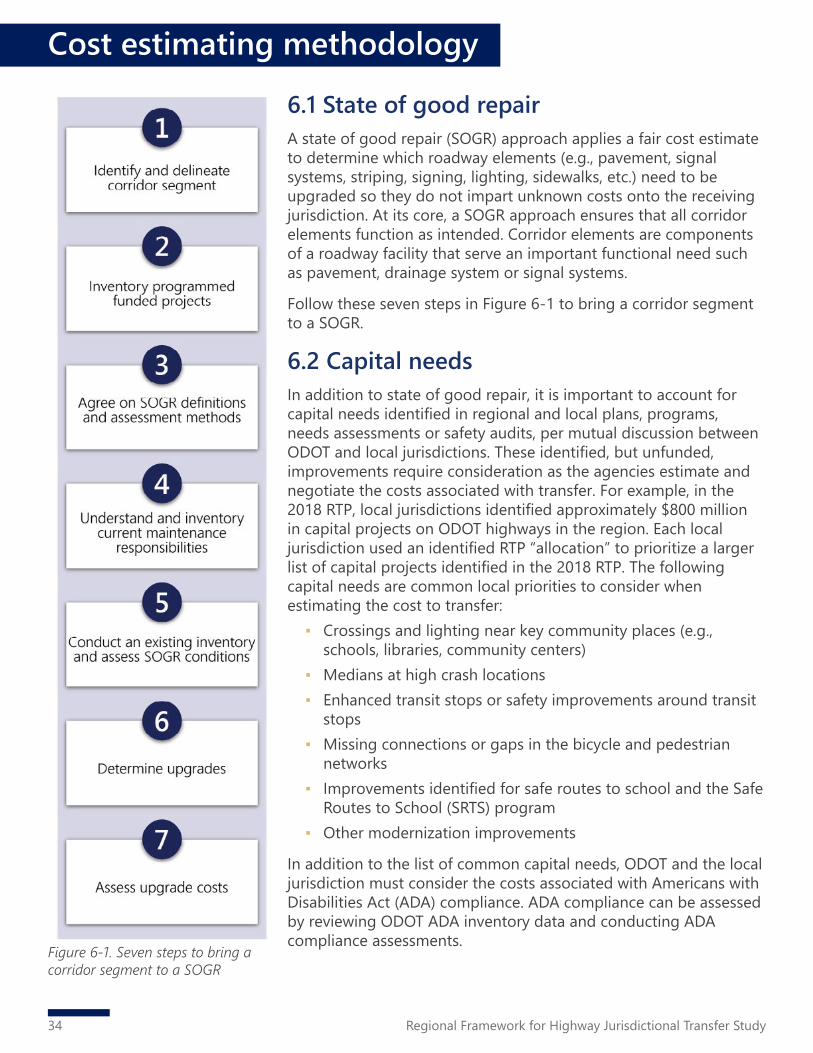
34 Regional Framework for Highway Jurisdictional Transfer Study
6.1 State of good repairA state of good repair (SOGR) approach applies a fair cost estimate to determine which roadway elements (e.g., pavement, signal systems, striping, signing, lighting, sidewalks, etc.) need to be upgraded so they do not impart unknown costs onto the receiving jurisdiction. At its core, a SOGR approach ensures that all corridor elements function as intended. Corridor elements are components of a roadway facility that serve an important functional need such as pavement, drainage system or signal systems.
Follow these seven steps in Figure 6-1 to bring a corridor segment to a SOGR.
6.2 Capital needsIn addition to state of good repair, it is important to account for capital needs identified in regional and local plans, programs, needs assessments or safety audits, per mutual discussion between ODOT and local jurisdictions. These identified, but unfunded, improvements require consideration as the agencies estimate and negotiate the costs associated with transfer. For example, in the 2018 RTP, local jurisdictions identified approximately $800 million in capital projects on ODOT highways in the region. Each local jurisdiction used an identified RTP “allocation” to prioritize a larger list of capital projects identified in the 2018 RTP. The following capital needs are common local priorities to consider when estimating the cost to transfer:
▪ Crossings and lighting near key community places (e.g., schools, libraries, community centers)
▪ Medians at high crash locations ▪ Enhanced transit stops or safety improvements around transit
stops ▪ Missing connections or gaps in the bicycle and pedestrian
networks ▪ Improvements identified for safe routes to school and the Safe
Routes to School (SRTS) program ▪ Other modernization improvements
In addition to the list of common capital needs, ODOT and the local jurisdiction must consider the costs associated with Americans with Disabilities Act (ADA) compliance. ADA compliance can be assessed by reviewing ODOT ADA inventory data and conducting ADA compliance assessments.
Figure 6-1. Seven steps to bring a corridor segment to a SOGR
Cost estimating methodology

35Regional Framework for Highway Jurisdictional Transfer Study
Cost estimating methodology
6.3 Maintenance and operation costsLong-term cost considerations include routine corridor inspections, basic maintenance of existing conditions, long-term improvement needs, staff training, and contingency costs associated with potential asset damage due to unforeseen events or conditions.
Maintenance and operation costs provide a forecast for future costs after a highway jurisdictional transfer is complete and should be considered during negotiations. Local jurisdictions may consider contracting maintenance and operation responsibilities to other agencies. Costs associated with these arrangements should be considered.
6.4 Ownership costsNon-physical soft costs of owning a corridor segment also need to be considered in the financial implications of jurisdictional transfer. These costs are overarching indirect costs associated with the acquisition of any new roadway to effectively manage it consistent with the local jurisdiction’s defined policies and goals. While these costs do not directly inflate the cost of transferring a highway from ODOT to a local jurisdiction, they need to be considered for the increase in staff time and skills required to own them.
Ownership costs are categorized by:1. Increase in liability2. Access management reviews3. Programming and planning4. Reporting obligations
Farmington Rd (OR 10)

This page intentionally left blank.
36 Regional Framework for Highway Jurisdictional Transfer Study

37Regional Framework for Highway Jurisdictional Transfer Study
7. Conclusion
The Metro Highway Jurisdictional Transfer Framework study provides a toolkit for state, regional and local jurisdiction leaders to identify promising candidate roadways for transfer and to facilitate successful transfer of roadway ownership. It identified the top 11 state-owned highway segments in greater Portland that could be considered for a jurisdictional transfer and addressed some of the opportunities and barriers to transferring the routes (refer to Section 4.1). These 11 highway segments have significant needs and deficiencies, such as pedestrian and bicycle facility gaps, poor pavement, or lacking safety infrastructure. Many of these segments travel adjacent to areas with high concentrations of people of color, people with low-incomes, or people who speak English as a second language. In general, these characteristics make them more promising candidates for jurisdictional transfer to local jurisdictions. In some cases, there is current interest from the local jurisdictions to pursue transfer in attempts to align existing and future land uses with community interest. In some cases, the local jurisdiction’s interest in a transfer is low. However, considering the technical, readiness and equity evaluations, the findings suggest that despite a jurisdiction’s low interest, those corridors may be the most promising for transfer when looking at transfers from a regional perspective. These corridors function more similar to a local roadway than a state highway. A transfer would give local jurisdictions more autonomy to make improvements.
Historically, identifying a single, comprehensive funding source for jurisdictional transfers in the region has been a challenge. Jurisdictions are typically only interested in transfers when accompanied by funding to improve the roadway, and it is difficult to provide a meaningful funding amount by piecing different funding buckets together. The study team recognizes the need for a wholistic and comprehensive funding strategy to fully accomplish jurisdictional transfers. Refer to the Consultant Recommendation memorandum (November 2020) for a list of funding sources and a broader funding discussion.
Jurisdictional transfers are an important part of managing and adapting to changing travel and land use patterns within the region. They can be a “win-win” for the state, local governments and local communities. The overall objective of jurisdictional transfers is to ensure that Oregon roads are owned and operated at the right jurisdictional level (i.e., by the right agency). This will ensure that roadways align appropriately to provide the right level of service and better meet the needs of users in terms of maintenance, ride quality and traffic safety.

This page intentionally left blank.
38 Regional Framework for Highway Jurisdictional Transfer Study