REGIONAL DEVELOPMENT STRATEGY PRESENTED BY MR SOE HLAING MYANMAR.
35
REGIONAL DEVELOPMENT STRATEGY PRESENTED BY MR SOE HLAING MYANMAR
-
Upload
dorthy-sparks -
Category
Documents
-
view
225 -
download
2
Transcript of REGIONAL DEVELOPMENT STRATEGY PRESENTED BY MR SOE HLAING MYANMAR.

REGIONAL DEVELOPMENT STRATEGY
PRESENTED BY MR SOE HLAINGMYANMAR
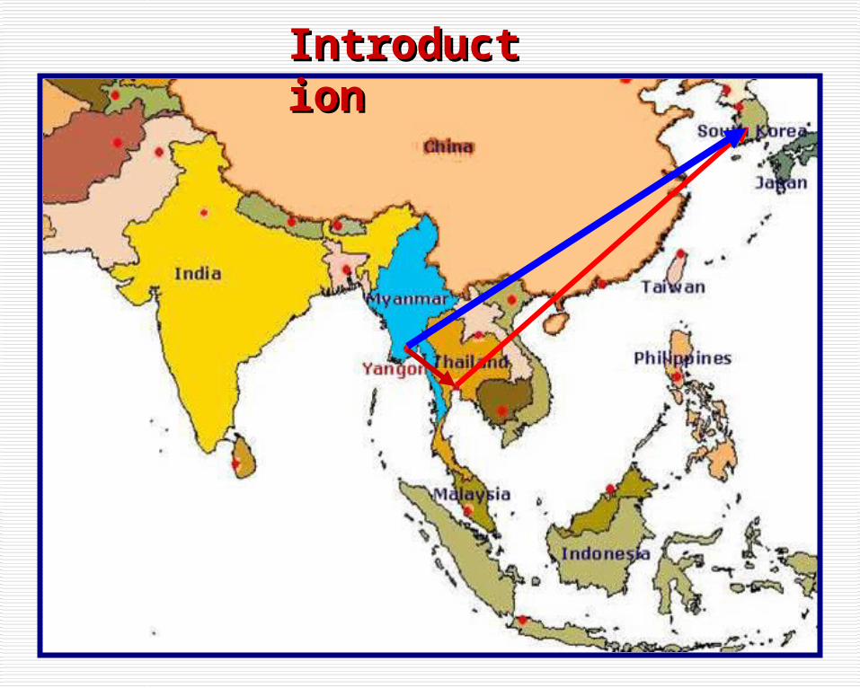
IntroductionIntroduction
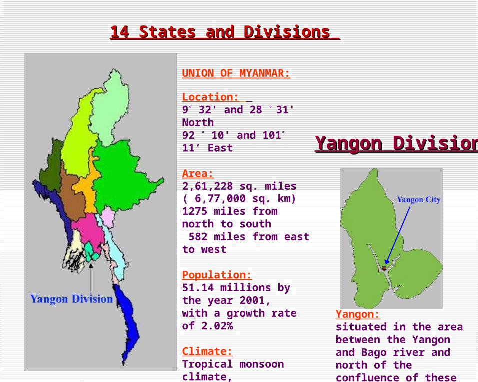
14 States and Divisions 14 States and Divisions
Yangon DivisionYangon Division
Yangon:situated in the area between the Yangon and Bago river and north of the confluence of these rivers.
UNION OF MYANMAR:
Location: 9° 32' and 28 ° 31' North92 ° 10' and 101° 11‘ East
Area:2,61,228 sq. miles ( 6,77,000 sq. km)1275 miles from north to south 582 miles from east to west
Population:51.14 millions by the year 2001,with a growth rate of 2.02%
Climate:Tropical monsoon climate, Three seasons, summer, rainy season and cold season
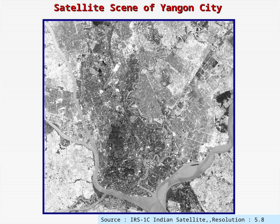
Satellite Scene of Yangon CitySatellite Scene of Yangon City
Source : IRS-1C Indian Satellite,,Resolution : 5.8 meter,Date : 1999, January

PRESENTSTATUS
OFCOUNTRY

CHANGESIN
LAND

71974 - Yangon Area (80 sq. miles), 27 Townships
North Okkalapa
South Okkalapa
Thaketa
FIRST STAGE OF YANGON MAP
Administrative boundary
ofYangon City Development Committee

8
Shwepyithar
Hlaingtharyar
Dagon Myothit(North, South, East, Seikkan)
1974 Yangon Area: 80 sq. miles(27 Townships)
1996 Yangon Area: 236 sq. miles(33 Townships)
SECOND STAGEOF
YANGON MAP
Administrative
boundary of
Yangon City Developme
nt Committee

Administrative boundary
ofYangon City
Development Committee

10
Responsible Institutions of City Planning and Development of Yangon City
Yangon City Development Committee
Department of Human Settlement and Housing Development.
Yangon City Development Committee (YCDC) is principal agency responsible for
planning, development, infrastructure provision and operation of municipal services in Yangon City.
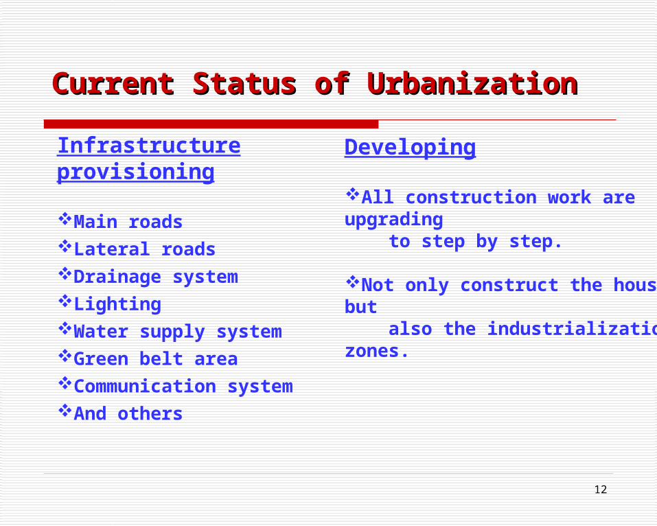
Current Status of UrbanizationCurrent Status of Urbanization

11
Construction
apartmentssingle storiesmini - marketsschoolspre- schoolsPlay groundsothers
Current Status of UrbanizationCurrent Status of Urbanization
Planning
Shwepyithar TownshipHlaingtharyar TownshipDagon Myothit Township
12
Infrastructure provisioning
Main roadsLateral roadsDrainage systemLightingWater supply systemGreen belt areaCommunication systemAnd others
Current Status of UrbanizationCurrent Status of Urbanization
Developing
All construction work are upgrading to step by step.
Not only construct the housing but also the industrialization zones.

13
NATURE PARK HOUSING DEVELOPMENT PROJECT
MINDAMA PROJECT
MAW TIN TOWER PROJECT

14
YANGON CITY DEVELOPMENT COMMITTEE

Organizational Chart of Yangon City Development CommitteeOrganizational Chart of Yangon City Development Committee
Chairman ( Mayor )
Joint-Secretary
Secretary
Vice-Chairman ( Vice Mayor )
Committee Members Committee Office
20 Departments
( Including Engineering Department
( Buildings )

16
Yangon City Development CommitteeYangon City Development Committee
YCDC has the duties and responsibilities to lay down the policy, give guidance, supervise or implement for the development works of the City of Yangon.
YCDC is formed with twenty departments to fulfill its duties and responsibilities. Among them, the following departments are directly concerned with the urban planning and management:-
City Planning and Land Administration DepartmentPollution Control and Cleaning DepartmentEngineering Department (Roads and Bridges)Engineering Department (Buildings)Engineering Department (Water and Sanitation)Playgrounds, Parks and Gardens Department

17
HEAD
DY-HEAD DY-HEAD DY-HEAD
WESTDISTRICT
NORTHDISTRICT
SOUTHDISTRICT
PERMITDIVISION
HOUSINGPROJECT
&DANGEROUS
BUILDINGDIVISION
INSPECTIONDIVISION
EASTDISTRICT
ORGANIZATION CHART OF ENGINEERING DEPARTMENT (BULDINGS)

18
MY OFFICE AND NATURE VIEWS OF CENTRAL BUSSINESS DISTRICT

19
Preparation of civil project and establishment of the new towns within the limits of the City of YangonMunicipality;
Administration of lands within the limits of the City of Yangon Municipality;
Determining only the population which should be allowed to settle properly in the City of Yangon;
Construction, repairing and demolition of buildings; squatter buildings and squatter wards;
Demolition and re-settlement of squatter huts, squatter buildings and squatter wards;
EXISTING LAWS AND REGULATIONS
20
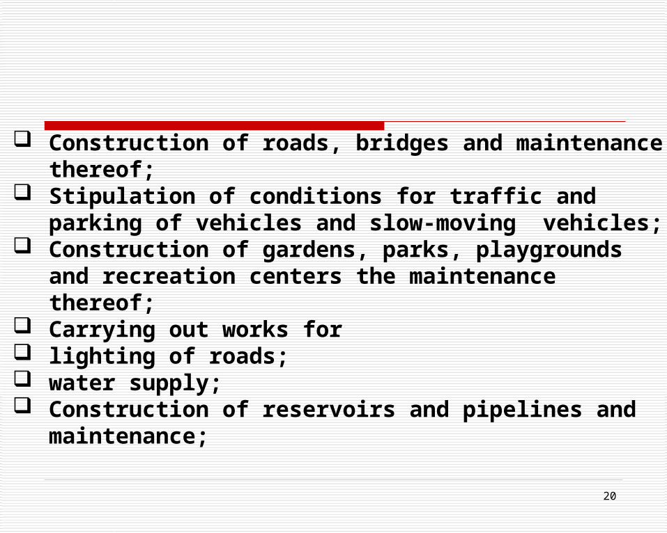
Construction of roads, bridges and maintenance thereof; Stipulation of conditions for traffic and parking of vehicles and
slow-moving vehicles; Construction of gardens, parks, playgrounds and recreation
centers the maintenance thereof; Carrying out works for lighting of roads; water supply; Construction of reservoirs and pipelines and maintenance;

21
Carrying out works for -
SANITATION
PUBLIC HEALTH
CONSTRUCTION
MAINTENANCE
ADMINISTRATION OF MARKETS
STIPULATION OF CONDITIONS IN RESPECT OF ROAD SIDE STALL
PRECAUTIONARY MEASURES AGAINST FIRE

22
Housing Scheme
There works are checked by weekly
To check the construction permitTo check the design To check the structureTo check the all construction works Deviate the permit and on ground they get the revise plan from ( Y.C.D.C ) single storey to eight storey has no problem, but more than storey have been attach the lift.
ISSUES AND COUNTERMEASURES

23
According to the Myanmar Agenda 21, four programmed areas are selected for enhancement of environmental quality management as the following:-
Strengthen the
Comprehensive water quality management program
Air quality management program
Improve the solid waste management program
Promote environmentally sound management of
Toxic chemical and
Hazardous wastes.

24
Overcrowded condition:- shortage in available bus fleet, limitations on the importation of additional vehicles, operational and regulatory constraints, including fare level and fuel allocation, need for surface improvement of road.Congestion and significant delays:- inadequate car parking, inadequate facilities for pedestrians, very substantial bus flow, anticipated growth in traffic volume
Main Issues and problemsMain Issues and problems
25
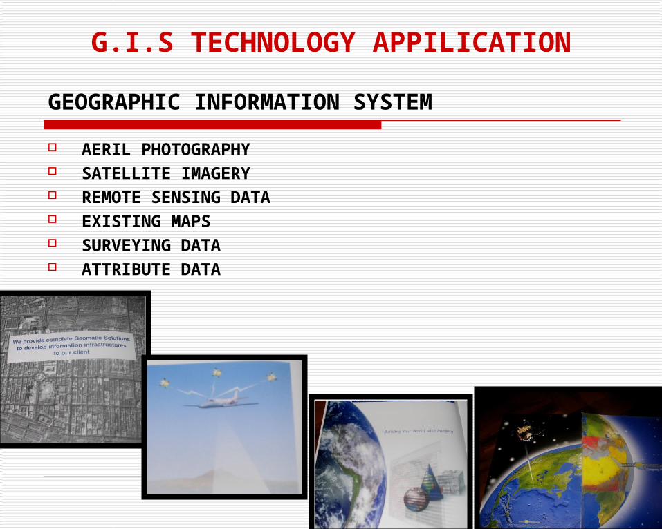
GEOGRAPHIC INFORMATION SYSTEM
AERIL PHOTOGRAPHY SATELLITE IMAGERY REMOTE SENSING DATA EXISTING MAPS SURVEYING DATA ATTRIBUTE DATA
G.I.S TECHNOLOGY APPILICATION

26
TECHNOLOGY IS POWER
OUR NEXT CHALLENGE IS THE INTEGRATION OF G.I.S ENTERPRISE TO PROVIDE THE PUBLIC WITH WIDE RANGE OF GEOMATIC TECHNOLOGIES
WE PROVIDE COMPLETE GEOMATIC SOLUTIONS TO DEVELOP INFORMATION INFRASTRUCTURES TO OUR CLIENT

27
MAJOR PROJECTS
NATIONAL BASE MAPPING 2000-2004
AGRICULTURE AND FORESTRY 2000-2004
RAILWAY INFRACTURE 1999-2002
HYDROPOWER 2001-2002
CITY PLANNING 2001
GEOLOGICAL MAPPING 2000-2001

Primary Sedimentation Tank
Secondary Sedimentation Tank
Sludge Digester
Sludge Thickener
Chlorination Tank
Final Effluent
Laboratary
Office Building
Pump SumpW
aste
wat
er
Influ
ent
Primary Sedimentation Tank
Beltpress
Layout Plan of Sewage Treatment Plant
Design Criteria:
Area of Plant - 5.56 acresDesign population - 300,000Daily wastewater discharge- - 14775 m3/dayBOD influent - 600mg / lBOD effluent - 60 mg / lSuspended solid influent- 700 mg / lSuspended solid effluent - 40 mg / l
Establishment of Sewage Treatment Plant
Detail Design Implementation Installation Commissioning Installation Training
Programme for Sewage Treatment Project
INFRASTRUCTURE FACILITY DEVELOPMENT

29
Housing, Community and Civic Participation Urban Redevelopment Project Low Cost Housing Development Project Hut to Apartment Schemes Hotel and Services Apartment Projects Residential Development and Commercial Building
Construction Projects Public-Private Partnership in Infrastructure Development
for Liveable City Public Partnership in Water Supply Public Partnership in Greening the City and Nature
Conservation
URBAN DEVELOPMENT

30
Complete Housing Scheme”to solve the scarcity of housing and have now increased the momentum by initiating the following strategies:-Slums Upgrading Schemes Site and Services SchemesUrban Development SchemesSale of Residential and Industrial PlotsImplementation of Smooth and Rapid CommunicationFurthermore it also undertakes the Water and Sanitation Projects, Estate and Land Management.

31
Extended Hanthawaddy Roundabout
Extended Uwizara Roundabout
Urban Development can positively affect the environment.

32
KANTAWGYI LAKE VIEWS
BANDULA PARK
C.B.D
KARAWEIK RAFT
RECREACTION CENTER

33
CBD Area Plan:- strengthen the local and other institutions in planning for future transport need, development of new bus routes, improvement and development of new facilities for non- motorized vehicles and pedestrians , maintain the efficiency of the freight distribution system,
improvement of traffic control system, development of off-street car parking system.
Public Transport Priority Plan:- development of network of selective bus priority measures, allocation of bus routes, relocation of the bus stops.
Action plan being Taken to Solve the Problem or Present SituationAction plan being Taken to Solve the Problem or Present Situation
FUTERE ASPECT
34
ConclusionConclusion
The YCDC has gained a lot of experiences in the field of city development strategy. From these experiences, we can clearly see our strengths and weaknesses. I hope to share our experiences with other participating countries and gain their valuable knowledge, experiences and points of view, especially, urban and regional development experiences of KOREA.