Reef Check Training Course Introduction to Coral Reefs Introduction to Reef Check Data Quality Team...
53
Reef Check Training Course Introduction to Coral Reefs Introduction to Reef Check Data Quality Team Tasks The Methods: The Planning Stage The Methods: The Survey
-
Upload
lorraine-nelson -
Category
Documents
-
view
214 -
download
0
Transcript of Reef Check Training Course Introduction to Coral Reefs Introduction to Reef Check Data Quality Team...

Reef Check Training Course
Introduction to Coral Reefs
Introduction to Reef Check
Data Quality
Team Tasks
The Methods: The Planning Stage
The Methods: The Survey

Introduction to coral reefs
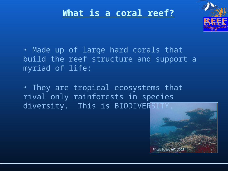
What is a coral reef?
• Made up of large hard corals that build the reef structure and support a myriad of life;
• They are tropical ecosystems that rival only rainforests in species diversity. This is BIODIVERSITY.
Photo by Jos Hill, 2002
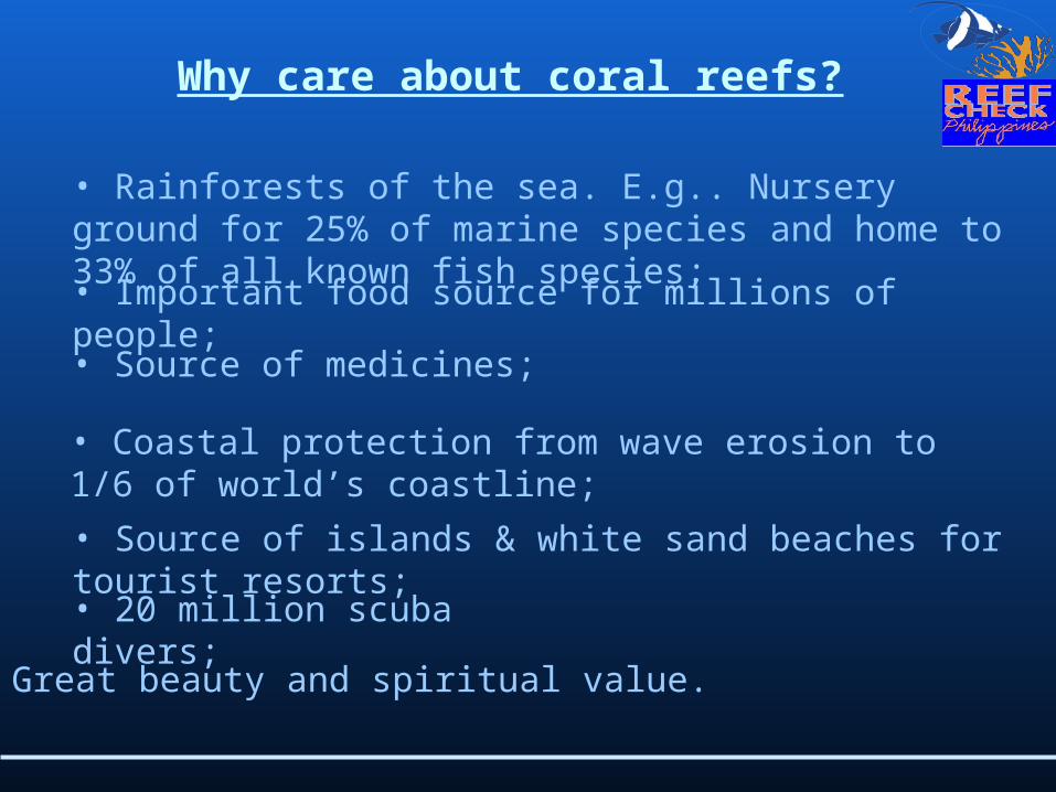
Why care about coral reefs?
• Rainforests of the sea. E.g.. Nursery ground for 25% of marine species and home to 33% of all known fish species; • Important food source for millions of people;
• Source of medicines;
• Coastal protection from wave erosion to 1/6 of world’s coastline;
• Source of islands & white sand beaches for tourist resorts;• 20 million scuba divers;
• Great beauty and spiritual value.

What conditions do coral reefs require?
• Light;
For more information see: http://www.coris.noaa.gov/about/what_are/what_are.html#Anchor-Where-16068
• Low nutrient, clear water;
• Salinity around 32-42/ppm; • Temperature between 18-29ºC;
• More effective management than is currently in place.
• Waves and good water circulation;
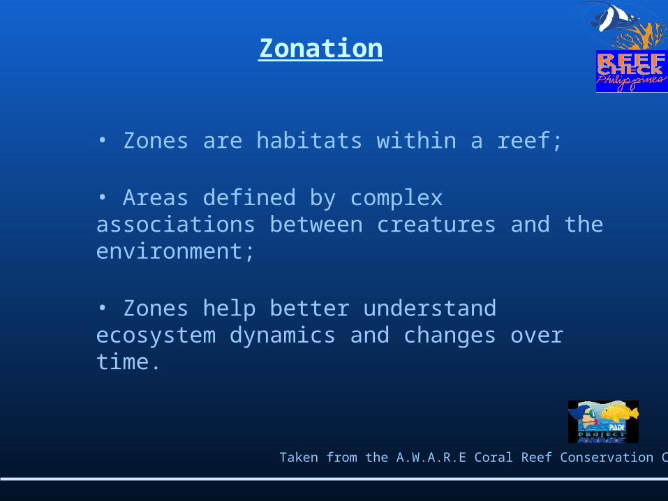
Zonation
• Zones are habitats within a reef;
• Areas defined by complex associations between creatures and the environment;
• Zones help better understand ecosystem dynamics and changes over time.
Taken from the A.W.A.R.E Coral Reef Conservation Course
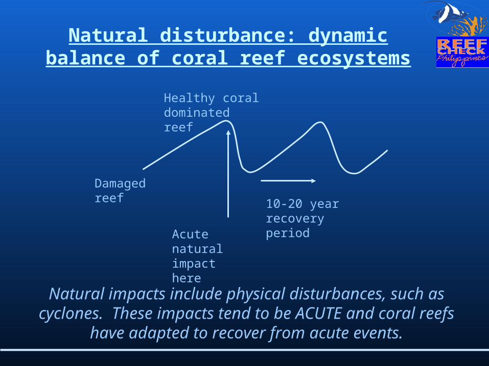
Natural disturbance: dynamic balance of coral reef ecosystems
10-20 year recovery periodAcute
natural impact here
Damaged reef
Healthy coral dominated reef
Natural impacts include physical disturbances, such as cyclones. These impacts tend to be ACUTE and
coral reefs have adapted to recover from acute events.
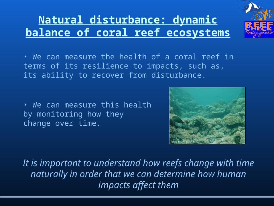
• We can measure the health of a coral reef in terms of its resilience to impacts, such as, its ability to recover from disturbance.
Natural disturbance: dynamic balance of coral reef ecosystems
It is important to understand how reefs change with time naturally in order that we can determine how
human impacts affect them
• We can measure this health by monitoring how they change over time.

A basic ecology lesson
Each organism in an ecosystem has a function
An ecosystem is like a jenga game.
Each block has a function to hold the system together.
Pull out too many blocks and the system will collapse…

Threats to coral reefs
2. Destructive fishing;
3. Sedimentation;
4. Pollution;
5. Global climate change.
1. Overfishing;
Human impacts tend to be CHRONIC and leave no recovery period.

Solutions to these problems…
In order to effectively manage a coral reef we must:
1. Determine what the problems are and where they are;
2. Put in place a management solution;
3. Monitor the effectiveness of the management.
Introduction to Reef Check

• In 1993 at a Symposium in Miami a question was asked:
History
What is the health of the world’s coral reefs?
• Science “as usual” failed to give answers because:• There are too few scientists who spend
too little time on reefs;
• Too few study sites;
• Few long-term studies;
• Emphasis on basic research;
• Different questions and methods used in different areas meaning that we cannot compare data.

Reef Check designed a global survey method for the International Year of the Reef. This protocol was:
• Simple, Rapid, All volunteer;
1997 – Reef Check begins
This 1997 survey effort revealed that coral reefs around the world were in very poor health!
• Combined manpower of local communities with scientific experts;
• ‘Eco-holistic’ -- not just fish or coral;• Provides basic data on coral reef health;
• Applicable anywhere in the world.

What is Reef Check?
• Educate the public about the coral reef crisis;
• Create a global network of volunteer teams, which regularly monitor and report on reef health;
• Scientifically investigate coral reef processes;
• Facilitate collaboration among academia, NGOs, governments and the private sector;
• Stimulate local community action to protect remaining pristine reefs and rehabilitate damaged reefs worldwide using ecologically sound and economically sustainable solutions.
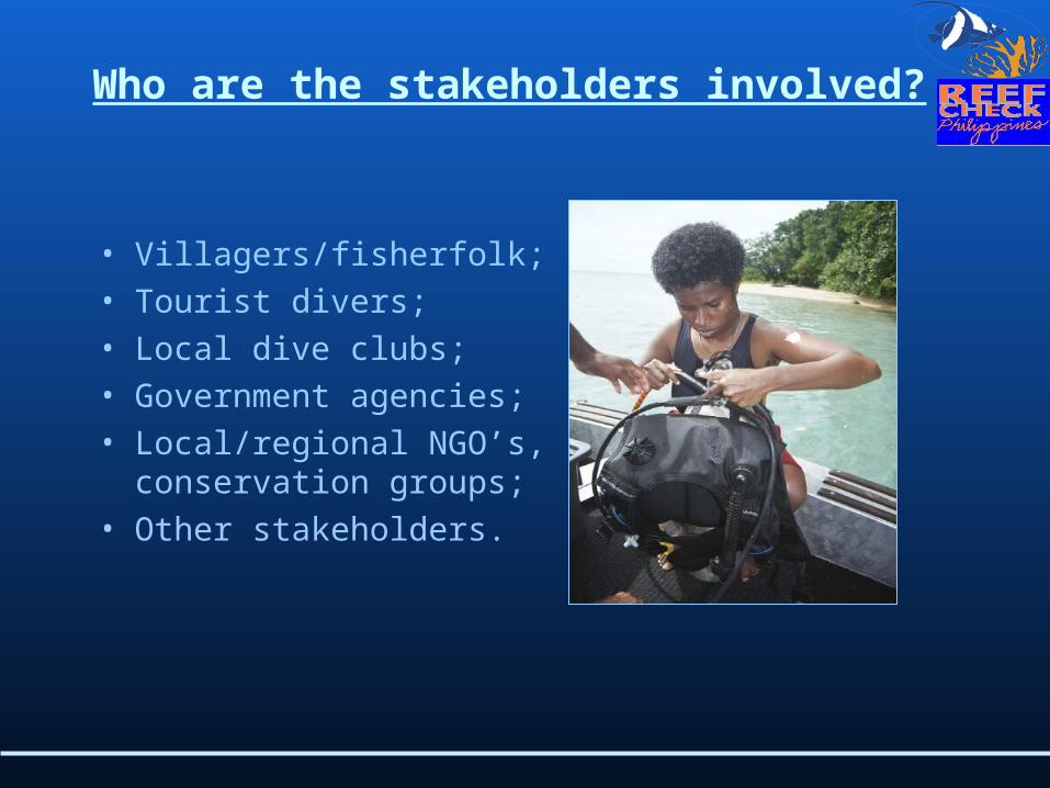
• Villagers/fisherfolk;• Tourist divers;• Local dive clubs;• Government agencies;• Local/regional NGO’s,
conservation groups;• Other stakeholders.
Who are the stakeholders involved?
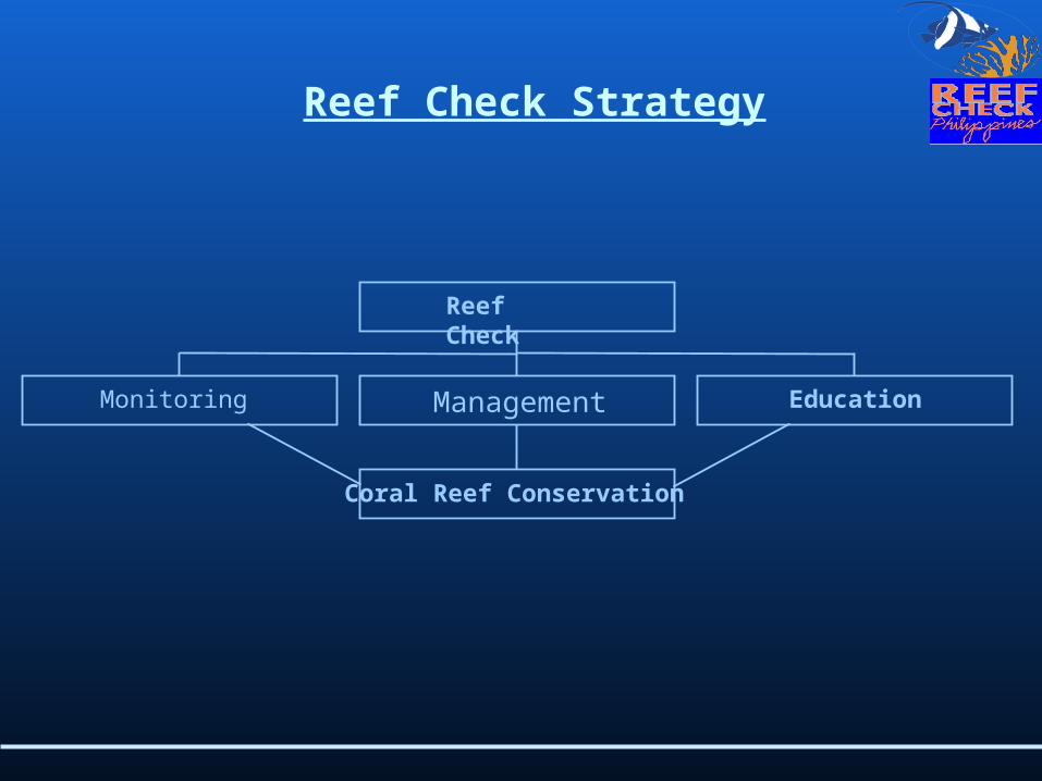
Monitoring
Coral Reef Conservation
Management Education
Reef Check
Reef Check Strategy
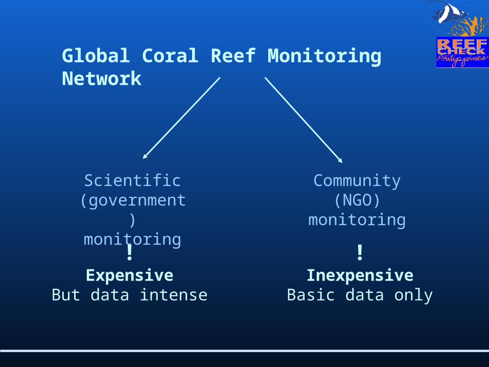
Global Coral Reef Monitoring Network
Scientific (government)
monitoring
Community (NGO)
monitoring
!Expensive
But data intense
!Inexpensive
Basic data only

1400 Reefs, 62 Countries and Territories
Reef Check Global Network 1997-pre
sent
** *
** **
*
*
**
***
*
***
**
*
**
* *** *
*
*
*
**
*
* *
*
***
*
*
*
**
*
** ***
**
**
*
* **
***
** *
******
***
**
** **
* *
*
*
*

What type of data do we collect?
1) A description of each reef site based on over 30 measures of environmental conditions and expert rating of human impacts;
2) Shellfish counts along an 800 m 2 section of shallow reef;
3) Fish counts along an 4000 m 3 section of shallow reef;
4) A measure of the percentage of the seabed covered by different substrate types including live and dead coral;
5) A video transect of the seabed.

Some Global Results 1997 - 2001
• Percent hard coral cover was significantly higher on reefs having no human impacts than on those with high impacts;• Algal cover was higher on reefs rated as having high sewage inputs;
• Zero grouper larger than 30 cm recorded at 48% of reefs surveyed – indicating overfishing;
• Many marine protected areas are not working very well;• The 1997 – 1998 bleaching event reduced live coral cover by 10% globally, indicating that coral reefs are a sensitive indicator of global warming.
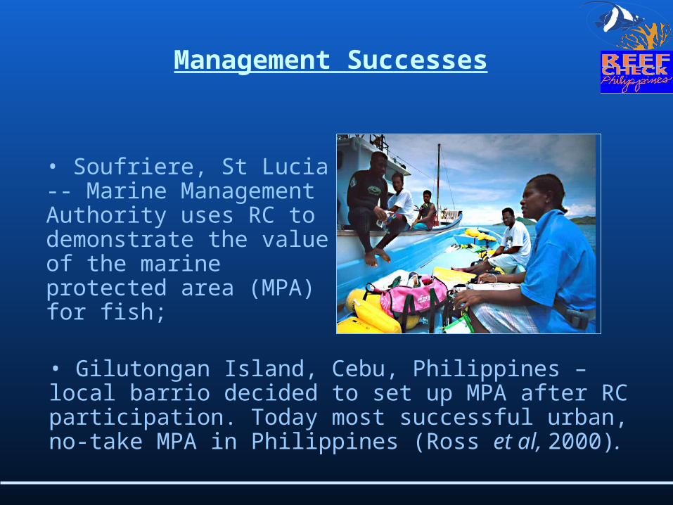
• Gilutongan Island, Cebu, Philippines – local barrio decided to set up MPA after RC participation. Today most successful urban, no-take MPA in Philippines (Ross et al, 2000).
• Soufriere, St Lucia -- Marine Management Authority uses RC to demonstrate the value of the marine protected area (MPA) for fish;
Management Successes
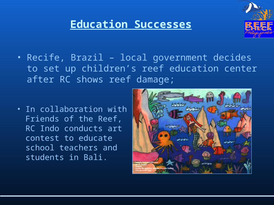
• Recife, Brazil – local government decides to set up children’s reef education center after RC shows reef damage;
• In collaboration with Friends of the Reef, RC Indo conducts art contest to educate school teachers and students in Bali.
Education Successes

Data Quality

Data quality
• Unfortunately we have to account for different types of error when we compare results of surveys over time.
% cover hard coral
Annual survey results
Is the hard coral cover really changing or is this survey error?
• Minimizing error is important because the more error we have, the lower the resolution by which environmental change can be detected.

Data quality: Sources of error
• Technical errors from transect placement;
• Perceptual errors;
• Identification errors.
Technical and perceptual errors can be minimized by standardising the methods. Identification errors must be minimized by standardising
training and testing!

Learning from the Past and Site Descriptions: Coral cover on Balicasag Island reef from 1984
to 1999(Christie et al. 2002)
Per
cent
age
(%)
1 9 8 4 1 9 9 2 1 9 9 9
Years
5 0
4 0
3 0
2 0
1 0
0
S a n ctu a ry to ta l h a rd c o r a l
S a n ctu a ry to ta l so ft c o ra l
N o n-sa n ctu a ry to ta l h a rd c o r a l
N o n-sa n ctu a ry to ta l so f t c o ra l
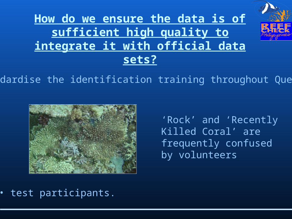
How do we ensure the data is of sufficient high quality to integrate it
with official data sets?
• standardise the identification training throughout Queensland;
‘Rock’ and ‘Recently Killed Coral’ are frequently confused by volunteers
• test participants.

What happens to our data?
• Sent to Reef Check Headquarters where it is integrated with the global database;
• Sent to The World Fish Centre’s ReefBase;
• Used for global, regional and national annual reports and publications

What are the objectives of participants?
• To be able to identify all of the target organisms to 80-95%* precision whilst following exactly AND SAFELY the Reef Check methods using SCUBA**;
*the level required for a particular Reef Check training event will depend upon the Reef Check organisers;
**snorkel teams may also be accommodated for shallow reef areas.
• To understand the importance of precise data collection and how this data can be used by scientists and managers for coral reef conservation;• To understand the use and limitations to the data that is collected using Reef Check;
• Gain an understanding of the threats facing coral reefs and solutions to these problems;
• To have fun!!

Team Tasks

Who must every Reef Check team include?
• Team Scientist;
• Team Leader;
• Equipment Cop.

What is the role of the Team Scientist?
• Site selection;
• Delegation of survey tasks;
• Survey briefing prior to dive;
• Ensure proper identifications and data recording are made underwater • Data sheet collection and filing;
• Organisation of data entry, filing and notification of data entered to coordinator;
• Organise data analysis and summary.

What is the role of the Team Leader?
• Confirm dive trip dates and arrangements;
• Confirm team availability;
• Field day organisation;
• Complete field log;
• Organisation of media releases;
• Dive safety;
What is the role of the Equipment Cop?
• Pre and post-survey equipment check;
• Bring the equipment to the survey.

The Methods: The Planning Stage
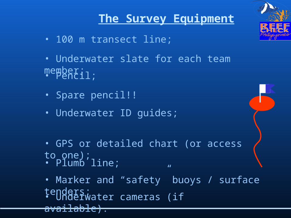
The Survey Equipment
• 100 m transect line;
• Underwater slate for each team member;• Pencil;
• Spare pencil!!
• Underwater ID guides;
• GPS or detailed chart (or access to one);• Plumb line;
• Underwater cameras (if available).
• Marker and “safety” buoys / surface tenders;

The Transect
20m
5m 20m
20m
20m
5m 5m
1 2 3 4
100m
The basic idea of the Reef Check protocol is to swim along a 100m line and count!

Planning the survey
It is important that team members know EXACTLY what they are to do.
Trying to communicate underwater can sometimes be difficult and we are working under the clock!

Site selection
• Critical for the success of Reef Check!
• Must be selected by an experience Reef Check Scientist;
• Re-surveys must be implemented at the same site in the same habitat!
• New sites would ideally be on a moderately to fully exposed reef with a reef crest and outer slope being ideal.
• Select the “best” reef areas for surveys
Steep reef walls or drop-offs, reefs predominantly located in caves or underhangs should be avoided.

The Survey Methods

Survey tasks•Initial site orientation survey (all divers)
•Lay the transect line (1 - 2 divers);
• Substrate survey (1 - 2 divers);
• Invertebrate/impact survey (1 - 2 divers);
• Retrieve the transect line (1 – 2 divers);
• Optional “safety” buddy and surface tender
Before you jump into the water…
• Record the GPS location;
• Record the name of the TS or TL on the data sheet;
• Start to fill out the site description form.
Divers should go over the dive plan before anyone enters the water in order to ensure that everyone
knows what they should be doing and when.

Site name:_________________________________
BASIC INFORMATION
Country:_________________________ State/Province:______________ City/town:_____________________
Date: __________________ Time: Start of survey: ______________ End of survey: __________________
Latitude (deg. min. sec): ______________________________ Longitude (deg. min. sec) : ______________________________
Distance from shore: _________m from nearest river: ______km
River mouth width: _________ <10m ________ 11-50m _______ 51-100m _____101-500m
Dist. to nearest population center: __________ km Population size: _____x1000
Weather: _____ sunny ________ cloudy ________raining
Visibility: __________m
Why is this site selected: ___________________________ Is this best site in the area? _____Yes _____No
IMPACTS:
Is this site: Always sheltered:_________ Sometimes sheltered: _______ Exposed:___________
Major coral damaging storms Yes:________ No:________ When was last storm: __________
Overall Anthropogenic impact None: ______ Low: ________ Med: ________ High: _____
Is siltation a problem Never Occasionally: ________ Often: _______ Always: _____
Dynamite fishing None: ______ Low: ________ Med: ________ Heavy: ____
Poison Fishing None: ______ Low: ________ Med: ________ High: _____
Aquarium Fishing None: ______ Low: ________ Med: ________ High: _____
Harvest Inverts for Food None: ______ Low: ________ Med: ________ High: _____
Harvest Inverts for curio sales None: ______ Low: ________ Med: ________ High: _____
Tourist Diving/snorkeling: None: ______ Low: ________ Med: ________ High: _____
Sewage Pollution None: ______ Low: ________ Med: ________ High: _____
Industrial pollution None: ______ Low: ________ Med: ________ High: _____
Commercial fishing None: ______ Low: ________ Med: ________ High: _____
Fish for the live food fish restaurant trade None: ______ Low: ________ Med: _____ High: _____
Artisinal/recreational None: ______ Low: ________ Med: _____ High: _____
How many yachts are typically present within 1km of this site : None: ______ Few (1-2): _____ Med (3-5): ____ Many (>5): _____
Other impacts: ____________________________________________________
PROTECTION:
Any Protection (legal or other) at this site? Yes:_______ No: __________ if yes, answer questions below
Is protection enforced Yes (full enforcement):_______ No:__________

Line deployment
• Reef Check typically surveys 2 depths:1) Between 2-6m2) Between 8-12m
• A snorkel survey over the site can help determine its eligibility for a Reef Check survey;
• The TS or experienced Reef Checkers will typically lay the transect line because care must be taken not to damage the reef.


The substrate survey
• The aim is to collect % cover estimates of various substrates and benthic organisms;
• A point sampling method is used every 50cm;
• Plumb line must be used to remove bias;
• This survey typically takes 30 mins to 1 hour to complete.

Time:
Substrate Code
HC hard coral SC soft coral (includes flower, tree, ornamental) RKC recently killed coral
HCB bleached hard coral SCL leathery soft coral RKCNIA recently killed coral and NIA
HCBR branching hard coral SCZ zoanthids RKCTA recently killed coral and turf algae
HCM massive hard coral SCB bleached soft coral
HCF foliose hard coral
HCP plate hard coral
HCE encrusting hard coral SP sponge RC rock
NIA nutrient indicator algae SPE encrusting sponge TA turf algae
RB rubble SD sand CA coralline algae
OT other SI silt/clay
(For first segment, if start point is 0 m, last point is 19.5 m)
SEGMENT 1 SEGMENT 2 SEGMENT 3 SEGMENT 4
0 - 19.5 m 25 - 44.5 m 50 - 69.5 m 75 - 94.5 m
0 10 25 35 50 60 75 85
0.5 10.5 25.5 35.5 50.5 60.5 75.5 85.5
1 11 26 36 51 61 76 86
1.5 11.5 26.5 36.5 51.5 61.5 76.5 86.5
2 12 27 37 52 62 77 87
2.5 12.5 27.5 37.5 52.5 62.5 77.5 87.5
3 13 28 38 53 63 78 88
3.5 13.5 28.5 38.5 53.5 63.5 78.5 88.5
4 14 29 39 54 64 79 89
4.5 14.5 29.5 39.5 54.5 64.5 79.5 89.5
5 15 30 40 55 65 80 90
5.5 15.5 30.5 40.5 55.5 65.5 80.5 90.5
6 16 31 41 56 66 81 91
6.5 16.5 31.5 41.5 56.5 66.5 81.5 91.5
7 17 32 42 57 67 82 92
Invert and impact survey
• This is a 5m wide belt transect. We use the same 4 x 20m long transects, but survey 2.5m either side of the tape;• The goal of this survey is to count the target mobile invertebrates and note any coral damage, such as, bleaching, Crown of Thorns Starfish, anchor damage or trash;
• The upside down pose is the easiest position to search and write;
• A regular U-shaped search pattern ensures a comprehensive coverage of the belt transect;
• This survey takes between 30 mins and 1 hour to complete.

Fish survey
• Same 5m wide belt transect but it is also 5m HIGH;
• The fish survey is the first survey to be done;
• The ideal survey time is between 09.00 and 10.00;
• Completion time is approximately 1 hour;
• The team must wait 15mins after the line is deployed before entering the water;
• Divers must make slow and careful movements;
• Concentrate on buoyancy;
• Coordinate counts with your buddy to avoid double counting; • Only count fish in the tunnel except for the Humphead wrasse and Bumphead parrotfish or mega fauna.

Site Name: Country/Island:
Depth: TS/TL:
Date: Time: Fish
Data recorded by: 0-20m 25-45m 50-70m 75-95m
Butterfly fish
Sweetlips (Haemulidae)
Snapper (Lutjanidae)
Barramundi Cod (Cromileptes)
Other Grouper >30cm*
Humphead wrasse
Bumphead parrot
Other Parrotfish (>20cm) Moray eel * give size in comments Invertebrates
Data recorded by:
0-20m 25-45m 50-70m 75-95m Banded coral shrimp (Stenopus hispidus)
Diadema urchins
Pencil urchin (Heterocentrotus mammilatus)
Sea cucumber (edible only)
Crown-of-thorns star (Acanthaster)
Giant clam (Tridacna)
Triton shell (Charonia tritonis)
Tripnustes
Drupella (Drupella sp)
Lobster
Coral Damage/Disease/Bleaching and Trash
Rate the following as: None=0, Low=1, Medium=2, High=3
0-20m 25-45m 50-70m 75-95m
Drupella scars
Crown of thorns star scars
Coral damage: Boat/Anchor
Coral damage: Dynamite
Coral damage: Other
Trash: Fish nets
Trash: General
Please fill in the following 0-20m 25-45m 50-70m 75-95m

Post-Dive Tasks
• Data entry;
• Media release;
• Thank-yous to supporters;
• See TL, TS and EC roles…..

Daghang Salamat!!!
Special thanks to Jos Hill PhD of Reef Check Australia for providing key parts of this presentation.