Populations Review KY Core Content SC-HS-4.7.5 Kimberly Valerio.
Federal Highway Administration
Record of Decision
for
State Route 167 Extension Project
Puyallup to State Route 509
October 2007

Table of Contents
Section Page Number
Decision 1
1.0 Decision Background and Project History 2
1.1 Purpose & Need for Project 3
1.1.1 Purpose 3
1.1.2 Need 3
1.1.3 Safety 3
1.1.4 Freight Mobility 3
1.1.5 Traffic Demand 4
1.1.6 Access 4
1.1.7 Route Continuity 4
1.1.8 Regional Transportation Plan 4
1.1.9 Transportation Improvement Opportunities 5
1.1.10 Air Quality 5
1.2 Community and Public Involvement 5
1.2.1 Stakeholders 5
1.2.2 Partners Committee 5
1.2.3 Citizen’s Advisory Committee 6
1.2.4 Tribal Coordination 6
1.2.5 Signature Agency Committee 6
1.2.6 RRP Technical Advisory Group 7
1.2.7 Workshops, Open Houses and Public Meetings 8
1.2.8 Environmental Hearings 8
1.2.9 Ongoing Public Outreach 8
2.0 Alternatives Considered and Rationale for Decision 8
2.1 Description of the Build Alternative (Selected Alternative) 10
2.2 Selected Interchange Options 10
2.2.1 54th Avenue East 11
• Loop Ramp Option 11
2.2.2 Interstate 5 (I-5) 11
• I-5 Interchange 11
2.2.3 Valley Avenue 12
• “Valley Avenue” Interchange Option. 12
2.2.4 SR 161/ SR 167 12
• “Urban Interchange” option 13
Table of Contents (continued) Section Page Number
2.3 Alternatives Not Selected 13 2.3.1 No Build Alternative 13
2.3.2 Interchange Options Not Selected 14
• 54th Avenue East Half Diamond Option 14
• Valley Avenue- Freeman Road Option 15
• Valley Avenue Realignment Option 15
• SR 161/ SR 167 Low Diamond Option 16
• SR 161/ SR1 67 Medium Diamond Option 16
3.0 Section 4(f) Evaluation 17
3.1 Section 4(f) Resources in the SR 167 Project Area 17
3.1.1 Historic 4(f) Resources 17
3.1.2 Recreational 4 (f) Resources 17
3.2 Summary of 4(f) Resource Findings 17
3.2.1 Historic 4(f) Resources 17
3.2.2 Recreational 4(f) Resources 18
3.2.3 Section 4(f) Determination 19
4.0 Measures to Minimize Harm (Commitments) 20
4.1 Air Quality 20
4.1.1 Mobile Source Air Toxins (MSAT) 21
4.2 Noise 21
4.3 Cultural Resources (Section 106) 23
4.4 Environmental Justice 25
4.5 Farmland 26
4.5.1 Mitigation Commitments for the Loss of Farmland 27
4.6 Water Resources 28
4.6.1 Floodplains 28 4.6.2 Riparian Restoration Proposal (RRP) 28
4.6.3 Wetlands 31
4.7 Wildlife and Fisheries 33
4.7.1 Endangered Species Act (ESA) 33
4.7.2 Magnuson- Stevens Act (MSA) 33
4.7.3 Migratory Bird Treaty Act (MBTA) 33
4.7.4 ESA/MSA Consultation 33
4.7.5 ESA/MSA Effects Evaluation 34
Table of Contents (continued) Section Page Number
4.7.6 Commitments to Avoid and Minimize Effects
On ESA Species and MSA Habitat 35 4.7.7 ESA/MSA Effect Determination 36
5.0 Monitoring and Enforcement 37
5.1 Archaeological Resource Monitoring 37
5.2 Nighttime Construction Noise Monitoring 37
5.3 Water Quality Monitoring 38
5.4 Wetland Monitoring 38
5.5 ESA and MSA Monitoring (Chinook salmon & Bull Trout) 38
5.6 MBTA Monitoring 38
5.7 Regulatory Permits (Enforcement) 39
6.0 Comments Received on the Final EIS and Responses 39
7.0 Summary Conclusion 40
Attachments 41
Attachment A Tier II FEIS Commitments List 42
Attachment B WDFW FEIS Comment Letter & FHWA Response 61
Attachment C Milton FEIS Comment Letter & WSDOT/FHWA Response 65
Attachment D EPA FEIS Comment Letter & FHWA Response 70
Attachment E Pierce Co. FEIS Comment Letters & Summary of
Meeting Between WSDOT & Pierce Co. 83

Federal Highway Administration
Record of Decision
for
State Route 167 Extension Project
Puyallup to State Route 509
Decision Based upon careful consideration of all the social, economic and environmental evaluations contained
in the SR 167 Tier I Draft and Final Environmental Impact Statement (EIS), the Tier I Record of
Decision, and the Tier II Draft and Final EIS/ Section 4(f) Evaluation; the input received from other
agencies, organizations and the public; and the factors and project commitments outlined below, the
Federal Highway Administration selects the Build alternative with a direct connection to SR 509 near
the Port of Tacoma and four interchange options included. These interchange options proceeding
from north to south along SR 167 are the 54th Avenue East (Loop Ramp) interchange, the I-5
Freeway-to-Freeway Interchange, Valley Avenue Interchange, and the Urban Interchange at SR 161
(North Meridian). The Urban Interchange will provide a direction connection to existing SR 167 in
Puyallup. The Build Alternative and these interchanges were identified as the preferred alternative
and interchange options in the Tier II FEIS and constitute the environmentally preferable alternative.
The selected Build Alternative best meets the project Purpose and Need as well as best protects and
enhances water resources, and provides socio-economic benefit for the project. It will also improve
regional mobility of the transportation system, reduce congestion and improve safety, provide
improved system continuity in the SR 167 corridor, maintain or improve air quality, and serve
multimodal passenger movement and Port of Tacoma freight movement. All practical means to avoid
and minimize environmental harm from the selected alternative have been adopted and this decision
is in the best overall public interest.
Based on considerations identified in the Tier II Draft and Final Section 4(f) Evaluation, the Federal
Highway Administration also concludes that there are no feasible and prudent alternatives to the use
of Section 4(f) protected lands, and that the proposed action includes all possible planning to
minimize harm to the identified Section 4(f) properties resulting from such use.
This Record of Decision (ROD) incorporates comments and responses received during the 30-day
review period after the Notice of Availability of the FEIS appeared in the Federal register. Additional
background information for this decision is contained in the balance of this ROD document below.
Date of Approval Daniel M. Mathis, P. E.
Division Administrator
Washington Division
Federal Highway
Administration

SR 167 Extension ROD October 2007 2
1.0 Decision Background and Project History
The National Environmental Policy Act (NEPA) documentation process for the State
Route (SR) 167 Extension project followed a tiered approach, as cited in Federal
Highway Administration (FHWA) regulations found in 23 Code of Federal Regulations
(CFR) Section 771.111 (g), and Council on Environmental Quality (CEQ) regulations
found in 40 CFR Section 1502.20. The first tier (Tier I) analysis consisted of a broad
corridor-level Draft Environmental Impact Statement (DEIS) issued in May 1993.
Subsequent to the completion of the Tier I DEIS, but prior to completing the Tier I Final
Environmental Impact Statement (FEIS), the FHWA and Federal Transit Administration
(FTA) designated this portion of the SR 167 Corridor as a project requiring a Major
Investment Study (MIS). After an extensive evaluation of the effectiveness and cost-
effectiveness of a wide array of alternatives, the MIS results supported the construction of
a freeway to complete SR 167 and remove one of the major missing links in the freeway
system in the region. The MIS was included in the Tier I FEIS (Appendix H).
The Tier I FEIS was approved March 30, 1999 and issued on April 23, 1999. The FHWA
and Washington Department of Transportation (WSDOT) concurred that Alternative 2
was the “Preferred Corridor”. The Record of Decision (ROD) for the Tier I FEIS was
issued by FHWA on June 9, 1999 and it was recommended that the project proceed to the
second-tier (Tier II), project-level analysis.
The selection of environmental issues to be reviewed in the Tier II NEPA process
followed the same general procedure as that of the Tier I NEPA process. The Tier II
NEPA process began on July 13, 1999, with an Agency Scoping Meeting and a public
Open House Scoping Meeting. FHWA and WSDOT prepared a Study Plan and formed
an Interdisciplinary Team (IDT) to guide the development of the SR 167 Tier II DEIS.
The Study Plan was completed in June 2000 and identified the environmental areas to be
studied in the Tier II DEIS.
The Tier II DEIS was approved on January 29, 2003. The Tier II DEIS was issued in
February 2003 for public comment. Two Environmental Hearings were held on March 18
& 20, 2003. FHWA and WSDOT received comments from the public, environmental
organizations, local, federal, and state governments, and the Puyallup Tribe of Indians
(see Appendix G Tier II FEIS). A draft Section 4(f) Evaluation was also circulated in
August 2005 for comment. Changes in the Tier II FEIS respond to comments received on
the Tier II DEIS and draft Section 4(f) Evaluation. The Tier II “Preferred Alternative”
became the “Selected Alternative/Build Alternative” presented in this ROD
The Tier II FEIS/ Section 4(f) Evaluation, FHWA-WA-EIS-2002-02-F, was approved on
November 9, 2006, and issued on December 1, 2006. The Notice of Availability appeared
in the Federal Register on December 1, 2006. The FEIS and final Section 4(f) Evaluation
and all findings therein are incorporated in this ROD by reference.

SR 167 Extension ROD October 2007 3
1.1 Purpose & Need for Project
1.1.1 Purpose: The purpose of the proposed project is to improve regional mobility of
the transportation system to serve multimodal local and port freight movement and
passenger movement between (1) the Puyallup termini of SR 167, SR 410, and SR 512
and (2) the Interstate 5 (I-5) corridor, the new SR 509 freeway, and the Port of Tacoma.
Furthermore, the project is intended to reduce congestion and improve safety on the
arterials and intersections in the study area, provide improved system continuity between
the SR 167 corridor and I-5, and maintain or improve air quality in the corridor to ensure
compliance with the current State Implementation Plan (SIP) and all requirements of the
Clean Air Act (CAA).
1.1.2 Need: There are a number of needs associated with the existing non-freeway
segment of SR 167 between the terminus of the freeway segment in the Puyallup area to
the I-5 corridor, Port of Tacoma, and Fife. The non-freeway segment, which is an
incomplete part of the planned north Pierce County freeway system, is on surface streets
and includes a circuitous route through the City of Puyallup via North Meridian and
River Road and a major truck route through Fife via Valley Avenue and 54th Avenue
East. Several intersections along these routes operate at over-capacity conditions during
peak periods resulting in traffic backup and delays. Two intersections (54th Avenue East
with 20th Street East and 54th Avenue East with Pacific Highway/SR 99) have been
improved by better synchronization of signals and adding lane channelization but still
operate at near to over-capacity conditions.
1.1.3 Safety: Accident rates on the non-freeway segments of SR 167 (River Road) have
been steadily increasing since the Tier I FEIS was approved in 1999. Although they have
fluctuated up and down in intervening years, the average rate per year has increased and
in 2005 the accident rate was higher than statewide averages for similar highways. The
accident rate in 2005 for existing SR 167 was 2.75 incidents per million vehicle miles
traveled and the statewide accident rate was 2.56 incidents per million vehicle miles
traveled statewide for similar highways. For more detailed accident data, see Section
3.14.2 Transportation Safety of the FEIS. The high levels of congestion at intersections
and the frequency of intersecting driveways contribute to these higher ratios. Accident
rates on a number of parallel local roads and major intersections that currently receive
diverted north-south through-traffic are also higher than the statewide averages for
accidents. The proposed project would remove all freeway or through traffic from the
local streets and arterials and eliminate or reduce accidents and safety related problems.
1.1.4 Freight Mobility: The existing freight mobility situation does not meet the needs
for current and future goods movement through the cities of Edgewood, Fife, Milton,
Puyallup and Tacoma. Traffic congestion and access problems on existing SR 167 due to
Port truck traffic are already substantial. Local streets and arterials are used to transport
freight to and from the Port of Tacoma and the connections to SR 161, SR 512 in
Puyallup and the freeway segment of SR 167 continuing north to Interstate 405 (I-405) in
Renton. Trucks currently travel through the City of Fife via Valley Avenue East and 54th
Avenue East or through the City of Puyallup via River Road. Several intersections along
SR 167 Extension ROD October 2007 4
these roadways operate at over-capacity conditions during peak traffic periods resulting
in delays and congestion.
1.1.5 Traffic Demand: Existing and projected peak-period traffic demand along SR 167
between I-5 and I-405 are substantially greater than system capacity. Currently, during
peak periods, SR 167 operates beyond acceptable vehicle-carrying capacity with
consistent low levels of service on the mainline roadway and at intersections. Projected
growth (residential, retail, and commercial development) and the expansion of regional
attractions, such as the Port of Tacoma in the lower Puyallup River Valley through the
planning year 2030 will only exacerbate the congestion problem. Additional congestion-
related delays occur when freight transport and large trucks divert onto local arterials and
surface streets. Since establishment of the Tier I Purpose and Need, the design year has
been changed from 2020 to 2030 and traffic projections have increased, making the
proposed project improvements all the more necessary.
1.1.6 Access: The Level of Service (LOS) on the existing SR 167 freeway between SR
509 and SR 161 will be substantially improved by the proposed new controlled access
facility. The existing LOS is poor because there are numerous access points along the
non-freeway segment of the SR 167 facility, especially on River Road and North
Meridian. These access points include driveways, T-intersections, and four-way
intersections. In addition, the many businesses, residences, and other facilities along the
existing roadway attract local trips. Consequently, the mixing of local and regional
through traffic along this facility has resulted in a situation where segments of existing
SR 167 are not able to provide effective movement of vehicles. Large trucks currently
divert to existing SR 167 to avoid using I-5 because of substantial congestion during peak
traffic periods. Large trucks also travel from Valley Avenue East to existing SR 167 in
Puyallup to avoid traveling over the existing steep grades on SR 18 from I-5 to I-90. By
constructing a new freeway alignment, distribution would be improved for the Port of
Tacoma and trucks bypassing I-5 and SR 18. In particular, heavy truck use on residential
surface streets would be substantially reduced.
1.1.7 Route Continuity: SR 167 is not a continuous freeway route from I-405 at Renton
to I-5 in Tacoma. A break in service occurs on SR 167 at SR 161. At this location, the
north-south corridors of SR 161 (North Meridian) and SR 167 (River Road) co-exist on
local roadways and SR 167 connects to I-5 at Bay Street Interchange. The new SR 167
corridor will improve the connectivity and continuity of the regional highway system and
give motorists better access to I-5 and the Port of Tacoma on the south and west as well
as to I-405 (Renton) to the north and Puyallup to the east. The National Highway System
(NHS) designation identifies SR 167 as part of the network of highways that provides
defense access, continuity, and emergency capabilities for the movement of personnel,
materials, and equipment during times of national emergency. The duration and
frequency of congestion on existing SR 167 substantially diminish the capability of SR
167 to operate consistent with the NHS functional designation.
1.1.8 Regional Transportation Plan: The Puget Sound Regional Council (PSRC) 1995
update of VISION 2020 recommends the extension of SR 167 as an improvement and

SR 167 Extension ROD October 2007 5
identifies SR 167 as a major regionally significant project for the Puget Sound in its Six-
Year Action Strategy (1999). In PSRC’s Destination 2030 Metropolitan Transportation
Plan (MTP) adopted in 2001 the proposed SR 167 corridor is identified and given support
as a regional project.
1.1.9 Transportation Improvement Opportunities: Some transportation improvement
opportunities currently exist in the SR 167 project corridor including constructing park
and ride lots and HOV lanes, and coordination with Sound Transit for the Sounder
Commuter Rail and new Light Rail Transit (LRT) systems is ongoing.
1.1.10 Air Quality: Currently, all portions of the study area are in maintenance for
ozone (O3), carbon monoxide (CO) and inhalable particulate matter sub 10-micron
(PM10) and no exceedances of the National Ambient Air Quality Standards (NAAQS) are
predicted during construction and operation of the Build Alternative. The project will
reduce congestion; improve truck mobility, and smooth traffic flow levels reducing
Mobile Source Air Toxics (MSAT). Within Washington, compliance with
Environmental Protection Agency (EPA) nationwide control program would also
help minimize MSAT in the overall Puget Sound Region.
1.2 Community and Public Involvement
The Community and Public Involvement program which was implemented at the
beginning of the Tier I EIS process and is ongoing today has been instrumental in
obtaining necessary public input and has been important to help ensure that the overall
process results in a decision that is in the best interest of the community and the
environment. Many methods were used to gather information on issues the community
felt were important. There was involvement not only with community members, but also
with interested businesses, community organizations and municipalities. The issues and
points brought forth by comments, suggestions, and questions gathered from the variety
of public involvements were utilized as a guide and incorporated in the development of
the Tier II FEIS. Some of the methods used to ensure the necessary community and
public involvement are briefly described below:
1.2.1 Stakeholders: In July 2000, WSDOT identified stakeholders who were
interviewed for their opinions on the project. The Stakeholder interview was a one-time
effort to gain a snapshot of opinions. The answers to the questions were compiled into the
SR 167 Tier II Stakeholder Interview Report. Overall, the Stakeholders felt that the
project would improve the transportation system regionally as well as locally, and
improve safety on local roadways.
1.2.2 Partners Committee: A Partners Committee was formed during the Tier I NEPA
process under the title of “Steering Committee.” This committee was comprised of
representatives from the cities of Edgewood, Fife, Milton, Puyallup and Tacoma along
with the Port of Tacoma, FHWA, Pierce County, Pierce Transit, Puyallup Tribe of
Indians (Puyallup Tribe), PSRC, and WSDOT. They provide direction and guidance on a
variety of issues to help maintain the progress of the project. The Partners Committee

SR 167 Extension ROD October 2007 6
has met monthly since January 1998 and has continued to meet throughout the Tier II
FEIS development.
1.2.3 Citizen’s Advisory Committee: A Citizen’s Advisory Committee (CAC) was also
formed to ensure representation of citizens, farmers, and business owners who may be
affected by the project. The CAC helped advise project staff on local issues and concerns
and assisted with improving outreach and communication efforts.
1.2.4 Tribal Coordination: The ROD issued for the Tier I FEIS required specific
commitments to coordinate with the Puyallup Tribe during the development of the Tier II
document. These commitments were made to ensure that the Puyallup Tribe concerns
were considered and incorporated where feasible. FHWA and WSDOT made the
commitment to work closely with the Puyallup Tribe regarding fisheries, cultural
resources, tribal-owned lands and any other issues that may concern them. Use of Tribal
trust land for the Build alternative may still be necessary depending on the final roadway
design. Agreements will be negotiated with the Puyallup Tribe to address the use of tribal
trust land, if necessary. The negotiated Agreements may include easements, property
modifications, land swaps or other mitigation mutually acceptable to both the Puyallup
Tribe and FHWA and WSDOT. FHWA and WSDOT have kept in contact with the
Puyallup Tribe through meetings, letters and phone conversations and are coordinating all
project related activities directly with the Puyallup Tribe.
The Puyallup Tribe was also represented at the Partners Committee Meetings held
monthly. After the distribution of the Tier II DEIS, the Puyallup Tribe agreed to meet
quarterly with project staff to discuss the SR 167 Project. Coordination with the Puyallup
Tribe will not end with the conclusion of the Tier II FEIS. FHWA and WSDOT are
committed to maintaining an open line of communication with the Tribe throughout the
design and construction phases of this project. FHWA and WSDOT also consulted with
the Muckleshoot Indian Tribe and the Confederated Tribes and Bands of the Yakima
Nation. No comments were received, from the Muckleshoot Indian Tribe or the
Confederated Tribes and Bands of the Yakima Nation, before or after the Tier II FEIS
was published.
1.2.5 Signature Agency Committee: The SR 167 Extension project team (FHWA and
WSDOT) participated in a Signature Agency Committee (SAC), formerly known as the
NEPA/404 Memorandum of Understanding (MOU) process. This process focused on
water resources. Through six years of involvement in the SAC, the SR 167 project team
obtained early, regular and detailed participation from the state and federal agencies with
regulatory oversight of the project. The regulatory agencies that participated were
typically the EPA, U.S. Army Corps of Engineers (COE), U.S. Fish and Wildlife Service
(USFWS), National Marine Fisheries Service (NMFS), Washington Department of Fish
and Wildlife (WDFW) and Washington Department of Ecology (Ecology). Participation
of the member agencies was assured through a series of coordination meetings and three
(3) concurrence points for both the Tier I and Tier II at key milestones throughout the
environmental analysis, documentation, and review process. This included concurrence
on the project Purpose and Need (Concurrence Point 1), range of alternatives to be

SR 167 Extension ROD October 2007 7
evaluated in each DEIS (Concurrence Point 2), and selection of the Preferred Alternative
for each FEIS (Concurrence Point 3).
For the Tier II EIS in April 2000 FHWA and WSDOT presented Concurrence Point 1 to
the SAC member agencies. Concurrence Point 1 consisted of the Purpose and Need for
the project and included defining the role of all participating agencies and screening
criteria for the options selection and requested concurrence from the SAC member
agencies. Concurrence Point 1 was agreed upon by all SAC member agencies in June
2000.
Concurrence Point 2 consisted of a determination of the range of project options to be
evaluated in the Tier II DEIS, and methodologies for indirect and cumulative impacts.
Interagency meetings were held with project staff and SAC members in August and
October of 2002 to discuss options and the methodology for the indirect and cumulative
effects analysis. SAC members ultimately concurred on these issues and Concurrence
Point 2 culminated with the completion of the Tier II DEIS on January 29, 2003.
For Concurrence Point 3, in July 2004, FHWA and WSDOT sought SAC member
concurrence on the final alignment and interchange options that were the
“environmentally preferred alternative” and conceptual mitigation plans for avoiding, and
minimizing impacts to water resources. WDFW concurred with Concurrence Point 3 as
presented. All other SAC member agencies did not concur. After reviewing the issues
raised as reasons for non-concurrence on Concurrence Point 3, FHWA and WSDOT met
with the USFWS, NMFS, EPA and the COE to discuss resolution of their issues. Some
final outstanding issues related to the treatment of stormwater through the Riparian
Restoration Proposal (RRP) were resolved among FHWA, WSDOT, USFWS, and
NMFS. The resolution focused on future coordination through the RRP Technical
Advisory Group (TAG). The RRP is described in Section 4.5.2 of this ROD. Final
agreement on Concurrence Point 3 (environmentally preferred alternative and conceptual
aquatic resource mitigation plan) was reached in May 2005.
1.2.6 RRP Technical Advisory Group (TAG): The RRP has been presented as an
alternative stormwater control specifically for stormwater management in the SR 167
corridor. The proposed RRP improvements in the corridor are expected to meet
regulatory requirements and offer additional environmental benefits. Agencies such as
the USFWS, NMFS, COE, WDFW, Ecology, Pierce County, Puyallup Tribe and the
Friends of the Hylebos Wetlands (FOHW), a local environmental group, are included in
the TAG participating in the RRP design process. This advisory process is a multi-phased
approach. During the first phase, broad-based goals and objectives were developed.
These broad-based goals and objectives have led to the development of performance
measures as part of the Endangered Species Act (ESA) consultation process for NMFS
and USFWS to develop their Biological Opinion (BO) regarding the potential effects of
the SR 167 Extension project on ESA protected species. FHWA and WSDOT will
continue to consult with the appropriate agencies through the RRP TAG during the
permitting and construction phase of the SR 167 Extension project

SR 167 Extension ROD October 2007 8
1.2.7 Workshops, Open Houses and Public Meetings: WSDOT conducted a series of
design workshops with outside agencies and the Puyallup Tribe to solicit their ideas
about the project, specifically concerning the proposed interchange options for the Build
Alternative. The Design Workshop participants helped develop several different
scenarios or options for each interchange. FHWA and WSDOT also held various Open
Houses and other public meetings over the course of the project. The Open House format
allowed interested persons to come and obtain project information and ask questions in
an informal leisurely format. Some public meetings included individual presentations to
local groups.
1.2.8 Environmental Hearings: On March 18 and 20, 2003, FHWA and WSDOT held
Environmental hearings for the Tier II DEIS in the cities of Fife and Puyallup. These
forums gave the general public a chance to voice their ideas and concerns about the SR
167 Extension project. During the two rounds of hearings, FHWA and WSDOT received
many comments. These comments and responses are included in Appendix “G” of the
FEIS. Comments on the Tier II DEIS were received in various formats. Oral comment
provided during the Hearings in Fife and Puyallup was manually transcribed. Written
comments also were received. Email was a common format for submitting comments
before and after the Hearings. Comment letters were the most frequent format submitted
formally by agencies and organizations. Many letters with similar comments were also
submitted by citizens advised of the opportunity by FOHW. A comment petition was
received that was signed by 161 residents of Edgewood where they urged WSDOT to
adopt the plan for the Valley Avenue Interchange option (Build Alternative described in
Section 2.2.3 below).
1.2.9 Ongoing Public Outreach: Public outreach will be continued in the future as the
SR 167 Extension project progresses through final design and construction. Information
concerning the project will be made available to all individuals, agencies and
organizations, including limited English population.
2.0 Alternatives Considered and Rationale for the Decision
The Community and Public Involvement program (as outlined in Section 1.2 above)
provided valuable information and was instrumental in the evaluation and final selection
of the Build Alternative and interchange options to be constructed. The SAC and Partners
Committee were groups that provided input for these key decisions. The SAC concurred
with FHWA and WSDOT through a series of three Concurrence Points on the project
Purpose and Need, alternatives to be evaluated in the draft EIS, and the “final” selection
of the “environmentally preferred alternative” to be included in the FEIS and ROD.
The NEPA process implemented for the SR 167 Extension project examined build and
non-build alternatives. Build alternatives involved building a new highway while non-
build alternatives involved operating the existing highways and arterials differently. In
Tier I numerous corridor routes were compared as build alternatives while transportation
systems management and transportation demand management were evaluated as non-
build options. Important criteria used for evaluating alternatives included their potential

SR 167 Extension ROD October 2007 9
adverse affects on the environment, especially water resources protected under the Clean
Water Act (CWA).
The SAC, formerly the NEPA/404 MOU process, integrated requirements of the CWA
Section 404 permit process into the SR 167 Extension project NEPA environmental
review. This integration will facilitate the preparation of the Section 404 permit
application at the end of the NEPA process. The COE typically cannot grant a CWA
Section 404 permit for a Build Alternative that is not the “least environmentally
damaging practicable alternative” (LEDPA). The LEDPA is the alternative that avoids
and minimizes impacts to waters of the United States (U.S.) to the greatest extent
possible.
In Tier I, FHWA and WSDOT sought SAC member concurrence on the alternative
corridor that contained the LEDPA. It was determined by the SAC that Corridor
Alternative 2 contained the LEDPA. The Corridor 2 Alternative (Preferred Alternative)
was brought forward from Tier I and underwent more thorough analysis and refinement
during Tier II. The Tier II EIS specifically evaluated two alternatives, a No Build and a
Build Alternative, focusing on a refined alignment and interchange designs for SR 167.
In Tier II the SAC concurred with the determination that the Build Alternative and
selected interchange options were the LEDPA that best met requirements under the CWA
including the avoidance and protection of wetlands. The SAC also agreed on the
proposed conceptual mitigation plans for avoiding, and minimizing impacts to water
resources. A more detailed discussion of how the alternatives were considered and the
tradeoffs between alternatives is contained in Chapter 2 of the FEIS.
In consideration of the preceding information it has been determined that the selected
Build Alternative (including interchange options) best meets the project Purpose and
Need and is the “environmentally preferred alternative.” The Tier I Record of Decision
selected the corridor that best met purpose and need with the least environmental impact.
This corridor provided the alignment for the Build Alternative studied in the Tier II EIS,
which refined the alignment to further avoid and minimize environmental impacts. The
Build Alternative incorporates extensive mitigation, including the innovative Riparian
Restoration Proposal, which provides a range of environmental benefits, as described in
Section 3.3.8 of the FEIS. The Tier II EIS has also studied interchange options and their
relative impacts. Each interchange option selected was either environmentally preferred
compared to the non-selected options or there was really no difference in environmental
impacts between the options and the option was selected based on engineering or design
considerations.
The Build Alternative will improve regional mobility of the transportation system, reduce
congestion and improve safety, provide improved system continuity between the SR 167
corridor and I-5, maintain or improve air quality, and serve multimodal local and port
freight movement and passenger movement.
The Build Alternative also allows for future planned improvements within the proposed
extension of the SR 167 corridor, and along the I-5 corridor within the project limits.

SR 167 Extension ROD October 2007 10
Other planned projects within the SR167 corridor include completion the I-5 HOV
Program by WSDOT. All of the other projects have been or will be evaluated under
separate NEPA and/or State Environmental Policy Act (SEPA) documents. A brief
description of the Build Alternative is given below, followed by a discussion of each
selected interchange option.
2.1 Description of the Build Alternative (Selected Alternative)
Only one build alternative was advanced for detailed consideration in the Tier II EIS
because the corridor selected in the Tier I ROD is too narrow to accommodate more than
one mainline alternative. Other corridors as well as non-build alternatives were evaluated
in the Tier I EIS. The Tier II EIS does include different alternatives for each interchange.
The interchange alternatives, referred to as “options” to avoid confusion with the
mainline alternative, are discussed in Section 2.2.
The Build Alternative will have a mainline alignment that generally consists of a four-
lane freeway (four general purpose lanes, two lanes in each direction) with one high
occupancy vehicle (HOV) lane in each direction between I-5 and SR 161. The Build
Alternative also includes:
• Direct connection with SR 509;
• Partial interchange with 54th Avenue East, preferred Loop Option;
• Freeway to freeway connection with I-5, including proposed HOV lanes;
• Realignment of 20th Street East and 70th Avenue East;
• Relocation of Hylebos Creek and Surprise Lake Drain
• Full interchange at Valley Avenue East with a Park and Ride facility and
modified riparian areas in connection with Wapato Creek, preferred Valley
Avenue Option;
• Washington State Patrol (WSP) weigh stations;
• Full interchange with SR 161, North Meridian, and a park and ride facility,
preferred Urban Interchange Option;
• Replacement of steel bridge and widening of the existing concrete bridge over the
Puyallup River;
• Direct connection with the existing freeway portion of SR 167;
• A Riparian Restoration Proposal (RRP) is also being developed for the Build
Alternative and the SR167 project corridor. The RRP is a comprehensive
stormwater management approach that removes existing encroachments and
would restore the historic riparian ecosystem and natural course of flooding.
2.2 Selected Interchange Options
The selected four interchange design options included in the Build Alternative
proceeding from north to south (SR 167 runs north/south and I-5 runs east/west in the
project area) are the 54th Avenue East (Loop Ramp) interchange, the I-5 Freeway-to-
Freeway Interchange, Valley Avenue Interchange, and the Urban Interchange at SR 161

SR 167 Extension ROD October 2007 11
(North Meridian). The reasons why these interchange options were selected and a brief
description of each are provided below:
2.2.1 54th Avenue East: There were two partial interchange options that were evaluated
in the Tier II EIS for the 54th Avenue East interchange. A “Loop Ramp” and “Half
Diamond Ramp” configuration were given equal consideration. The two options had
similar environmental impacts therefore the decision to select the “Loop Ramp” option
over the “Half Diamond” option was based on access and operational considerations. The
Port of Tacoma and the City of Fife provided input as to which interchange option best
met their operational needs by providing easier access and turning movements for large
trucks moving in and out of the Port facilities. The “Loop Ramp” option provides easier
access and turning movements because its design provides for safer and smoother egress
for large trucks leaving I-5 on their way to the Port of Tacoma and less conflict with
automobiles in the interchange area.. Therefore, it was determined that the “Loop Ramp”
option was the preferred Build Alternative. A description of its design features is given
below:
• Loop Ramp Option: The 54th Avenue East “Loop Ramp” partial interchange
option provides a southbound diamond off ramp and a northbound loop on ramp.
The off- ramp descends from southbound SR 167 on fill and connects with 54th
Avenue East at grade, approximately 600 feet north of 8th Street East. The loop
on-ramp starts from 54th Avenue East across from 8th Street East at grade,
ascending to an elevated north bound SR 167 mainline.
2.2.2 Interstate 5 (I-5): As determined through a Value Engineering (VE) workshop
there is only one interchange design option that can be developed to meet the needs of the
SR 167 Extension project at I-5. The reasons why there is only one design option at I-5
to locate a freeway-to-freeway interchange was because the I-5 Interchange design
requires constructing complex multi-level structures to accommodate multiple connecting
ramps, as well as to allow the pass through of other intersecting roadways and drainage
courses. At I-5 there is also limited available right-of-way to locate a complex freeway-
to-freeway connection because of the close proximity of the existing 54th Avenue East
interchange on the west. Federal guidelines require a minimum of one-mile spacing
between interchanges. There was also a necessity to avoid the B & L Woodwaste
(hazardous materials) site to the southeast, avoid the steep slopes extending up to the
neighborhood atop Fife Heights to the northwest and the Mountain View Apartment
Complex immediately adjacent to the south side of I-5. Additional benefits to the selected
location of the I-5 Interchange include the fact that it minimizes impacts to Hylebos
Creek and Porter Way. A description of its design features is given below:
• I-5 Interchange: The new I-5 interchange will consist of three elevated levels of
roadway structures extending up to 80 feet above ground. The SR 167 mainline
will also be elevated on structure over 12th Street East, Pacific Highway (SR 99),
Interstate 5, 20th Street East and 70th Avenue East. This interchange will provide
all freeway connections except the connection from northbound SR 167 to
southbound I-5 and the connection from northbound I-5 to southbound SR 167,
SR 167 Extension ROD October 2007 12
which are accommodated by existing interchanges and the local network. The
HOV direct access ramps will be provided for all four movements. I-5 will be
shifted to the west between the 54th Avenue East interchange and the Porter Way
Bridge over-crossing.
A collector-distributor road will be provided for the northbound I-5 off ramp to
northbound SR 167. North of the interchange, the I-5 mainline will be widened to
accommodate the on and off ramps to SR 167. Hylebos Creek will be relocated as
part of the I-5 interchange improvements. The existing Hylebos Creek between
SR 99 and 8th Street East will be restored with a riparian buffer under the RRP. It
will also provide a separated non-motorized path from 54th Avenue East to SR
99. Surprise Lake Drain will also be relocated as part of the I-5 interchange
improvements. The interchange improvements will include the replacement of
Porter Way Bridge over I-5, and new or improved bridges over the relocated
Hylebos Creek. Realignment of 20th Street East and 70th Avenue East is
required to allow 20th Street East to remain at grade through the interchange.
2.2.3 Valley Avenue: Three design options were developed for this interchange location.
All three Valley Avenue interchange options were given equal consideration in the FEIS.
For each option, the SR 167 mainline is elevated over Valley Avenue, Union Pacific Rail
Road (UPRR), Wapato Creek, and Freeman Road. Under all three options, Valley
Avenue will be widened from two lanes to five lanes from the northbound off ramp to the
intersection of Freeman Road East. Also, the three options had similar access and
operational characteristics therefore the decision to select the “Valley Avenue” option
over the “Freeman Road” and the “Valley Avenue Realignment” options were based on
environmental considerations. The “Freeman Road” option had much greater
displacement impacts to nearby residences and businesses than either the “Valley
Avenue” or the “Valley Avenue Realignment”. The “Valley Avenue Realignment”
option impacted a site of significance to the Puyallup Tribe, whereas the “Valley
Avenue” and Freeman Road options did not. Based on the fact that the “Valley Avenue”
option had less displacement impacts than the “Freeman Road” option and did not impact
a site of significance to the Puyallup Tribe as did the “Valley Avenue Realignment”
option the “Valley Avenue” option was the selected interchange to be included in the
Build Alternative. A description of its design features is given below:
• “Valley Avenue” Interchange Option: The SR 167 mainline would be elevated
over Valley Avenue, the UPRR, Wapato Creek, and Freeman Road. Valley
Avenue will be widened from two lanes to five lanes from the northbound off
ramp to the intersection of Freeman Road East. All ramps will be single lanes.
The northbound off ramp would leave SR 167 remaining at grade until matching
Valley Avenue. The north-bound on ramp would leave Valley Avenue at grade
elevating over the railroad and connecting into SR 167. All ramps would be
single lane. The southbound off ramp would leave SR 167 while elevated and
pass over Valley Avenue descending into a right hand loop back to Valley
Avenue, crossing over Wapato Creek on structure to match the existing grade.

SR 167 Extension ROD October 2007 13
The southbound on ramp would leave Valley Avenue, cross over Wapato Creek,
remaining at grade until matching SR 167.
2.2.4 SR 161/ SR 167: There were three interchange options that were evaluated in the
Tier II EIS at the confluence of existing SR 161, SR 167 and the Puyallup River. All
three SR 161/ SR 167 interchange options were given equal consideration. An existing
connection here provides the southern terminus for the freeway segment of SR 167
between Puyallup and Renton. With the proposed SR 167 Extension, this connection will
become a full interchange. For each of the three interchange design options, the SR 167
mainline will be elevated over SR161 (North Meridian). Also, in all three options, the
existing steel bridge over the Puyallup River (northbound SR 161) will be replaced and
the existing concrete bridge (southbound SR 161) will be widened.
The three options had similar environmental impacts. However; it was determined that
the “Urban Interchange” option provided easier access to surrounding land uses and was
better operationally than either the “Low Diamond” and the “Medium Diamond” options.
Therefore the “Urban Interchange” option was the selected interchange option to be
included in the Build Alternative. A description of its design features is given below:
• “Urban Interchange” option: The SR 167 mainline will be elevated over SR161
(North Meridian). The existing steel bridge over the Puyallup River (northbound
SR 161) will be replaced and the existing concrete bridge (southbound SR 161)
will be widened. The two-lane southbound off ramp would leave elevated SR 167
and intersect SR 161 at grade and widen into two left-turn lanes southbound and
one right turn lane northbound at SR 161. The northbound on ramp would leave
SR 161 at grade connecting into two-lanes at SR 167. A new connection will be
constructed across SR 167 facilitating traffic movements eliminated by the new
interchange at the east terminus of North Levee Road and allowing access to SR
161 (North Meridian) via Valley Avenue for homes and businesses along North
Levee Road. The northbound off ramp would begin as a single-lane at grade and
intersect SR 161 widening into two northbound lanes and one southbound lane.
The two southbound lanes would merge into one lane on the ramp and leave SR
161 at grade and elevate to match SR 167. The SR 512 off ramp would exit SR
167 east of the SR 161 crossing over the SR 167 northbound on ramp before
merging with SR 512 and becoming a single lane ramp. North Levee Road will
end in a cul-de-sac approximately 400 to 500 feet west of SR167. Existing
connections from North Levee Road to SR 161 would be eliminated; however,
access under the Puyallup River bridges would remain for the property in the
southeast quadrant of the SR 161/SR 167 interchange.
2.3 Alternatives Not Selected
2.3.1 No Build Alternative: The No Build Alternative represents the baseline conditions
assumed to exist in the future regardless of whether or not the proposed project is
constructed. Under the No Build Alternative, the SR 167 freeway will terminate at North
Meridian (SR 161), and the non-freeway SR 167 will continue to I-5 via North Meridian

SR 167 Extension ROD October 2007 14
and River Road where it will terminate at the Portland Avenue/Bay Street interchange in
Tacoma. The corridor would remain in the present state except for minor improvements
and maintenance. Hylebos Creek and Surprise Lake Drain will not be relocated.
Riparian restoration will not occur on Hylebos Creek, Surprise Lake Drain, or Wapato
Creek. Pierce County and the cities of Edgewood, Fife, Milton, Puyallup and Tacoma
will continue with their programmed and planned improvements to the local
transportation system.
Roadway projects that are planned include widening roads, signalizing intersections,
adding bicycle and pedestrian facilities, developing park and ride facilities, and
improving capacity. WSDOT will also continue making improvements to its facilities in
the study area under the No Build Alternative. These facilities include SR 509, SR 705,
SR 99, SR 161, SR 512, the existing SR 167, and I-5. The types of improvements
include adding HOV lanes, adding collector/distributor lanes, improving on and off
ramps, adding transportation demand management systems, and upgrading drainage
systems.
Even though the “No Build Alternative” does not result in immediate right-of-way and
construction impacts it was not selected because it:
• Does not meet the project Purpose and Need as described above.
• Does not enhance connectivity between other freeways, including SR 167 north of
Puyallup.
• Does not reduce traffic congestion on existing local roadways.
• Does not remove large heavy trucks from local roadways
• Does not improve traffic safety nor reduce accidents caused by the congestion and
heavy trucks on local roadways.
• Does not contribute to improved freight mobility for the Port of Tacoma and
nearby cities and businesses.
• Does not improve air quality because it does not reduce congestion, or improve
traffic flow, nor remove heavy trucks from local roadways and neighborhoods.
• Does not fulfill regional and local planning goals and objectives because it does
not provide the necessary transportation improvements to accommodate the
present rapid growth and/ or future planned growth in the area.
• Does not improve bus service or provide better opportunities for carpools and
other transit modes.
• Does not reduce the burden of the regional pass through vehicle traffic from the
local county and city service and maintenance organizations.
2.3.2 Interchange Options Not Selected: Two or three design options were developed
for each interchange location with the exception of I-5 which has only one design option
under consideration. All interchange options were given equal consideration in the Tier II
EIS process. They had similar design features and the overall operational and
environmental effects were not much different. The selection of one interchange design
option over another depended on individual differences that occurred because they either
moved traffic easier and were better operationally or had less effect on adjacent land uses

SR 167 Extension ROD October 2007 15
and sensitive environmental resources at their specific location. Specific reasons why
each interchange option was not selected and a brief description of design features for
each are provided below:
• 54th Avenue East- Half Diamond Option: The “Half Diamond” partial
interchange option was not selected because it did not meet the access and
operational needs of the Port of Tacoma and City of Fife as well as the selected
“Loop Ramp” option. As described for the selected “Loop Ramp” option, the
ramps for the “Half Diamond” option are single lane and provide only southbound
off and northbound on access to SR 167. Connections will be provided for
bicycle route continuity. The “Half Diamond” option provides for a southbound
diamond off ramp at the same location as the selected loop ramp option. The
northbound on ramp would be a diamond ramp which departs from 8th Street East
(approximately 1,000 feet east of 54th Avenue East) at grade then begins to
ascend matching into elevated northbound SR 167.
• Valley Avenue- Freeman Road Option: The “Freeman Road” option was not
selected because it had much greater displacement impacts to nearby residences
and businesses than either the “Valley Avenue” or the “Valley Avenue
Realignment” options. As mentioned above for the selected interchange option at
Valley Avenue, the SR 167 mainline for the Freeman Road option would be
elevated over Valley Avenue, UPRR, Wapato Creek, and Freeman Road. Valley
Avenue would be widened from two lanes to five lanes from the northbound SR
167 off-ramp to the intersection of Freeman Road East. For the “Freeman Road”
option the configuration for the northbound off and on ramps remains the same as
for the “Valley Avenue” option. Also, the southbound off-ramp would leave SR
167 while elevated and pass over the railroad and Valley Avenue. The ramp then
begins to descend and enters a right hand curve into Freeman Road. It then
matches the existing grade at Freeman Road. The southbound on-ramp leaves
Freeman Road, matching at grade. The ramp stays at grade until it matches into
SR 167. All on and off ramps would be single lane. Freeman Road would be
widened from the on/off ramp connections to Valley Avenue, while maintaining
the existing grade. South of Valley Avenue the road would be realigned to
improve the intersection angle with Valley Avenue and the at-grade railroad
crossing
• Valley Avenue- Realignment Option: The “Valley Avenue Realignment” option
impacted a site of significance to the Puyallup Tribe, whereas the “Valley
Avenue” option did not therefore the “Valley Avenue Realignment” option was
not the selected option. For the “Valley Avenue Realignment” option the SR 167
mainline is elevated over Valley Avenue, UPRR, Wapato Creek, and Freeman
Road. Valley Avenue will also be widened from two lanes to five lanes from the
northbound off ramp to the intersection of Freeman Road East. As in the
previously described Freeman Road option, the configuration for northbound off
and on ramp remains the same for the “Valley Avenue Realignment” option
where the southbound off ramp leaves SR 167 while elevated and passes over the
SR 167 Extension ROD October 2007 16
UPRR tracks. The ramp then begins to descend where it matches the grade on
realigned Valley Avenue. The southbound on ramp rises from the realigned
Valley Avenue, to the elevated mainline. All ramps would be single lane. At the
west end, Valley Avenue would begin realignment to the north at the northbound
on/off ramp termini. Valley Avenue would stay at grade the length of the
realignment. Valley Avenue would then match into the original alignment at the
existing railroad over-crossing east of the project. A short section of Freeman
Road must be realigned to attain the proper intersection angle with the realigned
Valley Avenue. The realigned Valley Avenue would be a five-lane roadway. Two
sections of the existing Valley Avenue would be removed, including a portion
that is under the footprint of SR 167, and the other portion at the crossing of
Wapato Creek to the east. Cul-de-sacs would be placed at the end of the
remaining section of Valley Avenue to maintain access to homes and businesses.
• SR 161/ SR 167- Low Diamond Option: The “Low Diamond” option was not
selected because it provided more complex access to surrounding land uses and
was determined to be not as good operationally than the selected “Urban
Interchange” option. For the “Low Diamond” option the northbound off ramp
leaves elevated SR 167 and stays at grade until it intersects with the North Levee
Road. The single lane off ramp would widen to two eastbound lanes and one
westbound lane at North Levee Road. The northbound on ramp leaves SR 161 at
grade then stays on grade until intersecting SR 167. The ramp curves around the
existing storage facility office building in the southeast quadrant of the SR
167/SR 161 interchange. This ramp would be a two-lane ramp. The southbound
off ramp leaves SR 167 at grade and matches into SR 161. The two-lane off ramp
would widen to two southbound lanes and one northbound lane at SR 161. The
southbound on ramp leaves SR 161, matching at grade. The ramp stays at grade
until it matches into SR 167. Two lanes on the ramp would merge to one lane.
The SR 512 off ramp and Puyallup River bridges would be the same as the
previous “Urban Interchange” option. North Levee Road would be widened to the
east and west of the terminus of the northbound off ramp. North Levee Road
would terminate at its present location at SR 161 with a one-lane connection both
northbound and southbound on SR 161. The existing access road under the
Puyallup River bridges would remain for access to the storage facility in the
southeast quadrant of the new SR 167/SR 161 interchange. This access road
would terminate in a cul-de-sac at the storage facility entrance. No access to the
SR 167 on ramp would be allowed with the “Low Diamond” option.
• SR 161/ SR 167- Medium Diamond Option: The “Medium Diamond” option was
not selected because it provided poorer access to surrounding land uses and was
determined to be poorer operationally than the selected “Urban Interchange”
option. For the “Medium Diamond” option the design would essentially be same
as the “Low Diamond” with the exceptions that the northbound on ramp has a
smoother curve than the “Low Diamond” option that would also impact the
existing storage facility office building in the southeast quadrant of the SR
167/SR 161 interchange potentially displacing the entire facility.
SR 167 Extension ROD October 2007 17
3.0 Section 4(f) Evaluation
The final Section 4(f) Evaluation is included in Chapter 5 of the FEIS, and is
incorporated here by reference. A summary of the Section 4(f) findings is provided
below:
3.1 Section 4(f) Resources in the SR 167 Corridor
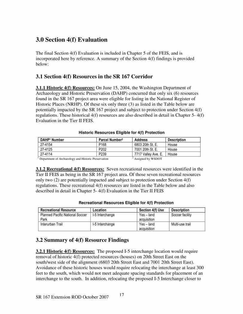
3.1.1 Historic 4(f) Resources: On June 15, 2004, the Washington Department of
Archaeology and Historic Preservation (DAHP) concurred that only six (6) resources
found in the SR 167 project area were eligible for listing in the National Register of
Historic Places (NRHP). Of these six only three (3) as listed in the Table below are
potentially impacted by the SR 167 project and subject to protection under Section 4(f)
regulations. These historical 4(f) resources are also described in detail in Chapter 5- 4(f)
Evaluation in the Tier II FEIS.
Historic Resources Eligible for 4(f) Protection
DAHP1 Number Parcel Number2 Address Description
27-4154 P168 6803 20th St. E. House
27-4125 P202 7001 20th St. E. House
27-4114 P239 7717 Valley Ave. E. House 1 Department of Archaeology and Historic Preservation
2 Assigned by WSDOT
3.1.2 Recreational 4(f) Resources: Seven recreational resources were identified in the
Tier II FEIS as being in the SR 167 project area. Of those seven recreational resources
only two (2) are potentially impacted and subject to protection under Section 4(f)
regulations. These recreational 4(f) resources are listed in the Table below and also
described in detail in Chapter 5- 4(f) Evaluation in the Tier II FEIS
Recreational Resources Eligible for 4(f) Protection
Recreational Resource Location Section 4(f) Use Description
Planned Pacific National Soccer Park
I-5 Interchange Yes – land acquisition
Soccer facility
Interurban Trail I-5 Interchange Yes – land acquisition
Multi-use trail
3.2 Summary of 4(f) Resource Findings
3.2.1 Historic 4(f) Resources: The proposed I-5 interchange location would require
removal of historic 4(f) protected resources (houses) on 20th Street East on the
south/west side of the alignment (6803 20th Street East and 7001 20th Street East).
Avoidance of these historic houses would require relocating the interchange at least 300
feet to the south, which would not meet adequate spacing standards for placement of an
interchange to the south. In addition, relocating the proposed I-5 Interchange closer to
SR 167 Extension ROD October 2007 18
the existing 54th Avenue East Interchange would impact the Mountain View apartment
complex with 241 units. Displacing this apartment complex would increase relocation
impacts associated with the I-5 Interchange.
At Valley Avenue the proposed interchange location would require removal of a 4(f)
historic resource (house) at 7717 Valley Avenue East. All three of the proposed
interchange options for SR 167 at Valley Avenue would potentially affect this historic
house. Avoidance of this particular historic resource would not be possible without
relocating the interchange to other locations that would impact Puyallup Tribe properties
and other historic resources as well as require the relocation of Freeman Road and
additional impacts and crossings to Wapato Creek.
Therefore, based on the issues identified in the preceding two paragraphs it is determined
that redesigning the mainline to avoid these 3 historic 4(f) protected resources (houses) is
neither feasible nor prudent. As outlined in the Memorandum of Agreement (see FEIS
Appendix H), the 3 historic houses will be offered for sale, based on the individual
buyer’s ability to move the house to a different location. If the houses do not sell within
a year, photo-documentation will occur and then they would be demolished
3.2.2 Recreational 4(f) Resources: During the development of the Tier II DEIS the
main line alignment of SR 167 was redesigned to meet updated federal design speed
requirements after the Tier I FEIS approved on June 9, 1999. For the mainline redesign,
five different centerline-only options were developed for SR 167 between SR 509 to just
south of the I-5 Interchange. All these options met the new design standard and changed
the I-5 crossing from a horizontal curve to a tangent section. State and Federal guidelines
require a minimum distance of one-mile between interchanges. Because of the location
of Hylebos Creek and the geography of the area in this vicinity, it is not possible to place
the I-5/SR 167 interchange any further north than 0.8-mile from the 54th Avenue East/I-5
Interchange.
Further detailed investigation was conducted to determine if there were any alternatives
that would avoid the use of Recreational 4(f) resources (Interurban Trail and the planned
City of Fife Pacific National Soccer Park). The investigation determined that some
impact to these two recreational resources would be unavoidable because they exist in an
area where there are many man-made or natural topographical features such as existing I-
5 and Hylebos Creek that limit opportunities for the SR 167 alignment to be located
elsewhere and still meet the updated federal design speed and interchange spacing
standards. The selected alternative also minimizes the impact to the greatest extent
practicable to Interurban Trail and the planned City of Fife Pacific National Soccer Park.
The Build Alternative will accommodate a redesigned and relocated Interurban Trail and
re-establish the public access connection to this trail in the vicinity of 70th Avenue East
and I-5. The relocated portion of the trail will be a separated Class I or II non-motorized
path linking to the City of Fife’s trail system that is ADA accessible. Any additional
facilities, such as parking that might be developed for the trailhead of the Interurban Trail
by the City of Milton will also be addressed. Prior to beginning construction of the SR
167 Extension project a trail conversion evaluation will be prepared detailing that all

SR 167 Extension ROD October 2007 19
practical alternatives to avoiding the conversion have been considered. The trail
conversion evaluation would provide a description of the fair market value of the land to
be converted, include a determination that the replacement land is of reasonably
equivalent recreational and location value and that the replacement land also meets 4(f)
eligibility requirements. In addition, the November 2004 MGS Water Resources Report
prepared for the SR 167 Extension project determined that flood impacts to the
Interurban Trail will be limited to the 100-year storm event with the project’s proposal to
relocate Hylebos Creek and establish the RRP.
The City of Fife was aware of the proposed SR 167 highway design at the time they
planned and acquired the property for the Pacific National Soccer Park. Presentations
were made to the public by the City of Fife concerning the soccer park design in June
2003 that showed the SR 167 Extension project relative to the proposed layout of soccer
fields and associated site improvements. Through meetings with the City of Fife and
Pierce County, the FHWA and WSDOT prepared an alternative design of the I-5
interchange, which reduced impacts to the planned soccer park such that 12 fields are
possible at the site. This met the minimum requirements for the City of Fife for funding
the facility.
The SR 167 Project has incorporated elements into the design of the project that will
benefit the planned Pacific National Soccer Park. A report entitled “Analysis of the SR
167 Extension and Riparian Restoration Proposal in the Hylebos Watershed” (MGS
Engineering Consultants, November 2004) included an analysis of stormwater runoff
from the soccer park. The project proposal to relocate Surprise Lake Drain from its
current ditched location and create a riparian zone around the relocation area will directly
benefit the planned soccer facility. The benefits of this relocation would also include
reducing flood impacts to the planned Pacific National Soccer Park.
Funding for construction of SR 167 is not secured at this time therefore the City of Fife is
presently only developing a master plan for the soccer park property. FHWA and
WSDOT are committed to continue working with the City of Fife and Pierce County as
the design plans for the SR 167 Extension project and the relocation of Surprise Lake
Drain and Hylebos Creek and associated regulatory buffers are refined. Final measures
to minimize harm to the soccer park property will be determined once construction
funding for SR 167 has been secured. Mitigation, if necessary, will be provided for any
required use of the soccer park property.
3.2.3 Section 4(f) Determination: Consistent with 23 CFR Section 771.135 and based
upon the considerations in Sections 3.2.1 and 3.2.2 above, the FHWA has made a
determination that the selected Build Alternative incorporates all possible planning to
avoid or minimize harm to the affected Section 4(f) resources. Furthermore, this
determination finds that there are no feasible and prudent locations or alternatives for the
action to avoid the use of land from historic resources (6803 20th Street East, 7001 20th
Street East, and 7717 Valley Avenue East) and recreational resources (Interurban Trail
and the planned Pacific National Soccer Park), and the proposed action includes all
possible planning to avoid or minimize harm resulting from such use, and no other

SR 167 Extension ROD October 2007 20
feasible and prudent alternative is more effective in avoiding or minimizing harm to
Section 4(f) resources. Details regarding the effects to Section 4(f) resources, the
proposed mitigation to offset and minimize those effects is included in Chapter 5 of the
FEIS and correspondence from all relevant jurisdictions is included in Appendix H of the
FEIS.
4.0 Measures to Minimize Harm (Commitments) The Build Alternative incorporates all practicable measures to minimize environmental
harm. Implementation of the Build alternative will include all mitigation measures
identified in Chapter 3 and listed in Appendix “F” (Tier II Commitments List) of the
FEIS. The Tier II Commitments list is included herein as Attachment “A” for easy
reference.
The following is a summary of mitigation measures and commitments imposed under this
ROD for the Build Alternative. These mitigation measures and commitments are
summarized under paragraph headings for categories of regulations that cover protected
resources such as air, noise, cultural resources, Environmental Justice, farmland, water
resources and endangered species. U.S. Department of Transportation (USDOT) Orders
and Presidential Executive Orders are noted where appropriate. This summary is also
provided to facilitate the monitoring of the implementation of the mitigation measures
and to give a sense of the nature of the mitigation actions and associated impacts.
However, this summary does not supersede or negate any of the commitments for
environmental mitigation established in the FEIS, where the impacts and mitigation
actions are described in more detail.
4.1 Air Quality
An analysis of air quality, conformity with the Federal Clean Air Act (42 U.S.C. 7506
(c)), and regional conformity with the SIP (40 CFR Part 93 and WAC 173-420) is
included in the FEIS. Initial results are presented in Chapter 3.5 of the FEIS. Based on
public comment and FHWA policy that project conformity is demonstrated prior to
issuance of the ROD on projects for which FHWA is lead agency, a conformity analysis
update was performed in 2002 and is included in Appendix H of the FEIS. The
conformity analysis was completed using the latest regional planning assumptions,
including emissions factors and an analysis year consistent with those used in the PSRC
MTP entitled Destination 2030, adopted in 2001.
On June 27, 2002, PSRC Executive Board approved refinement of the MTP to reflect the
design of the Build Alternative for the proposed project. The revised modeling shows
regional emissions below the emission budgets for all pollutants in 2020 and 2030 for the
MTP, including the Build Alternative. This modeling demonstrates that air quality in the
Puget Sound region, including implementation of the Build Alternative, will conform at
the regional level to the regional air quality maintenance plans.

SR 167 Extension ROD October 2007 21
The proposed project is included in the PSRC MTP and Regional Transportation
Improvement Plan (TIP). The project meets all requirements of 40 CFR Part 93 and
WAC 173-420, and thus conforms to the goals and objectives of all Puget Sound Air
Quality Maintenance Plans. The Build Alternative will not cause any new or contribute to
any existing regional exceedances of the NAAQS.
4.1.1 Mobile Source Air Toxins (MSAT): Emissions of MSAT were calculated as part
of the air quality analysis. Limitations in technical methods prevented the performance
of localized “hotspot” dispersion modeling for projects at the current time. EPA
recommends against dispersion modeling for particulate matter in its most recent
revisions to the transportation conformity rule, and dispersion model evaluation studies
have generally shown that dispersion models are accurate within about a factor of two.
The FEIS indicates that the expected difference in emissions between No Build and the
Build Alternative would be approximately 14%. Thus, air dispersion models are much
less precise than the change in MSAT emissions expected.
Also, the SR 167 roadway has only an incremental impact on total MSAT exposure, and
assessing MSAT exposure is not a simple matter of calculating the impacts of a roadway
in isolation from other sources of exposure. Calculating emissions trends and emissions
changes at the study area level is the most meaningful way to illustrate likely changes in
overall exposure.
Emissions analyses using the air quality model MOBILE 6.2 along with projected
increases in vehicle travel typically show a 50-80% decline in study area emissions
between the base year and the design year; a reduction of approximately 50% is expected
for this project (Section 3.2 of the FEIS). The fact that emissions are declining argues
against the need for localized “hotspot” dispersion modeling.
In the FEIS, readers were informed that localized increases relative to the No Build
Alternative would occur at locations where average daily traffic increases. However,
since overall emissions decline relative to current conditions, it is not expected that the
Build Alternative would lead to an increase in adverse health impacts attributed to MSAT
over current conditions.
4.2 Noise
The Tier I EIS and Record of Decision required a comprehensive noise study be
completed during the Tier II NEPA process. The Noise study concluded that
construction and operation of the proposed SR 167 Extension will have potential noise
impacts.
Construction noise impacts were described based on maximum noise levels for
construction equipment, published by the EPA. Daytime construction noise within
permitted hours of operation is not regulated by either local ordinance or federal criteria.
Only nighttime construction work is regulated by local ordinances. WSDOT contract
documents will require contractors to adhere to a variety of standard specifications aimed

SR 167 Extension ROD October 2007 22
at reducing and minimizing day and nighttime construction noise impacts and require the
contractor to notify the community about construction activities that will cause noise.
Nighttime construction noise monitoring would be conducted, see Section 5.2 below. To
reduce construction noise impacts at nearby receptors, the following mitigation measures
could be incorporated into construction plans and special provisions:
• Erecting noise berms and barriers as early as possible to provide noise shielding
• Limiting construction activities to between 7 AM and 10 PM, to reduce
construction noise level during nighttime hours in residential areas
• Equipping construction equipment engines with adequate mufflers, intake
silencers, and engine enclosures.
• Turning off construction equipment during prolonged periods of nonuse, to
eliminate noise from construction equipment during those periods
• Requiring contractors to maintain all equipment and train their equipment
operators, to minimize noise levels and increase operating efficiency
• Locating stationary equipment away from receiving properties to decrease noise
from this equipment in relation to the increased distance
• Constructing temporary noise barriers or curtains around stationary equipment
that must be located close to residences, to decrease noise levels at nearby
sensitive receptors
• Discussing noise issues at the pre-construction stage and develop community
involvement to identify haul roads and sensitive noise receptors
• Establishing the complaint mechanism during construction of the project
Traffic noises are predicted at specific noise-sensitive locations (receptors), and based on
projected future traffic operations using the FHWA Traffic Noise Model (TNM). FHWA
Noise Abatement Criteria (NAC) is used to identify and evaluate appropriate mitigation
measures including noise walls.
In general, an increase in volume, speed, or vehicle size increases traffic noise levels.
The majority of traffic noise comes from the engine, exhaust, and tires. Other conditions
affecting noise include defective mufflers, steep grades, terrain, distance from the
roadway, and shielding by barriers and buildings. A variety of mitigation methods can
serve as effective traffic noise impact reducers. For example, noise impacts from the
project’s long-term operation can be minimized by the following methods: implementing
traffic management measures, acquiring land as buffer zones, realigning the roadway, and
constructing noise barriers or berms. The final determination of noise barrier or berm
size and placement, and the implementation of other mitigation methods will take place
during detailed project design, after an opportunity for public involvement and approval
at the local, state, and federal levels.
Noise barriers include noise walls and berms. The effectiveness of a noise barrier is
determined by its height and length and by the project site’s topography. To be effective,
the barrier must block the “line of sight” between the highest point of a noise source (e.g.,
a truck exhaust stack) and the highest part of a receiver. A barrier must be long enough
to prevent sounds from passing around its ends, have no openings such as driveway
SR 167 Extension ROD October 2007 23
connections, and be dense enough so that noise would not be transmitted through it
(USDOT 1973).
FHWA and WSDOT evaluated noise barriers for feasibility and reasonableness. The
determination of engineering feasibility includes whether barriers could be built in a
location to achieve a noise reduction of at least 7 decibels “A” weighted (dBA) at the
closest receptors. The determination of reasonableness includes the number of sensitive
receptors benefited by at least 3 dBA, the cost-effectiveness of the barriers, and concerns
such as the desires of nearby residents, aesthetics, and safety. FHWA and WSDOT have
established a reasonableness criterion for the maximum allowed wall surface area per
household. Noise walls that exceed the maximum allowed wall surface area are deemed
not reasonable.
A noise barrier is proposed for the SR 167 Extension project along the south shoulder of
SR 167 west of Milwaukee Avenue East. This noise barrier, was analyzed since the DEIS
and found to be feasible and reasonable. It is feasible because a 14,400-square foot wall
(10 feet high and 1,400 feet long) would reduce noise levels by 6 to 9 dBA at nearby
sensitive receptors. It is reasonable because 16,401 square feet is the allowed wall area
based on the residences represented and future decibel levels. Because it is both feasible
and reasonable, it will be included in the final design of the Urban Interchange option for
this area.
The Tier I commitments made to the Puyallup Tribe in 1993 regarding noise mitigation
near 48th Street East have also been carried forward into this ROD. Landscaped noise
abatement structures were requested by the Puyallup Tribe for future residences
potentially built on Tribal Trust land. No time-frame for their construction has been
determined yet. FHWA and WSDOT will continue to collaborate with the Puyallup Tribe
during the upcoming design process to precisely define structures meeting their approval.
Because the project is on an elevated structure through this area, landscaping may not be
possible. Technical guidance to the Puyallup Tribe on the placement of businesses in
order to effectively use the noise barrier will be provided at the time of development of
the Tribal parcels. WSDOT will also retrofit houses on Tribal Trust land near Valley
Avenue with storm windows as mitigation to minimize noise impacts, if necessary.
4.3 Cultural Resources (Section 106)
Section 106 of the National Historic Preservation Act of 1966, as amended, and 36 CFR
Part 800, requires the review of federally assisted projects for impacts to districts, sites,
buildings, structures, and objects listed in, or eligible for inclusion in, the National
Register of Historic Places (NRHP). FHWA and WSDOT submitted a completed Historic
and Archaeological Report to the Washington State Historic Preservation Officer (SHPO)
for concurrence.
In 1999 WSDOT initiated consultations with federally recognized and non-recognized
tribes pursuant to 36 CFR 800.2(a)(4), and in March 2000, FHWA initiated formal
consultation with the tribes in compliance with Presidential Executive Order 13175

SR 167 Extension ROD October 2007 24
(2000). Tribes contacted included the Puyallup Tribe, Muckleshoot Tribe and Yakima
Nation, as determined from review of the Usual and Accustomed Area maps (Governor’s
Office of Indian Affairs, May 1987, as updated). FHWA delegated responsibility to
WSDOT to coordinate the report of findings with the SHPO for concurrence pursuant to
36 CFR 800.4(d) (1). The tribes were provided a 30-day comment period, and were
contacted by phone 15 days prior to the end of the comment period to seek additional
information.
Based on comments received from the Puyallup Tribe, Muckleshoot Tribe, and the
Yakima Nation, WSDOT initiated professional archaeological and historical monitoring
of planned geotechnical investigation work that involved subsurface soils disturbance.
Copies of the SR 167 Cultural Resources Monitoring Survey (WSDOT, November 2000)
and letters requesting comments were sent to the above tribes in February 2001. No
comments were received within the 30-day comment period or thereafter.
Cultural resource and archaeological sites are not usually adversely affected by operation
of transportation projects after construction. Historic structures, or their use and
enjoyment, may be affected by vibrations or noise caused by traffic. None of these
factors are expected to cause major effects if this project is constructed.
The SR 167 Build Alternative is expected to lead to some limited construction impacts on
cultural resources. As design progresses, further efforts will be made to avoid or
minimize the effects to cultural and historic resources. Most of the cultural resource
impacts associated with constructing the project would potentially occur at the I-5
Interchange. An NRHP-eligible, prehistoric cultural site near SR 99 and two NRHP-
eligible historic structures are located here. The two historic resources are located at 6803
20th Street East and 7001 20th Street East. They are also covered under Section 4(f), see
Section 3.0 above. Section 4(f) does not apply to the prehistoric cultural site near SR 99,
as explained in Section 5.4.1 of the FEIS. Other parcels in the I-5 interchange portion of
the project contain inventoried buildings, which are not NRHP-eligible historic
structures.
The Valley Avenue/SR 167 interchange area could be affected by project construction.
Two cultural resource sites are potentially affected. A NRHP eligible resource (historic
house) is located at 7717 Valley Avenue East. This resource is also covered under
Section 4(f), see Section 3.2.1 above. In addition one site in the vicinity of the Valley
Avenue Realignment interchange option described in Section 2.3.2 above is of potential
interest to the Puyallup Tribe. The site is the “Burial location” for a member of the
Puyallup Tribe and potentially considered sacred. The site will be avoided. No further
investigation has been conducted to determine whether the site is eligible for the NRHP
or subject to Section 4(f). The site is not discussed extensively in the FEIS in order to
maintain the confidentiality of its location. Prior to any ground disturbing activity at or
adjacent to this area, the Puyallup Tribe will be consulted.
The Tier I ROD called for design efforts to save the Carson Chestnut Tree. Accordingly,
all options at the SR 161/SR 167 Interchange were designed to protect this historic tree,

SR 167 Extension ROD October 2007 25
which has been nominated for listing on the Washington Heritage Register. No effect on
the Carson Chestnut Tree is expected because FHWA and WSDOT have committed to
avoiding the tree and avoiding construction activities that might damage the tree.
The SR 167 project and other planned development in the area will have cumulative
effects to cultural resources, primarily structures, in the immediate project area.
Likewise, cumulative effects of other actions in the Puyallup Valley that are unrelated to
the proposed SR 167 Extension would mostly result from ground disturbance or building
demolition associated with transportation improvements and new commercial or
industrial developments. These effects are anticipated to be concentrated in the Urban
Growth Boundary as planned under the Growth Management Act (GMA), rather than
dispersed throughout the Puyallup Valley and Pierce County. The mitigation measures
developed to avoid cultural resource effects by the proposed project would also minimize
contributions to cumulative effects.
In spite of the detailed studies during Tier II, construction of SR 167 could disturb or
destroy previously undiscovered archaeological sites. If sites or cultural resources are
found during construction, all work in the area would stop and the requirements of the
project Cultural Resources Discovery Plan would be followed. In addition an
Archaeological Monitoring Plan, which may include a geological model, detailing
personnel and methodologies for locating presently undiscovered buried cultural
resources potentially associated with ancient ground surfaces, will be developed during
final design (see Section 5.1 below).
A Section 106 Memorandum of Agreement (MOA) was developed in consultation with
FHWA, SHPO, the Advisory Council on Historic Preservation (ACHP), and the Puyallup
Tribe to address adverse effects of the project to the identified archaeological site and
four historic structures. The MOA includes measures to minimize or avoid the effects.
The City of Fife will be notified prior to the purchase of the historic properties subject to
protection under Section 106. Prior to any ground disturbing activity in the Valley
Avenue Interchange area, the Puyallup Tribe will be consulted. The MOA was approved
by all signatory parties in fall 2006 (September to November) and is included in
Appendix H of the FEIS.
4.4 Environmental Justice (Presidential Executive Order 12898)
The analysis of Environmental Justice is included in Chapter 3.11 of the FEIS. Consistent
with Presidential Executive Order 12898, “Federal Actions to Address Environmental
Justice in Minority Populations and Low-Income Populations” (February 1994) and
FHWA Order 6640.23, “FHWA Actions to Address Environmental Justice in Minority
Populations and Low-Income Populations” (December 1998), the FHWA concluded that
after the mitigation measures to minimize harm are implemented, no adverse human
health or environmental effects are expected to fall disproportionately on minority or
low-income populations as a result of implementing the Build Alternative.

SR 167 Extension ROD October 2007 26
4.5 Farmland
The Federal Farmland Protection Policy Act (FPPA- 7 USC 4201-4209) is intended to
minimize the extent to which federal activities contribute to the conversion of farmland to
non-agricultural uses. Consequently, the FPPA requires the FHWA to evaluate the
impact of proposed transportation improvements before they approve any project that
would convert farmland to transportation purposes.
The evaluation of impacts to farmland conducted by FHWA and WSDOT for the SR 167
Tier II EIS determined that all of the land being farmed within the project area is
occurring within urbanized areas. The majority of which is within Fife city limits. As
the cities of Fife, Puyallup and Tacoma continue to implement their Comprehensive
Plans, eventually all land currently farmed within the study area is expected to be
converted. The above mentioned cities have determined that the highest and best use of
land located within their city-limits is residential, commercial or industrial and they have
rezoned the land as such.
Interviews with farm families from the project area have made it clear that most of them
either have left or are planning to move away due to increased urbanization and property
values that are making farming unprofitable. Recently some farm families have
voluntarily participated in municipal service improvements to their property which would
enhance overall future non-agricultural development value. The encroachment of
commercial/ industrial development, high property assessments, and the financial
challenges facing family farm operations has brought into question the longevity of
existing agricultural operations in the project corridor as well as the overall lower
Puyallup Valley. There are no local farmland protection policies. Even under the No-
Build alternative it is expected that the impacted farmland would convert to long-term
residential, commercial or industrial uses. Also, it is anticipated by local governments
that any economic impacts or loss of tax-base related to the loss of farming businesses/
infrastructure will be more than adequately compensated for by the economic benefits
attributed to the increase of commercial business and industry.
Any mitigation commitment proposed for the direct loss of farmland will depend on the
land use existing on the property at the time of its acquisition prior to construction. It is
expected that by the time the SR 167 Extension project is ready for construction all of the
agricultural land within the corridor will be converted to other non-agricultural land uses.
However, the approval of the Tier I FEIS in June 1999 provided FHWA and WSDOT the
opportunity to acquire right-of-way in advance of final design to preserve a viable
corridor alignment to build the SR 167 Extension project. WSDOT has acquired several
properties in recent months promulgated at least partially by the fact that some of these
properties had been rezoned to commercial or industrial uses and were slated for potential
immediate development. WSDOT is reacting by purchasing properties slated for new
development to prevent considerably higher acquisition and relocation costs should the
property be advanced to become a commercial business or industry. WSDOT has
typically acquired properties from “Willing Sellers” and has avoided the acquisition of
viable agricultural operations.

SR 167 Extension ROD October 2007 27
Furthermore, during the Tier II EIS process WSDOT submitted farmland conversion
rating information concerning the SR 167 Extension project to the Natural Resources
Conservation Service (NRCS) for evaluation. According to the NRCS evaluation, the
amount of farmland that would be converted in the proposed project corridor accounts for
0.15 percent of the total farmland in Pierce County (Natsuhara 2004).The NRCS used
this information to evaluate whether there are farmlands in the project area that are
subject to protection under the FPPA. Farmlands that score 160 points or less in the
NRCS evaluation and rating do not need to be given further consideration for protection
by FHWA (7 CFR 658.4). The farmlands within the project study area, including those
included in the RRP and potential wetland mitigation sites, scored 153.6 points in the
NCRS rating and therefore do not need to be given further consideration for protection
under the requirements of the FPPA. However; mitigation commitments as described
below have been included to preserve agricultural uses that would remain adjacent the SR
167 Extension project.
4.5.1 Mitigation Commitments for the Loss of Farmland: Commitments to mitigate
impacts for farmland were developed for construction and operation of the SR 167
Extension project are listed in Attachment A and they are summarized below:
• Construction: During construction consultation and coordination with affected
farmers will be conducted to ensure that disruptions to adjacent farming
operations are minimized and adequate advanced notice of potential disruptions is
given. Erosion control measures will also be implemented during construction.
Construction zones along the roadway will be replanted after construction in
accordance with local and state guidelines. The use of water trucks and other
construction best management practices will be used in the control of dust. As
part of construction management, access and traffic mitigation and dust control
measures will be prepared and included in the project’s construction contract.
• Operation: Once design is complete, FHWA and WSDOT will work individually
with existing farmland owners to identify circulation options for movement of
farm equipment and to provide access to any fragmented acreage and where
appropriate provide connection from local streets by way of access roads and/or
easements. The RRP and other conventional water detention facilities will assist
in protecting farms from project stormwater runoff. The implementation of the
RRP would tend to mitigate impacts related to saturated soils from hydrological
changes due to impervious surfaces and the increased stormwater run-off. The
RRP would moderate the affect of the rapid growth and development that is
encroaching onto farmlands in the project area by providing open space or buffers
between the new roadway, agriculture and other non-agricultural uses.
Agricultural activities may be able to continue within RRP areas because it would
be conserved in perpetuity as open space and farming operations could coexist
because they would not necessarily impede the purposes of the RRP. During
project design and construction FHWA and WSDOT will work collaboratively
with local farmers and governments to identify ways to preserve farmland acreage

SR 167 Extension ROD October 2007 28
in the project area and explore the need, desire for, and feasibility of protecting
and maintaining farmland within the project corridor in the future.
4.6 Water Resources
The Federal Water Pollution Control Act of 1972 (amended in 1977), commonly known
as the Clean Water Act (CWA), established the basic structure for regulating discharges
of pollutants into the waters of the U.S. The CWA gave EPA the authority to implement
pollution control programs such as setting wastewater standards for industry. The CWA
also continued requirements to set water quality standards for all contaminants in surface
waters. The CWA made it unlawful for any person to discharge any pollutant from a
point source into navigable waters, unless a permit was obtained. It also funded the
construction of sewage treatment plants under the construction grants program and
recognized the need for planning to address the critical problems posed by non-point
source pollution such as highways.
In the SR 167 project area surface water, groundwater, floodplains and wetlands provide
public water supply, aquatic habitat, and flood storage. Potential effects of the proposed
project to these water resources include changes in water quality, floodwater storage and
displacement, erosion, and habitat quality and availability. FHWA and WSDOT will
adhere to all relevant regulations pertaining to the protection of water resources within
the project area. FHWA and WSDOT have determined that the proposed project
planning and design includes all measures to avoid and minimize impacts to surface
water, groundwater, floodplains and wetlands. Requirements contained in regulatory
permits, agreements, and plans may include additional specific mitigation measures and
monitoring requirements, which further ensure that construction and operation activities
are conducted in a manner that protect water resources. See Section 4.6.2 for RRP water
quality benefits. Water quality monitoring is discussed in Section 5.3 of this ROD.
4.6.1 Floodplains (USDOT Order 5660.1A; Presidential Executive Order 11988):
The USDOT and FHWA seek to assure the protection, preservation, and enhancement of
the nation’s floodplains to the fullest extent practicable during the planning, construction
and operation of transportation facilities and projects (USDOT Order 5660.1A;
Presidential Executive Order 11988). With the proposed RRP and other mitigation
measures for the protection of water resources to be implemented for the Build
Alternative, FHWA finds that the SR 167 Extension project meets all stormwater and
floodplain requirements and complies with Presidential Executive Order 11988. See RRP
Section 4.6.2 for benefits applicable to floodplains.
4.6.2 Riparian Restoration Proposal (RRP): Due to the potential impacts associated
with stormwater, runoff generated by the highway must meet flow control requirements
and water quality treatment requirements, known as stormwater Best Management
Practices (BMP), that have been set to protect in-stream water quality and hydrology.
These requirements are defined in the Stormwater Management Manual for Western
Washington (Ecology 2001) and are reflected in the WSDOT Highway Runoff Manual
(WSDOT 2004). Therefore, by design, it is expected that water quality standards will be
SR 167 Extension ROD October 2007 29
met and hydrology maintained to the extent defined by the regulations. Stormwater
control is a critical component of this project and the initial design phases have led to
development of a stormwater control strategy that is both diverse and innovative. The
following description of the RRP approach to stormwater treatment and rationale is
provided due to the innovative nature of the approach, and as background to the impacts.
The RRP is a comprehensive stormwater management plan (SWMP) that covers the
project corridor. Additional information will be developed during final design to further
define and clarify the SWMP approach. The RRP approach was selected because it does
not change the amount of flooding, but controls it through natural methods. The RRP
would create an environment where flooding and channel migration is not detrimental to
houses, roads, private property, public infrastructure, etc.; because these obstructions to
water flow are removed and new channel migration zones and riparian buffers are
established.
The advantage of the RRP approach is that it removes existing encroachments and
restores the riparian ecosystem and natural course of flooding. The RRP would reduce the
amount of stormwater coming onto the project from off-site sources by maintaining
natural flooding conditions. Stormwater coming from within the right-of-way would be
handled with traditional conventional methods onsite before being released into the RRP
system.
Conventional stormwater approaches tend to detain and collect stormwater both coming
onto the project from outside and water collected on-site within the right-of-way.
Stormwater detention ponds can regulate the amount and flow of water leaving the
project and allow for treatment before it percolates into groundwater or is released into
the surrounding environment. However, conventional methods often conflict with natural
processes by blocking channels, altering direction or rates of flow, and require handling
of large amounts of water from off-site sources that would not need to be dealt with under
a RRP method.
Stormwater treatment requirements include those associated with pollutant removal
(water quality) and those associated with reducing and minimizing runoff volume and
speed (water quantity). Runoff generated from the corridor must receive both water
quality and water quantity treatment. At this time (i.e., preliminary design) stormwater
treatment is expected to occur through the RRP, supplemented with standard stormwater
treatment facilities (i.e., biofiltration swales, detention ponds, constructed wetlands, and
manufactured treatment vaults), possibly deep fill infiltration, and landscaped fill slopes.
There are three RRP areas proposed for the project; Hylebos Creek, Surprise Lake Drain,
and Wapato Creek. Hylebos and Surprise Lake Drain RRPs also involve stream
relocations. Details on each of the three RRPs and their impacts are described in detail in
FEIS Section 3.2-4.
With conventional stormwater treatment, Hylebos Creek would still need to be relocated
from Porter Way to 70th Avenue East and riparian area around the relocated stream
SR 167 Extension ROD October 2007 30
would be established. However, Surprise Lake Drain would not be relocated and the
RRP area identified around the relocated Surprise Lake Drain would not be established.
Also the RRP area previously identified east of the I-5 corridor would not be established.
The result is that the 54 acres of upland riparian buffer (buffer not associated with
Hylebos relocation) that would be protected in the Hylebos area (including Surprise Lake
Drain) under the RRP, would not be protected with the conventional treatment approach.
In addition, 12 large stormwater ponds covering 34 acres in the vicinity of the I-5
Interchange would be required. This would result in 8 acres of additional wetland impact
at this interchange location.
With conventional treatment in the Wapato Creek portion of the project area (the Valley
Avenue interchange area), the riparian upland buffer in the RRP area would be greatly
reduced (from 60 acres to 7 acres) and approximately 16 stormwater ponds covering 24
acres would be required. Based on field conditions, the number and size of stormwater
ponds may change during final design and construction.
A Net Environmental Benefits Analysis (NEBA) was performed to quantitatively
estimate and compare the relative ecological losses and gains between the use of
conventional stormwater treatment ponds and the RRP approach. Project wide, the RRP
was found to have 57 percent greater environmental benefit than the conventional
treatment approach. In the Hylebos Basin there was an estimated 64 percent increase, in
Surprise Lake Drain an estimated 79 percent increase, and in Wapato Basin a 43 percent
increase in environmental benefits. These benefits were primarily due to improvements
in wetlands, riparian uplands, and stream channel. The NEBA is described in FEIS
Section 3.17.2)
Use of the RRP represents a non-conventional approach to stormwater flow control and
will minimize the need for conventional stormwater detention facilities for the SR 167
project. Its direct function is to address stormwater flow control, however the RRP will
also provide benefits that may be even more critical to the proper functioning of stream
resources. Some of these benefits include:
• Prevention of streambank erosion through both control of stormwater discharge
and through direct stabilization of the streambank via riparian planting;
• Improved shading of the stream through streamside plantings and eventual
development of a more diverse terrestrial and aquatic habitat structure;
• Reduction in transport of pollutants from the surrounding area and possibly
improvement in the streams ability to assimilate pollutants generated upstream;
• More natural interaction of the streams and their associated floodplains that would
allow the stream channels to form and change naturally;
• Wildlife corridor improvement and links to other existing habitat areas and
development of more diverse terrestrial and riparian habitats;
• Reduction in the need for manmade structures (pipelines, culverts, outlets) and
promoting natural dispersion and drainage patterns.
SR 167 Extension ROD October 2007 31
The RRP would also enhance a substantial amount of wetlands and protect them by
enhancing the surrounding uplands that would serve as wetland buffers. The RRP will
also provide wildlife habitat and other essential elements beneficial to this rapidly
urbanizing area. The RRP would acquire the property necessary to reestablish riparian
buffers along 4.4 miles of existing and relocated streams and allow for more natural
floodplain processes to occur within a channel migration zone. Buildings, roads,
culverts, and other infrastructure would be removed and the land use would be converted
back to a riparian forest planted with native vegetation. Existing fill materials that were
placed in the floodplain would be removed in some areas to improve floodplain capacity.
Replanting the banks with native riparian vegetation would minimize streambank erosion
more directly than conventional detention ponds. In addition to stabilizing the channels,
this proposal would develop 189 acres of habitat and establish wildlife linkages between
fragmented upland habitats. The RRP would also provide opportunities for passive
recreation and environmental education.
The RRP would result in considerable benefits to streams, such as increasing shade to
maintain cooler water temperatures, establish woody vegetation which increases bank
stability, and helping form habitat for fish and wildlife. The riparian habitat created by
the RRP will be a mix of riparian wetland, wetland buffer, and upland habitats.
4.6.3 Wetlands (USDOT Order 5660.1A; Presidential Executive Order 11990): The
USDOT and FHWA seek to assure the protection, preservation, and enhancement of the
nation’s wetlands to the fullest extent practicable during the planning, construction and
operation of transportation facilities and projects (USDOT Order 5660.1A; Presidential
Executive Order 11990).
With the proposed wetland mitigation measures as described below for the Build
Alternative, FHWA finds that the SR 167 Extension project meets the federal wetland
requirements.
Through interagency coordination efforts related to the SAC process, measures have been
implemented to reduce the wetland effects related to the selected Build Alternative. In
addition a COE Individual Section 404 permit will be obtained for the project which will
further address wetlands and impose mitigation.
As noted, wetlands are generally more strictly regulated than other wildlife habitat types.
To mitigate unavoidable wetland impacts, creating wetlands is proposed on at least one of
ten potential sites. There will be no net loss of wetland function or area from the
proposed project. Through the project design, impacts to wetlands and streams was
avoided or minimized to the greatest extent possible. During the Tier II preliminary
design process the alignment was shifted away from Hylebos Creek north of I-5. The
alignment necessitates the relocation of a segment (approximately one-mile) of Hylebos
Creek and Surprise Lake Drain. FHWA and WSDOT are proposing to mitigate for these
impacts by designing a more natural, meandering channel for the relocated streams. The
proposed relocations of Hylebos Creek and Surprise Lake Drain are described as part of
the RRP (see Section 4.6.2 above).
SR 167 Extension ROD October 2007 32
A Conceptual Mitigation Plan (WSDOT, May 2005) detailed the adverse effects on
wetlands and their buffer areas, required mitigation ratios (both state and local agency),
and planned mitigation as was more generally described in Chapter 3.3 of the FEIS. The
Conceptual Mitigation Plan is incorporated here by reference. Through conceptual
project design, impacts to wetlands have been avoided or minimized as much as possible,
but future opportunities for avoidance and minimization will be pursued in final design.
When the mainline was shifted away from Hylebos Creek north of I-5, this minimized
impacts and allowed for a large buffer. During final design, site-specific design criteria
will be applied to each interchange, mainline segment, and bridge. These can include
realignment of the mainline and ramps to minimize impacts to wetlands, adjustment of
bridge lengths to avoid wetlands for the stream crossing at Valley Avenue, and re-
vegetating Hylebos and Wapato Creeks, and Surprise Lake Drain to improve habitat.
The Hylebos Creek relocation will remove an existing bottleneck along I-5, increase
capacity, and improve riparian habitat. Initially, ten sites have been identified within the
project vicinity offer the potential to compensate for unavoidable project impacts on
wetlands. One or more sites may be needed to meet the wetland mitigation needs of the
project.
FHWA and WSDOT will select one or more preferred wetland mitigation site(s) after the
ROD is issued and before permitting and a final mitigation plan are completed. A
number of additional sites were also considered for mitigation but were not evaluated
further due to various causes. The mitigation wetlands to be restored/created and
enhanced at the potential wetland mitigation sites are expected to substantially exceed the
area and function of the moderate- to low-function, disturbed wetlands to be impacted by
the Build Alternative.
Wetland and riparian sites in the project area are of particular importance to wildlife
because surrounding lands are typically urban or agricultural parcels with little valuable
wildlife habitat. Wetland and riparian areas will be protected from disturbance during
project construction and operation through implementation with BMP and compliance
with buffer requirements established by the appropriate jurisdictions. Potential impacts
to streams crossed by the corridor will be avoided by constructing bridges over the
streams and adjacent riparian wetlands and placing bridge supports in upland areas
wherever practicable. Replacement of existing undersized culverts with culverts or
bridges sized to sustain ecological processes where feasible would have a positive benefit
to both fish and wildlife.
Pollution to wetlands and stream courses associated with road runoff will be minimized
through the use of vegetated biofiltration swales, wet ponds, constructed wetlands, and
other BMP. The emergent plant species typically used in vegetated swales aid in
sediment and chemical pollutant retention. The project design will include drainage
features that incorporate best available technology as a part of best management practices
and implement appropriate stormwater treatment for water quality and quantity as
established in the WSDOT Highway Runoff Manual (WSDOT 2004) to minimize impact
to wildlife and fisheries.

SR 167 Extension ROD October 2007 33
It is not possible to avoid all impacts and still meet the Purpose and Need of the project.
Some habitats, such as wetlands, are easily quantified with regard to direct impacts and
are regulated at local, state, and federal levels. Most jurisdictions have defined
compensation ratios for wetlands whereas other habitats are not regulated as such.
During design FHWA and WSDOT will continue to use all practicable means to
minimize impacts to habitats. These efforts may include, but not be limited to, using
retaining walls (to prevent fill from entering aquatic habitats), using structures to avoid
impacts, and refining the alignment by making additional minor shifts to avoid or
minimize impact to wetlands or other important habitats. Mitigation designed to offset
wetland impacts might also benefit migratory birds. Wetland and riparian areas would
also benefit from the proposed RRP (see Section 4.6.2 above).
4.7 Wildlife and Fisheries
4.7.1 Endangered Species Act (ESA): The Endangered Species Act (ESA) of 1973, as
amended, intends to protect threatened and endangered species. The ESA requires a
federal agency to ensure that any action it authorizes, funds, or carries out is not likely to
jeopardize the continued existence of any listed species or result in, destruction, or
adverse modification of critical habitat of listed species. This requirement is fulfilled
under Section 7 of the ESA (50 CFR 402.08) by completion of consultation on the
proposed actions with USFWS and/or NMFS.
4.7.2 Magnuson-Stevens Act (MSA): The 1996 Magnuson-Stevens Fisheries
Conservation and Management Act (MSA) amended federal fisheries management
regulations to require identification and conservation of habitat that is “essential” to
federally managed fish species. Essential Fish Habitat (EFH) is defined as “those waters
and substrate necessary to fish for spawning, breeding, feeding, or growth to maturity”. If
an action will adversely affect EFH, NMFS is required to provide the Federal action
agency with EFH conservation recommendations (MSA 305 (b) (4) (A)).
4.7.3 Migratory Bird Treaty Act (MBTA): The MBTA specifies that nesting
migratory birds must not be directly impacted from project-related activities. Direct
impacts could result if nesting migratory birds were present in the SR 167 project area
during construction. Construction activities will be reviewed to ensure compliance with
all Federal, State and local wildlife regulations, including MBTA. Monitoring is proposed
as mitigation for impacts to MBTA protected species (see Section 5.5 below).
4.7.4 ESA/MSA Consultation: A Biological Assessment (BA) for the project (WSDOT
October 2006) was submitted to the affected Federal resource agencies (USFWS and
NMFS). The BA is incorporated here by reference. Since the initial BA submittal in
October 2006, FHWA and WSDOT have worked collaboratively with the USFWS and
NMFS, providing several supporting documents to assist with the development of their
final Biological Opinion (BO). USFWS issued their BO concerning the Bull Trout on
May 31, 2007 and NMFS issued their BO concerning Chinook salmon on September 17,
2007. The final “ESA Effect Determination” as described in Section 4.7.7 below is based

SR 167 Extension ROD October 2007 34
on the information contained in the BA, BO and close and consistent coordination with
USFWS and NMFS.
4.7.5 ESA/MSA Effects Evaluation: The Table below shows Threatened and
Endangered (T&E) Species and critical habitat that may be affected in the study area as
well as an initial determination of effects. As can be seen, only Chinook salmon, Bull
Trout, and their respective habitat is potentially or likely to be adversely affected. The
other species of plants (Marsh Sandwort, Golden Paintbrush, and Water Howellia) and
the Bald Eagle will not be adversely affected.
Determination of Effects on Threatened and Endangered Species
COMMON NAME SCIENTIFIC NAME
FEDERAL
STATUS
EFFECT
DETERMINATION
Bald eagle Haliaeetus leucocephalus Threatened NLTAA
Marsh Sandwort Arenaria paludicola Endangered NE
Golden Paintbrush Castilleja levisecta Threatened NE
W ater Howellia Howellia aquatilis Threatened NE
Chinook Salmon O. tshawytscha Threatened LTAA
Chinook Salmon Critical
Habitat Proposed LTAA
Bull Trout Salvelinus confluentus Threatened LTAA
Bull Trout Critical Habitat Proposed LTAA NE = No Effect NLTAA = Not Likely To Adversely Affect LTAA = Likely to Adversely Affect
Juvenile Chinook salmon may be present in the action area throughout the year.
Migrating anadromous Bull Trout may also occur in the action area throughout the year.
These fish and their habitats are discussed below:
• Chinook salmon: The proposed project may affect, and is likely to adversely
affect (LTAA) Chinook salmon. This determination is based on the following:
- Pier placement may occur in potentially suitable spawning habitat.
- Juvenile Chinook salmon potentially occur in the Puyallup River
throughout the year and fish handling may be necessary.
- In-water work, including pile placement and potential dewatering,
proposed in the Puyallup River and Hylebos Creek, which may result in
harm and harassment of the species.
� Chinook salmon Critical Habitat: The project is likely to adversely affect (LTAA)
Chinook salmon critical habitat because the project could possibly affect some
critical habitat Primary Constituent Elements (PCE) of existing habitat.
� Bull Trout: The proposed project may affect, and is likely to adversely affect
(LTAA) Bull Trout. This determination is based on the following:
- Migrating anadromous Bull Trout potentially occur in the Puyallup River
throughout the year and fish handling may be necessary.
- In-water work, including pile placement and potential dewatering,
proposed in the Puyallup River that may result in harm and harassment of
the species.

SR 167 Extension ROD October 2007 35
• Bull Trout Proposed Critical Habitat: The project is likely to adversely affect
(LTAA) Bull Trout critical habitat because the project could possibly affect some
critical habitat PCEs of existing habitat.
Since the SR 167 Extension project may affect and is likely to adversely affect (LTAA)
both Chinook salmon and Bull Trout and could possibly affect some critical habitat PCEs
of existing habitat for both species, mitigation measures or commitments to avoid and
minimize impacts will be included in the project. These commitments are summarized in
Section 4.7.6 below:
4.7.6 Commitments to Avoid and Minimize Effects on ESA Species and MSA
Habitat: The development of the Tier I EIS and the selection of the current corridor was
the first step in the avoidance of impacts. The selected corridor has the least impacts. As
the project within the Tier I corridor was developed, individual design actions were taken
to further avoid and minimize impacts to various resources including habitats and
species. During the consultation process, several specific issues of concern were also
resolved. These include: indirect and cumulative impacts, stormwater pollutant loading,
and in-water pile placement. A collaborative process was used to: 1) develop
performance standards for the treatment of stormwater that address concerns about
pollutant loadings that could harm or injure fish and 2) sound pressure which, at certain
threshold levels, could harm and/or injure Chinook salmon and Bull Trout.
The project also includes performance standards and multiple measures that will
minimize adverse effects to Chinook salmon, Bull Trout, and their critical habitats.
However, adverse effects are still anticipated. Take, in the form of harm and harassment,
may occur to individual Chinook salmon and Bull Trout. Attachment A includes a List of
Commitments to avoid and minimize potential impacts to Chinook salmon and Bull
Trout. The Commitments are summarized below:
• During design, FHWA and WSDOT will continue to use all practicable means to
minimize impacts to habitats. These efforts may include, but not be limited to:
• Using retaining walls (to prevent fill from entering aquatic habitats);
• Using structures to avoid impacts;
• Refining the alignment by making additional minor shifts to avoid or minimize
impact to wetlands or other important habitats;
• Installing culverts at stream crossings that will comply with the project Hydraulic
Project Approval (HPA), and will, at minimum, be designed to withstand the
100-year flood event;
• Adding low-cost wildlife crossings and using over-sized culverts or clear-
spanning structures at appropriate locations where practicable;
• Timing in-water work to avoid adult salmon, Bull Trout, and steelhead migration,
juvenile out-migration, and alevin emergence.
• Noise minimization measures such as the use of bubble curtains to attenuate
sound pressure may be used.
• The segment of Hylebos Creek that will be abandoned and filled will be surveyed
for presence of freshwater mussels prior to construction. Any freshwater mussels
SR 167 Extension ROD October 2007 36
present in the filled segment of Hylebos Creek will be relocated. If it is necessary
to relocate mussels during channel filling and new channel creation, monitoring
should ensure relocated mussels are not being stressed or smothered by
sedimentation or flushed downstream during high flows.
• The project would be constructed in stages, sometimes with concurrent work on
more than one stage. This work will be coordinated to minimize cumulative
impacts of fisheries resources to the greatest extent possible. Coordination with
USFWS and NMFS would continue as the project is prepared for bid and
construction in conformance to the requirements of the ESA. FHWA and
WSDOT will ensure that the BA (October 2006) conclusions are not affected by
any change in ESA species designation or any change in the use of the action area
by threatened or endangered species.
• FHWA and WSDOT will apply the minimization measures and performance
standards from the BA and comply with the Terms and Conditions from the BOs
as approved by the USFWS and NMFS.
• In order to ensure the protection of sensitive species, a biologist knowledgeable in
the species of plants and wildlife protected by ESA and the Migratory Bird Treaty
Act (MBTA) would survey proposed work areas prior to construction. If any
protected species are found, FHWA and WSDOT would consult with USFWS
and NMFS to determine the best methods to protect and/or relocate them.
Monitoring will continue throughout the construction phase to maintain
compliance.
• The RRP will result in corridor linkage from upper to lower reaches of Hylebos
and Wapato Creeks and Surprise Lake Drain. Potential wetland mitigation sites
will provide additional linkage between the RRP areas. The addition of low-cost
wildlife crossings and the use of oversized culverts will be considered at
appropriate locations.
• Preservation of vegetation will decrease the impacts of project construction, and
existing native plants and trees will be preserved provided roadway clear zone and
sight distance requirements are met. Trees and shrubs, when present adjacent to
the alignment, will be preserved wherever possible for esthetic value. Vegetation
buffers will also offer wildlife physical protection from human disturbance.
Landscaping with native species will mitigate habitat losses in the alignment right
of way as vegetation matures. Vegetated areas adjacent to streams (riparian
corridors) are of relatively greater importance to wildlife than equivalent areas of
vegetation not associated with water.
• FHWA and WSDOT will work with Ecology, WDFW, USFWS and NMFS to
develop a plan to avoid and/or minimize any impacts to T&E species within the
project area that could be attributed to arsenic contamination from the B&L
Wood-waste site. This site is outside the project area.
4.7.7 ESA/MSA Effect Determination: In summary the project is expected to affect
low numbers of individual Chinook salmon and Bull Trout and the commitments to avoid
and minimize impacts to ESA Species and MSA habitat will eliminate and reduce
potential effects, therefore the proposed SR 167 project will not jeopardize the continued
existence of either Chinook salmon or Bull Trout. The project will also affect small

SR 167 Extension ROD October 2007 37
portions, but multiple PCEs, of designated Chinook salmon and Bull Trout critical
habitat. Therefore, the project “may affect and will likely adversely affect” Puget Sound
Chinook salmon and Coastal/Puget Sound Bull Trout critical habitat. However; the
project will not destroy the conservation value of entire critical habitat units and with the
implementation of the commitments to avoid and minimize impacts to the exiting habitat,
they would be replaced or preserved. Therefore, the project will not destroy or adversely
modify Chinook salmon and Bull Trout critical habitat.
The overall effect determination is that the proposed SR 167 project will not jeopardize
the continued existence of any federal or state threatened or endangered species, and will not result in the destruction or adverse modification of critical habitats. This
determination is based on the information contained in the BA and BOs and close and
consistent coordination with both USFWS and NMFS.
5.0 Monitoring and Enforcement
The Division Administrator, FHWA, and the Olympic Region Administrator, WSDOT,
will be responsible for monitoring and enforcing mitigation measures outlined within this
ROD. Monitoring will be implemented for archaeological resources, nighttime noise
during construction, water quality (pollutant loading), wetlands, endangered species
(Chinook salmon and Bull Trout) and migratory birds.
5.1 Archaeological Resources Monitoring
An Archaeological Monitoring Plan, which may include a geological model detailing
personnel and methodologies for locating presently undiscovered buried cultural
resources potentially associated with ancient ground surfaces, will be developed during
final design.
5.2 Nighttime Construction Noise Monitoring
Typically the construction contractor will be required by WSDOT to perform noise-
generating activities in the daytime, except when it is essential to carry out such activities
in the night. Nighttime construction work is regulated by local ordinances. WSDOT
contract documents will require contractors to adhere to a variety of standard
specifications aimed at reducing and minimizing day and nighttime construction noise
impacts and require the contractor to notify the community about construction activities
that will cause significant noise. To reduce construction noise impacts at nearby
receptors, mitigation measures would be incorporated into construction plans and special
provisions. (Attachment A lists Commitments to reduce construction noise). In
accordance with local city and county noise ordinances construction noise occurring
between the hours of 10 PM and 7 AM typically must not exceed 45 dBA for adjacent
residential receptors. WSDOT contractors will adhere to local noise ordinances. If
nighttime work is necessary, WSDOT and the contractor will apply for a variance to the
noise ordinance from local agencies and monitoring for noise would occur during all

SR 167 Extension ROD October 2007 38
nighttime construction activities to determine if appropriate noise levels and time limits
are exceeded.
5.3 Water Quality Monitoring
In accordance with EPA and Ecology guidelines a water quality monitoring and reporting
plan will be implemented that establishes baseline conditions and documents the
performance of stormwater best management practices (BMPs). The plan may also
include monitoring stormwater effluent concentrations (pollutant loading) to demonstrate
attainment of any terms and conditions adopted for pollutants such as dissolved copper
and zinc. Specific areas to be monitored would include the RRP, Puyallup River and the
relocated Hylebos Creek
5.4 Wetland Monitoring
Monitoring of wetland mitigation locations will be conducted annually for up to 5 years,
or as agreed among all appropriate agencies. The frequency and duration of monitoring
will be the subject of an agreement between the cities of Edgewood, Fife, Milton,
Puyallup and Tacoma, WSDOT and the wetland regulatory agencies. The agreement will
specify responsible parties for monitoring activities as well as specifics of methodology,
field assessments, reporting, and if needed, remedial actions. It is expected that
monitoring reports will be submitted to the COE and Ecology for review and comment
one, three and five years after construction, unless otherwise agreed to. Reports will
cover wetland hydrology, vegetation percent survival and percent cover. Should any
goals of mitigation not be achieved, consultation will occur with the wetland regulatory
agencies to determine the appropriate contingency measures to ensure that the original
mitigation goals and objectives are met.
5.5 ESA and MSA Monitoring (Chinook salmon & Bull Trout)
Federal permits that include provisions for the protection of ESA and MSA resources that
will be necessary for the SR 167 Extension project include the CWA Section 401 Water
Quality Certification, Section 402 Nationwide Pollution Discharge Elimination System
(NPDES) permit and the COE Section 404 permit. Washington state permits that ensure
protection of these same aquatic resources include the WDFW HPA, Washington
Department of Natural Resources (DNR) Aquatic Use Easements and local agency
Conditional Use/ Substantial Development Permit and/ or Critical Area Ordinance
(CAO). These local agency permits are directly supported by Ecology regulation. All of
these federal, state and local permits normally adopt most of the terms and conditions as
stipulated in the USFWS and NMFS BOs. The BOs will specify the required monitoring
and plan for Chinook salmon and Bull Trout.
5.6 MBTA Monitoring
In order to ensure the protection of Migratory Bird Treaty Act (MBTA) protected species,
a biologist knowledgeable about the birds protected by MBTA would survey proposed
SR 167 Extension ROD October 2007 39
work areas prior to construction. If any protected MBTA species are found, WSDOT
would consult with USFWS as to the best methods to protect and/or relocate them.
Monitoring would continue throughout the construction phase to maintain compliance.
5.7 Regulatory Permits (Enforcement)
The following is a summary list of Regulatory Permits that will be obtained by WSDOT
prior to beginning any construction activities for the SR 167 Extension project. Each of
these permits will include terms and conditions for enforcing the protection of the
environment, wildlife and water resources. Many of the terms and conditions listed in the
permits are taken directly from the FEIS list of Commitments and/ or BO.
Permits and Approvals that will be required for the SR 167 Extension project include:
• U.S. Army Corps of Engineers (COE)
– Section 404 of the Clean Water Act Nationwide Permit(s)
• Washington State Department of Ecology (Ecology)
– Water Quality Certification, Section 401 of the Clean Water Act
– National Pollutant Discharge Elimination System
(NPDES- Section 402 of the Clean Water Act) Stormwater Permit
– NPDES Stormwater Site Plan
• Puyallup Tribe of Indians
– Water Quality Certification, Section 401 of the Clean Water Act
• Washington Department of Natural Resources (DNR)
– Forest Practices Permit
- Aquatic Lands Use Authorization (Easement for Puyallup River and Hylebos
Creek)
• Washington State Department of Fish and Wildlife (WDFW)
– Hydraulic Project Approval (HPA)
• Cities of Edgewood, Fife, Milton, Puyallup, Tacoma and Pierce
County
– Noise Variance
– Grading/Clearing Permits
- Conditional Use and Substantial Development Permits
– Critical Area Ordinances (CAO)
6.0 Comments Received on the Final EIS and Responses
Four comment letters on the Tier II FEIS were received after it was issued in December
2006. These letters are briefly described below:
The first comment letter received was from the Washington Department of Fish and
Wildlife (WDFW) on January 3, 2007 and is included as Attachment B-1. The WDFW’s
concern was that right-of-way for mitigation purposes is mentioned in the FEIS but none
of the property had been purchased as yet. In a response (Letter Attachment B-2) FHWA

SR 167 Extension ROD October 2007 40
informed WDFW that any property or right-of-way intended for mitigation could not be
purchased prior to the issuance of the ROD.
The second comment letter received was from the City of Milton, Mayor Katrina Asay, to
FHWA Division Administrator Dan Mathis at the FHWA Division Office in Olympia,
Washington, dated January 5, 2007 (Attachment C-1). WSDOT and the City of Milton
have been working together since December 2006 to develop a Memorandum of
Understanding (MOU) to resolve any issues regarding the SR 167 Extension project.
FHWA responded in a letter dated September 6, 2007 (Attachment C-2) that supported
the MOU process and addressed the City of Milton’s concerns.
The third comment letter received was from, EPA, Region 10 on January 17, 2007 and it
is included as Attachment D-1. The FHWA response to the EPA letter is included as
Attachment D-2. This letter gives a full response to all of EPA’s comments.
The fourth and final comment letter received was from Pierce County (Attachment E-1)
regarding issues related to bicycle trails and access through the I-5/SR 167 interchange.
WSDOT met with Pierce County on January 30, 2007 (Meeting Summary Attachment E-
2) to clarify concerns and resolve any potential issues. Pierce County issued a letter
dated March 13, 2007 (Attachment E-3) stating that their issues concerning bicycle trails
and access through the I-5/SR 167 interchange had been resolved to their satisfaction.
7.0 Summary Conclusion
Based upon careful consideration of all the social, economic and environmental
evaluations contained in the SR 167 Tier I DEIS, FEIS and ROD, Tier II DEIS, FEIS and
Final Section 4(f) Evaluation; the mitigation measures as required, the input received
from other agencies, organizations and the public; the FHWA has determined in
accordance with U.S.C. Section 5324 (b); that adequate opportunity was offered for the
presentation of views by all parties with a significant economic, social or environmental
interest, and fair consideration has been given to the preservation and enhancement of the
environment and to the interests of the communities in which the project is located; and
all reasonable steps have been taken to minimize adverse environmental effects of the
proposed project and therefore selects the Build alternative with a direct connection to SR
509 near the Port of Tacoma and four interchange options included. These interchange
options proceeding from north to south along SR 167 are the 54th Avenue East (Loop
Ramp) interchange, the I-5 Freeway-to-Freeway Interchange, Valley Avenue
Interchange, and the Urban Interchange at SR 161 (North Meridian). The Urban
Interchange will provide a direction connection to existing SR 167 in Puyallup. The Build
Alternative is described in Section 2.1 above. Please See Decision on page 1 of this
ROD.
SR 167 Extension ROD October 2007 41
Attachments
Attachment A Tier II FEIS Commitments List
Attachment B WDFW FEIS Comment Letter & FHWA Response
Attachment C Milton FEIS Comment Letter & FHWA Response
Attachment D EPA FEIS Comment Letter & FHWA Response
Attachment E Pierce Co. FEIS Comment Letters & Summary of Meeting
Between WSDOT & Pierce Co.

SR 167 Extension ROD October 2007 42
Attachment A Tier II FEIS Commitments List
(The Tier II Commitments List below was taken directly from Appendix “F” of the FEIS)
Tier II Commitments List The Washington State Department of Transportation (WSDOT) has well-
established design, construction, and operation practices to minimize or
avoid adverse impacts on the environment from highway projects. This
appendix describes the current anticipated measures that the Federal
Highway Administration (FHWA) and WSDOT will include in the
project to mitigate anticipated adverse effects. Mitigation measures will
be refined as the design is advanced.
General
The proposed SR 167 Extension project has been analyzed under a two-
tiered environmental process, with the completion of Tier I Final EIS
(FEIS) and a Tier II FEIS. The Tier I FEIS was issued in April of 1999
and a Record of Decision (ROD) was issued in June of 1999. This Tier
II Commitments List addresses commitments from the Tier I ROD as
well as commitments in the Tier II FEIS.
WSDOT maintains a web site for the SR 167 Tier II EIS project
(http://www.wsdot.wa.gov/projects/SR167/TacomatoEdgewood), which
is updated monthly. The web site contains the history of the project,
what is currently being worked on, specific design options, and WSDOT
contacts. The web site will remain active for the duration of the project.
Tribal Coordination
FHWA and WSDOT worked closely with the Puyallup Tribe of Indians
regarding issues identified during the development of the Tier II FEIS.
FHWA and WSDOT are committed to maintaining an open line of
communication with the Puyallup Tribe of Indians throughout the design
and construction phases of this project.
Water Resources (Waterways, Hydrology, Water Quality, Hydrogeology, and Floodplains)
FHWA and WSDOT will adhere to all relevant regulations and obtain
required permits, and mitigating measures will be implemented.
Construction
A Temporary Erosion and Sediment Control Plan (TESC) and Spill
Prevention Control and Countermeasures (SPCC) Plan will be prepared
and implemented during the project construction, as required by the
WSDOT Highway Runoff Manual (WSDOT, 2004). As a minimum, the
plans will include the following construction best management practices:

SR 167 Extension ROD October 2007 43
• Erosion control measures for cut and fill slopes
• Sediment control measures, particularly for work near streams
• Temporary erosion protection measures for disturbed areas
• Reseeding and stabilization for cut and fill slopes as necessary
• Reseeding and/or replanting of temporarily impacted areas with
appropriate native seed mixes/species to the greatest extent possible
• Confining fuels, oils, and other potential contaminants within a berm
or barrier when staging areas cannot be located outside of frequently
flooded areas
• Limiting fueling and vehicle maintenance near water bodies and
sensitive areas
• Identifying proper construction equipment maintenance, cleaning,
and access locations
• Requiring proper hazardous and conventional waste disposal
• Scheduling and timing appropriate for the season
• Monitoring and maintaining erosion control BMPs
In addition to the TESC and SPCC Plans, the following project-specific
measures will minimize effects on water resources during construction:
• A Stormwater Pollution Prevention Plan (SWPPP) will be fully
implemented before, during, and after construction.
• Alternative construction techniques that minimize or avoid
dewatering (e.g., sheet piling, cased piers, driven piling, spread
footings) will be evaluated.
• A temporary Hylebos Creek diversion channel will be constructed
while the creek remains in its existing streambed. Measures to
minimize streambank erosion in the temporary channel will be
employed.
• Trees and shrubs when present adjacent to the alignment will be
preserved provided that roadway clear-zone and sight distance
requirements are met.

SR 167 Extension ROD October 2007 44
Operation
Public Water Supply Systems • An effort to identify other area wells has been undertaken for the
FEIS and additional research will be done before this project is
constructed.
• Wells that lie directly beneath the project footprint will be
decommissioned in accordance with state laws. Water rights
transfers and/or new water rights will be obtained from Ecology
prior to decommissioning the wells.
• A drinking water well for the City of Fife is on a parcel that is fenced
and located on high ground within the proposed riparian restoration
area. If access can be provided without jeopardizing the function of
the riparian buffer in this area, then consideration will be given to
exempting the well and associated buildings from the Riparian
Restoration Proposal (RRP). If this is not the case, other mitigation
will be negotiated with the City of Fife.
Floodplains A number of measures (MGS et al., 2004) to reduce flood elevations at
the 20th Street East Bridge and/or northbound I-5 bridges will be
considered during final design. These hydraulic measures include:
• Widening the culvert at 12th Street East;
• Creating an approximately 100-foot-wide off-channel, depressed
floodplain (bench cut) adjacent to the south side of Hylebos Creek
from SR 99 to 12th Street East;
• Widening the channel immediately downstream of 12th Street East
to smooth the transition from the new box culvert to the existing
channel;
• Removing debris and maintaining invert elevation of the channel
under SR 99.
Embankments and structures will be designed, to the extent practicable,
to pass maximum flood flows without substantial change to that
experienced today. If necessary, additional flood storage will be
provided. A final mitigation plan addressing floodplain mitigation
measures will be developed prior to construction.
Waterways
• An approximately 2,000-linear-foot section of Hylebos Creek
adjacent to I-5 will be filled due to the construction of the SR 167 I-5

SR 167 Extension ROD October 2007 45
Interchange. This interchange will also require the fill of
approximately 1,000 linear feet of Surprise Lake Drain. To
compensate for the channel and buffer lost to embankment fill, two
new stream channel sections will be constructed.
• Approximately 4,000 linear feet of new Hylebos Creek channel will
be constructed and over 87 acres of riparian zone will be preserved.
• The entire section of the Surprise Lake Drain channel, from its
confluence with the main stem of Hylebos Creek to the crossing at
Freeman Road, will be restored to improve the quality and condition
of the stream, and to provide flood control and habitat benefits. This
amounts to approximately 5,340 linear feet of new channel.
Additionally, 29 acres of adjacent riparian area will be protected.
• Stream relocation work will begin with constructing the new
channel. The timing of stream relocations will be planned to
minimize impacts to fish and other aquatic organisms and to avoid
relocating streams to locations that could be disturbed by
construction activities.
• The new stream banks will be re-vegetated with native trees and
shrubs to provide future shading and bank stabilization.
• Large woody debris (LWD) will be placed to increase bank stability,
allow for the development of pools for refugia, provide favorable
substrate for invertebrate colonization, and provide in stream cover
and shade.
• One of the stream crossings at the Valley Avenue Interchange
(preferred) will be designed to span both Wapato Creek and adjacent
wetlands to further avoid wetland impacts.
• The new stream crossing of Fife Ditch will be designed to result in
no long-term impact to water quality.
• If practicable, proposed bridges or culverts over Hylebos Creek,
Surprise Lake Drain, and Wapato Creek (including the wetlands
associated with Wapato Creek) will completely span these water
bodies, minimizing in-water work.
• An undersized bridge and bank armoring will be removed at the 8th
Street East crossing. An additional undersized bridge will be
removed at the 62nd Avenue East crossing, just upstream of the 8th
Street East crossing.
• New stream crossings will be designed to pass the 100-year storm
event at a minimum. When practicable, these structures will support
natural stream processes by minimizing channel constriction and
riprap placement.

SR 167 Extension ROD October 2007 46
• WSDOT will continue to keep the drainage districts informed of
plans associated with stream relocations and invite them to
participate in development of the specific plans.
Stormwater Treatment • Stormwater generated from the highway will be treated to meet flow
and water quality control requirements as described in the most
current WSDOT Highway Runoff Manual.
• Enhanced treatment for removal of dissolved metals will be provided
for those highway surfaces that exceed the traffic volume threshold
established in the most current WSDOT Highway Runoff Manual.
• Stormwater from the project will be treated for water quality. One or
more of the following methods may be used:
– Biofiltration swales
– Deep fill infiltration
– Landscaped fill slopes with composted soils
– Constructed wetlands
– Ponds
– RRP
• The RRP will convert approximately 189 acres of existing farmlands
and residences into a riparian landscape by removing encroachments
(buildings, roads, culverts and other infrastructure) from the land.
The riparian area will be planted with native vegetation. The
Riparian Restoration Proposal areas will be preserved as a mix of
riparian wetlands, buffers and riparian uplands for the purpose of
stormwater flow control.
• The Hylebos Creek RRP includes approximately 4000 feet of
new stream channel and approximately 87 acres of riparian
improvements.
• The Surprise Lake Drain RRP includes approximately 5340 feet
of new channel and approximately 29 acres of riparian
improvements.
• The Wapato RRP includes an approximately 9000-linear-foot-
long continuous riparian buffer along both sides of the stream,
except for a section adjacent to Valley Avenue. The RRP would
result in an approximately 300-foot-wide corridor through which
Wapato Creek would flow, totaling approximately 73 acres.
• The project will remove six crossings on Wapato Creek and replace
up to three crossings at the Valley Avenue interchange. When
practicable, these structures will support natural stream processes by
minimizing channel constrictions, provided that the existing profile
on Freeman Road is not affected.
• A Technical Advisory Group (TAG) will identify recommendations
for the ultimate design as well as maintenance and monitoring for the
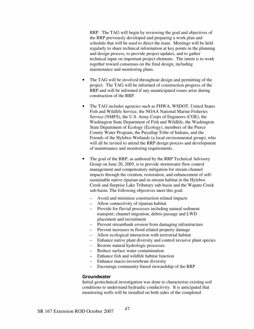
SR 167 Extension ROD October 2007 47
RRP. The TAG will begin by reviewing the goal and objectives of
the RRP previously developed and preparing a work plan and
schedule that will be used to direct the team. Meetings will be held
regularly to share technical information at key points in the planning
and design process, to provide project updates, and to gather
technical input on important project elements. The intent is to work
together toward consensus on the final design, including
maintenance and monitoring plans.
• The TAG will be involved throughout design and permitting of the
project. The TAG will be informed of construction progress of the
RRP and will be informed if any unanticipated issues arise during
construction of the RRP.
• The TAG includes agencies such as FHWA, WSDOT, United States
Fish and Wildlife Service, the NOAA National Marine Fisheries
Service (NMFS), the U.S. Army Corps of Engineers (COE), the
Washington State Department of Fish and Wildlife, the Washington
State Department of Ecology (Ecology), members of the Pierce
County Water Program, the Puyallup Tribe of Indians, and the
Friends of the Hylebos Wetlands (a local environmental group), who
will all be invited to attend the RRP design process and development
of maintenance and monitoring requirements.
• The goal of the RRP, as authored by the RRP Technical Advisory
Group on June 20, 2005, is to provide stormwater flow control
management and compensatory mitigation for stream channel
impacts through the creation, restoration, and enhancement of self-
sustainable native riparian and in-stream habitat in the Hylebos
Creek and Surprise Lake Tributary sub-basin and the Wapato Creek
sub-basin. The following objectives meet this goal:
– Avoid and minimize construction related impacts
– Allow connectivity of riparian habitat
– Provide for fluvial processes including natural sediment
transport, channel migration, debris passage and LWD
placement and recruitment
– Prevent streambank erosion from damaging infrastructure
– Prevent increases in flood related property damage
– Allow ecological interaction with terrestrial habitat
– Enhance native plant diversity and control invasive plant species
– Restore natural hydrologic processes
– Reduce surface water contamination
– Enhance fish and wildlife habitat function
– Enhance macro-invertebrate diversity
– Encourage community-based stewardship of the RRP
Groundwater Initial geotechnical investigation was done to characterize existing soil
conditions to understand hydraulic conductivity. It is anticipated that
monitoring wells will be installed on both sides of the completed

SR 167 Extension ROD October 2007 48
embankment to monitor groundwater. Additional field testing of vertical
and horizontal flows under embankments is planned prior to
construction.
Wetlands
Construction
FHWA and WSDOT will continue to consult with the project
cooperating agencies, the COE, and the City of Fife through the
permitting and construction phase of this project.
FHWA and WSDOT are examining opportunities to support watershed
restoration activities as alternative mitigation. WSDOT will pursue
partnerships with other agencies, the Tribe, and non-profit groups
interested in the Hylebos and Wapato Creek watersheds. WSDOT is
pursuing all funding opportunities for enhancing mitigation.
WSDOT will coordinate wetland mitigation site design with the TAG if
wetland mitigation sites adjacent to the RRP areas are selected. WSDOT
will coordinate wetland mitigation site design with Friends of Hylebos
Wetlands for mitigation sites that may be selected within the Hylebos
Watershed.
Avoidance and Minimization Efforts Wetland impacts have been minimized to the greatest extent practicable
based on preliminary design. FHWA and WSDOT will strive to
incorporate additional minimization measures as project design is
completed. Potential opportunities to incorporate additional avoidance
and minimization measures may include (but are not limited to):
• Making minor changes to design alignment;
• Using steeper fill slopes;
• Using retaining walls to eliminate fill slopes;
• Using culverts to hydrologically connect wetlands bisected by the
highway;
• Using a bridge design that spans the Puyallup River, avoiding the
placement of a pier within the river.
Wetland Delineations • Before initiating permitting or preparing a final wetland mitigation
plan, WSDOT intends to reevaluate all wetlands affected by this
project, including revisiting wetland delineation and categorizations
over three years old.
• Prior to construction, the COE will review the final wetland
delineation and categorization in the field.

SR 167 Extension ROD October 2007 49
• Guidance on ditches resulting from the recent U.S. Supreme Court
decision (referred to as the Talent decision) has recently become
available. Therefore, before initiating permitting, these areas will be
examined to determine if they are jurisdictional under the Clean
Water Act Section 104 Program.
Final Mitigation Plan • A final wetland and stream fill mitigation plan will be developed for
this project. The final mitigation plan will compensate for any
unavoidable impacts on wetlands and buffers.
• WSDOT will select one or more preferred wetland mitigation site
after the ROD is issued and before permitting and a final mitigation
plan are completed.
• The general criteria used to identify and evaluate potential wetland
mitigation sites in the Conceptual Mitigation Plan (May 2005) will
continue to be used in the final mitigation plan. The criteria are:
– Watershed focus
– Replacement of functions and values lost
– Habitat connectivity
– Reliable hydrology
– Undeveloped condition
– Uncontaminated
– Stakeholder support
– Satisfies regulatory requirements
• Off-channel habitat potential will be identified at the sites. Off-
channel habitat for fish is the top limiting factor in the Puyallup
River watershed.
Operation
None proposed.
Wildlife, Fisheries, and Threatened and Endangered Species
Construction
• Current federal laws affecting fish and wildlife include NEPA/SEPA,
the Endangered Species Act (ESA), the Federal Fish and Wildlife
Coordination Act, the Magnuson-Stevens Act, and the Migratory
Bird Treaty Act. Current state laws affecting fish and wildlife
include the Revised Code of Washington (HPA) requiring Hydraulic
Project Approval (HPA), the Salmon Recovery Planning Act, and the
Salmon Recovery Funding Act. All pertinent laws will be
considered and complied with during further design and
construction. WSDOT will comply with the State Salmonid
Recovery Plan, being finalized jointly by several state agencies.
WSDOT will work closely with these agencies during mitigation
planning.
SR 167 Extension ROD October 2007 50
During design, WSDOT will continue to use all practicable means to
minimize impacts to habitats. These efforts may include, but not be
limited to:
• Using retaining walls (to prevent fill from entering aquatic habitats);
• Using structures to avoid impacts;
• Refining the alignment by making additional minor shifts to avoid or
minimize impact to wetlands or other important habitats;
• Adding low-cost wildlife crossings and using over-sized culverts or
clear-spanning structures at appropriate locations;
• Installing culverts at stream crossings that will comply with the
project HPAs and will, at minimum, be designed to withstand the
100-year flood event;
• Timing in-water work to avoid adult salmon, Bull Trout, and
steelhead migration, juvenile out-migration, and alevin emergence.
The segment of Hylebos Creek that will be abandoned and filled will be
surveyed for presence of freshwater mussels prior to construction. Any
freshwater mussels present in the filled segment of Hylebos Creek will
be relocated. If it is necessary to relocate mussels during channel filling
and new channel creation, monitoring should ensure relocated mussels
are not being stressed or smothered by sedimentation or flushed
downstream during high flows.
The project would be constructed in stages, sometimes with concurrent
work on more than one stage. This work will be coordinated to minimize
cumulative impacts of fisheries resources to the greatest extent possible.
Coordination with USFWS and NMFS would continue as the project is
prepared for bid and construction in conformance to the requirements of
the ESA. FHWA and WSDOT will ensure that the Biological
Assessment (BA) (September 2005) conclusions are not affected by
any change in ESA species designation or any change in the use of the
action area by threatened or endangered species.
FHWA and WSDOT will apply the minimization measures and
performance standards from the BA and comply with the Terms and
Conditions from the Biological Opinion (BO) when it is approved by the
USFWS and NMFS.
In order to ensure the protection of T&E and MBTA species, a biologist
knowledgeable in the species of plants and wildlife protected by ESA
and the MBTA would survey proposed work areas prior to construction.
If any protected species are found, WSDOT would consult with NMFS,
USFWS, and WDFW as to the best methods to protect and/or relocate
them. Monitoring would continue throughout the construction phase to
maintain compliance. Also, mitigation designed to offset wetland

SR 167 Extension ROD October 2007 51
impacts would also benefit migratory birds. Approximately 50 acres of
new wetlands would be developed as a result of the proposed project.
Air Quality
Construction
A Fugitive Dust Plan will be prepared by the contractor prior to
construction to comply with Puget Sound Clean Air Agency (PSCAA)
regulations. This plan will include mitigation measures that will be
utilized as appropriate to minimize PM10, deposition of particulate
matter, emissions of carbon monoxide and ozone precursors, as well as
other mobile source air toxics during construction. These measures
include:
• Spraying exposed soil with water or other dust palliatives;
• Covering all trucks transporting materials, wetting materials in
trucks, or providing adequate freeboard (space from the top of the
material to the top of the truck);
• Providing wheel washers to remove particulate matter that would
otherwise be carried offsite by vehicles;
• Removing particulate matter deposited on paved, public roads;
• Minimizing delays to traffic during peak travel times;
• Placing quarry spall aprons where trucks enter public roads;
• Graveling or paving haul roads;
• Planting of vegetative cover as soon as possible after grading;
• Minimizing unnecessary idling of on-site diesel construction
equipment;
• Locating diesel engines, motors, or equipment away from existing
residential areas;
• Locating staging areas away from school buildings and playgrounds;
• Utilizing efficient street sweeping equipment at site access points
and all adjacent streets used by haul trucks;
• Limiting hours of operation near sensitive receptor areas and
rerouting the diesel truck traffic away from sensitive receptor areas;
• Coordinating construction activities with the Puyallup Recreation
Center and other sensitive receptor locations.

SR 167 Extension ROD October 2007 52
Puget Sound Clean Air Agency is recommending a voluntary low sulfur
diesel fuel program in the state of Washington. The requirement to use
ultra low sulfur diesel fuel at the time of construction will be considered
depending upon sufficient availability and comparable cost with other
diesel.
Operation
• This project will comply with applicable Environmental Protection
Agency (EPA) requirements for controlling mobile source air toxics.
Noise
Construction
• The contractor will be required by WSDOT to perform noise-
generating activities in the daytime, except when it is essential to
carry out such activities in the night.
• WSDOT contractors will adhere to local noise ordinances. If
nighttime work is necessary, WSDOT and the contractor will apply
for a variance to the noise ordinance from local agencies.
Operation
• A noise barrier will be included in the final design of the preferred
Urban Interchange option, which receives most of its noise from
traffic on SR 167, SR 512, and SR 161.
• FHWA and WSDOT have committed to the Puyallup Tribe of
Indians to provide landscaped noise abatement structures along 48th
Street East to mitigate noise impact to residences on Tribal trust land
• FHWA and WSDOT will assist the Puyallup Tribe of Indians in
locating new businesses to minimize noise and visual impacts
attributable to SR 167 and by sharing noise study data and advising
the Tribe about quiet locations, landscaping, and mitigation
measures.
• WSDOT will retrofit the houses on Tribal trust land near Valley
Avenue with storm windows as mitigation to minimize noise
impacts.
Energy
Construction
None proposed.
Operation
None proposed.
SR 167 Extension ROD October 2007 53
Hazardous Materials
Construction
There are multiple buildings that will be demolished during the
construction of the preferred alternative and/or widening of existing I-5
right-of-way (ROW). It is possible that some of the structures to be
acquired by WSDOT may contain Asbestos Containing Materials (ACM)
and Lead Based Paint (LBP). Prior to acquisition, WSDOT will conduct
an initial site assessment for each property for potential contamination.
FHWA and WSDOT anticipate that building demolitions will primarily
generate non-hazardous construction debris with the exception of ACM
and LBP. Such structures will be sampled and analyzed to determine the
appropriate disposal facility. Mitigation of ACM includes removal and
disposal prior to demolition.
Lead-contaminated paint chips and debris could be generated during
demolition of the steel bridge on the SR 161 crossing of the Puyallup
River. The project will ensure no loose material or debris enters the
water through the use of a containment system.
Underground storage tanks (USTs) will be addressed during project
planning. A magnetometer survey will be conducted prior to
construction if a UST is suspected on site, and all removal and site
assessment activities will follow Ecology’s Underground Storage Tank
Statute and Regulations (Chapter 90-76 RCW, Chapter 173-360 WAC).
FHWA and WSDOT will determine the appropriate strategy to prevent
contamination of Hylebos Creek from the B&L Woodwaste site during
final design, in collaboration with the EPA and Ecology.
Visual
Construction
None proposed.
Operation
Landscape related mitigation measures will be done in accordance with
the Roadside Classification Plan (WSDOT 1996).
Public Services and Utilities
Construction
• WSDOT will determine the locations of utilities within the
construction zone during the design phase. Before construction
begins, utility impacts will be closely evaluated and a determination
made on whether or not to relocate the utility facilities.

SR 167 Extension ROD October 2007 54
• WSDOT will coordinate with the utility owners, such as the Olympic
Pipeline, McChord Pipeline Company, Puget Sound Energy,
QWEST, Tacoma Public Works, and the cities of Fife and Milton, to
minimize impacts to their utilities.
• Construction activities will be coordinated with the Union Pacific
Railroad, the Burlington Northern Santa Fe Railroad, Tacoma Rail,
and the Port of Tacoma to minimize disruption of rail operations
through the project construction areas.
• Impacts to fire, emergency, and police services during construction
will be limited to temporary disruptions of service routes within the
construction zone. Service providers affected by construction will be
notified in advance of the construction period. Police departments,
fire and emergency response services, school districts, and solid
waste providers will be notified of construction schedules, access
restrictions, and possible detour routes prior to access modification.
• Affected businesses and residents will be notified of construction
activities in advance (including any necessary closures and detours),
and reasonable efforts will be made to minimize traffic disruptions
and access revisions during construction.
Operation
None proposed.
Land, Use, Socioeconomics, and Environmental Justice
Construction
• As the design proceeds, opportunities to minimize the impact on
existing land uses will be examined.
• Property owners, whose land will need to meet right-of-way
requirements, will be compensated at the full current market value in
accordance with the Uniform Relocation Act.
Operation
None proposed.
Farmland
Construction
• Consultation and coordination with affected farmers will be
conducted to ensure that disruptions to farming are minimized and
adequate advanced notice of potential disruptions is given. WSDOT
will work individually with each farmer to develop circulation
options for movement of farm equipment and to provide access to
fragmented acreage.

SR 167 Extension ROD October 2007 55
• FHWA and WSDOT will attempt to provide access to local farmers
from local streets by way of access roads and/or easements.
• East of the Puyallup Recreation Center, a developer is proposing to
build a crossing over the SR 167 mainline. The crossing would
connect Valley Avenue to North Levee Road. This crossing would
accommodate the size and type of tractors used in the fields.
Providing access to the crossroad from the fields would allow for the
continued farming of acreage on either side of the roadway. If this
crossing is not already in place at the time of construction, WSDOT
will determine the alternative mitigation for farmland impacts during
the design stage.
Operation
None proposed.
Displacement, Disruption, and Relocation
Construction
• Affected businesses and residences will be notified of construction
activities in advance (including any necessary closures and detours),
and reasonable efforts will be made to minimize traffic disruptions
and access revisions during construction.
• Displacements, disruptions, and replacements will be considered
during the selection of sites for detailed wetland mitigation design.
• Some displacements may be avoided through final design measures,
including the use of retaining walls and other modifications resulting
in reduced ROW requirements. These will be determined during
final design.
• The contractor will be required to follow approved work zone traffic
control plans and contract specifications that minimize disruption
impacts from construction activities.
• Where ROW acquisition is needed, the acquisition and relocation
program will be conducted in accordance with the Uniform
Relocation Assistance and Real Property Acquisition Policies Act of
1970, as amended. In addition, Chapters 8.08, 8.25, and 8.26 of the
Revised Code of Washington govern the process of acquiring
property for ROW.
Operation
None proposed.
SR 167 Extension ROD October 2007 56
Transportation
Construction
Staging, detours and temporary traffic control measures are developed
during the final design of the project. All plans will meet Federal
standards contained in the Manual for Uniform Traffic Control Devices.
The timing and extent of closures and/or detours will be determined in
the design phase of the project. The detour routing plan will also analyze
effects of rerouted traffic on detour routes and develop an operations
plan to mitigate the effects of the increases in traffic.
To the extent possible, traffic disruptions from adjacent local
improvement projects will be coordinated to minimize delay on the
surface streets. I-5 freeway lane closures will be limited to nighttime
periods of low traffic volumes.
WSDOT will continue to coordinate the design in this area with all of the
affected local agencies as the design progresses. WSDOT currently
utilizes the following specific strategies for Transportation Demand
Management (TDM) and will continue to use or enhance these TDM
strategies at project completion:
• Worksite commute trip reduction
• Rideshare information and assistance
• Effective land use zoning and planning
• Regional and local transit service
• Park and ride lots
Transportation System Management elements that will be incorporated
as feasible and per design standard are as follows:
• Signage improvements
• Motorist information systems
• Access control
• HOV lanes
• Channelization improvements
• Signal improvements including synchronization
• Transit system improvements
• Interchange improvements
SR 167 Extension ROD October 2007 57
• Ramp metering
• Traffic camera surveillance
• Traffic incident management
Operation
An Intelligent Transportation System (ITS) may be implemented for this
project in accordance with the WSDOT Olympic Region ITS
Implementation Plan.
Pedestrian and Bike Facilities
Construction
Work zone traffic control plans will take into account non-motorized
route continuity needs including public notification and provisions for
safe detour routes wherever reasonable. Any detour route for non-
motorized traffic indicated on the Traffic Control Plans will be
physically reviewed. The existing surfaces will be repaired within the
project limits to accommodate the special needs of non-motorists.
Operation
FHWA and WSDOT recognize the importance of working
collaboratively with both Pierce County and the City of Fife on the
Pacific National Soccer Park and with the City of Milton on the
Interurban Trail. FHWA and WSDOT will also work closely with the
City of Fife to address impacts to the Lower Hylebos Nature Park,
potentially including access and parking.
FHWA and WSDOT intend to accommodate non-motorized
transportation modes in the project area using best practice design. A
separate multiuse path is planned north of SR 167 approximately from
54th Avenue Interchange to SR 99. The connection of SR 509 and SR
167 will provide for continued bike and pedestrian travel on the existing
facilities of SR 509.
Roadway shoulder improvements will be made to SR 99 at the shared
use path terminus north to 70th Avenue East. Shoulder width will be
widened to not less than 5 feet and sidewalks and curbs will be
considered to control motorized access and provide for safe pedestrian
travel on this regionally recognized bike route.
In 2003, the City of Fife purchased 54 acres in the vicinity of the I-5
interchange for the purpose of developing a soccer park. The City of
Milton Interurban Trail is located in the same area. FHWA and WSDOT
will make every effort to minimize impacts to these properties.
The project will accommodate the Interurban Trail and re-establish the
public access connection to the trail in the vicinity of 70th Avenue East

SR 167 Extension ROD October 2007 58
and I-5. The relocated portion of the trail will be ADA accessible—a
separated Class I or II non-motorized path linking to the City of Fife trail
system. Design modifications to the (Interurban Trail) trailhead
connection will be provided with the realignment of 70th Avenue East.
Mitigation, if necessary, will be provided for any required use of the
developed soccer facility.
FHWA and WSDOT policy is to accommodate non-motorized
transportation modes in the study area using best practice design.
Towards this goal, FHWA and WSDOT follow a number of general
project mitigation measures regarding bicycles and pedestrians:
• Local access roadways within the right-of-way of the SR 167
interchanges will be designed to the local jurisdiction’s design
standards and often will include paved shoulders and/or sidewalks
for bicyclists and pedestrians.
• Local roadways and ramp intersections will, as traffic volumes
warrant, be signalized, to include pedestrian crosswalks and
activated signal systems.
• Local comprehensive plans will again be reviewed prior to
completion of contract plans for construction. This effort will
address non-motorized route continuity both at the local level and
within the project, consistency, and local jurisdiction coordination.
Any such local plans affected by the project and determined to have
been completed, progressed to design or construction phase will be
evaluated and appropriate measures taken to address impacts.
Geotechnical Analysis
A complete geotechnical investigation will be part of the final design of
SR 167.
Cultural Resources
Construction
As design progresses, efforts will be made to avoid or minimize the
impact to cultural and historic resources including the Carson Chestnut
Tree and cultural resources associated with ancient ground surfaces.
The Tier I ROD called for design efforts that attempted to save the
Carson Chestnut Tree. Accordingly, all options at the SR 161 / SR 167
Interchange were designed to avoid this historic tree, which has been
nominated for listing on the Washington Heritage Register. Efforts to
minimize any additional detrimental impacts to the Carson Chestnut Tree
will be made during design and construction.
Additional cultural resource studies will be conducted at wetland
mitigation sites identified for final design. An Archaeological

SR 167 Extension ROD October 2007 59
Monitoring Plan, detailing personnel and methodologies for locating
buried cultural resources potentially associated with ancient ground
surfaces, will be developed during final design. The Puyallup Tribe of
Indians will be consulted prior to any ground disturbing activity in the
Valley Avenue Interchange area.
Operation
A Memorandum of Agreement (MOA) was developed in consultation
with FHWA, SHPO, the Advisory Council on Historic Preservation, and
the Puyallup Tribe of Indians to address adverse effects of the project to
the archeological site and four historic structures. If any unanticipated
archeological resources (resources above and beyond those identified in
the Cultural Resource Survey) are discovered during construction,
appropriate action will be taken including notifying and coordinating
with the Puyallup Tribe of Indians. The MOA stipulates that FHWA will
ensure that the following measures are carried out:
1. WSDOT will plant riparian vegetation on the outer edges of the
proposed ramp curve nearest the 3423 Freeman Road historic
property to minimize visual effects.
2. Historic Property Recordation: WSDOT will consult with the SHPO
regarding appropriate large-format photo documentation to be
consistent with Department of Archaeology and Historic
Preservation Level 2 standards of historic properties (7001 20th
Street East, 6803 20th Street East, and 7717 Valley Avenue East) in
the area of potential effect.
3. NRHP-eligible buildings will be offered for sale for a minimum of
one year to any buyers willing to move the structures.
4. The project will have no adverse effect upon prehistoric site
45PI488, contingent upon WSDOT:
(a) Spanning the site with a bridge whose piers are constructed
outside the known boundaries of the site;
(b) Monitoring construction for cultural resources in the vicinity.
Should cultural resources or human remains be discovered
during bridge construction, procedures will be followed per
below (items 5 and 6).
5. Review of Effects Determination: During final design and prior to
construction of the undertaking, FHWA will review the eligibility
determinations to
(a) Determine if eligible properties retain the qualities that make
them eligible for the National Register of Historic Places;
SR 167 Extension ROD October 2007 60
(b) Determine if non-eligible properties obtained qualities that
would make them eligible for the National Register of Historic
Places (i.e. greater than 50 years old).
6. Amendment of the Agreement: If any of the consulting parties to
this Agreement determine that the terms of the Agreement cannot be
met or believe a change is necessary, they will immediately request
the signatory parties to consider an amendment or addendum which
will be executed in the same manner as the original Agreement. A
copy of the amended Agreement will be filed with the ACHP,
pursuant to 36 CFR 800.6(c) (7).
The City of Fife will be notified prior to the purchase of the historic
properties subject to protection under Section 106 of the National
Historic Preservation Act.
SR 167 Extension ROD October 2007 61
Attachment B
Attachment B-1 Washington Department of Fish and Wildlife (WDFW) letter dated
January 3, 2007.
Attachment B-2 FHWA Response to WDFW dated February 21, 2007.

SR 167 Extension ROD October 2007 62
State of Washington
Department of Fish and Wildlife
Puyallup Field Office, PO BOX 73249 – Puyallup WA, 98373 (253) 848-5113
January 3, 2007
Washington Department of Transportation
ATTN: Jeff Sawyer
P.O. Box 47440
Olympia, WA 98504-7440
RE: FHWA-WA-EIS-2002-02-D, SR167, Puyallup to SR509 DEIS/Tier II FEIS
Dear Mr. Sawyer:
The Washington State Department of Fish and Wildlife (WDFW) has reviewed the above-mentioned
document and offers the following comments at this time. Additional comments may follow as the project
develops in the future.
It appears that the mitigation proposals for project impacts are still in conceptual status. As previously
commented upon in Signatory Agency Committee (SAC) meetings, WDFW is concerned that the land
associated with the conceptual mitigation has not been secured. There have been several conceptual
designs developed for mitigation that are on land that may not be in Washington Department of
Transportation (DOT) ownership.
These mitigation designs have been proposed and comments have been solicited for by DOT on unsecured
mitigation land. If this is the case, the conceptual designs are unlikely options that should not be shared
until secured.
Thank you for the opportunity to provide this information. If you have any questions, please contact me at
(253) 848-5113.
Sincerely,
Travis W. Nelson
WDFW Area Habitat Biologist
TN:tn
cc: WDFW SEPA Coordinator – Teresa Eturaspe
Puyallup Tribe of Indians – Russ Ledley
FOTH – Chris Carrel

SR 167 Extension ROD October 2007 63

SR 167 Extension ROD October 2007 64
SR 167 Extension ROD October 2007 65
Attachment C-1 Letter from City of Milton, Mayor Katrina Asay, to FHWA
Division Administrator Dan Mathis at the FHWA Division Office in Olympia,
Washington, dated January 5, 2007.
Attachment C-2 WSDOT/ FHWA Response to City of Milton.

SR 167 Extension ROD October 2007 66
SR 167 Extension ROD October 2007 67

SR 167 Extension ROD October 2007 68

SR 167 Extension ROD October 2007 69

SR 167 Extension ROD October 2007 70
Attachment D
Attachment D-1 -U.S. Environmental Protection Agency (EPA), Region 10 Letter
dated January 17, 2007
Attachment D-2 FHWA Response to EPA dated March 5, 2007

SR 167 Extension ROD October 2007 71
January 17, 2007
Reply to
Attn Of: ETPA-088 Ref: 93-025-FHW
Ms. Megan P. Hall, Area Engineer
Federal Highway Administration
Washington Division
711 South Capitol Way, Suite 501
Olympia, WA 98501
Dear Ms. Hall:
The U.S. Environmental Protection Agency has reviewed the SR 167 Puyallup to
SR 509 Tier 2 Final Environmental Impact Statement (FEIS) and Section 4(f) Evaluation
(CEQ # 20060491). We are submitting comments in accordance with our responsibilities
under the National Environmental Policy Act (NEPA) and Section 309 of the Clean Air
Act. Thank you for accepting our comments.
Since the Tier 2 Draft EIS was issued in 2003, it is apparent that much work has
been done to improve the NEPA document and we appreciate these improvements. Our
comments regarding specific improvements and remaining issues are provided below.
Document quality: We commend FHWA and the WSDOT for the quality of the
Tier 2 FEIS. It is apparent that the efforts of WSDOT to produce reader-friendly
environmental documents have been fruitful. The organization, writing, presentation, and
content of the FEIS are much improved. We especially appreciate having the affected
environment, environmental consequences, indirect, and cumulative impacts all
contained within Chapter 3 by subject. Also we appreciate the effort to provide maps that
fit on normal size pages, however, legibility may have been compromised as a result. It
may be necessary to return to fold-out maps to improve clarity and readability.
Riparian Restoration Proposal (RRP): We also commend FHWA and
WSDOT for including the Riparian Restoration Proposal, an innovative approach to
stormwater management. As stated in the FEIS, this approach yields many additional
environmental benefits, which are also of social and economic importance. For example,
using the RRP, models predict less severe flooding with the Build Alternative than with
the No Build Alternative. Overall, the RRP provides a range of ecological services and
aesthetic benefits that are difficult to quantify in economic terms, but that are,
nonetheless, substantial. We hope that the RRP will set a new direction for stormwater
management and environmental mitigation.
Stormwater: Analysis and disclosure of stormwater pollutants have been
improved. The FEIS addresses 6 stormwater pollutants and characterizes the anticipated
pollutant loadings, although since data and assumptions used in these projections are a

SR 167 Extension ROD October 2007 72
rough surrogate for actual conditions, field validation would strengthen the tool. This
type of analysis could also be useful when conducting alternative futures scenarios that
would use various degrees of Low Impact Development throughout these watersheds. As
you know from our past comments, EPA strongly supports this kind of effort. Using the
RRP as an example and a significant beginning, we recommend that FHWA and WSDOT
collaborate with local entities (such as the City of Milton, which we understand may have
an interest), to expand efforts to implement environmentally sensitive development,
including low impact development, transit oriented development, smart growth, and other
restoration and sensitive area protection strategies. EPA would be happy to participate in
such a collaboration. We believe that such efforts would substantially offset the proposed
project’s direct, indirect, and cumulative effects, including build out of the project area.
Threatened and endangered species: We understand that the Biological
Opinions for the Endangered Species Act (ESA) Section 7 consultations for Bull Trout
and Chinook salmon are currently being prepared by US Fish and Wildlife Service and
NMFS. We are concerned that the FEIS was issued prior to the release of the Biological
Opinions because the direct, indirect, and cumulative effects to ESA-listed species and
the recommendations for addressing these effects are important to inform the public and
decision making under the NEPA. We recommend that the Biological Opinions be
released to the public well in advance of the issuance of the Record of Decision (ROD),
and that the recommendations of the Services be fully adopted in the ROD for
implementation.
Farmland: EPA remains concerned about the loss of environmentally significant
farmland. While we understand that the Farmland Protection Policy Act does not
authorize the Federal Government to regulate the use of private or non-federal land, the
Act does require Federal agencies to use policies and procedures to minimize the impact
Federal programs have on the unnecessary and irreversible conversion of farmland to
nonagricultural uses. NRCS states that these are the most arable farmlands in the state.
Unfortunately, little has been done to protect this valuable farmland and its associated
ecological and social functions. The FEIS states that WSDOT will work with individual
farmers regarding access to their land. However, the FEIS does not address impacts
regarding saturated soils from hydrological changes due to the project and associated
development, which may shorten the farmers’ growing season significantly, nor does it
address economic impacts, and loss of farming businesses/infrastructure. We also
believe there should be a discussion of the effects to local, regional, and state-wide
agriculture, economic diversity, and sustainability due to the loss of these lands.
Because the direct, indirect, and cumulative impacts of this proposed project
would result in the loss and decline of prime, environmentally significant farmland, we
believe that mitigation for farmland impacts and losses are within the scope of this
project. Thus, we encourage that the collaborative alternative futures analysis mentioned
above explore the need, desire for, and feasibility of protecting and maintaining farmland
within the Puyallup Valley into the future. We recommend that the ROD include
additional mitigation commitments to address the impacts to and loss of farmlands. We
also recommend that FHWA, WSDOT, Port of Tacoma, and other local governments
SR 167 Extension ROD October 2007 73
work collaboratively to preserve farmland acreage in the Puyallup Valley and elsewhere
in Western Washington, using approaches such as direct purchase for preservation, or
donation to a local farmland preservation fund.
Cumulative impacts: “The FEIS includes limited additional analysis, e.g.,
corridor impervious surface analysis, as well as reformatting” (page G-94). We
appreciate inclusion of the information on impervious surface. However, we believe that
additional information is needed to strengthen the cumulative effects analysis. As
recommended under “Threatened and Endangered Species” above, releasing a summary
of the findings from the ESA Biological Opinions from USFWS and NMFS for affected
fish species before issuance of the ROD would be helpful in the consideration of
cumulative impacts. We hope that the conservation measures will also benefit additional
resources highlighted in the cumulative effects analysis.
Indirect impacts: EPA, FHWA, and WSDOT are in the process of working out
mutually agreeable approaches to analyzing indirect impacts appropriate to the project
and the area, including induced travel and induced growth; this project will inform that
process. This FEIS does not address induced travel demand. We understand that the
Puget Sound Regional Council (PSRC) analysis addressed induced travel demand, but the
FEIS does not include information from that discussion. We believe that this kind of
information is important to include in a project level analysis so that decision makers and
the public can understand the interplay of the effects of the project in the context of
planned growth. EPA believes that further study is needed to determine what is and is
not accounted for at the regional scale, and the extent to which reliance upon the PSRC
analysis is appropriate for addressing project-specific effects. At a minimum, the EIS
should disclose indirect effects, including induced travel demand, and explain the specific
method by which these indirect effects were analyzed by PSRC. We also believe that the
scope of an indirect effects analysis should include the entire project. This EIS looked
only at the interchanges (up to ¼ mile from interchange ROW boundaries, p. 3-108),
which could be appropriate if the project involved only new interchanges. This focus
may have been in response to the Signatory Agency Committee (SAC) Concurrence
Point 2 request for analyzing the effects of the Valley Avenue interchange, but the EIS
does not indicate this purpose.
The FEIS states (p. 3-16) that the project would not induce unplanned regional
growth; however, it would enable growth, and would affect the rate, timing, and
location/pattern of development, and that it causes a ripple effect that is translated across
the basin (p. 3-78 to 3-80). Findings are that with the Build Alternative, development is
concentrated near the interchanges and the new roadway; with No Build, development is
concentrated near I-5 and the Port of Tacoma, resulting in slower and less intense
development in farmland areas. Also, similar to the level of growth impacts, the EIS
does not show differences in impervious surface, groundwater effects, or impacts to
wetlands between the Build and No Build alternatives. The response to EPA comments
(F02-026) states that: “The rate of change would potentially be different; however, the
ultimate impact to wetlands would not be substantively different.” We agree that the
project would affect rate, timing, and location of growth. If the rate of growth is increased

SR 167 Extension ROD October 2007 74
as a result of the project, it stands to reason that the overall growth of the area may
exceed that which is accounted for.
This kind of information would be useful early in the process, both for local land
planning decisions and transportation project decisions. To learn from this example, we
recommend monitoring the rate, timing, and pattern of development in this area as well as
the land use changes, such as additional annexations, rezones, UGA expansions, etc. that
occur over specific timeframes. This assessment could also potentially be done for other
comparable projects in Washington State that have completed the NEPA process.
Air Toxics: We are pleased that the FEIS includes commitments to implement
several mitigation measures to lessen the impacts of air toxics during project
construction. We also appreciate that the FEIS contains more information regarding
Mobile Source Air Toxics (MSATs) and their human health effects. However, we
remain concerned that there are no hot spot analyses for air toxics, no project-wide
identification and disclosure of sensitive receptors that would potentially be affected by
the proposed project, and there is no indication that MSATs were discussed with potential
sensitive receptors, such as the Puyallup Tribe, the Puyallup Recreation Center, nearby
schools, daycare and/or senior centers, etc. However, the construction mitigation
measures indicate awareness of and intent to mitigate MSAT emissions near residential
areas, school buildings and playgrounds, the Puyallup Recreation Center, and other
unspecified sensitive receptor locations.
With respect to hot spot analysis, we note that the FHWA guidance threshold of
140,000 vehicles per day would exclude most transportation projects, including major
port projects such as this. Analysis should include the direct, indirect, and cumulative
effects of project area sources of air toxics, including marine vessels, construction
equipment, heavy truck traffic, cars, and commercial/industrial emitters. At a minimum,
we recommend that the sensitive receptors identified for noise also be informed regarding
MSATs.
Wetlands and mitigation: We appreciate the responsiveness of FHWA and
WSDOT in presenting wetlands information according to the different sub-watersheds.
For historic wetland losses, the FEIS states that there has been a 90% loss in Washington
urban areas as a whole (p. 3-110), although, we did not find a characterization of historic
losses of wetlands and wetland functions by sub-watershed, except for some information
pertaining to Hylebos watershed (p. 3-114). The direct project wetlands impacts
information is presented according to interchange options. This helps to compare the
options, but is less helpful for determining sub-watershed impacts and mitigation needs.
To facilitate the evaluation of impacts and needed mitigation for the detailed mitigation
plan, we recommend that the information regarding wetlands impacts (type, acres,
functions, values, category, etc.) be summarized in one table, if possible, according to
sub-watershed.
In response to our concerns regarding the UPRR wetland mitigation site, we
appreciate that ten potential sites have now been identified, some of which are included

SR 167 Extension ROD October 2007 75
in the affected sub-watersheds. As detailed mitigation plans are developed, we
recommend that FHWA and WSDOT continue coordination with resource agencies
regarding the selection of mitigation sites. We also ask that the functions and values of
buffers be evaluated and compensated as much as possible in mitigation plans.
Wildlife: We are pleased that, due to the RRP, there has been more recognition
of the importance of habitat connectivity. However, we are concerned that while the
FEIS states that wildlife crossings will be considered, it makes no commitments to
provide crossings. The FEIS further limits this consideration to low-cost wildlife
crossings, such as for amphibians and reptiles. Medium and large mammals inhabit the
area and may increase with the establishment of the RRP and better connectivity with the
broader habitat network. Thus, we recommend that there be more commitment to
wildlife passage.
For example, in addition to small animal crossings, we recommend that the stream
crossings span, either with enlarged culverts or bridge structures, enough upland to allow
passage of medium and large mammals. Since design for each new stream crossing is to
provide for 100 year storm events, these structures could also provide additional upland
or an elevated ledge to accommodate terrestrial mammals. We recommend that all
aquatic crossings within the connected network of habitat affected by this project (of
which the RRP is a part) have wildlife crossings that are viable for the range of species
using the areas.
Transportation Demand Management (TDM), pedestrian/bicycle facilities: We are pleased that two Park and Ride lots are planned at interchanges, but concerned
that the construction of them is not included in the project (p. S-8). We recommend that
there be a firm commitment to the implementation of this important TDM measure, as
well as activation of the HOV lanes in concert with the park and ride lots, in the ROD.
It remains unclear whether there will be a pedestrian crossing near the Puyallup
Recreation Center. The preferred Urban SR 161 interchange includes an overcrossing
east of the Recreation Center, but it is not stated whether this locale is useful for the
Recreation Center. Also, there is no firm commitment by the Developer to provide a
crossing near the Recreation Center and what its location would be.
Noise: We did not see a map in the FEIS showing where the one noise barrier
wall would be built near the preferred Urban Interchange option, nor where sensitive
noise receptors are located. At the Puyallup Recreation Center, the City of Fife was
consulted, but it is not clear whether the Recreation Center officials and citizens
concurred that noise would not be a factor. We recommend that these parties be
consulted regarding noise (as well as air pollution) issues.
Similarly, more information and firm commitments are needed in the ROD
regarding the noise impacts and intended mitigation for the Puyallup Tribe. We note that
there is improved coordination with the Tribe (p. G-96), but it is not clear whether or not
SR 167 Extension ROD October 2007 76
the commitments to the Tribe regarding noise have been fully met. Please clarify what is
meant by “landscaped noise abatement structures”, since they are not a wall.
Environmental Justice: The FEIS states there is no disproportionate impact,
however, the data gathered indicate significant low income and minority populations
exist in the project area. In addition, the school children data indicate that low income
and minorities may exceed the County average (22%). It appears that school children
data may be more informative than the census data in determining low income and/or
minority populations. We recommend further examination of this issue to determine if
more outreach to these populations is warranted. It is important to note that
disproportionate impacts are not limited to housing displacements. All community
health, social, environmental, and economic impacts are of concern and should be
considered when making conclusions about disproportionate impacts.
We thank the project proponents for their ongoing coordination with the Puyallup
Tribe. We urge that all of the Tribe’s concerns and impacts be adequately addressed and
that they be fully informed regarding potential project impacts, including air toxics and
criteria pollutants.
Monitoring: Some water quality data were added to the FEIS, but no monitoring
was performed to fill data gaps, e.g., for Old Oxbox Lake Ditch and Surprise Lk Drain.
Since the RRP is innovative, we recommend that there be monitoring to document the
results of this effort, and that adequate baseline information be provided to effectively
document changes over time.
Context Sensitive Solutions, Use of Native Plants: Context sensitive solutions
apply to both facility siting and design. We continue to recommend attention to this
concept, as we believe that it is important to the livability and sustainability of the project
area, and the broader region.
The FEIS states that the WSDOT Roadside Classification Manual will be used,
and that native plants will be used in the RRP (p. G-95). We recommend that additional
use of native plants be incorporated for roadside use wherever appropriate, and that
invasive species be controlled in an effective and environmentally sensitive manner.
Thank you for the opportunity to comment and for the many improvements to the
EIS. We look forward to working with FHWA and WSDOT on this and future projects.
If you have questions or would like to discuss these comments, please contact Elaine
Somers of my staff at 206/553-2966.
Sincerely,
/s/
Christine B. Reichgott, Manager
NEPA Review Unit
SR 167 Extension ROD October 2007 77

SR 167 Extension ROD October 2007 78

SR 167 Extension ROD October 2007 79

SR 167 Extension ROD October 2007 80

SR 167 Extension ROD October 2007 81

SR 167 Extension ROD October 2007 82

SR 167 Extension ROD October 2007 83
Attachment E-1 Letter from Pierce County dated January 4, 2007.
Attachment E-2 Summary of Meeting January 30, 20007 between WSDOT and
Pierce County to discuss issues related to bicycle trails and access through the I-
5/SR 167 interchange.
Attachment E-3 Pierce County letter dated March 13, 2007 response to meeting
with WSDOT.

SR 167 Extension ROD October 2007 84

SR 167 Extension ROD October 2007 85
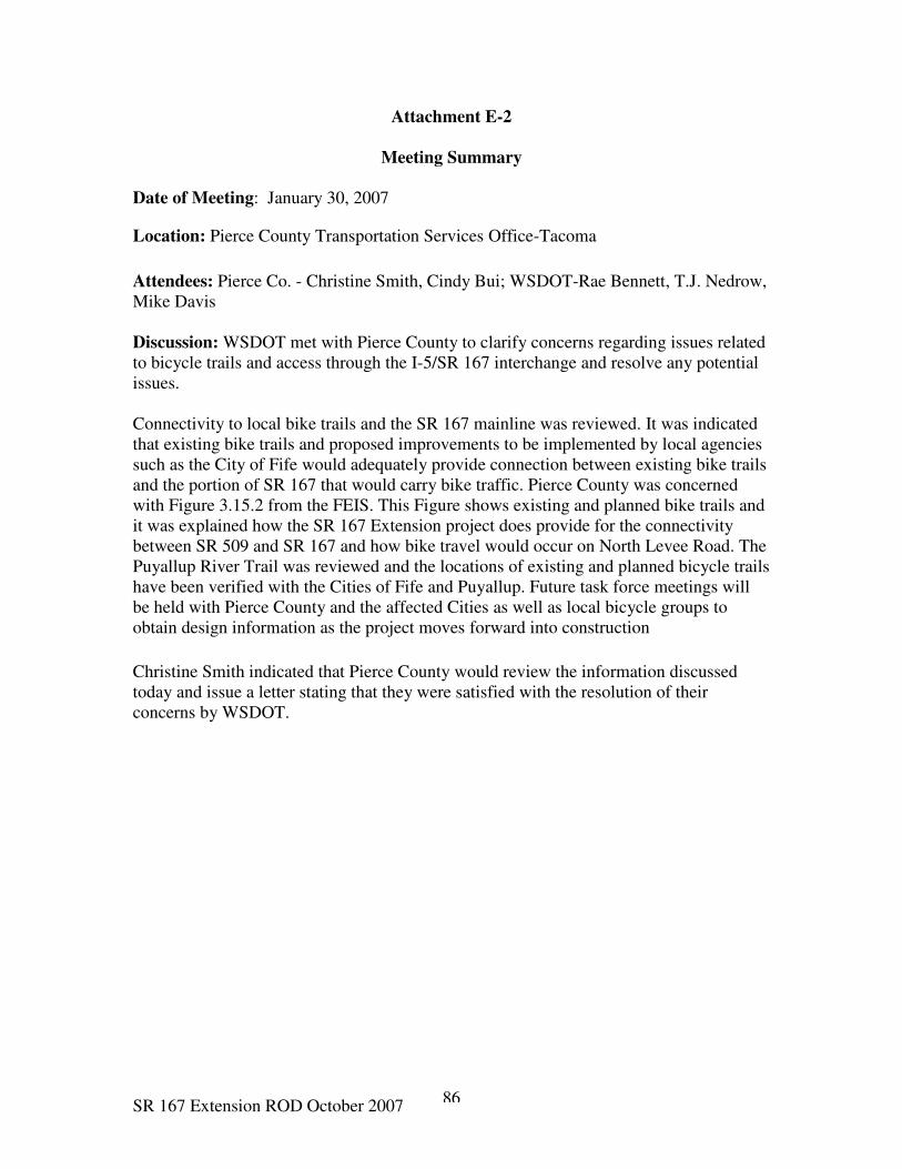
SR 167 Extension ROD October 2007 86
Attachment E-2
Meeting Summary
Date of Meeting: January 30, 2007
Location: Pierce County Transportation Services Office-Tacoma
Attendees: Pierce Co. - Christine Smith, Cindy Bui; WSDOT-Rae Bennett, T.J. Nedrow,
Mike Davis
Discussion: WSDOT met with Pierce County to clarify concerns regarding issues related
to bicycle trails and access through the I-5/SR 167 interchange and resolve any potential
issues.
Connectivity to local bike trails and the SR 167 mainline was reviewed. It was indicated
that existing bike trails and proposed improvements to be implemented by local agencies
such as the City of Fife would adequately provide connection between existing bike trails
and the portion of SR 167 that would carry bike traffic. Pierce County was concerned
with Figure 3.15.2 from the FEIS. This Figure shows existing and planned bike trails and
it was explained how the SR 167 Extension project does provide for the connectivity
between SR 509 and SR 167 and how bike travel would occur on North Levee Road. The
Puyallup River Trail was reviewed and the locations of existing and planned bicycle trails
have been verified with the Cities of Fife and Puyallup. Future task force meetings will
be held with Pierce County and the affected Cities as well as local bicycle groups to
obtain design information as the project moves forward into construction
Christine Smith indicated that Pierce County would review the information discussed
today and issue a letter stating that they were satisfied with the resolution of their
concerns by WSDOT.
SR 167 Extension ROD October 2007 87