
RDL Presents Upcycling St. Clair
94
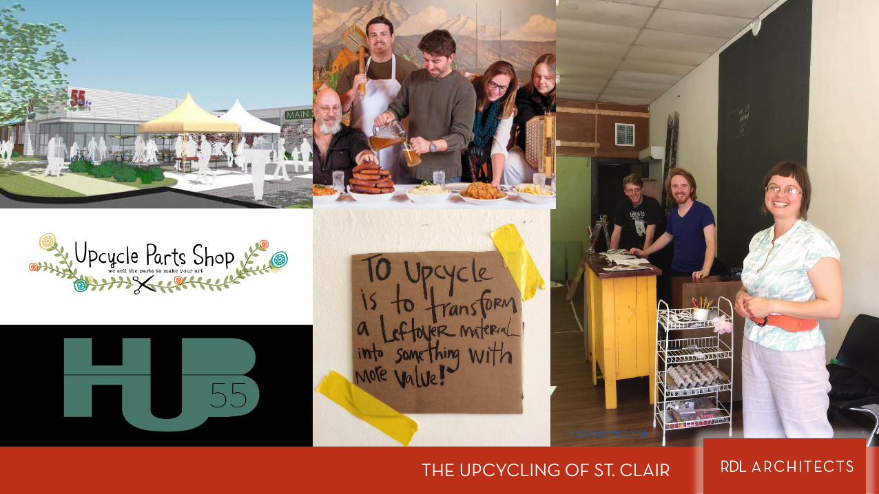
THE UNION THE UPCYCLING OF ST. CLAIR © 2015 All Rights Reserved.
-
Upload
rdl-architects -
Category
Design
-
view
58 -
download
0
Transcript of RDL Presents Upcycling St. Clair
THE UNIONTHE UPCYCLING OF ST. CLAIR
© 2015 All Rights Reserved.
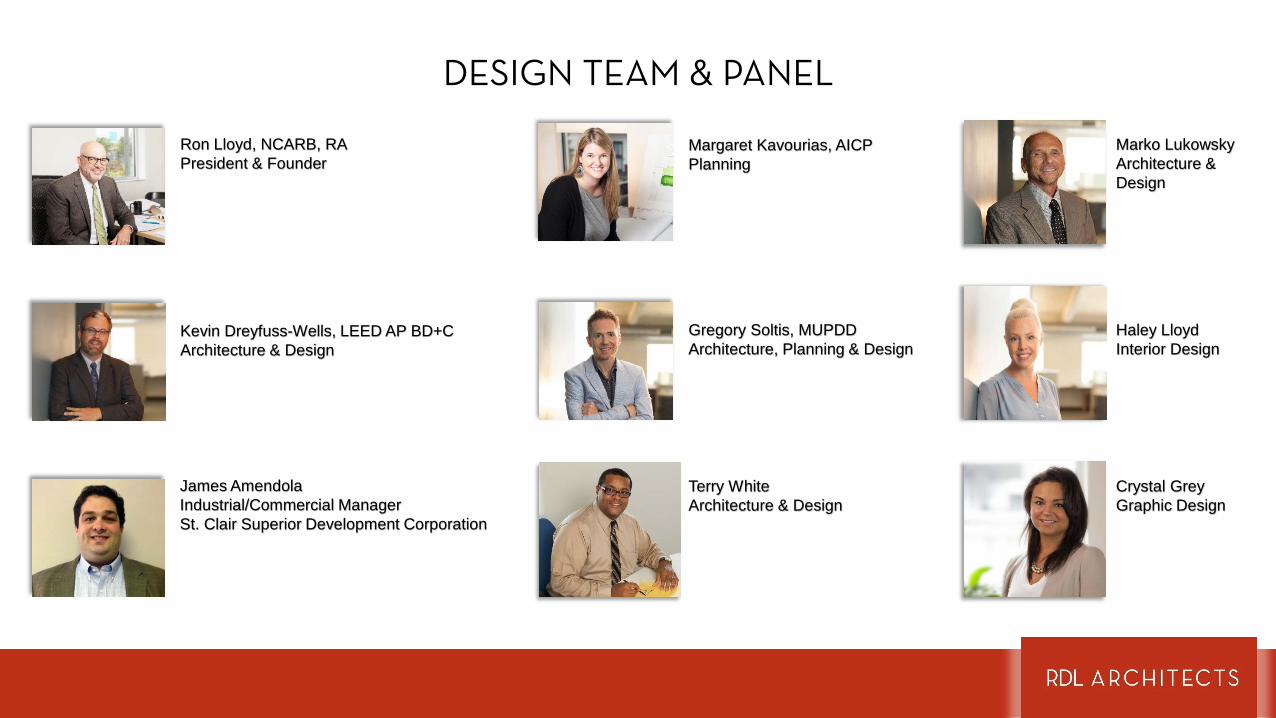
DESIGN TEAM & PANEL
Ron Lloyd, NCARB, RAPresident & Founder
Margaret Kavourias, AICPPlanning
Kevin Dreyfuss-Wells, LEED AP BD+CArchitecture & Design
Gregory Soltis, MUPDDArchitecture, Planning & Design
James AmendolaIndustrial/Commercial Manager St. Clair Superior Development Corporation
Haley LloydInterior Design
Crystal GreyGraphic Design
Marko LukowskyArchitecture & Design
Terry WhiteArchitecture & Design
Analysis of St. Clair Revealed St. Clair is one of the oldest neighborhoods in Cleveland. More than 50% of
the built environment dates before the 1920s. The neighborhood’s physical infrastructure is still relatively intact. Despite this, there are only five sites landmarked and protected, one is a park, three are existing buildings and one was East Madison School, an historic building that was demolished due to the state’s policies regarding school funding.
While the neighborhood is ringed by recreational greenspace, including the Cultural Gardens in Rockefeller Park and Gordon Park on Lake Erie, there is none within the core of the neighborhood.
The neighborhood has many vacant parcels, especially around its periphery near Superior Avenue and Rockefeller Park.
While St. Clair became the neighborhood it is largely because of jobs provided by industry; that same industry creates a ¼ mile-wide barrier from the area’s greatest asset, Lake Erie. There are only two points of connection to Lake Erie from the commercial and residential areas of St. Clair.
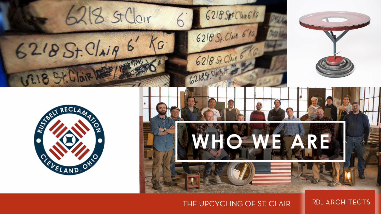
St. Clair has an abundance of upcycle and ethnic/culturally historic assets relevant to the entire metropolitan area.
SUMMARY
RDL’s Intervention Plan Addresses the Issues Identified in the Analysis by:
Leveraging Grdina Park, a vacant parcel left from the demolition of a East Madison School, and the parking lot in front of St. Vitus Church to create a memorial park and additional park spaces for daytime workers and residents.
Linking new greenspace in the core of the neighborhood to the greenspace on the edges with multimodal transit options; pedestrian designed and scaled streets that accommodate bikes, automobiles and public transit.
Creating a historic district that incorporates commercial and residential sections of the neighborhood. The goal is to encourage new residential settlement and a greater identity within the region as a destination for culture and recreation. Additionally, the historic district will signal to business owners and residents the value of their investment.
Branding the neighborhood to the greater Cleveland region as an “Upcycle Neighborhood”.
SUMMARY
About St. ClairThe Neighborhood and it’s Community Development Corporation
BACKGROUND
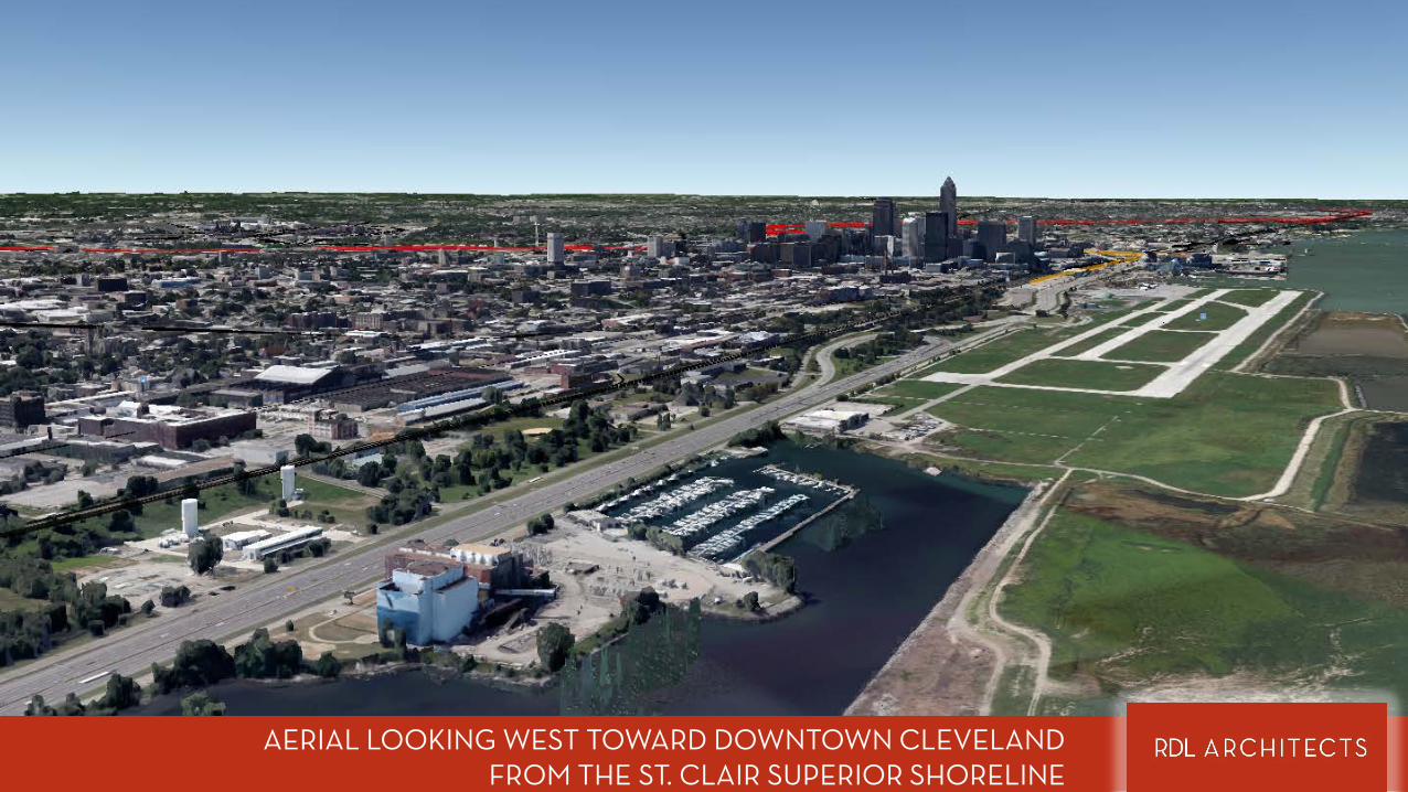
AERIAL LOOKING WEST TOWARD DOWNTOWN CLEVELAND FROM THE ST. CLAIR SUPERIOR SHORELINE
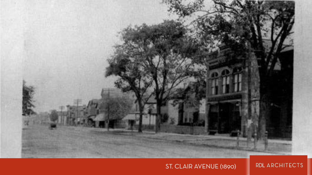
ST. CLAIR AVENUE (1890)
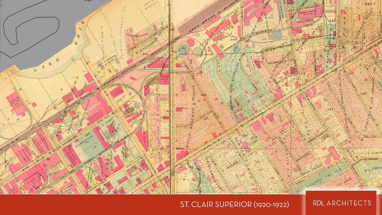
ST. CLAIR SUPERIOR (1920-1922)
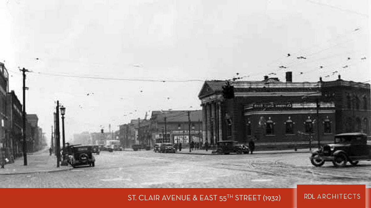
ST. CLAIR AVENUE & EAST 55TH STREET (1932)
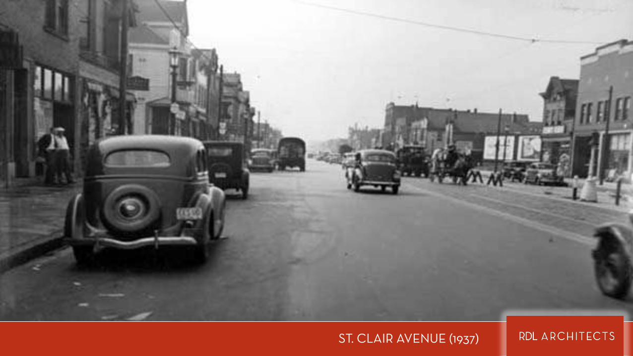
ST. CLAIR AVENUE (1937)
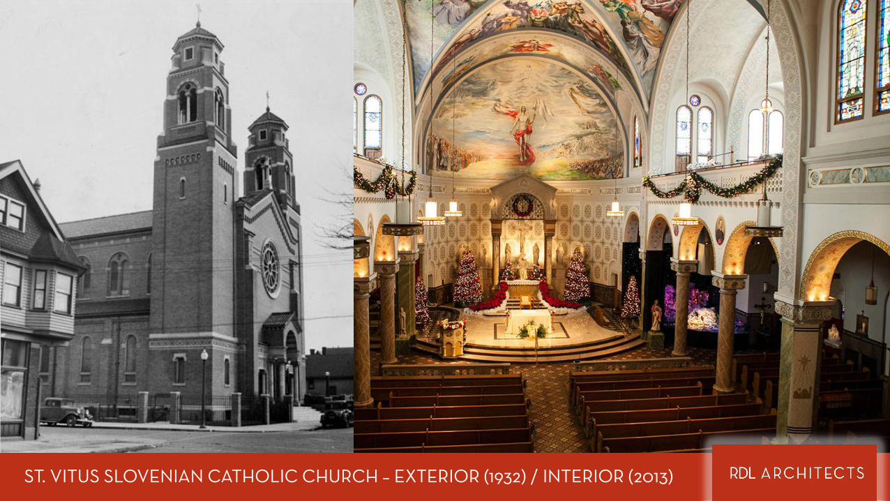
ST. VITUS SLOVENIAN CATHOLIC CHURCH – EXTERIOR (1932) / INTERIOR (2013)
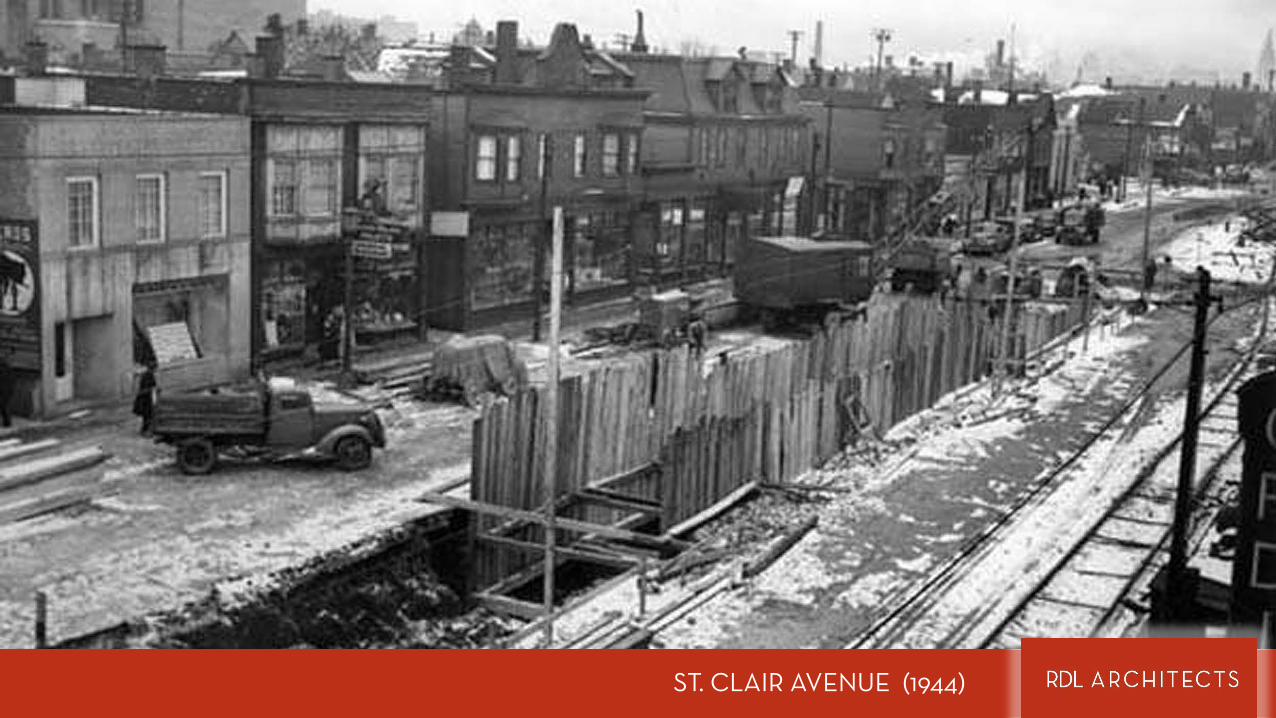
ST. CLAIR AVENUE (1944)
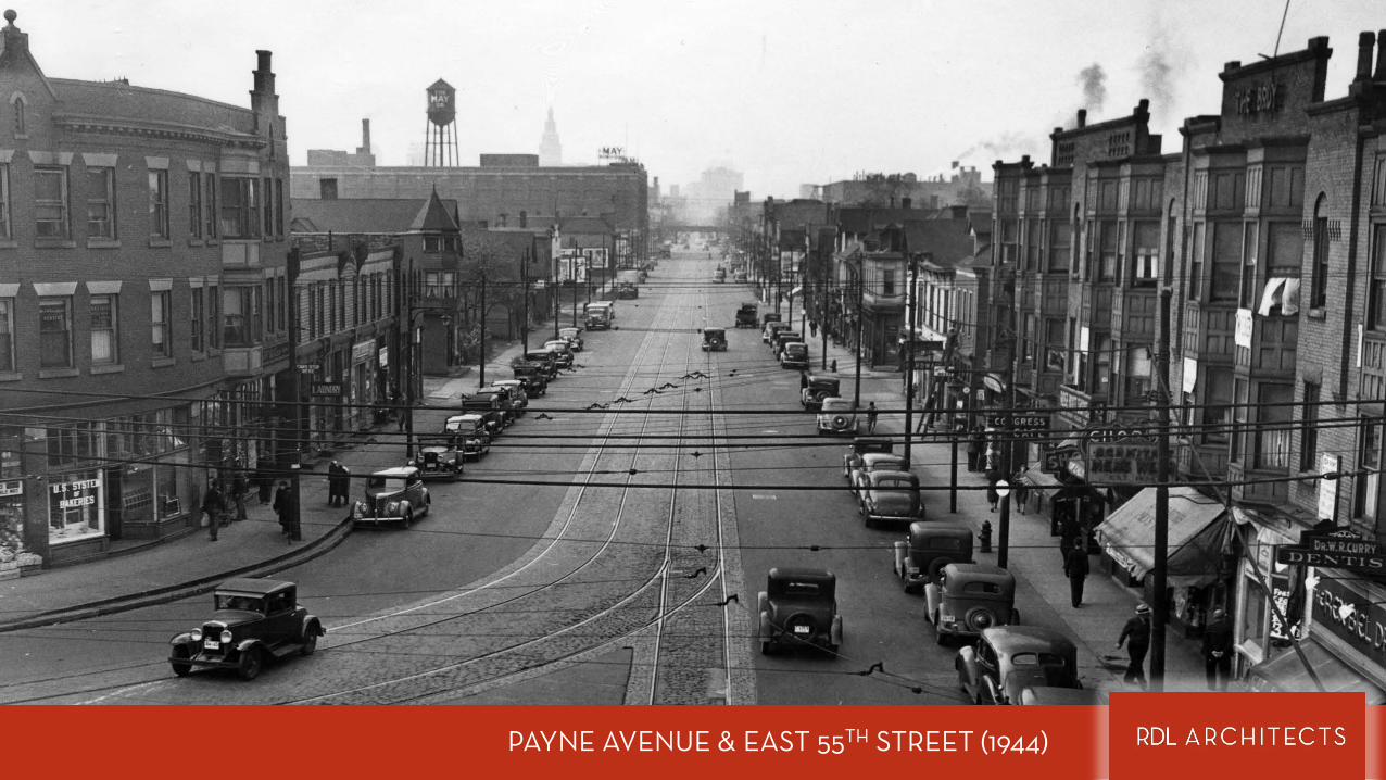
PAYNE AVENUE & EAST 55TH STREET (1944)
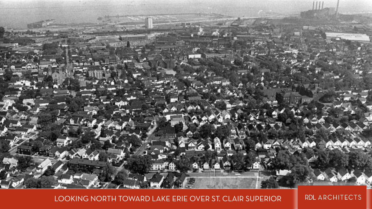
LOOKING NORTH TOWARD LAKE ERIE OVER ST. CLAIR SUPERIOR
EXPLORING ST CLAIR
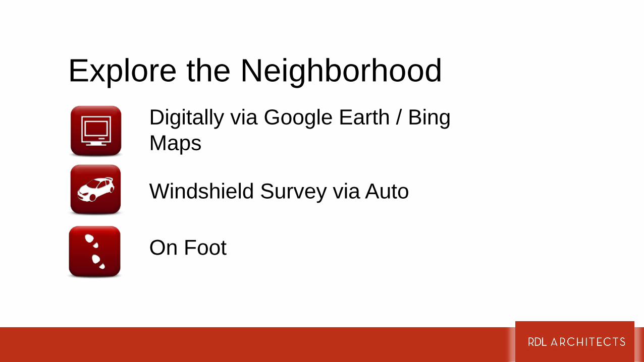
Explore the NeighborhoodDigitally via Google Earth / Bing Maps
Windshield Survey via Auto
On Foot

ST CLAIR SUPERIOR AND SURROUNDING NEIGHBORHOODS
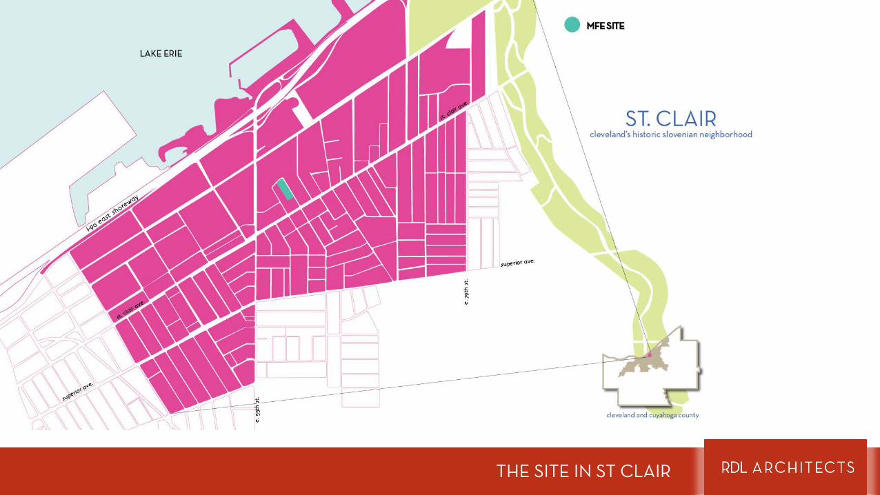
THE SITE IN ST CLAIR
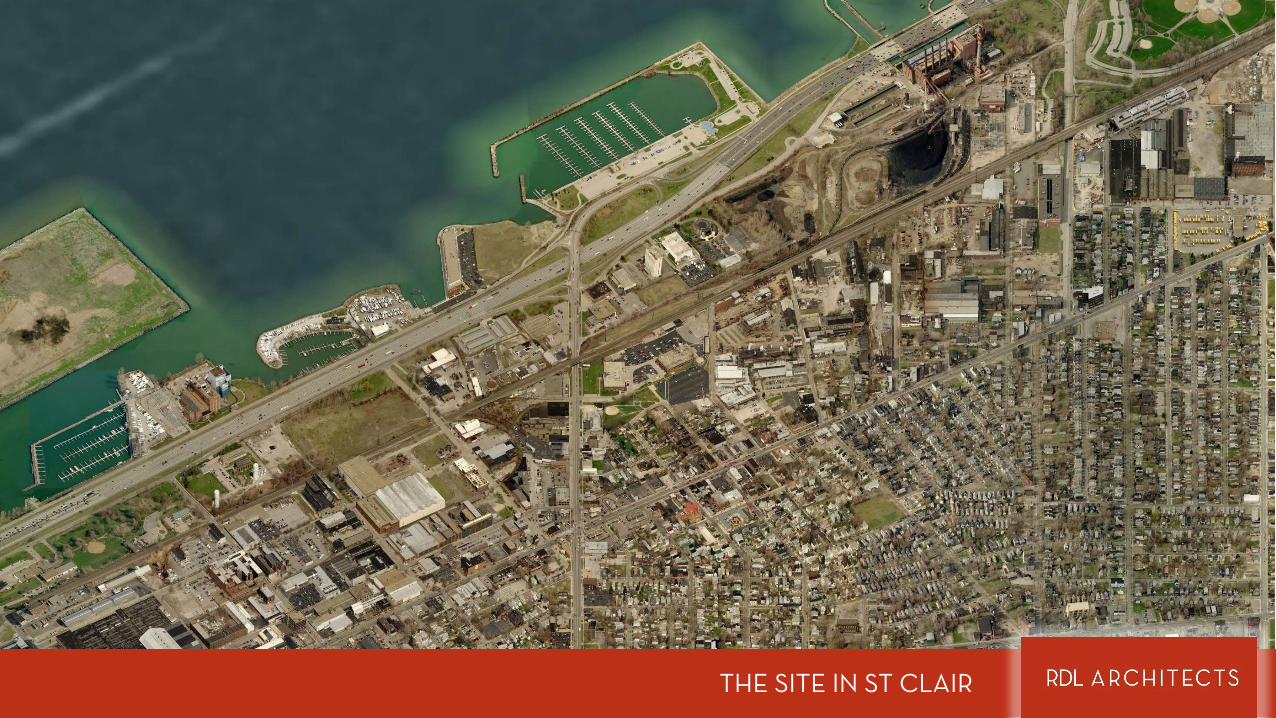
THE SITE IN ST CLAIR

THE SITE IN ST CLAIR
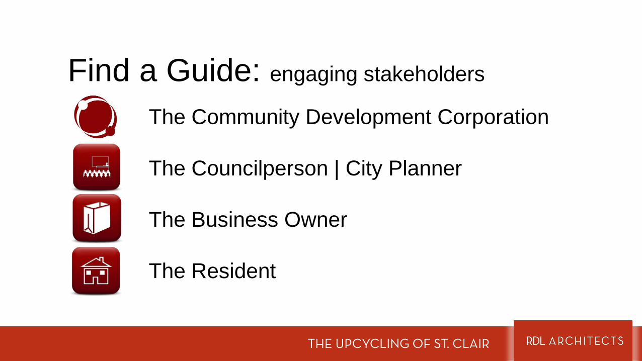
Find a Guide: engaging stakeholders
The Community Development Corporation
The Councilperson | City Planner
The Business Owner
The Resident
THE UPCYCLING OF ST. CLAIR
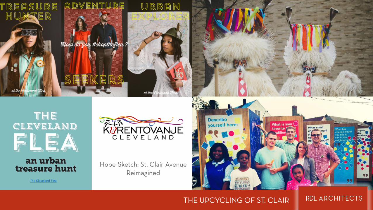
exploring st clair’s assets
THE UPCYCLING OF ST. CLAIR
Hope-Sketch: St. Clair Avenue Reimagined
THE UPCYCLING OF ST. CLAIR
The Cleveland Flea
THE UPCYCLING OF ST. CLAIR
THE UPCYCLING OF ST. CLAIR
THE UPCYCLING OF ST. CLAIR
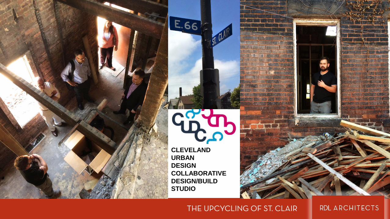
CLEVELAND URBAN DESIGN COLLABORATIVEDESIGN/BUILD STUDIO
THE UPCYCLING OF ST. CLAIR
ANALYZING ST CLAIR
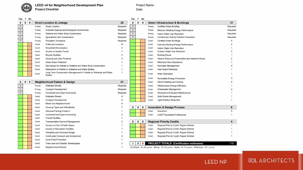
LEED NP
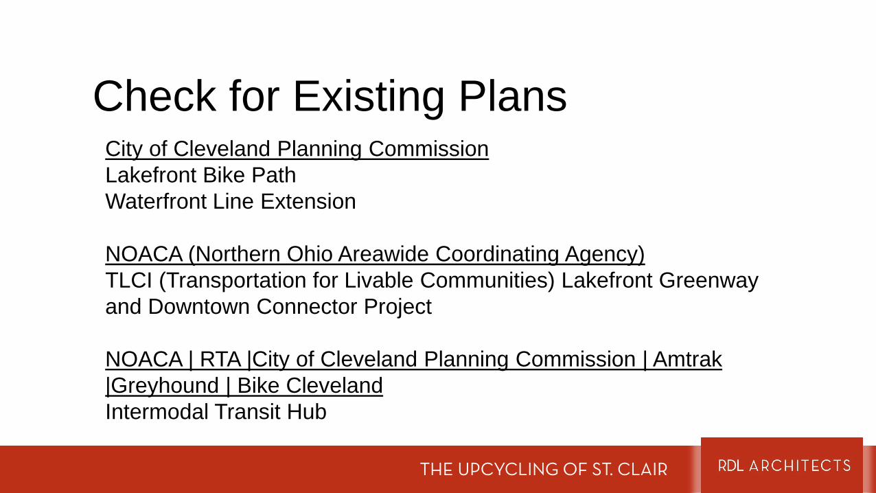
Check for Existing Plans
THE UPCYCLING OF ST. CLAIR
City of Cleveland Planning CommissionLakefront Bike PathWaterfront Line Extension
NOACA (Northern Ohio Areawide Coordinating Agency)TLCI (Transportation for Livable Communities) Lakefront Greenway and Downtown Connector Project
NOACA | RTA |City of Cleveland Planning Commission | Amtrak |Greyhound | Bike ClevelandIntermodal Transit Hub
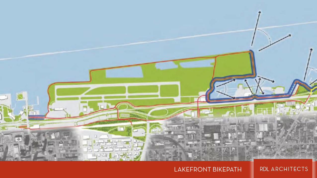
LAKEFRONT BIKEPATH

INTERMODAL TRANSIT HUB
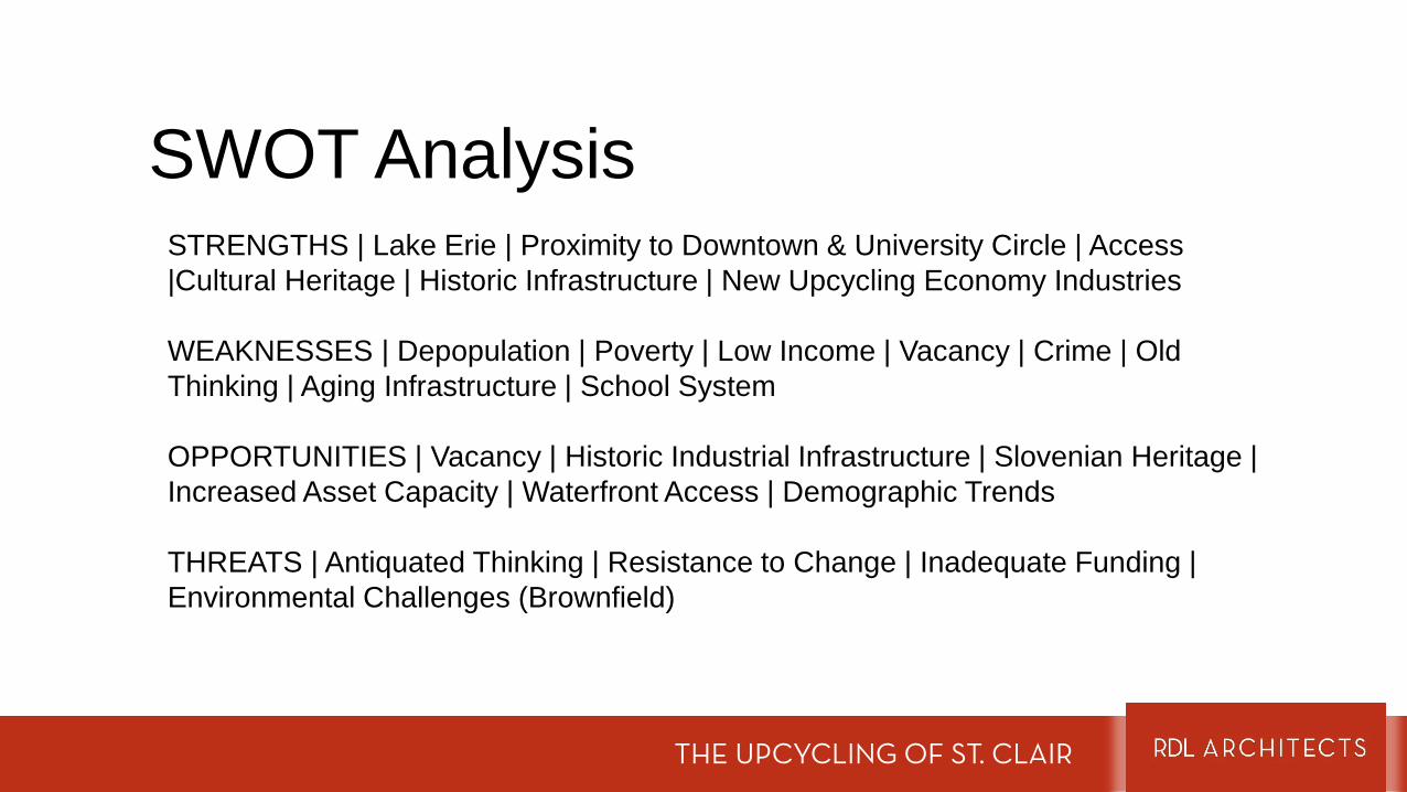
SWOT AnalysisSTRENGTHS | Lake Erie | Proximity to Downtown & University Circle | Access |Cultural Heritage | Historic Infrastructure | New Upcycling Economy Industries
WEAKNESSES | Depopulation | Poverty | Low Income | Vacancy | Crime | Old Thinking | Aging Infrastructure | School System
OPPORTUNITIES | Vacancy | Historic Industrial Infrastructure | Slovenian Heritage | Increased Asset Capacity | Waterfront Access | Demographic Trends
THREATS | Antiquated Thinking | Resistance to Change | Inadequate Funding | Environmental Challenges (Brownfield)
THE UPCYCLING OF ST. CLAIR
Map it OutEssential Maps
• Figure Ground – a map of building footprints• Sources
• Your city’s or county’s GIS portal • Google Earth | Bing
• Existing Land Use • Sources
• Your city’s or county’s GIS portal • Google Earth | Bing • First hand experience walking the neighborhood
• Assets• Sources
• Exploration & Guides
THE UPCYCLING OF ST. CLAIR
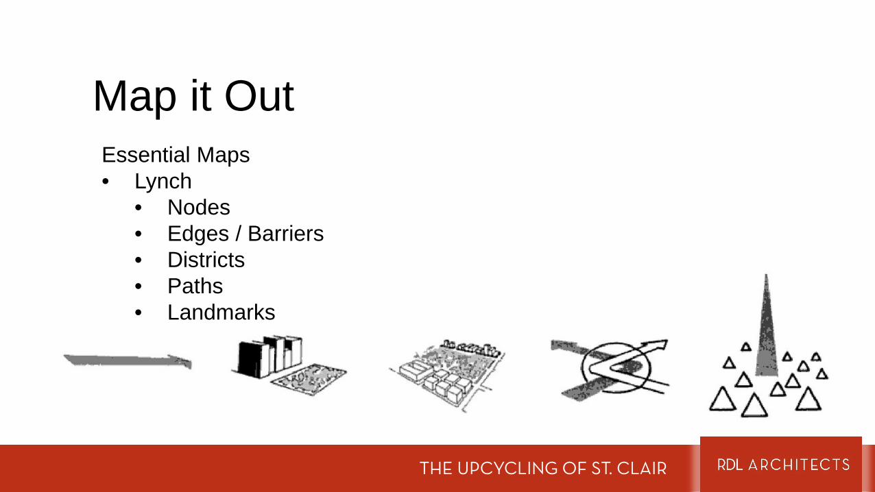
Map it OutEssential Maps• Lynch
• Nodes• Edges / Barriers• Districts• Paths• Landmarks
THE UPCYCLING OF ST. CLAIR
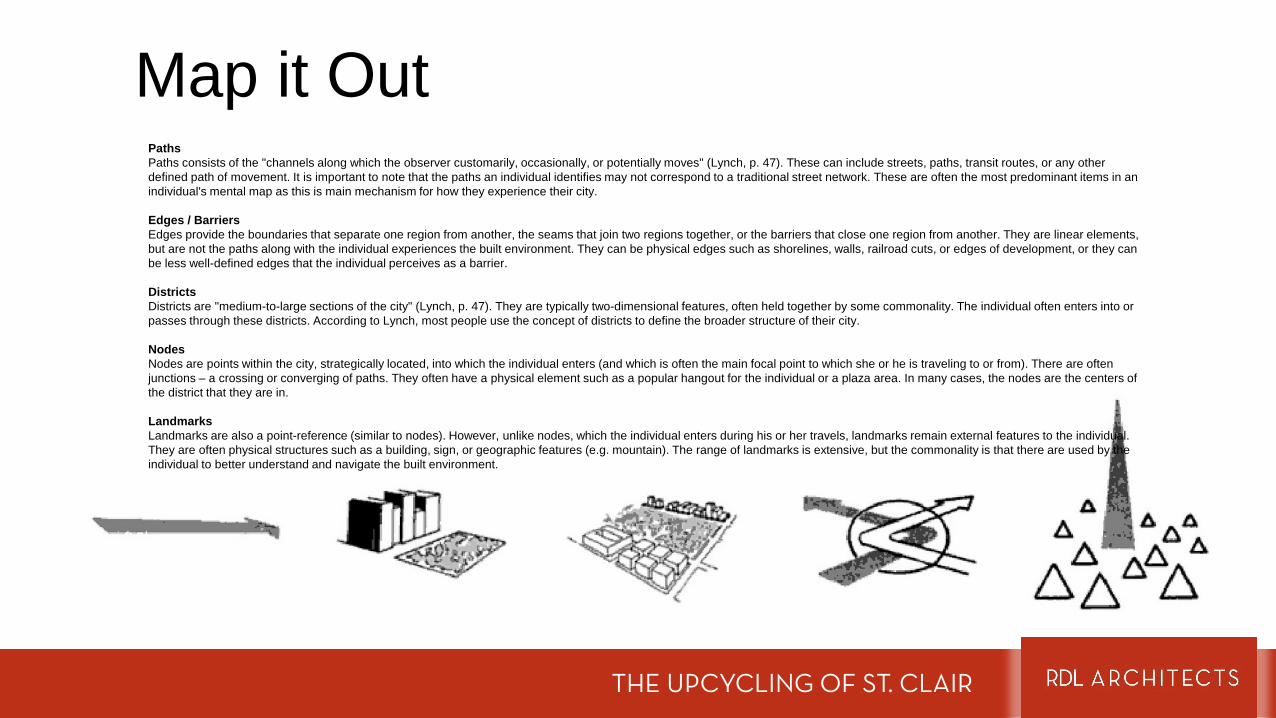
Map it OutPathsPaths consists of the "channels along which the observer customarily, occasionally, or potentially moves" (Lynch, p. 47). These can include streets, paths, transit routes, or any other defined path of movement. It is important to note that the paths an individual identifies may not correspond to a traditional street network. These are often the most predominant items in an individual's mental map as this is main mechanism for how they experience their city.
Edges / BarriersEdges provide the boundaries that separate one region from another, the seams that join two regions together, or the barriers that close one region from another. They are linear elements, but are not the paths along with the individual experiences the built environment. They can be physical edges such as shorelines, walls, railroad cuts, or edges of development, or they can be less well-defined edges that the individual perceives as a barrier.
DistrictsDistricts are "medium-to-large sections of the city" (Lynch, p. 47). They are typically two-dimensional features, often held together by some commonality. The individual often enters into or passes through these districts. According to Lynch, most people use the concept of districts to define the broader structure of their city.
NodesNodes are points within the city, strategically located, into which the individual enters (and which is often the main focal point to which she or he is traveling to or from). There are often junctions – a crossing or converging of paths. They often have a physical element such as a popular hangout for the individual or a plaza area. In many cases, the nodes are the centers of the district that they are in.
LandmarksLandmarks are also a point-reference (similar to nodes). However, unlike nodes, which the individual enters during his or her travels, landmarks remain external features to the individual. They are often physical structures such as a building, sign, or geographic features (e.g. mountain). The range of landmarks is extensive, but the commonality is that there are used by the individual to better understand and navigate the built environment.
THE UPCYCLING OF ST. CLAIR
Map it OutAdditional Maps – some suggestions
• Historic District/ Landmarks Map – remember there are differences between local landmarks and districts and national landmarks and districts.
• Brownfields
• Assets & Liabilities
• Political Boundaries – political districts, wards, CDC boundaries, etc.
• Land banked Parcels
THE UPCYCLING OF ST. CLAIR

THE SITE IN ST CLAIR
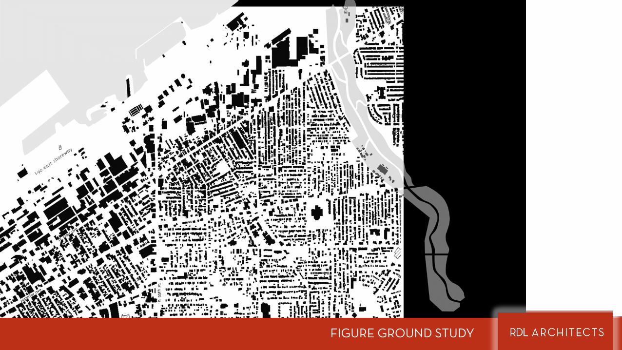
FIGURE GROUND STUDY

EXISTING LAND USE STUDY
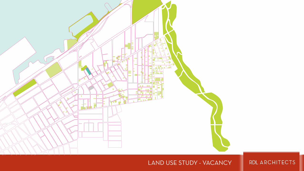
LAND USE STUDY - VACANCY
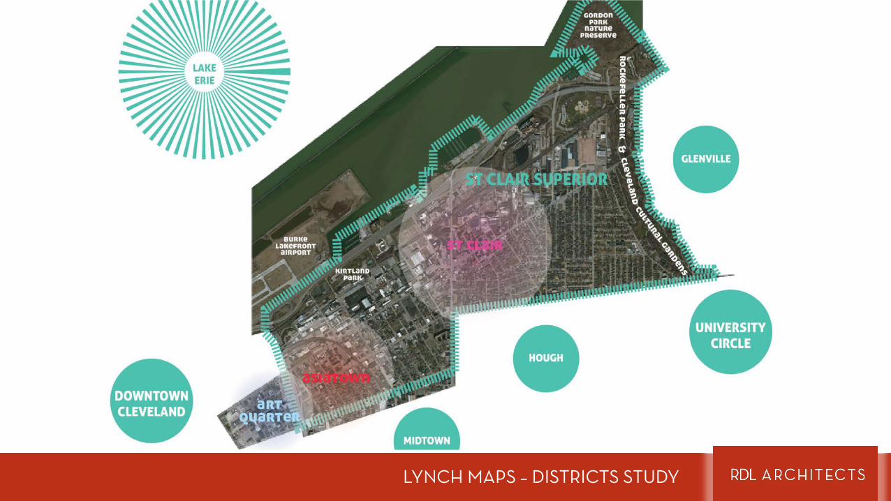
LYNCH MAPS – DISTRICTS STUDY
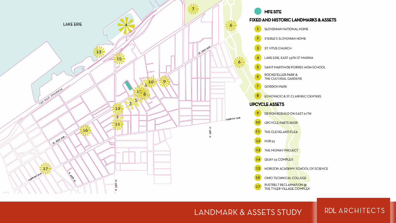
LANDMARK & ASSETS STUDY
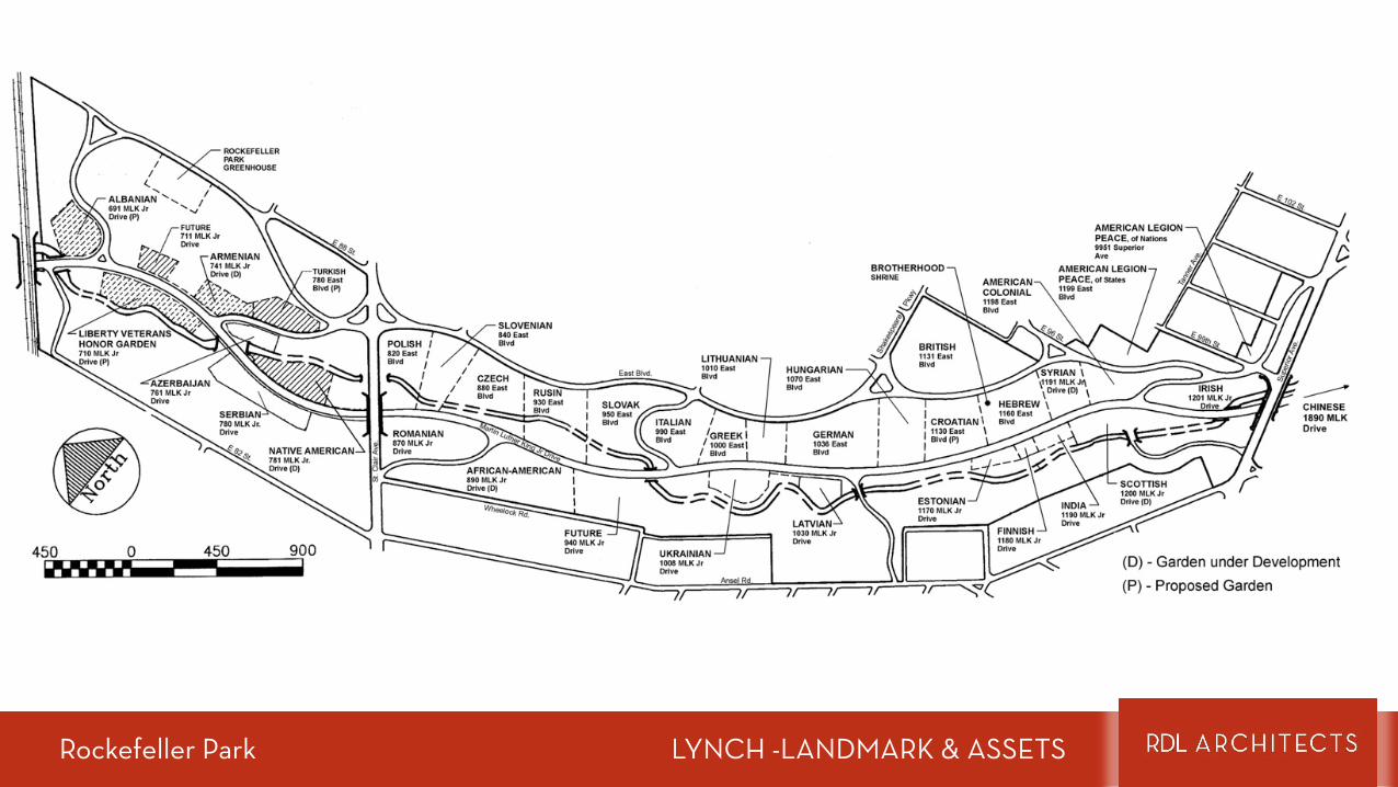
Rockefeller Park LYNCH -LANDMARK & ASSETS
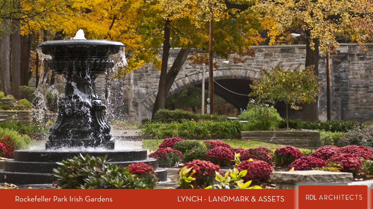
Rockefeller Park Irish Gardens LYNCH - LANDMARK & ASSETS

Rockefeller Park Italian Gardens / Lower Piazza LYNCH - LANDMARK & ASSETS
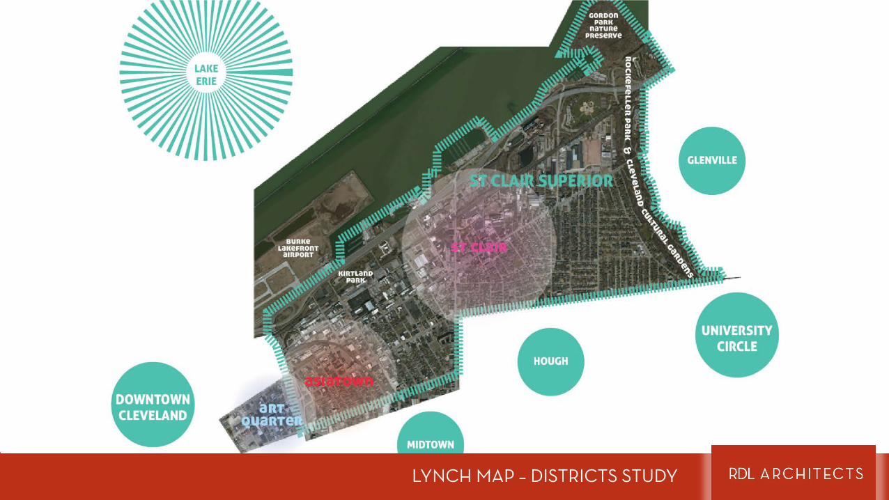
LYNCH MAP – DISTRICTS STUDY
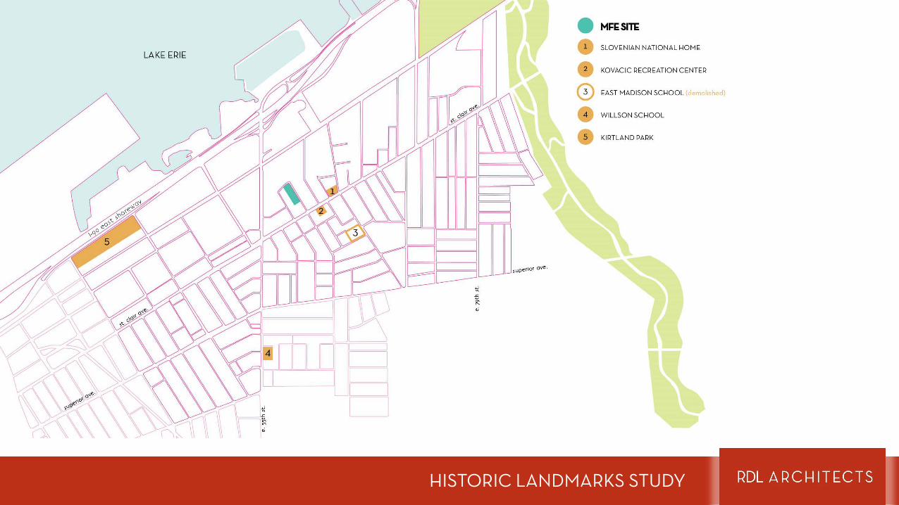
HISTORIC LANDMARKS STUDY
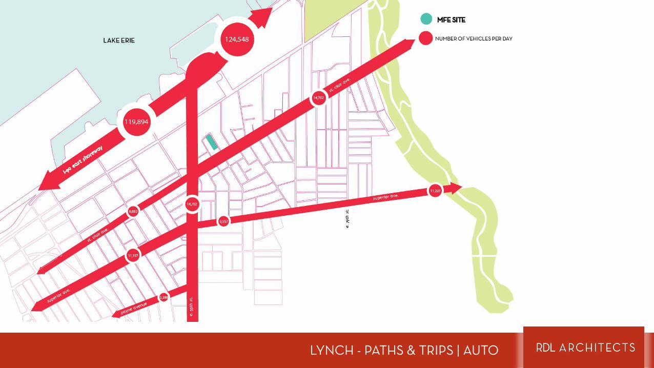
LYNCH - PATHS & TRIPS | AUTO
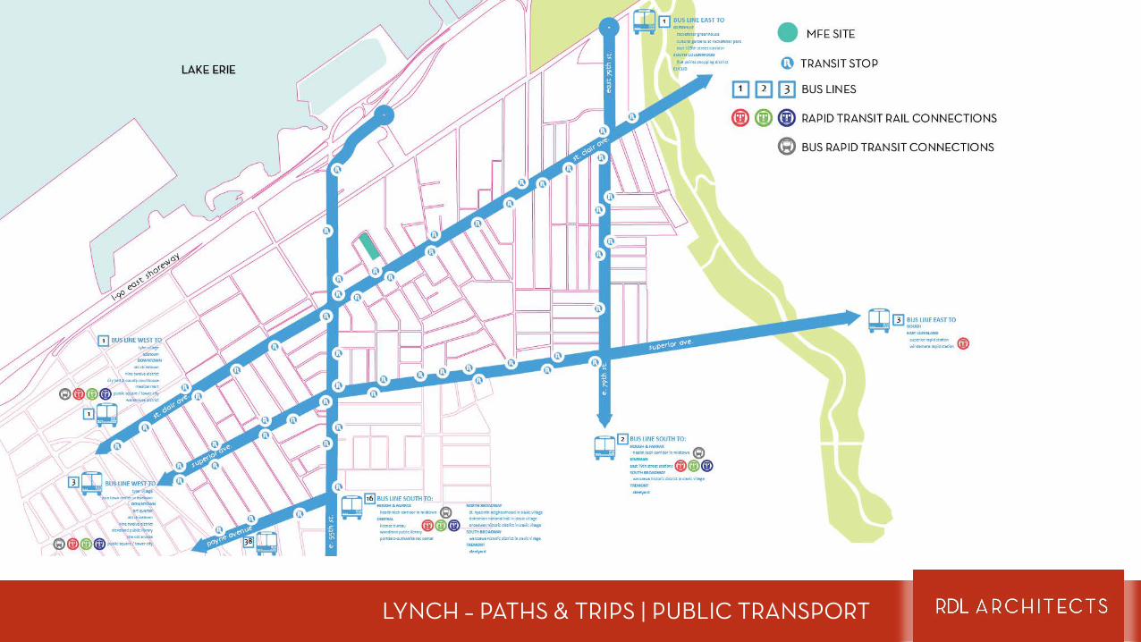
LYNCH – PATHS & TRIPS | PUBLIC TRANSPORT
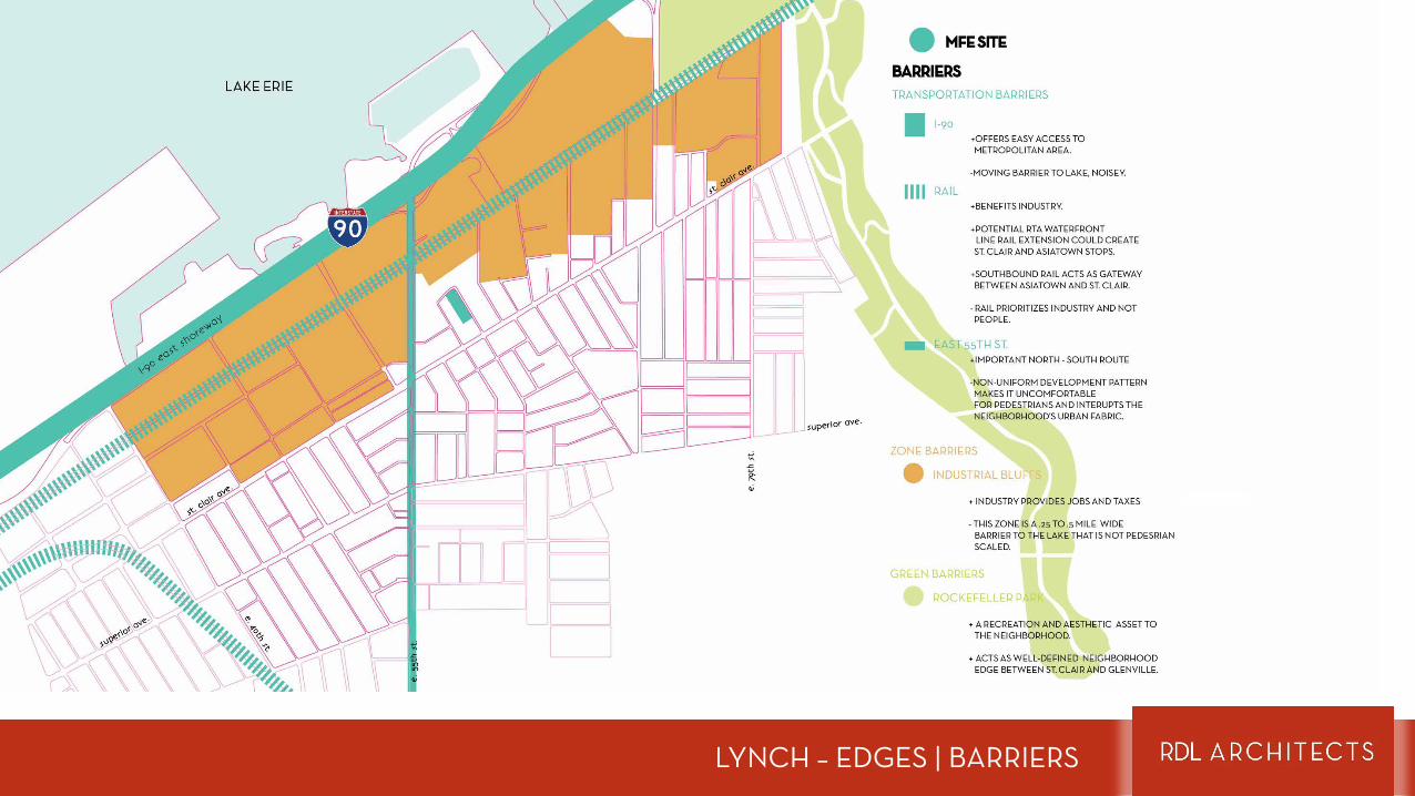
LYNCH – EDGES | BARRIERS
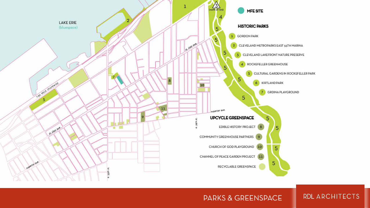
PARKS & GREENSPACE
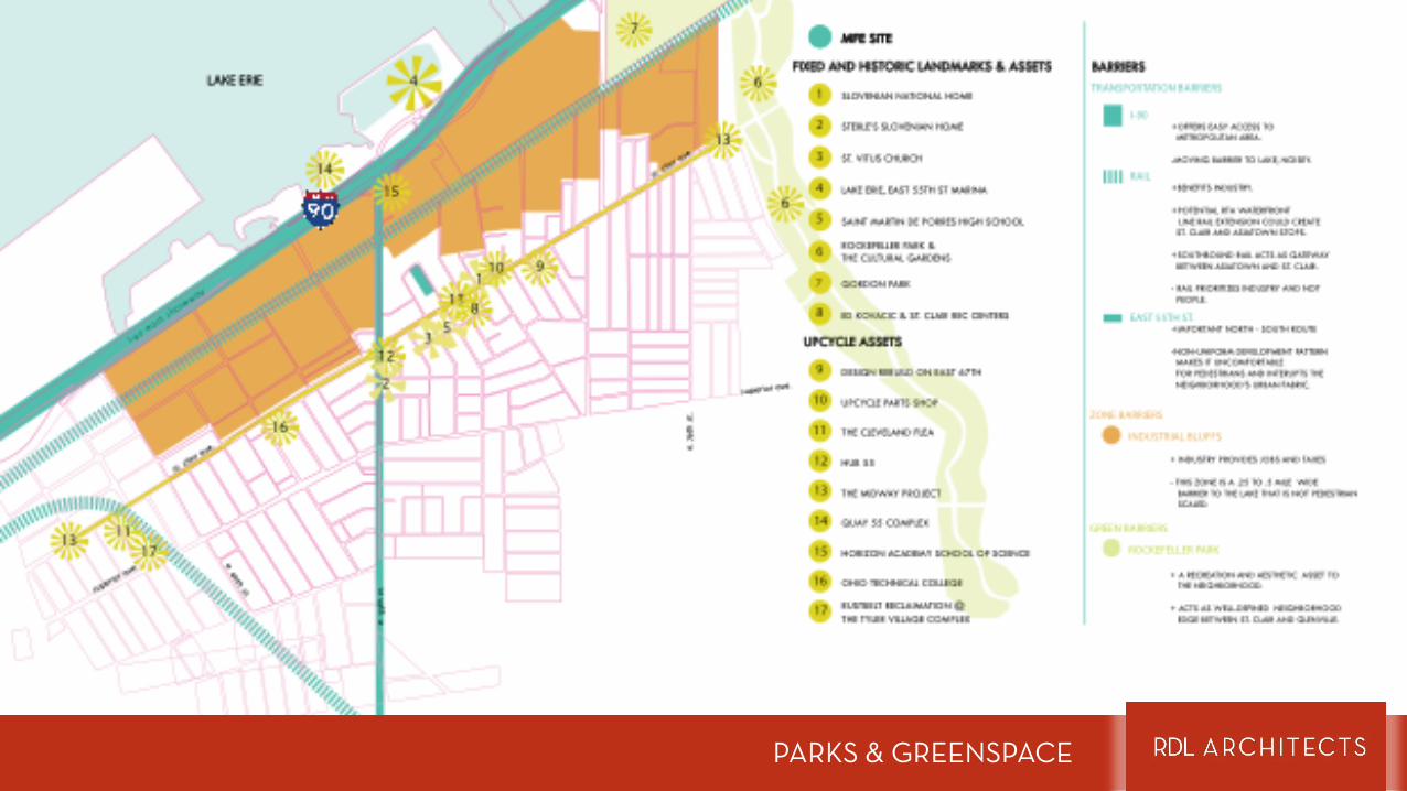
PARKS & GREENSPACE
IMPLEMENTATION
PLANNING
Trends & Demographics
THE UPCYCLING OF ST. CLAIR
What trends can help define your project and make it successful?
The Great InversionBoomers & Millennials seeking walkable urban lifestyle
The Cuyahoga Partnership for Arts & CultureCigarette tax approved by voters to support arts & culture.
intervention checklist
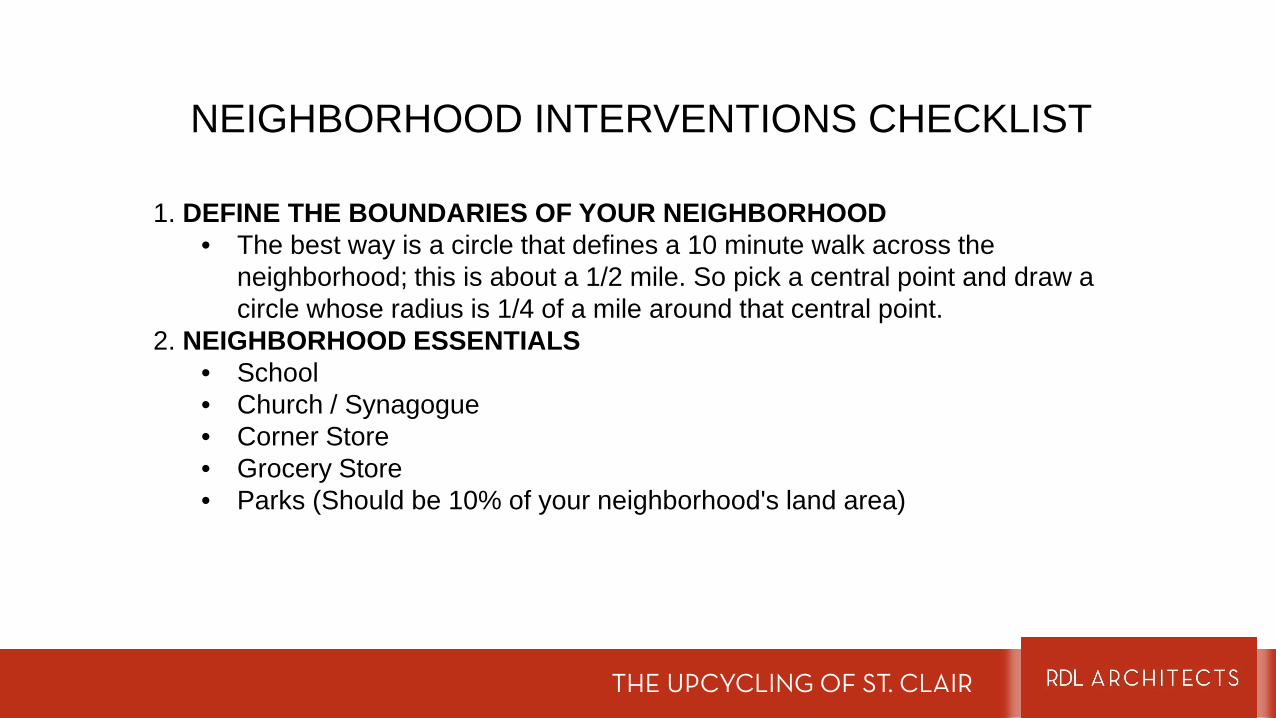
NEIGHBORHOOD INTERVENTIONS CHECKLIST
THE UPCYCLING OF ST. CLAIR
1. DEFINE THE BOUNDARIES OF YOUR NEIGHBORHOOD • The best way is a circle that defines a 10 minute walk across the
neighborhood; this is about a 1/2 mile. So pick a central point and draw a circle whose radius is 1/4 of a mile around that central point.
2. NEIGHBORHOOD ESSENTIALS • School• Church / Synagogue• Corner Store• Grocery Store• Parks (Should be 10% of your neighborhood's land area)
NEIGHBORHOOD INTERVENTIONS CHECKLIST
THE UPCYCLING OF ST. CLAIR
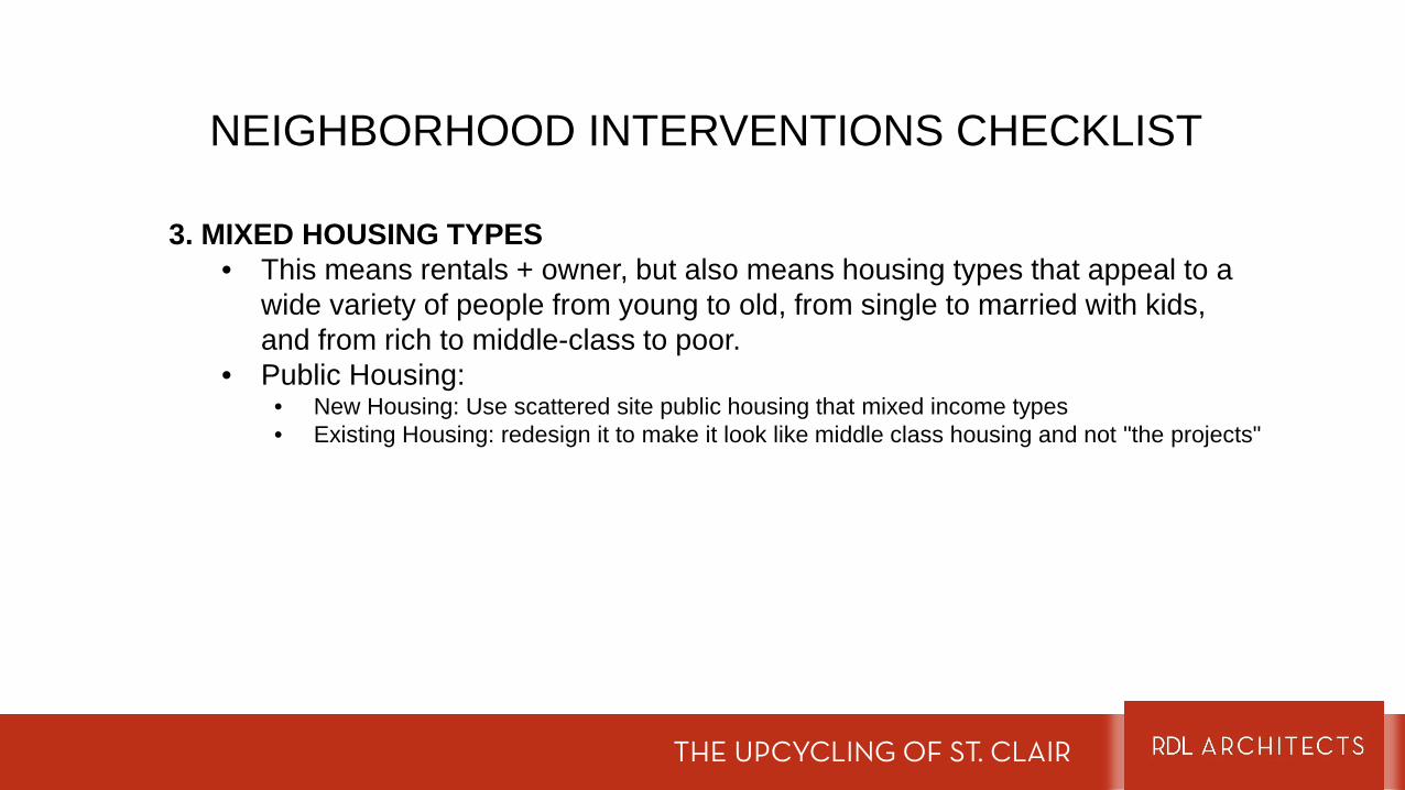
3. MIXED HOUSING TYPES• This means rentals + owner, but also means housing types that appeal to a
wide variety of people from young to old, from single to married with kids, and from rich to middle-class to poor.
• Public Housing: • New Housing: Use scattered site public housing that mixed income types • Existing Housing: redesign it to make it look like middle class housing and not "the projects"
NEIGHBORHOOD INTERVENTIONS CHECKLIST
THE UPCYCLING OF ST. CLAIR
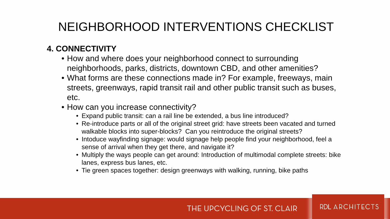
4. CONNECTIVITY• How and where does your neighborhood connect to surrounding
neighborhoods, parks, districts, downtown CBD, and other amenities? • What forms are these connections made in? For example, freeways, main
streets, greenways, rapid transit rail and other public transit such as buses, etc.
• How can you increase connectivity?• Expand public transit: can a rail line be extended, a bus line introduced?• Re-introduce parts or all of the original street grid: have streets been vacated and turned
walkable blocks into super-blocks? Can you reintroduce the original streets?• Intoduce wayfinding signage: would signage help people find your neighborhood, feel a
sense of arrival when they get there, and navigate it?• Multiply the ways people can get around: Introduction of multimodal complete streets: bike
lanes, express bus lanes, etc.• Tie green spaces together: design greenways with walking, running, bike paths
NEIGHBORHOOD INTERVENTIONS CHECKLIST
THE UPCYCLING OF ST. CLAIR
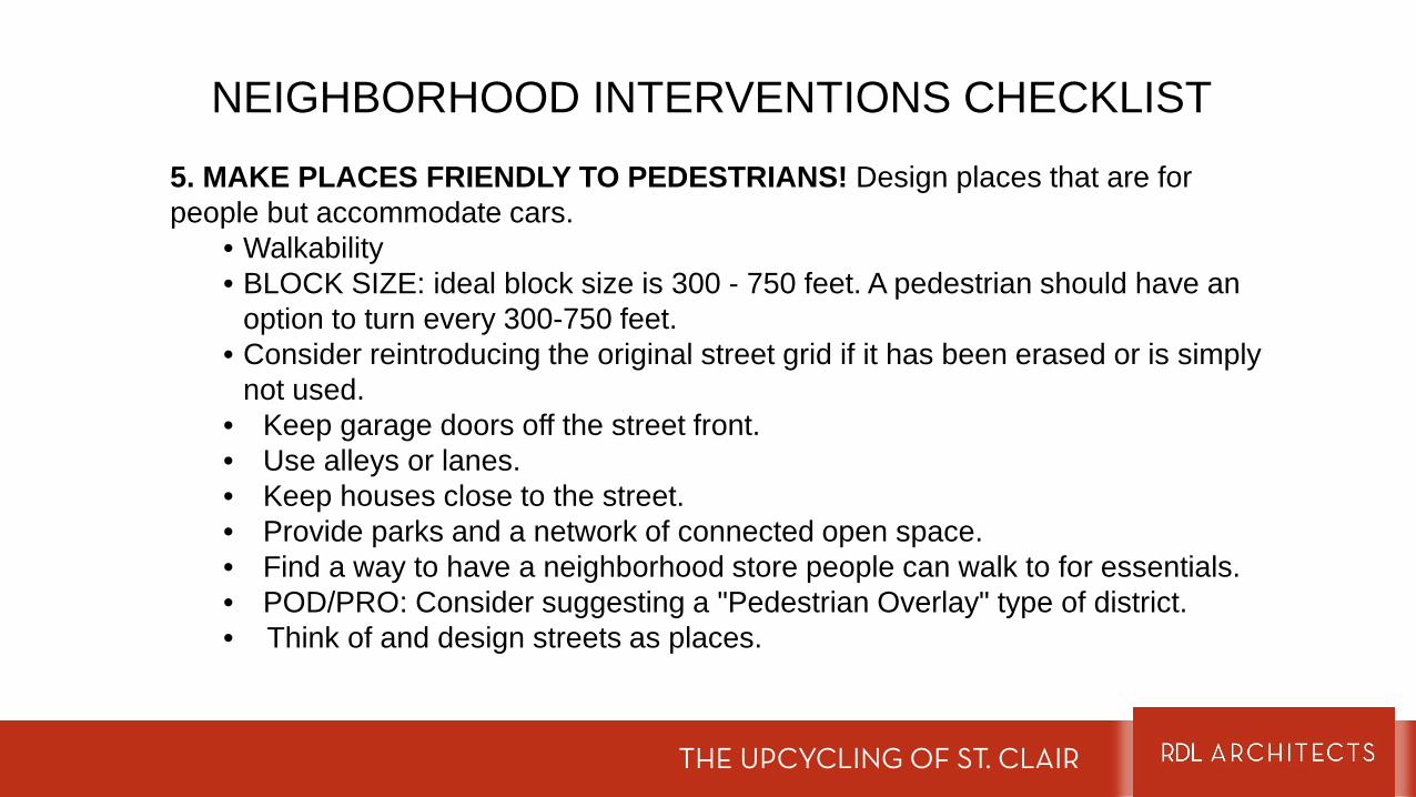
5. MAKE PLACES FRIENDLY TO PEDESTRIANS! Design places that are for people but accommodate cars.
• Walkability • BLOCK SIZE: ideal block size is 300 - 750 feet. A pedestrian should have an
option to turn every 300-750 feet. • Consider reintroducing the original street grid if it has been erased or is simply
not used. • Keep garage doors off the street front.• Use alleys or lanes.• Keep houses close to the street.• Provide parks and a network of connected open space.• Find a way to have a neighborhood store people can walk to for essentials.• POD/PRO: Consider suggesting a "Pedestrian Overlay" type of district. • Think of and design streets as places.
NEIGHBORHOOD INTERVENTIONS CHECKLIST
THE UPCYCLING OF ST. CLAIR
5. MULTIMODAL• Road Diet: consider the width of your street, is it too wide? Can you use some
of that space for bigger sidewalks and outdoor spaces? • Could you use extra space on a street for a dedicated bus lane? What other
forms of transport can you suggest and what street do they make sense for? For example, streetcars, light rail, BRT, bike lanes, greenways for jogging biking and walking, etc.
NEIGHBORHOOD INTERVENTIONS CHECKLIST
THE UPCYCLING OF ST. CLAIR
6. HISTORIC DISTRICT• Consider introducing a historic district or expanding an existing one.
the masterplan
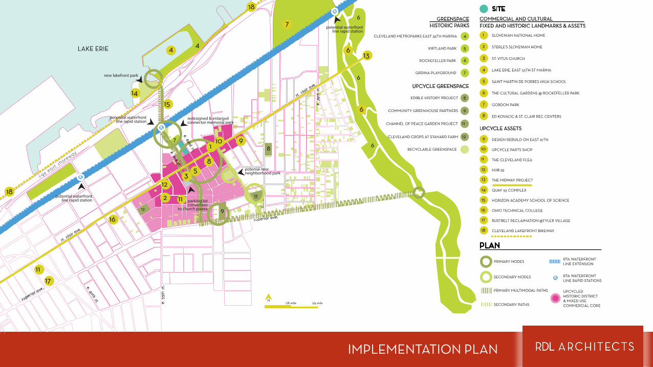
IMPLEMENTATION PLAN
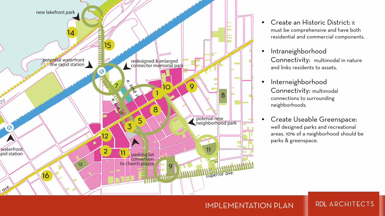
IMPLEMENTATION PLAN
• Create an Historic District: it must be comprehensive and have both residential and commercial components.
• Intraneighborhood Connectivity: multimodal in nature and links residents to assets.
• Interneighborhood Connectivity: multimodal connections to surrounding neighborhoods.
• Create Useable Greenspace: well designed parks and recreational areas. 10% of a neighborhood should be parks & greenspace.
the grdina park intervention
URBAN DESIGN

THE EXPLOSION
THE EXPLOSION
NTo Downtown
(formerly known as East Ohio Gas)
e
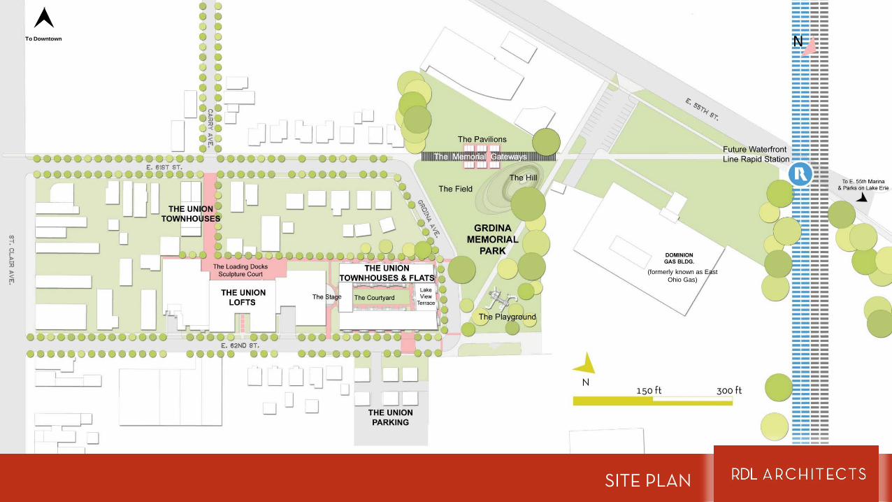
SITE PLAN
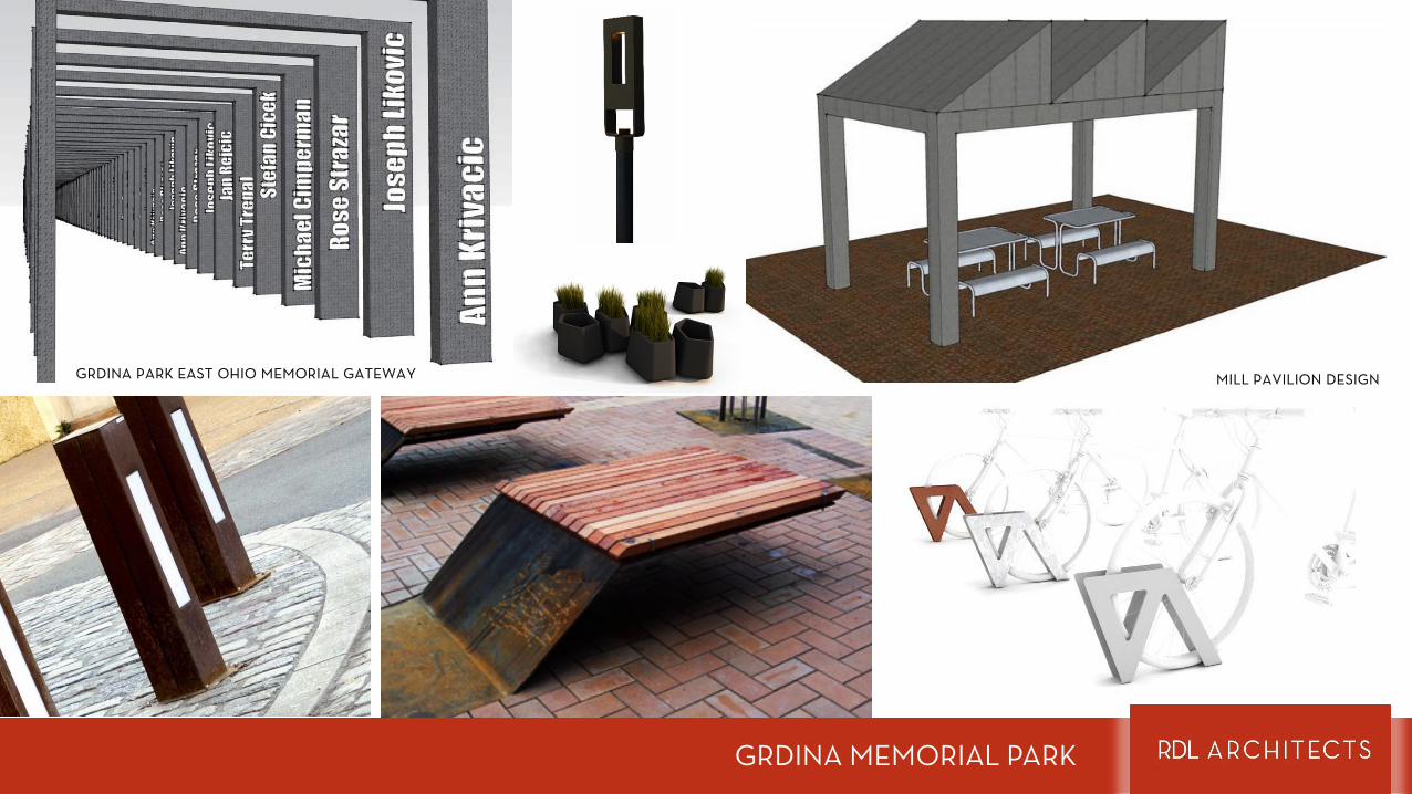
GRDINA PARK EAST OHIO MEMORIAL GATEWAY MILL PAVILION DESIGN
GRDINA MEMORIAL PARK
the union intervention
ARCHITECTURE & INTERIORS

GRDINA PARK
INTERIOR 1928 BUILDING
PRE BLAST ARCHITECTURE
INTERIOR 1946 BUILDING
POST BLAST BUNGALOWS
RESEARCH FACILITY NORTH END 1946ADDITION
RESEARCH FACILITY SOUTH END 1946 ADDITION
INTERIOR 1946 BUILDING
RESEARCH FACILITY 1928 BUILDING
EXISTING CONDITIONS
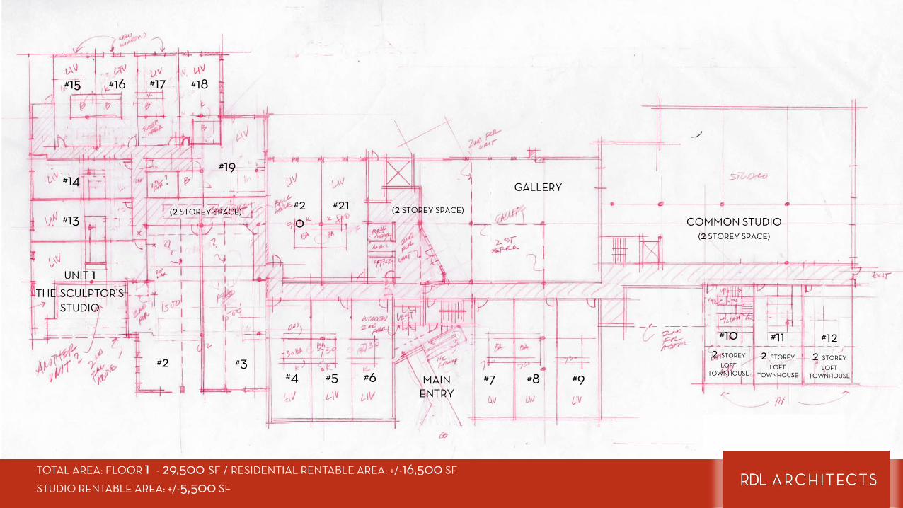
COMMON STUDIO(2 STOREY SPACE)
GALLERY
UNIT 1 THE SCULPTOR’S
STUDIO
#2 #3#4 #5 #6 #7
#18
#8 #9
#102 STOREY
LOFTTOWNHOUSE
#15 #16 #17
#13
#14#19
#20
#21
#112 STOREY
LOFTTOWNHOUSE
#122 STOREY
LOFTTOWNHOUSEMAIN
ENTRY
(2 STOREY SPACE)(2 STOREY SPACE)
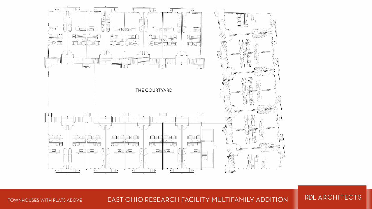
TOTAL AREA: FLOOR 1 - 29,500 SF / RESIDENTIAL RENTABLE AREA: +/-16,500 SF
STUDIO RENTABLE AREA: +/-5,500 SF
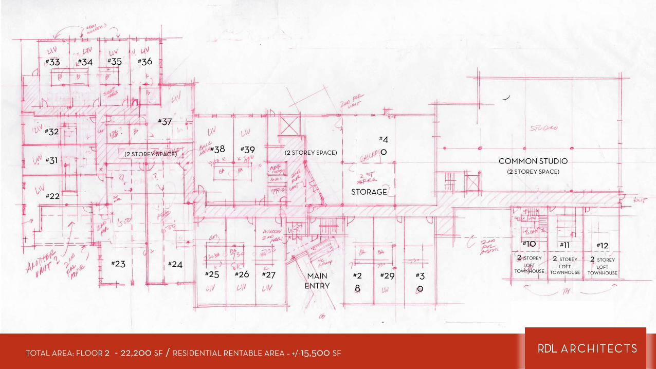
COMMON STUDIO(2 STOREY SPACE)
#23 #24#25 #26 #27 #2
8
#36
#29 #30
#102 STOREY
LOFTTOWNHOUSE
#33 #34 #35
#31
#32#37
#38 #39
#112 STOREY
LOFTTOWNHOUSE
#122 STOREY
LOFTTOWNHOUSEMAIN
ENTRY
#22
#40
STORAGE
(2 STOREY SPACE) (2 STOREY SPACE)
TOTAL AREA: FLOOR 2 - 22,200 SF / RESIDENTIAL RENTABLE AREA – +/-15,500 SF
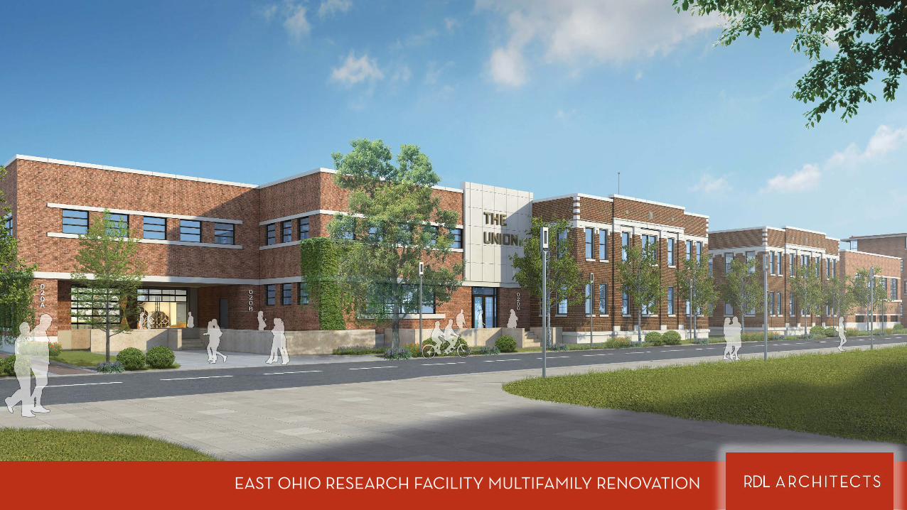
EAST OHIO RESEARCH FACILITY MULTIFAMILY RENOVATION
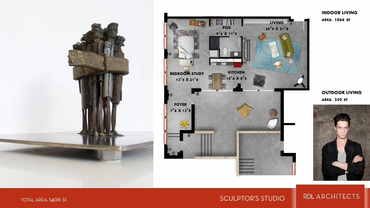
SCULPTOR’S STUDIOTOTAL AREA: 1406 SF
OUTDOOR LIVING
AREA: 340 SF
INDOOR LIVING
AREA: 1066 SF
FOYER
7’6 X 13’0
BEDROOM/STUDY
13’0 X 21’8
LIVING
20’0 X 21’8
KITCHEN
10’6 X 8’0
POD
9’6 X 11’9
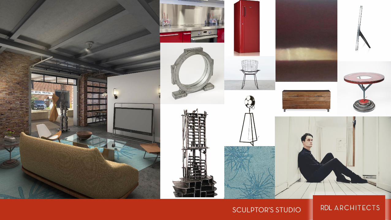
SCULPTOR’S STUDIO

SCULPTOR’S STUDIO
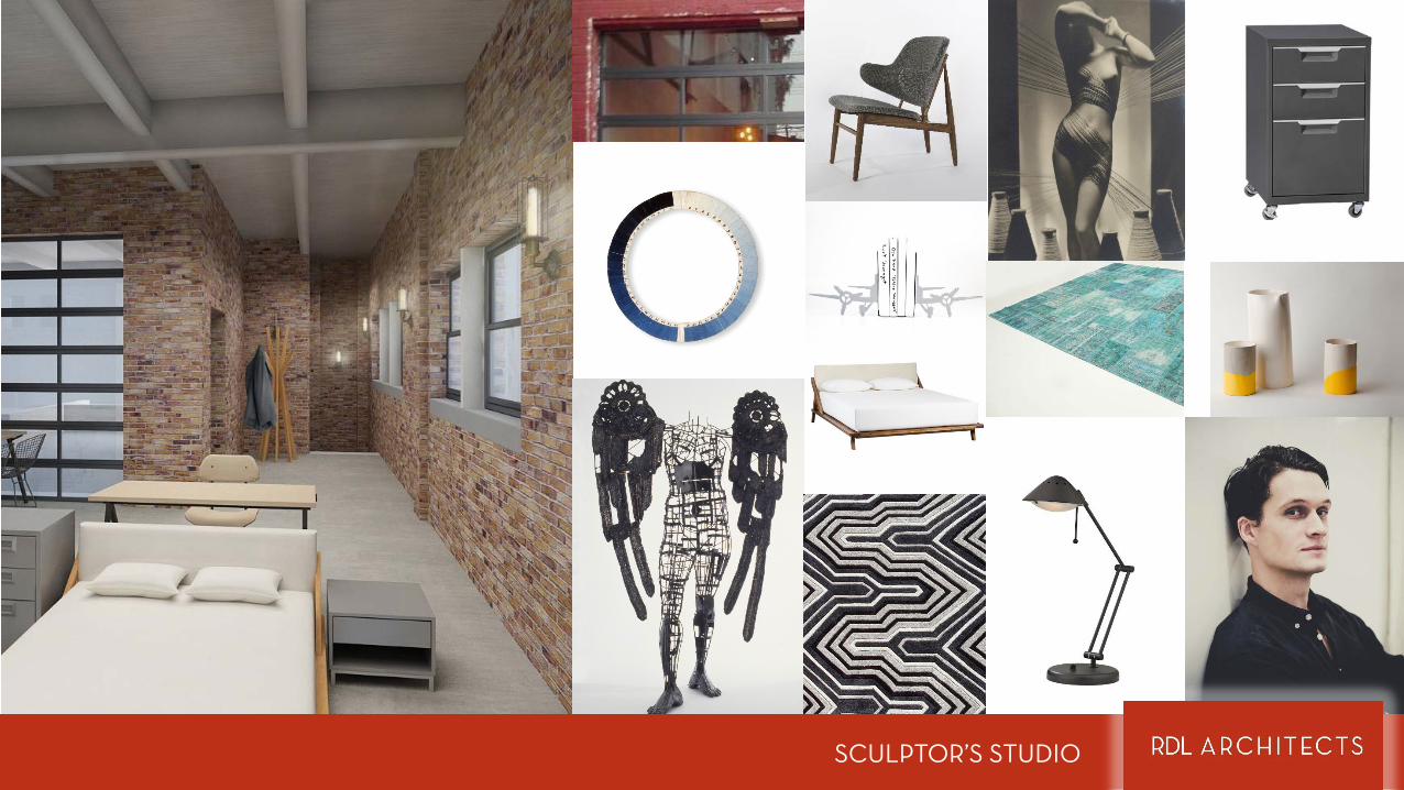
SCULPTOR’S STUDIO
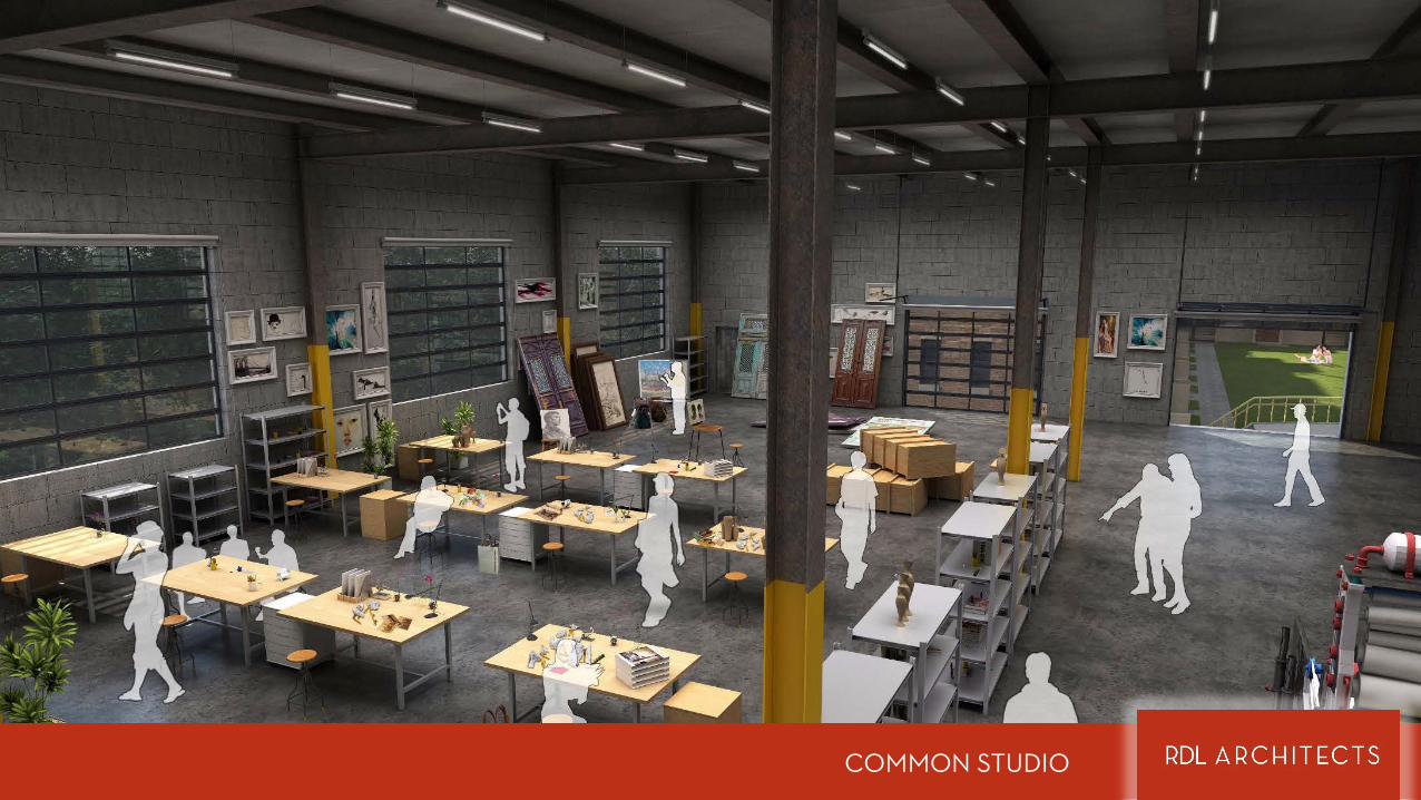
COMMON STUDIO
EAST OHIO RESEARCH FACILITY MULTIFAMILY ADDITION
THE COURTYARD
TOWNHOUSES WITH FLATS ABOVE
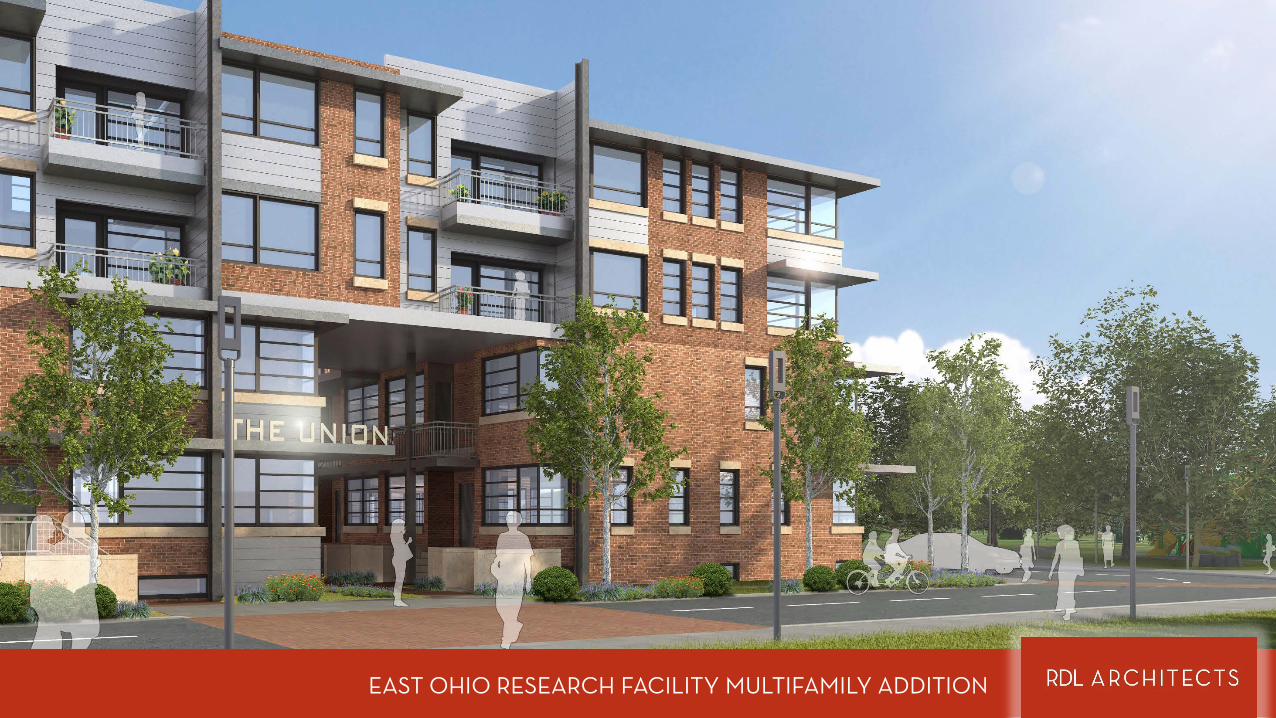
EAST OHIO RESEARCH FACILITY MULTIFAMILY ADDITION
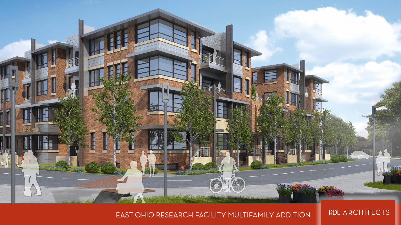
EAST OHIO RESEARCH FACILITY MULTIFAMILY ADDITION

GROUND FLOORAREA: 570 SF
MASTER BEDROOM15’6 X 11’8
GUEST BEDROOM12’0 X 11’8
BATH9’11 X 8’1
BALCONYCLOSET8’5 X 3’2
LIVING12’0 X 12’0
KITCHEN9’0 X 12’0
WORKSPACE11’0 X 10’2
CLOSET6’8 X 3’2
½ BATH
SECOND FLOORAREA: 530 SF
TOTAL AREA: 1100 SF BOOMER ARTIST TOWNHOUSE
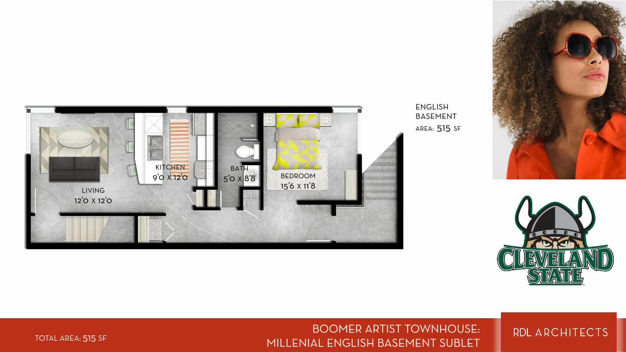
BOOMER ARTIST TOWNHOUSE: MILLENIAL ENGLISH BASEMENT SUBLET
BEDROOM15’6 X 11’8
BATH5’0 X 8’8
LIVING12’0 X 12’0
KITCHEN9’0 X 12’0
ENGLISH BASEMENTAREA: 515 SF
TOTAL AREA: 515 SF
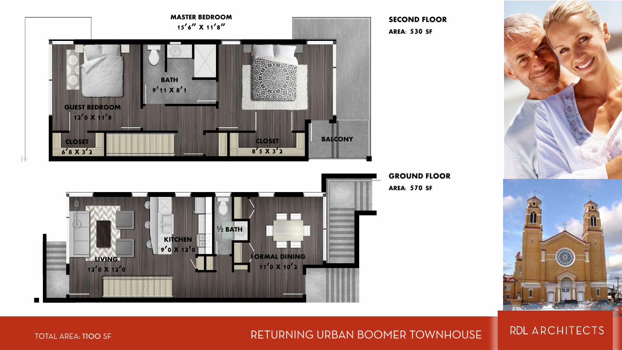
GROUND FLOOR
AREA: 570 SF
MASTER BEDROOM
15’6” X 11’8”
GUEST BEDROOM
12’0 X 11’8
BATH
9’11 X 8’1
BALCONYCLOSET
8’5 X 3’2
LIVING
12’0 X 12’0
KITCHEN
9’0 X 12’0FORMAL DINING
11’0 X 10’2
CLOSET
6’8 X 3’2
½ BATH
SECOND FLOOR
AREA: 530 SF
RETURNING URBAN BOOMER TOWNHOUSETOTAL AREA: 1100 SF

SUITE 2AREA: 260 SF
BEDROOM 210’5 X 15’6
LAUNDRY/STORAGE10’0 X 4’6
COMMON LIVING
10’6 X 24’0
BALCONY6’8 X 3’2
SUITE 1AREA: 254 SF
BEDROOM 110’5 X 12’3
(+NOOK)
SUITE 1
SUITE 2
YOUNG PROFESSIONAL’S FLATTOTAL AREA: 1100 SF
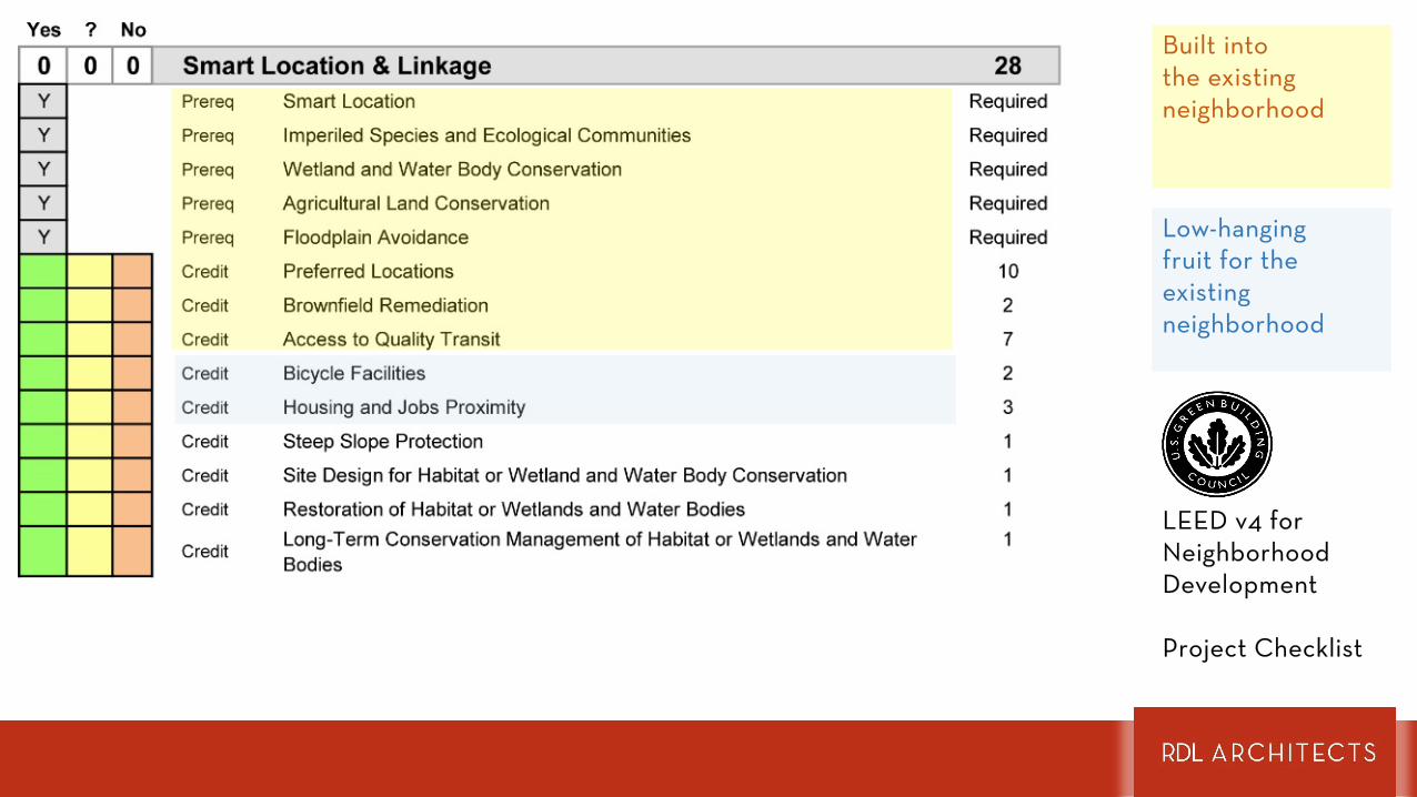
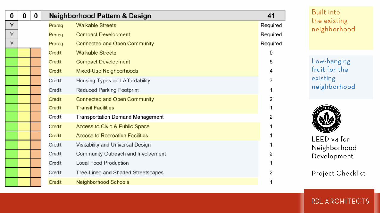
LEED FOR NEIGHBORHOOD DEVELOPMENT
POTENTIAL
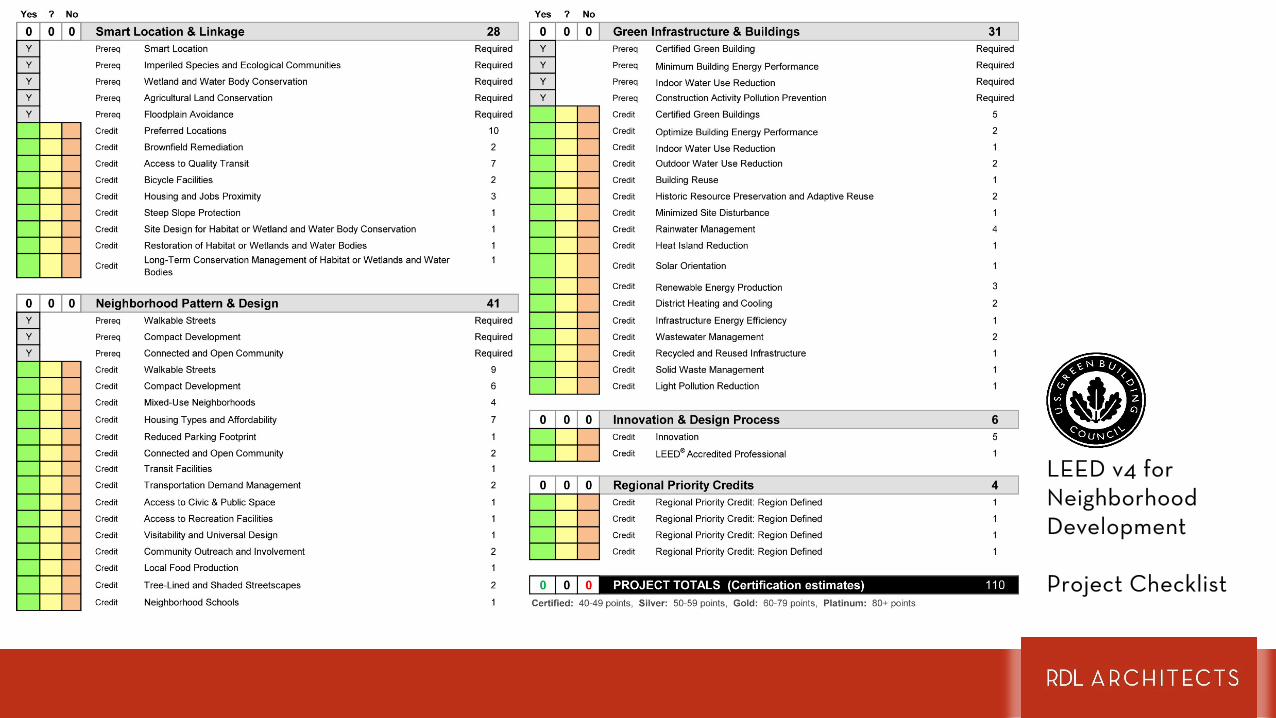
LEED v4 forNeighborhoodDevelopment
Project Checklist

Built into the existing neighborhood
LEED v4 forNeighborhoodDevelopment
Project Checklist
Built into the existing neighborhood
Low-hangingfruit for the existing neighborhood
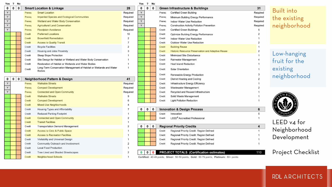
LEED v4 forNeighborhoodDevelopment
Project Checklist
Built into the existing neighborhood
Low-hangingfruit for the existing neighborhood
LEED v4 forNeighborhoodDevelopment
Project Checklist
Built into the existing neighborhood
Low-hangingfruit for the existing neighborhood
LEED v4 forNeighborhoodDevelopment
Project Checklist
Thank You
RDLarchitects.com