Purpose - Natural Disaster Operational Workgroupndow.net/NDOW Documents/Marsh Plan Template/Texas...
47
Natural Disaster Orphan Container Recovery in Sensitive Coastal Habitats of Texas United States Environmental Protection Agency (EPA) Region 6, United States Coast Guard (USCG), National Oceanic and Atmospheric Administration (NOAA), Texas General Land Office (TGLO), Texas Commission on Environmental Quality (TCEQ) & Texas Parks and Wildlife Department (TPWD) Disaster Response Procedures 5.1 Purpose This document, Orphan Container Recovery in Sensitive Coastal Habitats of Texas, provides recommended best practices for Unified Command to direct responders engaged in the removal of containers potentially containing oil or hazardous materials that are located in ecologically sensitive habitats of the Texas coast. This guidance is for the [ upper or mid and lower] coast of Texas from the [ Texas/Louisiana border to the Matagorda Bay System or the San Antonio Bay System to the Texas/Mexico border] and has been reviewed by the Federal and State resource agencies (RAs) as well as the Federal and State natural resource trustees (Trustees). The Trustees are the Department of the Interior (DOI), who may be represented by the U.S. Fish and Wildlife Service (USFWS) and/or the National Park Service (NPS); NOAA; TCEQ; TGLO; and TPWD. During an actual event, this document should be adapted for the current situation in coordination with local personnel from the Federal and State RAs and the Trustees. By coordinating with Trustee program staff from each of the Trustee agencies as well as local staff from the RAs (e.g., USFWS, NOAA, and TPWD) specific regional issues and concerns will be verified and checked against local knowledge and expertise in real time. 5.2 Background USEPA Region 6, USCG, TGLO, TCEQ, TPWD Disaster Response Procedures Finalized 12-11-12 1
Transcript of Purpose - Natural Disaster Operational Workgroupndow.net/NDOW Documents/Marsh Plan Template/Texas...

Natural DisasterOrphan Container Recovery in Sensitive Coastal Habitats of Texas
United States Environmental Protection Agency (EPA) Region 6, United States Coast Guard (USCG), National Oceanic and Atmospheric Administration (NOAA),
Texas General Land Office (TGLO), Texas Commission on Environmental Quality (TCEQ) & Texas Parks and Wildlife Department (TPWD) Disaster Response Procedures
1.0 Purpose
This document, Orphan Container Recovery in Sensitive Coastal Habitats of Texas, provides recommended best practices for Unified Command to direct responders engaged in the removal of containers potentially containing oil or hazardous materials that are located in ecologically sensitive habitats of the Texas coast. This guidance is for the [upper or mid and lower] coast of Texas from the [Texas/Louisiana border to the Matagorda Bay System or the San Antonio Bay System to the Texas/Mexico border] and has been reviewed by the Federal and State resource agencies (RAs) as well as the Federal and State natural resource trustees (Trustees). The Trustees are the Department of the Interior (DOI), who may be represented by the U.S. Fish and Wildlife Service (USFWS) and/or the National Park Service (NPS); NOAA; TCEQ; TGLO; and TPWD. During an actual event, this document should be adapted for the current situation in coordination with local personnel from the Federal and State RAs and the Trustees. By coordinating with Trustee program staff from each of the Trustee agencies as well as local staff from the RAs (e.g., USFWS, NOAA, and TPWD) specific regional issues and concerns will be verified and checked against local knowledge and expertise in real time.
2.0 Background
Federal Emergency Management Agency (FEMA) Emergency Support Function (ESF)-10 provides for a coordinated Federal response to actual or potential oil and hazardous materials (HAZMAT) incidents. Response to oil and hazardous materials incidents is generally carried out in accordance with the National Oil and Hazardous Substances Pollution Contingency Plan (NCP), 40 CFR Part 300. HAZMAT is a general term intended to mean hazardous substances, pollutants, and contaminants as defined in the NCP. The Unified Command, consisting of EPA, the USCG, and affected states (Texas), is tasked to undertake HAZMAT and oil pollution threat removal to address potentially dangerous materials that may become displaced by a major disaster or emergency. These materials include drums, cylinders, tanks, and other containers in the impacted area of operation that pose a risk to public health and the environment because of their contents, e.g., a drum containing a corrosive liquid. This guidance is focused only on HAZMAT and oil containers that are drum size and larger that are stranded in sensitive coastal habitats along the coast of Texas. Small items that are generally classified as Household Hazardous Waste will be collected as found, but the mission objective is to find and remove larger containers that pose a greater risk. The goal of the recovery activity is to remove the larger HAZMAT or
USEPA Region 6, USCG, TGLO, TCEQ, TPWD Disaster Response ProceduresFinalized 12-11-12 1

oil threat without causing environmental injury greater than that posed by the substance itself – in short, “do no greater harm.”
3.0 Development of Guidance
Federally funded activities, such as federal support provided by the EPA and the USCG following a disaster, must comply with the National Environmental Policy Act (NEPA). NEPA requires Federal agencies to integrate environmental assessment into their decision-making processes by considering the environmental impacts of their proposed action. The consideration of environmental impacts must include all reasonable alternatives to those actions, as well as consultations with appropriate agencies. Because of the emergent nature of disaster response activities, adequate NEPA compliance in responding to HAZMAT and oil spills can be problematic. The recovery of containers in sensitive coastal habitats poses a particular challenge in this regard because many factors bear on the determination and implementation of an appropriate response.
Variances to these requirements under a Presidential declared disaster are not well defined with respect to responding to HAZMAT and oil pollution spills and threats. As required in the NCP, Unified Command must coordinate with the Trustees and RAs to ensure that natural resource concerns are addressed in any proposed response action. Unified Command will hold meetings with the RAs and the Trustees to engage them in the recovery planning process. There may be additional reviews and consultations required for NEPA, the Endangered Species Act, essential fish habitat, historic/cultural resources, and other requirements that are not covered under this guidance.
The Trustees and RAs, in cooperation with EPA Region 6 and the USCG, focused on the environmental protection of sensitive coastal habitats in connection with the location and recovery of containers following a disaster. Documents developed to guide the recovery of containers from sensitive ecological habitats following disasters and other lessons learned were used by the Trustees and RAs to recommend best practices that are incorporated into this Guidance.
4.0 Document Organization
[This Guidance is a template should be modified for the upper, mid, or lower coast and adapted to the specific event. During an actual incident, this Guidance should be adapted for the current situation by Unified Command in coordination with the Trustees and local personnel from the RAs. By coordinating with Trustee program staff from each of the Trustee agencies as well as local staff from the resource agencies (e.g., USFWS, NOAA, and TPWD), specific regional issues and concerns will be verified and proposed recovery activities will be checked against local knowledge and expertise in real time.]
[This Guidance could be adapted to an oil spill cleanup as well as to an inland event in coordination with the Trustee agencies as well as local staff from the RAs.]
USEPA Region 6, USCG, TGLO, TCEQ, TPWD Disaster Response ProceduresFinalized 12-11-12 2

[The event-specific Guidance will be provided to Unified Command Operations for planning purposes. Additional guidelines will be developed as required to assist Operations managers in meeting the goal of leaving as small a footprint as possible when mitigating oil and HAZMAT debris in sensitive habitats.]
The following attachments are included in this Guidance:
A Texas Operations in Sensitive Coastal Habitats Quick Reference SheetB Texas Mid and Lower Coast Bay System DescriptionsC Marsh Buggy Use in Sensitive Coastal HabitatsD Debris Fields and Wrack Lines in Sensitive Coastal HabitatsE Texas Operations Check Sheet for Container Recovery in Sensitive Coastal HabitatsF Documentation of Operations in Sensitive Coastal HabitatsG TPWD’s Fish Kill and Injured/Oiled Wildlife FormH NOAA’s HAZMAT Report 96-1, Responding to Oil Spills in Coastal Marshes: the Fine Line
Between Help and Hindrance, December 1995
[All of these attachments and this Guidance are available on the Natural Disaster Operational Workgroup website (http://ndow.net/Documents/Documents.aspx).]
5.0 Best Management Practices
Emergency response activities to mitigate an immediate hazard, such as a leaking tank, will be responded to by whatever means is required to eliminate the hazard and protect the public, responders, and the environment. The threshold for emergency removal activities that would require an after-action consultation with RAs and Trustees is directly related to the potential for long- term environmental injury caused by the removal operation. In some situations, the HAZMAT itself has already caused environmental impact due to both physical damage and pollution release. It is the goal of the emergency response to minimize environmental injury, yet remove pollution threats created by such events. When determining what recovery action to take, the public health and environmental pollution threat will be weighed against the potential for causing additional environmental injury. It is likely that some tanks containing small amounts of oil or HAZMAT will be left in place rather than removed due to the environmental damage required to physically access the tanks. The type of product, location relative to public access and exposure, location relative to sensitive natural resources, location accessibility for responders, potential for excess environmental impact, and potential for damage to sites of historical/cultural interest will be factored into each removal decision.
5.1 Goal
Locating and removing containers without causing environmental injury greater than that posed by the potential discharges or releases of the HAZMAT or oil they contain. “Do no greater harm.”
USEPA Region 6, USCG, TGLO, TCEQ, TPWD Disaster Response ProceduresFinalized 12-11-12 3

5.2 Objectives
The objectives of this recovery plan are:
Reduce the threat to human health and the environment resulting from exposure to oil or HAZMATs through recovery of orphan containers or container contents, including aboveground storage tanks, totes, drums and cylinders.
Conduct recovery activities in a manner that limits adverse impacts to wetlands and other sensitive habitats to the extent practicable.
In order to facilitate the goal of minimizing any adverse environmental impacts resulting from recovery operations, the Unified Command will promote the use of BMPs developed through collaboration with staff from RAs and Trustees, and other key stakeholders as appropriate. BMPs will provide guidelines on how to conduct recovery operations in the coastal environment and will address significant environmental issues, including:
Threatened and endangered species
Habitat/environmental sensitivity
Archaeological or cultural resources
Natural or scenic rivers
Land ownership (state/federal parks, federal refuges, state management areas, oyster leases, tribal land).
5.3 Consultation and Coordination
Consultation with RAs, Trustees, and key stakeholders may occur well in advance of the operation, making use of geo-spatial data available through the Unified Command. These data can be used by stakeholders and decision-makers to prioritize recovery of containers and address significant environmental issues. Where practical and appropriate, this centralized planning is encouraged in order to both expedite consultation and to maximize cross-communication among RAs, stakeholders, Trustees, and Operations.
For response activities occurring within sensitive habitats, the Trustees agree that:
a. Any species of fish or wildlife injured or killed during response activities or discovery of killed or injured natural resources during response operations must be reported to the appropriate RA and Trustee agency for proper determination and action.
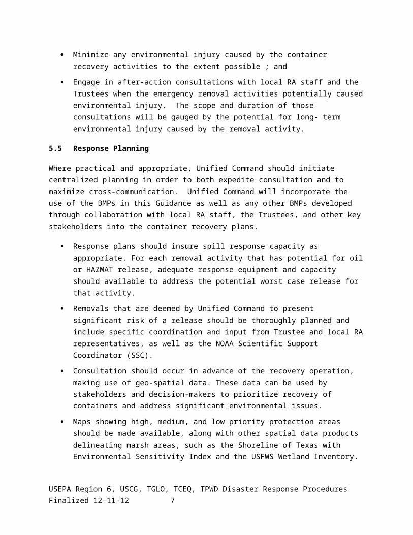
b. Response plans should ensure spill response capacity as appropriate.
c. Damage to sensitive habitats from removal/response activities should be repaired as quickly as practical and should be a planned and integral part of the response plan.
USEPA Region 6, USCG, TGLO, TCEQ, TPWD Disaster Response ProceduresFinalized 12-11-12 4

5.4 Emergency Response to Imminent Threats
During emergency response to imminent threats posed by containers potentially containing oil or HAZMATs, Unified Command will:
Mitigate an immediate container-related hazard, such as a leaking tank, by whatever means necessary to eliminate the imminent hazard for the protection of the public, responders, and the environment;
Minimize any environmental injury caused by the container recovery activities to the extent possible ; and
Engage in after-action consultations with local RA staff and the Trustees when the emergency removal activities potentially caused environmental injury. The scope and duration of those consultations will be gauged by the potential for long- term environmental injury caused by the removal activity.
5.5 Response Planning
Where practical and appropriate, Unified Command should initiate centralized planning in order to both expedite consultation and to maximize cross-communication. Unified Command will incorporate the use of the BMPs in this Guidance as well as any other BMPs developed through collaboration with local RA staff, the Trustees, and other key stakeholders into the container recovery plans.
Response plans should insure spill response capacity as appropriate. For each removal activity that has potential for oil or HAZMAT release, adequate response equipment and capacity should available to address the potential worst case release for that activity.
Removals that are deemed by Unified Command to present significant risk of a release should be thoroughly planned and include specific coordination and input from Trustee and local RA representatives, as well as the NOAA Scientific Support Coordinator (SSC).
Consultation should occur in advance of the recovery operation, making use of geo-spatial data. These data can be used by stakeholders and decision-makers to prioritize recovery of containers and address significant environmental issues.
Maps showing high, medium, and low priority protection areas should be made available, along with other spatial data products delineating marsh areas, such as the Shoreline of Texas with Environmental Sensitivity Index and the USFWS Wetland Inventory.
Container recovery target maps can be overlaid with maps of environmental conditions to create a priority list of containers in sensitive areas.
Equipment needs should be ascertained from the priority list of containers in sensitive areas.
USEPA Region 6, USCG, TGLO, TCEQ, TPWD Disaster Response ProceduresFinalized 12-11-12 5

5.6 Fish and Wildlife Impacts
These BMPs should be followed to minimize impacts to fish and wildlife:
Any fish or wildlife injured or killed during response activities, or discovery of these killed or injured resources during response operations, must be reported to the appropriate Resource Agency and the Trustees for proper determination and action. Impacts to fish and wildlife should also be documented on TPWD’s Fish Kill and Injured/Oiled Wildlife Form (Attachment G).
During the shorebird nesting season (March-August), care should be taken when landing in marshy areas to avoid impacts to bird nests.
During the turtle nesting season (March-July), care should be taken when working on beaches to avoid impacts to nests. Night operations should also be avoided on known turtle nesting beaches during turtle nesting season.
5.7 Habitat Impacts
These BMPs should be followed to minimize impacts to habitat:
Access over or into areas containing oyster beds should be restricted to shallow draft boats or barges. Care should be taken to avoid prop washing.
Access into marshes should be minimized to avoid disturbing the root systems that could lead to shoreline erosion, water quality degradation, and turbidity. Landings should be made outside of marshes or in areas of the least density.
Removal by helicopter should be considered if the container is located in the middle of an expanse of marsh in which access will result in a high impact to the resource.
Vehicles with wide tracks, wide tires, or specially designed and temporary mats should be used to spread out the weight of equipment and reduce compression.
Multiple trips through the same area should be avoided. Plan ahead to reduce trips.
Ruts will occur regardless of precautions taken, so be prepared to repair them. Air boats can be effective in smoothing ruts.
5.8 Documentation
All operations in sensitive coastal habitats are to be documented before, during, and after recovery efforts. The documented information will be included in area specific reports summarizing the activities and impacts related to the recovery of HAZMAT and oil containers in sensitive coastal habitats. Proper documentation of the response activities, habitat impacts, and any repair efforts is necessary to provide Trustees, RAs, and other stakeholders with information regarding the nature and magnitude of impact or injury. Consult Documentation of Operations in Sensitive Coastal Habitats in Attachment F for examples of proper and required documentation and photographs.
USEPA Region 6, USCG, TGLO, TCEQ, TPWD Disaster Response ProceduresFinalized 12-11-12 6
The Texas Operations Check Sheet for Container Recovery in Sensitive Coastal Habitats (Check Sheet) in Attachment E must be used to document container removal within a sensitive coastal habitat that cannot be retrieved by nonintrusive methods. Any method more intrusive than use of an airboat is considered intrusive for documentation purposes. Nonintrusive operations should be documented and photographed, but use of the Check Sheet is not required.
Vessels, tanks, or other debris left in place due to the inability to gain access or the potential for causing significant or unacceptable damage to habitat must be documented with location, latitude and longitude, photographs, condition, and other pertinent information. All of the corresponding documentations must be provided to the Trustees for comment and further recommendation if appropriate.
The geographical spread of emergency situations across the affected portions of the Gulf Coast and the need for time-critical response may limit the feasibility of making detailed documentation of every recovery action. If the Federal On-Scene Coordinator (FOSC) believes that an action would result in environmental injury that would trigger some form of emergency after-action consultations with the Trustee and RAs, the FOSC must ensure that, at a minimum, the following information is documented:
Description of the containers to be recovered and the nature of the HAZMAT or oil contained;
Description of and justification for the response actions taken;
Description of the habitat and characterization of possible Trustee and RA concerns (for example, significant rutting by tracked equipment or the take of an endangered species); and
Photographs taken before, during, and after the removal action.
6.0 Permitting
The U.S. Army Corps of Engineers (USACE) has jurisdiction over entry under the Wetland Protection Act and may require permits for recovery work. The USACE has four levels of permits:
1) Consultative Letter – Suitable for projects not requiring infrastructure such as roads and berms, or with no expectation of long-term injury.
2) Nationwide permit – Pre-existing permits covering common operations. May apply to some recovery operations.
3) General permits – Written for a specific mission, but can cover wide areas and general practices.
4) Individual permit – written for a specific operation in a specific location. Used for the most sensitive areas and complex projects requiring the most precautions.
In general, permits require BMPs to minimize injury, such as limiting entries and requiring wide tracks.
USEPA Region 6, USCG, TGLO, TCEQ, TPWD Disaster Response ProceduresFinalized 12-11-12 7

The process to obtain a USACE permit is as follows:
1) Contact USACE to discuss the permitting process
2) Meet with removal contractors to develop BMPs
3) Write practices into permits
4) Set damage/sensitivity thresholds. Above thresholds will require individual permits
7.0 Points of Contact
The FOSC should coordinate with one of the designated Points of Contact (POC) for each Trustee, RAs, and other stakeholders. These same POCs will also provide assistance in developing event-specific BMPs as needed, provide on-scene consulting as well as assistance in implementing the BMPs, the documentation process, and coordination with stakeholders.
Local Resource Agency Contacts Trustee ContactsName Agency Number Name Agency Number
TPWDTCEQGLODOINOAA
The EPA Marsh Operations Branch Director (MOBD) will serve as the overall principal POC for the Unified Command to coordinate Trustee and local RA concerns. To maintain continuity and uniformity during post-disaster response, Unified Command should identify the primary POC for each Operations Branch. The current branch contacts for Trustee and local RA coordination are:
Operations Branch Name NumberAlpha Branch
Alpha ReliefBravo Branch
Bravo ReliefCharlie Branch
Charlie Relief
If the MOBD is unavailable, the NOAA SSC or Assistant SSC assigned to the region will serve as the default POC for all Trustee and local RA coordination. If any party has difficultly contacting a member of the Unified Command for assistance, he or she should contact the EPA Liaison Officer.
USEPA Region 6, USCG, TGLO, TCEQ, TPWD Disaster Response ProceduresFinalized 12-11-12 8

8.0 Acronyms
BMP Best Management Practices
DOI United States Department of the Interior
EPA United States Environmental Protection Agency
ESF-10 Emergency Support Function #10 – Hazardous Materials
FOSC Federal On-Scene Coordinator
FEMA Federal Emergency Management Agency
HAZMAT Hazardous materials
MOBD EPA Marsh Operations Branch Director
NCP National Oil and Hazardous Substances Pollution Contingency Plan, 40 CFR Part 300
NDOW Natural Disaster Operational Workgroup
NEPA National Environmental Policy Act
NOAA National Oceanic and Atmospheric Administration
NPS National Park Service
POC Point of Contact
RA Resource agency
SSC Scientific Support Coordinator
TCEQ Texas Commission on Environmental Quality
TGLO Texas General Land Office
TPWD Texas Parks and Wildlife Department
USACE United States Army Corps of Engineers
USCG United States Coast Guard
USFWS United States Fish and Wildlife Service
9.0 Definitions
For the purpose of this Guidance document:
The term Best Management Practices means guidelines on how to conduct recovery operations in the coastal environment that address significant environmental issues, including (but not limited to):
Threatened and endangered species
Habitat/environmental sensitivity
USEPA Region 6, USCG, TGLO, TCEQ, TPWD Disaster Response ProceduresFinalized 12-11-12 9

Archaeological or cultural resources
Natural or scenic rivers
Land ownership (state/federal parks, federal refuges, state management areas, oyster leases, tribal land).
The term ESF-10 means FEMA Emergency Support Function #10 – Hazardous Materials, under which federal agencies provide support to state and local governments in response to an actual or potential discharge or release of hazardous materials following a major disaster or emergency.
The term Federal On-Scene Coordinator means the federal officials predesignated by EPA and the USCG to coordinate and direct response operations for oil removal or the governmental official designated by the lead agency to coordinate and direct removal actions for hazardous substances response.
The term HAZMAT is a general term intended to mean hazardous substances, pollutants, and contaminants as defined in the NCP. Hazardous materials include chemical, biological, and radiological substances, whether accidentally or intentionally released.
The term Resource Agency means those federal and state agencies that are responsible for the management and protection of natural resources, such as NOAA, NPS, TPWD, and USFWS.
The term Sensitive Coastal Habitats means coastal habitats including salt marsh, estuarine marsh, freshwater marsh, mudflats, seagrass beds, mangroves, and salt pan. This term may also include area specific habitats such as habitats designated as critical habitat under the Endangered Species Act.
The term Texas Mid and Lower Coast means the coastal areas of Texas from the San Antonio Bay System to the Texas/Mexico border.
The term Texas Upper Coast means the coastal areas of Texas from the Texas/Louisiana border to the Matagorda Bay system.
The term Trustees means the federal and state agencies designated as natural resource trustees for the purpose of conducting natural resource damage assessments under the Oil Pollution Act of 1990 and the Comprehensive Environmental Response, Compensation, and Liability Act. In Texas the designated Trustee agencies are DOI, NOAA, TCEQ, TGLO, and TPWD.
The term Unified Command means the structure established when there is more than one agency with incident jurisdiction or when incidents cross political jurisdictions. Agencies work together through the designated members of the Unified Command, often the senior person from agencies and/or disciplines participating in the Unified Command, to establish a common set of objectives and strategies and a single Incident Action Plan.
USEPA Region 6, USCG, TGLO, TCEQ, TPWD Disaster Response ProceduresFinalized 12-11-12 10

Attachment ATexas Operations in Sensitive Coastal Habitats Quick Reference Sheet
USEPA Region 6, USCG, TGLO, TCEQ, TPWD Disaster Response ProceduresFinalized 12-11-12 11

Natural Disaster Operational WorkgroupESF-10 HAZMAT Container Recovery Best Practices GuidelinesTexas Marsh Operations Quick Reference Sheet
1) All containers (i.e. “targets”) in vegetated wetlands (marsh) or other sensitive habitat will be subject to the guidance plan developed from the Guidance Template for the Recovery of ESF-10 Containers in Sensitive Coastal Habitats for the State of Texas (Upper Coast or Mid and Lower Coast) for a specific event.
2) Least-likely-to-impact techniques and best management practices will be employed in all cases.
3) Planning for operations in sensitive coastal habitats will include consultation with staff from the local resource agencies and Trustees.
4) Where possible, on-site restoration practices will be employed to mitigate recovery injury.
5) All marsh buggy operations will be subject to guidelines outlined in the (ESF-10 HAZMAT Container Recovery Best Practices Guidelines) Marsh Buggy Use in Sensitive Coastal Habitats of Texas.
6) All operations more aggressive than marsh buggies proposed for marsh recovery will be specifically reviewed by staff from the local resource agencies and Trustees, and approved in writing by the Unified Command.
7) All container recovery operations in debris fields and wrack lines will be subject to guidelines outlined in the (ESF-10 HAZMAT Container Recovery Best Practices Guidelines) Debris Fields and Wrack Lines in Sensitive Coastal Habitats of Texas.
8) All container removal operations within sensitive coastal habitat that cannot be retrieved by nonintrusive methods (any method more intrusive than that of an airboat) will have a completed a (ESF-10 HAZMAT Container Recovery Best Practices Guidelines) Texas Operations Check Sheet for Container Recovery in Sensitive Coastal Habitats. This form does NOT replace site documentation requirements, including photo-documentation, before and after operations. Nonintrusive operations do not require a check sheet, but should be documented and photographed.
9) All operations (including nonintrusive operations) in sensitive coastal habitats will be documented as prescribed in the (ESF-10 HAZMAT Container Recovery Best Practices Guidelines) Documentation of Operations in Sensitive Coastal Habitats of Texas.
USEPA Region 6, USCG, TGLO, TCEQ, TPWD Disaster Response ProceduresFinalized 12-11-12 12

Attachment BTexas Mid and Lower Coast Bay System Descriptions
USEPA Region 6, USCG, TGLO, TCEQ, TPWD Disaster Response ProceduresFinalized 12-11-12 13

Natural Disaster Operational Workgroup Guidance Template for the Recovery of ESF-10 Containers inSensitive Coastal Habitats for the State of TexasMid and Lower Coast Bay System Descriptions
San Antonio Bay System: The San Antonio Bay System is located on the Texas Coast, south of Matagorda Bay and north of Copano-Aransas Bays. The majority of the bay system is comprised of San Antonio Bay, but also includes Espirito Santo Bay, Mesquite Bay, Hynes Bay and Guadalupe Bay. Freshwater inflow comes from the San Antonio and Guadalupe Rivers, and the Green Lake/Victoria Barge Canal. Matagorda Island separates the system from the Gulf of Mexico, and Gulf water exchange takes place via Pass Cavallo on the north end of the island. As a result, there is little direct exchange between San Antonio Bay and Gulf waters. Threats to San Antonio Bay system come from the commercial harvest, trawling and inadvertent bycatch of non-target species, dredge and fill operations along the Gulf Intercoastal Waterway (GIWW), and the lack of adequate freshwater inflows.
Habitats occurring within the San Antonio Bay System include freshwater, Spartina and mangrove marshes, oyster reefs, seagrass beds, and tidal mud and sand flats. Spoil islands along the GIWW and the back side of Matagorda Island consist of a mosaic of Spartina and mangrove marsh with tidal flats.
Aransas Bay System: The Aransas Bay System lies on the Texas Coast between the Corpus Christi and San Antonio Bay Systems and is within the boundaries of the Mission-Aransas National Estuarine Research Reserve. This system is primarily comprised of Aransas and Copano Bays, but also includes Mission, St. Charles, Mesquite, and Ayers Bays. The portion of Redfish Bay north of Highway 361 is also considered part of the Aransas Bay System. Freshwater inflow is provided by the Aransas and Mission Rivers and also by Copano Creek, although overall, freshwater influence is minimal. These bays are separated from the Gulf of Mexico by San Jose Island and water exchange takes place via Aransas Pass to the south. The Aransas Bay System supports extensive commercial fisheries comprised of shrimp, crab, oyster, and finfish. The intense fishing pressure, both recreationally and commercially, threaten the health of the bay. Freshwater inflows are often inadequate to support the rich species diversity in the estuaries and bay area.
Aransas Bay has Spartina marsh, oyster reefs, seagrass beds, mangrove marsh, and tidal mud and sand flats. Aransas Bay contains the largest expanse of seagrass beds along the coast where all five Texas species occur simultaneously. Redfish Bay State Scientific Area is located at the southern end of the bay system and has over 14,000 acres of seagrass beds. As a state scientific area it is illegal to uproot any seagrass and “lift, drift, pole and troll” methods are promoted in the vicinity. Extensive oyster reefs occur throughout Copano Bay. The spoil islands along the GIWW and the back side of San Jose Island consist of a mosaic of Spartina and mangrove marsh with tidal flats.
Corpus Christi Bay System: The Corpus Christi Bay System is comprised of Corpus Christi, Nueces, and Oso Bays. The primary sources of freshwater inflow are Oso Creek and the Nueces River. However, reservoir construction, increased population, and industrial growth in the area have greatly reduced freshwater inflows in this already arid region. Reduced inflows of both water and riverine sediments have contributed to salinization and shoreline erosion of the delta. In 2005, Packery Channel was
USEPA Region 6, USCG, TGLO, TCEQ, TPWD Disaster Response ProceduresFinalized 12-11-12 14

Natural Disaster Operational Workgroup Guidance Template for the Recovery of ESF-10 Containers inSensitive Coastal Habitats for the State of TexasMid and Lower Coast Bay System Descriptions
completed providing boating access and water exchange between the Gulf of Mexico and the upper Laguna Madre. Intense industrial, commercial and shoreline development has affected Corpus Christi Bay. Dredging of the GIWW and deposition of dredged material also impacted water quality of the system by increasing turbidity and suspended solids in the water column.
While most of Corpus Christi Bay is comprised of fairly deep unvegetated open water, shallow areas contain Spartina marsh, oyster reefs, seagrass beds, mangrove marsh and tidal mud and sand flats. There are seagrass beds along the boundary of both Aransas Bay and the upper Laguna Madre. Nueces Bay has oyster reefs scattered along the upper end of the bay. Oso Bay supports extensive shallow seagrass beds throughout the bay with Spartina marsh, mangrove marsh, and mud flats occurring along the shoreline. There are extensive tidal flats (sand and mud) in the Blind Oso. The spoil islands along the GIWW and the back side of Mustang Island consist of a mosaic of Spartina marsh with tidal flats.
Upper Laguna Madre System: The upper Laguna Madre system consists of the upper Laguna Madre and the Baffin Bay Complex comprised of Baffin and Alazan Bays, as well as Laguna Salada, and Cayo del Grullo. The system is a long, narrow and shallow lagoon, bordered by North Padre Island to the east and the mainlands of Nueces, Kleberg, and Kenedy Counties to the west. The surrounding areas have very little development and industrialization. With no permanent openings into the Gulf of Mexico and limited freshwater inflow via ephemeral creeks associated with the Baffin Bay Complex, the Laguna Madre is characterized as a hypersaline lagoon. In other words, salinity levels within the lagoon exceed those of Gulf waters. Dredging, dredge material placement, and excess nutrient runoff threaten extensive seagrass beds and may be responsible for harmful algal blooms.
The upper Laguna Madre has Spartina marsh, serpulid reefs, seagrass beds, mangrove marsh and tidal mud and sand flats. There are seagrass beds throughout the upper Laguna Madre due to the shallow nature of the bay. Baffin Bay has serpulid reefs and rocks scattered at the entrance of the bay. The spoil islands along the GIWW and the back side of Padre Island consist of a mosaic of marsh with tidal flats. Tidal flats in the Laguna Madre are one of the most significant feeding areas for shorebirds on the Texas Gulf Coast.
Lower Laguna Madre System: The lower Laguna Madre is also a long shallow lagoon extending from the Kennedy Land Cut to Port Isabel and includes minor bays such as South Bay, San Martin Lake, and the Bahia Grande Complex. With the Arroyo Colorado and Northern Floodway providing limited sources of freshwater inflow, the lower Laguna Madre is also hypersaline. Rapid population growth in the Lower Rio Grande Valley affects the bay system. As with the upper Laguna Madre, dredging, dredge material placement and the presence of excess nutrients are primary threats. High nutrient concentrations come from municipal and industrial discharges, agricultural runoff, and discharged wastewaters from shrimp farms. Another serious concern is that there is sometimes no connection between the Rio Grande and the Gulf due to insufficient freshwater inflow, while exotic plants constrict the flow of the river. Water
USEPA Region 6, USCG, TGLO, TCEQ, TPWD Disaster Response ProceduresFinalized 12-11-12 15

Natural Disaster Operational Workgroup Guidance Template for the Recovery of ESF-10 Containers inSensitive Coastal Habitats for the State of TexasMid and Lower Coast Bay System Descriptions
exchange with the Gulf of Mexico occurs at two permanent passes, Port Mansfield Pass to the north and Brazos Santiago Pass to the south.
The lower Laguna Madre has Spartina marsh, seagrass beds, mangrove marsh and tidal mud and sand flats. Seagrass beds occur throughout the lower Laguna Madre due to the shallow nature of the bay. Like Redfish Bay, all five Texas seagrass species occur simultaneously within the lower Laguna Madre. Oysters occur as a unique and rare habitat. In the absence of tidal flats, shorelines are typically vegetated with mangrove marsh. South Bay is a coastal preserve and has a large expanse of seagrass beds. The Bahia Grande Complex is the result of a recent restoration project where large expanses of bare saline flats were hydrologically re-connected to the lower Laguna Madre System. These shallow un-vegetated open water areas provide feeding habitat for both wading birds and shorebirds. The spoil islands along the GIWW consist of a mosaic of mangrove marsh with tidal flats.
USEPA Region 6, USCG, TGLO, TCEQ, TPWD Disaster Response ProceduresFinalized 12-11-12 16

Attachment CMarsh Buggy Use in Sensitive Coastal Habitats
USEPA Region 6, USCG, TGLO, TCEQ, TPWD Disaster Response ProceduresFinalized 12-11-12 17

Natural Disaster Operational WorkgroupESF-10 HAZMAT Container Recovery Best Practices GuidelinesMarsh Buggy Use in Sensitive Coastal Habitats of Texas
The following guidance was adapted from operational standards compiled by the Louisiana Department of Natural Resources’ Coastal Management and Coastal Restoration Division and is intended only for emergency post-hurricane response as applied to coastal marshes in the state of Texas. The following guidelines address the use of equipment similar to the Louisiana plan, but have been adapted for emergency removal of cylinders, drums, totes, and tanks containing hazardous chemicals and oil (HAZMAT) in marsh habitats. Tracked or wheeled vehicles, if used inappropriately, can cause significant and lasting damage to fragile marshes – damage that may far exceed the initial ruts left behind and from which the environment may never recover if those ruts further subside and expand. The goal of the recovery effort is to remove the larger HAZMAT debris threats without causing environmental injury greater than that posed by the HAZMAT itself – in short, “do no greater harm”. Tracked vehicles such as marsh buggies will only be used when other, less potentially damaging equipment, will not meet the operational need.
Planning
1) Marsh buggies or other types of tracked marsh vehicles must be operated with minimal disturbance or damage to fish, wildlife, vegetation, and the environment. Marsh buggy transit in sensitive habitat should be minimized by the use of appropriate equipment (such as airboats or sleds) to shuttle HAZMAT debris to further reduce environmental impacts. All other surface traffic should be by small boat, airboat, or hovercraft to the extent practicable.
2) Appropriate coordination with Trustees and local resource agency staff is required to provide guidance to the emergency responders relative to specific historic, habitat, and protected species concerns within operational areas. Project supervisors must insure that Trustee and resource agency consultations have occurred. In many cases, this consultation may be conducted well in advance of the operation, making use of geo-spatial data analysis, and previously collected field data on target locations, type, size, and condition. Other, more complex situations may require onsite consultation or site-specific plan approval.
3) A tactical operations briefing, including site-relevant environmental and safety information, will be conducted before each day’s operation. The morning brief will emphasize the project’s commitment to minimize environmental impact. All personnel should be made aware of the conditions this document places on field operations.
4) The assessment of operational hazards must include an evaluation of possible surface and subsurface pipelines.
Documentation
1) All container removal operations within sensitive coastal habitat that cannot be retrieved by nonintrusive methods (any method more intrusive than that of an airboat) will have a completed a (ESF-10 HAZMAT Container Recovery Best Practices Guidelines) Texas Operations Check Sheet for Container Recovery in Sensitive Coastal Habitats.
USEPA Region 6, USCG, TGLO, TCEQ, TPWD Disaster Response ProceduresFinalized 12-11-12 18

Natural Disaster Operational WorkgroupESF-10 HAZMAT Container Recovery Best Practices GuidelinesMarsh Buggy Use in Sensitive Coastal Habitats of Texas
2) Orphan container recovery teams shall document marsh buggy use for response and recovery of HAZMAT containers by including the date, location, and photographs of field activities. Consult the (ESF-10 HAZMAT Container Recovery Best Practices Guidelines) Documentation of Operations in Sensitive Coastal Habitats of Texas for examples of proper and required documentation.
3) The information documented will be provided, if requested, to State of Texas and Federal agencies.
Vehicles
1) Wheeled and tracked vehicles will be used only when equipment with a smaller environmental footprint cannot perform the task.
2) Use Airboats in areas where the marsh is already stressed and/or beginning to break up, and in most salt marsh, when the water level is adequate. Airboats must not use lubricants on their exterior to access more restrictive areas.
3) Keep loading to a minimum to reduce ground pressure and minimize the numbers of vehicles used.
Operations
1) Only experienced operators will be used.
2) Minimize travel in sensitive habitat through the use of detailed daily and strategic operational planning.
3) Access routes shall be planned to have minimal impact to marshes. Open water, dikes, existing roads and trails, and previously disturbed areas such as spoil disposal areas should be used to minimize environmental impact. Transit of undisturbed marsh will be minimized.
4) The straightest route usually is not the least damaging route – project supervisors will plan accordingly.
5) Do not re-use previously made tracks unless required by specific guidance, as this may create permanent ruts or channels. No roaming or cross country travel is permitted.
6) Access routes and work areas should be clearly defined or marked so that operators know exactly where they are permitted to go (see item 3 under Planning).
7) Reduce turning maneuvers. Where available, use open water or other non-vegetated habitat for turns. Do not lock a track to turn equipment.
8) Avoid breaking the soil/vegetation surface.
9) Stay out of floating marsh.
USEPA Region 6, USCG, TGLO, TCEQ, TPWD Disaster Response ProceduresFinalized 12-11-12 19

Natural Disaster Operational WorkgroupESF-10 HAZMAT Container Recovery Best Practices GuidelinesMarsh Buggy Use in Sensitive Coastal Habitats of Texas
10) Marsh buggy operations should avoid any oyster reef or bed, including state-owned natural reefs.
11) Killing or harassing wildlife or damaging or molesting nests, dens, or bird rookeries is strictly prohibited.
12) Sensitive sites (archaeological, historical, pipelines, water control structures, etc.) must be avoided unless specific authorization has been granted.
13) Bank and shoreline crossings at canals, natural water bodies and ditches must be minimized.
14) Avoid creating ruts or channels.
15) Plan operations ahead of time to make the minimum number of passes. Access the site via the least damaging route, make one trip, and remove the equipment at the other end via the least damaging route.
16) Do not return equipment across the marsh for frivolous reasons, such as lunch, supplies, etc. Resupply via small boat, airboat or helicopter if possible.
17) Leave tracked or wheeled vehicles in the field overnight, using airborne or water transportation for personnel changes.
18) Lubricate tracks with biodegradable lubricants only.
19) Minimize maintenance performed in the field.
20) Keep daily logs of activities.
21) Litter, trash and debris shall be carried out daily.
Fuel and Oil Spills
1) Operators must be familiar with spill cleanup and reporting requirements.
2) Plan efficient refueling of vehicles daily to minimize travel and the chances of spills.
3) Periodically check for leaks under all operating vehicles and repair leaks immediately.
Oversight
1) The U.S. Environmental Protection Agency will be the overall supervisor for all removal operations under Federal Emergency Management Agency (FEMA) Emergency Support Function (ESF)-10 mission assignments.
2) Where appropriate, professional oversight may be sought and used in the form of consultants and other qualified individuals.
3) In all marsh recovery operations under the ESF-10 mission assignment, staff from a qualified state or federal resource management or Trustee agency may be present and provide direction, where appropriate. Qualified personnel may include staff from one of the Trustee
USEPA Region 6, USCG, TGLO, TCEQ, TPWD Disaster Response ProceduresFinalized 12-11-12 20
Natural Disaster Operational WorkgroupESF-10 HAZMAT Container Recovery Best Practices GuidelinesMarsh Buggy Use in Sensitive Coastal Habitats of Texas
agencies – including the Texas General Land Office (GLO), the Texas Parks and Wildlife Department (TPWD), the Texas Commission on Environmental Quality (TCEQ), the Department of the Interior, and the National Oceanic and Atmospheric Administration (NOAA) – or from one of the resource management agencies – including the U.S Fish and Wildlife Service, the National Park Service, NOAA, the U.S. Army Corps of Engineers, and TPWD.
USEPA Region 6, USCG, TGLO, TCEQ, TPWD Disaster Response ProceduresFinalized 12-11-12 21

Attachment DDebris Fields and Wrack Lines in Sensitive Coastal Habitats
USEPA Region 6, USCG, TGLO, TCEQ, TPWD Disaster Response ProceduresFinalized 12-11-12 22

Natural Disaster Operational WorkgroupESF-10 HAZMAT Container Recovery Best Practices GuidelinesDebris Fields and Wrack Lines in Sensitive Coastal Habitats of Texas
Credit: Federal Emergency Management Agency
Hurricanes and tropical storms often leave behind large debris fields and wrack lines along the coast. These post-storm features are typically dominated by vegetative matter, sods of displaced marsh, debris from structures destroyed by the storm, as well as containers washed up from facilities. Many of the commercial grade containers contain hazardous chemicals and petroleum products and are considered a public health and environmental threat. Debris fields and wrack lines may overlay sensitive coastal and upland habitat. While all recovery efforts should use Best Management Practices to reduce additional injury to these habitats, for the purpose of response operations, these debris fields and wrack lines are not considered as habitat themselves. Storm deposited debris, marsh wrack/sod, and woody vegetation are not considered part of a typical marsh matrix; therefore, any impact to the debris field or storm deposited wrack line would not require permitting under Section 404 of the Clean Water Act. Such delineation does not permit unrestricted activities. The following guidance should be used to develop plans for safe, effective recovery operations that minimize collateral habitat damage.
Best Practices for HAZMAT Container and Pollution Removal:
Hazardous chemicals and petroleum products contained in drums, totes, and tanks that present an appreciable risk to the public and environment should be mitigated by removing the container, but only if it can be done safely.
As much as possible, use the debris field itself, waterways, and adjacent upland areas as the “road” on which heavy equipment is operated and transported. Caution should be applied due to the potential of crushing unseen, buried HAZMAT containers when operating on debris fields.
Minimize impacts to substrate under the debris field or wrack line by minimizing travel distances and choosing routes that result in the least amount of damage to underlying substrate.
Consider using marsh buggies only where other equipment is not effective, and using smaller equipment to ferry the containers to trucks for transportation to staging or holding areas. Consult the (ESF-10 HAZMAT Container Recovery Best Practices Guidelines) Marsh Buggy Use in Sensitive Coastal Habitats of Texas for additional guidance.
USEPA Region 6, USCG, TGLO, TCEQ, TPWD Disaster Response ProceduresFinalized 12-11-12 23

Natural Disaster Operational WorkgroupESF-10 HAZMAT Container Recovery Best Practices GuidelinesDebris Fields and Wrack Lines in Sensitive Coastal Habitats of Texas
Redeposit excavated debris onto the existing debris field or wrack line. Consider splaying deep ruts and filling holes created by the removal operation.
Consider using mats to minimize contact pressures and reduce sinking where the debris field or wrack rests upon soft substrate.
For containers located beyond the extent of the debris field or wrack line, and where possible, use buoyant sleds and drag them across the more sensitive habitat. Accessing the adjacent marsh or wetland with heavy equipment such as a marsh buggy would require consistency with previous authorizations and guidance.
Large tanks that cannot be removed without dredging or cutting quality trees to access and remove the tank should be considered for lightering. Pump transfer operations should include drip pans at all hose connections.
Containers left in the field should be properly marked to indicate that they are either empty or do not present an appreciable hazard to the public or environment.
Drums, totes, and tanks that contain unidentified products should be considered extremely hazardous, and response personal should respond accordingly to eliminate personal exposure. If the product is known, appropriate PPE and response gear are required.
Credit: Federal Emergency Management Agency
USEPA Region 6, USCG, TGLO, TCEQ, TPWD Disaster Response ProceduresFinalized 12-11-12 24

Attachment ETexas Operations Check Sheet for Container Recovery in Sensitive Coastal Habitats
USEPA Region 6, USCG, TGLO, TCEQ, TPWD Disaster Response ProceduresFinalized 12-11-12 25

Natural Disaster Operational WorkgroupESF-10 HAZMAT Container Recovery Best Practices GuidelinesTexas Operations Check Sheet for Container Recovery in Sensitive Coastal Habitats
This check sheet is for container removal within a sensitive coastal habitat that cannot be retrieved by nonintrusive methods (any method more intrusive than that of an airboat). Nonintrusive operations do not require a check sheet, but should be documented and photographed.NOTE: This form does NOT replace site documentation requirements, including photo-documentation, before & after operations.
Date: (mm/dd/yyyy) Branch ALPHA BRAVO CHARLIE OTHER
Project Supervisor: Initials: Site Name/ID:Lat./Long.:
Approximate number of recoverable Deepest expected penetration into the marshtargets: feetRecovery Technique:
Manual No permit or consultation requiredAirboat No permit or consultation required (best practices employed)Marsh Buggy No permit, Resource Agency and Trustee consultation requiredRamps/Roads USACE permit requiredDredge USACE permit requiredOther Consult with Resource Agencies and Trustees for requirements
Resource Agency and Trustee Consultations have occurred on the following:Present Resource Concern Agency Consulted Contact Name
Threatened/Endangered Species/Habitat
Historical/Cultural Resources
State or Federal Managed Lands
Natural/Scenic Rivers
Briefly Describe the Planned Operation:
Additional information attached: yes no
USEPA Region 6, USCG, TGLO, TCEQ, TPWD Disaster Response ProceduresFinalized 12-11-12 26

Natural Disaster Operational WorkgroupESF-10 HAZMAT Container Recovery Best Practices GuidelinesTexas Operations Check Sheet for Container Recovery in Sensitive Coastal Habitats
Recovery Operation Restoration Recommended: Yes No
USEPA Region 6, USCG, TGLO, TCEQ, TPWD Disaster Response ProceduresFinalized 12-11-12 27

Attachment FDocumentation of Operations in Sensitive Coastal Habitats
USEPA Region 6, USCG, TGLO, TCEQ, TPWD Disaster Response ProceduresFinalized 12-11-12 28
Natural Disaster Operational WorkgroupESF-10 HAZMAT Container Recovery Best Practices GuidelinesDocumentation of Operations in Sensitive Coastal Habitats of Texas
All operations in sensitive coastal habitats are to be documented before, during, and after recovery efforts. All documented information will be included in area specific reports summarizing the activities and impacts related to the recovery of hazardous materials containers in sensitive coastal habitats.
A. Field Book
1. Write-up: Breakdown of activities and rationale
a. At beginning of field activities, note the field grid number and specific location within the grid where work is occurring. This can be done by noting landmarks or the GPS location in decimal degrees (WGS 84 projection).
b. Describe the planned activities of the day and any concerns, including the type of equipment to be used as well as a list of team members and their contacts.
c. For each task note the time and describe the events, including problems and/or successful completion of the task.
d. For each activity describe:
i. Vegetative cover types being impacted
ii. Hydrology (i.e. canal, inundated marsh, dry marsh, etc.)
iii. Quality of wetland prior to removal (i.e. heavily impacted by cattle, dominated by invasive species, stress due to salt intrusion from hurricane surge)
iv. Estimate area of previous impact (feet)
v. Estimate wetland impacted area (i.e. 20 ft x 100 ft)
vi. Estimate access route impacted area
vii. Remediation efforts/Method of removal
viii. Container type and quantity, item ID number, and GPS reference.(The following nomenclature should be used to number items: Affiliation (Agency)-Group Team name/number-Branch/Division Identifier- date (YYMMDD)-Consecutive target number. Example: EPA Orphan Container Hazard Evaluation Team 1 Alpha Branch working on November 23rd, 2010 opens its first target of the day. The orphan container should be named: EPA-HE1-A-101123-001.)
ix. Quality of wetland after removal activity
USEPA Region 6, USCG, TGLO, TCEQ, TPWD Disaster Response ProceduresFinalized 12-11-12 29

Natural Disaster Operational WorkgroupESF-10 HAZMAT Container Recovery Best Practices GuidelinesDocumentation of Operations in Sensitive Coastal Habitats of Texas
Figure 1: Example Log Book Entry
USEPA Region 6, USCG, TGLO, TCEQ, TPWD Disaster Response ProceduresFinalized 12-11-12 30

Natural Disaster Operational WorkgroupESF-10 HAZMAT Container Recovery Best Practices GuidelinesDocumentation of Operations in Sensitive Coastal Habitats of Texas
2. Site sketches : Depicts the following items
a. Field grid number
b. North arrow
c. Dimensions (width x length) of impact areas, including:
i. wetland areaii. debris areaiii. upland/levee area
d. Locations and dimensions of wetland, debris, and upland areas
e. Labeled habitat types (i.e. Spartina Marsh, Canal)
f. Container location and item ID number
g. Areas where wetland disturbances were repaired
h. Photograph number and location
i. Transit path and area
Figure 2: Example Site Sketch
USEPA Region 6, USCG, TGLO, TCEQ, TPWD Disaster Response ProceduresFinalized 12-11-12 31

Natural Disaster Operational WorkgroupESF-10 HAZMAT Container Recovery Best Practices GuidelinesDocumentation of Operations in Sensitive Coastal Habitats of Texas
B. Pictures1. Photos of the following items should be taken:
a. Overall vegetative communities
b. Wetland access points
c. Item recovery path
d. Recovery action
e. Equipment used
f. Impacted area
g. Restoration efforts
2. Descriptions should contain the following:
a. Picture number
b. GPS location in decimal degrees (WGS 84 projection)
c. Direction
d. Description of activity being depicted, including item ID number
e. Date and time
Note: The guidelines contained in this document are provided to operations for planning purposes. Additional guidelines will be developed as required to assist operational managers in meeting the goal of leaving as small a footprint as possible when mitigating HAZMAT debris in sensitive habitats.
USEPA Region 6, USCG, TGLO, TCEQ, TPWD Disaster Response ProceduresFinalized 12-11-12 32

Natural Disaster Operational WorkgroupESF-10 HAZMAT Container Recovery Best Practices GuidelinesDocumentation of Operations in Sensitive Coastal Habitats of Texas
QUICK REFERENCE GUIDE
Field Book Site sketch Description of activities and rational Picture specific captions Estimate area of previous impact (feet) Estimate wetland impacted area (i.e. 20 ft x I 00 ft) Estimate access route impacted area Remediation efforts Container type and quantity, item ID number, and GPS reference
in decimal degrees (WGS 84) Description of area: main vegetation types, soil type, hydrology
[presence or absence of canals, amount of water (i.e. 1-2 ft.)] Status of the marsh (stressed, not stressed)
Pictures Wetland access point Item recovery path Recovery action Equipment used Impacted area Post restoration efforts Note: It is very important to take pictures of previous impacts
(i.e. man-made impacts left before construction began) Impacts to access routes prior to impact restoration Access routes after restoration of impacts
Required Forms 214 Texas Operations Check Sheet for Container Recovery in
Sensitive Coastal Habitats
EQUIPMENT OPERATION GUIDANCE
This guidance is used to make sure that equipment operators understand the need to minimize impacts to wetlands. It includes practices and procedures that must be considered by operators while navigating boats, amphibious excavators, airboats, and other marsh vehicles.
Minimize travel by regular planning:o Straight routes are not always the path of least disturbanceo Make the minimum number of passes and access the site via the least
damaging route. Access routes and work areas should be clearly marked or understood prior to
movement of equipment. All vehicles must remain in designated work areas and access routes. No
roaming or cross country travel is permitted. Maintain constant forms of communication (visual and or radio) –
communication equipment should be present in all vehicles. Minimize crossing undisturbed areas and reusing previously used paths. A void breaking soil/vegetation surface:
o Reduce turning maneuvers; do not lock a track to turn equipment.o Operate equipment on debris as much as possible.
A void creating unnatural ruts, channels, levees, dikes, and drainage routes. A designated work area or assess corridor does not mean that anything goes in
that area:o Be aware of soil depressions that the equipment may be creating (a 6-inch
depression is permanent).o Impacts within designated work area or access areas must still be
minimized and restored. Do not return equipment across the marsh for frivolous reasons, such as lunch,
supplies, etc. Re-supply via small boat, airboat, or by foot. Minimize maintenance performed in the field. Plan efficient refueling of vehicles to minimize travel and chances of spills.
USEPA Region 6, USCG, TGLO, TCEQ, TPWD Disaster Response ProceduresFinalized 12-11-12 33

Natural Disaster Operational WorkgroupESF-10 HAZMAT Container Recovery Best Practices GuidelinesDocumentation of Operations in Sensitive Coastal Habitats of Texas
USEPA Region 6, USCG, TGLO, TCEQ, TPWD Disaster Response ProceduresFinalized 12-11-12 34

Attachment GTPWD’s Fish Kill and Injured/Oiled Wildlife Form
USEPA Region 6, USCG, TGLO, TCEQ, TPWD Disaster Response ProceduresFinalized 12-11-12 35

Attachment HNOAA’s HAZMAT Report 96-1, Responding to Oil Spills in Coastal Marshes: the Fine Line Between Help and Hindrance, December 1995
USEPA Region 6, USCG, TGLO, TCEQ, TPWD Disaster Response ProceduresFinalized 12-11-12 36