01 pandu sastrowardoyo msp revolution presentation avnet msp day

September – 2021
Proposal for making harmonized MSP plan data
available across Europe
Results of the work of the Technical Expert Group (TEG)
on MSP data

EUROPEAN COMMISSION
European Climate, Infrastructure and Environment Executive Agency Unit D.3 – Sustainable Blue Economy
E-mail: [email protected]
European Commission
B-1049 Brussels

EUROPEAN COMMISSION
European Climate, Infrastructure and Environment Executive Agency
This document was produced by the Technical Expert Group (TEG) on Data for MSP, chaired by Andrej Abramic from the University of Las Palmas de Gran Canaria and Joni Kaitaranta from the Baltic Marine Environment Protection Commission (HELCOM), and supported by CINEA, DG MARE and the Assistance Mechanism.
LEGAL NOTICE
This document has been prepared for the European Commission however it reflects the views only of the authors, and the Commission cannot be held responsible for any use which may be made of the information contained therein.
More information on the European Union is available on the Internet (https://ec.europa.eu).
Luxembourg: Publications Office of the European Union, 2021
PDF ISBN 978-92-95225-12-1 doi: 10.2926/029516 HZ-01-21-216-EN-N
© European Union, 2021
Reproduction is authorised provided the source is acknowledged.
EUROPE DIRECT is a service to help you find answers to your questions about the European Union
Freephone number (*): 00 800 6 7 8 9 10 11
(*) The information given is free, as are most calls (though some operators, phone boxes or hotels may charge you)

4
Proposal for making harmonized MSP plan data
available across Europe
Results of the work of the Technical Expert Group (TEG) on MSP data


Table of contents
1. INTRODUCTION ............................................................................. 5
2. EU MSP TEG DATA .......................................................................... 5
3. APPROACH TO GATHER AND HARMONIZE MSP PLAN DATA .................. 7
3.1. Basis for development ............................................................. 7 3.2. 1s t Meeting May 2020 .............................................................. 7 3.3. 2nd Meeting October 2020 ........................................................ 8 3.4. 3rd Meeting February 2021 ....................................................... 8
4. WHAT CAN MEMBER STATES DO? ..................................................... 9
5. ANNEX: DETAILS ON THE RECOMMENDED DATA MODELS BY TEG MSP DATA ................................................................................... 11
5.1. HELCOM-VASAB / BASEMAPS ................................................. 11 5.2. MSP INSPIRE data model (delivered by MarSP project) .............. 13 5.3. MSP EMODnet model ............................................................. 15

EUROPEAN COMMISSION
European Climate, Infrastructure and Environment Executive Agency
1. INTRODUCTION
Directive 2014/89/EU of the European Parliament and of the Council of 23 July 2014
establishing a framework for Maritime Spatial Planning (MSP) introduced an obligation to
develop MSP plans which are coherent and coordinated across the marine regions . In this
regard, Member States should organize the use of the best available data and decide how to
share the information necessary for maritime spatial plans.
The Directive outlines that EU Member States were required to develop MSP plans by March
2021. The planning has resulted in production of various geospatial data and maps on different
sea uses. However, there are no explicit or prescriptive requirements for harmonisation,
reporting or sharing of MSP data in the directive itself. Therefore, regional and project
developments have emerged and evolved to develop data sharing practices and data models to
be applied to share data resulting from MSP processes in a harmonized and comparable way.
The aim of this document is to present existing developments and to propose a solution for
sharing maritime spatial plans in common formats that enable the preparation of a harmonized
pan-European MSP map.
2. EU MSP TEG DATA
The data required for preparation of Maritime Spatial Plans are diverse, including different
domains, geographical areas, spatial and temporal scales, quality and completeness of
description, availability, and re-use potential. Furthermore, data availability varies within the EU
regions due to differences in applied data management, data infrastructure, documentation
(specifications) and metadata catalogues. Nevertheless, data diversity has also become a
challenge for those maritime spatial plans already developed, mainly due to interoperability
issues. Delivered plans which are using different non-standardized database structures (so
called data models) and which apply diverse symbology, sometimes make it difficult to
understand, compare and assess planning coherency in cross-border contexts and at the sea-
basin level.

6
Figure 1 -Slide from Kai Trümpler, BSH presented at the conference ‘Connecting Seas’.
In October 2019, DG MARE and EASME convened a workshop on ‘Data for MSP’ to exchange
knowledge and experience between MSP data practitioners. The workshop underlined the
willingness and openness of the MSP data community to share experience and further develop
knowledge.
Following this, DG MARE and EASME, with support from the MSP Assistance Mechanism,
formalized the establishment of the Technical Expert Group (TEG) on MSP data, to increase
dialogue within the European MSP community, sharing the experience gathered in the last
years, to contribute to policy making, to move towards more robust and common standards in
terms of MSP-related data collection, and to support the delivery of harmonized and
interoperable national plans.
Within the TEG there are more than 40 actively participating “data” experts. Since April 2020
when the first meeting was held, there have been four technical meetings and related workshop
organized within the framework of the INSPIRE Conference 2020.
After almost one year the TEG has achieved a major milestone, a technical solution for
harmonizing the data of maritime spatial plans, presented in this proposal on how to reach a
common MSP layer for Europe.

EUROPEAN COMMISSION
European Climate, Infrastructure and Environment Executive Agency
3. APPROACH TO GATHER AND HARMONIZE MSP PLAN DATA
3.1. Basis for development
In the run up to the March 2021 deadline for Member-States to deliver their spatial plans, the
TEG was focussed on developing a standard for MSP “output data” – a common data model
solution for maritime spatial plans.
Within the TEG, Sub-Group 2 was established to allow more efficient collaboration on this
precise task, namely, to identify or elaborate a common data model for the “Harmonization of
nomenclature and standardization of Output Data”. The TEG initiated the work with following
objectives:
- Delivering the standard before the deadline of March 2021 would allow member states
to implement harmonized approaches for their MSP outputs;
- Development of a harmonized common data layer that will include information for EU
seas on implementation of the Directive 2014/89/EU. Development of the EU MSP data
layer should be based on the data model with common vocabulary, that will allow cross -
border comparisons;
- The MSP data standard should take advantage of the INSPIRE Directive 1, to be adapted
to the needs of a maritime context and build on the regional work initiated in the MarSP
project and the HELCOM-VASAB working group.
- Provide support to the EMODnet team which is responsible for the development of a new
harmonized MSP section in EMODnet human activities portal.
3.2. 1st Meeting May 2020
The 1st meeting of this working sub-group was held on 28 of May 2020 and brought together
more than 40 MSP experts. During the meeting presentations were given on the two ‘ready to
use’ solutions, as well as the third model under development:
1) BASEMAPS developed in 2018-2019 by the HELCOM-VASAB working group on MSP
data coordination. This group delivered guidelines for output data, including data
specifications, technical requirements, and harmonization in the MSP context. Themes
within the Basemaps data model are derived from Article 8 MSP Directive. The
proposed flat data model has been identified as a relevant standard for plan data and
has been implemented within the HELCOM website as an online geographic data portal
that provides both input and output data from the MSP process in the Baltic Sea.
2) MSP INSPIRE data model developed in MarSP project, finalized at end of 2019. This
data model solution is an extended version of the INSPIRE model for terrestrial
planning, adapted for the needs of MSP. The solution includes a data specification
guidance document, extended vocabulary of maritime uses, GIS flat model templates,
including a symbology standard. The solution was discussed and tested for application
during a “hands on” MarSP project workshop, including examples of plans in
development, that are available on the Canaries MSP platform.
3) EMODnet – Human Activities portal team, presented the challenge to harmonize all
member-states marine spatial plans online by 2021. The team has developed a proposal
for a common nomenclature of ocean uses. The participants of Sub-Group 2 confirmed
their willingness to support MSP Human Activities team in development.
1 INSPIRE Directive 2007/2/EC is a legal EU initiative to establish an INfrastructure for SPatial InfoRmation in Europe and to make geographical information more accessible and interoperable for a managemen t of environment and other wide range of purposes, supporting sustainable development.

8
3.3. 2nd Meeting October 2020
On 29th October 2020 the 2nd meeting of TEG Sub-Group 2 was held. EMODnet Human Activities
portal team presented a first draft of MSP EMODnet model. The conceptual solution
presented extended the MSP INSPIRE data model and integrated BASEMAPS elements, bridging
the two data models into one. The conceptual solution and draft data specifications were
discussed in the meeting. Following the meeting TEG members provided feedback, comments,
technical proposals in order for the EMODnet Human Activities developers to finalize the
conceptual data model and Data specification document.
3.4. 3rd Meeting February 2021
The third meeting was held on 8th February 2021. The TEG Sub-Group 2 endorsed the newly
developed MSP EMODnet model as a ready to use solution together with BASEMAPS and the
MSP INSPIRE data models.
Furthermore, the TEG MSP Data provides the following recommendation to MS, to use any of
three ‘ready to use’ solutions, as they can be easily integrated in EMODnet Human Activities
geoportal in order to display MSP plans at the European level. The integrated data product will
be generalized and will represent a modelled overview of European MSP. It will not provide,
since it is not necessary within a harmonised view, the level of detail defined by MS ’ within their
national plans.
Figure 2 - Compatibility of MSP data models

EUROPEAN COMMISSION
European Climate, Infrastructure and Environment Executive Agency
4. WHAT CAN MEMBER STATES DO?
To achieve the goal of producing a coherent and harmonised European MSP map, it is proposed
that Member States choose one of the three recommended “ready to use” data models. This
approach allows flexibility for the MS to choose an “output data” standard that fits with their
MSP plan and/or is already implemented by the national authorities within a regional
cooperation or joint project.
The table below briefly presents a comparison of key features of each of the three “ready to
use” data models.
BASEMAPS is a robust and already operational solution running within the HELCOM spatial data
infrastructure, with established data flow and experience in merging MSP plans at the marine
basin level within HELCOM-VASAB cooperation. Following INSPIRE principles based on Land
use, it is a simple flat data model with general code lists. It is easy to implement and it counts
with operative data import and a validation tool. It is recommended that MSs follow this
standard if it is already operational and implemented within their sea region.
MSP INSPIRE data model, successfully tested with draft plans and current maritime uses in
Macaronesia basin. The standard is based on the land planning INSPIRE model, adapted for
MSP, extending the classification system to fits specific and detail maritime uses. The model
extends 2D land planning into three dimensions, including information on zoning vertical
extension. This model is suitable to specify a high level of detail within maritime uses
and for MS that plan to share MSP at the local level and for the development of the EU
common layer. The proposed solution includes templates for implementing flat data model,
tested for application during a “hands on” session with MSP implementers.
EMODnet MSP model is a hybrid solution from the BASEMAPS and MSP INSPIRE data models,
including all specific features from both solutions. It is based on the MSP INSPIRE data model ,
including 3D, detailed classification of maritime activities, adding BASEMAPS maritime uses
functionality classification and EMODnet system attributes. It is the most complete and complex
MSP data model as it integrates both solutions, but it is still not difficult to implement. This
data model is highly recommended as it enables translation between the existing
operational models and will be used to develop a generalized and modelled overv iew
of EU MSP which will be shared through the EMODnet Human Activities geoportal. It
should be noted that as this data model is a combination of two data models (BASEMAPS and
Data model Basemaps MSP INSPIRE data model EMODnet MSP model
Base data model Flat (simplified) INSPIRE Land Use
Flat (simplified) INSPIRE Planned Land
use
Flat (simplified) INSPIRE Planned Land
use
Base model
extensions
1. seaUse code list;
2.Maritime uses functionality
1. Vertical distribution of zoning
elements
2. Extension of Land use classification to
specify maritime uses
1. seaUse code list;
2.Maritime uses functionality
3. Vertical distribution of zoning
elements
4. Extension of Land use classification to
specify maritime uses
5. EMODnet operational attributes
Model complexity Lower complexity
2 spatial features
Higher complexity: 3 spatial features and 1 no-spatial
Higher complexity: 3 spatial features and 1 no-spatial
Maritime uses
classification
generalized
HELCOM-VASAB MSP Output data
Guideline code list (Based on MSP
Directive)
specific
INSPIRE Land use extended classification,
open for extensions
Generalized
MSP EMODnet themes
Implementation Fully operational, hosted by HELCOM
tested with MSP drafts and maritime
uses, operative on Canaries MSP
Platform
Fully operational, hosted by EMODNET
Human Activities portal
Available tools Data upload and validator (Basemaps
application)
Templates, Register of maritime
activities, Styled Layer Descriptor
Data upload portal.Check, download and
filtering by uses/countries.
Dimension 2D 3D 3D
Download service
availableno yes (by provider) yes

10
MSP INSPIRE), the data should be filled in only for the relevant parts – I.e. those relevant for
the Basemaps data model or the MSP INSPIRE data model.
The selected solution should be disseminated to planners and MSP practitioners at all levels in
the national/regional administrations, highlighting the importance of sharing plans. The chosen
model should be applied following related guidance – data specification document, employing
the already prepared data templates, symbology and tools to map the national maritime spatial
plan.
It is recommended that Maritime Spatial Plan - “output data” should be publicly available,
increasing the transparency of the MSP process, facilitating reuse and avoiding duplication of
effort in relation to data collection and analyses at the national, regional and European level.
Publicly shared maritime spatial plans can support resolution of transboundary issues, such as
cross-border pollution management, as well as sea basin planning consistency and uniform
application of international activities. For the avoidance of doubt, a disclaimer should be
attached to the publicly shared data in case it is not identical to the legally binding version of
the plans under national law.
As Maritime Spatial Plan output data can be legally binding national data, the display of
harmonized MSP output data product in an online portal should always be flagged with a
disclaimer stating that the data is a generalised and modelled overview of the countries’ MSPs
and should be used only for visualization purposes.
Maritime spatial plans can be shared through different data flow mechanisms, that can enable
use by EMODnet human activities:
1) Sharing MSP plans within the already operative MS national spatial data
infrastructure, making plans visible through geoportals, searchable by metadata
catalogues and downloadable by network services, following INSPIRE 2007/2/EC
Directive principles.
2) Sharing MS MSP plans with Regional Sea Convention spatial data infrastructure ,
making plans visible through geoportals, searchable by metadata catalogues and
downloadable by network services/links to MS national portals. E.g., as implemented by
HELCOM;
3) Including details on MSP shared “output data” within the EU MSP platform, updating
the national page;
4) Using the established EMODnet data flow mechanism. The EMODnet Data Ingestion
Portal streamlines the data ingestion process so that data holders from public and
private sectors, that are not yet connected to the existing marine data management
infrastructures, or who do not share data on a regular basis, can easily release their
data for safekeeping and subsequent distribution through EMODnet (available here:
https://www.emodnet-ingestion.eu/)

EUROPEAN COMMISSION
European Climate, Infrastructure and Environment Executive Agency
________________________________________________________________________
5. ANNEX: DETAILS ON THE RECOMMENDED DATA MODELS BY TEG MSP DATA
5.1. HELCOM-VASAB / BASEMAPS
Figure 3 – Basemaps – Output data displayed
Abstract:
Basemaps is a map service to access Baltic Sea maritime spatial planning (MSP) relevant data.
There are two sections within BASEMAPS - Input and Output data. This terminology is used
according to HELCOM-VASAB MSP Data Expert Subgroup to differentiate between data for plans
and the plans.
MSP output data contains national MSP plans harmonized according to HELCOM‐VASAB
Guidelines on transboundary MSP output data structure (flat data model):
The MSP Output data in BASEMAPS is provided by the national authority dealing with MSP and
data results from the official MSP plans of the country. Data is made available only for
visualization purposes. To download the MSP plan data, the national authority service should be
accessed.

12
BASEMAPS MSP output data section contains the following features to visualize MSP output
data:
- Visualization of MSP Plan Area: This general map defines the MSP Plan area information
such as the title, date, process step etc. based on the INSPIRE Land Use model.
- Visualization of MSP planned sea use (zoning elements): Actual MSP planning spatial
data based on HELCOM-VASAB flat data model. This is spatial data (polygons), where sea
uses have been categorized according to the sea use types. Specific visualization was
created to distinguish different sea uses and sea use types as well as visualize
overlapping polygons.
- Query of MSP planned sea use (zoning elements): User can query zoning elements e.g.
by selecting areas where sand and gravel extraction is priority sea use.
Data specification document: https://vasab.org/document/guidelines-on-transboundary-
msp-output-data-structure-2-2/
Supporting tools: https://basemaps.helcom.fi/ (Output Data section)
Basemaps admin panel for logged in users (national data providers) contains data validation
tool for providing data according to the HELCOM-VASAB data model.
Operative examples:
https://basemaps.helcom.fi/ (Output Data section)

EUROPEAN COMMISSION
European Climate, Infrastructure and Environment Executive Agency
5.2. MSP INSPIRE data model (delivered by MarSP project)
Figure 4 -MSP INSPIRE Data model and SLD example, applied for the current uses (Not MSP draf) within the Gran Canaria (Canary Islands, Spain)
Abstract:
The Maritime Spatial Planning (MSP) INSPIRE data model concept has been developing since
2014, applying Infrastructure for spatial information in Europe Directive 2007/2/EC (INSPIRE)
data management concepts for marine planning, through the Marine Pilot project (EC Joint
Research Centre 2014-2016) and continuing with the PLASMAR project (INTERREG–V 2017-
2020). The Macaronesian Maritime Spatial Planning (MarSP) project was a perfect opportunity to
finalise the conceptual data model development and, more importantly, to test the developed
data model, applying it to the real use cases, developed in the Macaronesia MSP process.
Initially, the INSPIRE data model for terrestrial planning (Planned Land Use) was tested to see if
it could be applied for MSP. Tests pointed out that the terrestrial data model is robust, and can
map MSP’s, but it tends to lose detail and specific information on marine uses. To be used for
MSP, the Planned Land Use data model needs to be adapted for planning of the maritime
activities in the marine space.
The INSPIRE data model was extended to cover the requirements of MSP:
1) Introducing within the zoning Vertical Distribution component, that provides information
where the maritime activity is taking part: surface and/or water column and/or seabed
and/or subsoil.
2) To avoid ambiguity, it is used an extended INSPIRE register/vocabulary with specific
maritime uses, that can be updated on the data providers’ request.
3) On the base on the extended INSPIRE vocabulary –maritime uses, it is developed
standard for the common symbology – provided as Styled Layer Descriptor (SLD)

14
Figure 5 – Extended register for specific maritime uses, specific type of fisheries
The MSP INSPIRE data model was discussed by GIS and MSP experts during MarSP technical
workshop (March 2019) and tested during the “hands on” session, applying it to a real use-case
(MSP draft), finalizing and finetuning the data model product.
Data specification guidance link:
http://www.geoportal.ulpgc.es/atom/download/MSP_INSPIRE_data_model_guidance_v1.0.pdf
Supporting tools:
- Register of maritime activities (HILUCS Extended register) available for extension:
http://www.geoportal.ulpgc.es/registro/plannedLandUse/HilucsExt/index.html
-Templates (xsd-gml, GeoPackage, ESRI Shapefile):
http://www.geoportal.ulpgc.es/atom/download/MSP_INSPIRE_Data_Model.zip
- Styled Layer Descriptor (SLD)- symbology schema based on register values:
http://www.geoportal.ulpgc.es/atom/download/msp_sld_styles.zip
Operative examples:
MSP INSPIRE data model applied on current uses (example not MSP draft):
http://www.geoportal.ulpgc.es/visor2/?json=mspcanarias.json#

EUROPEAN COMMISSION
European Climate, Infrastructure and Environment Executive Agency
5.3. MSP EMODnet model
Figure 6 – MSP EMODnet model and geoportal example. This model is applied on current official MSPs of 2 Member States: Finland (Left) & Belgium (Right).
Abstract:
The MSP EMODnet model has been created for the European Marine Observation and Data
Network (EMODNET). EMODnet makes information freely available as interoperable layers and
data products for all marine users supporting policy development and economic growth. Hence,
five criteria guided the data model development:
1) Simplicity: searching to balance the usability with the inclusion of all relevant
information.
2) Harmonization: using a nomenclature for marine uses and functions that is compatible
with the MSP and Inspire Directive.
3) Integrity: while harmonizing, the model should recognize the plurality of the plans
designed to address the needs of the different areas; therefore, the original MSP of each
Member State and the harmonize MSP are visualized at the platform.
4) Compatibility: capability to interlink with the most consolidated MSP models (HELCOM-
VASAB, MarSP and SIM projects), facilitating the integration.
5) Versatility: the model allows users to visualize and compare across countries, uses
and activities. The different marine data users can explore and download information
according to their specific needs.
The robustness and usability of the model were strengthened with the support and validation of
the Technical Expert Group on MSP Data.
The model is made up of 4 Feature Types, following the INSPIRE model of Planned Land Use
conceptual data model:

16
Figure 7 – EMODnet data model
Within the MSP Zoning element feature type are the most important fields of the data model.
Those fields are the following ones:
• SeaUseName, where the land use is defined according to the list of codes of uses of the land
defined by EMODnet Human Activities Platform, ensuring the dialogue between the MSP and
other datasets available at the portal.
• SeaUseFunction, to classify which uses are allowed, reserved, potential, among others, in a
certain area.
• SeaUseDescription, to describe the situation related to the uses of the sea in a certain area.
Table 1 – Example of MSP Zoning Element Feature functionality.
EUROPEAN COMMISSION
European Climate, Infrastructure and Environment Executive Agency
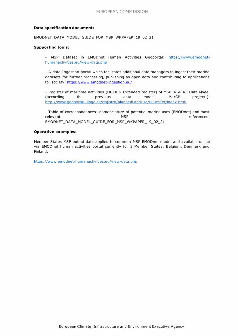
Data specification document:
EMODNET_DATA_MODEL_GUIDE_FOR_MSP_WKPAPER_19_02_21
Supporting tools:
- MSP Dataset in EMODnet Human Activities Geoportal: https://www.emodnet-
humanactivities.eu/view-data.php
- A data Ingestion portal which facilitates additional data managers to ingest their marine
datasets for further processing, publishing as open data and contributing to applications
for society: https://www.emodnet-ingestion.eu/
- Register of maritime activities (HILUCS Extended register) of MSP INSPIRE Data Model
(according the previous data model -MarSP project-):
http://www.geoportal.ulpgc.es/registro/plannedLandUse/HilucsExt/index.html
- Table of correspondences: nomenclature of potential marine uses (EMODnet) and most
relevant MSP references:
EMODNET_DATA_MODEL_GUIDE_FOR_MSP_WKPAPER_19_02_21
Operative examples:
Member States MSP output data applied to common MSP EMODnet model and available online
via EMODnet human activities portal currently for 3 Member States: Belgium, Denmark and
Finland.
https://www.emodnet-humanactivities.eu/view-data.php

GETTING IN TOUCH WITH THE EU
In person
All over the European Union there are hundreds of Europe Direct information centres. You can find the address of the centre nearest you at:
https://europa.eu/european-union/contact_en
On the phone or by email
Europe Direct is a service that answers your questions about the European Union. You can contact this service:
– by freephone: 00 800 6 7 8 9 10 11 (certain operators may charge for these calls),
– at the following standard number: +32 22999696, or
– by email via: https://europa.eu/european-union/contact_en
FINDING INFORMATION ABOUT THE EU
Online
Information about the European Union in all the official languages of the EU is available
on the Europa website at: https://europa.eu/european-union/index_en
EU publications
You can download or order free and priced EU publications from:
https://publications.europa.eu/en/publications. Multiple copies of free public ations may be obtained by contacting Europe Direct or your local information centre (see
https://europa.eu/european-union/contact_en).
EU law and related documents
For access to legal information from the EU, including all EU law since 1952 in all the official language versions, go to EUR-Lex at: http://eur-lex.europa.eu
Open data from the EU
The EU Open Data Portal (http://data.europa.eu/euodp/en) provides access to datasets
from the EU. Data can be downloaded and reused for free, for both commercial and non-commercial purposes.

doi: 10.2926/029516 ISBN 978-92-95225-12-1
HZ
-01-2
1-2
16
-EN
-N