
programming image services using silverlight web api Author Esri Subject Developer Summit 2012...
37
Programming Image Services using the Silverlight Web API Wenxue Ju, Hong Xu
Transcript of programming image services using silverlight web api Author Esri Subject Developer Summit 2012...

Programming Image Services using the Silverlight Web API
Wenxue Ju, Hong Xu
Presentation Outline
• Introduction of image service
• Image service capabilities
• Developing image service web application - Discuss seven application patterns
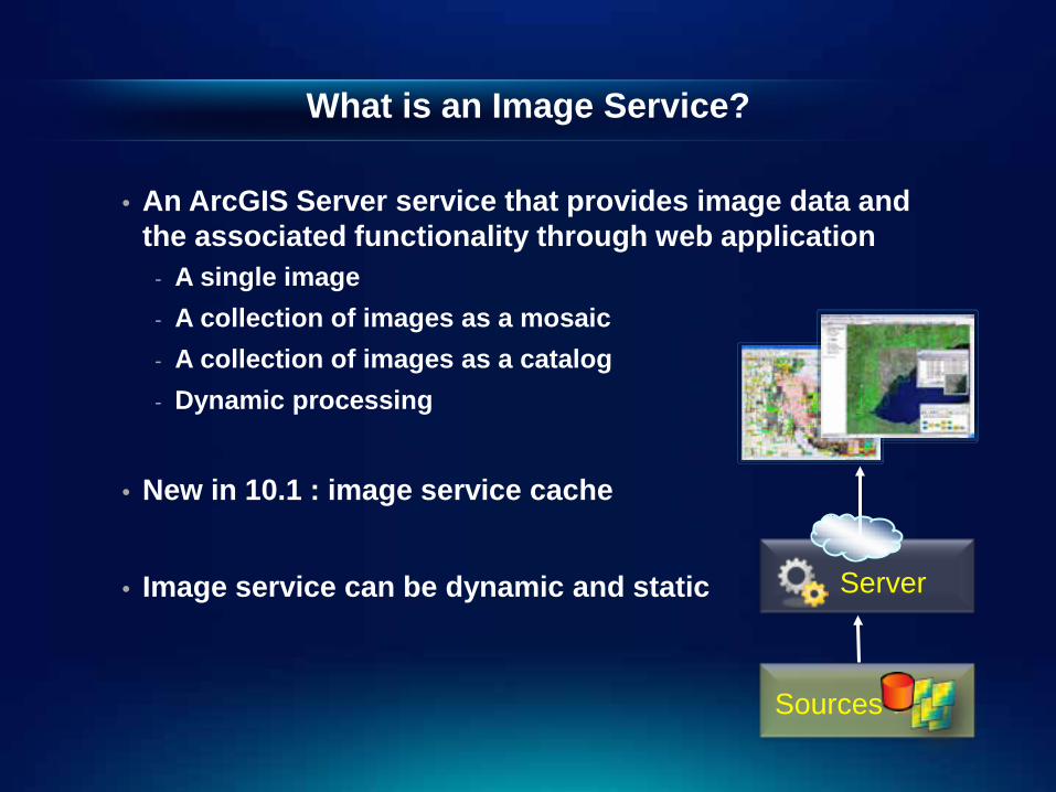
What is an Image Service?
• An ArcGIS Server service that provides image data and the associated functionality through web application
- A single image - A collection of images as a mosaic - A collection of images as a catalog - Dynamic processing
• New in 10.1 : image service cache
• Image service can be dynamic and static
Sources
Server
What Can Image Services Offer?
• Fast display • Export data
- Pixel value, raw image, and processed image
• Mosaicking and cataloging • Dynamic image processing • Image mensuration • Image service editing
- Add, delete, update
• Support OGC standard - WCS, WMS, WMTS, KML
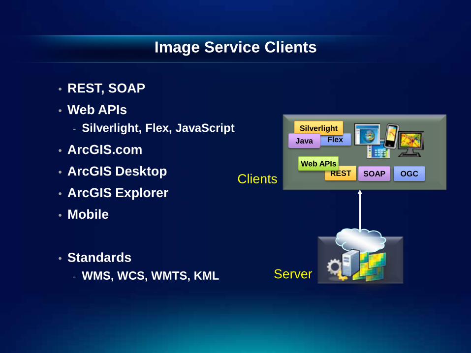
Image Service Clients
• REST, SOAP • Web APIs
- Silverlight, Flex, JavaScript
• ArcGIS.com • ArcGIS Desktop • ArcGIS Explorer • Mobile
• Standards
- WMS, WCS, WMTS, KML
REST
Flex Silverlight
Java
Web APIs OGC SOAP
Server
Clients
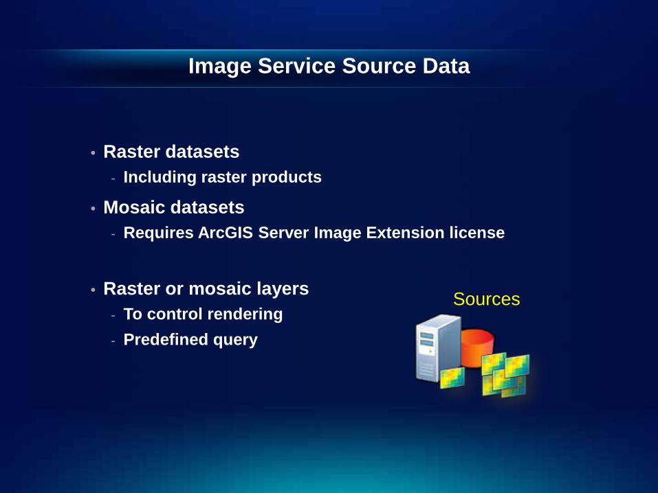
Image Service Source Data
• Raster datasets - Including raster products
• Mosaic datasets - Requires ArcGIS Server Image Extension license
• Raster or mosaic layers - To control rendering - Predefined query
Sources
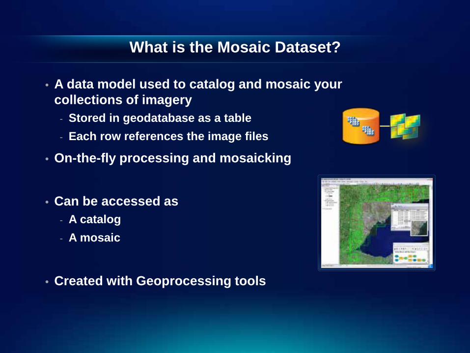
What is the Mosaic Dataset?
• A data model used to catalog and mosaic your collections of imagery
- Stored in geodatabase as a table - Each row references the image files
• On-the-fly processing and mosaicking
• Can be accessed as - A catalog - A mosaic
• Created with Geoprocessing tools
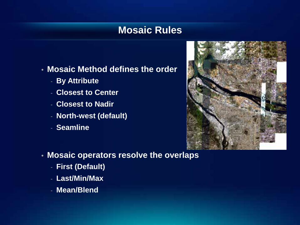
Mosaic Rules
• Mosaic Method defines the order - By Attribute - Closest to Center - Closest to Nadir - North-west (default) - Seamline
• Mosaic operators resolve the overlaps
- First (Default) - Last/Min/Max - Mean/Blend
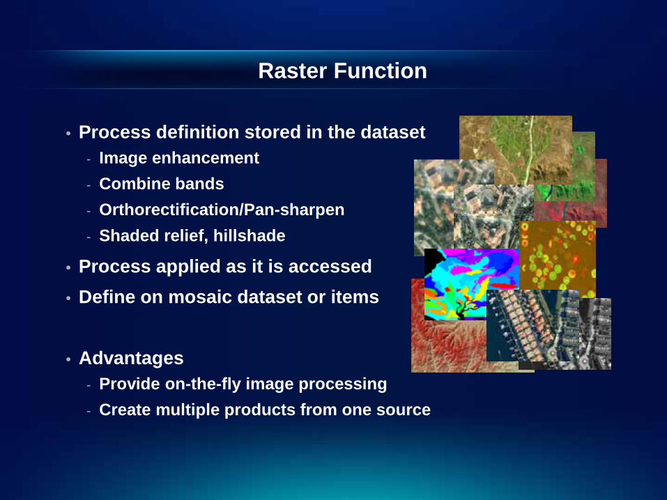
• Process definition stored in the dataset - Image enhancement - Combine bands - Orthorectification/Pan-sharpen - Shaded relief, hillshade
• Process applied as it is accessed • Define on mosaic dataset or items
• Advantages
- Provide on-the-fly image processing - Create multiple products from one source
Raster Function
Publish Image Service
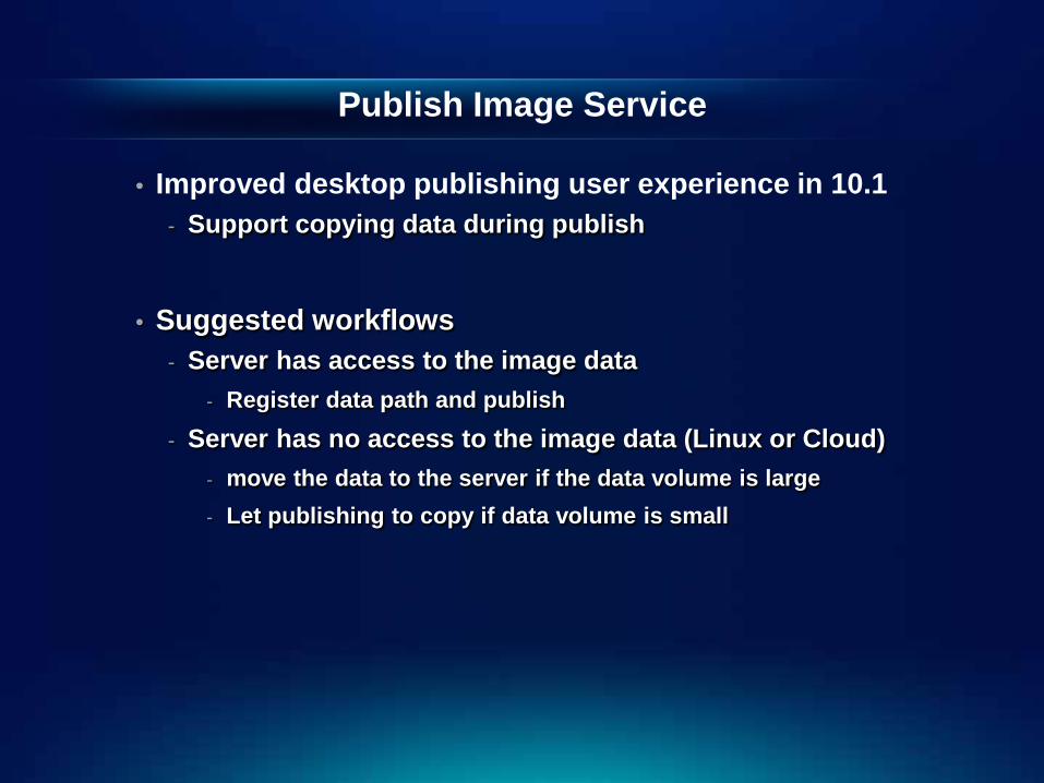
• Improved desktop publishing user experience in 10.1 - Support copying data during publish
• Suggested workflows
- Server has access to the image data - Register data path and publish
- Server has no access to the image data (Linux or Cloud) - move the data to the server if the data volume is large - Let publishing to copy if data volume is small

Publish an image service
Demo
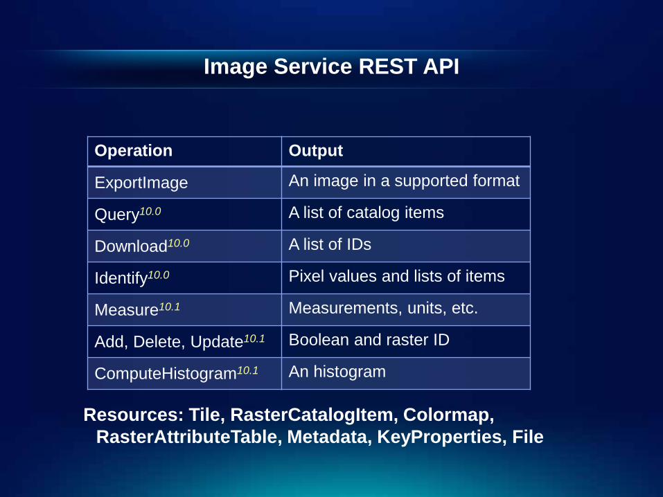
Image Service REST API
Operation Output
ExportImage An image in a supported format
Query10.0 A list of catalog items
Download10.0 A list of IDs
Identify10.0 Pixel values and lists of items
Measure10.1 Measurements, units, etc.
Add, Delete, Update10.1 Boolean and raster ID
ComputeHistogram10.1 An histogram
Resources: Tile, RasterCatalogItem, Colormap, RasterAttributeTable, Metadata, KeyProperties, File

Image Service Web APIs
ArcGISImageServiceLayer
ArcGISTiledMapServcieLayer
MosaicRule
RenderingRule
ImageServiceIdentifyTask
MensurationTask
Add/Update/Delete Rasters
Get (RasterInfo, KeyProperties, Metadata, Thumbnail)
Get (Colormap, AttributeTable, Histogram, KeyProperties)
QueryTask
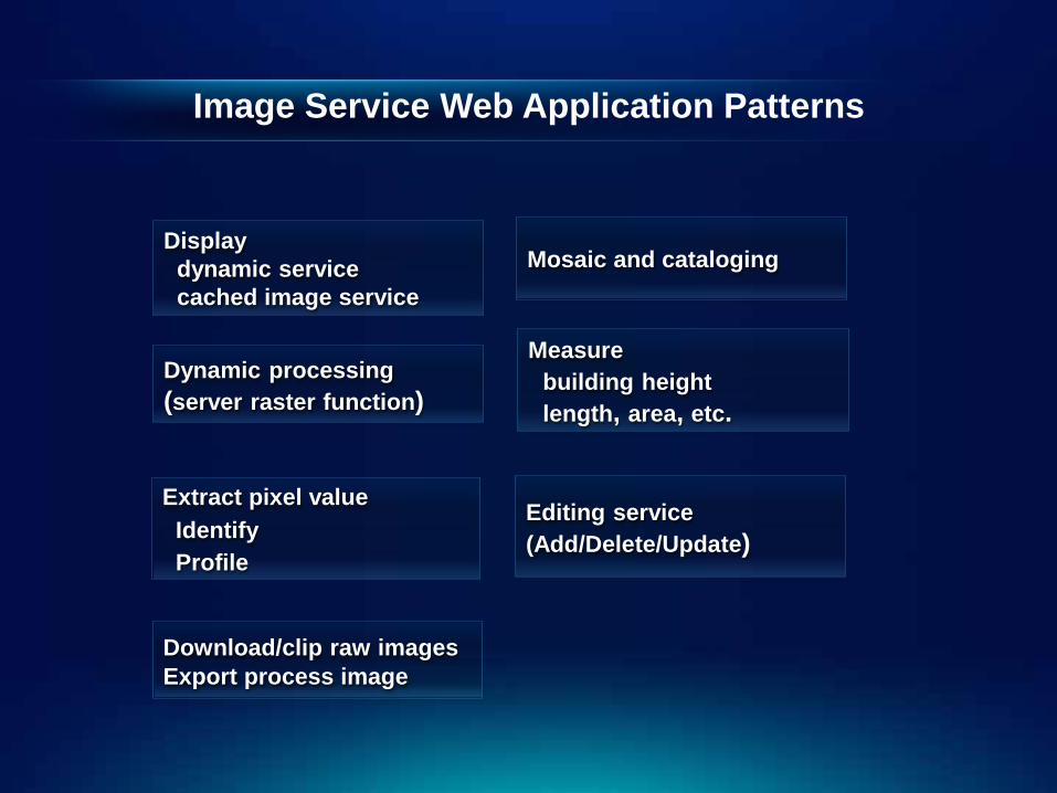
Image Service Web Application Patterns
Extract pixel value Identify Profile
Display dynamic service cached image service Dynamic processing (server raster function)
Measure building height length, area, etc.
Mosaic and cataloging
Editing service (Add/Delete/Update)
Download/clip raw images Export process image
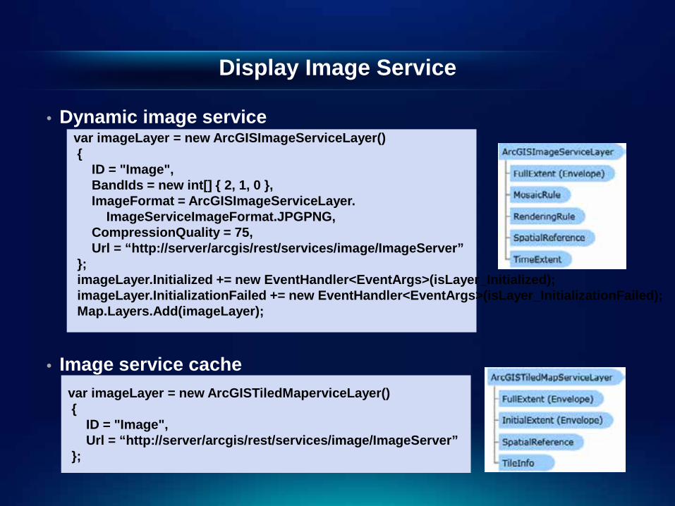
Display Image Service
• Dynamic image service
• Image service cache - Same as access map service cache
var imageLayer = new ArcGISImageServiceLayer() { ID = "Image", BandIds = new int[] { 2, 1, 0 }, ImageFormat = ArcGISImageServiceLayer. ImageServiceImageFormat.JPGPNG, CompressionQuality = 75, Url = “http://server/arcgis/rest/services/image/ImageServer” }; imageLayer.Initialized += new EventHandler<EventArgs>(isLayer_Initialized); imageLayer.InitializationFailed += new EventHandler<EventArgs>(isLayer_InitializationFailed); Map.Layers.Add(imageLayer);
var imageLayer = new ArcGISTiledMaperviceLayer() { ID = "Image", Url = “http://server/arcgis/rest/services/image/ImageServer” };

Display dynamic and cached image services
Demo
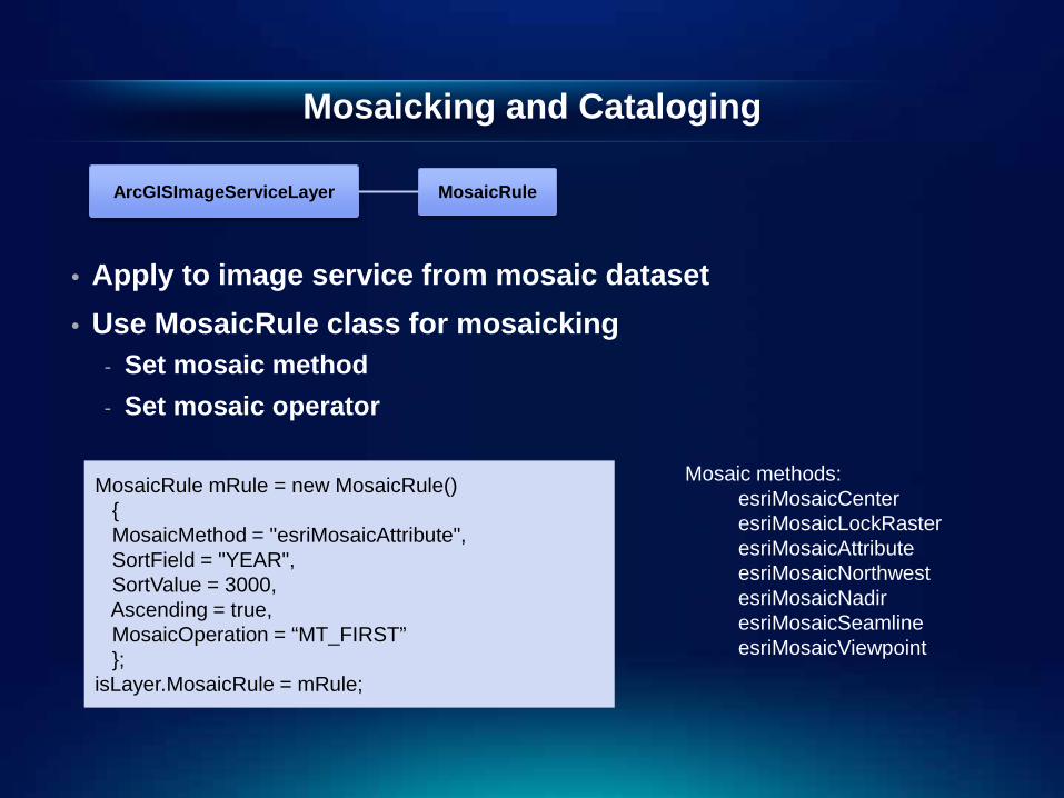
Mosaicking and Cataloging
• Apply to image service from mosaic dataset • Use MosaicRule class for mosaicking
- Set mosaic method - Set mosaic operator
MosaicRule mRule = new MosaicRule() { MosaicMethod = "esriMosaicAttribute", SortField = "YEAR", SortValue = 3000, Ascending = true, MosaicOperation = “MT_FIRST” }; isLayer.MosaicRule = mRule;
Mosaic methods: esriMosaicCenter esriMosaicLockRaster esriMosaicAttribute esriMosaicNorthwest esriMosaicNadir esriMosaicSeamline esriMosaicViewpoint
MosaicRule ArcGISImageServiceLayer

Mosaicking and cataloging (Continue)
• To access the catalog use QueryTask
//Define query parameter Query query = new ESRI.ArcGIS.Client.Tasks.Query(); query.Geometry = args.Geometry; query.Where = "Category = 1 order by Name"; query.ReturnGeometry = true; query.OutSpatialReference = Map.SpatialReference; query.OutFields.Add("*"); //Create a query task QueryTask queryTask = new QueryTask(imageserviceUrl); queryTask.ExecuteCompleted += QueryTask_ExecuteCompleted; queryTask.Failed += QueryTask_Failed; //Excute query task with defined parameters queryTask.ExecuteAsync(query);
QueryTask Query
FeatureSet

Mosaicking and cataloging
Demo
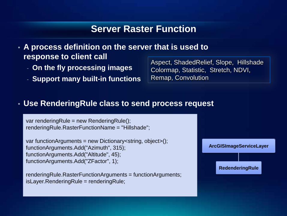
Server Raster Function
• A process definition on the server that is used to response to client call
- On the fly processing images - Support many built-in functions
• Use RenderingRule class to send process request
Aspect, ShadedRelief, Slope, Hillshade Colormap, Statistic, Stretch, NDVI, Remap, Convolution
var renderingRule = new RenderingRule(); renderingRule.RasterFunctionName = "Hillshade"; var functionArguments = new Dictionary<string, object>(); functionArguments.Add("Azimuth", 315); functionArguments.Add("Altitude", 45); functionArguments.Add("ZFactor", 1); renderingRule.RasterFunctionArguments = functionArguments; isLayer.RenderingRule = renderingRule;
RedenderingRule
ArcGISImageServiceLayer

Extending Server Raster Function
• Expandable through raster function template - Create with ArcMap - Added to server during publishing - Support customized raster function (COM extensible)
var renderingRule = new RenderingRule(); renderingRule.RasterFunctionName = “MyRFTName"; IDictionary<string, object> functionArguments = new Dictionary<string, object>(); functionArguments.Add(“Param1", val1); functionArguments.Add(“Param2", val2); functionArguments.Add(“Param3", val3); renderingRule. RasterFunctionArguments = functionArguments; isLayer.RenderingRule = renderingRule;

Create Raster Function Template Stretch
Remap-Colormap-ColormapToRGB
Demo
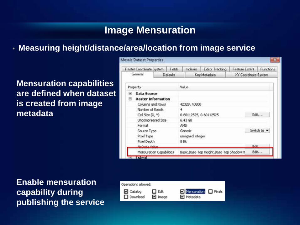
Image Mensuration • Measuring height/distance/area/location from image service
Mensuration capabilities are defined when dataset is created from image metadata Enable mensuration capability during publishing the service
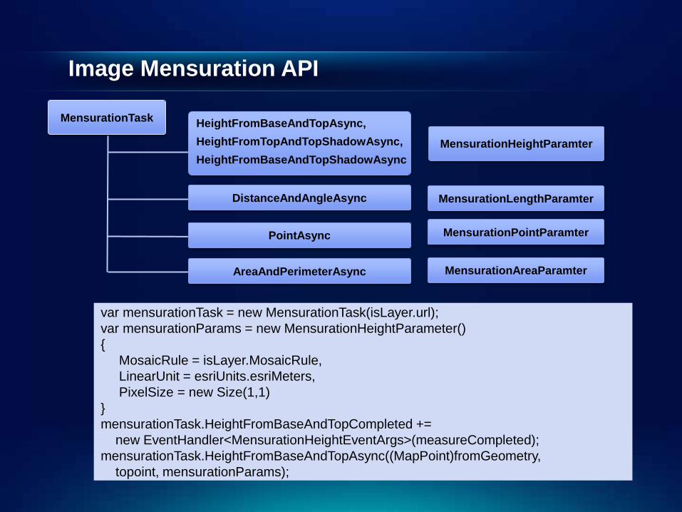
Image Mensuration API
var mensurationTask = new MensurationTask(isLayer.url); var mensurationParams = new MensurationHeightParameter() { MosaicRule = isLayer.MosaicRule, LinearUnit = esriUnits.esriMeters, PixelSize = new Size(1,1) } mensurationTask.HeightFromBaseAndTopCompleted += new EventHandler<MensurationHeightEventArgs>(measureCompleted); mensurationTask.HeightFromBaseAndTopAsync((MapPoint)fromGeometry, topoint, mensurationParams);
MensurationTask
MensurationHeightParamter
HeightFromBaseAndTopAsync,
HeightFromTopAndTopShadowAsync,
HeightFromBaseAndTopShadowAsync
MensurationAreaParamter
MensurationLengthParamter
MensurationPointParamter
DistanceAndAngleAsync
PointAsync
AreaAndPerimeterAsync

Measure Washington Monument
Demo
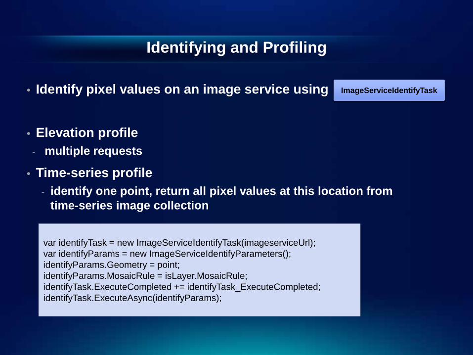
Identifying and Profiling
• Identify pixel values on an image service using
• Elevation profile - multiple requests
• Time-series profile - identify one point, return all pixel values at this location from
time-series image collection
var identifyTask = new ImageServiceIdentifyTask(imageserviceUrl); var identifyParams = new ImageServiceIdentifyParameters(); identifyParams.Geometry = point; identifyParams.MosaicRule = isLayer.MosaicRule; identifyTask.ExecuteCompleted += identifyTask_ExecuteCompleted; identifyTask.ExecuteAsync(identifyParams);
ImageServiceIdentifyTask

Elevation Profile Temperature trend
Demo

Image Service Editing • Allow add/delete/update images from image service • The backend must be an SDE mosaic dataset
- optional turn on editor tracking
• Enable editing capability
- Set workspace on server - Set raster type - Extend using raster type template
- Example: LAS
• Access control AGS users can add Owner can update delete
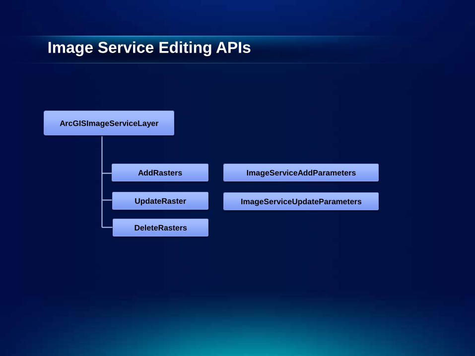
Image Service Editing APIs
ImageServiceAddParameters
ImageServiceUpdateParameters
DeleteRasters
UpdateRaster
AddRasters
ArcGISImageServiceLayer

Uploading LAS files to an elevation service
Demo
Download and Export Image
• Download raw images from server - Applies to image service of mosaic dataset - Clip/Convert in pixel space/original image/Maintain
transformation
• Export image
- Proccessed image - TIFF (GeoTIFF)
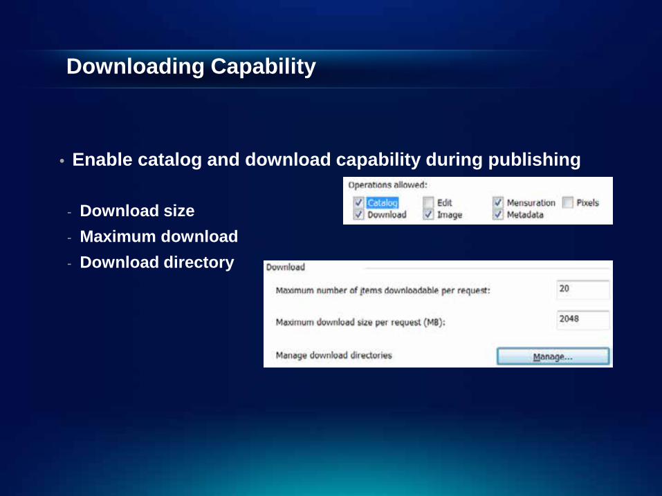
Downloading Capability
• Enable catalog and download capability during publishing
- Download size - Maximum download - Download directory
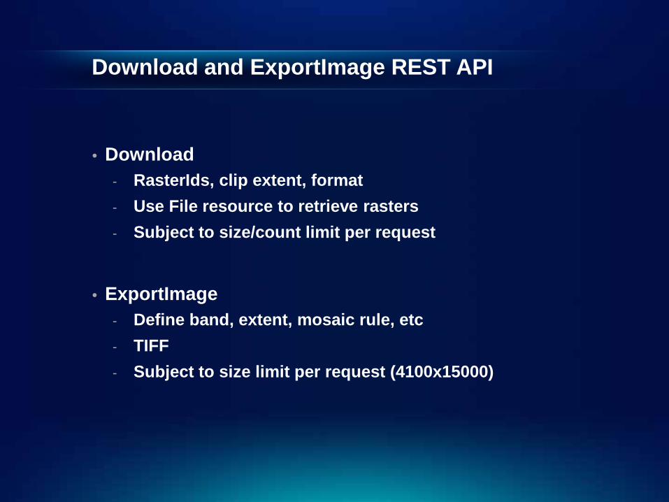
Download and ExportImage REST API
• Download - RasterIds, clip extent, format - Use File resource to retrieve rasters - Subject to size/count limit per request
• ExportImage
- Define band, extent, mosaic rule, etc - TIFF - Subject to size limit per request (4100x15000)

Download and Export
Demo

Performance
• Background: Cached service;
• Dynamic access: JPGPNG Format, or jpg • Identify: use ReturnCatalogItems, ReturnGeometry flags
• Hybrid use: cache for display; dynamic access for query,
identify, mensuration
Help and Sample Services
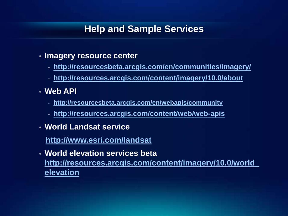
• Imagery resource center - http://resourcesbeta.arcgis.com/en/communities/imagery/ - http://resources.arcgis.com/content/imagery/10.0/about
• Web API - http://resourcesbeta.arcgis.com/en/webapis/community
- http://resources.arcgis.com/content/web/web-apis
• World Landsat service http://www.esri.com/landsat • World elevation services beta
http://resources.arcgis.com/content/imagery/10.0/world_elevation

Q&A
Thank you!
Please fill out the survey form


