Practical introduction to GRASS and related software …grass/docs/GRASS_beginners_2010...FOSS4G2010...
25
FOSS4G2010 Barcelona, Spain 6 FOSS4G2010 Barcelona, Spain 6 - 9 Sept. - 9 Sept. 2010 2010 Workshop Workshop Practical introduction to GRASS Practical introduction to GRASS Practical introduction to GRASS and related software for beginners Marco Ciolli, Clara Tattoni and Paolo Zatelli Department of Civil and Environmental Engineering University of Trento Italy
Transcript of Practical introduction to GRASS and related software …grass/docs/GRASS_beginners_2010...FOSS4G2010...

FOSS4G2010 Barcelona, Spain 6FOSS4G2010 Barcelona, Spain 6 - 9 Sept. - 9 Sept. 20102010
Workshop Workshop Practical introduction to GRASS Practical introduction to GRASS
Practical introduction to
GRASS and related software for beginners
Marco Ciolli, Clara Tattoni and Paolo Zatelli
Department of Civil and Environmental EngineeringUniversity of Trento
Italy

FOSS4G2010 Barcelona, Spain 6FOSS4G2010 Barcelona, Spain 6 - 9 Sept. - 9 Sept. 20102010 22
Workshop Workshop Practical introduction to GRASS Practical introduction to GRASS
Who are you, anyway?Who are you, anyway?
We are researchers in GIS and environmental applications at the University of Trento, Italy, for more than ten years.
We have organized the "Open Source Free Software GIS - GRASS users conference 2002", Trento, Italy, in 2002.
We have already organized the workshops:
●"GRASS Beginners" and "GRASS external RDBMS" for FOSS4G2006
●"GRASS GIS and RDBMS" for FOSS4G2007
●“Practical introduction to GRASS and related software for beginners” for FOSS4G2008 and FOSS4G2009

FOSS4G2010 Barcelona, Spain 6FOSS4G2010 Barcelona, Spain 6 - 9 Sept. - 9 Sept. 20102010 33
Workshop Workshop Practical introduction to GRASS Practical introduction to GRASS
What are we going to do?What are we going to do?
Well, of course, a “Practical introduction to GRASS and related software for beginners”!
It consists in:
✔ a brief presentation of GRASS;
✔ a hands-on tutorial.

FOSS4G2010 Barcelona, Spain 6FOSS4G2010 Barcelona, Spain 6 - 9 Sept. - 9 Sept. 20102010 44
Workshop Workshop Practical introduction to GRASS Practical introduction to GRASS
What are we going to use?What are we going to use?
The workshop material is self-contained in the Virtual Machine we are using. The Virtual Machine contains:
✔ The software ✔ Xubuntu 10.04 with:✔ GRASS GIS 6.4RC6;✔ R 2.10.1 with GRASS support;✔ QGIS 1.4.0 with GRASS plugin, PostgreSQL 8.4.4,
PostGIS 1.5.1, pgAdminIII 1.10.1 and pgagent 3.0.1.
✔ GRASS tutorial;
✔ These slides.
FOSS4G2010 Barcelona, Spain 6FOSS4G2010 Barcelona, Spain 6 - 9 Sept. - 9 Sept. 20102010 55
Workshop Workshop Practical introduction to GRASS Practical introduction to GRASS
Where can I find this?Where can I find this?
The workshop material is available on our web site:
http://www.ing.unitn.it/~grass
There you find:
✔ LIVE DVD iso images. Virtual Machines;
✔ GRASS tutorials;
✔ Other GRASS and GIS related documents and software.

FOSS4G2010 Barcelona, Spain 6FOSS4G2010 Barcelona, Spain 6 - 9 Sept. - 9 Sept. 20102010 66
Workshop Workshop Practical introduction to GRASS Practical introduction to GRASS
What is GRASS?What is GRASS?
grass [gras, grahs] noun
1. any plant of the family Gramineae, having jointed stems, sheathing leaves, and seedlike grains...
2. GRASS GIS (Geographic Resources Analysis Support System), a Geographic Information System (GIS).
It is available under the GNU General Public License (GPL).
It is part of the OSGeo's projects family.
FOSS4G2010 Barcelona, Spain 6FOSS4G2010 Barcelona, Spain 6 - 9 Sept. - 9 Sept. 20102010 77
Workshop Workshop Practical introduction to GRASS Practical introduction to GRASS
Where does GRASS come from?Where does GRASS come from?
GRASS was originally developed in the beginning of the 1980s by the US Army Construction Engineering Research Laboratories (USA-CERL), published as a public domain software.
The USA-CERL withdrew from the GRASS development in the early 1990s.
From 1999 it is developed by an international developer team, which published GRASS as a free software under the terms of the GNU General Public License.
The main site is http://grass.osgeo.org/

FOSS4G2010 Barcelona, Spain 6FOSS4G2010 Barcelona, Spain 6 - 9 Sept. - 9 Sept. 20102010 88
Workshop Workshop Practical introduction to GRASS Practical introduction to GRASS
What can GRASS do for me?What can GRASS do for me?
Main GRASS features are:●2D raster analysis and 3D voxel (volumes) management
●2D/3D vector engine with SQL based DBMS support
●Image processing modules
●Vector network analysis, Linear Referencing System
●Visualization of 2D, 3D maps and volumes
●Interoperable with standard raster and vector formats
●Works on GNU/Linux, Mac OS X, MS-Windows and other POSIX compliant platforms
●Modular architecture and scripting capabilities for batch processing
source: grass.osgeo.org
FOSS4G2010 Barcelona, Spain 6FOSS4G2010 Barcelona, Spain 6 - 9 Sept. - 9 Sept. 20102010 99
Workshop Workshop Practical introduction to GRASS Practical introduction to GRASS
Is GRASS alone out there?Is GRASS alone out there?
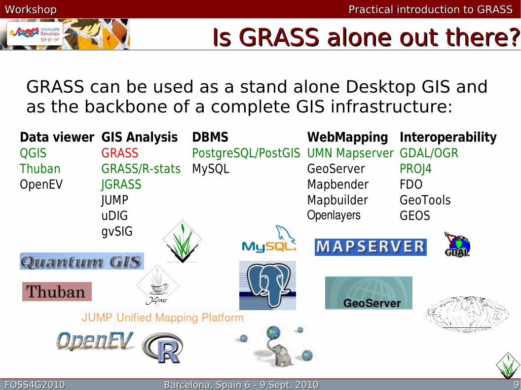
GRASS can be used as a stand alone Desktop GIS and as the backbone of a complete GIS infrastructure:
Data viewer GIS Analysis DBMS WebMapping InteroperabilityQGIS GRASS PostgreSQL/PostGIS UMN Mapserver GDAL/OGRThuban GRASS/R-stats MySQL GeoServer PROJ4OpenEV JGRASS Mapbender FDO
JUMP Mapbuilder GeoToolsuDIG Openlayers GEOSgvSIG
FOSS4G2010 Barcelona, Spain 6FOSS4G2010 Barcelona, Spain 6 - 9 Sept. - 9 Sept. 20102010 1010
Workshop Workshop Practical introduction to GRASS Practical introduction to GRASS
Where can I get GRASS?Where can I get GRASS?
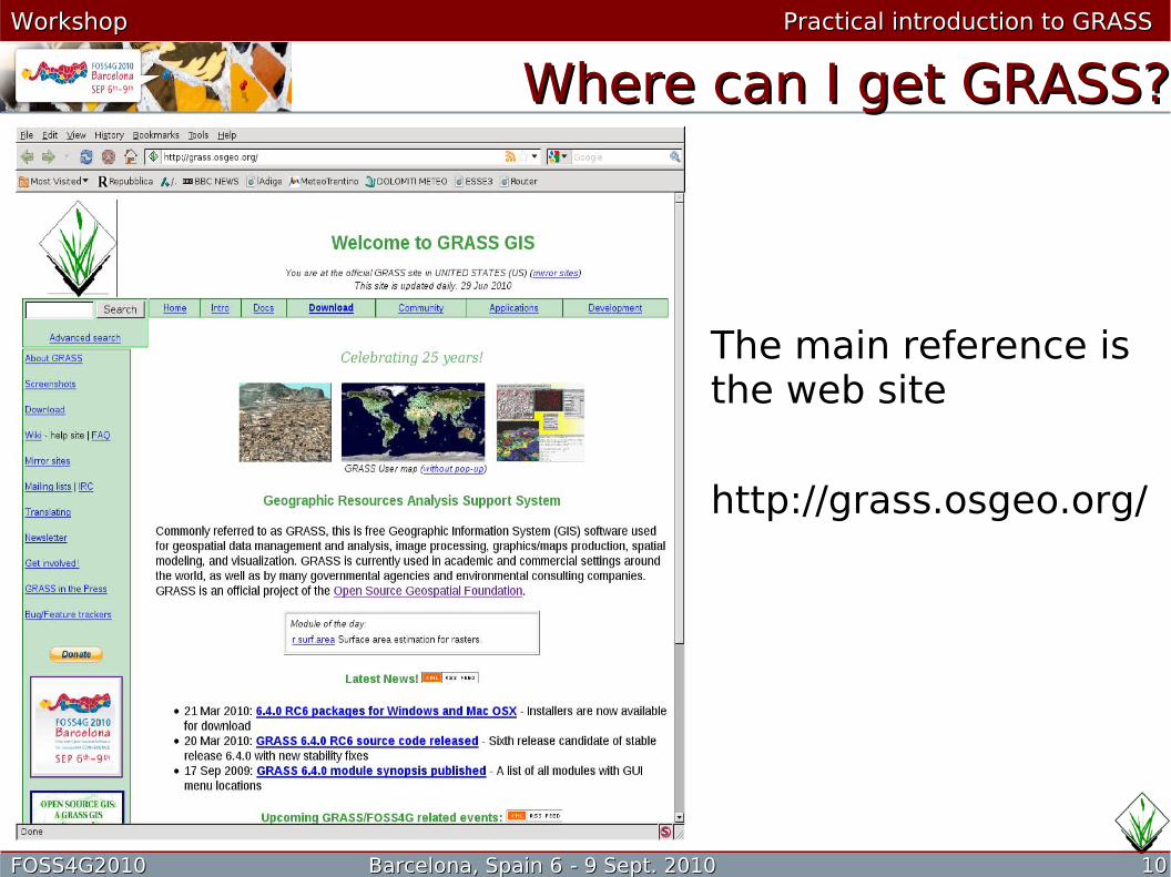
The main reference is the web site
http://grass.osgeo.org/
FOSS4G2010 Barcelona, Spain 6FOSS4G2010 Barcelona, Spain 6 - 9 Sept. - 9 Sept. 20102010 1111
Workshop Workshop Practical introduction to GRASS Practical introduction to GRASS
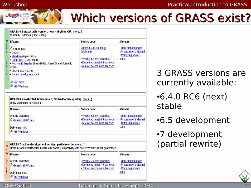
Which versions of GRASS exist?Which versions of GRASS exist?
3 GRASS versions are currently available:
●6.4.0 RC6 (next) stable
●6.5 development
●7 development (partial rewrite)
FOSS4G2010 Barcelona, Spain 6FOSS4G2010 Barcelona, Spain 6 - 9 Sept. - 9 Sept. 20102010 1212
Workshop Workshop Practical introduction to GRASS Practical introduction to GRASS
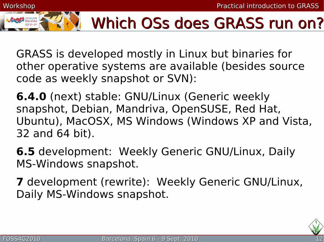
Which OSs does GRASS run on?Which OSs does GRASS run on?
GRASS is developed mostly in Linux but binaries for other operative systems are available (besides source code as weekly snapshot or SVN):
6.4.0 (next) stable: GNU/Linux (Generic weekly snapshot, Debian, Mandriva, OpenSUSE, Red Hat, Ubuntu), MacOSX, MS Windows (Windows XP and Vista, 32 and 64 bit).
6.5 development: Weekly Generic GNU/Linux, Daily MS-Windows snapshot.
7 development (rewrite): Weekly Generic GNU/Linux, Daily MS-Windows snapshot.

FOSS4G2010 Barcelona, Spain 6FOSS4G2010 Barcelona, Spain 6 - 9 Sept. - 9 Sept. 20102010 1313
Workshop Workshop Practical introduction to GRASS Practical introduction to GRASS
Binary or source code?Binary or source code?
Should I compile GRASS?
There are pros and cons:
For beginners binaries are the best choice, those able to configure and compile GRASS from source benefit from its optimization (and the possibility to develop).
Pros Cons
Binary Easy and fast installation Standard compile parameters,generated periodically
Source Optimization possible,latest version available
Must be configured, development libraries must be available

FOSS4G2010 Barcelona, Spain 6FOSS4G2010 Barcelona, Spain 6 - 9 Sept. - 9 Sept. 20102010 1414
Workshop Workshop Practical introduction to GRASS Practical introduction to GRASS
What if I want only to try GRASS?What if I want only to try GRASS?
The easiest way to try out GRASS without messing with installation is to use a Live CD/DVD or an USB distribution with pre-installed GRASS.
See http://grass.osgeo.org/download/cdrom.php
USB stick: slaxGIS, FOSSGIS on USB Stick.
CDROM/DVD: ArcheOS, DebianGIS Live Image, FOSS4G Toolkit CD, FOSS4G2006 LiveCD, FOSS4G2008 live Workshop DVD, geobuntu, , GISAK - Knoppix based GIS LiveCD, Italian GRASS DVD, Ominiverdi LiveCD Project, OSGEO Live GIS Disc, Poseidon Linux, SOURCEPOLE GIS Knoppix.

FOSS4G2010 Barcelona, Spain 6FOSS4G2010 Barcelona, Spain 6 - 9 Sept. - 9 Sept. 20102010 1515
Workshop Workshop Practical introduction to GRASS Practical introduction to GRASS
What does GRASS look like?What does GRASS look like?GNU/Linux (KDE 4)
See also http://grass.osgeo.org/screenshots/index.php

FOSS4G2010 Barcelona, Spain 6FOSS4G2010 Barcelona, Spain 6 - 9 Sept. - 9 Sept. 20102010 1616
Workshop Workshop Practical introduction to GRASS Practical introduction to GRASS
How many GUIs exist?How many GUIs exist?
Short answer: a lot.
Long answer: one of the best features of GRASS is that everything can be done using the Command Line Interface (CLI), the GUIs “build” the command line. Historically, several interfaces have been developed. Those actually in use are:
Python: the current interface for 6.4;
Tcl/Tk: it is used in older versions, up to 6.3 (but it is still available in the current version, you can try it with “g.gui gui=tcltk” or “g.gui gui=oldtcltk”);
QGIS: this GIS can be used as an interface for GRASS, since it is able to run GRASS commands. This approach is mostly used in MS Windows.
FOSS4G2010 Barcelona, Spain 6FOSS4G2010 Barcelona, Spain 6 - 9 Sept. - 9 Sept. 20102010 1717
Workshop Workshop Practical introduction to GRASS Practical introduction to GRASS
What do I need to run GRASS?What do I need to run GRASS?
A fairly modern Pc will do.
You need an operative system supported by GRASS: some flavor of UNIX (Solaris, IRIX, Linux, BSD), Mac OS X or MS windows (with or without cygwin).
The system (binaries, configuration, etc.) needs about 50 MB of disk space (the actual space is platform dependent). To compile GRASS you need around 500 MB of disk space.
Real requirements depend on the data you want to process.
Live CD/DVD are usually more demanding in terms of memory.

FOSS4G2010 Barcelona, Spain 6FOSS4G2010 Barcelona, Spain 6 - 9 Sept. - 9 Sept. 20102010 1818
Workshop Workshop Practical introduction to GRASS Practical introduction to GRASS
Which data can GRASS r/w?Which data can GRASS r/w?
Like most of the GISs, GRASS uses the GDAL library to handle data file I/O, so basically all the currently used formats are supported.
See http://www.gdal.org/ for details.
Datum and projection management is done by the PROJ4 library, see http://proj.maptools.org/
FOSS4G2010 Barcelona, Spain 6FOSS4G2010 Barcelona, Spain 6 - 9 Sept. - 9 Sept. 20102010 1919
Workshop Workshop Practical introduction to GRASS Practical introduction to GRASS
How does GRASS run?How does GRASS run?
GRASS itself is a working environment, the job is actually carried out by programs (called “modules”) running inside this environment.
Currently more than 350 modules are available.
To perform complex tasks modules are combined, each one doing part of the job, usually in scripts.
Moreover, more than 100 add-on modules are available on the GRASS web site.
FOSS4G2010 Barcelona, Spain 6FOSS4G2010 Barcelona, Spain 6 - 9 Sept. - 9 Sept. 20102010 2020
Workshop Workshop Practical introduction to GRASS Practical introduction to GRASS
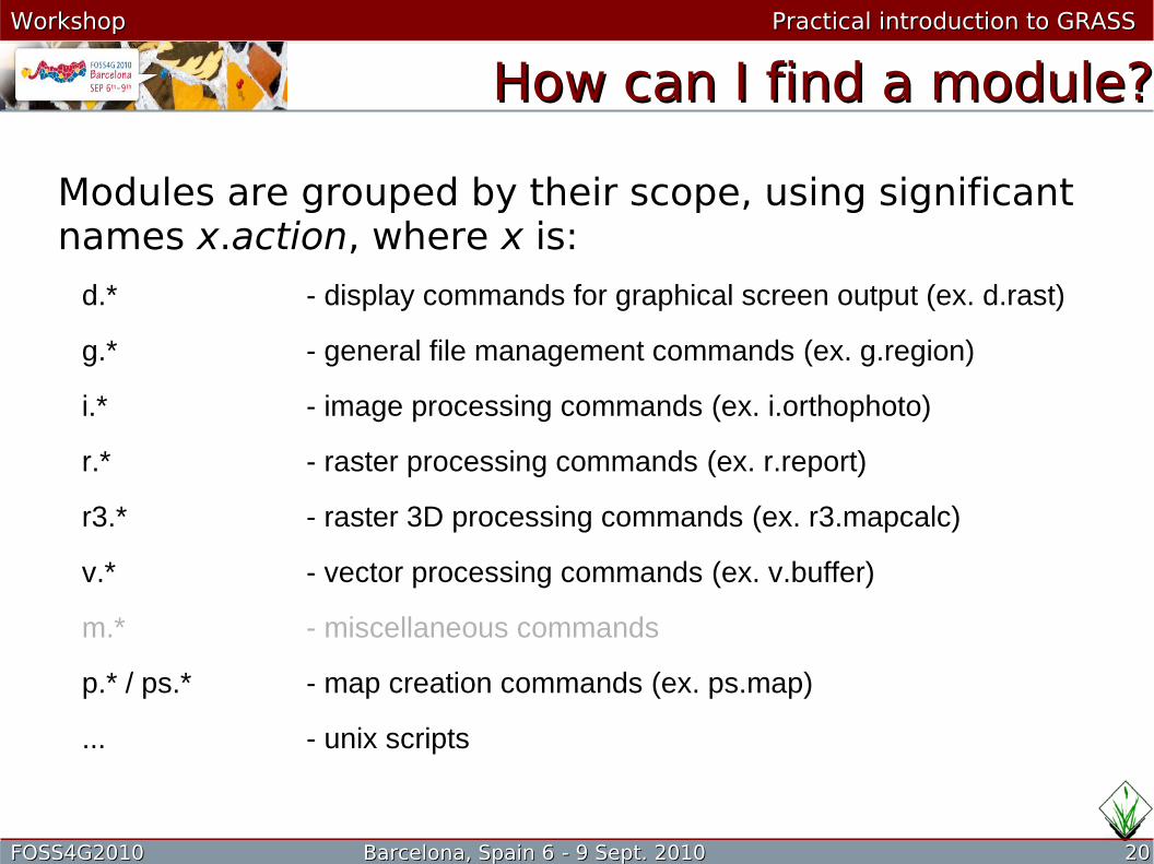
How can I find a module?How can I find a module?
Modules are grouped by their scope, using significant names x.action, where x is:
d.* - display commands for graphical screen output (ex. d.rast)
g.* - general file management commands (ex. g.region)
i.* - image processing commands (ex. i.orthophoto)
r.* - raster processing commands (ex. r.report)
r3.* - raster 3D processing commands (ex. r3.mapcalc)
v.* - vector processing commands (ex. v.buffer)
m.* - miscellaneous commands
p.* / ps.* - map creation commands (ex. ps.map)
... - unix scripts
FOSS4G2010 Barcelona, Spain 6FOSS4G2010 Barcelona, Spain 6 - 9 Sept. - 9 Sept. 20102010 2121
Workshop Workshop Practical introduction to GRASS Practical introduction to GRASS
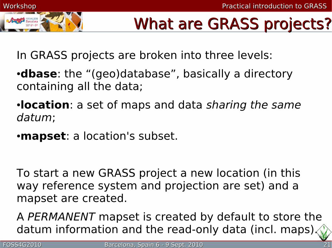
What are GRASS projects?What are GRASS projects?
In GRASS projects are broken into three levels:
●dbase: the “(geo)database”, basically a directory containing all the data;
●location: a set of maps and data sharing the same datum;
●mapset: a location's subset.
To start a new GRASS project a new location (in this way reference system and projection are set) and a mapset are created.
A PERMANENT mapset is created by default to store the datum information and the read-only data (incl. maps).

FOSS4G2010 Barcelona, Spain 6FOSS4G2010 Barcelona, Spain 6 - 9 Sept. - 9 Sept. 20102010 2222
Workshop Workshop Practical introduction to GRASS Practical introduction to GRASS
What is the What is the regionregion??
The current region or simply the region is a fundamental concept in GRASS: it identifies the extents and the resolution (for raster maps) used in all the operations, regardless of the properties of the maps involved.
All the raster maps are re-sampled on the fly to the resolution of the current region and only the part inside the current region's extents is used (smaller maps are padded with NULL values). However, only output maps are affected from the current region settings, input maps are not modified.
To further complicate the matter, map display is independent from the current region settings.
FOSS4G2010 Barcelona, Spain 6FOSS4G2010 Barcelona, Spain 6 - 9 Sept. - 9 Sept. 20102010 2323
Workshop Workshop Practical introduction to GRASS Practical introduction to GRASS
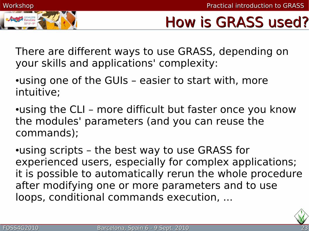
How is GRASS used?How is GRASS used?
There are different ways to use GRASS, depending on your skills and applications' complexity:
●using one of the GUIs – easier to start with, more intuitive;
●using the CLI – more difficult but faster once you know the modules' parameters (and you can reuse the commands);
●using scripts – the best way to use GRASS for experienced users, especially for complex applications; it is possible to automatically rerun the whole procedure after modifying one or more parameters and to use loops, conditional commands execution, ...

FOSS4G2010 Barcelona, Spain 6FOSS4G2010 Barcelona, Spain 6 - 9 Sept. - 9 Sept. 20102010 2424
Workshop Workshop Practical introduction to GRASS Practical introduction to GRASS
Where can I find more?Where can I find more?
This is a GRASS beginners' workshop, extensive documentation exists for the use of GRASS in particular fields.
For example, for GRASS and DBMS see the FOSS4G2007 "GRASS GIS and RDBMS" workshop.
A rich source of information is the “Special topic” section of the documentation site:
http://grass.osgeo.org/gdp/special.php

FOSS4G2010 Barcelona, Spain 6FOSS4G2010 Barcelona, Spain 6 - 9 Sept. - 9 Sept. 20102010 2525
Workshop Workshop Practical introduction to GRASS Practical introduction to GRASS
What now?What now?
Let's start the hands-on part:
●open the tutorial by clicking the Tutorial icon;
●when the tutorial suggests you to do so, run GRASS by clicking on the icon;
●the dataset is in the “grass” directory and the relevant GRASS' parameter are already set;
●enjoy GRASS!


![MapProxy - FOSS4G2010.foss4g.org/presentations/3225.pdfMapProxy The caching proxy for web map services ... lots of unit/system ... [GLOBAL_GEODETIC] layers: world: title: ...](https://static.fdocuments.in/doc/165x107/5ace67ea7f8b9a56098bbce5/mapproxy-the-caching-proxy-for-web-map-services-lots-of-unitsystem-globalgeodetic.jpg)