Polar and South Atlantic Space Weather studies during IPY/IHY
21
Polar and South Atlantic Space Weather studies during IPY/IHY IPY Kick-off meeting, Helsinki. 5 – 9 Feb 2007 Ben Opperman, Pierre Cilliers. Hermanus Magnetic Observatory, South Africa. http://www.hmo.ac.z
description
Polar and South Atlantic Space Weather studies during IPY/IHY. Ben Opperman, Pierre Cilliers. Hermanus Magnetic Observatory, South Africa. IPY Kick-off meeting, Helsinki. 5 – 9 Feb 2007. http://www.hmo.ac.za. Hermanus Magnetic Observatory (19 ° 13’E, 34° 25’S). - PowerPoint PPT Presentation
Transcript of Polar and South Atlantic Space Weather studies during IPY/IHY

Polar and South Atlantic Space Weather studies during IPY/IHY
IPY Kick-off meeting, Helsinki. 5 – 9 Feb 2007
Ben Opperman, Pierre Cilliers.
Hermanus Magnetic Observatory, South Africa.
http://www.hmo.ac.za

Hermanus Magnetic Observatory(19° 13’E, 34° 25’S)
Established 1932 (2nd Polar Year) Intermagnet station Space Physics Research (Magnetosphere,
ULF pulsations, Ionosphere, Waves in dusty plasmas, VLF waves, Neural network applications in space physics)
Science Outreach (Schools, Public, undergrad, graduate students)
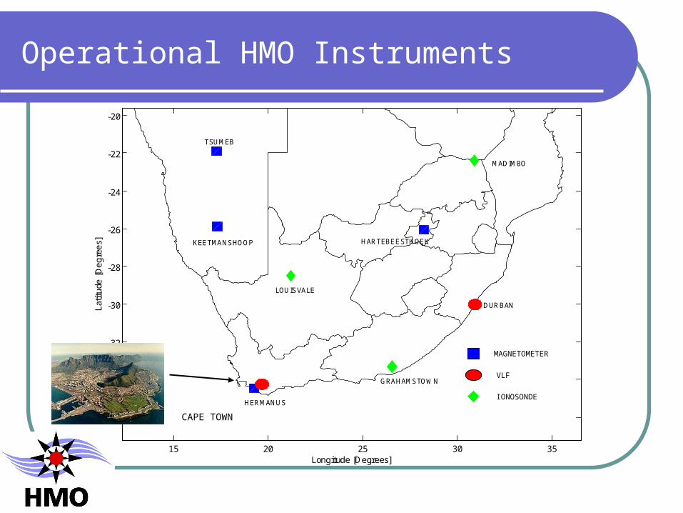
15 20 25 30 35
-36
-34
-32
-30
-28
-26
-24
-22
-20
DURBAN
HERMANUS
Longitude [Degrees]
Latit
ude
[Deg
rees
]
TSUMEB
KEETMANSHOOP
GRAHAMSTOWN
LOUISVALE
MADIMBO
HARTEBEESTHOEK
MAGNETOMETER
VLF
IONOSONDE
Operational HMO Instruments
CAPE TOWN

Operational HMO instruments (2)
SHARE HF Radar at Vesleskarvet, Antarctica (2° 50’W, 71° 40’S)
GPS receiver, Marion Island (37°5'E, 46°54’S)
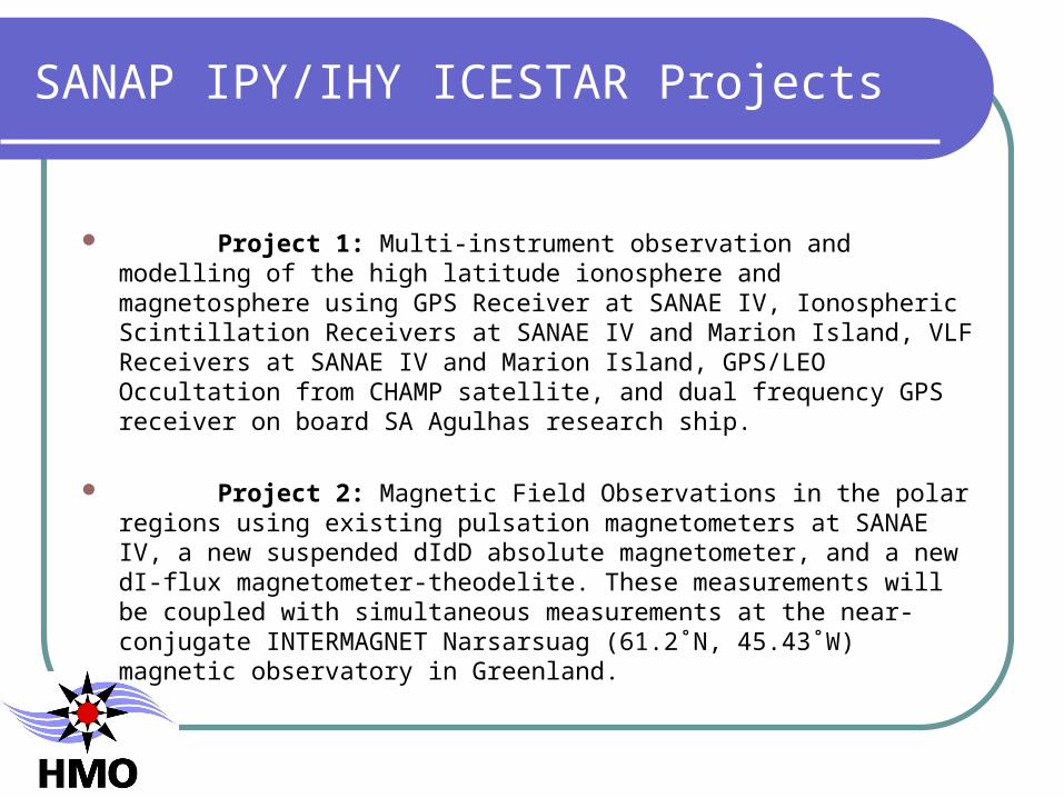
SANAP IPY/IHY ICESTAR Projects
Project 1: Multi-instrument observation and modelling of the high latitude ionosphere and magnetosphere using GPS Receiver at SANAE IV, Ionospheric Scintillation Receivers at SANAE IV and Marion Island, VLF Receivers at SANAE IV and Marion Island, GPS/LEO Occultation from CHAMP satellite, and dual frequency GPS receiver on board SA Agulhas research ship.
Project 2: Magnetic Field Observations in the polar regions using existing pulsation magnetometers at SANAE IV, a new suspended dIdD absolute magnetometer, and a new dI-flux magnetometer-theodelite. These measurements will be coupled with simultaneous measurements at the near-conjugate INTERMAGNET Narsarsuag (61.2˚N, 45.43˚W) magnetic observatory in Greenland.

Project 3: Ionospheric studies with riometers and aurora imaging using 64-element narrow angle imaging riometer at 38.2 MHz, broad beam riometers at 51.4 and 30 MHz, a low-level white-light, digitized all-sky auroral camera, and a narrow angle (field of view 25o) colour camera, two three-component fluxgate magnetometers.
Project 4: Promotion of public interest in Space Science through presentation of IPY/IHY research activities and outcomes at Schools, Science Fairs, at NASSP Colloquia, Summer and Winter Schools offered at the HMO, local conferences and in the public media, using much of the material prepared for this purpose by the international community.
The participation in IPY/IHY will serve as a focus for the Science Outreach programmes of the Interactive Science Centre of Hermanus Magnetic Observatory and will be made known via the South African Agency for Science and Technology Advancement (SAASTA).

IP(H)Y - SA
INGV
18E 24E 30E
36E
36 S
30S
24S
18 S
RUHMOISSA
UKZNHartRAO
UPNWU
75S

Area of Interest : South Atlantic
Theoretical South Atlantic coverage of the coastal and island-based dual frequency GPS receivers.
10º elevation angle cut-off, and an ionospheric peak density height, hmF2=350 km, is assumed
http://www.hmo.ac.za
S
VESLSYOG
DAV1MAW1
CAS1PALMOHI2
KERGEULEN
MARIONGOUG
LPGS
INGV
BOUVET
0
25 S
50 S

Ship-based ionospheric measurements
SA Agulhas
GPS receiver

Cape Town to SANAE IV 1-14 December 2005
http://www.hmo.ac.za
Ionospheric Pierce Points (IPPs) at hourly intervals for all satellite ray paths observed along the route of the SA Agulhas on its first trip to Antarctica during which measurements were made of the ionosphere over the South Atlantic Ocean using a GPS dual frequency receiver. The colours indicate bias-corrected VTEC at the IPPs.
Electron density distribution (x1011 /m3) along longitude =0º at 10:00 UT. Derived by ionospheric tomography using MIDAS from measurements made during the trip of the SA Agulhas to Antarctica on day 7 of the trip. The location of the ship at the time is shown by the red dot on the trajectory. Note the interesting high latitude structure resolved by the inversion.
TECUx1011/m3

Cape Town to Marion Island 6-12 April 2006
http://www.hmo.ac.za
IPPs for one hour intervals for all satellite ray paths observed along the route of the SA Agulhas on its first trip to Marion Island (6-12 Apr 2006) after being equipped with a dual frequency GPS receiver. Colours show bias-corrected VTEC values.
Electron density distribution (x1011 /m3) along longitude =30º for 10:00 UT on 09 Apr 2006. Derived by ionospheric tomography using MIDAS from GPS data recorded on the SA Agulhas during its trip to Marion Island when the ship was at about (42ºS, 30º E).
TECU
x1011/m3

Conjugate trajectories of SA Agulhas
Dec 2006, 2007,
200803, 04, 05, 08, 10, 2007/8
09-10 2007/8

IPY Instruments Vesleskarvet (1)
EuroPak 3MReceiver withdimensions235 * 154 * 71 mm
Ionospheric Scintillation Monitor (Novatel)
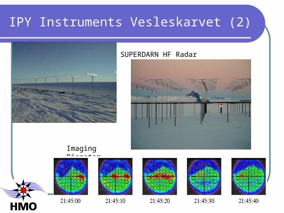
IPY Instruments Vesleskarvet (2)
SUPERDARN HF Radar
Imaging Riometer
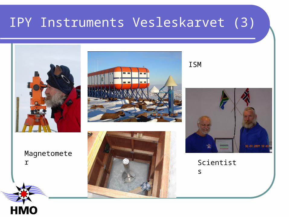
IPY Instruments Vesleskarvet (3)
Magnetometer
ISM
Scientists

IPY Instruments not shown
VLF receivers
Challenges
Data communication Thin VSAT communication link Aim for < 24-hour magnetometer and ISM data Radar data will take (little) longer Marion (Gough?) ISM to be installed May
(September?)
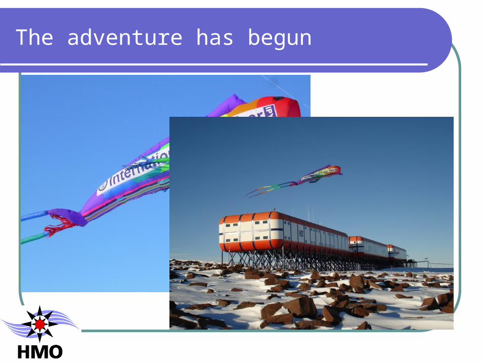
The adventure has begun


Thank you