Plateia - CADexpert 2017_WEB_LORES.pdf · 2017-01-26 · Solution for Roadway Design &...
8
BIM-ready Roadway Design Solution ver. 2017 Professional software solutions for Civil Engineering (C) 2016 by CGS plus Plateia by CGS plus
Transcript of Plateia - CADexpert 2017_WEB_LORES.pdf · 2017-01-26 · Solution for Roadway Design &...

BIM-ready Roadway Design Solution
ver. 2017
Professional software solutions for Civil Engineering
(C) 2016 by CGS plus
Plateia by CGS plus

Solution for Roadway Design & ReconstructionPlateia 2017 is a professional, BIM-ready, 3D road design and reconstruction software solution. It provides
the commands and tools to support the entire design process, from preliminary to detailed design, from
the initial input of survey data to complex 3D road models with analysis tools, to documentation and
publishing features. Using its flexible, dynamic data model, Plateia supports BIM (Building Information
Modeling) workflows and processes. Carefully designed UI and workflows are consistent with the road
design engineering practice. This makes Plateia fast-to-learn and easy-to-use.
Fields of usezz Roads design of all categories:
freeways (motorways), local roads, forest roads, mountain roads, ...
zz Design of intersections and roundabouts,
zz Design of interchanges,
zz Design of bridges, viaducts, overpasses, and underpasses,
zz Design of detours and bypasses,
zz Tunnel design,
zz Urban roads and areas,
zz Urban planning,
zz Bicycle paths,
zz Special roads: racing tracks,
zz Earthworks: quarries, open mine pits, dump areas, earth barriers, etc.,
zz Rehabilitation of landslides,
zz Ski-grounds design, ...
Some Plateia references:

Design features
Digital Terrain Modeling
The Surface creation tool is included in CGS plus software to produce detailed Digital Terrain Model (DTM) based on various surveys or other input data: total station data files, points, break lines, blocks, etc. This offers the possibility to use Plateia on plain AutoCAD or BricsCAD.
Plateia is ready for quick and effortless integration into BIM processes and workflows!
Create 3D solid road models, attach extended
data, and transfer the project to AutoCAD Civil
3D, Autodesk Infraworks, or Autodesk Navisworks.
Plateia road model is ready for IFC data integration.
Grading
Creation of complex slopes with multiple conditions in cut or fill gives users the capability to cover various design scenarios and geometry requirements for all kind of road projects, from simple forest road design to complex intersection geometry design. Furthermore, creating ponds, parking areas, platforms, road, rail tracks, river channels, and other features is easier and faster with CGS plus grading functionality.
Roadway Geometry Design Tools
Plateia provides a wide range of advanced alignment, profile geometry design, and editing tools. They include P(V)I design, floating and fixed elements design, alignment design created from the existing polyline, or ultimately creating a best-fit alignment based on existing road centerline or road edge survey data. Superelevation calculation is a comprehensive definition and editing tool. Plateia supports several superelevations definitions and pivot point options according to various European and AASHTO roadway design standards. A number of alignment labels according to different country standards, reports, and data export options give you the flexibility to cover a wide range of user requirements.
Plateia includes specialized tools for road rehabilitation
CGS plus software licensing and purchase optionsCGS software can be purchased as perpetual license, with or without subscription
or it can be rented for various time periods. Single and network licenses are
available. CGS plus also offers a very attractive CGS plus financing option (PAY1/
USE5) which allows instant use of sufficient number of licenses, payment in
monthly rates at a longer time-period, thus significantly increasing the value of
your investment.
Intersections and Roundabouts
Automated intersection and roundabout design is based on road geometry defined by alignment, profile, and super-elevations. The 3D Intersections function automatically adjusts secondary road profile and super elevation parameters with corresponding user defined curb returns. Automated intersection design results in detailed 3D intersection geometry for X or T shaped intersection types. Use the grading/surface mode with various parameters to customize 3D intersection geometry, and then use the automatic update option when alignment geometry changes.
3D Surface and 3D Solid Model
Roadway 3D model can be created as 3D surface or 3D solid model. 3D roadway surface model can be generated automatically from 3D road edges and terrain model, or it can be built with the grading function. 3D solid model is created on the basis of cross-section areas, where materials and volumes can be defined as extended data. With 3D solids we can also build tunnels, bridges and similar objects. Solid objects can be aligned with arcs and transition curves. All solid models, including extended data, can be imported into Autodesk Infraworks, Navisworks and can be used in various BIM workflows.
Cross Section Design and Editing Capabilities
Plateia provides capabilities for designing and editing roadway cross sections in a detailed way with almost no geometry limitations to the final project design. Adding multiple roadways to a single cross section gives you control over the geometry between the roads and other infrastructure objects your project requires, and lets you define these areas with great accuracy and detail.
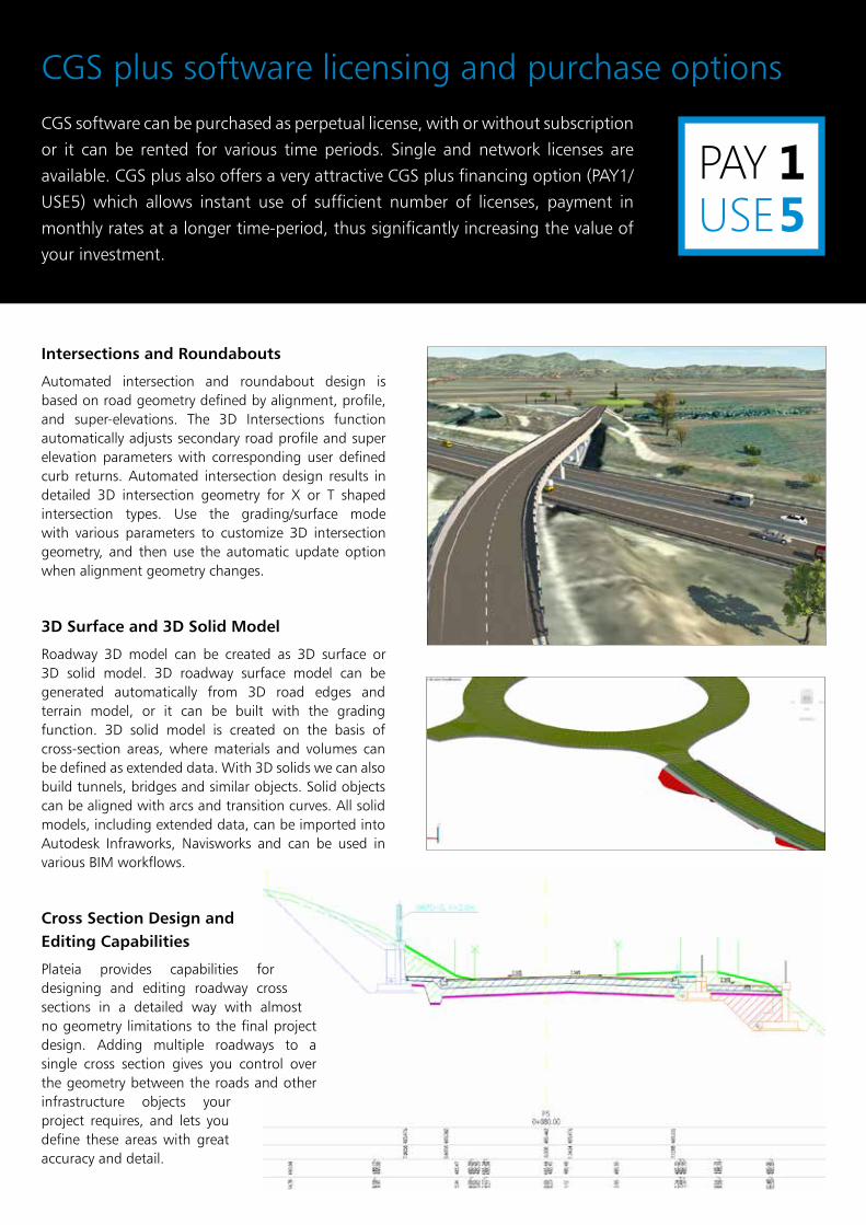
Select Plateia package that
meets your needs!
Survey data import + + +
Digital terrain modeling tool (DTM) + + +
3D Grading + + +
Alignment design + + +
Profile design + + +
Cross sections design + + +
Road super elevations + + +
3D Road modeling + + +
Points/Lines projection to profile/cross sections + + +
Labeling and dimensioning tools + + +
Visibility analysis & Stop sight distance + + +
Quantity Take-off & Mass Haul diagrams + + +
Intersections design 2D/3D + + +
Roundabout design + + +
Curb return fillets + + +
Intersections islands design + + +
Interfaces (Civil 3D objects <-> Plateia, export to Google Earth) + + +
Regression alignment and profile design (Best-Fit) + + +
Regression alignment & profile analysis and editing + + X
Side road objects distance calculation (Off-Set calculation) + + X
Support for 3D Solid objects + + X
3D Traffic signs & Road markings design + + X
3D Road signs gantry design + + X
3D Signs & Road markings visualization + + X
Traffic signs & Road markings reports + + X
Libraries with country specific traffic signs & road markings + + X
Custom traffic sign & Road markings design + + X
Horizontal swept path analysis & EasyDrive + X X
Vertical clearance analysis + X X
Swept path analysis reports + X X
Country specific vehicle libraries + X X
Custom vehicles & special transportation design + X X
Support for BIM (LandXML data import/export, IFC ready) + X X

Quantity take-off (QTO)
Plateia calculates material quantity take-off and features a QTO data export tool with custom defined Pay Item (Bill of materials) options. It gives users the possibility to link material defined in the drawing with a material database in cost estimate software, thus supporting digital data transfer and fast cost recalculation when project changes arise.
Mass Haul Diagram
Mass haul diagram presents a graphical view of the material moved in the proposed design site. Mass haul diagrams help designers and contractors understand where gross material movements occur and compare the economies of alternative designs. These diagrams are presented along with profile views for the design review phase.
Road Reconstruction/Rehabilitation
The road reconstruction/rehabilitation function offers powerful regression analysis tools for best-fit alignment and profile creation based on existing road centerline or road edge surveyed data. This gives you a detailed profile view for the existing and new roadway elevation, together with a calculation of resurfacing material quantities.
Autosign: 3D Traffic Signs, Road Markings, and Road Sign Gantry
Autosign is included in Plateia Ultimate 4D and Plateia Professional 3D software suites. It provides users with everything necessary to design, edit and visualize 3D traffic signs, road markings and road sign gantries. Several country-specific traffic signs libraries are available as well as traffic signs and road markings reports with quantity data.
Analysis features
Visibility and Stop Sight Distance
The Visibility and Stop sight distance road geometry tool gives you the graphical visibility distance analysis required to safely stop a vehicle traveling at design speed. This facilitates planning to avoid collisions with any other immobile objects obstructing the travel path. It supports various country specific guidelines and a number of calculation input parameters.
Autopath: Swept Path Analysis
Autopath, CGS plus swept path analysis software is included in Plateia Ultimate 4D and Plateia Professional 3D software suites. Autopath meets all your professional horizontal and vertical vehicle swept path analysis needs. A range of driving methods combined with predictive turning technology and
dynamic editing capabilities are available. Additionally you get several vehicle clearance analysis and animation tools. Autopath comes with predefined country-specific libraries of vehicle types, offers customization tools and supports special multi wheel transportation vehicles.
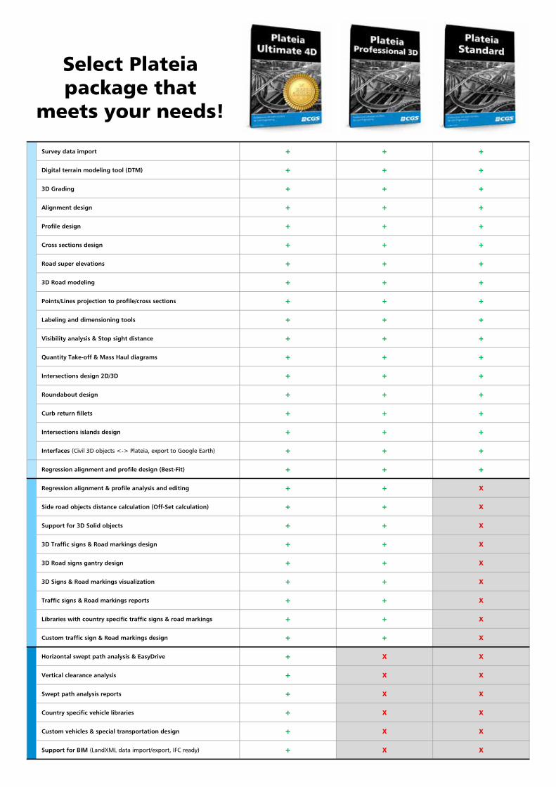
General features
Dynamic Data Model
Plateia stores all design data inside a .dwg data file, making for quick geometry updates and data exchanges within CGS plus software solutions, and Autodesk software. LandXML, OKSTRA, REB and AutoCAD Civil 3D data exchange interfaces are available. Dynamic updates to all geometry changes or design parameters are supported within single or multiple drawings with separated layout/profile and cross sections data.
Supporting Large Projects
Plateia easily handles large projects with very long alignments and thousands of cross-sections within seconds. Projects are neither limited in size nor is the performance critically affected while working on large scale projects, including extra long and multiple alignments, profiles, and cross section views. Cross sections can provide a high level of details with on-demand synchronization options, great processing speed, and consistent data.
Collaboration Capabilities
Large roadway projects can be efficiently divided among multiple team members, who can then work simultaneously. Projects can be done in a single drawing or split into several drawings, separating layout, profile, and cross sections.
Languages and country specific Design Standards
Plateia is available in several languages and supports country specific road design standards, drawing layouts, traffic signs and other symbols, vehicles, etc. Customers are entitled to use any country specific version of the software in case of designing projects for the foreign countries. Currently supported country/language versions are:
Extend Plateia’s functionality with point cloud data processing software - 3Dsurvey
3Dsurvey is a standalone software solution for
point cloud data processing. Use any UAV with
Lidar, a digital camera, DSLR, or a GoPro to
capture images and process them in 3Dsurvey.
Create orthophoto data or digital terrain
models, calculate volumes, profiles, and even
more.
Export digital terrain models to Plateia to create
road projects based on detailed surface model,
calculate material volumes, and export 3D road
surface models from Plateia back to 3Dsurvey
to create stunning aerial or drive-through
visualizations.
3Dsurvey is available as Plateia add-on (bundled)
software solution.
Supported platforms
Plateia 2017 runs on top of 2017-2013 versions of AutoCAD Civil 3D, AutoCAD or AutoCAD Map 3D as well as BricsCAD V16-V13. Only 64-bit versions are supported!
zz English (Int. and USA) zz Austriazz Bulgariazz Croatiazz Czech Republiczz Germanyzz Hungary
zz Macedoniazz Polandzz Romaniazz Russiazz Serbiazz Slovakiazz Sloveniazz Turkey
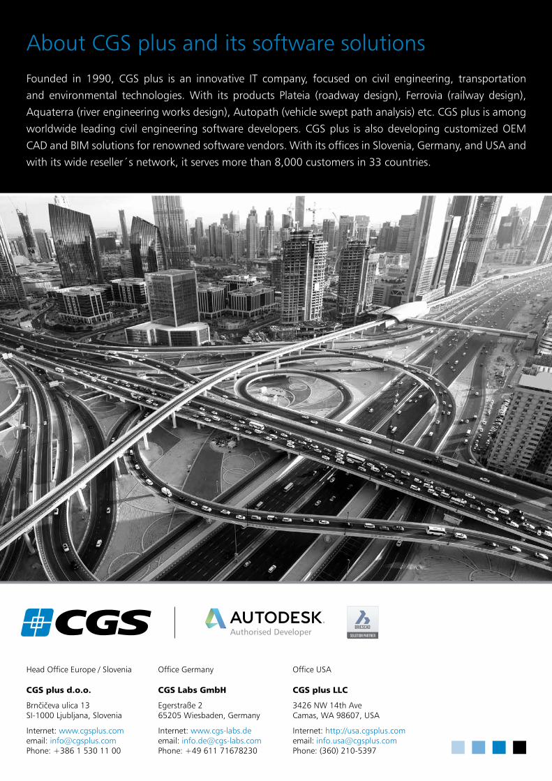
About CGS plus and its software solutionsFounded in 1990, CGS plus is an innovative IT company, focused on civil engineering, transportation
and environmental technologies. With its products Plateia (roadway design), Ferrovia (railway design),
Aquaterra (river engineering works design), Autopath (vehicle swept path analysis) etc. CGS plus is among
worldwide leading civil engineering software developers. CGS plus is also developing customized OEM
CAD and BIM solutions for renowned software vendors. With its offices in Slovenia, Germany, and USA and
with its wide reseller´s network, it serves more than 8,000 customers in 33 countries.
Head Office Europe / Slovenia
CGS plus d.o.o.
Brnčičeva ulica 13SI-1000 Ljubljana, Slovenia
Internet: www.cgsplus.comemail: [email protected]: +386 1 530 11 00
Office Germany
CGS Labs GmbH
Egerstraße 265205 Wiesbaden, Germany
Internet: www.cgs-labs.deemail: [email protected]: +49 611 71678230
Office USA
CGS plus LLC
3426 NW 14th AveCamas, WA 98607, USA
Internet: http://usa.cgsplus.comemail: [email protected]: (360) 210-5397