DEFORMATION OF THE EARTHS CRUST Types of Deformation 1.folds 2.faults.
Upload
sydney-flemingCategory
view
247download
1
Plate Tectonics Review
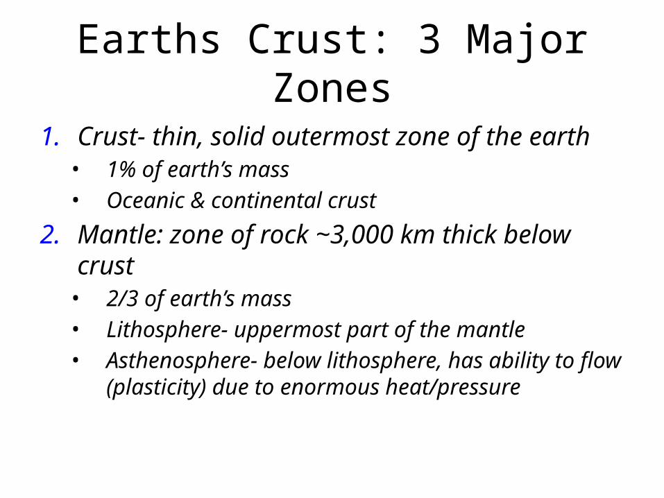
Earths Crust: 3 Major Zones
1. Crust- thin, solid outermost zone of the earth• 1% of earth’s mass• Oceanic & continental crust
2. Mantle: zone of rock ~3,000 km thick below crust• 2/3 of earth’s mass• Lithosphere- uppermost part of the mantle• Asthenosphere- below lithosphere, has ability to flow
(plasticity) due to enormous heat/pressure
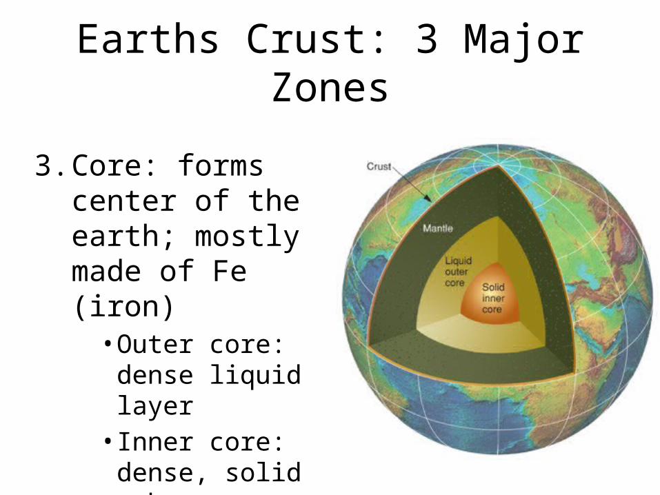
Earths Crust: 3 Major Zones
3. Core: forms center of the earth; mostly made of Fe (iron)• Outer core: dense
liquid layer• Inner core: dense,
solid sphere• 1/3 of earth’s mass
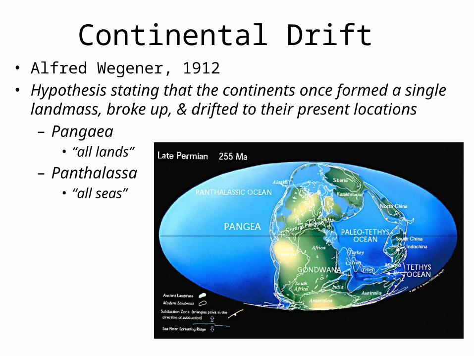
Continental Drift• Alfred Wegener, 1912• Hypothesis stating that the continents once formed a single
landmass, broke up, & drifted to their present locations– Pangaea
• “all lands”– Panthalassa
• “all seas”
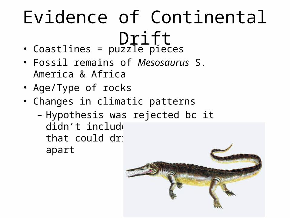
Evidence of Continental Drift• Coastlines = puzzle pieces• Fossil remains of Mesosaurus S. America & Africa• Age/Type of rocks• Changes in climatic patterns– Hypothesis was rejected bc it didn’t include
mention of a force that could drive the continents apart
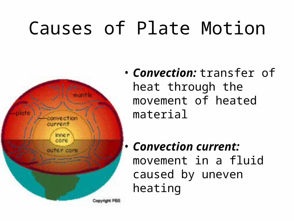
Causes of Plate Motion
• Convection: transfer of heat through the movement of heated material
• Convection current: movement in a fluid caused by uneven heating
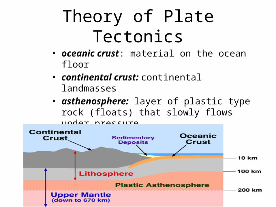
Theory of Plate Tectonics• oceanic crust: material on the ocean floor• continental crust: continental landmasses• asthenosphere: layer of plastic type rock (floats)
that slowly flows under pressure• lithosphere: oceanic/continental crust & rigid upper
mantle; thin outer shell of earth

Theory of Plate Tectonics• lithosphere is made of plates that float on
the asthenosphere & plate are moved by convection currents
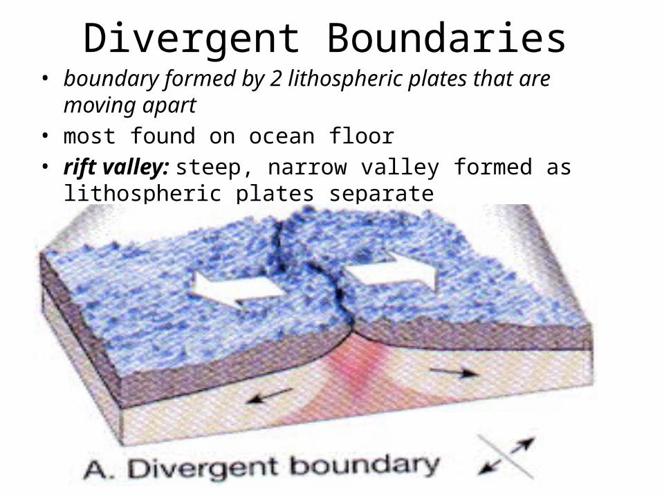
Divergent Boundaries• boundary formed by 2 lithospheric plates that are moving
apart• most found on ocean floor• rift valley: steep, narrow valley formed as lithospheric plates
separate
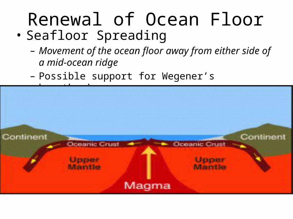
Renewal of Ocean Floor• Seafloor Spreading– Movement of the ocean floor away from either side of a
mid-ocean ridge– Possible support for Wegener’s hypothesis
Seafloor Spreading
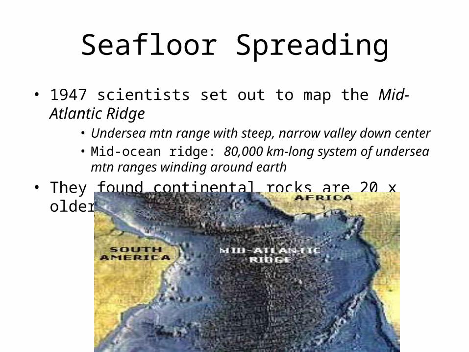
• 1947 scientists set out to map the Mid-Atlantic Ridge• Undersea mtn range with steep, narrow valley down center• Mid-ocean ridge: 80,000 km-long system of undersea mtn ranges
winding around earth
• They found continental rocks are 20 x older than oceanic rocks
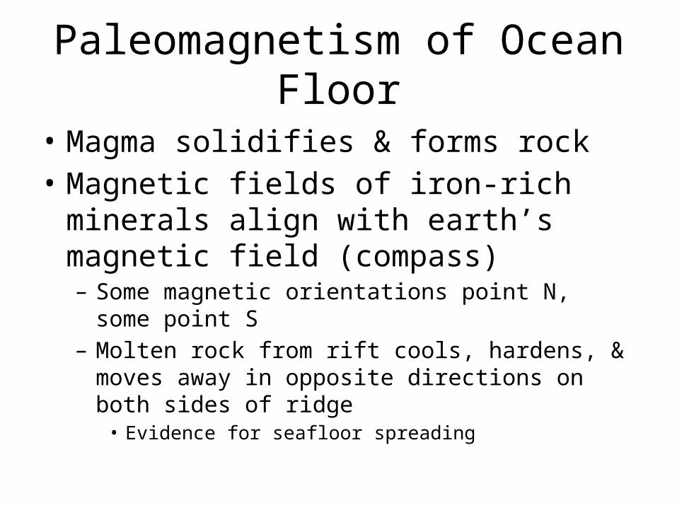
Paleomagnetism of Ocean Floor
• Magma solidifies & forms rock• Magnetic fields of iron-rich minerals align with
earth’s magnetic field (compass)– Some magnetic orientations point N, some point S– Molten rock from rift cools, hardens, & moves away in
opposite directions on both sides of ridge • Evidence for seafloor spreading
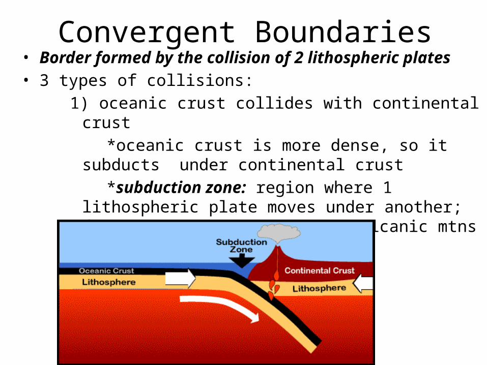
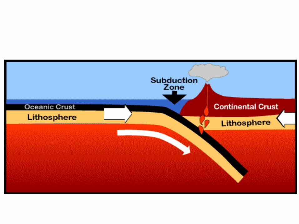
Convergent Boundaries• Border formed by the collision of 2 lithospheric plates• 3 types of collisions:
1) oceanic crust collides with continental crust*oceanic crust is more dense, so it subducts
under continental crust*subduction zone: region where 1
lithospheric plate moves under another; forms deep ocean trench = volcanic mtns
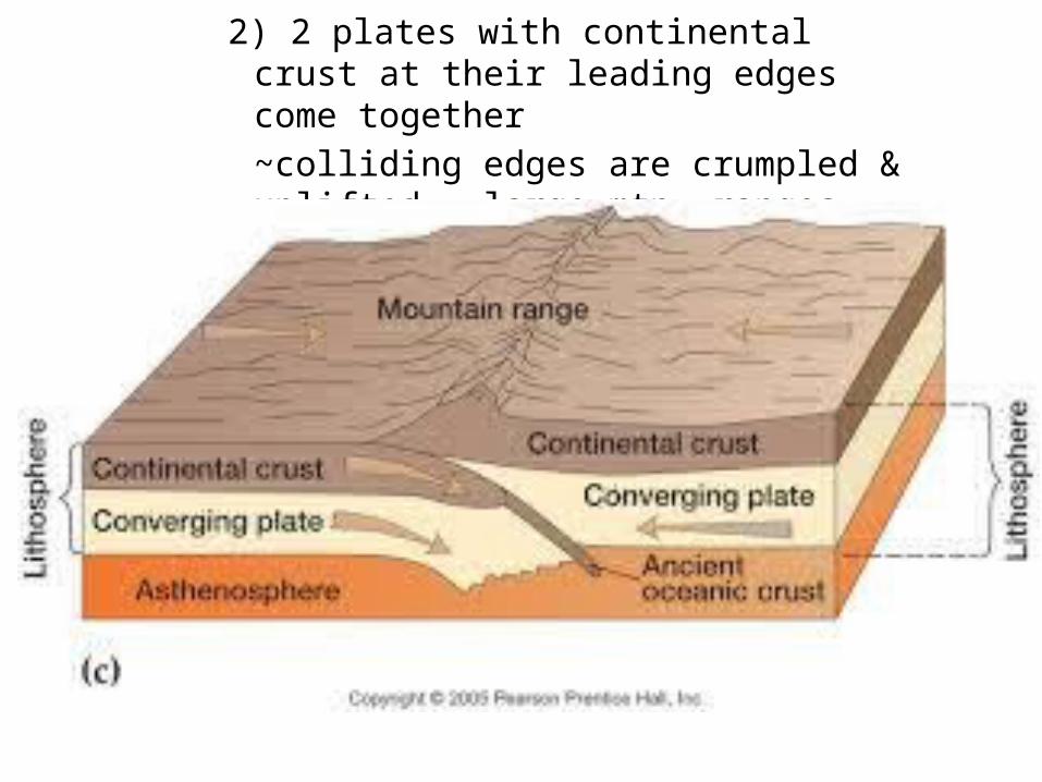
2) 2 plates with continental crust at their leading edges come together~colliding edges are crumpled & uplifted = large mtn. ranges (Himalayas)
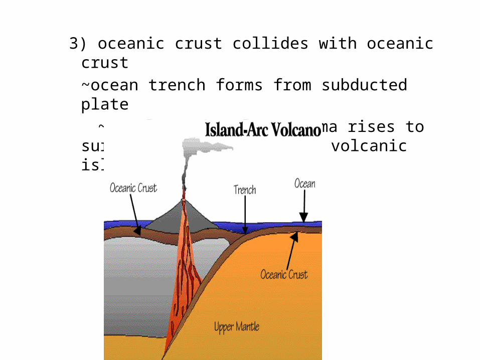
3) oceanic crust collides with oceanic crust~ocean trench forms from subducted plate
~mantle rock melts, magma rises to surface forming chains of volcanic islands (island arcs)

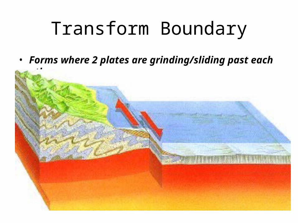
Transform Boundary
• Forms where 2 plates are grinding/sliding past each other

Create 2 Venn Diagrams. One with 3 circles about Convergent boundaries, and one with 2 circles
about divergent boundaries.
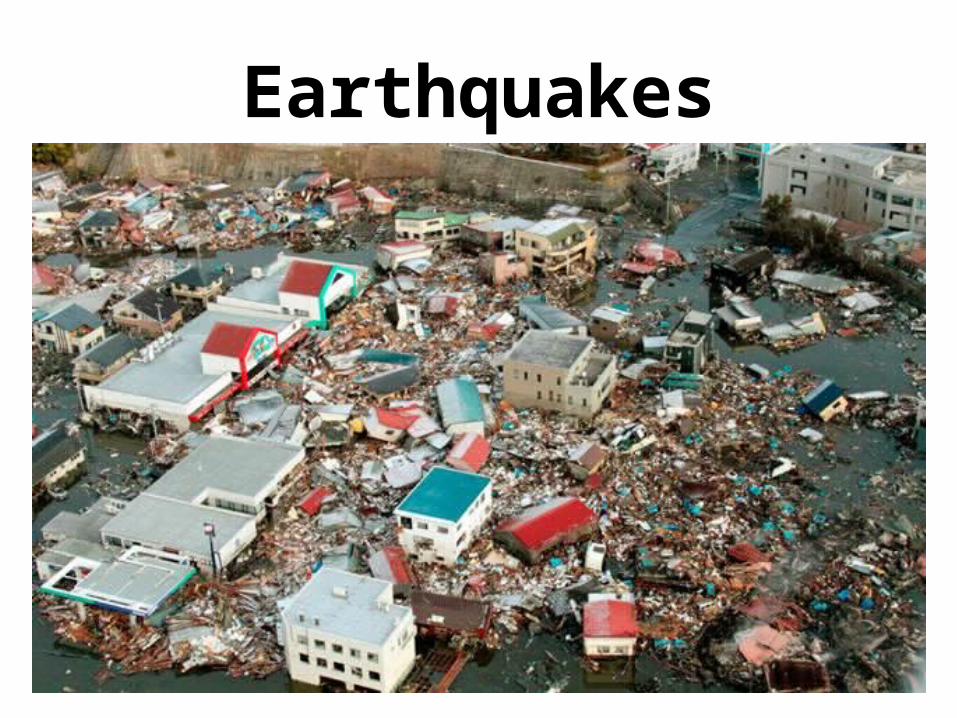
Earthquakes
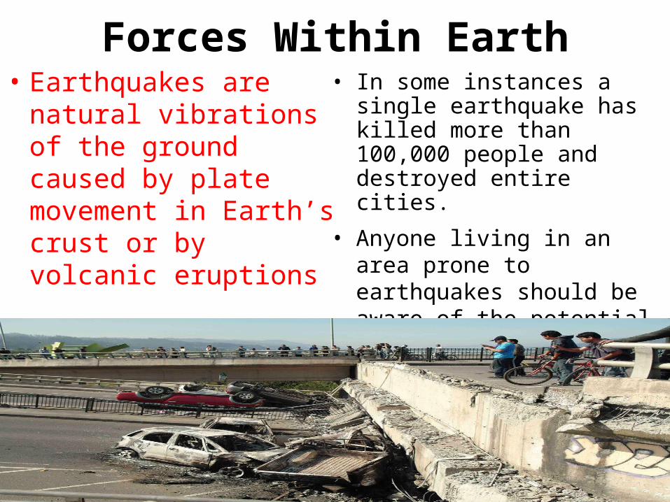
Forces Within Earth• Earthquakes are natural
vibrations of the ground caused by plate movement in Earth’s crust or by volcanic eruptions
• In some instances a single earthquake has killed more than 100,000 people and destroyed entire cities.
• Anyone living in an area prone to earthquakes should be aware of the potential danger and how to minimize the damage that they cause.
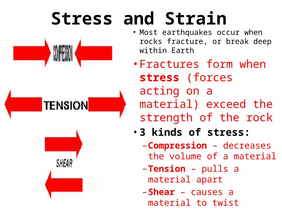
Stress and Strain• Most earthquakes occur when rocks
fracture, or break deep within Earth
• Fractures form when stress (forces acting on a material) exceed the strength of the rock
• 3 kinds of stress:– Compression – decreases
the volume of a material– Tension – pulls a material
apart– Shear – causes a material to
twist
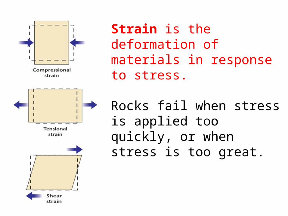
Strain is the deformation of materials in response to stress.
Rocks fail when stress is applied too quickly, or when stress is too great.
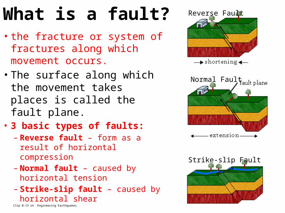
What is a fault?• the fracture or system of
fractures along which movement occurs.
• The surface along which the movement takes places is called the fault plane.
• 3 basic types of faults:– Reverse fault – form as a result of
horizontal compression– Normal fault – caused by horizontal
tension– Strike-slip fault – caused by
horizontal shearClip 0-13 on Engineering Earthquakes
Reverse Fault
Normal Fault
Strike-slip Fault
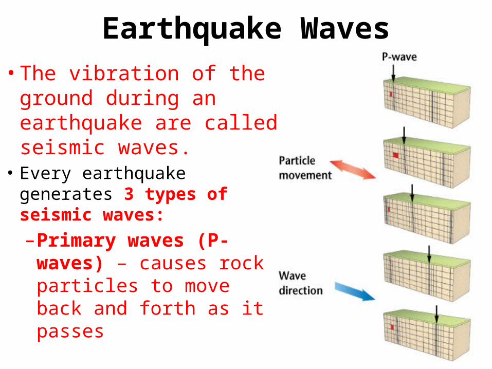
Earthquake Waves• The vibration of the
ground during an earthquake are called seismic waves.
• Every earthquake generates 3 types of seismic waves:–Primary waves (P-
waves) – causes rock particles to move back and forth as it passes
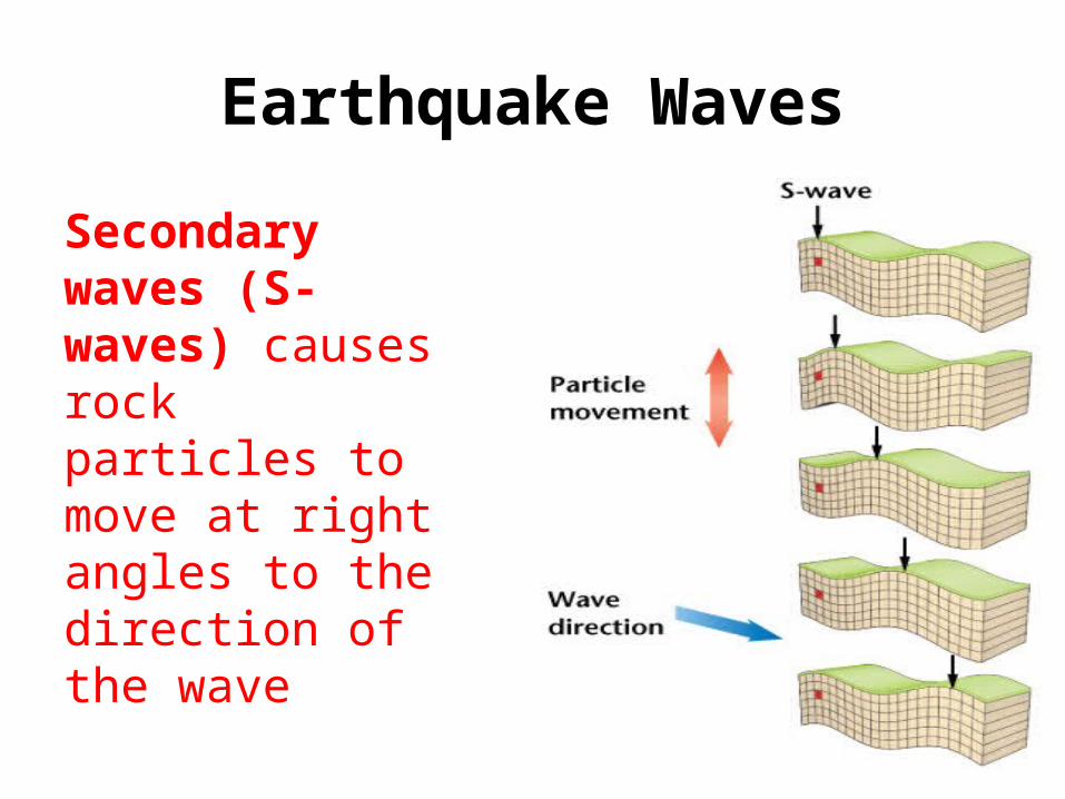
Earthquake Waves
Secondary waves (S-waves) causes rock particles to move at right angles to the direction of the wave
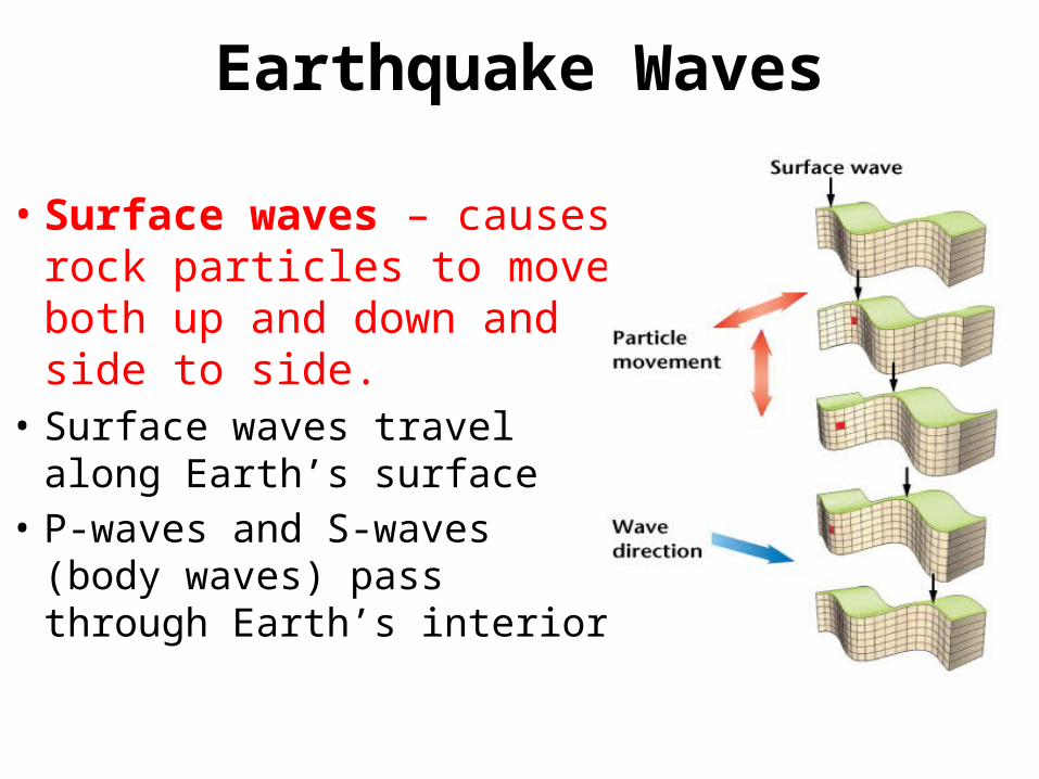
Earthquake Waves
• Surface waves – causes rock particles to move both up and down and side to side.
• Surface waves travel along Earth’s surface
• P-waves and S-waves (body waves) pass through Earth’s interior
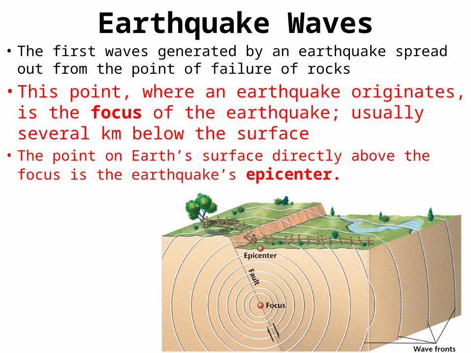
Earthquake Waves• The first waves generated by an earthquake spread out from the
point of failure of rocks
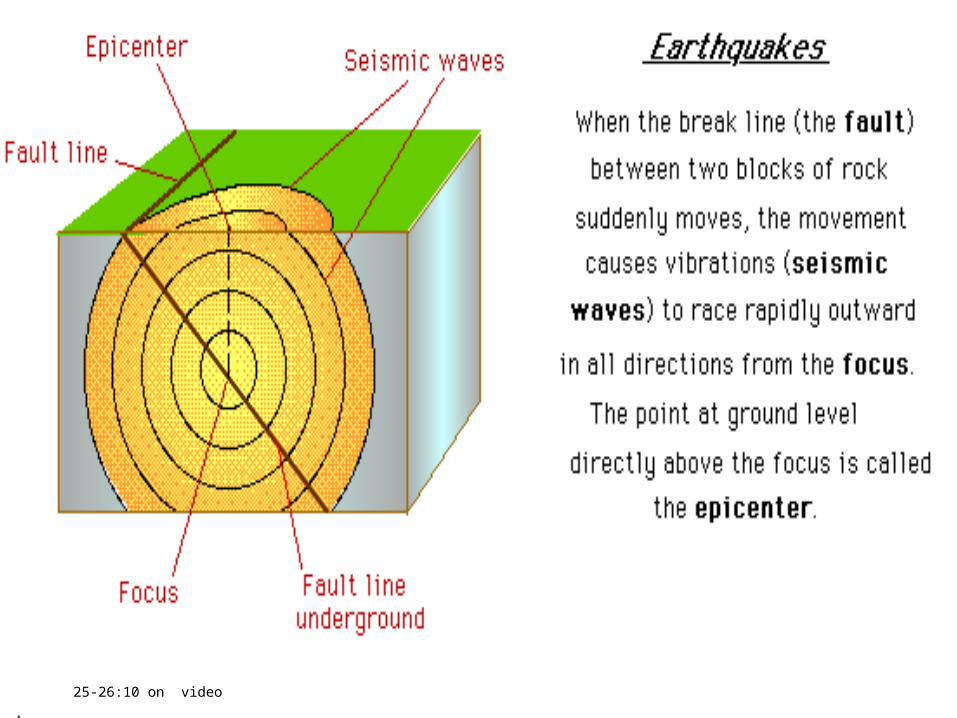
• This point, where an earthquake originates, is the focus of the earthquake; usually several km below the surface
• The point on Earth’s surface directly above the focus is the earthquake’s epicenter.
25-26:10 on video
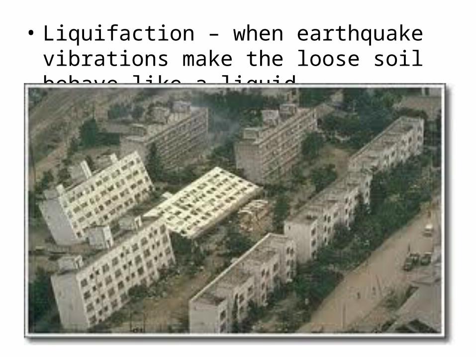
• Liquifaction – when earthquake vibrations make the loose soil behave like a liquid.
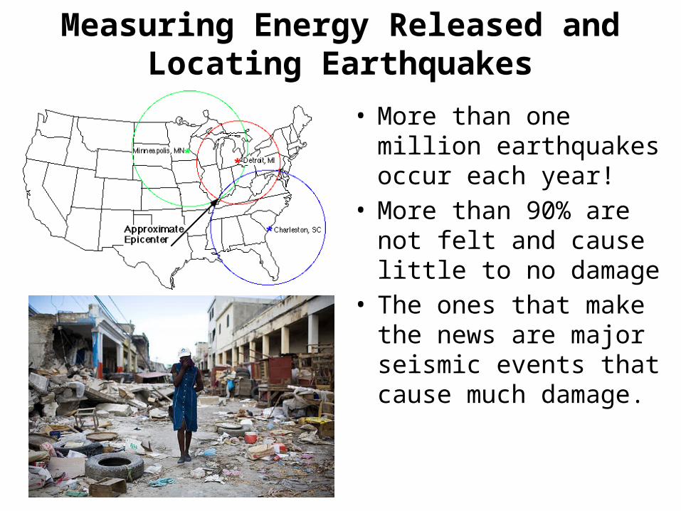
Measuring Energy Released and Locating Earthquakes
• More than one million earthquakes occur each year!
• More than 90% are not felt and cause little to no damage
• The ones that make the news are major seismic events that cause much damage.
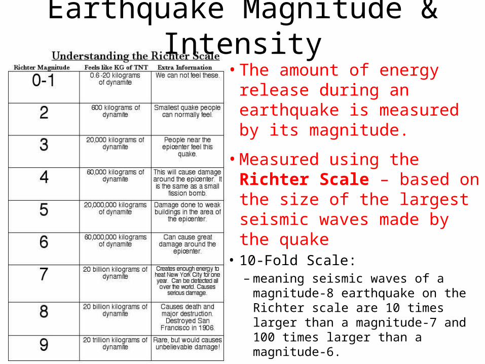
Earthquake Magnitude & Intensity• The amount of energy
release during an earthquake is measured by its magnitude.
• Measured using the Richter Scale – based on the size of the largest seismic waves made by the quake
• 10-Fold Scale: – meaning seismic waves of a
magnitude-8 earthquake on the Richter scale are 10 times larger than a magnitude-7 and 100 times larger than a magnitude-6.
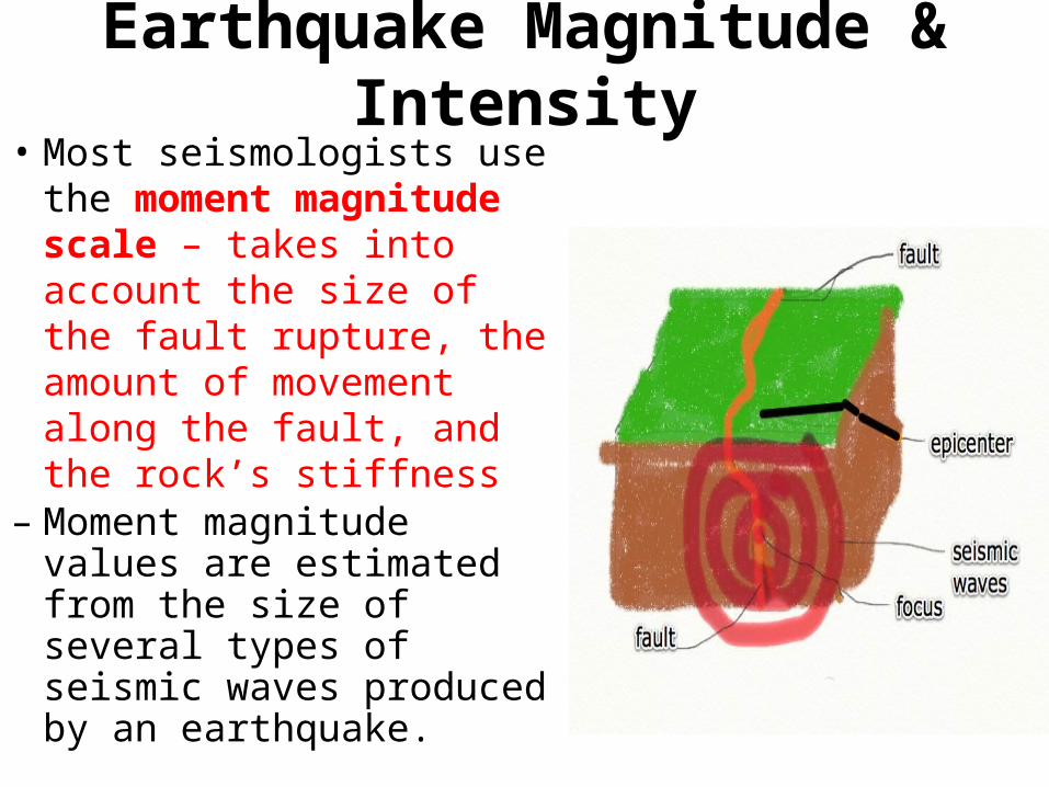
Earthquake Magnitude & Intensity• Most seismologists use
the moment magnitude scale – takes into account the size of the fault rupture, the amount of movement along the fault, and the rock’s stiffness
– Moment magnitude values are estimated from the size of several types of seismic waves produced by an earthquake.
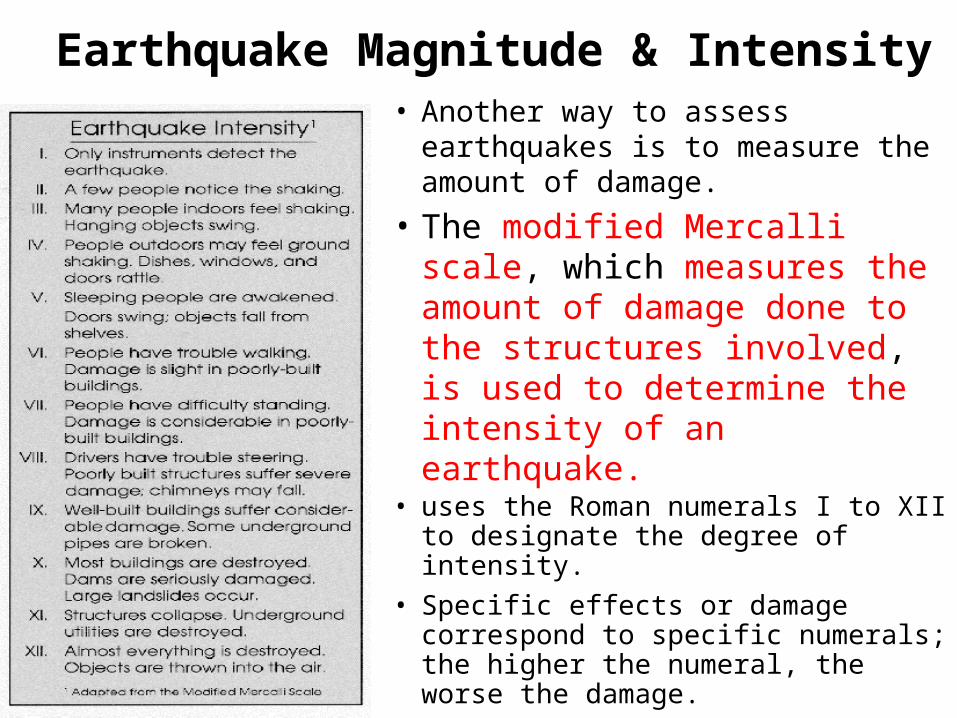
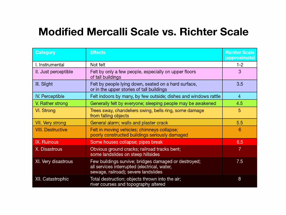
Earthquake Magnitude & Intensity• Another way to assess earthquakes
is to measure the amount of damage.
• The modified Mercalli scale, which measures the amount of damage done to the structures involved, is used to determine the intensity of an earthquake.
• uses the Roman numerals I to XII to designate the degree of intensity.
• Specific effects or damage correspond to specific numerals; the higher the numeral, the worse the damage.
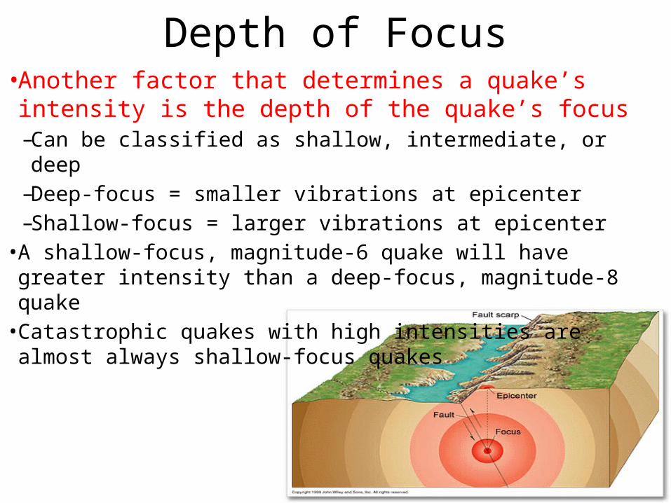
Depth of Focus• Another factor that determines a quake’s intensity is
the depth of the quake’s focus– Can be classified as shallow, intermediate, or deep– Deep-focus = smaller vibrations at epicenter– Shallow-focus = larger vibrations at epicenter
• A shallow-focus, magnitude-6 quake will have greater intensity than a deep-focus, magnitude-8 quake
• Catastrophic quakes with high intensities are almost always shallow-focus quakes
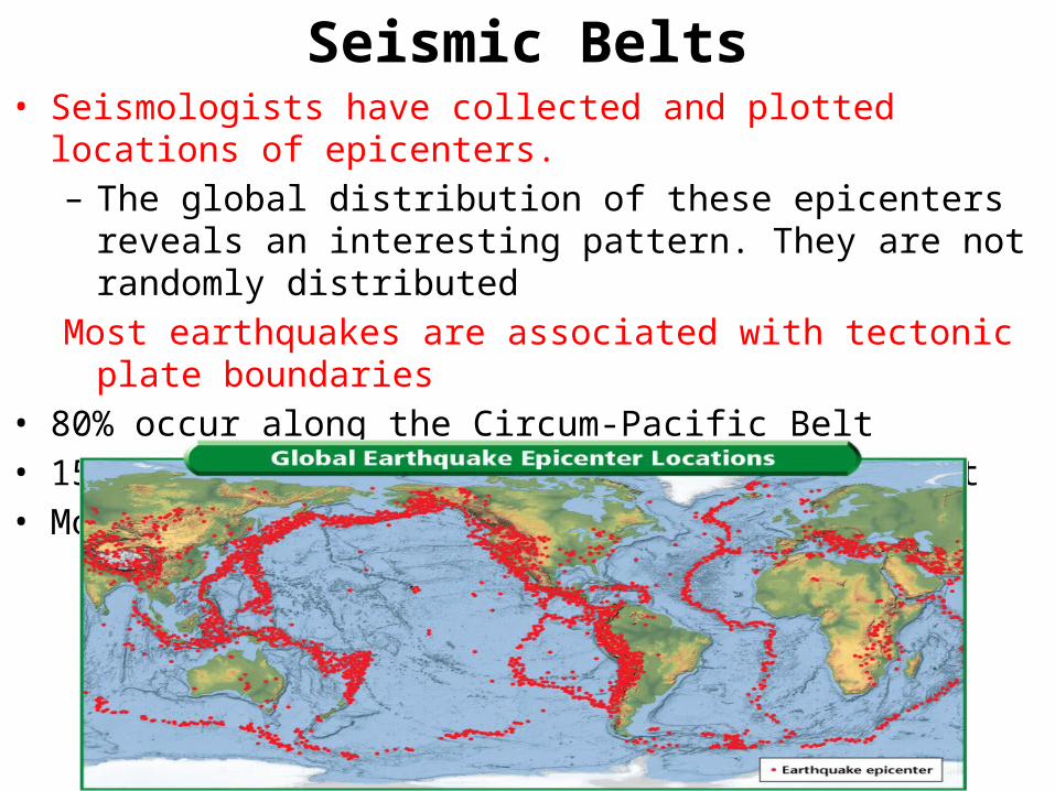
Seismic Belts• Seismologists have collected and plotted locations of epicenters.– The global distribution of these epicenters reveals an interesting
pattern. They are not randomly distributedMost earthquakes are associated with tectonic plate boundaries
• 80% occur along the Circum-Pacific Belt• 15% occur along the Mediterranean-Asian Belt• Most of the remaining occur at ocean ridges

Distance to an Earthquake• To determine the
location of the epicenter:– The locations of 3
seismic stations are plotted on a map
– A circle whose radius is equal to the epicentral distance is plotted around each station
– The point of intersection of these circles is the epicenter