P.L. 94-171 County Block Map (2010 Census)€¦ · 2010 PL BLOCK MAP (INDEX) 201019171000 INDEX...
23
2 3 4 5 1 8 10 11 6 7 9 12 W o l f C r k Carroll twp 90480 Crystal twp 90864 Howard twp 91995 Otter Creek twp 93243 Perry twp 93306 Tama twp 94083 Toledo twp 94128 Buckingham twp 90375 Carlton twp 90474 Clark twp 90669 Columbia twp 90786 Geneseo twp 91554 Grant twp 91707 Highland twp 91944 Indian Village twp 92037 Lincoln twp 92619 Oneida twp 93180 Richland twp 93618 Salt Creek twp 93750 Spring Creek twp 93972 York twp 94812 Belle Plaine city° Bruce twp Homer twp Iowa twp Kane twp Monroe twp Hickory Grove twp Greencastle twp Le Grand twp Marion twp Vienna twp Chester twp Jefferson twp Madison twp Sheridan twp Washington twp Honey Creek twp Big Creek twp Eagle twp Lincoln twp Black Hawk twp Clay twp Palermo twp POWESHIEK 157 IOWA 095 P O W E S H I E K 1 5 7 JASPER 099 MARSHALL 127 JASPER 099 MARSHALL 127 GRUNDY 075 BENTON 011 IOWA 095 POWESHIEK 157 TAMA 171 TAMA 171 BENTON 011 BLACK HAWK 013 TAMA 1 7 1 GRUNDY 075 TAMA 171 MARSHALL 127 TAMA 171 BEN TON 01 1 BLACK HAWK 013 GRUNDY 075 BLACK HAWK 013 SAC AND FOX/MESKWAKI SET 3280 Green Mountain Traer 78735 Toledo 78510 Tama 77115 Montour 53670 Lincoln 45255 Gladbrook 31035 Garwin 30045 Elberon 24375 Clutier 14655 Chelsea 12990 Dysart 23160 Le Grand 44220 Vining 81120 Conrad La Porte City Marshalltown Le Grand Keystone Belle Plaine Reinbeck Beaman Gilman Ferguson 8 96 146 21 229 229 21 21 131 131 21 30 218 63 63 63 J G E A F I B D H C LEGEND SYMBOL DESCRIPTION SYMBOL LABEL STYLE Federal American Indian Reservation L'ANSE RES 1880 Off-Reservation Trust Land, Hawaiian Home Land T1880 Oklahoma Tribal Statistical Area, Alaska Native Village Statistical Area, Tribal Designated Statistical Area KAW OTSA 5340 American Indian Tribal Subdivision EAGLE NEST DIST 200 State American Indian Reservation Tama Res 4125 State Designated Tribal Statistical Area Lumbee STSA 9815 Alaska Native Regional Corporation NANA ANRC 52120 State (or statistically equivalent entity) NEW YORK 36 County (or statistically equivalent entity) ERIE 029 Minor Civil Division (MCD) 1 Bristol town 07485 Census County Division (CCD), Census Subarea (CSA), Unorganized Territory (UT) Jemez CCD 91650 Consolidated City MILFORD 47500 Incorporated Place 1,2 Davis 18100 Census Designated Place (CDP) 2 Incline Village 35100 Voting District (VTD) 100015 State Legislative District - Upper (Senate) SLDU 14 State Legislative District - Lower (House) SLDL 26 Census Tract 33.07 Census Block 3 3012 DESCRIPTION SYMBOL DESCRIPTION SYMBOL Interstate 3 U.S. Highway 2 State Highway 4 Other Road Marsh Ln Cul-de-sac Circle 4WD Trail, Stairway, Alley, Walkway, or Ferry Raiload Southern RR Pipeline or Power Line Ridge or Fence Property Line Perennial Stream Tumbling Cr Intermittent Stream Piney Cr Nonvisible Boundary or Feature Not Elsewhere Classified Geographic Offset or Corridor Water Body Pleasant Lake Swamp, Marsh, or Gravel Pit/Quarry Okefenokee Swamp Glacier Bering Glacier Military Fort Belvoir National or State Park, Forest, or Recreation Area Yosemite NP Airport Oxnard Arprt Selected Mountain Peaks Mt Baker Inset Area A Outside Subject Area Where state, county, and/or MCD/CCD boundaries coincide, the map shows the boundary symbol for only the highest-ranking of these boundaries. Where American Indian reservation and American Indian tribal subdivision boundaries coincide, the map shows only the American Indian reservation boundaries. Where Oklahoma tribal statistical area boundaries and American Indian tribal subdivision boundaries coincide, the map shows only the Oklahoma tribal statistical area boundaries. 1 A ' ° ' following an MCD name denotes a false MCD. A ' ° ' following a place name indicates that a false MCD exists with the same name and FIPS code as the place; the false MCD label is not shown. 2 Place label color correlates to the place fill color. 3 A ' ' following a block number indicates that the block number is repeated elsewhere in the block. * USCENSUSBUREAU Location of County within State 2010 PL BLOCK MAP (INDEX) 201019171000 INDEX SHEET 42.337837N 92.873547W 42.332705N 92.184243W 41.821440N 92.193854W 41.826531N 92.877661W All legal boundaries and names are as of January 1, 2010. The boundaries shown on this map are for Census Bureau statistical data collection and tabulation purposes only; their depiction and designation for statistical purposes does not constitute a determination of jurisdictional authority or rights of ownership or entitlement. U.S. DEPARTMENT OF COMMERCE Economics and Statistics Administration U.S. Census Bureau Geographic Vintage: 2010 Census (reference date: January 1, 2010) Data Source: U.S. Census Bureau's MAF/TIGER database (TAB10ST19) Map Created by Geography Division: November 07, 2010 ENTITY TYPE: County or statistically equivalent entity NAME: Tama County (171) Projection: Albers Equal Area Conic Datum: NAD 83 Spheroid: GRS 80 1st Standard Parallel: 40 53 46 2nd Standard Parallel: 42 58 46 Central Meridian: -93 23 22 Latitude of Projection's Origin: 40 22 31 False Easting: 0 False Northing: 0 Total Sheets: 23 - Index Sheets: 1 - Parent Sheets: 12 - Inset Sheets: 10 ST: Iowa (19) 0 2 4 6 8 10 Kilometers 10 Kilometers 0 1 2 3 4 5 Miles 5 Miles The plotted map scale is 1:77786 P.L. 94-171 COUNTY BLOCK MAP (2010 CENSUS): Tama County, IA
Transcript of P.L. 94-171 County Block Map (2010 Census)€¦ · 2010 PL BLOCK MAP (INDEX) 201019171000 INDEX...

2 3
4 5
1
8
10 11
6
7 9
12
Wol
f Cr
k
Carroll twp 90480
Crystal twp 90864
Howard twp 91995
Otter Creek twp 93243
Perry twp 93306
Tama twp94083
Toledo twp 94128
Buckingham twp 90375
Carlton twp 90474
Clark twp 90669
Columbia twp 90786
Geneseo twp 91554Grant twp 91707
Highland twp 91944
Indian Village twp 92037
Lincoln twp 92619
Oneida twp 93180
Richland twp 93618 Salt Creek twp 93750
Spring Creek twp 93972
York twp 94812
BellePlainecity°
Bruce twp
Homer twp
Iowa twp
Kane twp
Monroe twp
Hickory Grove twp
Greencastle twp
Le Grand twp
Marion twp
Vienna twp
Chester twpJefferson twpMadison twpSheridan twp
Washington twp
Honey Creek twp
Big Creek twpEagle twpLincoln twpBlack Hawk twp
Clay twp
Palermo twp
PO
WE
SH
IEK
15
7
IOW
A 0
95
PO
WESH
IEK 157
JAS
PE
R 0
99
MARSHALL 127
JASPER 099
MARSHALL 127
GRUNDY 075
BENTON 011
IOWA 095
POWESHIEK 157
TAMA 171
TA
MA
17
1
BE
NT
ON
01
1
BLACK HAWK 013
TAMA 171GRUNDY 075
TAMA 171
MA
RS
HA
LL 12
7
TA
MA
17
1
BENTON 011
BLACK HAWK 013
GR
UN
DY
07
5
BLA
CK
HA
WK
01
3
SAC ANDFOX/MESKWAKI
SET 3280
GreenMountain
Traer78735
Toledo78510
Tama 77115
Montour 53670
Lincoln 45255
Gladbrook 31035
Garwin30045
Elberon 24375
Clutier14655
Chelsea 12990
Dysart23160
Le Grand 44220
Vining81120
Conrad
La PorteCity
Marshalltown
LeGrand
Keystone
Belle Plaine
Reinbeck
Beaman
Gilman
Ferguson
8
96
146
21
229
229
21
21
131 131
21
30
218
63
63
63
J
G
E
A
F
I
B
D
H
C
LEGEND
SYMBOL DESCRIPTION SYMBOL LABEL STYLE
Federal American IndianReservation L'ANSE RES 1880
Off-Reservation Trust Land,Hawaiian Home Land T1880
Oklahoma Tribal Statistical Area,Alaska Native Village Statistical Area,Tribal Designated Statistical Area
KAW OTSA 5340
American Indian TribalSubdivision EAGLE NEST DIST 200
State American IndianReservation Tama Res 4125
State Designated TribalStatistical Area Lumbee STSA 9815
Alaska Native RegionalCorporation NANA ANRC 52120
State (or statisticallyequivalent entity) NEW YORK 36
County (or statisticallyequivalent entity) ERIE 029
Minor Civil Division(MCD)1 Bristol town 07485Census County Division (CCD),Census Subarea (CSA),Unorganized Territory (UT)
Jemez CCD 91650
Consolidated City MILFORD 47500
Incorporated Place 1,2 Davis 18100Census Designated Place(CDP) 2 Incline Village 35100
Voting District (VTD) 100015State Legislative District -Upper (Senate)
SLDU14
State Legislative District -Lower (House)
SLDL26
Census Tract 33.07
Census Block 3 3012
DESCRIPTION SYMBOL DESCRIPTION SYMBOL
Interstate 3
U.S. Highway 2
State Highway 4
Other RoadMarsh Ln
Cul-de-sac
Circle
4WD Trail, Stairway,
Alley, Walkway, or Ferry
RailoadSouthern RR
Pipeline orPower Line
Ridge or Fence
Property Line
Perennial StreamTumbling Cr
Intermittent StreamPiney Cr
Nonvisible Boundaryor Feature NotElsewhere Classified
Geographic Offsetor Corridor
Water Body Pleasant Lake
Swamp, Marsh, orGravel Pit/Quarry
Okefenokee Swamp
Glacier Bering Glacier
Military Fort Belvoir
National or State Park,
Forest, or Recreation AreaYosemite NP
AirportOxnard Arprt
Selected Mountain PeaksMt Baker
Inset Area A
Outside Subject Area
Where state, county, and/or MCD/CCD boundaries coincide, the map shows theboundary symbol for only the highest-ranking of these boundaries. Where AmericanIndian reservation and American Indian tribal subdivision boundaries coincide, the mapshows only the American Indian reservation boundaries. Where Oklahoma tribalstatistical area boundaries and American Indian tribal subdivision boundariescoincide, the map shows only the Oklahoma tribal statistical area boundaries.
1 A ' ° ' following an MCD name denotes a false MCD. A ' ° ' following a place name indicates that a false MCD exists with the same name and FIPS code as the place; the false MCD label is not shown.
2 Place label color correlates to the place fill color.
3 A ' ' following a block number indicates that the block number is repeated elsewhere in the block.
*
U S C E N S U S B U R E A U
Location of County within State
2010 PL BLOCK MAP (INDEX)
201019171000
INDEX SHEET
42.337837N92.873547W
42.332705N92.184243W
41.821440N92.193854W
41.826531N92.877661W
All legal boundaries and names are as of January 1, 2010. The boundaries shown on thismap are for Census Bureau statistical data collection and tabulation purposes only; theirdepiction and designation for statistical purposes does not constitute a determination ofjurisdictional authority or rights of ownership or entitlement.
U.S. DEPARTMENT OF COMMERCE Economics and Statistics Administration U.S. Census Bureau
Geographic Vintage: 2010 Census (reference date: January 1, 2010)Data Source: U.S. Census Bureau's MAF/TIGER database (TAB10ST19)Map Created by Geography Division: November 07, 2010
ENTITY TYPE: County or statistically equivalent entity
NAME: Tama County (171) Projection: Albers Equal Area Conic
Datum: NAD 83
Spheroid: GRS 80
1st Standard Parallel: 40 53 46
2nd Standard Parallel: 42 58 46
Central Meridian: -93 23 22
Latitude of Projection's Origin: 40 22 31
False Easting: 0
False Northing: 0
Total Sheets: 23- Index Sheets: 1- Parent Sheets: 12- Inset Sheets: 10
ST: Iowa (19)
0 2 4 6 8 10 Kilometers10 Kilometers
0 1 2 3 4 5 Miles5 Miles
The plotted map scale is 1:77786
P.L. 94-171 COUNTY BLOCK MAP (2010 CENSUS): Tama County, IA
Munns Crk
Munns Crk
Mos
quito
Crk
Mosquito Crk
Mosquito Crk
Mosq uito Cr k
Little W olf Crk
Wolf Crk
N H
olla
nd
Little Wolf
C
rk
Little Wolf Crk
Twelvemile Crk
N Bea
man
Fourmile Crk
N Beaman
Little Wolf C
rk
Wolf Crk
Wolf Crk
N P
rairi
e
Black Hawk twp 90249
Clay twp 90675
Washington twp 94500
Viennatwp
94356
Palermo twp 93258
Crystal twp 90864
Spring Creek twp 93972
Grant twp 91707
Lincoln twp 92619
2104
2000*2006* 2001*
2033
2024
2048
2076
2116
2022
2055
2089
2107
2016 2011
2014
2003*
2026
2099*
2102
2006 2004 2003
2012*
2109
2009*
2045*
2008
2086
2079
2091
2090
2077
2080
2088
2030
2108
2032
2029 2047
2040
2078
20
41
2012
2085
2103
2017
2025
2018
2083
2101
2092
2082
2084
2081
2075
2023
2009
2015
2010
2054
2020
2013
2046*
2039*
20072005
2034*
2002*
2028
2019
2004*2005*
2031
2087
2111
2110
2106
2105
2011*2011*
2100*
2010
2008*
2021
2074*
2903
2902
GRUNDY 075
MARSHALL 127
TA
MA
17
1
GRUNDY 075
TAMA 171
Lincoln45255
SLDL43
SLDL40
SLDU22
SLDU20
075013075012
075014
075011
127004
171001
171008171009
171002
Mar
ble
Ave
W
Tama
310th St
290th St
270th St
330th St
Diagonal Rd
U A
ve
Q A
ve
S M
orris
on
S L
inco
ln
N M
orrio
n
S G
rant
300th St
Nic
kel R
d N
icke
l Ave
Fairg
roun
ds
260th St
B A
ve
130th St
E Ave
G Ave
F Ave
145th St
E Ave
140th St
Level B Rd
125th St
D A
ve
160th St
Aa
Ave
W Tama
E Main St
140th St
Dirt Rd
150th St
130th St
Sun
rise
Dr
E South St
160th St
Abbott A
ve
160th St
H A
ve
Abb
ott
Ave
120th St
South St
D A
ve
175
A
LEGEND
SYMBOL DESCRIPTION SYMBOL LABEL STYLE
Federal American IndianReservation L'ANSE RES 1880
Off-Reservation Trust Land,Hawaiian Home Land T1880
Oklahoma Tribal Statistical Area,Alaska Native Village Statistical Area,Tribal Designated Statistical Area
KAW OTSA 5340
American Indian TribalSubdivision EAGLE NEST DIST 200
State American IndianReservation Tama Res 4125
State Designated TribalStatistical Area Lumbee STSA 9815
Alaska Native RegionalCorporation NANA ANRC 52120
State (or statisticallyequivalent entity) NEW YORK 36
County (or statisticallyequivalent entity) ERIE 029
Minor Civil Division(MCD)1 Bristol town 07485Census County Division (CCD),Census Subarea (CSA),Unorganized Territory (UT)
Jemez CCD 91650
Consolidated City MILFORD 47500
Incorporated Place 1,2 Davis 18100Census Designated Place(CDP) 2 Incline Village 35100
Voting District (VTD) 100015State Legislative District -Upper (Senate)
SLDU14
State Legislative District -Lower (House)
SLDL26
Census Tract 33.07
Census Block 3 3012
DESCRIPTION SYMBOL DESCRIPTION SYMBOL
Interstate 3
U.S. Highway 2
State Highway 4
Other RoadMarsh Ln
Cul-de-sac
Circle
4WD Trail, Stairway,
Alley, Walkway, or Ferry
RailoadSouthern RR
Pipeline orPower Line
Ridge or Fence
Property Line
Perennial StreamTumbling Cr
Intermittent StreamPiney Cr
Nonvisible Boundaryor Feature NotElsewhere Classified
Geographic Offsetor Corridor
Water Body Pleasant Lake
Swamp, Marsh, orGravel Pit/Quarry
Okefenokee Swamp
Glacier Bering Glacier
Military Fort Belvoir
National or State Park,
Forest, or Recreation AreaYosemite NP
AirportOxnard Arprt
Selected Mountain PeaksMt Baker
Inset Area A
Outside Subject Area
Where state, county, and/or MCD/CCD boundaries coincide, the map shows theboundary symbol for only the highest-ranking of these boundaries. Where AmericanIndian reservation and American Indian tribal subdivision boundaries coincide, the mapshows only the American Indian reservation boundaries. Where Oklahoma tribalstatistical area boundaries and American Indian tribal subdivision boundariescoincide, the map shows only the Oklahoma tribal statistical area boundaries.
1 A ' ° ' following an MCD name denotes a false MCD. A ' ° ' following a place name indicates that a false MCD exists with the same name and FIPS code as the place; the false MCD label is not shown.
2 Place label color correlates to the place fill color.
3 A ' ' following a block number indicates that the block number is repeated elsewhere in the block.
*
Key to Sheets
4
2
5
1
U S C E N S U S B U R E A U
Location of County within State
42.331520N92.7815W
42.330512N92.613139W
42.205626N92.61466W
42.206632N92.782691W
All legal boundaries and names are as of January 1, 2010. The boundaries shown on thismap are for Census Bureau statistical data collection and tabulation purposes only; theirdepiction and designation for statistical purposes does not constitute a determination ofjurisdictional authority or rights of ownership or entitlement.
U.S. DEPARTMENT OF COMMERCE Economics and Statistics Administration U.S. Census Bureau
Geographic Vintage: 2010 Census (reference date: January 1, 2010)Data Source: U.S. Census Bureau's MAF/TIGER database (TAB10ST19)Map Created by Geography Division: November 07, 2010
ENTITY TYPE: County or statistically equivalent entity
NAME: Tama County (171) Projection: Albers Equal Area Conic
Datum: NAD 83
Spheroid: GRS 80
1st Standard Parallel: 40 53 46
2nd Standard Parallel: 42 58 46
Central Meridian: -93 23 22
Latitude of Projection's Origin: 40 22 31
False Easting: 0
False Northing: 0
Total Sheets: 23- Index Sheets: 1- Parent Sheets: 12- Inset Sheets: 10
ST: Iowa (19)
0 0.6 1.2 1.8 2.4 3 Kilometers3 Kilometers
0 0.4 0.8 1.2 1.6 2 Miles2 Miles
The plotted map scale is 1:19000
P.L. 94-171 COUNTY BLOCK MAP (2010 CENSUS): Tama County, IA
Sheet Location within Entity
2010 PL BLOCK MAP (PARENT)
201019171001
PARENT SHEET 1

Giv
en C
rk
Black H awk Cr k
Wolf C r k Fourm
ile Crk
Twelvemile Crk
Rock Crk
Roc
k C
rk
Roc
k C
rk
Rock
Crk
Giv
en C
rk
Black Hawk twp 90249 Lincoln twp 92526
Buckingham twp 90375
Perry twp 93306
Grant twp 91707
Crystal twp 90864
1091
1058
1057
1047
1125
1095
1094
10751086
1093
1096
2093*2094*
1069*
1026*
1072
1074
1083
1088
1073
2001 2000
1006
1004
1030*
1030*
1030*
2046*
2039*
1106*1106*
1099*
1089
1046
2052
1017
1080
2044
1071
1036
1041
1022
1012
1039
1037
1019
1081
10161015
1024
1029*
1029*
1029*
2038
1011
1051*
2045*
1053*
1065*
1052*
1097*
1038
2043
1013
1018
1049
1014
1002*
1003
1009
1007
1025*
1005
1060*
2100*
2074*
1070*
1062*
2099*
1010
1027
1050
1023
2053
2034*1020
1021
2096
1042
1035
1045
2037
1044
2042
1008
2002*
1061*
1101*
2049
1059
1100
1055
1056
1084
2072
2036
2035
10341028
1090
1087
2050
1040
1085
1076
1092
1048
2073
1082
1079
1078
1043
2051
1077
2902
TAMA 171
GRUNDY 075
GR
UN
DY
07
5
BLA
CK
HA
WK
01
3
BLACK HAWK 013
TAMA 171
Reinbeck 66315
SLDL20
SLDL40
SLDU10
SLDU20
075013013018
171002
171003
171007171008
Pine
St
Cen
ter
St
260th St
270th St
Din
sdal
e
Riff
les
S P
ione
er
S S
outh
Haw
keye
S H
udso
n R
d
W A
ve
X Ave
Gib
son
Rd
Linc
oln
Rd
Hic
ks R
d
Gru
ndy
Rd
Z Ave
W Tama Rd
W Reinbeck Rd
Cedar St
Park St
Com
mer
cial
St
Col
lege
St
Hill
cres
t D
r
Clark St
Grundy Ave
Eastgate
Dr
Che
stnu
t
St
Wes
t S
t
Pion
eer
Rd
Bla
ckha
wk
St
Bro
ad S
t
Randall St
Main
St
Burns
St
15
0th
St
Pvt U
n-Named
Driveway
N A
ve
155th St
145th St
I Ave
140th St
O A
ve
Co Hwy T
69
3rd
St
N A
ve
110th St
Grant
St
Mm
Ave
130th St
125th St
Ave
Pp A
ve
L Ave
Co Rd D65
110th St
150th St
1 50th
StRidge Rd
Ridge Rd
Ridge Rd
Q A
ve
2ndSt
Burns S
t
130th St
Allendale
Co
Rd
T69
Dike St
J Ave
160th St
150th St
150th St
K A
ve
M A
ve
N A
ve
125th St
Q A
ve
Dw
anS
t
140th St
K A
ve
Pp A
ve
160th St
P Ave
Norwood St
Level B Rd O A
ve
120th St
120th St
Co Rd D65
I Ave
Railroad St
Co R
d D65
175
175
63
63
63
LEGEND
SYMBOL DESCRIPTION SYMBOL LABEL STYLE
Federal American IndianReservation L'ANSE RES 1880
Off-Reservation Trust Land,Hawaiian Home Land T1880
Oklahoma Tribal Statistical Area,Alaska Native Village Statistical Area,Tribal Designated Statistical Area
KAW OTSA 5340
American Indian TribalSubdivision EAGLE NEST DIST 200
State American IndianReservation Tama Res 4125
State Designated TribalStatistical Area Lumbee STSA 9815
Alaska Native RegionalCorporation NANA ANRC 52120
State (or statisticallyequivalent entity) NEW YORK 36
County (or statisticallyequivalent entity) ERIE 029
Minor Civil Division(MCD)1 Bristol town 07485Census County Division (CCD),Census Subarea (CSA),Unorganized Territory (UT)
Jemez CCD 91650
Consolidated City MILFORD 47500
Incorporated Place 1,2 Davis 18100Census Designated Place(CDP) 2 Incline Village 35100
Voting District (VTD) 100015State Legislative District -Upper (Senate)
SLDU14
State Legislative District -Lower (House)
SLDL26
Census Tract 33.07
Census Block 3 3012
DESCRIPTION SYMBOL DESCRIPTION SYMBOL
Interstate 3
U.S. Highway 2
State Highway 4
Other RoadMarsh Ln
Cul-de-sac
Circle
4WD Trail, Stairway,
Alley, Walkway, or Ferry
RailoadSouthern RR
Pipeline orPower Line
Ridge or Fence
Property Line
Perennial StreamTumbling Cr
Intermittent StreamPiney Cr
Nonvisible Boundaryor Feature NotElsewhere Classified
Geographic Offsetor Corridor
Water Body Pleasant Lake
Swamp, Marsh, orGravel Pit/Quarry
Okefenokee Swamp
Glacier Bering Glacier
Military Fort Belvoir
National or State Park,
Forest, or Recreation AreaYosemite NP
AirportOxnard Arprt
Selected Mountain PeaksMt Baker
Inset Area A
Outside Subject Area
Where state, county, and/or MCD/CCD boundaries coincide, the map shows theboundary symbol for only the highest-ranking of these boundaries. Where AmericanIndian reservation and American Indian tribal subdivision boundaries coincide, the mapshows only the American Indian reservation boundaries. Where Oklahoma tribalstatistical area boundaries and American Indian tribal subdivision boundariescoincide, the map shows only the Oklahoma tribal statistical area boundaries.
1 A ' ° ' following an MCD name denotes a false MCD. A ' ° ' following a place name indicates that a false MCD exists with the same name and FIPS code as the place; the false MCD label is not shown.
2 Place label color correlates to the place fill color.
3 A ' ' following a block number indicates that the block number is repeated elsewhere in the block.
*
Key to Sheets
1
4 5
3
6
2
U S C E N S U S B U R E A U
Location of County within State
42.330512N92.613139W
42.329259N92.444784W
42.204375N92.446635W
42.205626N92.61466W
All legal boundaries and names are as of January 1, 2010. The boundaries shown on thismap are for Census Bureau statistical data collection and tabulation purposes only; theirdepiction and designation for statistical purposes does not constitute a determination ofjurisdictional authority or rights of ownership or entitlement.
U.S. DEPARTMENT OF COMMERCE Economics and Statistics Administration U.S. Census Bureau
Geographic Vintage: 2010 Census (reference date: January 1, 2010)Data Source: U.S. Census Bureau's MAF/TIGER database (TAB10ST19)Map Created by Geography Division: November 07, 2010
ENTITY TYPE: County or statistically equivalent entity
NAME: Tama County (171) Projection: Albers Equal Area Conic
Datum: NAD 83
Spheroid: GRS 80
1st Standard Parallel: 40 53 46
2nd Standard Parallel: 42 58 46
Central Meridian: -93 23 22
Latitude of Projection's Origin: 40 22 31
False Easting: 0
False Northing: 0
Total Sheets: 23- Index Sheets: 1- Parent Sheets: 12- Inset Sheets: 10
ST: Iowa (19)
0 0.6 1.2 1.8 2.4 3 Kilometers3 Kilometers
0 0.4 0.8 1.2 1.6 2 Miles2 Miles
The plotted map scale is 1:19000
P.L. 94-171 COUNTY BLOCK MAP (2010 CENSUS): Tama County, IA
Sheet Location within Entity
2010 PL BLOCK MAP (PARENT)
201019171002
PARENT SHEET 2

T F ClarkState Park
Mu d Crk Roc
k Crk
Wol
f C
rk
Miller Crk
Rock Crk
Littl
e C
oon
Crk
Wolf Crk
Wol
f Crk
Twelvemil e Crk W
olf Crk
Roc
k C
r k
Rock Crk
Rock Crk
Rock Cr
k
Rock Crk
R
ock Crk
Twelvemile Crk
Monroe twp 92964
Eagle twp 91092Lincoln twp 92526
Bruce twp 90363
Big Creek twp 90234
Clark twp 90669
Geneseo twp 91554
Buckingham twp 90375
Perry twp 93306
1000
1063
1013
1001
20072001
2004
2005
2015
2011
1011
1003
20
09
2014
1033
1031
2013
10082017
2000
1052*
1023*1021* 2024*
20192018
1032
1002
1026*
1026*
1026*
1061*
1053*
1065*
1141
1000
1009
1010
2012
1022
1007
20222023
2003
1054
2010
1012
1002*
1025*
1029*
1051*
1051*
2002
1005
2016
1064*
1015*
1001
1004
1006
1017
1126
1140
1062*
2020
1016*
1030*
2021
1060*
20062008
1014*
2902
2901
BLACK HAWK 013
BENTON 011BLACK HAWK 013
TAMA 171
TA
MA
17
1
BE
NT
ON
01
1
SLDL21
SLDL39
SLDL20
SLDL23
SLDL40
SLDU12
SLDU10
SLDU11
SLDU20
013018
013017
011001
013014
011008
171003
171005
171007
171004
Kim
ball
Ave
Ham
mon
d Ave
Ack
er
Rd
Foul
k R
d
52nd St
50th Street Dr
56th
St
55th St
53rd Street Dr
11th
Ave
E Reinbeck Rd
Haw
keye
Rd
Hes
s R
d
E Tama Rd
Ans
boro
ugh
Ave
Bec
k R
d
Hol
mes
Rd
Hw
y
V37
W Tama Rd
W Reinbeck Rd
11
th A
ve
Mea
dow
D
r
120th St
W
Ave
Lake
view
Dr
U A
ve
Hickory Hills Rd
120
th S
t
Vv A
ve
Hickory Ridge D
r
130th St
Payton Rd
SAve
Dys
art
Rd
160th St
130th St
X Ave
T Ave
R Ave
R Ave
11
5th S
t
160th St
W A
ve
X Ave
T Ave
110th St
V Ave
Ave
R A
ve
130th St
150th St
L E
Rd
Leve
l B R
d
W A
ve
YAve
V Ave
125th St
115th St
SAve
140th St
SAve
130th St
U A
ve
T Ave
160th St
130th St
Co Rd D65
21
21
175
LEGEND
SYMBOL DESCRIPTION SYMBOL LABEL STYLE
Federal American IndianReservation L'ANSE RES 1880
Off-Reservation Trust Land,Hawaiian Home Land T1880
Oklahoma Tribal Statistical Area,Alaska Native Village Statistical Area,Tribal Designated Statistical Area
KAW OTSA 5340
American Indian TribalSubdivision EAGLE NEST DIST 200
State American IndianReservation Tama Res 4125
State Designated TribalStatistical Area Lumbee STSA 9815
Alaska Native RegionalCorporation NANA ANRC 52120
State (or statisticallyequivalent entity) NEW YORK 36
County (or statisticallyequivalent entity) ERIE 029
Minor Civil Division(MCD)1 Bristol town 07485Census County Division (CCD),Census Subarea (CSA),Unorganized Territory (UT)
Jemez CCD 91650
Consolidated City MILFORD 47500
Incorporated Place 1,2 Davis 18100Census Designated Place(CDP) 2 Incline Village 35100
Voting District (VTD) 100015State Legislative District -Upper (Senate)
SLDU14
State Legislative District -Lower (House)
SLDL26
Census Tract 33.07
Census Block 3 3012
DESCRIPTION SYMBOL DESCRIPTION SYMBOL
Interstate 3
U.S. Highway 2
State Highway 4
Other RoadMarsh Ln
Cul-de-sac
Circle
4WD Trail, Stairway,
Alley, Walkway, or Ferry
RailoadSouthern RR
Pipeline orPower Line
Ridge or Fence
Property Line
Perennial StreamTumbling Cr
Intermittent StreamPiney Cr
Nonvisible Boundaryor Feature NotElsewhere Classified
Geographic Offsetor Corridor
Water Body Pleasant Lake
Swamp, Marsh, orGravel Pit/Quarry
Okefenokee Swamp
Glacier Bering Glacier
Military Fort Belvoir
National or State Park,
Forest, or Recreation AreaYosemite NP
AirportOxnard Arprt
Selected Mountain PeaksMt Baker
Inset Area A
Outside Subject Area
Where state, county, and/or MCD/CCD boundaries coincide, the map shows theboundary symbol for only the highest-ranking of these boundaries. Where AmericanIndian reservation and American Indian tribal subdivision boundaries coincide, the mapshows only the American Indian reservation boundaries. Where Oklahoma tribalstatistical area boundaries and American Indian tribal subdivision boundariescoincide, the map shows only the Oklahoma tribal statistical area boundaries.
1 A ' ° ' following an MCD name denotes a false MCD. A ' ° ' following a place name indicates that a false MCD exists with the same name and FIPS code as the place; the false MCD label is not shown.
2 Place label color correlates to the place fill color.
3 A ' ' following a block number indicates that the block number is repeated elsewhere in the block.
*
Key to Sheets
2
5 6
3
U S C E N S U S B U R E A U
Location of County within State
42.329259N92.444784W
42.327760N92.276436W
42.202879N92.278617W
42.204375N92.446635W
All legal boundaries and names are as of January 1, 2010. The boundaries shown on thismap are for Census Bureau statistical data collection and tabulation purposes only; theirdepiction and designation for statistical purposes does not constitute a determination ofjurisdictional authority or rights of ownership or entitlement.
U.S. DEPARTMENT OF COMMERCE Economics and Statistics Administration U.S. Census Bureau
Geographic Vintage: 2010 Census (reference date: January 1, 2010)Data Source: U.S. Census Bureau's MAF/TIGER database (TAB10ST19)Map Created by Geography Division: November 07, 2010
ENTITY TYPE: County or statistically equivalent entity
NAME: Tama County (171) Projection: Albers Equal Area Conic
Datum: NAD 83
Spheroid: GRS 80
1st Standard Parallel: 40 53 46
2nd Standard Parallel: 42 58 46
Central Meridian: -93 23 22
Latitude of Projection's Origin: 40 22 31
False Easting: 0
False Northing: 0
Total Sheets: 23- Index Sheets: 1- Parent Sheets: 12- Inset Sheets: 10
ST: Iowa (19)
0 0.6 1.2 1.8 2.4 3 Kilometers3 Kilometers
0 0.4 0.8 1.2 1.6 2 Miles2 Miles
The plotted map scale is 1:19000
P.L. 94-171 COUNTY BLOCK MAP (2010 CENSUS): Tama County, IA
Sheet Location within Entity
2010 PL BLOCK MAP (PARENT)
201019171003
PARENT SHEET 3

Union GroveState Park
Union Grove Lk
Deer C
rk
Deer C
rk
Deer C rk
Sugar Crk
Devils C r k
Sugar Crk
Wolf Crk
Sugar Crk
Dee
r C
rk
D
eer Crk
Dee
r C
rk
Crystal Crk
Devils Run
Deer C
rk
Pine Crk
Cr ystal C
rk
Sugar Crk
Dev ils C rk
Devils Crk
Wolf Crk
Wolf Crk
Wolf Crk
Wol
f C
rk
Wolf Crk Little Wolf Crk
Vienna twp 94356
Marion twp 92862 Carlton twp 90474
Crystal twp 90864
Howard twp 91995
Spring Creek twp 93972
2109
3002
30543009 1050
3003
2025
2024
1045
2012*
3049
1073*
3055
3059
2132
2115
3015
3001
3000
1043
21072105
2086
2096
2125
21242128
3008*1072*
2093
2137
2103
2014
2100
2101
2104
2084
3010
2000*
2108
2130
2122
2110
2090
2112
2121
2117
2011*
2118
2102
2016
2098
20972133
2114
1029*
2123
3006
2119
21132129
2135
2099
2034
2026
1051*
2006*
2017
2038
3060
3019
2023
2139
2138
2087
2020
2015
2001*
2013
2089
2088
2095
3007
3057
1030*
2078
2008*
2064
2094
2099*
2063
2018
1040*
2115*
1007*
1049*
1048*
2004*2005*
3050
3013
1047
2120
2091
2092
2131
2007
2116
1041
2021
1005*
2019
3017
1006*
2085
3048
*
3047*
1062*
2003*
2136
3056
1071*1074*
3004
3053
3005
2002
2111
2022
2126
3011
2009*
2009*
3016
30
44
3018
2076
1046
1044 1042
3014
2134
2106
3012
2127
2065
2903
2902
MA
RS
HA
LL 12
7
TA
MA
17
1
Gladbrook 31035
Garwin30045
SLDL43
SLDL40
SLDU22
SLDU20
127004
127005
171011171010
171009 171008
170th St
130th St
Garwin Rd
160th
St
150th St
140th St
120th St
110th St
175th St
Walnut St
215
th S
t
165th St
An
na
St
170th St
Richards Dr
Pine Bend
Anchor Ave
N Longhorn Ln
Docks Dr
230th St
180th St
Dock's Dr
230th St
Gable St
Hwy 229
G Ave
190th St
Aa
Ave
East
St
W 8th St
Beach Dr
F Ave
220thSt
H A
ve
G Ave
240th St
230th St
E Ave
240th St
E Ave
200th St
W Center St
Hwy 96
Hwy E-27
B A
ve
190th St
220th St
G Ave
8th St 8th
St
Abb
ott
Ave
175th St
215th St
T 4
7
Co Hwy T53
C A
ve
Bb Ave
215
St
Gethman Dr
D A
ve
E Ave
E Ave
D A
ve
Hwy E29
180th St Hwy 96
E Ave
1
st S
t
D A
ve
170th St
C
Ave
210th St
220th St
240th St
Bb Ave
170th St
Richards Dr
W 8th St
205th St
229
229
96
9696
229
96
229
229
E
C
LEGEND
SYMBOL DESCRIPTION SYMBOL LABEL STYLE
Federal American IndianReservation L'ANSE RES 1880
Off-Reservation Trust Land,Hawaiian Home Land T1880
Oklahoma Tribal Statistical Area,Alaska Native Village Statistical Area,Tribal Designated Statistical Area
KAW OTSA 5340
American Indian TribalSubdivision EAGLE NEST DIST 200
State American IndianReservation Tama Res 4125
State Designated TribalStatistical Area Lumbee STSA 9815
Alaska Native RegionalCorporation NANA ANRC 52120
State (or statisticallyequivalent entity) NEW YORK 36
County (or statisticallyequivalent entity) ERIE 029
Minor Civil Division(MCD)1 Bristol town 07485Census County Division (CCD),Census Subarea (CSA),Unorganized Territory (UT)
Jemez CCD 91650
Consolidated City MILFORD 47500
Incorporated Place 1,2 Davis 18100Census Designated Place(CDP) 2 Incline Village 35100
Voting District (VTD) 100015State Legislative District -Upper (Senate)
SLDU14
State Legislative District -Lower (House)
SLDL26
Census Tract 33.07
Census Block 3 3012
DESCRIPTION SYMBOL DESCRIPTION SYMBOL
Interstate 3
U.S. Highway 2
State Highway 4
Other RoadMarsh Ln
Cul-de-sac
Circle
4WD Trail, Stairway,
Alley, Walkway, or Ferry
RailoadSouthern RR
Pipeline orPower Line
Ridge or Fence
Property Line
Perennial StreamTumbling Cr
Intermittent StreamPiney Cr
Nonvisible Boundaryor Feature NotElsewhere Classified
Geographic Offsetor Corridor
Water Body Pleasant Lake
Swamp, Marsh, orGravel Pit/Quarry
Okefenokee Swamp
Glacier Bering Glacier
Military Fort Belvoir
National or State Park,
Forest, or Recreation AreaYosemite NP
AirportOxnard Arprt
Selected Mountain PeaksMt Baker
Inset Area A
Outside Subject Area
Where state, county, and/or MCD/CCD boundaries coincide, the map shows theboundary symbol for only the highest-ranking of these boundaries. Where AmericanIndian reservation and American Indian tribal subdivision boundaries coincide, the mapshows only the American Indian reservation boundaries. Where Oklahoma tribalstatistical area boundaries and American Indian tribal subdivision boundariescoincide, the map shows only the Oklahoma tribal statistical area boundaries.
1 A ' ° ' following an MCD name denotes a false MCD. A ' ° ' following a place name indicates that a false MCD exists with the same name and FIPS code as the place; the false MCD label is not shown.
2 Place label color correlates to the place fill color.
3 A ' ' following a block number indicates that the block number is repeated elsewhere in the block.
*
Key to Sheets
1
7
2
5
8
4
U S C E N S U S B U R E A U
Location of County within State
42.206632N92.782691W
42.205626N92.61466W
42.080738N92.616175W
42.081743N92.783878W
All legal boundaries and names are as of January 1, 2010. The boundaries shown on thismap are for Census Bureau statistical data collection and tabulation purposes only; theirdepiction and designation for statistical purposes does not constitute a determination ofjurisdictional authority or rights of ownership or entitlement.
U.S. DEPARTMENT OF COMMERCE Economics and Statistics Administration U.S. Census Bureau
Geographic Vintage: 2010 Census (reference date: January 1, 2010)Data Source: U.S. Census Bureau's MAF/TIGER database (TAB10ST19)Map Created by Geography Division: November 07, 2010
ENTITY TYPE: County or statistically equivalent entity
NAME: Tama County (171) Projection: Albers Equal Area Conic
Datum: NAD 83
Spheroid: GRS 80
1st Standard Parallel: 40 53 46
2nd Standard Parallel: 42 58 46
Central Meridian: -93 23 22
Latitude of Projection's Origin: 40 22 31
False Easting: 0
False Northing: 0
Total Sheets: 23- Index Sheets: 1- Parent Sheets: 12- Inset Sheets: 10
ST: Iowa (19)
0 0.6 1.2 1.8 2.4 3 Kilometers3 Kilometers
0 0.4 0.8 1.2 1.6 2 Miles2 Miles
The plotted map scale is 1:19000
P.L. 94-171 COUNTY BLOCK MAP (2010 CENSUS): Tama County, IA
Sheet Location within Entity
2010 PL BLOCK MAP (PARENT)
201019171004
PARENT SHEET 4

Wolf C
rk
Coon Crk
Jord
an C
rk
Wolf Crk
Wol
f C
rk
Coon Crk
Fourmile Crk
Coon C
rk
Little Co on Crk
Little Coon Crk
Salt Crk
S Branch Salt Crk
Salt Crk
Salt
Crk
Coon Crk
Salt Crk
Kibbe Crk
Coon Crk
Wolf Crk
Perry twp 93306
Carroll twp 90480
Crystal twp 90864
Howard twp 91995
10801079
3044
1035
1081
1036
1119
1122
10011004 10541000
1052
2114
2113
1067
1120
1078
1068
1077
3036
1069
1061
1105
1111 1110
1104
1034
1123
2098
1032
1017
1057
1141
1038
1082
1053
3043
1009
1022
1013
1010
2112
1051
1039
11793032
3041
1083
1028
1121
1002
2097
1021
1103
1102
1014
3035
3034
1025
1063
2095
1003
1008
1027
1052
1181
1174
1056
1059
1012
1015
1016
1055
1037
1076
1020
1023
10641065
1031
1011
1018
1026
1058
1098
1060
1024
1070
1062
1050
1084
1019
1033
1180
3033
1066
3037
3031
3040*
1074*
1097*
1051*
1066
1068
1140*
1071*
1029*
1135*
1129*
1006*
1134*
1139*
1139*
1005*
1065*
1112
1075*
1032
1099*
3050*
3042*3039*
1106*
11141115
3045*
1033
1085*
1085*
1054*
1053*
1108
3028*3046*
2099*
1107
1040*
1069*1070*
1049*
1031*
1030*
1138*
1135*
3027*
2094*
2093*
1101*
1007*
2115*
1136
1100*
1099*
3000
1137
3038*
3061
2903
2902
2901
Traer78735
Traer 78735
SLDL40
SLDU20
171007171008
171011 171012
175th St
Leve
l E R
d
O Ave
245th St
Hwy E29
K A
ve
N Main St
L Ave
220th St
P Ave
230th St
K A
ve
Toledo St
Pp A
ve Ridge Rd
Co Rd E29
Pp A
ve
220th St
200th St
170th St
195th St
J A
ve
L Ave
O A
ve
II Ave
170th St
190th St
195th St
MAve
245th St Q
Ave
I Ave
180th St
Ridge Rd
N A
ve
S M
ain
St
Mill St
J Ave
180th St
210th St
K A
ve
190th St
O A
ve
M Ave
I Ave
Hwy E29 Hwy 229
M Ave
II Ave
210th St
180th St
P Ave
180th St
Wes
t S
t W
est
St
96
8
229
63
63
63
63
63
B
LEGEND
SYMBOL DESCRIPTION SYMBOL LABEL STYLE
Federal American IndianReservation L'ANSE RES 1880
Off-Reservation Trust Land,Hawaiian Home Land T1880
Oklahoma Tribal Statistical Area,Alaska Native Village Statistical Area,Tribal Designated Statistical Area
KAW OTSA 5340
American Indian TribalSubdivision EAGLE NEST DIST 200
State American IndianReservation Tama Res 4125
State Designated TribalStatistical Area Lumbee STSA 9815
Alaska Native RegionalCorporation NANA ANRC 52120
State (or statisticallyequivalent entity) NEW YORK 36
County (or statisticallyequivalent entity) ERIE 029
Minor Civil Division(MCD)1 Bristol town 07485Census County Division (CCD),Census Subarea (CSA),Unorganized Territory (UT)
Jemez CCD 91650
Consolidated City MILFORD 47500
Incorporated Place 1,2 Davis 18100Census Designated Place(CDP) 2 Incline Village 35100
Voting District (VTD) 100015State Legislative District -Upper (Senate)
SLDU14
State Legislative District -Lower (House)
SLDL26
Census Tract 33.07
Census Block 3 3012
DESCRIPTION SYMBOL DESCRIPTION SYMBOL
Interstate 3
U.S. Highway 2
State Highway 4
Other RoadMarsh Ln
Cul-de-sac
Circle
4WD Trail, Stairway,
Alley, Walkway, or Ferry
RailoadSouthern RR
Pipeline orPower Line
Ridge or Fence
Property Line
Perennial StreamTumbling Cr
Intermittent StreamPiney Cr
Nonvisible Boundaryor Feature NotElsewhere Classified
Geographic Offsetor Corridor
Water Body Pleasant Lake
Swamp, Marsh, orGravel Pit/Quarry
Okefenokee Swamp
Glacier Bering Glacier
Military Fort Belvoir
National or State Park,
Forest, or Recreation AreaYosemite NP
AirportOxnard Arprt
Selected Mountain PeaksMt Baker
Inset Area A
Outside Subject Area
Where state, county, and/or MCD/CCD boundaries coincide, the map shows theboundary symbol for only the highest-ranking of these boundaries. Where AmericanIndian reservation and American Indian tribal subdivision boundaries coincide, the mapshows only the American Indian reservation boundaries. Where Oklahoma tribalstatistical area boundaries and American Indian tribal subdivision boundariescoincide, the map shows only the Oklahoma tribal statistical area boundaries.
1 A ' ° ' following an MCD name denotes a false MCD. A ' ° ' following a place name indicates that a false MCD exists with the same name and FIPS code as the place; the false MCD label is not shown.
2 Place label color correlates to the place fill color.
3 A ' ' following a block number indicates that the block number is repeated elsewhere in the block.
*
Key to Sheets
1
4
7
2
8
3
6
9
5
U S C E N S U S B U R E A U
Location of County within State
42.205626N92.61466W
42.204375N92.446635W
42.079490N92.448479W
42.080738N92.616175W
All legal boundaries and names are as of January 1, 2010. The boundaries shown on thismap are for Census Bureau statistical data collection and tabulation purposes only; theirdepiction and designation for statistical purposes does not constitute a determination ofjurisdictional authority or rights of ownership or entitlement.
U.S. DEPARTMENT OF COMMERCE Economics and Statistics Administration U.S. Census Bureau
Geographic Vintage: 2010 Census (reference date: January 1, 2010)Data Source: U.S. Census Bureau's MAF/TIGER database (TAB10ST19)Map Created by Geography Division: November 07, 2010
ENTITY TYPE: County or statistically equivalent entity
NAME: Tama County (171) Projection: Albers Equal Area Conic
Datum: NAD 83
Spheroid: GRS 80
1st Standard Parallel: 40 53 46
2nd Standard Parallel: 42 58 46
Central Meridian: -93 23 22
Latitude of Projection's Origin: 40 22 31
False Easting: 0
False Northing: 0
Total Sheets: 23- Index Sheets: 1- Parent Sheets: 12- Inset Sheets: 10
ST: Iowa (19)
0 0.6 1.2 1.8 2.4 3 Kilometers3 Kilometers
0 0.4 0.8 1.2 1.6 2 Miles2 Miles
The plotted map scale is 1:19000
P.L. 94-171 COUNTY BLOCK MAP (2010 CENSUS): Tama County, IA
Sheet Location within Entity
2010 PL BLOCK MAP (PARENT)
201019171005
PARENT SHEET 5

Stei
n C
rk
Stein
Crk
Rock Crk
Stein Crk
E Br
anch
Sal
t Crk
K ibbe C
rk
E Br
Little Coon Cr k
Simps
on C
rk
Coon Crk
Salt Crk
Sa l t Crk
Homer twp 91974
Monroe twp 92964
Perry twp 93306
Carroll twp 90480
Clark twp 90669
Oneida twp 93180
3026*
1064*
10
31
*
3004*3000*
1074*
1075*
1037
2025
1099*
1099*
1100*
3014
1139
1110
1111
1039
1028
3025*
3006*
3027*
1065*
1139*
1112
1136
1129
3024
10401073
1137
1045
1133
1027
1114
4037
4041
1014*
1113
2027
30173074*
1090
1128
1094
1128
1020 10241019
2026
1034
1134
1125
1107
3022
1093
3021
1046
1116
1117
1091
1097
1096
1106
1105
1092
1036
1035
1038
1041
1126
1098
1102
1101
1122
1132
1130
1131
1115
1120
1121
1123
1124
3023
1108
1133
1072
1127
1103
1043
1042
11091087
3080
1104
1095
1138
10261030
1048
1044
1089
1029
1047
1118
1127
1086
3079
1018
1088
1134*
1140*
1129*
1135*
1023*1021* 2024*
10
71
*
3075*
1119
3003*
3076*
3002*
1135*
3001*3005*
1138*
10
49
*
1015*
1085*
1025
1016*
2902
2901
TA
MA
17
1
BE
NT
ON
01
1
Traer 78735
Dysart 23160
Clutier 14655
SLDL39
SLDL40
SLDU20
011008
011009
171005
171012 171013
171007
171006
64th St
61st St
60th St
62nd
St
57th St
63rd St
59th St
58th St
11
th A
ve
65th St
Crisman St
Dostal C
t
Grant S
t
170th St
Park
St
Mai
n
St
Hwy
E29
4th St
245th St
Liberty St
220th St
W A
ve
V Ave
210th St
SAve
X Ave
E 4th St Y Ave
Cur
tis S
t
Fairview St
170th St
250th St
240th St
250thSt 250th St
YAve
Tilfo
rd S
t
170th St
Hwy E36
240th St
S Main St
Blaine St
180th St
Estelle St
250th
St
180th St
250th St
175th St
Hwy E36
R A
ve
200th St
190th St
195th St
Hwy E36
T Ave
Hol
sted
St
Hol
sted
St
Ave
210th St
Hwy E36
W A
ve
Ave
6th St
Sherman St
S Jefferson St
Cro
wle
y St
S Ave
U A
ve
220th St
230th St
R A
ve
Tamalage St
240th St
V Ave
250th St
Hwy 8
8
21
21
8
F
D
LEGEND
SYMBOL DESCRIPTION SYMBOL LABEL STYLE
Federal American IndianReservation L'ANSE RES 1880
Off-Reservation Trust Land,Hawaiian Home Land T1880
Oklahoma Tribal Statistical Area,Alaska Native Village Statistical Area,Tribal Designated Statistical Area
KAW OTSA 5340
American Indian TribalSubdivision EAGLE NEST DIST 200
State American IndianReservation Tama Res 4125
State Designated TribalStatistical Area Lumbee STSA 9815
Alaska Native RegionalCorporation NANA ANRC 52120
State (or statisticallyequivalent entity) NEW YORK 36
County (or statisticallyequivalent entity) ERIE 029
Minor Civil Division(MCD)1 Bristol town 07485Census County Division (CCD),Census Subarea (CSA),Unorganized Territory (UT)
Jemez CCD 91650
Consolidated City MILFORD 47500
Incorporated Place 1,2 Davis 18100Census Designated Place(CDP) 2 Incline Village 35100
Voting District (VTD) 100015State Legislative District -Upper (Senate)
SLDU14
State Legislative District -Lower (House)
SLDL26
Census Tract 33.07
Census Block 3 3012
DESCRIPTION SYMBOL DESCRIPTION SYMBOL
Interstate 3
U.S. Highway 2
State Highway 4
Other RoadMarsh Ln
Cul-de-sac
Circle
4WD Trail, Stairway,
Alley, Walkway, or Ferry
RailoadSouthern RR
Pipeline orPower Line
Ridge or Fence
Property Line
Perennial StreamTumbling Cr
Intermittent StreamPiney Cr
Nonvisible Boundaryor Feature NotElsewhere Classified
Geographic Offsetor Corridor
Water Body Pleasant Lake
Swamp, Marsh, orGravel Pit/Quarry
Okefenokee Swamp
Glacier Bering Glacier
Military Fort Belvoir
National or State Park,
Forest, or Recreation AreaYosemite NP
AirportOxnard Arprt
Selected Mountain PeaksMt Baker
Inset Area A
Outside Subject Area
Where state, county, and/or MCD/CCD boundaries coincide, the map shows theboundary symbol for only the highest-ranking of these boundaries. Where AmericanIndian reservation and American Indian tribal subdivision boundaries coincide, the mapshows only the American Indian reservation boundaries. Where Oklahoma tribalstatistical area boundaries and American Indian tribal subdivision boundariescoincide, the map shows only the Oklahoma tribal statistical area boundaries.
1 A ' ° ' following an MCD name denotes a false MCD. A ' ° ' following a place name indicates that a false MCD exists with the same name and FIPS code as the place; the false MCD label is not shown.
2 Place label color correlates to the place fill color.
3 A ' ' following a block number indicates that the block number is repeated elsewhere in the block.
*
Key to Sheets
2
5
8
3
9
6
U S C E N S U S B U R E A U
Location of County within State
42.204375N92.446635W
42.202879N92.278617W
42.077997N92.28079W
42.079490N92.448479W
All legal boundaries and names are as of January 1, 2010. The boundaries shown on thismap are for Census Bureau statistical data collection and tabulation purposes only; theirdepiction and designation for statistical purposes does not constitute a determination ofjurisdictional authority or rights of ownership or entitlement.
U.S. DEPARTMENT OF COMMERCE Economics and Statistics Administration U.S. Census Bureau
Geographic Vintage: 2010 Census (reference date: January 1, 2010)Data Source: U.S. Census Bureau's MAF/TIGER database (TAB10ST19)Map Created by Geography Division: November 07, 2010
ENTITY TYPE: County or statistically equivalent entity
NAME: Tama County (171) Projection: Albers Equal Area Conic
Datum: NAD 83
Spheroid: GRS 80
1st Standard Parallel: 40 53 46
2nd Standard Parallel: 42 58 46
Central Meridian: -93 23 22
Latitude of Projection's Origin: 40 22 31
False Easting: 0
False Northing: 0
Total Sheets: 23- Index Sheets: 1- Parent Sheets: 12- Inset Sheets: 10
ST: Iowa (19)
0 0.6 1.2 1.8 2.4 3 Kilometers3 Kilometers
0 0.4 0.8 1.2 1.6 2 Miles2 Miles
The plotted map scale is 1:19000
P.L. 94-171 COUNTY BLOCK MAP (2010 CENSUS): Tama County, IA
Sheet Location within Entity
2010 PL BLOCK MAP (PARENT)
201019171006
PARENT SHEET 6

Sportsman Lk
Deer Crk
Suga
r C
rk
Davisons Crk
Iowa Riv
Dee
r C
rk
Iow
a Ri
v
Iowa Riv
Ra
ven Crk
Indian Crk
Deer Crk
Sug ar Crk
Deer Crk
D eer Crk
Bennett Crk
Iowa Riv
Sugar Crk
Union Pacific RR
Union Pacific RR
Union Pacific RR
Marion twp 92862
Le Grand twp 92412
Carlton twp 90474
Indian Village twp 92037
Toledo twp 94128
Tama twp 94083
Howard twp 91995
1056
1006
2062
3015
1014
2007
1020
1004
1007
1071
1022
1169
1069
1104
1064
1005
30683066
1147
3008
3076
1137
1013
1142
2057*
1049*
1009
1016
1074*
1138
1012
1129
1082
1076
3077
1068
3010
1073
2022
2010
1084
1083
1066
1059
1001
2006
1067
1064
1002
1070
3086
3009
3078
3080
1068
2029
1069
3006
1090
1063
1099
1134
2030
1123
1146
1075
1011
3081
1023
3011
1074
1135
1021
1019
1132
1153
1061
2009
1066
1150
3013
2004
1102
2008
1080
1140
1062
1081*
2067*
1043
2064
1058
1108
1093
1162
1094
1117
1080
2024
1139
1057
1136
1025
1159
3067
2058
1121
2011
2017
2032
2027
3016
3007
1088
1109*
2003*
1075
1042
2016*
1008
1017
2017*
2033*
1065
1078
1018
3047* 1062*
3083*1065
1141
1090*1091*
1091*
3004*
1078* 2056*2060*
1077*
1092*
1079
1081
1172
1156
1119
1107*
1057*
1100
2031
1101
1092
1168*
3023*
3021*
1087
1116*
2005*
3008*1071*1072*3048*
2061*
1076*
1051*
3084*
1063
1048*
1085*
1026
1044
1154
1131
1133
1149
2023
1166
1144
1161
3024
1085
1118
11221089
1145
1000
1024
1098
1130
1125
1086
1003
1160
2026
1015
1103
1120
1128
1135
1072
1157
3074
1091
3005
3075
3082
2018
3017
3065
1158
2063
1165
1083
2025
1151
1084*2065*
1082*
1073*
3020
1126
1058
1079
2013
1096
1155
1139
1182
1152
1134
1010
3012
1061
1095
1105
1106
1127
1170
1070
1077
2059
1124
1171
1173
1097
1059
1060
3022
1136
1148
1167
1163
2015
2012
2028
1067
3058
3079
2014
1164
3085
3014
1143
1060
3069
2905
2903
2906
2904
MA
RS
HA
LL 12
7
TA
MA
17
1
SAC ANDFOX/MESKWAKI SET 3280
SAC ANDFOX/MESKWAKI
SET 3280
Montour 53670
Le Grand 44220
SLDL44
SLDL43
SLDL40
SLDU22
SLDU20
127005
127015
127014
127014
171010
171021
171011
171016
171020
171018
Cre
stvi
ew D
r
Dru
ry L
n
College Ave
N W
ebst
er S
t Zo
la A
ve
S W
ebst
er S
t
E Dawn St
270th St
260th St
W Julian St
W Main St E Main St
Zelle
r Av
e
Main Street Rd
200th St
Zola
Ave
250th St
Franklin St
290
St
Circ
le R
idge
Dr
E Quail Rd
290th St
E Quail Rd
305t
h St
Ff A
ve
305th St
S D
ivis
ion
St
D Ave
W V
illag
e R
d
W Village
Rd
H Ave Pl
Res vn
Hwy 7
S M
ain
St
315 St
Village R
d
295th St
E Quail Rd
280th St
Co R
d T47
Gg Ave
H Ave
295th St
250th St
F Ave
285th St
W Quail
Rd
Batt
legr
ound
Rd
280t
h St
260th St
B A
ve
310th St
Edgewood Dr
FAve
F Ave
330th St
G Ave
Co Rd E49
Red Eart h Dr
Meskw
aki Rd
Meskwaki Rd
310 St
290th St
300th St
270th St
275th St
E Ave
Deerfi
eld
W Q
uail Rd
D A
ve
330th S t
Abb
ott
Ave
E Lincoln Hwy
FAve
260th St
280th St
C A
ve
E A
ve
Abbott A
ve
285th St
G Ave
GAve
W Village Rd
Ff A
ve
Hwy 30
324thSt
290th St
D A
ve
Meskwaki Rd
320th St
E Ave
Co
Rd
T47
260th St
G A
ve
E Ave
250th St
C A
ve
260th St
H Av
e
270th St
C A
ve
305th St
D A
ve
H A
ve
320th St
E Ave
C Ave
Hwy 30
Lincoln Hwy
H A
ve
Sac & Fox
Rd
B A
ve
Aa
Ave
N Main St
30
I
LEGEND
SYMBOL DESCRIPTION SYMBOL LABEL STYLE
Federal American IndianReservation L'ANSE RES 1880
Off-Reservation Trust Land,Hawaiian Home Land T1880
Oklahoma Tribal Statistical Area,Alaska Native Village Statistical Area,Tribal Designated Statistical Area
KAW OTSA 5340
American Indian TribalSubdivision EAGLE NEST DIST 200
State American IndianReservation Tama Res 4125
State Designated TribalStatistical Area Lumbee STSA 9815
Alaska Native RegionalCorporation NANA ANRC 52120
State (or statisticallyequivalent entity) NEW YORK 36
County (or statisticallyequivalent entity) ERIE 029
Minor Civil Division(MCD)1 Bristol town 07485Census County Division (CCD),Census Subarea (CSA),Unorganized Territory (UT)
Jemez CCD 91650
Consolidated City MILFORD 47500
Incorporated Place 1,2 Davis 18100Census Designated Place(CDP) 2 Incline Village 35100
Voting District (VTD) 100015State Legislative District -Upper (Senate)
SLDU14
State Legislative District -Lower (House)
SLDL26
Census Tract 33.07
Census Block 3 3012
DESCRIPTION SYMBOL DESCRIPTION SYMBOL
Interstate 3
U.S. Highway 2
State Highway 4
Other RoadMarsh Ln
Cul-de-sac
Circle
4WD Trail, Stairway,
Alley, Walkway, or Ferry
RailoadSouthern RR
Pipeline orPower Line
Ridge or Fence
Property Line
Perennial StreamTumbling Cr
Intermittent StreamPiney Cr
Nonvisible Boundaryor Feature NotElsewhere Classified
Geographic Offsetor Corridor
Water Body Pleasant Lake
Swamp, Marsh, orGravel Pit/Quarry
Okefenokee Swamp
Glacier Bering Glacier
Military Fort Belvoir
National or State Park,
Forest, or Recreation AreaYosemite NP
AirportOxnard Arprt
Selected Mountain PeaksMt Baker
Inset Area A
Outside Subject Area
Where state, county, and/or MCD/CCD boundaries coincide, the map shows theboundary symbol for only the highest-ranking of these boundaries. Where AmericanIndian reservation and American Indian tribal subdivision boundaries coincide, the mapshows only the American Indian reservation boundaries. Where Oklahoma tribalstatistical area boundaries and American Indian tribal subdivision boundariescoincide, the map shows only the Oklahoma tribal statistical area boundaries.
1 A ' ° ' following an MCD name denotes a false MCD. A ' ° ' following a place name indicates that a false MCD exists with the same name and FIPS code as the place; the false MCD label is not shown.
2 Place label color correlates to the place fill color.
3 A ' ' following a block number indicates that the block number is repeated elsewhere in the block.
*
Key to Sheets
4
10
5
8
11
7
U S C E N S U S B U R E A U
Location of County within State
42.081743N92.783878W
42.080738N92.616175W
41.955849N92.617685W
41.956851N92.78506W
All legal boundaries and names are as of January 1, 2010. The boundaries shown on thismap are for Census Bureau statistical data collection and tabulation purposes only; theirdepiction and designation for statistical purposes does not constitute a determination ofjurisdictional authority or rights of ownership or entitlement.
U.S. DEPARTMENT OF COMMERCE Economics and Statistics Administration U.S. Census Bureau
Geographic Vintage: 2010 Census (reference date: January 1, 2010)Data Source: U.S. Census Bureau's MAF/TIGER database (TAB10ST19)Map Created by Geography Division: November 07, 2010
ENTITY TYPE: County or statistically equivalent entity
NAME: Tama County (171) Projection: Albers Equal Area Conic
Datum: NAD 83
Spheroid: GRS 80
1st Standard Parallel: 40 53 46
2nd Standard Parallel: 42 58 46
Central Meridian: -93 23 22
Latitude of Projection's Origin: 40 22 31
False Easting: 0
False Northing: 0
Total Sheets: 23- Index Sheets: 1- Parent Sheets: 12- Inset Sheets: 10
ST: Iowa (19)
0 0.6 1.2 1.8 2.4 3 Kilometers3 Kilometers
0 0.4 0.8 1.2 1.6 2 Miles2 Miles
The plotted map scale is 1:19000
P.L. 94-171 COUNTY BLOCK MAP (2010 CENSUS): Tama County, IA
Sheet Location within Entity
2010 PL BLOCK MAP (PARENT)
201019171007
PARENT SHEET 7

Toledo Municipal Arprt
Cherry Lk
M
innow Crk
Min
now C
rk
W
o lf Crk
Mud
Crk
Iowa Riv
Mud
Crk
Dee
r C
rk
Salt Crk
S B r anch Salt Crk
Iowa Riv
Dee
r Crk
Jordan Crk
Iowa Riv
S Br
Mud C
rk
Otter Crk
Union Pacific RR
Union Pacific RR
Toledo twp 94128
Carroll twp 90480Howard twp 91995
Otter Creek twp 93243
Tama twp 94083
3062
3116
1175
2015
3066
2046
3047
3063
1055
4127
2000
1176
2004
4068
2007
3109
1113
3053
3052
3118
2000
4063
4061
3107
3067
4124
4064
2048
2003
4126
4067
2002
3114
2002
3054
1000
2049
3025
4123
2016
4066
3064
2023
1058
3051
3113
4060
4059
3048
3061
3026
2051
1056
2018
1111
3119
3069
1000
3130
3068
3056
2071
3108
2035
2021
3120
3121
3117
2001
1177
3060
1115
1031
4065
1178
1114
3049
3057
3058
3065
3122
3115
2001
2034
2047
3059
1112
3055
4062
1110
3040*
4069*
1001
10
57
*
2050 2052
3027
3071*
2033*
3018
3045*
2044*
2019*
3050*
3042*
3039*
2003*
4057*
1059*
3030*
3042
1030
1109*
2019
2005*
1116*
2017* 2016*
2007
3021
*
3023*
1168*
1107*
3000
2036
2015*
3110*
3070*
3038*
1001
2020
2016*
1051*
3084*
2005* 2006*
3001
3002
1054* 1053*
2056*
3004*
3028*
3046*
2008*
1057
1056*
1053*
3027*
1058
20
18
*
3003
4121*
4125*
1046
1054
1060*
3083*
1055*
2017*
2901
2904
2906
2905
2903
Tama 77115
Toledo 78510
SLDL40
SLDU20
171017
171011171012
171015
171016
171018 171019
295th St
Q A
ve
Mm
Ave
N A
ve
O Ave
L Ave
I St
Q A
ve
280th St
E Madison St
L Ave
305th St
275th St
K A
ve
3rd
St
Hall St
L Ave
335th St
W Madison St
Hwy 30
Meskwaki Rd
P Ave
O A
ve
J Ave
330th St
W 1st S t
N C
ounty Rd
O A
ve
305th St
315th St
310th St 310th St
285th St
295th St
W 9th St
N W
est
St
W 4th St
2nd
St
Siegel S
t
Sie
gel S
t
W 8th St
N A
ve
280th St
II Ave
330th St
W 5th St
29
5th S
t
MAve
325th Ave
Hal
leck
St
H A
ve
250th St
300th St
S 2nd
St
W 14th St
K Ave
SC
ount
yR
d
335th St
335th St
P Ave
Hwy E43
270th St
W Ross St
285th St
Q A
ve
P Ave
Pros
pect
Dr
W High
St
N E
lm S
t
McC
lella
n St
Hwy 30
S McC
l ell an St
S Hall St
Ses
ame
Dr
260th St
L Ave
H Ave
270th St
Co Rd E49
O A
ve
P Ave
K A
ve
250th St
W 13th St
250th St
O A
ve
N A
ve
O Ave
MAve
Grant St
D S
t
Hw
y 6
3
1st St
270th St
Q A
ve
P Ave
270th St
I Ave
B S
t
4th St
1st St
L Ave
295th St
260th St
Mesquake Rd
W Hwy 30
John
St
Hwy E66
320th St
I Ave
P Ave
Ave
Water St
I Ave
Heritage
Cir
290th St
260th St
Harding S
t
W 3rd St
S 1st St
Hw
y 6
3
Was
hing
ton
St
Park St
P Ave
M Ave
N Av
e
300th St
300th St
300th St
II Ave
C S
t
260th St
O A
ve
P Ave
Ross St
30
30
63
63
G
LEGEND
SYMBOL DESCRIPTION SYMBOL LABEL STYLE
Federal American IndianReservation L'ANSE RES 1880
Off-Reservation Trust Land,Hawaiian Home Land T1880
Oklahoma Tribal Statistical Area,Alaska Native Village Statistical Area,Tribal Designated Statistical Area
KAW OTSA 5340
American Indian TribalSubdivision EAGLE NEST DIST 200
State American IndianReservation Tama Res 4125
State Designated TribalStatistical Area Lumbee STSA 9815
Alaska Native RegionalCorporation NANA ANRC 52120
State (or statisticallyequivalent entity) NEW YORK 36
County (or statisticallyequivalent entity) ERIE 029
Minor Civil Division(MCD)1 Bristol town 07485Census County Division (CCD),Census Subarea (CSA),Unorganized Territory (UT)
Jemez CCD 91650
Consolidated City MILFORD 47500
Incorporated Place 1,2 Davis 18100Census Designated Place(CDP) 2 Incline Village 35100
Voting District (VTD) 100015State Legislative District -Upper (Senate)
SLDU14
State Legislative District -Lower (House)
SLDL26
Census Tract 33.07
Census Block 3 3012
DESCRIPTION SYMBOL DESCRIPTION SYMBOL
Interstate 3
U.S. Highway 2
State Highway 4
Other RoadMarsh Ln
Cul-de-sac
Circle
4WD Trail, Stairway,
Alley, Walkway, or Ferry
RailoadSouthern RR
Pipeline orPower Line
Ridge or Fence
Property Line
Perennial StreamTumbling Cr
Intermittent StreamPiney Cr
Nonvisible Boundaryor Feature NotElsewhere Classified
Geographic Offsetor Corridor
Water Body Pleasant Lake
Swamp, Marsh, orGravel Pit/Quarry
Okefenokee Swamp
Glacier Bering Glacier
Military Fort Belvoir
National or State Park,
Forest, or Recreation AreaYosemite NP
AirportOxnard Arprt
Selected Mountain PeaksMt Baker
Inset Area A
Outside Subject Area
Where state, county, and/or MCD/CCD boundaries coincide, the map shows theboundary symbol for only the highest-ranking of these boundaries. Where AmericanIndian reservation and American Indian tribal subdivision boundaries coincide, the mapshows only the American Indian reservation boundaries. Where Oklahoma tribalstatistical area boundaries and American Indian tribal subdivision boundariescoincide, the map shows only the Oklahoma tribal statistical area boundaries.
1 A ' ° ' following an MCD name denotes a false MCD. A ' ° ' following a place name indicates that a false MCD exists with the same name and FIPS code as the place; the false MCD label is not shown.
2 Place label color correlates to the place fill color.
3 A ' ' following a block number indicates that the block number is repeated elsewhere in the block.
*
Key to Sheets
4
7
10
5
11
6
9
12
8
U S C E N S U S B U R E A U
Location of County within State
42.080738N92.616175W
42.079490N92.448479W
41.954603N92.450316W
41.955849N92.617685W
All legal boundaries and names are as of January 1, 2010. The boundaries shown on thismap are for Census Bureau statistical data collection and tabulation purposes only; theirdepiction and designation for statistical purposes does not constitute a determination ofjurisdictional authority or rights of ownership or entitlement.
U.S. DEPARTMENT OF COMMERCE Economics and Statistics Administration U.S. Census Bureau
Geographic Vintage: 2010 Census (reference date: January 1, 2010)Data Source: U.S. Census Bureau's MAF/TIGER database (TAB10ST19)Map Created by Geography Division: November 07, 2010
ENTITY TYPE: County or statistically equivalent entity
NAME: Tama County (171) Projection: Albers Equal Area Conic
Datum: NAD 83
Spheroid: GRS 80
1st Standard Parallel: 40 53 46
2nd Standard Parallel: 42 58 46
Central Meridian: -93 23 22
Latitude of Projection's Origin: 40 22 31
False Easting: 0
False Northing: 0
Total Sheets: 23- Index Sheets: 1- Parent Sheets: 12- Inset Sheets: 10
ST: Iowa (19)
0 0.6 1.2 1.8 2.4 3 Kilometers3 Kilometers
0 0.4 0.8 1.2 1.6 2 Miles2 Miles
The plotted map scale is 1:19000
P.L. 94-171 COUNTY BLOCK MAP (2010 CENSUS): Tama County, IA
Sheet Location within Entity
2010 PL BLOCK MAP (PARENT)
201019171008
PARENT SHEET 8
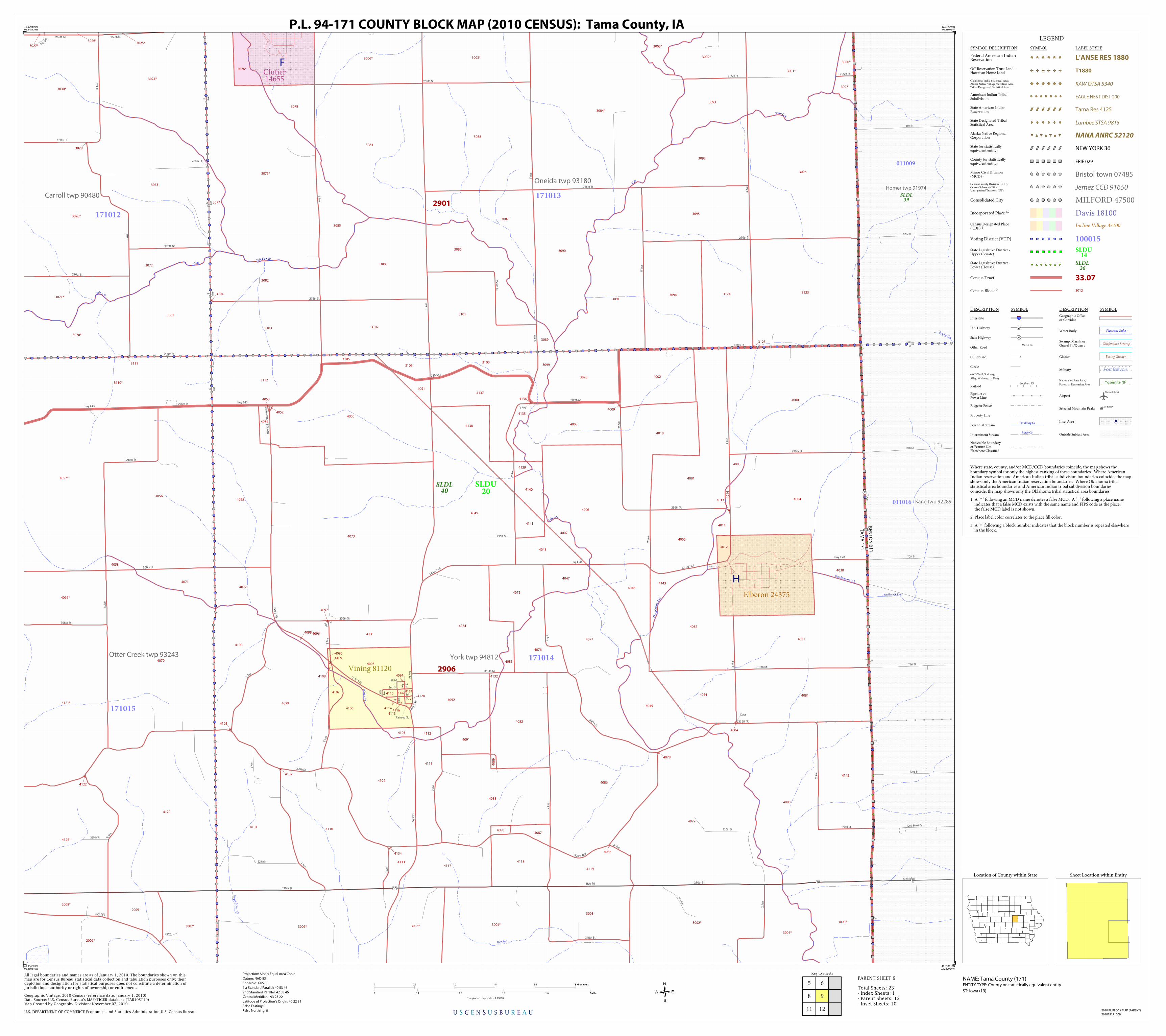
Plaque Mine C
rk
Hog Run
Troublesome Crk
Pra irie Crk
Wolf C
r k
Stein Crk
Tro
uble
som
e Crk
Salt Crk
E Br
Troublesome Crk
S alt Crk
S alt Cr S Br
S Br
Homer twp 91974
Kane twp 92289
Otter Creek twp 93243 York twp 94812
Carroll twp 90480
Oneida twp 93180
4072
3095
4137
4031
4093
40904087
40
89
4006
40
14
4141
4046
3104
4118
4075
4106
4104
41154128
4105
4070
3005*
3004*
4069*
3007*
4050
4054
4010
3093
3103
4071
4133
3125
4113
3082
4134
3091
3099
3092
4057*
4125*
4121*
3025*
3006*
3027*
2008*
2006*
3084
4030
4092
4074
41354009
4003
4001
3101
3112
4051
3003
3081
4073
4097
4012
4143
3028*
3004*3000*
3070*
4052
4091
4048
3110*
3071*
3001*
3002*
4081
4142
4140
3094
4088
4086
4132
4085
4110
4111
4082
2009
4130
3086
3111
3029
4007
4139
4114
4083
4107
4002
4044
4032
4080
3075*
3078
4000
3003*
3096
3085
31053100
4077
4079
3098
4098
4116
3030*
3076*
4058
4108
4095
4103
4078
4084
3002*
3123
4119
4120
4076
4102
4013
3124
3073
4056
3077
3000*
4005
3074*
3005*3006*
3106
3001*
3102
4045
4096
4109
4117
4099
4094
4131
3090
3072 3083
4047
3088
4055
4053
3026*
4138
3089
3097
4004
4011
4100
4129
4008
4049
3087
4136
4122
4101
4112
2901
2906
TA
MA
17
1
BE
NT
ON
01
1
Vining 81120
Elberon 24375
Clutier14655
SLDL39
SLDL40
SLDU20
011009
011016
171012
171015
171014
171013
67th St
66th St
72nd St
73rd St
72nd Street Dr
71st St
70th St
69th St
68th
St
Ww Ave
325th St
325th St
S A
ve
Rrave
295th St
320th St
S Ave
250th St
T Av
e
U A
ve
Railroad St
R Av
e
Hwy V
18
260th St
265th St
2nd St
4th
Ave
Hwy
V18
Hwy E66
T Ave
320th St
330th St
Hwy 30
Hwy E 44
W A
ve
W A
ve
305th St
T Ave
Hwy E43
V Ave
315th St
255th St
W A
ve
270th St
Hw
y V1
8
Main
St
260th St
S Ave
3rd St
320th Ave
280th St
315th St
290th St
310th St
W Ave
305th St
250thSt
X Ave
V Ave
R A
ve
X Ave
X Ave
280th St
R A
ve 255th St
255th St
S Ave
V Ave
270th St
27
5th S
t
270th St
U A
ve
X Ave
Hwy E43 Co H
wy V1
8
Co Rd E44
290th St
1st
St
S
Ave
330th St
275th St
300th St
295th St
T Ave
Hwy
E 44
R A
ve
335th St
Y Ave
X Ave
TAve
2nd
Ave
V Ave
Qq Av
e
Hwy E 44
320th St
280th St
S Ave
V Ave
295th St
V Ave
1st
Ave
U A
ve
X Ave
Co Rd E44
Co Rd V18
285th St
310th St
21
30
30
30
H
F
LEGEND
SYMBOL DESCRIPTION SYMBOL LABEL STYLE
Federal American IndianReservation L'ANSE RES 1880
Off-Reservation Trust Land,Hawaiian Home Land T1880
Oklahoma Tribal Statistical Area,Alaska Native Village Statistical Area,Tribal Designated Statistical Area
KAW OTSA 5340
American Indian TribalSubdivision EAGLE NEST DIST 200
State American IndianReservation Tama Res 4125
State Designated TribalStatistical Area Lumbee STSA 9815
Alaska Native RegionalCorporation NANA ANRC 52120
State (or statisticallyequivalent entity) NEW YORK 36
County (or statisticallyequivalent entity) ERIE 029
Minor Civil Division(MCD)1 Bristol town 07485Census County Division (CCD),Census Subarea (CSA),Unorganized Territory (UT)
Jemez CCD 91650
Consolidated City MILFORD 47500
Incorporated Place 1,2 Davis 18100Census Designated Place(CDP) 2 Incline Village 35100
Voting District (VTD) 100015State Legislative District -Upper (Senate)
SLDU14
State Legislative District -Lower (House)
SLDL26
Census Tract 33.07
Census Block 3 3012
DESCRIPTION SYMBOL DESCRIPTION SYMBOL
Interstate 3
U.S. Highway 2
State Highway 4
Other RoadMarsh Ln
Cul-de-sac
Circle
4WD Trail, Stairway,
Alley, Walkway, or Ferry
RailoadSouthern RR
Pipeline orPower Line
Ridge or Fence
Property Line
Perennial StreamTumbling Cr
Intermittent StreamPiney Cr
Nonvisible Boundaryor Feature NotElsewhere Classified
Geographic Offsetor Corridor
Water Body Pleasant Lake
Swamp, Marsh, orGravel Pit/Quarry
Okefenokee Swamp
Glacier Bering Glacier
Military Fort Belvoir
National or State Park,
Forest, or Recreation AreaYosemite NP
AirportOxnard Arprt
Selected Mountain PeaksMt Baker
Inset Area A
Outside Subject Area
Where state, county, and/or MCD/CCD boundaries coincide, the map shows theboundary symbol for only the highest-ranking of these boundaries. Where AmericanIndian reservation and American Indian tribal subdivision boundaries coincide, the mapshows only the American Indian reservation boundaries. Where Oklahoma tribalstatistical area boundaries and American Indian tribal subdivision boundariescoincide, the map shows only the Oklahoma tribal statistical area boundaries.
1 A ' ° ' following an MCD name denotes a false MCD. A ' ° ' following a place name indicates that a false MCD exists with the same name and FIPS code as the place; the false MCD label is not shown.
2 Place label color correlates to the place fill color.
3 A ' ' following a block number indicates that the block number is repeated elsewhere in the block.
*
Key to Sheets
5
8
11
6
12
9
U S C E N S U S B U R E A U
Location of County within State
42.079490N92.448479W
42.077997N92.28079W
41.953113N92.282954W
41.954603N92.450316W
All legal boundaries and names are as of January 1, 2010. The boundaries shown on thismap are for Census Bureau statistical data collection and tabulation purposes only; theirdepiction and designation for statistical purposes does not constitute a determination ofjurisdictional authority or rights of ownership or entitlement.
U.S. DEPARTMENT OF COMMERCE Economics and Statistics Administration U.S. Census Bureau
Geographic Vintage: 2010 Census (reference date: January 1, 2010)Data Source: U.S. Census Bureau's MAF/TIGER database (TAB10ST19)Map Created by Geography Division: November 07, 2010
ENTITY TYPE: County or statistically equivalent entity
NAME: Tama County (171) Projection: Albers Equal Area Conic
Datum: NAD 83
Spheroid: GRS 80
1st Standard Parallel: 40 53 46
2nd Standard Parallel: 42 58 46
Central Meridian: -93 23 22
Latitude of Projection's Origin: 40 22 31
False Easting: 0
False Northing: 0
Total Sheets: 23- Index Sheets: 1- Parent Sheets: 12- Inset Sheets: 10
ST: Iowa (19)
0 0.6 1.2 1.8 2.4 3 Kilometers3 Kilometers
0 0.4 0.8 1.2 1.6 2 Miles2 Miles
The plotted map scale is 1:19000
P.L. 94-171 COUNTY BLOCK MAP (2010 CENSUS): Tama County, IA
Sheet Location within Entity
2010 PL BLOCK MAP (PARENT)
201019171009
PARENT SHEET 9

Esbeck Fld
Abe
s Frk
Abes Frk
Elk Run
Walnut C
r k
Big Bear Crk
Raven Crk
Elk Run
Richland Crk
Iowa Riv
Raven Crk
Raven Crk Bennett
Crk
Abes Frk
Abe
s F
rk
Uni
on P
acifi
c R
R
Le Grandtwp 92412
Sheridan twp 93846
Hickory Grove twp 91920
Chester twp 90660
Greencastle twp 91749
Columbia twp 90786
Tama twp94083
Indian Village twp 92037
Highland twp 91944
2061*
21392137
1108
1113
1115
1094
1096
1088
1102
1129
2134
1084*2065*
1082*
2057*
2133*
2131*
2132*
2109*
2051*
1116
1097
2127
1122
1126
2110
1124
1093
1081*
2126
1114 2125
2121
2118
2116
2113
1086
1138
2123
2117
2128
2071
2054
1133
1105
20561137
2060
1095
1100
1107
2115
2111
2114
1111
2138
2061*
1106
2124
1127
2059
2057
2058
1099
1101
1128
1121
1131
2055
10871130
2066
11032049
2120
1117
2055*
2052*
2130
2067*
2136
1098
1104
1132
1085*
1076*
1120
2017*
2048*
1110
1109
2112
2122
2119
2135
2129
1089
1112
2053*
1118
1090*1091*
1123
1078* 2056*
2060*
1077*
1092*
2140
1119
1125
2905
2906
POWESHIEK 157
TAMA 171
PO
WE
SH
IEK
15
7
JAS
PE
R 0
99
MARSHALL 127
JASPER 099
TA
MA
17
1
MA
RS
HA
LL 12
7
SAC ANDFOX/MESKWAKI SET 3280
SAC ANDFOX/MESKWAKI SET 3280
SAC ANDFOX/MESKWAKI SET 3280
Gilman30900
SLDL41
SLDL44
SLDL75
SLDL40
SLDL76
SLDU22
SLDU21
SLDU20
SLDU38
099005
127016
157001157002
127014 171018171020
171022
171023
330th St
20
th S
t
Zeller Ave
N 115th E
290th St
275th St
S M
ain St
310th St
80
th S
t
320th Ave
320th St
310th Ave
N 107th Ave E
70
th
St
40
th S
t
50
th S
t
60
th S
t
35
th S
t
Hw
y T3
8 N
Ze
ller
Ave
Dunbar
Zola
Ave
N 99th Ave E
320th Ave
370th St
360th St
385th
St
C A
ve
370th St
H A
ve
Gg
Ave
B A
ve
H Av
e
380th St
400th St
G Ave
Ff A
ve
Hwy E 69
Abb
ott
Ave
385th St
H A
ve
340th St
E Ave
340 St
340th St
360th St
380th St
390th St
380th St
C A
ve
C A
ve
E Ave
370th St
350th St
B A
ve
D A
ve
370th St
F Ave
146
146
146
LEGEND
SYMBOL DESCRIPTION SYMBOL LABEL STYLE
Federal American IndianReservation L'ANSE RES 1880
Off-Reservation Trust Land,Hawaiian Home Land T1880
Oklahoma Tribal Statistical Area,Alaska Native Village Statistical Area,Tribal Designated Statistical Area
KAW OTSA 5340
American Indian TribalSubdivision EAGLE NEST DIST 200
State American IndianReservation Tama Res 4125
State Designated TribalStatistical Area Lumbee STSA 9815
Alaska Native RegionalCorporation NANA ANRC 52120
State (or statisticallyequivalent entity) NEW YORK 36
County (or statisticallyequivalent entity) ERIE 029
Minor Civil Division(MCD)1 Bristol town 07485Census County Division (CCD),Census Subarea (CSA),Unorganized Territory (UT)
Jemez CCD 91650
Consolidated City MILFORD 47500
Incorporated Place 1,2 Davis 18100Census Designated Place(CDP) 2 Incline Village 35100
Voting District (VTD) 100015State Legislative District -Upper (Senate)
SLDU14
State Legislative District -Lower (House)
SLDL26
Census Tract 33.07
Census Block 3 3012
DESCRIPTION SYMBOL DESCRIPTION SYMBOL
Interstate 3
U.S. Highway 2
State Highway 4
Other RoadMarsh Ln
Cul-de-sac
Circle
4WD Trail, Stairway,
Alley, Walkway, or Ferry
RailoadSouthern RR
Pipeline orPower Line
Ridge or Fence
Property Line
Perennial StreamTumbling Cr
Intermittent StreamPiney Cr
Nonvisible Boundaryor Feature NotElsewhere Classified
Geographic Offsetor Corridor
Water Body Pleasant Lake
Swamp, Marsh, orGravel Pit/Quarry
Okefenokee Swamp
Glacier Bering Glacier
Military Fort Belvoir
National or State Park,
Forest, or Recreation AreaYosemite NP
AirportOxnard Arprt
Selected Mountain PeaksMt Baker
Inset Area A
Outside Subject Area
Where state, county, and/or MCD/CCD boundaries coincide, the map shows theboundary symbol for only the highest-ranking of these boundaries. Where AmericanIndian reservation and American Indian tribal subdivision boundaries coincide, the mapshows only the American Indian reservation boundaries. Where Oklahoma tribalstatistical area boundaries and American Indian tribal subdivision boundariescoincide, the map shows only the Oklahoma tribal statistical area boundaries.
1 A ' ° ' following an MCD name denotes a false MCD. A ' ° ' following a place name indicates that a false MCD exists with the same name and FIPS code as the place; the false MCD label is not shown.
2 Place label color correlates to the place fill color.
3 A ' ' following a block number indicates that the block number is repeated elsewhere in the block.
*
Key to Sheets
7 8
1110
U S C E N S U S B U R E A U
Location of County within State
41.956851N92.78506W
41.955849N92.617685W
41.830956N92.619188W
41.831957N92.786237W
All legal boundaries and names are as of January 1, 2010. The boundaries shown on thismap are for Census Bureau statistical data collection and tabulation purposes only; theirdepiction and designation for statistical purposes does not constitute a determination ofjurisdictional authority or rights of ownership or entitlement.
U.S. DEPARTMENT OF COMMERCE Economics and Statistics Administration U.S. Census Bureau
Geographic Vintage: 2010 Census (reference date: January 1, 2010)Data Source: U.S. Census Bureau's MAF/TIGER database (TAB10ST19)Map Created by Geography Division: November 07, 2010
ENTITY TYPE: County or statistically equivalent entity
NAME: Tama County (171) Projection: Albers Equal Area Conic
Datum: NAD 83
Spheroid: GRS 80
1st Standard Parallel: 40 53 46
2nd Standard Parallel: 42 58 46
Central Meridian: -93 23 22
Latitude of Projection's Origin: 40 22 31
False Easting: 0
False Northing: 0
Total Sheets: 23- Index Sheets: 1- Parent Sheets: 12- Inset Sheets: 10
ST: Iowa (19)
0 0.6 1.2 1.8 2.4 3 Kilometers3 Kilometers
0 0.4 0.8 1.2 1.6 2 Miles2 Miles
The plotted map scale is 1:19000
P.L. 94-171 COUNTY BLOCK MAP (2010 CENSUS): Tama County, IA
Sheet Location within Entity
2010 PL BLOCK MAP (PARENT)
201019171010
PARENT SHEET 10

Tama Arprt
N Walnut Crk
Mud
Crk
Otter Crk
N W aln u t Crk
Io
wa Riv
Iowa Riv
Ri c hland
N Walnut Crk
Elk
Run
Richland Crk
Io wa Ri
v
W Walnut Crk
Union Pacific RR
Sheridan twp 93846 Madison twp 92784
Columbia twp 90786Richland twp 93618
Tamatwp
94083
Otter Creek twp 93243
2145
2091
2174
2094
202420252029
2033
2047
2063
2044
2062
2102
2028
2089
2069
2041
2108
2104
2087
2077
2050
2090
2014
2013
2043
2038
2167
2150
2158
2153
2082
2017*
2017*
1055*
2131*
2048*
1060*
2080*
2084*
2026
2042
2031
2154
2070
2066
2098
2106
1065
2095
2083
2156
2039
2045
2093*
2163*
2016*
2017*
2162*
2044*
2151
2161*
2101
2061*
2141
2055*
2052*
2100
2166
2015*
2142
2133*
2019*
21602132*
1059*
2109*
2018*
1053*
1056*
2051*
2010*
2035*
2006*2005*
2053*
2081*
2036*
2056*
2165
2159
1061
2146
2170*
2012*
2074
2027
2076
2144
2068
2034
2152
2045
2030
2086
2103
2054
2075
2070
2143
2149
2078
2072
2067
2105
2096
21472157
2019
2053
2020
2021
2023
2022
2046
2040
2088
2099
2071
2064
20
73
2107
2148
2155
2065
2069
2097
2032
2079
2085
2905
2906
TAMA 171
POWESHIEK 157
SAC ANDFOX/MESKWAKI
SET 3280
Tama 77115 SLDL40
SLDL76
SLDU20
SLDU38
157003
157002
171015
171023
171024
171019171018
90
th S
t
Hw
y 6
3
17
0th
St
320th Ave
11
0th
St
14
0th
St
310th Ave 310th Ave
12
0th
St 16
0th
St
13
0th
St
150t
h St
320th Ave 320th Ave
365th St
Pp A
ve
385th St
360t
h St
Ll A
ve
365th St
390th St
345th St
O A
ve
380th St
K A
ve
P Ave
L Ave
MAve
340th
St
M A
ve
370th St
Mm
Ave
P Ave
Hwy E 64
390th St
L Ave
400th St
N A
ve
380th St
Q A
ve
P Ave
Q A
ve
38
0th
St
Hw
y 6
3
370th St
P Ave
370th St
370th St
Co Rd E64
I Ave
360th St
J Ave
340th St
340th
St
345th
St
385th St
M A
ve
O A
ve
Hwy E64
360th St
340th
St
Hwy E 69
340th St
N A
ve
380th St
350th St
Ll A
ve
390th St
375th St
J Ave
365th St
Sta
teSt
370th St
340th St
Kav
e
S t
390th St
Co Rd
E64
63
LEGEND
SYMBOL DESCRIPTION SYMBOL LABEL STYLE
Federal American IndianReservation L'ANSE RES 1880
Off-Reservation Trust Land,Hawaiian Home Land T1880
Oklahoma Tribal Statistical Area,Alaska Native Village Statistical Area,Tribal Designated Statistical Area
KAW OTSA 5340
American Indian TribalSubdivision EAGLE NEST DIST 200
State American IndianReservation Tama Res 4125
State Designated TribalStatistical Area Lumbee STSA 9815
Alaska Native RegionalCorporation NANA ANRC 52120
State (or statisticallyequivalent entity) NEW YORK 36
County (or statisticallyequivalent entity) ERIE 029
Minor Civil Division(MCD)1 Bristol town 07485Census County Division (CCD),Census Subarea (CSA),Unorganized Territory (UT)
Jemez CCD 91650
Consolidated City MILFORD 47500
Incorporated Place 1,2 Davis 18100Census Designated Place(CDP) 2 Incline Village 35100
Voting District (VTD) 100015State Legislative District -Upper (Senate)
SLDU14
State Legislative District -Lower (House)
SLDL26
Census Tract 33.07
Census Block 3 3012
DESCRIPTION SYMBOL DESCRIPTION SYMBOL
Interstate 3
U.S. Highway 2
State Highway 4
Other RoadMarsh Ln
Cul-de-sac
Circle
4WD Trail, Stairway,
Alley, Walkway, or Ferry
RailoadSouthern RR
Pipeline orPower Line
Ridge or Fence
Property Line
Perennial StreamTumbling Cr
Intermittent StreamPiney Cr
Nonvisible Boundaryor Feature NotElsewhere Classified
Geographic Offsetor Corridor
Water Body Pleasant Lake
Swamp, Marsh, orGravel Pit/Quarry
Okefenokee Swamp
Glacier Bering Glacier
Military Fort Belvoir
National or State Park,
Forest, or Recreation AreaYosemite NP
AirportOxnard Arprt
Selected Mountain PeaksMt Baker
Inset Area A
Outside Subject Area
Where state, county, and/or MCD/CCD boundaries coincide, the map shows theboundary symbol for only the highest-ranking of these boundaries. Where AmericanIndian reservation and American Indian tribal subdivision boundaries coincide, the mapshows only the American Indian reservation boundaries. Where Oklahoma tribalstatistical area boundaries and American Indian tribal subdivision boundariescoincide, the map shows only the Oklahoma tribal statistical area boundaries.
1 A ' ° ' following an MCD name denotes a false MCD. A ' ° ' following a place name indicates that a false MCD exists with the same name and FIPS code as the place; the false MCD label is not shown.
2 Place label color correlates to the place fill color.
3 A ' ' following a block number indicates that the block number is repeated elsewhere in the block.
*
Key to Sheets
7
10
8 9
1211
U S C E N S U S B U R E A U
Location of County within State
41.955849N92.617685W
41.954603N92.450316W
41.829713N92.452145W
41.830956N92.619188W
All legal boundaries and names are as of January 1, 2010. The boundaries shown on thismap are for Census Bureau statistical data collection and tabulation purposes only; theirdepiction and designation for statistical purposes does not constitute a determination ofjurisdictional authority or rights of ownership or entitlement.
U.S. DEPARTMENT OF COMMERCE Economics and Statistics Administration U.S. Census Bureau
Geographic Vintage: 2010 Census (reference date: January 1, 2010)Data Source: U.S. Census Bureau's MAF/TIGER database (TAB10ST19)Map Created by Geography Division: November 07, 2010
ENTITY TYPE: County or statistically equivalent entity
NAME: Tama County (171) Projection: Albers Equal Area Conic
Datum: NAD 83
Spheroid: GRS 80
1st Standard Parallel: 40 53 46
2nd Standard Parallel: 42 58 46
Central Meridian: -93 23 22
Latitude of Projection's Origin: 40 22 31
False Easting: 0
False Northing: 0
Total Sheets: 23- Index Sheets: 1- Parent Sheets: 12- Inset Sheets: 10
ST: Iowa (19)
0 0.6 1.2 1.8 2.4 3 Kilometers3 Kilometers
0 0.4 0.8 1.2 1.6 2 Miles2 Miles
The plotted map scale is 1:19000
P.L. 94-171 COUNTY BLOCK MAP (2010 CENSUS): Tama County, IA
Sheet Location within Entity
2010 PL BLOCK MAP (PARENT)
201019171011
PARENT SHEET 11

Rain
bow Lk
Plaque Mine Crk
Hog Run
N Walnut Crk
Walnut Crk
Iow
a Riv
Salt Crk
O tt er Crk
Iowa R iv
Otter C
rk
Iowa Riv
Iow
a Riv
I owa Riv
Sa
lt Crk
Plag
ue M
ine
Crk
Richlan d
N Walnut Crk
Otter Crk
Union Pacific RR
Union Pacific RR
Union Pacific RR
Iowa twp 92052
Iowa twp 92052
Kane twp92289
Jefferson twp 92250Honey Creek twp 91983
Madison twp 92784
Otter Creektwp 93243
Richland twp 93618
York twp 94812
Salt Creek twp 93750
Belle Plaine city° 90178
3060
3064
2161*
3051
3087
3041
3057
3004*
2036*
3043
3056
3050
2164
3058
2092
3039
3025
30
24
3009
3032
3020
3065
3033
3040
3029
2169
2037
3053
30
38
3035
3072
3089
3075
3079
3016
3080
3077
3082
2010*
2035*
2006*
3008
3011
3021
3030
3066
3012
3010
3081
3042
3067
30343027
3007*
3037
3054
2171
3026
3059
3028
2011
2172
3031
3085
3005*3006*
2080*
2084*
3036
2081*
3070
3069
3078
2012*
2093*
3023
2173
3052
3018
3068
3084
3091
3013 3014
3063
3071
3076
3104
3061
3062
3073
3083
2170*
2163*
3001*3002*
3015
2162*
3074
3103
3090
3022
3086
3019
3017
3088
3000*
2168
2906
PO
WE
SH
IEK
15
7
IOW
A 0
95
POWESHIEK 157
TAMA 171
BE
NT
ON
01
1
TA
MA
17
1
BENTON 011
IOWA 095
BellePlaine05590
Chelsea12990
SLDL39
SLDL40
SLDL76
SLDU20
SLDU38
157003 157004
011017
011017
011018
011016
095001
171014171015
171024
171025
1st
Ave
1
0th
Ave
nue
Dr
310th Ave
301 Street Ave
23
7th
St 24
0th
St
315th Ave
230
th S
t
310th Ave
19
0th
St
21st St
76th St
75th St
8th St
15th St
Ken
t C
hurc
h R
d
320th Ave
110th St
Pow
eshi
ek-I
owa
Rd
74th
St
230t
h S t
310th Ave
22
0th
St
120th St
Industrial Park Blvd
16th St
20
0th
St
19
7th
St
V18
Rd
Sun
set
Dr
355 St
360th St
Kennedy St
Blazek Ln Grandview Dr
Rivervie w Ct
Xx A
ve
Stevens
St
395th St
Iowana
St
U A
ve
T Ave
R A
ve
T Ave
385th St
U A
ve
390th Ave
T Ave
U A
ve
39
0th St
Uu
Ave
YAve
V Ave
YAve
2nd St
360th St
Hwy V18
Hwy
V 18
Hwy E66
T Ave
Sunset
Ct
S Ave
Xx Ave
380th St
Sta
tion
St
S Ave
Blazek Ln
V Ave
Hwy E66
V Ave
370th St
400th St
340th St
380th St
Hwy E66
R A
ve
340th St
Dudley St
Ora
nge
St
W A
ve
X Ave
Co Rd E66
Co Rd V
18
380th St
Railroad St
Jacobs St
350th St
Oliv
e S
t
Co Rd E64
390th St
Irish St
Mai
n St
Broad
St
Station S
t
Station St
Gre
en S
t
W Ave
Co Rd V18
34
0 th St
370th St
S Ave
Co R
d V1
8
21
21
21
21
J
LEGEND
SYMBOL DESCRIPTION SYMBOL LABEL STYLE
Federal American IndianReservation L'ANSE RES 1880
Off-Reservation Trust Land,Hawaiian Home Land T1880
Oklahoma Tribal Statistical Area,Alaska Native Village Statistical Area,Tribal Designated Statistical Area
KAW OTSA 5340
American Indian TribalSubdivision EAGLE NEST DIST 200
State American IndianReservation Tama Res 4125
State Designated TribalStatistical Area Lumbee STSA 9815
Alaska Native RegionalCorporation NANA ANRC 52120
State (or statisticallyequivalent entity) NEW YORK 36
County (or statisticallyequivalent entity) ERIE 029
Minor Civil Division(MCD)1 Bristol town 07485Census County Division (CCD),Census Subarea (CSA),Unorganized Territory (UT)
Jemez CCD 91650
Consolidated City MILFORD 47500
Incorporated Place 1,2 Davis 18100Census Designated Place(CDP) 2 Incline Village 35100
Voting District (VTD) 100015State Legislative District -Upper (Senate)
SLDU14
State Legislative District -Lower (House)
SLDL26
Census Tract 33.07
Census Block 3 3012
DESCRIPTION SYMBOL DESCRIPTION SYMBOL
Interstate 3
U.S. Highway 2
State Highway 4
Other RoadMarsh Ln
Cul-de-sac
Circle
4WD Trail, Stairway,
Alley, Walkway, or Ferry
RailoadSouthern RR
Pipeline orPower Line
Ridge or Fence
Property Line
Perennial StreamTumbling Cr
Intermittent StreamPiney Cr
Nonvisible Boundaryor Feature NotElsewhere Classified
Geographic Offsetor Corridor
Water Body Pleasant Lake
Swamp, Marsh, orGravel Pit/Quarry
Okefenokee Swamp
Glacier Bering Glacier
Military Fort Belvoir
National or State Park,
Forest, or Recreation AreaYosemite NP
AirportOxnard Arprt
Selected Mountain PeaksMt Baker
Inset Area A
Outside Subject Area
Where state, county, and/or MCD/CCD boundaries coincide, the map shows theboundary symbol for only the highest-ranking of these boundaries. Where AmericanIndian reservation and American Indian tribal subdivision boundaries coincide, the mapshows only the American Indian reservation boundaries. Where Oklahoma tribalstatistical area boundaries and American Indian tribal subdivision boundariescoincide, the map shows only the Oklahoma tribal statistical area boundaries.
1 A ' ° ' following an MCD name denotes a false MCD. A ' ° ' following a place name indicates that a false MCD exists with the same name and FIPS code as the place; the false MCD label is not shown.
2 Place label color correlates to the place fill color.
3 A ' ' following a block number indicates that the block number is repeated elsewhere in the block.
*
Key to Sheets
8
11
9
12
U S C E N S U S B U R E A U
Location of County within State
41.954603N92.450316W
41.953113N92.282954W
41.828226N92.285109W
41.829713N92.452145W
All legal boundaries and names are as of January 1, 2010. The boundaries shown on thismap are for Census Bureau statistical data collection and tabulation purposes only; theirdepiction and designation for statistical purposes does not constitute a determination ofjurisdictional authority or rights of ownership or entitlement.
U.S. DEPARTMENT OF COMMERCE Economics and Statistics Administration U.S. Census Bureau
Geographic Vintage: 2010 Census (reference date: January 1, 2010)Data Source: U.S. Census Bureau's MAF/TIGER database (TAB10ST19)Map Created by Geography Division: November 07, 2010
ENTITY TYPE: County or statistically equivalent entity
NAME: Tama County (171) Projection: Albers Equal Area Conic
Datum: NAD 83
Spheroid: GRS 80
1st Standard Parallel: 40 53 46
2nd Standard Parallel: 42 58 46
Central Meridian: -93 23 22
Latitude of Projection's Origin: 40 22 31
False Easting: 0
False Northing: 0
Total Sheets: 23- Index Sheets: 1- Parent Sheets: 12- Inset Sheets: 10
ST: Iowa (19)
0 0.6 1.2 1.8 2.4 3 Kilometers3 Kilometers
0 0.4 0.8 1.2 1.6 2 Miles2 Miles
The plotted map scale is 1:19000
P.L. 94-171 COUNTY BLOCK MAP (2010 CENSUS): Tama County, IA
Sheet Location within Entity
2010 PL BLOCK MAP (PARENT)
201019171012
PARENT SHEET 12

Lincoln twp 92619
2058
2061
2056
2065
2066
2057
2067
2027
2068
2071
2062
2070
2060
2064
2059
2063
2069
2902
Lincoln 45255SLDL
40SLDU
20
171001
E Ave
120th St
E Ave
E Main St
Sun
rise
Dr
W R
ailro
ad S
t
W South St
Main St E Main St
Pers
hing
Ave
W Main St
High St
E R
ailro
ad S
t
Linc
oln
St
E Ave
North St
Sun
rise
Dr
Spencer St
South St
LEGEND
SYMBOL DESCRIPTION SYMBOL LABEL STYLE
Federal American IndianReservation L'ANSE RES 1880
Off-Reservation Trust Land,Hawaiian Home Land T1880
Oklahoma Tribal Statistical Area,Alaska Native Village Statistical Area,Tribal Designated Statistical Area
KAW OTSA 5340
American Indian TribalSubdivision EAGLE NEST DIST 200
State American IndianReservation Tama Res 4125
State Designated TribalStatistical Area Lumbee STSA 9815
Alaska Native RegionalCorporation NANA ANRC 52120
State (or statisticallyequivalent entity) NEW YORK 36
County (or statisticallyequivalent entity) ERIE 029
Minor Civil Division(MCD)1 Bristol town 07485Census County Division (CCD),Census Subarea (CSA),Unorganized Territory (UT)
Jemez CCD 91650
Consolidated City MILFORD 47500
Incorporated Place 1,2 Davis 18100Census Designated Place(CDP) 2 Incline Village 35100
Voting District (VTD) 100015State Legislative District -Upper (Senate)
SLDU14
State Legislative District -Lower (House)
SLDL26
Census Tract 33.07
Census Block 3 3012
DESCRIPTION SYMBOL DESCRIPTION SYMBOL
Interstate 3
U.S. Highway 2
State Highway 4
Other RoadMarsh Ln
Cul-de-sac
Circle
4WD Trail, Stairway,
Alley, Walkway, or Ferry
RailoadSouthern RR
Pipeline orPower Line
Ridge or Fence
Property Line
Perennial StreamTumbling Cr
Intermittent StreamPiney Cr
Nonvisible Boundaryor Feature NotElsewhere Classified
Geographic Offsetor Corridor
Water Body Pleasant Lake
Swamp, Marsh, orGravel Pit/Quarry
Okefenokee Swamp
Glacier Bering Glacier
Military Fort Belvoir
National or State Park,
Forest, or Recreation AreaYosemite NP
AirportOxnard Arprt
Selected Mountain PeaksMt Baker
Inset Area A
Outside Subject Area
Where state, county, and/or MCD/CCD boundaries coincide, the map shows theboundary symbol for only the highest-ranking of these boundaries. Where AmericanIndian reservation and American Indian tribal subdivision boundaries coincide, the mapshows only the American Indian reservation boundaries. Where Oklahoma tribalstatistical area boundaries and American Indian tribal subdivision boundariescoincide, the map shows only the Oklahoma tribal statistical area boundaries.
1 A ' ° ' following an MCD name denotes a false MCD. A ' ° ' following a place name indicates that a false MCD exists with the same name and FIPS code as the place; the false MCD label is not shown.
2 Place label color correlates to the place fill color.
3 A ' ' following a block number indicates that the block number is repeated elsewhere in the block.
*
U S C E N S U S B U R E A U
Location of County within State
42.268924N92.698624W
42.268835N92.683982W
42.257964N92.684102W
42.258052N92.698742W
All legal boundaries and names are as of January 1, 2010. The boundaries shown on thismap are for Census Bureau statistical data collection and tabulation purposes only; theirdepiction and designation for statistical purposes does not constitute a determination ofjurisdictional authority or rights of ownership or entitlement.
U.S. DEPARTMENT OF COMMERCE Economics and Statistics Administration U.S. Census Bureau
Geographic Vintage: 2010 Census (reference date: January 1, 2010)Data Source: U.S. Census Bureau's MAF/TIGER database (TAB10ST19)Map Created by Geography Division: November 07, 2010
ENTITY TYPE: County or statistically equivalent entity
NAME: Tama County (171) Projection: Albers Equal Area Conic
Datum: NAD 83
Spheroid: GRS 80
1st Standard Parallel: 40 53 46
2nd Standard Parallel: 42 58 46
Central Meridian: -93 23 22
Latitude of Projection's Origin: 40 22 31
False Easting: 0
False Northing: 0
Total Sheets: 23- Index Sheets: 1- Parent Sheets: 12- Inset Sheets: 10
ST: Iowa (19)
0 51 102 153 204 255 Meters255 Meters
0 173 346 519 692 865 Feet865 Feet
The plotted map scale is 1:1654
P.L. 94-171 COUNTY BLOCK MAP (2010 CENSUS): Tama County, IA
2010 PL BLOCK MAP (INSET)
201019171A01
INSET SHEET A1
Sheet Location within Entity

Little Coon Crk
Coon C
rk
Coo
n C
rk
Wolf Crk
Wol
f Crk
Coo
n C
rk
Little Coon Crk
Wolf Crk
Perry twp 933063
06
0
1117
3043
1109
3017
3001
1124
30371130
1132
3005
3015
10
67
1116
3059
3058
3026
1113
3042
3041
1131
3054
3048
1118
3025
3016
3039
303530343030302930283027
303230573049
3056
3055
3053
3024
3018
3031
3021
3007
30123014 3013
3008
3002
3023
3010
3036
30063020
30093011
3040
3004
3003
30333051
3052
3050
3062
3019
3022
3046
30453044
3038
3047
2902
2901
Traer 78735
SLDL40
SLDU20 171007
P Ave
170th St
Ridge Rd
Mill
St
180th St
180th St
Barb
our S
t
2nd St
Crestview Dr
Suns
et C
ir
Harrison St
5th St
Iowana St
Westview
Ct
A S
t
2nd St
Iowana St
O A
ve
Ber
lin A
ve
9th St
Che
rry
6th St
S C
herr
y
Vista St
Mill
St
Toledo St
Park Row
5th St
Mey
er S
t
Russell Rd
170th St
Lock
ard
St
Gre
en S
t
7th St
Leve
ring
St
S M
ain
St
Wilson St
1st St
Tayl
or S
t
Mill
St
Wilson St
Woodlawn St
4th St 4th St
3rd St
2nd St
N M
ain
St
8th St
N C
herry
St
Syl
van
Ct
Linn
St
Staveley Ln
North St
Wilson
Wes
t S
t
S C
herr
y
Wal
nut
St
Elm St
Mowery St
8
8
63
LEGEND
SYMBOL DESCRIPTION SYMBOL LABEL STYLE
Federal American IndianReservation L'ANSE RES 1880
Off-Reservation Trust Land,Hawaiian Home Land T1880
Oklahoma Tribal Statistical Area,Alaska Native Village Statistical Area,Tribal Designated Statistical Area
KAW OTSA 5340
American Indian TribalSubdivision EAGLE NEST DIST 200
State American IndianReservation Tama Res 4125
State Designated TribalStatistical Area Lumbee STSA 9815
Alaska Native RegionalCorporation NANA ANRC 52120
State (or statisticallyequivalent entity) NEW YORK 36
County (or statisticallyequivalent entity) ERIE 029
Minor Civil Division(MCD)1 Bristol town 07485Census County Division (CCD),Census Subarea (CSA),Unorganized Territory (UT)
Jemez CCD 91650
Consolidated City MILFORD 47500
Incorporated Place 1,2 Davis 18100Census Designated Place(CDP) 2 Incline Village 35100
Voting District (VTD) 100015State Legislative District -Upper (Senate)
SLDU14
State Legislative District -Lower (House)
SLDL26
Census Tract 33.07
Census Block 3 3012
DESCRIPTION SYMBOL DESCRIPTION SYMBOL
Interstate 3
U.S. Highway 2
State Highway 4
Other RoadMarsh Ln
Cul-de-sac
Circle
4WD Trail, Stairway,
Alley, Walkway, or Ferry
RailoadSouthern RR
Pipeline orPower Line
Ridge or Fence
Property Line
Perennial StreamTumbling Cr
Intermittent StreamPiney Cr
Nonvisible Boundaryor Feature NotElsewhere Classified
Geographic Offsetor Corridor
Water Body Pleasant Lake
Swamp, Marsh, orGravel Pit/Quarry
Okefenokee Swamp
Glacier Bering Glacier
Military Fort Belvoir
National or State Park,
Forest, or Recreation AreaYosemite NP
AirportOxnard Arprt
Selected Mountain PeaksMt Baker
Inset Area A
Outside Subject Area
Where state, county, and/or MCD/CCD boundaries coincide, the map shows theboundary symbol for only the highest-ranking of these boundaries. Where AmericanIndian reservation and American Indian tribal subdivision boundaries coincide, the mapshows only the American Indian reservation boundaries. Where Oklahoma tribalstatistical area boundaries and American Indian tribal subdivision boundariescoincide, the map shows only the Oklahoma tribal statistical area boundaries.
1 A ' ° ' following an MCD name denotes a false MCD. A ' ° ' following a place name indicates that a false MCD exists with the same name and FIPS code as the place; the false MCD label is not shown.
2 Place label color correlates to the place fill color.
3 A ' ' following a block number indicates that the block number is repeated elsewhere in the block.
*
U S C E N S U S B U R E A U
Location of County within State
42.199702N92.477714W
42.199501N92.452618W
42.180847N92.452893W
42.181048N92.47798W
All legal boundaries and names are as of January 1, 2010. The boundaries shown on thismap are for Census Bureau statistical data collection and tabulation purposes only; theirdepiction and designation for statistical purposes does not constitute a determination ofjurisdictional authority or rights of ownership or entitlement.
U.S. DEPARTMENT OF COMMERCE Economics and Statistics Administration U.S. Census Bureau
Geographic Vintage: 2010 Census (reference date: January 1, 2010)Data Source: U.S. Census Bureau's MAF/TIGER database (TAB10ST19)Map Created by Geography Division: November 07, 2010
ENTITY TYPE: County or statistically equivalent entity
NAME: Tama County (171) Projection: Albers Equal Area Conic
Datum: NAD 83
Spheroid: GRS 80
1st Standard Parallel: 40 53 46
2nd Standard Parallel: 42 58 46
Central Meridian: -93 23 22
Latitude of Projection's Origin: 40 22 31
False Easting: 0
False Northing: 0
Total Sheets: 23- Index Sheets: 1- Parent Sheets: 12- Inset Sheets: 10
ST: Iowa (19)
0 88 176 264 352 440 Meters440 Meters
0 297 594 891 1188 1485 Feet1485 Feet
The plotted map scale is 1:2838
P.L. 94-171 COUNTY BLOCK MAP (2010 CENSUS): Tama County, IA
2010 PL BLOCK MAP (INSET)
201019171B01
INSET SHEET B1
Sheet Location within Entity

Wolf Crk
Wolf Crk
Wolf Crk
Wolf Crk
Spring Creek twp 93972
20822083
2042
2069
2041
2061
20
62
2027
2059
2081
2030
2032
2060
2077
2079
2029
2074
2075
20702080
2031
2048
20572058
2028
2045
2056
2071206720732072
2044
2043
2046
2066
2047
2037
20552054
20492050
2036
20512053
204020522035
2033
2039
2068
2903 Gladbrook 31035SLDL
40SLDU
20171009
Hwy 96
Gable St
D A
ve
D A
ve
175th St
W Jo
hnst
on S
t
W 7th
W 2nd St
1st St
7th St
Gar
field
St
Art
hur
St
East
St
W 8th St
Gra
ce S
t
Green St
W 1st St
Johnston St
Spr
ing
St
Spr
ing
St
Linc
oln
St
8th St Hwy 96
5th St
Front St
2nd St
Grand St
Kin
g S
t
7th St
Gou
ld S
t
Was
hing
ton
St
6th St
Eliz
abet
h S
t
7th St
East St
Seventh Street Pl
5th St
Edge
land
St
4th St
D Ave
W 5th St
W 8th St
Hwy 96
96
96
9696
96
LEGEND
SYMBOL DESCRIPTION SYMBOL LABEL STYLE
Federal American IndianReservation L'ANSE RES 1880
Off-Reservation Trust Land,Hawaiian Home Land T1880
Oklahoma Tribal Statistical Area,Alaska Native Village Statistical Area,Tribal Designated Statistical Area
KAW OTSA 5340
American Indian TribalSubdivision EAGLE NEST DIST 200
State American IndianReservation Tama Res 4125
State Designated TribalStatistical Area Lumbee STSA 9815
Alaska Native RegionalCorporation NANA ANRC 52120
State (or statisticallyequivalent entity) NEW YORK 36
County (or statisticallyequivalent entity) ERIE 029
Minor Civil Division(MCD)1 Bristol town 07485Census County Division (CCD),Census Subarea (CSA),Unorganized Territory (UT)
Jemez CCD 91650
Consolidated City MILFORD 47500
Incorporated Place 1,2 Davis 18100Census Designated Place(CDP) 2 Incline Village 35100
Voting District (VTD) 100015State Legislative District -Upper (Senate)
SLDU14
State Legislative District -Lower (House)
SLDL26
Census Tract 33.07
Census Block 3 3012
DESCRIPTION SYMBOL DESCRIPTION SYMBOL
Interstate 3
U.S. Highway 2
State Highway 4
Other RoadMarsh Ln
Cul-de-sac
Circle
4WD Trail, Stairway,
Alley, Walkway, or Ferry
RailoadSouthern RR
Pipeline orPower Line
Ridge or Fence
Property Line
Perennial StreamTumbling Cr
Intermittent StreamPiney Cr
Nonvisible Boundaryor Feature NotElsewhere Classified
Geographic Offsetor Corridor
Water Body Pleasant Lake
Swamp, Marsh, orGravel Pit/Quarry
Okefenokee Swamp
Glacier Bering Glacier
Military Fort Belvoir
National or State Park,
Forest, or Recreation AreaYosemite NP
AirportOxnard Arprt
Selected Mountain PeaksMt Baker
Inset Area A
Outside Subject Area
Where state, county, and/or MCD/CCD boundaries coincide, the map shows theboundary symbol for only the highest-ranking of these boundaries. Where AmericanIndian reservation and American Indian tribal subdivision boundaries coincide, the mapshows only the American Indian reservation boundaries. Where Oklahoma tribalstatistical area boundaries and American Indian tribal subdivision boundariescoincide, the map shows only the Oklahoma tribal statistical area boundaries.
1 A ' ° ' following an MCD name denotes a false MCD. A ' ° ' following a place name indicates that a false MCD exists with the same name and FIPS code as the place; the false MCD label is not shown.
2 Place label color correlates to the place fill color.
3 A ' ' following a block number indicates that the block number is repeated elsewhere in the block.
*
U S C E N S U S B U R E A U
Location of County within State
42.195435N92.728345W
42.195289N92.703366W
42.176720N92.703566W
42.176866N92.728538W
All legal boundaries and names are as of January 1, 2010. The boundaries shown on thismap are for Census Bureau statistical data collection and tabulation purposes only; theirdepiction and designation for statistical purposes does not constitute a determination ofjurisdictional authority or rights of ownership or entitlement.
U.S. DEPARTMENT OF COMMERCE Economics and Statistics Administration U.S. Census Bureau
Geographic Vintage: 2010 Census (reference date: January 1, 2010)Data Source: U.S. Census Bureau's MAF/TIGER database (TAB10ST19)Map Created by Geography Division: November 07, 2010
ENTITY TYPE: County or statistically equivalent entity
NAME: Tama County (171) Projection: Albers Equal Area Conic
Datum: NAD 83
Spheroid: GRS 80
1st Standard Parallel: 40 53 46
2nd Standard Parallel: 42 58 46
Central Meridian: -93 23 22
Latitude of Projection's Origin: 40 22 31
False Easting: 0
False Northing: 0
Total Sheets: 23- Index Sheets: 1- Parent Sheets: 12- Inset Sheets: 10
ST: Iowa (19)
0 87 174 261 348 435 Meters435 Meters
0 296 592 888 1184 1480 Feet1480 Feet
The plotted map scale is 1:2825
P.L. 94-171 COUNTY BLOCK MAP (2010 CENSUS): Tama County, IA
2010 PL BLOCK MAP (INSET)
201019171C01
INSET SHEET C1
Sheet Location within Entity
Monroe twp 92964
Clark twp 90669
4012
20442035 2034
4008 4006 4002
4018 4022
2046 2045
2033 2029 2030
2036
4035
4001
2037
4021
4034
4019
4040
4036
4028
4026
2031
4000
4031
4030
4009
4003
4023
4020
4010
4024
4004
4011
4017
4033
4015
4025
4039 40384029
4042
2032
2028
4016
2040
4007
2047
2038
4027
4032
4005
2043
4013
203920412042
4014
2901
TA
MA
17
1
BE
NT
ON
01
1
Dysart 23160
SLDL39
SLDL40
SLDU20
011008
171005
171006
Hol
sted
St
Hol
sted
St
X Ave
X Ave
Blaine St
Park St
Cris
man
St
Gra
nt S
t
Dos
tal C
t
Dod
ge S
t
Tam
a S
t
Monroe St
Maple St
Clark St
Cod
y S
t
Wes
t S
t
Hol
sted
St
S M
ain
St
Mai
n S
t
Sta
te S
t
Iowa St
Libe
rty
St
Estelle St
Jeffe
rson
St
Cris
man
St
Blaine St
Fairview St
Fairl
ane
St
Connell St
S J
effe
rson
St
Sherman St
Tam
a S
t
Tamalage St
Gra
nt S
t
Pleasant St
Linc
oln
St
Leer St
Hol
sted
St
Tilfo
rd S
t
Park St
East
St
Fayv
ille
St
X Ave
Iowa St
Hol
stea
d S
t
Wilson St
Goken St
Libe
rty
St
Ben
ton
St
21
LEGEND
SYMBOL DESCRIPTION SYMBOL LABEL STYLE
Federal American IndianReservation L'ANSE RES 1880
Off-Reservation Trust Land,Hawaiian Home Land T1880
Oklahoma Tribal Statistical Area,Alaska Native Village Statistical Area,Tribal Designated Statistical Area
KAW OTSA 5340
American Indian TribalSubdivision EAGLE NEST DIST 200
State American IndianReservation Tama Res 4125
State Designated TribalStatistical Area Lumbee STSA 9815
Alaska Native RegionalCorporation NANA ANRC 52120
State (or statisticallyequivalent entity) NEW YORK 36
County (or statisticallyequivalent entity) ERIE 029
Minor Civil Division(MCD)1 Bristol town 07485Census County Division (CCD),Census Subarea (CSA),Unorganized Territory (UT)
Jemez CCD 91650
Consolidated City MILFORD 47500
Incorporated Place 1,2 Davis 18100Census Designated Place(CDP) 2 Incline Village 35100
Voting District (VTD) 100015State Legislative District -Upper (Senate)
SLDU14
State Legislative District -Lower (House)
SLDL26
Census Tract 33.07
Census Block 3 3012
DESCRIPTION SYMBOL DESCRIPTION SYMBOL
Interstate 3
U.S. Highway 2
State Highway 4
Other RoadMarsh Ln
Cul-de-sac
Circle
4WD Trail, Stairway,
Alley, Walkway, or Ferry
RailoadSouthern RR
Pipeline orPower Line
Ridge or Fence
Property Line
Perennial StreamTumbling Cr
Intermittent StreamPiney Cr
Nonvisible Boundaryor Feature NotElsewhere Classified
Geographic Offsetor Corridor
Water Body Pleasant Lake
Swamp, Marsh, orGravel Pit/Quarry
Okefenokee Swamp
Glacier Bering Glacier
Military Fort Belvoir
National or State Park,
Forest, or Recreation AreaYosemite NP
AirportOxnard Arprt
Selected Mountain PeaksMt Baker
Inset Area A
Outside Subject Area
Where state, county, and/or MCD/CCD boundaries coincide, the map shows theboundary symbol for only the highest-ranking of these boundaries. Where AmericanIndian reservation and American Indian tribal subdivision boundaries coincide, the mapshows only the American Indian reservation boundaries. Where Oklahoma tribalstatistical area boundaries and American Indian tribal subdivision boundariescoincide, the map shows only the Oklahoma tribal statistical area boundaries.
1 A ' ° ' following an MCD name denotes a false MCD. A ' ° ' following a place name indicates that a false MCD exists with the same name and FIPS code as the place; the false MCD label is not shown.
2 Place label color correlates to the place fill color.
3 A ' ' following a block number indicates that the block number is repeated elsewhere in the block.
*
U S C E N S U S B U R E A U
Location of County within State
42.176180N92.319233W
42.175989N92.298868W
42.160845N92.299127W
42.161036N92.319487W
All legal boundaries and names are as of January 1, 2010. The boundaries shown on thismap are for Census Bureau statistical data collection and tabulation purposes only; theirdepiction and designation for statistical purposes does not constitute a determination ofjurisdictional authority or rights of ownership or entitlement.
U.S. DEPARTMENT OF COMMERCE Economics and Statistics Administration U.S. Census Bureau
Geographic Vintage: 2010 Census (reference date: January 1, 2010)Data Source: U.S. Census Bureau's MAF/TIGER database (TAB10ST19)Map Created by Geography Division: November 07, 2010
ENTITY TYPE: County or statistically equivalent entity
NAME: Tama County (171) Projection: Albers Equal Area Conic
Datum: NAD 83
Spheroid: GRS 80
1st Standard Parallel: 40 53 46
2nd Standard Parallel: 42 58 46
Central Meridian: -93 23 22
Latitude of Projection's Origin: 40 22 31
False Easting: 0
False Northing: 0
Total Sheets: 23- Index Sheets: 1- Parent Sheets: 12- Inset Sheets: 10
ST: Iowa (19)
0 71 142 213 284 355 Meters355 Meters
0 241 482 723 964 1205 Feet1205 Feet
The plotted map scale is 1:2304
P.L. 94-171 COUNTY BLOCK MAP (2010 CENSUS): Tama County, IA
2010 PL BLOCK MAP (INSET)
201019171D01
INSET SHEET D1
Sheet Location within Entity

Deer C
rk
Deer C
rk
Deer Crk
Carlton twp 90474
3028
3045
3034
3022
3039
3023
3027
3020
3042
3021
3035 3031
3061
3052
3051
3032
3046
3038
3025
30263024
3043
3030
3037
30363040
3041
3029
3033
2903
Garwin 30045
SLDL40
SLDU20
171010W Center St
240th St
E Ave
Anna St
T 4
7
Walnut St
Carlton St
Johnson St
5th
St
Front St
F Ave
Main St
Carlton St
3rd
St
High St
2nd
St
E - 29
Clark St
Park St
Center St
Rider St
Anna St
Maple St
W Center St
Main St
4th
St
5th
St
1st
St
E Ave
4th
St
Center St 229
LEGEND
SYMBOL DESCRIPTION SYMBOL LABEL STYLE
Federal American IndianReservation L'ANSE RES 1880
Off-Reservation Trust Land,Hawaiian Home Land T1880
Oklahoma Tribal Statistical Area,Alaska Native Village Statistical Area,Tribal Designated Statistical Area
KAW OTSA 5340
American Indian TribalSubdivision EAGLE NEST DIST 200
State American IndianReservation Tama Res 4125
State Designated TribalStatistical Area Lumbee STSA 9815
Alaska Native RegionalCorporation NANA ANRC 52120
State (or statisticallyequivalent entity) NEW YORK 36
County (or statisticallyequivalent entity) ERIE 029
Minor Civil Division(MCD)1 Bristol town 07485Census County Division (CCD),Census Subarea (CSA),Unorganized Territory (UT)
Jemez CCD 91650
Consolidated City MILFORD 47500
Incorporated Place 1,2 Davis 18100Census Designated Place(CDP) 2 Incline Village 35100
Voting District (VTD) 100015State Legislative District -Upper (Senate)
SLDU14
State Legislative District -Lower (House)
SLDL26
Census Tract 33.07
Census Block 3 3012
DESCRIPTION SYMBOL DESCRIPTION SYMBOL
Interstate 3
U.S. Highway 2
State Highway 4
Other RoadMarsh Ln
Cul-de-sac
Circle
4WD Trail, Stairway,
Alley, Walkway, or Ferry
RailoadSouthern RR
Pipeline orPower Line
Ridge or Fence
Property Line
Perennial StreamTumbling Cr
Intermittent StreamPiney Cr
Nonvisible Boundaryor Feature NotElsewhere Classified
Geographic Offsetor Corridor
Water Body Pleasant Lake
Swamp, Marsh, orGravel Pit/Quarry
Okefenokee Swamp
Glacier Bering Glacier
Military Fort Belvoir
National or State Park,
Forest, or Recreation AreaYosemite NP
AirportOxnard Arprt
Selected Mountain PeaksMt Baker
Inset Area A
Outside Subject Area
Where state, county, and/or MCD/CCD boundaries coincide, the map shows theboundary symbol for only the highest-ranking of these boundaries. Where AmericanIndian reservation and American Indian tribal subdivision boundaries coincide, the mapshows only the American Indian reservation boundaries. Where Oklahoma tribalstatistical area boundaries and American Indian tribal subdivision boundariescoincide, the map shows only the Oklahoma tribal statistical area boundaries.
1 A ' ° ' following an MCD name denotes a false MCD. A ' ° ' following a place name indicates that a false MCD exists with the same name and FIPS code as the place; the false MCD label is not shown.
2 Place label color correlates to the place fill color.
3 A ' ' following a block number indicates that the block number is repeated elsewhere in the block.
*
U S C E N S U S B U R E A U
Location of County within State
42.100962N92.686453W
42.100838N92.666394W
42.085904N92.666563W
42.086028N92.686618W
All legal boundaries and names are as of January 1, 2010. The boundaries shown on thismap are for Census Bureau statistical data collection and tabulation purposes only; theirdepiction and designation for statistical purposes does not constitute a determination ofjurisdictional authority or rights of ownership or entitlement.
U.S. DEPARTMENT OF COMMERCE Economics and Statistics Administration U.S. Census Bureau
Geographic Vintage: 2010 Census (reference date: January 1, 2010)Data Source: U.S. Census Bureau's MAF/TIGER database (TAB10ST19)Map Created by Geography Division: November 07, 2010
ENTITY TYPE: County or statistically equivalent entity
NAME: Tama County (171) Projection: Albers Equal Area Conic
Datum: NAD 83
Spheroid: GRS 80
1st Standard Parallel: 40 53 46
2nd Standard Parallel: 42 58 46
Central Meridian: -93 23 22
Latitude of Projection's Origin: 40 22 31
False Easting: 0
False Northing: 0
Total Sheets: 23- Index Sheets: 1- Parent Sheets: 12- Inset Sheets: 10
ST: Iowa (19)
0 70 140 210 280 350 Meters350 Meters
0 238 476 714 952 1190 Feet1190 Feet
The plotted map scale is 1:2272
P.L. 94-171 COUNTY BLOCK MAP (2010 CENSUS): Tama County, IA
2010 PL BLOCK MAP (INSET)
201019171E01
INSET SHEET E1
Sheet Location within Entity

Salt Crk
Salt Crk
Salt Crk
Oneida twp 93180
3007
3010
3012
3132
3020
3016
31263127
3018
3019
3015
3013
3129
3128
3011
3009
300831333131
2901
Clutier 14655
SLDL40
SLDU20
171013
T Ave
T Ave
Car
ter
St
Wal
nut
St
Front St
W Front St
4th St
S Fr
ont S
t
1st St
3rd St
Mai
n S
t
2nd St
6th St
Cro
wle
y S
t
Cur
tis S
t
E 4th St 4th St
E 4th St
Front St
T Ave
5th St
LEGEND
SYMBOL DESCRIPTION SYMBOL LABEL STYLE
Federal American IndianReservation L'ANSE RES 1880
Off-Reservation Trust Land,Hawaiian Home Land T1880
Oklahoma Tribal Statistical Area,Alaska Native Village Statistical Area,Tribal Designated Statistical Area
KAW OTSA 5340
American Indian TribalSubdivision EAGLE NEST DIST 200
State American IndianReservation Tama Res 4125
State Designated TribalStatistical Area Lumbee STSA 9815
Alaska Native RegionalCorporation NANA ANRC 52120
State (or statisticallyequivalent entity) NEW YORK 36
County (or statisticallyequivalent entity) ERIE 029
Minor Civil Division(MCD)1 Bristol town 07485Census County Division (CCD),Census Subarea (CSA),Unorganized Territory (UT)
Jemez CCD 91650
Consolidated City MILFORD 47500
Incorporated Place 1,2 Davis 18100Census Designated Place(CDP) 2 Incline Village 35100
Voting District (VTD) 100015State Legislative District -Upper (Senate)
SLDU14
State Legislative District -Lower (House)
SLDL26
Census Tract 33.07
Census Block 3 3012
DESCRIPTION SYMBOL DESCRIPTION SYMBOL
Interstate 3
U.S. Highway 2
State Highway 4
Other RoadMarsh Ln
Cul-de-sac
Circle
4WD Trail, Stairway,
Alley, Walkway, or Ferry
RailoadSouthern RR
Pipeline orPower Line
Ridge or Fence
Property Line
Perennial StreamTumbling Cr
Intermittent StreamPiney Cr
Nonvisible Boundaryor Feature NotElsewhere Classified
Geographic Offsetor Corridor
Water Body Pleasant Lake
Swamp, Marsh, orGravel Pit/Quarry
Okefenokee Swamp
Glacier Bering Glacier
Military Fort Belvoir
National or State Park,
Forest, or Recreation AreaYosemite NP
AirportOxnard Arprt
Selected Mountain PeaksMt Baker
Inset Area A
Outside Subject Area
Where state, county, and/or MCD/CCD boundaries coincide, the map shows theboundary symbol for only the highest-ranking of these boundaries. Where AmericanIndian reservation and American Indian tribal subdivision boundaries coincide, the mapshows only the American Indian reservation boundaries. Where Oklahoma tribalstatistical area boundaries and American Indian tribal subdivision boundariescoincide, the map shows only the Oklahoma tribal statistical area boundaries.
1 A ' ° ' following an MCD name denotes a false MCD. A ' ° ' following a place name indicates that a false MCD exists with the same name and FIPS code as the place; the false MCD label is not shown.
2 Place label color correlates to the place fill color.
3 A ' ' following a block number indicates that the block number is repeated elsewhere in the block.
*
U S C E N S U S B U R E A U
Location of County within State
42.081850N92.409763W
42.081732N92.395976W
42.071465N92.396136W
42.071583N92.40992W
All legal boundaries and names are as of January 1, 2010. The boundaries shown on thismap are for Census Bureau statistical data collection and tabulation purposes only; theirdepiction and designation for statistical purposes does not constitute a determination ofjurisdictional authority or rights of ownership or entitlement.
U.S. DEPARTMENT OF COMMERCE Economics and Statistics Administration U.S. Census Bureau
Geographic Vintage: 2010 Census (reference date: January 1, 2010)Data Source: U.S. Census Bureau's MAF/TIGER database (TAB10ST19)Map Created by Geography Division: November 07, 2010
ENTITY TYPE: County or statistically equivalent entity
NAME: Tama County (171) Projection: Albers Equal Area Conic
Datum: NAD 83
Spheroid: GRS 80
1st Standard Parallel: 40 53 46
2nd Standard Parallel: 42 58 46
Central Meridian: -93 23 22
Latitude of Projection's Origin: 40 22 31
False Easting: 0
False Northing: 0
Total Sheets: 23- Index Sheets: 1- Parent Sheets: 12- Inset Sheets: 10
ST: Iowa (19)
0 48 96 144 192 240 Meters240 Meters
0 163 326 489 652 815 Feet815 Feet
The plotted map scale is 1:1562
P.L. 94-171 COUNTY BLOCK MAP (2010 CENSUS): Tama County, IA
2010 PL BLOCK MAP (INSET)
201019171F01
INSET SHEET F1
Sheet Location within Entity

Cherry Lk
Minnow Crk
Deer Crk
Deer C
rk
Mud C
rk
Mud
Crk
Dee
r C
rk
Mud
Crk
Dee
r Crk
Deer Crk
Dee
r Crk
Union Pacific RR
Union Pacific RR
Union Pacific RR
Tama twp 94083
Toledo twp 94128
20022003
304430432062
2042
103410321046
1051
103010311035
1023
1050
1020
1006
1010
1039
3072
1016
1022
2070
101110181019
101210131014
2064
3009
3019
1005
2012 2008
2009
1047
2045
2040
3060
3073
3032
1043
1042
1041
1040
1029
3000
3052
1025
3006
2069
3048 30472065
3040
3039
1057
2063
3041
3034
3035303630373038
3036
1037
1038
3037
1068
2004
1016
3038
3025
3027
205520662067
3046
1021
1023102210212033203220312030
1056
1004
3071
3001
2059
3013
3050 100310043049
3055
3056
30473048
3044 3046
30393040
10641047
2038 20392027
1025
3041
2049
1053
1018
1067
10481049
1015
3057
1008
3045
3012
3026
1024
3011
10
17
3024302320612058
1029
1036
3033303030293028302130222060
3031
3007300830183017301620422043
20
44
3020301430152041
2026
1027
1005
1026
1052
2043
1044
10452021
2024
3033
2025
2020
1048
1009
1050
3002
1066
1019
1040104320412040
1003
102410411042203420352036203720282047205020512052
102020002001
10153051
2011
1045
30313029
3070
1002
3005
3035
2037
1002
2054
2053
3062
2072
1032
3034302830303032
3053
30522068
1054
3049
3019
1017
3061
1007
1011
20292048
1027
2056
1055
1036
1033
10133058
1010
3054
1012
1009
10141006
3064
1028
3010
3003
1044
2006
3063
3043
2022
20102014 2046
2013
3042
1051
1052
2068
2057
2038
2039 3004
3045
3051
1049
1035
10071008
1037 1038 1039 1033
1026
1028
1034
2005
106210633059
3050
2905
2904
2906
Toledo 78510
Tama 77115
SLDL40
SLDU20
171017
171016
171018 171019
B S
t
I Ave
D S
t
I Ave
Ross St
Heritage Cir
L Ave
300th St
Co Rd E49
335th St
L Ave
K A
ve
310th St
305th St
335th St
29
5th
St
300th St
315th St
330th St
Hwy 30
S Main St
Columbian Ct
E 5th
E 8th St
W Harrison St
E 5th
Appleton
Pl
N W
illow
St
Oak St
S El
m S
t
E Vine St
S C
ente
r S
t
Gar
field
S W
illow
St
S G
reen
St
Wils
on
E Mason St
325th Ave
1st St
W Grand St
Hw
y 6
3
W 12th St
W 6th St
10th St
W 5th St
Halle
ck S
t
W State St
E 13th St
Sie
gel S
t
Hal
l St
E 9th St
Oakland D
r
E 5th St
E 5th St
E 4th St
W Ohio St
N E
ast
St
N C
ente
r S
t
W 7th St
E Grand St O
sweg
o S
t
N W
ilson
St
Sie
gel S
t
W Myrtle St
W 9th St
W 4th St
2nd St
N W
est
St
E Ross St
S W
est
St
W 8th St
W Washington St
Wils
on
E Courtland St
S E
ast
St
W Grace St
S E
ast
St
N M
ain
St
N H
arris
on S
t
E Summit St
Sie
gel S
t
Ove
rlook
Dr
Iuka
St
E 1st St
W 7th St
W Hwy 30
W Summit St
John
St
W 1st St
N C
ount
y R
d
Man
sfie
ld D
r
Pers
hing
E State St
S C
ente
r S
t
E Grace St
S M
ain
St
Wils
on S
t
W 8th St E 8th St
E Mill St
E 12th St
W 11th St
Hal
l St
2nd Ave
Cou
ntry
Clu
b D
r
Jack
son
St
Hwy
30
Sey
mou
r S
t
Gra
nt S
t
E Harrison St
33
5th S
t
W Madison St
W 10th St
N B
road
way
St
N C
hurc
h S
t
Bea
utifu
l
E 5th St
S B
road
way
St
N A
nn S
t
E High St
E 11th St
S 1st St
Hw
y 6
3
Sey
mou
r S
t
Har
ding
St
W 3rd St
Was
hing
ton
St
Troj
a n D
r
Cen
tral
St
Jack
son
St
Gar
field
Sta
te S
t
Commercial St
E Ohio St
N Court St
W 14th St
E Madison St
305th St
W Ross St
Was
hing
ton
St
Sey
mou
r S
t
E 9th St
Park
St
Har
mon
E Marshall St W Marshall St
W College St
N G
reen
St
E 7th St
K Ave
S Pr
ospe
ct D
r
W 13th St
E 5th St
E College St
300th St
SC
ount
yR
d
Thom
as D
r
S Ch
urch
St
W High St
S H
all S
t
Ses
ame
Dr
E Hwy 30
E 10th St
Osw
ego
St
S McClellan St
Jack
son
St
S E
lm S
t
Hw
y 6
3
S Prospect Dr S Prospect
Dr
W 17th St
W 16th St
W 15th St
W 11th St
McC
lella
n S
t
Pros
pect
Dr
E Carleton St
Beales Ct
Gra
nt S
t
W Mill St
Gra
nt S
t
N E
lm S
t
Fee
St
L Ave
S Mc C
le lla n St
S A
nn S
t
N T
own
St
Grandview Dr
E Washington St
335th St
Amw
ood
Dr
S 2nd St
W 14th St
E 3rd St
E College St
E 6th St
W Carleton St
Har
rison
St
E South St
30
30
63
30
30
63
LEGEND
SYMBOL DESCRIPTION SYMBOL LABEL STYLE
Federal American IndianReservation L'ANSE RES 1880
Off-Reservation Trust Land,Hawaiian Home Land T1880
Oklahoma Tribal Statistical Area,Alaska Native Village Statistical Area,Tribal Designated Statistical Area
KAW OTSA 5340
American Indian TribalSubdivision EAGLE NEST DIST 200
State American IndianReservation Tama Res 4125
State Designated TribalStatistical Area Lumbee STSA 9815
Alaska Native RegionalCorporation NANA ANRC 52120
State (or statisticallyequivalent entity) NEW YORK 36
County (or statisticallyequivalent entity) ERIE 029
Minor Civil Division(MCD)1 Bristol town 07485Census County Division (CCD),Census Subarea (CSA),Unorganized Territory (UT)
Jemez CCD 91650
Consolidated City MILFORD 47500
Incorporated Place 1,2 Davis 18100Census Designated Place(CDP) 2 Incline Village 35100
Voting District (VTD) 100015State Legislative District -Upper (Senate)
SLDU14
State Legislative District -Lower (House)
SLDL26
Census Tract 33.07
Census Block 3 3012
DESCRIPTION SYMBOL DESCRIPTION SYMBOL
Interstate 3
U.S. Highway 2
State Highway 4
Other RoadMarsh Ln
Cul-de-sac
Circle
4WD Trail, Stairway,
Alley, Walkway, or Ferry
RailoadSouthern RR
Pipeline orPower Line
Ridge or Fence
Property Line
Perennial StreamTumbling Cr
Intermittent StreamPiney Cr
Nonvisible Boundaryor Feature NotElsewhere Classified
Geographic Offsetor Corridor
Water Body Pleasant Lake
Swamp, Marsh, orGravel Pit/Quarry
Okefenokee Swamp
Glacier Bering Glacier
Military Fort Belvoir
National or State Park,
Forest, or Recreation AreaYosemite NP
AirportOxnard Arprt
Selected Mountain PeaksMt Baker
Inset Area A
Outside Subject Area
Where state, county, and/or MCD/CCD boundaries coincide, the map shows theboundary symbol for only the highest-ranking of these boundaries. Where AmericanIndian reservation and American Indian tribal subdivision boundaries coincide, the mapshows only the American Indian reservation boundaries. Where Oklahoma tribalstatistical area boundaries and American Indian tribal subdivision boundariescoincide, the map shows only the Oklahoma tribal statistical area boundaries.
1 A ' ° ' following an MCD name denotes a false MCD. A ' ° ' following a place name indicates that a false MCD exists with the same name and FIPS code as the place; the false MCD label is not shown.
2 Place label color correlates to the place fill color.
3 A ' ' following a block number indicates that the block number is repeated elsewhere in the block.
*
U S C E N S U S B U R E A U
Location of County within State
42.004569N92.604005W
42.004128N92.54196W
41.957867N92.542573W
41.958307N92.604573W
All legal boundaries and names are as of January 1, 2010. The boundaries shown on thismap are for Census Bureau statistical data collection and tabulation purposes only; theirdepiction and designation for statistical purposes does not constitute a determination ofjurisdictional authority or rights of ownership or entitlement.
U.S. DEPARTMENT OF COMMERCE Economics and Statistics Administration U.S. Census Bureau
Geographic Vintage: 2010 Census (reference date: January 1, 2010)Data Source: U.S. Census Bureau's MAF/TIGER database (TAB10ST19)Map Created by Geography Division: November 07, 2010
ENTITY TYPE: County or statistically equivalent entity
NAME: Tama County (171) Projection: Albers Equal Area Conic
Datum: NAD 83
Spheroid: GRS 80
1st Standard Parallel: 40 53 46
2nd Standard Parallel: 42 58 46
Central Meridian: -93 23 22
Latitude of Projection's Origin: 40 22 31
False Easting: 0
False Northing: 0
Total Sheets: 23- Index Sheets: 1- Parent Sheets: 12- Inset Sheets: 10
ST: Iowa (19)
0 0.2 0.4 0.6 0.8 1 Kilometers1 Kilometers
0 738 1476 2214 2952 3690 Feet3690 Feet
The plotted map scale is 1:7038
P.L. 94-171 COUNTY BLOCK MAP (2010 CENSUS): Tama County, IA
2010 PL BLOCK MAP (INSET)
201019171G01
INSET SHEET G1
Sheet Location within Entity

Troublesome Crk
Troublesome C
rk
York twp 94812
4019
40264024
4027
4038
40214020404140404018
4025
4042
4023
4034
4029
4015
4016
4035
4033
4017
4039
4037
4036
40434028
4022
2906Elberon 24375SLDL
40SLDU
20171014
X Ave
Hwy E 44
X Ave
5th
Ave
1st
Ave
Co Rd E44
3rd St
4th
Ave
East
St
3rd
Ave
Railway St
Mai
n S
t
2nd St
1st St
1st St
2nd
Ave
LEGEND
SYMBOL DESCRIPTION SYMBOL LABEL STYLE
Federal American IndianReservation L'ANSE RES 1880
Off-Reservation Trust Land,Hawaiian Home Land T1880
Oklahoma Tribal Statistical Area,Alaska Native Village Statistical Area,Tribal Designated Statistical Area
KAW OTSA 5340
American Indian TribalSubdivision EAGLE NEST DIST 200
State American IndianReservation Tama Res 4125
State Designated TribalStatistical Area Lumbee STSA 9815
Alaska Native RegionalCorporation NANA ANRC 52120
State (or statisticallyequivalent entity) NEW YORK 36
County (or statisticallyequivalent entity) ERIE 029
Minor Civil Division(MCD)1 Bristol town 07485Census County Division (CCD),Census Subarea (CSA),Unorganized Territory (UT)
Jemez CCD 91650
Consolidated City MILFORD 47500
Incorporated Place 1,2 Davis 18100Census Designated Place(CDP) 2 Incline Village 35100
Voting District (VTD) 100015State Legislative District -Upper (Senate)
SLDU14
State Legislative District -Lower (House)
SLDL26
Census Tract 33.07
Census Block 3 3012
DESCRIPTION SYMBOL DESCRIPTION SYMBOL
Interstate 3
U.S. Highway 2
State Highway 4
Other RoadMarsh Ln
Cul-de-sac
Circle
4WD Trail, Stairway,
Alley, Walkway, or Ferry
RailoadSouthern RR
Pipeline orPower Line
Ridge or Fence
Property Line
Perennial StreamTumbling Cr
Intermittent StreamPiney Cr
Nonvisible Boundaryor Feature NotElsewhere Classified
Geographic Offsetor Corridor
Water Body Pleasant Lake
Swamp, Marsh, orGravel Pit/Quarry
Okefenokee Swamp
Glacier Bering Glacier
Military Fort Belvoir
National or State Park,
Forest, or Recreation AreaYosemite NP
AirportOxnard Arprt
Selected Mountain PeaksMt Baker
Inset Area A
Outside Subject Area
Where state, county, and/or MCD/CCD boundaries coincide, the map shows theboundary symbol for only the highest-ranking of these boundaries. Where AmericanIndian reservation and American Indian tribal subdivision boundaries coincide, the mapshows only the American Indian reservation boundaries. Where Oklahoma tribalstatistical area boundaries and American Indian tribal subdivision boundariescoincide, the map shows only the Oklahoma tribal statistical area boundaries.
1 A ' ° ' following an MCD name denotes a false MCD. A ' ° ' following a place name indicates that a false MCD exists with the same name and FIPS code as the place; the false MCD label is not shown.
2 Place label color correlates to the place fill color.
3 A ' ' following a block number indicates that the block number is repeated elsewhere in the block.
*
U S C E N S U S B U R E A U
Location of County within State
42.012996N92.326732W
42.012811N92.306886W
41.998015N92.307136W
41.998200N92.326978W
All legal boundaries and names are as of January 1, 2010. The boundaries shown on thismap are for Census Bureau statistical data collection and tabulation purposes only; theirdepiction and designation for statistical purposes does not constitute a determination ofjurisdictional authority or rights of ownership or entitlement.
U.S. DEPARTMENT OF COMMERCE Economics and Statistics Administration U.S. Census Bureau
Geographic Vintage: 2010 Census (reference date: January 1, 2010)Data Source: U.S. Census Bureau's MAF/TIGER database (TAB10ST19)Map Created by Geography Division: November 07, 2010
ENTITY TYPE: County or statistically equivalent entity
NAME: Tama County (171) Projection: Albers Equal Area Conic
Datum: NAD 83
Spheroid: GRS 80
1st Standard Parallel: 40 53 46
2nd Standard Parallel: 42 58 46
Central Meridian: -93 23 22
Latitude of Projection's Origin: 40 22 31
False Easting: 0
False Northing: 0
Total Sheets: 23- Index Sheets: 1- Parent Sheets: 12- Inset Sheets: 10
ST: Iowa (19)
0 69 138 207 276 345 Meters345 Meters
0 236 472 708 944 1180 Feet1180 Feet
The plotted map scale is 1:2251
P.L. 94-171 COUNTY BLOCK MAP (2010 CENSUS): Tama County, IA
2010 PL BLOCK MAP (INSET)
201019171H01
INSET SHEET H1
Sheet Location within Entity

Indian Crk
Union
Pacific RR
Union Pacific RR
Union Pacific RR
Indian Village twp 92037
1051
1027
1031
1030
1045
1028 1032
1046 1054 10521055 1053
1048
1047
1050
1049
1034
1033
1040
1029
1038
1036
1037
1035
1039
1041
2906
Montour 53670
SLDL40
SLDU20
171020
S M
ain
St
Co Rd T47
Fran
klin
St
S D
ivis
ion
St
N Main St
D A
ve
Broad St
Jacob
St
E Broad St
E Jacob St
N Main St
N D
ivis
ion
St
S F
rank
lin S
t
Vine
St
E Lincoln Hwy
Washington St
E Elm St
S V
ine
St
S M
ain
St
Liberty St
N V
ine
St
S M
a dis
o n S
t
W Broad St
N F
rank
lin S
t
S D
ivis
ion
St
E Ave
Vine
St
W Elm St
Hol
lee
Rd
W Jacob St
Broad St
Lincoln Hwy
LEGEND
SYMBOL DESCRIPTION SYMBOL LABEL STYLE
Federal American IndianReservation L'ANSE RES 1880
Off-Reservation Trust Land,Hawaiian Home Land T1880
Oklahoma Tribal Statistical Area,Alaska Native Village Statistical Area,Tribal Designated Statistical Area
KAW OTSA 5340
American Indian TribalSubdivision EAGLE NEST DIST 200
State American IndianReservation Tama Res 4125
State Designated TribalStatistical Area Lumbee STSA 9815
Alaska Native RegionalCorporation NANA ANRC 52120
State (or statisticallyequivalent entity) NEW YORK 36
County (or statisticallyequivalent entity) ERIE 029
Minor Civil Division(MCD)1 Bristol town 07485Census County Division (CCD),Census Subarea (CSA),Unorganized Territory (UT)
Jemez CCD 91650
Consolidated City MILFORD 47500
Incorporated Place 1,2 Davis 18100Census Designated Place(CDP) 2 Incline Village 35100
Voting District (VTD) 100015State Legislative District -Upper (Senate)
SLDU14
State Legislative District -Lower (House)
SLDL26
Census Tract 33.07
Census Block 3 3012
DESCRIPTION SYMBOL DESCRIPTION SYMBOL
Interstate 3
U.S. Highway 2
State Highway 4
Other RoadMarsh Ln
Cul-de-sac
Circle
4WD Trail, Stairway,
Alley, Walkway, or Ferry
RailoadSouthern RR
Pipeline orPower Line
Ridge or Fence
Property Line
Perennial StreamTumbling Cr
Intermittent StreamPiney Cr
Nonvisible Boundaryor Feature NotElsewhere Classified
Geographic Offsetor Corridor
Water Body Pleasant Lake
Swamp, Marsh, orGravel Pit/Quarry
Okefenokee Swamp
Glacier Bering Glacier
Military Fort Belvoir
National or State Park,
Forest, or Recreation AreaYosemite NP
AirportOxnard Arprt
Selected Mountain PeaksMt Baker
Inset Area A
Outside Subject Area
Where state, county, and/or MCD/CCD boundaries coincide, the map shows theboundary symbol for only the highest-ranking of these boundaries. Where AmericanIndian reservation and American Indian tribal subdivision boundaries coincide, the mapshows only the American Indian reservation boundaries. Where Oklahoma tribalstatistical area boundaries and American Indian tribal subdivision boundariescoincide, the map shows only the Oklahoma tribal statistical area boundaries.
1 A ' ° ' following an MCD name denotes a false MCD. A ' ° ' following a place name indicates that a false MCD exists with the same name and FIPS code as the place; the false MCD label is not shown.
2 Place label color correlates to the place fill color.
3 A ' ' following a block number indicates that the block number is repeated elsewhere in the block.
*
U S C E N S U S B U R E A U
Location of County within State
41.987693N92.724732W
41.987596N92.708163W
41.975238N92.708294W
41.975335N92.724861W
All legal boundaries and names are as of January 1, 2010. The boundaries shown on thismap are for Census Bureau statistical data collection and tabulation purposes only; theirdepiction and designation for statistical purposes does not constitute a determination ofjurisdictional authority or rights of ownership or entitlement.
U.S. DEPARTMENT OF COMMERCE Economics and Statistics Administration U.S. Census Bureau
Geographic Vintage: 2010 Census (reference date: January 1, 2010)Data Source: U.S. Census Bureau's MAF/TIGER database (TAB10ST19)Map Created by Geography Division: November 07, 2010
ENTITY TYPE: County or statistically equivalent entity
NAME: Tama County (171) Projection: Albers Equal Area Conic
Datum: NAD 83
Spheroid: GRS 80
1st Standard Parallel: 40 53 46
2nd Standard Parallel: 42 58 46
Central Meridian: -93 23 22
Latitude of Projection's Origin: 40 22 31
False Easting: 0
False Northing: 0
Total Sheets: 23- Index Sheets: 1- Parent Sheets: 12- Inset Sheets: 10
ST: Iowa (19)
0 58 116 174 232 290 Meters290 Meters
0 197 394 591 788 985 Feet985 Feet
The plotted map scale is 1:1880
P.L. 94-171 COUNTY BLOCK MAP (2010 CENSUS): Tama County, IA
2010 PL BLOCK MAP (INSET)
201019171I01
INSET SHEET I1
Sheet Location within Entity

Otter C
rk
Otter Crk
Otter Crk
Otter Crk
Union Pacific RR
Union Pacific RR
Salt Creek twp 93750
3096
3095
3045
3055
3046
3044
3047
3097
3048
3102
3101
3049
3099
3092
3093
3094
3098
3100
2906
Chelsea 12990
SLDL76
SLDU38
171025
Stevens St
Hwy E66
Sta
tion
St
Jacobs St
T Ave
Broad St
2nd St
Dudley St
High St
Jacobs St
Bro
oks
St
Walnut St
Logan St
1st St
2nd St Broad St
Sta
tion
St
Gre
en S
t
Jacobs St
Railroad St
Sho
rt S
t
Seneca St
Stevens St
Hun
ter
St
Dudley St
Ora
nge
St
Sta
tion
St
Oliv
e S
t
Mai
n S
t
Iowana St
Carmichael St
Irish St
LEGEND
SYMBOL DESCRIPTION SYMBOL LABEL STYLE
Federal American IndianReservation L'ANSE RES 1880
Off-Reservation Trust Land,Hawaiian Home Land T1880
Oklahoma Tribal Statistical Area,Alaska Native Village Statistical Area,Tribal Designated Statistical Area
KAW OTSA 5340
American Indian TribalSubdivision EAGLE NEST DIST 200
State American IndianReservation Tama Res 4125
State Designated TribalStatistical Area Lumbee STSA 9815
Alaska Native RegionalCorporation NANA ANRC 52120
State (or statisticallyequivalent entity) NEW YORK 36
County (or statisticallyequivalent entity) ERIE 029
Minor Civil Division(MCD)1 Bristol town 07485Census County Division (CCD),Census Subarea (CSA),Unorganized Territory (UT)
Jemez CCD 91650
Consolidated City MILFORD 47500
Incorporated Place 1,2 Davis 18100Census Designated Place(CDP) 2 Incline Village 35100
Voting District (VTD) 100015State Legislative District -Upper (Senate)
SLDU14
State Legislative District -Lower (House)
SLDL26
Census Tract 33.07
Census Block 3 3012
DESCRIPTION SYMBOL DESCRIPTION SYMBOL
Interstate 3
U.S. Highway 2
State Highway 4
Other RoadMarsh Ln
Cul-de-sac
Circle
4WD Trail, Stairway,
Alley, Walkway, or Ferry
RailoadSouthern RR
Pipeline orPower Line
Ridge or Fence
Property Line
Perennial StreamTumbling Cr
Intermittent StreamPiney Cr
Nonvisible Boundaryor Feature NotElsewhere Classified
Geographic Offsetor Corridor
Water Body Pleasant Lake
Swamp, Marsh, orGravel Pit/Quarry
Okefenokee Swamp
Glacier Bering Glacier
Military Fort Belvoir
National or State Park,
Forest, or Recreation AreaYosemite NP
AirportOxnard Arprt
Selected Mountain PeaksMt Baker
Inset Area A
Outside Subject Area
Where state, county, and/or MCD/CCD boundaries coincide, the map shows theboundary symbol for only the highest-ranking of these boundaries. Where AmericanIndian reservation and American Indian tribal subdivision boundaries coincide, the mapshows only the American Indian reservation boundaries. Where Oklahoma tribalstatistical area boundaries and American Indian tribal subdivision boundariescoincide, the map shows only the Oklahoma tribal statistical area boundaries.
1 A ' ° ' following an MCD name denotes a false MCD. A ' ° ' following a place name indicates that a false MCD exists with the same name and FIPS code as the place; the false MCD label is not shown.
2 Place label color correlates to the place fill color.
3 A ' ' following a block number indicates that the block number is repeated elsewhere in the block.
*
U S C E N S U S B U R E A U
Location of County within State
41.922657N92.40141W
41.922540N92.387948W
41.912490N92.388105W
41.912607N92.401565W
All legal boundaries and names are as of January 1, 2010. The boundaries shown on thismap are for Census Bureau statistical data collection and tabulation purposes only; theirdepiction and designation for statistical purposes does not constitute a determination ofjurisdictional authority or rights of ownership or entitlement.
U.S. DEPARTMENT OF COMMERCE Economics and Statistics Administration U.S. Census Bureau
Geographic Vintage: 2010 Census (reference date: January 1, 2010)Data Source: U.S. Census Bureau's MAF/TIGER database (TAB10ST19)Map Created by Geography Division: November 07, 2010
ENTITY TYPE: County or statistically equivalent entity
NAME: Tama County (171) Projection: Albers Equal Area Conic
Datum: NAD 83
Spheroid: GRS 80
1st Standard Parallel: 40 53 46
2nd Standard Parallel: 42 58 46
Central Meridian: -93 23 22
Latitude of Projection's Origin: 40 22 31
False Easting: 0
False Northing: 0
Total Sheets: 23- Index Sheets: 1- Parent Sheets: 12- Inset Sheets: 10
ST: Iowa (19)
0 47 94 141 188 235 Meters235 Meters
0 160 320 480 640 800 Feet800 Feet
The plotted map scale is 1:1529
P.L. 94-171 COUNTY BLOCK MAP (2010 CENSUS): Tama County, IA
2010 PL BLOCK MAP (INSET)
201019171J01
INSET SHEET J1
Sheet Location within Entity


![Index [] · I 2014 Index Index Index type pag. Groep 1 Groupe 1 Group 1 handtakel palan à chaîne chain block Elephant S-100 2 handtakel palan à chaîne chain block Elephant C-21](https://static.fdocuments.in/doc/165x107/607bd254cbae8019c5403408/index-i-2014-index-index-index-type-pag-groep-1-groupe-1-group-1-handtakel.jpg)

![Twichell Survey Records - Map Index - University of … Survey Records - Map Index Title GLO Map# Orig. Index # Year Size Surveyor/Other Comments [Kansas] [West Half of the State of](https://static.fdocuments.in/doc/165x107/5b08e82f7f8b9a5f6d8d2524/twichell-survey-records-map-index-university-of-survey-records-map-index-title.jpg)