PISCO Kelp Forest Survey Modules 1. The PISCO annual survey overview - history and purpose of annual...
36
PISCO Kelp Forest Survey Modules 1. The PISCO annual survey overview - history and purpose of annual surveys 2. Fish sampling methods 3. Fish identifications 4. Benthic invertebrate and algae sampling methods 5. Benthic invertebrate and algae identifications
-
Upload
meadow-clare -
Category
Documents
-
view
215 -
download
1
Transcript of PISCO Kelp Forest Survey Modules 1. The PISCO annual survey overview - history and purpose of annual...
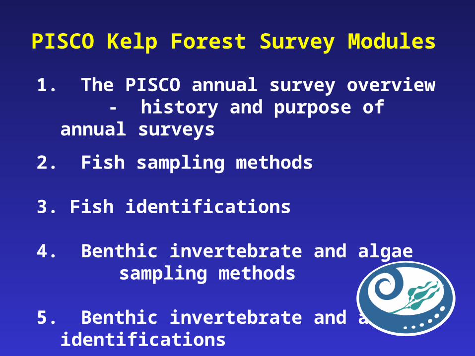
PISCO Kelp Forest Survey Modules
1. The PISCO annual survey overview- history and purpose of annual
surveys
2. Fish sampling methods
3. Fish identifications
4. Benthic invertebrate and algae sampling methods
5. Benthic invertebrate and algae identifications
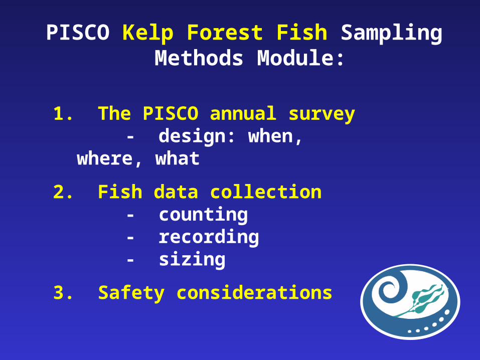
PISCO Kelp Forest Fish Sampling Methods Module:
1. The PISCO annual survey- design: when, where,
what
2. Fish data collection- counting- recording- sizing
3. Safety considerations
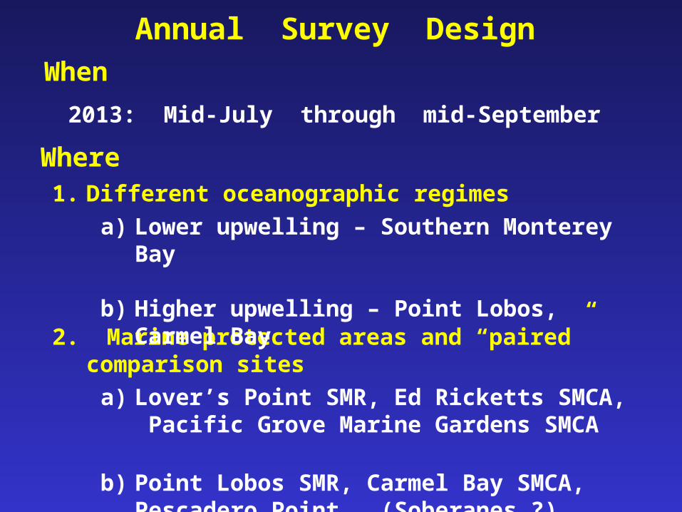
2. Marine protected areas and “paired” comparison sites
a) Lover’s Point SMR, Ed Ricketts SMCA, Pacific Grove Marine Gardens SMCA
b) Point Lobos SMR, Carmel Bay SMCA, Pescadero Point, (Soberanes ?)
When
2013: Mid-July through mid-September
Where1. Different oceanographic regimes
a) Lower upwelling – Southern Monterey Bay
b) Higher upwelling – Point Lobos, Carmel Bay
Annual Survey Design
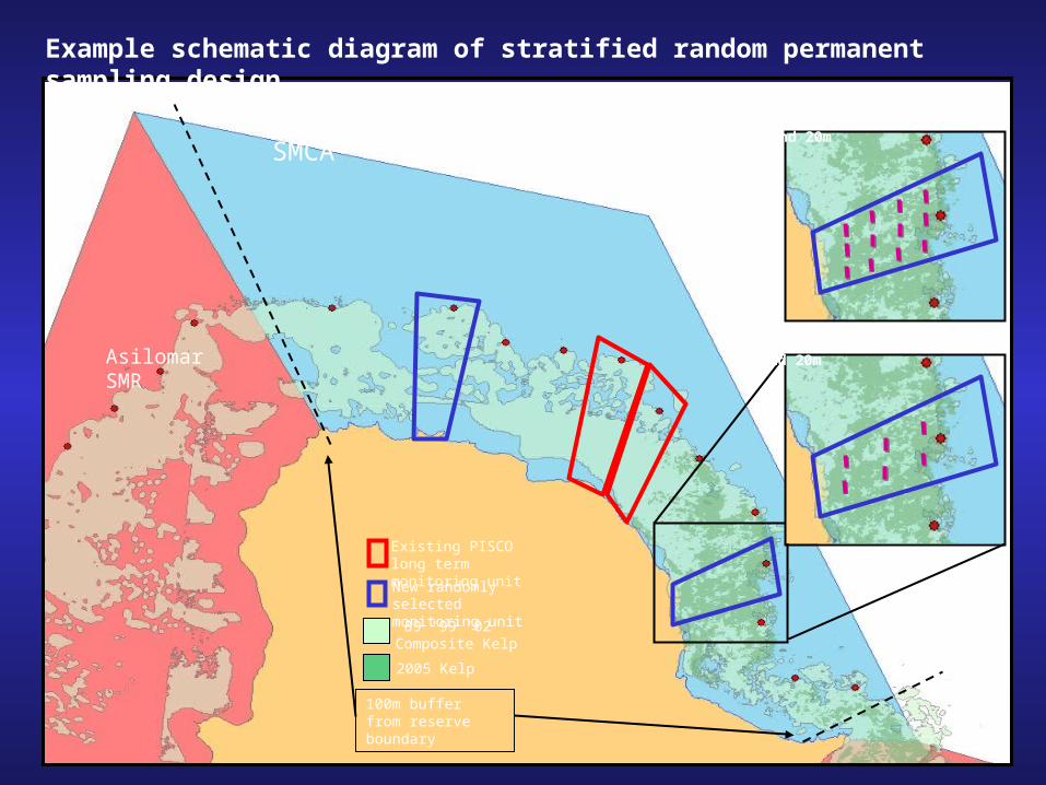
Pacific Grove Marine Gardens SMCA
100m buffer from reserve boundary
Asilomar SMR
Existing PISCO long term monitoring unit
New randomly selected monitoring unit
’89 ’99 ’02 Composite Kelp
2005 Kelp
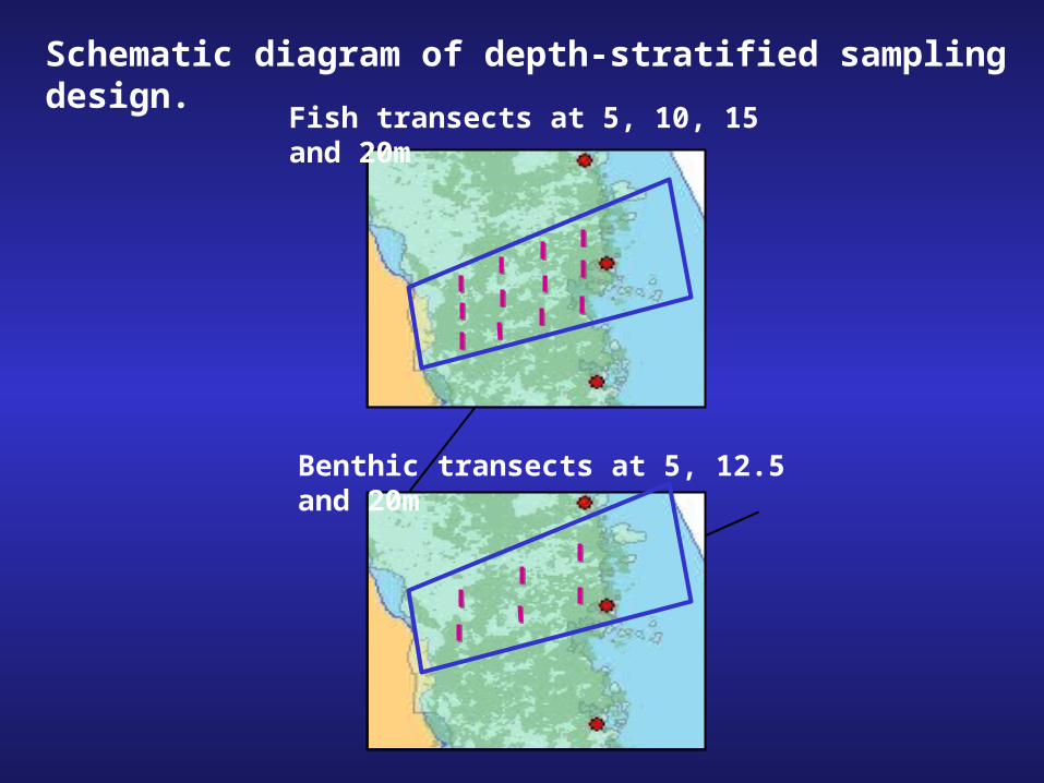
Benthic transects at 5, 12.5 and 20m
Fish transects at 5, 10, 15 and 20m
Example schematic diagram of stratified random permanent sampling design.
Benthic transects at 5, 12.5 and 20m
Fish transects at 5, 10, 15 and 20m
Schematic diagram of depth-stratified sampling design.

Source of variation
Regulatory treatment
MPA
Cell
Depth zone
Transects
Levels
Time Year 1 Year N…
SMR SMCA SMP Reference1
1 Reference refers to sites outside any marine protected area.
E. F. Ricketts Pacific Grove Carmel Bay
1 2 3 4
20 m 15 m 10 m 5 m
1 2 3
Analytical Design - Fishes
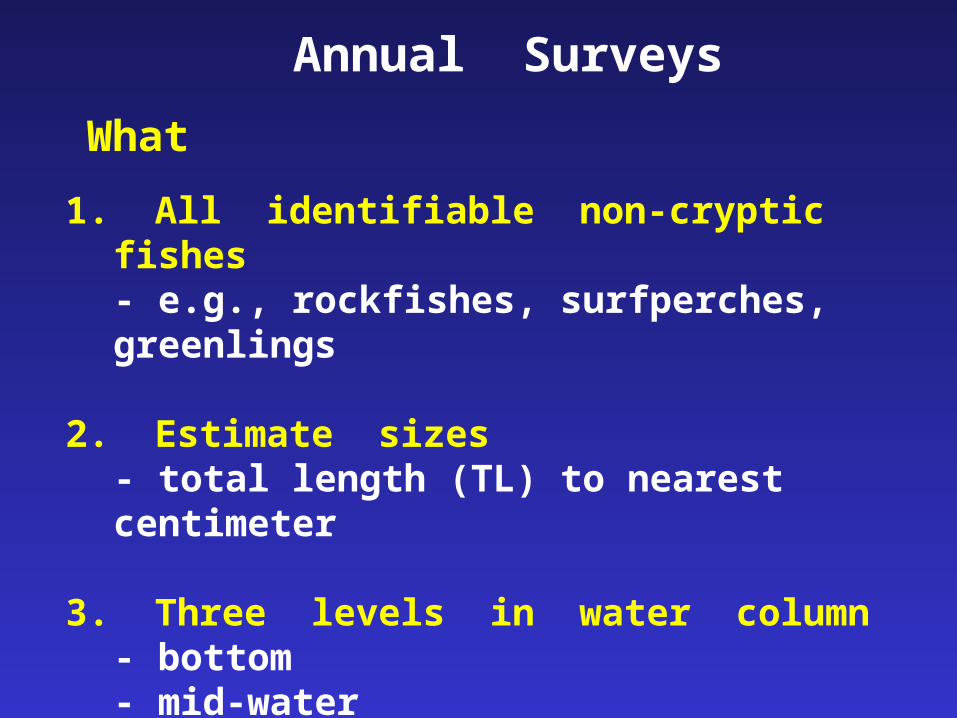
What
1. All identifiable non-cryptic fishes- e.g., rockfishes, surfperches, greenlings
2. Estimate sizes- total length (TL) to nearest centimeter
3. Three levels in water column - bottom- mid-water- surface canopy
Annual Surveys
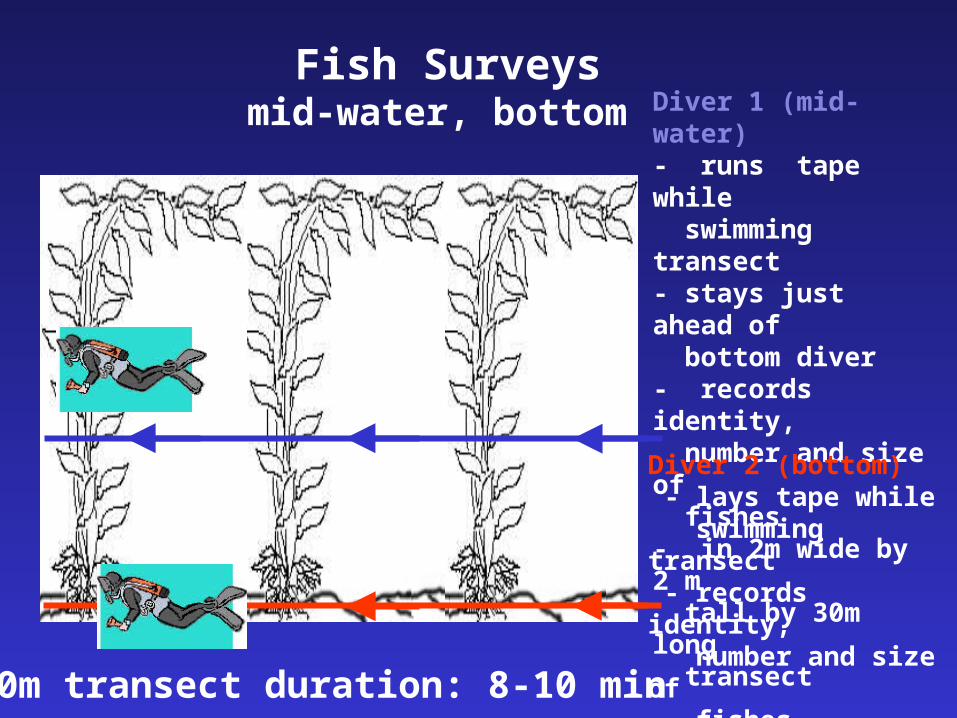
Fish Surveysmid-water, bottom Diver 1 (mid-water)
- runs tape while swimming transect- stays just ahead of bottom diver- records identity, number and size of fishes- in 2m wide by 2 m tall by 30m long transect
Diver 2 (bottom) - lays tape while swimming transect - records identity, number and size of fishes- in 2m wide by 2 m tall by 30m long transect 30m transect duration: 8-10 min
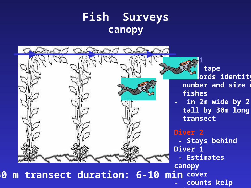
Fish Surveyscanopy
Diver 1 - Lays tape- records identity, number and size of fishes- in 2m wide by 2 m tall by 30m long transect
Diver 2 - Stays behind Diver 1 - Estimates canopy cover- counts kelp stipes
30 m transect duration: 6-10 min
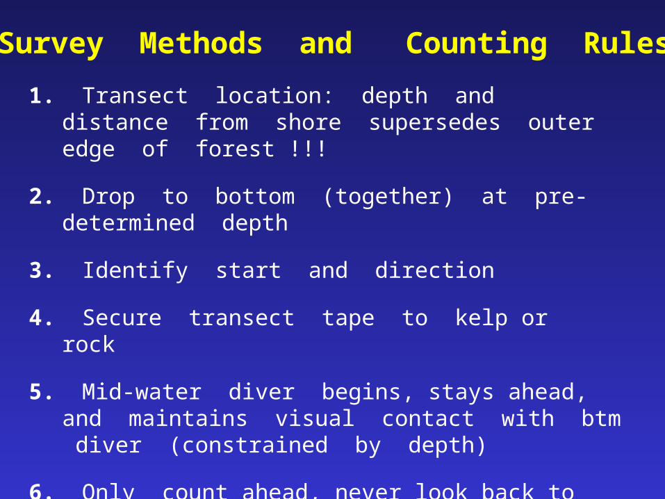
Survey Methods and Counting Rules
1. Transect location: depth and distance from shore supersedes outer edge of forest !!!
2. Drop to bottom (together) at pre-determined depth
3. Identify start and direction
4. Secure transect tape to kelp or rock
5. Mid-water diver begins, stays ahead, and maintains visual contact with btm diver (constrained by depth)
6. Only count ahead, never look back to count behind you
7. Maintain reasonable speed (can bias counts)
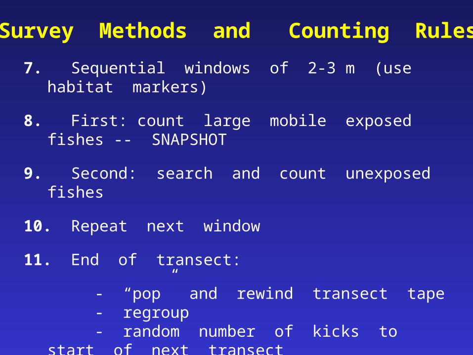
7. Sequential windows of 2-3 m (use habitat markers)
8. First: count large mobile exposed fishes -- SNAPSHOT
9. Second: search and count unexposed fishes
10. Repeat next window
11. End of transect:
- “pop” and rewind transect tape- regroup- random number of kicks to start of next
transect
12. High relief -- contour rock and maintain depth
13. Sand -- if headed off reef > 4 m, redirect transect
Survey Methods and Counting Rules

Moving Windows
3m
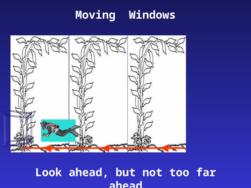
Look ahead, but not too far ahead
Moving Windows
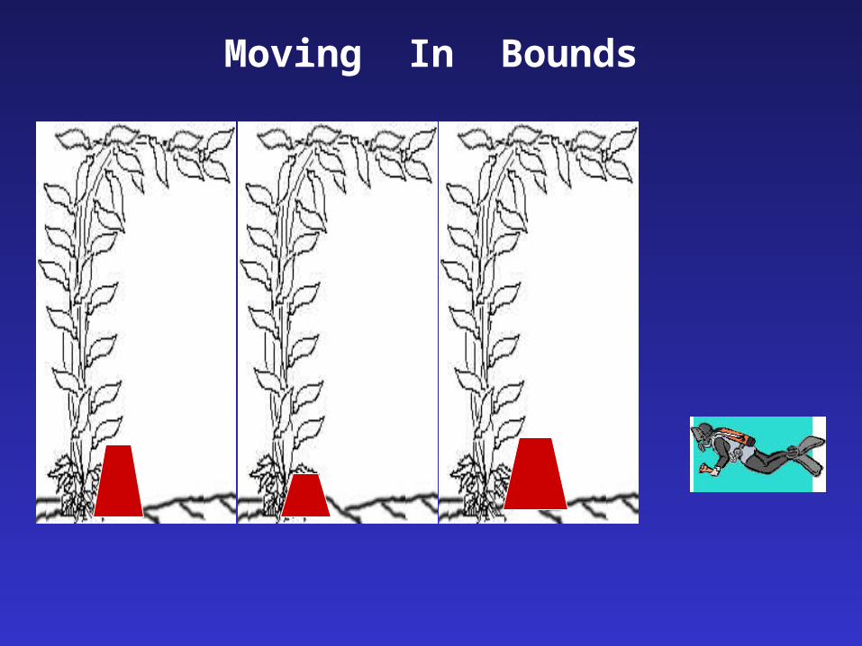
Moving In Bounds
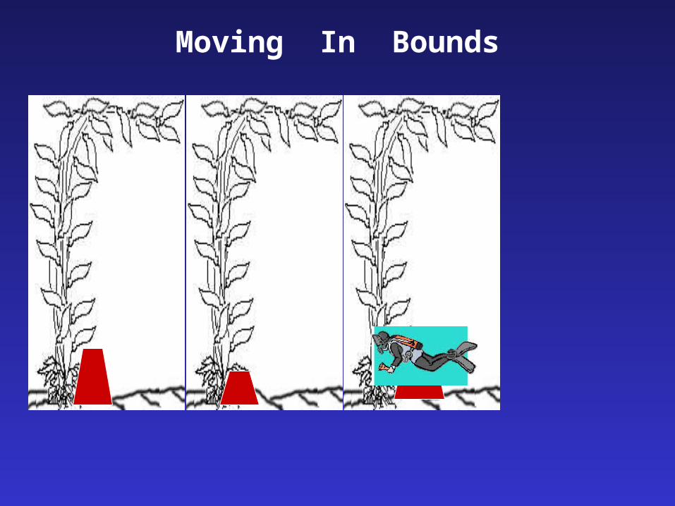
Moving In Bounds
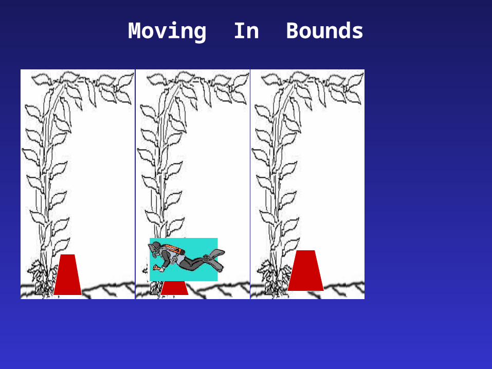
Moving In Bounds

Use landmarks to help divide the transect
Moving In Bounds
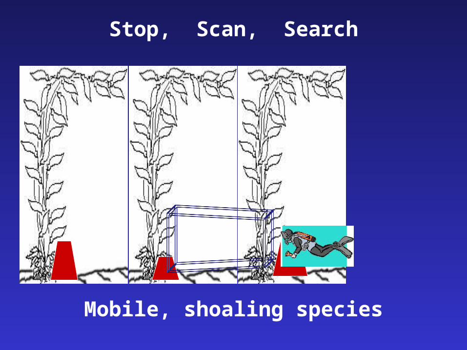
Stop, Scan, Search
Mobile, shoaling species
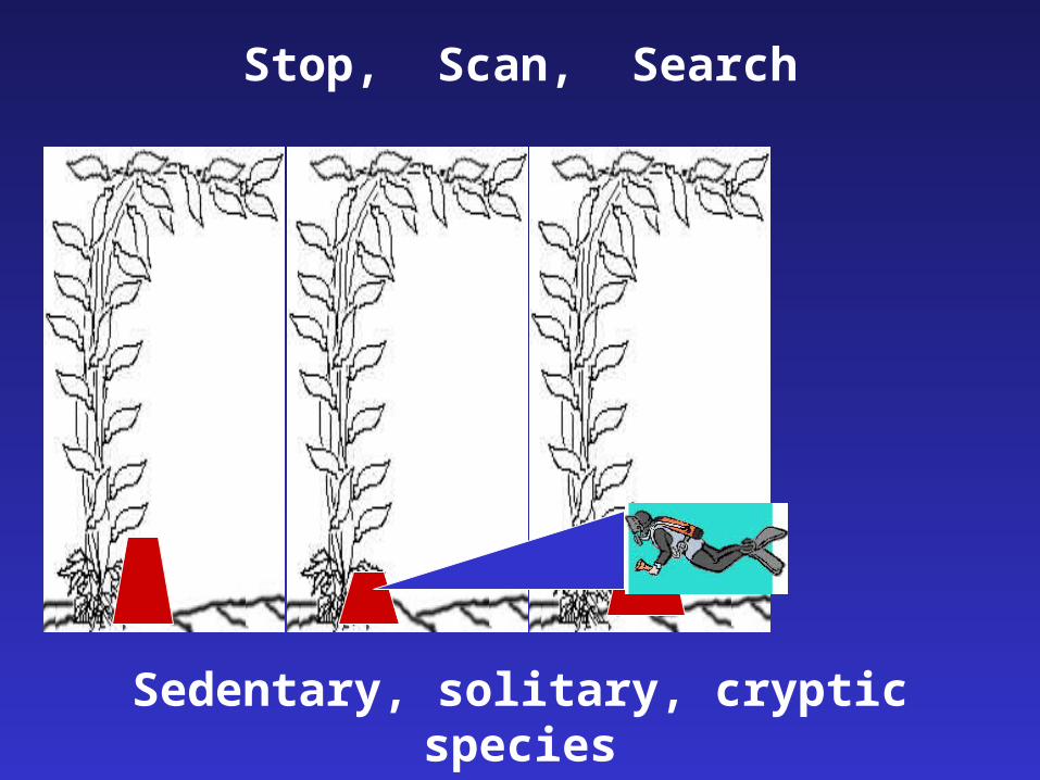
Sedentary, solitary, cryptic species
Stop, Scan, Search
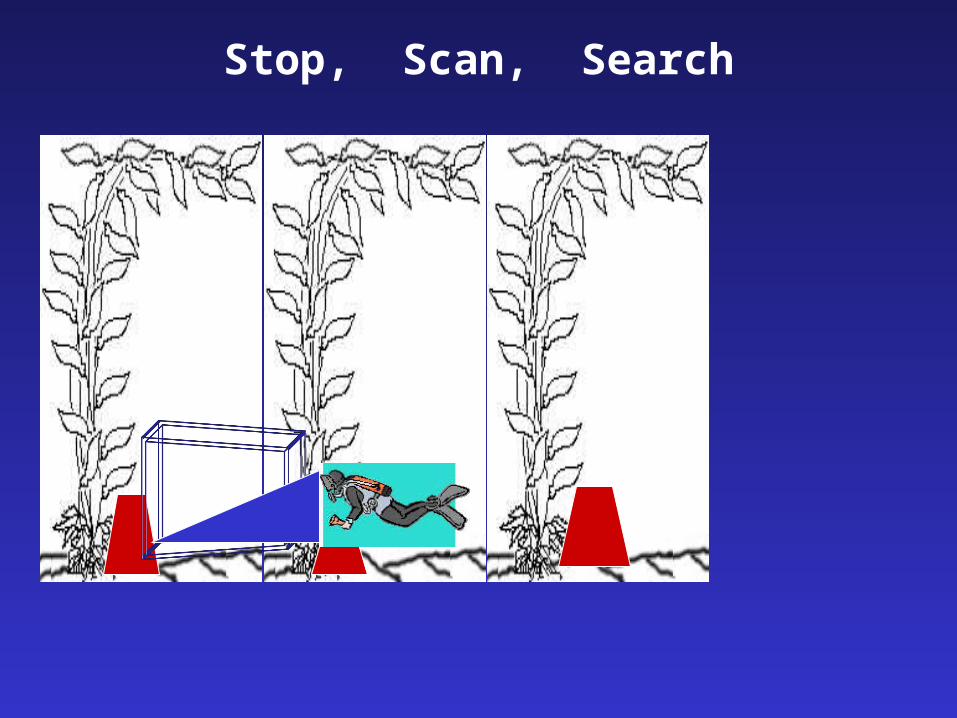
Stop, Scan, Search

Structure your counts, develop routine
Stop, Scan, Search
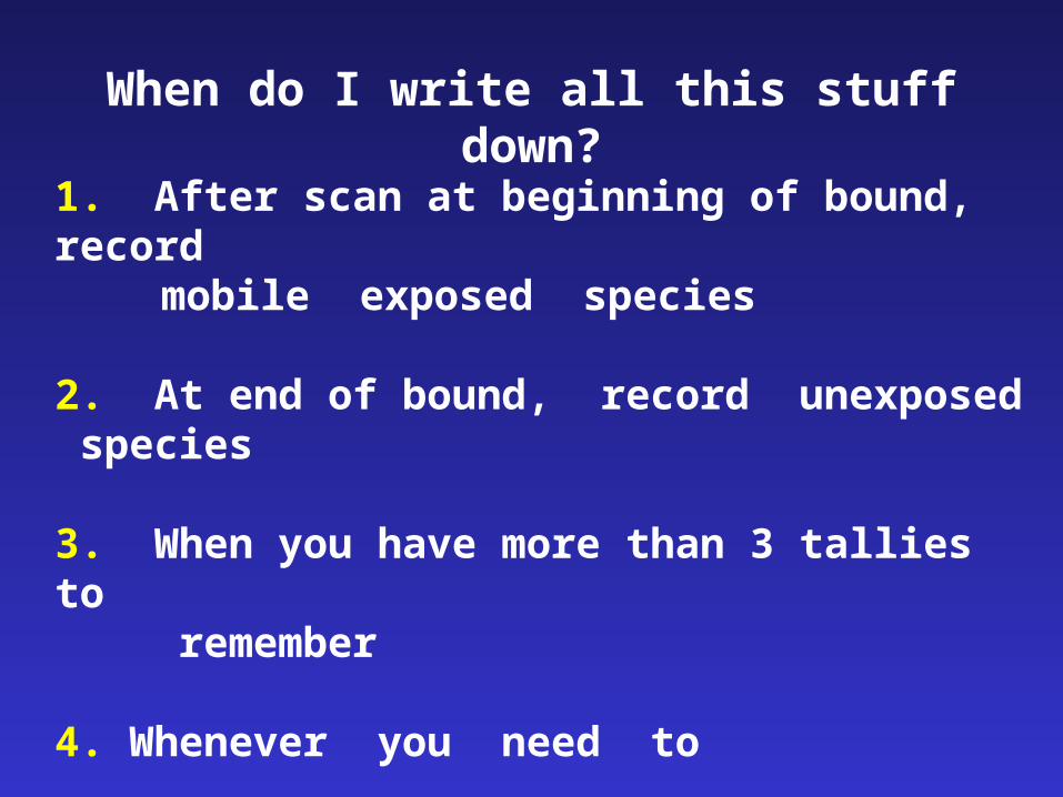
When do I write all this stuff down?
1. After scan at beginning of bound, recordmobile exposed species
2. At end of bound, record unexposed species
3. When you have more than 3 tallies to remember
4. Whenever you need to
Golden rule: Rarely lower your slate!

8,4)
14
8
Size (cm)
(3,
Number
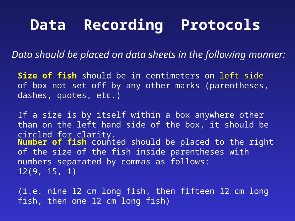
Data Recording Protocols
Size of fish should be in centimeters on left side of box not set off by any other marks (parentheses, dashes, quotes, etc.)
If a size is by itself within a box anywhere other than on the left hand side of the box, it should be circled for clarity.
Data should be placed on data sheets in the following manner:
Number of fish counted should be placed to the right of the size of the fish inside parentheses with numbers separated by commas as follows:12(9, 15, 1)
(i.e. nine 12 cm long fish, then fifteen 12 cm long fish, then one 12 cm long fish)
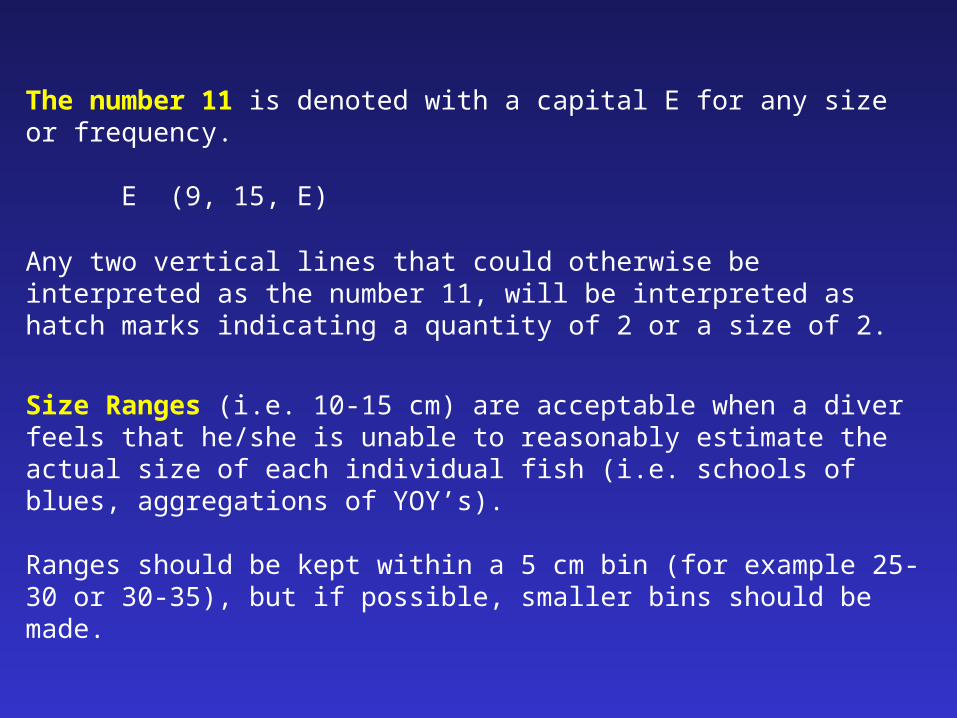
The number 11 is denoted with a capital E for any size or frequency.
E (9, 15, E)
Any two vertical lines that could otherwise be interpreted as the number 11, will be interpreted as hatch marks indicating a quantity of 2 or a size of 2.
Size Ranges (i.e. 10-15 cm) are acceptable when a diver feels that he/she is unable to reasonably estimate the actual size of each individual fish (i.e. schools of blues, aggregations of YOY’s).
Ranges should be kept within a 5 cm bin (for example 25-30 or 30-35), but if possible, smaller bins should be made.

When denoting Male vs. Female Fish (Kelp Greenling and Sheephead), make symbols clear (♀ and ♂). It is acceptable to use (F and M) for the same purpose, but symbols are preferred.
All Black-eyed Gobies should be larger than 8 cm to be recorded on data
sheet.
All small, cryptic sculpins will NOT be recorded except for juvenile cabezon
Olive and Yellowtail Rockfish are to be grouped in an OYT category.
Fish that are unknown should be classified to the best specific possibilities (such as “smelt” (jack or top), or “white perch” or “silver perch”), or into the nearest taxonomic grouping possible (i.e. genus or family).
If neither the specific possibilities, nor a genus or family can be discerned, fish should be recorded as “unknown” with a description for immediate topside investigation. No unknown beyond the above parameters shall be left as such without consent with others upon review.

Fish divers must use flashlights AT ALL TIMES to look in cracks, holes, and to help in the identification of YOY’s.
All information must be filled out including (transect, depth, temperature, surge, etc.)
Data Sheets must be checked by the individual diver AND by one person in charge of collecting data sheets for the day.
Sampling methods:
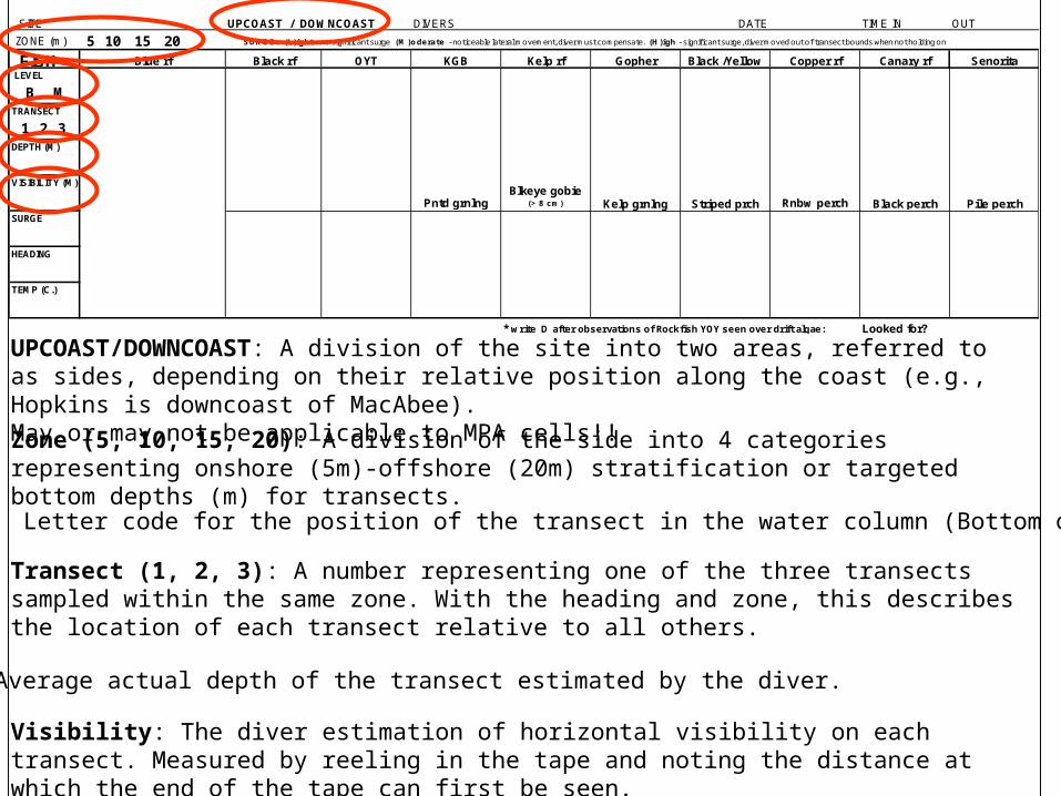
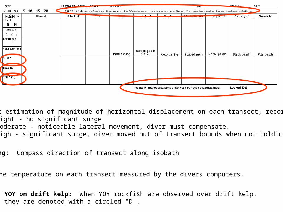
SITE UPCOAST / DOWNCOAST DIVERS DATE TIME IN OUT
ZONE (m) 5 10 15 20
FISH > Blue rf Black rf OYT KGB Kelp rf Gopher Black /Yellow Copper rf Canary rf SenoritaLEVEL `
B MTRANSECT
` 1 2 3 DEPTH (M)
VISIBILITY (M)
Pntd grnlngBlkeye gobie
(> 8 cm) Kelp grnlng Striped prch Rnbw perch Black perch Pile perchSURGE
HEADING
TEMP (C.)
* write D after observations of Rockfish YOY seen over drift algae: Looked for?
SURGE: (L)ight - no significant surge (M)oderate - noticeable lateral movement, diver must compensate. (H)igh - significant surge, diver moved out of transect bounds when not holding on
Zone (5, 10, 15, 20): A division of the side into 4 categories representing onshore (5m)-offshore (20m) stratification or targeted bottom depths (m) for transects.
UPCOAST/DOWNCOAST: A division of the site into two areas, referred to as sides, depending on their relative position along the coast (e.g., Hopkins is downcoast of MacAbee).May or may not be applicable to MPA cells!!
Level (B M): Letter code for the position of the transect in the water column (Bottom or Midwater)
Visibility: The diver estimation of horizontal visibility on each transect. Measured by reeling in the tape and noting the distance at which the end of the tape can first be seen.
Transect (1, 2, 3): A number representing one of the three transects sampled within the same zone. With the heading and zone, this describes the location of each transect relative to all others.
Depth: Average actual depth of the transect estimated by the diver.
SITE UPCOAST / DOWNCOAST DIVERS DATE TIME IN OUT
ZONE (m) 5 10 15 20
FISH > Blue rf Black rf OYT KGB Kelp rf Gopher Black /Yellow Copper rf Canary rf SenoritaLEVEL `
B MTRANSECT
` 1 2 3 DEPTH (M)
VISIBILITY (M)
Pntd grnlngBlkeye gobie
(> 8 cm) Kelp grnlng Striped prch Rnbw perch Black perch Pile perchSURGE
HEADING
TEMP (C.)
* write D after observations of Rockfish YOY seen over drift algae: Looked for?
SURGE: (L)ight - no significant surge (M)oderate - noticeable lateral movement, diver must compensate. (H)igh - significant surge, diver moved out of transect bounds when not holding on
Heading: Compass direction of transect along isobath
Temp: The temperature on each transect measured by the divers computers.
Surge: Diver estimation of magnitude of horizontal displacement on each transect, recorded at depth (L)ight - no significant surge (M)oderate - noticeable lateral movement, diver must compensate.
(H)igh - significant surge, diver moved out of transect bounds when not holding on
YOY on drift kelp: when YOY rockfish are observed over drift kelp, they are denoted with a circled “D”.

Sizing Fish Underwater
1. Total length
2. Aids to sizing fish
3. Factors that contribute to over- or under-estimation
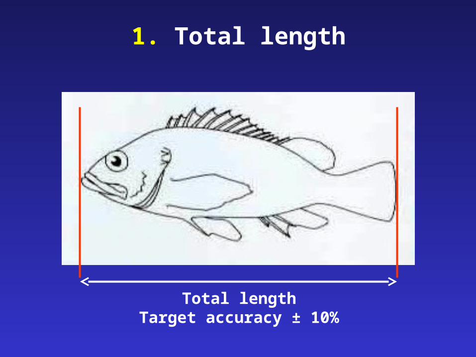
1. Total length
Total lengthTarget accuracy ± 10%

2. Aids to sizing fish
1. Slate marks
2. Transect tape marks
3. Hand measurements (measure your hand)
4. Bracketing (with habitat features)
5. Comparative approach (with habitat features)
6. Recalibration during dive (check yourself)

3. Factors that contribute to under and overestimation of size
1. ambient light low
2. body color dull
3. visibility poor
4. objects in foreground
5. body shape deep-bodied
Underestimate Overestimate
bright
bright
good
in background
elongate

Safety Considerations1. Dive profiles
- approved by DSO- well within no-decompression limits- maximum depth 20m- 3-5 min safety stops mandatory on dives below 10m
2. Air consumption- safety over data collection (300 – 500 psi minimum)
3. Buddy system- members of a dive team are always in visual contact
4. Sea conditions- diving will only be conducted in good conditions
5. Live boating- be careful surfacing
Dive Safety Brief1. Dive log - sign out and in
2. Dive procedures - ascent rate 10m / min - deep-shallow - maintain dive team
3. Communications: cell phone, VHF Ch 16, SPOT
4. First Aid & Oxygen - shore and vessel
5. Evacuation plan: develop for each section of the coast… everyone needs to be thinking of this

Evaluation During Training
1. Ongoing
2. Some self-evaluation required
3. End of day - submit data sheets
4. Species ID quizzes
5. Feedback