PHOTOMONTAGE OF PROPOSED WIND TURBINES FROM WEST …
1
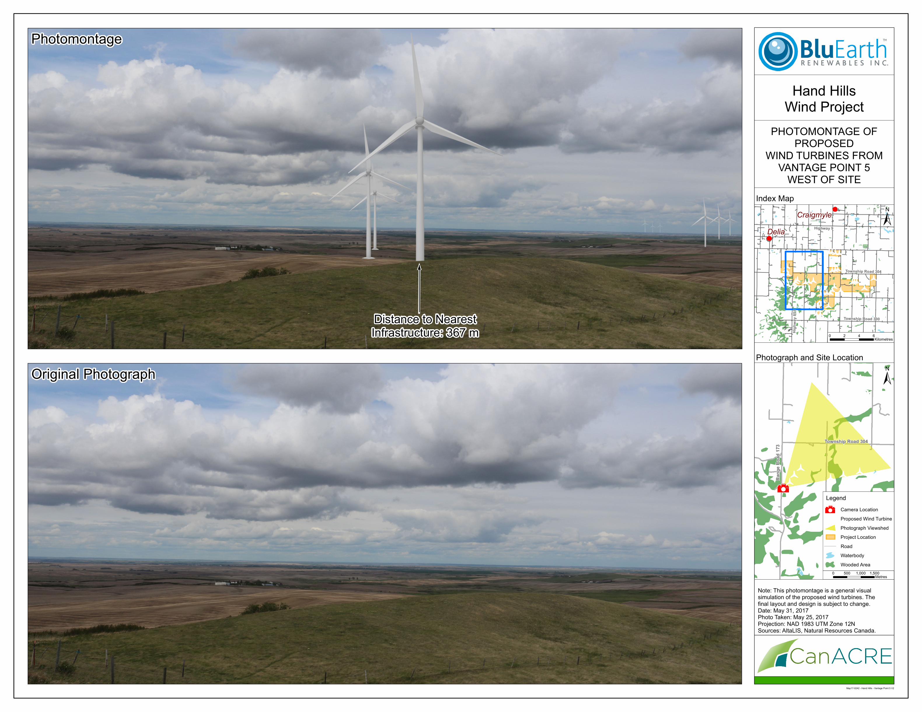
! b Township Road 304 Township Road 300 Highway 9 Highway 851 Map17-0242 - Hand Hills - Vantage Point 5 V2 0 2 4 6 Kilometres ± ± Original Photograph Photomontage Delia Hand Hills Wind Project Note: This photomontage is a general visual simulation of the proposed wind turbines. The final layout and design is subject to change. Date: May 31, 2017 Photo Taken: May 25, 2017 Projection: NAD 1983 UTM Zone 12N Sources: AltaLIS, Natural Resources Canada. Photograph and Site Location Index Map 0 500 1,000 1,500 Metres PHOTOMONTAGE OF PROPOSED WIND TURBINES FROM VANTAGE POINT 5 WEST OF SITE Distance to Nearest Infrastructure: 367 m Craigmyle Range Road 173 Township Road 304 Legend Wooded Area Waterbody Road Project Location Photograph Viewshed Proposed Wind Turbine b Camera Location
Transcript of PHOTOMONTAGE OF PROPOSED WIND TURBINES FROM WEST …
!b
Township Road 304
Township Road 300
Highway 9
High
way 8
51
Map17-0242 - Hand Hills - Vantage Point 5 V2
0 2 4 6Kilometres
±
±
Original Photograph
Photomontage
Delia
Hand HillsWind Project
Note: This photomontage is a general visualsimulation of the proposed wind turbines. Thefinal layout and design is subject to change.Date: May 31, 2017Photo Taken: May 25, 2017Projection: NAD 1983 UTM Zone 12NSources: AltaLIS, Natural Resources Canada.
Photograph and Site Location
Index Map
0 500 1,000 1,500Metres
PHOTOMONTAGE OFPROPOSED
WIND TURBINES FROMVANTAGE POINT 5
WEST OF SITE
Distance to NearestInfrastructure: 367 m
Craigmyle
Rang
e Roa
d 173
Township Road 304
Legend
Wooded AreaWaterbodyRoadProject LocationPhotograph ViewshedProposed Wind TurbinebCamera Location