Photogrammetry & Remote Sensing Geospatial Information ...
13
Transcript of Photogrammetry & Remote Sensing Geospatial Information ...


Four departments: o Geodesy and Hydrography o Photogrammetry & Remote Sensing o Geospatial Information Systems (GIS)
Three Institutes: o Center of Excellence in Surveying Engineering and Disaster Management o Research Institute of Geoinformation Technology o Institute for Development of Space Science Technology and Applications
10 Research Laboratories 1800 square meters of educational space 23 scientific staff members 5 international invited staff members Alumni: 1500 BSc. 800 MSc. 75 PhD. Current Student population (2021)
191 BSc. 169 MSc. 58 PhD.
In the late 1980’s, there was no specific educational institutes in the field of geomatics and surveying
engineering in the country. An increase in demand for human experts in the field along with the unique
position and the role of the college of engineering at the University of Tehran in presenting technical
and educational services to motivated youths in Iran, the group of Surveying Engineering was added
to the existing majors of the college of engineering in 1987. Almost 30 years later, at 2015, based on
its successful progress and achievements in education and research in the field, the group of surveying
engineering was promoted to the SCHOOL OF SURVEYING AND GEOSPATIAL ENGINEERING.
Since then, our faculty has been developed both qualitatively and quantitatively in number of items
including: progress in the number of faculty members and graduate students consist of MSc and PhD
students, substantial increase of surveying equipment, and achieve tenure in corresponding official
key posts in the country.
Consequently, the SCHOOL OF SURVEYING AND GEOSPATIAL ENGINEERING is acknowledged as one of the Iran’s
leading institutes in research and education in the field of geomatics and surveying engineering and
plays an important role in training surveying experts in the country. Our school continues to train and
educate young talents to meet the engineering needs of the country and has proudly delivered more
than 2400 engineers to our evolving society since its birthday in 1987.has proudly delivered more than
2400 engineers to our evolving society since its birthday in 1987.

The SCHOOL OF SURVEYING AND GEOSPATIAL ENGINEERING of University of Tehran is structured to meet the
following goals and objectives:
To respond to the society’s needs in the field of surveying and geospatial engineering: Researches are implemented based on the requests of private sector and government authorities, as well as industries. In the same direction Government-University-Industry linkage (GUI), has become a policy of the school to bring about a strong linkage. The deputy of research of the SCHOOL OF SURVEYING AND GEOSPATIAL ENGINEERING, is the intermediary of the school with industry and government to launch any research project. Professors and graduate students are the integral part of such activities at the school.
Training high-quality engineers and experts in the field of surveying and geospatial engineering to meet the demands of the society, and also educating professors and lecturers in the field for other universities and educational center of the country.
Internationalization of the University is currently another major drive. It is sought through the improvement of standards of the research and education at the high international levels, moving to the edge of knowledge, increasing the international cooperation and presence, developing exchange programs and growing the number of foreign students.
To become a top knowledge-based school in the field of surveying and geospatial engineering: This task has been through moving on the edge of knowledge, processing knowledge to technology through the Science and Technology Parks and many incubators is another task at the school.
Three decades of training and research in Geomatics engineering
Publish of more than 3000 conference and journal papers
Publish of 10 books in different fields of Geomatics engineering
Accomplish of 30 applied research projects for industry in the recent decades
Publish of EOGE journal, the first international professional scientific journal of Geomatics
engineering in Iran
Organize of the biannual international conferences of SMPR and GIResearch since 2011.
Register more than 8 national innovation patents resulting of our postgraduate research
Revising and updating of educational syllabus of B.S., M.Sc. and Ph.D. periods in every 3 years
Research integrity and ethics are important topics of discussion at university of Tehran, and
consequently, at the SCHOOL OF SURVEYING AND GEOSPATIAL ENGINEERING. The code of ethics of university
of Tehran formulates the aspirations, responsibilities and rights that ought to inspire and guide all
employees, staff members, and students. Rules and regulations are provided on different topics such
as ancillary activities, reimbursements, and academic integrity.

Admin: Dr. Mahdi Hasanlou [email protected]
Point cloud generation/modeling Space/Aerial/UAV photogrammetry CRP, SLAM and mobile mapping Scene understanding and learning Applications in mapping, industry, heritage,
space, medicine, civil, underwater and environment fields
Active and passive remote sensing Optical, thermal and microwave RS Physics remote sensing Remote sensing applications Geometric modeling of satellite images Digital remote sensing image processing Orbital mechanics
Admin:
Dr. MohammadAli Sharifi [email protected]
Offshore Geotechnical Services Management of offshore survey projects Marine fiber optics maintenance and cable-Laying Tidal Observations & Analysis Geotechnical Survey Side scan Surveying for Industrial sites Sub-bottom surveying for Industrial sites
Admin:
Dr. MohammadAli Sharifi [email protected]
Geokinematics and Geodynamics Geoid determination and modelling Gravity field monitoring Satellite Positioning and Navigation Numerical Optimizations Inverse problems Satellite Radar Interferometry
Management of field surveying team Topographic mapping of national/local areas Computational and programming aspects Aerial and satellite image processing and mapping GIS applications and implementations Software development for different applications
Admin:
Dr. Rahim Ali Abbaspour [email protected]
Land Information Systems Location-based Services GIS Project Management Spatial Web Advanced Spatial Analyses Computational Geometry

Research Topics: Environment Natural resources Urban Agriculture Forest Space Ocean Fundamental
Admin: Dr. Mahdi Hasanlou
Geodesy Lab.: Space geodesy Physical geodesy Tectonic geodesy Geodetic Engineering Astronomical geodesy Positioning & Navigation Remote Sensing Lab.: Optical remote sensing Thermal remote sensing Microwave remote
sensing Physics remote sensing
Photogrammetry Lab.: Analogue & Analytical
Photogrammetry Digital photogrammetry Close range
photogrammetry Space photogrammetry UAV photogrammetry Digital Image Processing Computer vision GIS Lab.: GIS algorithms and
applications Land administration and
SDI Location based services GIS and disaster
management
Research Topics: Mobile mapping and SLAM Structured light Photometric stereo Vision metrology Medical photogrammetry Architectural photogrammetry RGBD processing Terrestrial laser scanner Videogrammetry Panoramic imaging Shape from X Projective geometry Structure from motion Network design Admin: Dr. Mohammad Saadatseresht
crplab.ut.ac.ir
Research Topics:
3D data acquisition: - Stereo satellite images - UAV-based images - LiDAR data
3D data processing: - Dense point cloud generation - Topographic mapping and 3D modeling - Ortho-mosaic generation
3D data sharing: - National/international 3D benchmark datasets - Aerial, satellite and UAV-based LiDAR datasets - Web based search tools for 3D data
References sharing: - Articles, theses, reports, movies, ISI papers, and
other documents of 3D data in remote sensing Academic projects:
- In precise agriculture, mining, environment, wild life, …
Admin: Dr. Hossein Arefi,
[email protected] 3drslab.ut.ac.ir
8
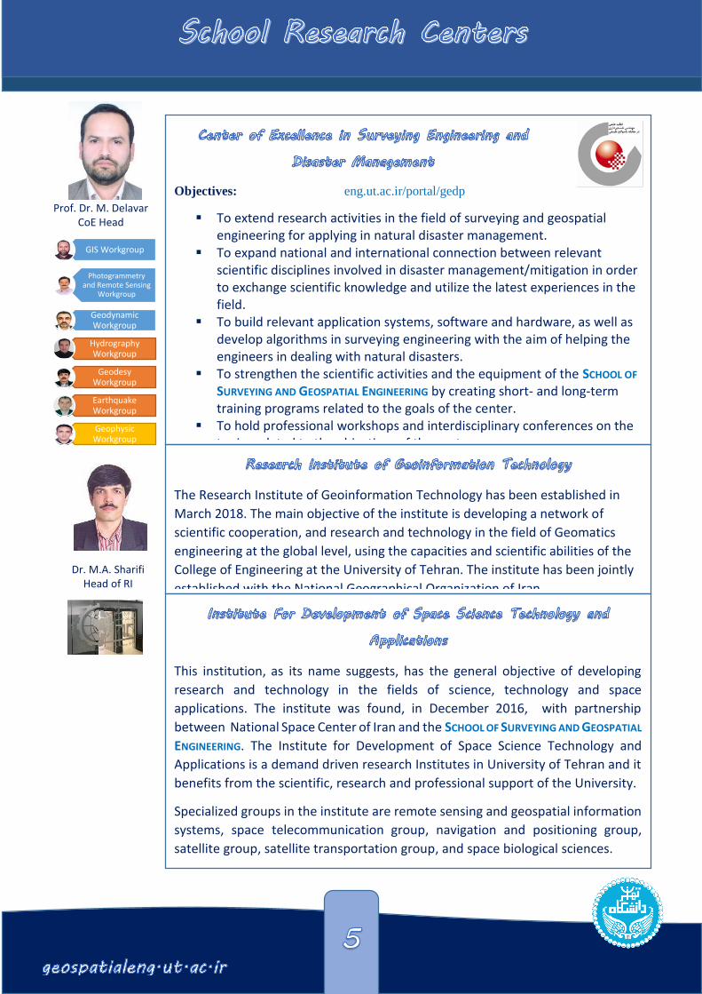
Objectives: eng.ut.ac.ir/portal/gedp
To extend research activities in the field of surveying and geospatial engineering for applying in natural disaster management.
To expand national and international connection between relevant scientific disciplines involved in disaster management/mitigation in order to exchange scientific knowledge and utilize the latest experiences in the field.
To build relevant application systems, software and hardware, as well as develop algorithms in surveying engineering with the aim of helping the engineers in dealing with natural disasters.
To strengthen the scientific activities and the equipment of the SCHOOL OF
SURVEYING AND GEOSPATIAL ENGINEERING by creating short- and long-term training programs related to the goals of the center.
To hold professional workshops and interdisciplinary conferences on the topics related to the objectives of the center.
This institution, as its name suggests, has the general objective of developing
research and technology in the fields of science, technology and space
applications. The institute was found, in December 2016, with partnership
between National Space Center of Iran and the SCHOOL OF SURVEYING AND GEOSPATIAL
ENGINEERING. The Institute for Development of Space Science Technology and
Applications is a demand driven research Institutes in University of Tehran and it
benefits from the scientific, research and professional support of the University.
Specialized groups in the institute are remote sensing and geospatial information
systems, space telecommunication group, navigation and positioning group,
satellite group, satellite transportation group, and space biological sciences.
The Research Institute of Geoinformation Technology has been established in
March 2018. The main objective of the institute is developing a network of
scientific cooperation, and research and technology in the field of Geomatics
engineering at the global level, using the capacities and scientific abilities of the
College of Engineering at the University of Tehran. The institute has been jointly
established with the National Geographical Organization of Iran.
GIS Workgroup
Photogrammetry and Remote Sensing
Workgroup
Geodynamic Workgroup
Hydrography Workgroup
Geodesy Workgroup
Earthquake Workgroup
Geophysic Workgroup
Prof. Dr. M. Delavar CoE Head
Dr. M.A. Sharifi Head of RI

EOGE is an open access international journal that will accept the original
research contributions (previously unpublished) from a broad range of topics
and approaches of Earth Observation and Geospatial Information. The
Journal provides a worldwide channel of communication for scientists and
professionals working in the many disciplines that employ Geodesy, GIS,
Remote sensing, and Photogrammetry. However, we will accept both
theoretical and empirical contributions in all subfields of surveying as long as
they contribute in a broad sense to the core theme.
We notice that the Ministry of Science, Research and Technology of Iran has
granted the Science and Research (Elmi-Pajouheshi) credit to EOGE according
to the letter No. 3/18/55482 on 9 June 2018.
Director-in-Charge Abdolreza Safari, Prof., School of SGE, College of Eng., University of Tehran
Email Address: asafari ut.ac.ir Editor-in-Chief Mohammad Ali Sharifi, Assoc. Prof., School of SGE, College of Eng., University of Tehran
Email Address: sharifi ut.ac.ir Internal Editorial Board Alireza A. Ardalan, Prof., School of SGE, College of Eng., University of Tehran Ali Azizi, Assoc. Prof., School of SGE, College of Eng., University of Tehran Jalal Amini, Prof., School of SGE, College of Eng., University of Tehran Mahmoud Reza Delavar, Prof., School of SGE, College of Eng., University of Tehran Farhad Samadzadegan, Prof., School of SGE, College of Eng., University of Tehran Mohammad Reza Saradjian Maralan, Prof., School of SGE, College of Eng., University of Tehran External Editorial Board Alireza Amiri Simkooei, Assoc. Prof., University of Isfahan Christophe Claramunt, Prof., Naval Academy Research Institute, France Yahya Djamour, Assoc. Prof., National Cartographic Center, Iran Andrew U. Frank, Prof., Vienna University of Technology, Austria Michael Hahn, Prof., Stuttgart University of Applied Sciences, Stuttgart, Germany Christian Heipke, Prof., Leibniz Universität Hannover, Germany Jonathan Li, Prof., University of Waterloo, Canada Mohammadreza Mobasheri, Prof., K.N.Toosi University of Technology, Iran Mohammad Saadi Mesgari, Assoc. Prof., K.N.Toosi University of Technology, Iran Barat Mojaradi, Assoc. Prof., Iran University of Science and Technology Mir Abolfazl Mostafavi, Prof., University of Laval, Canada Peter Reinartz, Prof., Applied Remote Sensing at German Aerospace Center (DLR), Germany Dietrich Schröder, Prof., Stuttgart University of Applied Sciences, Stuttgart, Germany
To access journal website, please refer to:
https://eoge.ut.ac.ir/

To bring together scholars from various disciplines to interact and exchange knowledge, experiences,
and ideas about GIS, Remote Sensing, Photogrammetry, Geodesy and Hydrography, School offers a
wide range of scientific speeches and workshops as well as exhibitions in biannual international
conferences:
GIResearch (Geospatial Information Research) SMPR (Sensors and Models in Photogrammetry and
Remote Sensing) The conference accepts two types of contributions: Full paper: that present remarkable scientific results;
will be published in the ISPRS Archive (listed in the ISI Conference Proceedings Citation Index (CPCI) of the Web of Science, SCOPUS, and the Directory of Open Access Journals (DOAJ)). Selected full papers will also be considered for publication in the International Journal of Earth Observation and Geospatial Information.
Work in progress: that presents ongoing research; and/or an extended abstract or full paper will be published in the conference proceedings.
List of biannual conferences: SMPR2011 SMPR2013 SMPR2015 and GIResearch2015 SMPR2017 and GIResearch2017 SMPR2019 and GIResearch2019

The Training Center of Engineering Skills is one of the subdivisions of
the Research Deputy of the SCHOOL OF SURVEYING AND GEOSPATIAL
ENGINEERING at University of Tehran. Though the center earns for the
school, the principal aim of the center is to meet complementary
educational needs of the students and graduated engineers outside
the university in the field of photogrammetry, remote sensing,
geodesy, hydrography, GIS, cartography and surveying.
Important activities of this center are the execution of
specialized courses, execution of training courses at
the employer's place or provincial centers, develop
the short and interdisciplinary courses, creation of e-
learning and remote education infrastructure, and
designing and production of proprietary training
packages. After each activity, a formal certificate from
University of Tehran is issued.
In order to improve the social role of the school, working group of scientific seminars actively organizes
different public scientific seminars which are regularly held at 4-6 PM on the last Monday of each
month. The invited speakers are selected from faculty members, top entrepreneurs, owners of
relevant knowledge-based companies, inventors and elites, inside and outside researchers, and others
from private and public sectors in all related fields to surveying and geospatial engineering.
At these gatherings, every two weeks, one of the students or staff members of the school holds a journal club to introduce and review one of the latest research papers in a relevant field. Obviously, the first condition for reviewing the articles is to simplify it in such a way that even a non-expert audience understand it. The goal is to establish interdisciplinary debates among active researchers of the faculty as well as make a deep and friendly academic atmosphere between the faculty members and students.

The office fills the relationship gap between the school and industry. To do this, following activities
are intended:
Applied researches: The office introduces the research project opportunities with known topics and financial support by the industry.
Fundamental researches: Professors can define some fundamental research projects in the framework of their comprehensive research plan and are benefited from some financial grants to accomplish them. The result of these researches can be presented to industry in order to be used in the real applications.
Cooperation agreements: Research agreements between the school and industry provide a basin to facilitate scientific cooperation and usually define a sort of applied research topics and supports.
Technology transfer basin: In order to reach an entrepreneur and wealthy school, this office tries to guide students to establish startup companies in the existing innovation centers by the support of accelerators, and develop valuable products for industry. The office gather round four groups of students, professors, industrial sections, and investors in a framework to convert the knowledge to the wealth.
Financial support of theses: The office financially supports MSc and PhD thesis researches via university grants, industrial research budgets, funds for researchers support and so on.
Internship: The office introduces students to different private and governmental industries in order to be more familiar with skills and operational tasks.
Research
Education
Technology

Industry Research Topic as Contract to Industry Researcher
Holy State of Imam Khomeini Topographic mapping by UAV photogrammetry in mapping scale of 1:500 for 1000 hectares area M. Saadatseresht and M. Hasanlou
Mineral Company 26.5 km corridor mapping by UAV in Fars Kuwar M. Saadatseresht and M. Hasanlou
Mineral Company Topographic mapping by UAV photogrammetry in mapping scale of 1:1000 for 281 hectares high mountainous area
M. Saadatseresht and M. Hasanlou
National land and housing organization
Production of five systems and related GIS software for control and monitoring of remote terrain protection teams
M. Saadatseresht
Karaj municipal Karaj ortho image map generation M. Saadatseresht
Qom municipal Photogrammetric and cartographic supervision in Qom map production line M. Saadatseresht
Farazamin Company Scientific advisor of photogrammetry for large scale map production of 2.3 million hectares of Bushehr province M. Saadatseresht
Ministry of Energy Assessment of rainfall gain induced by the application of electromagnetic waves S. Farzaneh
Renewable Energy and Energy Efficiency Organization
Gravimetry and its application in the exploration of geothermal systems S. Farzaneh
National Geographical Organization Multipurpose Geophysical network design S. Farzaneh
National Geographical Organization Satellite orbit determination using optical methods S. Farzaneh
Tehran Municipality Designing the geodetic reference benchmarks of the city of Tehran S. Farzaneh
Private Company Control Network design of Jamishan, Mahabad, Hajilerchai and Narmab dams S. Farzaneh
Private Company Deformation anlysis of Jamishan, Mahabad, Hajilerchai and Narmab dams S. Farzaneh
National Geographical Organization Future research on the Afghan border to formulate a strategic plan for the border regions of Iran and Afghanistan.
S. Farzaneh
Private Company micro-geodesy and control network design for deformation analysis of the Larestan stadium S. Farzaneh
Khatam-al Anbiya Construction Company
control network design for deformation analysis of Shiraz cable-bridge S. Farzaneh
Private Company Analysis of the Eastern Iran Geodynamic Network S. Farzaneh
Forests, Range and Watershed Management Organization
Monitoring and zoning of the decline of oak forests in the west of the country (National Project) M. Hasanlou
Tehran University Monitoring national parks using satellite imagery M. Hasanlou
Iranian National Institute for Oceanography and Atmospheric
Science Implementation and production of marine and ocean products using satellite imagery M. Hasanlou
Tehran University Monitoring of vegetation cover and cultivation area of strategic products using hyperspectral and multispectral UAV images
M. Hasanlou
Alborz Provincial Government Surveillance of unauthorized construction in suburban areas M. Hasanlou
Soil and Water Research Institute Estimation of soil moisture and salinity (monitoring and identification of potential agricultural lands) M. Hasanlou
National Geographical Organization Implementation of comprehensive field testing of remote sensing, photogrammetry and UAV mapping M. Hasanlou
Iranian Space Agency Change detection of various phenomena using satellite imagery M. Hasanlou
National Geographical Organization Fast feature extraction of from high resolution satellite images M. Hasanlou
Tehran Municipality Urban Design and comprehensive planning of Ardabil, Region 14 of Tehran A. Abedini
Iran Navy Hydrography for port design, and hydrodynamic data collection in Lengeh, Assaluyeh, Rishahr, Gorge, Chark, Kish A. Abedini
Iran Water and Power Resources Development Co.
Bakhtiari Dam site mapping A. Abedini
Road, Housing and Development Research Center
Preliminary studies of the first and second stages different road construction projects: Bonab passage, Ghodak road, Pol-Sefid, Ardal-Doplan road, Faiz Abad-Bijestan road, Shiraz passage, Miandoab passage, Segzi-Mulahammad road, Kupal- Ramhormoz road, and Pol-dokhtar passage
A. Abedini
Touring & Automobile Club of the Islamic Republic of Iran
Creating a Mapping System for Mecca and Medina Hotels A. Abedini
Forests, Range and Watershed Management Organization
Study and review of land cover changes in natural resources using remote sensing technology R.Shahhoseini
Iranian Space Agency Priliminary studies and design of optimal model for monitoring land cover changes R.Shahhoseini
Ahvaz Municipality Conducting applied research and supervising the aerial photography project and preparing a digital map of Ahvaz city
M.Saadat Seresht, R.Shahhoseini
Shiraz Municipality Conducting applied research and excellent supervision on the project of preparing orthophotos for the city of Shiraz and its suburbs with an area of approximately 100,000 hectares using a new photogrammetric method
M.Saadat Seresht,
R.Shahhoseini
Ghom Municipality Carrying out research consulting services to supervise the aerial photography project and orthophotos production from 13,000 hectares of urban and 24 hectares of suburbs by a new photogrammetric method
M.Saadat Seresht,
R.Shahhoseini
Iranian Space Agency Feasibility studies for the construction and operation of indigenous sites for field calibration of remote sensing satellites
R.Shahhoseini
Empowerment of care systems by building an a UAV-based awareness pest management network of to prevent pest spread and epidemic
F. Dadras Javan
Design and implementation of a simulation model of stereo-satellite-images with linear arrays F. Samadzadegan
Launch Airborne Surveillance System based on UAV platforms (ARMS) F. Samadzadegan
National Geographical Organization Design and implementation of an integrated geographical information storage and delivery platform F. Samadzadegan
Arial photo triangulation of Markazi province for preparing 1:10000 maps F. Samadzadegan
Design and manufacture of photogrammetric digital camera and its hardware and software accessories with the capability of installation on aircrafts and helicopters.
F. Samadzadegan
Production of multi-purpose base maps of 22 regions of city of Tehran F. Samadzadegan
Design of the multi-purpose control benchmarks-points of city of Tehran F. Samadzadegan
Ministry of Information and Communications Technology of Iran
Codification and design of frameworks and guidelines of spatial-data management of GIS and SDI F. Samadzadegan
Iran's atmospheric modeling for atmospheric correction of satellite images F. Samadzadegan
Tehran Municipality Design of Tehran location-based organization of municipality of Tehran(Strategic Plan for Spatial Data Management System)
F. Samadzadegan
Design and implementation of a software for automatic geo-referencing of aerial images F. Samadzadegan
Statistical Center of Iran Study of spatial rules affecting the field of statistics and existing approaches for their implementation F. Karimipour
Isfahan Municipality Change detection and update of reference maps using aerial photos, satellite imagery, and LiDAR F. Karimipour,
M.Hasanlou, H. Arefi
Isfahan Municipality Design of a guideline for encoding of urban roads and urban areas of Isfahan for urban management F. Karimipour

The SCHOOL OF SURVEYING AND GEOSPATIAL ENGINEERING has been prepared and utilized a range of different surveying equipment during educational programs in order to promote the operational skills of students: Surveying equipment including total stations, general to high precision levels, distometers and
GNSS receivers. Photogrammetry equipment including compact nonmetric to DSLR cameras, metric terrestrial
camera set, controllable computer vision camera, RGBD, stereo and panoramic cameras, optical scanner, terrestrial laser scanner, different test field for camera calibration, fixed wing and multirotor UAVs, analogue, analytical and digital photogrammetric workstations and stereoscopes.
Remote sensing equipment including multispectral and thermal cameras, high performance processing units, spectrometer.
Geodesy equipment including a permanent GNSS station and processing unit, high precision gravimeter, digital level, high precision theodolite, microgeodesy accessories, advanced station of satellite orbit determination, surveying camera calibration.

Address: North Kargar Ave., Jalal-Al-Ahmad Sq., University of Tehran
College of Engineering, Central Building, Floor #1
Po. Box: 11155-4563 Postal Code: 1439957131
Tel.: +9821 8800 8841 Fax: +9821 8800 8837
@GeospatialUT
Geospatialeng.ut.ac.ir