Phase 1 Heritage Impact Assessment Report
65
i HIA: Van Riebeeck Dams Phase 1 Heritage Impact Assessment Report Heritage Impact Assessmentfor the Proposed Repairs and Upgrades of the Van Riebeeck Dams, situated in Emmarentia, Johannesburg North, City of Johannesburg Metropolitan Municipality, Gauteng Province. Prepared By: Prepared For:
Transcript of Phase 1 Heritage Impact Assessment Report

i HIA: Van Riebeeck Dams
Phase 1 Heritage Impact Assessment Report
Heritage Impact Assessment for the
Proposed Repairs and Upgrades of the Van
Riebeeck Dams, situated in Emmarentia,
Johannesburg North, City of Johannesburg
Metropolitan Municipality,
Gauteng Province.
Prepared By:
Prepared For:

2019/06/20
HIA: Van Riebeeck Dams
ii
Project Director
STEPHAN GAIGHER (BA Hons, Archaeology, UP)
Principal Investigator for G&A Heritage
Member of ASAPA (Site Director Status)
Tel: (015) 516 1561
Cell: 073 752 6583
E-mail: [email protected]
Website: www.gaheritage.co.za
Report Author
STEPHAN GAIGHER
Disclaimer; Although all possible care is taken to identify all sites of cultural importance during the investigation of study areas, it is always possible that hidden or sub-surface sites could be overlooked during the study. G&A Heritage and its personnel will not be held liable for such oversights or for costs incurred as a result of such oversights.
Statement of Independence
As the duly appointed representative of G&A Heritage, I Stephan Gaigher, hereby conf irm my independence as a specialist and declare that neither I nor G&A Heritage have any interests, be it business or otherwise, in any proposed activity, application or appeal in respect of which the Environmental Consultant was appointed as Environmental Assessment Practitioner, other than fair remuneration f or work performed on this project.
SIGNED OFF BY: STEPHAN GAIGHER
……………………………………………….
CREDIT SHEET
MANAGEMENT SUMMARY

2019/06/20
HIA: Van Riebeeck Dams
iii
Site name and location: Proposed Repairs and Upgrades of the van Riebeeck Dams, situated in Emmarentia, Johannesburg North. Municipal Area: City of Johannesburg Metropolitan Municipality, Gauteng Province. Developer: Johannesburg Road Agency (JRA)
Consultant: G&A Heritage, PO Box 522, Louis Trichardt, 0920, South Africa 38A Vorster St, Louis Trichardt, 0920 Date of Report: 20 June 2019
The purpose of the management summary is to distil the information contained in the report into a format that can be used to give specif ic results quickly and facilitate management decisions. It is not the purpose of the management summary to repeat in shortened format all the information contained in the report, but rather to give a statement of results for decision making purposes. This study focuses on the proposed repairs and upgrades of the proposed repairs and upgrades of the van Riebeeck Dams, situated in Emmarentia, Johannesburg North, City of Johannesburg Metropolitan Municipality, Gauteng Province. This study encompasses the heritage impact investigation. A preliminary layout has been supplied to lead this phase of this study. Scope of Work A Heritage Impact Assessment (including Archaeological, Cultural heritage, Built Heritage and Basic Paleontological Assessment) to determine the impacts on heritage resources within the study area. The following are the required to perform the assessment:
• A desk-top investigation of the area;
• A site visit to the proposed development site;
• Identify possible archaeological, cultural, historic, built and paleontological sites within the proposed development area;
• Evaluate the potential impacts of construction and operation of the proposed development on archaeological, cultural, historical resources; built and paleontological resources; and
• Recommend mitigation measures to ameliorate any negative impacts on areas of archaeological, cultural, historical, built and paleontological importance.
The purpose of this study is to determine the possible occurrence of sites with cultural heritage signif icance within the study area. The study is based on archival and document combined with f ieldwo rk investigations. Findings & Recommendations The area was investigated during a f ield visit and through archival studies and found to be devoid of any heritage sites. The dams are of historical value and has high heritage signif icance due to their age and connection to the evolution of Johannesburg. Permits will be required for any alterations. Palaeontological Impacts are not anticipated as no excavations are planned for the dam wall rehabilitation. Where material sources are utilised, these should be sourced f rom existing borrow pits It is recommended that obscured, subterranean sites be managed, if they are encountered. Fatal Flaws No fatal f laws were identif ied.

2019/06/20
HIA: Van Riebeeck Dams
iv
1. Introduction.................................................................................... 10
2. Background Information .................................................................. 12
2.1 Project Description ........................................................................ 13
2.2 Objectives and Scope of Work ........................................................ 13
2.3 Project Location ............................................................................ 14
2.4 GPS Track Paths .......................................................................... 16
3. Regional Cultural Context ................................................................ 17
3.1 Paleontology ................................................................................ 17
3.2 Stone Age .................................................................................... 17
3.3 Iron Age....................................................................................... 19
3.4 The Historic Era ............................................................................ 21
3.5 Historical Maps ............................................................................. 22
3.6 Previous Studies ........................................................................... 36
3.7 Cultural & Natural Landscape ......................................................... 37
4. Findings ........................................................................................ 38
4.1 Map of Key Features ..................................................................... 38
4.1.1 Site 003 – Dam Wall ................................................................... 38
4.2 Fieldwork Results.......................................................................... 39
5. Methodology .................................................................................. 44
5.1 Inventory...................................................................................... 44
5.2 Evaluating Heritage Impacts ........................................................... 44
5.3 Fieldwork ..................................................................................... 44
6. Measuring Impacts ......................................................................... 45
6.1 Type of Resource.......................................................................... 45
6.2 Type of Significance ...................................................................... 45
6.2.1 Historic Value............................................................................. 45
TABLE OF CONTENTS

2019/06/20
HIA: Van Riebeeck Dams
v
6.2.2 Aesthetic Value .......................................................................... 45
6.2.3 Scientific Value........................................................................... 46
6.2.4 Social Value / Public Significance.................................................. 47
6.2.5 Ethnic Significance ..................................................................... 47
6.2.6 Economic Significance ................................................................ 47
6.2.7 Scientific Significance.................................................................. 47
6.2.8 Historic Significance .................................................................... 47
6.2.9 Public Significance...................................................................... 48
6.2.10 Other ...................................................................................... 48
6.3 Degrees of Significance ................................................................. 48
6.3.1 Significance Criteria .................................................................... 48
6.3.2 Rarity ........................................................................................ 49
6.3.3 Representivity ............................................................................ 49
7. Assessment of Heritage Potential ..................................................... 49
7.1 Assessment Matrix (Determining Archaeological Significance)............. 49
7.2 Assessing site value by attribute ...................................................... 51
7.3 Impact Statement (Assessment of Impacts) ...................................... 51
7.4 Indicators of Impact Severity ........................................................... 52
7.5 Post-Contact Sites......................................................................... 52
7.6 Built Environment .......................................................................... 52
7.7 Historic Significance ...................................................................... 52
7.8 Architectural Significance ............................................................... 53
7.9 Spatial Significance ....................................................................... 53
8. Impact Evaluation ........................................................................... 54
8.1 Determination of Significance of Impacts .......................................... 54
8.2 Impact Rating System.................................................................... 54
8.3 Rating System Used to Classify Impacts........................................... 54
9. Anticipated Impact of the Development.............................................. 57
9.1 Subterranean or Unmarked Sites .................................................... 57

2019/06/20
HIA: Van Riebeeck Dams
vi
9.2 Van Riebeeck Dams Walls ............................................................. 58
9.3 Assessing Visual Impact ................................................................ 58
9.4 Assumptions and Restrictions ......................................................... 59
10. Assessment of Impacts (Impact Statement) ..................................... 59
10.1 Cultural Landscape...................................................................... 59
11. Chance Finds Protocol .................................................................. 61
12. Conclusion................................................................................... 61
13. References Cited & Researched..................................................... 62

2019/06/20
HIA: Van Riebeeck Dams
vii
Figure 1. Van Riebeeck Dams Location Map .......................................... 15
Figure 2. Google Earth © Image: Van Riebeeck Dams Park Trackpath ...... 16
Figure 3. (1) handaxe on f lake; (2) thick discoidal core; (3) polyhedral core (Pollarolo, Kuman, Bruxelles, 2010)
........................................................................................................ 18
Figure 4. (1,2) Handaxes with large side removal; (3-6) handaxes (Pollarolo, Susino, Kuman, Bruxelles, 2010)
........................................................................................................ 18
Figure 5. Typographical Map 2628 AA 1939........................................... 24
Figure 6. Typographical Map 2628 AA 1954........................................... 25
Figure 7. Typographical Map 2628 AA 1975........................................... 26
Figure 8. Typographical Map 2628 AA 1983........................................... 27
Figure 9. Typographical Map 2628 AA 2002........................................... 28
Figure 10. Typographical Map 2628 AA 2010 ......................................... 29
Figure 11. Typographical Map 2627 BB 1943 ......................................... 30
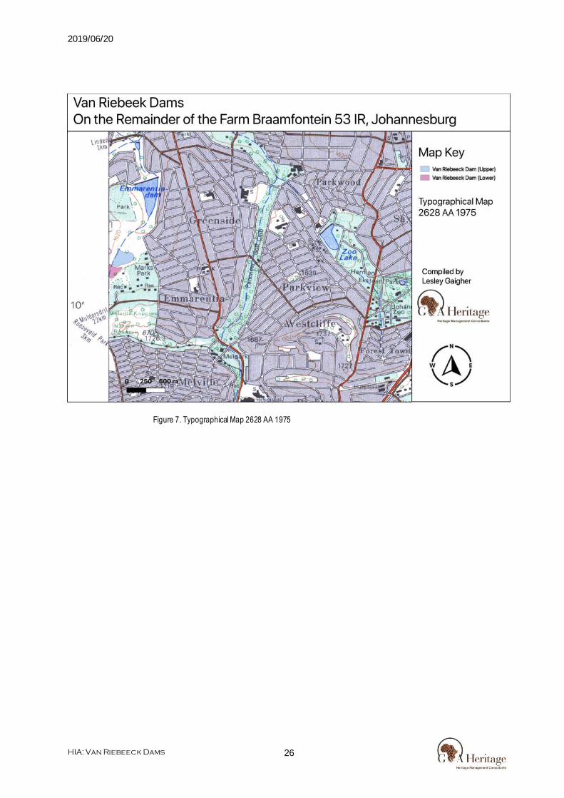
Figure 12. Typographical Map 2627 BB 1954 ......................................... 31
Figure 13. Typographical Map 2627 BB 1977 ......................................... 32
Figure 14. Typographical Map 2627 BB 1983 ......................................... 33
Figure 15. Typographical Map 2627 BB 1995 ......................................... 34
Figure 16. Typographical Map 2627 BB 2002 ......................................... 35
Figure 17. Typographical Map 2627 BB 2007 ......................................... 36
Figure 18. Entrance to the Johannesburg Botanic Garden........................ 37
Figure 19. General Landscape ............................................................. 38
Figure 20. General Landscape ............................................................. 38
Figure 21. Poverty stricken Boers at the end of the war (News Dog Media). 39
Figure 22. Van Riebeeck Dam ............................................................. 40
Figure 23. Van Riebeeck Dam ............................................................. 41
Figure 24. Van Riebeeck Dam Runoff ................................................... 41
Figure 25. Van Riebeeck Dam Runoff ................................................... 42
List of Figures

2019/06/20
HIA: Van Riebeeck Dams
viii
Figure 26. West Park Cemetery............................................................ 42
Figure 27. West Park Cemetery............................................................ 43

2019/06/20
HIA: Van Riebeeck Dams
ix
Bp ................................................................................. Before Present
EIA.................................................................................. Early Iron Age
ESA .............................................................................Early Stone Age
Fm ........................................................................ Femtometre (10-15m)
GPS ....................................................... Geographic Positioning System
HIA.............................................................Heritage Impact Assessment
JRA ............................................................ Johannesburg Road Agency
LIA ................................................................................... Late Iron Age
LSA ............................................................................... Late Stone Age
MYA ........................................................................... Million Years Ago
MSA .......................................................................... Middle Stone Age
NHRA............................... National Heritage Resources Act no 22 of 1999
SAHRA..................................... South African Heritage Resource Agency
S&EIR ....................................Scoping & Environmental Impact Reporting
Um .......................................................................... Micrometre (10-6 m)
WGS 84.................................................World Geodetic System for 1984
List of Abbreviations

10 HIA: Van Riebeeck Dams
Chapter
Project Resources 1 Heritage Impact Assessment Report
Heritage Impact Assessment Report for the Proposed
Repairs and Upgrades of the Van Riebeeck Dams.
1. Introduction
Legislation and methodology G&A Heritage was appointed by Galago Environmental to undertake a Heritage Impact Assessment for the proposed repairs and upgrades of the van Riebeeck Dams, situated in Emmarentia, Johannesburg North, City of Johannesburg Metropolitan Municipality, Gauteng Province. Section 38(1) of the South African Heritage Resources Act (25 of 1999) requires that a heritage study is undertaken for:
(a) Construction of a road, wall, power line, pipeline, canal or other similar form of linear development or barrier exceeding 300 m in length;
(b) Construction of a bridge or similar structure exceeding 50 m in length; and (c) Any development, or other activity which will change the character of an area of land, or water –
(1) Exceeding 10 000 m2 in extent; (2) Involving three or more existing erven or subdivisions thereof; or (3) Involving three or more erven, or subdivisions thereof, which have been consolidated within the past five years; or
(d) The costs of which will exceed a sum set in terms of regulations; or (e) Any other category of development provided for in regulations.
While the above describes the parameters of developments that fall under this Act., Section 38 (8) of the NHRA is applicable to this development. This section states that;
(8) The provisions of this section do not apply to a development as described in subsection (1) if an evaluation of the impact of such development on heritage resources is required in terms of the Environment Conservation Act, 1989 (Act 73 of 1989), or the integrated environmental management guidelines issued by the Department of Environment Affairs and Tourism, or the Minerals Act, 1991 (Act 50 of 1991), or any other legislation: Provided that the consenting authority must ensure that the evaluation fulfils the requirements of the relevant heritage resources authority in terms of subsection (3), and any comments and recommendations of the relevant heritage resources authority with regard to such development have been taken into account prior to the granting of the consent.
In regards to a development such as this that falls under Section 38 (8) of the NHRA, the requirements of Section 38 (3) applies to the subsequent reporting, stating that; (3) The responsible heritage resources authority must specify the information to be provided in a report
required in terms of subsection (2) (a): Provided that the following must be included: (a) The identification and mapping of all heritage resources in the area affected; (b) An assessment of the significance of such resources in terms of the heritag e assessment criteria set out in section 6 (2) or prescribed under section 7; (c) An assessment of the impact of the development on such heritage resources; (d) An evaluation of the impact of the development on heritage resources relative to the sustainable social and economic benefits to be derived from the development;

2019/06/20
HIA: Van Riebeeck Dams
11
(e) The results of consultation with communities affected by the proposed development and other interested parties regarding the impact of the development on heritage resources; (f) If heritage resources will be adversely affected by the proposed development, the consideration of alternatives; and
(g) Plans for mitigation of any adverse effects during and after the completion of the proposed development.
(1) Ancestral graves, (2) Royal graves and graves of traditional leaders, (3) Graves of victims of conflict (iv) graves of important individuals, (4) Historical graves and cemeteries older than 60 years, and (5) Other human remains which are not covered under the Human Tissues Act, 1983 (Act No.65 of 1983 as amended);
(h) Movable objects, including ; (1) Objects recovered f rom the soil or waters of South Africa including archaeological and paleontological objects and material, meteorites and rare geological specimens; (2) Ethnographic art and objects; (3) Military objects; (4) Objects of decorative art; (5) Objects of f ine art; (6) Objects of scientif ic or technological interest; (7) Books, records, documents, photographic positives and negatives, graphic, f ilm or video material or sound recordings; and (8) Any other prescribed categories, but excluding any object made by a living person;
(i) Battlef ields; (j) Traditional building techniques.
A ‘place’ is def ined as: (a) A site, area or region; (b) A building or other structure (which may include equipment, furniture, f ittings and articles associated with or connected with such building or other structure); (c) A group of buildings or other structures (which may include equipment, furniture, f ittings and articles associated with or connected with such group of buildings or other structures); and (d) an open space, including a public square, street or park; and in relation to the management of a place, includes the immediate surroundings of a place. ‘Structures’ means any building, works, device, or other facility made by people and which is f ixed to land and any f ixtures, f ittings and equipment associated therewith older than 60 years. ‘Archaeological’ means: (a) Material remains resulting f rom human activity which are in a state of disuse and are in or on land and are older than 100 years, including artefacts, human and hominid remains and artif icial features and structures; (b) Rock art, being a form of painting, engraving or other graphic representation on a f ixed rock surface or loose rock or stone, which was executed by human agency and is older than 100 years including any area within 10 m of such representation; and (c) Wrecks, being any vessel or aircraf t, or any part thereof , which was wrecked in South Africa, whether on land or in the maritime cultural zone referred to in section 5 of the Maritime Zones Act 1994 (Act 15 of 1994), and any cargo, debris or artefacts found or associated therewith, which are older than 60 years or which in terms of national legislation are considered to be worthy of conservation; (d) Features, structures and artefacts associated with military history which are older than 75 years and the sites on which they are found. ‘Paleontological’ means any fossilised remains or fossil trace of animals or plants which lived in the geological past, other than fossil fuels or fossiliferous rock intended for industrial use, and any site which contains such fossilised remains or trace. ‘Grave’ means a place of interment and includes the contents, headstone or other marker of and any other structures on or associated with such place. The South African Heritage Resources Agency (SAHRA) will

2019/06/20
HIA: Van Riebeeck Dams
12
only issue a permit for the alteration of a grave if it is satisf ied that every reasonable ef fort has been made to contact and obtain permission f rom the families concerned. The removal of graves is subject to the following procedures as outlined by the SAHRA:
- Notif ication of the impending removals (using English, Afrikaans and local language media and notices at the grave site);
- Consultation with individuals or communities related or known to the deceased; - Satisfactory arrangements for the curation of human remains and / or headstones in a museum,
where applicable; - Procurement of a permit f rom the SAHRA; - Appropriate arrangements for the exhumation (preferably by a suitably trained archaeologist) and
re-interment (sometimes by a registered undertaker, in a formally proclaimed cemetery); - Observation of rituals or ceremonies required by the families.
The limitations and assumptions associated with this heritage impact assessment are as follows;
- Field investigations were performed on foot and by vehicle where access was readily available. - Sites were evaluated by means of description of the cultural landscape, direct observations and
analysis of written sources and available databases. - It was assumed that the site layout as provided by Galago Environmental is accurate. - We assumed that the public participation process performed as part of the Basic Assessment
process was suf f iciently encompassing not to be repeated in the Heritage Assessment Phase.
Table 1. Impacts on the NHRA Sections
Act Section Description Possible Impact Action
National Heritage Resources Act (NHRA)
34 Preservation of buildings older than 60 years
Yes HIA
35 Archaeological, paleontological and meteor sites
No impact None
36 Graves and burial sites Yes HIA 37 Protection of public
monuments No impact None
38 Does activity trigger a HIA?
Yes HIA
Table 2. NHRA Triggers
Action Trigger Yes/No Description
Construction of a road, wall, power line, pipeline, canal or other linear form of development or barrier exceeding 300m in length.
No N/A
Construction of a bridge or similar structure exceeding 50m in length.
No N/A
Development exceeding 5000 m2 Yes Proposed Repairs and Upgrades of the Van Riebeeck Dams
Development involving more than 3 erven or sub divisions
No N/A
Development involving more than 3 erven or sub divisions that have been consolidated in the past 5 years
No N/A
Re-zoning of site exceeding 10 000 m2 No N/A Any other development category, public open space, squares, parks or recreational grounds
No N/A
2. Background Information

2019/06/20
HIA: Van Riebeeck Dams
13
2.1 Project Description
The current brief concerns the top two dams within the Jan van Riebeeck Park (also referred to as the Johannesburg Botanic Gardens). Previous assessments have made the following general observations in regard to these dams:
• Urbanized catchments have increased volumes and peak discharges in comparison with natural catchments – and the problem is exacerbated by the increased drainage ef f iciency of urbanized catchments. The spillways of these dams are sized for relatively f requent f lood events so that for larger events, the balance of the f loodwater spills over the embankment crest, creating erosive stress on the downstream slope of the embankment.
• Early stages of urban development expose so il, as development progresses surfaces are more protected f rom erosion. However, this is generally negated by increased runof f , with the result that urban rivers that are f ree to erode of ten carry more sediment than natural rivers. Excess sediment is deposited where velocity is decreased, e.g. impoundments. The cost of constructing and f requently desilting an upstream slit trap is likely to be similar to the cost of less f requent desilting of the impoundment immediately downstream.
The Van Riebeeck Dams (aka Emmarentia Dams) lie at the upper end of the Jan van Riebeeck Park. The upper catchment has been substantially transformed. Many of the impacts now af fecting the dam, are in fact the result of activities and changes to the upstream catchment, such as loss of vegetation, encroachment into wetlands and f loodplains and increased hard surfacing. This has led to increased energy and volumes of runof f and erosion and weathering which have brought unnatural loads of sediment and sand deposition to the top dam. Observations are that the spillways are poorly constructed and undersized for the f low regime and over time have been undermined, causing leaking and constant draining of the dams. Flows along the channel between the dams are super critical and there is bad erosion. The upstream dam wall face is badly eroded, and the dam wall has been breached on the right bank. The breached area has been patched with sand bags. The inlet is highly silted and overgrown with vegetation.
2.2 Objectives and Scope of Work
The objectives and scope include the proposed repairs and upgrades of two other dams (Emmarentia Dams) at the upper end of the Jan van Riebeeck Park (also referred to as the Johannesburg Botanic Gardens).
Scope of the Work: • In in-depth hydrological assessment of the wetland and riparian system comprising the three upstream
impoundments and associated wetlands and feeder systems, to include inter alia the following: o The identif ication of the primary sources of sediment and sediment deposition; o A dam assessment for the 3 upper dams, including inter alia as assessment of water quality,
sediment levels and toxicity; o Modelling of the sub catchment to identify the hydrological functionality and stress areas, including
inf low volumes and peak f low rates into the upper impoundments; o Analysis of optimal role of the upper impoundment in relation to the following options or a
combination thereof ; o Restoration of open water impoundment; o Design of the impoundment to serve as a managed ‘sediment trap’; o Investigate and propose the possibility of each dam having the capacity to perform a dual function;
that of a permanent enclosed water body as well as a spare capacity to act as a retention facility which could hold water back for at least 2-4 hours;
o Establishment of the system as a wetland.
• Feasible design options and cost estimated for modif ications required for reshaping of the waterfall area, to address the inadequacy of the current spillway relating to the second upper impoundment, to repair current breaches and to prevent further scouring and undermining of the spillway and concrete channel.
• Feasible design options and cost estimates for measures to improve the hydrological functioning of the
system and to address in particular the following: o Reduction of channelization

2019/06/20
HIA: Van Riebeeck Dams
14
o Erosion protection o Stream restoration o Reduction and removal of sediments and nutrients o Improvements in water quality o Restoration of wetland functionality o Habitat improvement
• Designs for hydrological improvements should be based on Sustainable Urban Drainage Systems and Water Sensitive Urban Design Systems principles and approaches and not seek to further engineer the system with hard engineering methods. The aim should be to build increased sustainability and resilience in the system. Designs should include revegetation of the disturbed areas with indigenous riparian and wetland vegetation.
2.3 Project Location
The study area is located on the Remainder of the farm Braamfontein 53 IR in the northern suburb of Johannesburg, Emmarentia.

2019/06/20
HIA: Van Riebeeck Dams
15
Figure 1. Van Riebeeck Dams Location Map

2019/06/20
HIA: Van Riebeeck Dams
16
2.4 GPS Track Paths
Figure 2. Google Earth © Image: Van Riebeeck Dams Park Trackpath

2019/06/20
HIA: Van Riebeeck Dams
17
Chapter
Findings 2
Heritage Indicators within the receiving
Environment
3. Regional Cultural Context
3.1 Paleontology
A section of the study area falls within the red demarcation on the PalaeoSensitivity Map. SAHRA states that in this case a f ield assessment and a protocol for f inds is required, however since no excavations are planned for the project, no impacts on palaeontological deposits are anticipated. (Due to the SAHRIS server being down at the time of writing this report, the Paleo Sensitivity Map for this area could not be included here).
3.2 Stone Age
No substantial number of Stone Age sites f rom any period o f the Stone Age is known to exist in this area – primarily as a result of a lack of research and general ignorance amongst the layman in recognizing stone tools that of ten may occur. However, it is possible that the f irst humans in the area may have been p receded by Homo erectus, who roamed large parts of the world during the Aucheulian period of the Early Stone Age, 500 000 years ago. The predecessors of Homo erectus, Australopithecus, which is considered to be the earliest ancestor of modern humans, lived in the Blaauwbank Valley around Krugersdorp (today part of the Cradle of Humankind – a World Heritage Site) several million years ago. During the Middle Stone Age, 200 000 years ago, modern man or Homo sapiens emerged, manufacturing a wider range of tools, with technologies more advanced than those f rom earlier periods. This enabled skilled hunter-gatherer bands to adapt to different environments. From this time onwards, rock shelters and caves were used for occupation and reoccupation over very long periods of time (Mitchell 2002). Two Middle Stone Age sites at the Withoek Spruit (Brakpan) were researched 17 years ago, but no information on this discovery has been published.

2019/06/20
HIA: Van Riebeeck Dams
18
Figure 3. (1) handaxe on flake; (2) thick discoidal core; (3) polyhedral core (Pollarolo, Kuman, Bruxelles, 2010)
Figure 4. (1,2) Handaxes with large side removal; (3-6) handaxes (Pollarolo, Susino, Kuman, Bruxelles, 2010)
The Late Stone Age, considered to have started some 20 000 years ago, is associated with the predecessors of the San and Khoi Khoi. San hunter-gatherer bands with their small (microlithic) stone tools

2019/06/20
HIA: Van Riebeeck Dams
19
may have lived in Eastern Gauteng, as a magnif icent eng raving site near Duncanville attests to their presence in Vereeniging, south of , but close to Ekurhuleni. Stone Age hunter-gatherers lived well into the 19th century in some places in South Africa but may not have been present in Brakpan when the f irst European colonists crossed the Vaal River during the early part of the 19th century Stone Age sites may occur all over the area where an unknown number may have been obliterated by mining activities, urbanization, industrialization, agriculture and other development activities during the past decades (Morris 2004).
3.3 Iron Age
A considerable number of Late Iron Age, stone walled sites, dating f rom the 18th and the 19 th centuries (some of which may have been occupied as early as the 16th century), occur along and on top of the rocky ridges of the eastern part of the Klipriviersberg towards Alberton. These settlements and features in these sites, such as huts, were built with dry stone, reed and clay available f rom the mountain and the Klip River (Mason 1968, 1986). The Late Iron Age sites within Ekurhuleni’s south-eastern border are a ‘spill-over’ f rom a larger concentration which are located further towards the west, in the Witwatersrand, while large concentrations of stone walled sites are also located directly to the south of Johannesburg, in the mountainous area around the Suikerbosrand in Heidelberg. The stone walled settlements are concentrated in clusters of sites and sometimes are dispersed over large areas making them vulnerable to developments of vario us kinds. A site consists of a circular or elliptical outer wall that is composed of a number of scalloped walls facing inwards towards one or more enclosures. Whilst the outer scalloped walls served as dwelling quarters for various family groups, cattle, sheep and goat were stocked in the centrally located enclosures. Huts with clay walls and f loors were built inside the dwelling units. Pottery and metal items are common on the sites. However, iron and copper were not produced locally on these sites (Killick 2004). Some 100 years earlier, African farmers in the Fokeng cluster built stonewalled settlements in the Tshwane area that emphasised the centre/side axis. From the air, these earlier settlements resemble a 'fried egg'; that is, a smooth outer ring about 60 metres across enclosed in a central cattle byre about 20 metres in diameter. When these early BaFokeng people moved north across the Vaal River, they met the ancestors of Southwest Sotho-Tswana, such as BaRolong and BaThlaping. Their interaction helped to create a new type of stonewalling called Klipriviersburg. Besides Johannesburg, Klipriviersburg walling is also found around Pretoria. All of these people were mixed farmers; that is, they herded cattle as well as sheep and goats, and they cultivated sorghums, millets and various beans and peas. They were also capable of making metal tools and jewellery. The earliest evidence of metal working in the region comes from the site Broederstroom west of Pretoria. Archaeologists have uncovered the remains of at least two stratified villages there that date back to between AD 550 and 700, each with evidence of iron forging. Two major technological steps characterise ancient iron production: smelting and forging. Technically, iron ore is reduced in a furnace to create a bloom. During this smelting process, silica in the host rock melts, flowing off as slag leaving the bloom behind. The bloom has to be forged in an oxidised atmosphere, usually in an open hearth. In both smelting and forging, bellows attached to clay pipes help the operators reach the necessary high temperatures. Culturally, Bantu-speaking people in the recent past compared the smelting process to childbirth, a private and sacred affair. Consequently, the smelter was usually secluded outside the settlement. Forging, in contrast, was comparable to raising the child; and so the forge was located in a public area in the centre of the homestead. The forges at Broederstroom follow this pattern. (http://www.sahistory.org.za/topic/prehistory-pretoria) Melville Koppies The granite ridge referred to as Melville Koppies has a rich prehistoric history. The majority of the work done in this area was done during the 1960 by Prof . Revil Mason. Seen by some as a radical in terms of research methods (he famously used dynamite to excavate the Makapansgat deposits!) he nonetheless was invaluable in raising interest in the prehistory of this area of Johannesburg and was key in the preservation actions taken as a result of his research. Mason believed that "archaeology is not limited to the distant past but recorded wherever human action leaves its mark on the landscape...". He identif ied eight archaeological sites on what we call Melville Koppies Central: - Stone Age camps 250 000 and 100 000 years old. - Ancestral Tswana Iron Furnace 500 years old. - African Iron Furnace Models.

2019/06/20
HIA: Van Riebeeck Dams
20
- A second Tswana Iron Furnace. - Tswana hut f loor and pottery - 300 years old. - 1880s gold prospecting. - 1900s gun emplacement. - Early 1900s quarries. The Stone Age camps were revealed in the same excavation, in 1963, which uncovered the 100-year-old furnace. The furnace is on a living f loor about 50cm below the present ground -level. The 100 000-year-old camp is about a metre below that, and the 250 000-year-old f loor another metre below that. Part of the excavation was f illed in on completion. The furnace and small parts of the older living f loors are preserved under glass in a shelter near the lecture hut. The artefacts discovered are housed at the University of the Witwatersrand. The Melville Koppies Reserve have Stone Age artefacts on display, but they are part of a collection donated to them over the years. Mason's 250 000BP date places these remains in the Middle Stone Age. He himself uses the term "Fauresmith", which is not common parlance today. The tools would have been made by people called "Archaic Homo Sapiens", meaning that they were anatomically similar to modern humans, but the remains they have lef t do not make it clear whether they were like us in mind and consciousness or not. Their way of life would have been that of hunter-gatherers and scavengers. The 100 000-year-old evidence is that of fully modern humans. The commonly accepted "out of Afri ca" theory today proposes that humans lef t Africa perhaps 80 000 years ago, equipped with the full human "toolkit" - tools, language, art, control of f ire, song, and sociability. The Iron Age evidence is that of a culture which reached the Witwatersrand p ossibly 500 years ago. The people were the ancestors of the present Tswana population. The knowledge of iron working came f rom far north in Africa. People with these skills were also part of a culture which combined pastoralism - goats, sheep, and cattle - with agriculture. They farmed sorghum, millet, and legumes. The community on Melville Koppies probably survived until the turmoil of the 1820s. Mason proposes that during these years the Melville Koppies settlement was part of a trading network which included communities at Klipriviersberg, Lonehill, Melville Koppies, and the Magaliesberg area. More agriculturally prosperous, the south (Klipriviersberg) would have traded cattle and grain for iron f rom the northern Witwatersrand, copper f rom the Magaliesberg, and specularite f rom the Boons and Tarlton area. Specularite, Iron Sulphite Fe2O3, is a glittering mineral of no value except for body decoration. It also seems that copper was used only as jewellery. Mason describes a burial of a teenage girl at Klipriviersberg who was adorned with copper earrings and iron beads and anklets. The ability to trade for cosmetics and jewellery as far as Melville Koppies and the Magaliesberg tells us that these communities - or at least some of them - were not living in desperate poverty. Not only the smelting furnace at Melville Koppies, but also the kloof - through which Beyers Naudé Drive now runs - means that it lay on a major trading route. The British regarded the kloof as an important enough access through the Witwatersrand to maintain a gun emplacement on the Koppies during the South African War. A less noticed heritage on the Melville Koppies is that of the last "Stone Age" peoples. These of course are the San or Khoisan. Mason does not mention the San living f loor on Melville Koppies Central. But he does write about the "cave" on Melville Koppies West. The "cave" is more like a small rock overhang than a cave in the way speleologists think of one. But it was excavated, and in it were found a grooved stone used by the San to shape arrows and to grind ostrich shell beads. Also found were bones of hunted animals, and a Zebra tooth. The San had a complicated relationship with the iron using pastoralists. There is evidence at Broederstroom that they may have cooperat ed with the

2019/06/20
HIA: Van Riebeeck Dams
21
settlement as hunters - for hunting and gathering, not pastoralism and agriculture, was their way of life. But they were possibly also enslaved or killed. Mason refers to the cave as a "refuge". This is because it is likely that the settlement in the 1820s f led the invasion by Mzilikatsi and some may have used the cave as a temporary hiding place. (www.mk.org.za)
3.4 The Historic Era
The f irst inhabitants of this area were Stone Age hunter-gatherers who roamed here some 50 000 years ago. Remnants of their weapons were found in the Rynf ield area and near Cranbourne Station many years ago. The f irst Voortrekker parties crossed the Vaal River and started occupying the area in the 1830’s. Farmers started moving into the area and declared farms for themselves, especially af ter the singing of the Sand River convention in 1852. The f irst major modern settlements in Johannesburg were loosely planned, as they grew up quickly in order to service the need for labour in the gold mines on the Witwatersrand. However, the population of Johannesburg increased rapidly, and the city quickly established formal neighbourhoods, most of which were racially mixed as labourers lived together. The earliest formal settlement to house people of all races, Kliptown, is located near today's Soweto. During the Apartheid Era (1948 to 1994), it was the discriminatory racial segregation (apartheid) legislation, enacted by the Nationalist Party (af ter coming to power in 1948) that extensively transformed the land-use. Citizens were separated into dif ferent townships according to their race with buf fer strips of at least 100m wide or by environmental buf fer zones thus the Black South Africans in the area lived in the Brakpan Old Location. The Brakpan Old Location was the backdrop to many anti-apartheid struggles. The people living in the location were actively trying to improve their living conditions and to challenge the laws that were suf focating them. Mbulelo Vizikhungo Mzamane wrote “Children of Paradise” to detail the area and the events of the time, through his own eyes as a young boy living in Brakpan Old Location. It is a poignant story of the innocence and trust of a young, black South African, who does not understand the severity of the situation he is caught in. Although beautifully told, it does not provide specif ic historical references to events unfolding in the area. It does however mention events and places that can be researched through alternative method s. The community of Brakpan Old Location were forcibly removed f rom their homes f rom 1974 to 1978 and had to re-establish themselves in Tskane approximately 15km South. The Old Location was razed. Many large f reeways were built to link Johannesburg with the rest of South Africa, although this permitted the further outward expansion of the city along the N1, N3, and M2 roadways. Public transport construction was completely abandoned, except for a minor bus system. This system continued until the 1980s, when international sanctions and a poor security situation led to a large contraction in the economy. Many companies abandoned skyscrapers that had been built in the Central Business District (CBD) in the 1960s and 1970s, and lef t warehouses empty or little used. When the Group Areas Act was repealed, there was a mass migration of former township dwellers and illegal immigrants to buildings in the CBD and surrounding areas, which caused crime rates to increase dramatically in the Central area of the city. Many businesses that had not closed their CBD of f ices left for more secured Northern suburbs, and in particular, Sandton. The amount of business and population of the northern suburbs increased exponentially, while the CBD was lef t empty and abandoned as a "no-go zone". The previous owners of buildings in the CBD abandoned them as their value decreased, and more illegal immigrants moved in. Many suburbs near the CBD also felt the demographic change as previously white and middle-class suburbs like Yeoville became mostly black and dangerous within the space of two to three years. The city government has attempted to rectify this situation as of 2005 by installing CCTV cameras all over the city centre and increasing police presence. Some businesses and residents have returned, although most businesses have built permanent and better facilities in the northern suburbs, so a large-scale return is unlikely. The city has grown so quickly to the north that the border between Johannesburg, Midrand,

2019/06/20
HIA: Van Riebeeck Dams
22
and Centurion is mostly an arbitrary political border, as the two cities have grown together so there is no space between them.
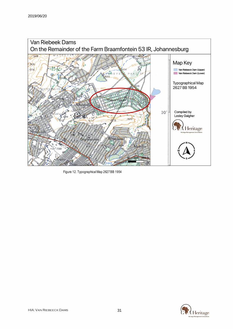
Johannesburg Botanic Gardens & Emmarentia Dam Specifically: The Johannesburg Botanical Gardens date all the way back to 1866, before the city of Johannesburg was founded. The area was part of the Braamfontein farm which was owned by the Geldenhuys family. Following the Anglo-Boer wars at the turn of the century the family contracted landless Boers to build the Emmarentia Dam (which was named af ter Louw Geldenhuys’s wife, Emmarentia) and to plant thousands of trees around the area. The botanical gardens were founded soon af ter.
After the Second Boer War, in which Louw Geldenhuys and his brother had taken part of as members of the Krugersdorp Commando, he decided to help some landless and unemployed Boers war veterans. He used them to construct a stone and earth dam from blocks of stone f rom hills behind the farm and cost £12,000. The dam was built over the Westdene spruit which is a tributary of the larger Braamfontein Spruit. The dam was then named af ter his wife Emmarentia Botha. A hundred of these workers were then settled in 14 irrigated smallholdings on 145 morgens of the farm in what are now the suburbs of Emmarentia, Linden and Greenside where they grew f ruits and vegetables with rent based on a third of the prof its of the sale of the produce. Louw died in 1929 and his wife Emmarentia began to sell parts of the farm that became the suburbs Greenside in 1931, Emmarentia in 1937 named af ter her, and in 1941, Emmarentia Extension. In 1933, 13 hectares of the farm were donated to the City of Johannesburg for parks and recreation, and af ter further pieces of land were acquired, became the Jan van Riebeeck Park (1952) and the Johannesburg Botanical Garden (1964), Emmarentia Dam (1939), the Marks Park Sports Club (1951) and West Park Cemetery (1942). Sources: http://www.sacp.org.za/docs/history/fifty3.html http://www.historyworld.net/wrldhis/PlainTextHistories.asp?ParagraphID=otw http://cals.ukzn.ac.za/Libraries/General_Docs/Mbulelo_Mzamane.sf lb.ashx http://www.sahistory.org.za/people/david-wilcox-bopape http://www.liferattle.ca/radio/podcast20110213.html Global.Britannica.com/Brakpan Historyworld.net SA History Online SA History Online/Consumer Boycotts SA Military History.org Mbulelo Vizikhungo Mzamane, “Children of Paradise” "List of Registered Dams – September 2009". Department of Water Af fairs. September 2009. Retrieved 5 January 2010. "Emmarentia Dam". Emmarentia Residents Association. Retrieved 18 October 2015. Davie, Lucille (15 July 2012). "Joburg's only dry suburb". Johannesburg City Council. Retrieved 18 October 2015. "The Origins of Emmarentia Dam". The Heritage Portal. 3 December 2013. Retrieved 18 October 2015. "Johannesburg Botanical Gardens". Johannesburg City Parks. Retrieved 6 January 2010.
3.5 Historical Maps
Especially during the evaluation of historic structures, the use of archived historic maps is very handy. They give a direct chronological reference for such sites and also lead the investigation on the ground. The following historic map sets are relevant for this study (in chronological order);
- 2628 AA 1939 - 2628 AA 1954 - 2628 AA 1975 - 2628 AA 1983 - 2628 AA 2002 - 2628 AA 2010
Nothing signif icant noted on any one of the above mentioned typographical maps.

2019/06/20
HIA: Van Riebeeck Dams
23
- 2627 BB 1943 - 2627 BB 1954 - 2627 BB 1977 - 2627 BB 1983 - 2627 BB 1995 - 2627 BB 2002 - 2627 BB 2010
West Park Cemetery noted on all the above mentioned typographical maps.
Significance of Scientific Information for the Study Area The above information when analysed in detail forms a matrix within which the study area at Demaneng 546 can be analysed, it furthermore also gives guidance to investigators to ensure that f ieldwork is focussed on the possible occurrence of sites and features as outlined in these studies. The main points that have been derived f rom these studies are the possible occurrence of the following features within the study area;
- Possible pre-colonial specularite mining activities. - Sites with petroglyph rock art. - Sites with mining implements f rom the Stone Age. - Stone tool manufacturing sites. - Colonial graves

2019/06/20
HIA: Van Riebeeck Dams
24
Figure 5. Typographical Map 2628 AA 1939

2019/06/20
HIA: Van Riebeeck Dams
25
Figure 6. Typographical Map 2628 AA 1954
2019/06/20
HIA: Van Riebeeck Dams
26
Figure 7. Typographical Map 2628 AA 1975

2019/06/20
HIA: Van Riebeeck Dams
27
Figure 8. Typographical Map 2628 AA 1983

2019/06/20
HIA: Van Riebeeck Dams
28
Figure 9. Typographical Map 2628 AA 2002

2019/06/20
HIA: Van Riebeeck Dams
29
Figure 10. Typographical Map 2628 AA 2010

2019/06/20
HIA: Van Riebeeck Dams
30
Figure 11. Typographical Map 2627 BB 1943
The West Park Cemetery is located approximately 125m (at the closest point) f rom the study area. This cemetery is present on all the subsequent maps. It will not be impacted upon.
2019/06/20
HIA: Van Riebeeck Dams
31
Figure 12. Typographical Map 2627 BB 1954

2019/06/20
HIA: Van Riebeeck Dams
32
Figure 13. Typographical Map 2627 BB 1977

2019/06/20
HIA: Van Riebeeck Dams
33
Figure 14. Typographical Map 2627 BB 1983

2019/06/20
HIA: Van Riebeeck Dams
34
Figure 15. Typographical Map 2627 BB 1995

2019/06/20
HIA: Van Riebeeck Dams
35
Figure 16. Typographical Map 2627 BB 2002

2019/06/20
HIA: Van Riebeeck Dams
36
Figure 17. Typographical Map 2627 BB 2007
3.6 Previous Studies
An extensive research into the SAHRIS database resulted in the identif icat ion of the following heritage related studies that have been performed over the last decade in the study area. Only studies within a radius of 50km from the study area were considered.
• Pelser, A. 2017. Report on a Desktop Cultural Heritage Assessment for the Proposed Houghton Estate Extension 1 Residential Development Located on the Remaining Extent of Portion 1 of Houghton Estate 56IR, Houghton, Gauteng.
• Van Der Walt, J. 2017. Notif ication of Intent to Develop for the Proposed Upgrading of Jan Smuts Road to Dual Carriage Way f rom Northworth Drive to Bolton Road and f rom 8 th Avenue to Kent Road, Rosebank, Johannesburg, Gauteng Province.
• Coetzee, F.P. 2016. Cultural Heritage Assessment of the Proposed 37.5 ML Underground Linksf ield Reservoir, City of Johannesburg, Gauteng Province.
• Coetzee, F.P. 2015. Cultural Heritage Assessment of the Proposed Construction of the Additional Meredale Reservoir (210 MI) (Eikenhof System), City of Johannesburg Metropolital Municipality, Gauteng.
• Kusel, U. 2016. Phase 1 Cultural Heritage Resources Impact Assessment for the Proposed Development on Portions of the Klipspruit Township, Nancef ield Precint, Soweto, Johannesburg, Gauteng Province.
• Van Ryneveld, K. 2015. HIA – Construction of the Celebration Sewer Pipeline B on Various Agricultural Holdings, North Riding, City of Johannesburg Metropolitan Municipality, Gauteng.
• De Jong, R.C. 2014. Final Heritage Impact Assessment Report Version 3: Proposed Huddle Park Golf Course Development, Johannesburg.
• Kruger, N. 2017. Archeological Impact Assessment (AIA) of areas demarcated for the Proposed Zandspruit Township Establishment on Portions 16, 22, 23, 26, 42, 51, 55, 56, 59, 67, 68, 72, 73, 76, 104, 105, 144 and 160 of the Farm Zandspruit 191-IQ and Holding 43 Sonedal, A.H., City of Johannesburg, Gauteng Province.

2019/06/20
HIA: Van Riebeeck Dams
37
• Birkholtz, P. 2015. Proposed Development of the G14 Pipeline by Rand Water: Heritage Impact Assessment for the Proposed Development of the G14 Pipeline between Forest Hill and Turf fontein Nek, Southern Johannesburg, Johannesburg Metropolitan Municipality, Gauteng Province.
• Van Schalkwyk, J. 2006. Review of Cultural Heritage Resources in the Modderfontein Area, East of Johannesburg, Gauteng.
• Breetzke, S. 2014. Proposed Alternations and Additions to House Breetzke – Erf 120 & 121 of
Forest Town, Gauteng, 5 Cluny Road, Johannesburg.
• Van Schalkwyk, J. 2015. Heritage Impact Assessment for the Proposed Widening of Conrad Drive Bridge and Erosion Protection Measures, Braamfontein Spruit, Blairgowrie, Johannesburg District Municipality, Gauteng Province.
3.7 Cultural & Natural Landscape
Just 6km f rom Johannesburg’s city centre, Emmarentia Dam and the surrounding botanical gardens provide a beautiful green space and recreational area for visitors to the area.
The north-east section of the gardens is dominated by the large Emmarentia Dam which is fed by two smaller dams within the Johannesburg Botanical Gardens. This section offers a different take on things to do in Gauteng. Emmarentia Dam spans 7.5-hectares, an area which makes it ideal for watersports such as canoeing and sailing small boats. There are canoeing and rowing club facilities on the eastern embankment, and birdwatchers can see geese, dabchicks (little grebes), moorhens and other waterfowl.
Figure 18. Entrance to the Johannesburg Botanic Garden

2019/06/20
HIA: Van Riebeeck Dams
38
Figure 19. General Landscape
Figure 20. General Landscape
4. Findings
4.1 Map of Key Features
No sites were identif ied within the proposed study area and as such a Key Features Map would be redundant.
4.1.1 Site 003 – Dam Wall
The Emmarentia dam, including the two smaller dams upstream (Van Riebeeck Dams) is itself a historic structure with signif icant heritage value. The dam wall was constructed by unemployed
2019/06/20
HIA: Van Riebeeck Dams
39
Boers af ter the end of the South African War. Louw Geldenhuys employed these Boers to build the dam wall f rom granite and sandstone blocks. They were then each awarded a 145-morgen piece of agricultural land downstream which would be irrigated f rom the dam. Payment would be in the form of 1/3 of their annual harvest.
Figure 21. Poverty stricken Boers at the end of the war (News Dog Media)
4.2 Fieldwork Results
The study area was found to be devoid of any heritage features of any signif icance.

2019/06/20
HIA: Van Riebeeck Dams
40
Figure 22. Van Riebeeck Dam

2019/06/20
HIA: Van Riebeeck Dams
41
Figure 23. Van Riebeeck Dam
Figure 24. Van Riebeeck Dam Runoff

2019/06/20
HIA: Van Riebeeck Dams
42
Figure 25. Van Riebeeck Dam Runoff
Figure 26. West Park Cemetery

2019/06/20
HIA: Van Riebeeck Dams
43
Figure 27. West Park Cemetery
Chapter

2019/06/20
HIA: Van Riebeeck Dams
44
3 Impact Assessment
5. Methodology This study def ines the heritage component of the EIA process being undertaken for the proposed repairs and upgrades of the van Riebeeck Dams, situated in Emmarentia, Johannesburg North, City of Johannesburg Metropolitan Municipality, Gauteng Province. It is described as a f irst phase (HIA). This report attempts to evaluate both the accumulated heritage knowledge of the area as well as information derived f rom direct physical observations.
5.1 Inventory
Inventory studies involve the in-f ield survey and recording of archaeological resources within a proposed development and buf fer area. The nature and scope of this type of study is defined primarily by the results of the overview study. In the case of site-specif ic developments, direct implementation of an inventory study may preclude the need for an overview.
There are a number of different methodological approaches to conducting inventory studies. Therefore, the proponent, in collaboration with the archaeological consultant, must develop an inventory plan for review and approval by the SAHRA prior to implementation (Dincause, Dena F., H. Martin Wobst, Robert J. Hasenstab and David M. Lacy 1984).
5.2 Evaluating Heritage Impacts
A combination of document research as well as the determination of the geographic suitability of areas and the evaluation of aerial photographs determined which areas could and should be accessed. Af ter plotting of the site on a GPS the areas were accessed using suitable combinations of vehicle access and access by foot. Sites were documented by digital photography and geo -located with GPS readings using the WGS 84 datum. Further techniques (where possible) included interviews with local inhabitants, visiting local museums and information centers and discussions with local experts. All this information was combined with information f rom an extensive literature study as well as the result of archival studies based on the SAHRA (South African Heritage Resource Agency) provincial databases. This Heritage Impact Assessment relies on the analysis of written documents, maps, aerial photographs and other archival sources combined with the results of site investigations and interviews with ef fected people. Site investigations are not exhaustive and of ten focus on areas such as river conf luence areas, elevated sites or occupational ruins. The following documents were consulted in this study;
- South African National Archive Documents - SAHRIS (South African Heritage Resources Information System) Database of Heritage Studies - Historic Maps - 2628 AA 1939, 1954, 1975, 1983, 2002 and 2010 Surveyor General Topographic Map series - 2627 BB 1943, 1954, 1977, 1983, 1995, 2002 and 2007 Surveyor General Topographic Map series - 1952 1:10 000 aerial photo survey - Google Earth 2019 imagery - Published articles and books - JSTOR Article Archive
5.3 Fieldwork
Fieldwork for this study was performed on the 11th of June 2019. Most of the areas were found to be accessible by vehicle. Areas of possible signif icance were investigated on foot. The survey was tracked using GPS and a track f ile in GPX format is available on request.

2019/06/20
HIA: Van Riebeeck Dams
45
Where sites were identif ied it was documented photographically and plotted using GPS with the WGS 84 datum point as reference. GPX f iles are available on request f rom G&A Heritage. The study area was surveyed using standard archaeological surveying methods. The area was surveyed using directional parameters supplied by the GPS and surveyed by foot. This technique has proven to result in the maximum coverage of an area. This action is def ined as;
‘an archaeologist being present in the course of the carrying-out of the development works (which may include conservation works), so as to identify and protect archaeological deposits, features or objects which may be uncovered or otherwise affected by the works’ (DAHGI 1999a, 28).
Standard archaeological documentation formats were employed in the description of sites. Using standard site documentation forms as comparable med ium, it enabled the surveyors to evaluate the relative importance of sites found. Furthermore, GPS (Global Positioning System) readings of all f inds and sites were taken. This information was then plotted using a Garmin Colorado GPS (WGS 84- datum).
Indicators such as surface f inds, plant growth anomalies, local information and topography were used in identifying sites of possible archaeological importance. Test probes were done at intervals to determine sub-surface occurrence of archaeological material. The importance of sites was assessed by comparisons with published information as well as comparative collections.
6. Measuring Impacts In 2003 the SAHRA (South African Heritage Resources Agency) compiled the following guidelines to evaluate the cultural signif icance of individual heritage resources:
6.1 Type of Resource
- Place - Archaeological Site - Structure - Grave - Paleontological Feature - Geological Feature
6.2 Type of Significance
6.2.1 Historic Value
It is important in the community, or pattern of history
o Important in the evolution of cultural landscapes and settlement patterns . o Important in exhibiting density, richness or diversity of cultural features illustrating the
human occupation and evolution of the nation, province, region or locality. o Important for association with events, developments or cultural phases that have had a
signif icant role in the human occupation and evolution of the nation, province, region or community.
o Important as an example for technical, creative, design or artistic excellence, innovation or achievement in a particular period.
It has strong or special association with the life or work of a person, group or organisation of importance in history
o Importance for close associations with individuals, groups or organisations whose life, works or activities have been signif icant within the history of the nation, province, region or community.
It has signif icance relating to the history of slavery
o Importance for a direct link to the history of slavery in South Africa.
6.2.2 Aesthetic Value

2019/06/20
HIA: Van Riebeeck Dams
46
It is important in exhibiting particular aesthetic characteristics valued by a community or cultural group.
o Important to a community for aesthetic characteristics held in high es teem or otherwise valued by the community.
o Importance for its creative, design or artistic excellence, innovation or achievement. o Importance for its contribution to the aesthetic values of the setting demonstrated by a
landmark quality or having impact on important vistas or otherwise contributing to the identif ied aesthetic qualities of the cultural environs or the natural landscape within which it is located.
o In the case of an historic precinct, importance for the aesthetic character created by the individual components which collectively form a signif icant streetscape, townscape or cultural environment.
6.2.3 Scientific Value
It has potential to yield information that will contribute to an understanding of natural or cultural heritage
o Importance for information contributing to a wider understanding of natural or cultural history by virtue of its use as a research site, teaching site, type locality, reference or benchmark site.
o Importance for information contributing to a wider understanding of the origin of the universe or of the development of the earth.
o Importance for information contributing to a wider understanding of the origin of life; the development of plant or animal species, or the biological or cultural development of hominid or human species.
o Importance for its potential to yield information contributing to a wider understanding of the history of human occupation of the nation, Province, region or locality.
o It is important in demonstrating a high degree of creative or technical achievement at a particular period
o Importance for its technical innovation or achievement.
(a) Does the site contain evidence, which may substantively enhance understanding of culture history, culture process, and other aspects of local and regional prehistory?
• internal stratif ication and depth
• chronologically sensitive cultural items
• materials for absolute dating
• association with ancient landforms
• quantity and variety of tool type
• distinct intra-site activity areas
• tool types indicative of specific socio-economic or religious activity
• cultural features such as burials, dwellings, hearths, etc.
• diagnostic faunal and f loral remains
• exotic cultural items and materials
• uniqueness or representativeness of the site
• integrity of the site (b) Does the site contain evidence which may be used for experimentation aimed at improving archaeological methods and techniques?
• monitoring impacts f rom artif icial or natural agents
• site preservation or conservation experiments
• data recovery experiments
• sampling experiments
• intra-site spatial analysis (c) Does the site contain evidence which can make important contributions to paleoenvironmental studies?
• topographical, geomorphological context
• depositional character
• diagnostic faunal, f loral data

2019/06/20
HIA: Van Riebeeck Dams
47
(d) Does the site contain evidence which can contribute to other scientif ic disciplines such as hydrology, geomorphology, pedology, meteorology, zoology, botany, forensic medicine, and environmental hazards research, or to industry including forestry and commercial f isheries?
6.2.4 Social Value / Public Significance
o It has strong or special association with a particular community or cultural group for social,
cultural or spiritual reasons o Importance as a place highly valued by a community or cultural group for reasons of social,
cultural, religious, spiritual, symbolic, aesthetic or educational associations. o Importance in contributing to a community’s sense of place.
(a) Does the site have potential for public use in an interpretive, educational or recreational capacity?
• integrity of the site
• technical and economic feasibility of restoration and development for public use
• visibility of cultural features and their ability to be easily interpreted
• accessibility to the public
• opportunities for protection against vandalism
• representativeness and uniqueness of the site
• aesthetics of the local setting
• proximity to established recreation areas
• present and potential land use
• land ownership and administration
• legal and jurisdictional status
• local community attitude toward development (b) Does the site receive visitation or use by tourists, local residents or school groups?
6.2.5 Ethnic Significance
(a) Does the site presently have traditional, social or religious importance to a particular group or community?
• ethnographic or ethno-historic reference
• documented local community recognition or, and concern for, the site
6.2.6 Economic Significance
(a) What value of user-benef its may be placed on the site?
• visitors' willingness-to-pay
• visitors' travel costs
6.2.7 Scientific Significance
(a) Does the site contain evidence, which may substantively enhance understanding of historic patterns of settlement and land use in a particular locality, regional or larger area? (b) Does the site contain evidence, which can make important contributions to other scientific disciplines or industry?
6.2.8 Historic Significance
(a) Is the site associated with the early exploration, settlement, land use, or other aspect of southern Africa’s cultural development?

2019/06/20
HIA: Van Riebeeck Dams
48
(b) Is the site associated with the life or activities of a particular historic f igure, group, organization, or institution that has made a signif icant contribution to, or impact on, the community, province or nation? (c) Is the site associated with a particular historic event whether cultural, economic, military, religious, social or political that has made a signif icant contribution to, or impact on, the community, province or nation? (d) Is the site associated with a traditional recurring event in the history of the community, province, or nation, such as an annual celebration?
6.2.9 Public Significance
(a) Does the site have potential for public use in an interpretive, educational or recreational capacity?
• visibility and accessibility to the public
• ability of the site to be easily interpreted
• opportunities for protection against vandalism
• economic and engineering feasibility of reconstruction, restoration and maintenance
• representativeness and uniqueness of the site
• proximity to established recreation areas
• compatibility with surrounding zoning regulations or land use
• land ownership and administration
• local community attitude toward site preservation, development or destruction
• present use of site
(b) Does the site receive visitation or use by tourists, local residents or school groups?
6.2.10 Other
(a) Is the site a commonly acknowledged landmark? (b) Does, or could, the site contribute to a sense of continuity or identity either alone or in conjunction with similar sites in the vicinity? (c) Is the site a good typical example of an early structure or device commonly used for a specific purpose throughout an area or period of time? (d) Is the site representative of a particular architectural style or pattern?
6.3 Degrees of Significance
6.3.1 Significance Criteria
There are several kinds of signif icance, including scientif ic, public, ethnic, historic and economic, that need to be taken into account when evaluating heritage resources. For any site, explicit criteria are used to measure these values. These checklists are not intended to be exhaustive or inf lexible. Innovative approaches to site evaluation which emphasize quantitative analysis and objectivity are encouraged. The process used to derive a measure of relative site signif icance must be rigorously documented, particularly the system for ranking or weighting various evaluated criteria.
Site integrity, or the degree to which a heritage site has been impaired or disturbed as a result of past land alteration, is an important consideration in evaluating site signif icance. In this regard, it is important to recognize that although an archaeological site has been disturbed, it may still contain important scientif ic information.
Heritage resources may be of scientif ic value in two respects. The potential to yield information, which, if properly recovered, will enhance understanding of Southern African human history, is one appropriate measure of scientif ic signif icance. In this respect, archaeological sites should be evaluated in terms of their potential to resolve current archaeological research problems. Scientific signif icance also refers to the potential for relevant contributions to other academic disciplines or to industry.
Public signif icance refers to the potential a site has for enhancing the public's understanding and appreciation of the past. The interpretive, educational and recreational potential of a site are valid

2019/06/20
HIA: Van Riebeeck Dams
49
indications of public value. Public signif icance criteria such as ease of access, land ownership, or scenic setting are of ten external to the site itself . The relevance of heritage resource data to private industry may also be interpreted as a particular kind of public signif icance.
Ethnic signif icance applies to heritage sites which have value to an ethnically distinct community or group of people. Determining the ethnic s ignif icance of an archaeological site may require consultation with persons having special knowledge of a particular site. It is essential that ethnic signif icance be assessed by someone properly trained in obtaining and evaluating such data.
Historic archaeological sites may relate to individuals or events that made an important, lasting contribution to the development of a particular locality or the province. Historically important sites also ref lect or commemorate the historic socioeconomic character of an area. Sites having high historical value will also usually have high public value.
The economic or monetary value of a heritage site, where calculable, is also an important indication of signif icance. In some cases, it may be possible to project monetary benef its derived f rom the public's use of a heritage site as an educational or recreational facility. This may be accomplished by employing established economic evaluation methods; most of which have been developed for valuating outdoor recreation. The objective is to determine the willingness of users, including local residents and tourists, to pay for the experiences or services the site provides even though no payment is presently being made. Calculation of user benef its will normally require some st udy of the visitor population (Smith, L.D. 1977).
6.3.2 Rarity
It possesses uncommon, rare or endangered aspects of natural or cultural heritage. o Importance for rare, endangered or uncommon structures, landscapes or phenomena.
6.3.3 Representivity
• It is important in demonstrating the principal characteristics of a particular class of natural or cultural places or objects.
• Importance in demonstrating the principal characteristics of a range of landscapes or
environments, the attributes of which identify it as being characteristic of its class.
• Importance in demonstrating the principal characteristics of human activities (including way of life, philosophy, custom, process, land-use, function, design or technique) in the environment of the nation, province, region or locality.
The table below illustrates how a site’s heritage signif icance is determined
Spheres of Signif icance
High Medium Low
International
National Provincial
Regional Local
Specif ic Community
7. Assessment of Heritage Potential
7.1 Assessment Matrix (Determining Archaeological
Significance)
In addition to guidelines provided by the National Heritage Resources Act (Act No. 25 of 1999), a set of criteria based on Deacon (J) and Whitelaw (1997) for assessing archaeological signif icance has been developed for Eastern Cape settings (Morris 2007a). These criteria include estimation of landform potential (in terms of its capacity to contain archaeological traces) and assessing the value to any archaeological traces (in terms of their attributes or their capacity to be construed as evidence, given that evidence is not

2019/06/20
HIA: Van Riebeeck Dams
50
given but constructed by the investigator).
Estimating site potential Table 1 (below) is a classif ication of landforms and visible archaeological traces used for estimating the potential of archaeological sites (af ter J. Deacon and, National Monuments Council). Type 3 sites tend to be those with higher archaeological potential, but there are notable exceptions to this rule, for example the renowned rock engravings site Driekopseiland near Kimberley which is on landform L1 Type 1 – normally a setting of lowest expected potential. It should also be noted that, generally, the older a site the poorer the preservation, so that sometimes any trace, even of only Type 1 quality, could be of exceptional signif icance. In light of this, estimation of potential will always be a matter for archaeological observation and interpretation.
Table 1: Classification of landforms and visible archaeological traces for estimating the potential for archaeological sites (after J. Deaon, NMC
as used in Morris)
Class Landform Type 1 Type 2 Type 3
L1 Rocky Surface Bedrock exposed Some soil patches Sandy/grassy patches L2 Ploughed land Far f rom water In f loodplain On old river terrace
L3 Sandy ground, inland Far f rom water In f loodplain or near features such as hill/dune
On old river terrace
L4 Sandy ground, coastal
>1 km f rom sea Inland of dune cordon Near rocky shore
L5 Water-logged deposit Heavily vegetated Running water Sedimentary basin
L6 Developed urban Heavily built-up with no known record of early settlement
Known early settlement, but buildings have basements
Buildings without extensive basements over known historical sites
L7 Lime/dolomite >5 myrs <5000 yrs Between 5000 yrs and 5 myrs
L8 Rock shelter Rocky f loor Loping f loor or small area
Flat f loor, high ceiling
Class Archaeological traces Type 1 Type 2 Type 3
A1 Area previously excavated
Little deposit remaining
More than half deposit remaining
High prof ile site
A2 Shell of bones visible Dispersed scatter Deposit <0.5 m thick Deposit >0.5 m thick; shell and bone dense
A3 Stone artefacts or stone walling or other feature visible
Dispersed scatter Deposit <0.5m thick Deposit >0.5 m thick
Table 2: Site attributes and value assessment (adopted from Whitelaw 1997 as used in Morris)
Class Landforms Type 1 Type 2 Type 3
1 Length of sequence /context
No sequence Poor context Dispersed distribution
Limited sequence Long sequence Favourable context High density of arte / ecofacts
2 Presence of exceptional items (incl. regional rarity)
Absent Present Major element
3 Organic preservation Absent Present Major element
4 Potential for future archaeological investigation
Low Medium High
5 Potential for public display Low Medium High
6 Aesthetic appeal Low Medium High 7 Potential for Low Medium High

2019/06/20
HIA: Van Riebeeck Dams
51
implementation of a long-term management plan
7.2 Assessing site value by attribute
Table 2 is adapted f rom Whitelaw (1997), who developed an approach for selecting sites meriting heritage recognition status in KwaZulu Natal. It is a means of judging a site’s archaeological value by ranking the relative strengths of a range of attributes (given in the second column of the table). While aspects o f this matrix remain qualitative, attribute assessment is a good indicator of the general archaeological signif icance of a site, with Type 3 attributes being those of highest signif icance.
7.3 Impact Statement (Assessment of Impacts)
A heritage resource impact may be broadly def ined as the net change between the integrity of a heritage site with and without the proposed development. This change may be either benef icial or adverse. Benef icial impacts occur wherever a proposed development actively protec ts, preserves or enhances a heritage resource. For example, development may have a benef icial ef fect by preventing or lessening natural site erosion. Similarly, an action may serve to preserve a site for future investigation by covering it with a protective layer of f ill. In other cases, the public or economic signif icance of an archaeological site may be enhanced by actions, which facilitate non-destructive public use. Although benef icial impacts are unlikely to occur f requently, they should be included in the assessment. More commonly, the ef fects of a project on heritage sites are of an adverse nature. Adverse impacts occur under conditions that include: (a) destruction or alteration of all or part of a heritage site; (b) isolation of a site f rom its natural setting; and (c) introduction of physical, chemical or visual elements that are out -of -character with the heritage resource and its setting. Adverse ef fects can be more specif ically def ined as direct or indirect impacts. Direct impacts are the immediately demonstrable ef fects of a project which can be attributed to particular land modifying actions. They are directly caused by a project or its ancillary facilities and occur at the same time and place. The immediate consequences of a project action, such as slope failure following reservoir inundation, are also considered direct impacts. Indirect impacts result f rom activities other than actual project actions. Nevertheless, they are clearly induced by a project and would not occur without it. For example, project development may induce changes in land use or population density, such as increased urban and recreational development, which may indirectly impact upon heritage sites. Increased vandalism of heritage sites, resulting f rom improved or newly introduced access, is also considered an indirect impact. Indirect impacts are much more dif f icult to assess and quantify than impacts of a direct nature. Once all project related impacts are identif ied, it is necessary to determine their individual level -of -ef fect on heritage resources. This assessment is aimed at determining the extent or degree to which future opportunities for scientif ic research, preservation, or public appreciation are foreclosed or otherwise adversely af fected by a proposed action. Therefore, the assessment provides a reasonable indication of the relative signif icance or importance of a particular impact. Normally, the assessment should follow site evaluation since it is important to know what heritage values may be adversely af fected. The assessment should include careful consideration of the following level-of -ef fect indicators, which are def ined below:
• magnitude
• severity
• duration
• range
• f requency
• diversity
• cumulative ef fect
• rate of change

2019/06/20
HIA: Van Riebeeck Dams
52
7.4 Indicators of Impact Severity
Magnitude The amount of physical alteration or destruction, which can be expected. The resultant loss of heritage value is measured either in amount or degree of disturbance. Severity The irreversibility of an impact. Adverse impacts, which result in a totally irreversible and irretrievable loss of heritage value, are of the highest severity. Duration The length of time an adverse impact persists. Impacts may have short -term or temporary ef fects, or conversely, more persistent, long-term ef fects on heritage sites. Range The spatial distribution, whether widespread or site-specif ic, of an adverse impact. Frequency The number of times an impact can be expected. For example, an adverse impact of variable magnitude and severity may occur only once. An impact such as that resulting f rom cultivation may be of recurr ing or on-going nature. Diversity The number of different kinds of project-related actions expected to af fect a heritage site. Cumulative Effect A progressive alteration or destruction of a site owing to the repetitive nature of one or more impacts. Rate of Change The rate at which an impact will ef fectively alter the integrity or physical condition of a heritage site. Although an important level-of -ef fect indicator, it is of ten dif f icult to estimate. Rate of change is normally assessed during or following project construction.
The level-of -ef fect assessment should be conducted and reported in a quantitative and objective fashion. The methodological approach, particularly the system of ranking level -of -ef fect indicators, must be rigorously documented and recommendations should be made with respect to managing uncertainties in the assessment. (Zubrow, Ezra B.A., 1984).
7.5 Post-Contact Sites
No sites associated with the post-contact era will be af fected by the proposed development.
7.6 Built Environment
Some structures associated with rural living were identif ied; - Fences (modern) - Dirt roads (modern) - Footpaths
The 2 dam walls have historic value and are signif icant in terms of heritage due to their part in the history of Johannesburg and their age. Both are protected under the NHRA.
7.7 Historic Significance
No Criteria Signif icance Rating
1 Are any of the identified sites or buildings associated with a historical person or group? Yes
N/A
2 Are any of the buildings or identified sites associated with a historical event?

2019/06/20
HIA: Van Riebeeck Dams
53
No N/A 3 Are any of the identified sites or buildings associated with a
religious, economic social or political or educational activity? No
N/A
4 Are any of the identified sites or buildings of archaeological significance? No
N/A
5 Are any of the identified buildings or structures older than 60 years? Yes
Dam walls
7.8 Architectural Significance
No Criteria Rating
1 Are any of the buildings or structures an important example of a building type? No
N/A
2 Are any of the buildings outstanding examples of a particular style or period? No
N/A
3 Do any of the buildings contain fine architectural details and reflect exceptional craftsmanship? No
N/A
4 Are any of the buildings an example of an industrial, engineering or technological development? No
N/A
5 What is the state of the architectural and structural integrity of the building? Poor
N/A
6 Is the building’s current and future use in sympathy with its original use (for which the building was designed)? Yes
-
7 Were the alterations done in sympathy with the original design? N/A
-
8 Were the additions and extensions done in sympathy with the original design? N/A
-
9 Are any of the buildings or structures the work of a major architect, engineer or builder? No.
N/A
7.9 Spatial Significance
Even though each building needs to be evaluated as a single artefact the site still needs to be evaluated in terms of its signif icance in its geographic area, city, town, village, neighbourhood or precinct. This set of criteria determines the spatial signif icance. No Criteria Rating
1 Can any of the identified buildings or structures be considered a landmark in the town or city? Yes
-
2 Do any of the buildings or structures contribute to the character of the neighborhood? Yes
-
3 Do any of the buildings contribute to the character of the square or streetscape? No
-
4 Do any of the buildings form part of an important group of buildings? No
-

2019/06/20
HIA: Van Riebeeck Dams
54
8. Impact Evaluation This HIA Methodology assists in evaluating the overall ef fect of a proposed activity on the heritage environment. The determination of the ef fect of a heritage impact on a heritage parameter is determined through a systematic analysis of the various components of the impact. This is undertaken using information that is available to the heritage practitioner through the process of heritage impact assessment. The impact evaluation of predicted impacts was undertaken through an assessment of the signif icance of the impacts.
8.1 Determination of Significance of Impacts
Signif icance is determined through a synthesis of impact characteristics, which include context and intensity of an impact. Context refers to the geographical scale i.e. site, local, national or global whereas intensity is def ined by the severity if the impact e.g. the magnitude of deviation f rom background conditions, the size of the area af fected, the duration of the impact and the overall probability of occurrence. Signif icance is an indication of the importance of the impact in terms of both physical extent and time scale, and therefore indicates the level of mitigation required. The total number of points scored for each impact indicates the level of signif icance of the impact.
8.2 Impact Rating System
Impact assessment must take account of the nature, scale and duration of ef fects on the heritage environment whether such ef fects are positive (benef icial) or negative (detrimental). Each issue / impact is also assessed according to the project stages:
▪ planning ▪ construction ▪ operation ▪ decommissioning
Where necessary, the proposal for mitigation or optimisation of an impact will be detailed. A brief
discussion of the impact and the rationale behind the assessment of it s signif icance has also been included.
8.3 Rating System Used to Classify Impacts
The rating system is applied to the potential impact on the receiving environment and includes an objective
evaluation of the mitigation of the impact. Impacts have been co nsolidated into one rating. In assessing
the signif icance of each issue, the following criteria (including an allocated point system) is used:
NATURE
Including a brief description of the impact of the heritage parameter being assessed in the context of the
project. This criterion includes a brief written statement of the heritage aspect being impacted upon by a
particular action or activity.
GEOGRAPHICAL EXTENT
This is def ined as the area over which the impact will be expressed. Typically, the severity and
signif icance of an impact have dif ferent scales and as such bracketing ranges are of ten required. This is
of ten useful during the detailed assessment of a project in terms of further def ining the determined.
1 Site The impact will only af fect the site.
2 Local/district Will af fect the local area or district.
3 Province/region Will af fect the entire province or region.
4 International and National Will af fect the entire country.

2019/06/20
HIA: Van Riebeeck Dams
55
PROBABILITY
This describes the chance of occurrence of an impact
1 Unlikely The chance of the impact occurring is extremely low (Less
than a 25% chance of occurrence).
2 Possible The impact may occur (Between a 25% to 50% chance of
occurrence).
3 Probable The impact will likely occur (Between a 50% to 75% chance
of occurrence).
4 Def inite Impact will certainly occur (Greater than a 75% chance of
occurrence).
REVERSIBILITY
This describes the degree to which an impact on a heritage parameter can be successfully reversed upon
completion of the proposed activity.
1 Completely reversible The impact is reversible with implementation of minor
mitigation measures.
2 Partly reversible The impact is partly reversible but more intense mitigation
measures are required.
3 Barely reversible The impact is unlikely to be reversed even with intense
mitigation measures.
4 Irreversible The impact is irreversible and no mitigation measures exist.
IRREPLACEABLE LOSS OF RESOURCES
This describes the degree to which heritage resources will be irreplaceably lost as a result of a proposed
activity.
1 No loss of resource. The impact will not result in the loss of any resources.
2 Marginal loss of resource The impact will result in marginal loss of resources.
3 Signif icant loss of resources The impact will result in signif icant loss of resources.
4 Complete loss of resources The impact is result in a complete loss of all resources.
DURATION
This describes the duration of the impacts on the heritage parameter. Duration indicates the lifetime of
the impact as a result of the proposed activity.
1 Short term The impact and its ef fects will either disappear with
mitigation or will be mitigated through natural process in a
span shorter than the construction phase (0 – 1 years), or
the impact and its ef fects will last for the period of a relatively
short construction period and a limited recovery time af ter
construction, thereaf ter it will be entirely negated (0 – 2
years).
2 Medium term The impact and its ef fects will continue or last for some time
af ter the construction phase but will be mitigated by direct
human action or by natural processes thereaf ter (2 – 10
years).
3 Long term The impact and its ef fects will continue or last for the entire
operational life of the development, but will be mitigated by

2019/06/20
HIA: Van Riebeeck Dams
56
direct human action or by natural processes thereaf ter (10
– 50 years).
4 Permanent The only class of impact that will be non-transitory.
Mitigation either by man or natural process will not occur in
such a way or such a time span that the impact can be
considered transient (Indef inite).
CUMULATIVE EFFECT
This describes the cumulative ef fect of the impacts on the heritage parameter. A cumulative ef fect/impact
is an ef fect, which in itself may not be signif icant but may become signif icant if added to other existing or
potential impacts emanating f rom other similar or diverse activities as a result of the project activity in
question.
1 Negligible Cumulative Impact The impact would result in negligible to no cumulative
ef fects.
2 Low Cumulative Impact The impact would result in insignif icant cumulative ef fects.
3 Medium Cumulative impact The impact would result in minor cumulative ef fects.
4 High Cumulative Impact The impact would result in signif icant cumulative ef fects .
INTENSITY / MAGNITUDE
Describes the severity of an impact.
1 Low Impact af fects the quality, use and integrity of the
system/component in a way that is barely perceptible.
2 Medium Impact alters the quality, use and integrity of the
system/component but system/ component still continues to
function in a moderately modif ied way and maintains
general integrity (some impact on integrity).
3 High Impact af fects the continued viability of the
system/component and the quality, use, integrity and
functionality of the system or component is severely
impaired and may temporarily cease. High costs of
rehabilitation and remediation.
4 Very high Impact af fects the continued viability of the
system/component and the quality, use, integrity and
functionality of the system or component permanently
ceases and is irreversibly impaired (system collapse).
Rehabilitation and remediation of ten impossible. If possible
rehabilitation and remediation of ten unfeasible due to
extremely high costs of rehabilitation and remediation.
SIGNIFICANCE
Signif icance is determined through a synthesis of impact characteristics. Signif icance is an indication of
the importance of the impact in terms of both physical extent and time scale, and therefore indicates the
level of mitigation required. This describes the signif icance of the impact on the heritage parameter. The
calculation of the signif icance of an impact uses the following formula:
(Extent + probability + reversibility + irreplaceability + duration + cumulative effect) x
magnitude/intensity.

2019/06/20
HIA: Van Riebeeck Dams
57
The summation of the dif ferent criteria will produce a non-weighted value. By multiplying this value with
the magnitude/intensity, the resultant value acquires a weighted characteristic which can be measured
and assigned a signif icance rating.
Points Impact Significance Rating Description
6 to 28 Negative Low impact The anticipated impact will have negligible negative ef fects
and will require little to no mitigation.
6 to 28 Positive Low impact The anticipated impact will have minor positive ef fects.
29 to 50 Negative Medium impact The anticipated impact will have moderate negative ef fects
and will require moderate mitigation measures.
29 to 50 Positive Medium impact The anticipated impact will have moderate positive ef fects.
51 to 73 Negative High impact The anticipated impact will have signif icant ef fects and will
require signif icant mitigation measures to achieve an
acceptable level of impact.
51 to 73 Positive High impact The anticipated impact will have signif icant positive ef fects.
74 to 96 Negative Very high impact The anticipated impact will have highly signif icant ef fects
and are unlikely to be able to be mitigated adequately.
These impacts could be considered "fatal f laws".
74 to 96 Positive Very high impact The anticipated impact will have highly signif icant positive
ef fects.
9. Anticipated Impact of the Development
9.1 Subterranean or Unmarked Sites
IMPACT TABLE FORMAT
Issue/Impact/Heritage Impact/Nature Unmarked or buried heritage sites.
Extent Provincial (3)
Probability Possible (2)
Reversibility Partly Reversible (2)
Irreplaceable loss of resources Significant loss of resources (3)
Duration Medium term (2)
Cumulative effect Medium cumulative effect (3)
Intensity/magnitude Medium (2)
Significance Rating of Potential
Impact
30 points. The impact will have a medium negative impact
rating.
Pre-mitigation impact rating Post mitigation impact rating
Extent 3 2
Probability 2 1
Reversibility 2 2
Irreplaceable loss 3 1
Duration 2 2

2019/06/20
HIA: Van Riebeeck Dams
58
Cumulative ef fect 3 1
Intensity/magnitude 2 1
Signif icance rating 30 (medium negative) 8 (low negative)
Mitigation measure Should any unmarked sites or subterranean sites be
encountered, the chance finds protocol contained in this
report should be followed.
9.2 Van Riebeeck Dams Walls
IMPACT TABLE FORMAT
Issue/Impact/Heritage Impact/Nature Rehabilitation of the Van Riebeeck Dams Walls
Extent Provincial (3)
Probability Possible (2)
Reversibility Partly Reversible (2)
Irreplaceable loss of resources Significant loss of resources (3)
Duration Medium term (2)
Cumulative effect Medium cumulative effect (3)
Intensity/magnitude Medium (2)
Significance Rating of Potential
Impact
30 points. The impact will have a medium negative impact
rating.
Pre-mitigation impact rating Post mitigation impact rating
Extent 3 2
Probability 2 1
Reversibility 2 2
Irreplaceable loss 3 1
Duration 2 2
Cumulative ef fect 3 1
Intensity/magnitude 2 1
Signif icance rating 30 (medium negative) 8 (low negative)
Mitigation measure Due to this historic character of the dam wall as well as its
high heritage significance it is recommended that these sites
be subjected to a second phase of documentation before any
alterations are made. A permit for the work will also need to
be applied for by the developer. Furthermore, it is
recommended that the construction work be periodically
monitored by an experienced heritage practitioner.
9.3 Assessing Visual Impact
Visual impacts of developments result when sites that are culturally celebrated are visually af fected by a development. The exact parameters for the determination of visual impacts have not yet been rigidly def ined and are still mostly open to interpretation. CNdV Architects and The Department of Environmental Af fairs and Development Planning (2006) have developed some guidelines for the management of the visual impacts of wind turbines in the Western Cape, although these have not yet been formalised. In these

2019/06/20
HIA: Van Riebeeck Dams
59
guidelines they recommend a buf fer zone of 1km around signif icant heritage sites to minimise the visual impact. Due to the fact that the project will mainly involve sub -surface inf rastructure it is not anticipated that any visual impacts will be encountered. Pump stations will also be of low prof ile and will therefore have a minimum of impact.
9.4 Assumptions and Restrictions
• It is assumed that the South African Heritage Resources Information System (SAHRIS) database locations are correct.
• It is assumed that the paleontological information collected for the project is comprehensive.
• It is assumed that the social impact assessment and public participation process of the Basic Assessment will result in the identif ication of any intangible sites of heritage potential.
10. Assessment of Impacts (Impact Statement)
10.1 Cultural Landscape
The following landscape types were identif ied during the study. Landscape Type Description Occurrence
still possible?
Identified on site?
1 Paleontological Mostly fossil remains. Remains include microbial fossils such as found in Barberton Greenstones
No No
2 Archaeological Evidence of human occupation associated with the following phases – Early-, Middle-, Late Stone Age, Early-, Late Iron Age, Pre-Contact Sites, Post-Contact Sites
Yes, sub-surface
No
3 Historic Built Environment
- Historical townscapes/streetscapes - Historical structures; i.e. older than 60 years - Formal public spaces - Formally declared urban conservation areas - Places associated with social
identity/displacement
Yes Yes
4 Historic Farmland
These possess distinctive patterns of settlement and historical features such as:
- Historical farm yards - Historical farm workers villages/settlements - Irrigation furrows - Tree alignments and groupings - Historical routes and pathways - Distinctive types of planting - Distinctive architecture of cultivation e.g.
planting blocks, trellising, terracing, ornamental planting.
Yes Yes
5 Historic rural town
- Historic mission settlements - Historic townscapes
Yes Yes
6 Pristine natural landscape
- Historical patterns of access to a natural amenity
- Formally proclaimed nature reserves - Evidence of pre-colonial occupation - Scenic resources, e.g. view corridors,
viewing sites, visual edges, visual linkages - Historical structures/settlements older than
60 years - Pre-colonial or historical burial sites
No No

2019/06/20
HIA: Van Riebeeck Dams
60
- Geological sites of cultural signif icance. 7 Relic Landscape
- Past farming settlements - Past industrial sites - Places of isolation related to attitudes to
medical treatment - Battle sites - Sites of displacement,
Yes Yes
8 Burial grounds and grave sites
- Pre-colonial burials (marked or unmarked, known or unknown)
- Historical graves (marked or unmarked, known or unknown)
- Graves of victims of conflict - Human remains (older than 100 years) - Associated burial goods (older than 100
years) - Burial architecture (older than 60 years)
Yes No
9 Associated Landscapes
- Sites associated with living heritage e.g. initiation sites, harvesting of natural resources for traditional medicinal purposes
- Sites associated with displacement & contestation
- Sites of political conf lict/struggle - Sites associated with an historic
event/person - Sites associated with public memory
No No
10 Historical Farmyard
- Setting of the yard and its context - Composition of structures - Historical/architectural value of individual
structures - Tree alignments - Views to and f rom - Axial relationships - System of enclosure, e.g. def ining walls - Systems of water reticulation and irrigation,
e.g. furrows - Sites associated with slavery and farm
labour - Colonial period archaeology
No No
11 Historic institutions
- Historical prisons - Hospital sites - Historical school/reformatory sites - Military bases
No No
12 Scenic visual - Scenic routes No No 13 Amenity landscape
- View sheds - View points - Views to and f rom - Gateway conditions - Distinctive representative landscape
conditions - Scenic corridors
No No
Mitigation It is recommended that the development designs take into account the positive and negative characteristics of the existing cultural landscape type and that they endeavor to promote the positive aspects while at the same time mitigating the negative aspects.

2019/06/20
HIA: Van Riebeeck Dams
61
11. Chance Finds Protocol Although unlikely, sub-surface remains of heritage sites could still be encountered during the construction activities associated with the project. Such sites would of fer no surface indication of their presence due to the high state of alterations in some areas as well as heavy plant cover in other areas. The following indicators of unmarked sub-surface sites could be encountered:
• Ash deposits (unnaturally grey appearance of soil compared to the surrounding substrate);
• Bone concentrations, either animal or human;
• Ceramic f ragments such as pottery shards either historic or pre-contact;
• Stone concentrations of any formal nature.
The following recommendations are given should any sub -surface remains of heritage sites be identif ied as indicated above:
• All operators of excavation equipment should be made aware of the possibility of the occurrence of sub-surface heritage features and the following procedures should they be encountered.
• All construction in the immediate vicinity (50m radius of the site) should cease.
• The heritage practitioner should be informed as soon as possible.
• In the event of obvious human remains the South African Police Services (SAPS) should be notif ied.
• Mitigation measures (such as ref illing etc.) should not be attempted.
• The area in a 50m radius of the f ind should be cordoned of f with hazard tape.
• Public access should be limited.
• The area should be placed under guard.
• No media statements should be released until such time as the heritage practitioner has had suf f icient time to analyze the f inds.
12. Conclusion The proposed repairs and upgrades of the van Riebeeck Dams, situated in Emmarentia, Johannesburg North, City of Johannesburg Metropolitan Municipality, Gauteng Province were investigated during a f ield visit and through archival studies. Palaeontological Impacts are not anticipated as no excavations are planned for the dam wall rehabilitation. Where material sources are utilised, these should be sourced f rom existing borrow pits . The dam walls themselves (which is the focus of the project) has signif icant heritage value. It is a unique example of post war Boer engineering. It is recommended that the original dam walls be subjected to a second phase of documentation before any work commences. Due to its historic value, a permit for any alterations to the dam walls will have to be applied for through SAHRA and the Gauteng Provincial Heritage Resources Agency’s Built Environment Committee. It is recommended that obscured, subterranean sites be managed, if they are encountered. Provided the recommendations in this report is followed there is no reason, f rom a heritage point of view, why this development cannot continue.

2019/06/20
HIA: Van Riebeeck Dams
62
13. References Cited & Researched
Ahler, S.A. 1977. Functional analysis of nonobsidian chipped stone artefacts: terms, variables and quantif ication. In: Hayden, B. (ed.). Lithic use-wear analysis: 301-328. New York: Academic Press.
Bewsher, P K, & De Jong, R C, (1997), Ecotourism and cultural resource management. Document prepared for the SA Wildlife College. Pretoria: Centre for Ecotourism.
Canadian Parks Service, (1989). Proposed policy.
Cultural Institutions Act, No 119 of 1998.
De Jong, R.C., (1992). Draf t policy guidelines for cultural resource management in nature conservation and forestry areas in South Africa. Pretoria: National Cultural History Museum (unpublished)
Department of Arts, Culture, Science and Technology, (1996). White Paper on Arts, Culture and Heritage. Pretoria: SA Communication Service.
DEAT, (1998). White Paper on environmental management policy for South Africa. Government Gazette, Vol 395, No 18894, 15 May 1998.
De Jong, R. 1992. Policy guidelines for cultural resource management in nature conservation and forestry areas in South Africa.
Department of Public Works, (1998), White Paper 1997. Public Works towards the 21st century. Government Gazette, Vol 391, No 18616, 14 January 1998.
Desmond, C: The Discarded People. Penguin, Harmondsworth 1971.
Dreyer, C. 2008. Archaeological and Cultural Heritage Assessment of the Proposed Residential Developments at Namahadi (Frankfort), Free State.
Entries on towns in the Standard Encyclopedia of Southern Africa, published by Nasou, 1970-1976 (11 volumes).
Galla, A, (1996), Shif ting the paradigm. A plan to diversify heritage practice in South Africa. Cape Town: South African Museums Association.
General Information for archaeologists and palaeontologists on the National Heritag e Resources Act (No 25 of 1999).
Greenf ield, H. J. and van Schalkwyk, L. O. 2003. Intr a- settlement social and economic organization of Early Iron Age farming communities in southern Africa: view f rom Ndondondwane. Azania, 38: 121-37.

2019/06/20
HIA: Van Riebeeck Dams
63
Government Gazette, Vol 391, No 18616, 14 January 1998.
Hall, C.M, & McArthur, S. (eds), (1996). Heritage management in Australia and New Zealand. Draft publication.
Harrison, R, (1994). Manual of heritage management. Oxford: Butterworth Heinemann.
Huf fman, T. N. 1993. Broederstroom and the Central Cattle Pattern. South African Journal of Science, 89: 220-26.
Huf fman, T. N. 2001. The Central Cattle Pattern and interpreting the past. Southern African Humanities, 13: 19-35.
Huf fman, T.N. 2007. Handbook to the Iron Age: The archaeology of pre-colonial societies in southern Africa. Scottsville: University of Kwa-Zulu Natal Press.
Japha, D., Japha, V., Le grange, L & Todeschini, F. Mission Settlements in South Africa: A Report on their historical background and prospects for conservation. University of Cape Town.
Jote, K, (1994). International legal protection of cultural heritage. Stockholm: Juristförlaget.
Kent, S. 1998. Invisible gender-invisible foragers: hunter-gatherer spatial patterning and the southern African archaeological record. In: Kent, S. (ed.) Gender in African prehistory: 39-67. California: Altamira Press.
Killick, D. 2004. Review Essay: "What Do We Know About African Iron Working?" Journal of African Archaeology. Vol 2 (1) pp. 135–152
Maggs, T.M. 1976. Iron Age communities of the southern Highveld. Pietermaritzburg: Natal Museum.
Maggs, T. O. 1984c. The Iron Age south of the Zambezi. In Southern African Prehistory and
Paleoenvironments (ed. R. Klein). Rotterdam: Balken, pp. 329-60.
Maggs, T. O. 1995. The Early Iron Age in the extreme south: some patterns and problems. Azania,
29/30: 171-8.
McCarthy, T.S. 2006. The Witwatersrand Supergroup. In: Johnson MR, Anhaeusser and Thomas RJ (Eds). The Geology of South Africa. Geological Society of South Africa, Johannesburg/Council for Geoscience, Pretoria. pp 155-186.
McCarthy, T.S. and Rubidge, B.S. 2005. The story of Earth and Life – a southern African perspective on the 4.6 billion year journey. Struik Publishers, Cape Town. pp 333.

2019/06/20
HIA: Van Riebeeck Dams
64
Mason, R. (1986). Origins of Black People of Johannesburg and the Southern Western Central Transvaal AD350-1880. Occasional Paper No. 16 of the Archaeological Research Unit.
Mitchell, P. 2002. The archaeology of southern Africa. Cambridge: Cambridge University Press.
Musa, (1994). Museums for South Africa: Intersectoral investigation for national policy. Pretoria: MUSA Secretariat.
National Research Foundation, Nexus database of current and completed research projects.
National Heritage Resources Act (No. 25 of 1999).
National Heritage Resources Act (No 25 of 1999). 2002. Regulations.
Platzky, L.; Walker, C: The Surplus People: Forced Removals in South Africa. Ravan Press, Johannesburg 1985.
Republic of South Africa, (1996). Constitution of the Republic of South Africa, Act 108 of 1996. Government Gazette, Vol 378, No 17678, 18 December 1996.
Ross, M. (1996). Planning and the heritage. Policy and procedures. Second edition. London:E &FN Spon.
SAHRA website http://www.sahra.org.za
Sampson, C.G. 1972. The Stone Age Industries of the Orange River Scheme andSouth Africa. National Museum, Bloemfontein: Memoir no. 6.
Schoeman, K. 1982. Vrystaatse Erfenis: Bouwerk en geboue in die 19e eeu. Cape Town: Human & Rousseau.
Smith, A.B. 1995. Archaeological Observations along the Orange River and its Hinterland. In A.B. Smith (ed.) Einiqua/and, pp. 265 - 300. Rondebosch, UCT Press.
Stark, F, (1986). Germiston: The heart of South Africa. Germiston: Felstar Publishing.
The City of Germiston: Of f icial Guide, (1957). Germiston: Publicity Association.
Theal, G.M. 1915. History of South Africa f rom 1795 to 1884. Allen & Unwin, London.
Ewer R.F. 1956. The Dating of the Australopithecinae: Faunal Evidence. The South African Archaeological Bulletin Vol. 11, No. 42 (Jun., 1956), pp. 41-45

2019/06/20
HIA: Van Riebeeck Dams
65
Thorp, C.R. 1996. A preliminary report on evidence of interaction between hunter-gatherers and farmers along a hypothesized f rontier in the eastern Free State. The South African Archaeological Bulletin, 51: 57-63.
Val, A; Taru P; Steininger, C; 2014. NEW TAPHONOMIC ANALYSIS OF LARGE-BODIED PRIMATE ASSEMBLAGE FROM COOPER'S D, BLOUBANK VALLEY, SOUTH AFRICA . The South African Archaeological Bulletin, Vol. 69, No. 199 (JUNE 2014), pp. 49-58
Webley, L. 1990. The use of stone ‘scrapers’ by semi-sedentary pastoralist groups in Namaqualand, South Africa. South African Archaeological Bulletin 45:28-32.
Walton, J. 1953. An Early Fokeng-Hlakoana Settlement at Metlaeeng, Basutoland. The South African Archaeological Bulletin, 8 (29): 3 – 11.
Webley, L.; Lanham, J. & Miller, D. March 2010. Scoping Heritage Impact Assessment: Proposed prospecting on 20* farms in the Olifantshoek and Kuruman areas of the Northern Cape.