Pathfinder Community Day
101
Pathfinder Community Day
Transcript of Pathfinder Community Day

Pathfinder Community Day

Agenda10.00 Pathfinder Steering Group Panel
• DfT - Aviation Strategy & Policy Updates James Bell
• BEIS – Future Flight Gordon Baker
• CAA – Regulatory Sandbox Launch, Policy & Brexit Kevin Woolsey
• TSC – UTM Project Outcomes & Pathfinder updates Ed Anastassacos
• Pathfinder Challenges & Priorities James Bell
11.30 Q&A Ajay Modha
11.45 Coffee
12.00 Industry Presentations
• UTM CONOPs Project – Trax International Chris Barnes/Brent Day
• Flylogix Chris Adams
• Collins Aerospace Sean Camileri
• Future Flight ATI/Innovate
• Q&A
13.00-14.30 Networking Lunch

DfT Policy Updates & Aviation StrategyJames Bell

• Air Navigation Order amendment • Airport Restrictions March 2019• Digital maps – Dronesafe website
• Drone Bill• Additional police powers, associated
Fixed Penalty Notices• Significant cross-government working• Later in 2019
• Counter-Drones• Continuing to support Home Office and
CPNI
DfT Policy Update

• Drone Registration & Education System• Operator Registration, Pilot Competence• On track for Oct-Nov 19
• Unmanned Traffic Management• Transport Systems Catapult
– UTM White Paper• DfT Airspace Modernisation Strategy
– Incorporating ‘UTM’• Electronic Conspicuity
• Major step for all airspace users• Priority for DfT and CAA• Aviation Strategy Green Paper – policy
proposal
DfT Policy Update

• Recognises the importance of Drones and the opportunity available
• Chapter 6: Ensuring a Safe & Secure Way to Travel
• New Technologies• Electronic conspicuity
• Chapter 8: Encouraging Innovation & New Technology
• Automation• Electronic identification• Unmanned Traffic Management • Electrification• Data Sharing• Agile Regulation• Public Acceptance & Demonstration


BEIS – Future FlightGordon Baker

Civil Aviation Authority
Kevin Woolsey, UAS Policy Lead
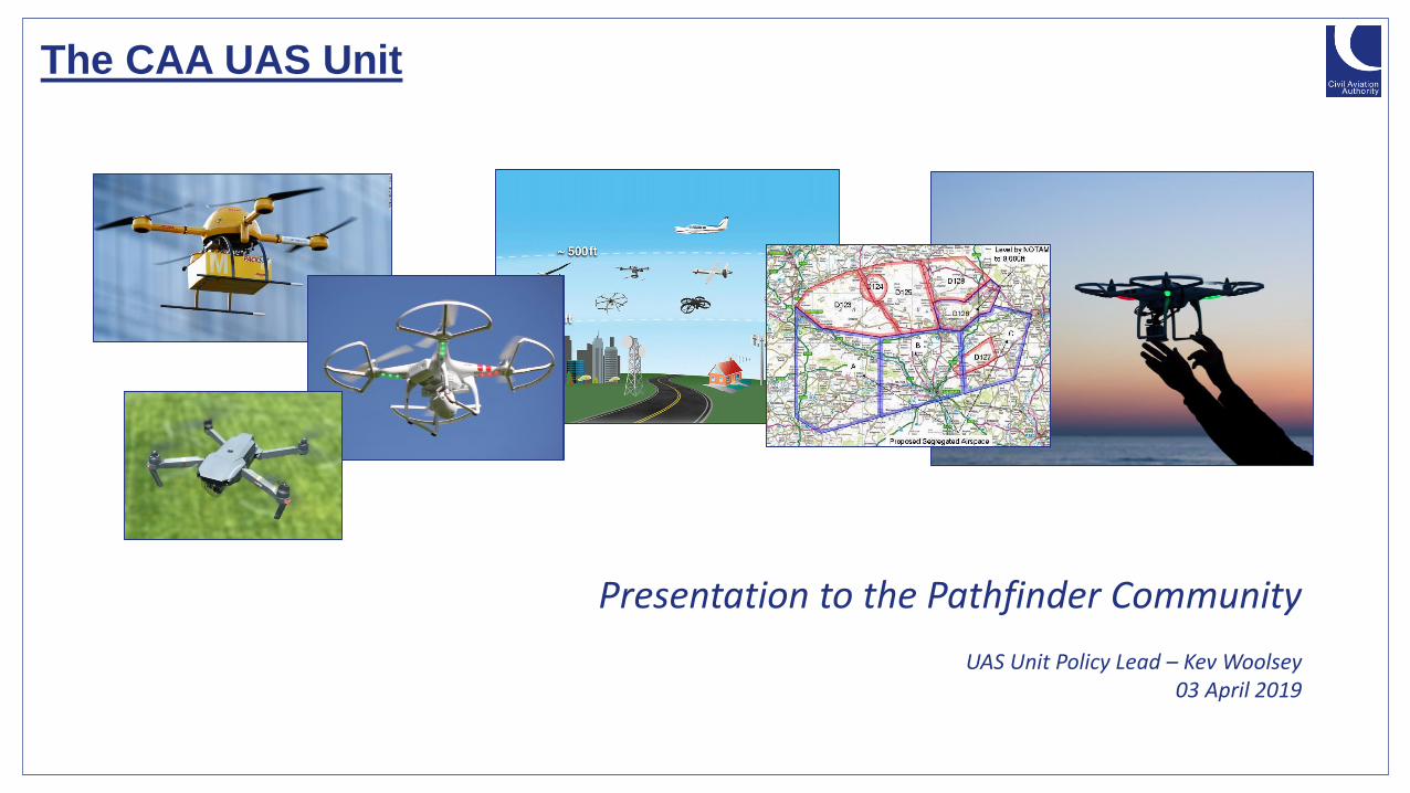
The CAA UAS Unit
Presentation to the Pathfinder Community
UAS Unit Policy Lead – Kev Woolsey03 April 2019

What does UAS mean?
A small unmanned aircraft is..
“Any unmanned aircraft, other than a balloon or a kite, having a mass of not more than 20kg without its fuel but including any articles or equipment installed or attached at the commencement of its flight” Schedule 1 Air Navigation Order 2016
but, there are bigger ones…
..and they are all still aircraft. They are just piloted differently

UAS Unit remit
Remit:
To manage applications from UAS operators for complex Operational Safety Cases (OSCs); to manage applications
from National Qualified Entities (NQEs) who assess competency of less complex UAS permissions; manage
enforcement efforts and run our oversight regime (Sector Team); to influence, write and mange new UAS
regulation (Policy Team) and to understand and mitigate UAS safety risks (Cross Team).

UAS Unit remit and organisation
UK Law
EU Law
InternationalLaw
(ICAO)
InternationalStandards
(EUROCAE)
InternationalGuidance/ Policy
(JARUS)
National Policy National Guidance
Permissions
Exemptions
Safety Notices
Information Notices
DfT
CAA
We:Influence decisions at International / EU level
Advise on National regulatory decisions
Actively manage stakeholders within our regulatory scope
Communicate with the public (Drone Code)
Regulate our regulated community (permissions/exemptions etc)

Activity since set up
Demand Turnaround times Backlog Size of the UAS Unit
How UAS was paid forOperator and NQE
FeedbackOversight Enforcement process
Project Chatham Electronic ConspicuityInternational policy
makingSafety Data

Activity since set up
Manage demandReduce turnaround
timesRemove backlog
Right size the UAS Unit
Use budget flexibilityRespond to Operator and NQE Feedback
Put in place oversight Enforcement process
Restart Project Chatham
Become part of Electronic Conspicuity
Prioritise international policy making
Start Safety Data Sharing meeting

The Policy Team and its work
• Policy Lead
• Operations Specialist
• Operations Specialist
• Airworthiness Specialist
• Airworthiness Specialist

The Policy Team and its work

The Policy Team and its work
• Low/no risk
• Basic ruleset
• Operator Registration & RP competency reqs
• No involvement of Aviation Authority
• Less than 25kg
• VLOS
• 120m (400ft) max ‘height’
• 3 x sub categories based on product standards(‘CE mark’)
OPEN
• Med/Special risk
• cannot comply with Open cat
• Operational authorisation
• based on safety risk assessment
SPECIFIC
• Same regulatory regime as manned aviation
• Competent Authority Certificates• Transport of people or
DG
• Intended flight over assemblies
• Risk ’too high’ for Specific cat
• Current ‘manned’ regs to be adapted for UAS
CERTIFIED
• Harmonised Rules
• Operationally centric
• Safety Risk based
EU UAS Regulation
• Pragmatic for UK to align
BREXIT ‘Agnostic’
Applicable in June 2020

The Sector Team and its work
• Sector Lead
• Sector Inspector
• Sector Inspector
• Sector Surveyor
• Sector Surveyor
• Sector Surveyor

Who we regulate

Sector Team work
• Hobbyist
• ANO articles 94 and 95
• Standard permission – Congested area / commercial
• Non-standard permission – BVLOS, EVLOS and reduced distances
• MOR data
• Work with manufacturers on safety
• Complexity triangles, EPT
• Human Factors
• DRES

Recent Events
• Gatwick/Heathrow/Birmingham
• Air Navigation Order Updates
• EU Regulation

Some Future Dates
• Share the Air – 27 June 2019
• EU Regulations• In force estimated June 2019
• Implemented 12 months later
• Drone Registration and Education Scheme - 30 Nov 2019

Innovation Tools
• Innovation Gateway (April 2019)• Encourage innovators to engage with the CAA
• Triage incoming queries
• Advocate innovation and economic growth
• Regulatory Sandbox• Test innovative solutions that don’t fit within current framework
• Maximise regulatory readiness of innovation
• Anticipate future innovation and manage future regulation
• Regulatory Lab• Longer term identify specific regulatory challenges to innovation

Questions

Open Access UTM Project
Edward AnastassacosUAS Systems Engineer

Heading UTM RESEARCH OBJECTIVES
• Understand what problems UTM will need to cope with
• Inform Government on potential UTM approaches to Architecture
• Roles and Responsibilities
• Communications
• Support industry to propose UTM Concept of Operations
• What are the major research areas within UTM for PHASE 2

ROLE OF THE TRANSPORT SYSTEMS CATAPULT
GROWING THE UK ECONOMY
COORDINATE WITH GOVERNMENT
COORDINATE WITH INDUSTRY
IDENITFY BARRIERS
UK INITIATIVES
UNLOCK CAPABILITIES
COMMERCIA-LISATION

PROGRAMME CONSORTIUM
COORDINATE WITH GOVERNMENT
COORDINATE WITH INDUSTRY

PRINCIPLES, CRITERIA1
UTM ARCHITECTURES, COMMUNICATION FRAMEWORK2
UTM SCENARIOS3
UTM OPERATION4
UTM KEY SERVICES5
OPEN ACCESS UTM - SUBJECT MATTERS

OPEN UTM - CRITERIA
• SAFETY
• SECURITY
• TRANSPARENCY
• FLEXIBILITY
• SCALABILITY

OPEN UTM - ARCHITECTURE
• UAS OPERATOR• UTM SERVICE PROVIDER• ATM• PUBLIC AUTHORITIES• OTHER SERVICES• UTM CORE SERVICE
• ROLES WITHIN UTM ARCHITECTURE

OPEN UTM - ARCHITECTURE
UTM SERVICE PROVIDER
• PROVIDES A DEGREE OF STRATEGIC, TACTICAL DECONFLICTION
• AS ASSUMED NECESSARY FOR SOME FUTURE BVLOS
• ENGAGES WITH AIRSPACE STAKEHOLDERS TO COORDINATE AIRSPACE USE
• IMPROVES SITUATIONAL AWARENESS
• IT IS NOT ABOUT SIMPLE DATA PROVISION

OPEN UTM - ARCHITECTURE
UTM CORE SERVICE
• MAJOR RESPONSIBILITIES• MAINTAIN UTM INFORMATION
REPOSITORIES:
• USER, VEHICLE REGISTRATION
• TFR REGISTRIES
• UTM SP AUTHORISATION
• UTM SP DISCOVERY
• ENCODE REGULATIONS

OPEN UTM - OPERATIONS
• NOMINAL, BASLINE OPERATIONAL PROCEDURE
• 3 STEP:• PRE-FLIGHT [CLICK]• IN-FLIGHT [CLICK]• POST-FLIGHT
• CONDUCT TYPICAL OPERATIONS
• APPLY A LAYER CONFLICT RESOLUTION FRAMEWORK

OPEN UTM - COMMUNICATIONS
• Communication Requirements• Cooperative UTM data exchange • General communication APIs• Dedicated APIs for other services• Builds on other initiatives around the
world
• Baseline API message specifications outlined
• Validate through Simulation and Trials

OPEN UTM - SCENARIOS
• SCENARIO GENERATION:
• CLASS OF OPERATIONS
• APPLY OPERATION INTERVENTION
• IMPLEMENT CORRESPONDING UTM DE-CONFLICTION
• COMBINATION OF ABOVE INSTANCES
# OPERATIONS DESCRIPTION
1VLOS operation in
uncontrolled airspace
A VLOS flight of a UAS is maintained within 500m from the operator, and below
400ft. Operators seeking to conduct VLOS flights are not required to seek …
2VLOS operation in
controlled airspace
A VLOS flight within the boundaries of controlled airspace. The operator
(potentially through the UTM Service Provider) is expected to engage with …
3BVLOS operation in
uncontrolled airspace
This use-case considers BVLOS flight in uncontrolled airspace, not near an
airport and are limited to flight below 400ft. BVLOS operators are assumed …
4BVLOS operation in
controlled airspace
This use-case considers BVLOS flight in uncontrolled airspace, not near an
airport and are limited to flight below 400ft. As with #3, BVLOS operators …
# INTERVENTIONS DESCRIPTION QUESTIONS
1
In-flight conflict with
dynamic geo-
fence/exclusion zone
• TFRs are dynamically applied within
the area of operation …
• What happens to UAS in-flight,
external to exclusion zone?
• …
2De-confliction with Blue-
Lights services
BL Helicopter flies through airspace
occupied by UAS. Airspace must…
• How is emergency protocol
implemented?
• …
3UAS Conflict with Non-
Cooperative UAS
A non-cooperative UAS is detected
and determined to be operating …
• How is information of non-
cooperative UAS communicated
across the UTM …
4Flight path conflict between
cooperative UAS
In some circumstances, cooperative
UAS flight paths may interfere. …
• How is tactical deconfliction by UTM
Service Providers managed?
• …
5 … … • …

OPEN UTM - SCENARIOS
• SCENARIO GENERATION:
• CLASS OF OPERATIONS
• APPLY OPERATION INTERVENTION
• IMPLEMENT CORRESPONDING UTM DE-CONFLICTION
• COMBINATION OF ABOVE INSTANCES
# DESCRIPTION OBJECTIVES OPERATIONS INTERVENTIONS
A
Multiple UAS operations in uncontrolled and
controlled airspace. Each UTM Service
Provider will manage multiple instances of
VLOS and BVLOS operations in
uncontrolled airspace.
Note: Coordination with ATC does not mean
ATC intervention
• Demonstrate inter-UTM
negotiation for strategic airspace
deconfliction
• Demonstrate engagement and
airspace coordination with ATC
• Multiple
operations of type
#1
• Multiple
operations of type
#3
• Intervention #4
B
Multiple UAS operations in uncontrolled and
controlled airspace with ATC coordination to
manage airspace deconfliction with high-
priority emergency services - i.e. helicopter
intersecting flight paths and operating areas
of Scenario A.
An exclusion zone is established around the
site of an incident, where the helicopter can
approach and land before departing.
• Demonstrate inter-UTM
negotiation for strategic airspace
deconfliction
• Demonstrate engagement and
airspace coordination with ATC
• Demonstrate how authorities
might insert exclusion zones, and
appropriate information is
disseminated through the UTM
network.
• Multiple
operations of type
#1
• Multiple
operations of type
#3
• Intervention #1
• Intervention #2
• Intervention #4
• Intervention #10
• Intervention #10
C
Multiple UAS operations in uncontrolled and
controlled airspace with ATC coordination to
manage airspace deconfliction. Lost control
and communication with UAS, requiring
action to mitigate risk to other cooperative
airspace users.
• Demonstration inter-UTM
negotiation for strategic airspace
deconfliction
• Demonstration inter-UTM
negotiation for tactical airspace
deconfliction
• Demonstration engagement and
airspace coordination with ATC
• Multiple
operations of type
#1
• Multiple
operations of type
#3
• Intervention #2
• Intervention #5
• Intervention #6
• Intervention #7
• Intervention #10

OPEN UTM - KEY SERVICES, CONSIDERATIONS
• PERMISSIONS MANAGEMENT• CONTROLLED AIRSPACE• UNCONTROLLED AIRSPACE• ATM INTERFACE• RISK MITIGATION
• DYNAMIC TFRs -> UVRs• WHO CAN ISSUE?• HOW ARE THEY ISSUED?
• UTM SERVICE DISCOVERY• PROCESS, METHODOLOGY• CONTROL HANDOVER
• INTER-UTMSP NEGOTIATION• FLIGHT/AIRSPACE PRIORITISATION• FLIGHT PLAN NEGOTIATION• LOCAL UTM NETWORK (LUN)
• FLIGHT PLANNING AND REALTIME TELEMETRY
• FLIGHT NOTICE BOARD METHODOLOGY• TELEMETRY BROADCAST
REQUIREMENTS

NEXT STEPS
• RELEASE OPEN UTM WHITEPAPER
• VALIDATION OF FINDINGS THROUGH SIMULATION
• DEVELOPMENT OF:
• CONFLICT MANAGEMENT FRAMEWORK
• OPERATIONAL FRAMEWORK
• DYNAMIC AIRSPACE MANAGEMENT
• TRIALS AND DEMONSTRATIONS

End
Edward AnastassacosSystems Engineer, Transport Systems Catapult

Challenges & PrioritiesJames Bell

08 April 2019
Pathfinders: The Need For Change
43
Transparency & collaboration
Clearer, more defined goals
Clear criteria for projects and outcomes
Articulation of the benefits

08 April 2019
Building Foundations: Governance Framework
44
✓ Clear programme vision, mission and methodology
✓ Clarity on the organisation & governance
✓ Articulates the benefits of the programme to UK plc
✓ … and the benefits of being a Pathfinder Project
✓ Clear criteria for becoming and remaining a PF Project
✓ Prioritised Programme “Challenges”: Driving forward progress

08 April 2019
The Pathfinder Framework
45
PATHFINDER FRAMEWORK
BENEFITS CRITERIA
CONTEXT VISION METHOD
Pathfinder
Framework
introduced in Nov
18.
Providing a structure
for collaboration
and sharing to
support the UK.
Benefits of
Pathfinder…
- To participant
projects.
- To the
community.
- To the UK.
Criteria by which
new projects are
gauged and
existing projects
are monitored.
To ensure fair
access, clear
justifications, as
well as ensuring
positive progress
towards the
vision.

08 April 2019
The Pathfinder Framework
46
PATHFINDER FRAMEWORK
BENEFITS CRITERIA
CONTEXT VISION METHOD
CHALLENGES
We identified the
need to prioritise
and articulate the
key hurdles or
challenges faced in
bringing a BVLOS
drone service to
market.
Necessary to
support the rest of
the Framework, and
to provide direction
and drive for the
programme.
It is intended that the
Challenges will
adapt in response to
safety and regulatory
requirements;
changing demands
in the market; or new
strategic direction.

08 April 2019
The Pathfinder Framework
47
PATHFINDER FRAMEWORK
BENEFITS CRITERIA
CONTEXT VISION METHOD
CHALLENGES
PATHFINDER CHARTER
End-User ClientDrone solution
provider
Local
Authorities
Other
RegulatorsAssociations
System
integrator
Connecting the solution
with the end-user to
reach both a viable
service for the customer
and a new opportunity
for the UK
A Pathfinder Charter,
mutually agreed for
each project, setting
out the intentions and
expectations.

08 April 2019
The Pathfinder Challenges
Articulating the challenges
faced in bringing a new BVLOS
drone-based service to market
in the UK.
But first… a reminder

08 April 2019
Objective 1
ROUTINE BVLOS operations
in UNSEGREGATED airspace

08 April 2019
Objective 2
Enabling operations
with CROSS-CUTTING applicability

08 April 2019
Objective 3
Enabling
SAFE,
SECURE &
SUSTAINABLE
operations

08 April 2019
Quick Caveats
The Pathfinder Challenges…
✓ Are not exhaustive (majority for the majority)
✓ Highest priority, with the biggest impact
✓ Collated from input
… Government
… CAA
… Industry
… Academia
Continued input required

CO
MM
UN
ICA
TIO
N
RF spectrum access & risks Access to/requirements for robust RF spectrum - Is there a case for establishing the threats to command and control link performance on
ISM bands? Do these threats justify seeking alternative spectrum or alternative methods for improving robustness?
Command and control range
capabilitiesIs there a case for establishing control link performance and limitations for systems based on COTS devices? Do practical, economical
methods exist for extending command and control link range for BVLOS operations?
Understanding of the BVLOS operating
environment not visible to the remote
pilot
How should this information be presented to the remote pilot/autonomous sUAS? Is there a case for setting minimum requirements in terms
of the information presented to and used by the remote pilot? terrain, weather, other airspace users, airspace restrictions, etc
Robustness of the Comms linkIs there a case for establishing interference level thresholds for command and control link performance on ISM bands? Do these threats
justify seeking alternative spectrum or alternative methods for improving interference tolerance?
External limiting factorsIf RF spectrum proves to be a limiting factor to sUAS functionality, what Is the trajectory needed to build in appropriate levels of automation
onboard the sUAS?
NA
VIG
AT
ION Reliance on GNSS
GPS/GNSS is heavily relied upon for positioning, but is susceptible to service interruption through jamming, spoofing and interference. Is
there scope for exploring alternative methods of navigation capability such as radio positioning services (cellular communications), signals of
opportunity (cell towers, radio/TV broadcast signals) etc?
Radio positioning service capabilities Are current networks sufficiently resilient and have appropriate levels of performance and what are the risks and barriers to implementation?
Geofencing and geo-awareness
capabilities
What is acceptable in terms of positioning performance and availability? Can it be met by current COTS GNSS receivers and are back-up
solutions capable of achieving it? Enhancements to the GNSS capabilities - Is there a case for requiring multi-constellation or augmented
GNSS systems for BVLOS operations to maintain system availability? How can current GNSS be made more robust and less susceptible to
jamming, spoofing and interference?
SU
RV
EIL
LA
NC
E Non-cooperative surveillanceThis has advantages in terms of sUAS operator burden and cost and impact on the current aviation system but has operational
disadvantages in terms of UA visibility. Can Non-cooperative surveillance provide an effective safety net for BVLOS operations?
Management of unmanned trafficHow can other airspace users be detected and information on them be presented to remote pilots in a manner that does not require
cooperative surveillance or impact the current aviation system?
Providing the airspace pictureHow can this be made available to a number of airspace participants to provide a useful level of situational awareness and in which
environments should this be considered a requirement? What information needs to be displayed by the drone to enable target depiction? How
can interoperability of different information gathering tools be assured?
Topographic IntelligenceHow can topographic features such as hazardous terrain be added to produce a 3D airspace picture? How can this information be integrated
with the communication and navigation aspects?
Safety Challenges v1

Operational Challenges v1
Long Linear BVLOS
in Rural / Remote / Low Population
Large Area Surveys
in Rural / Remote / Low Population
Urban BVLOS*
One-to-Many
Drones
Robust, Resilient, Redundant
*…think different!

08 April 2019
The Pathfinder Challenges: The Approach
55

08 April 2019
The Pathfinder Challenges: The Approach
56
* All ✓s are illustrative
OUTPUTS include…
5) Technical standards
6) Technical solutions
7) Technical mitigations
With a research focus
Cross-cutting
Applicable across
multiple categories of
operation
Blockers to routine,
unsegregated
e.g.
Reliance on GPS
Detect & Avoid

08 April 2019
The Pathfinder Challenges: The Approach
57
* All ✓s are illustrative
OUTPUTS include…
1) Standard scenarios
2) CONOPs
3) Operational mitigations
with a commercial focus

08 April 2019
The Pathfinder Challenges: The Approach
58
* All ✓s are illustrative
Information at the
intersections
between Safety &
Operational
challenges Post-Test
Pre-Test

08 April 2019
Next Steps
Feedback on the Approach, the Safety and
Operational Challenges
Set up the mechanisms (database,
assessments, etc)
Open to new projects
59

COFFEE 15 mins

Industry Presentations….

Unmanned Integration CONOPS
Brent Day, Trax International


BEYOND THE HORIZON REMOTE OFFSHORE INSPECTION
82

PROBLEM
Unmanned aviation services offer reduction in cost and risk for all three
OUR CUSTOMERS NEED THREE BROAD CATEGORIES OF REMOTE SERVICES
VISUAL
INSPECTION
GAS
DETECTIONDELIVERY
83

OUR FOCUS
Existing solutions are cost-prohibitive and existing regulations currently exclude routine BVLOS operations
WE HAVE FOCUSED OUR DEVELOPMENT AROUND THREE DISTINCT PRINCIPLES
LOW COST BVLOS SERVICE
84

CURRENT OPERATIONCURRENT SYSTEM ENABLES DELIVERY OF A
COMMERCIAL SERVICE AT ACCESSIBLE PRICE POINT
85

CHALLENGES
86
LOCAL OPERATING PROCEDURES
STANDARD OPERATING PROCEDURES
LIAISON WITH SEARCH AND RESCUE
HAZID
OBTAINING A CAA LICENSE
RISK ASSESSMENT
SAFETY CASE
LIAISON WITH ATC
LIAISON WITH LOCAL SCHOOLS

OPERATIONS TODAY
We currently have permissions from
the CAA for operations in the
North Sea, Aberporth,
Aberdeen and the Solent.
87

We are working on a collaborative project with OGTC, NATS and Total to open airspace in the North Sea
Underpinned by commercial contracts with a range of blue chip companies

If I have seen further, it is only by standing on the shoulders of giants.
-Isaac Newton-

How can we help you?
How can we work together to secure a future where UAVs are
able to operate routinely?

BEYOND THE HORIZON REMOTE OFFSHORE INSPECTION
91

OUR TEAM

REMOVING PEOPLE FROM HARM & TRANSFORMING
DATA ACQUISITION

COLLABORATIVE OBJECTIVES
Going Beyond Visual Line of Sight

ALIGNING REQUIREMENTS
• All sectors looking to perform long linear surface, perimeter and asset inspections as well as incident response
• Overlapping airspace interests where Road, Rail and Airports intersect
• Desire for scalable and open architecture solutions
• High focus on proving safe operations, and in turn use safe drone operations to increase employee and public safety

CAPABILITY APPROACH
• System as a Service by combining discriminatory capabilities
• Open architecture and ability to integrate with existing and developing systems
• Platform and payload agnostic
• AMEY ensuring data capture and analysis meet the sector needs
• AMEY/VTOL developing a drone platform and payloads
• Collins Aerospace providing the required operational infrastructure including UTM, C2 and Virtual Environment
• Partnering to fill the gaps…

• Working closely with the end user to
identify their data acquisition needs
• Simulating the use cases in our virtual
environment to plan and validate the
operations and develop the safety
case
• Developing a series of capability
pilots to phase in services gradually
as the appetite increases
USE CASE DEVELOPMENT

SIMULATION FIRST

LAYERED COMMSAND PAYLOAD LINKS
• CNPC – 1Ghz and 5Ghz Variants
• 4G – Public and Private
• SATCOM
• Wireless (2.4Ghz)
• Wired/Tethered
• Combinations
Designed to suit the use case and environment requirements
Augmenting existing infrastructures where possible

DATA ANALYTICS AND EXPLOITATION

NETWORKING LUNCH
& CHALLENGES WHITE BOARDS