Participatory 3-Dimensional Mapping (P3DM) for …€¢It is widely acknowledged that disaster risk...
18
Participatory 3-Dimensional Mapping (P3DM) for Disaster Risk Reduction JC Gaillard Université de Grenoble – France University of the Philippines Diliman Jake Rom D. Cadag Université de Montpellier, France and University of the Philippines Diliman Leigh G. Lingad & Emmanuel A. Maceda University of the Philippines Diliman Ryan Christopher P. Viado Department of Science and Technology, Philippines and University of the Philippines Diliman
Transcript of Participatory 3-Dimensional Mapping (P3DM) for …€¢It is widely acknowledged that disaster risk...
Participatory 3-Dimensional Mapping (P3DM)
for Disaster Risk Reduction
JC GaillardUniversité de Grenoble – France
University of the Philippines Diliman
Jake Rom D. CadagUniversité de Montpellier, France
and
University of the Philippines Diliman
Leigh G. Lingad & Emmanuel A. MacedaUniversity of the Philippines Diliman
Ryan Christopher P. ViadoDepartment of Science and Technology,
Philippines
and
University of the Philippines Diliman
• Therefore DRR should involve a large array of stakeholders, including local communities, NGOs, local and national governments, scientists, school communities, faith groups, private sector institutions, etc.
• It is widely acknowledged that disaster risk reduction (DRR) should be community-based.
Community-Based Disaster Risk Reduction
• CBDRR should integrate both bottom-up and top-down actions as well as indigenous and outsiders’ knowledge.
• CBDRR often limits to local communities and NGOs partners.
How do we foster dialogue among those stakeholders?
• Scientists often dismiss indigenous knowledge.
• Local governments are often enclosed within top-down and command-and-control national disaster management frameworks which give them little freedom for alternative initiatives.
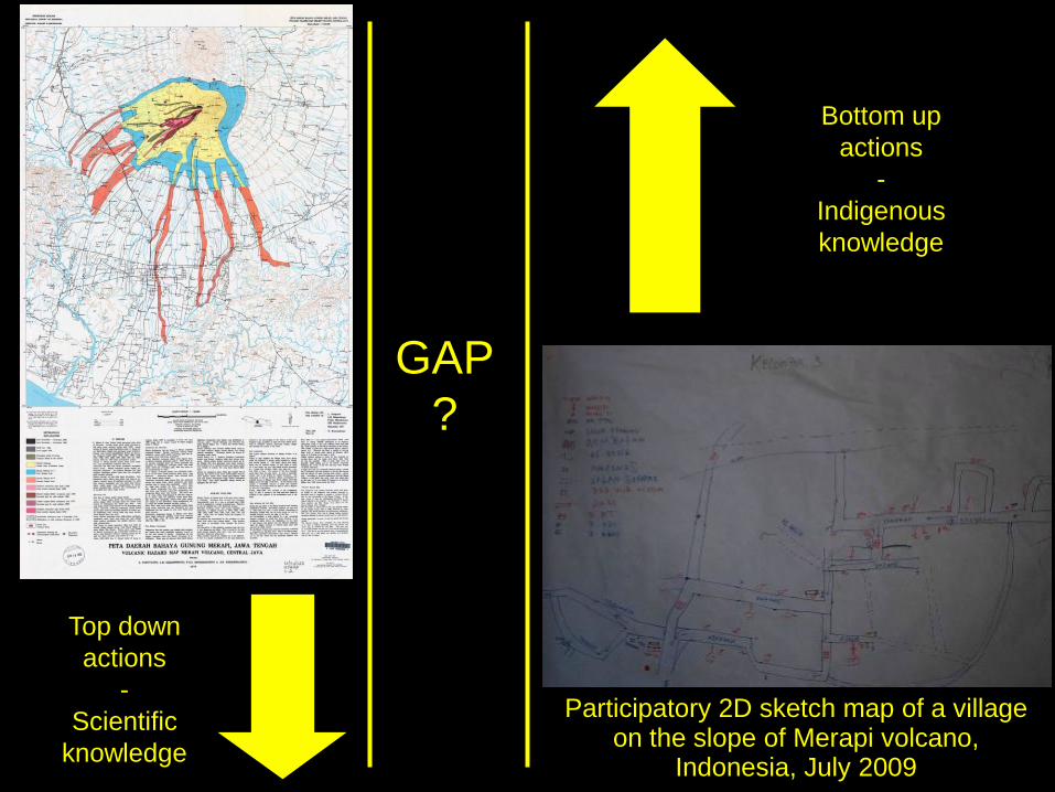
Participatory 2D sketch map of a village on the slope of Merapi volcano,
Indonesia, July 2009
GAP
?
Top down
actions
-
Scientific
knowledge
Bottom up
actions
-
Indigenous
knowledge
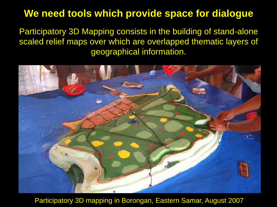
Participatory 3D Mapping consists in the building of stand-alone
scaled relief maps over which are overlapped thematic layers of
geographical information.
Participatory 3D mapping in Borongan, Eastern Samar, August 2007
We need tools which provide space for dialogue
Participatory 3D mapping in Masantol, Pampanga, August 2008
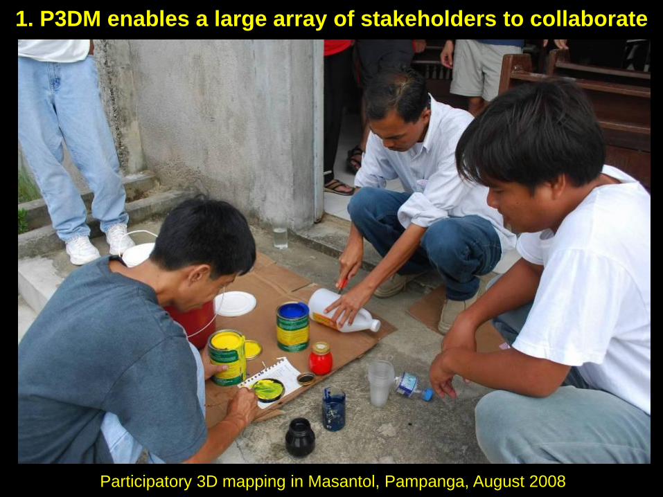
1. P3DM enables a large array of stakeholders to collaborate
Participatory 3D mapping in Masantol, Pampanga, August 2008
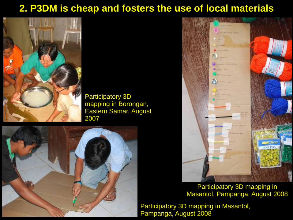
Participatory 3D mapping in Masantol, Pampanga, August 2008
Participatory 3D mapping in Borongan, Eastern Samar, August 2007
2. P3DM is cheap and fosters the use of local materials
Participatory 3D mapping in Borongan, Eastern Samar, August 2007
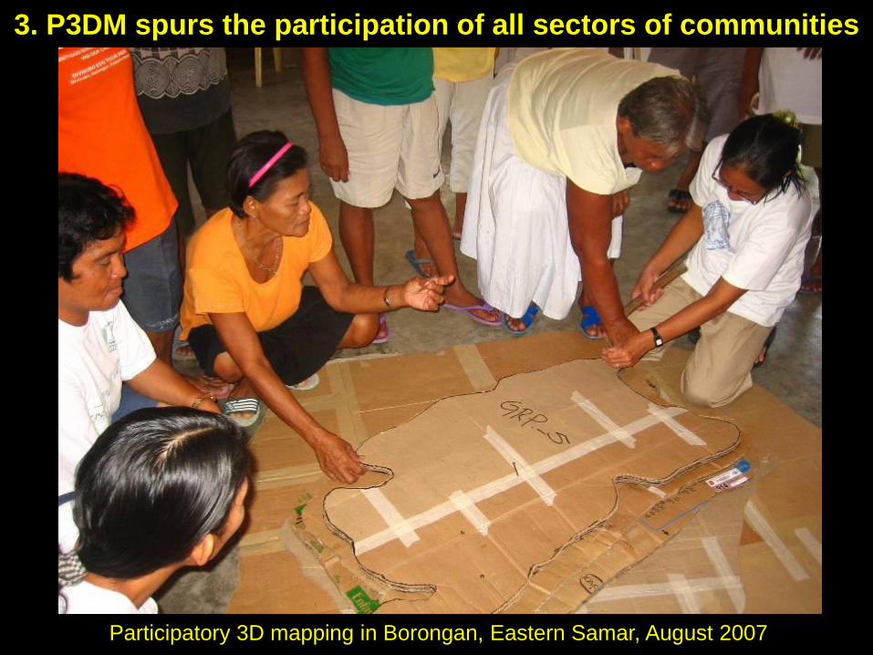
3. P3DM spurs the participation of all sectors of communities
Participatory 3D mapping in Borongan, Eastern Samar, August 2007
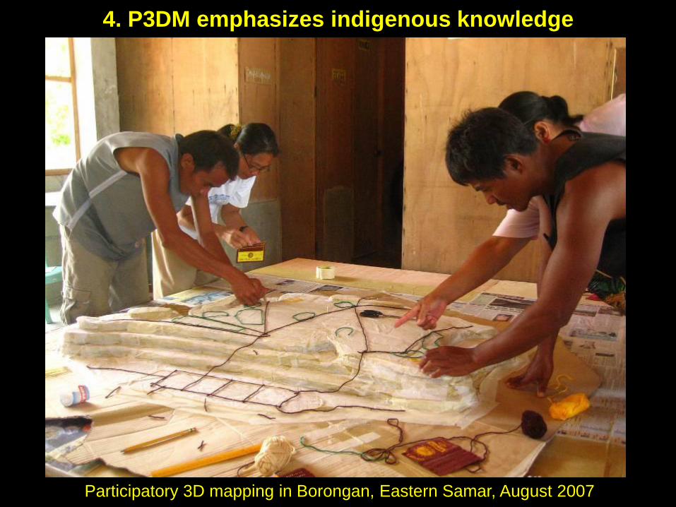
4. P3DM emphasizes indigenous knowledge
Participatory 3D mapping in Borongan, Eastern Samar, August 2007
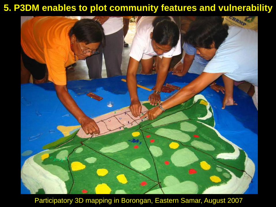
5. P3DM enables to plot community features and vulnerability
Participatory 3D mapping in Masantol, Pampanga, August 2008
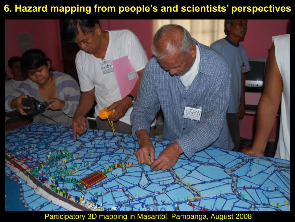
6. Hazard mapping from people’s and scientists’ perspectives

Participatory 3D mapping in Dagupan, Pangasinan, July 2009
7. P3DM increases people’s perception of their vulnerability
Boat
Children
Flood marker
Karabaw
Pregnant
woman
Elderly
Disabled
Regular vehicle
Semi-concrete
house w/ 3
people
Vehicle
for evac.
Light house w/ employees
Pick-up point
Evacuation center
Host family
Fire
hydrant
Resto
Sari-sari
store
Concrete
house
Water
pump
Waiting
shedHealth
center
Day
care
Disabled
Area highly
flooded
Area moderately
flooded
Elec.
line
Court
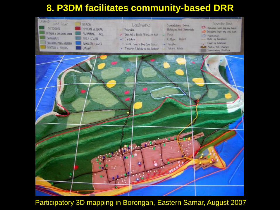
Participatory 3D mapping in Borongan, Eastern Samar, August 2007
8. P3DM facilitates community-based DRR
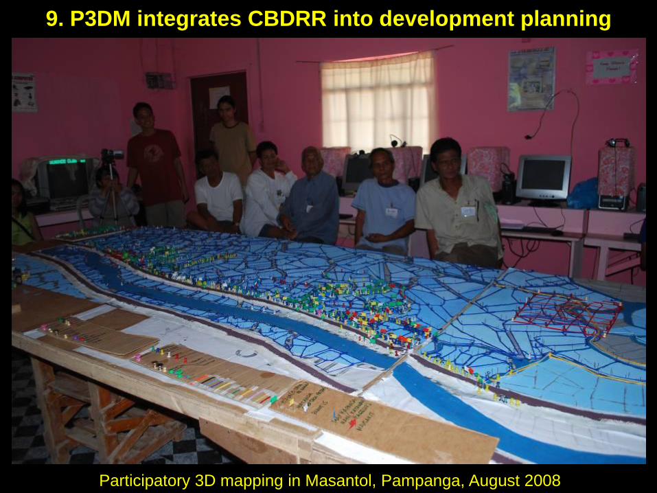
9. P3DM integrates CBDRR into development planning
Participatory 3D mapping in Masantol, Pampanga, August 2008
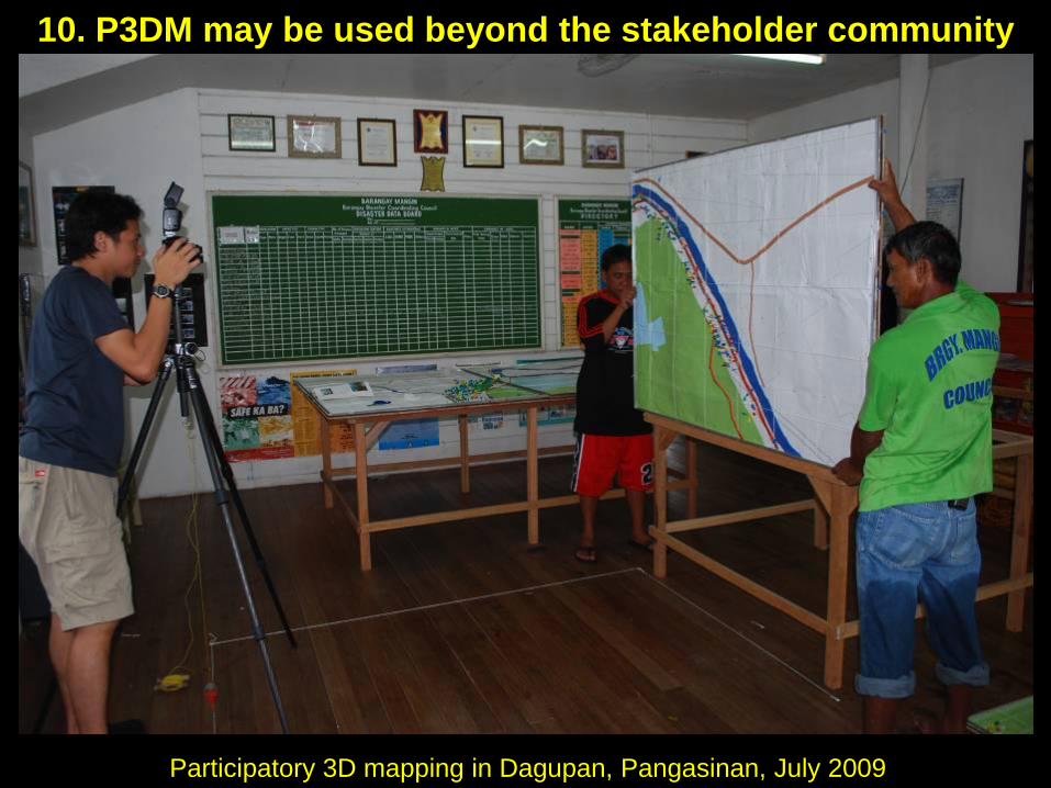
10. P3DM may be used beyond the stakeholder community
Participatory 3D mapping in Dagupan, Pangasinan, July 2009
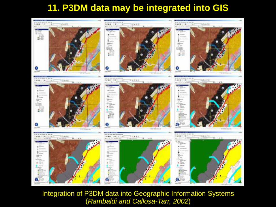
Integration of P3DM data into Geographic Information Systems(Rambaldi and Callosa-Tarr, 2002)
11. P3DM data may be integrated into GIS

Conclusions
• P3DM is a tool which cannot stand alone. It should be combined with other tools common to vulnerability and capacities analysis (VCA) and participatory and learning actions (PLA).
• P3DM only partially covers social vulnerability / capacities and better applies to physical vulnerability / capacities.
• Variation of vulnerability and capacities in time (especially on the short term) according to population mobility, is another issue still to be addressed on the maps.
• P3DM is also highly dependent on the scale chosen for the map and thus on the space for storing it.
• Better sustainability is achieved when monitoring and upgrading of the map rely on the long-term implication of mapping facilitators from local NGOs or governments.
The end!
Thank you very much!