PART A - PROPONENT AND PROPOSAL INFORMATION · PART A - PROPONENT AND PROPOSAL INFORMATION (All...
27
Transcript of PART A - PROPONENT AND PROPOSAL INFORMATION · PART A - PROPONENT AND PROPOSAL INFORMATION (All...


3
PART A - PROPONENT AND PROPOSAL INFORMATION (All fields of Part A must be completed for this document to be treated as a referral)
1 PROPONENT AND PROPOSAL INFORMATION
1.1 Proponent
Name
Water Corporation
Joint Venture parties (if applicable)
None
Australian Company Number (if applicable)
ABN 28 003 434 917
Postal Address (where the proponent is a corporation or an association of persons, whether incorporated or not, the postal address is that of the principal place of business or of the principal office in the State)
PO Box 100 LEEDERVILLE WA 6902
Key proponent contact for the proposal:
name
address
phone
Rupert Duckworth As above 9420 3069 [email protected]
Consultant for the proposal (if applicable):
name
address
phone
Not applicable
1.2 Proposal
Title Millstream - Greenbushes Water Supply Link C-W00050
Description The proposal is to construct and operate:
A connection to the existing Millstream to Greenbushes pipeline near Camp Brook in the locality of Southampton;
16km of buried pipeline from Camp Brook across the Blackwood River and then via Huitson Rd and Maranup Ford Rd to Greenbushes;
The Blackwood River will be crossed by Horizontal Directional Drilling near Camp Brook;
A pump station in Lot 1 on the east side of the Blackwood River (Southampton Rd Pump Station);

4
A radio repeater in Lot 11 on the high point above the pump station (Southampton Rd Repeater);
One and possibly two air cushions on a local high point within Lot 14 Huitson Rd;
A 1 ML concrete tank and pump station in Lot 802 (a recently acquired portion of former Lots 3457 and 12723) Maranup Ford Road (Raw Water Tank and Greenbushes Supply Pump Station);
A 1 ML concrete tank and associated works to integrate the new scheme with the existing water supply system located at George St in Greenbushes.
Extent (area) of proposed ground disturbance. 19.34 hectares
Timeframe in which the activity or development is proposed to occur (including start and finish dates where applicable).
Construction to begin in October 2013 and to be substantially completed by May 2015.
Details of any staging of the proposal. None
Is the proposal a strategic proposal? No
Is the proponent requesting a declaration that the proposal is a derived proposal? If so, provide the following information on the strategic assessment within which the referred proposal was identified:
title of the strategic assessment; and
Ministerial Statement number.
No
Please indicate whether, and in what way, the proposal is related to other proposals in the region.
This project forms part of the Bridgetown Regional Water Supply Scheme (BRWSS) which will supply water from Millstream Dam (with backup from Nannup Bore) to seven towns in the Shires of Donnybrook-Balingup, Bridgetown-Greenbushes and Boyup Brook. The Water Corporation has previously referred the following projects under Part IV of the EP Act, but the EPA determined not to assess them:
Nannup Bore
Nannup - Millstream Pipeline
Millstream Dam Raising

5
Does the proponent own the land on which the proposal is to be established? If not, what other arrangements have been established to access the land?
No. However the Corporation has obtained in-principle approval from all affected land owners to a program of (a) acquisition of land for pump stations, tanks & disinfection facilities and (b) acquisition of easements for the pipeline.
What is the current land use on the property, and the extent (area in hectares) of the property?
See table below for detailed description.
Shire of Donnybrook-Balingup
Road Reserve, Southampton Rd
Unsealed local road (road crossing near the intersection with Tuia Rd)
Lot 201 Private plantation/lifestyle block, through largely cleared area
UCL Blackwood River crossing. Riparian vegetation
Lot 1 Department of Environment and Conservation (DEC) pine plantation and cleared firebreaks
Lot 986 Firebreaks within DEC pine plantation
Unnamed Road Reserve Mainly used as a firebreak and access track for pine plantations either side
Shire of Bridgetown – Greenbushes
Lot 11 Firebreak within DEC pine plantation;
Unnamed Road Reserve Unsealed local road with cleared verge on south side
Lot 14 Firebreak within Private plantation;
Lot 6704 Firebreak within Private plantation;
Lot 2 Firebreak within Private plantation;
Lot 1739 Firebreak within Private plantation;
Lot 220 Firebreak within Private plantation;
Lot 2168 Firebreak within Private plantation;
Lot 11716 Firebreak within Private plantation;
Lot 802 Water Corporation freehold site (acquired from original Lots 12723 and 3457);
Lot 2750 Private plantation (future Lot 805, subdivision in progress);
Lot 12723 Private farmland (future Lot 804, subdivision in progress);
Lot 3457 Private farmland (future Lot 803, subdivision in progress);
Road Reserve/ State Forest 30
Road reserve and State forest;
Road Reserve/ State Forest 20
Road reserve and State forest;
Road Reserve/ State Forest 20
Previously rehabilitated forest, Mining lease (Talison Lithium)
Lot 375 UCL town site block;
Unallocated Crown Land (UCL)
Vacant land and closed roads, edge of town site;
Lot 188 Primary School – along the back boundary of the property, adjacent to Talison Lithium mine site;
Lot 339 Shire reserve;
Road Reserve Jephson Street;
Lot 231 Shire reserve (recreation);
Road Reserve George St and Stanifer St road reserves;
State Forest 20 State Forest;
6
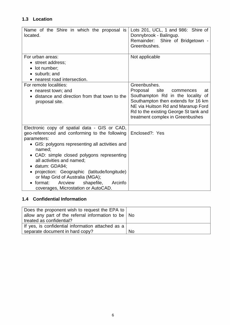
1.3 Location
Name of the Shire in which the proposal is located.
Lots 201, UCL, 1 and 986: Shire of Donnybrook - Balingup. Remainder: Shire of Bridgetown - Greenbushes.
For urban areas:
street address;
lot number;
suburb; and
nearest road intersection.
Not applicable
For remote localities:
nearest town; and
distance and direction from that town to the proposal site.
Greenbushes. Proposal site commences at Southampton Rd in the locality of Southampton then extends for 16 km NE via Huitson Rd and Maranup Ford Rd to the existing George St tank and treatment complex in Greenbushes
Electronic copy of spatial data - GIS or CAD, geo-referenced and conforming to the following parameters:
GIS: polygons representing all activities and named;
CAD: simple closed polygons representing all activities and named;
datum: GDA94;
projection: Geographic (latitude/longitude) or Map Grid of Australia (MGA);
format: Arcview shapefile, Arcinfo coverages, Microstation or AutoCAD.
Enclosed?: Yes
1.4 Confidential Information
Does the proponent wish to request the EPA to allow any part of the referral information to be treated as confidential?
No
If yes, is confidential information attached as a separate document in hard copy?
No

7
1.5 Government Approvals
Is rezoning of any land required before the proposal can be implemented? If yes, please provide details.
No – Proposed scheme is a permitted use under the Local Town Planning Scheme. The Shires of Donnybrook Balingup, and Bridgetown Greenbushes provided written in principle approval on 26 Mar and 28 Apr 2010 respectively.
Is approval required from any Commonwealth or State Government agency or Local Authority for any part of the proposal? If yes, please complete the table below.
Yes
Agency/Authority Approval required Application lodged Yes / No
Agency/Local Authority contact(s) for proposal
Federal Department of Sustainability, Environment, Water, Population and Communities
For removing Black Cockatoo habitat
Yes. Determined as “Not Controlled Action", EPBC ref: 2012/6632 dated 18 Dec 2012.
Allira Hunnemann
Conservation Commission
Vesting authority for Greenbushes and Hester State Forests
Briefed in July 2010. In principle approval letter provided 02 Dec 2012.
Gordon Graham
Department of Environment & Conservation (DEC)
Clearing of native vegetation, management of dieback, Construction Environmental Management Plan for works in DEC managed lands
Briefed in 2010. In principle approval letter ref: 2008/00268 provided 02 Feb 2010. CEMP will be referred to DEC for approval, prior to works commencing.
Jeremy Chick DEC Blackwood District
Department of Water (DoW)
Bed and Banks permit is required for the crossing of the Blackwood River by horizontal directional drilling.
DoW has been briefed and an application will be lodged in parallel with this referral.
Steve De Munck DoW Manjimup District
Minister for Aboriginal Heritage
Approval to use the land containing aboriginal heritage sites, for the construction and maintenance of a pipeline and associated infrastructure.
Yes. The Minister has approved the application.
Sally McGann, DIA senior heritage Officer

8
PART B - ENVIRONMENTAL IMPACTS AND PROPOSED MANAGEMENT
2. ENVIRONMENTAL IMPACTS
Describe the impacts of the proposal on the following elements of the environment, by answering the questions contained in Sections 2.1-2.11:
2.1 flora and vegetation;
2.2 fauna;
2.3 rivers, creeks, wetlands and estuaries;
2.4 significant areas and/ or land features;
2.5 coastal zone areas;
2.6 marine areas and biota;
2.7 water supply and drainage catchments;
2.8 pollution;
2.9 greenhouse gas emissions;
2.10 contamination; and
2.11 social surroundings.
These features should be shown on the site plan, where appropriate.
For all information, please indicate:
(a) the source of the information; and
(b) the currency of the information.
2.1 Flora and Vegetation
2.1.1 Do you propose to clear any native flora and vegetation as a part of this proposal?
(please tick) Yes If yes, complete the rest of this section.
No If no, go to the next section
2.1.2 How much vegetation are you proposing to clear (in hectares)?
A total of 5.93 Ha of native vegetation will be cleared for the construction works.
The project requires a minor area of 5.29 ha of Jarrah Marri forest to be cleared, which is recognised as providing foraging and potentially roosting and breeding habitat for the three species of conservation significant Black Cockatoos. The area of native forest vegetation to be cleared consists of
4.65 ha of intact Jarrah Marri forest located along the edge of Maranup Ford Road and at the George St tank site;
an estimated area of 0.64 ha of individual and clusters of Jarrah/Marri trees contained within the area mapped as “Planted” species, located along Maranup Ford Road adjacent to the Talison mine. This area has been historically revegetated by infill planting mostly with exotic and non-indigenous species, such as Black Wattle; and
0.64 ha of degraded riparian vegetation to accommodate the horizontal directional drilling under the Blackwood River. This vegetation comprises an overstorey of Eucalyptus Rudis Subspecies cratyantha (Priority 4) (see section

9
2.1.6) and an understorey of weeds, predominantly the Declared weed Blackberry. This area has been burnt in the recent catastrophic bushfire.
2.1.3 Have you submitted an application to clear native vegetation to the DEC (unless you are exempt from such a requirement)?
Yes X No If yes, on what date and to which office was the application submitted of the DEC?
The Water Corporation will assess and manage the required clearing under its Statewide Purpose Clearing Permit for Project Activities (CPS 185/3) and discuss the project with the DEC to agree and finalise any offsets, if required.
2.1.4 Are you aware of any recent flora surveys carried out over the area to be disturbed
by this proposal?
Yes No If yes, please attach a copy of any related survey reports and provide the date and name of persons / companies involved in the survey(s).
If no, please do not arrange to have any biological surveys conducted prior to consulting with the DEC.
AECOM (2010) undertook a Level 2 Flora and Level 1 Fauna survey of a 20 m corridor along the preliminary project alignment, incorporating a survey of trees potentially suitable for nesting by Black Cockatoos and Western Ringtail Possums. Field work was carried out in Spring 2009 and the report dated April 2010 is appended.
ENV (2011) undertook a Level 2 Flora and Level 1 Fauna survey of the 10 m final, revised construction corridor, incorporating a survey of trees potentially suitable for nesting by Black Cockatoos and Western Ringtail Possums. Field work was carried out in Spring 2011 and the report dated December 2011 is appended.
2.1.5 Has a search of DEC records for known occurrences of rare or priority flora or
threatened ecological communities been conducted for the site?
Yes No If you are proposing to clear native vegetation for any part of your proposal, a search of DEC records of known occurrences of rare or priority flora and threatened ecological communities will be required. Please contact DEC for more information.
No species listed under the EPBC Act or gazetted as Threatened flora under the Wildlife Conservation Act have been previously recorded on the project area. In addition no species listed as Priority Flora by the DEC have been previously recorded in the project area (AECOM, 2010; ENV 2011). 2.1.6 Are there any known occurrences of rare or priority flora or threatened ecological
communities on the site?

10
Yes X No If yes, please indicate which species or communities are involved and provide copies of any correspondence with DEC regarding these matters.
No Threatened species pursuant to the EPBC Act and/or gazetted as Threatened (DRF) pursuant to the WC Act were recorded in the study area during the survey by ENV (2011). One Threatened (Declared Rare Flora) taxa (Caladenia harringtoniae) occurs within 10 km of the study area. The species is found in low-lying swampy areas or near granite (WAH 2011). The study area contained only a small area of suitable habitat for Caladenia harringtoniae along Maranup Ford Road; however, the area was highly degraded and the species was not recorded. This species flowers between October and November and therefore would have been detected if it was present in the study area, as the biological survey was undertaken in late October 2011 (ENV, 2011). No vegetation analogous to any known Threatened Ecological Communities (TEC) or Priority Ecological Communities (PEC) was described from the project area (ENV, 2011). These findings by ENV (2011) are supported by the previous survey undertaken by AECOM (2010). AECOM (2010) did not record any Threatened species pursuant to the EPBC Act and/or gazetted as Threatened (DRF) pursuant to the WC Act, Priority Flora and TECs or PECs along the preliminary pipeline corridor route. One PEC does occur within approximately 40km of the study area (DEC 2011a): Blackwood Alluvial Flats (Priority 3). This PEC consists of six vegetation types:
woodlands and shrublands on the alluvial soils of the upper Blackwood River (Condinup and Darkan 5f soil-landscape sub-systems);
wet shrublands on alluvial clay flats;
Jarrah-Marri woodlands on alluvial grey-brown loams;
Wandoo woodlands on alluvial grey-brown clay-loams (includes vernal pools);
Flooded Gum-Wandoo woodland on alluvial grey clays (includes vernal pools); and
Wandoo woodlands on grey sandy-loams’ (DEC 2010).
No vegetation associations mapped in the project area are analogous to the PEC Blackwood Alluvial Flats (ENV, 2011). Flooded Gum (Eucalyptus rudis subsp. cratyantha) forms a vegetation association along the Blackwood River in the southern extremity of the project area, however, was not recorded in association with Wandoo (Eucalyptus wandoo). This area also lacked alluvial grey clays as the soil type required for the PEC (ENV, 2011). ENV (2011) recorded two Priority flora species in the survey area:
Tetratheca parvifolia (Priority 3) is a small shrub up to 0.3m with pink flowers in October and is found in Jarrah/Marri forest (WAH, 2011); and
Eucalyptus rudis subsp. cratyantha (Priority 4) is a large tree growing to 20 m with box-like bark and has white flowers during July-September. This subspecies differs from the typical species in having larger buds and fruits. It is often found growing near drainage lines on loan soils (WAH, 2011). A catastrophic bushfire in February 2013 has burnt much of the riparian area along the Blackwood River which contains this subspecies.

11
2.1.7 If located within the Perth Metropolitan Region, is the proposed development within or adjacent to a listed Bush Forever Site? (You will need to contact the Bush Forever Office, at the Department for Planning and Infrastructure)
Yes X No If yes, please indicate which Bush Forever Site is affected (site number and name of site where appropriate).
2.1.8 What is the condition of the vegetation at the site?
ENV (2011) undertook an assessment of vegetation condition of the survey area, which is summarised below:
Vegetation type Extent within footprint
(ha)
Percentage of
footprint %
Condition
Native forest vegetation 5.29 27.36 Very good to Excellent
Riparian vegetation 0.64 3.32 Degraded
Revegetation (in the vicinity of the Talison mine)
0.64 3.32 Degraded
Plantation 5.67 29.32
Completely degraded
Existing cleared areas and tracks 7.10 36.67 Cleared
ENV (2011) noted that the vegetation condition ranged from Completely Degraded to Excellent, with the majority of the vegetation in a Degraded condition. The proximity of vegetation to major roads, and the town of Greenbushes, historical vegetation clearing for firebreaks and tracks and the presence of some very aggressive weeds at high density had the greatest impact on the native vegetation.
Some areas of native vegetation have also been degraded by infestation with Phytophthora cinnamomi (Pc), Dieback disease. The construction footprint area was mapped by the DEC Forest Management Branch’s accredited dieback interpreters in August 2012. All previously disturbed areas were excluded from assessment, and the DEC recommends that these areas (comprising approximately two thirds of the total project construction corridor) be treated as ‘unprotectable’, due to the past disturbance, probably without hygiene measures and likely future disturbance again without hygiene measures.
The section of the construction corridor along Maranup Ford Road south of the Talison Mine, contains forest vegetation which has several patches of uninfested forest within the majority of the forest which is infested with Pc. This will require careful management to ensure that construction activities are not the vector for spread of the disease.
The dieback boundaries will be rechecked in August 2013 and a Hygiene Management Plan (HMP) will be agreed between the DEC and the Water Corporation at that time. The requirements of the HMP will be implemented during the construction project and incorporated in the project CEMP.
2.2 Fauna
2.2.1 Do you expect that any fauna or fauna habitat will be impacted by the proposal?
(please tick) Yes If yes, complete the rest of this section.
No If no, go to the next section.
2.2.2 Describe the nature and extent of the expected impact.

12
Impacts resulting from clearing of native vegetation
The assessment by ENV (2011), which is supported by the earlier assessment of a wider corridor by AECOM (2010), indicates that a narrow linear construction corridor of 10m will have negligible impact on conservation significant fauna which may be present in the area.
The project requires a very minor area of 5.29 ha of Jarrah Marri forest to be cleared, which is recognised as providing foraging and potentially roosting and breeding habitat for the three species of conservation significant Black Cockatoos. The area of native forest vegetation to be cleared consists of 4.65 ha of intact Jarrah Marri forest located along the edge of Maranup Ford Road and at the George St tank site; and an estimated area of 0.64 ha of individual and clustered Jarrah/Marri trees contained within the area mapped as “Planted” species, located along Maranup Ford Road adjacent to the Talison mine. This area has been historically revegetated by infill planting mostly with exotic and non-indigenous species, such as Black Wattle (ENV, 2011).
This clearing is unavoidable because the town of Greenbushes is surrounded by the Greenbushes and Hester State Forests. Locating the pipeline along Maranup Ford Road (which passes through the forest), is the alignment with least impact on the forest. However Jarrah/Marri Forest is widespread and common in the region, with approximately 200,000ha or 70% of Jarrah/Marri forest remaining (Shepherd et al. 2001). The conservation status of the forest vegetation type (Shepherd et al. 2001) recorded in the study area is considered to be of Least Concern. (DNRE 2002).
The impact of this clearing on Black Cockatoos will be negligible for the following reasons:
Clearing will be limited to 5.29 ha of native forest vegetation;
The area to be cleared represents less than 0.002% of the Jarrah/Marri forest remaining in the shires of Donnybrook/Balingup and Bridgetown/Greenbushes in which the project is located;
Clearing is only within a 10 m wide corridor and either along the edge of an existing sealed road or within a short distance of the road. This habitat is already fragmented, or subject to disturbance such as weeds and dieback disease;
The outer 2.5 m section of the 10 m pipeline construction corridor passing through the Jarrah/Marri forest will be allowed to revegetate naturally, resulting in regrowth of foraging species over time;
The clearing of native vegetation and the natural revegetation of part of the pipeline (above) will be sensitively managed through management measures detailed in the project Construction Environmental Management Plan (CEMP); and
ENV 2011 has determined that along the route only 8 trees with hollows suitable for nesting were recorded in the proposal area, but the survey did not record active breeding activities.
During the habitat assessment of the survey area, no individuals or signs of the Western Ringtail Possum were recorded. Western Ringtail Possum prefer areas that contain the coastal species Agonis flexuosa and this species was not present in the survey area (ENV, 2011).
The desktop assessment carried out for the 10m construction corridor indicated that several terrestrial fauna species are likely to utilise the area, including the Carpet Python, Western Quoll, Brush-tailed Phascogale, Numbat and the Western Brush Wallaby (ENV, 2011). However any disturbance associated with the clearing of a 10m wide construction corridor, and the subsequent construction activities, are unlikely to impact on these mobile, terrestrial fauna species in a local or regional context.

13
The Water Corporation has gone to considerable effort to avoid and minimise impacts to the natural environment and in particular to minimise clearing of native vegetation and subsequent impacts to Black Cockatoos and native fauna. It has routed the project footprint through cleared areas of private plantations or farmland wherever possible, and where that was not feasible it has chosen the lowest-impact areas along the edges of native forest that have already been impacted by infrastructure (roads, overhead power lines, mining tenements, etc). Clearing of some riparian vegetation along the Blackwood River is unavoidable, but the area has been minimised, and the vegetation is degraded, and has recently been burnt. Impacts resulting from the Blackwood River pipeline crossing Horizontal directional drilling (HDD) will be used to lay the pipeline under the Blackwood River. Upward leakage of drilling mud (predominantly highly dispersive bentonite clay) into the river is a known risk associated with HDDand has been assessed as a low risk to the environment for this project, due to the steep entry and exit angle to be deployed and the depth of the drill hole (6m) below the river bed. The impacts of drilling mud released into the river, would be a temporary increase in the turbidity of the river at the shallow crossing site and the immediate downstream section of the adjacent river pool (referred to as Southampton Pool). Known impacts of high turbidity on aquatic ecosystems include reduction in light penetration and photosynthesis, impairment of feeding activities, and in-filling of benthic habitats. Beatty et al (2013) conclude that while there is some potential for impacts to resident aquatic fauna associated with the construction phase, these were deemed to be manageable and they conclude that the proposed activities pose a negligible overall risk to the aquatic fauna in the Blackwood River as a whole and a minor risk to the biodiversity values within Southampton Pool. Beatty et al (2013) recommend management measures to manage the risk of drilling mud escape to the River, which will be included in the project Construction Environmental Management Plan (CEMP).
2.2.3 Are you aware of any recent fauna surveys carried out over the area to be disturbed by this proposal?
Yes No If yes, please attach a copy of any related survey reports and provide the date and name of persons / companies involved in the survey(s).
If no, please do not arrange to have any biological surveys conducted prior to consulting with the DEC.
Terrestrial fauna AECOM (2010) and ENV (2011) both included a Level 1 Fauna assessment (see section 2.1.4 above). These comprised desktop reviews followed by field surveys, which consisted of habitat assessments as well as opportunistic fauna observations. A database investigation of the likelihood of conservation significant fauna being present within the project area was undertaken by ENV (2011). This involved a search of the following sources:

14
Western Australian Museum (WAM) and DEC combined biological database NatureMap (DEC 2011e) (area search based on an approximate 10 km buffer around the study area);
DEC Threatened and Priority Fauna Database (DEC 2011f) (area search based on an approximate 10 km buffer around the study area);
Birds Australia’s Birdata (Birdata 2011) (area search based on a one degree square at around the study area);
DSEWPaC Protected Matters Search Tool (DSEWPaC 2011a), also known as an EPBC search (10 km buffer); and
Previous fauna surveys (e.g. previous ENV reports in the general area and other consultant’s reports including AECOM (2010)).
Collectively, these sources were used to compile a list of species that have been previously recorded in the region. This list invariably includes some species that do not occur in the current study area due to its restricted size. Furthermore some fauna have a limited or patchy distribution or a high level of habitat specificity for habitats which are not located in the study area. Some fauna may also have become locally extinct or were erroneously identified in previous surveys. These fauna were excluded from the list where relevant.

15
ENV (2011) results are summarised in the following table:
Taxa Conservation
Status
Likelihood
Reptiles
Ctenotus delli P4 Unlikely
Carpet Python (Morelia spilota imbricata) S4 Likely (recorded during the survey)
Birds
Fork-tailed Swift (Apus pacificus) Mi Possible
Peregrine Falcon (Falco peregrinus) S4 Possible
Australian Bustard (Ardeotis australis) P4 Unlikely
Bush Stone-curlew (Burhinus grallarius) P4 Unlikely
Red-tailed Black Cockatoo (Calyptorhynchus banksii naso)
Vu, S1 Likely (recorded by AECOM (2010)
Baudin’s Cockatoo (Calyptorhynchus baudinii) Vu, S1 Likely
Carnaby’s Cockatoo (Calyptorhynchus latirostris) En, S1 Likely (recorded during the survey)
Masked Owl (Tyto novaehollandiae) P3 Possible
Rainbow Bee-eater (Merops ornatus) Mi Likely (recorded during the survey)
Crested Shrike-tit (Falcunculus frontatus leucogaster) P4 Possible
Mammals
Western Quoll (Dasyurus geoffroyi) Vu, S1 Likely
Brush-tailed Phascogale (Phascogale tapoatafa) S1 Likely
Numbat (Myrmecobius fasciatus) Vu, S1 Likely
Quenda (Isoodon obesulus fusciventer) P5 Unlikely
Western Brush Wallaby (Macropus irma) P4 Likely
Quokka (Setonix brachyurus) Vu, S1 Possible
Western Ringtail Possum (Pseudocheirus occidentalis) Vu, S1 Unlikely
Western False Pipistrelle (Falsistrellus mackenziei) P4 Likely
Aquatic fauna Murdoch University’s Freshwater Fish Group and Fish Health Unit undertook a survey of fish, decapods and macro-invertebrates, and hydrological and water quality data within the Blackwood River in the vicinity of the proposed shallow pipeline crossing and the adjacent deep river pool (referred to as Southampton Pool, which extends 2.2km downstream of the crossing site). A variety of established sampling methods (ie fyke nets, seine nets, box-traps, sweep nets, underwater transects, nocturnal visual surveys) were deployed to help ensure all resident fauna were recorded. This survey (Beatty, et al, 2013) was undertaken in January 2013 with the aim of determining the aquatic species present and an assessment of the possible impacts on them if problems are experienced with the proposed river crossing method (horizontal directional drilling). The sampling resulted in the capture or direct observation of 12117 fish and decapods.

16
The fish and crayfish fauna within the pool was generally typical of the marginal section of this secondarily salinised river. Approximately half (i.e. 52.4%) of the macrofauna (i.e. fish or decapods) recorded were fish with the majority of those (i.e. 82.5%) being common salt-tolerant (typically estuarine) species, the next abundant fish was the introduced Gambusia holbrooki (12.8%), followed by four endemic (to south-western Australia) freshwater fishes (4.7%). Of the endemic freshwater fishes (i.e. the group with the highest conservation significance), the Freshwater Cobbler dominated numerically and by biomass (i.e. 271 individuals, or 91.9% of freshwater fishes). The decapods recorded consisted almost entirely (i.e. 99.9%) of the salt tolerant Freshwater Shrimp Palaemonetes australis. Only three individual freshwater crayfish were recorded (all being the common Gilgie Cherax quinquecarinatus) while body parts of two individual Smooth Marron Cherax cainii were also recorded. It is important to note that greatest abundances of Smooth Marron exist in the Blackwood River well downstream of the current site as do the freshwater endemic fishes recorded here (and other species); particularly in the section where fresh groundwater from the Yarragadee and Leederville aquifers enters the river. Macroinvertebrate fauna was relatively diverse (29 taxa) yet lower than previously reported in other studies in the Blackwood River; probably due to the timing of sampling. However, the taxa recorded were typical of those known from the Blackwood River. The macroinvertebrate community was dominated by Insecta with the highest diversity occurring at the downstream end of Southampton Pool (i.e. furthest from the proposed construction site). There were differences in the richness between the pipeline sites and sites downstream within the pool, however, 15 taxa were shared between the two groups. Eleven taxa were found only within the pool compared within only three at the proposed pipeline construction site. There was greater diversity of sensitive EPT taxa within the pool sites compared with the shallow pipeline crossing site. The shells (i.e. deceased animals) of several Carter’s Freshwater Mussels were observed as were their larvae on Freshwater Cobbler. Recent work (Klunzinger 2012) has suggested that salinity has greatly reduced the range of this species in south-western Australia. Beatty et al (2013) conclude that while some sensitive macroinvertebrate taxa were recorded, the study revealed a relatively altered fish and crayfish community of relatively low overall conservation value in the study area. 2.2.4 Has a search of DEC records for known occurrences of Specially Protected
(threatened) fauna been conducted for the site?
Yes No (please tick)
See 2.2.3 above.
2.2.5 Are there any known occurrences of Specially Protected (threatened) fauna on the site?
Yes No If yes, please indicate which species or communities are involved and provide copies of any correspondence with DEC regarding these matters.

17
See section 2.2.3 above. In terms of terrestrial fauna, three species of conservation significant fauna were recorded by ENV (2011): the Carpet Python, Carnaby’s Cockatoo and the Rainbow Bee-eater, with a further seven conservation significant species considered ‘likely’ to occur based on habitat preference, previous records and dispersal capabilities. No threatened species of any aquatic faunal group were recorded in the Blackwood River up to 2.2km downstream of the proposed river crossing site (Beatty et al (2013)).
2.3 Rivers, Creeks, Wetlands and Estuaries
2.3.1 Will the development occur within 200 metres of a river, creek, wetland or estuary?
(please tick) Yes If yes, complete the rest of this section.
No If no, go to the next section.
The proposed pipeline will cross the Blackwood River (UCL, Southampton) and one of its marked tributaries (Lot 220, Maranup).
2.3.2 Will the development result in the clearing of vegetation within the 200 metre zone?
Yes No If yes, please describe the extent of the expected impact.
Blackwood River, Southampton The existing river corridor at the pipeline crossing site is approximately 130 metres wide and both banks are moderately vegetated, predominantly with Eucalyptus rudis upper storey and weed (Blackberry) under storey. If the horizontal directional drilling (HDD) operation proceeds as expected then no vegetation on the bed and banks of the river corridor will be impacted by the work.
The HDD set up will take place on the east side of the River, just outside the river corridor and within an existing cleared road reserve and DEC Lot 1 pine plantation, an area approximately 40 metres long by 20 metres wide.
On the west side of the River, just outside the river corridor and within private Lot 201, currently there is a cleared track approximately 6 m wide. A portion of this track about 80m long will be widened to about 10 metres wide to provide an assembly and launch area for the welded PE pipe strings that will be installed using HDD methods, and to create a receiving point for the drill string and mud recovery facilities. Widening this track will require the clearing of approximately 12 Eucalyptus rudis trees and the blackberry-infested understorey.
The HDD operation will pilot-drill beneath the river commencing from the edge of the road reserve on the east bank at an entry angle of around 20 degrees and extending in a downward arc to a depth of about 6 metres below the middle of the river bed, after which it will be directed upwards to emerge on the west bank near the boundary of Lot 201. The pilot bore will then be reamed to the requisite size (about 560mm diameter) and then the PE pipe strings (firstly the sleeve and secondly the carrier pipe) will be pulled back through the reamed tunnel. The proposed minimum depth of 6 metres, along with the ability to control the viscosity of the drilling mud, are designed to minimise the possibility of drilling mud escaping to the surface at some point along the crossing. The project Construction Environmental Management Plan (CEMP) will address the management of drilling mud escaping to land and the Blackwood River.

18
Blackwood River Tributary, Lot 220 Maranup This ephemeral tributary is situated within a pine plantation. It is approximately 20 metres wide. Its bed and banks are stabilised with grass and weeds and contains no native vegetation. It is proposed to construct the pipeline across this tributary by open trenching during summer when there is no flow.
2.3.3 Will the development result in the filling or excavation of a river, creek, wetland or
estuary?
Yes No If yes, please describe the extent of the expected impact.
Refer to 2.3.2 concerning the excavation and backfilling of the pipeline through a tributary of the Blackwood River within Lot 220, Maranup).
2.3.4 Will the development result in the impoundment of a river, creek, wetland or estuary?
Yes X No If yes, please describe the extent of the expected impact.
Will the development result in draining to a river, creek, wetland or estuary?
Yes X No If yes, please describe the extent of the expected impact.
2.3.5 Are you aware if the proposal will impact on a river, creek, wetland or estuary (or its buffer) within one of the following categories? (please tick)
Conservation Category Wetland Yes No Unsure
Environmental Protection (South West Agricultural Zone Wetlands) Policy 1998
Yes X No Unsure
Perth’s Bush Forever site Yes X No Unsure
Environmental Protection (Swan & Canning Rivers) Policy 1998
Yes X No Unsure
The management area as defined in s4(1) of the Swan River Trust Act 1988
Yes X No Unsure
Which is subject to an international agreement, because of the importance of the wetland for waterbirds and waterbird habitats (e.g. Ramsar, JAMBA, CAMBA)
Yes X No Unsure
2.4 Significant Areas and/ or Land Features
2.4.1 Is the proposed development located within or adjacent to an existing or proposed National Park or Nature Reserve?
Yes X No If yes, please provide details.

19
2.4.2 Are you aware of any Environmentally Sensitive Areas (as declared by the Minister under section 51B of the EP Act) that will be impacted by the proposed development?
Yes X No If yes, please provide details.
2.4.3 Are you aware of any significant natural land features (e.g. caves, ranges etc) that
will be impacted by the proposed development?
Yes X No If yes, please provide details.
2.5 Coastal Zone Areas (Coastal Dunes and Beaches)
2.5.1 Will the development occur within 300metres of a coastal area?
(please tick) Yes If yes, complete the rest of this section.
X No If no, go to the next section.
2.5.2 What is the expected setback of the development from the high tide level and from the primary dune?
2.5.3 Will the development impact on coastal areas with significant landforms including
beach ridge plain, cuspate headland, coastal dunes or karst?
Yes x No If yes, please describe the extent of the expected impact.
2.5.4 Is the development likely to impact on mangroves?
Yes x No If yes, please describe the extent of the expected impact.
2.6 Marine Areas and Biota
2.6.1 Is the development likely to impact on an area of sensitive benthic communities, such as seagrasses, coral reefs or mangroves?
Yes X No If yes, please describe the extent of the expected impact.
2.6.2 Is the development likely to impact on marine conservation reserves or areas recommended for reservation (as described in A Representative Marine Reserve System for Western Australia, CALM, 1994)?
Yes X No If yes, please describe the extent of the expected impact.

20
2.6.3 Is the development likely to impact on marine areas used extensively for recreation or for commercial fishing activities?
Yes X No If yes, please describe the extent of the expected impact, and provide any written advice from relevant agencies (e.g. Fisheries WA).
2.7 Water Supply and Drainage Catchments
2.7.1 Are you in a proclaimed or proposed groundwater or surface water protection area?
(You may need to contact the Department of Water (DoW) for more information on the requirements for your location, including the requirement for licences for water abstraction. Also, refer to the DoW website)
Yes X No If yes, please describe what category of area.
2.7.2 Are you in an existing or proposed Underground Water Supply and Pollution Control area?
(You may need to contact the DoW for more information on the requirements for your location, including the requirement for licences for water abstraction. Also, refer to the DoW website)
Yes X No If yes, please describe what category of area.
2.7.3 Are you in a Public Drinking Water Supply Area (PDWSA)?
(You may need to contact the DoW for more information or refer to the DoW website. A proposal to clear vegetation within a PDWSA requires approval from DoW.)
Yes No If yes, please describe what category of area.
Greenbushes townsite is located within a public drinking water source area (Protection area – not assigned). The pipeline will pass through a section of this PDWSA.
2.7.4 Is there sufficient water available for the proposal?
(Please consult with the DoW as to whether approvals are required to source water as you propose. Where necessary, please provide a letter of intent from the DoW)
Yes No (please tick)
Assessment of water sources and sufficiency of supply has been assessed under the Nannup Bore and Millstream Dam projects and associated planning, and does not form part of this project.
2.7.5 Will the proposal require drainage of the land?
Yes X No If yes, how is the site to be drained and will the drainage be connected to an existing Local Authority or Water Corporation drainage system? Please provide details.

21
2.7.6 Is there a water requirement for the construction and/ or operation of this proposal?
(please tick) Yes If yes, complete the rest of this section.
No If no, go to the next section.
2.7.7 What is the water requirement for the construction and operation of this proposal, in
kilolitres per year?
Construction: Estimated to be 1,500 -2,000 kilolitres per summer season for earthworks compaction, dust suppression and pipeline testing/disinfection.
There is no water requirement for the operation of this pipeline and associated infrastructure.
2.7.8 What is the proposed source of water for the proposal? (e.g. dam, bore, surface
water etc.)
Water from the Nannup bore (source is the Yarragadee aquifer, and hence does not require disinfection for dieback management).
Millstream Dam and Camp Brook (water will need to be disinfected to kill dieback and other pathogens) will be used for construction purposes, for example dust suppression
2.8 Pollution
2.8.1 Is there likely to be any discharge of pollutants from this development, such as noise, vibration, gaseous emissions, dust, liquid effluent, solid waste or other pollutants?
(please tick) Yes If yes, complete the rest of this section.
No If no, go to the next section.
The construction works will inevitably generate some noise, dust, vibration and other pollutants, however these will not be excessive and will be readily managed through management measures detailed in the project Construction Environmental Management Plan (CEMP).
2.8.2 Is the proposal a prescribed premise, under the Environmental Protection Regulations 1987?
(Refer to the EPA’s General Guide for Referral of Proposals to the EPA under section 38(1) of the EP Act 1986 for more information)
Yes X No If yes, please describe what category of prescribed premise.
2.8.3 Will the proposal result in gaseous emissions to air?
Yes X No If yes, please briefly describe.
2.8.4 Have you done any modelling or analysis to demonstrate that air quality standards
will be met, including consideration of cumulative impacts from other emission sources?
22
Yes X No If yes, please briefly describe.
2.8.5 Will the proposal result in liquid effluent discharge?
Yes X No If yes, please briefly describe the nature, concentrations and receiving environment.
2.8.6 If there is likely to be discharges to a watercourse or marine environment, has
any analysis been done to demonstrate that the State Water Quality Management Strategy or other appropriate standards will be able to be met?
Yes X No If yes, please describe.
Appropriate management measures to prevent and manage seepage of drilling mud into the Blackwood River will be contained in the project CEMP.
2.8.7 Will the proposal produce or result in solid wastes?
Yes No If yes, please briefly describe the nature, concentrations and disposal location/ method.
Some solid wastes associated with construction including waste oils, pipe off cuts and excess spoil will be produced. These will be disposed of appropriately, through management actions detailed in the project CEMP.
2.8.8 Will the proposal result in significant off-site noise emissions?
Yes X No If yes, please briefly describe.
2.8.9 Will the development be subject to the Environmental Protection (Noise) Regulations 1997?
Yes No If yes, has any analysis been carried out to demonstrate that the proposal will comply with the Regulations?
Please attach the analysis.
Construction. No extraordinary noise issues are anticipated. Near residences, working hours will be restricted to 6am - 6pm Monday to Saturday. Through the Greenbushes school site construction will occur only during school holiday periods.
Operation. The only noise-producing assets in this project are the Southampton Rd Pump Station beside the Blackwood River and the Greenbushes Supply Pump Station beside Maranup Ford Road. The design consultant has conducted a noise assessment and will specify noise-control hoods that meet requirements under the EP Act Noise Regulations for the Greenbushes Supply Pump Station. Noise control measures are not required at the Southampton Rd Pump Station.
2.8.10 Does the proposal have the potential to generate off-site, air quality impacts, dust,
odour or another pollutant that may affect the amenity of residents and other

23
“sensitive premises” such as schools and hospitals (proposals in this category may include intensive agriculture, aquaculture, marinas, mines and quarries etc.)?
Yes No If yes, please describe and provide the distance to residences and other “sensitive premises”.
Construction. Dust may be generated by construction activities or traffic. This will be controlled by limiting the amount of excavation left open at any time. In critical locations close to residences there will be limited dust suppression using water carts. Dust will be managed appropriately through management actions detailed in the Construction Environmental Management Plan.
Operation. No exhaust emissions expected other than those from the diesel generator at Southampton Rd Pump Station.
2.8.11 If the proposal has a residential component or involves “sensitive premises”, is it located near a land use that may discharge a pollutant?
Yes X No Not Applicable
If yes, please describe and provide the distance to the potential pollution source
2.9 Greenhouse Gas Emissions
2.9.1 Is this proposal likely to result in substantial greenhouse gas emissions (greater than 100 000 tonnes per annum of carbon dioxide equivalent emissions)?
Yes X No If yes, please provide an estimate of the annual gross emissions in absolute and in carbon dioxide equivalent figures.
2.9.2 Further, if yes, please describe proposed measures to minimise emissions, and any sink enhancement actions proposed to offset emissions.
2.10 Contamination
2.10.1 Has the property on which the proposal is to be located been used in the past for activities which may have caused soil or groundwater contamination?
Yes X No Unsure If yes, please describe.
2.10.2 Has any assessment been done for soil or groundwater contamination on the site?
Yes X No If yes, please describe.
No suspected contamination was found in geotechnical investigation test pits dug at approximately 200 metre intervals along the whole of the route.

24
The geotechnical investigation identified acid soil conditions including AASS and PASS in an 800 metre section of the pipeline that runs beside the Blackwood River. An ASS management plan has been prepared for this area. Tests along the remainder of the route did not detect any acid soil conditions.
2.10.3 Has the site been registered as a contaminated site under the Contaminated Sites Act 2003? (on finalisation of the CS Regulations and proclamation of the CS Act)
Yes X No If yes, please describe.
2.11 Social Surroundings
2.11.1 Is the proposal on a property which contains or is near a site of Aboriginal ethnographic or archaeological significance that may be disturbed?
Yes No Unsure If yes, please describe.
1. Lot 201 contains an artefact site. It was discovered and mapped in September 2012;
2. The UCL at Blackwood River comprises mythological site 20434; and
3. Lot 220 contains a tributary of the Blackwood River which forms part of mythological site 20434.
After consultation with representatives of the relevant Aboriginal community in which their consent to the proposal was obtained, a Section 18 submission was lodged with the DIA in November 2012 for consideration by the ACMC at its December meeting. The Minister approved the application on 5 February 2013.
2.11.2 Is the proposal on a property which contains or is near a site of high public interest
(e.g. a major recreation area or natural scenic feature)?
Yes X No If yes, please describe.
The first few hundred metres of the pipeline runs alongside and crosses the Blackwood River. The Southampton Rd Pump Station will be situated at approximate RL 112m AHD on the east side of and about 150 metres from the Blackwood River.
2.11.3 Will the proposal result in or require substantial transport of goods, which may
affect the amenity of the local area?
Yes X No If yes, please describe.
Construction. There is expected to be around 9km of DN400 pipe and 7km of DN200 pipe that will need to be delivered to and strung out along the site. This material is usually packed efficiently and delivered by road train. Also there will be sand transport to provide bedding/backfill in selected sections of the pipeline, concrete transport for constructing the 2 x 1ML tanks and personnel transport for pipeline and asset construction. This will produce a temporary increase in local traffic movements but will not constitute a "substantial" amount of traffic. On the steep slope out of the Blackwood River valley (between Southampton Rd PS and Southampton Rd Repeater) some explosive blasting is expected to be required in order to remove hard rock.

25
Operation. Little traffic is expected to be generated. There will be (maximum) monthly fuel deliveries to the Southampton Rd PS by a rigid truck, weekly operator visits to the pump station and tank sites by light vehicle and occasional trades-maintenance visits by light vehicle or hiab truck.
The Bibbulmun Track passes along Tuia Road where the pipeline will be laid, however no disruption or risks to walkers (or vehicular traffic) is anticipated, as at all times part of Tuia Road will be kept open, and signage and temporary fencing will be used around trenches and the pipeline construction.

26
3. PROPOSED MANAGEMENT
3.1 Principles of Environmental Protection
3.1.1 Have you considered how your project gives attention to the following Principles,
as set out in section 4A of the EP Act? (For information on the Principles of Environmental Protection, please see EPA Position Statement No. 7, available on the EPA website)
1. The precautionary principle. Yes No
2. The principle of intergenerational equity. Yes No
3. The principle of the conservation of biological diversity and ecological integrity.
Yes No
4. Principles relating to improved valuation, pricing and incentive mechanisms.
Yes No
5. The principle of waste minimisation. Yes No
The Water Corporation has paid particular attention to minimising the area of native vegetation clearing, by locating the pipeline and associated infrastructure as far as possible along previously cleared land (such as firebreaks, along tracks and road verges, and in tree plantations) or where clearing of native vegetation is unavoidable, in areas which are already subject to disturbance such as along public roads. The Water Corporation is confident that the environmental impacts associated with this project are not significant, and the project CEMP will contain management measures to ensure such impacts are minimised.
3.1.2 Is the proposal consistent with the EPA’s Environmental Protection
Bulletins/Position Statements and Environmental Assessment Guidelines/Guidance Statements (available on the EPA website)?
Yes No
3.2 Consultation
3.2.1 Has public consultation taken place (such as with other government agencies, community groups or neighbours), or is it intended that consultation shall take place?
Yes No If yes, please list those consulted and attach comments or summarise response on a separate sheet.
Written in-principle agreement for the proposal has been obtained from:
Conservation Commission of WA;
Department of Environment & Conservation;
Shire of Bridgetown - Greenbushes;

27
Shire of Donnybrook - Balingup;
Companies with mining tenements over SF20 and SF30;
All 11 private property owners along the route.
Verbal agreement has been obtained from the Department of Education (in relation to the location of the pipeline at the back of the Greenbushes Primary School).
On 2nd November 2012 formal Notices of Proposal were issued to all external stakeholders including affected owners along the project footprint. A copy of the Notice (3 x A3 pages) is provided at Figure 3. There were no objections to the proposal. Local indigenous stakeholders have been consulted and an Aboriginal Heritage Management Plan will be developed in conjunction with them prior to work commencing (regarding (a) the crossing of the Blackwood River and one of its tributaries and (b) an artefact scatter found in Lot 201). In addition, a Section 18 application to disturb these sites was lodged with the Department of Indigenous Affairs for consideration by the Aboriginal Cultural Materials Committee at its meeting in December 2012, and approved by the Minister on 5 February 2013.