OVERVIEW - Missouri Department of Conservation€¢ Firearm range with ... IV. Area Restrictions or...
18
Transcript of OVERVIEW - Missouri Department of Conservation€¢ Firearm range with ... IV. Area Restrictions or...

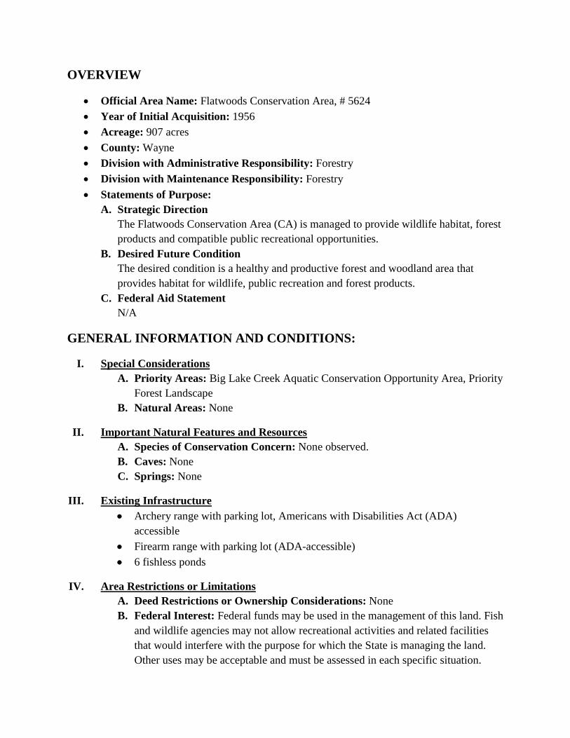
OVERVIEW
• Official Area Name: Flatwoods Conservation Area, # 5624 • Year of Initial Acquisition: 1956 • Acreage: 907 acres • County: Wayne • Division with Administrative Responsibility: Forestry • Division with Maintenance Responsibility: Forestry • Statements of Purpose:
A. Strategic Direction The Flatwoods Conservation Area (CA) is managed to provide wildlife habitat, forest products and compatible public recreational opportunities.
B. Desired Future Condition The desired condition is a healthy and productive forest and woodland area that provides habitat for wildlife, public recreation and forest products.
C. Federal Aid Statement N/A
GENERAL INFORMATION AND CONDITIONS:
I. Special Considerations A. Priority Areas: Big Lake Creek Aquatic Conservation Opportunity Area, Priority
Forest Landscape B. Natural Areas: None
II. Important Natural Features and Resources A. Species of Conservation Concern: None observed. B. Caves: None C. Springs: None
III. Existing Infrastructure • Archery range with parking lot, Americans with Disabilities Act (ADA)
accessible • Firearm range with parking lot (ADA-accessible) • 6 fishless ponds
IV. Area Restrictions or Limitations A. Deed Restrictions or Ownership Considerations: None B. Federal Interest: Federal funds may be used in the management of this land. Fish
and wildlife agencies may not allow recreational activities and related facilities that would interfere with the purpose for which the State is managing the land. Other uses may be acceptable and must be assessed in each specific situation.
2016 Flatwoods Conservation Area Management Plan Page 4
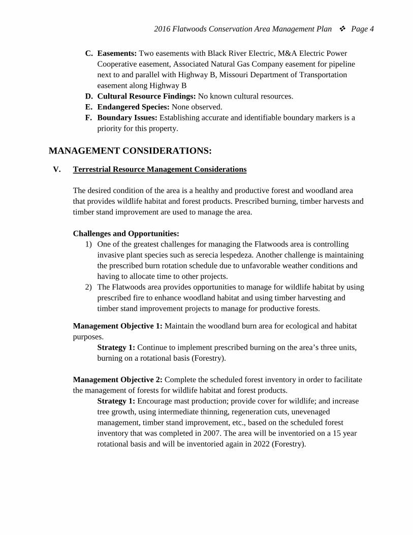
C. Easements: Two easements with Black River Electric, M&A Electric Power Cooperative easement, Associated Natural Gas Company easement for pipeline next to and parallel with Highway B, Missouri Department of Transportation easement along Highway B
D. Cultural Resource Findings: No known cultural resources. E. Endangered Species: None observed. F. Boundary Issues: Establishing accurate and identifiable boundary markers is a
priority for this property.
MANAGEMENT CONSIDERATIONS:
V. Terrestrial Resource Management Considerations
The desired condition of the area is a healthy and productive forest and woodland area that provides wildlife habitat and forest products. Prescribed burning, timber harvests and timber stand improvement are used to manage the area. Challenges and Opportunities:
1) One of the greatest challenges for managing the Flatwoods area is controlling invasive plant species such as serecia lespedeza. Another challenge is maintaining the prescribed burn rotation schedule due to unfavorable weather conditions and having to allocate time to other projects.
2) The Flatwoods area provides opportunities to manage for wildlife habitat by using prescribed fire to enhance woodland habitat and using timber harvesting and timber stand improvement projects to manage for productive forests.
Management Objective 1: Maintain the woodland burn area for ecological and habitat purposes.
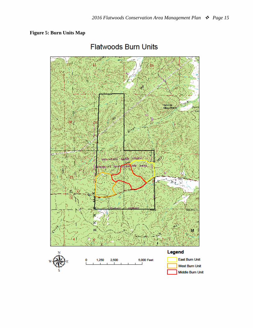
Strategy 1: Continue to implement prescribed burning on the area’s three units, burning on a rotational basis (Forestry).
Management Objective 2: Complete the scheduled forest inventory in order to facilitate the management of forests for wildlife habitat and forest products.
Strategy 1: Encourage mast production; provide cover for wildlife; and increase tree growth, using intermediate thinning, regeneration cuts, unevenaged management, timber stand improvement, etc., based on the scheduled forest inventory that was completed in 2007. The area will be inventoried on a 15 year rotational basis and will be inventoried again in 2022 (Forestry).
2016 Flatwoods Conservation Area Management Plan Page 5
VI. Aquatic Resource Management Considerations
Challenges and Opportunities: 1) Maintain the integrity of the area’s intermittent streams. 2) Maintain riparian corridors along intermittent stream banks to benefit water
quality and aquatic species.
Management Objective 1: Maintain riparian corridors along intermittent streams on the area and prevent soil erosion during timber harvests.
Strategy 1: Follow the Missouri Department of Conservation’s (the Department’s) 2014 Missouri Watershed Protection Practice manual when maintaining and constructing roadways and conducting timber harvests (Forestry).
VII. Public Use Management Considerations
Challenges and Opportunities: 1) Manage visitor safety at the archery and firearms ranges. 2) Maintain the area as an attractive place for public recreation. Discourage litter
and vandalism at the parking lots and ranges. 3) Provide public recreational and economic opportunities for Piedmont area
residents and those outside the area, including use of the archery and firearms ranges, wildlife viewing, timber harvesting and hunting.
Management Objective 1: Maintain warning signs around the archery and firearm ranges to promote public safety.
Strategy 1: Post and maintain warning signs around the perimeter of the archery and firearm ranges in accordance with the Department’s range manual (Forestry).
Management Objective 2: Maintain the archery and firearm ranges to promote public enjoyment of the ranges.
Strategy 1: Maintain areas by removing litter, providing targets, maintaining target holders and managing encroaching vegetation with mowing of grass or chemical treatment of pathways (Forestry).
2016 Flatwoods Conservation Area Management Plan Page 6
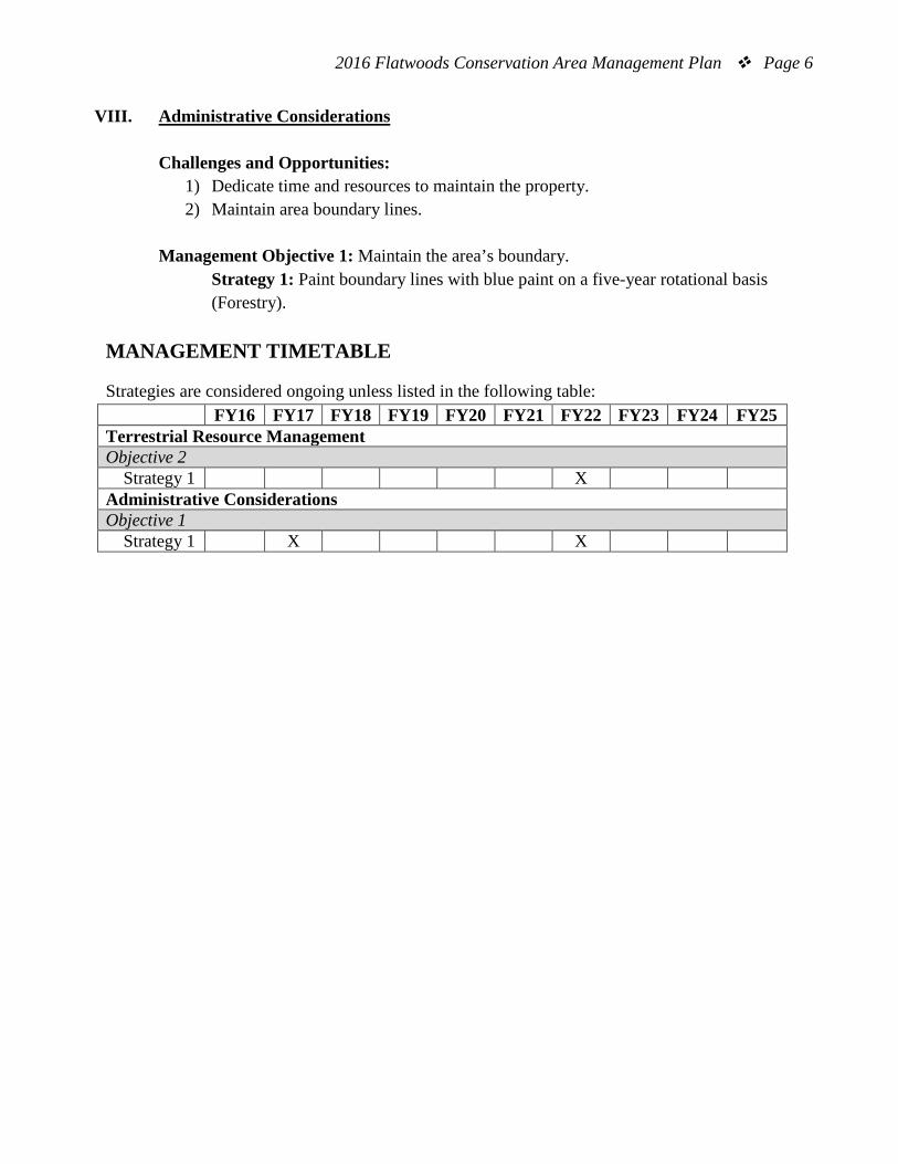
VIII. Administrative Considerations
Challenges and Opportunities: 1) Dedicate time and resources to maintain the property. 2) Maintain area boundary lines.
Management Objective 1: Maintain the area’s boundary.
Strategy 1: Paint boundary lines with blue paint on a five-year rotational basis (Forestry).
MANAGEMENT TIMETABLE
Strategies are considered ongoing unless listed in the following table: FY16 FY17 FY18 FY19 FY20 FY21 FY22 FY23 FY24 FY25 Terrestrial Resource Management Objective 2 Strategy 1 X Administrative Considerations Objective 1 Strategy 1 X X
2016 Flatwoods Conservation Area Management Plan Page 7
APPENDICES
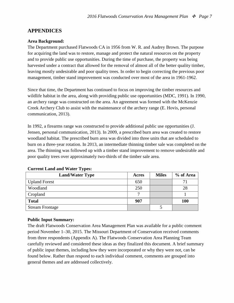
Area Background: The Department purchased Flatwoods CA in 1956 from W. R. and Audrey Brown. The purpose for acquiring the land was to restore, manage and protect the natural resources on the property and to provide public use opportunities. During the time of purchase, the property was being harvested under a contract that allowed for the removal of almost all of the better quality timber, leaving mostly undesirable and poor quality trees. In order to begin correcting the previous poor management, timber stand improvement was conducted over most of the area in 1961-1962. Since that time, the Department has continued to focus on improving the timber resources and wildlife habitat in the area, along with providing public use opportunities (MDC, 1991). In 1990, an archery range was constructed on the area. An agreement was formed with the McKenzie Creek Archery Club to assist with the maintenance of the archery range (E. Hovis, personal communication, 2013). In 1992, a firearms range was constructed to provide additional public use opportunities (J. Jensen, personal communication, 2013). In 2009, a prescribed burn area was created to restore woodland habitat. The prescribed burn area was divided into three units that are scheduled to burn on a three-year rotation. In 2013, an intermediate thinning timber sale was completed on the area. The thinning was followed up with a timber stand improvement to remove undesirable and poor quality trees over approximately two-thirds of the timber sale area. Current Land and Water Types:
Land/Water Type Acres Miles % of Area Upland Forest 650 71 Woodland 250 28 Cropland 7 1 Total 907 100 Stream Frontage 5 Public Input Summary: The draft Flatwoods Conservation Area Management Plan was available for a public comment period November 1–30, 2015. The Missouri Department of Conservation received comments from three respondents (Appendix A). The Flatwoods Conservation Area Planning Team carefully reviewed and considered these ideas as they finalized this document. A brief summary of public input themes, including how they were incorporated or why they were not, can be found below. Rather than respond to each individual comment, comments are grouped into general themes and are addressed collectively.

2016 Flatwoods Conservation Area Management Plan Page 8
Department responses to themes and issues identified through Flatwoods Conservation Area public comment period Wonders if there will be much change from how the area is currently managed? The main priorities for the Flatwoods area are to provide habitat for wildlife and produce timber products. To accomplish these priorities, management practices will remain similar to what has been done in the past. Forest stands will be commercially harvested or have a timber stand improvement implemented if it is necessary to maintain or improve tree health or enhance wildlife habitat. Also, salvage sales will be conducted, if warranted, in the event of storm damage or insect and disease damage. In the woodland burn units, prescribed fire will continue to be used on a rotational basis in order to provide wildlife habitat. The firearms and archery range will continue to be maintained to provide recreational opportunities for the public. One recent change to the area was the addition of approximately 7 ½ acres of food plots. These food plots will be managed on a rotational basis to provide green browse, seed crops, and idle (nesting) areas for wildlife. Supports management focus on woodland restoration. Suggests including shortleaf pine regeneration as a goal in prescribed burn units. Long-term shortleaf pine regeneration is a current goal in the prescribed burn units. The main long-term goal for the burn units is to maintain a shortleaf pine/oak woodland unit. In the future, the prescribed fire regime may be adjusted in order to ensure that the pine and oak component is maintained in the burn units. Wonders if timber harvest will maintain vegetative screening buffers around archery and shooting ranges? A visual buffer of 100 feet will be left around the shooting range if any timber harvests are done around the area in the future. If trees are harvested in the buffer zone, the amount harvested will be minimal to reduce the impact on the visual screen. The archery range is surrounded by the woodland burn units where timber harvesting is not a priority. In the past, the archery range was included as part of the woodland burn unit and was managed with prescribed fire. However, the archery range has now been removed from the burn unit and the trees in the archery range are being allowed to grow back. This will provide a visual buffer for the archery range if any timber harvests are done in the surrounding burn units in the future. Suggests adding a low-water crossing on the road to the shooting range to protect the intermittent stream. The access road to the shooting range has a large culvert installed to protect the integrity of the intermittent stream. There is another road that lies to the west of the shooting range that does cross the same intermittent stream. However, this road does not provide access to the shooting range and it receives minimal use. The road crosses the intermittent stream at a right angle in
2016 Flatwoods Conservation Area Management Plan Page 9
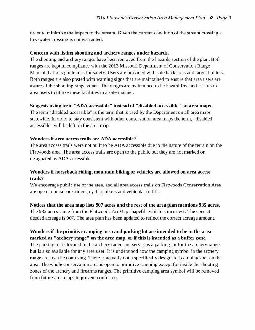
order to minimize the impact to the stream. Given the current condition of the stream crossing a low-water crossing is not warranted. Concern with listing shooting and archery ranges under hazards. The shooting and archery ranges have been removed from the hazards section of the plan. Both ranges are kept in compliance with the 2013 Missouri Department of Conservation Range Manual that sets guidelines for safety. Users are provided with safe backstops and target holders. Both ranges are also posted with warning signs that are maintained to ensure that area users are aware of the shooting range zones. The ranges are maintained to be hazard free and it is up to area users to utilize these facilities in a safe manner. Suggests using term "ADA accessible" instead of "disabled accessible" on area maps. The term “disabled accessible” is the term that is used by the Department on all area maps statewide. In order to stay consistent with other conservation area maps the term, “disabled accessible” will be left on the area map. Wonders if area access trails are ADA accessible? The area access trails were not built to be ADA accessible due to the nature of the terrain on the Flatwoods area. The area access trails are open to the public but they are not marked or designated as ADA accessible. Wonders if horseback riding, mountain biking or vehicles are allowed on area access trails? We encourage public use of the area, and all area access trails on Flatwoods Conservation Area are open to horseback riders, cyclist, hikers and vehicular traffic. Notices that the area map lists 907 acres and the rest of the area plan mentions 935 acres. The 935 acres came from the Flatwoods ArcMap shapefile which is incorrect. The correct deeded acreage is 907. The area plan has been updated to reflect the correct acreage amount. Wonders if the primitive camping area and parking lot are intended to be in the area marked as "archery range" on the area map, or if this is intended as a buffer zone. The parking lot is located in the archery range and serves as a parking lot for the archery range but is also available for any area user. It is understood how the camping symbol in the archery range area can be confusing. There is actually not a specifically designated camping spot on the area. The whole conservation area is open to primitive camping except for inside the shooting zones of the archery and firearms ranges. The primitive camping area symbol will be removed from future area maps to prevent confusion.
2016 Flatwoods Conservation Area Management Plan Page 10
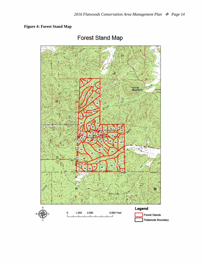
Wonders if food plots are visible from the shooting range? The food plots are not visible from the shooting range. Both food plots are positioned behind a buffer zone of trees that prevents shooters at the range from being able to see the food plots. Would like to see more details about the shooting range. (What is the length of the shooting range? Are there any restricted calibers for the shooting range? Are ranges open at night? Does the ridge serve as an effective backstop? Are shooting benches provided and are they ADA accessible?) There are three different target holders at the range that are set up at 25, 50 and 100 yards from the shooting benches. There are shooting benches available for each set of target holders and they are all ADA accessible. There is also an area to pattern shotguns and shoot clay pigeons. Shooting range users are allowed to use any firearm that is legal to use in the state of Missouri. The range is not open for use at night. There are three separate ridges that are behind the shooting range and all of these ridges may serve as a backstop. However, the constructed berm directly behind the target holders is what is in place to serve as the primary backstop. References: Missouri Department of Conservation (MDC). (1991). Flatwoods State Forest plan. Missouri Department of Conservation. Missouri Department of Conservation (MDC). (2013). Shooting Range Facility Program Manual. Missouri Department of Conservation. Missouri Department of Conservation (MDC). (2014). Missouri watershed protection practice recommended practices for Missouri forests: 2014 management guidelines for maintaining forested watersheds to protect streams. Jefferson City, Missouri: Conservation Commission of the State of Missouri. Maps: Figure 1: Area Map Figure 2: Topographic Map Figure 3: Landcover Map Figure 4: Forest Stand Map Figure 5: Burn Units Map
Addional Appendices: Appendix A. Flatwoods Conservation Area Management Plan Public Comments
2016 Flatwoods Conservation Area Management Plan Page 11
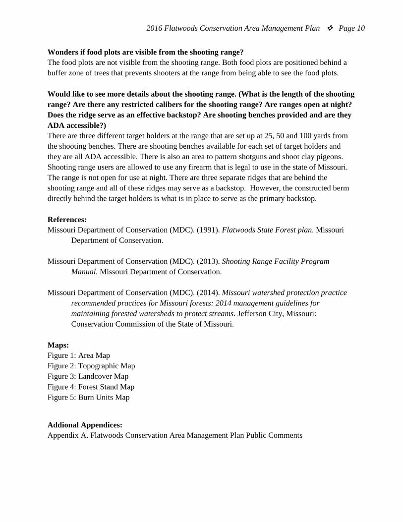
Figure 1: Area Map
2016 Flatwoods Conservation Area Management Plan Page 12
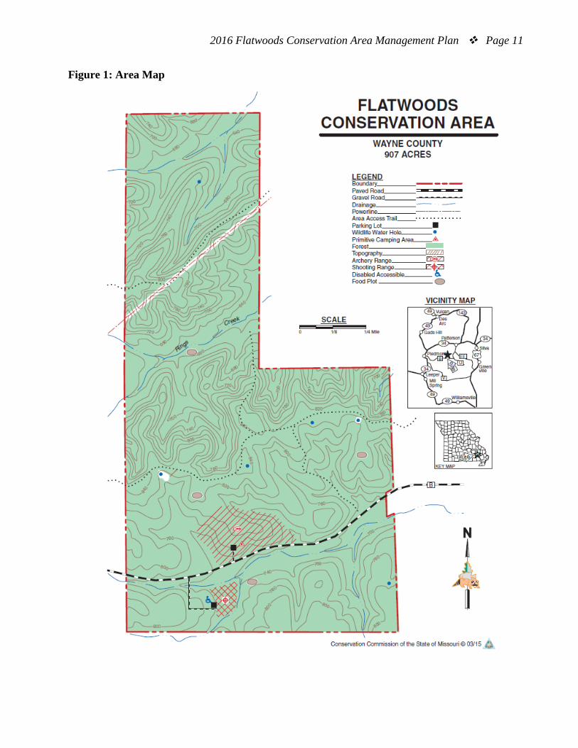
Figure 2: Topographic Map
2016 Flatwoods Conservation Area Management Plan Page 13
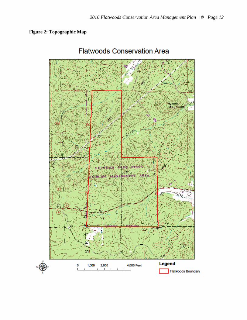
Figure 3: Landcover Map
2016 Flatwoods Conservation Area Management Plan Page 14
Figure 4: Forest Stand Map
2016 Flatwoods Conservation Area Management Plan Page 15
Figure 5: Burn Units Map
2016 Flatwoods Conservation Area Management Plan Page 16
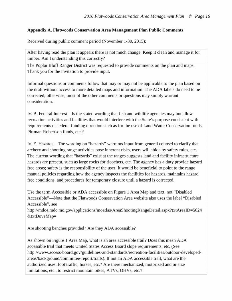
Appendix A. Flatwoods Conservation Area Management Plan Public Comments Received during public comment period (November 1-30, 2015): After having read the plan it appears there is not much change. Keep it clean and manage it for timber. Am I understanding this correctly? The Poplar Bluff Ranger District was requested to provide comments on the plan and maps. Thank you for the invitation to provide input. Informal questions or comments follow that may or may not be applicable to the plan based on the draft without access to more detailed maps and information. The ADA labels do need to be corrected; otherwise, most of the other comments or questions may simply warrant consideration. Iv. B. Federal Interest—Is the stated wording that fish and wildlife agencies may not allow recreation activities and facilities that would interfere with the State’s purpose consistent with requirements of federal funding direction such as for the use of Land Water Conservation funds, Pittman-Robertson funds, etc.? Iv. E. Hazards—The wording on “hazards” warrants input from general counsel to clarify that archery and shooting range activities pose inherent risks, users will abide by safety rules, etc. The current wording that “hazards” exist at the ranges suggests land and facility infrastructure hazards are present, such as large rocks for ricochets, etc. The agency has a duty provide hazard free areas; safety is the responsibility of the user. It would be beneficial to point to the range manual policies regarding how the agency inspects the facilities for hazards, maintains hazard free conditions, and procedures for temporary closure until a hazard is corrected. Use the term Accessible or ADA accessible on Figure 1 Area Map and text, not “Disabled Accessible”—Note that the Flatwoods Conservation Area website also uses the label “Disabled Accessible”, see http://mdc4.mdc.mo.gov/applications/moatlas/AreaShootingRangeDetail.aspx?txtAreaID=5624&txtDoveMap= Are shooting benches provided? Are they ADA accessible? As shown on Figure 1 Area Map, what is an area accessible trail? Does this mean ADA accessible trail that meets United States Access Board slope requirements, etc. (See http://www.access-board.gov/guidelines-and-standards/recreation-facilities/outdoor-developed-areas/background/committee-report/trails). If not an ADA accessible trail, what are the authorized uses, foot traffic, horses, etc.? Are there mechanized, motorized and or size limitations, etc., to restrict mountain bikes, ATVs, OHVs, etc.?
2016 Flatwoods Conservation Area Management Plan Page 17
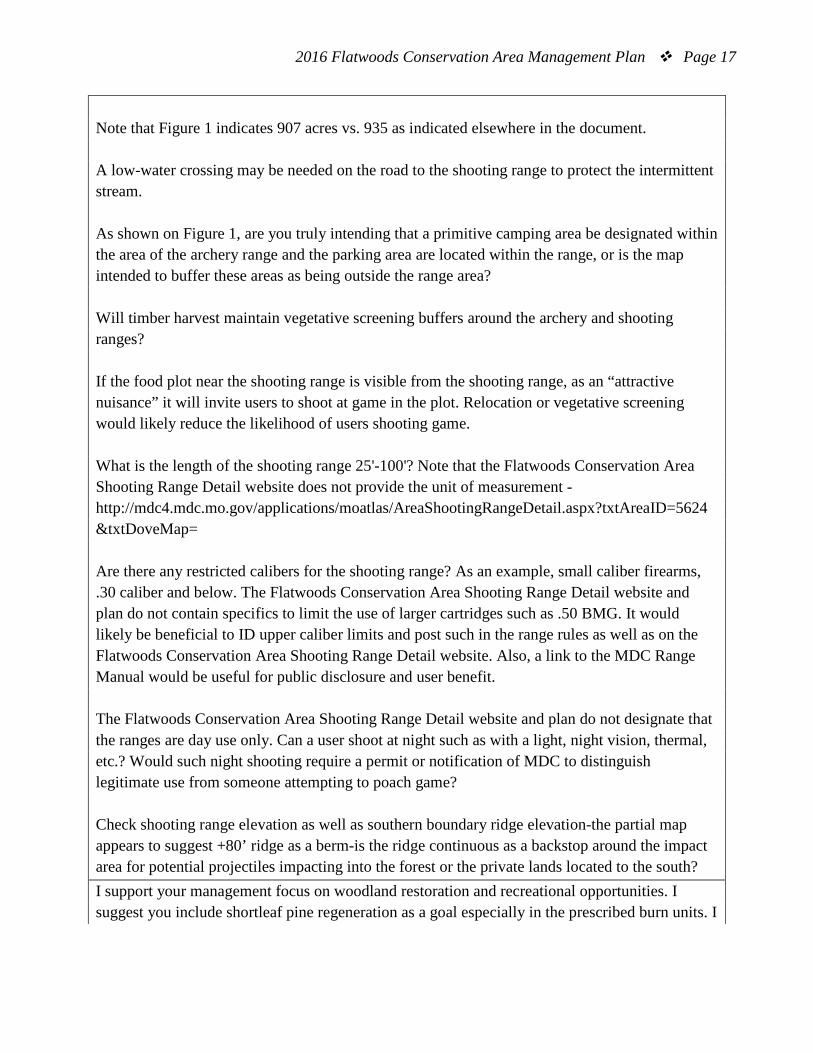
Note that Figure 1 indicates 907 acres vs. 935 as indicated elsewhere in the document. A low-water crossing may be needed on the road to the shooting range to protect the intermittent stream. As shown on Figure 1, are you truly intending that a primitive camping area be designated within the area of the archery range and the parking area are located within the range, or is the map intended to buffer these areas as being outside the range area? Will timber harvest maintain vegetative screening buffers around the archery and shooting ranges? If the food plot near the shooting range is visible from the shooting range, as an “attractive nuisance” it will invite users to shoot at game in the plot. Relocation or vegetative screening would likely reduce the likelihood of users shooting game. What is the length of the shooting range 25'-100'? Note that the Flatwoods Conservation Area Shooting Range Detail website does not provide the unit of measurement - http://mdc4.mdc.mo.gov/applications/moatlas/AreaShootingRangeDetail.aspx?txtAreaID=5624&txtDoveMap= Are there any restricted calibers for the shooting range? As an example, small caliber firearms, .30 caliber and below. The Flatwoods Conservation Area Shooting Range Detail website and plan do not contain specifics to limit the use of larger cartridges such as .50 BMG. It would likely be beneficial to ID upper caliber limits and post such in the range rules as well as on the Flatwoods Conservation Area Shooting Range Detail website. Also, a link to the MDC Range Manual would be useful for public disclosure and user benefit. The Flatwoods Conservation Area Shooting Range Detail website and plan do not designate that the ranges are day use only. Can a user shoot at night such as with a light, night vision, thermal, etc.? Would such night shooting require a permit or notification of MDC to distinguish legitimate use from someone attempting to poach game? Check shooting range elevation as well as southern boundary ridge elevation-the partial map appears to suggest +80’ ridge as a berm-is the ridge continuous as a backstop around the impact area for potential projectiles impacting into the forest or the private lands located to the south? I support your management focus on woodland restoration and recreational opportunities. I suggest you include shortleaf pine regeneration as a goal especially in the prescribed burn units. I

2016 Flatwoods Conservation Area Management Plan Page 18
have had some success bringing pine regeneration through short burn rotations. If chemical site prep is an option to you could also use existing pine in a seed tree strategy.