ORKSHOP EPORT CONSERVING OKANAGAN WETLANDS OCAL...
33
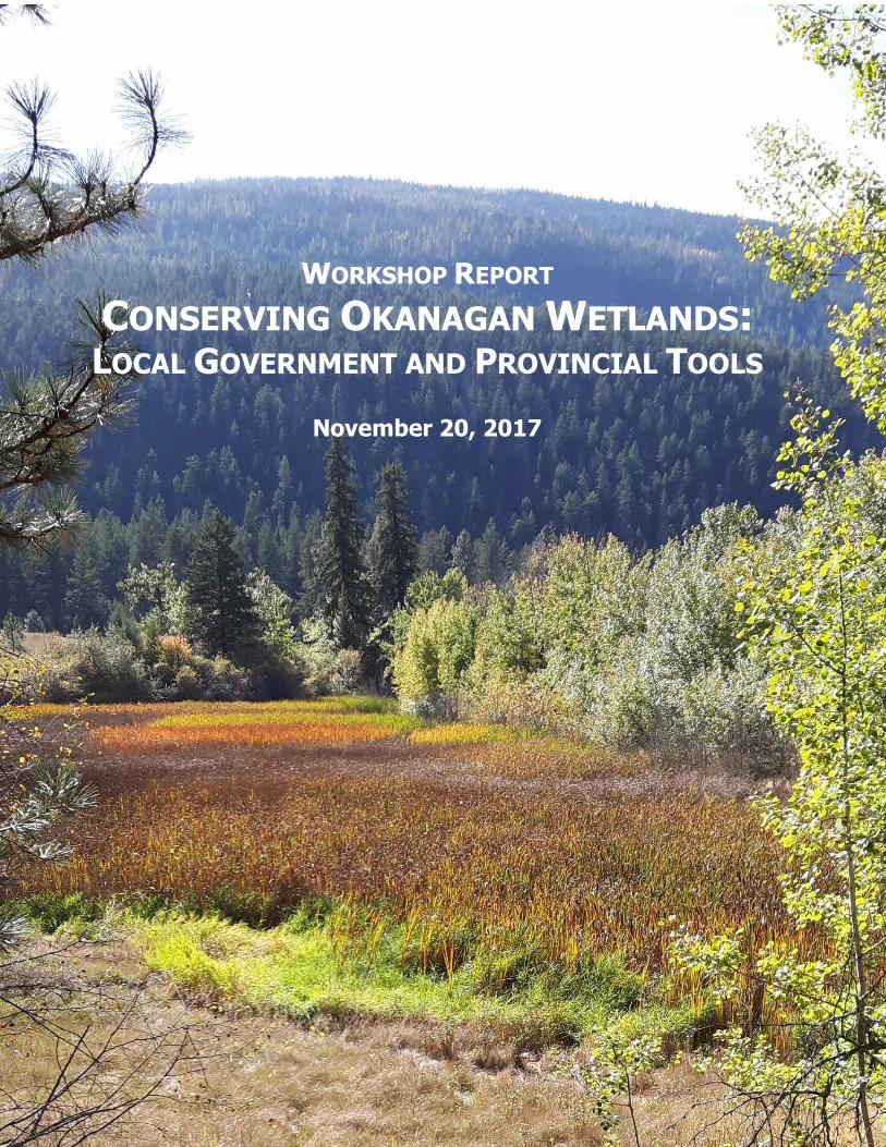
WORKSHOP REPORT CONSERVING OKANAGAN WETLANDS: LOCAL GOVERNMENT AND PROVINCIAL TOOLS November 20, 2017
Transcript of ORKSHOP EPORT CONSERVING OKANAGAN WETLANDS OCAL...
WORKSHOP REPORT CONSERVING OKANAGAN WETLANDS: LOCAL GOVERNMENT AND PROVINCIAL TOOLS
November 20, 2017
THANK YOU TO THE WORKSHOP PARTNERS AND SUPPORTERS
Hosted by the Ecosystems Section of the Ministry of Forests, Lands, Natural Resource Operations
and Rural Development in partnership with the Okanagan Basin Water Board and Ducks Unlimited
Canada and with the support of the South Okanagan Similkameen Conservation Program, the
Okanagan Collaborative Conservation Program, the BC Wildlife Federation, and the Planning
Institute of BC. Scott Boswell, OCCP's Program Manager, facilitated the morning session of the
program. Tanis Gieselman, the Projects Coordinator for OCCP, facilitated the afternoon portion of
the program, and helped summarize the input from the workshop into this final report.
CONSERVING OKANAGAN WETLANDS: LOCAL GOVERNMENT AND PROVINCIAL TOOLS WORKSHOP REPORT
3
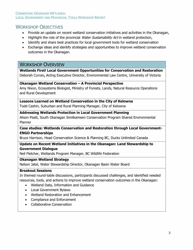
WORKSHOP OBJECTIVES Provide an update on recent wetland conservation initiatives and activities in the Okanagan,
Highlight the role of the provincial Water Sustainability Act in wetland protection,
Identify and share best practices for local government tools for wetland conservation
Exchange ideas and identify strategies and opportunities to improve wetland conservation
outcomes in the Okanagan.
WORKSHOP OVERVIEW Wetlands First! Local Government Opportunities for Conservation and Restoration
Deborah Curran, Acting Executive Director, Environmental Law Centre, University of Victoria
Okanagan Wetland Conservation – A Provincial Perspective
Amy Nixon, Ecosystems Biologist, Ministry of Forests, Lands, Natural Resource Operations
and Rural Development
Lessons Learned on Wetland Conservation in the City of Kelowna
Todd Cashin, Suburban and Rural Planning Manager, City of Kelowna
Addressing Wetlands Protection in Local Government Planning
Alison Peatt, South Okanagan Similkameen Conservation Program Shared Environmental
Planner
Case studies: Wetlands Conservation and Restoration through Local Government-
ENGO Partnerships
Bruce Harrison, Head Conservation Science & Planning BC, Ducks Unlimited Canada
Update on Recent Wetland Initiatives in the Okanagan: Land Stewardship to
Government Dialogue
Neil Fletcher, Wetlands Program Manager, BC Wildlife Federation
Okanagan Wetland Strategy
Nelson Jatel, Water Stewardship Director, Okanagan Basin Water Board
Breakout Sessions
In themed round-table discussions, participants discussed challenges, and identified needed
resources, tools, and actions to improve wetland conservation outcomes in the Okanagan:
Wetland Data, Information and Guidance
Local Government Bylaws
Wetland Restoration and Enhancement
Compliance and Enforcement
Collaborative Conservation
CONSERVING OKANAGAN WETLANDS: LOCAL GOVERNMENT AND PROVINCIAL TOOLS WORKSHOP REPORT
4
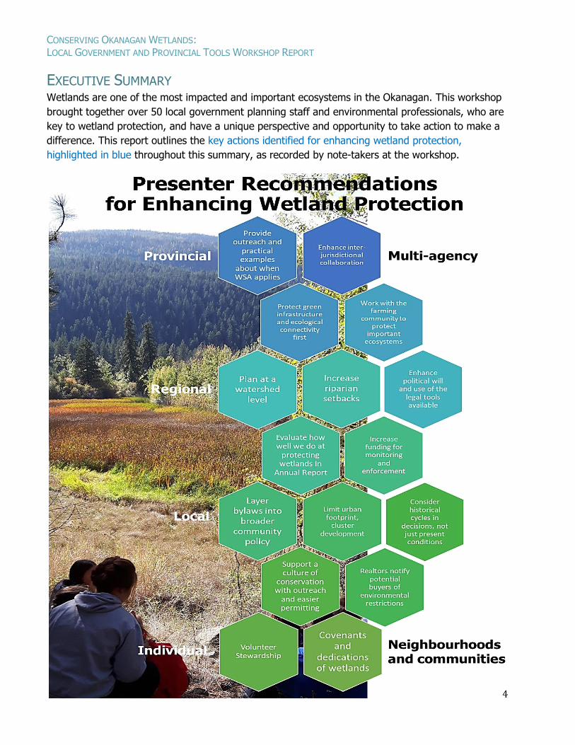
EXECUTIVE SUMMARY Wetlands are one of the most impacted and important ecosystems in the Okanagan. This workshop
brought together over 50 local government planning staff and environmental professionals, who are
key to wetland protection, and have a unique perspective and opportunity to take action to make a
difference. This report outlines the key actions identified for enhancing wetland protection,
highlighted in blue throughout this summary, as recorded by note-takers at the workshop.
CONSERVING OKANAGAN WETLANDS: LOCAL GOVERNMENT AND PROVINCIAL TOOLS WORKSHOP REPORT
5
CONSERVING OKANAGAN WETLANDS: LOCAL GOVERNMENT AND PROVINCIAL TOOLS WORKSHOP REPORT
6
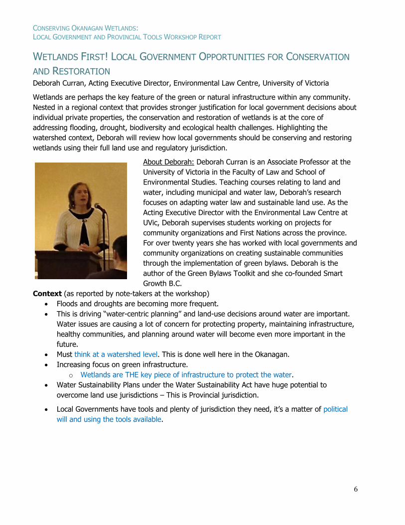
WETLANDS FIRST! LOCAL GOVERNMENT OPPORTUNITIES FOR CONSERVATION
AND RESTORATION Deborah Curran, Acting Executive Director, Environmental Law Centre, University of Victoria
Wetlands are perhaps the key feature of the green or natural infrastructure within any community.
Nested in a regional context that provides stronger justification for local government decisions about
individual private properties, the conservation and restoration of wetlands is at the core of
addressing flooding, drought, biodiversity and ecological health challenges. Highlighting the
watershed context, Deborah will review how local governments should be conserving and restoring
wetlands using their full land use and regulatory jurisdiction.
About Deborah: Deborah Curran is an Associate Professor at the
University of Victoria in the Faculty of Law and School of
Environmental Studies. Teaching courses relating to land and
water, including municipal and water law, Deborah’s research
focuses on adapting water law and sustainable land use. As the
Acting Executive Director with the Environmental Law Centre at
UVic, Deborah supervises students working on projects for
community organizations and First Nations across the province.
For over twenty years she has worked with local governments and
community organizations on creating sustainable communities
through the implementation of green bylaws. Deborah is the
author of the Green Bylaws Toolkit and she co-founded Smart
Growth B.C.
Context (as reported by note-takers at the workshop)
Floods and droughts are becoming more frequent.
This is driving “water-centric planning” and land-use decisions around water are important.
Water issues are causing a lot of concern for protecting property, maintaining infrastructure,
healthy communities, and planning around water will become even more important in the
future.
Must think at a watershed level. This is done well here in the Okanagan.
Increasing focus on green infrastructure.
o Wetlands are THE key piece of infrastructure to protect the water.
Water Sustainability Plans under the Water Sustainability Act have huge potential to
overcome land use jurisdictions – This is Provincial jurisdiction.
Local Governments have tools and plenty of jurisdiction they need, it’s a matter of political
will and using the tools available.
CONSERVING OKANAGAN WETLANDS: LOCAL GOVERNMENT AND PROVINCIAL TOOLS WORKSHOP REPORT
7
Observations
Must move away from arguing about property rights, and move towards discussing how
what happens on individual property is important on a regional scale.
A focus on water can help. Water is a key connector. It is part of a larger riparian
ecosystem and essential for ecological health.
Governments need to be willing to say “You are lucky to be living in the riparian
ecosystem, this is what we require of you”.
Regulations allow for considerable discretion by governments, which is good and bad.
Monitoring and evaluation is not done well now due to budget constraints.
Need to embed metrics of measuring environmental protection into Official Community
Plans (OCPs) & Regional Growth Strategies (RGSs). Suggest governments report on
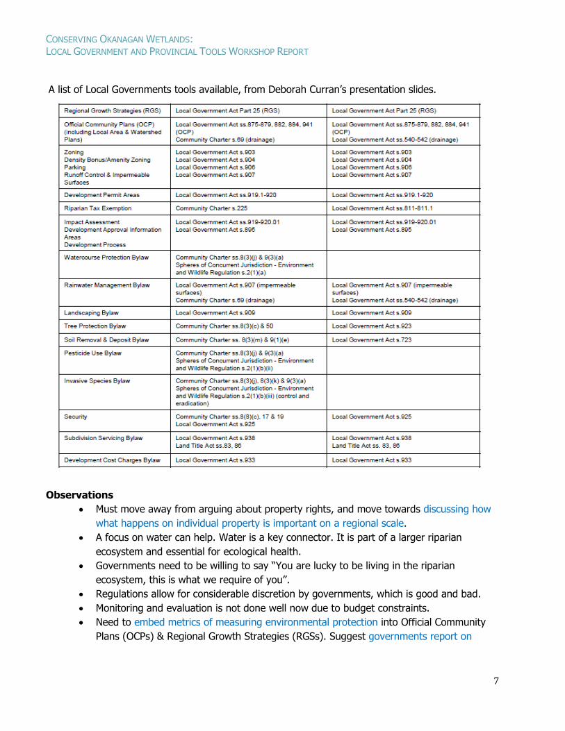
A list of Local Governments tools available, from Deborah Curran’s presentation slides.
CONSERVING OKANAGAN WETLANDS: LOCAL GOVERNMENT AND PROVINCIAL TOOLS WORKSHOP REPORT
8
monitoring and evaluation of riparian protection in annual reporting, to bring them to
light, and support the budget for monitoring and reporting.
To date, the focus has been on obtaining enough mapping data to justify environmental
decisions. Now there is enough mapping to satisfy the legal requirement for delineating
rough boundaries in planning, and there is no need for governments to get more detail in
their mapping.
It is time for governments to move to take action, and support a culture of conservation
rather than focussing on trying have overly-specific mapping. Overly-specific mapping is
still not accurate to an individual lot-size, and being too specific with public maps risks
that protections can be picked apart by technicalities created by interpreting the regional-
scale mapping to be exact at an individual parcel-scale.
Principles that Direct Bylaw Development
1. Designating biodiversity corridors in planning is the most important and effective action
needed. Habitat protection is essential, but keeping connections is a top priority. Regional
planning is necessary to protect connectivity.
o Embed plans into broader community goals set out in Regional Growth Strategies
(RGS) and Official Community Plans (OCP) that drive bylaw development, and include
metrics to evaluate progress over time.
o Typically these are defined in an ecological health strategy or biodiversity
conservation strategy (see examples from Surrey, Comox, and the Okanagan).
o Mapping can help show where corridors should/could be (e.g. Biodiversity
Conservation Strategy for the Okanagan Region). Identification of corridors and
connectivity is critical, and need to be identified at a macro scale, and implemented at
a more local scale.
o Many believe that local governments have no planning jurisdiction on Agricultural
Land Reserve (ALR), but this is not true.
Yes, their jurisdiction is circumscribed: the ability to have bylaws apply is
affected by Farm Practices Protection (Right to Farm) Act (nuisance, noise),
and zoning is also impacted by this Act.
However, Environmentally Sensitive Development Permit Areas (ESDPAs) can
apply to land in the ALR. There is nothing in ESDPA law that says ESDPAs do
not apply on ALR land. What would that look like? What if you worked with the
farming community to apply ESDPAs to farmlands that are important for
ecosystem goods and services?
2. Containing the urban footprint is the next most important and effective action.
o Define servicing limits in RGSs and OCPs, and specify the processes under which
these limits could be extended (e.g. to respond to a public health emergency, or as
part of the 5 year planning review of RGSs and OCPs, rather than application driven).
3. Enhancing green infrastructure is a critically impactful action.
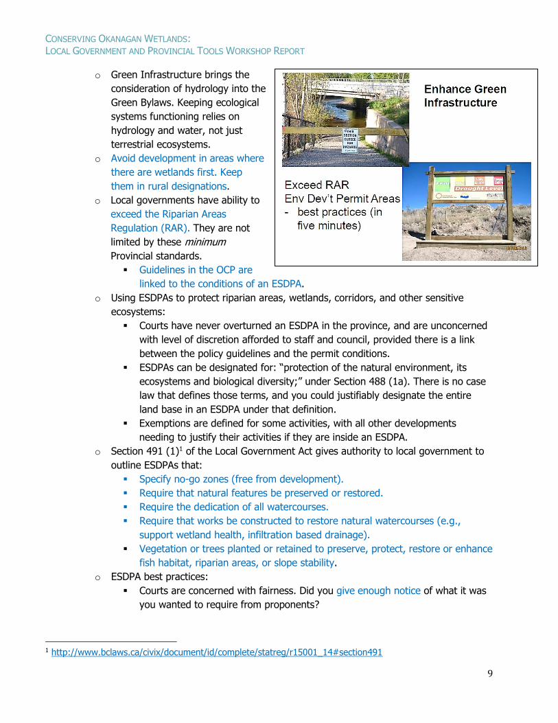
CONSERVING OKANAGAN WETLANDS: LOCAL GOVERNMENT AND PROVINCIAL TOOLS WORKSHOP REPORT
9
o Green Infrastructure brings the
consideration of hydrology into the
Green Bylaws. Keeping ecological
systems functioning relies on
hydrology and water, not just
terrestrial ecosystems.
o Avoid development in areas where
there are wetlands first. Keep
them in rural designations.
o Local governments have ability to
exceed the Riparian Areas
Regulation (RAR). They are not
limited by these minimum
Provincial standards.
Guidelines in the OCP are
linked to the conditions of an ESDPA.
o Using ESDPAs to protect riparian areas, wetlands, corridors, and other sensitive
ecosystems:
Courts have never overturned an ESDPA in the province, and are unconcerned
with level of discretion afforded to staff and council, provided there is a link
between the policy guidelines and the permit conditions.
ESDPAs can be designated for: “protection of the natural environment, its
ecosystems and biological diversity;” under Section 488 (1a). There is no case
law that defines those terms, and you could justifiably designate the entire
land base in an ESDPA under that definition.
Exemptions are defined for some activities, with all other developments
needing to justify their activities if they are inside an ESDPA.
o Section 491 (1)1 of the Local Government Act gives authority to local government to
outline ESDPAs that:
Specify no-go zones (free from development).
Require that natural features be preserved or restored.
Require the dedication of all watercourses.
Require that works be constructed to restore natural watercourses (e.g.,
support wetland health, infiltration based drainage).
Vegetation or trees planted or retained to preserve, protect, restore or enhance
fish habitat, riparian areas, or slope stability.
o ESDPA best practices:
Courts are concerned with fairness. Did you give enough notice of what it was
you wanted to require from proponents?
1 http://www.bclaws.ca/civix/document/id/complete/statreg/r15001_14#section491
CONSERVING OKANAGAN WETLANDS: LOCAL GOVERNMENT AND PROVINCIAL TOOLS WORKSHOP REPORT
10
For designation of lands in an ESDPA, a broad zone of risk is appropriate; on-
the-ground certainty is not required. Be clear and simple, and include buffers.
Qualified Environmental Professional (QEP) or staff to do the ground-truthing
at the time of a development application.
Guidelines do not need to be precise. They are directing principles, and can be
broadly defined to allow for flexibility in application.
Ecosystem connectivity is important in ESDPAs. Some lawyers challenge this,
but it is perfectly acceptable, and prohibitions and buffers available for ESDPAs
are very clearly indicated in Section 491.
Restoration and mitigation should always be part of permit conditions;
therefore, you need to have guidelines around metrics for restoration,
enhancement, and mitigation. (e.g. Vernon has categories 1 (no-go zone), 2,
and 3 (offsets possible). Must define what is required if they are allowed to
develop a wetland.
Site assessment done by QEPs. Designate broadly, with clear guidelines, then
work with QEP around ESDPA conditions.
Can incorporate best management practices in ESDPA guidelines, but the court
doesn’t like that. They prefer specificity on what landowners are required to do.
It is important to note that you will need to designate Development Approval
Info Areas in order to ask for studies and information from applicant, unless
Hazard Area is approved. Development Approval Info Areas can be put over
the whole area.
The bylaws are a tool to achieve our objectives, rather than a hurdle. Local
governments have more discretion than some lawyers have led them to
believe. Broad zones that are designated may not all look like corridors now,
and could be restored.
4. Clustering development is another priority action.
o Specify provisions for clustering of development in RGS, OCPs, and policies; the
approving officer is then obligated to consider these policies. Subdivision policies can
designate no-go zones if in an ESDPA. However, ESDPA enforcement is through the
court system.
o Regulatory bylaws are important because you can issue tickets under the bylaws (Soil
Removal Bylaw, Tree Protection, etc.). Set up parallel bylaw provisions that speak to
guidelines in the ESDPAs to provide initial ability for ticketing and enforcement.
o Regulatory bylaws require security and monitoring, but you can’t do it in ESDPA
wording. It is enabled separately under other sections of Community Charter and the
Local Government Act.
o Tax Exemptions & Covenants
Riparian Tax Exemption (Community Charter) has been available since 2003. If
a landowner agrees to protect riparian habitat, local governments can provide
a tax exemption. This requires an annual bylaw, and possibly a covenant on
the title. Gibsons has done it, but it was a pain, with poor uptake. The best
CONSERVING OKANAGAN WETLANDS: LOCAL GOVERNMENT AND PROVINCIAL TOOLS WORKSHOP REPORT
11
approach would be to promote riparian restoration in a particular area through
a targeted approach. It is too much administration to just invite applications.
Revitalization Tax Exemption provides a tax exemption for 10 years on the
value of the revitalization done on an existing developed property. Local
governments could connect this to wetlands and riparian areas as a condition
of the tax exemption.
Covenants are often seen as the only way to bind future landowners to
protecting sensitive ecosystems. Positive covenants do not bind future
landowners, but restrictive covenants do. Register the prohibition on title.
The covenant holder is a government or land trust organization that monitors
and enforces the covenant. Detailed maps and ongoing monitoring are needed,
so they are a bit cumbersome and expensive to manage, but they are useful.
For example, they could be used in exchange for clustering development away
from sensitive areas, and prevent future applications if the area was not
designated parkland.
5. Protecting important areas is also vital, but less of a priority than those actions listed already.
o Securing important areas permanently can be very effective. Regional conservation
funds are a useful tool (see “Local Conservation Funds in British Columbia: A Guide
for Local Governments and Community Organizations”2)
o Parkland Acquisition Fund is another tool available.
o Priorities should be identified in a conservation strategy so that everyone is working
together on what the priorities are at a regional level (e.g. a haphazard 5% giveback
on subdivision is not very strategic).
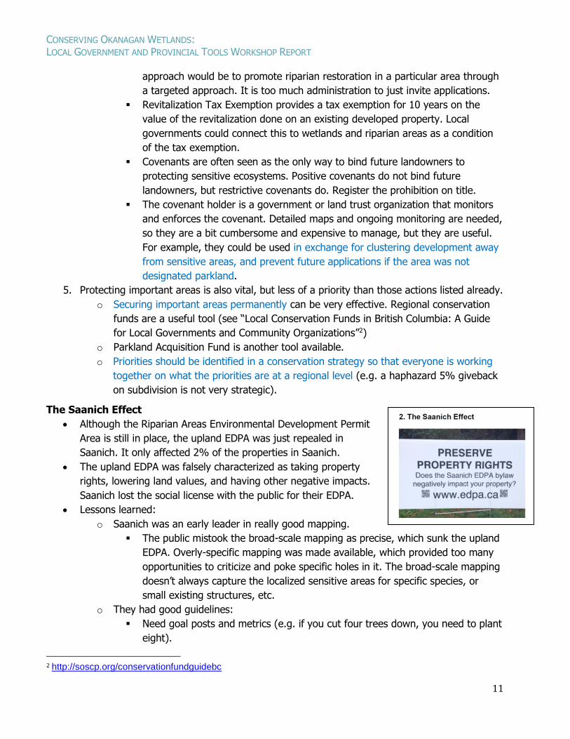
The Saanich Effect
Although the Riparian Areas Environmental Development Permit
Area is still in place, the upland EDPA was just repealed in
Saanich. It only affected 2% of the properties in Saanich.
The upland EDPA was falsely characterized as taking property
rights, lowering land values, and having other negative impacts.
Saanich lost the social license with the public for their EDPA.
Lessons learned:
o Saanich was an early leader in really good mapping.
The public mistook the broad-scale mapping as precise, which sunk the upland
EDPA. Overly-specific mapping was made available, which provided too many
opportunities to criticize and poke specific holes in it. The broad-scale mapping
doesn’t always capture the localized sensitive areas for specific species, or
small existing structures, etc.
o They had good guidelines:
Need goal posts and metrics (e.g. if you cut four trees down, you need to plant
eight).
2 http://soscp.org/conservationfundguidebc
CONSERVING OKANAGAN WETLANDS: LOCAL GOVERNMENT AND PROVINCIAL TOOLS WORKSHOP REPORT
12
Need to embed guidelines in a larger environmental protection program.
o Saanich needed more funding to do outreach about ESDPAs, and support public
education and stewardship to create a culture of conservation. For example, there
was a public perception that areas with invasive weeds were not sensitive. They
didn’t connect to the possibility of being able to restore the area.
Need to be clear about requirements for restoration, and link to regional plans
and the need for corridors.
Summary
Commitment to connectivity at all levels
of government and in the public.
Link ecological protection to asset
management and risk management:
green infrastructure for floods and
drought.
There is a lot of discretion for local
governments, and you don’t need to
compensate for any reduction in land
values, unless restricting for public use
(s.458, Local Government Act).
Questions for Deborah
1) The ALR is good, but is it forcing development up onto hillsides where there are sensitive
ecosystems, and contributing to fragmentation and urban sprawl?
a. I would challenge that. It is a choice of how we allow development and direct density
(e.g., not everyone needs 3500 square foot single detached homes). Create a culture
of stewardship.
b. Ideally the local government would have an urban growth boundary, and servicing
policies that require infill development until a certain density. Minimum densities not
discussed widely in BC.
2) Floodplain mapping is ongoing. Have you seen any link between flood protection and
wetland protection bylaws in development?
a. There hasn’t been a BC example where communities are experiencing the same thing
as the Okanagan in terms of flood and drought.
b. Gibsons is including green infrastructure in their asset management framework. It
would be interesting to explore this for wetlands protection. You would need to bring
it into the five year asset management plan and put a dollar figure onto it.
c. Wetlands are physical manifestations of flood prone areas. Flood bylaw maps and
wetland maps likely overlap, providing the opportunity to protect both. Asset wording
would be important.
d. The goal is to have no future development in floodplains and wetlands, and consider
the impacts of development in floodplain on hydrology, including impacts on
CONSERVING OKANAGAN WETLANDS: LOCAL GOVERNMENT AND PROVINCIAL TOOLS WORKSHOP REPORT
13
wetlands. For example, Surrey has implemented no future subdivisions in sea level
rise areas.
3) Everyone wants views and moorage. Development pressures are great, and seem to provoke
the spread of mis-information (e.g., Saanich); In Lake Country, in response to the Gable
Beach proposal there was a huge petition, but little information was presented to the people
who signed on.
a. Speaks to the need for culture of conservation (e.g., Tree protection bylaw in North
Vancouver is long-standing, despite impacts of falling trees because it is part of their
culture;
b. Whistler has acted to protect community culture with policy: they will not approve
zoning for new bed units until the existing zoning capacity has been built out. The
only way to get around it was to provide resident housing.
c. Embed in larger strategies.
4) There is a building and restoration challenge: local governments struggle with how to
regulate restoration. For example a fair amount of restoration gets done by stewardship
organizations. Is it appropriate to regulate restoration?
a. Regulation of restoration may be important to track restoration and demonstrate
change over time, and the condition of the land before and after the restoration
works.
b. What is restoration? Should this be defined in an OCP (e.g. from a fairness
perspective; definitions about exemptions for restoration)? You could use a one page
description, and create an exemption for restoration in the EDPA. Then you would
need to have that definition for what restoration entails.
5) Can you comment on the relative weight of a no-build covenant vs. an ESDPA?
a. A covenant binds future landowners, and usually put on title, which is a notice to
future landowners that it is a no-build zone before the purchase of the land.
b. ESDPA no-build designation could cause confusion and future arguments with future
landowners because it isn’t binding. Protection relies on the ESDPA application
process again in the future, and the future landowners are not usually notified of
ESDPA zones ahead of purchasing, causing frustration if plans are not approved.
c. If it is a watercourse/wetland, consider dedicating it to local government. Local
governments sometimes do not want to take on this role, as the responsibility can
become a liability. However, the liability piece goes both ways from a flood and
drought perspective.
6) For properties are already zoned, is it true that ESDPAs cannot affect density?
a. It is true that development permit areas cannot restrict zoning or use on the
property, but if not subdivided, you can still require clustering. That’s why it’s at the
bottom of the list, and zoning, RGSs, and OCPs are priorities to establish before
ESDPAs. ESDPAs are less satisfactory because they act at the detailed, site-specific
scale.
CONSERVING OKANAGAN WETLANDS: LOCAL GOVERNMENT AND PROVINCIAL TOOLS WORKSHOP REPORT
14
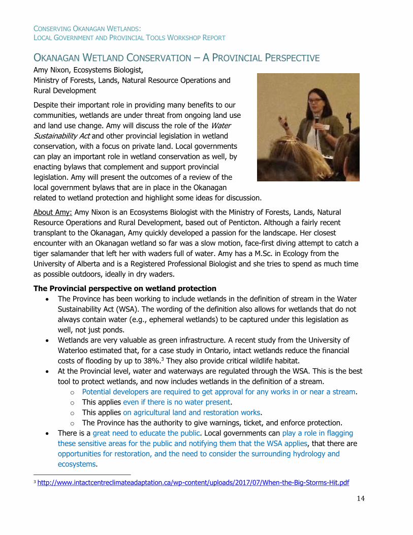
OKANAGAN WETLAND CONSERVATION – A PROVINCIAL PERSPECTIVE Amy Nixon, Ecosystems Biologist,
Ministry of Forests, Lands, Natural Resource Operations and
Rural Development
Despite their important role in providing many benefits to our
communities, wetlands are under threat from ongoing land use
and land use change. Amy will discuss the role of the Water
Sustainability Act and other provincial legislation in wetland
conservation, with a focus on private land. Local governments
can play an important role in wetland conservation as well, by
enacting bylaws that complement and support provincial
legislation. Amy will present the outcomes of a review of the
local government bylaws that are in place in the Okanagan
related to wetland protection and highlight some ideas for discussion.
About Amy: Amy Nixon is an Ecosystems Biologist with the Ministry of Forests, Lands, Natural
Resource Operations and Rural Development, based out of Penticton. Although a fairly recent
transplant to the Okanagan, Amy quickly developed a passion for the landscape. Her closest
encounter with an Okanagan wetland so far was a slow motion, face-first diving attempt to catch a
tiger salamander that left her with waders full of water. Amy has a M.Sc. in Ecology from the
University of Alberta and is a Registered Professional Biologist and she tries to spend as much time
as possible outdoors, ideally in dry waders.
The Provincial perspective on wetland protection
The Province has been working to include wetlands in the definition of stream in the Water
Sustainability Act (WSA). The wording of the definition also allows for wetlands that do not
always contain water (e.g., ephemeral wetlands) to be captured under this legislation as
well, not just ponds.
Wetlands are very valuable as green infrastructure. A recent study from the University of
Waterloo estimated that, for a case study in Ontario, intact wetlands reduce the financial
costs of flooding by up to 38%.3 They also provide critical wildlife habitat.
At the Provincial level, water and waterways are regulated through the WSA. This is the best
tool to protect wetlands, and now includes wetlands in the definition of a stream.
o Potential developers are required to get approval for any works in or near a stream.
o This applies even if there is no water present.
o This applies on agricultural land and restoration works.
o The Province has the authority to give warnings, ticket, and enforce protection.
There is a great need to educate the public. Local governments can play a role in flagging
these sensitive areas for the public and notifying them that the WSA applies, that there are
opportunities for restoration, and the need to consider the surrounding hydrology and
ecosystems.
3 http://www.intactcentreclimateadaptation.ca/wp-content/uploads/2017/07/When-the-Big-Storms-Hit.pdf
CONSERVING OKANAGAN WETLANDS: LOCAL GOVERNMENT AND PROVINCIAL TOOLS WORKSHOP REPORT
15
The Riparian Areas Regulation (RAR) is focused on fish habitat, and therefore doesn’t apply
to all wetlands. This regulation cannot protect all sensitive ecosystems.
The Forest and Range Practices Act could protect from off-road vehicle damage, but is hard
to enact.
The Wildlife Act protects wildlife and specific habitats, like beaver dams, from direct harm,
and can be used to implement motor vehicle closure areas.
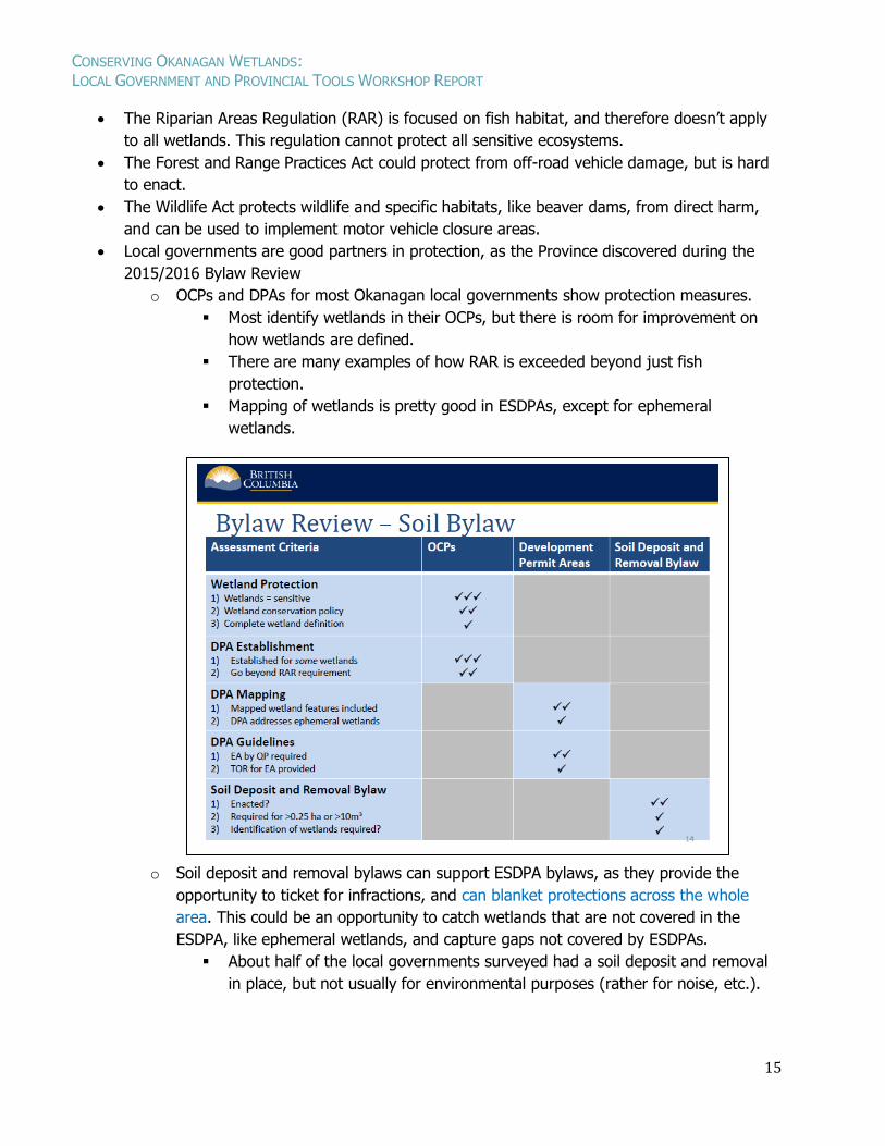
Local governments are good partners in protection, as the Province discovered during the
2015/2016 Bylaw Review
o OCPs and DPAs for most Okanagan local governments show protection measures.
Most identify wetlands in their OCPs, but there is room for improvement on
how wetlands are defined.
There are many examples of how RAR is exceeded beyond just fish
protection.
Mapping of wetlands is pretty good in ESDPAs, except for ephemeral
wetlands.
o Soil deposit and removal bylaws can support ESDPA bylaws, as they provide the
opportunity to ticket for infractions, and can blanket protections across the whole
area. This could be an opportunity to catch wetlands that are not covered in the
ESDPA, like ephemeral wetlands, and capture gaps not covered by ESDPAs.
About half of the local governments surveyed had a soil deposit and removal
in place, but not usually for environmental purposes (rather for noise, etc.).
CONSERVING OKANAGAN WETLANDS: LOCAL GOVERNMENT AND PROVINCIAL TOOLS WORKSHOP REPORT
16
The volume and area of soil moved that triggers the bylaw is quite variable.
The desired trigger would be movement of anything above 10 m3, and it
would be beneficial to have wetlands included as part of the process to
determine why and where soil is moved.
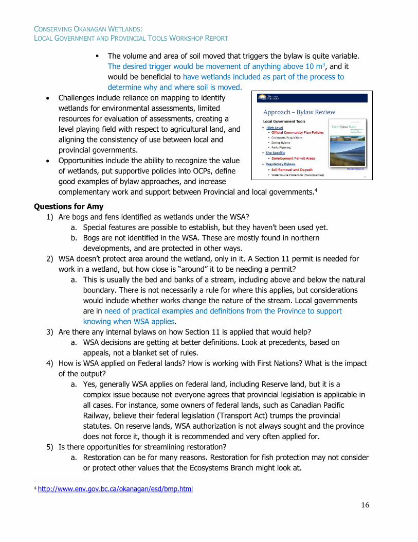
Challenges include reliance on mapping to identify
wetlands for environmental assessments, limited
resources for evaluation of assessments, creating a
level playing field with respect to agricultural land, and
aligning the consistency of use between local and
provincial governments.
Opportunities include the ability to recognize the value
of wetlands, put supportive policies into OCPs, define
good examples of bylaw approaches, and increase
complementary work and support between Provincial and local governments.4
Questions for Amy
1) Are bogs and fens identified as wetlands under the WSA?
a. Special features are possible to establish, but they haven’t been used yet.
b. Bogs are not identified in the WSA. These are mostly found in northern
developments, and are protected in other ways.
2) WSA doesn’t protect area around the wetland, only in it. A Section 11 permit is needed for
work in a wetland, but how close is “around” it to be needing a permit?
a. This is usually the bed and banks of a stream, including above and below the natural
boundary. There is not necessarily a rule for where this applies, but considerations
would include whether works change the nature of the stream. Local governments
are in need of practical examples and definitions from the Province to support
knowing when WSA applies.
3) Are there any internal bylaws on how Section 11 is applied that would help?
a. WSA decisions are getting at better definitions. Look at precedents, based on
appeals, not a blanket set of rules.
4) How is WSA applied on Federal lands? How is working with First Nations? What is the impact
of the output?
a. Yes, generally WSA applies on federal land, including Reserve land, but it is a
complex issue because not everyone agrees that provincial legislation is applicable in
all cases. For instance, some owners of federal lands, such as Canadian Pacific
Railway, believe their federal legislation (Transport Act) trumps the provincial
statutes. On reserve lands, WSA authorization is not always sought and the province
does not force it, though it is recommended and very often applied for.
5) Is there opportunities for streamlining restoration?
a. Restoration can be for many reasons. Restoration for fish protection may not consider
or protect other values that the Ecosystems Branch might look at.
4 http://www.env.gov.bc.ca/okanagan/esd/bmp.html
CONSERVING OKANAGAN WETLANDS: LOCAL GOVERNMENT AND PROVINCIAL TOOLS WORKSHOP REPORT
17
LESSONS LEARNED ON WETLAND CONSERVATION IN THE CITY OF KELOWNA Todd Cashin, Suburban and Rural Planning Manager, City of Kelowna
Wetlands have been significantly impacted by human activities over the last 100 years in Okanagan
Valley with more than 90% of historic wetlands now lost in the City of Kelowna. Given this, these
ecosystems are now extremely rare, and as a result, a significant amount of effort has been placed
on identifying remaining wetlands and protecting them. Despite all the great work over the last 10
years, there is general agreement among biological professionals that these ecologically sensitive
areas continue to be impacted due to poor land use practices.
About Todd: Todd Cashin has been employed in the environmental planning sector for over 20
years, the last 10 years with the City of Kelowna where he is currently Kelowna’s Suburban & Rural
Planning Manager and Deputy Subdivision Approving Officer. In this role, Todd is responsible for
managing land development, developing progressive land use policies and negotiating parkland and
farmland protection. Prior to coming to the City of Kelowna, Todd worked in regional government
and in both the forestry and transportation sectors. Todd has a background in environmental
planning, land development, stream hydrology, river restoration and emergency management, and
is a member of the Association of BC Forest Professionals, College of Applied Biology and Applied
Science Technologists and Technicians of BC. In his spare time, Todd and his wife Sharon enjoy
skiing & snowboarding, hiking and travelling with their three boys (William, Andrew and Finn).
Mapping projects highlighted ongoing impacts to wetlands
The concern over wetlands started with Sensitive Ecosystem Inventory (SEI) at RDCO in
2001. This report flagged that wetlands were in big trouble.
Sensitive Habitat Inventory and Mapping (SHIM) showed more impacts on wetlands.
2005 Foreshore Inventory and Mapping identified wetlands along foreshore, and loss of
historic wetlands was notable.
Kelowna also completed SEI at the city level.
CONSERVING OKANAGAN WETLANDS: LOCAL GOVERNMENT AND PROVINCIAL TOOLS WORKSHOP REPORT
18
In his 2008 study, Ted Lea looked back at historic aerial photos to determine the historical
extent of each Okanagan habitat.
o In the 1800s Kelowna was grizzly habitat, with cottonwood stands where the bulk of
the urban centre is, and remnant oxbows and side channels around Mission Creek.
o By 1938 there was considerable transition of the land into agriculture, but there was
still lots habitat there. The mouth of Mission Creek was a big wetland sponge.
The Mission Creek Restoration Initiative (MCRI) aims to restore the channel from diking done
in the 1940s and 50s. In this project 500 m of dike was moved and extended to 800 m.
Severe flooding this year affected restoration plantings, and the team is still trying to figure
out how Mission Creek works, and where it wants to go.
Wetland Inventory and Mapping (WIM) in 2011 identified over 300 wetlands.
Kelowna has bulked up OCP, created ESDPAs and bylaws, but are still losing wetlands.
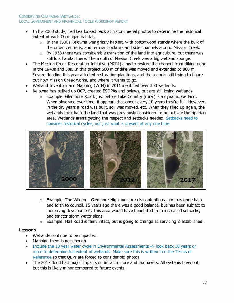
o Example: Glenmore Road, just before Lake Country (rural) is a dynamic wetland.
When observed over time, it appears that about every 10 years they’re full. However,
in the dry years a road was built, soil was moved, etc. When they filled up again, the
wetlands took back the land that was previously considered to be outside the riparian
area. Wetlands aren’t getting the respect and setbacks needed. Setbacks need to
consider historical cycles, not just what is present at any one time.
o Example: The Wilden – Glenmore Highlands area is contentious, and has gone back
and forth to council. 15 years ago there was a good balance, but has been subject to
increasing development. This area would have benefitted from increased setbacks,
and stricter storm water plans.
o Example: Hall Road is fairly intact, but is going to change as servicing is established.
Lessons
Wetlands continue to be impacted.
Mapping them is not enough.
Include the 10 year water cycle in Environmental Assessments -> look back 10 years or
more to determine full extent of wetlands. Make sure this is written into the Terms of
Reference so that QEPs are forced to consider old photos.
The 2017 flood had major impacts on infrastructure and tax payers. All systems blew out,
but this is likely minor compared to future events.
CONSERVING OKANAGAN WETLANDS: LOCAL GOVERNMENT AND PROVINCIAL TOOLS WORKSHOP REPORT
19
Wetlands need better protection. Alkaline wetlands especially need more room. Buy them or
use covenants to protect them (storm water and fire protection).
Constructed Wetlands
The Okanagan Basin Water Board is doing great work on developing a Wetland Strategy and
a constructed wetlands guide. This is overdue and much needed, but we also need better
cooperation.
Few operations staff are present at this meeting. We need the support of operations staff
(e.g. engineers – subdivision plan, drainage plans). Go back to work and make relationships
with these decision-makers.
Recommendations
Facilitate a less onerous permitting process.
Increase enforcement and monitoring.
Improve collaborative working relationships.
Increase setbacks for wetlands.
Protect remaining wetlands, and build more wetlands now.
Questions and Comments for Todd
1) The minimum setback for Riparian Areas Regulation of 15 m is commonly used. Wider
setbacks are almost never seen. We are not currently giving respect to individual
circumstances. We need to do more, ideally not just using a minimum number, but
determining what is suitable for protecting ecosystem function.
2) Why are you dissatisfied with constructed wetlands?
a. Operations staff get stuck with constructed wetlands. Everyone is trying to do more
with less, and no-one wants to get stuck managing something extra (costs,
permitting process for dredging, liability, etc.). We need to collaborate with
Operations and Infrastructure staff in order to improve wetland construction projects,
storm water management, etc.
CONSERVING OKANAGAN WETLANDS: LOCAL GOVERNMENT AND PROVINCIAL TOOLS WORKSHOP REPORT
20
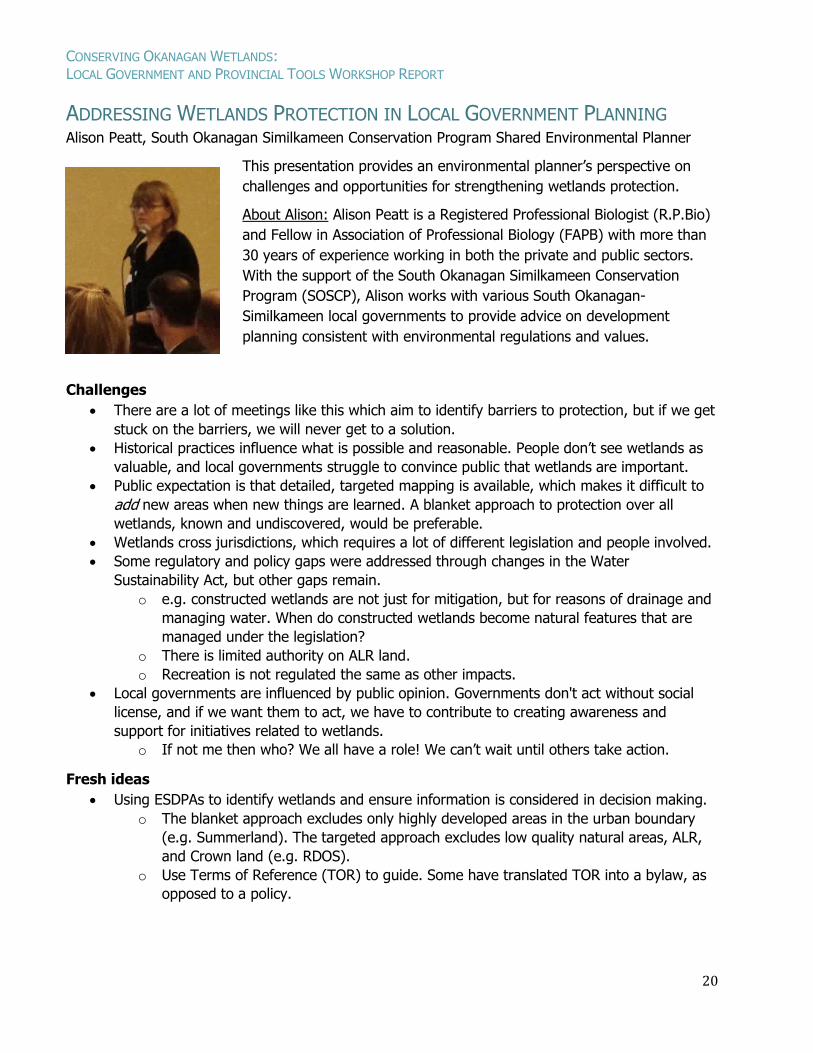
ADDRESSING WETLANDS PROTECTION IN LOCAL GOVERNMENT PLANNING Alison Peatt, South Okanagan Similkameen Conservation Program Shared Environmental Planner
This presentation provides an environmental planner’s perspective on
challenges and opportunities for strengthening wetlands protection.
About Alison: Alison Peatt is a Registered Professional Biologist (R.P.Bio)
and Fellow in Association of Professional Biology (FAPB) with more than
30 years of experience working in both the private and public sectors.
With the support of the South Okanagan Similkameen Conservation
Program (SOSCP), Alison works with various South Okanagan-
Similkameen local governments to provide advice on development
planning consistent with environmental regulations and values.
Challenges
There are a lot of meetings like this which aim to identify barriers to protection, but if we get
stuck on the barriers, we will never get to a solution.
Historical practices influence what is possible and reasonable. People don’t see wetlands as
valuable, and local governments struggle to convince public that wetlands are important.
Public expectation is that detailed, targeted mapping is available, which makes it difficult to
add new areas when new things are learned. A blanket approach to protection over all
wetlands, known and undiscovered, would be preferable.
Wetlands cross jurisdictions, which requires a lot of different legislation and people involved.
Some regulatory and policy gaps were addressed through changes in the Water
Sustainability Act, but other gaps remain.
o e.g. constructed wetlands are not just for mitigation, but for reasons of drainage and
managing water. When do constructed wetlands become natural features that are
managed under the legislation?
o There is limited authority on ALR land.
o Recreation is not regulated the same as other impacts.
Local governments are influenced by public opinion. Governments don't act without social
license, and if we want them to act, we have to contribute to creating awareness and
support for initiatives related to wetlands.
o If not me then who? We all have a role! We can’t wait until others take action.
Fresh ideas
Using ESDPAs to identify wetlands and ensure information is considered in decision making.
o The blanket approach excludes only highly developed areas in the urban boundary
(e.g. Summerland). The targeted approach excludes low quality natural areas, ALR,
and Crown land (e.g. RDOS).
o Use Terms of Reference (TOR) to guide. Some have translated TOR into a bylaw, as
opposed to a policy.
CONSERVING OKANAGAN WETLANDS: LOCAL GOVERNMENT AND PROVINCIAL TOOLS WORKSHOP REPORT
21
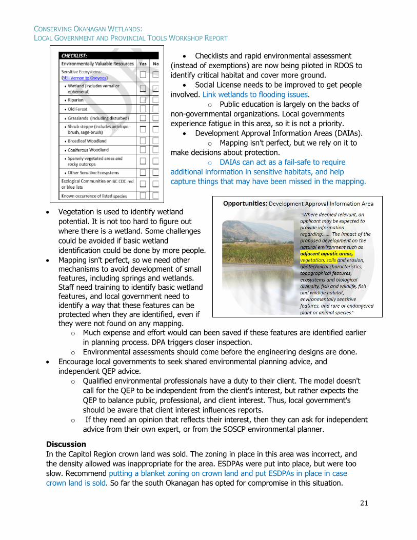
Checklists and rapid environmental assessment
(instead of exemptions) are now being piloted in RDOS to
identify critical habitat and cover more ground.
Social License needs to be improved to get people
involved. Link wetlands to flooding issues.
o Public education is largely on the backs of
non-governmental organizations. Local governments
experience fatigue in this area, so it is not a priority.
Development Approval Information Areas (DAIAs).
o Mapping isn’t perfect, but we rely on it to
make decisions about protection.
o DAIAs can act as a fail-safe to require
additional information in sensitive habitats, and help
capture things that may have been missed in the mapping.
Vegetation is used to identify wetland
potential. It is not too hard to figure out
where there is a wetland. Some challenges
could be avoided if basic wetland
identification could be done by more people.
Mapping isn't perfect, so we need other mechanisms to avoid development of small features, including springs and wetlands. Staff need training to identify basic wetland features, and local government need to identify a way that these features can be protected when they are identified, even if they were not found on any mapping.
o Much expense and effort would can been saved if these features are identified earlier
in planning process. DPA triggers closer inspection.
o Environmental assessments should come before the engineering designs are done.
Encourage local governments to seek shared environmental planning advice, and
independent QEP advice.
o Qualified environmental professionals have a duty to their client. The model doesn't
call for the QEP to be independent from the client's interest, but rather expects the
QEP to balance public, professional, and client interest. Thus, local government's
should be aware that client interest influences reports.
o If they need an opinion that reflects their interest, then they can ask for independent
advice from their own expert, or from the SOSCP environmental planner.
Discussion
In the Capitol Region crown land was sold. The zoning in place in this area was incorrect, and
the density allowed was inappropriate for the area. ESDPAs were put into place, but were too
slow. Recommend putting a blanket zoning on crown land and put ESDPAs in place in case
crown land is sold. So far the south Okanagan has opted for compromise in this situation.
CONSERVING OKANAGAN WETLANDS: LOCAL GOVERNMENT AND PROVINCIAL TOOLS WORKSHOP REPORT
22
CASE STUDIES: WETLANDS CONSERVATION AND RESTORATION THROUGH
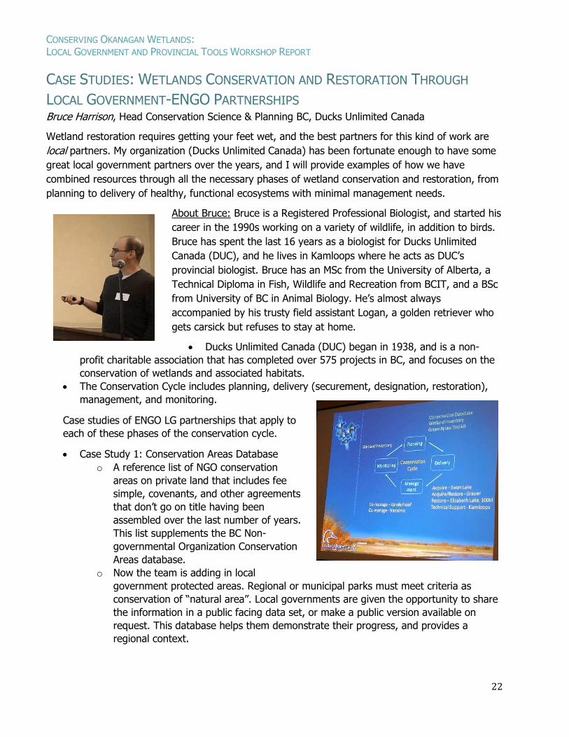
LOCAL GOVERNMENT-ENGO PARTNERSHIPS Bruce Harrison, Head Conservation Science & Planning BC, Ducks Unlimited Canada
Wetland restoration requires getting your feet wet, and the best partners for this kind of work are
local partners. My organization (Ducks Unlimited Canada) has been fortunate enough to have some
great local government partners over the years, and I will provide examples of how we have
combined resources through all the necessary phases of wetland conservation and restoration, from
planning to delivery of healthy, functional ecosystems with minimal management needs.
About Bruce: Bruce is a Registered Professional Biologist, and started his
career in the 1990s working on a variety of wildlife, in addition to birds.
Bruce has spent the last 16 years as a biologist for Ducks Unlimited
Canada (DUC), and he lives in Kamloops where he acts as DUC’s
provincial biologist. Bruce has an MSc from the University of Alberta, a
Technical Diploma in Fish, Wildlife and Recreation from BCIT, and a BSc
from University of BC in Animal Biology. He’s almost always
accompanied by his trusty field assistant Logan, a golden retriever who
gets carsick but refuses to stay at home.
Ducks Unlimited Canada (DUC) began in 1938, and is a non-
profit charitable association that has completed over 575 projects in BC, and focuses on the
conservation of wetlands and associated habitats.
The Conservation Cycle includes planning, delivery (securement, designation, restoration),
management, and monitoring.
Case studies of ENGO LG partnerships that apply to
each of these phases of the conservation cycle.
Case Study 1: Conservation Areas Database
o A reference list of NGO conservation
areas on private land that includes fee
simple, covenants, and other agreements
that don’t go on title having been
assembled over the last number of years.
This list supplements the BC Non-
governmental Organization Conservation
Areas database.
o Now the team is adding in local
government protected areas. Regional or municipal parks must meet criteria as
conservation of “natural area”. Local governments are given the opportunity to share
the information in a public facing data set, or make a public version available on
request. This database helps them demonstrate their progress, and provides a
regional context.
CONSERVING OKANAGAN WETLANDS: LOCAL GOVERNMENT AND PROVINCIAL TOOLS WORKSHOP REPORT
23
Case Study 2: Wetland Inventories
o Kelowna Wetland Inventory and Mapping (WIM; 2007).
o Lots of wetlands were recognized that hadn’t bene previously identified. Remaining
wetlands cover about 1% of the land in Kelowna. 24% of the wetlands were natural,
74% had been modified, and 2% were constructed wetlands.
o Canadian Wetland Inventory has good coverage in prairies and in the east. Sensitive
Ecosystems Inventory (SEI) data is could help expand the Canadian Wetland
Inventory.
o A 2007 study by Ted Lea estimates that 92% of historical water birch/red-osier
dogwood wetland habitat has been lost.5
o SPOT imagery detected 38% loss or isolation of wetlands over 22 years, ending in
2010. Some of it was hard to understand based on water levels (shorter term cycles;
dry period during study, and some may have recovered now)
o Tells us not only where we’re going, but also how much restoration is needed to get
back to where we need to be.
Case Study 3: Green Bylaws toolkit
o DUC was heavily involved in this project from the beginning. Others have already
discussed this project at this workshop.
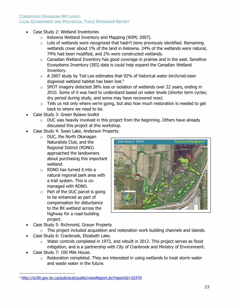
Case Study 4: Swan Lake, Anderson Property.
o DUC, the North Okanagan
Naturalists Club, and the
Regional District (RDNO)
approached the landowners
about purchasing this important
wetland.
o RDNO has turned it into a
natural regional park area with
a trail system. This is co-
managed with RDNO.
o Part of the DUC parcel is going
to be enhanced as part of
compensation for disturbance
to the BX wetland across the
highway for a road-building
project.
Case Study 5: Richmond, Grauer Property
o This project included acquisition and restoration work building channels and islands.
Case Study 6: Cranbrook, Elizabeth Lake.
o Water controls completed in 1972, and rebuilt in 2012. This project serves as flood
mitigation, and is a partnership with City of Cranbrook and Ministry of Environment.
Case Study 7: 100 Mile House.
o Restoration completed. They are interested in using wetlands to treat storm water
and waste water in the future.
5 http://a100.gov.bc.ca/pub/acat/public/viewReport.do?reportId=52470
CONSERVING OKANAGAN WETLANDS: LOCAL GOVERNMENT AND PROVINCIAL TOOLS WORKSHOP REPORT
24
Case Study 8: District of Vanderhoof.
o This project is an example of co-management, with expansion of greenspace. They
provide support for property maintenance, in partnership with the school district.
Case Study 10: Nanaimo.
o The property is owned by The Nature Trust of BC, DUC, and Nanaimo, and Nanaimo
manages the property.
o Ecosystem goods and services study at Buttertubs Marsh. Estimating capital and
operating costs of providing the storm water management services, considering
marsh and channels, and several scenarios, including climate change impacts.
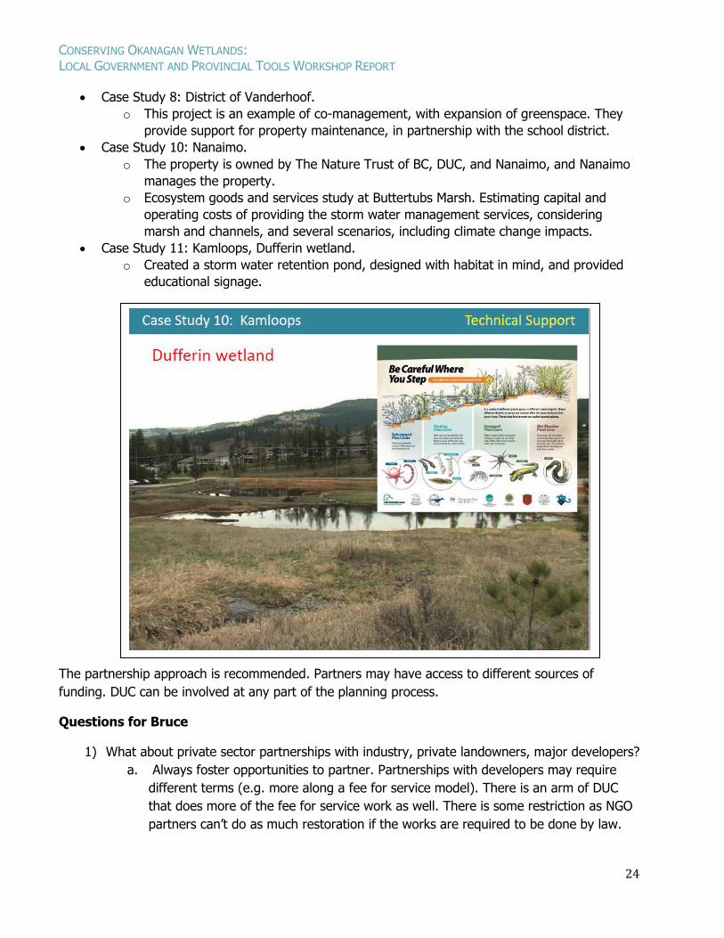
Case Study 11: Kamloops, Dufferin wetland.
o Created a storm water retention pond, designed with habitat in mind, and provided
educational signage.
The partnership approach is recommended. Partners may have access to different sources of
funding. DUC can be involved at any part of the planning process.
Questions for Bruce
1) What about private sector partnerships with industry, private landowners, major developers?
a. Always foster opportunities to partner. Partnerships with developers may require
different terms (e.g. more along a fee for service model). There is an arm of DUC
that does more of the fee for service work as well. There is some restriction as NGO
partners can’t do as much restoration if the works are required to be done by law.
CONSERVING OKANAGAN WETLANDS: LOCAL GOVERNMENT AND PROVINCIAL TOOLS WORKSHOP REPORT
25
UPDATE ON RECENT WETLAND INITIATIVES IN THE OKANAGAN:
LAND STEWARDSHIP TO GOVERNMENT DIALOGUE Neil Fletcher, Wetlands Program Manager,
BC Wildlife Federation
We can all play our part in wetland conservation. Landowners, provincial/federal government, First
Nations, local government, stewardship groups, and businesses have different tools that they can
apply to conserve wetlands. Building upon the earlier presentations of the day, Neil will present a
framework for how these initiatives interconnect at multiple scales. He will highlight some recent
wetland restoration initiatives within the Okanagan, and discuss some of the outcomes of a Local
Government Working Group Workshop held in Vernon in 2015 as fodder the afternoon discussion.
About Neil: Since 2010, Neil has served as the Wetlands Program
Manager with the BC Wildlife Federation to deliver wetland
related workshops and support initiatives across the province in
an effort to enhance capacity of communities to steward
wetlands. He is the chair of the Wetland Stewardship Partnership
of BC (a multi-agency organization that works on wetland related
issues at a provincial level), and an active member of the
Canadian Wetland Roundtable (that looks at National Level
Issues). In the Okanagan, Neil has provided support as a
steering committee member of the Okanagan Wetlands Strategy
and has delivered several wetland related workshops in the
region in recent years. When not working or thinking about wetlands, he spends time with his family
and two young daughters in New Westminster pushing swings or reading children’s books.
Wetland Initiatives in the Okanagan
Few wetlands remain (e.g. Lea, 20076) because we like to live where wetlands are.
Many of the wetlands that we still have are in a degraded state from cattle, over-
nutrification, invasive species, and being boxed in by roads and other development.
The Province is responsible for managing our water, but staff have been cut back, and it is
really up to all of us to keep wetlands protected.
The Wetland Stewardship Partnership (WSP) started 15 years ago, and is a collective
multiagency partnership. They have worked on many documents (Green Bylaws, Primers for
local governments, Wetlands Action Plan for BC, Wetlands mitigation policy) and helped
develop wetland inventory standards, and education resources.
Local government takes up a big part of what WSP takes into consideration. BCWF has
helped to host lots of wetland workshops to determine what’s making them tick, what are
their needs, and how can they get help. It can be challenging to synthesize issues as there
can be multiple factors affecting local governments both internally, and differences among
them.
6 http://a100.gov.bc.ca/pub/acat/public/viewReport.do?reportId=52470
CONSERVING OKANAGAN WETLANDS: LOCAL GOVERNMENT AND PROVINCIAL TOOLS WORKSHOP REPORT
26
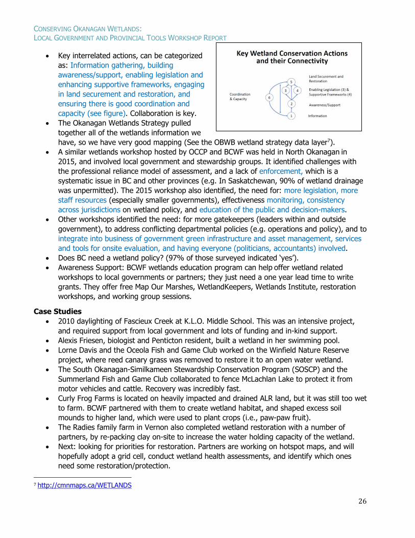
Key interrelated actions, can be categorized
as: Information gathering, building
awareness/support, enabling legislation and
enhancing supportive frameworks, engaging
in land securement and restoration, and
ensuring there is good coordination and
capacity (see figure). Collaboration is key.
The Okanagan Wetlands Strategy pulled
together all of the wetlands information we
have, so we have very good mapping (See the OBWB wetland strategy data layer7).
A similar wetlands workshop hosted by OCCP and BCWF was held in North Okanagan in
2015, and involved local government and stewardship groups. It identified challenges with
the professional reliance model of assessment, and a lack of enforcement, which is a
systematic issue in BC and other provinces (e.g. In Saskatchewan, 90% of wetland drainage
was unpermitted). The 2015 workshop also identified, the need for: more legislation, more
staff resources (especially smaller governments), effectiveness monitoring, consistency
across jurisdictions on wetland policy, and education of the public and decision-makers.
Other workshops identified the need: for more gatekeepers (leaders within and outside
government), to address conflicting departmental policies (e.g. operations and policy), and to
integrate into business of government green infrastructure and asset management, services
and tools for onsite evaluation, and having everyone (politicians, accountants) involved.
Does BC need a wetland policy? (97% of those surveyed indicated ‘yes’).
Awareness Support: BCWF wetlands education program can help offer wetland related
workshops to local governments or partners; they just need a one year lead time to write
grants. They offer free Map Our Marshes, WetlandKeepers, Wetlands Institute, restoration
workshops, and working group sessions.
Case Studies
2010 daylighting of Fascieux Creek at K.L.O. Middle School. This was an intensive project,
and required support from local government and lots of funding and in-kind support.
Alexis Friesen, biologist and Penticton resident, built a wetland in her swimming pool.
Lorne Davis and the Oceola Fish and Game Club worked on the Winfield Nature Reserve
project, where reed canary grass was removed to restore it to an open water wetland.
The South Okanagan-Similkameen Stewardship Conservation Program (SOSCP) and the
Summerland Fish and Game Club collaborated to fence McLachlan Lake to protect it from
motor vehicles and cattle. Recovery was incredibly fast.
Curly Frog Farms is located on heavily impacted and drained ALR land, but it was still too wet
to farm. BCWF partnered with them to create wetland habitat, and shaped excess soil
mounds to higher land, which were used to plant crops (i.e., paw-paw fruit).
The Radies family farm in Vernon also completed wetland restoration with a number of
partners, by re-packing clay on-site to increase the water holding capacity of the wetland.
Next: looking for priorities for restoration. Partners are working on hotspot maps, and will
hopefully adopt a grid cell, conduct wetland health assessments, and identify which ones
need some restoration/protection.
7 http://cmnmaps.ca/WETLANDS
CONSERVING OKANAGAN WETLANDS: LOCAL GOVERNMENT AND PROVINCIAL TOOLS WORKSHOP REPORT
27
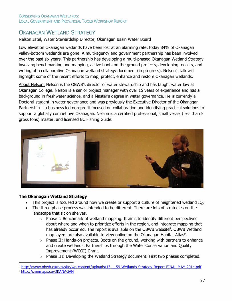
OKANAGAN WETLAND STRATEGY Nelson Jatel, Water Stewardship Director, Okanagan Basin Water Board
Low elevation Okanagan wetlands have been lost at an alarming rate, today 84% of Okanagan
valley-bottom wetlands are gone. A multi-agency and government partnership has been involved
over the past six years. This partnership has developing a multi-phased Okanagan Wetland Strategy
involving benchmarking and mapping, active boots on the ground projects, developing toolkits, and
writing of a collaborative Okanagan wetland strategy document (in progress). Nelson’s talk will
highlight some of the recent efforts to map, protect, enhance and restore Okanagan wetlands.
About Nelson: Nelson is the OBWB’s director of water stewardship and has taught water law at
Okanagan College. Nelson is a senior project manager with over 15 years of experience and has a
background in freshwater science, and a Master’s degree in water governance. He is currently a
Doctoral student in water governance and was previously the Executive Director of the Okanagan
Partnership – a business led non-profit focused on collaboration and identifying practical solutions to
support a globally competitive Okanagan. Nelson is a certified professional, small vessel (less than 5
gross tons) master, and licensed BC Fishing Guide.
The Okanagan Wetland Strategy
This project is focused around how we create or support a culture of heightened wetland IQ.
The three phase process was intended to be different. There are lots of strategies on the
landscape that sit on shelves.
o Phase I: Benchmark of wetland mapping. It aims to identify different perspectives
about where and when to prioritize efforts in the region, and integrate mapping that
has already occurred. The report is available on the OBWB website8. OBWB Wetland
map layers are also available to view online on the Okanagan Habitat Atlas9.
o Phase II: Hands-on projects. Boots on the ground, working with partners to enhance
and create wetlands. Partnerships through the Water Conservation and Quality
Improvement (WCQI) Grant.
o Phase III: Developing the Wetland Strategy document. First two phases completed.
8 http://www.obwb.ca/newsite/wp-content/uploads/13-1159-Wetlands-Strategy-Report-FINAL-MAY-2014.pdf 9 http://cmnmaps.ca/OKANAGAN
CONSERVING OKANAGAN WETLANDS: LOCAL GOVERNMENT AND PROVINCIAL TOOLS WORKSHOP REPORT
28
Guiding principles: think regionally and long term, protect nature for the benefit of all,
anticipate change, balance multiple priorities, and provide clear communications.
Working on an Okanagan Constructed Wetland manual: an efficient and effective guidebook
for local governments interested in constructing wetlands for storm water retention and
treatment in the Okanagan.
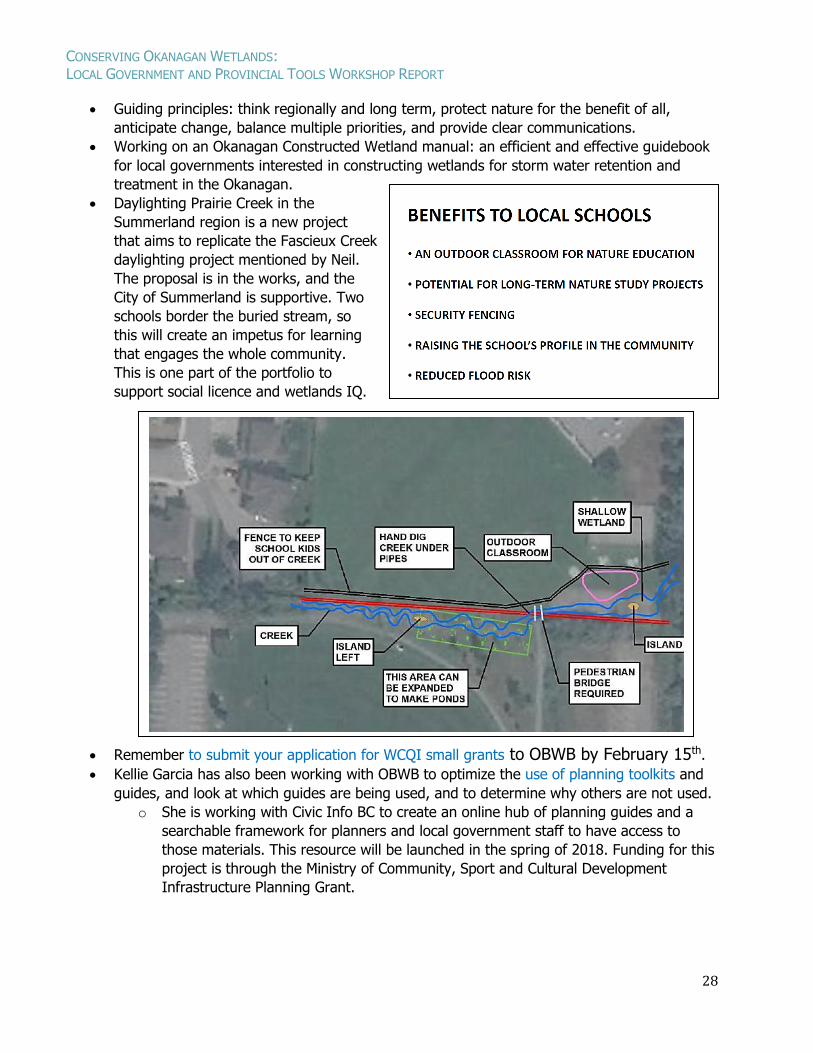
Daylighting Prairie Creek in the
Summerland region is a new project
that aims to replicate the Fascieux Creek
daylighting project mentioned by Neil.
The proposal is in the works, and the
City of Summerland is supportive. Two
schools border the buried stream, so
this will create an impetus for learning
that engages the whole community.
This is one part of the portfolio to
support social licence and wetlands IQ.
Remember to submit your application for WCQI small grants to OBWB by February 15th.
Kellie Garcia has also been working with OBWB to optimize the use of planning toolkits and
guides, and look at which guides are being used, and to determine why others are not used.
o She is working with Civic Info BC to create an online hub of planning guides and a
searchable framework for planners and local government staff to have access to
those materials. This resource will be launched in the spring of 2018. Funding for this
project is through the Ministry of Community, Sport and Cultural Development
Infrastructure Planning Grant.
CONSERVING OKANAGAN WETLANDS: LOCAL GOVERNMENT AND PROVINCIAL TOOLS WORKSHOP REPORT
29
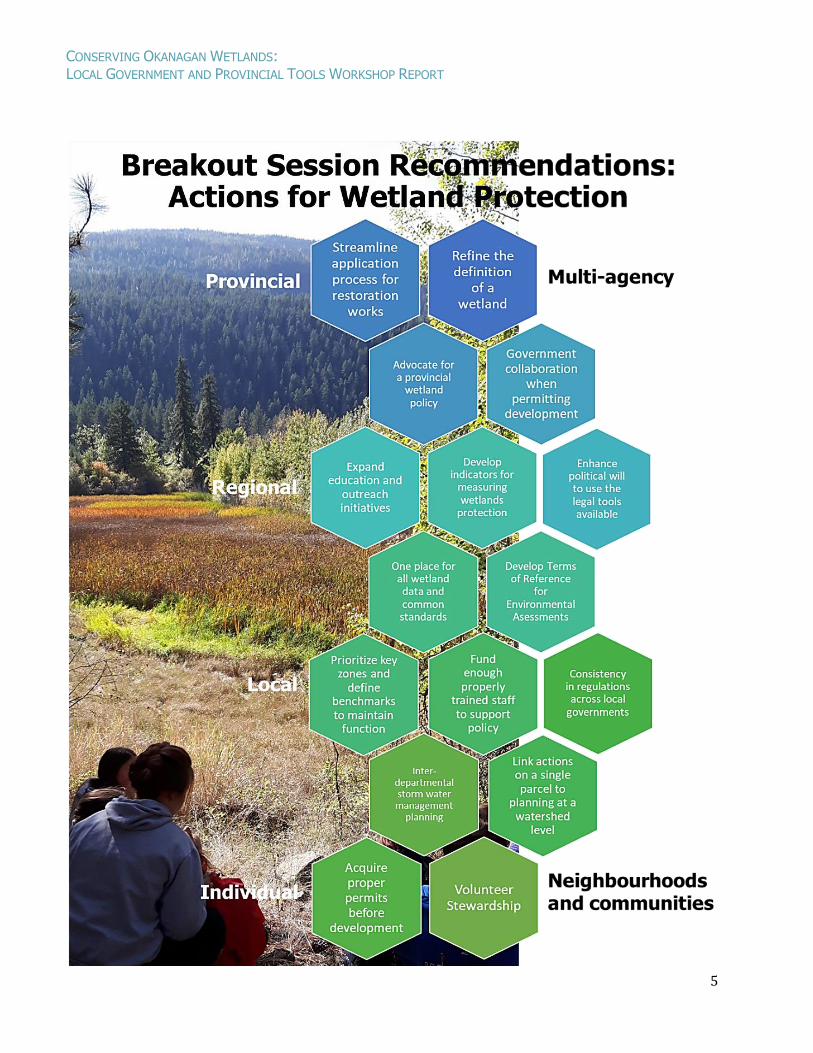
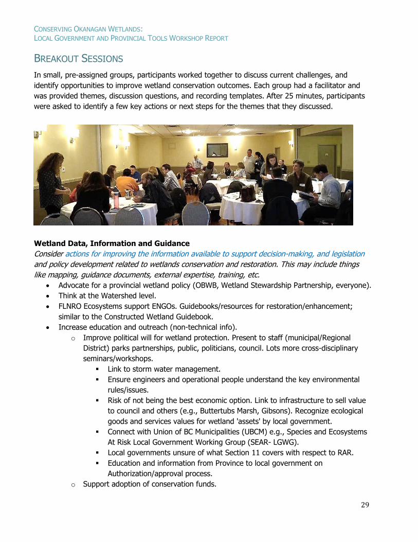
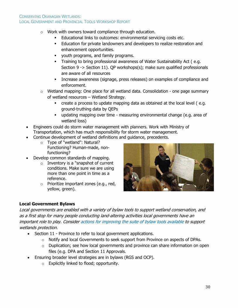
BREAKOUT SESSIONS
In small, pre-assigned groups, participants worked together to discuss current challenges, and
identify opportunities to improve wetland conservation outcomes. Each group had a facilitator and
was provided themes, discussion questions, and recording templates. After 25 minutes, participants
were asked to identify a few key actions or next steps for the themes that they discussed.
Wetland Data, Information and Guidance
Consider actions for improving the information available to support decision-making, and legislation
and policy development related to wetlands conservation and restoration. This may include things
like mapping, guidance documents, external expertise, training, etc.
Advocate for a provincial wetland policy (OBWB, Wetland Stewardship Partnership, everyone).
Think at the Watershed level.
FLNRO Ecosystems support ENGOs. Guidebooks/resources for restoration/enhancement;
similar to the Constructed Wetland Guidebook.
Increase education and outreach (non-technical info).
o Improve political will for wetland protection. Present to staff (municipal/Regional
District) parks partnerships, public, politicians, council. Lots more cross-disciplinary
seminars/workshops.
Link to storm water management.
Ensure engineers and operational people understand the key environmental
rules/issues.
Risk of not being the best economic option. Link to infrastructure to sell value
to council and others (e.g., Buttertubs Marsh, Gibsons). Recognize ecological
goods and services values for wetland 'assets' by local government.
Connect with Union of BC Municipalities (UBCM) e.g., Species and Ecosystems
At Risk Local Government Working Group (SEAR- LGWG).
Local governments unsure of what Section 11 covers with respect to RAR.
Education and information from Province to local government on
Authorization/approval process.
o Support adoption of conservation funds.
CONSERVING OKANAGAN WETLANDS: LOCAL GOVERNMENT AND PROVINCIAL TOOLS WORKSHOP REPORT
30
o Work with owners toward compliance through education.
Educational links to outcomes: environmental servicing costs etc.
Education for private landowners and developers to realize restoration and
enhancement opportunities.
youth programs, and family programs.
Training to bring professional awareness of Water Sustainability Act ( e.g.
Section 9 -> Section 11). QP workshops(s); make sure qualified professionals
are aware of all resources
Increase awareness (signage, press releases) on examples of compliance and
enforcement.
o Wetland mapping: One place for all wetland data. Consolidation - one page summary
of wetland resources – Wetland Strategy.
create a process to update mapping data as obtained at the local level ( e.g.
ground-truthing data by QEPs
updating mapping over time - measuring environmental change (e.g. area of
wetland loss)
Engineers could do storm water management with planners. Work with Ministry of Transportation, which has much responsibility for storm water management.
Continue development of wetland definitions and guidance, precedents. o Type of "wetland": Natural?
Functioning? Human-made, non-functioning?
Develop common standards of mapping. o Inventory is a "snapshot of current
conditions. Make sure we are using more than one point in time as a reference.
o Prioritize important zones (e.g., red, yellow, green).
Local Government Bylaws
Local governments are enabled with a variety of bylaw tools to support wetland conservation, and
as a first stop for many people conducting land-altering activities local governments have an
important role to play. Consider actions for improving the suite of bylaw tools available to support
wetlands protection.
Section 11 - Province to refer to local government applications.
o Notify and local Governments to seek support from Province on aspects of DPAs.
o Duplication; see how local governments and province can share information on open
files (e.g. DPA and Section 11 Approvals.
Ensuring broader level strategies are in bylaws (RGS and OCP).
o Explicitly linked to flood; opportunity.
CONSERVING OKANAGAN WETLANDS: LOCAL GOVERNMENT AND PROVINCIAL TOOLS WORKSHOP REPORT
31
o Develop and embed metrics on wetland protection and restoration into regional
reporting (e.g., State of the Basin reports, other community reporting on Regional
Growth Strategies, etc.)
Down-zoning? e.g. 50 Ha to 500 Ha minimums (not common), politically charged (e.g.
Dominion Observatory; not a wetland example, but example of how community priority is
done through zoning change.
Investigate Revitalization Tax Incentive on a LG basis- carrot vs. stick. Penticton uses.
Redevelopment for downtown stage.
o Realize monetary value through local government, Province, property value asset?
Covenants, tax exemption, infrastructure payback
Improve enforcement of ESDPAs; DPs are currently a weak tool. Designate ESDPAs to their
full potential for the protection of the natural environment, and biological diversity.
o Qualified Environmental Professionals are supposed to implement monitoring, but
what is being done, and are they effective?
o Terms of Reference - Share template from S. Okanagan or RDCO? Provincial Support
to help tailor? Development Permit Terms of Reference for Environmental
Assessments not defined consistently.
o Environmental Assessments (ID wetlands) before engineered design.
o Link soil bylaw back to ESDPA
o Public consultation on DPs vs. zoning
o Define restoration and enhancement in regulations.
o Increase Security Bonds. Securities are well below what local governments need to
restore an area.
Rapid Environmental Assessment - Address low-risk activities through exemptions.
Monitor effectiveness following permitting. Metrics need to be clearly understood by public
and politicians e.g. State of Environment reporting
o Role of Province in providing indicators for wetlands e.g. loss? Hectares restored?
Audit; reporting by local governments re: development permits. Province to
coordinate?
o Collaborate on water/wetlands related audit (NROs and bylaw enforcement)
o Provincial Compliance and Enforcement and bylaw collaboration; e.g. boat patrol
(RAR and water).
Lack of resources (people and money) for extension and capacity (in house) for Provincial
and Local government. Need "staffing up to policy".
CONSERVING OKANAGAN WETLANDS: LOCAL GOVERNMENT AND PROVINCIAL TOOLS WORKSHOP REPORT
32
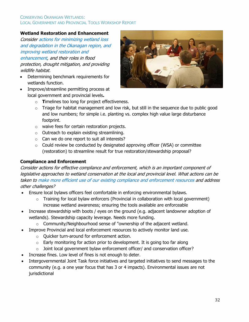
Wetland Restoration and Enhancement
Consider actions for minimizing wetland loss
and degradation in the Okanagan region, and
improving wetland restoration and
enhancement, and their roles in flood
protection, drought mitigation, and providing
wildlife habitat.
Determining benchmark requirements for
wetlands function.
Improve/streamline permitting process at
local government and provincial levels.
o Timelines too long for project effectiveness.
o Triage for habitat management and low risk, but still in the sequence due to public good
and low numbers; for simple i.e. planting vs. complex high value large disturbance
footprint.
o waive fees for certain restoration projects.
o Outreach to explain existing streamlining.
o Can we do one report to suit all interests?
o Could review be conducted by designated approving officer (WSA) or committee
(restoration) to streamline result for true restoration/stewardship proposal?
Compliance and Enforcement
Consider actions for effective compliance and enforcement, which is an important component of
legislative approaches to wetland conservation at the local and provincial level. What actions can be
taken to make more efficient use of our existing compliance and enforcement resources and address
other challenges?
Ensure local bylaws officers feel comfortable in enforcing environmental bylaws.
o Training for local bylaw enforcers (Provincial in collaboration with local government)
increase wetland awareness; ensuring the tools available are enforceable
Increase stewardship with boots / eyes on the ground (e.g. adjacent landowner adoption of
wetlands). Stewardship capacity leverage. Needs more funding.
o Community/Neighbourhood sense of "ownership of the adjacent wetland.
Improve Provincial and local enforcement resources to actively monitor land use.
o Quicker turn-around for enforcement action.
o Early monitoring for action prior to development. It is going too far along
o Joint local government bylaw enforcement officer/ and conservation officer?
Increase fines. Low level of fines is not enough to deter.
Intergovernmental Joint Task force initiatives and targeted initiatives to send messages to the
community (e.g. a one year focus that has 3 or 4 impacts). Environmental issues are not
jurisdictional
CONSERVING OKANAGAN WETLANDS: LOCAL GOVERNMENT AND PROVINCIAL TOOLS WORKSHOP REPORT
33
Collaborative Conservation
Many governmental and non-governmental agencies are already involved with wetland conservation
and restoration initiatives, and there is both provincial legislation and local government bylaws that
support wetland conservation. What collaborative actions could address challenges or improve on
what is already working?
Make application process supportive of projects, not detrimental.
Can we eliminate overlap where water act and development permit/soil removal
authorization are both needed?
o If Province focusses on in-stream, local government could focus on upland?
o Provincially set up RAR and Section 11 as concurrent processes;
o Reducing overlap is great, but may create gaps. Some overlap is good.
o Can't educate if we shut people down with too much regulation; change culture
develop social licence.
o Consistency across government. Can we create a high quality consistent standard
based on risk? Setting conservation priorities and identifying important wetlands
through collaboration and input from local NGOs, RGS, OCP.
o Ensure local government gets triggered or consistently referred when Water
Sustainability Act applications are made in their areas. Refer relevant local
applications to Province. No requirement for Provincial approval (Section 11) in most
DP process.
Pilot collaboration Provincial and Local government etc. Front Counter BC,
can they help? Provincial Compliance and Enforcement and bylaw
collaboration; e.g. boat patrol (RAR and water).
Include Syilx/First Nations
DFO - Community Advisors might help to address barriers on ground.
MOTI approving officer
Joint local government bylaw enforcement officer/and conservation officer?
Coordinated professionals for local government approvals.
OBWB, OCCP, SOSCP - targeted roles
Shared environmental planner - raising jurisdictional baseline requirements (regions).
Shuswap Watershed Council
Conservation Fund (RDOS)
Funding resource partnerships with insurance companies.
Supplementary Materials
Appendix 1: Workshop participant list.
Appendix 2: Presentation slides.