FAQ - Onshore oil and gas (conventional and unconventional ...

Onshore oil and gas: risks to groundwater
Ian Davey Principal Scientist, Evidence
Environment Agency
EOSCA, 3 November 2015, Manchester

Summary
! What is groundwater? ! How do we protect groundwater? ! Risks from onshore oil and gas ! Assessment of risks from chemicals ! Ongoing research

Where is groundwater?


What does groundwater look like?

Groundwater maintains rivers
Watercress beds, Hampshire
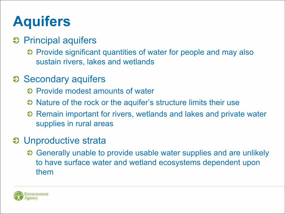
Aquifers ! Principal aquifers
! Provide significant quantities of water for people and may also sustain rivers, lakes and wetlands
! Secondary aquifers ! Provide modest amounts of water ! Nature of the rock or the aquifer’s structure limits their use ! Remain important for rivers, wetlands and lakes and private water
supplies in rural areas
! Unproductive strata ! Generally unable to provide usable water supplies and are unlikely
to have surface water and wetland ecosystems dependent upon them
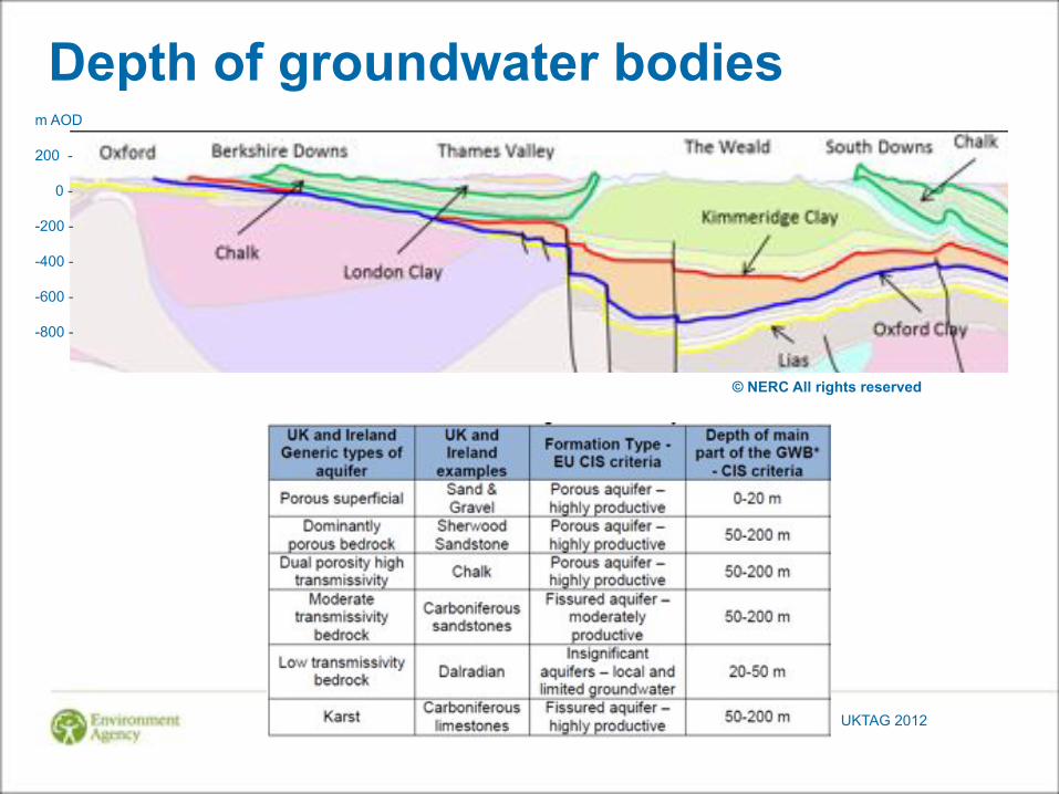
Depth of groundwater bodies m AOD 200 - 0 - -200 - -400 - -600 - -800 -
© NERC All rights reserved
UKTAG 2012

Groundwater at depth
2500 metres
UK Groundwater Forum
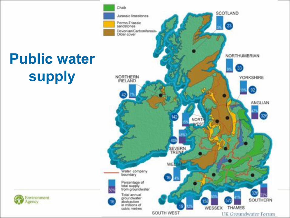
Public water supply
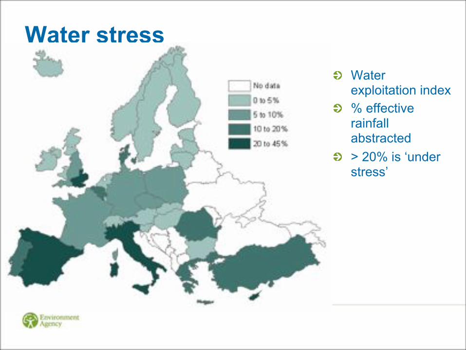
Water stress ! Water
exploitation index ! % effective
rainfall abstracted
! > 20% is ‘under stress’
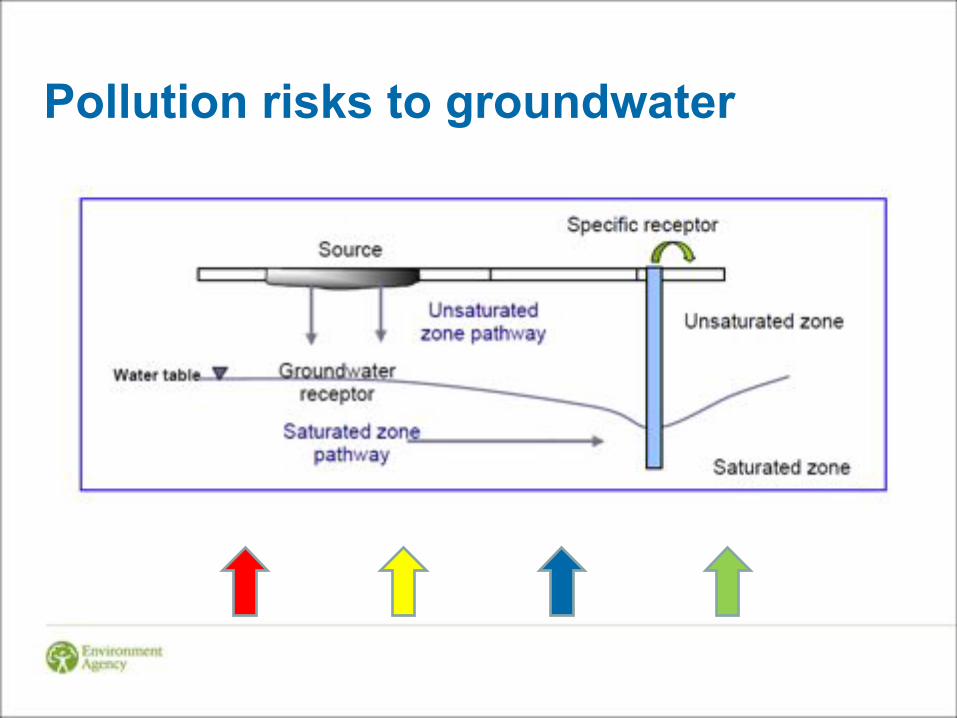
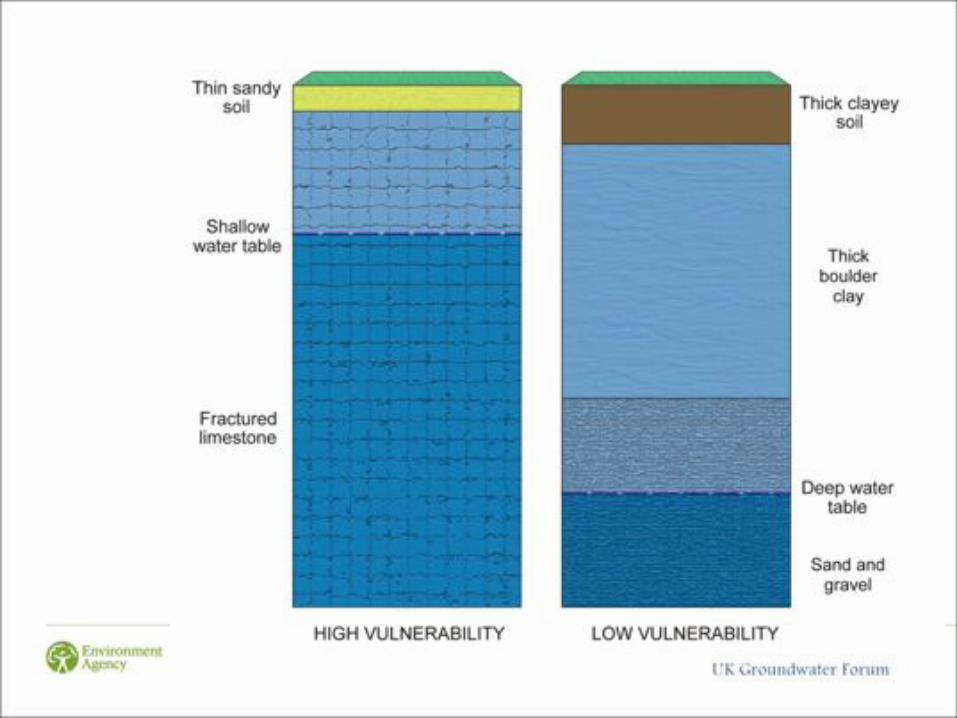
Pollution risks to groundwater

Water Framework Directive Groundwater Daughter Directive ! Prevent entry of hazardous substances
! Persistent, bioaccumulative, toxic
! Prevent pollution by non-hazardous pollutants
! Applies to all groundwater ! “all water which is below the surface of the ground in the saturation
zone and in direct contact with the ground or subsoil”
! Defra – it is for EA to determine if groundwater is present ! E.g. no groundwater in evaporites, dense crystalline rocks, clays
! Environmental Permitting Regulations ! Groundwater, mining waste, radioactive substances
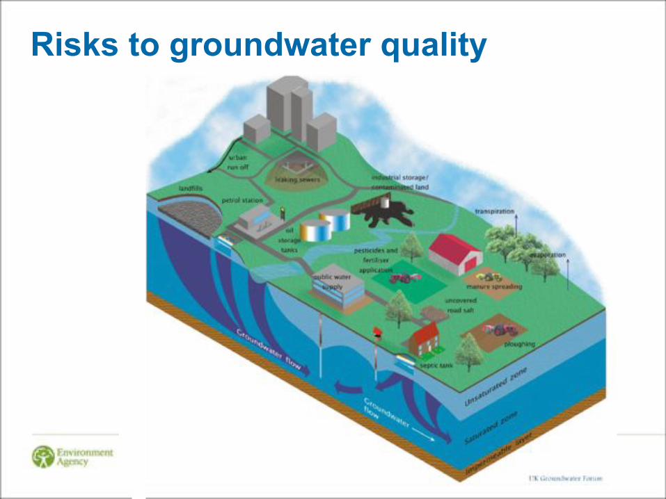
Risks to groundwater quality
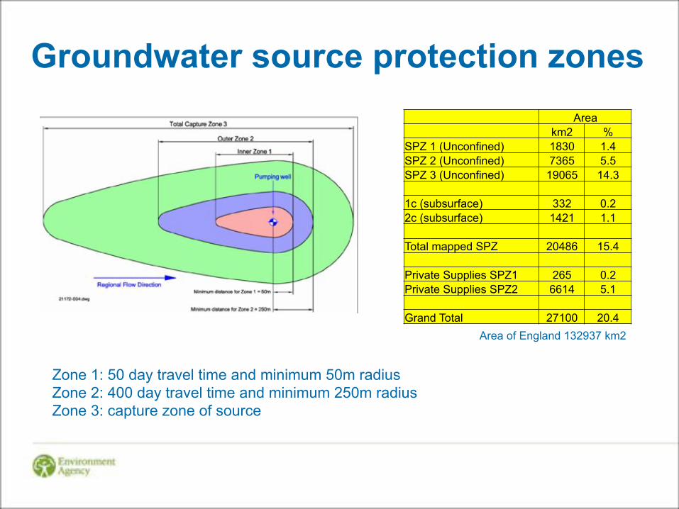
Groundwater source protection zones
Zone 1: 50 day travel time and minimum 50m radius Zone 2: 400 day travel time and minimum 250m radius Zone 3: capture zone of source
Area km2 % SPZ 1 (Unconfined) 1830 1.4 SPZ 2 (Unconfined) 7365 5.5 SPZ 3 (Unconfined) 19065 14.3 1c (subsurface) 332 0.2 2c (subsurface) 1421 1.1 Total mapped SPZ 20486 15.4 Private Supplies SPZ1 265 0.2 Private Supplies SPZ2 6614 5.1 Grand Total 27100 20.4
Area of England 132937 km2
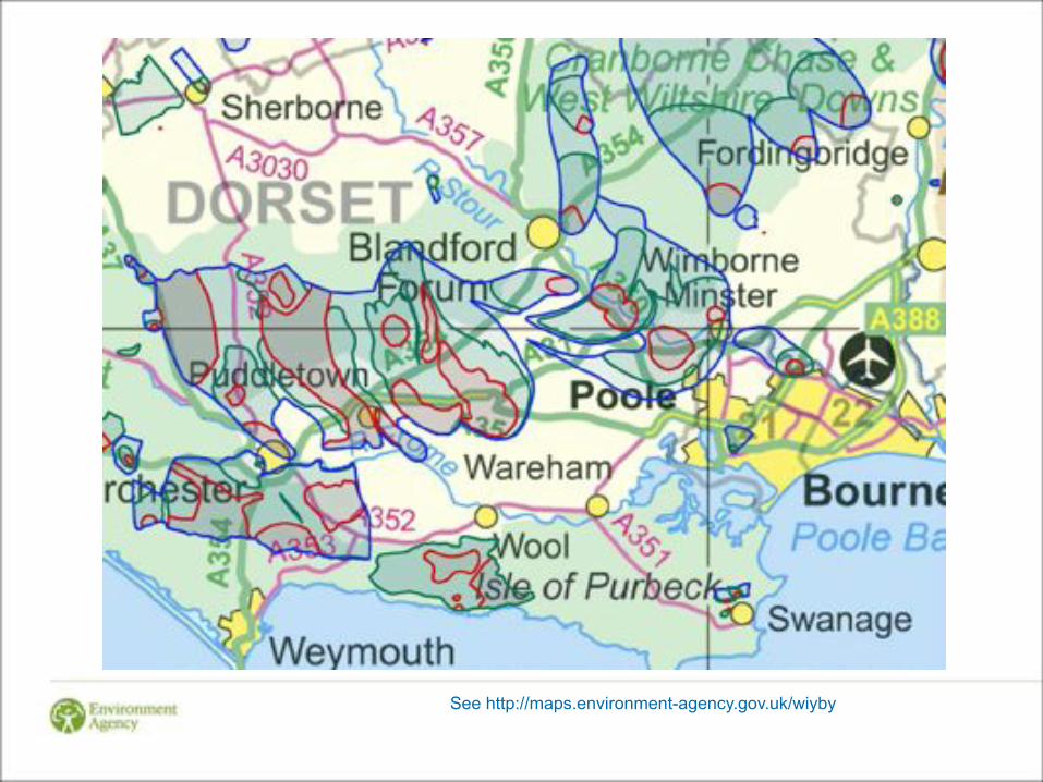
See http://maps.environment-agency.gov.uk/wiyby

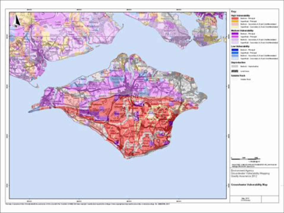
Principal aquifers and source protection zones
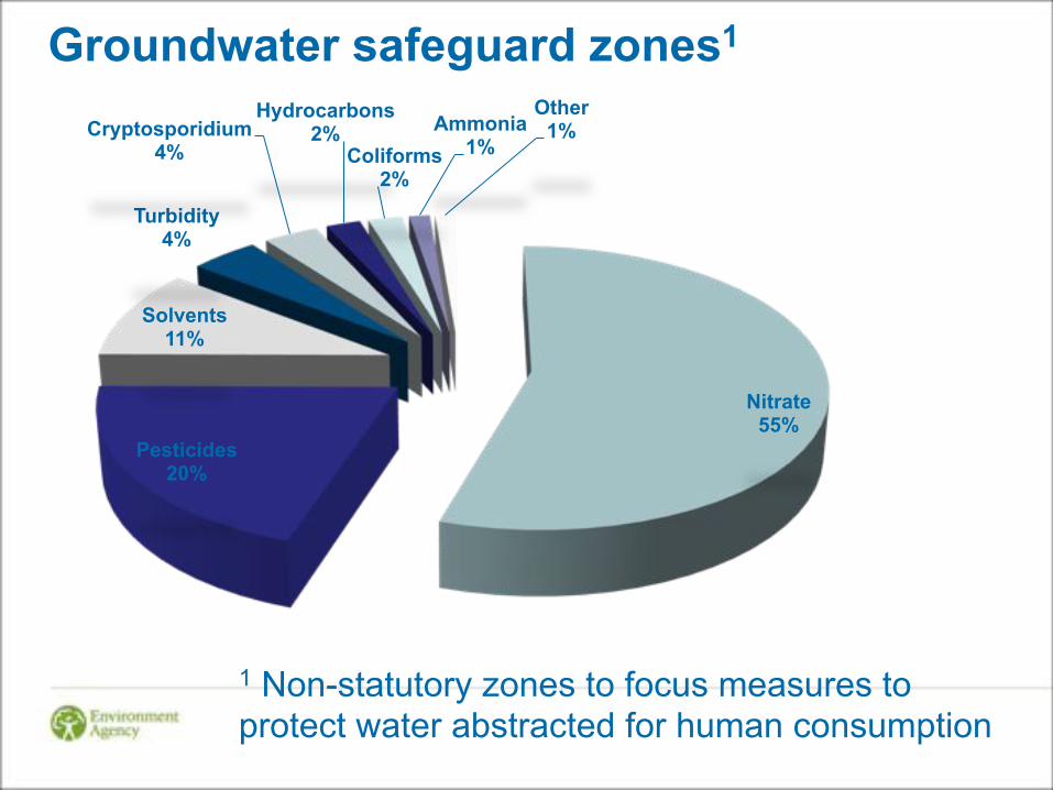
Groundwater safeguard zones1
Nitrate 55%
Pesticides 20%
Solvents 11%
Turbidity 4%
Cryptosporidium 4%
Hydrocarbons 2%
Coliforms 2%
Ammonia 1%
Other 1%
1 Non-statutory zones to focus measures to protect water abstracted for human consumption

Oil, gas & water
BGS
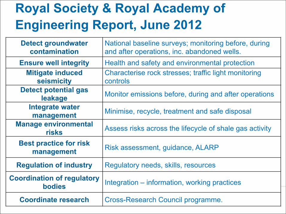
Detect groundwater contamination
National baseline surveys; monitoring before, during and after operations, inc. abandoned wells.
Ensure well integrity Health and safety and environmental protection Mitigate induced
seismicity Characterise rock stresses; traffic light monitoring controls
Detect potential gas leakage Monitor emissions before, during and after operations
Integrate water management Minimise, recycle, treatment and safe disposal
Manage environmental risks Assess risks across the lifecycle of shale gas activity
Best practice for risk management Risk assessment, guidance, ALARP
Regulation of industry Regulatory needs, skills, resources
Coordination of regulatory bodies Integration – information, working practices
Coordinate research Cross-Research Council programme.
Royal Society & Royal Academy of Engineering Report, June 2012
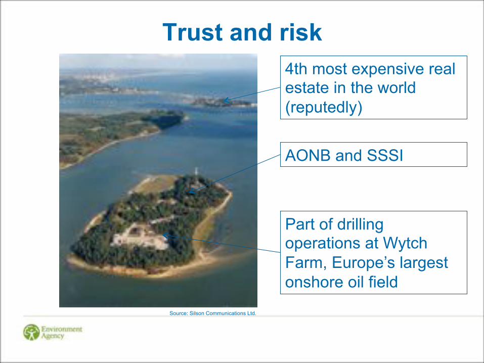
Trust and risk
Dales Water Services Ltd Source: Silson Communications Ltd.
AONB and SSSI
Part of drilling operations at Wytch Farm, Europe’s largest onshore oil field
4th most expensive real estate in the world (reputedly)
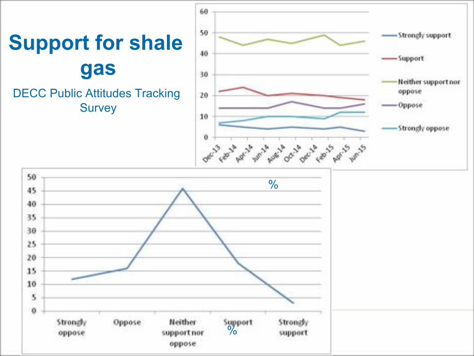
Support for shale gas
DECC Public Attitudes Tracking Survey
%
%

Fracture propagation
Davies et al (2012) ! Maximum reported hydraulic
fracture heights – 588m • ‘Chances of going beyond
600 m is negligible’ • Probability of hydraulic
fracture extending vertically >350m is 1%
! Interconnection with natural fissures could extend the potential distance for fluid migration

Well construction
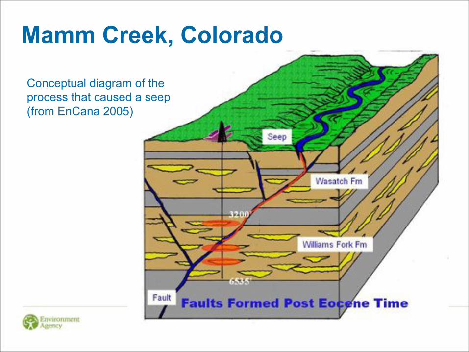
Mamm Creek, Colorado
Conceptual diagram of the process that caused a seep (from EnCana 2005)

Drilling
! EA Groundwater Protection: Principles and Practice (2013) ! We will object to [oil and gas] activity in SPZ1 ! Outside SPZ1 we will object to [oil and gas] activity where there would be
an unacceptable impact on groundwater
! In many cases impact from drilling fluids likely to be considered ‘de minimis’ ! Subject to certain restrictions on type of drilling fluid and use of additives ! Near surface drilling – water based mud with very limited range of
additives ! Deeper drilling wider range of additives/fluids providing cannot cause
pollution
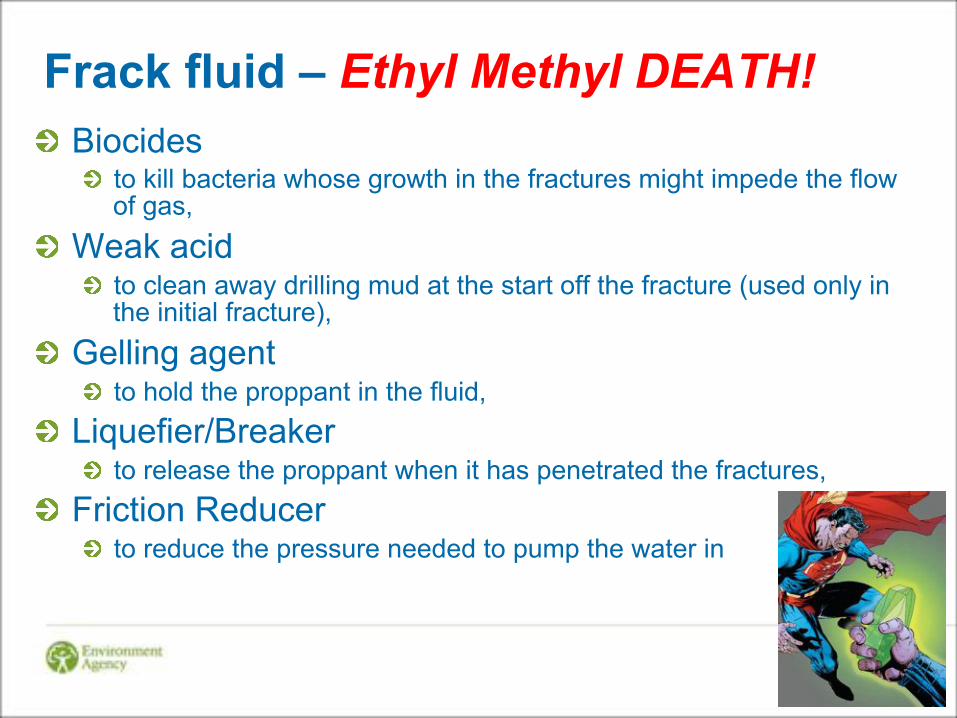
Frack fluid – Ethyl Methyl DEATH! ! Biocides
! to kill bacteria whose growth in the fractures might impede the flow of gas,
! Weak acid ! to clean away drilling mud at the start off the fracture (used only in
the initial fracture), ! Gelling agent
! to hold the proppant in the fluid, ! Liquefier/Breaker
! to release the proppant when it has penetrated the fractures, ! Friction Reducer
! to reduce the pressure needed to pump the water in
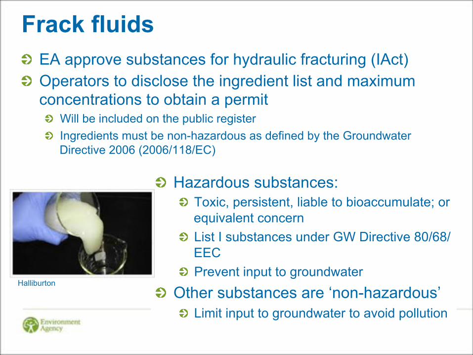
Frack fluids ! EA approve substances for hydraulic fracturing (IAct) ! Operators to disclose the ingredient list and maximum
concentrations to obtain a permit ! Will be included on the public register ! Ingredients must be non-hazardous as defined by the Groundwater
Directive 2006 (2006/118/EC)
! Hazardous substances: ! Toxic, persistent, liable to bioaccumulate; or
equivalent concern ! List I substances under GW Directive 80/68/
EEC ! Prevent input to groundwater
! Other substances are ‘non-hazardous’ ! Limit input to groundwater to avoid pollution
Halliburton
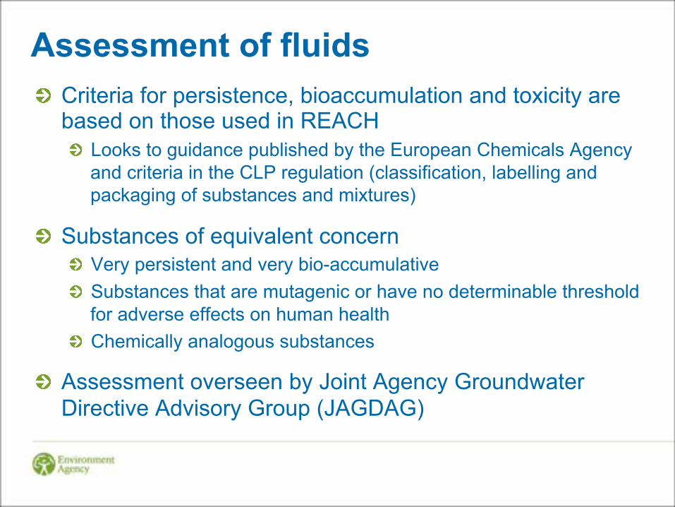
Assessment of fluids ! Criteria for persistence, bioaccumulation and toxicity are
based on those used in REACH ! Looks to guidance published by the European Chemicals Agency
and criteria in the CLP regulation (classification, labelling and packaging of substances and mixtures)
! Substances of equivalent concern ! Very persistent and very bio-accumulative ! Substances that are mutagenic or have no determinable threshold
for adverse effects on human health ! Chemically analogous substances
! Assessment overseen by Joint Agency Groundwater Directive Advisory Group (JAGDAG)
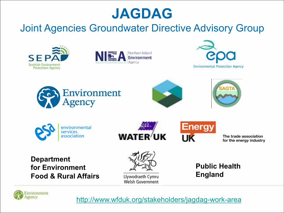
JAGDAG Joint Agencies Groundwater Directive Advisory Group
Department for Environment Food & Rural Affairs
Public Health England
http://www.wfduk.org/stakeholders/jagdag-work-area
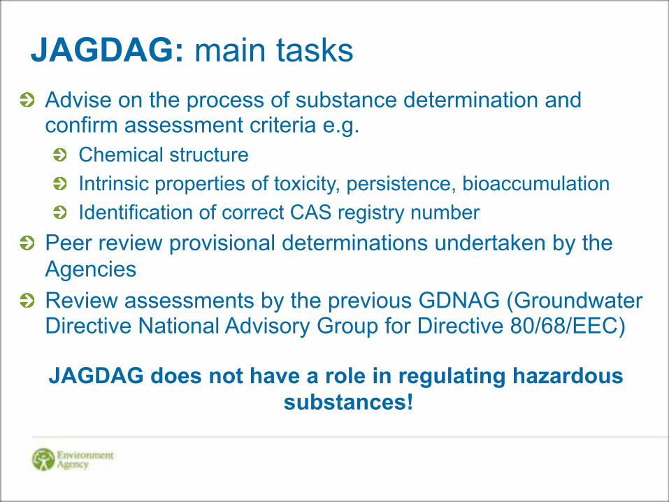
JAGDAG: main tasks ! Advise on the process of substance determination and
confirm assessment criteria e.g. ! Chemical structure ! Intrinsic properties of toxicity, persistence, bioaccumulation ! Identification of correct CAS registry number
! Peer review provisional determinations undertaken by the Agencies
! Review assessments by the previous GDNAG (Groundwater Directive National Advisory Group for Directive 80/68/EEC)
JAGDAG does not have a role in regulating hazardous substances!

Working with industry ! Develop a better understanding of the risks to groundwater
from drilling and hydraulic fracturing products/chemicals
! Review other systems for assessing environmental risks ! MSDS ! Offshore Chemical Notification Scheme
! Share knowledge, data and expertise for assessing risks to groundwater from products and chemicals
! Increase industry’s role in undertaking assessments
! Compile an inventory of products and chemicals used in onshore drilling and hydraulic fracturing fluids in England and their assessed risks to groundwater
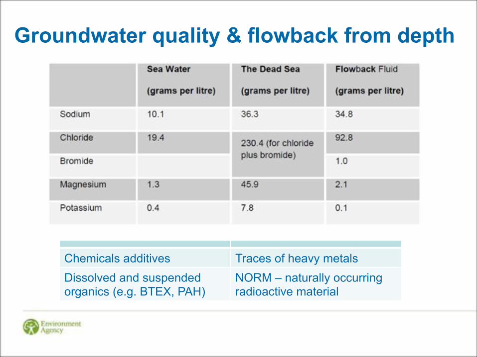
Groundwater quality & flowback from depth
Chemicals additives Traces of heavy metals Dissolved and suspended organics (e.g. BTEX, PAH)
NORM – naturally occurring radioactive material
Baselines in Lancs and N Yorks BGS consortium ! water level ! temperature, pH, conductivity, redox potential ! major ions and trace elements ! dissolved gases (O2, CO2, CH4, N2, radon, noble gases) ! organic chemicals ! stable isotopes (18O, 2H of water, 13C of inorganic carbon) ! groundwater 'age' indicators (CFCs, SF6) ! naturally occurring radioactive materials (NORM: uranium
and thorium decay series).

BGS

BGS Lancashire
BGS

Status! Baseline conditions, ambient air quality, geology and geomechanics, hydrogeology, monitoring, statistical evaluation of data!
Pressure/risk analysis!
Chemicals, emissions, flaring, fracking, drilling, reinjection, abandoned wells, groundwater vulnerability, risk assessments, fate and behaviour of chemicals, modelling!
Impact management!
Well design (e.g. cement), BAT, flares, operational guidance, seismicity, monitoring and analysis techniques!
EA research themes
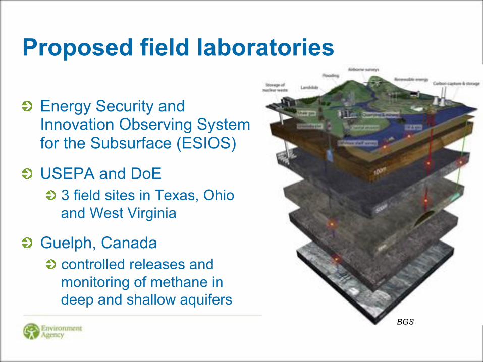
Proposed field laboratories
! Energy Security and Innovation Observing System for the Subsurface (ESIOS)
! USEPA and DoE ! 3 field sites in Texas, Ohio
and West Virginia
! Guelph, Canada ! controlled releases and
monitoring of methane in deep and shallow aquifers
BGS